Marine Geophysical Methods: What Can and Cannot Be Done to Iden8fy Hazards to Dredging & Marine Construc8on
|
|
|
- Geraldine Wade
- 5 years ago
- Views:
Transcription

1 Marine Geophysical Methods: What Can and Cannot Be Done to Iden8fy Hazards to Dredging & Marine Construc8on
2 Marine Geophysics Sham or Savior? Seen alternatively as the silver bullet or snake oil, marine geophysical techniques use a variety of different methods to identify conditions and features on and below the seabed. 2
3 Marine Geophysics Sham or Savior? Therefore it is very important to understand that there are a variety of geophysical techniques. Not one size fits all. And some problems simply cannot be solved by geophysics. 3

4 Quick Method Summary 4
5 How to Select the Right Tool? Boundary Conditions Methods and their Limitations Baseline or repeated survey Sensor Selection Sensor Deployment Data processing and interpret Presentation of results Report Charts 5 EWEA Offshore / Copenhagen


6 Marine Geophysical Methods Generally, geophysical methods use remote sensing to investigate seabed & substrate. Surface Expression Subsuface Expression Surface expressions can be readily visualized. Subsurface data requires processing and interpretation. 6

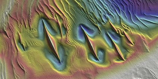
7 This is What We Are Used to Seeing from Marine Surveys 7

8 Technology Now Allows Broader and More Detailed Applications 8

9 Technology Now Allows Broader and More Detailed Applications 9

10 Cross-Section Comparisons: Present vs. Historical BREAKWATER CROSS SECTION CURRENT CONDITION AND CONSTRUCTION DESIGN 10 PDF Map Book

11 Surveying for Site Investigation / As-Built / Demolition 11

12 Surveying for Site Investigation / As-Built / Demolition Debris in Demolition Area San Francisco/Oakland Bay Bridge: Pre-demolition Survey 12

13 Surface Expression Visible in Multibeam or Side-Scan Sonar Pipelines Power Cables 13 Cerritos Channel
14 Surface Expression Visible in Multibeam or Side-Scan Sonar Piles Removed from Data You can find even very small objects. 14
15 Surface Expression Visible in Multibeam or Side-Scan Sonar Piles Removed from Data You can find even very small objects...like tires. 15
 $369k change order to remove piles Norfolk Light Rail at Broad")
16 Surface Expression Visible in Multibeam or Side-Scan Sonar 260 rail pilings found in construction area (20 initially reported to construction contractor) $369k change order to remove piles Norfolk Light Rail at Broad Creek 16

17 Seabed (Sub-surface) Geophysical Surveys Seabed geophysics may use active or passive methods. Acoustic signal reflection, refraction, electro-magnetic resistivity and passive magnetometers make up the most common methods. 17
 is")

18 Acoustic Geophysics: Sub-Bottom Profiling Low-frequency acoustic reflection is used for deep substrate penetration High-frequency (such as CHIRP technology) is used for identifying different sediment layers in the shallow seabed (e.g. silt, gravel, bedrock). It CAN also find hard objects buried near the seafloor sometimes 18

19 Acoustic Geophysics: Sub-Bottom Profiling BUT sub-bottom is a profiling technology. The sensor detects only what is immediately below it. 19

20 Acoustic Geophysics: Sub-Bottom Profiling BUT sub-bottom is a profiling technology. The sensor detects only what is immediately below it. Yet, we expect knowledge of the complete seabed. 20

21 Acoustic Geophysics: Sub-Bottom Profiling & Seismic Reflection BUT sub-bottom is a profiling technology. The sensor detects only what is immediately below it. And interpretation is not always obvious. And penetration is limited by the seabed material. 21

22 Acoustic Geophysics: Sub-Bottom Profiling & Seismic Reflection Different seismic sources: chirp, boomer, sparker or air-gun Different receivers: single/multi-channel/digital/analogue Data interpreted with core samples to produce geological maps 22

23 Acoustic Geophysics: Seismic Reflection Example Data collected at the Port of Los Angeles with a Boomer plate acoustic source and digital streamer configured w/36 channels. Note near-surface faulting, folding, and dredging 23 GeoEel: ULTRA HIGH RESOLUTION, PORTABLE, MULTICHANNEL SEISMIC REFLECTION SYSTEM

24 2-D Line Density Can Create a 3-D Geological Model 3-D Subsurface: Integration of Geophysics and Geotechnics Red/Yellow Bars = Soil Borings Surfaces = Geological Layers Blue = Bay Bottom (Bathymetry) 24


25 Marine Utility Locating Surveys Identify location of utilities below the seabed detecting: Magnetic characteristics Surface expressions Geophysical signature Specialized tools for determining depth of burial in active development. 25 Magnetic Anomaly Seafloor Pipeline

26 Sub-Bottom Geophysics for Object Identification Sub-bottom profiling for identifying cables and pipelines is very challenging. Without knowing that a feature is present already, identifying the object can be extremely challenging. Even harder in very shallow water. Example below is a SBP line perpendicular crossing of DC electric cable. Outside diameter 6 26
27 Magnetometry Passive magnetometry systems act like metal detectors to identify ferrous metals on/below the seabed. Non-metallic objects are invisible. There are different methods of magnetic detection (cesium vapor, PPM, Overhauser). Sensitivity is affected by range to target, metallic mass, soil composition and nearby objects. Also impacted if energized/active. 27


28 Magnetometry Magnetic Gradiometer measures magnetic gradient (direction) by using multiple magnetometers in an array. An array can detect variations in both vertical and transverse magnetic gradient, which enables the ferrous signature from background geology and motion noise to be significantly removed during data processing. 28
29 Magnetometry Triangulation of the gradient between units can be used to calculate depth of burial. 29


30 Electromagnetic Induction Marine Transient Electromagnetic Induction surveys introduce transient currents through the conductive water column and into the seabed to generate secondary magnetic fields. This secondary EM field can be used to detect metallic objects, such as buried pipes, cables, unexploded ordnance or debris. However, powered cables introduce interference impacting the data. Teledyne TSS 440 EMI Pipe & Cable Tracking Geomatrix EM-61S System Geomatrix EM-61S: Detection depth for Steel Pipe 30


31 Data Deliverables Maps/charts that integrate the seabed and the position of features are generally the desired product. Data can be presented as hard copy plots, digital PDF files, CAD drawings, GIS layers, rendered in 3-D, etc. Data can also be viewed in vessel navigation programs onboard vessels for real-time avoidance assurance. 31
32 Depth of Burial the Great Unknown Depth of burial is often not repeatable between system types. They may generally trends similarly, but absolute values are often different. Therefore technique is better suited to change detection and using the same system each time. Below is a comparison between Teledyne TSS 350 (red) and OR ORION with 2 sensors (blue) / 4 sensors (green) array. 32
33 Depth of Burial the Great Unknown Similarly, cable condition at the time of survey affects Depth of Burial. Below, the blue line represents the cable inactive with a tone generator. All others, the cable is in active service. 33
.")

34 Example: Seafloor Cable Detection Cable avoidance/cable protection Cable may be visible in surface expression (easiest to detect). Can be cable itself, can be rock armouring, seabed mattresses Cable may be energized (active power) or can be manually energized to detect (radio detection Source: CCI Cable can be detected by magnetometer (array needed to detect depth) Cable can possibly be identified by subbottom profiling (very unreliable method) 34

 Type of cable?")
")
35 Example: Seafloor Cable Detection: Boundary Conditions Operating status? (energized, out-ofservice) Accessibility? (signal induction) Type of cable? (AC / DC / FO) Design of cable? (diameter, conductor, shielding, armoring) Expected coverage, burial depth? Seafloor morphology, sediment structure? 35
36 Example: Cable Detection: Methods and their Limitations Method Evaluation: Multibeam/Side-Scan Sonar - must be a physical expression of the cable on the seafloor - horizontal positioning; vertical position generally very shallow or on top of seabed Magnetometer / Gradiometer - horizontal positioning possible; vertically inaccurate - detection range is dependant on magnetic mass & armoring Active cable tracking system (*) - horizontal and vertical positioning (coverage in combination w/ Altimeter) - detection range typically < 2 m Passive energized cable tracking system (**) - horizontal and vertical positioning (coverage in combination w/ Altimeter) - detection range typically 5+ m Magnetometer / Gradiometer (magnetized cable) - horizontal und vertical positioning (coverage in combination w/ Altimeter) - detection range typically 2 m Acoustic cable tracking system - horizontal und vertical positioning (coverage in combination w/ Altimeter) - detections range typically 5+ m, strongly dependant on soil conditions (*) pulse induction; (**) tone detection 36


37 Example: Seafloor Cable Detection: Sensor Selection Source: Teledyne TSS Ltd. Source: Innovatum Ltd. Source: Pangeo Inc. 37
38 Review Boundary Conditions Methods and their Limitations Baseline or repeated survey Sensor Selection Sensor Deployment Data processing and interpret Presentation of results Report Charts 38
39 Summary? No Silver Bullet Here Unfortunately, there s no silver bullet to finding hidden objects in the seabed. Different techniques offer different capabilities applicable to differing conditions. However, when the feature sought is known, selecting the appropriate sensor can go a long way to identifying it and averting a disaster. 39
40 Thank you for your time Questions? Todd Mitchell Fugro +1 (805)
Geophysical Site Surveys
 Geophysical Site Surveys Simon Oakley Geoscience Team Leader Fugro Survey Limited 16/04/2014 Contents Menu Introduction Section 1 - Geophysical Site Surveys - Seabed Bathymetry - Shallow Geology - Seabed
Offshore Operations and Project Execution Geophysical Site Surveys
 Offshore Operations and Project Execution Geophysical Site Surveys Chris Almond Senior Geophysicist Fugro Survey Limited 22/04/2015 Presentation Summary: Office-based Personnel Project Awarded Pre Offshore
Inspection of Waterfront Facilities Using Vessel-Based Remote Sensing Mitchell, Del Bello, Suarez
 Inspection of Waterfront Facilities Using Vessel-Based Remote Sensing Mitchell, Del Bello, Suarez American Association of Port Authorities Facilities Engineering Conference October 20-22, 2015 Waterfront
Geophysics for Environmental and Geotechnical Applications
 Geophysics for Environmental and Geotechnical Applications Dr. Katherine Grote University of Wisconsin Eau Claire Why Use Geophysics? Improve the quality of site characterization (higher resolution and
THE 4Gs IN PRACTICE: INVESTIGATING HOW THE 4Gs ARE APPLIED IN THE OIL & GAS INDUSTRY
 THE 4Gs IN PRACTICE: INVESTIGATING HOW THE 4Gs ARE APPLIED IN THE OIL & GAS INDUSTRY Society for Underwater Technology, Evening Technical Meeting 14 AUGUST 2013 GEOPHYSICS & PORT DEVELOPMENTS EXPLORING
Multibeam Hydrographic Survey Use for Construction Control of Filling and Ground Improvement Activities
 Multibeam Hydrographic Survey Use for Construction Control of Filling and Ground Improvement Activities WEDA Cincinnati April 10, 2014 Ray Wood C.Eng Executive Vice President Fugro Consultants Inc Advantages
Magnetics: Fundamentals and Parameter Extraction
 : Fundamentals and Parameter Extraction Stephen Billings Magnetic module outline fundamentals Sensor systems Data examples and demo Parameter extraction Concepts Real-world examples Classification Using
Deep Water Marine Surveys
 Deep Water Marine Surveys Deep Sea International Consortium Workshop Rio de Janeiro, February 01st & 2nd Fred Marins Marketing Director fred.marins@gardline.com.br Key Aspects Gardline: Since 1969 + 1500
NEW SEAFLOOR INSTALLATIONS REQUIRE ULTRA-HIGH RESOLUTION SURVEYS
 NEW SEAFLOOR INSTALLATIONS REQUIRE ULTRA-HIGH RESOLUTION SURVEYS Donald Hussong (Fugro Seafloor Surveys, Inc.) dhussong@fugro.com Fugro Seafloor Surveys, Inc., 1100 Dexter Avenue North (Suite 100), Seattle,
FOUNDATIONS FOR OFFSHORE STRUCTURES
 FOUNDATIONS FOR OFFSHORE STRUCTURES DELHI CHAPTER Pradeep Hora It takes less time to do a thing right than explain why you did it wrong. - Henry Wadsworth Longfellow 2 1 Site Investigations (Survey) What
BELFAST SEWERS PROJECT
 BELFAST SEWERS PROJECT Adam Green - Atkins Tunnelling Scheme Overview New stormwater interceptor Tunnel Scheme within Belfast City Centre to alleviate flooding and divert storm water flows from existing
High Resolution Geophysics: A Better View of the Subsurface. By John Jansen, P.G., Ph.D., Aquifer Science and Technology
 High Resolution Geophysics: A Better View of the Subsurface By John Jansen, P.G., Ph.D., Aquifer Science and Technology Geologist Use Only Part of the Information Available To Them Most Geologist rely
Unexploded Ordnance on Auckland s Doorstep. WasteMINZ November 2017
 Unexploded Ordnance on Auckland s Doorstep WasteMINZ November 2017 Scope Site Background. Site Assessment. Geophysical Survey. Investigation. Findings. Challenges. Key Points. Weiti Bay Site Access Road
The Arctic - A New Frontier The geological, environmental and engineering challenges for submarine telecommunication cables
 The Arctic - A New Frontier The geological, environmental and engineering challenges for submarine telecommunication cables Ryan Wopschall 5 September 2013 Oceanology International China, Shanghai Fugro
Environmental Geophysics for Coastal Management
 Environmental for Coastal Management Paul Donaldson 1, Dr Douglas Bergersen 2, Dr Matthew Barnes 3, Conor Jones 3 Coast To Coast, Hobart April 2018 1 BMT Newcastle, Australia, 2 Acoustic Imaging, Cooroy,
Indonesia Frontier Basin SUNDA (SU-08) NON-EXCLUSIVE 2-D SURVEY 3084km
 NON-EXCLUSIVE 2-D SURVEY 3084km") Indonesia Frontier Basin SUNDA (SU-08) NON-EXCLUSIVE 2-D SURVEY 3084km SEISMIC ACQUISITION PARAMETERS Acquisition Date: January - March 2008 Vessel: M/V Osprey Explorer Shooting Orientation: Strike-Dip
Indonesia Frontier Basin SUNDA (SU-08) NON-EXCLUSIVE 2-D SURVEY 3084km SEISMIC ACQUISITION PARAMETERS Acquisition Date: January - March 2008 Vessel: M/V Osprey Explorer Shooting Orientation: Strike-Dip
Introduction to Acoustic Remote Sensing and Seafloor Mapping (AE4-E13) May 19, 2010
 May 19, 2010") Introduction to Acoustic Remote Sensing and Seafloor Mapping (AE4-E13) May 19, 2010 1 Delft Vermelding Institute onderdeel of Earth organisatie Observation and Space Systems Why Acoustic Remote Sensing?
Introduction to Acoustic Remote Sensing and Seafloor Mapping (AE4-E13) May 19, 2010 1 Delft Vermelding Institute onderdeel of Earth organisatie Observation and Space Systems Why Acoustic Remote Sensing?
SONGS Seismic Research Projects
 SONGS Seismic Research Projects Energy Division Independent Peer Review Group September 21, 2012 Agenda Background Overview Project Support Permits, Approvals, and Reviews Schedule Use of Advanced Technologies
Geophysical Site Investigation (Seismic methods) Amit Prashant Indian Institute of Technology Gandhinagar
 Amit Prashant Indian Institute of Technology Gandhinagar") Geophysical Site Investigation (Seismic methods) Amit Prashant Indian Institute of Technology Gandhinagar Short Course on Geotechnical Aspects of Earthquake Engineering 04 08 March, 2013 Seismic Waves
Geophysical Site Investigation (Seismic methods) Amit Prashant Indian Institute of Technology Gandhinagar Short Course on Geotechnical Aspects of Earthquake Engineering 04 08 March, 2013 Seismic Waves
Data and Information Management. UK All Energy 22 nd May Presented by Leo James
 Data and Information Management UK All Energy 22 nd May 2013 Presented by Leo James Strategic Development Plans Observations at the outset Data and information management and dissemination: company or
Lower 8.3 Miles of the Lower Passaic River Operable Unit 2 Presentation to The Passaic River Community Advisory Group. September 14, 2017
 Lower 8.3 Miles of the Lower Passaic River Operable Unit 2 Presentation to The Passaic River Community Advisory Group September 14, 2017 Agenda Pre-Design Investigation (PDI) Status Geophysical, Bathymetric,
GEOSYNTEC CONSULTANTS
 GEOSYNTEC CONSULTANTS 2100 Main Street, Suite 150 Huntington Beach, CA 92648 USA Tel (714) 969-0800 Fax (714) 969-0820 15 February 2006 Ms. Tamara Zeier, P.E. Project Manager Project Navigator, Ltd. One
ambiguity in earth sciences IESO Geophysics Section Eddy hartantyo, Lab Geofisika FMIPA UGM
 ambiguity in earth sciences IESO Geophysics Section Eddy hartantyo, Lab Geofisika FMIPA UGM Pelatihan Tahap II IESO Teknik Geologi UGM Februari 2009 1 Introduction Photos from http://www.eegs.org/whatis/
Diablo Canyon SSHAC Level 3 Study
 1 Diablo Canyon SSHAC Level 3 Study Workshop 1 Summary of SSC Hazard Significant Issues and Data Needed William Lettis November 29 to December 1, 2011 PG&E DCPP SSHAC Study 2 Hosgri Hosgri Location Hosgri
3. UNDERWAY GEOPHYSICS 1
 Sawyer, D.S., Whitmarsh, R.B., Klaus, A., et al., 1994 Proceedings of the Ocean Drilling Program, Initial Reports, Vol. 149 3. UNDERWAY GEOPHYSICS 1 Shipboard Scientific Party 2 EQUIPMENT AND METHODS Navigation
Appendix H High Resolution Marine Seismic Reflection Surveys
 Appendix H High Resolution Marine Seismic Reflection Surveys Shoreline Fault Zone Report, Appendix H Seis. Reflection Page H-1 of 8 Introduction Single-channel seismic-reflection data were acquired in
An Introduction to Geophysical Exploration
 An Introduction to Geophysical Exploration Philip Kearey Department of Earth Sciences University of Bristol Michael Brooks Ty Newydd, City Near Cowbridge Vale of Glamorgan Ian Hill Department of Geology
Land seismic sources
 Seismic Sources HOW TO GENERATE SEISMIC WAVES? Exploration seismology mostly artificial sources à active technique Natural sources can also be used (e.g. earthquakes) usually for tectonic studies (passive
(32) marine technology April
 marine technology April") As part of a 2012 Gulf of Mexico deep water project, an Echoscope 3D sonar imager documented the depth of a 20 pipeline in a trench, below mud line, during a post-dredging operation. (32) marine technology
As part of a 2012 Gulf of Mexico deep water project, an Echoscope 3D sonar imager documented the depth of a 20 pipeline in a trench, below mud line, during a post-dredging operation. (32) marine technology
7.0 Project Reports 7.1 Geophysical Mapping of Submarine Environments
 7.0 Project Reports 7.1 Geophysical Mapping of Submarine Environments Suzanne Carbotte, Robin Bell, Roger Flood 7.1.1 METHODS In April 2000 we deployed the R/V Onrust, operated by MSRC at SUNY Stony Brook,
Geophysical Survey, Magnetometry. Azekah 2013 July 23 August 14 Jana Krizova
 Geophysical Survey, Magnetometry Azekah 2013 July 23 August 14 Jana Krizova Instrument: Proton magnetometer PMG-2, SatisGeo Measured quantity: Gradient of the magnetic field of the earth Spacing 1 meter
Tu 23 A12 Multi-frequency Seafloor Characterization Using Seismic Sources of Opportunity
 Tu 23 A12 Multi-frequency Seafloor Characterization Using Seismic Sources of Opportunity M.N. Banda* (University of Bath/Seiche Ltd), Ph. Blondel (University of Bath), M. Burnett (Seiche Ltd), R. Wyatt
Geophysical alluvial exploration using the Aquares resistivity method
 Geophysical alluvial exploration using the Aquares resistivity method P.M. Brabers Demco NV, Belgium Traditional seismic geophysical methods always have had limited success in gravel deposits because of
Department of National Defence B-Jetty Reconstruction
 Department of National Defence B-Jetty Reconstruction CFB Esquimalt, BC Presented by: Stantec & Golder Associates February 2, 2016 Agenda 1 B-Jetty Project Background 2 Distinguishing Project Features
Towed Streamer EM data from Barents Sea, Norway
 Towed Streamer EM data from Barents Sea, Norway Anwar Bhuiyan*, Eivind Vesterås and Allan McKay, PGS Summary The measured Towed Streamer EM data from a survey in the Barents Sea, undertaken in the Norwegian
IODP Science Evaluation Panel: Guidelines and Rationale for Site Characterization Data (Revised: August 2013)
") Site Characterization Data Guidelines IODP Science Evaluation Panel: Guidelines and Rationale for Site Characterization Data (Revised: August 2013) This document outlines the method and rationale for data
Site Characterization Data Guidelines IODP Science Evaluation Panel: Guidelines and Rationale for Site Characterization Data (Revised: August 2013) This document outlines the method and rationale for data
MT Prospecting. Map Resistivity. Determine Formations. Determine Structure. Targeted Drilling
 MT Prospecting Map Resistivity Determine Formations Determine Structure Targeted Drilling Cross-sectional interpretation before and after an MT survey of a mineral exploration prospect containing volcanic
Site Investigations for Offshore Wind
 Site Investigations for Offshore Wind A multi-disciplinary approach Mattijs de Lange Gardline Marine Sciences Limited My thanks to: Maarten Timmerman David Cerda Saltzman Sue Crothers Albert van der Hem
CORPORATE PROFILE Airborne Geophysics for Mineral Exploration
 CORPORATE PROFILE Airborne Geophysics for Mineral Exploration Highlights Specialists in high resolution airborne geophysical surveys in mountainous terrain Precision GeoSurveys is a full-service airborne
RAYFRACT IN MARINE SURVEYS. The data provided by the contractor needed total re-picking and reinterpretation.
 RAYFRACT IN MARINE SURVEYS As part of a geotechnical assessment and feasibility planning of channel improvement a shallow marine seismic refraction survey was undertaken. The data was initially processed
Lesson 1 Introduction to geophysical methods Emanuele Forte
 Lesson 1 Introduction to geophysical methods Emanuele Forte 3 rd September 2016 Naxos, Greece 1 Outline - What is Geophysics - Base concepts: (Geo)Physical parameters Sensitivity Resolution - Active and
Applied Geophysics for Environmental Site Characterization and Remediation
 Applied Geophysics for Environmental Site Characterization and Remediation MSECA Webinar September 24, 2015 John Mundell, P.E., L.P.G. Ryan Brumbaugh, L.P.G. MUNDELL & ASSOCIATES, INC. Webinar Objective
Detection, Delineation and Characterization of Shallow Anomalies Using Dual Sensor Seismic and Towed Streamer EM data
 Detection, Delineation and Characterization of Shallow Anomalies Using Dual Sensor Seismic and Towed Streamer EM data A.J. McKay* (Petroleum Geo-Services ASA), M. Widmaier (Petroleum Geo- Services ASA),
Lima Project: Seismic Refraction and Resistivity Survey. Alten du Plessis Global Geophysical
 Lima Project: Seismic Refraction and Resistivity Survey Alten du Plessis Global Geophysical Report no 0706/2006 18 December 2006 Lima Project: Seismic Refraction and Resistivity Survey by Alten du Plessis
THE MEASUREMENT AND ANALYSIS OF BATHYMETRY, MORPHOLOGY, AND SEDIMENT THICKNESS
 THE MEASUREMENT AND ANALYSIS OF BATHYMETRY, MORPHOLOGY, AND SEDIMENT THICKNESS Ron Macnab Geological Survey of Canada (Retired) OUTLINE OF PRESENTATION Principles and practice of: Echo-sounding Seismic
Automated Seabed Mapping and Data Delivery in the Cloud
 Automated Seabed Mapping and Data Delivery in the Cloud London, 2nd November 2017 11/20/2017 1 2 WE CALL IT SEABED INTELLIGENCE Ocean Infinity are explorers. We go to unmapped locations to survey the seabed
Geophysics. Geophysical investigations /GEOPHYSICS
 25 + 1 Geophysics /GEOPHYSICS 2 Geophysical Toolbox 3D GPR 0 3m GPR 2D Geology 0 30m MAG METALDETECT 0 3m MASW S-velocity 0 40m REFRACTION SEISMIC Depth to Bedrock, 0 120m SEISMIC REFLECTION MOBILE LASER
Mitigation of Gypsum Mine Voids Under SR-2 in Ottawa County, Ohio
 Subsurface Investigation and Conceptual Alternatives Mitigation of Gypsum Mine Voids Under SR-2 in Ottawa County, Ohio Presented By: Ohio Department of Transportation CH2M HILL CTL Engineering Technos,
Location of Abandoned Water Wells by Magnetic Surveys over the Edwards Aquifer in the San Antonio Area, Texas. Abstract. 1.
 Bulletin of the Location of Abandoned Water Wells by Magnetic Surveys over the Edwards Aquifer in the San Antonio Area, Texas Mustafa Saribudak 1, Alf Hawkins 1 and Roger Andrade 2 1 Environmental Geophysics
The fields of application of the Ground Penetrating Radar (GPR) are: CONSTRUCTION APPLICATIONS
 are: CONSTRUCTION APPLICATIONS") I.Industrial (technical) applications of geophysical methods used by the Archeo-geophysics laboratory in construction, plumbing, geotechnical engineering, engineering geology, mining, electricity power
I.Industrial (technical) applications of geophysical methods used by the Archeo-geophysics laboratory in construction, plumbing, geotechnical engineering, engineering geology, mining, electricity power
MITIGATING DREDGING RISKS USING ENHANCED GEOPHYSICAL METHODS: THE AQUARES RESISTIVITY METHOD
 MITIGATING DREDGING RISKS USING ENHANCED GEOPHYSICAL METHODS: THE AQUARES RESISTIVITY METHOD P. M. Brabers 1, J.F. Sawyer 2 and J. Errey 3 ABSTRACT The development of a new or an existing port involving
Appendix 3: Sæby Offshore Wind Farm Technical Description, Offshore
 Appendix 3: Sæby Offshore Wind Farm Technical Description, Offshore Appendix 3: Sæby Offshore Wind Farm Technical Description, Offshore Appendix 3: Sæby Offshore Wind Farm Technical Description, Offshore
Last Time. GY 305: Geophysics. Seismology (Marine Surveys) Seismology. Seismology. Other Seismic Techniques UNIVERSITY OF SOUTH ALABAMA
 Seismology. Seismology. Other Seismic Techniques UNIVERSITY OF SOUTH ALABAMA") UNIVERSITY OF SOUTH ALABAMA Last Time GY 305: Geophysics Lecture 12: Introduction to (resolution versus penetration) Techniques (marine versus terrestrial) (Marine Surveys) http://www.glossary.oilfield.slb.com/displayimage.cfm?id=236
UNIVERSITY OF SOUTH ALABAMA Last Time GY 305: Geophysics Lecture 12: Introduction to (resolution versus penetration) Techniques (marine versus terrestrial) (Marine Surveys) http://www.glossary.oilfield.slb.com/displayimage.cfm?id=236
An overview of USGS Hurricane Sandy Supplemental Studies along the Delmarva Peninsula
 An overview of USGS Hurricane Sandy Supplemental Studies along the Delmarva Peninsula Neil K. Ganju, Laura L. Brothers, Nathaniel G. Plant, Christopher G. Smith, E. Robert Thieler Coastal and Marine Geology
12/11/2013& egm502 seafloor mapping
 egm502 seafloor mapping lecture 13 multi-beam echo-sounders The majority of the current charts of the ocean floors have been produced from single beam echo-sounder data. Even though these data have been
Does the SDCP need inputs from geology?
 The British Geological Survey s Experience and Expertise in Supporting Projects such as the Sirte Depression Connection Project David Ovadia Director of International Kingsley Dunham Centre Keyworth Nottingham
Geotechnical verification of impact compaction
 PII-73 Geotechnical verification of impact compaction P. J. Waddell1, R. A. Moyle2 & R. J. Whiteley1 1 2 Coffey Geotechnics, Sydney, Australia Coffey Geotechnics, Harrogate, UK Abstract Remediation of
Topic: Bathymetric Survey Techniques. (a) Single-beam echo-sounders (SBES) (b) Multi-beam echo-sounders (MBES)
 Single-beam echo-sounders (SBES) (b) Multi-beam echo-sounders (MBES)") Topic: Bathymetric Survey Techniques (a) Single-beam echo-sounders (SBES) (b) Multi-beam echo-sounders (MBES) Bathymetry is the measurement of water depths - bathymetry is the underwater equivalent of
Topic: Bathymetric Survey Techniques (a) Single-beam echo-sounders (SBES) (b) Multi-beam echo-sounders (MBES) Bathymetry is the measurement of water depths - bathymetry is the underwater equivalent of
Principles of Applied Geophysics
 Principles of Applied Geophysics Fifth edition D.S. Parasnis Professor emeritus of Applied Geophysics Department of Applied Geophysics, University ofluled, Lulea, Sweden Fellow of the Royal Swedish Academy
SANDER GEOPHYSICS LW 42D13SW ISLE ST. IGNACE RICHMONl
 SANDER GEOPHYSICS LW 42D13SW8363 83.1-117 ISLE ST. IGNACE 010 1305 RICHMONl REPORT ON THE HELICOPTER BORNE EM AND MAGNETOMETER SURVEY OFF ST. IGNACE ISLAND, LAKE SUPERIOR THUNDERBAY MINING DISTRICT, ONTARIO
Hypothesis/Experiment
 Investigating Regional Seafloor Hazards Using NOAA Multibeam Data and the Relationship of These Detected Seafloor Hazards with Oil and Gas Installations in the Gulf Of Mexico. Erick Huchzermeyer Hypothesis/Experiment
Coring and sediment sampling
 Coring and sampling Principle: In order to ground-truth geophysical data, it is necessary to obtain a sample of the seabed. There are two main techniques available for sampling unconsolidated s : (1) seabed
National Marine Sanctuary Program
 National Marine Sanctuary Program NMSP/USGS Joint Seabed Mapping Initiative: September 2004 AA National Ocean Service National Marine Sanctuaries Interim Report September 2004 Background: Since 2002,
Geology Merit Badge Workbook
 Merit Badge Workbook This workbook can help you but you still need to read the merit badge pamphlet. This Workbook can help you organize your thoughts as you prepare to meet with your merit badge counselor.
Improved Geohazard Analysis for Drilling Favorability Maps
 Improved Geohazard Analysis for Drilling Favorability Maps Joshua T. Kelly William C. Haneberg ESRI Petroleum GIS Conference 9 April, 2015 1 Overview Section 1 Introduction to Geohazards & Favorability
A National Outer Continental Shelf Sand / Sediment Inventory
 A National Outer Continental Shelf Sand / Sediment Inventory Sand Resource Areas Lease Areas Lora Turner December 15, 2016 Restoring and Protecting Our Nation s Coasts through Stewardship of OCS Resources
Hydrofest The Hydrographic Society in Scotland
 Hydrofest 2017 The Hydrographic Society in Scotland Offshore Survey in the Oil and Gas Industry Hydrofest 2017 Chris Leaf Head Offshore Surveys Shell Projects and Technology, Europe Presentation Overview
Future Ocean Floor Mapping: Ocean Stewardship & Initial Industry Contributions. U.S Hydro Galveston, TX March 23, 2017 David Millar - Fugro
 Future Ocean Floor Mapping: Ocean Stewardship & Initial Industry Contributions U.S Hydro 2017 - Galveston, TX March 23, 2017 David Millar - Fugro Presentation Outline The Need for Ocean Mapping GEBCO GEBCO
surr1ch H Y D R 0 G R A P H I C S Capability Statelllent
 H Y D R 0 G R A P H I C S Capability Statelllent 2015 Company Profile Surrich Hydrographics provides Level 1 Certified Hydrographic Services and Geophysical Services for activities including navigational
Nanometrics Posthole Seismometers. World Class Performance
 Contents Summary... 3 Performance of the Trillium Posthole versus World Class Vault Instruments... 3 Variation in Noise with Depth... 3 Installation Examples... 4 Shallow Bedrock Installation... 4 Thick
CONTENTS PREFACE. VII 1. INTRODUCTION VARIOUS TOPICS IN SEISMOLOGY TECTONICS PERTAINING TO EQ PREDICTION 5
 CONTENTS PREFACE. VII 1. INTRODUCTION.... 1 2. VARIOUS TOPICS IN SEISMOLOGY TECTONICS PERTAINING TO EQ PREDICTION 5 2.1. Spatial distribution of strong EQs. 5 2.1.1. Mapping of major seismic fracture zones
Geological Mapping using Geophysics
 Geological Mapping using Geophysics Pugin, A.J.M. and T.H. Larson Illinois State Geological Survey, 615 E Peabody Dr., Champaign, IL 61820; E-mail: A.J.M. Pugin at pugin@isgs.uiuc.edu Mapping Techniques.
US ARMY CORPS OF ENGINEERS New England District BUILDING STRONG
 US ARMY CORPS OF ENGINEERS New England District STUDIES Sediment Sampling Biological Sampling (benthic community analysis) Hydroacoustic Surveys (side scan sonar, bathymetry) Remotely Operated Vehicle
SCIENTIFIC MEASUREMENTS IN SERVICE TO DEEPENING AND DREDGING OF NEW YORK AND NEW JERSEY HARBOR
 SCIENTIFIC MEASUREMENTS IN SERVICE TO DEEPENING AND DREDGING OF NEW YORK AND NEW JERSEY HARBOR W. Murphy III 1, W.B. Ward 1, B. Boyd 1, W. Murphy IV 1, R. Nolen-Hoeksema 1, M. Art 1, D.A. Rosales-R 1 B.A.
Improved Exploration, Appraisal and Production Monitoring with Multi-Transient EM Solutions
 Improved Exploration, Appraisal and Production Monitoring with Multi-Transient EM Solutions Folke Engelmark* PGS Multi-Transient EM, Asia-Pacific, Singapore folke.engelmark@pgs.com Summary Successful as
Smart Survey Approach: Multibeam Echosounder and Integrated Water Column Data as an Added Value for Seep Hunting
 Smart Survey Approach: Multibeam Echosounder and Integrated Water Column Data as an Added Value for Seep Hunting HYDRO 2016 8 November 2016 Marco Filippone Introduction, Multibeam Sonars & water column
Terms of reference ( c ) Marine seismic assets Marine Seismic Assets sub-committee
 Marine seismic assets Marine Seismic Assets sub-committee") Terms of reference ( c ) Marine seismic assets Marine Seismic Assets sub-committee Active source: Warren Wood, Beatrice Magnani, others OBS: Del Bohnenstiehl, others From the MSROC Terms of Reference (c)
Terms of reference ( c ) Marine seismic assets Marine Seismic Assets sub-committee Active source: Warren Wood, Beatrice Magnani, others OBS: Del Bohnenstiehl, others From the MSROC Terms of Reference (c)
Council for West Virginia Archaeology Spring Workshop Charleston, West Virginia June 7, 2003
 GEOPHYSICAL DETECTION OF GRAVES BASIC BACKGROUND AND CASE HISTORIES FROM HISTORIC CEMETERIES By William J. Johnson 1 Abstract The identification of graves is an important issue at many historical cemeteries.
SEISMIC SURVEY METHODS
 SEISMIC SURVEY METHODS Seismic methods Seismic surveys are used in geology and geotechnical engineering to: a) define the depth of the bedrock; b) investigate the landslide areas, c) check the structural
CONTENTS 1. INTRODUCTION. 2. THE D.C. RESISTIVITY METHOD 2.1 Equipment 2.2 Survey Procedure 2.3 Data Reduction
 (i) CONTENTS 1. INTRODUCTION page 1 2. THE D.C. RESISTIVITY METHOD 2.1 Equipment 2.2 Survey Procedure 2.3 Data Reduction 3 3 3 3 3. GEOPHYSICAL RESULTS 3.1 General 3.2 Discussion 4 4 4 4. LIMITATIONS 5
SAND WINNING - PHASE II REPORT
 ADRIATIC SEA - ABRUZZO GEOPHYSICAL SURVEY SAND WINNING - PHASE II REPORT Date: 11/08/2009 Ref: 09_053/MA/GP/RE Version Date Reason for Issue Written by Checked by Approved by 01 11/08/09 ARE GMO FRE Certified
OFFSHORE SURVEY IN THE OIL & GAS INDUSTRY WHAT S THAT ALL ABOUT? Ian Douglas Head, Offshore Surveys, Shell Projects & Technology Europe
 OFFSHORE SURVEY IN THE OIL & GAS INDUSTRY WHAT S THAT ALL ABOUT? Ian Douglas Head, Offshore Surveys, Shell Projects & Technology Europe Hydrofest 2014 13 March 2014 1 Why Position Matters The Exploration
GG710 Remote Sensing in Submarine Environments Sidescan Sonar
 GG710 Remote Sensing in Submarine Environments Sidescan Sonar Harold Edgerton, a professor of electrical engineering at the Massachusetts Institute of Technology, developed sidescan sonar technology for
Geophysics the use of geology, laboratory & field experiments, mathematics, and instruments to study: Earthquakes and Volcanoes seismometers,
 Geophysics the use of geology, laboratory & field experiments, mathematics, and instruments to study: Earthquakes and Volcanoes seismometers, tiltmeters, EDM, remote sensing, Energy: oil, gas, hydrothermal
Bathymetry Measures the vertical distance from the ocean surface to mountains, valleys, plains, and other sea floor features
 1 2 3 4 5 6 7 8 9 10 11 CHAPTER 3 Marine Provinces Chapter Overview The study of bathymetry determines ocean depths and ocean floor topography. Echo sounding and satellites are efficient bathymetric tools.
Seismic Sources. Seismic sources. Requirements; Principles; Onshore, offshore. Reading: Telford et al., Section 4.5 Sheriff and Geldart, Chapter 7
 Seismic Sources Seismic sources Requirements; Principles; Onshore, offshore. Reading: Telford et al., Section 4.5 Sheriff and Geldart, Chapter 7 Seismic Source Localized region within which a sudden increase
The Self-Compensating Magnetometer (SCM) System Test Results from a Remus 600 AUV Survey in Yellowstone Lake. Matthew Kowalczyk Feb 15, 2017
 System Test Results from a Remus 600 AUV Survey in Yellowstone Lake. Matthew Kowalczyk Feb 15, 2017") The Self-Compensating Magnetometer (SCM) System Test Results from a Remus 600 AUV Survey in Yellowstone Lake Matthew Kowalczyk Feb 15, 2017 Company History OFG was formed in 2007 to develop and deploy
The Self-Compensating Magnetometer (SCM) System Test Results from a Remus 600 AUV Survey in Yellowstone Lake Matthew Kowalczyk Feb 15, 2017 Company History OFG was formed in 2007 to develop and deploy
Seafloor Mapping and Research Activities
 Seafloor Mapping and Research Activities Marco D Emidio Mississippi Mineral Resources Institute Advisory Board Meeting Jackson, MS February 12, 2015 Outline 1. Define your Goal/Target What do you want
LECTURE 10. Module 3 : Field Tests in Rock 3.6 GEOPHYSICAL INVESTIGATION
 LECTURE 10 3.6 GEOPHYSICAL INVESTIGATION In geophysical methods of site investigation, the application of the principles of physics are used to the study of the ground. The soil/rock have different characteristics
3. UNDERWAY GEOPHYSICS 1
 Mayer, L., Pisias, N., Janecek, T., et al., 1992 Proceedings of the Ocean Drilling Program, Initial Reports, Vol. 138 3. UNDERWAY GEOPHYSICS 1 Stephen F. Bloomer 2 and Shipboard Scientific Party 3 INTRODUCTION
SYDNEY MARINE TERMINAL Second Berth Progress
 SYDNEY MARINE TERMINAL Second Berth Progress Second Berth - Project Proponents Second Berth - Project Partners Second Berth - Key Stakeholder Second Berth Project Components New Second Berth: 1 2 Main
THE UTILITY OF HORIZONTAL COMPONENT MEASUREMENTS IN RANDOM-WALK TEM SURVEYS. Abstract
 THE UTILITY OF HORIZONTAL COMPONENT MEASUREMENTS IN RANDOM-WALK TEM SURVEYS Norman R. Carlson, Zonge Engineering & Research Organization, Inc., Tucson, AZ Kenneth L. Zonge, Zonge Engineering & Research
Classification of geodiversity in a natural tidal inlet system based on topobathymetric LiDAR data
 Classification of geodiversity in a natural tidal inlet system based on topobathymetric LiDAR data MSc Thesis, September 2015 Mikkel Skovgaard Andersen DANCORE, 2/10-2015, Copenhagen Content 1. Motivation
Dynamic preservation of the coastline
 Dynamic preservation of the coastline Content Introduction The Dutch coastal defence by dynamic processes Data collection Management of the sand resources Growing importance of marine sand and gravel resources
3. Magnetic Methods / 62
 Contents Preface to the Second Edition / xv Excerpts from Preface to the FirstEdition / xvii Mathematical Conventions / xix 1. Introduction / 1 Reference / 5 2. Gravity Methods / 6 2. I. Introduction /
Hazard Mapping Along the Dead Sea Shoreline
 FIG Working Week in Marrakech, Morocco 18-22 May 2011 Hazard Mapping Along the Dead Sea Shoreline Rami Al-Ruzouq, Abdullah Al-Zuobi, AbdEl-Rahman Abueladas, Emad Akkawi Department of Surveying and Geomatics
Chapter Overview. Bathymetry. Measuring Bathymetry. Measuring Bathymetry
 CHAPTER 3 Marine Provinces Chapter Overview The study of bathymetry determines ocean depths and ocean floor topography. Echo sounding and satellites are efficient bathymetric tools. Most ocean floor features
SUB BOTTOM PROFILERS (SBP)
") SUB BOTTOM PROFILERS (SBP) BENTOS Servicios y Equipos Marinos Ltda. Avda. Suecia 3005, Ñuñoa, Santiago Telephone: (56 2) 296 373 60 Fax: (56 2) 296 373 77 E-mail: info@bentos.cl A SUB BOTTOM PROFILER (SBP),
SUB BOTTOM PROFILERS (SBP) BENTOS Servicios y Equipos Marinos Ltda. Avda. Suecia 3005, Ñuñoa, Santiago Telephone: (56 2) 296 373 60 Fax: (56 2) 296 373 77 E-mail: info@bentos.cl A SUB BOTTOM PROFILER (SBP),
Darnley Bay Resources Preliminary Airborne Survey Results
 4 King Street West, Suite 1103 Toronto, Ontario M5H 1B6, Canada Tel:(416) 862-7885 Fax:(416) 862-7889 dbr@darnleybay.com UPDATE Trading Symbol: DBL. TSX Venture Exchange April 19, 2010 Darnley Bay Resources
Geophysical Exploration in Water Resources Assessment. John Mundell, P.E., L.P.G., P.G. Ryan Brumbaugh, L.P.G. Mundell & Associates, Inc.
 Geophysical Exploration in Water Resources Assessment John Mundell, P.E., L.P.G., P.G. Ryan Brumbaugh, L.P.G. Mundell & Associates, Inc. Presentation Objective Introduce the use of geophysical survey methods