Future Ocean Floor Mapping: Ocean Stewardship & Initial Industry Contributions. U.S Hydro Galveston, TX March 23, 2017 David Millar - Fugro
|
|
|
- Denis Goodman
- 5 years ago
- Views:
Transcription

1 Future Ocean Floor Mapping: Ocean Stewardship & Initial Industry Contributions U.S Hydro Galveston, TX March 23, 2017 David Millar - Fugro

2 Presentation Outline The Need for Ocean Mapping GEBCO GEBCO Bathymetric Database Forum for Future Ocean Floor Mapping The Role of Industry Initial Industry Contributions 2
 are yet to be mapped using modern survey techniques.")

3 The Need for Ocean Mapping 70% of the Earth s surface is covered by ocean. Approximately 85% of the world s oceans (shallow and deep water) are yet to be mapped using modern survey techniques. Global baseline bathymetry data will help inform ocean policy, guide sustainable use, improve ocean/weather models, and identify future research, exploration, and development needs. Beneficiaries of these data will include: Oil and gas industry Deep sea mining industry Marine shipping industry Cruise line industry Commercial fishing industry Telecommunications industry Coastal infrastructure (ports & harbors) First responders National defense Coastal communities Scientific research communities Mankind 3


4 We Have Better Maps of Mars than our Own Oceans The World s Oceans Satellite altimeter data 5km horizontal resolution +/- 1km vertical accuracy Mars Stereo camera 20m horizontal resolution +/- 13m vertical accuracy It s impossible to map the ocean floor using radio or other electromagnetic waves 2,300 miles 2,300 miles 1,700 miles 1,700 miles 4 Image from Google Earth Image from Google Mars

5 MH370 Survey - Bathymetry from Satellite Altimeter Data Geelvink Fracture Zone 5

6 MH370 Survey - Bathymetry from Hull Mounted Multibeam Data Geelvink Fracture Zone 6

7 Mapping Resolution on Mars Image from Google Mars 7

8 MH370 Survey Satellite Altimeter Bathymetry Vertical Accuracy 8


9 GEBCO - General Bathymetric Chart of the Oceans Non-profit making organization established in 1903 by Prince Albert of Monaco Aim is to provide the most authoritative publicly-available bathymetry of the world's oceans Products include: Gridded bathymetric datasets Global set of digital bathymetric contours GEBCO Gazetteer of Undersea Feature Names GEBCO Digital Atlas GEBCO World Map IHO-IOC GEBCO Cookbook 9

10 GEBCO General Bathymetric Chart of the Oceans Image reproduced from the GEBCO world map 2014, 10

11 GEBCO 2014 Bathymetric Data Coverage Image from GEBCO 11

12 GEBCO 2014 Bathymetric Data Coverage Image from GEBCO 12

13 Forum for Future Ocean Floor Mapping (F-FOFM) Monaco - June 2016 Meeting of 200 individuals from 45 countries Experts on ocean mapping to stakeholders and users of bathymetric information Participants from academia, industry, governmental institutions, international and national organizations with interests in the ocean Plenary presentations + 2 days of intensive panel discussions and breakout sessions Provide a comprehensive, high resolution map of the world s ocean floor with no feature larger than 100 m left unmapped by the year
14 Forum Conclusions GEBCO tasked with developing a roadmap Initially identify and access existing bathymetric data from hydrographic offices, industry, research organizations and individual mariners Bathymetric gaps can be filled using coordinated regional compilations, basin scale mapping campaigns, satellite derived bathymetry, crowd sourcing, LIDAR and innovative new tools and techniques Greater access to tools and technology (through capacity building) for developing coastal nations Strong partnerships for collecting, sharing and compiling data Image from GEBCO Supports the United Nations Sustainable Development Goal 14 to conserve and sustainably use the world s oceans, seas and marine resources 14


15 The Role of Industry GEBCO tasked with developing a roadmap Initially identify and access existing bathymetric data from hydrographic offices, industry, research organizations and individual mariners Bathymetric gaps can be filled using coordinated regional compilations, basin scale mapping campaigns, satellite derived bathymetry, crowd sourcing, LIDAR and innovative new tools and techniques Greater access to tools and technology (through capacity building) for developing coastal nations Strong partnerships for collecting, sharing and compiling data Image from GEBCO Supports the United Nations Sustainable Development Goal 14 to conserve and sustainably use the world s oceans, seas and marine resources 15

16 Initial Industry Contributions - Fugro 16

17 Initial Industry Contributions - Fugro 280,000 km 2 600,000 km 2 110,000 km 2 250,000 km 2 Fugro acquires on the order of 1,000,000 km 2 of MBES data per year, but these data are most often owned by our customers 17

18 Identify and Access Existing Data 18

19 Can Decimated Data be Made Available? Google Earth MBES - 5m Grid 19

20 What Level of Decimation is Acceptable? MBES 5m Grid MBES 100m Grid 20


21 Bathymetric Gaps can be Filled Using Crowd Sourcing Fugro s global fleet consists of 48 vessels Collect crowdsourced bathymetric data while transiting between project locations. Proof-of-concept initiated in Americas region in August 2016 Systems and processes for remote command and control of survey systems being tested and improved Workflow for upload to public-sector hosting agencies.(ncei) will be tested next Approach can establish standards for other industry contributors Expect to expand across Fugro s global organization in time 21

22 Bathymetric Gaps can be Filled Using Crowd Sourcing Losses are due to seafloor tracking and the systems inability to recover when it loses tracking work required 22
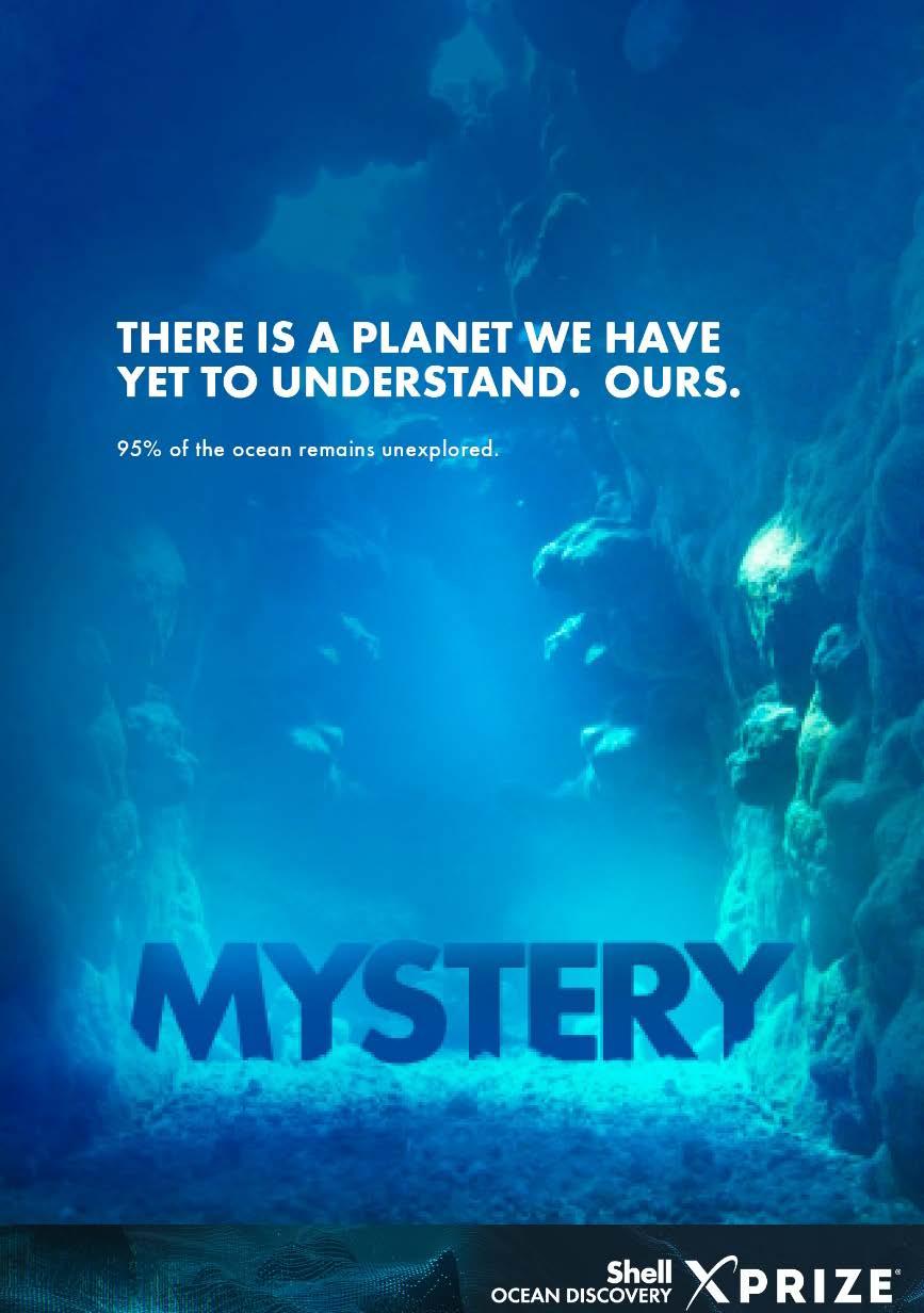

23 Innovative Tools and Techniques 23 Image from XPRIZE

24 Ocean Stewardship Difficult to achieve without a comprehensive map of the world s oceans Image from XPRIZE 24
25 Thank You David Millar Fugro San Diego, USA
Briefing on the work of GEBCO (GENERAL BATHYMETRIC CHART OF THE OCEANS)
") Briefing on the work of GEBCO (GENERAL BATHYMETRIC CHART OF THE OCEANS) 7th ROPME Sea Area Hydrographic Commission Meeting, Muscat, Oman 20-22 February 2017 What is GEBCO? The General Bathymetric Chart
Briefing on the work of GEBCO (GENERAL BATHYMETRIC CHART OF THE OCEANS) 7th ROPME Sea Area Hydrographic Commission Meeting, Muscat, Oman 20-22 February 2017 What is GEBCO? The General Bathymetric Chart
Established Global bathymetry yproducts. Undersea feature names. Capacity building
 IHO IOC Established 1903 Global bathymetry yproducts Undersea feature names Capacity building A GEBCO data GEBCO s d t sets t and d products d t Global bathymetric grids Global set of bathymetric contours
General Bathymetric Chart of the Oceans
 General Bathymetric Chart of the Oceans GEBCO A look at the world from an ocean s perspective On behalf of GEBCO: Boris Dorschel 1, Martin Jakobsson 2 1 Department of Geophysics, Alfred Wegener Institute
Seabed 2030: A Call to Action
 Seabed 2030: A Call to Action Rear Adm. Shepard Smith NOAA Office of Coast Survey shep.smith@noaa.gov Introduction Many people like me start speeches about mapping the ocean with we know more about the
IHO Input to the Report of the UN Secretary General on Oceans and Law of the Sea Executive Summary General
 IHO Input to the Report of the UN Secretary General on Oceans and Law of the Sea The following notes provide information on activities of the International Hydrographic Organization that are relevant to
NOAA/University of New Hampshire Joint Hydrographic Center & Center for Coastal and Ocean Mapping. MAPPS Summer Conference July 23, 2013
 NOAA/University of New Hampshire Joint Hydrographic Center & Center for Coastal and Ocean Mapping MAPPS Summer Conference July 23, 2013 07/23/2013 2 07/23/2013 3 Center Goals To be a world leader in the
Open Geospatial Consortium activities in the Maritime domain
 Open Geospatial Consortium activities in the Maritime domain Scott Simmons Executive Director, Standards Program General Maritime efforts participants Alliance partners IHO ISO / TC 211 Members Danish
The route towards a new GEBCO grid
 The route towards a new GEBCO grid Pauline Weatherall, GEBCO Digital Atlas Manager British Oceanographic Data Centre (BODC) GEBCO TSCOM/SCRUM meeting, Monaco, October 2012 The route towards a new GEBCO
PRINCIPLES AND APPLICATIONS of OCEAN FEATURE NOMENCLATURE
 PRINCIPLES AND APPLICATIONS of OCEAN FEATURE NOMENCLATURE Michel HUET International Hydrographic Bureau MONACO "Undersea feature" is a part of the ocean floor or seabed that has measurable relief or is
R E P U B L I C O F C Y P R U S NATIONAL REPORT OF CYPRUS TO THE MEDITERRANEAN AND BLACK SEAS HYDROGRAPHIC COMMISSION (MBSHC)
") R E P U B L I C O F C Y P R U S NATIONAL REPORT OF CYPRUS TO THE MEDITERRANEAN AND BLACK SEAS HYDROGRAPHIC COMMISSION (MBSHC) ISTANBUL MEETING 25-27 SEPTEMBER 2013 NATIONAL REPORT OF CYPRUS TO THE MEDITERRANEAN
R E P U B L I C O F C Y P R U S NATIONAL REPORT OF CYPRUS TO THE MEDITERRANEAN AND BLACK SEAS HYDROGRAPHIC COMMISSION (MBSHC) ISTANBUL MEETING 25-27 SEPTEMBER 2013 NATIONAL REPORT OF CYPRUS TO THE MEDITERRANEAN
INTERNATIONAL HYDROGRAPHIC BUREAU 4b, quai Antoine 1er BP 445 MC MONACO CEDEX PRINCIPAUTE DE MONACO
 IHO Input to Part I of the Report of the UN Secretary General on Oceans and Law of the Sea This contribution is provided in response to letter LOS/SGR/2015 dated 10 December 2014 as the input from the
Billions of measurements for millions of square kilometres
 Billions of measurements for millions of square kilometres Dr. Mathias Jonas Secretary-General of the : History and Constitution 2 1 All waters on earth 3 20 th Century idea: GEBCO General bathymetric
CANADIAN HYDROGRAPHIC SERVICE
 CANADIAN HYDROGRAPHIC SERVICE Surveying and Charting Canada s Waters Since 1883 Ilulisat Maritime Workshop 2017 The Importance and Need for Hydrography Denis Hains, Hydrographer General of Canada & Director
12/11/2013& egm502 seafloor mapping
 egm502 seafloor mapping lecture 13 multi-beam echo-sounders The majority of the current charts of the ocean floors have been produced from single beam echo-sounder data. Even though these data have been
Bathymetry. EMODnet Stakeholder Conference & Sea-basin Workshops February Bathymetry
 EMODnet Stakeholder Conference & Sea-basin Workshops 14-15 February 2017 Arctic checkpoint Belinda Kater On behalf of all Checkpoints http://www.emodnet.eu 1 ? is the study of the "beds" or "floors" of
Joint Hydrographic Center, National Oceanic and Atmospheric Administration, Durham, NH 03824, USA
 Future directions in hydrography using satellite-derived bathymetry Shachak Pe eri 1, Christopher Parrish 2, 3, Lee Alexander 1, Chukwuma Azuike 1, Andrew Armstrong 1,3 and Maryellen Sault 2 1 Center for
Briefing Notes for World Hydrography Day
 Briefing Notes for World Hydrography Day - 2017 Mapping our seas, oceans and waterways - more important than ever Purpose of World Hydrography Day In 2005, the General Assembly of the United Nations (UN)
The Arctic - A New Frontier The geological, environmental and engineering challenges for submarine telecommunication cables
 The Arctic - A New Frontier The geological, environmental and engineering challenges for submarine telecommunication cables Ryan Wopschall 5 September 2013 Oceanology International China, Shanghai Fugro
Critical issues relating to the integration of land and marine geospatial information
 Committee of Experts on Background document 1 Global Geospatial Information Management Available in English only Third session Cambridge, United Kingdom of Great Britain and Northern Ireland 24-26 July
OCEANOGRAPHIC DATA MANAGEMENT
 OCEANOGRAPHIC DATA MANAGEMENT Presented to: Environmental Disaster Data Management Meeting Russ Beard Director, National Coastal Data Development Center Interim Science Coordinator, Gulf Restoration Council
Seabed knowledge In support of UN SDGs
 Seabed knowledge In support of UN SDGs Evert Flier Fiskerifaglig forum 2. november 2017 Hydrography & small scale fishing Hydrography in Transition Serving the Maritime Community Hydrography in Transition
Current Hydrographic Projects at BSH
 7 th Workshop Seabed Acoustics, Rostock, November 19/20, 2015 P01-1 Current Hydrographic Projects at BSH Thomas Dehling Federal Maritime and Hydrographic Agency (BSH) Germany Contact Address Website BSH
- West Africa. Abuja, Nigeria May Fredericton Canada Heeswijk The Netherlands Washington DC United States Adelaide Australia
 A Case Study in Land and Sea Data Interoperability Patricia GASPAR(Netherlands), Andrew HOGGARTH(Canade), Gordon JOHNSTON(UK), Charles de JONG(Netherlands) - West Africa Abuja, Nigeria - 6-10 May 2013
National Marine Sanctuary Program
 National Marine Sanctuary Program NMSP/USGS Joint Seabed Mapping Initiative: September 2004 AA National Ocean Service National Marine Sanctuaries Interim Report September 2004 Background: Since 2002,
SW Florida Escarpment Mapping Area
 Overview NOAA s Okeanos Explorer (EX) Program plans to conduct systematic mapping and telepresence-enabled ROV explorations in the Gulf of Mexico during Spring 2014. In 2011, the EX conducted mapping operations
GEBCO 2013 TSCOM. EMODNET Hydrography status report
 www.emodnet-hydrography.eu GEBCO 2013 TSCOM EMODNET Hydrography status report Eric Moussat, Ifremer on behalf of the Emodnet consortium 1 Background and objectives EU proposed to take steps in 2008 towards
Appendix I: Geographic Information System Data Sources
 Appendix I: Geographic Information System Data Sources Draft Environmental Impact Statement/Overseas Environmental Impact Statement Hawaii-Southern California Training and Testing TABLE OF CONTENTS...
Economic and Social Council 10 July 2013
 ADVANCE UNEDITED VERSION UNITED NATIONS E/C.20/2013/10/Add.1 Economic and Social Council 10 July 2013 Committee of Experts on Global Geospatial Information Management Third session Cambridge, United Kingdom
Detailed mapping of seabed topography,
 MAREANO program Detailed mapping of seabed topography, sediments, bottom fauna and pollutants in Norwegian waters HYDROGRAPHIC DATA FOR THE BENEFIT OF SOCIETY MAREANO program - Detailed mapping of seabed
Marine Spatial Data for Marine Spatial Planning. Ocean Leadership 2010 Public Policy Forum
 Marine Spatial Data for Marine Spatial Planning Ocean Leadership 2010 Public Policy Forum March 10, 2010 Edward Saade President, Fugro EarthData, Inc 1 Marine Spatial Data What is Marine Spatial Data?
Inspection of Waterfront Facilities Using Vessel-Based Remote Sensing Mitchell, Del Bello, Suarez
 Inspection of Waterfront Facilities Using Vessel-Based Remote Sensing Mitchell, Del Bello, Suarez American Association of Port Authorities Facilities Engineering Conference October 20-22, 2015 Waterfront
A Case Study in Land and Sea Data Interoperability
 Andrew HOGGARTH, CANADA, Gordon JOHNSTON, UNITED KINGDOM, Charles de Jongh and Peter Schwarzberg, NETHERLANDS Key words: Disaster Planning, Coast, Bathymetry, Database, Interoperability SUMMARY In Mozambique
The Global Statistical Geospatial Framework and the Global Fundamental Geospatial Themes
 The Global Statistical Geospatial Framework and the Global Fundamental Geospatial Themes Sub-regional workshop on integration of administrative data, big data and geospatial information for the compilation
Ministry of ICT of I.R.IRAN
 The ECO 8/6 mill km 2 10 Slamic countries ~330 mill people Oil, Gas, Industries,Tourism 2 Issue transformation in last decade Problem solving needs more integrated approach More interaction &complexity
IHO Perspective on a Marine Spatial Data Infrastructure
 IHO Perspective on a Marine Spatial Data Infrastructure Anthony Pharaoh (International Hydrographic Bureau) Definitions of Hydrography on the Web: The study of the surface waters of the Earth. www.geographic.org/glossary.html
MARINE SPATIAL PLANNING & MARINE CADASTRE: CHALLENGES AND ISSUES
 MARINE SPATIAL PLANNING & MARINE CADASTRE: CHALLENGES AND ISSUES Roger Longhorn Secretary General, GSDI Association rlonghorn@gsdi.org Member, IHO Marine SDI Working Group ral@alum.mit.edu Member, UNESCO
Figure 3.1: Illustration showing the bathymetry s role for the tsunami propagation following the earth quake 26 December 2004 outside of Sumatra.
 Figure 3.1: Illustration showing the bathymetry s role for the tsunami propagation following the earth quake 26 December 2004 outside of Sumatra. The left globe shows the seafloor bathymetry as portrayed
Image Services Providing Access to Scientific Data at NOAA/NCEI
 Image Services Providing Access to Scientific Data at NOAA/NCEI Jesse Varner Cooperative Institute for Research in Environmental Sciences (CIRES), University of Colorado John Cartwright NOAA National Centers
14 th NIOHC, Myanmar National Report MYANMAR NAVAL HYDROGRAPHIC CENTRE (MNHC) NATIONAL REPORT HYDROGRAPHIC DEPARTMENT, ROYAL THAI NAVY-HDRTN
 NATIONAL REPORT HYDROGRAPHIC DEPARTMENT, ROYAL THAI NAVY-HDRTN") 14 th NIOHC, Myanmar National Report MYANMAR NAVAL HYDROGRAPHIC CENTRE (MNHC) NATIONAL REPORT 14 th NORTH INDIAN OCEAN HYDROGRAPHIC COMMISSION CONFERENCE HYDROGRAPHIC DEPARTMENT, ROYAL THAI NAVY-HDRTN
14 th NIOHC, Myanmar National Report MYANMAR NAVAL HYDROGRAPHIC CENTRE (MNHC) NATIONAL REPORT 14 th NORTH INDIAN OCEAN HYDROGRAPHIC COMMISSION CONFERENCE HYDROGRAPHIC DEPARTMENT, ROYAL THAI NAVY-HDRTN
IHO MSDI Forum 30 January 2013 The IHO perspective - Is there a new role for national HO and IHO?
 International Hydrographic Organization IHO MSDI Forum 30 January 2013 The IHO perspective - Is there a new role for national HO and IHO? Michel Huet IHB XVIIIth IHC, Monaco, Apr. 2012 The main aim for
U.S. Arctic Campaign Scenario
 Prepared by the NOAA Office of Ocean Exploration and Research for Nation Ocean Exploration Forum 2016: Beyond the Ships. Sea ice extent from National Snow Service Layer Credits: NOAA National Centers for
Options in Capacity Building. Underpinning the Blue Economy. Slide 1/78. Derrick R. Peyton. 14 th MACHC Meeting. IIC Technologies. December 9-13, 2013
 Options in Capacity Building Underpinning the Blue Economy Derrick R. Peyton IIC Technologies 14 th MACHC Meeting December 9-13, 2013 Slide 1/78 Overview Blue Economy Defined Challenges (SDI, MSDI, Standards)
Supplement of Scenario-based numerical modelling and the palaeo-historic record of tsunamis in Wallis and Futuna, Southwest Pacific
 Supplement of Nat. Hazards Earth Syst. Sci., 15, 1763 1784, 2015 http://www.nat-hazards-earth-syst-sci.net/15/1763/2015/ doi:10.5194/nhess-15-1763-2015-supplement Author(s) 2015. CC Attribution 3.0 License.
Into the Digital Age the GEBCO Digital Atlas
 1983-2003 1983 * Digitisation of the GEBCO Fifth Edition - 1993 1993 * Initialisation of the GEBCO Digital Atlas 1993 * Updating the GEBCO Digital Atlas - 2003 Revised Bathymetry - contours Creation of
STATUS OF MARINE SPATIAL DATA INFRASTRUCTURE
 STATUS OF MARINE SPATIAL DATA INFRASTRUCTURE IN PACIFIC ISLAND COUNTRIES 26 th January, 2016 7 th IHO Marine Spatial Data Infrastructure Working Group Meeting Tokyo Sachindra Singh Senior Geospatial Systems
CANADIAN HYDROGRAPHIC SERVICE & OCEANOGRAPHIC SERVICES
 CANADIAN HYDROGRAPHIC SERVICE & OCEANOGRAPHIC SERVICES Presentation to Warming of the North Conference Ottawa, March 2 nd, 2015 Denis Hains, Director General & Hydrographer General of Canada TIP OF THE
UNDERSEA FEATURE NAME PROPOSAL (See IHO-IOC Publication B-6 and NOTE overleaf)
") INTERNATIONAL HYDROGRAPHIC ORGANIZATION INTERGOVERNMENTAL OCEANOGRAPHIC COMMISSION (of UNESCO) Note: The boxes will expand as you fill the form. UNDERSEA FEATURE NAME PROPOSAL (See IHO-IOC Publication
INTERNATIONAL HYDROGRAPHIC ORGANIZATION INTERGOVERNMENTAL OCEANOGRAPHIC COMMISSION (of UNESCO) Note: The boxes will expand as you fill the form. UNDERSEA FEATURE NAME PROPOSAL (See IHO-IOC Publication
The french national programme for claiming continental shelf beyond 200 Miles
 The french national programme for claiming continental shelf beyond 200 Miles Using global bathymetric models in the context of an Extended Continental Shelf submission EXTRAPLAC Using Global Bathymetric
Marine Spatial Planning: A Tool for Implementing Ecosystem-Based Management
 Marine Spatial Planning: A Tool for Implementing Ecosystem-Based Management Steven Murawski, Ph.D., Ecosystem Goal Team Lead National Oceanic and Atmospheric Administration NOAA November 16, 2009 1 To
NEW TOOLS TO IMPROVE DESKTOP SURVEYS
 NEW TOOLS TO IMPROVE DESKTOP SURVEYS Pablo Vengoechea (Telemediciones S.A.), Jorge O. García (Telemediciones S.A.), Email: Telemediciones S.A. / Cra. 46 94-17 Bogotá D.C.
3. UNDERWAY GEOPHYSICS 1
 Sawyer, D.S., Whitmarsh, R.B., Klaus, A., et al., 1994 Proceedings of the Ocean Drilling Program, Initial Reports, Vol. 149 3. UNDERWAY GEOPHYSICS 1 Shipboard Scientific Party 2 EQUIPMENT AND METHODS Navigation
8 th Arctic Regional Hydrographic Commission Meeting September 2018, Longyearbyen, Svalbard Norway
 8 th Arctic Regional Hydrographic Commission Meeting 11-13 September 2018, Longyearbyen, Svalbard Norway Status Report of the Arctic Regional Marine Spatial Data Infrastructures Working Group (ARMSDIWG)
Geophysical Site Surveys
 Geophysical Site Surveys Simon Oakley Geoscience Team Leader Fugro Survey Limited 16/04/2014 Contents Menu Introduction Section 1 - Geophysical Site Surveys - Seabed Bathymetry - Shallow Geology - Seabed
UNDERSEA FEATURE NAME PROPOSAL (See IHO-IOC Publication B-6 and NOTE overleaf)
") INTERNATIONAL HYDROGRAPHIC ORGANIZATION INTERGOVERNMENTAL OCEANOGRAPHIC COMMISSION (of UNESCO) Note: The boxes will expand as you fill the form. UNDERSEA FEATURE NAME PROPOSAL (See IHO-IOC Publication
INTERNATIONAL HYDROGRAPHIC ORGANIZATION INTERGOVERNMENTAL OCEANOGRAPHIC COMMISSION (of UNESCO) Note: The boxes will expand as you fill the form. UNDERSEA FEATURE NAME PROPOSAL (See IHO-IOC Publication
EU HOs in Mediterranean and Black Sea (MBS) CROATIA FRANCE GREECE ITALY MALTA X SLOVENIA X SPAIN ROMANIA X
 CROATIA FRANCE GREECE ITALY MALTA X SLOVENIA X SPAIN ROMANIA X") EU HOs in Mediterranean and Black Sea (MBS) CROATIA FRANCE GREECE ITALY MALTA X SLOVENIA X SPAIN ROMANIA X Croatia Current status of hydrographic survey in acc. IHO C-55 pub. criteria Croatia Croatia by
EU HOs in Mediterranean and Black Sea (MBS) CROATIA FRANCE GREECE ITALY MALTA X SLOVENIA X SPAIN ROMANIA X Croatia Current status of hydrographic survey in acc. IHO C-55 pub. criteria Croatia Croatia by
Faatasi Malologa (PGSC Chair) Director Department of Lands & Survey, Tuvalu
 Director Department of Lands & Survey, Tuvalu") Seventh Session of the United Nations Committee of Experts on Global Geospatial Information Management (UN-GGIM) - 31 July -4 August 2017 Faatasi Malologa (PGSC Chair) Director Department of Lands & Survey,
Seventh Session of the United Nations Committee of Experts on Global Geospatial Information Management (UN-GGIM) - 31 July -4 August 2017 Faatasi Malologa (PGSC Chair) Director Department of Lands & Survey,
NOAA Surface Weather Program
 NOAA Surface Weather Program Maintenance Decision Support System Stakeholder Meeting #9 Jim O Sullivan NOAA Surface Weather Program Manager NWS Office of Climate, Water, and Weather Services September
Marine Spatial Management Tool
 Marine Spatial Management Tool Marine Spatial Management Tool Support the marine spatial planning process with updated and reliable geospatial information Marine management is important to Norway with
Lawrence A. Lawver Ian W.D. Dalziel Robert Larter University of Texas at Austin, Institute for Geophysics British Antarctic Survey
 20 August 2012 Prof. Hans-Werner Schenke, Chairman GEBCO Sub-Committee on Undersea Feature Names (SCUFN) International Hydrographic Bureau (IHB) 4, Quai Antoine 1er B.P. 445 MC 98011 MONACO CEDEX Principality
Initiatives in Using Crowdsourcing, Satellite Derived Bathymetry, and Other Non-Traditional Hydrographic/Bathymetric Measurements
 University of New Hampshire University of New Hampshire Scholars' Repository Center for Coastal and Ocean Mapping Center for Coastal and Ocean Mapping 10-5-2015 Initiatives in Using Crowdsourcing, Satellite
Updating the GEBCO_08 Grid with regional compilations and surveys
 Updating the GEBCO_08 Grid with regional compilations and surveys Pauline Weatherall, GEBCO Digital Atlas Manager, British Oceanographic Data Centre (BODC) GEBCO TSCOM/iSCRUM meeting, SIO, October 2011
EMODnet High Resolution Seabed Mapping - further developing and providing a high resolution digital bathymetry for European seas
 EMODnet High Resolution Seabed Mapping - further developing and providing a high resolution digital bathymetry for European seas EGU Fall 2017 meeting New Orleans USA, December 2017 Schaap Dick MARIS,
An Industry Perspective. Bryn Fosburgh Vice President Trimble
 An Industry Perspective Bryn Fosburgh Vice President Trimble Who are we? Professionals & Consultants Geospatial Professionals working at or with: AEC Consultants Transportation Departments Construction
Coastal Mapping Follow on? Bruno Frachon Corine Lochet Gaël Morvan
 Coastal Mapping Follow on? Bruno Frachon Corine Lochet Gaël Morvan Shared objectives; IHO DG MARE CPMR Development of a Joint European Coastal Mapping Programme (JECMaP) within the IHO EU network with
IHO STAKEHOLDERS FORUM. Hydrographic data and its role in MSDI. Thursday 27 September Jens Peter Hartmann KMS
 IHO STAKEHOLDERS FORUM Hydrographic data and its role in MSDI Thursday 27 September Jens Peter Hartmann KMS Agenda Traditional approach to hydrographic data Expectations within the marine / maritime field
Cooperating Organization Report of Circum Pacific Council for Energy and Mineral Resources (CPC)
") CCOP-41AS/6.2-29 Coordinating Committee for Geoscience Programmes in East and Southeast Asia (CCOP) 41 st CCOP Annual Session 15 18 November 2004 Tsukuba, Japan Cooperating Organization Report of Circum
CCOP-41AS/6.2-29 Coordinating Committee for Geoscience Programmes in East and Southeast Asia (CCOP) 41 st CCOP Annual Session 15 18 November 2004 Tsukuba, Japan Cooperating Organization Report of Circum
Mapping Undersea Feature Names in S-100. UFNPT at SCUFN 31 Wellington, New Zealand October, 2018
 Mapping Undersea Feature Names in S-100 UFNPT at SCUFN 31 Wellington, New Zealand October, 2018 Content - Update about UFNPT - Discovery of Undersea Features - excercise Work Plan of the UFNPT November
R E P U B L I C O F C Y P R U S. NATIONAL REPORT OF CYPRUS TO THE 19 th MEDITERRANEAN AND BLACK SEAS HYDROGRAPHIC COMMISSION (MBSHC)
") R E P U B L I C O F C Y P R U S NATIONAL REPORT OF CYPRUS TO THE 19 th MEDITERRANEAN AND BLACK SEAS HYDROGRAPHIC COMMISSION (MBSHC) BATUMI MEETING 30 JUNE TO 02 JULY 2015 NATIONAL REPORT OF CYPRUS TO THE
R E P U B L I C O F C Y P R U S NATIONAL REPORT OF CYPRUS TO THE 19 th MEDITERRANEAN AND BLACK SEAS HYDROGRAPHIC COMMISSION (MBSHC) BATUMI MEETING 30 JUNE TO 02 JULY 2015 NATIONAL REPORT OF CYPRUS TO THE
Advancing Geoscientific Capability. Geological Survey of Finland
 Advancing Geoscientific Capability Geological Survey of Finland GTK in brief The Geological Survey of Finland (GTK) is one of the largest European centres of excellence in assessment, research and the
UN GGIM and National SDI Strategy
 MSDI Open Forum on 26 th January 2016 Contributing to the successful delivery of MSDI UN GGIM and National SDI Strategy Hiroshi Murakami Deputy Administrator Geospatial Information Authority of Japan Geospatial
Enabling Access to Arctic Location Based Information - the Arctic SDI
 Enabling Access to Arctic Location Based Information - the Arctic SDI Jani Kylmäaho Head of Arctic SDI Geoportal WG National Land Survey of Finland SAO Chair, WG Chairs and Executive Secretaries meeting
FINMARINET: Inventories and Planning for the Marine Natura 2000 Network in Finland. A.2 Geological inventories of the seafloor Final Report
 LIFE07 NAT/FIN/000151 FINMARINET: Inventories and Planning for the Marine Natura 2000 Network in Finland A.2 Geological inventories of the seafloor Final Report Geological Survey of Finland, GTK 1. Introduction
Working Group on Geospatial Information
 GEO-XIV Plenary Summary Working Group on Geospatial Information 4 th Meeting Lawrence Friedl Argyro Kavvada Group on Earth Observations NASA Earth Science Dec. 6-8, 2017 An intergovernmental organization
MONITORING OF VENICE INLET CHANNELS. Sharing knowledge to make data available for everyone
 MONITORING OF VENICE INLET CHANNELS Sharing knowledge to make data available for everyone Introduction What does hydrography really mean? IHO defines hydrography as a description of the physical features
Mapping Maine s Working Waterfront: for Our Heritage and Economy
 Mapping Maine s Working Waterfront: for Our Heritage and Economy Abstract Mapping Maine s Working Waterfronts is a collaborative project led by the Island Institute that inventories the state s current
Bathymetry Data and Models: Best Practices
 Bathymetry Data and Models: Best Practices Barry Eakins & Lisa Taylor The NOAA National Geophysical Data Center Over 600 data types - from the core of the Earth to the surface of the Sun NGDC Bathymetry
The role of the Italian Navy Hydrographic Institute in the Arctic activities
 The role of the Italian Navy Hydrographic Institute in the Arctic activities Luigi Sinapi Director of the Italian Hydrographic Institute Early Arctic hydrographic surveys ICE ICE Arctic hydrographic monitoring
Pan American Institute of Geography and History. 12th MACHC 5-9 December 2011
 Pan American Institute of Geography and History 12th MACHC 5-9 December 2011 1 PAIGH Mission and Objectives To encourage, coordinate, and publicize cartographical, geographical, geophysical and historical
Arctic Spatial Data Infrastructure Enabling Access to Arctic Location-Based Information
 Arctic Spatial Data Infrastructure Enabling Access to Arctic Location-Based Information Arctic SDI Side Event Co-Chairs: Arvo Kokkonen Arctic SDI Board Chair & Director General, National Land Survey of
Managing bathymetric data in a hydrographic survey company
 Managing bathymetric data in a hydrographic survey company Overview Brief Introduction to MMT How MMT use GIS Why we need to manage bathy data The BIS Inputting Data to the BIS Using the BIS GIS Product
Implementing the Sustainable Development Goals: The Role of Geospatial Technology and Innovation
 Fifth High Level Forum on UN Global Geospatial Information Management Implementing the Sustainable Development Goals: The Role of Geospatial Technology and Innovation 28-30 November 2017 Sheraton Maria
Coordinates : A - of midpoint or summit : Lat., Long. } to. Description (kind of feature) : seachannel
 : seachannel") INTERNATIONAL HYDROGRAPHIC ORGANIZATION INTERGOVERNMENTAL OCEANOGRAPHIC COMMISSION (of UNESCO) IHO/IOC Form No. 1 UNDERSEA FEATURE NAME PROPOSAL (See NOTE overleaf) Ocean or Sea Japan Sea Name proposed
INTERNATIONAL HYDROGRAPHIC ORGANIZATION INTERGOVERNMENTAL OCEANOGRAPHIC COMMISSION (of UNESCO) IHO/IOC Form No. 1 UNDERSEA FEATURE NAME PROPOSAL (See NOTE overleaf) Ocean or Sea Japan Sea Name proposed
The Chairmanship Brand
 The Chairmanship Brand One Arctic: Shared Opportunities, Challenges and Responsibilities Borrowed One Arctic from ICC 2014 General Assembly shows unity among the Arctic States and peoples Shared Opportunities,
EMODnet High Resolution Seabed Mapping - further developing a high resolution digital bathymetry for European seas
 EMODnet High Resolution Seabed Mapping - further developing a high resolution digital bathymetry for European seas IMDIS 2018 Conference, 7 November 2018, Barcelona - Spain Thierry Schmitt Dick M.A. Schaap
COVERAGE-Sargasso Sea
 COVERAGE-Sargasso Sea A Collaborative Project between NASA and the Sargasso Sea Commission Dr. Vardis Tsontos Dr. Jorge Vazquez NASA Jet Propulsion Laboratory, California Institute of Technology UN-HQ
Digital Elevation Model (DEM) of Sable Island Bank and adjacent areas
 of Sable Island Bank and adjacent areas") GEOLOGICAL SURVEY OF CANADA OPEN FILE 5348 Digital Elevation Model (DEM) of Sable Island Bank and adjacent areas K.J. Webb and E.L. King 2014 GEOLOGICAL SURVEY OF CANADA OPEN FILE 5348 Digital Elevation
GEOLOGICAL SURVEY OF CANADA OPEN FILE 5348 Digital Elevation Model (DEM) of Sable Island Bank and adjacent areas K.J. Webb and E.L. King 2014 GEOLOGICAL SURVEY OF CANADA OPEN FILE 5348 Digital Elevation
Outline of presentation
 - lessons learnt from precedent cases of establishing the s Outline of presentation Extending Ireland s continental shelf jurisdiction to the outer s in the Porcupine Abyssal Plain: progress, issues and
Smart Survey Approach: Multibeam Echosounder and Integrated Water Column Data as an Added Value for Seep Hunting
 Smart Survey Approach: Multibeam Echosounder and Integrated Water Column Data as an Added Value for Seep Hunting HYDRO 2016 8 November 2016 Marco Filippone Introduction, Multibeam Sonars & water column
A Factor of 2-4 Improvement in Marine Gravity and Predicted Bathymetry from CryoSat, Jason-1, and Envisat Radar Altimetry: Arctic and Coastal Regions
 DISTRIBUTION STATEMENT A. Approved for public release; distribution is unlimited. A Factor of 2-4 Improvement in Marine Gravity and Predicted Bathymetry from CryoSat, Jason-1, and Envisat Radar Altimetry:
Situational Report HOW PLANET MONITORS DEVELOPMENTS IN THE SOUTH CHINA SEA AUGUST 1, 2016 IMAGE ACQUIRED: JULY 22, 2015 PLANET.
 Situational Report IMAGE ACQUIRED: JULY 22, 2015 HOW PLANET MONITORS DEVELOPMENTS IN THE SOUTH CHINA SEA AUGUST 1, 2016 PRESS@PLANET.COM PLANET.COM THE SITUATION An international tribunal in The Hague
Applications of GIS and Remote Sensing in Ocean Exploration
 Applications of GIS and Remote Sensing in Ocean Exploration Geographic Information Systems (GIS) and Remote Sensing (RS) are critical to the success of Ocean Exploration. In the most basic sense, there
European Commission STUDY ON INTERIM EVALUATION OF EUROPEAN MARINE OBSERVATION AND DATA NETWORK. Executive Summary
 European Commission STUDY ON INTERIM EVALUATION OF EUROPEAN MARINE OBSERVATION AND DATA NETWORK Executive Summary by NILOS Netherlands Institute for the Law of the Sea June 2011 Page ii Study on Interim
Your web browser (Safari 7) is out of date. For more security, comfort and the best experience on this site: Update your browser Ignore
 is out of date. For more security, comfort and the best experience on this site: Update your browser Ignore") Your web browser (Safari 7) is out of date. For more security, comfort and the best experience on this site: Update your browser Ignore BATHYMETRY For the complete encyclopedic entry with media resources,
Your web browser (Safari 7) is out of date. For more security, comfort and the best experience on this site: Update your browser Ignore BATHYMETRY For the complete encyclopedic entry with media resources,
A National Ocean Policy for Malaysia: Rationale and Proposed Components. Mohd Nizam Basiron and Cheryl Rita Kaur Maritime Institute of Malaysia
 A National Ocean Policy for Malaysia: Rationale and Proposed Components Mohd Nizam Basiron and Cheryl Rita Kaur Maritime Institute of Malaysia Outline of Presentation Objectives of Presentation Introduction
Proposal for the preparation of a new International Bathymetric Chart of the Southern Ocean (IBCSO) to be presented at the 3 rd HCA Meeting
 to be presented at the 3 rd HCA Meeting") IHO HYDROGRAPHIC COMMITTEE ON ANTARCTICA (HCA) 3rd Meeting, IHB, Monaco, 8-10 September 2003 Dr.-Ing. Hans Werner Schenke Proposal for the preparation of a new International Bathymetric Chart of the Southern
IHO HYDROGRAPHIC COMMITTEE ON ANTARCTICA (HCA) 3rd Meeting, IHB, Monaco, 8-10 September 2003 Dr.-Ing. Hans Werner Schenke Proposal for the preparation of a new International Bathymetric Chart of the Southern
STATISTICAL ANALYSIS FOR AUTOMATED SEEP EXTRACTION IN GIS
 STATISTICAL ANALYSIS FOR AUTOMATED SEEP EXTRACTION IN GIS Presented by Pamela Kanu, GISP ESRI USER CONFERENCE JULY 2017 SEEPS Seeps are natural gas and crude oil that enter the ocean through cracks and
GEO Coastal Zone Community of Practice (CZCP)
") ! "#$%&" $'( )$*+,-.'// Global, regional and local trends in natural processes and human demands on coastal ecosystems jeopardize the ability of these ecosystems to support commerce, living resources,
! "#$%&" $'( )$*+,-.'// Global, regional and local trends in natural processes and human demands on coastal ecosystems jeopardize the ability of these ecosystems to support commerce, living resources,
Coastal Response Research Center. Nancy Kinner University of New Hampshire (UNH) Michele Jacobi NOAA ORR. September 27, 2007
 Michele Jacobi NOAA ORR. September 27, 2007") Coastal Response Research Center Nancy Kinner University of New Hampshire (UNH) Michele Jacobi NOAA ORR September 27, 2007 1 Coastal Response Research Center (CRRC) CRRC is partnership between NOAA s Office
Coastal Response Research Center Nancy Kinner University of New Hampshire (UNH) Michele Jacobi NOAA ORR September 27, 2007 1 Coastal Response Research Center (CRRC) CRRC is partnership between NOAA s Office
Capacity Building in Ocean Bathymetry The Nippon Foundation GEBCO Training Programme at the University of New Hampshire
 VOL. 6 NO. 3 (NEW SERIES) NOVEMBER 2005 Note Capacity Building in Ocean Bathymetry The Nippon Foundation GEBCO Training Programme at the University of New Hampshire Srinivas Karlapati 1, Dave Monahan 2,
Specification & Content of Marine Reference Information
 Specification & Content of Marine Reference Information By Mike Osborne and James Rapaport SeaZone Solutions Limited CONTENTS 1. History of Marine Data 2. User Requirements 3. Geographic Content 4. SeaZone