Multibeam Hydrographic Survey Use for Construction Control of Filling and Ground Improvement Activities
|
|
|
- Neal Pope
- 5 years ago
- Views:
Transcription

1 Multibeam Hydrographic Survey Use for Construction Control of Filling and Ground Improvement Activities WEDA Cincinnati April 10, 2014 Ray Wood C.Eng Executive Vice President Fugro Consultants Inc

2 Advantages of High Resolution MBES Survey Technology High accuracy and precision of data collection Clearly define site sea/river bed conditions through remote detection Minimize probability of encountering site hazards/obstructions while maximizing safety of overall project Provide guidance during project planning and geotechnical survey Easily integrated with side scan sonar, sub bottom profiling, magnetometer surveys to provide cost effective site characterisation Good data minimises Contractor s pricing of risk contingencies
3 Hydrographic Survey Systems: R2 Sonic 2024 Multibeam Overview Acquisition system uses 256 beams at a 0.5 degree beam angle and is recorded at 200 to 400 khz Beam angles can be electronically adjusted to : 1. Provide increased data density in narrower swath 2. Rotate and focus energy at Mudline desired angle Adjustments to swath and rotation can be made during real-time survey operations ROTATED NARROW SWATH 256 Beams with 30 Swath - Rotated Transducer WIDE SWATH 256 Beams with 160 Swath Transducer NARROW SWATH 256 Beams with 30 Swath Transducer Beams Steered to Focus on Toe of Slope Mudline Mudline Schematic drawings angles are approximate Increased Data Density

4 Advantages of Swath Bathymetry Ideal solution for shallow water Complete coverage of riverbed Uses sound (sonar) pulses to map the seafloor Optimum seafloor detail for engineering, construction, scour monitoring, dredge programs, and environmental projects Fewer boat passes than single beam survey = faster survey Comparison of Survey System Footprints Single Beam Multibeam Wide Angle Multibeam Schematic drawing actual swath apertures will vary depending on system and system settings


5 Hydrographic Survey Systems: Pierhead Survey Steerable multibeam -Identify debris -Slope Failures -Q/A Dredge Cuts -Image behind pierhead Pierhead Debris: Pile U.S. Navy Pier 12 Slope Failure Overhang from Cutterhead 17 feet Over Steepened Slope Date


6 Hydrographic Survey Systems: Data Density Example Higher density data can provide: 1. Better water depth definition 2. Better resolution of features in the dredge cut or on the riverbed Obstructions, slope failures, shoals Lower Data Density Survey Sunken barge Higher Data Density Survey R2 Sonic multibeam beams can be focused to collect narrower swath and denser data in dredge cut than shallower water flanks outside of cut Norfolk, VA Survey Better-defined detail of sunken barge Pilings


 compensation measurements")

7 Multibeam Survey Comparison of Same Site Fugro Survey No offset in riverbed No offset in pipelines Survey by Others Vessel motion artifacts present Incorrect roll, pitch, or yaw/azimuth offsets Corrected through patch test Roll Artifacts Pipelines Poor motion (roll, pitch, and yaw) compensation measurements from bad patch tests or sensor misalignment and offsets may result in significant vessel motion artifacts

8 Hydrographic Services Infrastructure Conditions INTACT PIPELINE


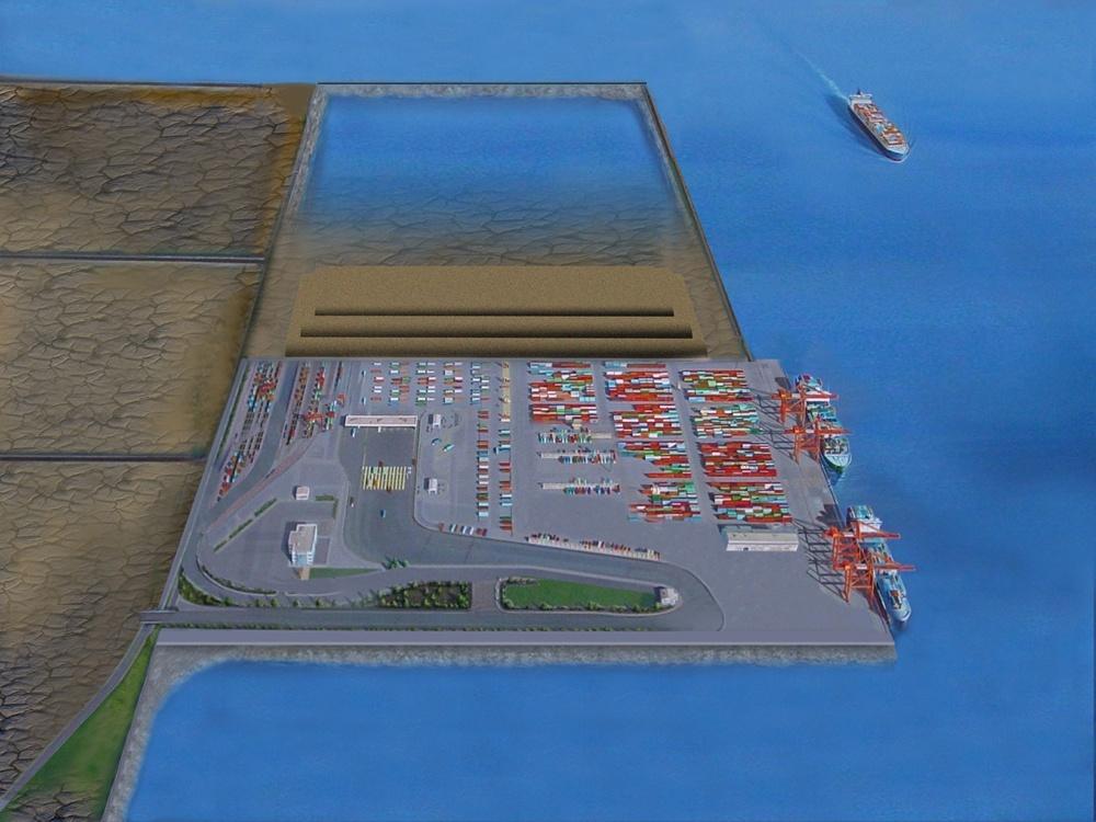
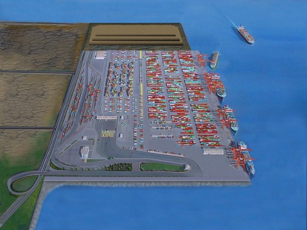
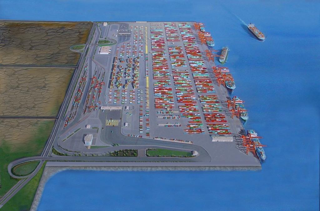
9 Craney Island Eastward Expansion

10 Craney Island Eastward Expansion Kansai Airport Japan Hong Hong Kong Kong Airport Airport San Francisco Airport Pier 400 Port of LA Craney Island Predicted Settlement ~20 to 30 ft

11 Cross Section

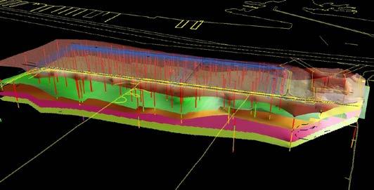
12 Isopach and Structural Maps of 7 Units


13 Construction Monitoring Cross Dikes Monitoring placement of cross dike construction fill If sand is placed too much too fast, will induce a mud wave or failure like 1954 Craney construction Placing 1.5 to 2 ft sand lifts

14 Project Design - Cross Dikes Final target elevation = +18 ft (MLLW) Length of cross dike 2400 lf Constructed on soft clay Required PVDs Elevation in feet (MLLW) Distance in feet (x 1000) PVD Drains Dike Fill Upper Norfolk Clay (Qnu) Pleistocene/Pliocene Sands (Qnl/Tys) 500 feet

15 PVD Program Overview Ground Model Used to Design PVD Program GPS Navigation System Used to Position Barges Bow Barge Stern Barge GPS Navigation System Records: XY Position Coordinate, Depth, Elevation, Tide Thrust Pressure, Penetration Rate Date/Time Norfolk Clay Interbedded Plio-Pleistocene Sand Stiff Clay As-built PVD Installation Data Stored and Managed in GIS Database PVD As-built Data Integrated with Ground Model and Reviewed
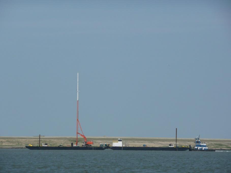

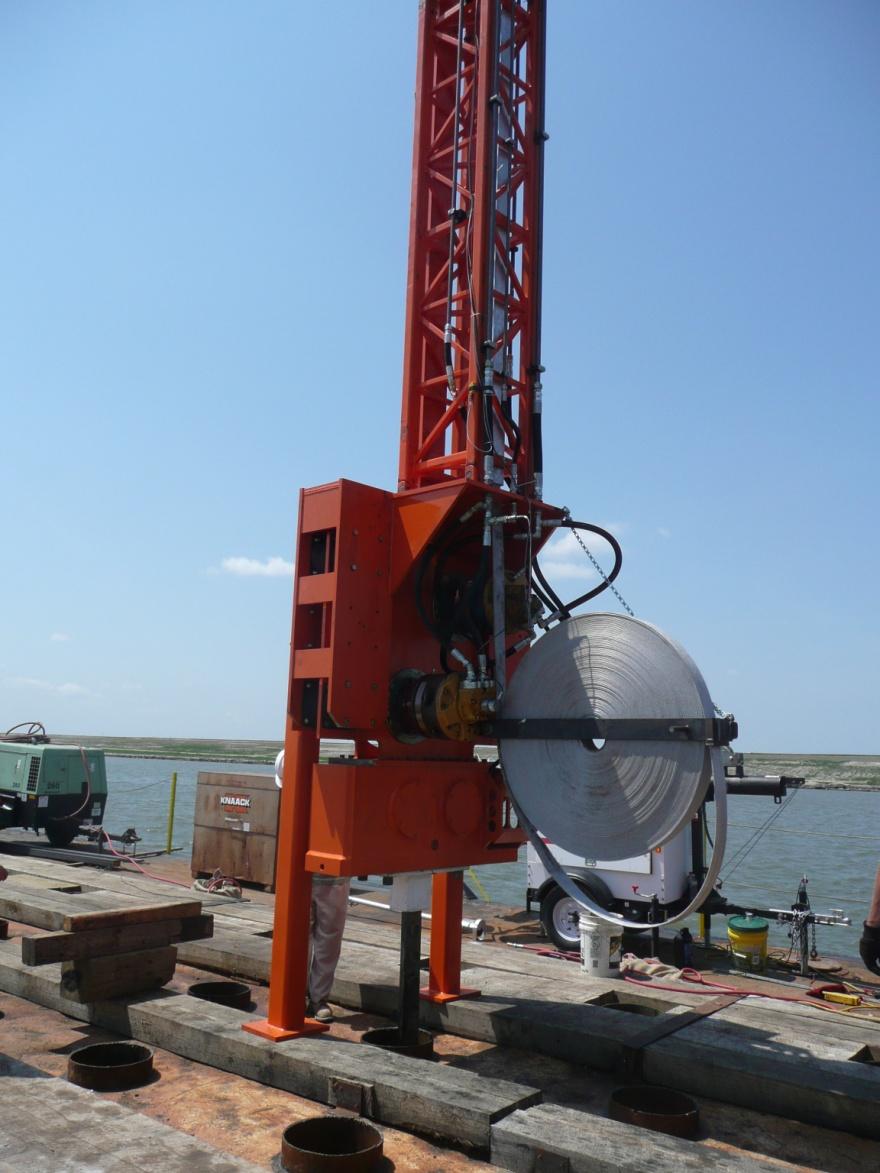
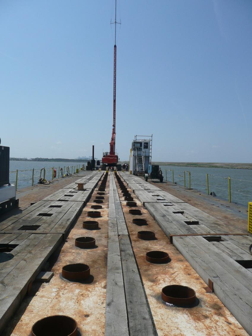

16 PVD Installation


17 PVD Locations Verified using Multibeam Data PVD depressions are approximately 0.5ft deep by 1ft diameter S E PVD Barge Spuds Depressions Edge of PVD Field South Cross Dike North PVD Zone E S Approx. Toe S Approx. Crest PVD FIELD S S E Missing PVDs

18 Fill Placement Monitoring Multibeam surveys used to monitor material placement GIS managed data and used to create evaluation documents Profiles, isopach, elevation, morphologic evaluation for slope failures, and mud waves

19 Filling Control
20 Survey Monitoring During Hold Period Multibeam surveys used to monitor settlement during hold period Note ~1ft of settlement after PVDs installed between 4/16 & 7/21 PVD Zone PVD Zone

21 Integrating Information
22 Thank You Ray Wood C.Eng. Executive Vice President Fugro Consultants, Inc. 101 West Main Street, Suite 350 Norfolk, Virginia Tel
Inspection of Waterfront Facilities Using Vessel-Based Remote Sensing Mitchell, Del Bello, Suarez
 Inspection of Waterfront Facilities Using Vessel-Based Remote Sensing Mitchell, Del Bello, Suarez American Association of Port Authorities Facilities Engineering Conference October 20-22, 2015 Waterfront
Changes in bottom morphology of Long Island Sound near Mount Misery Shoal as observed through Repeated Multibeam Surveys
 Changes in bottom morphology of Long Island Sound near Mount Misery Shoal as observed through Repeated Multibeam Surveys Laurie A. Zaleski Laurie.Zaleski@msrc.sunysb.edu Roger D. Flood rflood@notes.cc.sunysb.edu
CHARACTERIZATION OF SOFT CLAY- A CASE STUDY AT CRANEY ISLAND
 National Defense Industrial Association 2005 Tri-Service Infrastructure Systems Conference and Exhibition Re-Energizing Engineering Excellence CHARACTERIZATION OF SOFT CLAY- A CASE STUDY AT CRANEY ISLAND
Offshore Operations and Project Execution Geophysical Site Surveys
 Offshore Operations and Project Execution Geophysical Site Surveys Chris Almond Senior Geophysicist Fugro Survey Limited 22/04/2015 Presentation Summary: Office-based Personnel Project Awarded Pre Offshore
Marine Geophysical Methods: What Can and Cannot Be Done to Iden8fy Hazards to Dredging & Marine Construc8on
 Marine Geophysical Methods: What Can and Cannot Be Done to Iden8fy Hazards to Dredging & Marine Construc8on Marine Geophysics Sham or Savior? Seen alternatively as the silver bullet or snake oil, marine
Redwood City Harbor, California, Navigation Improvement Feasibility Study. Appendix D. Geotechnical Engineering. DRAFT April 2015
 1 Redwood City Harbor, California, Navigation Improvement Feasibility Study Appendix D Geotechnical Engineering DRAFT April 2015 2 Contents 1 Purposes of Report... 3 2 Background... 3 3 References and
MLLW and the NAD83 Ellipsoid: An Investigation of Local Offsets and Trends Using PPK and Gauge Derived Water Surfaces.
 MLLW and the NAD83 Ellipsoid: An Investigation of Local Offsets and Trends Using PPK and Gauge Derived Water Surfaces. Abstract: Authors Doug Lockhart, Fugro Pelagos, Inc. Andy Orthmann, Fugro Pelagos,
River bed classification using multi-beam echo-sounder backscatter data
 River bed classification using multi-beam echo-sounder backscatter data Niels Kinneging Mirjam Snellen Dimitrios Eleftherakis Dick Simons Erik Mosselman Arjan Sieben 13 November 2012 transport water management
Geophysical Site Surveys
 Geophysical Site Surveys Simon Oakley Geoscience Team Leader Fugro Survey Limited 16/04/2014 Contents Menu Introduction Section 1 - Geophysical Site Surveys - Seabed Bathymetry - Shallow Geology - Seabed
Lower 8.3 Miles of the Lower Passaic River Operable Unit 2 Presentation to The Passaic River Community Advisory Group. September 14, 2017
 Lower 8.3 Miles of the Lower Passaic River Operable Unit 2 Presentation to The Passaic River Community Advisory Group September 14, 2017 Agenda Pre-Design Investigation (PDI) Status Geophysical, Bathymetric,
12/11/2013& egm502 seafloor mapping
 egm502 seafloor mapping lecture 13 multi-beam echo-sounders The majority of the current charts of the ocean floors have been produced from single beam echo-sounder data. Even though these data have been
River bed classification using multi-beam echo-sounder backscatter data. Niels KINNEGING Rijkswaterstaat Centre for Water Management
 River bed classification using multi-beam echo-sounder backscatter data Niels KINNEGING Rijkswaterstaat Centre for Water Management Mirjam SNELLEN Delft University of Techonology Dimitrios ELEFTHERAKIS
Automated Seabed Mapping and Data Delivery in the Cloud
 Automated Seabed Mapping and Data Delivery in the Cloud London, 2nd November 2017 11/20/2017 1 2 WE CALL IT SEABED INTELLIGENCE Ocean Infinity are explorers. We go to unmapped locations to survey the seabed
Recent developments in multi-beam echo-sounder processing at the Delft
 Recent developments in multi-beam echo-sounder processing at the Delft University of Technology Prof. Dr. Dick G. Simons Acoustic Remote Sensing Group, Faculty of Aerospace Engineering, Delft University
NEW SEAFLOOR INSTALLATIONS REQUIRE ULTRA-HIGH RESOLUTION SURVEYS
 NEW SEAFLOOR INSTALLATIONS REQUIRE ULTRA-HIGH RESOLUTION SURVEYS Donald Hussong (Fugro Seafloor Surveys, Inc.) dhussong@fugro.com Fugro Seafloor Surveys, Inc., 1100 Dexter Avenue North (Suite 100), Seattle,
US ARMY CORPS OF ENGINEERS New England District BUILDING STRONG
 US ARMY CORPS OF ENGINEERS New England District STUDIES Sediment Sampling Biological Sampling (benthic community analysis) Hydroacoustic Surveys (side scan sonar, bathymetry) Remotely Operated Vehicle
Hydrofest The Hydrographic Society in Scotland
 Hydrofest 2017 The Hydrographic Society in Scotland Offshore Survey in the Oil and Gas Industry Hydrofest 2017 Chris Leaf Head Offshore Surveys Shell Projects and Technology, Europe Presentation Overview
Topic: Bathymetric Survey Techniques. (a) Single-beam echo-sounders (SBES) (b) Multi-beam echo-sounders (MBES)
 Single-beam echo-sounders (SBES) (b) Multi-beam echo-sounders (MBES)") Topic: Bathymetric Survey Techniques (a) Single-beam echo-sounders (SBES) (b) Multi-beam echo-sounders (MBES) Bathymetry is the measurement of water depths - bathymetry is the underwater equivalent of
Topic: Bathymetric Survey Techniques (a) Single-beam echo-sounders (SBES) (b) Multi-beam echo-sounders (MBES) Bathymetry is the measurement of water depths - bathymetry is the underwater equivalent of
CHAPTER 6 RESULTS FIGURE 8.- DATA WORK FLOW FOR BACKSCATTER PROCESSING IN HYPACK
 CHAPTER 6 RESULTS 6.1. Backscatter Workflow Comparison Currently, INOCAR owns and operates RESON and Kongsberg multibeam systems for nearshore surveys. The RESON system is integrated with HYPACK Hysweep
Observed bed elevation changes in the data may arise as a result of any of several causes:
 10 July 2014 TECHNICAL MEMORANDUM: INTRODUCTION NEWARK BAY STUDY AREA, NEW JERSEY BATHYMETRIC COMPARISON AND ANALYSIS Periodic single- and multi-beam sonar bathymetric surveys within Newark Bay (Bay) in
2) re-positioning of the SSS data, 3) individuation of geomorphological features and morphometrical parameters correlated to instability phenomena.
 re-positioning of the SSS data, 3) individuation of geomorphological features and morphometrical parameters correlated to instability phenomena.") HIGH-RESOLUTION SIDE SCAN SONAR AND MULTIBEAM DATA PROCESSING AND MERGING TO STUDY SUBMARINE INSTABILITY PHENOMENA ON VOLCANIC ISLANDS (PONTINE, CAMPANIAN AND AEOLIAN ARCHIPELAGOS) A. BOSMAN Extended abstract:
HIGH-RESOLUTION SIDE SCAN SONAR AND MULTIBEAM DATA PROCESSING AND MERGING TO STUDY SUBMARINE INSTABILITY PHENOMENA ON VOLCANIC ISLANDS (PONTINE, CAMPANIAN AND AEOLIAN ARCHIPELAGOS) A. BOSMAN Extended abstract:
Acoustic seafloor mapping systems. September 14, 2010
 Acoustic seafloor mapping systems September 14, 010 1 Delft Vermelding Institute onderdeel of Earth organisatie Observation and Space Systems Acoustic seafloor mapping techniques Single-beam echosounder
Highland Lake Bathymetric Survey
 Highland Lake Bathymetric Survey Final Report, Prepared For: The Town of Highland Lake 612 Lakeshore Drive Oneonta, AL 35121 Prepared By: Tetra Tech 2110 Powers Ferry Road SE Suite 202 Atlanta, GA 30339
Changes in Geomorphology and Backscatter Patterns in Mount Misery Shoal, Long Island Sound as Revealed through Multiple Multibeam Surveys
 Changes in Geomorphology and Backscatter Patterns in Mount Misery Shoal, Long Island Sound as Revealed through Multiple Multibeam Surveys Laurie A. Zaleski Laurie.Zaleski@msrc.sunysb.edu, Roger D. Flood
THE 4Gs IN PRACTICE: INVESTIGATING HOW THE 4Gs ARE APPLIED IN THE OIL & GAS INDUSTRY
 THE 4Gs IN PRACTICE: INVESTIGATING HOW THE 4Gs ARE APPLIED IN THE OIL & GAS INDUSTRY Society for Underwater Technology, Evening Technical Meeting 14 AUGUST 2013 GEOPHYSICS & PORT DEVELOPMENTS EXPLORING
OFFSHORE SURVEY IN THE OIL & GAS INDUSTRY WHAT S THAT ALL ABOUT? Ian Douglas Head, Offshore Surveys, Shell Projects & Technology Europe
 OFFSHORE SURVEY IN THE OIL & GAS INDUSTRY WHAT S THAT ALL ABOUT? Ian Douglas Head, Offshore Surveys, Shell Projects & Technology Europe Hydrofest 2014 13 March 2014 1 Why Position Matters The Exploration
Clearing the Mississippi Coast, Locating Post Hurricane Katrina Marine Debris
 Joseph Burke (primary author and intended presenter) Project Manager NOAA Division, C&C Technologies, Inc. 730 East Kaliste Saloom Rd., Lafayette LA, USA 70508 Phone: 337-261-0660, E-mail: Joseph.Burke@cctechnol.com
SonTek HydroSurveyor M9 now powered by HYPACK! CASE STUDY: USGS HYDROSURVEYOR SURVEY OF FENA VALLEY RESERVOIR, GUAM
 SonTek HydroSurveyor M9 now powered by HYPACK! CASE STUDY: USGS HYDROSURVEYOR SURVEY OF FENA VALLEY RESERVOIR, GUAM Presenters Harold Orlinsky General Manager HYPACK Isaac Jones Product manager, SonTek
Parametric Sub Bottom Profiler measurements of the subaquatic portion of the debris fan of Gschliefgraben in Lake Traunsee, Austria
 Parametric Sub Bottom Profiler measurements of the subaquatic portion of the debris fan of Gschliefgraben in Lake Traunsee, Austria Brian Kreis & Sebastian Riegler (students) Erwin Heine supported by INNOMAR
FOUNDATIONS FOR OFFSHORE STRUCTURES
 FOUNDATIONS FOR OFFSHORE STRUCTURES DELHI CHAPTER Pradeep Hora It takes less time to do a thing right than explain why you did it wrong. - Henry Wadsworth Longfellow 2 1 Site Investigations (Survey) What
H.A.R.S. PRA #1 (Historic Area Remediation Site)
") H.A.R.S. PRA #1 (Historic Area Remediation Site) 2009 Multibeam Bathymetry TABLE OF CONTENTS Page LIST OF TABLES 2 LIST OF FIGURES 3 1.0 INTRODUCTION 4 2.0 OBJECTIVE 4 3.0 PROCEDURE 4 3.1 DATA ACQUISITION
H.A.R.S. PRA #1 (Historic Area Remediation Site) 2009 Multibeam Bathymetry TABLE OF CONTENTS Page LIST OF TABLES 2 LIST OF FIGURES 3 1.0 INTRODUCTION 4 2.0 OBJECTIVE 4 3.0 PROCEDURE 4 3.1 DATA ACQUISITION
Map shows 3 main features of ocean floor
 Map shows 3 main features of ocean floor 2017 Pearson Education, Inc. Chapter 3 Marine Provinces 2017 Pearson Education, Inc. 1 Chapter 3 Overview The study of bathymetry determines ocean depths and ocean
The Arctic - A New Frontier The geological, environmental and engineering challenges for submarine telecommunication cables
 The Arctic - A New Frontier The geological, environmental and engineering challenges for submarine telecommunication cables Ryan Wopschall 5 September 2013 Oceanology International China, Shanghai Fugro
Department of National Defence B-Jetty Reconstruction
 Department of National Defence B-Jetty Reconstruction CFB Esquimalt, BC Presented by: Stantec & Golder Associates February 2, 2016 Agenda 1 B-Jetty Project Background 2 Distinguishing Project Features
Monitoring The Sand Extraction On The Belgian Continental Shelf
 Monitoring The Sand Extraction On The Belgian Continental Shelf Methodology, Results And Expectations K. Degrendele and M. Roche Within the framework of a sustainable exploitation of the mineral resources
Bathymetry Measures the vertical distance from the ocean surface to mountains, valleys, plains, and other sea floor features
 1 2 3 4 5 6 7 8 9 10 11 CHAPTER 3 Marine Provinces Chapter Overview The study of bathymetry determines ocean depths and ocean floor topography. Echo sounding and satellites are efficient bathymetric tools.
Precision of Environmental Dredging Factors and Processes
 Precision of Environmental Dredging Factors and Processes Michael Palermo - Mike Palermo Consulting, Inc. John Kern Kern Statistical Services, Inc. Presented at DREDGING 2012 October 22-25, 2012, San Diego,
Chapter Overview. Bathymetry. Measuring Bathymetry. Measuring Bathymetry
 CHAPTER 3 Marine Provinces Chapter Overview The study of bathymetry determines ocean depths and ocean floor topography. Echo sounding and satellites are efficient bathymetric tools. Most ocean floor features
A lithological map created from multibeam backscatter data in challenging circumstances: the Lower Sea Scheldt estuary
 A lithological map created from multibeam backscatter data in challenging circumstances: the Lower Sea Scheldt estuary Mieke Mathys*, Marc Sas*, Frederik Roose** HYDRO12, Rotterdam, 15/11/2012 *International
Data and Information Management. UK All Energy 22 nd May Presented by Leo James
 Data and Information Management UK All Energy 22 nd May 2013 Presented by Leo James Strategic Development Plans Observations at the outset Data and information management and dissemination: company or
COMPUTER ALGORITHM FOR ANALYSIS OF BEDFORM GEOMETRY
 13 th International Symposium on Water Management and Hydraulic Engineering, September 9-12, 2013 Bratislava, Slovakia COMPUTER ALGORITHM FOR ANALYSIS OF BEDFORM GEOMETRY G. Gilja 1, N. Kuspilić 2 and
Improved Geohazard Analysis for Drilling Favorability Maps
 Improved Geohazard Analysis for Drilling Favorability Maps Joshua T. Kelly William C. Haneberg ESRI Petroleum GIS Conference 9 April, 2015 1 Overview Section 1 Introduction to Geohazards & Favorability
Using the MBES for classification of riverbed sediments
 Acoustics 8 Paris Using the MBES for classification of riverbed sediments A. Amiri-Simkooei a, M. Snellen a and D. G Simons b a Acoustic Remote Sensing Group, Delft Institute of Earth Observation and Space
Client RSK Environment Ltd Job No. J387 Date 19/11/2016. Project: Environmental Survey Location: Otranto Vessel: RV Atlante
 FUGRO OCEANSISMICA S.p.A. GEODETIC PARAMETERS Client RSK Environment Ltd Job No. J387 Date 19/11/216 Project: Environmental Survey Location: Otranto Vessel: RV Atlante WGS-84 Geodetic Parameters Datum
WORK PLAN SEDIMENT, SURFACE WATER, AND GROUNDWATER SAMPLING PLAN TO ASSESS CURRENT GROUNDWATER DISCHARGE IMPACTS TO THE OFFSHORE ENVIRONMENT
 WORK PLAN SEDIMENT, SURFACE WATER, AND GROUNDWATER SAMPLING PLAN TO ASSESS CURRENT GROUNDWATER DISCHARGE IMPACTS TO THE OFFSHORE ENVIRONMENT Prepared for Severstal-Sparrows Point, LLC 1430 Sparrows Point
SCIENTIFIC MEASUREMENTS IN SERVICE TO DEEPENING AND DREDGING OF NEW YORK AND NEW JERSEY HARBOR
 SCIENTIFIC MEASUREMENTS IN SERVICE TO DEEPENING AND DREDGING OF NEW YORK AND NEW JERSEY HARBOR W. Murphy III 1, W.B. Ward 1, B. Boyd 1, W. Murphy IV 1, R. Nolen-Hoeksema 1, M. Art 1, D.A. Rosales-R 1 B.A.
design, construction, operation, and maintenance of the BAP is consistent with recognized and generally accepted good engineering standards.
 design, construction, operation, and maintenance of the BAP is consistent with recognized and generally accepted good engineering standards. In addition to the field inspection, Associated Engineers, Inc.
MaxDepth Aquatics, Inc.
 MaxDepth Aquatics, Inc. Bathymetry of Mirror Pond From Newport Bridge to Galveston Bridge Prepared for the City of Bend By Joseph Eilers & Benn Eilers MaxDepth Aquatics, Inc. Bend, OR June 2005 INTRODUCTION
Evaluating the USACE's NCMP for NOAA charting operations
 University of New Hampshire University of New Hampshire Scholars' Repository Center for Coastal and Ocean Mapping Center for Coastal and Ocean Mapping 8-2013 Evaluating the USACE's NCMP for NOAA charting
Adaptive Bathymetric System Mapping of Champagne Reef and Scott s Head
 Adaptive Bathymetric System Mapping of Champagne Reef and Scott s Head TRAVIS ROOF¹ ABSRACT Bathymetric maps are crucial not only for navigational purposes but also for conservation of marine environments.
Smart Survey Approach: Multibeam Echosounder and Integrated Water Column Data as an Added Value for Seep Hunting
 Smart Survey Approach: Multibeam Echosounder and Integrated Water Column Data as an Added Value for Seep Hunting HYDRO 2016 8 November 2016 Marco Filippone Introduction, Multibeam Sonars & water column
Introduction to Acoustic Remote Sensing and Seafloor Mapping (AE4-E13) May 19, 2010
 May 19, 2010") Introduction to Acoustic Remote Sensing and Seafloor Mapping (AE4-E13) May 19, 2010 1 Delft Vermelding Institute onderdeel of Earth organisatie Observation and Space Systems Why Acoustic Remote Sensing?
Introduction to Acoustic Remote Sensing and Seafloor Mapping (AE4-E13) May 19, 2010 1 Delft Vermelding Institute onderdeel of Earth organisatie Observation and Space Systems Why Acoustic Remote Sensing?
6. GEOTECHNICAL, SEA LEVEL RISE AND SHORELINE IMPROVEMENTS
 6. GEOTECHNICAL, SEA LEVEL RISE AND SHORELINE IMPROVEMENTS 6.1 6.2 6.3 6.4 GEOTECHNICAL DOCUMENTS TREASURE ISLAND AND CAUSEWAY GEOTECHNICAL IMPROVEMENTS YERBA BUENA ISLAND GEOTECHNICAL IMPROVEMENTS SEA
(32) marine technology April
 marine technology April") As part of a 2012 Gulf of Mexico deep water project, an Echoscope 3D sonar imager documented the depth of a 20 pipeline in a trench, below mud line, during a post-dredging operation. (32) marine technology
As part of a 2012 Gulf of Mexico deep water project, an Echoscope 3D sonar imager documented the depth of a 20 pipeline in a trench, below mud line, during a post-dredging operation. (32) marine technology
IN SITU SPECIFIC GRAVITY VS GRAIN SIZE: A BETTER METHOD TO ESTIMATE NEW WORK DREDGING PRODUCTION
 IN SITU SPECIFIC GRAVITY VS GRAIN SIZE: A BETTER METHOD TO ESTIMATE NEW WORK DREDGING PRODUCTION Nancy Case O Bourke, PE 1, Gregory L. Hartman, PE 2 and Paul Fuglevand, PE 3 ABSTRACT In-situ specific gravity
EFFECTIVENESS OF HYDROFRACTURE PREDICTION FOR HDD DESIGN
 North American Society for Trenchless Technology (NASTT) No-Dig Show 2010 Chicago, Illinois May 2-7, 2010 Paper F-1-01 EFFECTIVENESS OF HYDROFRACTURE PREDICTION FOR HDD DESIGN Kimberlie Staheli, Ph.D.,
3. UNDERWAY GEOPHYSICS 1
 Sawyer, D.S., Whitmarsh, R.B., Klaus, A., et al., 1994 Proceedings of the Ocean Drilling Program, Initial Reports, Vol. 149 3. UNDERWAY GEOPHYSICS 1 Shipboard Scientific Party 2 EQUIPMENT AND METHODS Navigation
Port of Kalama, 2013 TEMCO Berth Maintenance Dredging and In-water Flow-Lane Placement Project
 2014 WEDA ENVIRONMENTAL EXCELLENCE AWARDS Category: Navigation Dredging Port of Kalama, 2013 TEMCO Berth Maintenance Dredging and In-water Flow-Lane Placement Project Port of Kalama, Washington 18 April
ENGINEER S CERTIFICATION OF FAULT AREA DEMONSTRATION (40 CFR )
") PLATTE RIVER POWER AUTHORITY RAWHIDE ENERGY STATION BOTTOM ASH TRANSFER (BAT) IMPOUNDMENTS LARIMER COUNTY, CO ENGINEER S CERTIFICATION OF FAULT AREA DEMONSTRATION (40 CFR 257.62) FOR COAL COMBUSTION RESIDUALS
PLATTE RIVER POWER AUTHORITY RAWHIDE ENERGY STATION BOTTOM ASH TRANSFER (BAT) IMPOUNDMENTS LARIMER COUNTY, CO ENGINEER S CERTIFICATION OF FAULT AREA DEMONSTRATION (40 CFR 257.62) FOR COAL COMBUSTION RESIDUALS
COBRA Cable Site Investigation in the Wadden Sea, Denmark
 NGM 2016 Reykjavik Proceedings of the 17 th Nordic Geotechnical Meeting Challenges in Nordic Geotechnic 25 th 28 th of May COBRA Cable Site Investigation in the Wadden Sea, Denmark L. Klinkby COWI, Denmark,
SONIC PULSE VELOCITY TESTING TO ASSESS CONDITION OF A CONCRETE DAM
 SONIC PULSE VELOCITY TESTING TO ASSESS CONDITION OF A CONCRETE DAM Edward D. Billington, AG&E-Schnabel, Greensboro, NC Dennis A. Sack and Larry D. Olson, Olson Engineering Inc., Wheat Ridge, CO Abstract
National Marine Sanctuary Program
 National Marine Sanctuary Program NMSP/USGS Joint Seabed Mapping Initiative: September 2004 AA National Ocean Service National Marine Sanctuaries Interim Report September 2004 Background: Since 2002,
IN-SITU SAMPLE CORE SCANNING FOR PREPARATION OF DREDGING WORKS
 IN-SITU SAMPLE CORE SCANNING FOR PREPARATION OF DREDGING WORKS By K. Geirnaert 1, P. Staelens 1, L-R. Cool 1 S. Sargis 2 ABSTRACT Geotechnical information from the seabed is critical for the successful
CCR Rule Annual Inspection Report (cont.) 2
 2") The inspection findings consisted of maintenance items and items that were not observed to be signs or potential signs of significant structural weakness. No deficiencies or disrupting conditions that
The inspection findings consisted of maintenance items and items that were not observed to be signs or potential signs of significant structural weakness. No deficiencies or disrupting conditions that
Confidence Assessment Scoring System
 Confidence Assessment Scoring System Confidence field Confidence group Confidence question Comments Remote sensing data collection RemoteTechnique Were the techniques used appropriate for the ground type?
LIQUEFACTION OF EARTH EMBANKMENT DAMS TWO CASE HISTORIES: (1) LIQUEFACTION OF THE EMBANKMENT SOILS, AND (2) LIQUEFACTION OF THE FOUNDATIONS SOILS
 LIQUEFACTION OF THE EMBANKMENT SOILS, AND (2) LIQUEFACTION OF THE FOUNDATIONS SOILS") LIQUEFACTION OF EARTH EMBANKMENT DAMS TWO CASE HISTORIES: (1) LIQUEFACTION OF THE EMBANKMENT SOILS, AND (2) LIQUEFACTION OF THE FOUNDATIONS SOILS Antonio Fernandez, Ph.D. 1 ABSTRACT Paul C. Rizzo Associates,
LIQUEFACTION OF EARTH EMBANKMENT DAMS TWO CASE HISTORIES: (1) LIQUEFACTION OF THE EMBANKMENT SOILS, AND (2) LIQUEFACTION OF THE FOUNDATIONS SOILS Antonio Fernandez, Ph.D. 1 ABSTRACT Paul C. Rizzo Associates,
Hydrographic Survey Program Texas Water Development Board. Nathan Leber Holly Holmquist Khan Iqbal Josh Duty Eli Pruitt
 Hydrographic Survey Program Texas Water Development Board Nathan Leber Holly Holmquist Khan Iqbal Josh Duty Eli Pruitt The following presentation is based upon professional research and analysis within
Countermeasure Calculations and Design
 Countermeasure Calculations and Design Summarized from Bridge Scour and Stream Instability Countermeasures, Experience, Selection, and Design Guidance, Second Edition, Publication No. FHWA NHI 01-003,
MARINE GEOPHYSICAL INVESTIGATION In Support Of The SAN FRANCISCO BAY ROCKS REMOVAL PROJECT
 MARINE GEOPHYSICAL INVESTIGATION In Support Of The SAN FRANCISCO BAY ROCKS REMOVAL PROJECT TABLE OF CONTENTS 1. INTRODUCTION 2 2. FIELD SURVEY METHODS AND ANALYTICAL TECHNIQUES 5 2.1 SURVEY VESSELS 5 2.2
Common Dataset Information
 Common Dataset Information Introduction The Common Dataset is a defining feature of the Shallow Survey conferences and consists of a series of surveys conducted over a common area of seabed using a variety
GSA DATA REPOSITORY
 GSA DATA REPOSITORY 2009206 Miner et al. Supplemental Material Bathymetric Survey Methods The bathymetric data for the area were gathered using a single-beam bathymetric survey rig mounted aboard a 21-foot
Site Investigations for Offshore Wind
 Site Investigations for Offshore Wind A multi-disciplinary approach Mattijs de Lange Gardline Marine Sciences Limited My thanks to: Maarten Timmerman David Cerda Saltzman Sue Crothers Albert van der Hem
Bathymetric lidar to support pre-engineering analysis for marine liquefied natural gas transport infrastructure
 Bathymetric lidar to support pre-engineering analysis for marine liquefied natural gas transport infrastructure Candace MacDonald, Dr. Tim Webster Kate Collins, Nathan Crowell, Kevin McGuigan NSCC Applied
September 18, 2017 Project No.: 5077
 #109 3011 Underhill Avenue Burnaby, BC V5A 3C2 Phone: (604) 421-3288 Email: info@terrangeo.com September 18, 2017 Project No.: 5077 Kevin Brooks City of Campbell River 301 St. Ann s Road Campbell River,
Marine environment monitoring : The basic requirements to support Marine Renewable Energies
 Marine environment monitoring : The basic requirements to support Marine Renewable Energies SHOM in brief SHOM is the French Government agency in charge of Hydrography and Oceanography SHOM s vocation
Digital Elevation Model (DEM) of Sable Island Bank and adjacent areas
 of Sable Island Bank and adjacent areas") GEOLOGICAL SURVEY OF CANADA OPEN FILE 5348 Digital Elevation Model (DEM) of Sable Island Bank and adjacent areas K.J. Webb and E.L. King 2014 GEOLOGICAL SURVEY OF CANADA OPEN FILE 5348 Digital Elevation
GEOLOGICAL SURVEY OF CANADA OPEN FILE 5348 Digital Elevation Model (DEM) of Sable Island Bank and adjacent areas K.J. Webb and E.L. King 2014 GEOLOGICAL SURVEY OF CANADA OPEN FILE 5348 Digital Elevation
7.0 Project Reports 7.1 Geophysical Mapping of Submarine Environments
 7.0 Project Reports 7.1 Geophysical Mapping of Submarine Environments Suzanne Carbotte, Robin Bell, Roger Flood 7.1.1 METHODS In April 2000 we deployed the R/V Onrust, operated by MSRC at SUNY Stony Brook,
A Multi beam Bathymetric Investigation of Changes in Bed form Morphology of the Little River Inlet as a Result of Hurricane Matthew 2017
 A Multi beam Bathymetric Investigation of Changes in Bed form Morphology of the Little River Inlet as a Result of Hurricane Matthew 2017 BY Malarie O'Brien Marine Science Submitted in Partial Fullfillment
 Red River Flooding June 2015 Caddo and Bossier Parishes Presented by: Flood Technical Committee Where the Rain Falls Matters I-30 versus I-20 I-20 Backwater and Tributary Floods (Localized) 2016 Flood
Benthic habitat mapping using multibeam sonar
 Benthic habitat mapping using multibeam sonar Iain M. Parnum 1, Alexander Gavrilov 1 and Justy Siwabessy 2 1. Centre for Marine Science and Technology, Curtin University, Perth, Australia 2. Geoscience
Terje Pedersen Product Manager Software / Hydrography Hydroacoustics Division
 Terje Pedersen Product Manager Software / Hydrography Hydroacoustics Division WORLD CLASS through people, technology and dedication WORLD CLASS through people, technology and dedication 1 2 HYDROFEST 2005
Site characterization for the HZM immersed tunnel
 DGF 2013-09-12 (18 th ICSMGE Paris; Discussion Session TC102) Site characterization for the HZM immersed tunnel HKSAR Jørgen S. Steenfelt COWI, Denmark Co-authors: S. Yding, A. Rosborg, J.G. Hansen, R.
Exploitation of Ocean Predictions by the Oil and Gas Industry. GODAE OceanView Symposium 2013
 Exploitation of Ocean Predictions by the Oil and Gas Industry GODAE OceanView Symposium 2013 Introduction Information needs Challenges Acknowledgements IMarEST/SUT Metocean Awareness Course Colleagues
Chapter (11) Pile Foundations
 Pile Foundations") Chapter (11) Introduction Piles are structural members that are made of steel, concrete, or timber. They are used to build pile foundations (classified as deep foundations) which cost more than shallow
Chapter (11) Introduction Piles are structural members that are made of steel, concrete, or timber. They are used to build pile foundations (classified as deep foundations) which cost more than shallow
ENCE 3610 Soil Mechanics. Site Exploration and Characterisation Field Exploration Methods
 ENCE 3610 Soil Mechanics Site Exploration and Characterisation Field Exploration Methods Geotechnical Involvement in Project Phases Planning Design Alternatives Preparation of Detailed Plans Final Design
Sabal Trail Pipeline Project Evaluation of Karst Topography and Sinkhole Potential for Pipeline and Facilities
 November 11, 2014 Sabal Trail Pipeline Project Evaluation of Karst Topography and Sinkhole Potential for Pipeline and Facilities Gulf Interstate Engineering Attention: Mr. Denys Stavnychyi - Project Engineer
Relationship between gas-bearing (?) sediments and biogenic mounds in the Kalloni Gulf, Lesvos Island, Greece
 sediments and biogenic mounds in the Kalloni Gulf, Lesvos Island, Greece") 6 th Workshop Seabed Acoustics, Rostock, November 14/15, 2013 P13-1 Relationship between gas-bearing (?) sediments and biogenic mounds in the Kalloni Gulf, Lesvos Island, Greece Alexandros Chronis, Dr.
6 th Workshop Seabed Acoustics, Rostock, November 14/15, 2013 P13-1 Relationship between gas-bearing (?) sediments and biogenic mounds in the Kalloni Gulf, Lesvos Island, Greece Alexandros Chronis, Dr.
Data Summary Report for the Monitoring Survey at the New London Disposal Site - October Disposal Area Monitoring System DAMOS
 Data Summary Report for the - Disposal Area Monitoring System DAMOS Data Summary Report DR 2015-04 February 2017 This report should be cited as: Carey, D. A.; Sturdivant, K. S.; Bellagamba Fucile, E. 2017.
GG710 Remote Sensing in Submarine Environments Sidescan Sonar
 GG710 Remote Sensing in Submarine Environments Sidescan Sonar Harold Edgerton, a professor of electrical engineering at the Massachusetts Institute of Technology, developed sidescan sonar technology for
RESULTS OF THE 2007 MULTIBEAM BATHYMETRIC AND BACKSCATTER SURVEYS AT THE HISTORIC AREA REMEDIATION SITE
 RESULTS OF THE 2007 MULTIBEAM BATHYMETRIC AND BACKSCATTER SURVEYS AT THE HISTORIC AREA REMEDIATION SITE FINAL DRAFT December 2007 Contract No. SAIC Project No. 01-0236-08-6326-400 SAIC Report No. 724 Prepared
Joint Hydrographic Center, National Oceanic and Atmospheric Administration, Durham, NH 03824, USA
 Future directions in hydrography using satellite-derived bathymetry Shachak Pe eri 1, Christopher Parrish 2, 3, Lee Alexander 1, Chukwuma Azuike 1, Andrew Armstrong 1,3 and Maryellen Sault 2 1 Center for
An Overview of Geomatics Involvement in the Offshore Oil & Gas Industry
 An Overview of Geomatics Involvement in the Offshore Oil & Gas Industry David Whitcombe Head Offshore Surveys - Europe Explore Appraise Develop ProduceDecommission Content Overview Oil & Gas Industry Geomatics
3.0 ROBERTS BANK TIDAL FLAT MORPHOLOGY
 Vancouver Port Authority Northwest Hydraulic Consultants Ltd. /Triton Consultants Ltd. Roberts Bank Container Expansion File: 33863 Coastal Geomorphology Study - 19 - November 2004 3.0 ROBERTS BANK TIDAL
A STUDY OF LOCAL SCOUR AT BRIDGE PIERS OF EL-MINIA
 A STUDY OF LOCAL SCOUR AT BRIDGE PIERS OF EL-MINIA Dr. Gamal A. Sallam 1 and Dr. Medhat Aziz 2 ABSTRACT Bridges are critical structures that require a substantial investment to construct and serve an important
Cold Water Coral WHY?
 The Cold Water Coral Research by bathymetry, acoustic geophysical and methane data, Santa Maria di Leuca, Northern Ionian Sea Apulian continental slop. Speaker: Kuan-Ting Lin March 15 th 2012 WHY? Where
Technical Report COASTAL ENGINEERING ANALYSIS, REMEDIATION CONCEPT DESIGN AND IMPACT ANALYSIS PORT OF SAN FRANCISCO CENTRAL BASIN, CALIFORNIA
 Technical Report COASTAL ENGINEERING ANALYSIS, REMEDIATION CONCEPT DESIGN AND IMPACT ANALYSIS PORT OF SAN FRANCISCO CENTRAL BASIN, CALIFORNIA Technical Report COASTAL ENGINEERING ANALYSIS, REMEDIATION
Unit 6: The Sea Floor
 Unit 6: The Sea Floor Turn to Page 62 in Introduction to the World s Oceans Study the bathymetric chart What features do you see? How do the Atlantic and Pacific Oceans differ? What do you think accounts
Lower Susquehanna River Integrated Sediment & Nutrient Monitoring Program
 Lower Susquehanna River Integrated Sediment & Nutrient Monitoring Program Presented at the Chesapeake Bay Program Scientific and Technical Advisory Committee (STAC) Workshop January 13, 2016 Background
Longitudinal dams as an alternative to wing dikes in river engineering. Fredrik Huthoff
 Longitudinal dams as an alternative to wing dikes in river engineering Fredrik Huthoff Contents Introduction Why consider longitudinal dams? Room for the river in the Netherlands The pilot study The Dutch
Decline of Lake Michigan-Huron Levels Caused by Erosion of the St. Clair River
 Decline of Lake Michigan-Huron Levels Caused by Erosion of the St. Clair River W.F. & Associates Coastal Engineers (in association with Frank Quinn) April 13, 2005 Outline Problem Definition Understanding