|
|
|
- Melvin Harrison
- 6 years ago
- Views:
Transcription
1
2
3
4
5
6
7
8
9
10
11
12
13
14

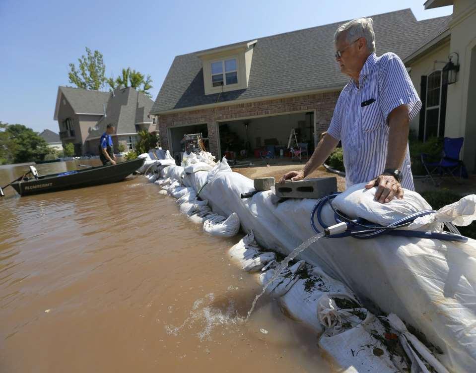
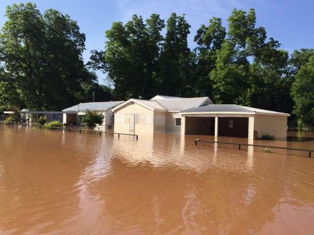
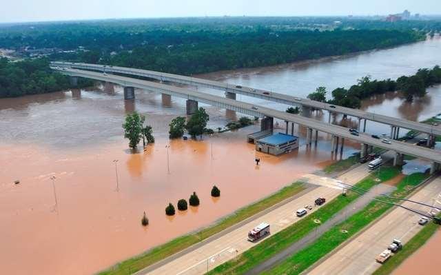
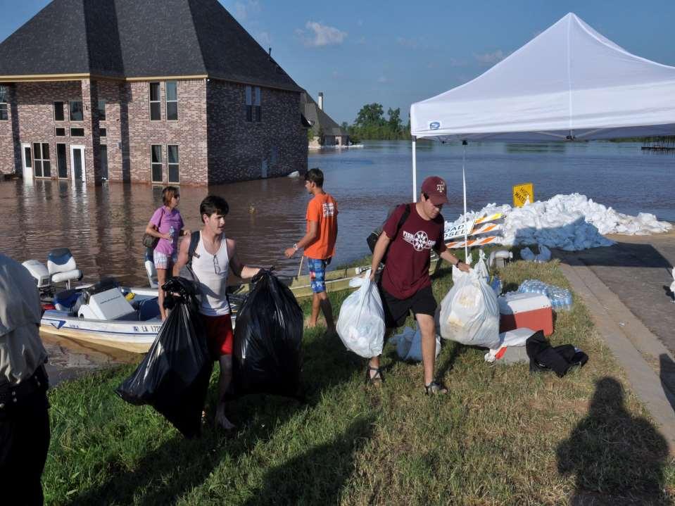
15 Red River Flooding June 2015 Caddo and Bossier Parishes Presented by: Flood Technical Committee

16 Where the Rain Falls Matters I-30 versus I-20
 2016")
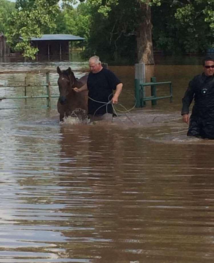
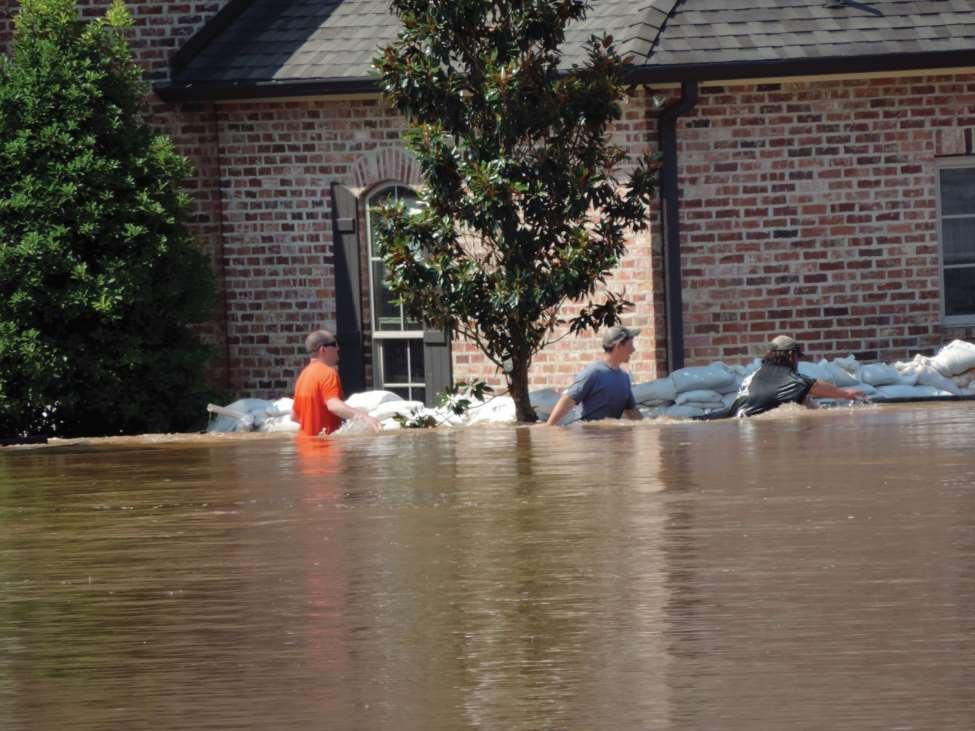
17 I-20 Backwater and Tributary Floods (Localized) 2016 Flood

18 Less Water Flow Than

19 Higher Crest Lower Flow

20
21 Flood Technical Committee Red River Valley Association (Chair) Caddo Sheriff/Office of Homeland Security and Emergency Preparedness Caddo and Bossier Parishes Cities of Shreveport and Bossier City Caddo and Bossier Levee Districts Caddo-Bossier Port Red River Watershed Management Institute Red River Waterway Commission
22 Purpose of Committee To coordinate with federal agencies: Corps of Engineers, National Weather Service, US Geological Survey (USGS), and Federal Emergency Management Agency (FEMA) To investigate causes; siltation and urbanization To consider mitigation for future impacts To analyze data and provide recommendations to community leaders
23 Definitions Base Flood Elevation (BFE) The computed elevation to which flood water is expected to rise during the base flood. FEMA responsibility. Cubic Feet per Second (CFS) Amount of water (flow) passing a point in the river. Measured by the gage at Texas Street Bridge. High Water Mark (HWM) The highest point the river reached during the flood crest. Flood Insurance Rate Maps (FIRM) - FEMA responsibility.

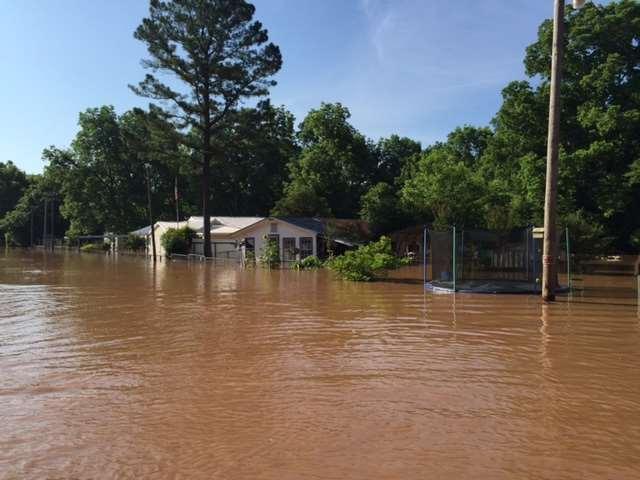
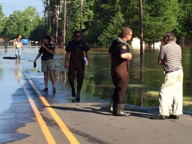
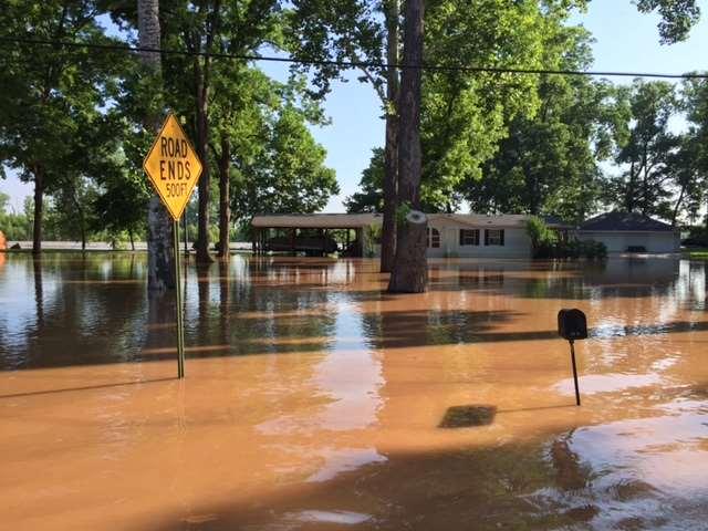
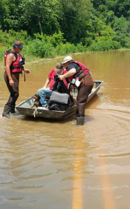
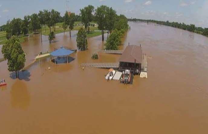
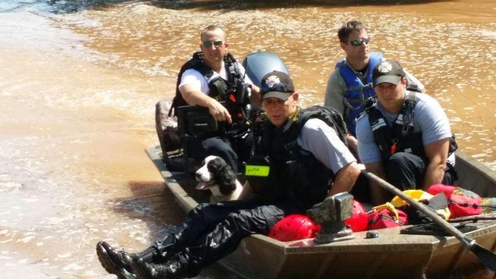
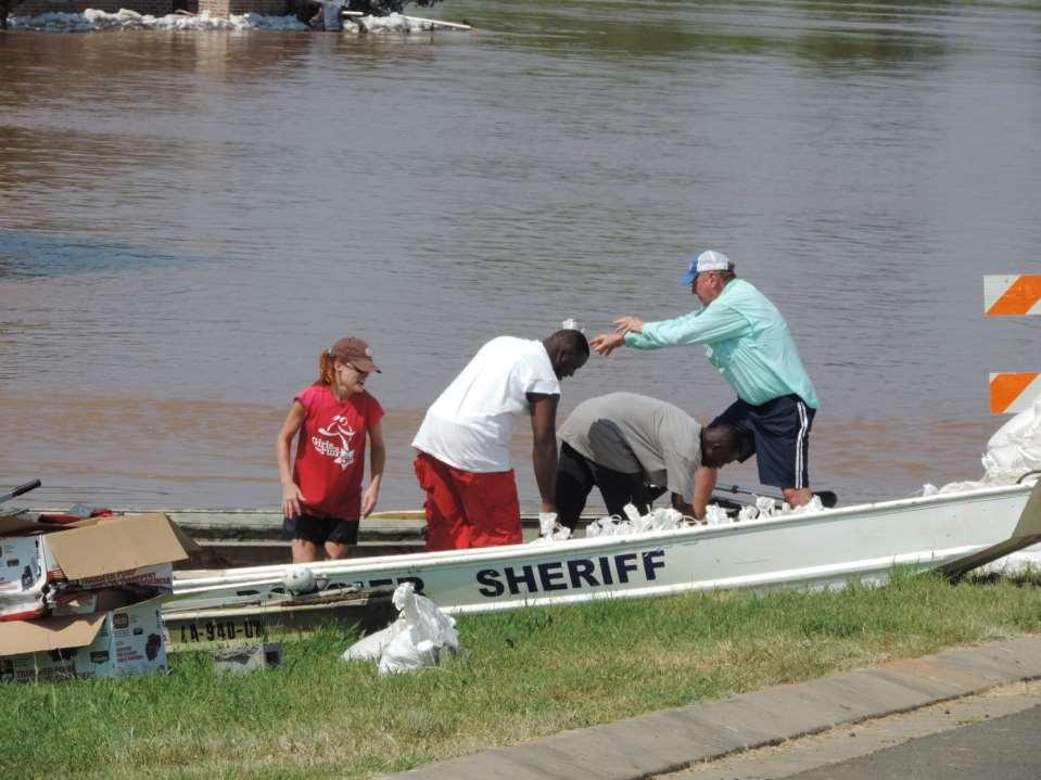
24 June 2015 Historical Flood Red River Shreveport/Bossier
25 Red River Facts Named for the RED-BED country (sedimentary rocks) of its watershed. There are several rivers with the same name. It originates at elevation 3,440 feet in the Texas panhandle and New Mexico. It travels across Texas, Oklahoma, Arkansas and Louisiana where it discharges at elevation 34 feet into the Atchafalaya/Mississippi in West Feliciana Parish miles long, 65,595 square mile drainage basin, average discharge rate of 57 kcfs and maximum rate of 303 kcfs, April 7, 1945.
26

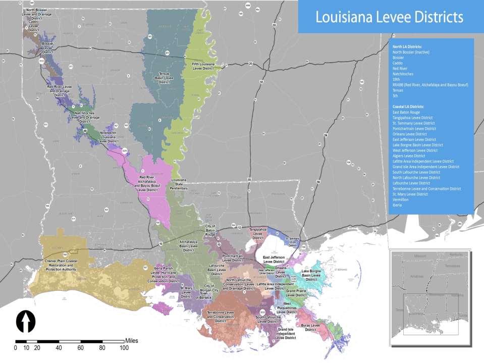
27 Caddo & Bossier Levee Districts
28 Caddo Levee District Caddo Levee District is charged with operating and maintaining miles of levee system miles along the Red River miles along Twelve Mile Bayou, Black Bayou, and Cherokee Park Bayou Provides flood protection for over 30,000 residents and 200,000 acres of land
29 Bossier Levee District Bossier Levee District is charged with operating and maintaining 67.4 miles of levee system 48.6 miles along the Red River 18.8 miles along Red Chute Bayou Provides flood protection for over 157,000 acres of land in Bossier Parish and 4,000 acres in Red River Parish
30 Why were the Levees Built? The original levees in Caddo and Bossier were built by local farmers along areas they owned on the Red River and Twelve Mile Bayou. The purpose of the levees was to create farm land for agricultural use. The heights of the levees were modified over the years. Some of the levees were re-built and some had to be relocated.


31 High Water Marks (HWM) HWM High Water Mark

32 River High Water Marks June 2015 Red River HWM s 12-Mile Bayou HWM s
33 Red River Base Flood Elevations vs Observed June 2015 High Water Marks Location BFE HWM Feet above BFE Flournoy/E. Kings Bagley Road th Street Bridge Barksdale Bridge RR at Veterans Park I Texas St. Bridge Cross Bayou Jack Wells Airport/Wells Island I & George Rd
34 Twelve Mile Bayou - BFE s vs June 2015 Observed High Water Marks Location BFE HWM Feet above BFE Cross Red River N. Market N. Common N. Hearne N. Market / I
35 Date HWM Flow(kcfs) 30-Jun Jun Nov Mar May Apr May May Jun May
36 Red River 2015 BFE 166 Crest

37 What Could Have Caused this Flood?


38 May Rainfall Totals Record Rainfall Widespread 10+ inches over the Red River basin Broad area of 20+ inches upstream of Lake Texoma and Hugo Lake Percent of Normal: % Wettest May on record for TX and OK Denison Dam Hugo Lake Pecan Point

39 Waterway Project Locks and Dams Dikes and Revetments

40 Sand and Sediment Accumulation

41 Sand and Sediment Accumulation

42 Corps of Engineers 1998 DRAFT STUDY
43 Executive Summary The results of the Red River Sediment Transportation Study showed that the majority of the sediments entering the Red River above Index, Arkansas, are falling along various points on the river to form sandbars and shoals prior to reaching Index. However, the study determined that all the sand sediments flowing past Index, Arkansas, which are estimated to be approximately 1.6 million cubic yards (2.29 million tons of wet sand) per year are ending up in the navigation channel at Pool 5 near SHREVEPORT.

44 North of Jimmie Davis Bridge 1976 DIKE Jimmie Davis Bridge

45 Rock Dikes Rock Dikes Jimmie Davis Bridge
 Jimmy Davis Bridge")
46 Choke Points - Obstructions and Changes (Man-made and Natural) Jimmy Davis Bridge Dike Dike

47 Silted-up and forested behind and across rock dikes


48 Development on both sides of the Red River after 1980

49 Jimmy Davis Bridge / Fant Parkway Hesco Wall

50 Parkways are a Barrier, but not a Levee Caddo Levee Jimmie Davis Bridge
 Shr.")
51 Vacant Land South of I-20 (1976) Shr.-Barksdale I-20

52 Urbanization in Flood Plain
53 HOW ACCURATE ARE THE Flood Insurance Rate Maps (FIRM) PUBLISHED BY FEMA?

54 Original FEMA Flood Map 1984 Lake Street BFE 166 I Downtown Shreveport

55 Current FEMA Flood Map 2014 LEVEE BFE 166 I L E V E E
56 How Accurate are the Flood Maps Published by FEMA? The first maps published for the Caddo Bossier area were in the early 1980 s. Maps are usually updated every 10 years to insure current Base Flood Elevations are available. Maps are used by public agencies to regulate development located in flood prone areas. Base Flood Elevations usually change with the increase of development within the watershed of a stream.
57 How Accurate are the Flood Maps Published by FEMA? Improvements to the river s channel will result in lower Base Flood Elevations. Encroachments on the river s channel or obstructions of the channel will result in higher Base Flood Elevations. The Base Flood Elevation of the Red River was established in the late 1970 s at an elevation of 166 feet near downtown Shreveport. The Base Flood Elevation shown on the current maps that were published in 2014 is 166 feet at the same location NO CHANGE.
58 How Accurate are the Flood Maps Published by FEMA? The Base Flood Elevation by FEMA for the Red River has not changed since the late 1970 s (approximately years). The Red River s channel has changed in the last years. The overflow area for backwater flood storage on both sides of the River has experienced significant reductions.
59 What has been learned? FEMA s Base Flood Elevations of the Red River shown on the FIRM are outdated and not accurate. FEMA s BFE s of the Red River s tributaries (Twelve Mile Bayou in Caddo and Loggy Bayou in Bossier) are impacted by backwater flooding from the Red River, are not accurate, and are outdated. The Red River s main channel has been changed due to siltation since the BFE s were established by FEMA.
60 What has been learned? Significant changes in the land use between the two Levee Systems has occurred since the BFE s were established by FEMA. The height of the existing levee system in Caddo and Bossier Parishes may not meet the three (3) foot free board (safety factor) established by FEMA, which may result in de-certification of the levee system. Removal of silt from the river s channel by dredging to provide flood protection is not economically feasible and possible.
61 What has been done? A Flood Technical Committee was formed. Completed documentation of High Water Marks (HWM s) along the levee system on the Red River in both parishes. Corps initiated a $1.5 million Hydraulic & Sediment Survey, but only received $250,000. The FY 2017 budget requires $1.25 million to complete the survey. The survey is from Lock 1 to Hwy 72 Bridge, AR. FEMA needs the Corps data for BFE / Maps / Insurance.
62 What has been done? Bossier Parish and Bossier City have enacted legislation which allows use of established HWM s to regulate future developments on land located between the levee system and the Red River. Caddo Parish and the City of Shreveport have adopted a voluntary policy that recommends the use of high water marks for development on land between the levee and the Red River.
63 What Should be Done to Protect Lives and Property? Local public agencies should use the HWM s to regulate development on land located between Caddo and Bossier levee systems. Local public agencies should establish legislation that will allow preservation of open space for flood plain storage protection. Local public agencies should establish legislation that mandates mitigation (Flood Plain Compensation) for development authorized on land located between the levee systems on both sides of the river.
64 What Should be Done to Protect Lives and Property? Corps of Engineers should complete the Hydraulic Model and Sedimentation Survey of the Red River. FEMA needs the Corps data for BFE / Maps / Insurance. FEMA should establish accurate Base Flood Elevations for the Red River and its tributaries in Caddo and Bossier Parishes. Levee Boards should ensure the height of the levee system meets or exceeds FEMA s certification requirements.

65 Discussion QUESTIONS? / Questions
Red River Levee Panel
 Red River Levee Panel Mississippi River Commission Monday, August 9, 2017 Red River Levees in LA & AR NONE along TX & OK Boarder Red River Levee Issues Caddo Levee Cherokee Park Authorization Bossier Levee
LOMR SUBMITTAL LOWER NEHALEM RIVER TILLAMOOK COUNTY, OREGON
 LOMR SUBMITTAL LOWER NEHALEM RIVER TILLAMOOK COUNTY, OREGON Prepared for: TILLAMOOK COUNTY DEPARTMENT OF COMMUNITY DEVELOPMENT 1510-B THIRD STREET TILLAMOOK, OR 97141 Prepared by: 10300 SW GREENBURG ROAD,
Pequabuck River Flooding Study and Flood Mitigation Plan The City of Bristol and Towns of Plainville and Plymouth, CT
 Pequabuck River Flooding Study and Flood Mitigation Plan The City of Bristol and Towns of Plainville and Plymouth, CT Raymond Rogozinski and Maged Aboelata The City of Bristol and Towns of Plainville and
YELLOWSTONE RIVER FLOOD STUDY REPORT TEXT
 YELLOWSTONE RIVER FLOOD STUDY REPORT TEXT TECHNICAL REPORT Prepared for: City of Livingston 411 East Callender Livingston, MT 59047 Prepared by: Clear Creek Hydrology, Inc. 1627 West Main Street, #294
LOMR SUBMITTAL LOWER NESTUCCA RIVER TILLAMOOK COUNTY, OREGON
 LOMR SUBMITTAL LOWER NESTUCCA RIVER TILLAMOOK COUNTY, OREGON Prepared for: TILLAMOOK COUNTY DEPARTMENT OF COMMUNITY DEVELOPMENT 1510-B THIRD STREET TILLAMOOK, OR 97141 Prepared by: 10300 SW GREENBURG ROAD,
3.11 Floodplains Existing Conditions
 Other stormwater control practices may be needed to mitigate water quality impacts. In addition to detention facilities, other practices such as vegetated basins/buffers, infiltration basins, and bioswales
Appendix E Guidance for Shallow Flooding Analyses and Mapping
 Appendix E Guidance for Shallow Flooding Analyses and Mapping E.1 Introduction Different types of shallow flooding commonly occur throughout the United States. Types of flows that result in shallow flooding
Section 4: Model Development and Application
 Section 4: Model Development and Application The hydrologic model for the Wissahickon Act 167 study was built using GIS layers of land use, hydrologic soil groups, terrain and orthophotography. Within
REDWOOD VALLEY SUBAREA
 Independent Science Review Panel Conceptual Model of Watershed Hydrology, Surface Water and Groundwater Interactions and Stream Ecology for the Russian River Watershed Appendices A-1 APPENDIX A A-2 REDWOOD
LOCATED IN INDIAN RIVER COUNTY PREPARED FOR S.J.R.W.M.D. AND F.W.C.D. DECEMBER, 2003 Updated 2007 Updated May 2014 PREPARED BY
 FELLSMERE WATER CONTROL DISTRICT EAST MASTER DRAINAGE PLAN AND STORMWATER HYDROLOGIC ANALYSIS OF THE GRAVITY DRAINAGE SYSTEM LOCATED BETWEEN THE EAST BOUNDARY, LATERAL U, THE MAIN CANAL, AND DITCH 24 LOCATED
JOURNAL OF ENVIRONMENTAL HYDROLOGY The Electronic Journal of the International Association for Environmental Hydrology VOLUME
 JOURNAL OF ENVIRONMENTAL HYDROLOGY The Electronic Journal of the International Association for Environmental Hydrology VOLUME 18 2010 REDUCED CHANNEL CONVEYANCE ON THE WICHITA RIVER AT WICHITA FALLS, TEXAS,
Implementing a Project with 319 Funds: The Spring Brook Meander Project. Leslie A. Berns
 Implementing a Project with 319 Funds: The Spring Brook Meander Project Leslie A. Berns "...to acquire... and hold lands... for the purpose of protecting and preserving the flora, fauna and scenic beauties...
EAGLES NEST AND PIASA ISLANDS
 EAGLES NEST AND PIASA ISLANDS HABITAT REHABILITATION AND ENHANCEMENT PROJECT MADISON AND JERSEY COUNTIES, ILLINOIS ENVIRONMENTAL MANAGEMENT PROGRAM ST. LOUIS DISTRICT FACT SHEET I. LOCATION The proposed
White River Update. Jeanne Stypula, Supervising Engineer. Advisory Committee Meeting April 26, 2016
 White River Update Jeanne Stypula, Supervising Engineer Advisory Committee Meeting April 26, 2016 Department of Natural Resources and Parks Water and Land Resources Division River and Floodplain Management
!"#$%&&'()*+#$%(,-./0*)%(!
*+#$%(,-./0*)%(!") 8:30 Sign in Hoosic River Revival Coalition!"#$%&&'()*+#$%(,-./0*)%(! 12-#30+4/#"5-(60 9:00 Welcome and Introductions 9:15 Goals for Today s Program: A Description of the Planning Process 9:30 First Session:
8:30 Sign in Hoosic River Revival Coalition!"#$%&&'()*+#$%(,-./0*)%(! 12-#30+4/#"5-(60 9:00 Welcome and Introductions 9:15 Goals for Today s Program: A Description of the Planning Process 9:30 First Session:
Flood Event Analysis to Estimate the Avoided Damages Due to Flood Improvement Projects & Voluntary Buyout Program
 Flood Event Analysis to Estimate the Avoided Damages Due to Flood Improvement Projects & Voluntary Buyout Program Ataul Hannan, P.E., CFM Planning Division Director Harris County Flood Control District
PENNSYLVANIA DEPARTMENT OF TRANSPORTATION ENGINEERING DISTRICT 3-0
 PENNSYLVANIA DEPARTMENT OF TRANSPORTATION ENGINEERING DISTRICT 3-0 LYCOMING COUNTY S.R.15, SECTION C41 FINAL HYDROLOGIC AND HYDRAULIC REPORT STEAM VALLEY RUN STREAM RELOCATION DATE: June, 2006 REVISED:
Suwannee Satilla Basins Flood Control Issues, Opportunities and Assistance
 Suwannee Satilla Basins Flood Control Issues, Opportunities and Assistance Georgia Silver Jackets Meeting Valdosta, GA April 11, 2013 Presentation Outline Basin overview Recent floods: 2009 100 year flood
Analysis of Hydraulic Impacts on the Schuylkill River
 Analysis of Hydraulic Impacts on the Schuylkill River Manayunk Sewer Basin Construction Project and the Venice Island Recreation Center Reconstruction Project Venice Island, Manayunk, Philadelphia, PA
Folsom Dam Water Control Manual Update Joint Federal Project, Folsom Dam
 Folsom Dam Water Control Manual Update Joint Federal Project, Folsom Dam Public Workshop May 28, 2015 Library Galleria 828 I Street, Sacramento, CA US Army Corps of Engineers BUILDING STRONG WELCOME &
State Water Survey Division SURFACE WATER SECTION
 State Water Survey Division SURFACE WATER SECTION AT THE UNIVERSITY OF ILLINOIS Illinois Department of Energy and Natural Resources SWS Miscellaneous Publication 88 SEDIMENTATION OF POOL 19 ON THE MISSISSIPPI
9. PROBABLE MAXIMUM PRECIPITATION AND PROBABLE MAXIMUM FLOOD
 9. PROBABLE MAXIMUM PRECIPITATION AND PROBABLE MAXIMUM FLOOD 9.1. Introduction Due to the size of Watana Dam and the economic importance of the Project to the Railbelt, the Probable Maximum Flood (PMF)
UPPER COSUMNES RIVER FLOOD MAPPING
 UPPER COSUMNES RIVER FLOOD MAPPING DRAFT BASIC DATA NARRATIVE FLOOD INSURANCE STUDY SACRAMENTO COUTY, CALIFORNIA Community No. 060262 November 2008 Prepared By: CIVIL ENGINEERING SOLUTIONS, INC. 1325 Howe
Bank Erosion and Morphology of the Kaskaskia River
 Bank Erosion and Morphology of the Kaskaskia River US Army Corps Of Engineers St. Louis District Fayette County Soil and Water Conservation District Team Partners : Carlyle Lake Ecosystem Partnership Vicinity
Mississippi River and Tributaries Project Mississippi River Geomorphology and Potamology Program
 Mississippi River and Tributaries Project Mississippi River Geomorphology and Potamology Program Barb Kleiss, Mississippi Valley Division Freddie Pinkard, Vicksburg District June, 2016 Program Objectives
Assessment of the Hood River Delta Hood River, Oregon
 Assessment of the Hood River Delta Hood River, Oregon Pacific Northwest Waterways Association Annual Meeting October 13, 2010 Michael McElwee, Executive Director Port of Hood River Overview U.S. Army Corps
Chapter 7 Mudflow Analysis
 Chapter 7 Mudflow Analysis 7.0 Introduction This chapter provides information on the potential and magnitude of mud floods and mudflows that may develop in Aspen due to rainfall events, snowmelt, or rain
Material Workshop. Galveston District 2012 Beneficial Use of Dredged. Material Workshop. Custodians of the Coast
 Galveston District 2012 Beneficial Use of Dredged Material Workshop Galveston District 2012 Beneficial Use of Dredged Material Workshop US Army Corps of Engineers BUILDING STRONG Welcome Opening Remarks
Chapter 5 CALIBRATION AND VERIFICATION
 Chapter 5 CALIBRATION AND VERIFICATION This chapter contains the calibration procedure and data used for the LSC existing conditions model. The goal of the calibration effort was to develop a hydraulic
Erosion Surface Water. moving, transporting, and depositing sediment.
 + Erosion Surface Water moving, transporting, and depositing sediment. + Surface Water 2 Water from rainfall can hit Earth s surface and do a number of things: Slowly soak into the ground: Infiltration
Roger Andy Gaines, Research Civil Engineer, PhD, P.E.
 Roger Andy Gaines, Research Civil Engineer, PhD, P.E. Research Civil Engineer/Regional Technical Specialist Memphis District August 24, 2010 Objectives Where we have been (recap of situation and what s
U.S. ARMY CORPS OF ENGINEERS
 CORPS FACTS Regulating Mississippi River Navigation Pools U.S. ARMY CORPS OF ENGINEERS BUILDING STRONG Historical Background Federal improvements in the interest of navigation on the Mississippi River
Folsom Dam Water Control Manual Update Joint Federal Project, Folsom Dam
 Folsom Dam Water Control Manual Update Joint Federal Project, Folsom Dam Public Workshop May 25, 2016 Sacramento Library Galleria 828 I Street, Sacramento, CA US Army Corps of Engineers BUILDING STRONG
Background on the March 13-14, 2007 Flooding in Browns Valley (Traverse County), Minnesota
, Minnesota") Background on the March 13-14, 2007 Flooding in Browns Valley (Traverse County), Minnesota Report to the Minnesota Governor s Office Prepared by: Minnesota Department of Natural Resources Waters Division
Background on the March 13-14, 2007 Flooding in Browns Valley (Traverse County), Minnesota Report to the Minnesota Governor s Office Prepared by: Minnesota Department of Natural Resources Waters Division
Attachment B to Technical Memorandum No.2. Operations Plan of Ross Valley Detention Basins
 Attachment B to Technical Memorandum No.2 Operations Plan of Ross Valley Detention Basins Operations Plan of Ross Valley Detention Basins Stetson Engineers Inc. January 26, 2011 1.0 Introduction Achieving
Sediment Trap. A temporary runoff containment area, which promotes sedimentation prior to discharge of the runoff through a stabilized spillway.
 Sediment Trap SC-15 Source: Caltrans Construction Site Best Management Practices Manual, 2003. Description A temporary runoff containment area, which promotes sedimentation prior to discharge of the runoff
Highland Lake Bathymetric Survey
 Highland Lake Bathymetric Survey Final Report, Prepared For: The Town of Highland Lake 612 Lakeshore Drive Oneonta, AL 35121 Prepared By: Tetra Tech 2110 Powers Ferry Road SE Suite 202 Atlanta, GA 30339
Working with Natural Stream Systems
 Working with Natural Stream Systems Graydon Dutcher Delaware County Soil & Water Conservation District Stream Corridor Management Program Tropical Storm Sandy October 29,2012 What is a Watershed?
Chapter 7 Mudflow Analysis
 Chapter 7 Mudflow Analysis 7.0 Introduction This chapter provides information on the potential and magnitude of mud floods and mudflows that may develop in Aspen due to rainfall events, snowmelt, or rain
3/3/2013. The hydro cycle water returns from the sea. All "toilet to tap." Introduction to Environmental Geology, 5e
 Introduction to Environmental Geology, 5e Running Water: summary in haiku form Edward A. Keller Chapter 9 Rivers and Flooding Lecture Presentation prepared by X. Mara Chen, Salisbury University The hydro
COMMUNITY EMERGENCY RESPONSE TEAM FLOODS INTRODUCTION
 INTRODUCTION Floods are one of the most common hazards in the United States. A flood occurs any time a body of water rises to cover what is usually dry land. Flood effects can be local, impacting a neighborhood
Remaining Capacity in Great Lakes Reservoirs
 US Army Corps of Engineers Detroit District Remaining Capacity in Great Lakes Reservoirs Storage Capacity Behind Great Lakes Dams Field Data and Modeling Motivation for project Project overview Data and
How Do Human Impacts and Geomorphological Responses Vary with Spatial Scale in the Streams and Rivers of the Illinois Basin?
 How Do Human Impacts and Geomorphological Responses Vary with Spatial Scale in the Streams and Rivers of the Illinois Basin? Bruce Rhoads Department of Geography University of Illinois at Urbana-Champaign
StreamStats: Delivering Streamflow Information to the Public. By Kernell Ries
 StreamStats: Delivering Streamflow Information to the Public By Kernell Ries U.S. Department of the Interior U.S. Geological Survey MD-DE-DC District 410-238-4317 kries@usgs.gov StreamStats Web Application
Chapter 3 Erosion in the Las Vegas Wash
 Chapter 3 Erosion in the Las Vegas Wash Introduction As described in Chapter 1, the Las Vegas Wash (Wash) has experienced considerable change as a result of development of the Las Vegas Valley (Valley).
USING GIS TO MODEL AND ANALYZE HISTORICAL FLOODING OF THE GUADALUPE RIVER NEAR NEW BRAUNFELS, TEXAS
 USING GIS TO MODEL AND ANALYZE HISTORICAL FLOODING OF THE GUADALUPE RIVER NEAR NEW BRAUNFELS, TEXAS ASHLEY EVANS While the state of Texas is well-known for flooding, the Guadalupe River Basin is one of
FORECAST-BASED OPERATIONS AT FOLSOM DAM AND LAKE
 FORECAST-BASED OPERATIONS AT FOLSOM DAM AND LAKE 255 237 237 237 217 217 217 200 200 200 0 163 131 Bridging the Gap163Conference 255 0 132 255 0 163 122 The Dana on Mission Bay San Diego, CA January 28,
Influence of the Major Drainages to the Mississippi River and Implications for System Level Management
 Influence of the Major Drainages to the Mississippi River and Implications for System Level Management Brian M. Vosburg Geologist Louisiana Coastal Protection and Restoration Authority brian.vosburg@la.gov
Statewide Topographic Mapping Program
 Statewide Topographic Mapping Program February 28, 2018 www.dotd.la.gov Outline Purpose of the Statewide Topographic Mapping Program History Breakdown of R.S. 48:36 - Topographic Mapping Statewide Topographic
Local Flood Hazards. Click here for Real-time River Information
 Local Flood Hazards Floods of the White River and Killbuck Creek are caused by runoff from general, and/or intense rainfall. Other areas of flooding concern are from the Boland Ditch and Pittsford Ditch.
UGRC 144 Science and Technology in Our Lives/Geohazards
 UGRC 144 Science and Technology in Our Lives/Geohazards Flood and Flood Hazards Dr. Patrick Asamoah Sakyi Department of Earth Science, UG, Legon College of Education School of Continuing and Distance Education
Earth Science Chapter 6 Section 2 Review
 Name: Class: Date: Earth Science Chapter 6 Section Review Multiple Choice Identify the choice that best completes the statement or answers the question. 1. Most streams carry the largest part of their
THE TRINITY RIVER VISION/ GATEWAY PARK / PANTHER ISLAND
 Quarterly Project Status Report May 2018 THE TRINITY RIVER VISION/ GATEWAY PARK / PANTHER ISLAND Flood Control Project Update Construction of North Main Street Bridge by TxDOT s bridge contractor, Texas
Dealing with Zone A Flood Zones. Topics of Discussion. What is a Zone A Floodplain?
 Dealing with Zone A Flood Zones Topics of Discussion Overview of Zone A Floodplains Permitting Development in Zone A Floodplains Estimating Flood Elevations in Zone A Flood Insurance Implications Letters
THE TRINITY RIVER VISION/ GATEWAY PARK / PANTHER ISLAND Flood Control Project Update
 Quarterly Project Status Report September 2018 THE TRINITY RIVER VISION/ GATEWAY PARK / PANTHER ISLAND Flood Control Project Update TxDot s contractor has nearly completed the superstructure false work
Integrating Weather Forecasts into Folsom Reservoir Operations
 Integrating Weather Forecasts into Folsom Reservoir Operations California Extreme Precipitation Symposium September 6, 2016 Brad Moore, PE US Army Corps of Engineers Biography Brad Moore is a Lead Civil
STABILIZATION OF THE H&CT RAILWAY STONE DAM WALTER E. SKIPWITH, PE, JOYCE CRUM, AIA AND JOHN BAUMGARTNER, PE. Introduction.
 STABILIZATION OF THE H&CT RAILWAY STONE DAM WALTER E. SKIPWITH, PE, JOYCE CRUM, AIA AND JOHN BAUMGARTNER, PE I. A. Introduction General The Old Stone Dam is located in the upper reach of Cottonwood Creek
Lake Sedimentation Survey of Siloam Springs State Park Lake, Adams County, Illinois
 Contract Report 567 Lake Sedimentation Survey of Siloam Springs State Park Lake, Adams County, Illinois by Richard L. Allgire Office of Sediment & Wetland Studies Prepared for the Illinois Department of
United States Multi-Hazard Early Warning System
 United States Multi-Hazard Early Warning System Saving Lives Through Partnership Lynn Maximuk National Weather Service Director, Central Region Kansas City, Missouri America s s Weather Enterprise: Protecting
Big Wood River. General Information
 General Information The flows out of the southern portion of the Sawtooth National Recreation Area in central Idaho. The study reach is about a,200 ft length of river about.5 miles upstream from the discontinued
Sediment Traps. CAG Meeting May 21, 2012
 Sediment Traps CAG Meeting May 21, 2012 Agenda Background Fundamentals of Sediment Transport Sediment Trap Existing Information Next Steps 2 The Site Saginaw River 22 mile river beginning at confluence
APPENDIX A M&T/Llano Seco Long-Term Water Reliability Study These photos are examples of rock spurs in use throughout the United States
 APPENDIX A M&T/Llano Seco Long-Term Water Reliability Study These photos are examples of rock spurs in use throughout the United States Glenn Colusa Irrigation District completed a Sacramento River project
Ground Water Protection Council 2017 Annual Forum Boston, Massachusetts. Ben Binder (303)
") Ground Water Protection Council 2017 Annual Forum Boston, Massachusetts Protecting Groundwater Sources from Flood Borne Contamination Ben Binder (303) 860-0600 Digital Design Group, Inc. The Problem Houston
Ground Water Protection Council 2017 Annual Forum Boston, Massachusetts Protecting Groundwater Sources from Flood Borne Contamination Ben Binder (303) 860-0600 Digital Design Group, Inc. The Problem Houston
Environmental Geology Chapter 9 Rivers and Flooding
 Environmental Geology Chapter 9 Rivers and Flooding Flooding in Pakistan 2010-1600 killed/20000 affected The hydrologic cycle is powered by the Sun The cycle includes evaporation, precipitation, infiltration,
Island Design. UMRS EMP Regional Workshop. Presentation for the
 Island Design Presentation for the UMRS EMP Regional Workshop by Jon Hendrickson Hydraulic Engineer Regional Technical Specialist, Water Quality and Habitat Restoration August 17 19, 2005 Project Delivery
Mobile District River System Status for October 25, 2018
 Mobile District River System Status for October 25, 2018 Weather Update The Quantitative Precipitation Forecast (QPF) in Figure 1 shows 0.4 to 2.5 inches of precipitation forecasted for the next 7 days.
mountain rivers fixed channel boundaries (bedrock banks and bed) high transport capacity low storage input output
 high transport capacity low storage input output") mountain rivers fixed channel boundaries (bedrock banks and bed) high transport capacity low storage input output strong interaction between streams & hillslopes Sediment Budgets for Mountain Rivers Little
mountain rivers fixed channel boundaries (bedrock banks and bed) high transport capacity low storage input output strong interaction between streams & hillslopes Sediment Budgets for Mountain Rivers Little
Low Low Water in Puget Sound vs. Mean Sea Level. What do the flood event gauge readings at Sedro Woolley really mean?
 Low Low Water in Puget Sound vs. Mean Sea Level What do the flood event gauge readings at Sedro Woolley really mean? When you make the adjustment of 8.93 feet to the published values and then subtract
CR AAO Bridge. Dead River Flood & Natural Channel Design. Mitch Koetje Water Resources Division UP District
 CR AAO Bridge Dead River Flood & Natural Channel Design Mitch Koetje Water Resources Division UP District Old County Road AAO Bridge Map courtesy of Marquette County Silver Lake Basin McClure Basin
Chapter 11. Rivers: Shaping our landscape
 Chapter 11 Rivers: Shaping our landscape Learning outcomes In this presentation you will learn: Common terms associated with rivers About the three stages of a river About the processes of river erosion
STREUVER FIDELCO CAPPELLI, LLC YONKERS DOWNTOWN DEVELOPMENT PHASE 1. DRAFT ENVIRONMENTAL IMPACT STATEMENT For: PALISADES POINT
 STREUVER FIDELCO CAPPELLI, LLC YONKERS DOWNTOWN DEVELOPMENT PHASE 1 DRAFT ENVIRONMENTAL IMPACT STATEMENT For: PALISADES POINT Prepared by: PAULUS, SOKOLOWSKI & SARTOR STORMWATER MANAGEMENT 1. Methodology
Technical Memorandum No
 Pajaro River Watershed Study in association with Technical Memorandum No. 1.2.10 Task: Evaluation of Four Watershed Conditions - Sediment To: PRWFPA Staff Working Group Prepared by: Gregory Morris and
CASE STUDY #9 - Brushy Fork Dam, Sugar Grove, West Virginia
 CASE STUDY #9 - Brushy Fork Dam, Sugar Grove, West Virginia Brushy Fork Dam is a flood control structure built by the Soil Conservation Service southeast of the city of Franklin in Pendleton County, West
CENTRAL TEXAS HILL COUNTRY FLOOD
 CENTRAL TEXAS HILL COUNTRY FLOOD Term project report DECEMBER 7, 2018 UNIVERSITY OF TEXAS AT AUSTIN CE394K: GIS in Water Resources Engineering RIFAAI Mohamed Talha Table of Contents Introduction... 3 Context...
FEMA Hazards Loss Modeling Task Force (MOTF) Situation Report #14. Colorado Spring Flood Risk ***FINAL REPORT***
 Situation Report #14. Colorado Spring Flood Risk ***FINAL REPORT***") FEMA Hazards Loss Modeling Task Force (MOTF) Situation Report #14 Colorado Spring Flood Risk FEMA Modeling Task Force (MOTF) Denver Federal Center, Building 710A Denver, Colorado 80225 Email: FEMA-MOTF@fema.dhs.gov
FEMA Hazards Loss Modeling Task Force (MOTF) Situation Report #14 Colorado Spring Flood Risk FEMA Modeling Task Force (MOTF) Denver Federal Center, Building 710A Denver, Colorado 80225 Email: FEMA-MOTF@fema.dhs.gov
Progress Report. Flood Hazard Mapping in Thailand
 Progress Report Flood Hazard Mapping in Thailand Prepared By: Mr. PAITOON NAKTAE Chief of Safety Standard sub-beuro Disaster Prevention beuro Department of Disaster Prevention and Mitigation THAILAND E-mail:
Report on the Damage Survey Caused by Hurricane Katrina (Tentative Report)
") Report on the Damage Survey Caused by Hurricane Katrina (Tentative Report) November 1, 2005 Coastal Disaster Prevention Technology Survey Team 1. Introduction Hurricane Katrina struck the United States
Report on the Damage Survey Caused by Hurricane Katrina (Tentative Report) November 1, 2005 Coastal Disaster Prevention Technology Survey Team 1. Introduction Hurricane Katrina struck the United States
3.0 TECHNICAL FEASIBILITY
 3.0 TECHNICAL FEASIBILITY 3.1 INTRODUCTION To enable seasonal storage and release of water from Lake Wenatchee, an impoundment structure would need to be constructed on the lake outlet channel. The structure
Missouri River Basin Water Management
 Missouri River Basin Water Management US Army Corps of Engineers Missouri River Navigator s Meeting February 12, 2014 Bill Doan, P.E. Missouri River Basin Water Management US Army Corps of Engineers BUILDING
PRELIMINARY DRAFT FOR DISCUSSION PURPOSES
 Memorandum To: David Thompson From: John Haapala CC: Dan McDonald Bob Montgomery Date: February 24, 2003 File #: 1003551 Re: Lake Wenatchee Historic Water Levels, Operation Model, and Flood Operation This
Earth Wind & Fire. Game Changing Restoration Options in the Texas Chenier Plain
 Earth Wind & Fire Game Changing Restoration Options in the Texas Chenier Plain EARTH: The Chenier Plain is a 5 million acre coastal region in Southwest Louisiana and Southeast Texas providing landscape
Opportunities to Improve Ecological Functions of Floodplains and Reduce Flood Risk along Major Rivers in the Puget Sound Basin
 Opportunities to Improve Ecological Functions of Floodplains and Reduce Flood Risk along Major Rivers in the Puget Sound Basin Christopher Konrad, US Geological Survey Tim Beechie, NOAA Fisheries Managing
2011 Flood: Technical Review of Lake Manitoba, Lake St. Martin and Assiniboine River Water Levels Summary
 2011 Flood: Technical Review of Lake Manitoba, Lake St. Martin and Assiniboine River Water Levels Summary October 2013 Introduction Manitoba experienced unprecedented flooding in 2011. While flooding was
Hydrologic Forecast Centre. Manitoba Infrastructure. Winnipeg, Manitoba FEBRUARY FLOOD OUTLOOK REPORT FOR MANITOBA.
 Page 1 of 20 Hydrologic Forecast Centre Manitoba Infrastructure Winnipeg, Manitoba FEBRUARY FLOOD OUTLOOK REPORT FOR MANITOBA February 28, 2019 Overview The February Outlook Report prepared by the Hydrologic
THE IMPORTANCE OF SCIENCE IN COASTAL RESTORATION IN LOUISIANA
 THE IMPORTANCE OF SCIENCE IN COASTAL RESTORATION IN LOUISIANA Barb Kleiss USACE, Mississippi Valley Division August 3, 2011 LCA S&T Office Authorized under WRDA 2007 Designed to address technical issues
Inter State Large Navigable Rivers of the United States
 Inter State Large Navigable Rivers of the United States REVIEW OF NORTH AMERICAN BASINS: GREAT LAKES AND MISSISSIPPI RIVER HELEN A. BROHL, EXECUTIVE DIRECTOR US COMMITTEE ON THE MARINE TRANSPORTATION SYSTEM
Examination of Direct Discharge Measurement Data and Historic Daily Data for Selected Gages on the Middle Mississippi River,
 Examination of Direct Discharge Measurement Data and Historic Daily Data for Selected Gages on the Middle Mississippi River, 1861-2008 - Richard J. Huizinga, P.E. U.S. Geological Survey Missouri Water
Update to Lake Houston Area Grassroots Flood Prevention Initiative
 Update to Lake Houston Area Grassroots Flood Prevention Initiative Kaaren Cambio April 17, 2018 Where were you when Harvey came? Harvey Average of 33 of rain in 4 days across Harris County. 120,000 structures
Monthly Long Range Weather Commentary Issued: APRIL 18, 2017 Steven A. Root, CCM, Chief Analytics Officer, Sr. VP,
 Monthly Long Range Weather Commentary Issued: APRIL 18, 2017 Steven A. Root, CCM, Chief Analytics Officer, Sr. VP, sroot@weatherbank.com MARCH 2017 Climate Highlights The Month in Review The average contiguous
Sedimentation in Quincy Bay and Potential Remedial Measures
 REPORT OF INVESTIGATION 108 Sedimentation in Quincy Bay and Potential Remedial Measures by J. RODGER ADAMS, NANI G. BHOWMIK, WILLIAM C. BOGIMER, and FRANK S. DILLON Title: Sedimentation in Quincy Bay and
Las Colonias Subdivision September 2010 Flood Study
 Las Colonias Subdivision September 2010 Flood Study Curtis Beitel, P.E., CFM Scott Muchard, P.E. Project Engineer William Badini, CFM Senior Meteorologist Location Map Background Los Colonias Subdivision
Physical landscapes River landscapes in the UK
 Physical landscapes River landscapes in the UK The shape of river valleys change s as rivers flow downstream - PROCESSES Erosion Abrasion or corrasion Attrition Hydraulic Action Solution or corrosion Deposition
B-1. Attachment B-1. Evaluation of AdH Model Simplifications in Conowingo Reservoir Sediment Transport Modeling
 Attachment B-1 Evaluation of AdH Model Simplifications in Conowingo Reservoir Sediment Transport Modeling 1 October 2012 Lower Susquehanna River Watershed Assessment Evaluation of AdH Model Simplifications
Squaw Creek. General Information
 General Information is a tributary to the Salmon River. It enters the north side of the river about 0 miles downstream of North Fork, Idaho. The study reach is about a 30 ft length of stream about 2 miles
Climate Adaptation Challenges for Boston s Water and Sewer Systems
 National Association of Flood & Stormwater Management Agencies Climate Adaptation Challenges for Boston s Water and Sewer Systems John P Sullivan P.E. October 15,2014 Boston 1630 Boston 1630-2012 Boston
INFLOW DESIGN FLOOD CONTROL SYSTEM PLAN 40 C.F.R. PART PLANT YATES ASH POND 2 (AP-2) GEORGIA POWER COMPANY
 GEORGIA POWER COMPANY") INFLOW DESIGN FLOOD CONTROL SYSTEM PLAN 40 C.F.R. PART 257.82 PLANT YATES ASH POND 2 (AP-2) GEORGIA POWER COMPANY EPA s Disposal of Coal Combustion Residuals from Electric Utilities Final Rule (40 C.F.R.
INFLOW DESIGN FLOOD CONTROL SYSTEM PLAN 40 C.F.R. PART 257.82 PLANT YATES ASH POND 2 (AP-2) GEORGIA POWER COMPANY EPA s Disposal of Coal Combustion Residuals from Electric Utilities Final Rule (40 C.F.R.
President s Day Weekend Storm Community Meeting and Workshop April 17, 2017
 President s Day Weekend Storm Community Meeting and Workshop April 17, 2017 Meeting outline 1. Progress update on the City of San Jose s recovery efforts 2. Water district presentation on: Weather situation
USGS Flood Inundation Mapping of the Suncook River in Chichester, Epsom, Pembroke and Allenstown, New Hampshire
 USGS Flood Inundation Mapping of the Suncook River in Chichester, Epsom, Pembroke and Allenstown, New Hampshire NH Water & Watershed Conference Robert Flynn, USGS NH-VT Water Science Center March 23, 2012
USGS Hydrography Overview. May 9, 2018
 + 1 USGS Hydrography Overview May 9, 2018 + 2 The National Geospatial Program Provides the geospatial baseline of the Nation s topography, natural landscape and built environment through The National Map,
Summer 2007 Flood Report
 Summer 2007 Flood Report LCRA Water Services River Operations Center NEXRAD image of the June 27 storm that triggered the Summer 2007 Flood Executive Summary Flood Facts: The Summer 2007 Flood was unexpected,