Hydrofest The Hydrographic Society in Scotland
|
|
|
- Jemima Townsend
- 5 years ago
- Views:
Transcription

1 Hydrofest 2017 The Hydrographic Society in Scotland
2 Offshore Survey in the Oil and Gas Industry Hydrofest 2017 Chris Leaf Head Offshore Surveys Shell Projects and Technology, Europe

3 Presentation Overview Why Position Matters The Exploration & Production Lifecycle Seismic Surveys Rig Moves Seabed & Geohazard Surveys Construction Support Subsidence Monitoring Emergency Response Conclusions
4 Why Position Matters Around 80% of the data used by Oil & Gas companies is spatially referenced. Errors in positioning, or a poor understanding of spatial relationships, can be extremely costly and have hugely significant safety and commercial implications. Such as: Major HSSE incidents Legal costs Drilling targets missed Incorrect interpretation Understanding of reservoir characteristics Loss of asset value Loss of revenue Higher lifting costs Delays to schedules Loss of reputation

 Drill Floor Elevation, Kelly bushing?")
5 Is Your Survey Referenced Correctly? There are many different coordinate systems/datums/projections Coordinate Systems & Datum in Europe 18 Offshore systems 15 Onshore systems 8 Datums (3 x ED50) Vertical reference Units (metres/feet) Drill Floor Elevation, Kelly bushing? Datum, Mean Sea Level (MSL), Lowest Astronomic Tide (LAT)? North References True, Grid or Magnetic North? 5

")
6 How to Produce a Dry Hole Planned well at coordinates lat= , long= (WGS84 coordinate system) Actual well at coordinates lat= long= (ED50 coordinate system) m reservoir
7 The Upstream Oil & Gas Industry Lifecycle Explore Appraise Develop Produce Decommission Coordinate Reference Systems & Geodetic Parameters Geo-Info & data management GIS & Mapping Remote Sensing Emergency Response Seismic, Well and Asset Coordinates Positioning & Navigation
8 Offshore Survey in the E&P Industry Lifecycle Explore Appraise Develop Produce Decommission Scouting As Built Survey As Left Survey Seismic Seismic Seismic Environmental Baseline Environmental Monitoring Environmental Monitoring Seabed Survey Seabed Survey Seabed Survey Seabed Survey Seabed Survey Geohazard Assessment Geohazard Assessment Geohazard Assessment Geohazard Assessment Geohazard Assessment Rig Positioning Rig Positioning Rig Positioning Rig Positioning Rig Positioning Stratigraphic Coring Geotechnical Borehole Geotechnical Borehole Pipeline Routing Shallow Geotechnical Construction Support Pipeline Inspection Shallow Geotechnical Construction Support Pipeline Inspection Construction Support
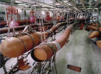
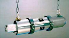
9 Marine Seismic Acquisition Explore Appraise Develop Produce Decommission 2D Seismic 3D Seismic 4D Seismic Broadseis Wide Azimuth (WAZ) Multi Azimuth (MAZ) Undershoot Transition Zone (TZ) On Bottom Cable (OBC) Node Surveys Electro Magnetic (EM)
 Hydrophones Path of reflected")
10 Marine Seismic Acquisition The Basics Survey Ship Seismic Source (airgun) Hydrophones Path of reflected sound

11 Seismic Navigation & Positioning 10 + Steerable Streamers 6 8 KMs long m lateral separation 2400 hydrophones to be positioned every 11.5 seconds For a 1000 sq km 3D survey = 135 million coordinated hydrophone position Vessel Navigation Gun Timing Control Streamer Steering Steamer positioning Real time navigation data processing Post processing


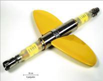
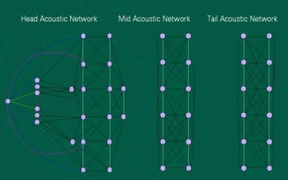
12 Seismic Navigation & Positioning Birds Vessel Guns & Paravanes Front End Acoustic Pod (Compass & depth) Active Steering Tail Buoy Seismic Airgun Gun Array Acoustic Network Instrument Room


13 Seismic Permanent Reservoir Monitoring Seismic array covers an area of 40 sq. km >120 kms of 4D seismic cable 300m between cables Designed around seabed infrastructure Available hub connectors allow for adding more cables in the future. Cable trenched into seabed Umbilical connection to platform based seismic recording system Cables trenched to an average depth of 1.1 metres 79 locations were rock dumped Seabed Array Termination Canister


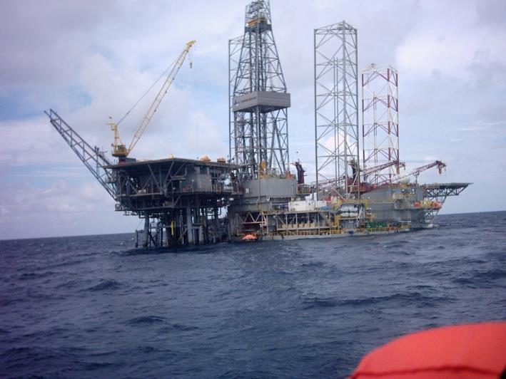
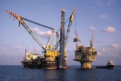
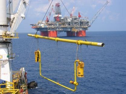
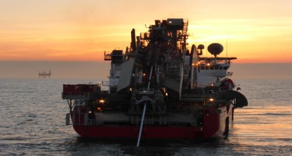
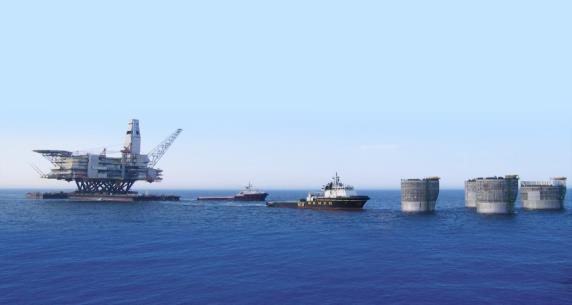
14 Offshore Survey in the E&P Lifecycle Rig Positioning Explore Appraise Develop Produce Decommission Jack Up Rig Semi-Submersible Rig Dynamically Positioned (DP) Rig Drill Ship Exploration & Appraisal Development Workover Abandonment

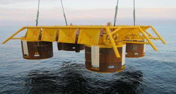
15 Positioning Rig & Anchors in the Correct Place Ensure rig and anchors are positioned within tolerance Design Anchor Plan or jack up location Compile Well Set Procedures Confirm Location Antenna Offsets and winch offsets Gyro checks and known errors Subsea structures 1


16 Anchor Planning & Mooring Analysis All executed in GIS... Source: 2009 Annual Report


17 Front End Feasibility Studies Using GIS analysis to assess ease of access to Drilling Permits Underlying Data Protected Habitats Migratory Birds Fish & Mammals Shipping Activity Explosive Remnants of War Military Areas Difficult Easier 1

 Seismic Survey Shallow and Deep Geotechnical")
18 Offshore Survey in the E&P Lifecycle Seabed Surveys Explore Appraise Develop Produce Decommission Seabed Survey Bathymetry Survey Geohazard Survey High Resolution 2D (HR2D) Seismic Survey Shallow and Deep Geotechnical Environmental


19 Anchoring Conditions & Jack-Up Surveys Seabed surveys Design, Acquisition and Reporting: Shallow Geohazards How hard is the seabed? Seabed Relief? Obstacles & Debris 1


20 Underwater Vehicles for Seabed Surveys Autonomous Underwater Vehicle (AUV) Remotely Operated Vehicle (ROV) Image source: Designed to run multiple survey sensors simultaneously Sharp clean data possible More coverage in less time Accurate positioning is a challenge over extreme topography Not designed to run full survey sensor spread simultaneously Very high resolution data possible More time for less coverage: expensive for large areas Greater control on subsea positioning Greater flexibility for close inspection or changing survey plan 2


21 30 to 60 metre peaks Example of Seabed Survey Seafloor Bathymetry


22 Offshore Survey in the E&P Lifecycle Geohazard Survey Explore Appraise Develop Produce Decommission Drilling Hazards Shallow gas Faults Boulders Loose sands Reactive clays Other Geohazards and Hazards Buried channels Geotechnical/shallow soils Seabed topography Obstructions Habitats Archaeological Explosive Remnants of War

23 Safety Critical Activities


24 Safety Critical Activities

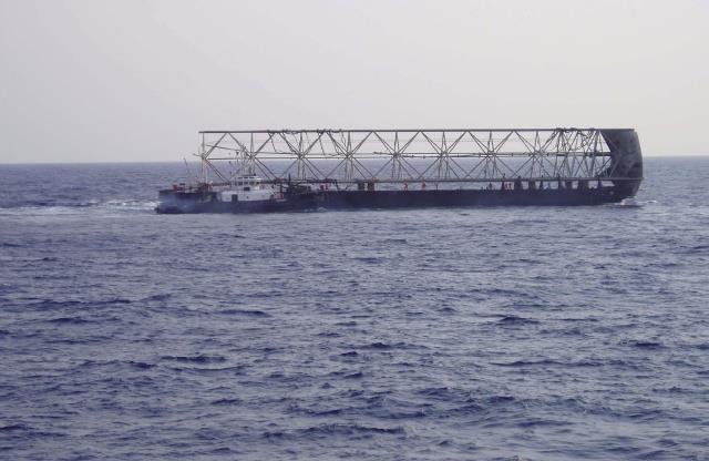
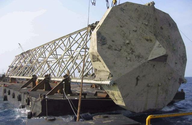
25 Offshore Survey in the E&P Lifecycle Offshore Construction Explore Appraise Develop Produce Decommission Pipelay Pipeline Bundle Tow & Installation J-Lay, S-Lay Manifold / Template Installation Heavy Lift Barge Plowing, Trenching & Jetting Out of Straightness Survey Seabed Intervention Metrology Spool Piece, Jumper, Riser As-Built Survey
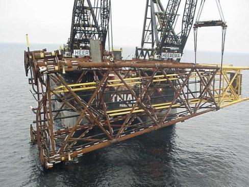
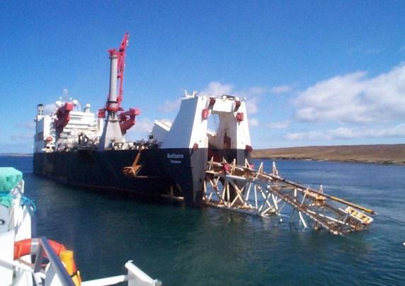
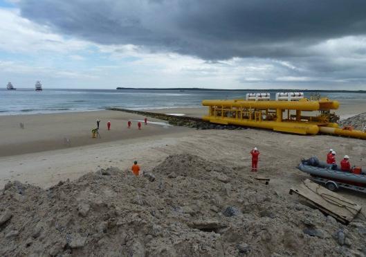
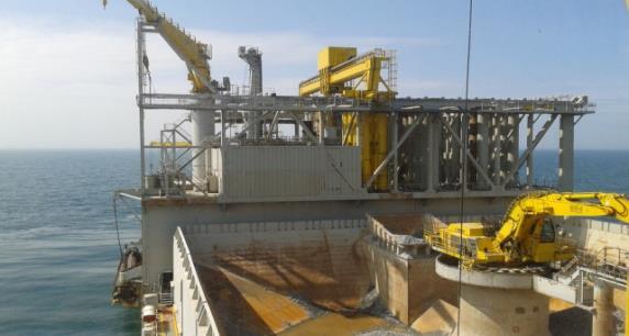
26 Offshore Construction


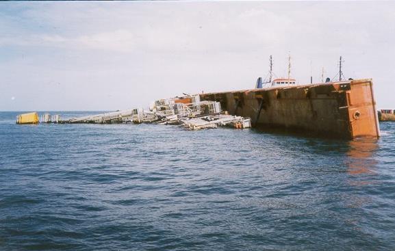
27 Decommissioning & Restoration What is decommissioning? Decommissioning is the process by which options for the physical removal and disposal of structures at the end of their working life are assessed; a plan of action is formulated by the operator, approved by government and then implemented. The overall timescale for this is several years, as it needs to take into account many diverse factors and involves many organisations. a b The decommissioning of Southern North Sea fixed platforms Brent Spar: a) towed to shore, b) part of a new dock construction


28 Subsidence & Reservoir Monitoring Tilt & Settlement Surveys Continuous GPS Monitoring Air Gap Survey Scour Monitoring Seabed Geodesy Time Lapse 4D Gravity Surveys

29 Emergency Response Incident Preparedness Oil Spill Modelling Incident Response Search & Rescue Incident Investigation Common Operating Picture


30 Data Integration to Provide Situational Awareness Available anywhere in the world where Shell operates (upstream, downstream, shipping) INFRASTRUCTURE ADMIN. BOUNDARIES NAUTICAL CHARTS ENVIRONMENTAL INCIDENT FEATURES VESSELS BATHYMETRY INFRASTRUCTURE TOPOGRAPHY METOCEAN WEATHER RADAR IMAGERY DESKTOP MOBILE Unified Command Situational Status Public Information Operations WEB HARDCOPY MAPS Planning Safety Logistics Finance Static info Observed data ARCHIVE Dynamic info Predicted data 30
31 Conclusions Offshore survey is a fundamental activity within the Exploration and Production industry 80% all data managed by an E&P company is geographically referenced Always be careful with coordinates. Check, check and check again!! Offshore survey is required from cradle to grave for an E&P project Explore Appraise Develop Produce Decommission Requires a broad range of skills and competences The cost of getting it wrong can be severe $$$, HSSE, Reputational, license to operate
32 Q&A
OFFSHORE SURVEY IN THE OIL & GAS INDUSTRY WHAT S THAT ALL ABOUT? Ian Douglas Head, Offshore Surveys, Shell Projects & Technology Europe
 OFFSHORE SURVEY IN THE OIL & GAS INDUSTRY WHAT S THAT ALL ABOUT? Ian Douglas Head, Offshore Surveys, Shell Projects & Technology Europe Hydrofest 2014 13 March 2014 1 Why Position Matters The Exploration
Geophysical Site Surveys
 Geophysical Site Surveys Simon Oakley Geoscience Team Leader Fugro Survey Limited 16/04/2014 Contents Menu Introduction Section 1 - Geophysical Site Surveys - Seabed Bathymetry - Shallow Geology - Seabed
Exploitation of Ocean Predictions by the Oil and Gas Industry. GODAE OceanView Symposium 2013
 Exploitation of Ocean Predictions by the Oil and Gas Industry GODAE OceanView Symposium 2013 Introduction Information needs Challenges Acknowledgements IMarEST/SUT Metocean Awareness Course Colleagues
Offshore Operations and Project Execution Geophysical Site Surveys
 Offshore Operations and Project Execution Geophysical Site Surveys Chris Almond Senior Geophysicist Fugro Survey Limited 22/04/2015 Presentation Summary: Office-based Personnel Project Awarded Pre Offshore
An Overview of Geomatics Involvement in the Offshore Oil & Gas Industry
 An Overview of Geomatics Involvement in the Offshore Oil & Gas Industry David Whitcombe Head Offshore Surveys - Europe Explore Appraise Develop ProduceDecommission Content Overview Oil & Gas Industry Geomatics
FOUNDATIONS FOR OFFSHORE STRUCTURES
 FOUNDATIONS FOR OFFSHORE STRUCTURES DELHI CHAPTER Pradeep Hora It takes less time to do a thing right than explain why you did it wrong. - Henry Wadsworth Longfellow 2 1 Site Investigations (Survey) What
Geography 3202 Unit 4 S.C.O. 4.3 & 4.5. Primary Resource Activities Offshore Oil And Gas
 Geography 3202 Unit 4 S.C.O. 4.3 & 4.5 Primary Resource Activities Offshore Oil And Gas Factors Affecting The Decision To Recover Offshore Oil And Gas (4.3.1) Physical Factors 1. Ocean Related Factors
(32) marine technology April
 marine technology April") As part of a 2012 Gulf of Mexico deep water project, an Echoscope 3D sonar imager documented the depth of a 20 pipeline in a trench, below mud line, during a post-dredging operation. (32) marine technology
As part of a 2012 Gulf of Mexico deep water project, an Echoscope 3D sonar imager documented the depth of a 20 pipeline in a trench, below mud line, during a post-dredging operation. (32) marine technology
The Arctic - A New Frontier The geological, environmental and engineering challenges for submarine telecommunication cables
 The Arctic - A New Frontier The geological, environmental and engineering challenges for submarine telecommunication cables Ryan Wopschall 5 September 2013 Oceanology International China, Shanghai Fugro
PETROLEUM 101. Mark Shrimpton Jacques Whitford
 PETROLEUM 101 Mark Shrimpton Jacques Whitford PRESENTATION STRUCTURE The Offshore Petroleum Industry Petroleum Geology Petroleum Technology: Exploration agreements Geophysical exploration Drilling Development
Multibeam Hydrographic Survey Use for Construction Control of Filling and Ground Improvement Activities
 Multibeam Hydrographic Survey Use for Construction Control of Filling and Ground Improvement Activities WEDA Cincinnati April 10, 2014 Ray Wood C.Eng Executive Vice President Fugro Consultants Inc Advantages
Data and Information Management. UK All Energy 22 nd May Presented by Leo James
 Data and Information Management UK All Energy 22 nd May 2013 Presented by Leo James Strategic Development Plans Observations at the outset Data and information management and dissemination: company or
Site Investigations for Offshore Wind
 Site Investigations for Offshore Wind A multi-disciplinary approach Mattijs de Lange Gardline Marine Sciences Limited My thanks to: Maarten Timmerman David Cerda Saltzman Sue Crothers Albert van der Hem
Tu 23 A12 Multi-frequency Seafloor Characterization Using Seismic Sources of Opportunity
 Tu 23 A12 Multi-frequency Seafloor Characterization Using Seismic Sources of Opportunity M.N. Banda* (University of Bath/Seiche Ltd), Ph. Blondel (University of Bath), M. Burnett (Seiche Ltd), R. Wyatt
IOGP Hazard Survey Guidelines and Technical Notes. Andy W Hill, BP America, March 2016
 IOGP Hazard Survey Guidelines and Technical Notes Andy W Hill, BP America, March 2016 Summary Background to the IOGP Guidelines for the Conduct of Offshore Drilling Hazard Site Surveys (DHSS) Objective
"Our Profession: Today and the Next Ten FiveYears" Jack Verouden Outgoing Chairman OGP Surveying & Positioning Committee
 "Our Profession: Today and the Next Ten FiveYears" Jack Verouden Outgoing Chairman OGP Surveying & Positioning Committee and Shell Chief Surveyor Greenwich Meridian 112 m No error in Google Earth: Different
NEW SEAFLOOR INSTALLATIONS REQUIRE ULTRA-HIGH RESOLUTION SURVEYS
 NEW SEAFLOOR INSTALLATIONS REQUIRE ULTRA-HIGH RESOLUTION SURVEYS Donald Hussong (Fugro Seafloor Surveys, Inc.) dhussong@fugro.com Fugro Seafloor Surveys, Inc., 1100 Dexter Avenue North (Suite 100), Seattle,
Introduction to Acoustic Remote Sensing and Seafloor Mapping (AE4-E13) May 19, 2010
 May 19, 2010") Introduction to Acoustic Remote Sensing and Seafloor Mapping (AE4-E13) May 19, 2010 1 Delft Vermelding Institute onderdeel of Earth organisatie Observation and Space Systems Why Acoustic Remote Sensing?
Introduction to Acoustic Remote Sensing and Seafloor Mapping (AE4-E13) May 19, 2010 1 Delft Vermelding Institute onderdeel of Earth organisatie Observation and Space Systems Why Acoustic Remote Sensing?
Land seismic sources
 Seismic Sources HOW TO GENERATE SEISMIC WAVES? Exploration seismology mostly artificial sources à active technique Natural sources can also be used (e.g. earthquakes) usually for tectonic studies (passive
Marine Geophysical Methods: What Can and Cannot Be Done to Iden8fy Hazards to Dredging & Marine Construc8on
 Marine Geophysical Methods: What Can and Cannot Be Done to Iden8fy Hazards to Dredging & Marine Construc8on Marine Geophysics Sham or Savior? Seen alternatively as the silver bullet or snake oil, marine
Storage: Deep Monitoring and Verification
 Storage: Deep Monitoring and Verification IEA GHG Summer School, Austin, TX David White 7 th to 11 th July, 2014 www.slb.com/carbonservices CS1406-063-DW Why Monitor? Manage Risk Risk = (Impact of Undesirable
ENCE 3610 Soil Mechanics. Site Exploration and Characterisation Field Exploration Methods
 ENCE 3610 Soil Mechanics Site Exploration and Characterisation Field Exploration Methods Geotechnical Involvement in Project Phases Planning Design Alternatives Preparation of Detailed Plans Final Design
Nord Stream 2 A story of gas pipelines and GIS technology from the start. Cécile Noverraz GIS Analyst
 Nord Stream 2 A story of gas pipelines and GIS technology from the start 30-10-2018 Cécile Noverraz GIS Analyst Presentation - Outline >Project Overview > Initial GIS Project Setup > Project Data > GIS
Themes for Geomatics Conference. Geodesy Themes
 Themes for Geomatics Conference Geodesy Themes Geodynamics o Modeling the Deformation of the Earth s Crust o Recent Advances in Geometric Approaches to Deformation Analysis o Monitoring Systems (Sensors
SONGS Seismic Research Projects
 SONGS Seismic Research Projects Energy Division Independent Peer Review Group September 21, 2012 Agenda Background Overview Project Support Permits, Approvals, and Reviews Schedule Use of Advanced Technologies
Charts and Chart Work with Poole Sailing
 with Poole Sailing Nautical charts are a mine of information but they need to be up to date. Corrections to charts are published by the Hydrographic Office monthly as Notices to Mariners both in print
PG&E OFFSHORE CENTRAL COASTAL CALIFORNIA SEISMIC IMAGING PROJECT
 PG&E OFFSHORE CENTRAL COASTAL CALIFORNIA SEISMIC IMAGING PROJECT Public Scoping Meeting California State Lands Commission July 21, 2011 Project Area Project Commitments Assessment of the Hosgri, Shoreline,
Coastal Response Research Center. Nancy Kinner University of New Hampshire (UNH) Michele Jacobi NOAA ORR. September 27, 2007
 Michele Jacobi NOAA ORR. September 27, 2007") Coastal Response Research Center Nancy Kinner University of New Hampshire (UNH) Michele Jacobi NOAA ORR September 27, 2007 1 Coastal Response Research Center (CRRC) CRRC is partnership between NOAA s Office
Coastal Response Research Center Nancy Kinner University of New Hampshire (UNH) Michele Jacobi NOAA ORR September 27, 2007 1 Coastal Response Research Center (CRRC) CRRC is partnership between NOAA s Office
2 nd Tidal and Water Level Working Group Meeting
 2 nd Tidal and Water Level Working Group Meeting Norwegian Hydrographic Service, Stavanger, Norway 27 29 April 2010 Vertical Offshore Reference Framework (VORF) Chris Jones United Kingdom Hydrographic
Shape of the Earth. Data Output by the Receiver
 It is quite common for confusion to arise about the process used during a hydrographic survey when GPS-derived water surface elevation is incorporated into the data as an RTK Tide correction. This article
You might know your position precisely but do you know where you are?
 You might know your position precisely but do you know where you are? Whosoever wishes to know about the world must learn about it in its particular details. The possession of knowledge does not kill the
REPUBLIC OF THE MARSHALL ISLANDS MARITIME ZONES DECLARATION ACT 2016.
 Republic of the Marshall Islands Maritime Zones Declaration Act 2016. 33MIRCCh.1Index TITLE 33 - MARINE ZONES AND PROTECTION OF MAMMALS CHAPTER 1 - MARITIME ZONE DECLARATION s Republic of the Marshall
CONTENTS. Preface. Introduction 1. Oil and Gas 3. Exploration 9. Drilling Rigs 15. Drilling a Well 31
 CONTENTS Preface ix Introduction 1 First Offshore Operations in the U.S. 1 The Scope of Offshore Operations 2 Oil and Gas 3 Characteristics of Oil and Gas 3 Characteristics of Rock 4 Types of Rocks 4 Origin
Programmatic Approaches to Assessing and Mitigating Risk to Pipelines from Natural Forces
 Programmatic Approaches to Assessing and Mitigating Risk to Pipelines from Natural Forces 23 rd International Petroleum Environmental Conference New Orleans, Louisiana November 8-10, 2016 Introduction
Introduction / General Aspects of Marine Sonar and Seismic Surveys. Mustafa Ergün
 Introduction / General Aspects of Marine Sonar and Seismic Surveys Mustafa Ergün INTRODUCTION TO MARINE STUDIES Exploration of the oceans using the techniques of the marine sonar and seismics has had a
Appendix A. Background Information Document
 Appendix A Background Information Document BACKGROUND INFORMATION DOCUMENT Proposed oil and gas exploration activities in the Deepwater Durban Exploration Area, offshore of the East Coast of South Africa
Guidelines for the conduct of offshore drilling hazard site surveys
 Guidelines for the conduct of offshore drilling hazard site surveys Report No. 373-18-1 April 2011 International Association of Oil & Gas Producers P ublications Global experience The International Association
NT10-09 Cruise Report KUMANO-NADA DONET Node Installation & Observatory Construction
 NT10-09 Cruise Report KUMANO-NADA DONET Node Installation & Observatory Construction June 2010 Table of Contents 1. Overview 2. Schedule 3. Dive Summary 4. Concluding Remarks 1. Overview DONET is a program
Managing bathymetric data in a hydrographic survey company
 Managing bathymetric data in a hydrographic survey company Overview Brief Introduction to MMT How MMT use GIS Why we need to manage bathy data The BIS Inputting Data to the BIS Using the BIS GIS Product
BAUER MeBo Sea Bed Drill Rig
 BAUER MeBo Sea Bed Drill Rig Spotlights BAUER Maritime Experiences 1993 Diamond deposit exploration with a BC cutter in water depth of 160 m (South Africa) Atlantic Ocean 2005 Drilling inside of a monopile
Imaging Deep into the Gulf of
 TECHNOLOGY EXPLAINED Imaging Deep into the Gulf of Houston Houston The Gulf of Mexico as viewed from space. This Mediterraneantype sea is located at the southeastern corner of North America. It covers
Environmental Response Management Application
 Environmental Response Management Application Coastal Response Research Center Nancy Kinner, Michele Jacobi, Rob Braswell, Kurt Schwehr & Amy Merten RRT III May 14, 2008 1 Talk Outline Overview of Center
Landslide Mapping and Hazard Analysis for a Natural Gas Pipeline Project
 CIVIL GOVERNMENT SERVICES MINING & METALS OIL, GAS & CHEMICALS POWER Albert Kottke, Mark Lee, & Matthew Waterman Landslide Mapping and Hazard Analysis for a Natural Gas Pipeline Project Technical Innovation
THE 4Gs IN PRACTICE: INVESTIGATING HOW THE 4Gs ARE APPLIED IN THE OIL & GAS INDUSTRY
 THE 4Gs IN PRACTICE: INVESTIGATING HOW THE 4Gs ARE APPLIED IN THE OIL & GAS INDUSTRY Society for Underwater Technology, Evening Technical Meeting 14 AUGUST 2013 GEOPHYSICS & PORT DEVELOPMENTS EXPLORING
Real Time Monitoring System for Megathrust Earthquakes and Tsunamis - Cabled Network System and Buoy System in Japan -
 Real Time Monitoring System for Megathrust Earthquakes and Tsunamis - Cabled Network System and Buoy System in Japan - 1 Subduction zones around the world Haiti Italy Turkey Tohoku Sichuan Taiwan Sumatra
GEOPHYSICAL TECHNIQUES FOR MARITIME ARCHAEOLOGICAL SURVEYS. Abstract
 GEOPHYSICAL TECHNIQUES FOR MARITIME ARCHAEOLOGICAL SURVEYS Mark Lawrence, Wessex Archaeology, Salisbury, UK, Ian Oxley, English Heritage, Portsmouth, UK, C. Richard Bates, University of St. Andrews, St.
Current Hydrographic Projects at BSH
 7 th Workshop Seabed Acoustics, Rostock, November 19/20, 2015 P01-1 Current Hydrographic Projects at BSH Thomas Dehling Federal Maritime and Hydrographic Agency (BSH) Germany Contact Address Website BSH
Automated Seabed Mapping and Data Delivery in the Cloud
 Automated Seabed Mapping and Data Delivery in the Cloud London, 2nd November 2017 11/20/2017 1 2 WE CALL IT SEABED INTELLIGENCE Ocean Infinity are explorers. We go to unmapped locations to survey the seabed
DMFT2014, Zhuhai China
 OIL & GAS DMFT2014, Zhuhai China 深水管道管道设计设计及安装的风险和挑战 Risks and Challenges of Deepwater Pipeline Design and Installation Edwardus NG, BD Manager O&G Asia Pacific 19th October 2014 1 SAFER, SMARTER, GREENER
The Danish Maritime Spatial Data Infrastructure (MSDI) Geodata of the Sea
 Geodata of the Sea") MSDI/MSP The Danish Maritime Spatial Data Infrastructure (MSDI) Geodata of the Sea Components of an infrastructure: DATA - metadata, datasets FUNCTIONALITY - spatial data services, web services and other
MSDI/MSP The Danish Maritime Spatial Data Infrastructure (MSDI) Geodata of the Sea Components of an infrastructure: DATA - metadata, datasets FUNCTIONALITY - spatial data services, web services and other
Exploration, Drilling & Production
 Nontechnical Guide to PETMOLEUM Geology, Exploration, Drilling & Production Third Edition Norman J. Hyne, Ph.D. Contents Preface *i Introduction 1 The Nature of Gas and Oil 1 Petroleum 1 The Chemistry
Use of Elevation Data in NOAA Coastal Mapping Shoreline Products. Coastal GeoTools April 1, 2015
 Use of Elevation Data in NOAA Coastal Mapping Shoreline Products Coastal GeoTools April 1, 2015 - NOAA s Coastal Mapping Program & CUSP - Shoreline Uses, Delineation Issues, Definitions - Current Extraction
Inspection of Waterfront Facilities Using Vessel-Based Remote Sensing Mitchell, Del Bello, Suarez
 Inspection of Waterfront Facilities Using Vessel-Based Remote Sensing Mitchell, Del Bello, Suarez American Association of Port Authorities Facilities Engineering Conference October 20-22, 2015 Waterfront
Remote Sensing Techniques for Renewable Energy Projects. Dr Stuart Clough APEM Ltd
 Remote Sensing Techniques for Renewable Energy Projects Dr Stuart Clough APEM Ltd What is Remote Sensing? The use of aerial sensors to detect and classify objects on Earth Remote sensing for ecological
Fish and Fish Habitat Follow-up Program. Scotian Basin Exploration Project
 Fish and Fish Habitat Follow-up Program Scotian Basin Exploration Project April 2018 Contents 1 Introduction... 1 2 Scope... 1 3 EIS Commitments and Predictions... 2 4 Methodology and Reporting... 2 4.1
Ocean Observatories Initiative
 Ocean Observatories Initiative Pioneer Array Micro-Siting Process Meeting URI Coastal Institute November 15, 2010 Jean McGovern, NSF Al Plueddemann, WHOI Action Items from 5 Oct Meeting NSF will address
Engineering in Support of Transformative Science
 Engineering in Support of Transformative Science Scientific Ocean Drilling of Mid-Ocean Ridge and Ridge-Flank Setting Workshop August 27, 2009 Austin, Texas Greg Myers IODP-MI Outline o Main engineering
Non-Technical Summary
 Non-Technical Summary Proposed Project TGS-NOPEC Geophysical Company ASA (TGS) proposes to undertake a two dimensional (2D) seismic survey and seabed sampling in the western Greenland Sea off North East
Seabed 2030: A Call to Action
 Seabed 2030: A Call to Action Rear Adm. Shepard Smith NOAA Office of Coast Survey shep.smith@noaa.gov Introduction Many people like me start speeches about mapping the ocean with we know more about the
National Marine Sanctuary Program
 National Marine Sanctuary Program NMSP/USGS Joint Seabed Mapping Initiative: September 2004 AA National Ocean Service National Marine Sanctuaries Interim Report September 2004 Background: Since 2002,
How to Interpret Mining Company Drill Reports & Announcements
 How to Interpret Mining Company Drill Reports & Announcements A Simple Guide amscot Stockbroking Pty Ltd A division of State One Stockbroking Ltd (AFSL 247 100) Disclaimer: All information in this document
BLOCKS 5 (ANY), 6 (PITU) AND 8 (NAPU)
, 6 (PITU) AND 8 (NAPU)") August, 2013 SHELL GREENLAND 2013 SITE SURVEY IN BAFFIN BAY BLOCKS 5 (ANY), 6 (PITU) AND 8 (NAPU) FINAL EIA - ADDITIONAL WORK SCOPE NON-TECHNICAL SUMMARY 2013 SITE SURVEY IN BAFFIN BAY BLOCKS 5 (ANY),
August, 2013 SHELL GREENLAND 2013 SITE SURVEY IN BAFFIN BAY BLOCKS 5 (ANY), 6 (PITU) AND 8 (NAPU) FINAL EIA - ADDITIONAL WORK SCOPE NON-TECHNICAL SUMMARY 2013 SITE SURVEY IN BAFFIN BAY BLOCKS 5 (ANY),
Options in Capacity Building. Underpinning the Blue Economy. Slide 1/78. Derrick R. Peyton. 14 th MACHC Meeting. IIC Technologies. December 9-13, 2013
 Options in Capacity Building Underpinning the Blue Economy Derrick R. Peyton IIC Technologies 14 th MACHC Meeting December 9-13, 2013 Slide 1/78 Overview Blue Economy Defined Challenges (SDI, MSDI, Standards)
Yev Kontar. Illinois State Geological Survey, University of Illinois at Urbana-Champaign
 Addressing Caribbean Geophysical Hazards through the Continuously Operating Caribbean GPS Observational Network (COCONet) and International Ocean Drilling Program (IODP) Yev Kontar Illinois State Geological
Observation of Deep Seafloor by Autonomous Underwater Vehicle
 Indian Journal of Geo-Marine Sciences Vol. 42 (8), December 2013,pp. 1028-1033 Observation of Deep Seafloor by Autonomous Underwater Vehicle Tamaki Ura 1 Underwater Technology Research Center, Institute
Outlook for Major Segments of the International Offshore Industry Geology and Geophysical
 2015-2017 Outlook for Major Segments of the International Offshore Industry Geology and Geophysical Dave Ridyard SVP Business Development ION Geophysical 38th ANNUAL MARINE/OFFSHORE INDUSTRY OUTLOOK CONFERENCE
12/11/2013& egm502 seafloor mapping
 egm502 seafloor mapping lecture 13 multi-beam echo-sounders The majority of the current charts of the ocean floors have been produced from single beam echo-sounder data. Even though these data have been
Observation of Deep Seafloor by Autonomous Underwater Vehicle
 Observation of Deep Seafloor by Autonomous Underwater Vehicle Tamaki Ura 1 Underwater Technology Research Center Institute of Industrial Science, The University of Tokyo 4-6-1, Komaba, Minato, Tokyo, Japan
Geotechnical Investigation Juneau Seawalk - Taku Fisheries to Miner s Wharf Juneau, Alaska DM&A Job No
 Duane Miller & Associates 5821 Arctic Boulevard, Suite A Anchorage, AK 99518-1654 (907) 644-3200 Fax 644-0507 Arctic & Geotechnical Engineering May 4, 2006 Tetra Tech/KCM, Inc. 1971 First Avenue Seattle,
RAYFRACT IN MARINE SURVEYS. The data provided by the contractor needed total re-picking and reinterpretation.
 RAYFRACT IN MARINE SURVEYS As part of a geotechnical assessment and feasibility planning of channel improvement a shallow marine seismic refraction survey was undertaken. The data was initially processed
Offshore geo-hazards to keep in mind during prospecting and exploration activities of the Jan Mayen Micro- Continent area.
 Offshore geo-hazards to keep in mind during prospecting and exploration activities of the Jan Mayen Micro- Continent area. Anett Blischke, Iceland GeoSurvey Þórarinn S. Arnarson, of Iceland Bjarni Richter,
NEW TOOLS TO IMPROVE DESKTOP SURVEYS
 NEW TOOLS TO IMPROVE DESKTOP SURVEYS Pablo Vengoechea (Telemediciones S.A.), Jorge O. García (Telemediciones S.A.), Email: Telemediciones S.A. / Cra. 46 94-17 Bogotá D.C.
Deep Water Marine Surveys
 Deep Water Marine Surveys Deep Sea International Consortium Workshop Rio de Janeiro, February 01st & 2nd Fred Marins Marketing Director fred.marins@gardline.com.br Key Aspects Gardline: Since 1969 + 1500
Guideline REGULATORY REQUIREMENTS FOR FINAL WELL REPORTS ONSHORE TO OFFSHORE WELLS
 Guideline REGULATORY REQUIREMENTS FOR FINAL WELL REPORTS ONSHORE TO OFFSHORE WELLS 1. Introduction The requirement to prepare and submit a Final Well Report is specified by subsection 201(1) of the Newfoundland
InnovaRig - an Instrument for a European Geothermal Drilling Program
 InnovaRig - an Instrument for a European Geothermal Drilling Program Lothar Wohlgemuth, Bernhard Prevedel, and Ernst Huenges GeoForschungsZentrum Potsdam GeoForschungsZentrum Potsdam Member of the Helmholtz
Planning and Operating a Transition Zone 2D Seismic Survey on Lake Tanganyika*
 Planning and Operating a Transition Zone 2D Seismic Survey on Lake Tanganyika* Doug Roberts 1 and Jeremy P. FitzPatrick 2 Search and Discovery Article #41765 (2016) Posted January 25, 2016 *Adapted from
A Broad View of Geospatial Technology & Systems
 A Broad View of Geospatial Technology & Systems Pete Large Vice President, Trimble On the shoulders of giants 1 Since their time, our ability to generate geospatial information has grown exponentially
Geophysics for Environmental and Geotechnical Applications
 Geophysics for Environmental and Geotechnical Applications Dr. Katherine Grote University of Wisconsin Eau Claire Why Use Geophysics? Improve the quality of site characterization (higher resolution and
Reel-lay Installation of Steel Catenary Risers and Inline Sleds in High Surface Currents
 NH GRAND HOTEL KRASNAPOLSKY AMSTERDAM 3-5 APRIL 2017 Reel-lay Installation of Steel Catenary Risers and Inline Sleds in High Surface Currents D. Jacob Fannon, P.E. EMAS CHIYODA Subsea Problem Statement:
Relatively little hard substrate occurs naturally in the
 CHAPTER FIVE Rock Habitats Relatively little hard substrate occurs naturally in the estuary, owing mainly to the vast quantities of fine sediment that have been deposited by the rivers. Rock habitat is
Page 7 1 NON-TECHNICAL SUMMARY
 Page 7 1 NON-TECHNICAL SUMMARY This section provides a non-technical summary of the Environmental Impact Assessment (EIA) for Shell and its Consortium partners shallow coring program proposed to occur
Arctic. Ocean Observing Build Out Plan. alaska ocean observing system. March 1, 2013 draft. Tom Van Pelt
 Arctic Ocean Observing Build Out Plan March 1, 2013 draft Tom Van Pelt alaska ocean observing system Tom Van Pelt Why a coastal observing system in the Arctic? The Arctic is booming with increased activity
Monitoring the coastal ocean: from local to regional
 Monitoring the coastal ocean: from local to regional Luísa Bastos University of Porto / CIIMAR RAIA partners Ocean monitoring To answer key societal and scientific challenges navigation safety, fisheries,
NOAA s National Ocean Service. Center for Operational Oceanographic Products and Services
 NOAA s National Ocean Service Center for Operational Oceanographic Products and Services Richard Edwing, CO-OPS Acting Director January 27, 2010 Outline CO-OPS Overview Programs Observing Systems PORTS
HydroSpatial II Practical application of INSPIRE in Marine Mapping Data
 HydroSpatial II Practical application of INSPIRE in Marine Mapping Data INSPIRE Conference 30 th June 2011 Carlos Berná Esteban, GIS Analyst, SeaZone carlos.berna-esteban@seazone.com Overview HydroSpatial
Common Exploration Methods.
 Common Exploration Methods. The following list contains the most common methods which a company with a mineral prospecting licence in Northern Ireland might use to carry out a mineral prospecting programme.
v=7tat9croynk&feature=youtu.be
 https://www.youtube.com/watch? v=7tat9croynk&feature=youtu.be Malta Summer School 2018 Operational Oceanography for Blue Growth EMODnet in a nutshell: unlocking, and offering access to, European marine
Environmental protection through the use of technology. Modular polyvalent and adaptable solutions for any needs
 Environmental protection through the use of technology Modular polyvalent and adaptable solutions for any needs Socially responsible: we promote the well-being of territory where we work Certified quality
Impact of Noise on the Marine Environment a Regulatory Perspective
 Impact of Noise on the Marine Environment a Regulatory Perspective John Hartley Hartley Anderson Ltd. Photographs courtesy of JNCC Over-arching Objective Minimise the Impact of Oil and Gas Activities &
Chapter Overview. Bathymetry. Measuring Bathymetry. Measuring Bathymetry
 CHAPTER 3 Marine Provinces Chapter Overview The study of bathymetry determines ocean depths and ocean floor topography. Echo sounding and satellites are efficient bathymetric tools. Most ocean floor features
STATUS QUO REPORT ON ENC ACTIVITIES
 NETWORK OF DANUBE WATERWAY ADMINISTRATIONS South-East European Transnational Cooperation Programme STATUS QUO REPORT ON ENC ACTIVITIES UA - SHS Document ID: Activity: 5.2 Author / Project Partner: Date:
Development and proof for monitoring technique of sub-seabed CCS
 Development and proof for monitoring technique of sub-seabed CCS Kimonori Shitashima IEAGHG 2 nd Combined Meeting of the Modelling and Monitoring Networks 6-8 July 2016, Edinburgh Detection/monitoring
Last Time. GY 305: Geophysics. Seismology (Marine Surveys) Seismology. Seismology. Other Seismic Techniques UNIVERSITY OF SOUTH ALABAMA
 Seismology. Seismology. Other Seismic Techniques UNIVERSITY OF SOUTH ALABAMA") UNIVERSITY OF SOUTH ALABAMA Last Time GY 305: Geophysics Lecture 12: Introduction to (resolution versus penetration) Techniques (marine versus terrestrial) (Marine Surveys) http://www.glossary.oilfield.slb.com/displayimage.cfm?id=236
UNIVERSITY OF SOUTH ALABAMA Last Time GY 305: Geophysics Lecture 12: Introduction to (resolution versus penetration) Techniques (marine versus terrestrial) (Marine Surveys) http://www.glossary.oilfield.slb.com/displayimage.cfm?id=236
The Integration of Land and Marine Spatial Data Set As Part of Indonesian Spatial Data Infrastructure Development
 UNITED NATIONS E/CONF.97/6/IP. 46 ECONOMIC AND SOCIAL COUNCIL Seventeenth United Nations Regional Cartographic Conference for Asia and the Pacific Bangkok, 18-22 September 2006 Item 7 of the provisional
EDUCATION DAYS ABERDEEN 2018
 EDUCATION DAYS ABERDEEN 2018 28-31 AUGUST 2018 I ABERDEEN, UK www.learninggeoscience.org Welcome to Aberdeen! EAGE is pleased to invite you to visit Aberdeen for our Education Days Aberdeen 2018. Dear
Developing the Arundel Field Maximising Hub Value through Seismic Uplift. Chris Hill CNS Geophysicist, BP
 Developing the Arundel Field Maximising Hub Value through Seismic Uplift Chris Hill CNS Geophysicist, BP Arundel Area Introduction Lista Palaeocene Turbidite reservoirs Sands are high productivity with
U.S. Arctic Campaign Scenario
 Prepared by the NOAA Office of Ocean Exploration and Research for Nation Ocean Exploration Forum 2016: Beyond the Ships. Sea ice extent from National Snow Service Layer Credits: NOAA National Centers for
Session 1 Presentation - Use of Offshore Energy Facilities as Deepwater Ocean Observing Platforms
 University of New Orleans ScholarWorks@UNO Ocean Waves Workshop Ocean Waves Workshop 2017 Dec 7th, 9:00 AM - 9:45 AM Session 1 Presentation - Use of Offshore Energy Facilities as Deepwater Ocean Observing
The Petroleum Industry. Phonse Fagan, P. Geo. President A.J. Fagan Consulting Inc. and
 The Petroleum Industry by Phonse Fagan, P. Geo. President A.J. Fagan Consulting Inc. and Terminology Petroleum Natural Gas Oil Crude Hydrocarbons http://www.kerrheating.com/products/fuel_oil_tanks_liberty.htm
FINMARINET: Inventories and Planning for the Marine Natura 2000 Network in Finland. A.2 Geological inventories of the seafloor Final Report
 LIFE07 NAT/FIN/000151 FINMARINET: Inventories and Planning for the Marine Natura 2000 Network in Finland A.2 Geological inventories of the seafloor Final Report Geological Survey of Finland, GTK 1. Introduction