Monitoring The Sand Extraction On The Belgian Continental Shelf
|
|
|
- Hillary Welch
- 5 years ago
- Views:
Transcription

1 Monitoring The Sand Extraction On The Belgian Continental Shelf Methodology, Results And Expectations K. Degrendele and M. Roche Within the framework of a sustainable exploitation of the mineral resources on the Belgian Continental Shelf, the Belgian government has established a surveillance and monitoring program of the extraction activities and the impact on the environment. The up to date results show a concentration of the activities on the Kwintebank, resulting in a strong but merely local impact of the extractions on the bathymetry and sediments of the seafloor. In the near future the governmental control will evolve to a real-time surveillance and a dynamic and three-dimensional monitoring program to assure the future sustainability of the economically important exploitation of mineral resources. Legislative and economic framework Numerous tidal sandbanks characterize the Belgian continental shelf. These sedimentary bodies stretch out over several tens of km. They reach a height ranging between 10 and 20m and are separated by parallel swales with a maximum depth of 40m. The extraction of sand on tidal sandbanks of the Belgian Continental Shelf started very cautiously in 1976 and is inventoried since The annual extraction has increased regularly from 370,000m3 in 1979 to 1,700,000m3 in the mid of the 90 s. In 2001 the production exceeded the limit of 1,900,000m3 (or nearly 3,000,000m3 tons at a mean density for sand of 1.5t/m3). The last 3 years, however, the production has been around 1,600,000m3. To assure a sustainable exploitation of the mineral resources on the Belgian Continental Shelf a legislative framework for the regulation of the exploration and exploitation of the aggregates was established in 2004 by the General Direction Quality and Safety of the FPS Economy. Within this framework, three control zones and one exploration zone are defined (Figure 1). Methodology and results The governmental control is two-fold: Figure 1: Dredging zones on the Belgian Continental Shelf. Monitoring of the extraction activities - Each extraction vessel operating in Belgium has to be in possession of a register providing all relevant information on each extraction (vessel identification, date and location and discharging volume); - A black box has to be installed aboard each exploitation vessel, This black box registers parameters entered by the crew before each journey (identification of the concession holder and reference number of the journey) and the automatically collected data (identification of the vessel; date and hour of the registration; position and speed of the vessel; status of the pumps and status of the extraction activity). All data are collected and analysed. The analysis of the registers and the black-box records of the trailer suction hopper dredgers operating on the Belgian Continental Shelf reveals that, since the beginning of the extraction in 1976, at least 75% of the total extracted volume originates from only one sandbank, the Kwintebank. On this sandbank the two most dredged areas are morphologically distinguished by two depressions: one in the central and one in the northern part of the bank (Figure 2). In order to limit the impact of the sand extraction on the bathymetry, the Fund for Sand Extraction has closed the central depression of the Kwintebank for exploitation in February Mb-028 Roche 70 10/10/ :34:36 AM


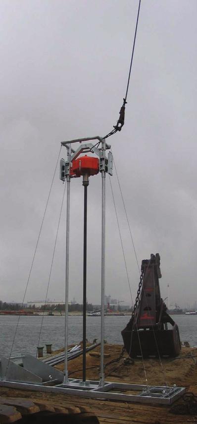
2 MULTIBEAM (1 EN 2) - Degrendele and Roche Monitoring of the impact of the extraction on the seabed In the framework of the follow-up of the marine extractions by the Fund for Sand Extraction, the Federal Public Service Economy acquired a Kongsberg Maritime 1002S multibeam echosounder. This system has been installed aboard the RV Belgica in summer The EM1002 provides 111 beams of 2 (athwart) x 3.3 (foreaft) width. It works at a nominal frequency of 95kHz with a ping-rate of around 4 to 6Hz. The data are real-time corrected for the roll and heave with a Seatex MRU 5 motion sensor and for the heading with an Anschütz Standard 20 gyrocompas. The geographic co-ordinates are provided by a Sercel NR103 (1999 until January 2003) and a Thales Aquarius 02 (since January 2003) GPS positioning system with a theoretical precision of respectively <5m and 10mm. The soundings are tide-corrected using the specific M2 tidal reduction method for the Belgian coastal zone and referenced to the level of mean lowest low water at springtide (MLLWS). The large amount of gathered data and the full-coverage capabilities of such remote system allow the construction of logical model of the Kwintebank (number of dredging records from accurate terrain models of the seafloor. A global bathymetric 05/11/1996 to 30/03/2005; each record represents 30 seconds of error (2σ) of 0.35% of depth has been estimated on the basis operation by a trailer suction hopper dredger). of the variance between the resulting bathymetrical digital terrain models of four successive surveys of the same area within one tide cycle and on successive measurements on a stable wreck. This global error on the final product, the terrain model, is the combination of the independent errors of the EM1002 multibeam echosounder, the auxiliary sensors and the draught and tide corrections. Figure 2: Superposition of the extraction intensity on the geomorpho- The processing of the backscattered acoustic signal through specific software packages results in the acoustic cartography of the seabed (seabed imagery). Despite the large amount of alongtrack artefacts, acoustic zones can be delimited (acoustic classification). The resulting maps partially reflect the real sedimentary nature of the seabed. To evaluate the impact of the extraction in detail, several monitoring zones were defined: two in the active control zones (central and northern part of the Kwintebank) and one on the neighbouring bank to the east, the Middelkerkebank, situated outside the control zones (Figure 3). From November 1999 until the closure for extraction in February 2003 and the subsequent post-dredging evolution until June 2005, a total of 17 surveys were carried out on the central part of the Kwintebank (KBMA, Figure 4) and on a reference zone situated on the Middelkerkebank (R2), outside the dredging area. The Figure 3: Location of the monitoring areas KBMA, KBMB and R2. resulting time series of digital terrain models (DTMs) and backscatter strength maps allow a detailed comparison of the bathy-morphological and sedimentary evolution of both monitoring areas. 71 Mb-028 Roche 71 10/10/ :34:38 AM

3 Positioning SEABED Navigation Dredge & Port monitoring Sub-bottom sampling Getting to the bottom of things. +31(0) Seabed ad :23:21

4 Since the start of multibeam monitoring in 1999, a global deepening of 0.5m of the whole KBMA monitoring zone is observed until February From that moment on, KBMA was closed for extraction and the bathymetrical trend on the central depression becomes less negative. The evolution of the KBMA can be considered as a combination of natural and anthropogenic factors. After the subtraction of the extracted volumetric component from the total volume evolution of the KBMA monitoring area, a close to natural evolution can be deduced and enables a comparison with the volume evolution of the R2 area outside the dredging area. This forms, together with the much smaller decrease since the closure of the zone for extraction and the lack of indications for cumulative effects on the bathymetry, a clear evidence of the merely local impact of the extraction. At the scale of the KBMA monitoring area, there is no indication of a change in natural processes. The volume evolution that was observed during extraction is reversed nor maintained. The mapping of the backscatter values suggests a clear difference in sediments between the depression sensu stricto and the rest of the KBMA monitoring area. The central depression has a mean depression. Figure 4: Detail of the monitoring area KBMA and the delimitation of the central backscatter value of 24dB, which coincides with a backscatter strength mean value for medium to coarse sand. The mean of the backscattered strength values recorded on the east side of the KBMA area is up to 27dB, suggesting the dominance of very fine sand in this sub-area. The western side of the KBMA shows intermediate backscatter values, and is characterized as medium to coarse sands with grab samples. The focus of the extraction industry on this depressed part of the bank is explained by the presence of this medium to coarse sand. The backscatter strength values are fairly stable and do not show a clear evolution before or after the cessation of dredging. According to these data within the KBMA area, the sedimentary composition of the seabed at the water-sediment interface seems to be quite stable. However, the seabed classification indicates a minor tendency towards more fine and homogenous sand in the depression after February A similar stability of the backscatter strength is observed for the R2 monitoring area. Expectations The monitoring of the extraction activities is a control activity with a delay of a few months at best. The registers and black box readings are collected at regular intervals and processed. This constitutes an effective control of the extraction activities, but doesn t allow a real-time surveillance. Furthermore, the extracted volume for each dredging vessel and company is calculated based on the extracted volumes listed in the registers. These values are submitted on his word of honour by the exploitation vessel s captain. To establish a real-time monitoring independent of the controlled organisations the black boxes should be used to calculate the extracted quantities. The black box data should be collected as close as possible to real time to enable a direct response to infractions and a close follow up. For the latter, the use of AIS data can complement the information of the black boxes and provide a real time follow up of the extraction vessels and activities. The monitoring of the seabed can still be improved on a few fundamental points. The important compensations for the draught of the vessel and the tidal height can be ameliorated and made available in real-time. Most important however, the use of a more adapted tool for the measurements, a very shallow water high frequency echosounder, instead of the by all means non ideal solution of a shallow to medium water echosounder, will greatly improve the accuracy, resolution and efficiency of the measurements. This will permit the researchers to refine and intensify the study of the impact of the extractions. Due to the limitations of the present system the monitoring is confined to small areas. The large-scale monitoring is currently executed by comparing the mapped sandbanks with recently sailed transects. With a more efficient system the re-mapping of large structures becomes a feasible option. If the monitoring of the extractions activities can evolve to a near real-time surveillance, a dynamic monitoring of the impact becomes possible. The surveillance will enable the adjustment of the monitoring to the up to date information and provide a more adaptive, dynamic monitoring. 73 Mb-028 Roche 73 10/10/ :33:32 AM
5 The monitoring of the seabed is at present a 2D evaluation of the surface of the seafloor. A real 3D evaluation of the mineral resources and present sedimentary bodies is necessary to establish the impact on the available volumes of sand and gravel and to develop a sustainable exploitation. From this point of view the Fund for Sand Extraction has launched a new project to develop and optimise techniques to transgress to a full 3D monitoring and cartography of the Belgian Continental Shelf. Acknowledgements The Fund for Sand Extraction wishes to thank the crew of the R.V. Belgica for their assistance during the surveys. The Management Unit of the Mathematical Model of the North Sea and the Scheldt Estuary (MUMM) is thanked for the provision of ship time on board the Belgica. Koen Degrendele, Federal Public Service Economy - Fund for Sand Extraction, 1000 Brussels, Belgium Koen.Degrendele@mineco.fgov.be Marc Roche, Federal Public Service Economy - Fund for Sand Extraction, 1000 Brussels, Belgium Marc.Roche@mineco.fgov.be 74 Mb-028 Roche 74 10/10/ :33:34 AM
Sand extraction in the Belgian part of the North Sea: European context and lessons from 10 years of EMS control and bathymetric monitoring
 Sand extraction in the Belgian part of the North Sea: European context and lessons from years of EMS control and bathymetric monitoring M. Roche, K. Degrendele, L. De Mol, P. Schotte & H. Vandenreyken
Results of the RV Simon Stevin EM2040 Sea Acceptance Test and comparison with EM3002D data from the HS Ter Streep and RV Belgica.
 Results of the RV Simon Stevin EM2040 Sea Acceptance Test and comparison with EM3002D data from the HS Ter Streep and RV Belgica. Cattrijsse Andre, Degrendele Koen, De Mol Lies, Naudts Lieven, Roche Marc,
Recent developments in multi-beam echo-sounder processing at the Delft
 Recent developments in multi-beam echo-sounder processing at the Delft University of Technology Prof. Dr. Dick G. Simons Acoustic Remote Sensing Group, Faculty of Aerospace Engineering, Delft University
Belgian marine sand: a scarce resource?
 Belgian marine sand: a scarce resource? Study day 9 June 2017 Hotel Andromeda - Ostend Editors: Koen Degrendele and Helga Vandenreyken CONTENT REGULAR CONTRIBUTIONS 3 Multi time and space scale monitoring
A lithological map created from multibeam backscatter data in challenging circumstances: the Lower Sea Scheldt estuary
 A lithological map created from multibeam backscatter data in challenging circumstances: the Lower Sea Scheldt estuary Mieke Mathys*, Marc Sas*, Frederik Roose** HYDRO12, Rotterdam, 15/11/2012 *International
Sand and gravel extraction in the Belgian part of the North Sea
 Sand and gravel extraction in the Belgian part of the North Sea Sand and gravel extraction in the Belgian part of the North Sea Within the framework of the mission of the FPS Economy, SMEs, Self-employed
BUDGET. Investigation of natural sand transport on the Belgian continental shelf
 BUDGET Investigation of natural sand transport on the Belgian continental shelf Funded by Federal Office for Scientific, Technical and Cultural Affairs Program: Sustainable Management of the North Sea
River bed classification using multi-beam echo-sounder backscatter data. Niels KINNEGING Rijkswaterstaat Centre for Water Management
 River bed classification using multi-beam echo-sounder backscatter data Niels KINNEGING Rijkswaterstaat Centre for Water Management Mirjam SNELLEN Delft University of Techonology Dimitrios ELEFTHERAKIS
CHAPTER 6 RESULTS FIGURE 8.- DATA WORK FLOW FOR BACKSCATTER PROCESSING IN HYPACK
 CHAPTER 6 RESULTS 6.1. Backscatter Workflow Comparison Currently, INOCAR owns and operates RESON and Kongsberg multibeam systems for nearshore surveys. The RESON system is integrated with HYPACK Hysweep
MBES BS calibration on reference patch areas using singlebeam calibrated data
 MBES BS calibration on reference patch areas using singlebeam calibrated data Southampton, U.K. Brussels, Belgium NOC 3 FPS Economy 2, Continental Shelf Service D. Eleftherakis 1, X. Lurton 1, J.M. Augustin
Changes in Geomorphology and Backscatter Patterns in Mount Misery Shoal, Long Island Sound as Revealed through Multiple Multibeam Surveys
 Changes in Geomorphology and Backscatter Patterns in Mount Misery Shoal, Long Island Sound as Revealed through Multiple Multibeam Surveys Laurie A. Zaleski Laurie.Zaleski@msrc.sunysb.edu, Roger D. Flood
River bed classification using multi-beam echo-sounder backscatter data
 River bed classification using multi-beam echo-sounder backscatter data Niels Kinneging Mirjam Snellen Dimitrios Eleftherakis Dick Simons Erik Mosselman Arjan Sieben 13 November 2012 transport water management
FINMARINET: Inventories and Planning for the Marine Natura 2000 Network in Finland. A.2 Geological inventories of the seafloor Final Report
 LIFE07 NAT/FIN/000151 FINMARINET: Inventories and Planning for the Marine Natura 2000 Network in Finland A.2 Geological inventories of the seafloor Final Report Geological Survey of Finland, GTK 1. Introduction
Introduction to Acoustic Remote Sensing and Seafloor Mapping (AE4-E13) May 19, 2010
 May 19, 2010") Introduction to Acoustic Remote Sensing and Seafloor Mapping (AE4-E13) May 19, 2010 1 Delft Vermelding Institute onderdeel of Earth organisatie Observation and Space Systems Why Acoustic Remote Sensing?
Introduction to Acoustic Remote Sensing and Seafloor Mapping (AE4-E13) May 19, 2010 1 Delft Vermelding Institute onderdeel of Earth organisatie Observation and Space Systems Why Acoustic Remote Sensing?
Changes in bottom morphology of Long Island Sound near Mount Misery Shoal as observed through Repeated Multibeam Surveys
 Changes in bottom morphology of Long Island Sound near Mount Misery Shoal as observed through Repeated Multibeam Surveys Laurie A. Zaleski Laurie.Zaleski@msrc.sunysb.edu Roger D. Flood rflood@notes.cc.sunysb.edu
SEABED CLASSIFICATION FROM MULTIBEAM ECHOSOUNDER BACKSCATTER DATA USING WAVELET TRANSFORMATION AND NEURAL NETWORK APPROACH
 SEABED CLASSIFICATION FROM MULTIBEAM ECHOSOUNDER BACKSCATTER DATA USING WAVELET TRANSFORMATION AND NEURAL NETWORK APPROACH Jaroslaw Tegowski a,b, Jaroslaw Nowak a, Mateusz Moskalik c, Kazimierz Szefler
7.0 Project Reports 7.1 Geophysical Mapping of Submarine Environments
 7.0 Project Reports 7.1 Geophysical Mapping of Submarine Environments Suzanne Carbotte, Robin Bell, Roger Flood 7.1.1 METHODS In April 2000 we deployed the R/V Onrust, operated by MSRC at SUNY Stony Brook,
Geo-environmental Characterization of the Kwinte Bank
 Journal of Coastal Research SI 51 63-76 West Palm Beach, Florida Summer 2010 Geo-environmental Characterization of the Kwinte Bank Valérie K. Bellec 1*, Vera Van Lancker 1**, Koen Degrendele², Marc Roche²
GSA DATA REPOSITORY
 GSA DATA REPOSITORY 2009206 Miner et al. Supplemental Material Bathymetric Survey Methods The bathymetric data for the area were gathered using a single-beam bathymetric survey rig mounted aboard a 21-foot
WP. 4 Detection and characterization of CWA dumpsites. Zygmunt Klusek Ulf Olsson
 WP. 4 Detection and characterization of CWA dumpsites Zygmunt Klusek Ulf Olsson Stockholm 02.03.2013 Zygmunt Klusek & Ulf Olsson WP. 4 Detection and characterization of CWA dumpsites 0.2.03.2013 This page
Geophysical Site Surveys
 Geophysical Site Surveys Simon Oakley Geoscience Team Leader Fugro Survey Limited 16/04/2014 Contents Menu Introduction Section 1 - Geophysical Site Surveys - Seabed Bathymetry - Shallow Geology - Seabed
Topic: Bathymetric Survey Techniques. (a) Single-beam echo-sounders (SBES) (b) Multi-beam echo-sounders (MBES)
 Single-beam echo-sounders (SBES) (b) Multi-beam echo-sounders (MBES)") Topic: Bathymetric Survey Techniques (a) Single-beam echo-sounders (SBES) (b) Multi-beam echo-sounders (MBES) Bathymetry is the measurement of water depths - bathymetry is the underwater equivalent of
Topic: Bathymetric Survey Techniques (a) Single-beam echo-sounders (SBES) (b) Multi-beam echo-sounders (MBES) Bathymetry is the measurement of water depths - bathymetry is the underwater equivalent of
Terje Pedersen Product Manager Software / Hydrography Hydroacoustics Division
 Terje Pedersen Product Manager Software / Hydrography Hydroacoustics Division WORLD CLASS through people, technology and dedication WORLD CLASS through people, technology and dedication 1 2 HYDROFEST 2005
Current and Future Technology Applications for Coastal Zone Management. Bruce K. Carlisle, Acting Director Office of Coastal Zone Management
 Current and Future Technology Applications for Coastal Zone Management Bruce K. Carlisle, Acting Director Office of Coastal Zone Management The Massachusetts Coastal Zone Management Program Approved in
J.B. Shaw and D. Mohrig
 GSA DATA REPOSITORY 2014008 J.B. Shaw and D. Mohrig Supplementary Material Methods Bathymetric surveys were conducted on 26 June- 4 July, 2010 (Fig. 2A), 7 March, 2011 (Fig. 2B), 11-12 August, 2011 (Figs.
Acoustic seafloor mapping systems. September 14, 2010
 Acoustic seafloor mapping systems September 14, 010 1 Delft Vermelding Institute onderdeel of Earth organisatie Observation and Space Systems Acoustic seafloor mapping techniques Single-beam echosounder
SEAFLOOR PROPERTIES AND SEGMENTATION
 SEAFLOOR PROPERTIES AND SEGMENTATION G. CANEPA, N. G. PACE, E. POULIQUEN, P. FRANCHI, R. LOMBARDI, C. SISTI NATO Undersea Research Centre Viale San Bartolomeo 400, I-19138 La Spezia, Italy E-mail: canepa@saclantc.nato.int
Marine environment monitoring : The basic requirements to support Marine Renewable Energies
 Marine environment monitoring : The basic requirements to support Marine Renewable Energies SHOM in brief SHOM is the French Government agency in charge of Hydrography and Oceanography SHOM s vocation
Inspection of Waterfront Facilities Using Vessel-Based Remote Sensing Mitchell, Del Bello, Suarez
 Inspection of Waterfront Facilities Using Vessel-Based Remote Sensing Mitchell, Del Bello, Suarez American Association of Port Authorities Facilities Engineering Conference October 20-22, 2015 Waterfront
Current Hydrographic Projects at BSH
 7 th Workshop Seabed Acoustics, Rostock, November 19/20, 2015 P01-1 Current Hydrographic Projects at BSH Thomas Dehling Federal Maritime and Hydrographic Agency (BSH) Germany Contact Address Website BSH
Developing a Seabed Resurvey Strategy: A GIS approach to modelling seabed changes and resurvey risk
 Developing a Seabed Resurvey Strategy: A GIS approach to modelling seabed changes and resurvey risk A. M. Bakare, J. G. Morley, R. R. Simons Department of Geomatic Engineering, University College London,
Indonesia Frontier Basin SUNDA (SU-08) NON-EXCLUSIVE 2-D SURVEY 3084km
 NON-EXCLUSIVE 2-D SURVEY 3084km") Indonesia Frontier Basin SUNDA (SU-08) NON-EXCLUSIVE 2-D SURVEY 3084km SEISMIC ACQUISITION PARAMETERS Acquisition Date: January - March 2008 Vessel: M/V Osprey Explorer Shooting Orientation: Strike-Dip
Indonesia Frontier Basin SUNDA (SU-08) NON-EXCLUSIVE 2-D SURVEY 3084km SEISMIC ACQUISITION PARAMETERS Acquisition Date: January - March 2008 Vessel: M/V Osprey Explorer Shooting Orientation: Strike-Dip
MORPHODYNAMIC PROCESSES IN ESTUARIES COMPARISON OF MARINE AND LIMNIC TIDAL FLATS
 MORPHODYNAMIC PROCESSES IN ESTUARIES COMPARISON OF MARINE AND LIMNIC TIDAL FLATS Thorsten Albers 1, Dagmar Much 2, Nino Ohle 2, Nicole von Lieberman 1, Eva Falke 1 Tidal flat areas in estuaries are affected
MLLW and the NAD83 Ellipsoid: An Investigation of Local Offsets and Trends Using PPK and Gauge Derived Water Surfaces.
 MLLW and the NAD83 Ellipsoid: An Investigation of Local Offsets and Trends Using PPK and Gauge Derived Water Surfaces. Abstract: Authors Doug Lockhart, Fugro Pelagos, Inc. Andy Orthmann, Fugro Pelagos,
2) re-positioning of the SSS data, 3) individuation of geomorphological features and morphometrical parameters correlated to instability phenomena.
 re-positioning of the SSS data, 3) individuation of geomorphological features and morphometrical parameters correlated to instability phenomena.") HIGH-RESOLUTION SIDE SCAN SONAR AND MULTIBEAM DATA PROCESSING AND MERGING TO STUDY SUBMARINE INSTABILITY PHENOMENA ON VOLCANIC ISLANDS (PONTINE, CAMPANIAN AND AEOLIAN ARCHIPELAGOS) A. BOSMAN Extended abstract:
HIGH-RESOLUTION SIDE SCAN SONAR AND MULTIBEAM DATA PROCESSING AND MERGING TO STUDY SUBMARINE INSTABILITY PHENOMENA ON VOLCANIC ISLANDS (PONTINE, CAMPANIAN AND AEOLIAN ARCHIPELAGOS) A. BOSMAN Extended abstract:
Using the MBES for classification of riverbed sediments
 Acoustics 8 Paris Using the MBES for classification of riverbed sediments A. Amiri-Simkooei a, M. Snellen a and D. G Simons b a Acoustic Remote Sensing Group, Delft Institute of Earth Observation and Space
Acoustical recognition of the bottom sediments in the southern Baltic Sea
 Acoustical recognition of the bottom sediments in the southern Baltic Sea PACS: 43.30.Ma Jaros³aw Têgowski Institute of Oceanology, Polish Academy of Sciences, Powstañców Warszawy 55,8-7 Sopot, Poland,
Field and Numerical Study of the Columbia River Mouth
 DISTRIBUTION STATEMENT A. Approved for public release; distribution is unlimited. Field and Numerical Study of the Columbia River Mouth Guy Gelfenbaum 400 Natural Bridges Dr. Santa Cruz, CA 95060 Phone:
US ARMY CORPS OF ENGINEERS New England District BUILDING STRONG
 US ARMY CORPS OF ENGINEERS New England District STUDIES Sediment Sampling Biological Sampling (benthic community analysis) Hydroacoustic Surveys (side scan sonar, bathymetry) Remotely Operated Vehicle
Form 4 of Schedule 5 of the Exclusive Economic Zone and Continental Shelf (Environmental Effects Permitted Activities) Regulations 2013
 Regulations 2013") FORM 4 Permitted activities: Post-activity report Form 4 of Schedule 5 of the Exclusive Economic Zone and Continental Shelf (Environmental Effects Permitted Activities) Regulations 2013 How to use this
FORM 4 Permitted activities: Post-activity report Form 4 of Schedule 5 of the Exclusive Economic Zone and Continental Shelf (Environmental Effects Permitted Activities) Regulations 2013 How to use this
CANADIAN HYDROGRAPHIC SERVICE
 CANADIAN HYDROGRAPHIC SERVICE Surveying and Charting Canada s Waters Since 1883 Ilulisat Maritime Workshop 2017 The Importance and Need for Hydrography Denis Hains, Hydrographer General of Canada & Director
The Urban Sea and Coastal Zone Management
 The Urban Sea and Coastal Zone Management David NEALE, Trinidad and Tobago Key words: hydrography, Caribbean, coastal zone management, land use. SUMMARY Within the coastal zone of Eastern Caribbean States,
Ultrasonic Measuring System for Deposition of Sediments in Reservoirs
 MECAHITECH 11, vol. 3, year: 011 Ultrasonic Measuring System for Deposition of Sediments in Reservoirs M. Mărgăritescu* 1, A. Moldovanu * 1, P. Boeriu *, A.M.E. Rolea* 1 * 1 National Institute of Research
46ºN to 75ºN (Quebec City to the Beaufort Sea): 2011 Ocean Mapping Group Operations in the Canadian Arctic, Part III. By Doug Cartwright
: 2011 Ocean Mapping Group Operations in the Canadian Arctic, Part III. By Doug Cartwright") 46ºN to 75ºN (Quebec City to the Beaufort Sea): 2011 Ocean Mapping Group Operations in the Canadian Arctic, Part III By Doug Cartwright Doug Cartwright, Christine Legere and Pim Kuus met up with the CCGS
46ºN to 75ºN (Quebec City to the Beaufort Sea): 2011 Ocean Mapping Group Operations in the Canadian Arctic, Part III By Doug Cartwright Doug Cartwright, Christine Legere and Pim Kuus met up with the CCGS
SEISMIC CAMPAIGN SIMON STEVIN (Cruise No ) 10-4 OCTOBER 2016
 10-4 OCTOBER 2016") IWT SBO PROJECT 120003 SEARCH Archaeological heritage in the North Sea Development of an efficient assessment methodology and approach towards a sustainable management policy and legal framework in Belgium.
IWT SBO PROJECT 120003 SEARCH Archaeological heritage in the North Sea Development of an efficient assessment methodology and approach towards a sustainable management policy and legal framework in Belgium.
Digital Elevation Model (DEM) of Sable Island Bank and adjacent areas
 of Sable Island Bank and adjacent areas") GEOLOGICAL SURVEY OF CANADA OPEN FILE 5348 Digital Elevation Model (DEM) of Sable Island Bank and adjacent areas K.J. Webb and E.L. King 2014 GEOLOGICAL SURVEY OF CANADA OPEN FILE 5348 Digital Elevation
GEOLOGICAL SURVEY OF CANADA OPEN FILE 5348 Digital Elevation Model (DEM) of Sable Island Bank and adjacent areas K.J. Webb and E.L. King 2014 GEOLOGICAL SURVEY OF CANADA OPEN FILE 5348 Digital Elevation
NOAA Nautical Charts and Coastal and Marine Spatial Planning. Meredith Westington Chief Geographer NOAA/NOS/Office of Coast Survey
 NOAA Nautical Charts and Coastal and Marine Spatial Planning Meredith Westington Chief Geographer NOAA/NOS/Office of Coast Survey Ocean Policy Task Force What is CMSP? A comprehensive, adaptive, integrated,
Joint Hydrographic Center, National Oceanic and Atmospheric Administration, Durham, NH 03824, USA
 Future directions in hydrography using satellite-derived bathymetry Shachak Pe eri 1, Christopher Parrish 2, 3, Lee Alexander 1, Chukwuma Azuike 1, Andrew Armstrong 1,3 and Maryellen Sault 2 1 Center for
Options in Capacity Building. Underpinning the Blue Economy. Slide 1/78. Derrick R. Peyton. 14 th MACHC Meeting. IIC Technologies. December 9-13, 2013
 Options in Capacity Building Underpinning the Blue Economy Derrick R. Peyton IIC Technologies 14 th MACHC Meeting December 9-13, 2013 Slide 1/78 Overview Blue Economy Defined Challenges (SDI, MSDI, Standards)
Multibeam Hydrographic Survey Use for Construction Control of Filling and Ground Improvement Activities
 Multibeam Hydrographic Survey Use for Construction Control of Filling and Ground Improvement Activities WEDA Cincinnati April 10, 2014 Ray Wood C.Eng Executive Vice President Fugro Consultants Inc Advantages
European Commission STUDY ON INTERIM EVALUATION OF EUROPEAN MARINE OBSERVATION AND DATA NETWORK. Executive Summary
 European Commission STUDY ON INTERIM EVALUATION OF EUROPEAN MARINE OBSERVATION AND DATA NETWORK Executive Summary by NILOS Netherlands Institute for the Law of the Sea June 2011 Page ii Study on Interim
APPLICATION FOR THE CONSENT TO CONDUCT MARINE SCIENTIFIC RESEARCH IN AREAS UNDER NATIONAL JURISDICTION OF THE UNITED KINGDOM
 APPLICATION FOR THE CONSENT TO CONDUCT MARINE SCIENTIFIC RESEARCH IN AREAS UNDER NATIONAL JURISDICTION OF THE UNITED KINGDOM 1. General information Date: 27 th January 2011 1.1 Cruise name and/or number:
MONITORING OF VENICE INLET CHANNELS. Sharing knowledge to make data available for everyone
 MONITORING OF VENICE INLET CHANNELS Sharing knowledge to make data available for everyone Introduction What does hydrography really mean? IHO defines hydrography as a description of the physical features
3.2 Geophysical Habitat Mapping
 APPENDIX 3 GEOPHYSICS Prepared for: Namibian Marine Phosphate (Pty) Ltd. Prepared by: Jeremy Midgley September 2014 Mr Jeremy Midgley Pr.Sci.Nat J. Midgley & Associates PO Box 110 Constantia 7806 South
Kyle Griebel NRS 509 Dr. August & Dr. Wang GIS and remote sensing in Seafloor mapping
 GIS and remote sensing in Seafloor mapping Introduction to seafloor mapping Seafloor maps have a wide variety of uses for scientists and coastal planning needs. Some of these uses include biological assessment
Work Package 5: Signal Processing and Seafloor Classification
 Work Package 5: Signal Processing and Seafloor Classification Jarosław Tęgowski and Karolina Trzcińska Marine Geophysics Lab. Institute of Oceanography University of Gdańsk, Poland Kick-Off Meeting, Kiel,
SUT WA Research Night
 SUT WA Research Night An introduction to acoustic seafloor observation and geostatistical data interpolation Elizabeth Mair BSc (GIS) Honours Curtin University Contents Project Introduction Methodology
Themes for Geomatics Conference. Geodesy Themes
 Themes for Geomatics Conference Geodesy Themes Geodynamics o Modeling the Deformation of the Earth s Crust o Recent Advances in Geometric Approaches to Deformation Analysis o Monitoring Systems (Sensors
Environmental impact assessment study of the new offshore dumping sites for Šventoji port in Lithuania
 Environmental impact assessment study of the new offshore dumping sites for Šventoji port in Lithuania Introduction Summary In 2003 Lithuanian Ministry of Transport initiated the preparation of feasibility
National Marine Sanctuary Program
 National Marine Sanctuary Program NMSP/USGS Joint Seabed Mapping Initiative: September 2004 AA National Ocean Service National Marine Sanctuaries Interim Report September 2004 Background: Since 2002,
Short summary of Project 1 activity during research cruise with RV Poseidon (P408-2b)
") Short summary of Project 1 activity during research cruise with RV Poseidon (P408-2b) Chief scientist: Dr. Mark Schmidt Shipboard scientific party: Dr. Peter Linke, Dr. Daniel McGinnis, Dr. Alaa Al-Barakati,
Short summary of Project 1 activity during research cruise with RV Poseidon (P408-2b) Chief scientist: Dr. Mark Schmidt Shipboard scientific party: Dr. Peter Linke, Dr. Daniel McGinnis, Dr. Alaa Al-Barakati,
Observations of the Spatial and Temporal Variability of Wave Formed Ripples from the 2007 Martha's Vineyard RipplesDRI Experiment
 Observations of the Spatial and Temporal Variability of Wave Formed Ripples from the 2007 Martha's Vineyard RipplesDRI Experiment Dr. Peter Traykovski Woods Hole Oceanographic Institution Applied Ocean
SEAFLOOR CHARACTERIZATION BY ELECTROMAGNETIC BENTHIC PROFILING
 SEAFLOOR CHARACTERIZATION BY ELECTROMAGNETIC BENTHIC PROFILING Hendrik Müller Christian Hilgenfeldt Tilo von Dobeneck Benjamin Baasch Thomas Frederichs MARUM Center for Marine Environmental Sciences (University
High-frequency multibeam echosounder classification for rapid environmental assessment
 High-frequency multibeam echosounder classification for rapid environmental assessment K. Siemes a, M. Snellen a, D. G Simons b, J.-P. Hermand c, M. Meyer d,c and J.-C. Le Gac e a Acoustic Remote Sensing
Observed bed elevation changes in the data may arise as a result of any of several causes:
 10 July 2014 TECHNICAL MEMORANDUM: INTRODUCTION NEWARK BAY STUDY AREA, NEW JERSEY BATHYMETRIC COMPARISON AND ANALYSIS Periodic single- and multi-beam sonar bathymetric surveys within Newark Bay (Bay) in
Mapping of marine habitats in shallow coastal areas in Denmark
 6 th Workshop Seabed Acoustics, Rostock, November 14/15, 2013 P11-1 Mapping of marine habitats in shallow coastal areas in Denmark Dr. Zyad Al-Hamdani Geological Survey of Denmark and Greenland - GEUS
CSL HERON MAPPING OPERATIONS, MAY 23 RD -JUNE 4 TH BLUE HILL BAY, MAINE, USA OCEAN MAPPING GROUP CRUISE REPORT JAMES MUGGAH AND TRAVIS HAMILTON
 CSL HERON MAPPING OPERATIONS, MAY 23 RD -JUNE 4 TH BLUE HILL BAY, MAINE, USA OCEAN MAPPING GROUP CRUISE REPORT JAMES MUGGAH AND TRAVIS HAMILTON SPRING 2009 / NOVEMBER 2009 OCEAN MAPPING GROUP UNIVERSITY
STATISTICAL ANALYSIS FOR AUTOMATED SEEP EXTRACTION IN GIS
 STATISTICAL ANALYSIS FOR AUTOMATED SEEP EXTRACTION IN GIS Presented by Pamela Kanu, GISP ESRI USER CONFERENCE JULY 2017 SEEPS Seeps are natural gas and crude oil that enter the ocean through cracks and
H.A.R.S. PRA #1 (Historic Area Remediation Site)
") H.A.R.S. PRA #1 (Historic Area Remediation Site) 2009 Multibeam Bathymetry TABLE OF CONTENTS Page LIST OF TABLES 2 LIST OF FIGURES 3 1.0 INTRODUCTION 4 2.0 OBJECTIVE 4 3.0 PROCEDURE 4 3.1 DATA ACQUISITION
H.A.R.S. PRA #1 (Historic Area Remediation Site) 2009 Multibeam Bathymetry TABLE OF CONTENTS Page LIST OF TABLES 2 LIST OF FIGURES 3 1.0 INTRODUCTION 4 2.0 OBJECTIVE 4 3.0 PROCEDURE 4 3.1 DATA ACQUISITION
Relationship between gas-bearing (?) sediments and biogenic mounds in the Kalloni Gulf, Lesvos Island, Greece
 sediments and biogenic mounds in the Kalloni Gulf, Lesvos Island, Greece") 6 th Workshop Seabed Acoustics, Rostock, November 14/15, 2013 P13-1 Relationship between gas-bearing (?) sediments and biogenic mounds in the Kalloni Gulf, Lesvos Island, Greece Alexandros Chronis, Dr.
6 th Workshop Seabed Acoustics, Rostock, November 14/15, 2013 P13-1 Relationship between gas-bearing (?) sediments and biogenic mounds in the Kalloni Gulf, Lesvos Island, Greece Alexandros Chronis, Dr.
Detailed mapping of seabed topography,
 MAREANO program Detailed mapping of seabed topography, sediments, bottom fauna and pollutants in Norwegian waters HYDROGRAPHIC DATA FOR THE BENEFIT OF SOCIETY MAREANO program - Detailed mapping of seabed
Highland Lake Bathymetric Survey
 Highland Lake Bathymetric Survey Final Report, Prepared For: The Town of Highland Lake 612 Lakeshore Drive Oneonta, AL 35121 Prepared By: Tetra Tech 2110 Powers Ferry Road SE Suite 202 Atlanta, GA 30339
Outline of presentation
 - lessons learnt from precedent cases of establishing the s Outline of presentation Extending Ireland s continental shelf jurisdiction to the outer s in the Porcupine Abyssal Plain: progress, issues and
Backscatter calibration for MBES Project Shom / Ifremer
 Backscatter calibration for MBES Project Shom / Ifremer Christophe Vrignaud Sophie Loyer Julian Le Deunf (Shom) Xavier Lurton - Jean-Marie Augustin Laurent Berger (Ifremer) INTRODUCTION The main need:
Climate change and socio-economic impact on the long term sediment balance in the Belgian Part of the North Sea
 Climate change and socio-economic impact on the long term sediment balance in the Belgian Part of the North Sea De Sutter Renaat, Ghent University & IMDC Van Lancker Vera, Fettweis Michael, Van den Eynde
ANNEX 23 RESOLUTION MSC.231(82) ADOPTION OF AMENDMENTS TO THE EXISTING MANDATORY SHIP REPORTING SYSTEM IN THE GULF OF FINLAND
 ADOPTION OF AMENDMENTS TO THE EXISTING MANDATORY SHIP REPORTING SYSTEM IN THE GULF OF FINLAND") RESOLUTION MSC.231(82) (adopted on 5 December 2006) ADOPTION OF AMENDMENTS TO THE EXISTING MANDATORY SHIP REPORTING SYSTEM IN THE GULF OF FINLAND THE MARITIME SAFETY COMMITTEE, RECALLING Article 28(b)
RESOLUTION MSC.231(82) (adopted on 5 December 2006) ADOPTION OF AMENDMENTS TO THE EXISTING MANDATORY SHIP REPORTING SYSTEM IN THE GULF OF FINLAND THE MARITIME SAFETY COMMITTEE, RECALLING Article 28(b)
14 th NIOHC, Myanmar National Report MYANMAR NAVAL HYDROGRAPHIC CENTRE (MNHC) NATIONAL REPORT HYDROGRAPHIC DEPARTMENT, ROYAL THAI NAVY-HDRTN
 NATIONAL REPORT HYDROGRAPHIC DEPARTMENT, ROYAL THAI NAVY-HDRTN") 14 th NIOHC, Myanmar National Report MYANMAR NAVAL HYDROGRAPHIC CENTRE (MNHC) NATIONAL REPORT 14 th NORTH INDIAN OCEAN HYDROGRAPHIC COMMISSION CONFERENCE HYDROGRAPHIC DEPARTMENT, ROYAL THAI NAVY-HDRTN
14 th NIOHC, Myanmar National Report MYANMAR NAVAL HYDROGRAPHIC CENTRE (MNHC) NATIONAL REPORT 14 th NORTH INDIAN OCEAN HYDROGRAPHIC COMMISSION CONFERENCE HYDROGRAPHIC DEPARTMENT, ROYAL THAI NAVY-HDRTN
June 2018 Sediments and Dredging at GBR Ports
 June 2018 Sediments and Dredging at GBR Ports Reef 2050 Long Term Sustainability Plan The Great Barrier Reef is over 2000 km long and covers an area of approximately 350,000 square kilometres. It is a
Regional-scale understanding of the geologic character and sand resources of the Atlantic inner continental shelf, Maine to Virginia
 Regional-scale understanding of the geologic character and sand resources of the Atlantic inner continental shelf, Maine to Virginia Workshop on Dredging, Beach Nourishment and Bird Conservation Atlantic
MaxDepth Aquatics, Inc.
 MaxDepth Aquatics, Inc. Bathymetry of Mirror Pond From Newport Bridge to Galveston Bridge Prepared for the City of Bend By Joseph Eilers & Benn Eilers MaxDepth Aquatics, Inc. Bend, OR June 2005 INTRODUCTION
Mapping Coastal Change Using LiDAR and Multispectral Imagery
 Mapping Coastal Change Using LiDAR and Multispectral Imagery Contributor: Patrick Collins, Technical Solutions Engineer Presented by TABLE OF CONTENTS Introduction... 1 Coastal Change... 1 Mapping Coastal
ZEEBRUGGE VALLEY AND SEPIA PITS SEISMIC CAMPAIGN MARCH 2015
 IWT SBO PROJECT 120003 SEARCH Archaeological heritage in the North Sea Development of an efficient assessment methodology and approach towards a sustainable management policy and legal framework in Belgium.
Smart Survey Approach: Multibeam Echosounder and Integrated Water Column Data as an Added Value for Seep Hunting
 Smart Survey Approach: Multibeam Echosounder and Integrated Water Column Data as an Added Value for Seep Hunting HYDRO 2016 8 November 2016 Marco Filippone Introduction, Multibeam Sonars & water column
SEDIMENT TRANSPORT IN RIVER MOUTH ESTUARY
 SEDIMENT TRANSPORT IN RIVER MOUTH ESTUARY Katsuhide YOKOYAMA, Dr.Eng. dredge Assistant Professor Department of Civil Engineering Tokyo Metropolitan University 1-1 Minami-Osawa Osawa, Hachioji,, Tokyo,
Summary Description Municipality of Anchorage. Anchorage Coastal Resource Atlas Project
 Summary Description Municipality of Anchorage Anchorage Coastal Resource Atlas Project By: Thede Tobish, MOA Planner; and Charlie Barnwell, MOA GIS Manager Introduction Local governments often struggle
PAKISTAN NATIONAL REPORT
 PAKISTAN NATIONAL REPORT 16 th MEETING NORTH INDIAN OCEAN HYDROGRAPHIC COMMISSION (NIOHC) CHITTAGONG, BANGLADESH 14-16 MARCH 2016 BY PAKISTAN NAVY HYDROGRAPHIC DEPARTMENT HYDROGRAPHIC DEPARTMENT OF PAKISTAN
Managing bathymetric data in a hydrographic survey company
 Managing bathymetric data in a hydrographic survey company Overview Brief Introduction to MMT How MMT use GIS Why we need to manage bathy data The BIS Inputting Data to the BIS Using the BIS GIS Product
Benthic habitat mapping using multibeam sonar
 Benthic habitat mapping using multibeam sonar Iain M. Parnum 1, Alexander Gavrilov 1 and Justy Siwabessy 2 1. Centre for Marine Science and Technology, Curtin University, Perth, Australia 2. Geoscience
v=7tat9croynk&feature=youtu.be
 https://www.youtube.com/watch? v=7tat9croynk&feature=youtu.be Malta Summer School 2018 Operational Oceanography for Blue Growth EMODnet in a nutshell: unlocking, and offering access to, European marine
BOEM Marine Minerals Program
 BOEM Marine Minerals Program Restoring and Protecting Our Nation s Coasts through Stewardship of OCS Sand Resources SECOORA 2018 Annual Meeting May 22-24 Doug Piatkowski Douglas.piatkowski@boem.gov 703-787-1833
Estimated Sediment Volume: Bridge Street Dam Impoundment, Royal River, Yarmouth, Maine
 University of Southern Maine USM Digital Commons Publications Casco Bay Estuary Partnership (CBEP) 2015 Estimated Sediment Volume: Bridge Street Dam Impoundment, Royal River, Yarmouth, Maine Stantec Follow
SEDIMENT MANAGEMENT CONCEPT OF THE PORT OF HAMBURG
 International Conference - Karlsruher Flussgebietstage 2013 62 SEDIMENT MANAGEMENT CONCEPT OF THE PORT OF HAMBURG Axel Netzband Contact: Axel Netzband Hamburg Port Authority Neuer Wandrahm 4 20457 Hamburg
Offshore Operations and Project Execution Geophysical Site Surveys
 Offshore Operations and Project Execution Geophysical Site Surveys Chris Almond Senior Geophysicist Fugro Survey Limited 22/04/2015 Presentation Summary: Office-based Personnel Project Awarded Pre Offshore
Acoustic classification of fine-scale sediment variability and interconnection with benthic habitats of the Eckernförde Bay, Kiel
 7 th Workshop Seabed Acoustics, Rostock, November 19/20, 2015 P11-1 Acoustic classification of fine-scale sediment variability and interconnection with benthic habitats of the Eckernförde Bay, Kiel Evangelos
RV BELGICA CRUISE 2015/16 CRUISE REPORT
 Operational Directorate Natural Environment RV BELGICA CRUISE 2015/16 CRUISE REPORT Subscribers Institutes Addresses Telephones E mails CSS: Koen Degrendele (KD); DGMR: Sonia Papili (SP); Dr. Olga Lopera
SYDNEY MARINE TERMINAL Second Berth Progress
 SYDNEY MARINE TERMINAL Second Berth Progress Second Berth - Project Proponents Second Berth - Project Partners Second Berth - Key Stakeholder Second Berth Project Components New Second Berth: 1 2 Main
NOAA/University of New Hampshire Joint Hydrographic Center & Center for Coastal and Ocean Mapping. MAPPS Summer Conference July 23, 2013
 NOAA/University of New Hampshire Joint Hydrographic Center & Center for Coastal and Ocean Mapping MAPPS Summer Conference July 23, 2013 07/23/2013 2 07/23/2013 3 Center Goals To be a world leader in the
Ecological mapping using satellite imagery: an Abu Dhabi case study Middle East Geospatial Forum 16 th February 2015
 Ecological mapping using satellite imagery: an Abu Dhabi case study Middle East Geospatial Forum 16 th February 2015 Richard Flemmings rf@proteusgeo.com About Proteus Formed in UAE 2011 We specialise in
VOYAGE (PASSAGE) PLANNING
 PLANNING") VOYAGE (PASSAGE) PLANNING Introduction O Passage planning or voyage planning is a procedure of developing a complete description of a vessel's voyage from start to finish. O Production of a passage plan
VOYAGE (PASSAGE) PLANNING Introduction O Passage planning or voyage planning is a procedure of developing a complete description of a vessel's voyage from start to finish. O Production of a passage plan
IODP Science Evaluation Panel: Guidelines and Rationale for Site Characterization Data (Revised: August 2013)
") Site Characterization Data Guidelines IODP Science Evaluation Panel: Guidelines and Rationale for Site Characterization Data (Revised: August 2013) This document outlines the method and rationale for data
Site Characterization Data Guidelines IODP Science Evaluation Panel: Guidelines and Rationale for Site Characterization Data (Revised: August 2013) This document outlines the method and rationale for data