Canadian National Railways tracks from the foot bridge across the. Thompson River from the Trans Canada Highway. A pick-up truck was used
|
|
|
- Cecily Baker
- 5 years ago
- Views:
Transcription
1
2
3 Canadian National Railways tracks from the foot bridge across the Thompson River from the Trans Canada Highway. A pick-up truck was used on the highway side and a h-wheel drive Jeep was transported by Canadian National Railways flatcar to the property access road and used for transportation on the property. 3) Field Work Between April 15th and May 31st, 1970, geological mapping and a magnetometer survey were carried out on the claims. - -v -"l.-"c" -*_r_r -.*-%-F"-v--pq--- _" -- -
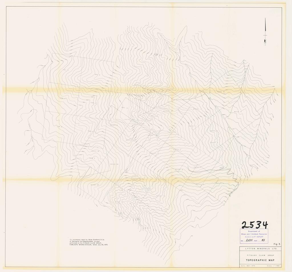
4 Geological mapping of the claim group was carried out with reference to a topographic map of lff=400' from an airphoto survey performed previously on the property. Contour intervals were 25 feet. The general geology of the claim area is a leyered intrusive overlain by the Spences Bridge Group. The layered intrusive has been subsequently intruded by a smaller granitic mass and also basic dykes have been intruded into areas of weakness in the host rock type. Consequently, the layered intrusive has been highly altered in places and often weathers to a chalky white broken rock. The only copper mineral noted is chalcopyrite and occurs mainly disseminated throughout some parts of the host rock. Chalcopyrite is also found in small fractures but is of minor amount, hence the deposit is believed to be of primary origin. Assays were made for possible nickel and cobalt as pyrrhotite is present in varying amounts, but the - assays were negative. Magnetite is also present in the layered intrusive, and is generally > more concentratedin the basic layers. Exploration consisting of diamond drilling and detailed mapping was performed in 1963 on the main zone (see Fig. 1). Geological mapping was done on the surrounding area this year with hopes of finding a continuation of the main zone. Minor amounts of chalcopyrite were found but mineralization is sporadic and does not appear to be of economic importance. Much of the area has been faulted and fractured, making the layers difficult to follow. The general trend of the intrusive is 320 to 330'
5 3- with an easterly dip of 25 0 to 350. Differential banding is very apparent over most of the property. Albitization is prominent around areas of -/ intense fracturing, and calcite and quartz filled fracture are common. Primary magnetite up to 5% often occurs with higher grades of disseminated chalcopyrite, and for this reason a magnetometer survey was performed, with hopes of finding a similar magnetic trend to the main zone. *See Fig.1. b) Magnetometer Survey A total of 18.2 miles of lines were surveyed using a compass and a Sharpe MF-1 magnetometer with a sensitivity of 20 gammas. Readings were taken at 100 foot intervals and were corrected with reference to base station established at regular intervals. The corrected readings were plotted on the accompanying map (~i~. 2), of scale 1"=400'. The lines were run approximately parallel to the topographic contours due to the high topographic relief. The magnetometer grid was tied in to a previous survey grid on the main zone. The magnetic trend follows the general trend of the layered intrusive. The main zone magnetic readings range between gammas but geological mapping in this magnetic range in adjacent areas did not show further concentrates of chalcopyrite. t is believed that higher magnetic readings were due to magnetite content and rock type and are not of use in locating additional chalcopyrite
6
7 PROJECT PERSONNEL WOR EXPENSES APPLCABLE TO TE GEOLOGCAL AND MAGNETOMETER SURVEYS. Name A d d r e s s Work Period Type of Work Rate /~onth Gross * 1 i L. Bradford Box 41 April 15- May 28, 1970 Trenching, magnetometer $ Kimb erley, B. C. survey. E. saaks 1776 Trimble St. April 19 -May 31, 1970 Geological mapping $ $ $ i Vancouver, B. C. t K. Pride c/o Box 322 April 21 - May 31, 1970 Geological mapping 1 Watson Lake, Magnetometer survey $ $ Yukon Territory $ M. Bradford c/o Box 322 April 15 - May 31, 1970 Geological Mapping $ Watson Lake, Magnetometer survey & Supervision Yukon Territory 20 Rothmere Drive April , D.W.Asbury May 31, 1970 Supervision $ Toronto 10, Ont. i $ OTHER EXPENSES Vehicle rental -Jeep $ Pick-up _-_-_---- \ i i: Explosives (sadis) i Groceries ( ~ d e ' s )! $ i * ncludes holiday pay CERTFED CORRECT Unemployment nsurance and Canada Pension. COEPTROLLER., ' C 3 i i
8
9
10
11
I PRELIMINARY MAGNETOMETER SURVEY
 .REPORT O N I PRELIMINARY MAGNETOMETER SURVEY and GEOLOGICAL RECONNAISSANCE L AND K GROUP OF CLAIMS Located 8 Miles East of Princeton, B. C. Similkameen Mining Division Lat. 49' 27' N. Long. 120' 16' W
 ..m,"f.k*"--v- A tot,al of 18 line miles of magnetometer surveying was completed on the "B" and "J" claim groups during August of 197. Approximately two-thirds of the area covered by the survey is glaciated,
The Cobalt Rainbow. Airborne geophysical maps show that a north trending aeromagnetic high suggests further undiscovered mineralisation.
 The Cobalt Rainbow The property is located on Greenstone Creek, approximately 4.8 kilometres south west of the creek mouth. The property is located about 24 km due west of Campbell River, in the east-central
SUPPLEMENT TO MAGNETOMETER 6 ELECTROMAGNETIC SURVEY REPORT. DATED NOVEMBER l, 1973 CIGLEN INVESTMENTS LIMITED CLAIMS GROUP BAD VERMILLION LAKE AREA
 ^ A R l ^ 1974 010 PROJECTS UNIT SUPPLEMENT TO MAGNETOMETER 6 ELECTROMAGNETIC SURVEY REPORT DATED NOVEMBER l, 1973 CIGLEN INVESTMENTS LIMITED CLAIMS GROUP BAD VERMILLION LAKE AREA DISTRICT OF RAINY RIVER
.April 3, Jon G. Baird, B.Sc., P.Eng. LOCATION : One mile west of Mile 70 on the Haynes Road At lin Mining Division 135" 59 O SE
 , It I i REPORT ON MAGNETIC AND ELECTROMAGNETIC SURVEYS ON SOME LUNAR CLAIMS NADAHINI MOUNTAIN AREA NORTHERN BRITISH COLUMBIA ON BEHALF OF MAX FUERSTNER AND IRWIN DEFT 1 t Jon G. Baird, B.Sc., P.Eng..April
7 MILES WEST OF PORT HARDY, B.C.
 GEOPHYSICAL REPORT VERTICAL INTENSITY MAGNETOMEER SURVEY ON LUK CLAIMS, 7 MILES WEST OF PORT HARDY, B.C. 50' 127O SE BY R. E. SHIELDS UNDER SUPERVISION OF J. R. BILLINGSLEY FOR SECOND0 MINING LTD. (N.
REPORT ON THE MAGNETOMETER SURVEYOF THE SO0 MINERAL CLAIMS MERRITT, B. C.
 336 REPORT ON THE MAGNETOMETER SURVEYOF THE SO0 MINERAL CLAIMS MERRITT, B. C. To: The Directore Copper Soo Mining Syndicate OSO~OOS, B. C. R. C. Clough hglneering Ltd. Harvey H. Cohen, P. Pmg. TABLE OF
Mineral Claims. Aspen Grove Area Nicola Mining Division, British Columbia. Latitude N., Longitude W. NTS Map Sheet 92H/lSE
 Mineral Claims Aspen Grove Area Nicola Mining Division, British Columbia Latitude 49 51 N., Longitude 120 35 W. NTS Map Sheet 92H/lSE James P. Balmer, B.SC., P.Geo. on behalf of Gary Brown November 26,2003
GEOPHYSICAL REPORT. Airborne Magnetometer Survey. of the SHEEP-GOAT GROUP OF MINERAL CLAIMS. near Li l looet, B.C.
 GEOPHYSICAL REPORT 977 Airborne Magnetometer Survey of the SHEEP-GOAT GROUP OF MINERAL CLAIMS near Li l looet, B.C. Lillooet Mining Division (Lat.51 'lot Long. 122 40' 7 5t0[2L05E. for DUFFEY LAKES MINES
SULMAC EXPLORATION SERVICES LIMITED
 42E13SEMM 63.947 KABY LAKE " M""' 1 "1 010 SUMMARY REPORT ELMHIRST TOWNSHIP PROPERTY JACOBUS MINING CORPORATION LIMITED Introduction An exploration programme has been completed for Jacobus Mining Corporation
J.D. Mason, Prof. Engineer. Report on the Reconnaissance Magnetometer Survey. Completed for. North American Platinum Corporation Ltd.
 Report on the Reconnaissance Magnetometer Survey Completed for North American Platinum Corporation Ltd. Olivine Mountain Property, Tulameen, B.C. J.D. Mason, Prof. Engineer. November 28, 1967. Certificate
A PRELIMINARY REPORT ON THE ZYMOST2 CLAIM GROtP, TERRACE, B.C.
 NATIVE EXPLORATIONS LTD. A PRELIMINARY REPORT ON THE ZYMOST2 CLAIM GROtP, TERRACE, B.C. INTRODUCTION': The Zymoetz claim group is, at present, held under option by Native Explorations Ltd.. On the 19th
NICOLA M.D King Street West, April, 1969 AMALG 1-44 MINERAL CLAIMS 1. OWNER: Dr. F. R. Burton, W. M. Sirola, P. Eng.
 REPORT ON ' MAGNETIC AND ELECTROMAGNETIC SURVEY AMALG 1-44 MINERAL CLAIMS 1. NICOLA M.D. 49'501 N - 12Oo57f W OWNER: Dr. F. R. Burton, 1506-44 King Street West, Toronto 1, Ontario. by W. M. Sirola, P.
Assessment Report by the Canadian Nickel Co. Ltd. Magnetometer Survey. Larder Lake Mining Division Lebel Tovnship, Ontario
 32084Nwea67 2.331* LEBEL 010 Assessment Report by the Canadian Nickel Co. Ltd. Magnetometer Survey Larder Lake Mining Division Lebel Tovnship, Ontario Claims L-531657 L-531658 L-531111 Map No.: M-359,
MONETA PORCUPINE MINES, LIMITED
 MONETA PORCUPINE MINES, LIMITED VANCOUVER 3. B.C. Telephone: MIJtd 1.9721 The Mining Recorder, GRAND FORKS, B.C. Dear Sir:- The following is a record of salaries, wages, and expenses paid in connection
on the SALAL CREEK MOLYBDENUM PROPERTY, SALAL CREEK, B.C. LILLOOET MINING DIVISION, BRITISH COLUMBIA
 on the J PLUG 9-12, PLUG 19-24, BAT 10-14, BAT 15 Fr., BAT 16 Fr. MINERAL CLAIMS, SALAL CREEK MOLYBDENUM PROPERTY, SALAL CREEK, B.C. LILLOOET MINING DIVISION, BRITISH COLUMBIA N.T.S. 92 J 14 LATITUDE 50
I 4.w.g //old. Lat. 5Oo35T Long T. for. By: James R. Glass, P. Eng. June 6, DUSTY MAC MINES LTD. (N.P.L.)
") 440 6 REPORT ON MAGNETOMETER SURVEY POD GROU'OF CLAIMS HIGHLAND VALLEY KAMLOOPS MINING DIVISION Lat. 5Oo35T Long. 120 55T 9.2 1 //old for DUSTY MAC MINES LTD. (N.P.L.) By: James R. Glass, P. Eng. June
440 6 REPORT ON MAGNETOMETER SURVEY POD GROU'OF CLAIMS HIGHLAND VALLEY KAMLOOPS MINING DIVISION Lat. 5Oo35T Long. 120 55T 9.2 1 //old for DUSTY MAC MINES LTD. (N.P.L.) By: James R. Glass, P. Eng. June
UNION MINIERE EXPLORATIONS AND MINING CORPORATION LIMITED ASSESSMENT REPORT ON FITINAT MINERAL CLAIM. Alberni Mining Division Record No.
 M F )( UNION MINIERE EXPLORATIONS AND MINING CORPORATION LIMITED Suite 200, 4299 Canada Way, Burnaby, B.C. V5G 1 H4 Telephone (604) 437-9491 ASSESSMENT REPORT ON GEOCHEMICAL SOIL SURVEYS AND ROCKSAMPLING
41,a* h0.iiii*bll*i2l,i DEADWOOD CREEK. for. James R. on the BOMBINI GROUP OF CLAIMS. GREENWOOD, British Columbia. Lat. 49'07' Long. 118'43 f.
 GEOLOGCAL REPORT on the BOMBN GROUP OF CLAMS DEADWOOD CREEK GREENWOOD, British Columbia Lat. 49'07' Long. 118'43 f in the GREENWOOD MNNG DVSON for FURY EXPLORATONS LTD. (N. P. L. ) Vancouver, B. C. December
Norlex Mines Property. Whitefish Bay Area, Kenora District. The property of Norlex Mines under option to Canadian Javelin
 52E09SW0025 63.2231 WHITEFISH BAY AND MA Norlex Mines Property D: KENORA 010 D. SEP 14-1967 RECEIPT No. MINING DIVISION Whitefish Bay Area, Kenora District. '; Introduction The property of Norlex Mines
ASSESSMENT REPORT MAGNETOMETER SURVEY GOLDEN ROD, GOLDEN ROD #2. Long.: General Delivery, Vananda, B. C.
 ASSESSMENT REPORT MAGNETOMETER SURVEY GOLDEN ROD, GOLDEN ROD #2 t=/ NTS 92~110w Lat.: Long.: 49O 44' N 124O 34' W Owner: E. Johanson General Delivery, Vananda, B. C. Operator: Rhyolite Resources I nc.
W. 1.NELSON Jr. P. ENG.
 GEOCHEMICAL AND GEOPHYSICAL SURVEY SNO GROUP CLAIMS W. 1.NELSON Jr. P. ENG. NORANDA EXPLORATION COMPANY, LIMITED OMINECA MINING DIVISION AUG. 17, 1971 - AUG. 29, 1971 TABLE OF CONTENTS - Page INTRODUCTION
Report of Gridding and Magnetic Surveys. On the. Munro Property. Munro and Beatty Townships, Ontario. Larder Lake Mining Division
 Report of Gridding and Magnetic Surveys On the Munro Property Munro and Beatty Townships, Ontario Larder Lake Mining Division Claims: 39 4244 For Big Red Diamond Corporation October 3, 2 Timmins, Ontario
A Prospecting Report on the Leo d Or Mineral Claims
 A Prospecting Report on the Leo d Or Mineral Claims Hnvilah Gold Mines Ltd. John Devlin Ande Rychter Leo d Or Claims 2202 C63 NTS, 32 L/7NNippkish 1264 W W, 508) 23$J o f Owner: M.S. Madnri /nay 25, 1987
POTENTIAL OF THE DONGWE COPPER GOLD PROJECT
 POTENTIAL OF THE DONGWE COPPER GOLD PROJECT By Nathan Sabao, P.Geo. September 2015 1 TABLE OF CONTENTS Page 1.0 EXECUTIVE SUMMARY 1 2.0 LOCATION 2 3.0 ACCESS 2 4.0 GEOLOGY 3 5.0 PREVIOUS DRILLING 5 6.0
We are committed to providing accessible customer service. If you need accessible formats or communications supports, please contact us.
 We are committed to providing accessible customer service. If you need accessible formats or communications supports, please contact us. Nous tenons à améliorer l accessibilité des services à la clientèle.
lat ' N Long ' W
 305 7 ec1;, REPORT ON THE JERY CLAIMS OF POLA RESOURCES LTD. NTS 93L/16 0 0 lat. 54 45' N Long. 126 22' W BABIXE LAKE AREA OMINECA MINING DIVISION, B.C. PAUL PLICKA CONSULTING GEOLOGIST DECEMBER 30, 1981
ASSES5dMENT REPORT. Department of. Sept. 15th, Mines and Petroleum Resource.: NO... s?.rk... MAP... I. GEOPHYSICAL mport
 GEOPHYSCAL mport ON THE 92~/2 FOSSELL CmEK GROUP OF COUS CmEK COPPER MNES LTD. AT PORT ALBERN, B. C. BY N.B. VOLLO, P.ENG Sept. 15th, 1976 t Department of Mines and Petroleum Resource.: ASSES5dMENT REPORT
The survey covered claims, in part or in full, DUCKLING 3, 4, 5, 4 fraction, and 5 fraction.
 514 687-6671 XXX- 602 West Hastin~a StroeP, Vata;sn@ouver, BritlsA fhlum~b~a, Garaadsa B81apphgtaa DISCUSS ION OF MAGNETOMETER SURVEY ON DUCKLING CLAIMS FOR DONNA MINES LTD. (N0P.L.) Submitted to: DONNA
3 I1 I I Ill 111 II! II 111 II Ill I IlE I I P I
 -7 3 1 1 11111111111111111111111111111111 ll 111! 111 111 111 111 111111111111111 ll 1111111 1 11111111111111 le P GEOCHEMCAL SURVEY OF THE KE AND D'ARCY CLAM GROUPS.. Similkameen Mining Division, B.C.
PROSPECTORS ASSISTANCE PROGRAM MINISTRY OF ENERGY AND MINES
 BRITISH COLUMBIA PROSPECTORS ASSISTANCE PROGRAM MINISTRY OF ENERGY AND MINES GEOLOGICAL SURVEY BRANCH PROGRAM YEAR: 1999/2000 REPORT #: PAP 99-l 6 NAME: KIM ANSCHETZ PROSPECTORS TlEPORT on the 99 LOUIS
BALFOUR MINING LTD. (N.P.L.) HAM GROUP 92-P-6, CLINTON M. D.8 B. C. Lat 51 17'N, GEOCHEMICAL REPORT. V. CUKOR, P. Eng.
 HAM GROUP 92-P-6, CLINTON M. D.8 B. C. Lat 51 17'N, GEOCHEMICAL REPORT. V. CUKOR, P. Eng.") 34q '7 BALFOUR MINING LTD. (N.P.L.) HAM GROUP 92-P-6, CLINTON M. D.8 B. C. Lat 51 17'N, Long 12lo14'W GEOCHEMICAL REPORT, V. CUKOR, P. Eng. January 31, 1972 TABLE OF CONTENTS 1. INTRODUCTION 2. PROPERTY,
34q '7 BALFOUR MINING LTD. (N.P.L.) HAM GROUP 92-P-6, CLINTON M. D.8 B. C. Lat 51 17'N, Long 12lo14'W GEOCHEMICAL REPORT, V. CUKOR, P. Eng. January 31, 1972 TABLE OF CONTENTS 1. INTRODUCTION 2. PROPERTY,
T-1 Mines and Petroleum Resources
 Department of T-1 Mines and Petroleum Resources ASSESSfdEEdT REPORT NO..LC... 7.t... hlap... ... NTRODUCTON Y ' PERSONNEL.... GEOGRAPHY.... Location..... Access... Page 1 Page 2 Page 2 Page 2 Page 2 Topography...
Summary of Rover Metals Geologic Mapping Program at the Up Town Gold Project, Northwest Territories
 October 13, 2017 Summary of Rover Metals Geologic Mapping Program at the Up Town Gold Project, Northwest Territories Vancouver, British Columbia, Canada - Rover Metals Corp., Rover, is pleased to provide
HOWE COPPER MINE PROJECT HIGH GRADE Cu-Ag with Au
 HOWE COPPER MINE PROJECT HIGH GRADE Cu-Ag with Au The Howe Copper Mine property is located approximately 55 kilometres northwest of Vancouver, BC. It is situated at 1431 metres elevation on the eastern
Montgomery Bedrock Geology 21d-Gowganda Formation: conglomerate, sandstone, siltstone, argillite
 Work Report 2014 Trenching Montgomery Township G-3303 Claim #4259384,4245818 Sault Ste. Marie Mining Division Michael & Yvon Gagne Montgomery Copper Property 1 P a g e 2 P a g e Montgomery Bedrock Geology
GEOPHYS I CAL AND 'GEOLOG I CAL REPORT ON THE MILLIE GROUP (May, June, Millie & April Claims) West shore of Pitt Lake Lat. 49"26'N, Long.
 West shore of Pitt Lake Lat. 4926'N, Long.") GEOPHYS I CAL AND 'GEOLOG I CAL REPORT ON THE MILLIE GROUP (May, June, Millie & April Claims) West shore of Pitt Lake Lat. 49"26'N, Long. 122'34'W by M. K. Lorimer, B.A.Sc., P.Eng. for Yukon Gold Placers,
GEOPHYS I CAL AND 'GEOLOG I CAL REPORT ON THE MILLIE GROUP (May, June, Millie & April Claims) West shore of Pitt Lake Lat. 49"26'N, Long. 122'34'W by M. K. Lorimer, B.A.Sc., P.Eng. for Yukon Gold Placers,
JUNE 12, 1974 '. " 6. A. Noel, (P. Eng.) Geologist, EOLOGICAL - GEOCHEMICAL RE ON THE CLAIM GROUP
 Geologist, EOLOGICAL - GEOCHEMICAL RE ON THE CLAIM GROUP") 't EOLOGICAL - GEOCHEMICAL RE ON THE +E I B R U C E CLAIM GROUP LOCATED: Eight miles due west of McLeod Lake Indian Reserve No. 5, McLeod Lake Area, CARIB00 MINING DIVISION 1 I 8 % ~~\;;'l~3;?s 1";>.;;.l.,;.s.,.,.,.,
't EOLOGICAL - GEOCHEMICAL RE ON THE +E I B R U C E CLAIM GROUP LOCATED: Eight miles due west of McLeod Lake Indian Reserve No. 5, McLeod Lake Area, CARIB00 MINING DIVISION 1 I 8 % ~~\;;'l~3;?s 1";>.;;.l.,;.s.,.,.,.,
REPORT. on the. Omineca Mining Division, British Columbia. Latitude N., Longitude W. NTS map sheet 93F/7E. James W. McLeod, P.Geo.
 REPORT on the CHU MOLYBDENUM PROPERTY Omineca Mining Division, British Columbia Latitude 53 21 N., Longitude 124 37 W. NTS map sheet 93F/7E James W. McLeod, P.Geo. on behalf of Mr. Chris Delorme TABLE
compietea since tnat date, and wnicn comprisea btage I ot tne recommended
 compietea since tnat date, and wnicn comprisea btage I ot tne recommended four-stage program. GEOLOGY & MINERALIZATION The property situate6 on the southeast slope of Nickel Plate Mtn., and within the
GEOCHEMICAL REPORT ON A SOIL SAMPLING SURVEY OF PORTIONS OF THE KR GROUP OF MINERAL CLAIMS OF PLATEAU METALS LIMITED.
 GEOCHEMICAL REPORT ON A SOIL SAMPLING SURVEY OF PORTIONS OF THE KR GROUP OF MINERAL CLAIMS OF PLATEAU METALS LIMITED By Kol Lovang Christopher Riley, P. Eng., Supervisor c Vancouver, B. c. Work Performed:
TOPOGRAPHICAL SURVEY REPORT ON THE GREENDROP PROPERTY NEAR CHILLIWACK, B.C. 92-H-3/W
 TOPOGRAPHICAL SURVEY REPORT ON THE GREENDROP PROPERTY NEW WESTMINSTER M.D. NEAR CHILLIWACK, B.C. 92-H-3/W Location: The central pap of the claims is located at coordinates 49 08'N, latitude by 121 26'W,
CONSULTING GEOLOGICAL & MINING ENGINEERS 1000 GUINNESS TOWER VANCOUVER I, B.C. GEOCHEMICAL AND GEOLOGICAL RE PORT
 DOLMAGE CAMPBELL & ASSOCIATES LTD. CONSULTING GEOLOGICAL & MINING ENGINEERS 1000 GUINNESS TOWER VANCOUVER I, B.C. GEOCHEMICAL AND GEOLOGICAL RE PORT on RAVEN MINERAL CLAIMS Nos. 1-10 and 17-21 Claim Sheet
Introducti on. Land Survey. Geomagnetic Survey. Geomagnetic Results and Interpretati ons - Conclusions and Recommendations C
 m M 42A86SW8281 63.42 PRICE 010 C O H T E H l 42A86SW828I 63.42 PRICE 010C Introducti on Land Survey Geomagnetic Survey Geomagnetic Results and Interpretati ons - Conclusions and Recommendations - - -
GEOLOGICAL BRANCH ASSESSMENT REPORT
 GEOLOGICAL BRANCH ASSESSMENT REPORT REPORT ON GEOPHYSICAL GROUND SURVEYS ON THE CHILI CLAIM MAGNETIC, VLF DIP ANGLE ELECTROMAGNETIC, AND VLF RESISTIVITY SURVEYS BY HI LIMION SEPTEMBER 12, 1986 &! FILMED
OEOMAQNETIC SURVEI QUIBORD TOWNSHIP GROUP #2 HOLLINGER CONSOLIDATED GOLD MINES, LTD.
 OEOMAQNETIC SURVEI QUIBORD TOWNSHIP GROUP #2 HOLLINGER CONSOLIDATED GOLD MINES, LTD. 42Ae9SE0268 63.1502 GUIBORD (711(71 Introduction During the period January 5 - February 26, 1965, a magnetometer survey
GEOPHYSICAL ASSESSMENT REPORT (TOP & BOTTOM CLAIMS) MCINTYRE LAKE. VERNON MINING DIVISION, B-Cm
 MCINTYRE LAKE. VERNON MINING DIVISION, B-Cm") GEOPHYSICAL ASSESSMENT REPORT on the TOP PROPERTY (TOP & BOTTOM CLAIMS) MCINTYRE LAKE VERNON MINING DIVISION, B-Cm NTS : Latitude: 50'04' North Longitude: Owner: Consultant : Author : 118'33 ' West Brican
GEOPHYSICAL ASSESSMENT REPORT on the TOP PROPERTY (TOP & BOTTOM CLAIMS) MCINTYRE LAKE VERNON MINING DIVISION, B-Cm NTS : Latitude: 50'04' North Longitude: Owner: Consultant : Author : 118'33 ' West Brican
L FILMED I GEOLOGICAL BRANCH ASSESSMENT REPORT. on the. in the. A Geological Report. situated. Nelson Mining Division
 A Geological Report on the GOV 5 Claim situated 4 km north of Creston, B.C. in the Nelson Mining Division N.T.S. 82pF/7tEf Lat: 49m1 N Long: 116'4.5'W 24.8' Dates of Work: 11-1 September 1986 Date of Report:
GRISWOLD CREEK, B.C. 6 " GEOCHJ3lICAL REPORT
 GRISWOLD CREEK, B.C. 6 " GEOCHJ3lICAL REPORT AUTROR: W. Meyer, BSc. ENDORSED El!: John De Leen, BASc.* NASc., E.M., P. Eng. No. 3675 Vancouver, B.C. January 22nd, 1965. -I- During the period of July 27th
42H88SW NEWMAN
 42H88SW0003 63.8199 NEWMAN 010 TRIPOINT MINES LIMITED, Suite 305-100 Adelaide St. West, Toronto l, Ontario. Gentlemen: Your Company recently conducted a combined magneticelectromagnetic survey over a ten
:^^^^.^:*^.-f.^ r--", y.;-., - :^--,.,:,-;. ^;^u;;:-4:-;:-c?\'rfe *.V. V '^-t?"' :"^4^'A^'-*""^ ::--^-*^ii^i' :'^'^
 43C88SW0176 9939 JACOBSON i ;^*X ' y-f-'v' - * - :- " v-v-vj- "'-, p,v- *.,-... ''- i,. --: ^j v i,:^ v.- ' *,..-.- x, S'J~ f;" V J *J ' :'i? "'. 'f ' -'"c,- ; i -- - -?-.-'.f ' -' ' -. '.f-,-,.~.~ -Ji-'.'-:
Gold Mountain Group Gold Mtn. A, B, C & D Mineral Claims Record Nos. 697, 698, 699 & 700. Island Mountain Cariboo Mining Division British Columbia
 GOLD POINT RESOURCES LTD. Geophysical Survey Gold Mountain Group Gold Mtn. A, B, C & D Mineral Claims Record Nos. 697, 698, 699 & 700 Island Mountain Cariboo Mining Division British Columbia Vancouver,
Magnetic Field and VLF Surveys on the Shining Tree Property. Claims: , , , , , , , ,
 December 29, 2014 NTS: 041P11 Magnetic Field and VLF Surveys on the Shining Tree Property Claims: 1203361, 4251801, 4251803, 4251805, 4263067, 4263068, 4270940, 4270436, 4276740 Churchill and Asquith Townships
REPORT ON GEOLOGY DUVAN COPPER COMPANY LTD. REX LAKE PROPERTY, TORONTO.
 * 52L*7NEM36 7 63A.S55 REX LAKE 010 REPORT ON GEOLOGY DUVAN COPPER COMPANY LTD. REX LAKE PROPERTY, TORONTO. Toronto, Ontario July 28, 19^9- INTRODUCTION A party consisting of A. Kopare, engineer and P.
Geo chemi c a1 Rep or t SILVER KING FAST GROUP. H. S. Lazenby Geologist. Vancouver, B.C. 16 November 1967
 Geo chemi c a1 Rep or t on SILVER KING FAST GROUP 1967 Vancouver, B.C. 16 November 1967 H. S. Lazenby Geologist Contents Introduction P. 1 Method of Survey P. 1 Interpretation of Results p. L&2 Statement
July Exploring for Canadian Gold in the Rainy River District of Ontario
 July 2013 Exploring for Canadian Gold in the Rainy River District of Ontario 1 Forward Looking Statements Some of the statements in this document may be deemed to be "forward-looking statements". All statements
THE PROPERTIES of. JSR1CH0 HIKES LTD. and GAZA MIH1SS LTD, HIGHLAND VALLiSY, BRITISH COLUMBIA. for ALWIN MINING COMPAKY LTD.
 BACON & CROWHURST LTD. on THE PROPERTIES of JSR1CH0 HIKES LTD. and GAZA MIH1SS LTD, HIGHLAND VALLiSY, BRITISH COLUMBIA for ALWIN MINING COMPAKY LTD. by R.W. PHENULER, B.Sc., P.Eng. Vancouver, B.C July
REPORT ON DIAMOND DRILLING SUBSTITUTION EAST PROPERTY CLAIMS AND HEBERT TOWNSHIP ONTARIO, CANADA
 REPORT ON DIAMOND DRILLING SUBSTITUTION EAST PROPERTY CLAIMS 1248920 AND 1248921 HEBERT TOWNSHIP ONTARIO, CANADA Adroit Resources Inc. Suite #610-1111 Melville Street Vancouver, British Columbia, Canada
A New Direction. Copper-Gold Deposit at Thor TSX.V:COL. August 11, May 2013
 A New Direction Copper-Gold Deposit at Thor August 11, 2016 May 2013 TSX.V:COL FORWARD LOOKING STATEMENTS This presentation includes certain forward-looking information or forward-looking statements for
For personal use only
 ANNOUNCEMENT TO THE AUSTRALIAN SECURITIES EXCHANGE: 28 NOVEMBER 2012 DRILLING UPDATE MABILO PROJECT The Directors of Sierra Mining Limited ( Sierra ) are pleased to announce further results from reconnaissance
GEOLOGICAL MAPPING OF SKARNS ON THE SHEEP AND EWE CLAIMS, TURNAGAIN RIVER, B.C. DURING THE 1979 SUMMER SEASON
 GEOLOGICAL MAPPING OF SKARNS ON THE SHEEP AND EWE CLAIMS, TURNAGAIN RIVER, B.C. DURING THE 1979 SUMMER SEASON CLAIMS: Sheep 1 to 4 Ewe 1, 3, 4 to 8 Lamb 12 Fraction Liard Mining Division, B.C. NTS 104
GEOLOGICAL MAPPING REPORT ON THE ASH MINERAL CLAIM OSOYOOS MINING DIVISION ASHNOLA RIVER MAP SHEET NTS M092,H019 MCBRIDE CREEK AREA, ASHNOLA RIVER,
 GEOLOGICAL MAPPING REPORT ON THE ASH MINERAL CLAIM OSOYOOS MINING DIVISION ASHNOLA RIVER MAP SHEET NTS M092,H019 LATITUDE 49 o O6, LONGITUDE 120 o 22 MCBRIDE CREEK AREA, ASHNOLA RIVER, KEREMEOS, B.C. CANADA
Assessment Work Report. on the Geophysical Surveys carried out over the
 Assessment Work Report on the Geophysical Surveys carried out over the PINE GROUP of Mineral Claims 951-J-15-W Lillooet Mining Division Goldbridge, B.C. Long 122 48' Lat. 50 48' by Levon Resources Ltd.
MODERN GEOPHYt INTRODUCTION
 MODERN GEOPHYt SUITE 5-13 ADELAIDE ST. E. TORONTO - ONTARIO 42A06SE8121 63.1009 ELDORADO 0 10 JU*Jkl.TJLA. JL JL^A^r GEOPHYSICAL SURVEYS ELECTROMAGNETIC (VERTICAL 8r HORIZONTAL) TELEPHONE: MAGNETIC EMPIRE
ARGENTINE FRONTIER RESOURCES INC (AFRI) SALTA EXPLORACIONES SA (SESA)
 SALTA EXPLORACIONES SA (SESA)") ARGENTINE FRONTIER RESOURCES INC (AFRI) SALTA EXPLORACIONES SA (SESA) LA SARITA IOCG-Porphyry Copper-Gold August 2006 La Sarita Cateo 2 La Sarita - bleached center is Taca Taca Arriba. The hematite zone
ARGENTINE FRONTIER RESOURCES INC (AFRI) SALTA EXPLORACIONES SA (SESA) LA SARITA IOCG-Porphyry Copper-Gold August 2006 La Sarita Cateo 2 La Sarita - bleached center is Taca Taca Arriba. The hematite zone
GEOPHYSICAL SURVEY WHITEY AND H GROUP MINERAL CLAIMS KEEN CREEK AREA, SLOCAN MINING DIVISION ANDEX MINES LTD. VANCOWER, B.C.
 R E P O R T ON THE GEOPHYSICAL SURVEY WHITEY AND H GROUP MINERAL CLAIMS KEEN CREEK AREA, B.C. SLOCAN MINING DIVISION ANDEX MINES LTD. VANCOWER, B.C. Andex Mines Ltd., 315-543 Granville Street, Vancouver,
Hope Brook gold mine, NL - Copper, then switched to gold
 Chapter 12 : Mining in NL Defined as the extraction of valuable minerals from Earth from an ore body, vein, or seam. A mineral is any chemical substance arranged in some crystalline structure. - must have
April Exploring for Canadian Gold in the Rainy River District of Ontario
 April 2013 Exploring for Canadian Gold in the Rainy River District of Ontario 1 Forward Looking Statements This presentation may contain forward-looking statements including but not limited to comments
Notes: Note. Township of GODSON Report NQ: 12. Diamond Dniiing. Hole NQ Footage Date. July/56. July/56. Aug/56. Aug/56. Claim NQ 487' K ' l-a
 Diamond Dniiing S2F«4NW«194 12 GODSON 010 Township of GODSON Report NQ: 12 Work performed by: KENNCO EXPLORATIONS (CANADA) LTD. Claim NQ Hole NQ Footage Date Note K 25434 l 487' July/56 l-a 48' July/56
GIANT MASCOT MINES LIMITED ~nen~z~s~11~uumsn~ SURRARD STREET VANCOUVER 1, B. C. June 4, 1968
 NtNI OFFICE; P. 0. BOX 820. HOPE. 8. C. TELEP*ON
GEOCHEMICAL REPORT THE 82M/12 FH GROUP BIRCH ISLAND, B.C. S1 119O NOW. ROYAL CANADIAN VENTUR 3S LTD. By: Vollo, P. Eng. N.B. Pay 28th, 1969.
 c GEOCHEMICAL REPORT ON THE 82M/12 FH GROUP AT BIRCH ISLAND, BC S1 119O NOW BY ROYAL CANADIAN VENTUR 3S LTD NB By: Vollo, P Eng Pay 28th, 1969 Approximately 700 samples were collected over 14 miles of
Elephant Mountain, Alaska Intrusive Related Gold Project July Option to Earn 100%
 Elephant Mountain, Alaska Intrusive Related Gold Project July 2018 Option to Earn 100% CORPORATE Corporate DISCLOSURE Disclosure The information contained herein, while obtained from sources which we believe
n3a 92 C- /.I 4 tr November 6, 1979 J. F. MclNTYRE, P.ENG. CONSU LTlNG MINING ENGl NEER Map #92C-16 TRANS PACIFIC VENTURES LTD.
 TELEPHONE : 5 9 6-1331 J. F. MclNTYRE, P.ENG. CONSU LTlNG MINING ENGl NEER 6466 CAGELDU CRESCENT DELTA, B.C. CANADA TRANS PACIFIC VENTURES LTD. c i. SAMPLING AND GEOPHYSICAL REPORT CAP CLAIM, VICTORIA
CONTENTS. Location, Access and History...6. Tenure Status and Geology Regional Andy Property Geology Map...9
 TYPE OFWORK IN THIS REPORT EXTENT OF WORK (rn METRTC UNITS) ON WHICH CLAIMS PROJECT COSTS APPORTIONED (incl. support) GEOLOGICAL (scale, area) Ground, mapping Photo interpretation GEOPHYSICAL (line-kilometres)
32?un North of Hope, B.C.,
 Geological Reconnaissance Assessment Report on portions of the Gilt Creek Group (Mike, C.G., Julie, and Gilt Mineral Claims) Situated 32?un North of Hope, B.C., New Westminster Mining Division N 'P 97H/11W
GEOLOGIST'S XLPOXT. CLJK G.iOUP OF tkucf^plu^to flnls LTD. BATCHA'-ttNA AuiA, ONTAhlO. The 5 - claim group of Bruce Presto Mines Ltd.
 G Q 5f*/-S2 a. GEOLOGIST'S XLPOXT ON CLJK G.iOUP OF tkucf^plu^to flnls LTD. BATCHA'-ttNA AuiA, ONTAhlO MMM A MAY 12 1964 l RESIDENT GEOLOGIST SAULT STC. MARIE SUMMARY The 5 - claim group of Bruce Presto
1 CLAIMS GEOPHYSICAL REPORT ON BOYAL SITUATE NORTHEAST OF TILLICUM MOUNTAIN GOLD AREA BURTON - NAKUSP SIQCAEJ MINING DIVISION
 GEOPHYSICAL REPORT ON BOYAL 1 CLAIMS SITUATE NORTHEAST OF TILLICUM MOUNTAIN GOLD AREA BURTON - NAKUSP SIQCAEJ MINING DIVISION CONSULTING GEOLOGIST AUGUST 1983 VANCOUVER B *C INDEX INTRODUCTION ooa,.eoaaa.aaaoaaooaoa~ao~o
Prospectivity Modelling of Granite-Related Nickel Deposits Throughout Eastern Australia
 Prospectivity Modelling of Granite-Related Nickel Deposits Throughout Eastern Australia M P Hill 1 and A McCarthy 2 ABSTRACT Spatial modelling has been used to determine potential locations of granite-related
0.. HUDSON BAY EXPLORATION AND DEVELOPMENT COMPANY LIMITED OMINECA MINING DIVISION BRITISH COLUMBIA REPORT ON EXPLORATION PROGRAM
 'I '0; 63 HUDSON BAY EXPLORATION AND DEVELOPMENT COMPANY LIMITED LSD CLAIM PROPERTY OMINECA MINING DIVISION Q. i!' p BRITISH COLUMBIA REPORT ON EXPLORATION PROGRAM - 972 BY R. A. FREBERG, P. ENG. SEPTEMBER
EMPIRE DEVELOPMENT COMPANY LIMITED
 EMPIRE DEVELOPMENT COMPANY LIMITED 1017-736 Granville Street Vancouver 2, B.C. January 17, 1966 Chief Gold Commissioner, Department of Mines & Petroleum Reso,urces, Victoria, B.C. Dear Sir: The field work
NO. MAP..._._..._...,,..,.
 KERR- ADDISON GOLD MINES LIMITED SELF-POTENTIAL SURVEY OWL!i- 12 1 Dwner ) NAOINA 1-4 ) MINERAL CLAIMS W. F. McGowan, ) 3262 Marine Orive, ANGUS 1-4 ) west Vancouver, 8. c. LOCATED AT 5. E. ENO OF OWEN
BLURTON CREEK NICKEL PROPERTY. (Minfile # 082LNW-039)
") 5489153 BLURTON CREEK NICKEL PROPERTY (Minfile # 082LNW-039) Mara Lake Area / Salmon Arm B.C NTS - 82L-11 (UTM 83/Z10, 357690E, 5614220N) Prepared by: Jim Cuttle, B.Sc., P.Geo. 86 Cloudburst Road Whistler,
5489153 BLURTON CREEK NICKEL PROPERTY (Minfile # 082LNW-039) Mara Lake Area / Salmon Arm B.C NTS - 82L-11 (UTM 83/Z10, 357690E, 5614220N) Prepared by: Jim Cuttle, B.Sc., P.Geo. 86 Cloudburst Road Whistler,
3D potential-field inversions and alteration mapping in the Gawler Craton and Curnamona Province, South Australia
 3D potential-field inversions and alteration mapping in the Gawler Craton and Curnamona Province, South Australia Richard Chopping, Nick Williams, Tony Meixner and Indrajit Roy Outline Inversions Introduction
WEST MCARTHUR UPDATE April 17, Table 1: Winter 2018 Drill Hole Summary
 WEST MCARTHUR UPDATE April 17, 2018. Table 1: Winter 2018 Drill Hole Summary WMA044: Sooty pyrite alteration is disseminated along local beds and coats local fractures between 401.2 m and 724 metres. A
Report of Assessment Work done on Ace Claix
 Report of Assessment Work done on Ace Claix -. 1-14, Atlin Mining Division, B.C. Location: Long 132~00~. Lat. 58' OOW (Coordinates of S.E. Quad) In the Menatatuline Range, approximately 12 J miles SE of
Rail Lake Copper Property (WB Claims) G.M. Depaoli, B.Sc. Geophysicist J.F. ALl.an, P.Eng. (B.C.! July 1973
 G.M. Depaoli, B.Sc. Geophysicist J.F. ALl.an, P.Eng. (B.C.! July 1973") 1973 Geophysical Report TITLE AUTHORS DATE, COI"4ODITY LOCATION-A rea -Mining Division -Coordinates -NTS Rail Lake Copper Property (WB Claims) GM Depaoli, BSc Geophysicist JF ALlan, PEng (BC! July 1973
1973 Geophysical Report TITLE AUTHORS DATE, COI"4ODITY LOCATION-A rea -Mining Division -Coordinates -NTS Rail Lake Copper Property (WB Claims) GM Depaoli, BSc Geophysicist JF ALlan, PEng (BC! July 1973
ASSESSMENT REPORT. Geochemical and Geological Surveys. on the. Gooch#1-4. Mineral Claims. Omenica Mining District NTS 93L/7W
 f- GEOLOGICAL BRANCH ASSESSMENT REPORT ASSESSMENT REPORT Geochemical and Geological Surveys on the Gooch#1-4 Mineral Claims Omenica Mining District NTS 93L/7W LAT: 54O25'W LONG: 126O26'W Operator: SMD
We are committed to providing accessible customer service. If you need accessible formats or communications supports, please contact us.
 We are committed to providing accessible customer service. If you need accessible formats or communications supports, please contact us. Nous tenons à améliorer l accessibilité des services à la clientèle.
ON THE GEOLOGICAL AND MAGNETOMETER SURVEYS ON THE FANG NO. 1 TO 9 AND NO. 10 FRACTION MINERAL CLAIMS PROJECT 6051 N.T.S.
 AN INTERIM REPORT ON THE GEOLOGICAL AND MAGNETOMETER SURVEYS ON THE FANG NO. 1 TO 9 AND NO. 10 FRACTION MINERAL CLAIMS PROJECT 6051 LAT.~o'~~' LONG. 127'33' 8 MILES SOUTHWEST OF PORT ALICE, B.C. N.T.S.
ANTLER GOLD DRILLS GRAMS PER TONNE GOLD OVER 5.35 METRES AT THE WILDING LAKE GOLD PROJECT, NEWFOUNDLAND
 ANTLER GOLD DRILLS 10.01 GRAMS PER TONNE GOLD OVER 5.35 METRES AT THE WILDING LAKE GOLD PROJECT, NEWFOUNDLAND HALIFAX, NOVA SCOTIA (CNW December 13 th, 2017) Antler Gold Inc. ( Antler ) (TSX- V:ANTL) is
T'he Horn property comprises a group of forty. contiguous claims owned by Canadian Superior Exploration
 -1- INTRODUCTION T'he Horn property comprises a group of forty contiguous claims owned by Canadian Superior Exploration Limited. The group is located five miles nort'h of Motase Lake. In July and August,
on the Diamond Drilling done on the LAKESIOE GROUP of Mineral Claims SLOCAN MINING DIVISION 82-F-14-W Long ' Lat '
 Assessment Work Report on the Diamond Drilling done on the LAKESIOE GROUP of Mineral Claims SLOCAN MINING DIVISION 82-F-14-W Long 117 22' Lat. 49 58' ADRIAN KESLER SILVERTON, B.C. operator LEVON RESOURCES
ELOISE COPPER MINE 20 YEARS STRONG
 ELOISE COPPER MINE 20 YEARS STRONG 1973 Magnetic high anomaly on government air-mag survey Ground magnetic and gravity profiles 1975 Coincident gravity anomaly Savage Exploration s search for magnetite
Yukon Presentation. October 2012
 Yukon Presentation October 2012 Disclaimer This presentation contains forward looking statements. All statements, other than statements of historical fact, included herein, including without limitation,
The SL group is located 10 miles east of Lac La Hache and can be reached by good secondary roads.
 0 Summary Soil samples were collected and analyzed for trace mercury vapour content over a magnetic and electromagnetic anomaly. Weak positive evidence of base metal mineralization was obtained. Location
DÉCOUVERTE Positioned for Discovery in James Bay, Quebec. Investor Presentation, January 2018 by Danae Voormeij, MSc, PGeo
 DÉCOUVERTE Positioned for Discovery in James Bay, Quebec Investor Presentation, January 2018 by Danae Voormeij, MSc, PGeo Location Maps and Infrastructure Location: Durango Resources 100% owned Découverte
FANCAMP EXPLORATION LTD.
 FANCAMP EXPLORATION LTD. Fancamp Exploration Ltd. Overview of Ontario Projects Prepared by: J. Kleinboeck, P.Geo. August 4 th, 2018 Dorothy Lake Project Comprised of 104 unpatented claims covering an
REPORT ON THE SURVEY MRGNETOMETER. STELLA Nos. l-4 CLAIMS. ROSEA c 0 P P ER MINES L T D. ROBERTSON R I Y E R, B. C. April 26, F.J. Hemsworth.
 REPORT ON THE MRGNETOMETER SURVEY of the STELLA Nos. l-4 CLAIMS ROSEA c 0 P P ER MINES L T D. ROBERTSON R I Y E R, B. C. April 26, 1957. F.J. Hemsworth. Subject TABLE OF CONTENTS KEY XAP... i%l& II\!TRODUCTION...
Anthill Resources Yukon - An Update on the Einarson Project
 Anthill Resources Yukon - An Update on the Einarson Project The Eastern Extension of a Carlin-type Gold Trend in the Selwyn Basin Anthill Resources Ltd Yukon Claim Holdings Over 2400 km 2 Property Location
This report describes the results of a magnetometer. survey and a resistivity check survey conducted by Geo-Technical
 Aumaque Gold Mines Limited, 100 Adelaide Street, West, Suite I6OO, Toronto, 1, Ontario, Gentlemen: This report describes the results of a magnetometer survey and a resistivity check survey conducted by