Rail Lake Copper Property (WB Claims) G.M. Depaoli, B.Sc. Geophysicist J.F. ALl.an, P.Eng. (B.C.! July 1973
|
|
|
- Dulcie Neal
- 5 years ago
- Views:
Transcription
1 1973 Geophysical Report TITLE AUTHORS DATE, COI"4ODITY LOCATION-A rea -Mining Division -Coordinates -NTS Rail Lake Copper Property (WB Claims) GM Depaoli, BSc Geophysicist JF ALlan, PEng (BC! July 1973 cu Lac La Hache Clinton 51 58'N Latitude, 121"27'w Longitude 92 P 14 AMAX VANCOWER OFFICE +55g : MAP :- I NO I I -
2 / TABLE OF COJ!J? ENTS - APPENDIX I - Statement of Costs,--
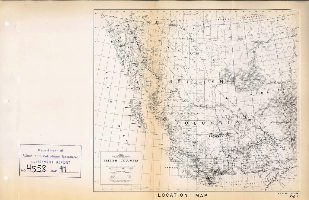
3 r S UiWii RY A ground magnetometer survey was completed on the Rail Lake Copper Property during the period June 14 to 22, 1973 A contoured presentation of the measurements obtained reveals two large magnetic anomalies The southernmost anomaly reflects the highest susceptibility and its extent has not been completely defined To date no outcrop exposure has been discovered on the property, however near surface concentrations of magnetite are anticipated /-- I NTRODLJCT ION The Rail Lake Copper Property consists of twenty-one mineral claims owned by P,ma)r Potash Limited During the period June 9 to June 22, 1973 twelve miles of line cutting and ten miles of ground magnetometer surveying was completed on the property The following report describes the instrumentation,' field procedure and results obtained from the survey Location and Access The property is located within the Interior Plateau of south-central' British Columbia, ten miles north of Lac La Hache It is accessible by a two wheel drive vehicle via the Spout Lake gravel road It lies in the Clinton Mining Division at 51"58'N latitude and 121'27'W longitude (see Figure 1) Grid Control The control grid consists of 123 miles of cut, chained and picketed lines The central baseline, which skirts the eastern edge of a large meadow, strikes north 40" west and is cut froin the Spout Lake road to the Coranex access road The total length of the baseline is over 14,000 feet however, O+OO is located at the northern edge of the laige meadow Starting from this origin and proceeding southerly a total of eighteen cross lines have beer! cut and picketed at 400 foot intervals
4

5 AMAX POTASH LAKE COPP W B CLAIMS
6 The cross lines are only cut on the east side of the 'baseline and they all extend for 2600 feet (see Figure 3) GENERAL GEOLOGY To date no outcrop exposures have been located on the property In a regional sense the property is near the contact of Nicola Group rocks and overlying Tertiary plateau basalts I I r MAGhJ TOMETER SURVEY Introduction and Theory A ground magnetometer survey was initiated in order to further define and accurately locate an intense aeromagnetic anomaly visible on aeromagnetic map sheet 92 P 14 Because of the lack of exposure it was also hoped that the results of the survey would aid in the interpretation of structural trends The magnetism of a11 rocks is controlled by their content of ferromagnetic material, ie substances possessing a relatively high susceptibility and capable of acquiring permanent magnetization Often skarn mineral assemblages include considerable amounts of the mineral magnetite, intensity magnetic anomalies may therefore be used as an indicator of skarn environments Instrument and Procedure The instrument employed was the Model G-816 High portable Proton Magnetometer, manufactured by Geometrics of 914 Industrial Avenue, Palo Alto, California This proton free precession magnetometer operates on the principle of nuclear magnetic - resonance to produce a measurement of the total magnetic intensity of the earth's field The instrument is comprised of a console with 12 size "D" flashlight batteries, 25 kg (55 pounds) ; sensor and signal cable 18 kg (4 pounds) and an aluminui-(2 staff 09 ky (2 poun~s), Because of the anticipated
7 3 order of magnitude of the anomalies, the sensor was carried in the back pack rather than on the staff Values are obtained from a digital display read-out and operating temperatures are from -4OOC to 85OC Coordinates 41+00S, O+OOE on the baseline were selected as the datum value for the survey The baseline was surveyed north from this point at 100 foot intervals to station 04-OOS, O+OOE and then resurveyed back to the starting position Special care was observed on cross line intersections and corrections were made for the diurnal variation fashion magnetic reference points were obtained for the remaining southern portion of the baseline In a similar The north-east oriented cross lines were then surveyed at 100 foot station intervals and diurnal corrections were calculated from the baseline reference points Corrected values were plotted on a scale of 1"=400 feet and are presented in Figure 3 f- liesults an2 3iscussion The data was contoured employing a 1009 gainnia contour interval and the resulting magnetic patterns are displayed in Figure 3 pattern Two large magnetic anomalies dominate the isomagnetic The northern anomaly has a strike length of 3500 feet and a maximum width of 1000 feet on cross line 24 south source of this anomaly is interpreted to be at a depth of greater than 200 feet below ground surface The Because of the broad nature of the anomaly one might expect a highly susceptible rock type containing up to 3% magnetite The southern anoinaly has not been completely defined and is still on the ecge of the map sheet This feature on cross lj-nz 56 south c?p;?ears very intense and quite narrow might interpret the source to be a near surface concentration One c
8 f- of magnetite Further grid lines are necessary to coinplctely define the southern limit of this anomaly July 1973 af-* GM DePaoli, 33S~ n JF Allan, PEng (BC) c
9 RAIL LAKE - Amax Potash Limited r APPENDIX I STATEMENT OF COSTS Record Number Claim Number Due Date Green GrouD WB 2 July 22, WB 4 July 22, WB 6 July 22, WB 8 July 22, WB 10 July 22, incl WB incl July 22, WB 18 July 22, WB 20 July 22, WB 22 July 22, WB 24 July 22, WB 26 July 22, incl WB incl July 22, WB 32 July 22,1973 Period of Work - June 9, 1973 to June 22, 1973 Summary of Work - Cut and Chained Picket Line - 12 line m iles - Magnetometer Survey - 10 line miles S Personnel CJ Hodgson Thurlow Street, Vancouver 5, BC Geologist 2 $6500/day $ GM DePaoli Thurlow Street, Vancouver 5, BC Geophysicist 5 days 0 $5400/day FJ Feryuson Thurlow Street, Vancouver 5, BC Geological Technician 5 $4300/day BW Munday - Box 54, Avola, BC Labourer 5 days 8 $2649/day Nick Sworyk - Box 235, Houston, BC Labourer 5 $2649/day TE Gilchrist Street, North Delta, BC Jr Assistant 2 $1710/day Peter Gutzman Laurelynn Drive, North Vancouver, BC Jr Assistant 4 days 8 $1710/day DD McLeod - Box 280 Enderby, BC Sr Assistant 4 $2649/day DS Brooks Cloverley Street, North Vancouver, BC Jr Assistant 3 $1796/day 5388 Board - 35 man Magnetometer Rental - Geometri-cs G-816 Vehicle $looo/day 7 $1500/day 14 $1000/day
10 9 b I -- Rail Lake Statement of Costs Paqe Two Report Preparation and Drafting $1,92459 The work is to be applied for one year on Green Group WB 2, 4, 6, 8, 10, 12-16, 18, 20, 22,
11
PHOENIX GEOPHYSICS LIMITED REPORT ON THE VLF-EM AND TOTAL FIELD MAGNETOMETER SURVEYS ON THE
 PHOENIX GEOPHYSICS LIMITED REPORT ON THE VLF-EM AND TOTAL FIELD MAGNETOMETER SURVEYS ON THE TAN CLAIMS, CHILLIWACK AREA NEW WESTMINSTER MINING DIVISION, BRITISH COLUMBIA FOR LORNEX MINING CORPORATION LIMITED
GIANT MASCOT MINES LIMITED ~nen~z~s~11~uumsn~ SURRARD STREET VANCOUVER 1, B. C. June 4, 1968
 NtNI OFFICE; P. 0. BOX 820. HOPE. 8. C. TELEP*ON
ASSESSMENT' REPORT GEOPHYSICAL REPORT ON THE ATTORNEY 2 CLAIM (4 UNITS) OMINECA MINING DIVISION SHEILA A. CRAWFORD.
 OMINECA MINING DIVISION SHEILA A. CRAWFORD.") ASSESSMENT' REPORT GEOPHYSICAL REPORT ON THE ATTORNEY 2 CLAIM (4 UNITS) OMINECA MINING DIVISION by SHEILA A. CRAWFORD LOCATION: 57z17' N Latitude 127 11' W Longitude N.T.S. 94E/6E OWNER/OPERATOR: SEREM
ASSESSMENT' REPORT GEOPHYSICAL REPORT ON THE ATTORNEY 2 CLAIM (4 UNITS) OMINECA MINING DIVISION by SHEILA A. CRAWFORD LOCATION: 57z17' N Latitude 127 11' W Longitude N.T.S. 94E/6E OWNER/OPERATOR: SEREM
I PRELIMINARY MAGNETOMETER SURVEY
 .REPORT O N I PRELIMINARY MAGNETOMETER SURVEY and GEOLOGICAL RECONNAISSANCE L AND K GROUP OF CLAIMS Located 8 Miles East of Princeton, B. C. Similkameen Mining Division Lat. 49' 27' N. Long. 120' 16' W
7 MILES WEST OF PORT HARDY, B.C.
 GEOPHYSICAL REPORT VERTICAL INTENSITY MAGNETOMEER SURVEY ON LUK CLAIMS, 7 MILES WEST OF PORT HARDY, B.C. 50' 127O SE BY R. E. SHIELDS UNDER SUPERVISION OF J. R. BILLINGSLEY FOR SECOND0 MINING LTD. (N.
'-7' REPORT ON A MAGNETOMETER SURVEY OVER PART OF THE MAX CLAIM GROUP 1-20 LAC LE JEUNE AREA KAMLOOPS MINING DIVISION KAMLOOPS, BRITISH COLUMBIA
 I,., - SUITE 102. 222 BELLEVUE WES t ANCOUVER, B. '-7' REPORT ON A I MAGNETOMETER SURVEY OVER PART OF THE MAX CLAIM GROUP 1-20 LAC LE JEUNE AREA KAMLOOPS MINING DIVISION KAMLOOPS, BRITISH COLUMBIA 50-30
BALFOUR MINING LTD. (N.P.L.) HAM GROUP 92-P-6, CLINTON M. D.8 B. C. Lat 51 17'N, GEOCHEMICAL REPORT. V. CUKOR, P. Eng.
 HAM GROUP 92-P-6, CLINTON M. D.8 B. C. Lat 51 17'N, GEOCHEMICAL REPORT. V. CUKOR, P. Eng.") 34q '7 BALFOUR MINING LTD. (N.P.L.) HAM GROUP 92-P-6, CLINTON M. D.8 B. C. Lat 51 17'N, Long 12lo14'W GEOCHEMICAL REPORT, V. CUKOR, P. Eng. January 31, 1972 TABLE OF CONTENTS 1. INTRODUCTION 2. PROPERTY,
34q '7 BALFOUR MINING LTD. (N.P.L.) HAM GROUP 92-P-6, CLINTON M. D.8 B. C. Lat 51 17'N, Long 12lo14'W GEOCHEMICAL REPORT, V. CUKOR, P. Eng. January 31, 1972 TABLE OF CONTENTS 1. INTRODUCTION 2. PROPERTY,
REPORT ON MAGNETOMETER SURVEY TIK-1 CLAIM e&f KAMLOOPS MINING DTVISION. by D. Hendry D. C. MILLER. February 3, for
 REPORT ON MAGNETOMETER SURVEY TIK-1 CLAIM 92-1-14 e&f KAMLOOPS MINING DTVISION lat. 50 57 ' 12" long. 121O23 ' 37" OWNER: ST. JOSEPH EXPLORATIONS LIMITED OPERATIOR: ST. JOSEPH EXPLORATIONS LIMITED by D.
I 4.w.g //old. Lat. 5Oo35T Long T. for. By: James R. Glass, P. Eng. June 6, DUSTY MAC MINES LTD. (N.P.L.)
") 440 6 REPORT ON MAGNETOMETER SURVEY POD GROU'OF CLAIMS HIGHLAND VALLEY KAMLOOPS MINING DIVISION Lat. 5Oo35T Long. 120 55T 9.2 1 //old for DUSTY MAC MINES LTD. (N.P.L.) By: James R. Glass, P. Eng. June
440 6 REPORT ON MAGNETOMETER SURVEY POD GROU'OF CLAIMS HIGHLAND VALLEY KAMLOOPS MINING DIVISION Lat. 5Oo35T Long. 120 55T 9.2 1 //old for DUSTY MAC MINES LTD. (N.P.L.) By: James R. Glass, P. Eng. June
for the Greenwood Mining Division, B.C. NTS 82E/7W Latitude 49' 27' W, Longitude 118' 5 Prepared by a= D. Dylan Watt, B.Sc.
 t. b LOGnO: 37~ -08 m. ACTIO#: for the AMP AMP 2 AMP 3 t AMP 4 CLAIMS Greenwood Mining Division, B.C. NTS 82E/7W Latitude 49' 27' W, Longitude 8' 5 %E c,w zc *& a w Prepared by a= -4c. D. Dylan Watt, B.Sc.
Gold Mountain Group Gold Mtn. A, B, C & D Mineral Claims Record Nos. 697, 698, 699 & 700. Island Mountain Cariboo Mining Division British Columbia
 GOLD POINT RESOURCES LTD. Geophysical Survey Gold Mountain Group Gold Mtn. A, B, C & D Mineral Claims Record Nos. 697, 698, 699 & 700 Island Mountain Cariboo Mining Division British Columbia Vancouver,
Report of Gridding and Magnetic Surveys. On the. Munro Property. Munro and Beatty Townships, Ontario. Larder Lake Mining Division
 Report of Gridding and Magnetic Surveys On the Munro Property Munro and Beatty Townships, Ontario Larder Lake Mining Division Claims: 39 4244 For Big Red Diamond Corporation October 3, 2 Timmins, Ontario
The survey covered claims, in part or in full, DUCKLING 3, 4, 5, 4 fraction, and 5 fraction.
 514 687-6671 XXX- 602 West Hastin~a StroeP, Vata;sn@ouver, BritlsA fhlum~b~a, Garaadsa B81apphgtaa DISCUSS ION OF MAGNETOMETER SURVEY ON DUCKLING CLAIMS FOR DONNA MINES LTD. (N0P.L.) Submitted to: DONNA
GEOCSZNICAL - SURVEY. ICAMLOOPS Kl.D. 2'' 6;kr. HY "'f. Alfred R. Allen,P.Eng. 1 NO.%=...,... 6"- 'I.
 t i.i GEOCSZNICAL - SURVEY i p' ICAMLOOPS Kl.D. 2'' 6;kr HY 50-64 +."'f 121-51 NE 5-10-70 : 19-10-70 Alfred R. Allen,P.Eng. I) ' 1 6"- 'I. 1 NO.%=...,..... Q.C. EXPLORATIONS LTD. 2Cl- 535 Kowe Street Vancouver
COMINCO LTD. HORIZONTAL LOOP EM AND MAGNETIC SURVEYS ON SHA. CLAIMS 1, 2, 7 and 8 NELSON AND FORT STEELE MINING DIVISIONS, B.C.
 COMINCO LTD. EXPLORATION WESTERN DISTRICT NTS: 82-F/1 HORIZONTAL LOOP EM AND MAGNETIC SURVEYS ON SHA CLAIMS 1, 2, 7 and 8 - ASSESSMENT REPORT - NELSON AND FORT STEELE MINING DIVISIONS, B.C. Latitude Longitude
Assessment Report by the Canadian Nickel Co. Ltd. Magnetometer Survey. Larder Lake Mining Division Lebel Tovnship, Ontario
 32084Nwea67 2.331* LEBEL 010 Assessment Report by the Canadian Nickel Co. Ltd. Magnetometer Survey Larder Lake Mining Division Lebel Tovnship, Ontario Claims L-531657 L-531658 L-531111 Map No.: M-359,
GEOCHEMICAL REPORT ON A SOIL SAMPLING SURVEY OF PORTIONS OF THE KR GROUP OF MINERAL CLAIMS OF PLATEAU METALS LIMITED.
 GEOCHEMICAL REPORT ON A SOIL SAMPLING SURVEY OF PORTIONS OF THE KR GROUP OF MINERAL CLAIMS OF PLATEAU METALS LIMITED By Kol Lovang Christopher Riley, P. Eng., Supervisor c Vancouver, B. c. Work Performed:
NICOLA M.D King Street West, April, 1969 AMALG 1-44 MINERAL CLAIMS 1. OWNER: Dr. F. R. Burton, W. M. Sirola, P. Eng.
 REPORT ON ' MAGNETIC AND ELECTROMAGNETIC SURVEY AMALG 1-44 MINERAL CLAIMS 1. NICOLA M.D. 49'501 N - 12Oo57f W OWNER: Dr. F. R. Burton, 1506-44 King Street West, Toronto 1, Ontario. by W. M. Sirola, P.
Introducti on. Land Survey. Geomagnetic Survey. Geomagnetic Results and Interpretati ons - Conclusions and Recommendations C
 m M 42A86SW8281 63.42 PRICE 010 C O H T E H l 42A86SW828I 63.42 PRICE 010C Introducti on Land Survey Geomagnetic Survey Geomagnetic Results and Interpretati ons - Conclusions and Recommendations - - -
PHYSICAL WORK REPORT. the BAY CLAIMS. Omineca Mining Division Smithers, British Columbia N.T.S. 93E 13E/W
 PHYSICAL WORK REPORT the BAY CLAIMS Omineca Mining Division Smithers, British Columbia a N.T.S. 93E 13E/W LATITUDE: 53 57 00 N I LONGITUDE: 127 45 OO W for Home Ventures Ltd. 1201-675 West Hastings Street
HELICOPTER MAGNETIC SURVEY MISINCHINKA RANGE AREA, B.C. ONINECA MINING DIVISION. on behalf of STOKES EXPLORATION MANAGEMENT LTD.
 HELICOPTER MAGNETIC SURVEY MISINCHINKA RANGE AREA, B.C. ONINECA MINING DIVISION on behalf of STOKES EXPLORATION MANAGEMENT LTD. Claims : FALCON $1, FALCON #2 Location: Dated: About 7% kilometers N.E. of
... corrcluslons... 4 OF CONTENTS FOLD R AT M.CK OF REPORT. 1 Pl.AM*VlEW - APPARENT REStSTlVITY
 ;c ' t,..' A0,! 3-41 NO TA)tE OF CONTENTS... HSTORY... 2 PROCEDURE FOR NDUCED POLARZATON RECOW1 SSANCE SURVEY...*...~..~... 3 RESULTS. 0 0 1 0 rn. 0. 0 0 4 corrcluslons... 4 RECOMMENDATlOMS... 4 COSTS
PRECIOUS METALS. owner. JMT Services Corp. GEOCHPlICAL SAMPLING CHELASLIE WCE, NORTH CENTRAL, B.C. OMINECA MINING DIVISION NTS 93F/5E & 6W
 PRECIOUS METALS REPORT ON 1980 RECONNAISSANCE GEOCHPlICAL SAMPLING CHELASLIE WCE, NORTH CENTRAL, B.C. OMINECA MINING DIVISION NTS 93F/5E & 6W LATITUDE 53O28 N LONGITUDE 125O31 W DATES Qp WORK: JULY 10
PIOTR LUTYNSKI VANCOUVER, BRITISH COLUMBIA
 AN ASSESSMENT REPORT ON GROUND MAGNETIC SURVEYING CHUCHI PROPERTY FORT ST. JAMES AREA, BRITISH COLUMBIA OMINECA M.D. 55 17 N, 124 31 W NTS 93N/ 7&8 Claims Surveyed: 597976, 597878-597880 Survey Dates:
SELCO EXPLORATION COMPANY LIMITED
 --..-..-...-.....l.iibibiiiiiiiiiiiiiii II III S2J16NW9001 52J16NW0014A1 PASHKOKOGAM LAKE 0 10 SELCO EXPLORATION COMPANY LIMITED GEOPHYSICAL REPORT CLAIMS 200696 TO 200707 PATRICIA MINING DIVISION August
GEOPHYSICAL REPORT THE CAVZ CLAIMS
 GEOPHYSICAL REPORT Magnetometer Survey on THE CAVZ CLAIMS CAVZ M.C.'s 1 to 12, 15 to 26, 29 to 40, 45 to 54 Trail Peak, Omineca M.D. 13 miles northeast of Fort Babine 550 ) 126 S.E. by G.Podolsky J.Russell
GEOPHYSICAL REPORT ON AN INDUCED POLAR.IZATION SURVEY
 GEOPHYSICAL REPORT ON AN INDUCED POLAR.IZATION SURVEY T & V Claim Groups some 12 miles Northwest of Babine Lake, B.C. Latitude 55' 26'N Longitude 126' 35'W AUTHOR: Glen E. White, Chief Geophysicist,a,
A PRELIMINARY REPORT ON THE ZYMOST2 CLAIM GROtP, TERRACE, B.C.
 NATIVE EXPLORATIONS LTD. A PRELIMINARY REPORT ON THE ZYMOST2 CLAIM GROtP, TERRACE, B.C. INTRODUCTION': The Zymoetz claim group is, at present, held under option by Native Explorations Ltd.. On the 19th
ASSESSMENT REPORT ON THE PEAVINE PROJECT. DGW & Associates # Alberni Street, Vancouver, British Columbia, V6E 4V2
 ASSESSMENT REPORT ON THE PEAVINE PROJECT KAMLOOPS MINING DIVISION BRITISH COLUMBIA NTS 082M 12 Latitude 51 36' 19.0"North -- Longitude --119 47' 27.0"West UTM Zone 11, NAD 83 5720827N 306744E Prepared
NO. MAP..._._..._...,,..,.
 KERR- ADDISON GOLD MINES LIMITED SELF-POTENTIAL SURVEY OWL!i- 12 1 Dwner ) NAOINA 1-4 ) MINERAL CLAIMS W. F. McGowan, ) 3262 Marine Orive, ANGUS 1-4 ) west Vancouver, 8. c. LOCATED AT 5. E. ENO OF OWEN
 ..m,"f.k*"--v- A tot,al of 18 line miles of magnetometer surveying was completed on the "B" and "J" claim groups during August of 197. Approximately two-thirds of the area covered by the survey is glaciated,
490 20' 30" North Latitude ' 30" West Longitude
 _._.. I CONSULTING GEOLOGISTS 605-602 WEST HASTINGS STREET, VANCOUVER, B.C. V6B 1P2 TELEPHONE: (604) 689-5533 6 I F: ASSESSMENT REPORT ON THE PATSY 1 MINERAL CLAIM ' '?%2% I WHISTLE CREEK, HEDLEY ARE L-l-
t+o...&zz!. ASSESSMENT REPORT Department of Miner and Petroleum Resources MAP.,- INDUCED POLAKIZATION SURVEY OVER THE BROOKS PROSPECT
 5873 INDUCED POLAKIZATION SURVEY OVER THE BROOKS PROSPECT BROOKS PENINSULA AREA VANCOUVER ISLAND, B.C. NANAIMO AND ALBERNI MINING DIVISIONS BY Z. B. DOBORZYNSKI JANUARY, 1976 Department of Miner and Petroleum
on the SALAL CREEK MOLYBDENUM PROPERTY, SALAL CREEK, B.C. LILLOOET MINING DIVISION, BRITISH COLUMBIA
 on the J PLUG 9-12, PLUG 19-24, BAT 10-14, BAT 15 Fr., BAT 16 Fr. MINERAL CLAIMS, SALAL CREEK MOLYBDENUM PROPERTY, SALAL CREEK, B.C. LILLOOET MINING DIVISION, BRITISH COLUMBIA N.T.S. 92 J 14 LATITUDE 50
Fox 2-Record No. 2524
 F HELICOPTER E.M. AND MAGNETOMETER SURVEY OVER THE FOX CLAIMS, OMINECA MINING DISTRICT BRITISH COLUMBIA ON BEHALF OF OWNER MR. MIKE BOYLE Claims: Fox l-record No. 2523 Fox 2-Record No. 2524 Location 126'
J.D. Mason, Prof. Engineer. Report on the Reconnaissance Magnetometer Survey. Completed for. North American Platinum Corporation Ltd.
 Report on the Reconnaissance Magnetometer Survey Completed for North American Platinum Corporation Ltd. Olivine Mountain Property, Tulameen, B.C. J.D. Mason, Prof. Engineer. November 28, 1967. Certificate
LOGISTICS REPORT PREPARED HARD ROCK GOLD LTD. GROUND MAGNETOMETER SURVEY TENDERFOOT PROJECT
 LOGISTICS REPORT PREPARED FOR HARD ROCK GOLD LTD. GROUD MAGETOMETER SURVEY O THE TEDERFOOT PROJECT KAMLOOPS, B.C., CAADA LATITUDE: 50 49' LOGITUDE: W120 45' BCGS SHEET: 092I077 & 78 TS SHEET: 092I15 MIIG
GEOLOGICAL BRANCH ASSESSMENT REB(3,R.T
 GEOPHYSICAL REPORT on the PHANTOM CLAIMS 2-3 CARIB00 MINING DIVISION N.T.S. 93B/16 East by H. Limion, Chief Geophysicist J. A. Turner, Geologist January 1983 CLAIMS OWNED BY: WORK DONE BY: Newmont Exploration
'?a October 31, 1990 COMINCO LTD. EXPLORATION NTS: 93 G-6. Cariboo Mining Division. Latitude: 53 deg. 16' N Longitude: 123 deg.
 COMINCO LTD. EXPLORATION NTS: 93 G-6 WESTERN DISTR CT Cariboo Mining Division Latitude: 53 deg. 16' N Longitude: 123 deg. 13' W Work Dates: June 7-8, 1990 '?a October 31, 1990 D.J. Holcombe ....... A ASSESSMENT
A Report on a Magnetometer Survey. Division, British Columbia. Gypsy 1-32 and Gypsy 1 Fr-9 Fr. 27 miles north of Smithers
 - A Report on a Magnetometer Survey on the Gypsy Claims, Omineca Mining Division, British Columbia Covering: Gypsy 1-32 and Gypsy 1 Fr-9 Fr Located: 27 miles north of Smithers Latitude 55O11' N Longitude
Assessment Work Report. on the Geophysical Surveys carried out over the
 Assessment Work Report on the Geophysical Surveys carried out over the PINE GROUP of Mineral Claims 951-J-15-W Lillooet Mining Division Goldbridge, B.C. Long 122 48' Lat. 50 48' by Levon Resources Ltd.
ASSESSMENT REPORT N 0. REPORT ON HORIZONTAL COPLANAR LOOP ELECTROMAGNETIC SURVEY HOUSTON AREA OF BRITISH COLUMBIA AQUITAINE COMPANY OF CANADA DURING
 tf 62 33 REPORT ON HORIZONTAL COPLANAR LOOP ELECTROMAGNETIC SURVEY IN THE HOUSTON AREA OF BRITISH COLUMBIA BY AQUITAINE COMPANY OF CANADA c DURING MARCH 21 - MARCH 25, 1977 MINERAL RESOURCES BRANCH ASSESSMENT
VLF and GRADIOMETER SURVEY OVER THE CAT GROUP, INVERMERE AREA GOLDEN MINING DIVISION, BRITISH COLUMBIA NTS 82K/O8W LAT/LONG 50 29' ' FOR
 VLF and GRADIOMETER SURVEY OVER THE CAT GROUP, INVERMERE AREA GOLDEN MINING DIVISION, BRITISH COLUMBIA NTS 82K/O8W LAT/LONG 50 29' - 116 15' FOR W. POCHYLKO STETTLER, ALBERTA BY T.R.B. DUNDAS ISOGEOS EXPLORATION
SUPPLEMENT TO MAGNETOMETER 6 ELECTROMAGNETIC SURVEY REPORT. DATED NOVEMBER l, 1973 CIGLEN INVESTMENTS LIMITED CLAIMS GROUP BAD VERMILLION LAKE AREA
 ^ A R l ^ 1974 010 PROJECTS UNIT SUPPLEMENT TO MAGNETOMETER 6 ELECTROMAGNETIC SURVEY REPORT DATED NOVEMBER l, 1973 CIGLEN INVESTMENTS LIMITED CLAIMS GROUP BAD VERMILLION LAKE AREA DISTRICT OF RAINY RIVER
GEOPHYSICAL REPORT of the GROUND MAGNETO METER S U RVEY. on the LOC MINERAL CLAIMS SELISH MOUNTAIN AREA, B. C. NICOLA MINING DIVISION
 f -. GEOPHYSICAL REPORT of the GROUND MAGNETO METER S U RVEY on the LOC MINERAL CLAIMS SELISH MOUNTAIN AREA, B. C. NICOLA MINING DIVISION Latitude: 49'49" Longitude: 120'48'W N.T.S. 92H/15 on behalf of
W. 1.NELSON Jr. P. ENG.
 GEOCHEMICAL AND GEOPHYSICAL SURVEY SNO GROUP CLAIMS W. 1.NELSON Jr. P. ENG. NORANDA EXPLORATION COMPANY, LIMITED OMINECA MINING DIVISION AUG. 17, 1971 - AUG. 29, 1971 TABLE OF CONTENTS - Page INTRODUCTION
ASSESSMENT REPORT MAGNETOMETER SURVEY GOLDEN ROD, GOLDEN ROD #2. Long.: General Delivery, Vananda, B. C.
 ASSESSMENT REPORT MAGNETOMETER SURVEY GOLDEN ROD, GOLDEN ROD #2 t=/ NTS 92~110w Lat.: Long.: 49O 44' N 124O 34' W Owner: E. Johanson General Delivery, Vananda, B. C. Operator: Rhyolite Resources I nc.
Canadian National Railways tracks from the foot bridge across the. Thompson River from the Trans Canada Highway. A pick-up truck was used
 Canadian National Railways tracks from the foot bridge across the Thompson River from the Trans Canada Highway. A pick-up truck was used on the highway side and a h-wheel drive Jeep was transported by
1 i I.; :<7 6EOLOGICAL BRANCH ASSESSMENT REPORT HLEM, VLF-EM AND MAGNETOMETER TEST SURVEY ON THE ARC PROPERTY FOR SURVEY BY SJ GEOPHYSICS LTD.
 f - ~ --- j LOG NO: MAR 2 a 1992,,, -- - - - -- L$TiC'P;: I.; 1 i HLEM, VLF-EM AND MAGNETOMETER TEST SURVEY ON THE ARC PROPERTY FOR SURVEY BY SJ GEOPHYSICS LTD. SLOCAN M.D., B.C. N.T.S. 88 F/10 d 2- :
1 CLAIMS GEOPHYSICAL REPORT ON BOYAL SITUATE NORTHEAST OF TILLICUM MOUNTAIN GOLD AREA BURTON - NAKUSP SIQCAEJ MINING DIVISION
 GEOPHYSICAL REPORT ON BOYAL 1 CLAIMS SITUATE NORTHEAST OF TILLICUM MOUNTAIN GOLD AREA BURTON - NAKUSP SIQCAEJ MINING DIVISION CONSULTING GEOLOGIST AUGUST 1983 VANCOUVER B *C INDEX INTRODUCTION ooa,.eoaaa.aaaoaaooaoa~ao~o
GEOPHYSICAL REPORT. Airborne Magnetometer Survey. of the SHEEP-GOAT GROUP OF MINERAL CLAIMS. near Li l looet, B.C.
 GEOPHYSICAL REPORT 977 Airborne Magnetometer Survey of the SHEEP-GOAT GROUP OF MINERAL CLAIMS near Li l looet, B.C. Lillooet Mining Division (Lat.51 'lot Long. 122 40' 7 5t0[2L05E. for DUFFEY LAKES MINES
REPORT ON GEOPHYSICAL SURVEYS ON THE BAMAJI LAKE PROPERTY CROBIE PROJECT, NW ONTARIO OF UMEX INC.
 S20e3NWe«28 S20«3NWee37 FRY LAKE 0 1 0 REPORT ON GEOPHYSICAL SURVEYS ON THE BAMAJI LAKE PROPERTY CROBIE PROJECT, NW ONTARIO OF UMEX INC. Patricia Mining Division NTS 52 0/3 Latitude 51 10'N Longitude 91
PROSPECTING REPORT THE WALLACE CLAIM OMENICA MINING DIVISION. 54" x6" 3.d d. for. Reako Exlorat ions Ltd. Wallace Rev. C.G.
 PROSPECTING REPORT ON THE WALLACE CLAIM OMENICA MINING DIVISION 54"44 14 1x6" 3.d d by David A. Howard P.Eng. for Reako Exlorat ions Ltd. Claim Locat ion Wallace Rev. C.G. #1560 Dome Mountain Area 9 3
CONSULTING GEOLOGICAL 8: MINING ENGINEERS STINGS STREET DA V6E 2E9 GEOPHYSICAL SURVEY SILVER QUEEN 2 ZEBALLOS AREA. B.C.
 DOLMAGE CAMPBELL & ASSOCIATES (1 975) LTD. CONSULTING GEOLOGICAL 8: MINING ENGINEERS STINGS STREET DA V6E 2E9 '' 1E O L 0 G I C A.L B'x;&a:f2:#& 'SESSMENT REPObT 12, Assessment RESOURCES LTD. 111 ReDort
R.A. COMINCO LTD. EXPLORATION NTS: 92H/16. WESTERN DISTRICT January 6, 1982 ASSESSMENT REPORT 1981 SOIL GEOCHEMISTRY ON THE TROUT PROPERTY
 COMINCO LTD. EXPLORATION NTS: 92H/16 WESTERN DISTRICT January 6, 1982 ASSESSMENT REPORT 1981 SOIL GEOCHEMISTRY ON THE TROUT PROPERTY (Trout 1 and 6 Claims) SIWASH LAKE AREA, SIMILKAMEEN M.D., B.C. (Work
2013 GEOLOGICAL ASSESSMENT REPORT SHERIDAN HILL PROPERTY
 2013 GEOLOGICAL ASSESSMENT REPORT ON THE SHERIDAN HILL PROPERTY NEW WESTMINSTER MINING DIVISION BRITISH COLUMBIA NTS 092G07 49 16 31 NORTH LATITUDE, 122 39 48 WEST LONGITUDE PREPARED FOR Sheridan Hill
EWS PETROLEUM CORPCWAT~ WEST HASTINGS STREET VANCOUVER, 8. C. V6C 186
 EWS PETROLEUM CORPCWAT~ 613-837 WEST HASTINGS STREET VANCOUVER, 8. C. V6C 186 GEOPHYSICAL REPORT on a VLF - ELECTROkAGNETlC SURVEY on the SHEBA MINERAL CLAIM CARIBOO MINING OIVISION NTS 93 H/3 Lat. 53
SUMMl'l WlLS LIU. GEOPHYSICAL REPORT. W. CT. a~evenson Y I
 SUMMl'l WlLS LIU. GEOPHYSICAL REPORT W. CT. a~evenson Y3 qi@, 1970. I 2-90 9 CONTENTS - PAGE Introduction... 1 Property... 1 Location and Access... 1 Survey Specifications Survey Grid... 1 Induced Polarization
UNION MINIERE EXPLORATIONS AND MINING CORPORATION LIMITED 1 GROUP OF MINERAL CLAIMS. Liard Mining Division, British Columbia
 UNION MINIERE EXPLORATIONS AND MINING CORPORATION LIMITED SUITE 200-4299 CANADA WAY BURNABY. RC. V5G 1 H4 TELEPHONE 437-949 1 - Z ASSESSMENT REPORT ON DIAMOND DRILLING ON THE CLAW NO. 1 GROUP OF MINERAL
for the Greenwood Mining Division, B.C. NTS 82E/7W 29' W, Longitude 118' 53' N Prepared by D. Dylan Watt, B.Sc.
 for the FltE NO: u VOLT 1, VOLT 2, VOLT 3, & VOLT 4 CLAIMS Greenwood Mining Division, B.C. NTS 82E/7W Latitude 49' 29' W, Longitude 118' 53' N Prepared by D. Dylan Watt, B.Sc. #309-1996 Trutch Street Vancouver,
GEOCHEMICAL REPORT ON THE YEP CLAIMS, Clinton Mining Division. P.E. Fox, PhD. P.Eng.
 CLNTON 1 MNNG RECORDER GEOCHEMCAL REPORT ON THE YEP CLAMS, Clinton Mining Division P.E. Fox, PhD. P.Eng. Fox Geological Consultants Ltd 204-635 Victoria St. Kamloops, B. C. August 5, 1974 Work done: Juge
A GEOPHYSICAL REPORT INDUCED POLARIZATION & MAGNETIC SURVEYING
 I A GEOPHYSICAL REPORT INDUCED POLARIZATION & MAGNETIC SURVEYING Bluff Property,,- Cariboo Mining District, B.G4 52"Ol'N, 121" 187W%\% 1,-. N.T.S. 93A004(\? c, ',
on the COMINCO LTD. WESTERN DISTRICT EXPLORATION N.T.S. 94L/3E GEOPHYSICAL SURVEYS LATITUDE: 58' 12' N; LONGITUDE: 127' 10' W
 COMNCO LTD. EXPLORATON N.T.S. 94L/3E WESTERN DSTRCT GEOPHYSCAL SURVEYS on the WEST GROUP, FROG RVER PROPERTY KECHKA AREA, LARD MNNG DVSON, B.C. LATTUDE: 58' 12' N; LONGTUDE: 127' 10' W WORK PERFORMED:
.April 3, Jon G. Baird, B.Sc., P.Eng. LOCATION : One mile west of Mile 70 on the Haynes Road At lin Mining Division 135" 59 O SE
 , It I i REPORT ON MAGNETIC AND ELECTROMAGNETIC SURVEYS ON SOME LUNAR CLAIMS NADAHINI MOUNTAIN AREA NORTHERN BRITISH COLUMBIA ON BEHALF OF MAX FUERSTNER AND IRWIN DEFT 1 t Jon G. Baird, B.Sc., P.Eng..April
51 46'N Latitude, 119'44'1;!
 COMI)!CO LTD. EXPLORATION NTS: 82 1'1/13E GEOCHEKICAL ASSESSMENT REPORT ON THE SI 1 MINERAL CLAIM in the Kamloops Mining Division 51 46'N Latitude, 119'44'1;! Longitude Work Period: June 25, 1979 - July
SELF POTENTIAL SURVEY OVER THE JAY GROUP, INVERMERE AREA GOLDEN MINING DIVISION, BFUTISH COLUMBIA NTS 82W8W7 82W9W LATLONG 50 30' ' FOR
 - GEOLOGICAL SURVEY BRANCH ASSESSMENT REPORTS -- -- DATE RECEI?/::D 06T 10 1996 - SELF POTENTIAL SURVEY OVER THE JAY GROUP, INVERMERE AREA GOLDEN MINING DIVISION, BFUTISH COLUMBIA NTS 82W8W7 82W9W LATLONG
I engineering ltd. / MINING DIVISION Vancouver.,... NTS V+W... k!!. cc u e /... .?!I. (P0.7. YEAR OF WORK as a h ~. ~
 - @! TYP Of RfPORf/SURVEY (SJ Geophysical / DAMR CUKOR AUTHOH(S~... SGNATUREiS i...... k!!. /DATE STATEMENT Of EKYLORAflON AN0 DEVELOPMENT FLED...... /PROPERTY NAMEW... KWG... M?+...... LOHMDUTCS PRESENT.....
GRANGES EXPLORATION AB CANADIAN DIVISION
 GRANGES EXPLORATON AB CANADAN DVSON GEOCHEMCAL REPORT ON "B" and "D" CLAMS OMNECA MNNG DEVSON FAWNE NOSE AREA LATTUDE: 53O 19' LONGTUDE: 125O 1' MNERAL RESOURCES BRANCH N.T.S 93F/6 E Owner and Operator
Reconnaissance. Of the. Denis mineral claims. Situated at Kilometer 844 of the Alaska Highway. Liard Mining Division. Northeastern British Columbia
 Reconnaissance Of the Denis mineral claims Situated at Kilometer 844 of the Alaska Highway Liard Mining Division Northeastern British Columbia N.T.S. 94M.075 Latitude 59 42 25 Longitude 127 13 12 Field
REPORT OF WORK GEOPHYSICRL SURVEYS ON THE HENK MINERRL CLRIM N. T. S. 93L/2,3 ( ', 54 85' ) Omineca Mining Division
 Omineca Mining Division") REPORT OF WORK GEOPHYSICRL SURVEYS ON THE HENK MINERRL CLRIM N. T. S. 93L/2,3 ( 126 49', 54 85' ) Omineca Mining Division 1 L/$\ GEOLOGICAId BRANCH ASSESSMENT BEPORT -- Submitted by : L. Eradish Division
REPORT OF WORK GEOPHYSICRL SURVEYS ON THE HENK MINERRL CLRIM N. T. S. 93L/2,3 ( 126 49', 54 85' ) Omineca Mining Division 1 L/$\ GEOLOGICAId BRANCH ASSESSMENT BEPORT -- Submitted by : L. Eradish Division
cpw 6. E. Spencer Engineering Ltd. HANNA 9 M. C. 104 REP 0 RT DIAMOND DRILLING PROGRAMME LIARD MINING DISTRICT, K.T.S. FOR TAURUS RESOURCES LTD.
 6. E. Spencer Engineering Ltd. LlJ REP 0 RT ON DAMOND DRLLNG PROGRAMME cpw HANNA 9 M. C. LARD MNNG DSTRCT, K.T.S. 104 P@g FOR TAURUS RESOURCES LTD. BY B. E. SPENCER, P. ENG. B. E. SPENCER ENGNEERNG LTD.
GEOLOGICAL MAPPING REPORT ON THE ASH MINERAL CLAIM OSOYOOS MINING DIVISION ASHNOLA RIVER MAP SHEET NTS M092,H019 MCBRIDE CREEK AREA, ASHNOLA RIVER,
 GEOLOGICAL MAPPING REPORT ON THE ASH MINERAL CLAIM OSOYOOS MINING DIVISION ASHNOLA RIVER MAP SHEET NTS M092,H019 LATITUDE 49 o O6, LONGITUDE 120 o 22 MCBRIDE CREEK AREA, ASHNOLA RIVER, KEREMEOS, B.C. CANADA
RECONNAISSANCE GEOCHEMICAL SURVEY
 RECONNAISSANCE GEOCHEMICAL SURVEY LEGAL, RITA, LOUISE FR. (CHAPLEAU GROUP) REVERTED CROWN GRANTS CHAPLEAU CREEK AREAJ, SLOC& MINING DIVISION 82 F/11W Lat: 49'44" Long: 117"22'W MINERAL RESOURCES BRANCH
ASSES5dMENT REPORT. Department of. Sept. 15th, Mines and Petroleum Resource.: NO... s?.rk... MAP... I. GEOPHYSICAL mport
 GEOPHYSCAL mport ON THE 92~/2 FOSSELL CmEK GROUP OF COUS CmEK COPPER MNES LTD. AT PORT ALBERN, B. C. BY N.B. VOLLO, P.ENG Sept. 15th, 1976 t Department of Mines and Petroleum Resource.: ASSES5dMENT REPORT
GEOLOGICAL BRANCH ASSESSMENT REPORT
 GEOLOGICAL BRANCH ASSESSMENT REPORT REPORT ON GEOPHYSICAL GROUND SURVEYS ON THE CHILI CLAIM MAGNETIC, VLF DIP ANGLE ELECTROMAGNETIC, AND VLF RESISTIVITY SURVEYS BY HI LIMION SEPTEMBER 12, 1986 &! FILMED
OEOMAQNETIC SURVEI QUIBORD TOWNSHIP GROUP #2 HOLLINGER CONSOLIDATED GOLD MINES, LTD.
 OEOMAQNETIC SURVEI QUIBORD TOWNSHIP GROUP #2 HOLLINGER CONSOLIDATED GOLD MINES, LTD. 42Ae9SE0268 63.1502 GUIBORD (711(71 Introduction During the period January 5 - February 26, 1965, a magnetometer survey
lat ' N Long ' W
 305 7 ec1;, REPORT ON THE JERY CLAIMS OF POLA RESOURCES LTD. NTS 93L/16 0 0 lat. 54 45' N Long. 126 22' W BABIXE LAKE AREA OMINECA MINING DIVISION, B.C. PAUL PLICKA CONSULTING GEOLOGIST DECEMBER 30, 1981
We are committed to providing accessible customer service. If you need accessible formats or communications supports, please contact us.
 We are committed to providing accessible customer service. If you need accessible formats or communications supports, please contact us. Nous tenons à améliorer l accessibilité des services à la clientèle.
ASSESSMENT REPORT I.P./RESISTIVITY AND MAGNETICS SURVEY ON THE HAUTETE PROPERTY LATITUDE: 55O 12' N LONGITUDE: 126O 07' W
 NTS: 93W1 ASSESSMENT REPORT I.P./RESISTIVITY AND MAGNETICS SURVEY ON THE HAUTETE PROPERTY LATITUDE: 55O 12' N LONGITUDE: 126O 07' W OMINECA MINING DISTRICI'. B.C. CLAIMS COVERED : TET 1-8 TIME PERIOD:
We are committed to providing accessible customer service. If you need accessible formats or communications supports, please contact us.
 We are committed to providing accessible customer service. If you need accessible formats or communications supports, please contact us. Nous tenons à améliorer l accessibilité des services à la clientèle.
_.----." 2) Gravimetric Profiles... In Pocket TABLE OF CONTENTS PAGE - SUMMARY AN0 CONCLUSIONS... 1A GRAVIMETRIC SURVEY Field Procedures...
 Gravimetric Profiles... In Pocket TABLE OF CONTENTS PAGE - SUMMARY AN0 CONCLUSIONS... 1A GRAVIMETRIC SURVEY Field Procedures...") _.----." TABLE OF CONTENTS PAGE - SUMMARY AN0 CONCLUSIONS... 1A GRAVIMETRIC SURVEY... 1 Field Procedures... 1 Elevation and Horizontal Control... 2 Meter Procedures... 2 Computing Procedures... 2 Plotting...
_.----." TABLE OF CONTENTS PAGE - SUMMARY AN0 CONCLUSIONS... 1A GRAVIMETRIC SURVEY... 1 Field Procedures... 1 Elevation and Horizontal Control... 2 Meter Procedures... 2 Computing Procedures... 2 Plotting...
PERCY CONTRACTING SERVICES LTD.
 GEOLOGICAL REPORT ON TEN PLACER LEASES (3139, 3140, 3141, 3142, 3143, 3144, 3145, 3146, 3147, 3148) MOREHEAD CREEK CARIB00 MINING DIVISION, B.C. 938/12W (52 38 N, 121 47 W) For PERCY CONTRACTING SERVICES
4J)SESSMEN'I' REPORT BRANCH. cc" FILE No: ASSESSMENT REPORT VICTORIA MINING DIVISION. Latitude 123O SF' Longitude 48O S5'
SESSMEN'I' REPORT BRANCH. cc FILE No: ASSESSMENT REPORT VICTORIA MINING DIVISION. Latitude 123O SF' Longitude 48O S5'") ASSESSMENT REPORT - ON THE ORM 1 MINERAL CLAIM VICTORIA MINING DIVISION NTS 92B cc" Latitude 123O SF' Longitude 48O S5' 3-2. w N C FILE No: @&@LOGI.CAL BRANCH 4J)SESSMEN'I' REPORT Date : June 1, 1990 TABLE
ASSESSMENT REPORT - ON THE ORM 1 MINERAL CLAIM VICTORIA MINING DIVISION NTS 92B cc" Latitude 123O SF' Longitude 48O S5' 3-2. w N C FILE No: @&@LOGI.CAL BRANCH 4J)SESSMEN'I' REPORT Date : June 1, 1990 TABLE
3 I1 I I Ill 111 II! II 111 II Ill I IlE I I P I
 -7 3 1 1 11111111111111111111111111111111 ll 111! 111 111 111 111 111111111111111 ll 1111111 1 11111111111111 le P GEOCHEMCAL SURVEY OF THE KE AND D'ARCY CLAM GROUPS.. Similkameen Mining Division, B.C.
42H88SW NEWMAN
 42H88SW0003 63.8199 NEWMAN 010 TRIPOINT MINES LIMITED, Suite 305-100 Adelaide St. West, Toronto l, Ontario. Gentlemen: Your Company recently conducted a combined magneticelectromagnetic survey over a ten
MEMORANDUM. Interpretation of Magnetic and Volterra-3DIP survey MC Claims
 11966 95A Avenue, Delta, BC V4C 3W2 Canada Tel +1 (604) 582-1100 www.sjgeophysics.com MEMORANDUM Date: September 13, 2017 From: To: SUBJECT: E. Trent Pezzot Bonanza Mining Corporation Interpretation of
r Department of Mines and P,1Pr2!sum Resources I ... ' AS f 5 5 E t.! T R E p (J RT Mt, Sicker, Duncan Area, Vancouver Island, B.C.
 45- I A REPORT - ON AN ELECTROMAGNETIC SURVEY Mt, Sicker, Duncan Area, Vancouver Island, B.C. DUCANEX RESOURCES LIMITED Vancouver, British Columbia r Department of Mines and P,1Pr2!sum Resources I AS f
UNION MINIERE EXPLORATIONS AND MINING CORPORATION LIMITED ASSESSMENT REPORT ON FITINAT MINERAL CLAIM. Alberni Mining Division Record No.
 M F )( UNION MINIERE EXPLORATIONS AND MINING CORPORATION LIMITED Suite 200, 4299 Canada Way, Burnaby, B.C. V5G 1 H4 Telephone (604) 437-9491 ASSESSMENT REPORT ON GEOCHEMICAL SOIL SURVEYS AND ROCKSAMPLING
..!I AXE CLAIMS ON THE. for RICHCORE EXPLORATIONS LTO. GREENWOOD MINING DIVISION BRITISH COLUMBIA. Latitude 49O 30"; Longitude 118' 30'W NTS 82E/9W
 ON THE AXE CLAIMS for RICHCORE EXPLORATIONS LTO. GREENWOOD MINING DIVISION BRITISH COLUMBIA Latitude 49O 30"; Longitude 118' 30'W NTS 82E/9W... -... ~ i.,...._.'..!i Vancouver, B.C. September, 1980 P.
a 93 J GEOLOGICAL BRANCH ON THE COMINCO LTD. EXPLORATION WESTERN DISTRICT ASSESSMENT REPORT GEOPHYSICAL SURVEYS WEE 4,5,8,12 MINERAL CLAIMS
 COMNCO LTD. EXPLORATON a 93 J 10111 WESTERN DSTRCT ASSESSMENT REPORT ON GEOPHYSCAL SURVEYS ON THE WEE 4,5,8,12 MNERAL CLAMS Record No's 9568, 9569, 10219, 10512 Cariboo Mining Division Latitude: 54 den.
Serengeti Resources Inc GEOCHEMICAL REPORT ON THE SHADOW PROPERTY a.
 Serengeti Resources Inc. 2004 GEOCHEMICAL REPORT ON THE SHADOW PROPERTY a. Located in the Johanson Lake Area Omenica Mining Division NTS 94D/9 6 degrees and 32 minutes North Latitude 126 degrees and 2
GRISWOLD CREEK, B.C. 6 " GEOCHJ3lICAL REPORT
 GRISWOLD CREEK, B.C. 6 " GEOCHJ3lICAL REPORT AUTROR: W. Meyer, BSc. ENDORSED El!: John De Leen, BASc.* NASc., E.M., P. Eng. No. 3675 Vancouver, B.C. January 22nd, 1965. -I- During the period of July 27th
REPORT ON THE MAGNETOMETER SURVEYOF THE SO0 MINERAL CLAIMS MERRITT, B. C.
 336 REPORT ON THE MAGNETOMETER SURVEYOF THE SO0 MINERAL CLAIMS MERRITT, B. C. To: The Directore Copper Soo Mining Syndicate OSO~OOS, B. C. R. C. Clough hglneering Ltd. Harvey H. Cohen, P. Pmg. TABLE OF
S 7 P #. Y.lC-4y5Y/ GEOPHYSICAL REPORT. Doe. Dill. Daf and Po mineral claims. DATE OF WORK: Narch 1-21, 1978 DATE OF WPOHT: April 21, 1978
 r GEOPHYSICAL REPORT S 7 P #. Y.lC-4y5Y/ Doe. Dill. Daf and Po mineral claims ~~ Grandforks area, Greenwood I\?ining Division Lat. 49 03t30'tN Long. 118 24t'd N.T.S. 82 E/l AUTHOR: Glen E. White, B.Sc.,
REPORT ON A GEOLOGICAL MAPPING AND PROSPECTING PROGRAM LOOK PROPERTY
 b KOKANEE EXPLORATIONS LTDI I WNO. 0 I- n c/ REPORT ON A GEOLOGICAL MAPPING AND PROSPECTING PROGRAM LOOK PROPERTY LOOK 1-31, 36-43 CLAIMS FORT STEELE MINING DIVISION CRANBROOK AREA N.T.S. 82G/5W + 4E E:
-KERR-ADDISON GOLD MINES LTD. 6EOPHYSICAL & GEOCHEMICAL INVESTIGATION. Of 24 CLAIMS Of THE FAULT GROUP OF MINERAL CLAIMS
 -KERR-ADDISON GOLD MINES LTD. 6EOPHYSICAL & GEOCHEMICAL INVESTIGATION Of 24 CLAIMS Of THE FAULT GROUP OF MINERAL CLAIMS Located About 3 Miles West Of Merritt, B.C. In Nicola M.D. 50 N - 120 w BY W. M.
SOIL GEOCHEMISTRY ENTERPRISE MINE NTS 82 F/14 W ARCTEX ENGINEERING SERVICES CONSULTANT, OWNER, OPERATOR, AUTHOR JANUARY, 1.981
 SOIL GEOCHEMISTRY ENTERPRISE MINE t SLOCAN MINING DIVISION, Bn C, NTS 82 F/14 W LATITUDE 49'49') LONGITUDE 1'19' ARCTEX ENGINEERING SERVICES I L, B, GOLDSMITH, PiENG, CONSULTANT, OWNER, OPERATOR, AUTHOR
GEOPHYSICAL REPORT ON THE PRINCE GEORGE PORPHYRY PROJECT LYNX PROPERTY
 GEOPHYSICAL REPORT ON THE PRINCE GEORGE PORPHYRY PROJECT LYNX PROPERTY Lynx Property Omenica Mining Division British Columbia Tenure # 841107, 742942, 741962 NTS Sheet 093K MTO Event Number - 5434711 UTM
Report on The Magnetic Survey. Property of Loydex Resources Inc. Keigat Lake Area. Red Lake Mining Division
 010 Report on The Magnetic Survey On The Property of Loydex Resources Inc. SANDY POINT PROJECT Keigat Lake Area District of Kenora, Patricia Portion Red Lake Mining Division N.T.S. 52-N-8 Whitby, Ontario
GRAVITY AND MAGNETIC SURVEY NECHAKO BASIN STUDY ACQUISITION AND PROCESSING PHASE
 GRAVITY AND MAGNETIC SURVEY NECHAKO BASIN STUDY ACQUISITION AND PROCESSING PHASE Report prepared for the B.C. Ministry of Energy and Mines Resource Development Division New Ventures Branch by Bemex Consulting