RECEIVED. for Sharpmin Developments Incorporated FEB Geologist January 4, 1996 Toronto, Ontario MINING LANDS BRANCH
|
|
|
- Adela Butler
- 5 years ago
- Views:
Transcription
1 31F06NE OO SEBASTOPOL 010 Analytical Results for Apatite Samples from Turner's Island, Island 'D', Mining Claim SO , Sebastopol Township, Renfrew County, Southern Ontario Mining Division for Sharpmin Developments Incorporated RECEIVED FEB MINING LANDS BRANCH Geologist January 4, 1996 Toronto, Ontario
2 Background(ppm) Several apatite samples collected during past mapping and in storage were prepared and analyzed for Y concentrations. Sample Preparation Double polished thin sections of 50 micron thickness were cut and polished to include the C crystallographic axis of 4 apatite samples. The apatite samples were from different calcite veins and were of different colors The samples were analyzed by electron microprobe (EDS). Sample Yttrium BB 4335 LC 495 MC 455 DC 2620 Assessment Work Value Sample Preparation S607sample Analyses Subtotal GST 2520 TOTAL Address Sharpmin Developments Incorporated Suite St George Street Toronto, Ontario M5R 2L9
3
4
5 TroMchoi onapatito colclt* Pink nombloitdo lyoni pcgmotito fovnd in i Scattoroo' gmitt outcrop?^ cut by pacjinortto DETAILED SKETCH OF BACK WAU OF *3 CUT l. -; Storey, C. C. and M. A. Vos (1981) Industrial Mnxnb(rftfaePanbrokcHRenfrewAreaPart2) i-. Ontario Geological Sr^vc^ omieriu Deposits Circular 22^ p 'd E98S0^.950iI 01 WCWd
6 V/ljl *o u:lb KhCORl) ING OFFICE M TEMlt P. W J intarlo im Development ^"""J^ Report of Work Conducted After Recording Claim Winino. Act Numb* wwity, anura, F3e SA5. MeplMM (70S) S70-72S4. ttruatfone: - Please type or print and submit in duplicate. - Refer to the Mining Act and Regulations for rr Recorder. - A separate copy of this form must be compto - Technical reports and msps must aecompany - A sketch, showing the cfajn^ the work is ass* 31F06NE OO SEBASTOPOL J. U Vt.X/... ^i^*l^^ ork Performed (Check One Woric Group Only) Woifc Oroup GvoMchnteaJ Survey Physical Won*, mduding Orfling OOiflr AmhortzmJ wortc Assays Assignment Irom 185. el Assessment Work Claimed on the Attached Statement of Costs l *e: The Minister may reject for assessment mirk credit afl or part of the assessment work submitted if the recorded homer cannot verify expenditures claimed hi the statement of costs wffhln SO days or a request tor verification. sons and Survey Company Who Performed the Work (Gh/e Name and Address of Author of Report) Addreu 7. //Wr M-.tnwm 0(00^4. *- - * *~*- *t I H-I Iflcetfon of Beneffoiat interest * See Note No. 1 en reverse side 'itffy inf tt (tie Sme the worts wst pwtomwd, the cwnw cowivf In f* wo* jft ww* imortf^ (R it* cunvn hottest MRI* or NW under e beneftetal MM* 'Jut or ApMt mcavon of Work Report *rtffy th*t l hvm a penon* fcimnwy of ttw fedc col forth h ** Work report, hiring performed Vie mm or *ftr*ttej same Anftig and/or tftar KJ nnraed noon to mie. ftntf DM* C0rfliM By (BlgrMlur*) Use Only *J VtKw Gr. 385 ONTARIO MINING DIVISION RECEIVED
7 1 S" li M C) \n rj C m-- -OS < i! i QS2 lift *st*z f l Credits you are claiming in this report may be cut back. In order to minimize the adverse effects of such deletions, please indicate from which claims you wish to priorize the deletion of credits. Please mark (^) one of the following: 1. f H Credits are to be cut back starting with the claim listed last, working backwards. 2. M Credits are to be cut back equally over all claims contained in this report of work. 3. LD Credits are to be cut back as priorized on the attached appendix. In the event that you have not specified your choice of priority, option one will be implemented. Note 1: Note 2; Examples of beneficial interest are unrecorded transfers, option agreements, memorandum of agreements, etc., with respect to the mining claims. If work has been performed on patented or leased land, please complete the following: l certify that the recorded holder had a beneficial interest in the patented o' "e???* land at the time the worv was Signature Date
8 Ontario Ministry of tortfiern Development and Mines Ministere du Developpement du Nord et des mines Statement of Costs for Assessment Credit Etat des couts aux fins du credit devaluation Mining Act/Loi sur les mines Personal information collected on this form is obtained under the authority of the Mining Act. This information will be used to maintain a record and ongoing status of the mining claim(s) Questions about this collection should be directed to the Provincial Manager. Minings Lands, Ministry of Northern Development and Mines. 4th Floor. 159 Cedar Street. Sudbury. Ontario P3E 6A5. telephone (705) Transaction No IN" de transaction oooo3 i o 4 O O Les 'enseignements personnels contenus dans la presente formule sont recueil'is en vertu de la Lol sur les mines et servironl 4 tenir d jour un registre des concessions minieres. Adresser loule question sur la collece de ces renseignements an chef provincial des terrains miniers. ministere du Developpement do Moid et des Mines. 159, rue Cedar, 4e etage. Sudbury (Ontario) P3E 6A5. telephone (705) Direct Costs/CoOts directs Type Wages Salalres Contractor's and Consultant's Fees DrofUde ('entrepreneur et de I'expertconsen Supplies Used Foumltures utfltsees Equipment Rental Location de materiel Description Labour Main-d'oeuvre Field Supervision Supervision sur le terrain Txs~ft Type Type Amount Montan! I&KZC Total Direct Costs Total des couts directs Totals Total global 3^5. 2o Indirect Costs/CoOts Indirects Note: When claiming Rehabilitation work Indirect costs are not al'cwable as assessment work. Pour le lemboursement des travaux de rehabilitation, les couts indirects ne son! pas admissibles en tant que travaux d Evaluation Type Transportation Transport Food and Lodging MourrHure et hebergement Mobilization and Demobilization Mobilisation et demobilisation 'ype Description n p P F 1 V H c o i- ' v *. FEB Amount Montan! : D MINING LANDS BR VNCH Sub Total of Indirect Costs Total partlel des coots Indirects Amount Allowable (not greater than 20H of Direct Costs) Montant admissible (n'excedant pas 20 H des couts directs) Total Value ol Assessment Credit (Total of Direct and Allowable Indirect costal Valeur tolate du credtt d'evahiatlon (Total del codti dlrccta tt Mkecta admtesmei i Totals Total global Note: The recorded holder will be required to verify expenditures claimed in this statement of costs within 30 days of a request for verification If verification is not made, the Minister may reject for assessment work all or part of the assessment work submitted Note : Le titu'aire enregisti6 sera tenu de verifier les depenses demandees dans le present etat des couts dans les 30 jours suivant une demande d cet eflel Si la verification n'est pas effecluee. le ministre peut rejeter tout ou une partie des travaux d'evaluation presentes. Filing Discounts 1. Work filed within two years of completion is claimed at loo'm) of the above Total Value of Assessment Credit. 2. Work filed three, four or five years after completion is claimed at 5004 of the above Total Value of Assessment Credit. See calculations betow: Remises pour depot 1. Les travaux deposes dans les deux ans suivant leur achevement son! rembourses d 100 W) de la vateur totale susmentkxinee du credit d'evaluation. Les travaux deposes trois. quatre ou cinq ans apres leur achevement sont rembourses a 50 Vfe de la valeur totale du credit d'evaluation susmentionne Voir les calculs ci-dessous. Total Value of Assessment Credit Total Assessment Claimed Valeur totale du ciedit d'evaluation Evaluation totale demandee x O 50 x 0,50 = Certification Verifying Statement of Costs i hereby certify: that the amounts shown are as accurate as possible and these costs were incurred while conducting assessment work on the lands shown on the accompanying Report of Work form. Attestation de I'etat des couts J'atteste par la presente : que les montants indiques sont le plus exact possible et que ces d^penses ont M engag^es pour effectuer les travaux devaluation sur les terrains indiques dans la formule de rapport de travail ci-joint that as Holder. Agent. Position in Company) l am authorized Et qu'a titre de. je suis autorise (!r*ulai'9 P"'ea''-t'*. representant. poste occup* dans la compagnie) o make this certification fair* cette attestation. Date x.-,
9 Ontario Ministry of Northern Development and Mines May 30, 1996 Ministers du Developpement du Nord et des Mines Mining Recorder Ministry of Northern Development 6 Mines MacDonald Block, Room M Bay Street Toronto, Ontario M7A 1C3 Dear Mr Denomme: Geoscience Assessment Office 933 Ramsey Lake Road 6th Floor Sudbury, Ontario P3E 6B5 Telephone: (705) Fax: (705) Our File: Transaction t : W SUBJECT: APPROVAL OF ASSESSMENT WORK CREDIT ON MINING LAND, CLAIM IN SEBASTOPOL TOWNSHIP The revisions outlined in the Notice dated April 12, 1996, have been corrected. Accordingly, assessment work credit has been approved as outlined on the Declaration of Assessment Work Form accompanying this submission. The credit has been approved under Section 17, Assays, of the Assessment Work Regulation. The approval date is May 27, If you have any questions regarding this correspondence, please contact Lucille Jerome at (705) Your ORIGIN ncerely, SIGNED BY: "Gashinski Senior Manager, Mining Lands Section Mines and Minerals Division LBJ/jl f\ Enclosure: cc: Resident Geologist Tweed, Ontario Assessment Files Library Sudbury, Ontario

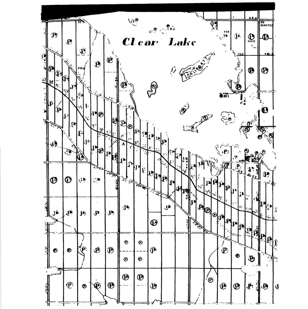
10 ONTARIO MINISTRY OF NATURAL RESOURCES LEGEND M.I48 SURVEYS AND MAPPING BRANCH SEBASTOI C A 1^1 C. Z L. LE D Le AS E s S. Areas withdrawn from staking under Section 43 of the Mining Aet.(R.SO.Vo) Order no File Date Disposition W S X JAN II -7* S.R.O. DATE OF ISSUE JAN SOUTHERN ONTARIO MINING DIVISION SOUTHERN ONTARIO Scale 1O Chains * I Inch D FROM VARIOUS SOURCES AND ACCURACY IS NOT GUARANTEED. THOSE WISHING TO STAKE MIN ING CLAIMS SHOULD CON SULT WITH THE MINING RECORDER. MINISTRY OF NORTHERN DEVELOP MENT AND MINES. FOR AD DITIONAL INFORMATION ON THE STATUS OF THE ylands SHOWN HEREON of O CCUPATION M l*' 'H G RIGHTS OtVLY R j C M rs O,VLY L. Q M. R.O. 5- Q O. RECEIVE MINING LANDS BRANCH 5 5 JL -SSft BifiJ'J,. i - nh 1^a roan d Q!f lake. 5 g r/rcrs- PLAN NO MJ-^S
42AeSNEeSe GODFREY ASSESSMENT WORK FOR RICHARD MATHIEU ON THE GODFREY TOWNSHIP PROPERTY TIMMINS, ONTARIO RECEIVED MINING LANDS BRANCH
 42AeSNEeSe7 2.14685 GODFREY 010 ASSESSMENT WORK FOR RICHARD MATHIEU ON THE GODFREY TOWNSHIP PROPERTY TIMMINS, ONTARIO RECEIVED AUG13 1992 MINING LANDS BRANCH PROSPECTING WORK (a) CLAIM LOCATION Area:...
Magnetometer Survey on the
 42E13NE8400 2.15192 CASTLEWOOD LAKE 010 Magnetometer Survey on the FOUNDER RESOURCES INC. Conglomerate Lake Property Castlewood Area/ Ontario District of Thunder Bay Oct. 15, 1993 By: Barbara Kowalski
31L11NW MCAUSLAN 010 A REPORT ON A RECONNAISANCE GEOLOGY SURVEY PROJECT
 31L11NW9557 2.15064 MCAUSLAN 010 2. 15064 A REPORT ON A RECONNAISANCE GEOLOGY SURVEY PROJECT IN MCAUSLAN TOWNSHIP, ONTARIO FOR CENTRAL ONTARIO NATURAL STONE COMPANY LIMITED,o RECEIVED JUN l 5 1993 MINING
2. i. GEOLOGY Vincent Twp., Ontario NTS 42E/12. By: Barbara Kowalski FOUNDER RESOURCES INC. 42E12NE VINCENT
 42E12NE0062 2.15658 VINCENT 010 2. i FOUNDER RESOURCES INC. GEOLOGY Vincent Twp., Ontario NTS 42E/12 September 21, 1994 By: Barbara Kowalski 42E12NE0062 2.15658 VINCENT 010C TABLE OF CONTENTS TITLE PAGE
. QOtSI. Timmins Area. Geological Report NE Eldorodo Township Property. June, 1994 D R. 42A06SE M93E DORADO "" 010
 . QOtSI 42A06SE00462 1M93E DORADO "" 010 Geological Report NE Eldorodo Township Property Timmins Area June, 1994 D R. mile Langmuir Tp. - M.292 Geological Report NE Eldorodo Township Property Timmins Area
Within. Mineral Claim
 31E12SE2001 2.19268 RYERSON 010 2.19-68 January 15,1999 ASSESSMENT REPORT ON A GEOLOGICAL MAPPING PROJECT Within Mineral Claim 1077246 Ryerson Township, Southern Ontario TABLE OF CONTENTS 1. Summary And
BLACK PEARL MINERALS INC.
 52F07SE0008 2.16968 MEGGISI LAKE 010 BLACK PEARL MINERALS INC. GEOPHYSICAL SURVEYS «SUNSHINE LAKE PROPERTY» Octobre 1996 «* TABLE OF CONTENTS I - INTRODUCTION P. 1 II - PROPERTY P. 1 III - LOCATION & ACCESSIBILITY
XRAL X-RAY Bharti Engineering Associates Inc Lasalle Blvd. P O Box 2336 Sudbury (M P3A4S8. DATE SUBMITTED 9-Aug-89
 XRAL X-RAY 1885 LESLIE S TEL: (416)445 41113SE9429 2.12731 ULSTER 010 C ERT X F X O A.T E TO: BHARTI ENGINEERING ASSOCIATES INC. ATTN: HAROLD J. TRACANELLI 1009 LASALLE BLVD P.O. BOX 2336 SUDBURY, ONTARIO
fe JAMES LAKE PROPERTY BEST TWP. HORIZONTAL LOOP ELECTROMAGNETICS GEOPHYSICAL SURVEY by: David Laronde 31M04NE001S BEST
 fe. 15449 31M04NE001S 2 15449 BEST 010 JAMES LAKE PROPERTY BEST TWP. HORIZONTAL LOOP ELECTROMAGNETICS GEOPHYSICAL SURVEY FEBRUARY 1994 by: David Laronde HUH 01OC Table of Contents 1.0 Introduction 2.0
Lost nine Property Assessment Work Report Van Horne Township ( Kenora Mining Division
 52F10NW2001 2.20035 VAN HORNE 010 Lost nine Property Assessment Work Report Van Horne Township ( Kenora Mining Division Wm. J. Sovereign 103 Wabigoon Drive Dryden, Ontario P8N 1W4 January 22, 2000 TABLE
REPORT OF MAGNETOMETER SURVEY ON TB RICKABY 8 LAPIERRE TOWNSHIPS THUNDER BAY MINING DIVISION THUNDER BAY, ONTARIO RECEIVED
 42E14SW0017 2.15545 LAPIERRE LAKE 010 REPORT OF MAGNETOMETER SURVEY ON TB1196017 RICKABY 8 LAPIERRE TOWNSHIPS THUNDER BAY MINING DIVISION THUNDER BAY, ONTARIO 2.15545 RECEIVED AUG 2 9 1994 ' MINING UkNDS
DIAMOND DRILLING NOTES: 1. W , filed July 19/93. TWyARKA Scapa REPORT NO. WORK 1'KUKOIIMKD l.\)i^oranda Ex P loration Co - Ltd -
i^oranda Ex P loration Co - Ltd -") 3aE04SW934B l SCAPA 00 DIAMOND DRIING TWyARKA Scapa REPORT NO. WORK 'KUKOIIMKD l.\)i^oranda Ex P loration Co - td - RKOORDKn HOUWIl: SAME AS ABOVE f X l : OTHER! j CIAIM NO. 590 HOK NO. SC-90- FOOTAGE
3aE04SW934B l SCAPA 00 DIAMOND DRIING TWyARKA Scapa REPORT NO. WORK 'KUKOIIMKD l.\)i^oranda Ex P loration Co - td - RKOORDKn HOUWIl: SAME AS ABOVE f X l : OTHER! j CIAIM NO. 590 HOK NO. SC-90- FOOTAGE
No other previoro work recorded on the area covered
 PROSPECTING REPORT FISHER LAKE AREA #62617 KENORA MINING DIVISION NTS52F12SE LAT. 49 34'45" to 49 35 i 45 lt north LONG. 93 30'30" to 9 3 31'45" WEST INTRODUCTION Claimsl149639-40-41-42 vere staked to
DDH MS Over burden 42EioNwooiow944o.ooi56ASHMORE ' qtz. carovein aampj.c nu. j. ^ Altered Dacite j
 s J Hole depth 156 Hole dip -45 DDH MS-90-2 Maw OT 1 QQfl 0-8 Over burden 42EioNwooiow944o.ooi56ASHMORE 010 8-8.8.8' qtz. carovein aampj.c nu. j. ^ 8-62.5 Altered Dacite j 11.8-12.2.4' qtz. carb along
Ontario. Strathy Township Temagami Area Sudbury Mining Division. Driffield Cameron GROUND ELECTROMAGNETIC SURVEY PENROSE NORTH PROPERTY.
 l J1MO4SW0153 2 16336 STRATHY 010 GROUND ELECTROMAGNETIC SURVEY PENROSE NORTH PROPERTY Strathy Township Temagami Area Sudbury Mining Division Ontario Driffield Cameron January 5, 1996 r*, t 31MCWSW01S3
52AieNE8iei MCTAVISH
 C 52AieNE8iei 63.6201 MCTAVISH 010 r - A. rf T able of Contents 52AiaiNE8lei 63.6281 MCTAVISH Introduction..............................,.......,.. 1 Location Map.........................................
RECEIVED GOLD PROPERTY REPORT ON THE 1992 EXPLORATION OF THE LASSILA-HOUGHTON ELMHIRST TWP. MINING LANDS BRANO NTS 42E/13.
 42E13SE0603 E.14999 ELMHIRST 010 1499 REPORT ON THE 1992 EXPLORATION OF THE LASSILA-HOUGHTON ELMHIRST TWP. GOLD PROPERTY NTS 42E/13 Latitude 490 50* Longitude 870 21' Date: December 1992 By: P. Lassila
* STUART W. DEVEAU. r '/i SEPTEMBER 1995 NTS: 52K/13 PLACER DOME CANADA LIMITED PROJECT CLAIM KRL
 S2K13NW0011 2 16217 BAIRD 010 PLACER DOME CANADA LIMITED PROJECT 413 - CLAIM KRL 1184166 GEOLOGICAL REPORT - 1995 WORK PROGRAMME BAIRD TOWNSHIP, ONTARIO NTS: 52K/13 r '/i SEPTEMBER 1995 * STUART W. DEVEAU
g. 14 RECEIVFH NOV l MINING LANDS BRANCH REPORT ON THE EXPLORATION CARRIED OUT ON THE MOSS TOWNSHIP PROPERTY FOR FOGEN-WING-WALLACE-CALVERT
 52B18SW8101 2.14799 MOSS 010 REPORT ON THE EXPLORATION CARRIED OUT ON THE MOSS TOWNSHIP PROPERTY FOR FOGEN-WING-WALLACE-CALVERT RECEIVFH NOV l 7 1992 MINING LANDS BRANCH by: CLAUDE LAROUCHE OVALBAY GEOLOGICAL
SELCO EXPLORATION COMPANY LIMITED
 --..-..-...-.....l.iibibiiiiiiiiiiiiiii II III S2J16NW9001 52J16NW0014A1 PASHKOKOGAM LAKE 0 10 SELCO EXPLORATION COMPANY LIMITED GEOPHYSICAL REPORT CLAIMS 200696 TO 200707 PATRICIA MINING DIVISION August
REPORT ON GEOLOGICAL MAPPING OF CLAIM SHAW TOWNSHIP PORCUPINE MINING DIVISION) NORTHEASTERN ONTARIO FOR LAURION GOLD INCORPORATED
 NORTHEASTERN ONTARIO FOR LAURION GOLD INCORPORATED") REPORT ON GEOLOGICAL MAPPING OF CLAIM 1180899 SHAW TOWNSHIP PORCUPINE MINING DIVISION) NORTHEASTERN ONTARIO * O Q Q fi FOR LAURION GOLD INCORPORATED Schumacher, ON November 29th, 2004 Leslie A. Tihor Tihor
REPORT ON GEOLOGICAL MAPPING OF CLAIM 1180899 SHAW TOWNSHIP PORCUPINE MINING DIVISION) NORTHEASTERN ONTARIO * O Q Q fi FOR LAURION GOLD INCORPORATED Schumacher, ON November 29th, 2004 Leslie A. Tihor Tihor
Post. Claim E.O D.D.Hole \ L ength 243' Bearing N.52 U W, Dip 45 0 AXT core BIJOU MINFS LIMITED. l" to 100' 31C15NW PALMERSTON 010
 #1 Post Claim E.O. 460392 D.D.Hole \ L ength 243' Bearing N.52 U W, Dip 45 0 AXT core BIJOU MINFS LIMITED l" to 100' September 22, 1977 J. P. Jewell 31C15NW0019 74 PALMERSTON 010 DIAMOND DRILL RECORD PROPERTY
010 BAND - ORE RESOURCES LTD. ROSS PROPERTY. Penhorwood Township, Ontario Porcupine Mining Division NTS: 42B/1
 42B01NE0049 2 16729 KENOGAMING 010 BAND - ORE RESOURCES LTD. ROSS PROPERTY Penhorwood Township, Ontario Porcupine Mining Division NTS: 42B/1 REPORT ON GROUND MAGNETIC SURVEYS November 30th, 1995 o ROBERT
WORK PERFORMED FOR: * FOSTER MARCHALL
 31M13SE0024 23 INGRAM DIAMOND DRILLING 010 TOWNSHIP; INGRAM REPORT NO: 2 3 WORK PERFORMED FOR: * FOSTER MARCHALL RECORDED HOLDER: SAME AS ABOVE : OTHER l J CLAIM NO. HOLE NO. FOOTAGE DATE NOTE L822224
Work Report #2 Mining Claims & MacGregor Township, G-062 May 11,2004 By: Marc Ciccarelli - Claim Holder
 9 2 7672 Work Report #2 Mining Claims 1247155 & 1247156 MacGregor Township, G-062 May 11,2004 By: Marc Ciccarelli - Claim Holder This report includes a brief geological description of the rocks on these
GROUND MAGNETOMETER SURVEY CLAIMS , M CASEY TWP. ONTARIO. by: Gary Dunn Exploration 710 Brewster St, Haileybury Ontario.
 010 GROUND MAGNETOMETER SURVEY CLAIMS 1211535,1211536M211537 CASEY TWP. ONTARIO l 62 G 3 ^V by: Gary Dunn Exploration 710 Brewster St, Haileybury Ontario date: November J? 1995 NTS: RECEIVED NO V l 5 ^995
Castlewood Lake Map Area (6-22) Thunder Bay Mining District, Ontario
 Thunder Bay Mining District, Ontario") 42E3NEee87 2. M469 CASTLEWD LAKE 0 REPRT N THE 99 EXPLRATIN F THE LASSILA CN LAKE PRPERTY Castlewood Lake Map Area (6-22) Thunder Bay Mining District, ntario Date: January 992 By: P. Lassila 42E3NE8M7
42E3NEee87 2. M469 CASTLEWD LAKE 0 REPRT N THE 99 EXPLRATIN F THE LASSILA CN LAKE PRPERTY Castlewood Lake Map Area (6-22) Thunder Bay Mining District, ntario Date: January 992 By: P. Lassila 42E3NE8M7
Simplified exploration work report
 Simplified exploration work report Work Report of exploration and examination of outcrops of rock and boulders Report on stripping and excavating work of $ 5 000 or less.(section 81 of regulation) Report
To test an EM conductor and provide geological information.
 Banting Township Property OPAP Final Submission 1998 DIAMOND DRILLING REPORT January 27, 1999. Objective: To test an EM conductor and provide geological information. Final results: Two holes were drilled
NELSON GRANITE LIMITED. Test Quarrying, Sample Block Removal. Sawing and Polishing Tests. Mining Claim K-l Kilgour Lake Area NTS: 52K 4SW
 l 52K04SW2005 2.20708 KILGOUR LAKE 010 2.20708 NELSON GRANITE LIMITED Test Quarrying, Sample Block Removal Sawing and Polishing Tests Mining Claim K-l 149856 Kilgour Lake Area NTS: 52K 4SW Kenora Mining
NAR RESOURCES LTD. BEATTY TWP. PROPERTY DIAMOND DRILL LOGS AND CROSS SECTIONS
 42A09SW0146 W9780.00024 BEATTY 010 NAR RESOURCES LTD. BEATTY TWP. PROPERTY DIAMOND DRILL LOGS AND CROSS SECTIONS SHORT FORMS FOR DRILL LOGS aim alteration fractg fracturing sil siliceous approx approximate
ASSESSMENT SUMMARY - A. SALO PROPERTY ( MCGARRY TOWNSHIP ^ NTS 32D/4. Introduction
 2. 16102 ASSESSMENT SUMMARY - A. SALO PROPERTY ( MCGARRY TOWNSHIP ^ NTS 32D/4 Introduction On May 25, 1995, Falconbridge geologist Ray Kohlsmith visited staked claims 1 187016 A 1 187017 located 500m north
Developpement economique Canada Economic Development Canada. A l v I E R I C A N A I R E S I N C.
 1*1 I n n o v a t i o n, S c i e n c e s e t I n n o v a t i o n, S c i e n c e a n d Developpement economique Canada Economic Development Canada Office de la propriete intellectuelle du Canada Canadian
John A. Wakeford Noranda Exploration Co., Ltd, November 4, 1980 rinnnins, Ontario
 42CC1NEfc4e9 801101 ECHUM 010 " ' i-^y&sg?' '.. -.r. K;VW\\:.!^-*.]-^--'^-r-r^Pj^Q..-. ;,: v 1,;-'-,..- ^^-^^^^ysr-r^ijjfiv^jj. v -." ". '. ' "i - '' '. '':.;': s.'.ilv'., p...--'*l r-j@tw IP ^vt'.'v*:-^
REPORT A MAGNETOMETER AND GEOLOGICAL SURVEY CUNNINGHAM - STALMACK PROPERTY LEBEL TOWNSHIP, ONTARIO 1991 OPAP
 I.. l 4458 32D04NWei7a 2.14458 LEBEL 010 REPORT ON A MAGNETOMETER AND GEOLOGICAL SURVEY CUNNINGHAM - STALMACK PROPERTY PERSON'S NAME LEBEL TOWNSHIP, ONTARIO bivision OR BRANCH" 1991 OPAP CITY. BUILDING.
31M05SE LORRAIN 010
 LATOLIR LAKE VLF SURVEY 31M05SE0003 2.4460 LORRAIN 010 The EM-16 survey program on the Latour Lake Property located in Lorrain Township, District of Temiskaming, Sudbury Mining Division has been extended
April/93. WORK PERFORMED FOR: Moneta Porcupine Mines Inc. M Om. TWP AREA: Godfrey : OTHER HOLE NO. P f^-;^p^ili^ REPORT NO.
 42A12SE8904 62 GODFREY 010 TWP AREA: Godfrey REPORT NO. 62 WORK PERFORMED FOR: Moneta Porcupine Mines Inc.. f^-;^p^ili^ ' : OTHER CLAIM NO. HOLE NO. DATE NOTE P. 9921 M-55-02 197. Om April/93 (D "-. NOTES:
RECEIVED APR NELSON GRANITE 1997 STRIPPING AND BULK SAMPLING PROGRAM FORGOTTEN LAKE CLAIM BLOCK. Forgotten Lake Area
 52L01SW2001 2.18578 FORGOTTEN LAKE 010 NELSON GRANITE 1997 STRIPPING AND BULK SAMPLING PROGRAM FORGOTTEN LAKE CLAIM BLOCK Forgotten Lake Area NTS: 52L/1SW Kenora Mining Division 2.18578 2.1839 RECEIVED
Rubicon Minerals Corporation. Physical Work Submission Report June, RED LAKE PROPERTY MECHANICAL STRIPPING South Pipestone Bay
 Rubicon Minerals Corporation Physical Work Submission Report June, 2001 RED LAKE PROPERTY MECHANICAL STRIPPING South Pipestone Bay Ball Township Red Lake Mining Division NTS 52/N4 2.216 A /^ r--^'^-, t'n
Drilling. What is the Activity?
 Drilling What is the Activity? Drilling is a critical activity in mineral exploration. There are several types of drilling. Diamond drilling is the most common type of drilling conducted in Ontario. It
RECEIVED MINING LANDS SECTION. a.9535 MCTAVISH. E.A. JENNINGS, H.D.Se. Thunder Bay, Ontario September GEOLOGY OF THE THUNDER BAY AMETHYST MINE
 a.9535 MCTAVISH 010 GEOLOGY OF THE THUNDER BAY AMETHYST MINE AND PRECIOUS PURPLE GEMSTOHES CLAIMS E.A. JENNINGS, H.D.Se. Thunder Bay, Ontario September 30 1985 RECEIVED MOV l o 1986 MINING LANDS SECTION
MAGNETOMETER SURVEY Frere Lake Property Hudson Township Harley Walton August 1997
 MAGNETOMETER SURVEY Frere Lake Property Hudson Township Harley Walton August 1997 E c RECEIVED SEP 1 8 1997! 31M12SW0025 2.17740 HUDSON 010 ieoscience ASSESSMENT Meegwich Consultants Inc. P.O. Box 482,
Dwg. S Geological Plan and Section (Hole 93-1) showing visual X of garnet.
 showing visual X of garnet.") 31F03NW0002 W9490.00059 ASHBY 010 TABLE OF 31F03NW0002 W9490.00059 ASHBY IP DRXLLINQ 01OC On Ruby Annby Townsn -i p Agont:, R. J..A. Summary ft Recommendat i ons Results Of Drilling 1 2 APPENDIX A Diamond
31F03NW0002 W9490.00059 ASHBY 010 TABLE OF 31F03NW0002 W9490.00059 ASHBY IP DRXLLINQ 01OC On Ruby Annby Townsn -i p Agont:, R. J..A. Summary ft Recommendat i ons Results Of Drilling 1 2 APPENDIX A Diamond
RFHEIVED STRIPPING REPORT ON CLAIM
 RFHEIVED STRIPPING REPORT ON CLAIM 243429 NOV 2 e 2CO'i This report documents a mechanical stripping, geological mapping, and channel samplingi program carried out on claim 243429, Jacobson Township, Sault
April, *A K.A. Jansen A Associates Ltd. IH* ConsuKing Exploration A Mining Geologists VLF ELECTROMAGNETIC SURVEY. for
 *A K.A. Jansen A Associates Ltd. IH* ConsuKing Exploration A Mining Geologists VLF ELECTROMAGNETIC SURVEY for MONETA PORCUPINE MINES INC. NORTHEAST GODFREY PROPERTY in GODFREY TOWNSHIP PORCUPINE MINING
Prospecting Report on Claim # on Bull's Eye Lake Property
 Prospecting Report on Claim #3009706 on Bull's Eye Lake Property By Eric Covington "RECEIVED OCT -7 200* GEOSCIENCE ASSESSMENT OFFICE September 27, 2004 31C07NE2001 2.28602 LOUGHBOROUGH 010 This report
Assessment- work after staking EI. W o r k re pi o r i- n u m b e r l. Subject; Turner Swill Lake, Leslie Township G 2862, Claim No.
 42F04NW0001 W9540.115 LESLIE 010 Assessment- work after staking EI claim W o r k re pi o r i- n u m b e r l Subject; Turner Swill Lake, Leslie Township G 2862, Claim No. TB 1099714 Physical work conducted
3 IT RECEIVED. JUL o 7::: 3 JUL RECEIVED. Geochemical Analyses McCart Township Property McCart Township Porcupine Mining Division. D. R.
 42A5SW2 2.24 MCCART PRVINCIAL RECRDING FFICE - SUDBURY RECEIVED JUL 7 2 A.M.'.V5^? p.n 7 S 9 lp l.l 2 l 2 3 4 5 /I. 6 Geochemical Analyses McCart Township Property McCart Township Porcupine Mining Division
RECEIVED. Report on Geophysical Work. KIDD 24 PROPERTY Kidd Township NTS: 42A/11 Project # for FALCONBRIDGE LIMITED. May 1998 Sharon Taylor
 42A11NW2006 2.18507 KIDD 010 Report on Geophysical Work KIDD 24 PROPERTY Kidd Township NTS: 42A/11 Project # 8035 for FALCONBRIDGE LIMITED RECEIVED JUH O 1 1998 May 1998 Sharon Taylor SUMMARY AND RECOMMENDATIONS
Ground Magnetometer Survey Claim Bucke Twp Larder Lake Mining Division Ontario
 010 Ground Magnetometer Survey Claim 1118540 Bucke Twp Larder Lake Mining Division Ontario for Consolidated Pine Channel Gold Corp #921-470GranvilleSt Vancouver British Columbia by Gary Dunn Exploration
["RECEIVED " FEB \ FEB 2 8 2m. Prospecting Report for claim Van Horne Twp. February 3/05. Alex Glatz. PROVINCIAL.R,eco"WN^ RorCES VED
 Prospecting Report for claim ["RECEIVED " \ FEB 2 8 2m GEOSCIENCE ASSESSMENT OFFICE-- - -. Van Horne Twp. PROVINCIAL.R,eco"WN^ RorCES VED FEB282005 AU ** - -^ ** ^N*w* ^ rm* A*W- 293 86 February 3/05 by
Report on Exploratory Drilling. Prospecting Claim Nos and
 Report on Exploratory Drilling Prospecting Claim Nos. 4212342 and 4212343 Glamorgan Township, Lot 34, Concession IV: Southern Ontario Mining Division Exploratory Drilling Program Site Work: November 11-17,2008
Assessment Report by the Canadian Nickel Co. Ltd. Magnetometer Survey. Larder Lake Mining Division Lebel Tovnship, Ontario
 32084Nwea67 2.331* LEBEL 010 Assessment Report by the Canadian Nickel Co. Ltd. Magnetometer Survey Larder Lake Mining Division Lebel Tovnship, Ontario Claims L-531657 L-531658 L-531111 Map No.: M-359,
We are committed to providing accessible customer service. If you need accessible formats or communications supports, please contact us.
 We are committed to providing accessible customer service. If you need accessible formats or communications supports, please contact us. Nous tenons à améliorer l accessibilité des services à la clientèle.
6000 ELI l 5750 EL LEGEND. PLACER DOME (CLA) LIMITED CLAIM # Section Looking North East. o, ffi. o Ko ' COfH O O O CO.
 LIMITED CLAIM # Section Looking North East. o, ffi. o Ko ' COfH O O O CO.") CHO H O O O CO 6000 ELI l O o; o, ffi 00 o Ko ' COfH 5750 EL BIF CAS FZ LEGEND Banded Iron Formation Casing Fault Zone Talc Chlorite Rock Uniform Greenstone Scale: l" 60' PLACER DOME (CLA) LIMITED CLAIM
CHO H O O O CO 6000 ELI l O o; o, ffi 00 o Ko ' COfH 5750 EL BIF CAS FZ LEGEND Banded Iron Formation Casing Fault Zone Talc Chlorite Rock Uniform Greenstone Scale: l" 60' PLACER DOME (CLA) LIMITED CLAIM
NOTICE OF PUBLIC TENDER
 Ministry of Natural Gas Development UPSTREAM DEVELOPMENT DIVISION NOTICE OF PUBLIC TENDER COMPETITION FOR THE RIGHT TO EXPLORE AND DEVELOP CROWN PETROLEUM AND NATURAL GAS RESOURCES JULY 16, 2014 Pursuant
Geneva Lake Mine Property
 2 "-,." j, i.. \' i Fli FR l- ' 2 "- ''. -" ^tji. o -^' " - - - S? l GEOSCIENCE ASSESSMENT Reconnaissance" Prospecting and Geological Surveys on the j Geneva Lake Mine Property Hess TOWNSHIP Zn-Pb-Cu-Ag
BALFOUR MINING LTD. (N.P.L.) HAM GROUP 92-P-6, CLINTON M. D.8 B. C. Lat 51 17'N, GEOCHEMICAL REPORT. V. CUKOR, P. Eng.
 HAM GROUP 92-P-6, CLINTON M. D.8 B. C. Lat 51 17'N, GEOCHEMICAL REPORT. V. CUKOR, P. Eng.") 34q '7 BALFOUR MINING LTD. (N.P.L.) HAM GROUP 92-P-6, CLINTON M. D.8 B. C. Lat 51 17'N, Long 12lo14'W GEOCHEMICAL REPORT, V. CUKOR, P. Eng. January 31, 1972 TABLE OF CONTENTS 1. INTRODUCTION 2. PROPERTY,
34q '7 BALFOUR MINING LTD. (N.P.L.) HAM GROUP 92-P-6, CLINTON M. D.8 B. C. Lat 51 17'N, Long 12lo14'W GEOCHEMICAL REPORT, V. CUKOR, P. Eng. January 31, 1972 TABLE OF CONTENTS 1. INTRODUCTION 2. PROPERTY,
CHESTER J. KURYLIW, M.Se., CONSULTING; GEOLOGIST 46 INGALL DR. DRYOEN, ONTARIO PUN 3B7 THE KURYLIW CHROME-QUARTZ DEPOSIT SIOUX LOOKOUT AREA
 CHESTER J. KURYLIW, M.Se., CONSULTING; GEOLOGIST 46 INGALL DR. DRYOEN, ONTARIO PUN 3B7 I-HONB 807-223-6080 THE KURYLIW CHROME-QUARTZ DEPOSIT CD r--* CO jd no 9 m SIOUX LOOKOUT AREA NORTHWESTERN, ONTARIO
Toronto, Ontario November 16, This report may not be reproduced, in whole or in part, without the written permission of Derry, Michener S Booth.
 13 2.1354 L ITTLE 010 GEOPHYSICAL SURVEYS, LITTLE TOWNSHIP CLAIM GROUP OB-F TIMMINS AREA PORCUPINE MINING DIVISION, ONTARIO Toronto, Ontario November 16, 1973 This report may not be reproduced, in whole
DOMINION GULF COMPANY 203 BAY STREET TORONTO l, ONTARIO, CANADA
 31M12SE8ai2 6 3.281 CASEY DOMINION GULF COMPANY 203 BAY STREET TORONTO l, ONTARIO, CANADA 010 E. W. WE8TRICK GENERAL AOENT IN REPLY REFER TO: February l, 1952. REGISTERED Mr. H. C. Rickaby, Deputy Minister
Guidelines for the Form of Reports and Illustrations
 Guidelines for the Form of Reports and Illustrations as Prescribed by the Minister as per Section 55(2) of The Consolidated Newfoundland and Labrador Regulation 1143/96 (As Amended) (Revised - December,
TECK EXPLORATION LTD. NORTH BAY, ONTARIO ASSESSMENT REPORT
 TECK EXPLORATION LTD. NORTH BAY, ONTARIO r J*. ' J ASSESSMENT REPORT ON LINE CUTTING AND GEOLOGICAL MAPPING CLAIM NUMBERS LI 36335-46, LI 3635 HOLMES TOWNSHIP LARDER LAKE MINING DIVISION, ONTARIO by R.
7 MILES WEST OF PORT HARDY, B.C.
 GEOPHYSICAL REPORT VERTICAL INTENSITY MAGNETOMEER SURVEY ON LUK CLAIMS, 7 MILES WEST OF PORT HARDY, B.C. 50' 127O SE BY R. E. SHIELDS UNDER SUPERVISION OF J. R. BILLINGSLEY FOR SECOND0 MINING LTD. (N.
PROSPECTING REPORT THE WALLACE CLAIM OMENICA MINING DIVISION. 54" x6" 3.d d. for. Reako Exlorat ions Ltd. Wallace Rev. C.G.
 PROSPECTING REPORT ON THE WALLACE CLAIM OMENICA MINING DIVISION 54"44 14 1x6" 3.d d by David A. Howard P.Eng. for Reako Exlorat ions Ltd. Claim Locat ion Wallace Rev. C.G. #1560 Dome Mountain Area 9 3
Appendix U. Communication with Shabogamo M.E. ALDERON IRON ORE CORP.
 ALDERON IRON ORE CORP. AMENDMENT TO THE ENVIRONMENTAL IMPACT STATEMENT VOLUME 3 APPENDICES INFORMATION REQUEST RESPONSES Appendix U Communication with Shabogamo M.E. VIA EMAIL October 31,2012 Dr. Rehan
43E14SW8500 2,15319 LAPIERRE LAKE 010 ATIGOGAMA LAKE AREA NORTHWEST LAPIERRE TWP 4 CLAIM GROUP DAVID K. KINDLA OP93-252
 43E14SW8500 2,15319 LAPIERRE LAKE 010 ATIGOGAMA LAKE AREA NORTHWEST LAPIERRE TWP 4 CLAIM GROUP DAVID K. KINDLA OP93-252 1993 42EMSW8500 2.15319 LAPIERRE LAKE 010C TABLE OF CONTENTS LOCATION MAP.................................
# St. George Street, Toronto, Ontario M5R 2L9, and
 31F04NW0001 2.15999 MONTEAGLE 010 MAY l 2 1995 MNING LANDS RP*HP,, GEOLOGICAL REPORT 15999 on Mining Claim SO 1150873, Lot 24 East half, Concession VI, Monteagle Township, Southern Ontario Mining Division
We are committed to providing accessible customer service. If you need accessible formats or communications supports, please contact us.
 We are committed to providing accessible customer service. If you need accessible formats or communications supports, please contact us. Nous tenons à améliorer l accessibilité des services à la clientèle.
41O16SW MARION PROV NCE OF ONTAR. ieoscience ASSESSMENT. nmr**-
 41O16SW2005 2.22486 MARION 010. 22 4 8 PROV NCE OF ONTAR ieoscience ASSESSMENT nmr**- . MARION CLAIM BLOCK SoftMap Techndogies l ne eptesewwi by OiflDepartmefrtcf Natural Resoii'ces, and by S*M Scale 1:
On August 10, 2017, I conducted an inspection of the exploration site associated with Permit PR The inspection report is attached.
 Ministry of Northern Development and Mines Mineral Development and Lands Branch B002 435 James Street South Thunder Bay, Ontario P7E 6S7 Tel.: 807-475-1123 (reception) Fax: 807-475-1112 Ministère du Développement
1 CLAIMS GEOPHYSICAL REPORT ON BOYAL SITUATE NORTHEAST OF TILLICUM MOUNTAIN GOLD AREA BURTON - NAKUSP SIQCAEJ MINING DIVISION
 GEOPHYSICAL REPORT ON BOYAL 1 CLAIMS SITUATE NORTHEAST OF TILLICUM MOUNTAIN GOLD AREA BURTON - NAKUSP SIQCAEJ MINING DIVISION CONSULTING GEOLOGIST AUGUST 1983 VANCOUVER B *C INDEX INTRODUCTION ooa,.eoaaa.aaaoaaooaoa~ao~o
Saroplo Interval. to to
 PQ'WER OPTION RESAPLING 2.34 EEN LAKE E-6- Sample j P 4 P 42 P 43 P 44 P 45 P 46 P 4 P 4 P 4 P 4 P 4 P 42 P 43 P 44 P 45 P 46 P 4 P 4 P 4 P 420 P 42 P 4 P 423 P 4 P 4 P 426 P 42 P 42 P 42 Saroplo Interval
L. GERVAIS PROPERTY GEOPHYSICAL SURVEYS GUIBORD TWP., ONTARIO DECEMBER RECEIVED. DEC 2 2 m i. GEOSCIENGfc 42A09SE02082.
 I L. GERVAIS PROPERTY GEOPHYSICAL SURVEYS GUIBORD TWP., ONTARIO DECEMBER 1 997 RECEIVED DEC 2 2 m i GEOSCIENGfc 42A09SE02082.18031 GUIBORD 010 TABLE OF CONTENTS I - INTRODUCTION P. 01 II - PROPERTY P.
STRATHY PROJECT REPORT ON EXPLORATION ACTIVITIES PERFORMED UNDER O.P.A.P STRATHY TOWNSHIP SUDBURY MINING DIVISION, PROVINCE OF ONTARIO
 31M04SW9746 2.M974 STRATHY 0 o STRATHY PROJECT REPORT ON EXPLORATION ACTIVITIES PERFORMED UNDER O.P.A.P. 1992-93 STRATHY TOWNSHIP SUDBURY MINING DIVISION, PROVINCE OF ONTARIO Bjarne Westin OPAP 92-594
SUPPLEMENT TO MAGNETOMETER 6 ELECTROMAGNETIC SURVEY REPORT. DATED NOVEMBER l, 1973 CIGLEN INVESTMENTS LIMITED CLAIMS GROUP BAD VERMILLION LAKE AREA
 ^ A R l ^ 1974 010 PROJECTS UNIT SUPPLEMENT TO MAGNETOMETER 6 ELECTROMAGNETIC SURVEY REPORT DATED NOVEMBER l, 1973 CIGLEN INVESTMENTS LIMITED CLAIMS GROUP BAD VERMILLION LAKE AREA DISTRICT OF RAINY RIVER
Outils de Recherche Opérationnelle en Génie MTH Astuce de modélisation en Programmation Linéaire
 Outils de Recherche Opérationnelle en Génie MTH 8414 Astuce de modélisation en Programmation Linéaire Résumé Les problèmes ne se présentent pas toujours sous une forme qui soit naturellement linéaire.
Jess Lake Mackelcan Twp. -90 degrees
 FROM : PGEOPH1L FflX NO. : 757521123 Nov. 19 23 1:7PM PI Flag Resources: Hole no: Location: Claim no: Depth: Core size: Core stored: Dip: tarted: Finished: Core logged by: Jess Lake Mackelcan Twp JL-3-8
MINING CLAIMS t A
 2L**NE* 2.2*38 METCALFE LAKE OO CESCRIPTION OF WORK PERFORMED ON MINING CLAIMS 3. 3. 32. 327t 3260. A 326 3 Located and cleaned out three previously excavated rock trenches* Trenches measured 00 feet,
Name of Applicant Mailing Address address Telephone Number
 District Court, Water Division, Colorado Court Address: CONCERNING THE APPLICATION FOR WATER RIGHTS OF Applicant: In the River or its Tributaries In COUNTY Attorney or Party Without Attorney (Name and
31D16NE MONMOUTH 010. for
 31D16NE2001 2.20361 MONMOUTH 010 Physical Work Report on Mining Claim SO 1150881 (2 claim units), Lot 24 South Half Concession X, Lot 24 North Half Concession EX, Monmouth Township (G-1298), Haliburton
Assessment Work - Bertus Industrial Claims SO , 63, 65 By G.H.K. Pearse
 Assessment Work - Bertus Industrial Claims SO. 1076762, 63, 65 By G.H.K. Pearse l. Qualifications of Author Gary Pearse has over 35 years experience in a broad range of geological and engineering work
551, on claim \ Date of Report
 Ontario initry of t,rthern Development d Mine Report ofwork or each jelow). Report cal and Name and Potal Addre of Recorded Holder Canlorm Reource Inc. 500 67 Richmond St. Wet, Toronto, Ontario M5H 1Z5
REPORT OF PHYSICAL EXPLORATION AND DEVELOPMENT Section 15 - Mineral Tenure Act Regulation
 1. EVENT NUMBER(S) 1234567 4. RECORDED HOLDER Doe 123 Main Street REPORT OF PHYSICAL EXPLORATION AND DEVELOPMENT Section 15 - Mineral Tenure Act Regulation Mineral Titles and Policy Branch Ministry of
42E12NE WALTERS CONTENTS
 CONTENTS 42E12NE2021 2.28788 WALTERS 010 1. LOCATION MAP #1 2. LOCATION MAP #2 3. PROPERTY ACCESS 4. GEOLOGY 5. WORK S GEOLOGY 6. ASSAY SHEET 7. REMARKS 8. STATEMENT OF COSTS 9. WORK MAP 2. 287 88 C. PETTIT
TOWNSHIP: ARNOLD REPORT NO; 18. Date Note Nov-Dec/87 (1) Footage 266' Notes: (1) IW , filed in August/88. WORK PERFORMED FOR: LAC Minerals Ltd
 Footage 266' Notes: (1) IW , filed in August/88. WORK PERFORMED FOR: LAC Minerals Ltd") 32DMNWW2, 16 ARNOLD 010 DIAMOND DRILLING TOWNSHIP: ARNOLD REPORT NO; 18 WORK PERFORMED FOR: LAC Minerals Ltd RECORDED HOLDER: Same as Above [xx] : Other [ ] Claim No. L 884017 Hole No. A14A Footage 266'
32DMNWW2, 16 ARNOLD 010 DIAMOND DRILLING TOWNSHIP: ARNOLD REPORT NO; 18 WORK PERFORMED FOR: LAC Minerals Ltd RECORDED HOLDER: Same as Above [xx] : Other [ ] Claim No. L 884017 Hole No. A14A Footage 266'
42C88SW RIGGS 010. T Rt (O C H (M 6 (JUG
 42C88SW0847 2.11597 RIGGS 010 Of T Rt (O C H (M 6 (JUG .y. BULLDOZER TRENCHING RIGG? TWP. L X SSM 827186 SCALE l" a 200' t BULLDOZER STRIPPING RIGGS TWP. 0 o M SSM 827187 a M s SCALE l" 5 200' s. BULLDOZER
2018 Technical Standards and Safety Authority and Ministry of Advanced Education & Skills Development Examination Schedule
 Ministry of Advanced Education & Skills Development ination Schedule Last Updated: June 7, 2018 Document Uncontrolled if Printed ination Schedule Preface: The following sets out and identifies the 2018
RECEIVED" MAY 17 :::i
 RECEIVED" MAY 17 :::i GEOSCPCE ASSESSMENT Sampling Program on Mining Claim L -1241983, Moen urcny TownuiiD, Larder lake Mining Division, District of Sudbury Table of Contents Paee Property Location Map
4. Geological maps published by the Ontario Department of Mines.
 52J08NWei45 S2J08NWa6B1 SMYE 010 AMALGAMATED RARE EARTH MINES LTD. *, SAVANT LAKE PROSPECT x ONTARIO INTRODUCTION t This Is a report on a group of 28 claims control led by Amalgamated Rare Earth Mines
Overburden Felsic Tuff (3-sil, mag, tr-25% py, po, Doierlption (colour, grain (lit, taxturt, ttructurt. ate.) Alteration Mineraltiatton Ramarki
 Alteration Mineraltiatton Ramarki") 42A1SNE0024 W8880 00086 MORTIMOR l 010 LATITUDE. DEPARTURE DIP AT COLLAR 900S Mortimer "A" Grid,, AU 110W 75m -SO 0 atab.un Grid Bast (90*) 200m NORANDA EXPLORATION COMPANY LIMITED DIAMOND DRILL CORE LOG
42A1SNE0024 W8880 00086 MORTIMOR l 010 LATITUDE. DEPARTURE DIP AT COLLAR 900S Mortimer "A" Grid,, AU 110W 75m -SO 0 atab.un Grid Bast (90*) 200m NORANDA EXPLORATION COMPANY LIMITED DIAMOND DRILL CORE LOG
PHYSICAL WORK REPORT. the BAY CLAIMS. Omineca Mining Division Smithers, British Columbia N.T.S. 93E 13E/W
 PHYSICAL WORK REPORT the BAY CLAIMS Omineca Mining Division Smithers, British Columbia a N.T.S. 93E 13E/W LATITUDE: 53 57 00 N I LONGITUDE: 127 45 OO W for Home Ventures Ltd. 1201-675 West Hastings Street
Québec s Mining Industry. Presented by Frank Mariage February 4 th, 2015
 Québec s Mining Industry Presented by Frank Mariage February 4 th, 2015 Table of contents 1. Legal framework of the mining industry in Québec 2. Mining exploration in Québec 3. Mining production in Québec
Licensed Science Officer Benchmark
 POSITION EVALUATION RATIONALE POSITION TITLE MINISTRY AND DIVISION Energy, Mines and Petroleum Resources: Geology Division BRANCH AND SECTION Mineral Resources Branch, Applied Geology Section UNIT OR PROGRAM
APPLICATION FOR CONDITIONAL ABSOLUTE WATER STORAGE RIGHT
 District Court, Water Division, Colorado Court Address: CONCERNING THE APPLICATION FOR WATER RIGHTS OF Applicant: In the River or its Tributaries In COUNTY Attorney or Party Without Attorney (Name and
y^ cjc-o-4-o^v*, O cx S oj X o 5 \ J * X -*-oj *O *^l vxyvx^v^s- ' o r^. OO*JLc 52N07SVMW26 OPO2-10S SKINNER
 5N07SVMW6 OPO-10S SKINNER i\ r^. OO*JLc ' K. vxyvx^v^s- \ J *^l * X -*-J *O O cx l X 5 S J y^ cjc--4-^v*, I. c/ ^ f hi *r M, fu ^ r^ vp p P v ^ r?ur' f R Hi?f r^lrtf r H ^ i? f * r j pir f ^t-? ^ f ^ f,
Keels Venure Inc. Re: Assessment Report for 6735M, 8289M & 10280M Grouped to M
 Keels Venure Inc. April 10, 2011 Mr. Jim Hinchey, P. Geo. Department of Natural Resources P.O. Box 8700 St. John s, NL A1B 4J6 Re: Assessment Report for 6735M, 8289M & 10280M Grouped to 011690M Dear Jim,
Received : Jao :26Pm P008
 Received :6133953119 Jao 5 216 1:26Pm P8 FROM :CPandCW FAX O. :613 395 3719 Jan. 25 216 2:33PM P6 GRIFFITH QUARRY DOATIO OF DIAMOD DRILL CORE TO TWEED DRILL CORE LIBRARY August 215 Introduction The Griffith
G&OK&J ^Z't.^ l+ottf 73 J&& Z><=S?^s**=n A T ^tt&l 7)4.71^, Ut* /' -4 - */ ^" CoA* " fa**?*. " tflto* tzz#*jt -7t~ i * 'i.
4.71^, Ut* /' -4 - */ ^ CoA* fa**?*. tflto* tzz#*jt -7t~ i * 'i.") ~7(ftGkfOg^s ofc fitfjsk-fitftp&lf /AJ 1 - IIIIIIIIIMIMI 41J16SE0007W9470.00019 OLINYK Q " Address/Location where core stored Adresse/endroit ou la carotte est stockee PtKtfFiuun pirn. 77*V" dfe S?v#g
~7(ftGkfOg^s ofc fitfjsk-fitftp&lf /AJ 1 - IIIIIIIIIMIMI 41J16SE0007W9470.00019 OLINYK Q " Address/Location where core stored Adresse/endroit ou la carotte est stockee PtKtfFiuun pirn. 77*V" dfe S?v#g
REQUEST FOR PROPOSALS
 West Q Avenue, Kalamazoo, MI P: () - F: () - www.texastownship.org REQUEST FOR PROPOSALS - Winter Snow Removal Services Proposals The Charter Township of Texas, Kalamazoo County Michigan, is requesting