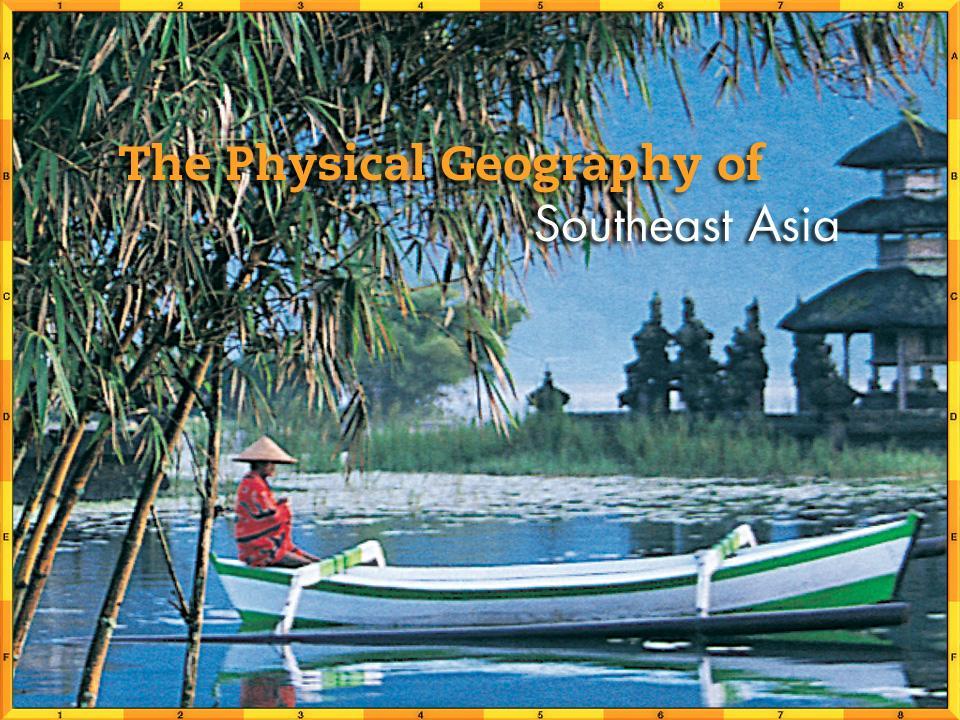
Presentation Plus! Glencoe World Geography Copyright by The McGraw-Hill Companies, Inc. Developed by FSCreations, Inc., Cincinnati, Ohio 45202
|
|
|
- Chloe Hensley
- 6 years ago
- Views:
Transcription
1 Presentation Plus! Glencoe World Geography Copyright by The McGraw-Hill Companies, Inc. Developed by FSCreations, Inc., Cincinnati, Ohio Send all inquiries to: GLENCOE DIVISION Glencoe/McGraw-Hill 8787 Orion Place Columbus, Ohio 43240


2
3 Chapter Introduction Section 1 The Land Section 2 Climate and Vegetation Chapter Summary & Study Guide Chapter Assessment Click on a hyperlink to view the corresponding slides.
4
5 Chapter Objectives Describe the dominant landforms and natural resources of Southeast Asia. Discuss Southeast Asia s climate and vegetation. Space Bar to display the information.

6 As you read the chapter, visualize places in Southeast Asia that are discussed in the chapter. Write entries in your journal that describe the region s prominent physical features. Use vivid images and details in your entries.
7
8 The Land Objectives Describe how tectonic plates and activity from volcanoes and earthquakes formed Southeast Asia. Explain why the region s waterways are important to its peoples. Summarize how rich natural resources affect Southeast Asia s economy. Space Bar to display the information.
9 The Land Terms to Know cordillera archipelago insular flora fauna Space Bar to display the information.
10 The Land Places to Locate Indochina Peninsula Malay Peninsula Annam Cordillera Irrawaddy River Chao Phraya River Red River Mekong River Space Bar to display the information.

11 Click the Speaker button to listen to the audio again.
.")
12 Although the Philippines includes over 7,000 islands, the archipelago s total area is only 115,831 square miles (300,001 sq. km), about the size of Arizona. The islands that make up the Philippines together have a coastline that measures 22,554 miles (36,289 km). The two large islands of Luzon and Mindanao account for about 66 percent of the country s land area.
13 Peninsulas and Islands The collision of three tectonic plates millions of years ago produced the peninsulas and islands of Southeast Asia. Straddling the Equator, Southeast Asia has mountainous terrain with a predominately tropical climate. (pages )
14 Peninsulas and Islands (cont.) Mainland Southeast Asia About half of Southeast Asia s 11 countries are located on the mainland. Malaysia is both a mainland and an island country. Laos is the only landlocked country in the region. Space Bar to display the information. (pages )
 Click the Speaker button to listen to the audio")
15 Peninsulas and Islands (cont.) Click the Speaker button to listen to the audio again. (pages )
16 Peninsulas and Islands (cont.) Island Southeast Asia Southeast Asia s island nations include Brunei, East Timor, Indonesia, Singapore, and the Philippines. Indonesia the largest island country in the region is made up of more than 13,500 islands that span 3,000 miles (4,827 km) and two oceans, the Indian and the Pacific. Singapore consists of one large island and 50 smaller ones. Space Bar to display the information. (pages )
17 Peninsulas and Islands (cont.) The Philippines is made up of more than 7,000 islands, 11 of which are home to 95 percent of the population. (pages )
18 Peninsulas and Islands (cont.) Why do you think so many of the region s islands are not settled? Possible answers: The small islands do not have resources to support populations; therefore, they are not developed. Some islands are too rocky and inhospitable. Space Bar to display the answer. (pages )
19 Physical Features Mountains Southeast Asia s many mountains create geographical and political boundaries. Some of them are active volcanoes, forming part of the Ring of Fire. Over time, mineral-rich volcanic material has broken down to provide farmers with rich, fertile soil. Space Bar to display the information. (pages )
20 Physical Features (cont.) Volcanoes of Indonesia and the Philippines Java, an Indonesian island, is one of the Ring of Fire s most active areas. It is home to 17 of Indonesia s 100 active volcanoes. In 1883, the eruption of Krakatau (Krakatoa) in Indonesia caused massive destruction and great loss of life. In 1991, the Philippines s Mount Pinatubo erupted, burying the surrounding area under a foot of mineral-rich volcanic ash. Space Bar to display the information. (pages )


21 Physical Features (cont.) Click the Speaker button to listen to the audio again. (pages )
22 Physical Features (cont.) Rivers Southeast Asians rely on waterways for transportation, communication, and food. Mainland rivers originate in the northern highlands and flow south toward the Gulf of Thailand. Major rivers include the Irrawaddy in Myanmar, the Chao Phraya in Thailand, the Red River in Vietnam, and the Mekong River, which flows through the Indochina Peninsula before emptying into the South China Sea. Space Bar to display the information. (pages )
23 Physical Features (cont.) The rivers on islands are generally shorter and flow in various directions. (pages )
 Click the Speaker button to listen to the")
24 Physical Features (cont.) Click the Speaker button to listen to the audio again. (pages )
25 Physical Features (cont.) Compare and contrast the physical features of these islands with those of other islands you have studied, such as Great Britain, various Mediterranean islands, or Hawaii. Possible answers: Great Britain is much cooler and has no volcanoes. It does have a network of rivers, like those on these islands. Hawaii is very much like the Southeast Asian islands tropical, mountainous, and volcanic. Space Bar to display the answer. (pages )
26 Natural Resources Energy Sources Southeast Asia has a plentiful supply of coal, oil, and natural gas. Indonesia, one of the leading producers of oil, is a member of OPEC. Malaysia, Vietnam, the Philippines, and Brunei also have fossil fuel resources. Space Bar to display the information. (pages )
27 Natural Resources (cont.) Minerals and Gems Southeast Asia has abundant mineral resources. Indonesia mines nickel and iron, and copper is mined in the Philippines. Other countries in the region, especially Malaysia, mine tin. Sapphires, rubies, and pearls are also found in large quantities in Southeast Asia. Space Bar to display the information. (pages )
28 Natural Resources (cont.) Myanmar has substantial deposits of minerals and gems, but mining employs less than 1 percent of Myanmar s workers. (pages )
29 Natural Resources (cont.) Flora and Fauna A vast array of flowers and plants contributes to the region s economy. Thailand is one of the world s leading exporters of orchids. Malaysia is a source of much of the world s rubber, and Indonesia is the world s largest supplier of plywood. Southeast Asia has a wide variety of animals including elephants, rhinoceroses, tigers, and orangutans. Space Bar to display the information. (pages )
30 Natural Resources (cont.) Animals exclusive to the region include the Komodo dragon, an Indonesian lizard, and the bearded pig. (pages )
31 Natural Resources (cont.) Fishing More than 2,500 species of fish swim the tropical waters of Southeast Asia. Southeast Asians consume seafood at almost twice the world s average rate. Fish farming is important to local economies. Concern about overfishing has risen because local fishers must now compete with large fleets of trawlers. Space Bar to display the information. (pages )
32 Natural Resources (cont.) Why do you think Myanmar has not tapped its mineral and gemstone resources? Possible answers: Myanmar may lack the technology or infrastructure to exploit its resources. Political conditions may limit Myanmar s access to foreign expertise and investment. Space Bar to display the answer. (pages )
33 Checking for Understanding Define Match each definition in the left column with the appropriate term in the right column. C 1. constituting an island, as in Java B 2. a group or chain of islands D 3. the plant life of a region A 4. parallel chains or ranges of mountains E 5. the animal life of a region A. cordillera B. archipelago C. insular D. flora E. fauna Space Bar to display the answers.
34 Critical Thinking Identifying Cause and Effect Rich soil makes Southeast Asia a productive agricultural region. What makes this soil so fertile? Possible answer: The soil is fertile because of the fertile river plains and deltas and the effects of volcanic lava. Space Bar to display the answer.
35 Critical Thinking Drawing Conclusions Southeast Asia has a diversity of peoples and cultures. How might physical geography have shaped this diversity?
36 Critical Thinking Making Generalizations What special challenges does the location of Laos, the only country in the region without a coastline, present? Possible answer: Mountains to the north are an obstacle, lack of a coastline limits trade and other interactions with island countries, and absence of river deltas means limited access to the delta s fertile soil. Space Bar to display the answer.
37 Analyzing Maps Location Review the text and analyze the physical-political map below. Note the geographic features found on Southeast Asia islands. What geographic features do the islands of Borneo, Celebes, and New Guinea share? Space Bar to display the answer.
38 Analyzing Maps They all are large islands with mountainous interiors.
39 Applying Geography Effects of Water Write a paragraph explaining why the abundance of water in Southeast Asia can be both an asset and a challenge for the region s population. Possible answers: Benefits may include that abundant water contributes to meeting basic human needs, fertile soil, and transportation through rugged terrain, and dense forests. Challenges include danger to people and destruction to property from flooding as well as barriers to trade and communications. Space Bar to display the answer.
40 Close Reread A Geographic View on page 719 of your textbook. Tell how you visualize the landforms, flora and fauna of Southeast Asia based on this written description.
41
42 Climate and Vegetation Objectives Identify the weather pattern that influences Southeast Asia s climate. List the region s main climate types. State the main type of natural vegetation found in Southeast Asia. Space Bar to display the information.
43 Climate and Vegetation Terms to Know endemic deciduous Space Bar to display the information.
44 Climate and Vegetation Places to Locate Shan Plateau Myanmar New Guinea Borneo Space Bar to display the information.

45 Click the Speaker button to listen to the audio again.
46 Malaysia includes mainland and island areas: West Malaysia, primarily on the southern part of the Malay Peninsula, and East Malaysia, on the northern part of the island of Borneo. Both areas, however, have similar natural features: coastal swamps or mangrove forests, lowland rain forests, and interior mountains.
47 Tropical Climate Regions Southeast Asia s rain forests depend on the moisture brought by the summer monsoons blowing in from the south and west. (pages )
48 Tropical Climate Regions (cont.) Tropical Rain Forest Climate - Most of Southeast Asia has a tropical rain forest climate. - Temperatures are fairly constant, averaging 79 F (26 C). - Humidity is always high, and annual rainfall is between 79 and 188 inches (201 and 478 cm). - The rain forests feature more than 145,000 species of flowering plants. - Other types of vegetation include peat swamp forests, mangrove swamp forests, and evergreen trees. Space Bar to display the information. (pages )
49 Tropical Climate Regions (cont.) Singapore Singapore, once covered by dense rain forest, is now almost entirely urbanized. Nearly 80 percent of the trees now growing there are imported, some originating from such distant places as Central and South America. Space Bar to display the information. (pages )
50 Tropical Climate Regions (cont.) Tropical Savanna Climate Parts of the Indochina Peninsula and the islands of Indonesia have a tropical savanna climate, with alternating wet and dry seasons and tree-covered grasslands. The dry season may last from four to eight months per year. Space Bar to display the information. (pages )
 Click the Speaker button to listen to the audio")
51 Tropical Climate Regions (cont.) Click the Speaker button to listen to the audio again. (pages )
52 Tropical Climate Regions (cont.) Humid Subtropical Climate Northern Myanmar and Vietnam, most of Laos, and part of Thailand have a humid subtropical climate, with a cool dry season lasting from November to April. (pages )
53 Tropical Climate Regions (cont.) What geographical factor accounts for the fairly constant year-round temperatures in Southeast Asia? The region is near the Equator, where there is little seasonal variation in the amount of sunlight or day length. Space Bar to display the answer. (pages )
54 Highlands Climate Region Highlands climates predominate in mountainous areas of Myanmar, New Guinea, and Borneo. Temperatures are cooler here. Space Bar to display the information. (page 729)
 Click the Speaker button to listen to the")
55 Highlands Climate Region (cont.) Click the Speaker button to listen to the audio again. (page 729)
56 Highlands Climate Region (cont.) Why did Singapore replace much of its original habitat? Singapore s main island became highly urbanized and densely populated. As development continued and the population increased, the need for living space led to the gradual elimination of the rain forest. Space Bar to display the answer. (page 729)
57 Checking for Understanding Define Match each definition in the left column with the appropriate term in the right column. B 1. trees, usually broad leaved such as oak and maple, that lose their leaves in autumn A 2. native plant or animal species A. endemic B. deciduous Space Bar to display the answers.
58 Critical Thinking Analyzing Information How do monsoon winds impact climates and seasonal changes in Southeast Asia? North of the Equator, monsoons bring rain from May through October. The rains benefit agriculture, but can endanger lives and damage property. Space Bar to display the answer.
59 Critical Thinking Identifying Cause and Effect Why are wet and dry seasons in Southeast Asia reversed on different sides of the Equator? The time of the seasons is reversed in the Southern Hemisphere. Space Bar to display the answer.
60 Critical Thinking Analyzing Information How does a humid subtropical climate differ from a tropical rain forest climate? Tropical rain forest climate is hot and wet throughout the year. Humid subtropical has hot, humid conditions for six months of the year. Space Bar to display the answer.
61 Analyzing Maps Climate Regions Study the map of climate regions below. Which of the countries in Southeast Asia has the most varied climate? Space Bar to display the answer.
62 Analyzing Maps Myanmar and Indonesia have the most varied climate.
63 Applying Geography Climate and Vegetation Review Southeast Asia s climate regions and natural vegetation. How might these features influence the region s economic activities? Possible answer: Heavy rains limit transportation and industry, but are favorable to certain kinds of agriculture, such as rice farming. Space Bar to display the answer.
64 Close Predict what you will learn about the region in the rest of this unit, based on what you know about the region s physical geography. Your instructor will record your predictions on a piece of poster board or overhead transparencies, and refer to them as you study the reminder of the unit.
65
66 Section 1: The Land (pages ) Key Points Southeast Asia s mountains were formed when the Indo-Australian, Philippine, and Eurasian tectonic plates collided. Straddling the Equator, Southeast Asia includes the Indochina and Malay Peninsulas as well as the 20,000 islands of the Malay Archipelago. About half of Southeast Asia s 11 countries are located on the mainland. The rest are island countries, except for Malaysia, which is both a mainland and an island country. Space Bar to display the information.
67 Section 1: The Land (pages ) Key Points Mountains and rivers dominate the region s landscape. The island mountains are part of the Pacific Ring of Fire. Rivers on the mainland of Southeast Asia are important for agriculture, communication, and transportation. Southeast Asia contains abundant natural resources, including fossil fuels, natural steam, minerals, and gems. Space Bar to display the information.
68 Section 2: Climate and Vegetation Key Points Monsoons cause two main seasons in Southeast Asia, one wet and one dry. (pages ) Southeast Asia s major climate is tropical rain forest, although parts of the mainland and some of the islands have other types of climate. Humid subtropical climates predominate in Laos and in northern areas of Myanmar, Thailand, and Vietnam. Highlands climates are found in the mountains of Myanmar, Borneo, and New Guinea. Space Bar to display the information.
69 Section 2: Climate and Vegetation (pages ) Key Points Southeast Asia s lush vegetation is characteristic of tropical rain forest and tropical savanna climate regions.

70
71 Reviewing Key Terms Insert the key term that matches the definition below. archipelago cordillera deciduous endemic flora and fauna insular 1. archipelago group of islands 2. cordillera system of parallel mountain ranges 3. insular island 4. endemic native to a particular area 5. deciduous trees that lose leaves in autumn 6. flora and fauna plants and animals Space Bar to display the answers.
72 Reviewing Facts Section 1: The Land Which Southeast Asian countries lie partially or entirely on the Indochina Peninsula? Vietnam, Cambodia, Thailand, Laos, and Myanmar lie partially or entirely on the Indochina Peninsula. Space Bar to display the answer.
73 Reviewing Facts Section 1: The Land Name the five insular countries. Brunei, East Timor, Indonesia, Singapore, and the Philippines are five insular countries. Space Bar to display the answer.
74 Reviewing Facts Section 1: The Land What geologic activities created Southeast Asia? Volcanoes and earthquakes created Southeast Asia. Space Bar to display the answer.
75 Reviewing Facts Section 1: The Land Explain why waterways are important to Southeast Asia s people. Waterways are important to Southeast Asia s people because they provide transportation, communications, and food. Space Bar to display the answer.
76 Reviewing Facts Section 1: The Land Name a Southeast Asian resource found underground, another resource found underwater, and a third resource found in a tropical rain forest. Minerals such as petroleum and gold are found underground. Fish are found underwater, and wood and spices are found in a tropical rain forest. Space Bar to display the answer.
77 Reviewing Facts Section 2: Climate and Vegetation What are the four main climate regions of Southeast Asia? The four main climate regions are tropical rain forest, tropical savanna, humid subtropical, and highlands. Space Bar to display the answer.
78 Reviewing Facts Section 2: Climate and Vegetation Where are the region s oldest forests found? The oldest forests are found in Malaysia. Space Bar to display the answer.
79 Reviewing Facts Section 2: Climate and Vegetation Where can highlands climates be found? Highlands climates can be found in Myanmar, Borneo, and New Guinea. Space Bar to display the answer.
80 Reviewing Facts Section 2: Climate and Vegetation How is weather north of the Equator different from weather south of the Equator? The wet and dry cycles are reversed. Space Bar to display the answer.
81 Reviewing Facts Section 2: Climate and Vegetation What is unusual about most of Singapore s vegetation? Nearly 80 percent of the vegetation is imported. Space Bar to display the answer.
82 Critical Thinking Drawing Conclusions What geographic factors explain the large number of islands in Southeast Asia? Volcanoes and earthquakes explain the large number of islands. Space Bar to display the answer.
83 Critical Thinking Making Inferences How might volcanoes affect the region s economy? Volcanoes produce fertile soil and could be a source of geothermal energy. Space Bar to display the answer.

84 Locating Places Match the letters on the map with the places and physical features of Southeast Asia. 1. E Singapore 2. G Irrawaddy River 3. H Thailand 4. D Malay Peninsula 5. A Mekong River 6. B Vietnam 7. J Philippines 8. F Java 9. C Sumatra 10. I Borneo Space Bar to display the answers.
85 What do you think is a good reason for classifying the nations of Southeast Asia as a region? The nations of Southeast Asia share a location, climate and vegetation, and have similar landforms. Space Bar to display the answer.
86


87 Explore online information about the topics introduced in this chapter. Click on the Connect button to launch your browser and go to the Glencoe World Geography Web site. At this site, you will find interactive activities, current events information, and Web sites correlated with the chapters and units in the textbook. When you finish exploring, exit the browser program to return to this presentation. If you experience difficulty connecting to the Web site, manually launch your Web browser and go to

88 Choose the best answer for the following multiplechoice question. If you have trouble answering the question, use the process of elimination to narrow your choices.
89 1. About how much tin does Indonesia produce each year? A 55,900 metric tons B 55,000,900 metric tons C 55.9 million metric tons D 55.9 billion metric tons Test-Taking Tip In order to understand any type of graph, look carefully around the graph for keys that show how it is organized. On this bar graph, the numbers along the left side represent the exact number shown. You do not have to multiply by millions or billions to find the number of metric tons. Space Bar to display the answer.
90 Despite Irian Jaya s tropical location, high mountains with snow-capped peaks occupy three-quarters of the Indonesian province. Irian Jaya s highlands contain Asia s only tropical glaciers.
91 Cambodia During the rainy season, overflow from the Mekong River increases the depth of Cambodia s Tonle Sap, or Great Lake, from about 7 feet (2.2 m) to as much as 35 feet (11 m).


92 Cambodia Language: Khmer, French Population: 13,100, per square mi. 72 per square km Landmass: 69,900 square mi. 181,041 square km Currency: Riel Government: Constitutional Monarchy Major Export Major Import Timber Construction Materials
93 Writing About Geography Writing well is an essential skill. In school you write research papers and answers to essay questions. Beyond the classroom you may have to write business letters or reports. The writing process can help you put your thoughts on paper.
94 Writing About Geography Learning the Skill The writing process has several steps: prewriting, writing, revising, proofreading, and publishing. Following this process allows you to organize your ideas and complete the writing task in a logical manner. Use the following steps to help you write about geography: Prewriting is the research, writing, and organization you do before you begin your essay or report. Select a topic, and define your purpose for writing about it. Identify the audience who will read your final product. Then do research to gather information. Organize your ideas using a graphic organizer such as a chart, a web diagram, or an outline. Space Bar to display the information.
95 Writing About Geography Learning the Skill Write your first draft. As you write, follow the plan you created during the pre-writing step. Do not worry about grammatically correct sentences in this stage. Focus on getting your main ideas and supporting details down on paper. Revise your draft. Look for places where you can add transitions between ideas, combine or rearrange paragraphs or sentences, or cut repetitive or unnecessary sections. Proofread your draft. Check your draft for grammar, spelling, and punctuation errors. Space Bar to display the information.
96 Writing About Geography Learning the Skill Publish your draft. Create a clean draft, and present it to your audience.
97 Writing About Geography Practicing the Skill You have been assigned to write a travel brochure for a Southeast Asian country for an advertising agency. Answer the following questions about the writing process. 1. What will you need to do before you begin writing the first draft of your brochure? Before writing, you should do prewriting including researching to gather information and organizing ideas using a graphic organizer. Space Bar to display possible answer.
98 Writing About Geography Practicing the Skill You have been assigned to write a travel brochure for a Southeast Asian country for an advertising agency. Answer the following questions about the writing process. 2. Why might it be a good idea to let a day pass between writing and revising your brochure? Waiting a day allows the writer to step back and look at the draft with a fresh perspective. This may inspire new ideas and make it easier to see points that need clarification or additional information. Space Bar to display possible answer.

99 Writing About Geography Practicing the Skill You have been assigned to write a travel brochure for a Southeast Asian country for an advertising agency. Answer the following questions about the writing process. 3. What are two resources you might use while proofreading your brochure? You might use a dictionary, a thesaurus, or a grammar and composition handbook. Space Bar to display possible answer.
100 Maps Southeast Asia: Physical-Political Southeast Asia: Climate Regions Southeast Asia: Natural Vegetation Click on a hyperlink to view the corresponding slide.
101
102


103

104

105 Space Bar to display the answer.

106 Space Bar to display the answer.
107 End of Custom Shows WARNING! Do Not Remove This slide is intentionally blank and is set to auto-advance to end custom shows and return to the main presentation.
108
Thursday, April 27, 17
 Thursday, April 27, 17 Geography of Southeast Asia Objec-ve: Understand the geographical differences between the mainland region and the insular region of Southeast Asia. Do Now: What is the capital of
Chapter 21 Southwest Asia: Harsh & Arid Lands
 Name Hour Chapter 21 Southwest Asia: Harsh & Arid Lands Essential Question: How has the physical geography of Asia influenced the development of these regions (i.e. history, population distribution, &
Chapter 24 Test on Southeast Asia
 Name Score Chapter 24 Test on Southeast Asia Part 1 - Multiple Choice (24 pts.) Read the following statements carefully. Select and circle the most correct choice from among the choices provided. 1. Which
South, Southeast, and East Asia. Physical Geography
 South, Southeast, and East Asia Physical Geography Mountains v Mountains are important in Asia because they influence: A. Population patterns B. Movement of people and goods C. Climate Mountains v The
The United States & Canada. A Regional Study of Anglo America
 A Regional Study of Anglo America Landform Regions of the United States & Canada world leaders in agricultural and industrial production because of... VAST LANDS stretch from the Atlantic Ocean on the
Chapter 2 Planet Earth
 Chapter 2 Planet Earth Section Notes Earth and the Sun s Energy Water on Earth The Land Close-up The Water Cycle World Almanac Major Eruptions in the Ring of Fire Quick Facts Chapter 2 Visual Summary Video
World Geography Chapter 3
 World Geography Chapter 3 Section 1 A. Introduction a. Weather b. Climate c. Both weather and climate are influenced by i. direct sunlight. ii. iii. iv. the features of the earth s surface. B. The Greenhouse
Unit 2. United States Physical Geography
 Unit 2 United States Physical Geography Physical Geography U.S. extends from the Atlantic to Pacific U.S. is the 3rd largest country U.S. has fertile soils, vast forests, and variety of minerals All major
netw rks Guided Reading Activity Essential Question: How does geography influence the way people live? Earth's Physical Geography
 Guided Reading Activity Lesson 1 Earth and the Sun Essential Question: How does geography influence the way people live? Looking at Earth Directions: What are the layers that make up Earth? Use your textbook
Name Date Class. well as the inland, found near the Tropics. 4. In the, or the regions near the Equator, you may find a lush
 WATER, CLIMATE, AND VEGETATION Vocabulary Activity DIRECTIONS: Fill in the Blanks Select a term from below to complete each of the following sentences. CHAPTER 1. The constant movement of water, a process
Physical Geography of Southeast Asia: Module Materials
 TEKS Alignment Physical Geography of Southeast Asia: Module Materials (3) Geography. The student understands how physical processes shape patterns in the physical environment. The student is expected to:
Iceland. 1. Warm up. A. Talk about the picture and read the essay. B. Discuss the questions about the essay.
 1. Warm up A. Talk about the picture and read the essay. Iceland My country, Iceland, is one of the most beautiful countries on Earth. It is an island country. It is located in Europe, in the North Atlantic
(version 3) I. HumAN -Environment Interaction
 I. HumAN -Environment Interaction") (version 3) I. HumAN -Environment Interaction A. Landforms 1. Earth s topography is made up of many different types of landforms. 2. While the planet is covered primarily with water, the four major types
(version 3) I. HumAN -Environment Interaction A. Landforms 1. Earth s topography is made up of many different types of landforms. 2. While the planet is covered primarily with water, the four major types
Chapter 32. Australia & New Zealand
 Chapter 32 Australia & New Zealand Lesson 1: Physical Geography of Australia & New Zealand Landforms Australia lies between the Pacific and Indian Oceans in the Southern Hemisphere. Although an island,
Chapter 32. Australia & New Zealand
 Chapter 32 Australia & New Zealand Lesson 1: Physical Geography of Australia & New Zealand Landforms Australia lies between the Pacific and Indian Oceans in the Southern Hemisphere. Although an island,
Chapter 3 Section 3 World Climate Regions In-Depth Resources: Unit 1
 Guided Reading A. Determining Cause and Effect Use the organizer below to show the two most important causes of climate. 1. 2. Climate B. Making Comparisons Use the chart below to compare the different
UPDATE OF REGIONAL WEATHER AND SMOKE HAZE December 2016
 UPDATE OF REGIONAL WEATHER AND SMOKE HAZE December 2016 1. Review of Regional Weather Conditions in November 2016 1.1 Inter monsoon conditions prevailed in the first half of November 2016. During this
Chapter 27. Bhutan, Maldives, Nepal, & Sri Lanka
 Chapter 27 Bhutan, Maldives, Nepal, & Sri Lanka Physical Geography of Bhutan, Maldives, Nepal & Sri Lanka Landforms Their locations on the fringe of South Asia means their physical and human geography
Sec$on 1: Geography and Early China. How does China s geography affect the culture?
 Sec$on 1: Geography and Early China How does China s geography affect the culture? Con$nents of the World Label the continents. Where is China located? Where is China located? In your groups, begin filling
Chapter 6, Part Colonizers arriving in North America found extremely landscapes. It looked different to region showing great.
 Social Studies 9 Unit 1 Worksheet Chapter 6, Part 1. 1. Colonizers arriving in North America found extremely landscapes. It looked different to region showing great. 2. The Earth is years old and is composed
Chapter 1 Section 2. Land, Water, and Climate
 Chapter 1 Section 2 Land, Water, and Climate Vocabulary 1. Landforms- natural features of the Earth s land surface 2. Elevation- height above sea level 3. Relief- changes in height 4. Core- most inner
Tropical Moist Rainforest
 Tropical or Lowlatitude Climates: Controlled by equatorial tropical air masses Tropical Moist Rainforest Rainfall is heavy in all months - more than 250 cm. (100 in.). Common temperatures of 27 C (80 F)
Physical Geography of East Asia
 Physical Geography of East Asia Satellite View of China Landforms of China China s Geography China Miles 0 250 500 1,000 1,500 2,000 United States 3 rd largest country in the world. Comparable to the US
The Impact of Geography in South and East Asia
 The Impact of Geography in South and East Asia Gobi desert, Mongolia Essential Question: How does the geography of SE Asia impact trade and the distribution of population throughout the region? (AKS #52a)
Australia and New Zealand: Powerpoint
 Australia and New Zealand: Powerpoint Physical Geography Australia and New Zealand are between the Indian and Pacific Oceans. Australia s seasons are opposite of the United States due to their location.
Chapter 27. Bhutan, Maldives, Nepal, & Sri Lanka
 Chapter 27 Bhutan, Maldives, Nepal, & Sri Lanka Physical Geography of Bhutan, Maldives, Nepal & Sri Lanka Landforms Their locations on the fringe of South Asia means their physical and human geography
Geography Teach Yourself Series Topic 4: Global Distribution of Land Cover
 Geography Teach Yourself Series Topic 4: Global Distribution of Land Cover A: Level 14, 474 Flinders Street Melbourne VIC 3000 T: 1300 134 518 W: tssm.com.au E: info@tssm.com.au TSSM 2016 Page 1 of 7 Contents
STUDY GUIDE. The Land. Physical Features. Australia. Oceania. Chapter 32, Section 1. New Zealand Antarctica. Terms to Know DRAWING FROM EXPERIENCE
 For use with textbook pages 793 798. The Land Terms to Know artesian well A well from which pressurized water flows to the surface (page 794) coral The limestone skeletons of tiny sea animals (page 795)
The Impact of Geography in South and East Asia
 The Impact of Geography in South and East Asia Gobi desert, Mongolia Essential Question: How does the geography of SE Asia impact trade and the distribution of population throughout the region? (AKS #52a)
UPDATE OF REGIONAL WEATHER AND SMOKE HAZE November 2016
 UPDATE OF REGIONAL WEATHER AND SMOKE HAZE November 2016 1. Review of Regional Weather Conditions in November 2016 1.1 Southwest Monsoon conditions prevailed on most days in October 2016 and the winds were
By Geri Flanary To accompany AP Human Geography: A Study Guide 3 rd edition By Ethel Wood
 Session 1 By Geri Flanary To accompany AP Human Geography: A Study Guide 3 rd edition By Ethel Wood WHAT IS DEMOGRAPHY? It is the scientific or statistical study of population. It comes from the Greek
Explain the impact of location, climate, natural resources, and population distribution on Europe. a. Compare how the location, climate, and natural
 SS6G10 Explain the impact of location, climate, natural resources, and population distribution on Europe. a. Compare how the location, climate, and natural resources of Germany, the United Kingdom and
Unit 1: Geography GeoTrekkers in the Western Hemisphere. Illustrated Glossary
 Unit 1: Geography GeoTrekkers in the Western Hemisphere Illustrated Glossary adapt to change in order to fit new condi/ons archipelago a group or chain of islands clustered together in a sea or ocean bodies
TABLE OF CONTENTS. Student Letter Exploring the Strategies Unit One: Play Unit Two: Fantasy Unit Three: Mystery...
 TABLE OF CONTENTS Student Letter........................................... 2 Exploring the Strategies................................... 3 Unit One: Play........................................... 4 Unit
EQ: Discuss main geographic landforms of the U.S. & Canada and examine varied landforms in relation to their lifestyles.
 EQ: Discuss main geographic landforms of the U.S. & Canada and examine varied landforms in relation to their lifestyles. Places & Terms for Discussion Appalachian Mountains Great Plains Canadian Shield
GLOBAL CLIMATES FOCUS
 which you will learn more about in Chapter 6. Refer to the climate map and chart on pages 28-29 as you read the rest of this chapter. FOCUS GLOBAL CLIMATES What are the major influences on climate? Where
UPDATE OF REGIONAL WEATHER AND SMOKE HAZE (December 2017)
") UPDATE OF REGIONAL WEATHER AND SMOKE HAZE (December 2017) 1. Review of Regional Weather Conditions for November 2017 1.1 In November 2017, Southeast Asia experienced inter-monsoon conditions in the first
UPDATE OF REGIONAL WEATHER AND SMOKE HAZE (December 2017) 1. Review of Regional Weather Conditions for November 2017 1.1 In November 2017, Southeast Asia experienced inter-monsoon conditions in the first
PHYSICAL FEATURES OF EUROPE. Europe Unit
 PHYSICAL FEATURES OF EUROPE Europe Unit PENINSULA OF PENINSULAS Europe is a large peninsula that consists of many smaller peninsulas Most places in Europe are no more than 300 miles from an ocean or sea
Terms. divide headwaters tributary fall line fishery
 Chapter 5 Preview Section 1 The Land Objectives Identify some key similarities and differences in the physical geography of the United States and Canada. Explain why rivers have played such an important
Exploring Geography. Chapter 1
 Exploring Geography Chapter 1 The Study of Geography Geography is the study of where people, places, and things are located and how they relate to each other. Greek meaning writing about or describing
1 Earth s Oceans. TAKE A LOOK 2. Identify What are the five main oceans?
 CHAPTER 13 1 Earth s Oceans SECTION Exploring the Oceans BEFORE YOU READ After you read this section, you should be able to answer these questions: What affects the salinity of ocean water? What affects
Mount Everest and the Gobi Desert
 Mount Everest and the Gobi Desert 1 Mount Everest is part of the mountain chain known as the Himalaya. Adventurers from all over the world come to try to climb it. Mount Everest is the highest mountain
UPDATE OF REGIONAL WEATHER AND SMOKE HAZE (May 2017)
") UPDATE OF REGIONAL WEATHER AND SMOKE HAZE (May 2017) 1. Review of Regional Weather Conditions in April 2017 1.1 Inter monsoon conditions, characterised by afternoon showers and winds that are generally
UPDATE OF REGIONAL WEATHER AND SMOKE HAZE (May 2017) 1. Review of Regional Weather Conditions in April 2017 1.1 Inter monsoon conditions, characterised by afternoon showers and winds that are generally
Natural Disasters in Member Countries (2002 Summary)
") 4.2 Member Countries and their Disaster Characteristics: Table 5: Natural Disasters in Member Countries (2002 Summary) (Country/Disaster Type/Disaster Characteristics) Data Country DisType Count of TotAff
4.2 Member Countries and their Disaster Characteristics: Table 5: Natural Disasters in Member Countries (2002 Summary) (Country/Disaster Type/Disaster Characteristics) Data Country DisType Count of TotAff
UPDATE OF REGIONAL WEATHER AND SMOKE HAZE (February 2018)
") UPDATE OF REGIONAL WEATHER AND SMOKE HAZE (February 2018) 1. Review of Regional Weather Conditions for January 2018 1.1 The prevailing Northeast monsoon conditions over Southeast Asia strengthened in January
UPDATE OF REGIONAL WEATHER AND SMOKE HAZE (February 2018) 1. Review of Regional Weather Conditions for January 2018 1.1 The prevailing Northeast monsoon conditions over Southeast Asia strengthened in January
UNIT 11 SOUTH ASIA SG 1 - PHYSICAL GEOGRAPHY & THE ENVIRONMENT
 UNIT 11 SOUTH ASIA SG 1 - PHYSICAL GEOGRAPHY & THE ENVIRONMENT I. PHYSICAL GEOGRAPHY TAKE OUT YOUR PHYSICAL MAP OF SOUTH ASIA A. The Himalayan Mountains form the northern boundary of the region (color
BASINS RIVER. Luzon. Mekong. Java. Delta. Phraya. Chao. Delta. Malaya. Coast. West. Irrawaddy. Delta
 Part II Hinterlands Hinterlands 75 Geography gives logic to the otherwise fragmented national economic histories of Southeast Asia. Over the very long term since 1850 the region s economic development
What is the largest country in the world? Russia
 What is the largest country in the world? #1 Russia CSCOPE 2007 2 Russia Dimensions #2-3 Spans 11 Time Zones From East to West: Gulf of Finland to Alaska From North to South: Above the Arctic Circle to
Social Studies. Chapter 2 Canada s Physical Landscape
 Social Studies Chapter 2 Canada s Physical Landscape Introduction Canada s geography its landforms and climate - has a great impact on Canadians sense of identity. Planet Earth The earth is divided into
4 Changes in Climate. TAKE A LOOK 2. Explain Why is more land exposed during glacial periods than at other times?
 Name Class CHAPTER 3 Date Climate 4 Changes in Climate SECTION National Science Education Standards BEFORE YOU READ After you read this section, you should be able to answer these questions: ES 1k, 2a
The Earth, the sun, the planets and the twinkling stars in the sky are all part of a galaxy, or family of stars. We call our galaxy the Milky Way
 Part One The Earth, the sun, the planets and the twinkling stars in the sky are all part of a galaxy, or family of stars. We call our galaxy the Milky Way because the lights from its billions of stars
UPDATE OF REGIONAL WEATHER AND SMOKE HAZE February 2016
 UPDATE OF REGIONAL WEATHER AND SMOKE HAZE February 2016 1. Review of Regional Weather Conditions in January 2016 1.1 The Northeast Monsoon conditions prevailed in the region in January 2016. With the monsoon
8th Geography Pre-Test
 Quiz Preview Go back Student's Name appears here Course Name appears here QuizStar 8th Geography Pre-Test Quiz Directions Choose the BEST answer for each question. Directions: 1. Answer the questions below
The Impact of Geography in South and East Asia
 The Impact of Geography in South and East Asia Gobi desert, Mongolia Essential Question: How does geography impact the distribution of population throughout South and East Asia? I CAN Explain how geography
Volcanoes: Help or Hindrance?
 Volcanoes: Help or Hindrance? Volcanic eruptions can range from violent to mild. All kinds of eruptions have effects that can be both harmful and beneficial to people and the environment. Volcanoes Can
2 Georgia: Its Heritage and Its Promise
 TERMS region, erosion, fault, elevation, Fall Line, aquifer, marsh, climate, weather, precipitation, drought, tornado, hurricane, wetland, estuary, barrier island, swamp PLACES Appalachian Mountains, Appalachian
TO GO TO ANY OF THE PAGES LISTED BELOW, CLICK ON ITS TITLE
 TO GO TO ANY OF THE PAGES LISTED BELOW, CLICK ON ITS TITLE CHAPTER 6 Plate Tectonics 1 6-1 What is continental drift? 2 6-2 Why is the seafloor spreading? 3 6-3 What evidence supports seafloor spreading?
Chapter 1 Study Guide
 Chapter 1 Study Guide Reminders: Vocabulary quiz and test will be on Tuesday, September 6th. Complete study guide and bring completed to school Friday, September 2nd. You are NOT required to print the
4th Grade U.S. Regional Geography
 4th Grade U.S. Regional Geography Multiple Choice Identify the choice that best completes the statement or answers the question. What does the term mainland mean in the sentence above? A the continent
Physical Geography of the United States and Canada Chapter 5 A Land of Contrasts
 Physical Geography of the United States and Canada Chapter 5 A Land of Contrasts Land Area Together the U.S. and Canada cover more than 7 million square miles. In total area, Canada ranks 2 nd and the
Chapter 2 Earth s Interlocking Systems pg The Earth and Its Forces pg
 Chapter 2 Earth s Interlocking Systems pg. 24 55 2 1 The Earth and Its Forces pg. 27 33 Connecting to Your World and Internal Forces Shaping the Earth The Earth is unique in the solar system because it
Presentation Plus! Glencoe World Geography Copyright by The McGraw-Hill Companies, Inc. Developed by FSCreations, Inc., Cincinnati, Ohio 45202
 Presentation Plus! Glencoe World Geography Copyright by The McGraw-Hill Companies, Inc. Developed by FSCreations, Inc., Cincinnati, Ohio 45202 Send all inquiries to: GLENCOE DIVISION Glencoe/McGraw-Hill
WHAT IS THE EARTH MADE OF? LITHOSPHERE AND HYDROSPHERE
 UNIT 8 WHAT IS THE EARTH MADE OF? LITHOSPHERE AND HYDROSPHERE TABLE OF CONTENTS 1 THE STRUCTURE OF THE EARTH... 2 2 THE FORMATION OF THE RELIEF: INTERNAL AND EXTERNAL FORCES.... 2 2.1 Internal forces:
The structure of the Earth and how its motion creates the seasons. The landforms of the earth and the forces that shape the land.
 The structure of the Earth and how its motion creates the seasons. The landforms of the earth and the forces that shape the land. The role of wind and water in creating climate. The different climate and
discussion of North America s physical features, including its landforms and bodies of
 Chapter 7 Natural Environments of North America Chapter 7 focuses on the natural environments of North America. The chapter opens with a discussion of North America s physical features, including its landforms
Module 11: Meteorology Topic 3 Content: Climate Zones Notes
 Introduction Latitude is such an important climate factor that you can make generalizations about a location's climate based on its latitude. Areas near the equator or the low latitudes are generally hot
Lesson- 6 WEATHER AND CLIMATE
 Lesson- 6 WEATHER AND CLIMATE New Words 1. Heat Zones:- the division of the earth according to the climate. 2. Frigid:- the zone that is the coldest 3. Temperate:- the zone that is neither too hot nor
Regional Atlas Activity C
 Political Location Activity AUSTRALIA, OCEANIA, AND ANTARCTICA Regional Atlas Activity C DIRECTIONS: Identify each country marked by a number on the map. Then write the correct name on the numbered blanks
ELEMENTS OF BASIC WORLD GEOGRAPHY TABLE OF CONTENTS UNIT 1 THE BASICS OF GEOGRAPHY AND NORTH AMERICA
 TABLE OF CONTENTS UNIT 1 THE BASICS OF GEOGRAPHY AND NORTH AMERICA IMPORTANT WORDS TO KNOW... 1 CHAPTER 1 THE BASICS OF GEOGRAPHY GEOGRAPHY... 2 TOOLS OF GEOGRAPHY... 3 EARTH...4 SEASONS, CLIMATE, AND
California: Land and People Lesson 1: Locating California
 California: Land and People Lesson 1: Locating California Hemisphere One half of the earth or another sphere Video on Hemispheres click here Relative location Where a place is compared to one or more other
Physical Geography: Patterns, Processes, and Interactions, Grade 11, University/College Expectations
 Geographic Foundations: Space and Systems SSV.01 explain major theories of the origin and internal structure of the earth; Page 1 SSV.02 demonstrate an understanding of the principal features of the earth
Name Hour. Section 4-1 The Role of Climate (pages 87-89) What Is Climate? (page 87) 1. How is weather different from climate?
 What Is Climate? (page 87) 1. How is weather different from climate?") Name Hour Section 4-1 The Role of Climate (pages 87-89) What Is Climate? (page 87) 1. How is weather different from climate? 2. What factors cause climate? The Greenhouse Effect (page 87) 3. Circle the
Name Hour Section 4-1 The Role of Climate (pages 87-89) What Is Climate? (page 87) 1. How is weather different from climate? 2. What factors cause climate? The Greenhouse Effect (page 87) 3. Circle the
Wednesday, November 15, 2017
 Wednesday, November 15, 2017 Northern Europe: Physical Geography Objective: Locate and describe the various traditional regions of Western Europe. Outline how the physical geography varies from region
Cambridge International Examinations Cambridge International General Certificate of Secondary Education
 Cambridge International Examinations Cambridge International General Certificate of Secondary Education *4298138811* ENVIRONMENTAL MANAGEMENT 0680/23 Paper 2 October/November 2014 1 hour 45 minutes Candidates
UPDATE OF REGIONAL WEATHER AND SMOKE HAZE (September 2017)
") UPDATE OF REGIONAL WEATHER AND SMOKE HAZE (September 2017) 1. Review of Regional Weather Conditions in August 2017 1.1 Southwest Monsoon conditions continued to prevail in the region in August 2017. The
UPDATE OF REGIONAL WEATHER AND SMOKE HAZE (September 2017) 1. Review of Regional Weather Conditions in August 2017 1.1 Southwest Monsoon conditions continued to prevail in the region in August 2017. The
How does the greenhouse effect maintain the biosphere s temperature range? What are Earth s three main climate zones?
 Section 4 1 The Role of Climate (pages 87 89) Key Concepts How does the greenhouse effect maintain the biosphere s temperature range? What are Earth s three main climate zones? What Is Climate? (page 87)
4th Grade Social Studies First Nine Weeks
 4th Grade Social Studies First Nine Weeks Multiple Choice Identify the choice that best completes the statement or answers the question. 1 Name the mountains that are located in the eastern United States.
NORTH VISTA SECONDARY SCHOOL HUMANITIES DEPARTMENT SECONDARY 3 EXPRESS HUMANITIES (GEOGRAPHY) 2272/02 CONTENT OUTLINE Term 1
 2272/02 CONTENT OUTLINE Term 1") NORTH VISTA SECONDARY SCHOOL HUMANITIES DEPARTMENT SECONDARY 3 EXPRESS HUMANITIES (GEOGRAPHY) 2272/02 CONTENT OUTLINE 2019 Term 1 Week Learning Outcomes Skills to be covered Assignment Test Project 1-2
NORTH VISTA SECONDARY SCHOOL HUMANITIES DEPARTMENT SECONDARY 3 EXPRESS HUMANITIES (GEOGRAPHY) 2272/02 CONTENT OUTLINE 2019 Term 1 Week Learning Outcomes Skills to be covered Assignment Test Project 1-2
MARS AREA SCHOOL DISTRICT CURRICULUM GRADE: Grade 4
 MARS AREA SCHOOL DISTRICT CURRICULUM GRADE: Grade 4 Course Title: Social Studies Brief Description Overview: Students will explore the history, geography, government, and economy of the United States with
WHAT CAN MAPS TELL US ABOUT THE GEOGRAPHY OF ANCIENT GREECE? MAP TYPE 1: CLIMATE MAPS
 WHAT CAN MAPS TELL US ABOUT THE GEOGRAPHY OF ANCIENT GREECE? MAP TYPE 1: CLIMATE MAPS MAP TYPE 2: PHYSICAL AND/OR TOPOGRAPHICAL MAPS MAP TYPE 3: POLITICAL MAPS TYPE 4: RESOURCE & TRADE MAPS Descriptions
Landforms and Bodies of Water
 Chapter 5, Section 1 For use with textbook pages 115 120. The Land Terms to Know divide A high point or ridge that determines the direction that rivers flow (page 118) headwaters The source waters of a
East Asia. Mongolia, China, Taiwan, the Koreas, and Japan
 East Asia Mongolia, China, Taiwan, the Koreas, and Japan Major Geographic Characteristics of East Asia East Asia is the most populous region in the world China is the most populous country, and the oldest
5th social studies geography (5thsocstud_geography)
") Name: Date: 1. Many of the Native Americans who lived on the Great Plains were nomadic people. Why did they move from place to place? A. They were finding new areas to mine. B. They were looking for fertile
Name: Date: 1. Many of the Native Americans who lived on the Great Plains were nomadic people. Why did they move from place to place? A. They were finding new areas to mine. B. They were looking for fertile
Exploring Geography. Chapter 1. Chapter 1, Section
 Chapter 1, Section World Geography Chapter 1 Exploring Geography Copyright 2003 by Pearson Education, Inc., publishing as Prentice Hall, Upper Saddle River, NJ. All rights reserved. Chapter 1, Section
Quarterly Pacing Guide 6th grade Social Studies Content Expectations
 6.G1 The World in Spacial Term Terms: Geographical Habits of Mind 6.G1.1 Spacial Thinking 6 - G1.1.1 Use maps, globes, and web based geography technology to investigate the world at global, interregional,
September 14, 2013 Objective: How does geography impact history? What important features exist that have shaped societies?
 Lowenhaupt 1 September 14, 2013 Objective: How does geography impact history? What important features exist that have shaped societies? Warm-Up: In your binder, answer the following question: Imagine you
Chapter 2, Section 1 Planet Earth
 Chapter 2, Section 1 Planet Earth (Pages 33 36) Setting a Purpose for Reading Think about these questions as you read: Where is Earth located in our solar system? How is Earth shaped? What is Earth s structure?
Wednesday, May 23, 2018
 Wednesday, May 23, 2018 Physical Geography of West Africa Objective: Summarize the main geographic aspects of each country in West Africa. Understand each country s development pattern and their current
How Geographers View the World: Human Geography. ESSENTIAL QUESTION: How does geography influence the way people live?
 How Geographers View the World: Human Geography ESSENTIAL QUESTION: How does geography influence the way people live? Geographers Think Spatially Gefffffdgfhfjgjp Guiding Question: What does it mean to
Unit 1: Basics of Geography Test Review
 Name Date Period Unit 1: Basics of Geography Test Review Directions: Reading the following sections and complete the questions, charts, and diagrams. Types of Maps Maps that have a particular theme are
Grade 7 History Mr. Norton
 Grade 7 History Mr. Norton Section 1: Thinking Geographically Section 2: Land and Climates of the United States Section 3: The Tools of History Section 4: Economics and Other Social Sciences Grade 7 History
OUR COUNTRY INDIA LOCATIONAL SETTING
 7 India is a country of vast geographical expanse. In the north, it is bound by the lofty Himalayas. The Arabian Sea in the west, the Bay of Bengal in the east and the Indian Ocean in the south, wash the
Grade 9 Social Studies Canadian Identity. Chapter 2 Review Canada s Physical Landscape
 Grade 9 Social Studies Canadian Identity Chapter 2 Review Canada s Physical Landscape Name: Unit 1: Empowerment Terms (notes or textbook) 1. Core 2. Crust 3. Mantle 4. Magma 5. Continental drift 6. Plate
HOW GEOGRAPHY AND GEOLOGY AFFECT BIOLOGICAL DIVERSITY
 HOW GEOGRAPHY AND GEOLOGY AFFECT BIOLOGICAL DIVERSITY Factors Affecting Extinction Rates Natural Factors Climate change Cataclysmic event (volcano, earthquake) Human Activities Habitat Loss/Fragmentation
Module 10: Resources and Virginia Geology Topic 4 Content: Virginia Geology Notes
 Virginia is composed of a very diverse landscape that extends from the beaches and barrier islands all of the way to the highly elevated Appalachian Plateau. Geologists have discovered ancient shallow
Cambridge International Examinations Cambridge Ordinary Level
 Cambridge International Examinations Cambridge Ordinary Level *5500826079* ENVIRONMENTAL MANAGEMENT 5014/12 Paper 1 May/June 2016 2 hours 15 minutes Candidates answer on the Question Paper. No Additional
Geography. Programmes of study for Key Stages 1-3
 Geography Programmes of study for Key Stages 1-3 February 2013 Contents Purpose of study 3 Aims 3 Attainment targets 3 Subject content 4 Key Stage 1 4 Key Stage 2 5 Key Stage 3 6 2 Purpose of study A high-quality
V Q \ = 5a?WZTL 156 Unit 6
 156 Unit 6 It is large and almost round. The colors are blue and brown. There are also swirls of white. It even glows at night. What a wonderful sight! What is it? I will learn to talk about physical features
Chapter 2: Physical Geography
 Chapter 2: Physical Geography Pg. 39-68 Learning Goals for Chp2: q q q q q Explain how the Earth moves in space and why seasons change. Outline the factors that influence climate and recognize different
LAB 7. Lab 7. Formation of Geologic Features: How Can We Explain the Growth of the Hawaiian Archipelago Over the Past 100 Million Years?
 LAB 7 Lab Handout Lab 7. Formation of Geologic Features: How Can We Explain the Growth of the Hawaiian Archipelago Over the Past 100 Million Years? Introduction Scientists use the theory of plate tectonics