Limits and Potentials of High Resolution Terrestrial Laser Scanning in Monitoring Estuarine Geomorphologic Variability.
|
|
|
- Eugenia Strickland
- 6 years ago
- Views:
Transcription

1 Limits and Potentials of High Resolution Terrestrial Laser Scanning in Monitoring Estuarine Geomorphologic Variability Charlie Endris January 20, 2010

2 Elkhorn Slough: Erosion and Habitat Loss Evolution of salt marsh to mudflat Salt Marsh Vegetation Cover 1980 Mean X-section width of tidal creeks ~10 25 cm/yr 2001 From Van Dyke and Wasson, 2005.
3 Wetland monitoring How do we identify change on a shorter time-scale and at high resolutions??
4 Wetland monitoring Current methods of monitoring geomorphologic change in a wetland environment? Direct observations and measurements SET s and Marker Horizons PVC pipe markers along bank edges (Malzone, 1999) *Attempted in Elkhorn Slough Tidal creek flora and fauna indicate morphologic and hydrologic change (Lindquist, 1998; Lowe, 1999) Observations using Remote sensing/survey techniques
 Photogrammetry 1 day 1 month 1 year 1000 years Time Scale Modified from Heritage and Heatherington,")
5 Survey Techniques: Remote Sensing Spatial and Temporal Limits Trimble VX Spatial Station 1000km Aerial Photos 1km GPS Airborne LiDAR Spatial Scale Theodolite TSC2 Controller Reflective prism 1m 1mm Terrestrial LiDAR (TLS) Photogrammetry 1 day 1 month 1 year 1000 years Time Scale Modified from Heritage and Heatherington, 2007
6 TLS Operation: Calculating Distance Time of flight principle Time of beam travel to a target and back 2 X Speed of Light = Distance

7 TLS Operation: Calculating Distance Time of flight principle Time of beam travel to a target and back 2 X Speed of Light = Distance
8 TLS Operation: Calculating Angles
9 TLS Operation Trimble VX Technical Specifications Single point measurements Direct surface scanning (point cloud) Robotic magnetic drive Range: 2500 m (prism), 150 m (direct) Speed: up to 15 pts/sec Measures reflectivity (intensity) 3 mm point precision

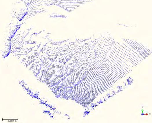
10 Data collection Top-down view
")

11 Post-processing Point Cloud Digital Elevation Model (DEM) Inverse Distance Weighted (IDW) interpolation Sun-illuminated topography
12 Objectives/Goals 1. Potential: Can we use TLS to monitor geomorphologic change in wetlands at high resolution and at multiple spatial and temporal scales? a) Long-term monitoring of different marsh environments b) Short-term effects of single tidal cycles on tidal creek margin stability 2. Limitations: Investigate sources of measurement error with respect to laser beam characteristics
13 Objectives/Goals 1. Potential: Can we use TLS to monitor geomorphologic change in wetlands at high resolution and at multiple spatial and temporal scales? a) Long-term monitoring of different marsh environments b) Short-term effects of single tidal cycles on tidal creek margin stability 2. Limitations: Investigate sources of measurement error with respect to laser beam characteristics
14 Case Studies Elkhorn Slough Spatial and temporal scales a) Long-term monitoring of marsh environments including: - pickleweed edge - mudbanks - Mudflats - mudflat creeks Site #4: North Azavedo Pond Site #3: Bird Observatory Site #2: Sandholdt Bridge Site #1: Potrero Rd

15 Case Studies Elkhorn Slough Spatial and temporal scales a) Long-term monitoring of marsh environments including: - pickleweed edge - mudbanks - Mudflats - mudflat creeks Site #4: North Azavedo Pond Site #3: Bird Observatory Site #2: Sandholdt Bridge Site #1: Potrero Rd

16 Case Studies Elkhorn Slough Spatial and temporal scales a) Long-term monitoring of marsh environments including: - pickleweed edge - mudbanks - Mudflats - mudflat creeks Site #4: North Azavedo Pond Site #3: Bird Observatory Site #2: Sandholdt Bridge Site #1: Potrero Rd

17 Case Studies Elkhorn Slough Spatial and temporal scales a) Long-term monitoring of marsh environments including: - pickleweed edge - mudbanks - Mudflats - mudflat creeks Site #4: North Azavedo Pond Site #3: Bird Observatory Site #2: Sandholdt Bridge Site #1: Potrero Rd

18 Case Studies Elkhorn Slough Spatial and temporal scales a) Long-term monitoring of marsh environments including: - pickleweed edge - mudbanks - Mudflats - mudflat creeks Site #4: North Azavedo Pond Site #3: Bird Observatory Site #2: Sandholdt Bridge Site #1: Potrero Rd
19 Case Studies Elkhorn Slough Spatial and temporal scales a) Long-term monitoring of marsh environments including: - pickleweed edge - mudbanks - Mudflats - mudflat creeks b) Short-term effects of single tidal cycles on tidal creek margin stability Site #4: North Azavedo Pond Site #3: Bird Observatory Site #2: Sandholdt Bridge Site #1: Potrero Rd
: Historic")


 Aerial")
20 Potrero Rd. (Site 1): Historic change m 2 increase in mudflat area ~ 21 cm/yr of marsh loss (horizontal) Aerial imagery courtesy of GoogleEarth
: Mudflat change-")
21 Potrero Rd. (Site 1): Mudflat change- Long-term Dec 19, 2007
: Mudflat change-")
22 Potrero Rd. (Site 1): Mudflat change- Long-term Feb 10, 2009
: Mudflat")
23 Potrero Rd. (Site 1): Mudflat DEM s
: Mudflat")
24 Potrero Rd. (Site 1): Mudflat DEM s
25 Potrero Rd. (Site 1): Mudflat DEM s
: Measuring mudflat creeks Mar-6-2009 Elevation -1.0-2.")
26 Potrero Rd. (Site 1): Measuring mudflat creeks Mar Elevation Measured 118 x-section and thalweg widths and depths
: Mudflat Creek")

 0.5 0.0-0.")


27 Potrero Rd. (Site 1): Mudflat Creek Comparison Results- Long-term Mudflat creek comparisons Dec Mar Distance (m) X-section width Thalweg width Thalweg depth X-section width V -shape U -shape -2.0 Dec 2007 Oct 2008 Mar 2009 Depth Mudflat creek: X-section width / Thalweg width ratio Dec Mar Thalweg width V -shape to U -shape Ratio cm increase in mean creek width Dec 2007 Oct 2008 Mar 2009


28 Bird Observatory (Site 3) Looking north Looking east
29 Bird Observatory (Site 3) Typical Edge Profile: Marsh to Mudflat Pickleweed Edge Pickleweed Marsh Mudflat


30 Bird Observatory (Site 3): Comparison results of mudflat and mudbank, 48 hrs. Dec. 9-11, 2008 N N 2 cm of elevation change! < No change >10 Raster resolution: 3 cm
31 Bird Observatory (Site 3): Pickleweed edge, VERTICAL PLANE Typical Edge Profile: Marsh to Mudflat Pickleweed Edge Pickleweed Marsh Mudflat
32 Bird Observatory (Site 3): Pickleweed edge variability over 1 month (LONG-TERM) Dec. 11- Jan. 9 BEFORE Dec. 11, 2008 AFTER Jan. 9, 2009 Vertical Plane Sloped Plane
 Dec. 11- Jan. 9 BEFORE Dec.")

33 Bird Observatory (Site 3): Pickleweed edge variability over 1 month (LONG-TERM) Dec. 11- Jan. 9 BEFORE Dec. 11, 2008 AFTER Jan. 9, 2009 (m) Change Comparison Results 0.10 Pickleweed edge Vertical Plane Mudbank Sloped Plane
34 Objectives/Goals 1. Potential: Can we use TLS to monitor geomorphologic change in wetlands at high resolution and at multiple spatial and temporal scales? a) Long-term monitoring of different marsh environments b) Short-term effects of single tidal cycles on tidal creek margin stability 2. Limitations: Investigate sources of measurement error with respect to laser beam characteristics Question: How do distance, angle of incidence, and grain size affect the accuracy of TLS measurements?


35 Beam Divergence and Angle of Incidence 0 o Angle Distance = 100 m Beam Diameter 8 4 Footprint (cm) created by laser at angle 0 o 45 o Angle Distance = 100 m 11 4 Trimble VX beam divergence: 8 cm vertical and 4 cm horizontal at 100 m Footprint elongated by 45 o target angle
36 Beam Footprint Footprint Diameter (cm) Trimble VX Spatial Station: IR Laser Footprint Vertical Diameter Distance from station (m) Angle of Incidence (deg O ) * Footprint diameter calculations based on factory technical specifications of beam divergence of 8 cm vertical and 4 cm horizontal at 100 m


37 Surface Properties SAND 45 o 70 o 80 o 45 o 70 o MUD 80 o **Experiment reveals less accurate results when measuring mud at high angles of incidence**
38 Accuracy Experiment: Summary Measurements with high angle of incidence and distance produce large footprint diameters- reducing resolution and accuracy At high angles and distance, fine-grained (mud) surfaces produce less accurate results than coarse-grained (sand) surfaces
39 Take-home message Important to be aware of the limitations of TLS surveys TLS is a rapid and efficient method used to monitor geomorphologic change in a wetland at high resolution and at multiple spatial scales Ability to identify and interpret change is critical to understanding the finescale variability of wetland environments

40 Take-home message Important to be aware of the limitations of TLS surveys TLS is a rapid and efficient method used to monitor geomorphologic change in a wetland at high resolution and at multiple spatial scales Ability to identify and interpret change is critical to understanding the finescale variability of wetland environments - Applications: salt panne development in salt marsh habitats


41 Take-home message Important to be aware of the limitations of TLS surveys TLS is a rapid and efficient method used to monitor geomorphologic change in a wetland at high resolution and at multiple spatial scales Ability to identify and interpret change is critical to understanding the finescale variability of wetland environments - Applications: large-scale engineering projects Parsons Slough proposed sill structure Recently constructed dike at N. Azavedo Pond
 Committee Members Ivano Aiello, MLML John Oliver, MLML Ellen Hines,")
42 Acknowledgements Funding Support California Sea Grant David and Lucile Packard Foundation (Friends of MLML) Committee Members Ivano Aiello, MLML John Oliver, MLML Ellen Hines, SFSU
TIDAL EROSION AT ELKHORN SLOUGH
 TIDAL EROSION AT ELKHORN SLOUGH Virtually all of California s tidal wetlands have been dramatically altered. Hydrological manipulations changes in water flow are widespread. Either flow has been decreased
Using Remote Sensing to Map the Evolution of Marsh Vegetation in the South Bay of San Francisco
 Using Remote Sensing to Map the Evolution of Marsh Vegetation in the South Bay of San Francisco Brian Fulfrost Design, Community and Environment (DC&E) 6 th Annual Bay-Delta Science Conference PROJECT
High Resolution Numerical Models of Tidal Marshes in the Delaware Bay
 High Resolution Numerical Models of Tidal Marshes in the Delaware Bay Ramona Stammermann Dept. of Civil, Architectural & Environmental Engineering, Drexel University, Philadelphia, PA Michael Piasecki
Mechanisms for persistence of Gracilariopsis andersonii in the Elkhorn Slough: links to sediments. Megan Wehrenberg Moss Landing Marine Labs
 Mechanisms for persistence of Gracilariopsis andersonii in the Elkhorn Slough: links to sediments Megan Wehrenberg Moss Landing Marine Labs Gracilariopsis andersonii in Central CA Intertidal Open Coast
Sediment Dynamics in Restored Tidal Wetlands of San Francisco Bay
 Sediment Dynamics in Restored Tidal Wetlands of San Francisco Bay John Callaway & Jennifer Gagnon (USF) Lisa Schile (UC Berkeley) Evyan Borgnis & Tom Parker (SFSU) Donna Ball (HT Harvey & Assoc.) Gene
Wetland Sediment Dynamics at Crissy Field Marsh Annual Report
 Wetland Sediment Dynamics at Crissy Field Marsh 27 Annual Report John Callaway Department of Environmental Science University of San Francisco 217 Fulton St. San Francisco, CA 94117 (415) 422-572 callaway@usfca.edu
Sea Level Rise and the Scarborough Marsh Scarborough Land Trust Annual Meeting April 24, 2018
 Sea Level Rise and the Scarborough Marsh Scarborough Land Trust Annual Meeting April 24, 2018 Peter A. Slovinsky, Marine Geologist Maine Geological Survey Funded by: 50% 40% Figure modified from Griggs,
Elkhorn Slough Marsh Stratigraphy
 Elkhorn Slough Marsh Stratigraphy Prehistoric marsh extent & recent sediment accretion Elizabeth Burke Watson, Ph.D. U.S. Environmental Protection Agency Narragansett, RI Paleoecology: Reconstruction of
GCD WORKSHOP E. TRADITIONAL APPROACHES TO GEOMORPHIC CHANGE DETECTION
 GCD WORKSHOP ICRRR Workshop Joe Wheaton THE BACKGROUND PROBLEM Rivers change through time how do we detect that change? 1 BECOMING EASIER TO TRACK CHANGE... Wheaton (2008) HOW CAN WE CALCULATE CHANGE?
Current and Future Technology Applications for Coastal Zone Management. Bruce K. Carlisle, Acting Director Office of Coastal Zone Management
 Current and Future Technology Applications for Coastal Zone Management Bruce K. Carlisle, Acting Director Office of Coastal Zone Management The Massachusetts Coastal Zone Management Program Approved in
Whiskey Island Marsh Creation Rolling with the Punches
 Whiskey Island Marsh Creation Rolling with the Punches Santiago Alfageme, M&N Jerry Carroll, LADNR Brad Miller, LADNR Project Location Historic Island Retreat Previous Restoration Project Whiskey Island
Disturbance, site, and vegetation feedbacks create landscape structure in South Florida coastal wetlands. M Ross, K Zhang, B Thapa, and D Gann
 Disturbance, site, and vegetation feedbacks create landscape structure in South Florida coastal wetlands M Ross, K Zhang, B Thapa, and D Gann Department of Earth & Environment Florida International University
Holderness Erosion and Evolution of the Spurn Peninsula
 Holderness Erosion and Evolution of the Spurn Peninsula Prof. Ken Pye and Dr. Simon Blott Kenneth Pye Associates Ltd. Outline of the Presentation Overview of historical erosion trends Effects of coast
Predicting the Evolution of Tidal Channels in Muddy Coastlines
 Predicting the Evolution of Tidal Channels in Muddy Coastlines Sergio Fagherazzi Department of Earth Sciences and Center for Computational Science Boston University, Boston MA 02215 Phone: (617) 353-2092
1Watershed Institute, California State University. Monterey Bay. 2Elkhorn Slough National Estuarine Research Reserve
 Central Coast Watershed Studies CCoWS 29 Years of Geomorphic Change in Elkhorn Slough, California Publication No. WI-2010-01 February 22, 2010 Brian Spear¹ Douglas Smith¹ Eric Van Dyke² Lee Vaage 3 The
Quantifying Coastal Evolution using Remote Sensing Approaches
 Quantifying Coastal Evolution using Remote Sensing Approaches Sojan Mathew, Linh Truong Hong, Xavier Pellicer*, Colman Gallagher University College Dublin Geological Survey of Ireland* INFOMAR SEMINAR,
9 th INTECOL Orlando, Florida June 7, 2012
 Restoration of the Everglades Saline Wetlands and Florida Bay: Responses Driven from Land and Sea David Rudnick 1, Colin Saunders 2, Carlos Coronado 2, Fred Sklar 2 Erik Stabenau 1, Vic Engel 1, Rene Price
Coastline monitoring. Virginie Lafon Cyril Mallet. S. Capo, A. Dehouck, E. Maneux, A. Michot, C. Proisy, R. Walker
 Coastline monitoring Virginie Lafon Cyril Mallet Doris_Net May 29, 2012 Pessac, France S. Capo, A. Dehouck, E. Maneux, A. Michot, C. Proisy, R. Walker 29/05/2012 Spatial applications for coastal services
Assessing the Permanence of Blue Carbon Sinks
 Assessing the Permanence of Blue Carbon Sinks with Rising Sea Levels Gail L. Chmura and Dante D. Torio Department of Geography, McGill University and Global Environmental and Climate Change Centre Montreal,
Elkhorn Slough, California
 A bathymetric analysis of equilibrium potential within Elkhorn Slough, California Joshua Sampey Advisor: Rikk Kvitek Prepared for the division of Science and Environmental Policy (SEP), California State
3. MARINE HABITAT RESTORATION
 Feasibility Study for Restoration of Titlow Lagoon Fish Passage South Puget Sound Salmon Enhancement Group 3. MARINE HABITAT RESTORATION Marine habitat restoration at Titlow Park could include restoration
Work Package 5: Signal Processing and Seafloor Classification
 Work Package 5: Signal Processing and Seafloor Classification Jarosław Tęgowski and Karolina Trzcińska Marine Geophysics Lab. Institute of Oceanography University of Gdańsk, Poland Kick-Off Meeting, Kiel,
Object Based Imagery Exploration with. Outline
 Object Based Imagery Exploration with Dan Craver Portland State University June 11, 2007 Outline Overview Getting Started Processing and Derivatives Object-oriented classification Literature review Demo
ELKHORN SLOUGH TECHNICAL REPORT SERIES 2012: 2
 ELKHORN SLOUGH TECHNICAL REPORT SERIES 2012: 2 Sponsored by the Elkhorn Slough National Estuarine Research Reserve and the Elkhorn Slough Foundation Water levels, wetland elevations, and marsh loss Eric
Remote Sensing / GIS Conference. The Louisiana Proposed Elevation for the Nation Business Plan Components
 Remote Sensing / GIS Conference 08 April 2008 The Louisiana Proposed Elevation for the Nation Business Plan Components David Gisclair, Louisiana Oil Spill Coordinators Office, Office of the Governor david.gisclair@la.gov
Modeling Coastal Change Using GIS Technology
 Emily Scott NRS 509 Final Report December 5, 2013 Modeling Coastal Change Using GIS Technology In the past few decades, coastal communities around the world are being threatened by accelerating rates of
RADAR Remote Sensing Application Examples
 RADAR Remote Sensing Application Examples! All-weather capability: Microwave penetrates clouds! Construction of short-interval time series through cloud cover - crop-growth cycle! Roughness - Land cover,
Tidal Wetlands & Climate Change
 Tidal Wetlands & Climate Change Tom Parker (SF State) John Callaway (Univ SF) Lisa Schile (UCB); Ellen Herbert (Indiana U); Evyan Borgnis (USF, SFSU) Jessica Vandenberg (SFSU) Vance Vredenburg (SF State)
Remote Sensing of Snow GEOG 454 / 654
 Remote Sensing of Snow GEOG 454 / 654 What crysopheric questions can RS help to answer? 2 o Where is snow lying? (Snow-covered area or extent) o How much is there? o How rapidly is it melting? (Area, depth,
Geomorphologic Mapping by Airborne Laser Scanning in Southern Victoria Land
 Geomorphologic Mapping by Airborne Laser Scanning in Southern Victoria Land Bea Csatho, Terry Wilson, Tony Schenk, Garry McKenzie, Byrd Polar Research Center, The Ohio State University, Columbus, OH William
UNDERSTANDING STORM TIDES
 UNDERSTANDING STORM TIDES Run from the water, hide from the wind.. CATEGORY CATEGORY CATEGORY CATEGORY CATEGORY 1 2 3 4 5 WIND 74-95 mph 64-82 knots 96-110 mph 83-95 knots 111-130 mph 96-113 knots 131-155
Coastal Zone Mapping and Imaging Lidar (CZMIL)
") Coastal Zone Mapping (CZMIL) Shallow Survey 2012 Wellington, New Zealand Christopher L. Macon U.S. Army Corps of Engineers, Mobile District Joint Airborne Lidar Bathymetry Technical Center of expertise
Coastal Zone Mapping (CZMIL) Shallow Survey 2012 Wellington, New Zealand Christopher L. Macon U.S. Army Corps of Engineers, Mobile District Joint Airborne Lidar Bathymetry Technical Center of expertise
MONITORING AND MODELING NATURAL AND ANTHROPOGENIC TERRAIN CHANGE
 MONITORING AND MODELING NATURAL AND ANTHROPOGENIC TERRAIN CHANGE Spatial analysis and simulations of impact on landscape processess Helena MITASOVA, Russell S. HARMON, David BERNSTEIN, Jaroslav HOFIERKA,
Why Geomorphology for Fish Passage
 Channel Morphology - Stream Crossing Interactions An Overview Michael Love Michael Love & Associates mlove@h2odesigns.com (707) 476-8938 Why Geomorphology for Fish Passage 1. Understand the Scale of the
Digital Elevation Models (DEM) / DTM
 / DTM") Digital Elevation Models (DEM) / DTM Uses in remote sensing: queries and analysis, 3D visualisation, classification input Fogo Island, Cape Verde Republic ASTER DEM / image Banks Peninsula, Christchurch,
Digital Elevation Models (DEM) / DTM Uses in remote sensing: queries and analysis, 3D visualisation, classification input Fogo Island, Cape Verde Republic ASTER DEM / image Banks Peninsula, Christchurch,
12/26/2012. Geographic Information Systems * * * * GIS (... yrezaei
 ( - Geographic Information Systems ( ( 1 2 3 Information System Data base DB IS IS DB (Knowledge ( ( (System (Information System - (Georefrence Analysis Data + Knowledge ======== Information 4 5 ( < 10%
MONITORING OF FLUVIAL TRANSPORT IN THE MOUNTAIN RIVER BED USING TERRESTRIAL LASER SCANNING
 MONITORING OF FLUVIAL TRANSPORT IN THE MOUNTAIN RIVER BED USING TERRESTRIAL LASER SCANNING G. Jozkow a, *, A. Borkowski a, M. Kasprzak b a Institute of Geodesy and Geoinformatics, Wroclaw University of
JALBTCX AND THE USACE NATIONAL COASTAL MAPPING PROGRAM
 JALBTCX AND THE USACE NATIONAL COASTAL MAPPING PROGRAM 237 237 237 217 217 217 200 200 200 80 119 27 252 174.59 1 255 255 255 0 0 0 163 163 163 131 132 122 239 65 53 110 135 120 112 92 56 62 102 130 102
Integrating LiDAR data into the workflow of cartographic representation.
 Integrating LiDAR data into the workflow of cartographic representation. Cartographic Workflow I. 1 2 3 4 5 Surveying Vector (Nat. GDB) GPS, Laser Range Finder Yes/ No Scanning old maps LiDARflights Capture
Applications of GIS in assessing Coastal Change Rachel Hehre November 30, 2004 NRS 509 OVERVIEW
 Applications of GIS in assessing Coastal Change Rachel Hehre November 30, 2004 NRS 509 OVERVIEW ITRODUCTION Due to the dynamic nature of coastal systems, representing coastal change with precision and
Analysis of Road Sediment Accumulation to Monumental Creek using the GRAIP Method
 Analysis of Road Sediment Accumulation to Monumental Creek using the GRAIP Method Introduction (from http://www.neng.usu.edu/cee/faculty/dtarb/graip/#over): The Geomorphologic Road Analysis and Inventory
Technical Drafting, Geographic Information Systems and Computer- Based Cartography
 Technical Drafting, Geographic Information Systems and Computer- Based Cartography Project-Specific and Regional Resource Mapping Services Geographic Information Systems - Spatial Analysis Terrestrial
08/01/2012. LiDAR. LiDAR Benefits. LiDAR-BASED DELINEATION OF WETLAND BORDERS. CCFFR-2012 Society for Canadian Limnologists:
 LiDAR CCFFR-2012 Society for Canadian Limnologists: Science for Wetland Policy and Management LiDAR-BASED DELINEATION OF WETLAND BORDERS Distance from laser to ground and back again: Determined as laser-pulse
USGS efforts to model sea-level rise impact to tidal marshes along the California coast.
 USGS efforts to model sea-level rise impact to tidal marshes along the California coast. Karen Thorne 1 J.Y Takekawa 1, K. Buffington 1, K. Swanson 2, J. Drexler 2, D.Schoellhamer 2, M. Casazza 3, and
GIS USE IN THE STUDY OF ESTUARINE SOILS AND SEDIMENTS Margot K. Payne NRS 509 November 30, 2005
 GIS USE IN THE STUDY OF ESTUARINE SOILS AND SEDIMENTS Margot K. Payne NRS 509 November 30, 2005 Throughout the world, estuaries are not only some of the most ecologically productive environments, but are
Waterborne Environmental, Inc., Leesburg, VA, USA 2. Syngenta Crop Protection, LLC, North America 3. Syngenta Crop Protection, Int.
 Application of High Resolution Elevation Data (LiDAR) to Assess Natural and Anthropogenic Agricultural Features Affecting the Transport of Pesticides at Multiple Spatial Scales Josh Amos 1, Chris Holmes
Spatial Survey of Surface Soil Moisture in a Sub-alpine Watershed
 Spatial Survey of Surface Soil Moisture in a Sub-alpine Watershed Katherine E. Williams M.S. GISc Candidate Department of Geography, University of Denver October 7, 2010 Purpose 2 Introduction to Soil
Effects of erosion on subtidal communities in Elkhorn Slough. Catalina E. Reyes Moss Landing Marine Laboratories January 20, 2010
 Effects of erosion on subtidal communities in Elkhorn Slough Catalina E. Reyes Moss Landing Marine Laboratories January 2, 21 Estuarine Habitats Estuaries Low relief sedimentary Little to no rocky substrate
A Detailed Examination of DTM Creation Methods and Sources. Study Area Overview
 A Detailed Examination of DTM Creation Methods and Sources Adam Mosbrucker & Melinda Lamb Geography 593: Dec. 2 nd, 2010 Study Area Overview Mt. St. Helens -active volcano many eruptions in the past 30
SEDIMENT TRANSPORT IN RIVER MOUTH ESTUARY
 SEDIMENT TRANSPORT IN RIVER MOUTH ESTUARY Katsuhide YOKOYAMA, Dr.Eng. dredge Assistant Professor Department of Civil Engineering Tokyo Metropolitan University 1-1 Minami-Osawa Osawa, Hachioji,, Tokyo,
MaxDepth Aquatics, Inc.
 MaxDepth Aquatics, Inc. Bathymetry of Mirror Pond From Newport Bridge to Galveston Bridge Prepared for the City of Bend By Joseph Eilers & Benn Eilers MaxDepth Aquatics, Inc. Bend, OR June 2005 INTRODUCTION
Long-term estuary processes and morphological change
 Long-term estuary processes and morphological change Professor Ken Pye with contributions from Dr. Simon Blott and Dr. Daphne van der Wal Department of Geology Available top-down methods relying on data
3.3 CLIMATE, GEOLOGY, TOPOGRAPHY, AND SOILS CLIMATE GEOLOGY TOPOGRAPHY
 3.3 CLIMATE, GEOLOGY, TOPOGRAPHY, AND SOILS This section describes the climate, geology, topography, and soil resource characteristics of the Yolo Bypass Wildlife Area (Wildlife Area). Agricultural soil
ENGRG Introduction to GIS
 ENGRG 59910 Introduction to GIS Michael Piasecki March 17, 2014 Lecture 08: Terrain Analysis Outline: Terrain Analysis Earth Surface Representation Contour TIN Mass Points Digital Elevation Models Slope
Tidal Wetland Vegetation
 Wetlands Regional Monitoring Program Plan 00 Data Collection Protocol Michael Vasey San Francisco State University San Francisco CA John Callaway University of San Francisco San Francisco CA V. Thomas
APPENDIX F SEDIMENT DEPOSITION AND HABITAT CONVERSION ANALYSIS
 APPENDIX F SEDIMENT DEPOSITION AND HABITAT CONVERSION ANALYSIS San Dieguito Lagoon W-19 Restoration Project Draft EIR March 2017 Appendices Introduction: The following is an analysis to provide the volume
Geomorphology Studies
 Geomorphology Studies Technical Workgroup Meeting February 14, 2012 Prepared by: Tetra Tech Prepared for: Alaska Energy Authority Overall Goal Geomorphology Studies Two studies Geomorphology Study (RSP
ISO Swift Current LiDAR Project 2009 Data Product Specifications. Revision: A
 ISO 19131 Swift Current LiDAR Project 2009 Data Product Specifications Revision: A Data product specifications: Swift Current LiDAR Project 2009 - Table of Contents- 1. Overview... 4 1.1. Informal description...
Baseline Estuarine-Upland Transition Zone
 Baseline Estuarine-Upland Transition Zone in SF, San Pablo and Suisun Bays 10/5/18 Prepared for San Francisco Bay Joint Venture (SFBJV) Prepared by Brian Fulfrost, Principal bfaconsult@gmail.com with additional
Channel responses to the removal of Gold Ray and Savage Rapids Dam. Prepared by Desirée Tullos and Cara Water
 Channel responses to the removal of Gold Ray and Savage Rapids Dam Prepared by Desirée Tullos and Cara Water Introduction. As the results of extensive efforts over several decades, the Rogue River is now
Primer on Coastal Erosion And Habitat Creation
 2 nd Regional Conference Dredging, Beach Nourishment & Bird Conservation Primer on Coastal Erosion And Habitat Creation Timothy Kana Ph.D Source: Newsday 1962 Photo by Kelsey Aerials 1978 Source: U Mass
Wetland & Floodplain Functional Assessments and Mapping To Protect and Restore Riverine Systems in Vermont. Mike Kline and Laura Lapierre Vermont DEC
 Wetland & Floodplain Functional Assessments and Mapping To Protect and Restore Riverine Systems in Vermont Mike Kline and Laura Lapierre Vermont DEC NWI+ Hydro-Geomorphic Characterization of Wetlands and
Laser scanning for Engineering Geology
 Laser scanning for Engineering Geology Peter Hobbs British Geological Survey Keyworth, Nottingham, NG12 5GG prnh@bgs.ac.uk Digital Information in 3D Innovations & Best Practice, Prince Philip House, London,
ENGRG Introduction to GIS
 ENGRG 59910 Introduction to GIS Michael Piasecki November 17, 2017 Lecture 11: Terrain Analysis Outline: Terrain Analysis Earth Surface Representation Contour TIN Mass Points Digital Elevation Models Slope
Summary Visualizations for Coastal Spatial Temporal Dynamics
 Summary Visualizations for Coastal Spatial Temporal Dynamics October 24 2011 Providence, RI Sidharth Thakur 1, Laura Tateosian 2, Helena Mitasova, Eric Hardin, and Margery Overton 1. sthakur@renci.org,
Topographical Change Monitoring for Susceptible Landslide Area Determination by Using Multi-Date Digital Terrain Models and LiDAR
 Topographical Change Monitoring for Susceptible Landslide Area Determination by Using Multi-Date Digital Terrain Models and Chanist PRASERTBURANAKUL 1, Parkorn SUWANICH 2, Kanchana NAKHAPAKORN 3, and Sukit
KING EDWARD POINT OBSERVATORY MAGNETIC DATA
 BRITISH GEOLOGICAL SURVEY King Edward d Point Observatory Monthly Magnetic Bulletin May 2018 18/05/KE King Edward Point (UK) Maps British Antarctic Survey KING EDWARD POINT OBSERVATORY MAGNETIC DATA 1.
A Multi-Hazard Evaluation of Vulnerability using GIS along Cape Hatteras National Seashore, NC
 A Multi-Hazard Evaluation of Vulnerability using GIS along Cape Hatteras National Seashore, NC Tom Allen¹, Burrell Montz¹, JP Walsh¹, Tom Crawford² ¹East Carolina University, ²Saint Louis University Presented
KING EDWARD POINT OBSERVATORY MAGNETIC DATA
 BRITISH GEOLOGICAL SURVEY King Edward d Point Observatory Monthly Magnetic Bulletin September 2018 18/09/KE King Edward Point (UK) Maps British Antarctic Survey KING EDWARD POINT OBSERVATORY MAGNETIC DATA
Luyi Sun & Jan-Peter Muller, Imaging Group, Mullard Space Science Laboratory, University College London
 Evaluation of the use of the sub-pixel Offset Tracking method with conventional dinsar techniques to monitor landslides in densely vegetated terrain in the Three Gorges Region, China Luyi Sun & Jan-Peter
Design of Levee Breaches in Sheltered Water for Flood Risk Reduction & Marsh Restoration ASFMP; June 5, 2014 Presented By:
 Design of Levee Breaches in Sheltered Water for Flood Risk Reduction & Marsh Restoration ASFMP; June 5, 2014 Presented By: Rohin Saleh Alameda County Flood Control District Matt Powers, P.E. GEI Consultants
KING EDWARD POINT OBSERVATORY MAGNETIC DATA
 BRITISH GEOLOGICAL SURVEY King Edward d Point Observatory Monthly Magnetic Bulletin October 2018 18/10/KE King Edward Point (UK) Maps British Antarctic Survey KING EDWARD POINT OBSERVATORY MAGNETIC DATA
Hazard Mapping Along the Dead Sea Shoreline
 FIG Working Week in Marrakech, Morocco 18-22 May 2011 Hazard Mapping Along the Dead Sea Shoreline Rami Al-Ruzouq, Abdullah Al-Zuobi, AbdEl-Rahman Abueladas, Emad Akkawi Department of Surveying and Geomatics
2.2.7 Backbarrier flats
 FIGURE 24. VERTICAL PHOTOGRAPH SHOWING THE DEVELOPMENT OF SMALL PARABOLIC DUNES FROM BLOWOUTS IN A LARGE RELICT FOREDUNE NORTHWEST OF HUNTER'S CREEK. PHOTOGRAPH COURTESY OF CAR'T'ER HOLT HARVEY FORESTS
Planning for the Future of Humboldt Bay: Sea Level Rise, Sediment Management, Sand Spits and Salt Marshes. Joel Gerwein
 Planning for the Future of Humboldt Bay: Sea Level Rise, Sediment Management, Sand Spits and Salt Marshes Joel Gerwein Introduction to Humboldt Bay Setting Economy, community, and environment Sediment
Digital Elevation Models (DEM) / DTM
 / DTM") Digital Elevation Models (DEM) / DTM Uses in remote sensing: queries and analysis, 3D visualisation, layers in classification Fogo Island, Cape Verde Republic ASTER DEM / image Banks Peninsula, Christchurch,
Digital Elevation Models (DEM) / DTM Uses in remote sensing: queries and analysis, 3D visualisation, layers in classification Fogo Island, Cape Verde Republic ASTER DEM / image Banks Peninsula, Christchurch,
Modeling habitat suitability for the European green crab using the ShoreZone mapping system
 Modeling habitat suitability for the European green crab using the ShoreZone mapping system Jodi N. Harney, Ph.D. and John R. Harper, Ph.D. Coastal and Ocean Resources Inc. Mary Morris, R.P. Bio. Archipelago
REDWOOD VALLEY SUBAREA
 Independent Science Review Panel Conceptual Model of Watershed Hydrology, Surface Water and Groundwater Interactions and Stream Ecology for the Russian River Watershed Appendices A-1 APPENDIX A A-2 REDWOOD
Determining the Suitable Sediment extraction Locations of Existing Sand and Gravel Mines on Boshar River in Iran using HEC-RAS Modeling
 ICSE6-134 Determining the Suitable Sediment extraction Locations of Existing Sand and Gravel Mines on Boshar River in Iran using HEC-RAS Modeling Mohammad GHARESIFARD 1, Ali JAHEDAN 2, Bahar MOLAZEM 3
MPA Baseline Program. Annual Progress Report. North Coast
 MPA Baseline Program Annual Progress Report Principal Investigators - please use this form to submit your MPA Baseline Program project annual report, including an update on activities completed over the
Lidar data in water resources applications. Paola Passalacqua CE 374K Lecture, April 5 th, 2012
 Lidar data in water resources applications Paola Passalacqua CE 374K Lecture, April 5 th, 2012 Airborne Lidar Airborne laser altimetry technology (LiDAR, Light Detection And Ranging) provides high-resolution
J.B. Shaw and D. Mohrig
 GSA DATA REPOSITORY 2014008 J.B. Shaw and D. Mohrig Supplementary Material Methods Bathymetric surveys were conducted on 26 June- 4 July, 2010 (Fig. 2A), 7 March, 2011 (Fig. 2B), 11-12 August, 2011 (Figs.
Geospatial Data, Services, and Products. National Surveying, mapping and geospatial conference
 Geospatial Data, Services, and Products Federal Programs -- USDA NRCS National Surveying, mapping and geospatial conference March 15, 2016 NRCS Applications using Geosaptial Products & Services Field
Use of Elevation Data in NOAA Coastal Mapping Shoreline Products. Coastal GeoTools April 1, 2015
 Use of Elevation Data in NOAA Coastal Mapping Shoreline Products Coastal GeoTools April 1, 2015 - NOAA s Coastal Mapping Program & CUSP - Shoreline Uses, Delineation Issues, Definitions - Current Extraction
Stop 1: Marmot Dam Stop 1: Marmot Dam
 Stop 1: Marmot Dam Stop 1: Marmot Dam Following the removal of Marmot Dam in 2007, the fate of the reservoir sediments has been monitored through a series of surveys and sediment transport measurements.
Geog 1000 Lecture 17: Chapter 10
 Geog 1000 Lecture 17: Chapter 10 Landslides and Mass Movements Link to lectures: http://scholar.ulethbridge.ca/chasmer/classes/ Today s Lecture 1. Assignment 2 Due Pick up Assignment 1 if you don t have
The Use of Geographic Information Systems to Assess Change in Salt Marsh Ecosystems Under Rising Sea Level Scenarios.
 The Use of Geographic Information Systems to Assess Change in Salt Marsh Ecosystems Under Rising Sea Level Scenarios Robert Hancock The ecological challenges presented by global climate change are vast,
GIS based Estimation of snow depth in mountainous Himalayan region: A case study
 GIS based Estimation of snow depth in mountainous Himalayan region: A case study Chander Shekhar *1, S K Dewali *, Snehmani * * Snow and Avalanche Study Establishment, Chandigarh, India 160036, India 1
Cowichan Estuary Habitat Mapping and Oyster Population Assessment. Cowichan Stewardship Round Table
 Cowichan Estuary Habitat Mapping and Oyster Population Assessment Presentation at Cowichan Stewardship Round Table June 21, 2018 By Dr. Goetz Schuerholz 1 More than 8000 drone photos taken stitched together
Coastal Barrier Island Network (CBIN): Management strategies for the future
: Management strategies for the future") Coastal Barrier Island Network (CBIN): Management strategies for the future Heather Joesting*, Amy Williams**, Rusty Feagin**, and William K. Smith* *Department of Biology, Wake Forest University, Winston
Coastal Barrier Island Network (CBIN): Management strategies for the future Heather Joesting*, Amy Williams**, Rusty Feagin**, and William K. Smith* *Department of Biology, Wake Forest University, Winston
CAUSES FOR CHANGE IN STREAM-CHANNEL MORPHOLOGY
 CAUSES FOR CHANGE IN STREAM-CHANNEL MORPHOLOGY Chad A. Whaley, Department of Earth Sciences, University of South Alabama, MobileAL, 36688. E-MAIL: caw408@jaguar1.usouthal.edu The ultimate goal of this
Hydro One (Sept 2014) Hydro One (Sept 2014) Hydro One (Sept 2014)
 Hydro One (Sept 2014) Hydro One (Sept 2014)") TABLE 1 WELL CONSTRUCTION DETAILS MOE WWR No Well ID Location Installation Date Status Easting Coordinates Northing Source Elevation Screened Interval Screened Material Borehole Well Stick-up Ground Top
TABLE 1 WELL CONSTRUCTION DETAILS MOE WWR No Well ID Location Installation Date Status Easting Coordinates Northing Source Elevation Screened Interval Screened Material Borehole Well Stick-up Ground Top
Ground Water Control of Tree Island Origin, Genesis and Destruction. By John F. Meeder and Peter W. Harlem SERC,FIU
 Ground Water Control of Tree Island Origin, Genesis and Destruction By John F. Meeder and Peter W. Harlem SERC,FIU Functional Definition Our functional definition of a Tree Island is; an isolated scrub
GEOGRAPHIC INFORMATION SYSTEMS (GIS) AT GERS LAB
 AT GERS LAB") GEOGRAPHIC INFORMATION SYSTEMS (GIS) AT GERS LAB Fernando Gilbes Santaella GERS Lab-Department of Geology University of Puerto Rico at Mayaguez fernando.gilbes@upr.edu Geological and Environmental Remote
GEOGRAPHIC INFORMATION SYSTEMS (GIS) AT GERS LAB Fernando Gilbes Santaella GERS Lab-Department of Geology University of Puerto Rico at Mayaguez fernando.gilbes@upr.edu Geological and Environmental Remote
Monthly Magnetic Bulletin
 BRITISH GEOLOGICAL SURVEY Ascension Island Observatory Monthly Magnetic Bulletin March 2017 17/03/AS Crown copyright; Ordnance Survey ASCENSION ISLAND OBSERVATORY MAGNETIC DATA 1. Introduction Ascension
GIS and Remote Sensing
 Spring School Land use and the vulnerability of socio-ecosystems to climate change: remote sensing and modelling techniques GIS and Remote Sensing Katerina Tzavella Project Researcher PhD candidate Technology
MID-TERM CONFERENCE CREST
 MID-TERM CONFERENCE CREST 23 November 2017 Innovation in Coastal Monitoring Alain De Wulf (Ugent, Geography Dept.) Innovation in coastal monitoring Outline Why? How? What (tools do we use to assess)? Conclusion
Changes in bottom morphology of Long Island Sound near Mount Misery Shoal as observed through Repeated Multibeam Surveys
 Changes in bottom morphology of Long Island Sound near Mount Misery Shoal as observed through Repeated Multibeam Surveys Laurie A. Zaleski Laurie.Zaleski@msrc.sunysb.edu Roger D. Flood rflood@notes.cc.sunysb.edu
Appendix C Fluvial Flood Hazards
 Appendix C Fluvial Flood Hazards Sea Level Rise Vulnerability Assessment and Adaptation Project March 2019 Contents Contents... i Figures... i Tables... i Definitions, Acronyms, & Abbreviations... ii
Estimating Stream Gradient Using NHD Stream Lines and DEM Data
 Estimating Stream Gradient Using NHD Stream Lines and DEM Data David Nagel, John M. Buffington, and Daniel Isaak U.S. Forest Service, Rocky Mountain Research Station Boise Aquatic Sciences Lab Boise, ID