MID-TERM CONFERENCE CREST
|
|
|
- Nathaniel Chapman
- 5 years ago
- Views:
Transcription

1 MID-TERM CONFERENCE CREST 23 November 2017 Innovation in Coastal Monitoring Alain De Wulf (Ugent, Geography Dept.)
2 Innovation in coastal monitoring Outline Why? How? What (tools do we use to assess)? Conclusion 23/11/2017
3 Innovation in coastal monitoring Outline Why? How? What (tools do we use to assess)? Conclusion 23/11/2017
 Wet transport (tides, currents,")
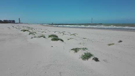
4 Why monitor the coast? Sand particles move! Dry transport (wind) Wet transport (tides, currents, waves) 23/11/2017
5 Why monitor the sand particles on the coast? Coastal Safety (flooding) Tourism (spatious sand beaches) Habitat preservation Therefore the erosion/accretion balance must be monitored and understood. Classical assumption: Erosion during storm events Accretion in standard weather situations 23/11/2017


6 Why monitor the sand particles on the coast If erosion/accretion volumes are not in balance => beach nourishment = reclamation of the beach areas (quite expensive) 23/11/2017
7 Innovation in coastal monitoring Outline Why? How? What (tools do we use to assess)? Conclusion 23/11/2017


8 How? 1. By measuring the geometric changes Comparison of different techniques Aerial Lidar Drone survey Terrestrial Static GNSS Kinematic GNSS Static Lidar Kinematic Lidar Hydrographic Single beam echosounder Multi beam echosounder 23/11/2017
 By")

9 How: 2. By measuring the sand transport in the dry (Aeolian campaigns) By measuring the spatial and temporal variability of sediment transport on the beach with acoustic sensors and sand traps and sand catchers By measuring surficial moisture content changes 23/11/2017
 By measuring the wind conditions:")
10 How? 2. By measuring the sand transport in the dry (Aeolian campaigns) By measuring the wind conditions: wind speed and wind direction at different heights above the surface with meteorological stations

11 How? 2. By measuring the sand transport in the dry (Aeolian campaigns)

12 How? 3. By measuring the sand transport in the wet Near shore wave and current conditions (e.g. with ADCP, ) Sediment concentration, 23/11/2017
13 Innovation in coastal monitoring Outline Why? How? What? Conclusion 23/11/2017
14 Innovation in coastal monitoring Outline Why? How? What is the innovation in monitoring techniques? Conclusion 23/11/2017
15 Innovation in coastal monitoring What is the innovation in geometric monitoring techniques? Speed of acquisition - Terrestrial Lidar: 0.25 till 1 million points/s (<> 20 p/s). Quantity of acquisition (point density) - 1 cross-section per 5 cm (<> 50 m). - interval distance in the cross-section: 1-5 cm (<> 5m). Quality of acquisition - Accuracy on sub cm level in x,y,z (<> 1 dm). 23/11/2017
16 Innovation in coastal monitoring What is the innovation in geometric monitoring techniques? Speed, density, quality => Detailed 3D model instead of small set 2D profiles 4D (1 model per hour) with static long-range terrestrial laser scanner => Small (sub cm) changes and very short time ( 1 hour) changes can now be monitored. 23/11/2017
17 Innovation in coastal monitoring What is the innovation in monitoring techniques? Dry aeolian transport: detection of sand particle movement with automated electronic devices. Wet transport: automated density and current sensors. multi beam in intertidal zone (even in extremely shallow water < 1 m). 23/11/2017
18 Innovation in coastal monitoring Outline Why? How? What tools do we use to evaluate the topographic / morphologic changes? Conclusion 23/11/2017
. Allows: Sub-cm grid intervals (e.g. 300 m by 160 m grid of 1 cm cells => ca. 0.")
19 How: tools to evaluate the topographic / morphologic changes Software development of high precision analysis tool High precision digital terrain modelling tool (PC: maximum up to 8 billion grid cells with 32 Gb RAM). Allows: Sub-cm grid intervals (e.g. 300 m by 160 m grid of 1 cm cells => ca. 0.5 billion cells) Visualisation Filtering (outlier removal) Correlation computation CREST meeting January 20, 2016

20 How: tools to evaluate the topographic / morphologic changes Depth Analysis CREST meeting January 20, 2016

 SeArch meeting")
21 How: tools to evaluate the topographic / morphologic changes Slope Analysis Maximal Slope (%) SeArch meeting January 14, 2016


22 How: tools to evaluate the topographic / morphologic changes Slope Analysis Maximal Slope (%) Direction of maximal slope SeArch meeting January 14, 2016


23 How: tools to evaluate the topographic / morphologic changes Slope Analysis Maximal Slope (%) Direction of maximal slope Slope in specified direction SeArch meeting January 14, 2016
 Direction of")
 SeArch meeting")
24 How: tools to evaluate the topographic / morphologic changes Slope Analysis Maximal Slope (%) Direction of maximal slope Slope in specified direction Slope curvature (second derivative model) SeArch meeting January 14, 2016

25 How: tools to evaluate the topographic / morphologic changes Intensity Analysis Intensity values of the backscatter SeArch meeting January 14, 2016

26 How: tools to evaluate the topographic / morphologic changes Intensity Analysis Maximum slope of intensity values SeArch meeting January 14, 2016

27 How: tools to evaluate the topographic / morphologic changes Intensity Analysis Maximum slope of intensity values Direction of maximum intensity slope SeArch meeting January 14, 2016
28 How: tools to evaluate the topographic / morphologic changes Backscatter intensity Analysis Intensity of the backscatter signal Direction of maximum intensity slope Slope in specified direction SeArch meeting January 14, 2016

 SeArch meeting January")
29 How: tools to evaluate the topographic / morphologic changes Backscatter intensity Analysis Intensity of the backscatter signal Direction of maximum intensity slope Slope in specified direction Slope curvature (second derivative model) SeArch meeting January 14, 2016

30 How: tools to evaluate the topographic / morphologic changes Correlation analysis height <> backscatter Without noise elimination and intensity correction => almost no correlation Geometric model can be improved by optimal noise filtering Backscatter model can be improved by corrections for distance, angle (and humidity?) In the near future significant higher correlation can be expected between the improved geometry and the improved backscatter model CREST meeting January 20, 2016
 Boxplot (1.")
31 How: tools to evaluate the topographic / morphologic changes Noise removal: outlier elimination Local Relief (absolute difference value) Standard Deviation (n*sd) Boxplot (1.5 * (Q3-Q1)) Can be applied to: Geometric model Depths Slopes Curvature Backscatter model Intensity Slopes Curvature SeArch meeting January 14, 2016
32 How: tools to evaluate the topographic / morphologic changes Noise removal: outlier elimination Local Relief (absolute difference value) Standard Deviation (n*sd) Boxplot (1.5 * (Q3-Q1)) SeArch meeting January 14, 2016
33 Innovation in coastal monitoring Outline Why? How? What (tools do we use to assess)? Conclusion 23/11/2017
34 Innovation in coastal monitoring Conclusion Safety, tourism and habitat protection requires accurate and frequent beach monitoring. Nowadays significantly more fast and accurate technologies are available as well for geometry modelling of the beaches as for dry (aeolian) and wet transport of sand particles. A combination of these techniques combined with simultaneous measurements allows a new and deeper insight in the mechanisms of sand transport and will connect the small scale observations with the big scale observations. 23/11/2017

35 In samenwerking met Met dank aan 23/11/2017

36 Monitoring wind-blown sand Glenn Strypsteen Mid-term Conference CREST, 23/11/2017 Conference Room Planet Ocean

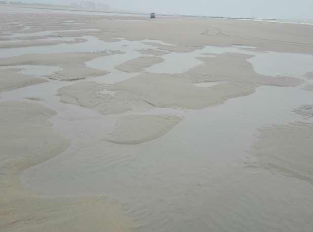
37 Study area
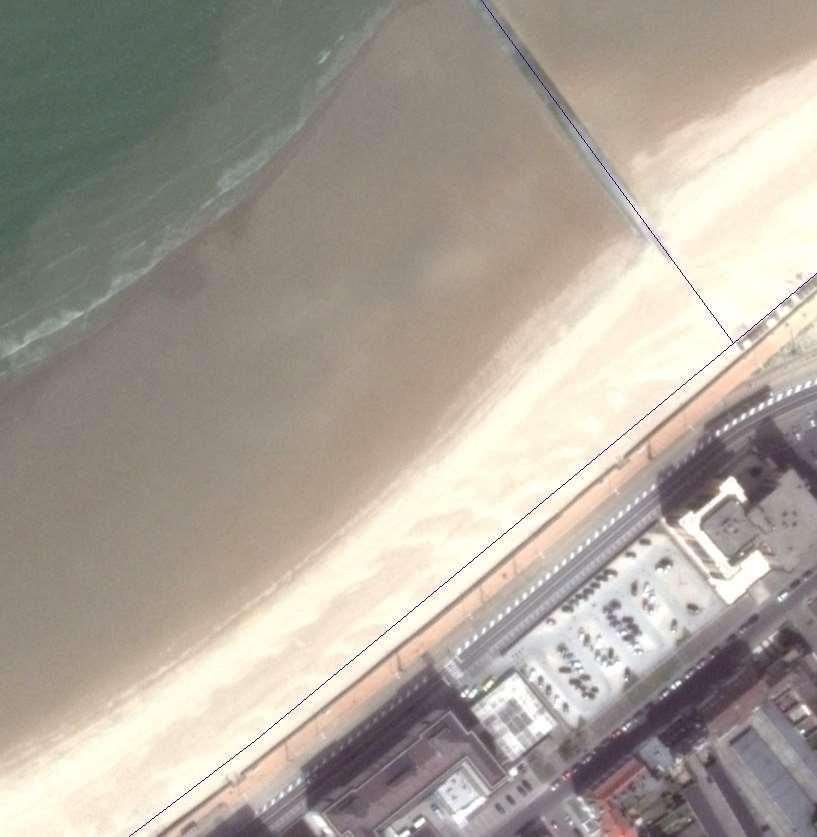
38 Measurement positions

39 A variety of instruments are used
40 Sand traps capture the wind-blown sand at different heights

41 Saltiphones record grain impacts every second

42 A horizontal sand trap captures sand in downwind direction

43 Laser scanner measures the topography from a fixed position (TU Delft)

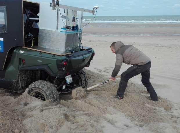
44 Or on a mobile all-terrain vehicle (Ughent)

45 Meteorological stations measure the wind conditions and temperature
46 A typical campaign
47 A typical campaign

48 Thank you! Glenn Strypsteen KU Leuven Campus Bruges Faculty of Engineering Technology
49 MID-TERM CONFERENCE CREST 23 November 2017 Beach topography: measuring techniques
50 Topography: traditional survey 2D Profiles RTK-GNSS 14/05/2018

51 Topography: traditional survey 2D Profiles RTK-GNSS 14/05/2018

52 3D survey Platform: mobile 4x4 with Laserscanner RTK-GNSS Motion sensor 14/05/2018
53 3D survey MTLS (Lidar): Own system:
54 3D survey Acquisition similar to multibeam setup Boresight offsets Calibration 14/05/2018

55 3D survey Acquisition on site Survey lines Approx. 2-3 hours 14/05/2018
56 3D survey Challenges 14/05/2018
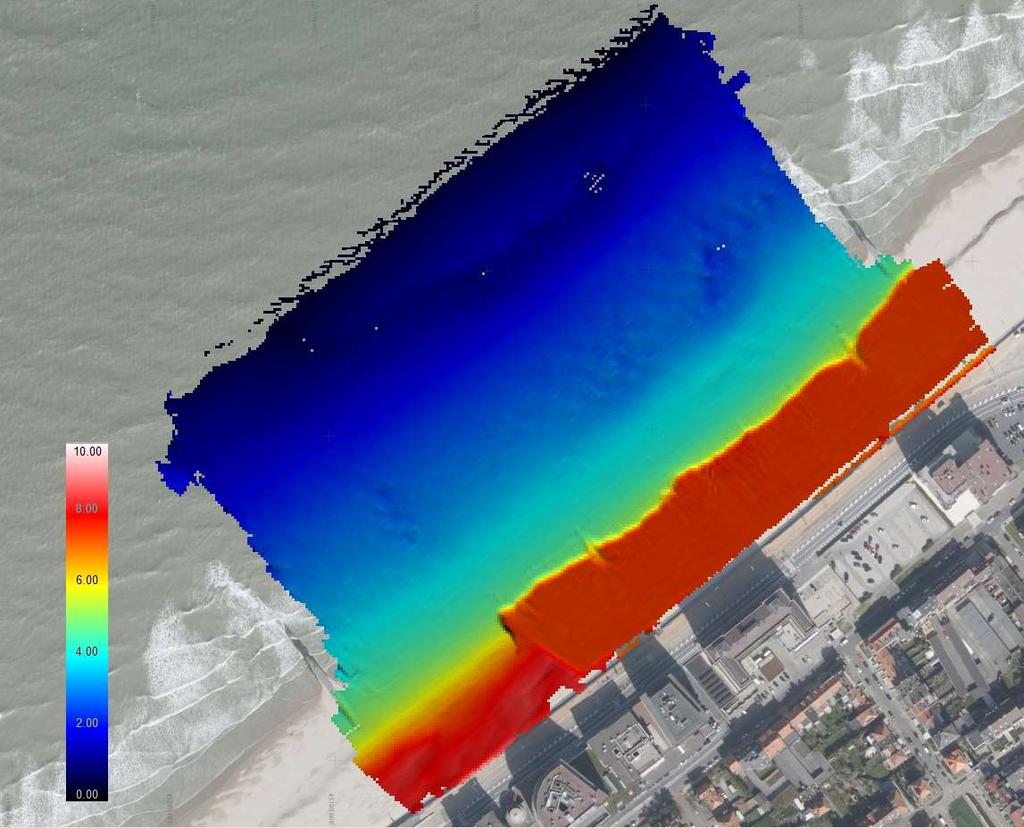
57 3D survey 14/05/2018

58 Result: after cleaning
59 Comparing techniques Drone survey Long distance laser Lidar 14/05/2018

60 Comparing techniques Drone survey Long distance laser Lidar 14/05/2018
61 Comparing techniques Drone survey Long distance laser Lidar 14/05/2018
62 In samenwerking met Met dank aan 14/05/2018
Beach Profile Changes using RTK GPS : A Case Study Maizati Binti Mohamed Amin 1, a, Radzuan Sa ari 1, b, Muhammad Azril Hezmi 1, c
 Beach Profile Changes using RTK GPS : A Case Study Maizati Binti Mohamed Amin 1, a, Radzuan Sa ari 1, b, Muhammad Azril Hezmi 1, c 1 Faculty of Civil Engineering, Universiti Teknologi Malaysia, Malaysia
Dunes Growth Estimation for Coastal Protection
 Dunes Growth Estimation for Coastal Protection Muhammad Zikra Department of Ocean Engineering, Faculty of Marine Technology, ITS, Kampus ITS Keputih Sukolilo, Surabaya 60111 Abstract: This paper describes
Quantifying Coastal Evolution using Remote Sensing Approaches
 Quantifying Coastal Evolution using Remote Sensing Approaches Sojan Mathew, Linh Truong Hong, Xavier Pellicer*, Colman Gallagher University College Dublin Geological Survey of Ireland* INFOMAR SEMINAR,
Overview. Calibration Bench. Research topic & Error Sources. Methodology. Results. Future Research. Conclusion
 PROCEDURE FOR ANALYZING GEOMETREICAL CHARACTERISTICS OF AN EDM CALIBRATION BENCH Ghent University, Department of Geography, Ghent, Belgium 3D Data Acquisition Cluster Alain De Wulf Denis Constales Jessica
Applications of GIS in assessing Coastal Change Rachel Hehre November 30, 2004 NRS 509 OVERVIEW
 Applications of GIS in assessing Coastal Change Rachel Hehre November 30, 2004 NRS 509 OVERVIEW ITRODUCTION Due to the dynamic nature of coastal systems, representing coastal change with precision and
PHASE 1 STUDIES UPDATE EROSION WORKING GROUP
 PHASE 1 STUDIES UPDATE EROSION WORKING GROUP Presented By MICHAEL WOLFF, PG Erosion Study Area Manager West Valley Demonstration Project Quarterly Public Meeting February 24, 2016 OUTLINE Study 1 Terrain
Coastal Zone Mapping and Imaging Lidar (CZMIL)
") Coastal Zone Mapping (CZMIL) Shallow Survey 2012 Wellington, New Zealand Christopher L. Macon U.S. Army Corps of Engineers, Mobile District Joint Airborne Lidar Bathymetry Technical Center of expertise
Coastal Zone Mapping (CZMIL) Shallow Survey 2012 Wellington, New Zealand Christopher L. Macon U.S. Army Corps of Engineers, Mobile District Joint Airborne Lidar Bathymetry Technical Center of expertise
High Resolution Numerical Models of Tidal Marshes in the Delaware Bay
 High Resolution Numerical Models of Tidal Marshes in the Delaware Bay Ramona Stammermann Dept. of Civil, Architectural & Environmental Engineering, Drexel University, Philadelphia, PA Michael Piasecki
Introduction to Acoustic Remote Sensing and Seafloor Mapping (AE4-E13) May 19, 2010
 May 19, 2010") Introduction to Acoustic Remote Sensing and Seafloor Mapping (AE4-E13) May 19, 2010 1 Delft Vermelding Institute onderdeel of Earth organisatie Observation and Space Systems Why Acoustic Remote Sensing?
Introduction to Acoustic Remote Sensing and Seafloor Mapping (AE4-E13) May 19, 2010 1 Delft Vermelding Institute onderdeel of Earth organisatie Observation and Space Systems Why Acoustic Remote Sensing?
Hydrographic Control Measurements of Sediment in the Accumulation Basin of the HPP Salakovac using Multibeam Echosounder
 Hydrographic Control Measurements of Sediment in the Accumulation Basin of the HPP Salakovac using Multibeam Echosounder Bosko PRIBICEVIC, Almin DAPO, Branko KORDIC, Croatia University of Zagreb, Faculty
GRAIN-SIZE SORTING IN THE SWASH ZONE ON UNEQUILIBRIUM BEACHES AT THE TIMESCALE OF INDIVIDUAL WAVES
 GRAIN-SIZE SORTING IN THE SWASH ZONE ON UNEQUILIBRIUM BEACHES AT THE TIMESCALE OF INDIVIDUAL WAVES Tetauya Kakinoki 1, Gozo Tsujimoto 1 and Kohji Uno 1 The purpose of this study is to investigate sediment
The Delaware Environmental Monitoring & Analysis Center
 The Delaware Environmental Monitoring & Analysis Center Tina Callahan Delaware Estuary Science & Environmental Summit 2013 January 27-30, 2013 What is DEMAC? Delaware Environmental Monitoring & Analysis
Bathymetry Data and Models: Best Practices
 Bathymetry Data and Models: Best Practices Barry Eakins & Lisa Taylor The NOAA National Geophysical Data Center Over 600 data types - from the core of the Earth to the surface of the Sun NGDC Bathymetry
Mangrove Erosion in the Mekong delta
 Mangrove Erosion in the Mekong delta 1. Introduction a. Mangrove coast - a balance between different forcing factors Mangroves are coastal environments frequently observed in the tropical muddy coasts.
Themes for Geomatics Conference. Geodesy Themes
 Themes for Geomatics Conference Geodesy Themes Geodynamics o Modeling the Deformation of the Earth s Crust o Recent Advances in Geometric Approaches to Deformation Analysis o Monitoring Systems (Sensors
MORPHODYNAMIC PROCESSES IN ESTUARIES COMPARISON OF MARINE AND LIMNIC TIDAL FLATS
 MORPHODYNAMIC PROCESSES IN ESTUARIES COMPARISON OF MARINE AND LIMNIC TIDAL FLATS Thorsten Albers 1, Dagmar Much 2, Nino Ohle 2, Nicole von Lieberman 1, Eva Falke 1 Tidal flat areas in estuaries are affected
WP4: COASTAL PROCESSES
 WP4: COASTAL PROCESSES Coordinator: G. EBERHARDS Faculty of Geography and Earth Sciences, University of Latvia Daugavpils, 2008 Goal: The objective of this study is analysis of coastal changes and forecast
Current and Future Technology Applications for Coastal Zone Management. Bruce K. Carlisle, Acting Director Office of Coastal Zone Management
 Current and Future Technology Applications for Coastal Zone Management Bruce K. Carlisle, Acting Director Office of Coastal Zone Management The Massachusetts Coastal Zone Management Program Approved in
MONITORING AND MODELING NATURAL AND ANTHROPOGENIC TERRAIN CHANGE
 MONITORING AND MODELING NATURAL AND ANTHROPOGENIC TERRAIN CHANGE Spatial analysis and simulations of impact on landscape processess Helena MITASOVA, Russell S. HARMON, David BERNSTEIN, Jaroslav HOFIERKA,
2) re-positioning of the SSS data, 3) individuation of geomorphological features and morphometrical parameters correlated to instability phenomena.
 re-positioning of the SSS data, 3) individuation of geomorphological features and morphometrical parameters correlated to instability phenomena.") HIGH-RESOLUTION SIDE SCAN SONAR AND MULTIBEAM DATA PROCESSING AND MERGING TO STUDY SUBMARINE INSTABILITY PHENOMENA ON VOLCANIC ISLANDS (PONTINE, CAMPANIAN AND AEOLIAN ARCHIPELAGOS) A. BOSMAN Extended abstract:
HIGH-RESOLUTION SIDE SCAN SONAR AND MULTIBEAM DATA PROCESSING AND MERGING TO STUDY SUBMARINE INSTABILITY PHENOMENA ON VOLCANIC ISLANDS (PONTINE, CAMPANIAN AND AEOLIAN ARCHIPELAGOS) A. BOSMAN Extended abstract:
Using Remote Piloted Aircraft for Seawall Condition Assessment
 Using Remote Piloted Aircraft for Seawall Condition Assessment Moreton Bay Regional Council Shamim Yazdani Senior Engineer - Stormwater Planning DJI Industries Phantom FC-40 remotely-piloted aircraft 1
Controlling Processes That Change Land
 1 Name Date Controlling Processes That Change Land People try to control some of the processes that change land. To do this, people apply technology- the use of science to solve problems in everyday life.
The Marine Environment
 The Marine Environment SECTION 16.1 Shoreline Features In your textbook, read about erosional landforms, beaches, estuaries, longshore currents, and rip currents. For each statement below, write true or
Protecting the Storm Damage Prevention and Flood Control Interests of Coastal Resource Areas
 Protecting the Storm Damage Prevention and Flood Control Interests of Coastal Resource Areas Presented by: Massachusetts Department of Environmental Protection & Massachusetts Office of Coastal Zone Management
AN EXPERIMENTAL STUDY ON SAND DUNE SEDIMENT TRANSPORT DUE TO TSUNAMI OVERWASH. K M Ahtesham Hossain Raju 1 and Shinji Sato 2
 AN EXPERIMENTAL STUDY ON SAND DUNE SEDIMENT TRANSPORT DUE TO TSUNAMI OVERWASH K M Ahtesham Hossain Raju 1 and Shinji Sato 2 Response of sand dune when overwashed by tsunami or storm surge, is investigated
Monitoring the coastal ocean: from local to regional
 Monitoring the coastal ocean: from local to regional Luísa Bastos University of Porto / CIIMAR RAIA partners Ocean monitoring To answer key societal and scientific challenges navigation safety, fisheries,
Supplement of Scenario-based numerical modelling and the palaeo-historic record of tsunamis in Wallis and Futuna, Southwest Pacific
 Supplement of Nat. Hazards Earth Syst. Sci., 15, 1763 1784, 2015 http://www.nat-hazards-earth-syst-sci.net/15/1763/2015/ doi:10.5194/nhess-15-1763-2015-supplement Author(s) 2015. CC Attribution 3.0 License.
Opportunities provided by fine-scale meteorological sensor array
 Opportunities provided by fine-scale meteorological sensor array R.M. Randall, C.M Hocut, D.K. Knapp, B.T. MacCall, & J.A. Smith MSA Program Overview Army Challenge Research gaps exist which challenge
Geol 117 Lecture 18 Beaches & Coastlines. I. Types of Coastlines A. Definition:
 I. Types of Coastlines A. Definition: 1. Shore = narrow zone where ocean meets land (e.g. beach) 2. Coast is a broad area where both ocean and land processes act a. Includes onshore marshes, dunes, sea
Monitoring Coastal Erosion with UAV Lidar
 ARTICLE COMPREHENSIVE SURVEYING OF COASTAL TOPOGRAPHY Monitoring Coastal Erosion with UAV Lidar The French Mediterranean coast is a complex natural environment where geology, climate and the sea interact
The Marine Environment
 The Marine Environment SECTION 16.1 Shoreline Features In your textbook, read about erosional landforms, beaches, estuaries, longshore currents, and rip currents. For each statement below, write or. 1.
Recent developments in multi-beam echo-sounder processing at the Delft
 Recent developments in multi-beam echo-sounder processing at the Delft University of Technology Prof. Dr. Dick G. Simons Acoustic Remote Sensing Group, Faculty of Aerospace Engineering, Delft University
Inspection of Waterfront Facilities Using Vessel-Based Remote Sensing Mitchell, Del Bello, Suarez
 Inspection of Waterfront Facilities Using Vessel-Based Remote Sensing Mitchell, Del Bello, Suarez American Association of Port Authorities Facilities Engineering Conference October 20-22, 2015 Waterfront
COASTAL EVOLUTION AND CLIMATE CHANGE: CHALLENGES OF MULTI-SCALE SPATIAL AND TEMPORAL VARIABILITY
 COASTAL EVOLUTION AND CLIMATE CHANGE: CHALLENGES OF MULTI-SCALE SPATIAL AND TEMPORAL VARIABILITY Dr. Jennifer L. Miselis Naval Research Laboratory Stennis Space Center, MS jmiselis@nrlssc.navy.mil 1 PRIMARY
Complex Terrain (EDUCT) experiment, conducted by the National Center for Atmospheric
 experiment, conducted by the National Center for Atmospheric") Alex Ameen Shenandoah Trip Paper I visited Shenandoah National Park on April 11, 2009 to investigate the Education in Complex Terrain (EDUCT) experiment, conducted by the National Center for Atmospheric
Alex Ameen Shenandoah Trip Paper I visited Shenandoah National Park on April 11, 2009 to investigate the Education in Complex Terrain (EDUCT) experiment, conducted by the National Center for Atmospheric
River bed classification using multi-beam echo-sounder backscatter data
 River bed classification using multi-beam echo-sounder backscatter data Niels Kinneging Mirjam Snellen Dimitrios Eleftherakis Dick Simons Erik Mosselman Arjan Sieben 13 November 2012 transport water management
Assessing the Permanence of Blue Carbon Sinks
 Assessing the Permanence of Blue Carbon Sinks with Rising Sea Levels Gail L. Chmura and Dante D. Torio Department of Geography, McGill University and Global Environmental and Climate Change Centre Montreal,
Windcube TM Pulsed lidar wind profiler Overview of more than 2 years of field experience J.P.Cariou, R. Parmentier, M. Boquet, L.
 Windcube TM Pulsed lidar wind profiler Overview of more than 2 years of field experience J.P.Cariou, R. Parmentier, M. Boquet, L.Sauvage 15 th Coherent Laser Radar Conference Toulouse, France 25/06/2009
Joint Hydrographic Center, National Oceanic and Atmospheric Administration, Durham, NH 03824, USA
 Future directions in hydrography using satellite-derived bathymetry Shachak Pe eri 1, Christopher Parrish 2, 3, Lee Alexander 1, Chukwuma Azuike 1, Andrew Armstrong 1,3 and Maryellen Sault 2 1 Center for
Sediment classification from multibeam backscatter images using simple histogram analysis
 Sediment classification from multibeam backscatter images using simple histogram analysis Rozaimi Che Hasan 1,2, Mohd Razali Mahmud 3 and Shahrin Amizul Shamsudin 1 1 UTM Razak School of Engineering and
The use of MIKE21 to study the. barrier beach system of Inner Dingle Bay, Co. Kerry, Ireland. Dr. Michael O Shea Malachy Walsh and Partners
 The use of MIKE21 to study the morphodynamic evolution of the mid-bay barrier beach system of Inner Dingle Bay, Co. Kerry, Ireland Dr. Michael O Shea Malachy Walsh and Partners Contents Why Study Morphodynamics
PROCESS-BASED MODELING OF COASTAL DUNE DEVELOPMENT
 PROCESS-BASED MODELING OF COASTAL DUNE DEVELOPMENT Martijn Muller 1, Dano Roelvink 23, Arjen Luijendijk 12, Sierd de Vries 1 and Jaap van Thiel de Vries 12 In this paper, the aeolian transport model DUNE
Modeling Coastal Change Using GIS Technology
 Emily Scott NRS 509 Final Report December 5, 2013 Modeling Coastal Change Using GIS Technology In the past few decades, coastal communities around the world are being threatened by accelerating rates of
A simple and accurate nonlinear method for recovering the surface wave elevation from pressure measurements
 ICCE 2018 Baltimore July 30-August 3, 2018 A simple and accurate nonlinear method for recovering the surface wave elevation from pressure measurements Bonneton P. 1, Mouragues A. 1, Lannes D. 1, Martins
Shorelines and Diesel
 Shorelines and Diesel Rock Platforms (bedrock): A common shoreline type with a rocky environment that is both exposed and submerged from tide cycles. Platforms are generally horizontal and collect sediments
Laserscanning for DEM generation Uwe Lohr TopoSys GmbH, Freiherr-vom-Stein-Str. 7, D Ravensburg,
 Laserscanning for DEM generation Uwe Lohr TopoSys GmbH, Freiherr-vom-Stein-Str. 7, D-88212 Ravensburg, Germany Email: toposys@w-4.de Abstract During the last years laserscanning has been accepted as a
Changes in Geomorphology and Backscatter Patterns in Mount Misery Shoal, Long Island Sound as Revealed through Multiple Multibeam Surveys
 Changes in Geomorphology and Backscatter Patterns in Mount Misery Shoal, Long Island Sound as Revealed through Multiple Multibeam Surveys Laurie A. Zaleski Laurie.Zaleski@msrc.sunysb.edu, Roger D. Flood
Numerical models in context of coastal climate change, adaptation and protection schemes. Nils Drønen Head of Innovation, CED, DHI
 Numerical models in context of coastal climate change, adaptation and protection schemes Nils Drønen Head of Innovation, CED, DHI Agenda Introduction How can we quantify coastal response to climate change
Morphological Modeling of Inlets and Adjacent Shorelines on Engineering Timescales
 CB&I Morphological Modeling of Inlets and Adjacent Shorelines on Engineering Timescales Challenges and Model Improvements based on Recent Studies Dobrochinski, J.P.H.; Benedet, L.; Signorin, M.; Pierro,
JALBTCX AND THE USACE NATIONAL COASTAL MAPPING PROGRAM
 JALBTCX AND THE USACE NATIONAL COASTAL MAPPING PROGRAM 237 237 237 217 217 217 200 200 200 80 119 27 252 174.59 1 255 255 255 0 0 0 163 163 163 131 132 122 239 65 53 110 135 120 112 92 56 62 102 130 102
Kyle Griebel NRS 509 Dr. August & Dr. Wang GIS and remote sensing in Seafloor mapping
 GIS and remote sensing in Seafloor mapping Introduction to seafloor mapping Seafloor maps have a wide variety of uses for scientists and coastal planning needs. Some of these uses include biological assessment
ENVIRONMENTAL GEOSCIENCE UNIFORM SYLLABUS
 ENVIRONMENTAL GEOSCIENCE UNIFORM SYLLABUS The Association of Professional Engineers and Geoscientists of the Province of British Columbia Note: 1. This Syllabus May Be Subject To Change 2. These Courses
Data Processing and Analysis: Literature Update. FISH 538 Emma DeWitt Cotter
 Data Processing and Analysis: Literature Update FISH 538 Emma DeWitt Cotter Calibration Results Acoustic Data Hydrographic data Abundance Estimations Known Target Strength Curves Survey Track Geography
GEOGRAPHY (029) CLASS XI ( ) Part A: Fundamentals of Physical Geography. Map and Diagram 5. Part B India-Physical Environment 35 Marks
 CLASS XI ( ) Part A: Fundamentals of Physical Geography. Map and Diagram 5. Part B India-Physical Environment 35 Marks") GEOGRAPHY (029) CLASS XI (207-8) One Theory Paper 70 Marks 3 Hours Part A Fundamentals of Physical Geography 35 Marks Unit-: Geography as a discipline Unit-3: Landforms Unit-4: Climate Unit-5: Water (Oceans)
GEOGRAPHY (029) CLASS XI (207-8) One Theory Paper 70 Marks 3 Hours Part A Fundamentals of Physical Geography 35 Marks Unit-: Geography as a discipline Unit-3: Landforms Unit-4: Climate Unit-5: Water (Oceans)
PHOTOGRAMMETRY AND GIS TECHNOL 1 OGIES FOR MONITORING COASTAL EROSION ALONG DAR ES SALAAM COASTLINE. By: Z.Y Masele, S.D Mayunga1.
 PHOTOGRAMMETRY AND GIS TECHNOL 1 OGIES FOR MONITORING COASTAL EROSION ALONG DAR ES SALAAM COASTLINE. By: Z.Y Masele, S.D Mayunga1 Abstract Dar Es salaam coastline is seriously suffering from coastal soil
SEDIMENT TRANSPORT AND GO-CONG MORPHOLOGICAL CHANGE MODELING BY TELEMAC MODEL SUITE
 SEDIMENT TRANSPORT AND GO-CONG MORPHOLOGICAL CHANGE MODELING BY TELEMAC MODEL SUITE TABLE OF CONTENTS 1. INTRODUCTION... 2 2. OBJECTIVES... 2 3. METHOLOGY... 2 4. MODEL CALIBRATION, VALIDATION OF SEDIMENT
COASTAL DATA APPLICATION
 2015 Coastal GeoTools Proactive By Design. Our Company Commitment COASTAL DATA APPLICATION Projecting Future Coastal Flood Risk for Massachusetts Bay Bin Wang, Tianyi Liu, Daniel Stapleton & Michael Mobile
Notes and Summary pages:
 Topographic Mapping 8.9C Interpret topographical maps and satellite views to identify land and erosional features and predict how these shapes may be reshaped by weathering ATL Skills: Communication taking
Observations of the Spatial and Temporal Variability of Wave Formed Ripples from the 2007 Martha's Vineyard RipplesDRI Experiment
 Observations of the Spatial and Temporal Variability of Wave Formed Ripples from the 2007 Martha's Vineyard RipplesDRI Experiment Dr. Peter Traykovski Woods Hole Oceanographic Institution Applied Ocean
Remote sensing and GIS for multi-hazard risk assessments in the coastal zone: recent applications and challenges in the Pacific Jens Kruger
 Remote sensing and GIS for multi-hazard risk assessments in the coastal zone: recent applications and challenges in the Pacific Jens Kruger Geoscience Division Pacific Community (SPC) The First Pacific
Sea Level Rise and the Scarborough Marsh Scarborough Land Trust Annual Meeting April 24, 2018
 Sea Level Rise and the Scarborough Marsh Scarborough Land Trust Annual Meeting April 24, 2018 Peter A. Slovinsky, Marine Geologist Maine Geological Survey Funded by: 50% 40% Figure modified from Griggs,
Hurricanes. Cause: a low pressure storm system over warm ocean water. Effect: potential massive widespread destruction and flooding.
 Hurricanes Hurricanes Cause: a low pressure storm system over warm ocean water. Effect: potential massive widespread destruction and flooding. Hurricanes also known as: cyclone (Indian Ocean) or typhoon
NOAA/University of New Hampshire Joint Hydrographic Center & Center for Coastal and Ocean Mapping. MAPPS Summer Conference July 23, 2013
 NOAA/University of New Hampshire Joint Hydrographic Center & Center for Coastal and Ocean Mapping MAPPS Summer Conference July 23, 2013 07/23/2013 2 07/23/2013 3 Center Goals To be a world leader in the
Lower 8.3 Miles of the Lower Passaic River Operable Unit 2 Presentation to The Passaic River Community Advisory Group. September 14, 2017
 Lower 8.3 Miles of the Lower Passaic River Operable Unit 2 Presentation to The Passaic River Community Advisory Group September 14, 2017 Agenda Pre-Design Investigation (PDI) Status Geophysical, Bathymetric,
Shoreline Mapping & Erosion Patterns. Julia Knisel Julia Knisel Coastal Shoreline & Floodplain Manager
 Shoreline Mapping & Erosion Patterns Along the Massachusetts Coast Julia Knisel Julia Knisel Coastal Shoreline & Floodplain Manager CZM Shoreline Change Project Timeline 1989: produced coast wide maps
Use of Elevation Data in NOAA Coastal Mapping Shoreline Products. Coastal GeoTools April 1, 2015
 Use of Elevation Data in NOAA Coastal Mapping Shoreline Products Coastal GeoTools April 1, 2015 - NOAA s Coastal Mapping Program & CUSP - Shoreline Uses, Delineation Issues, Definitions - Current Extraction
Within-event spatially distributed bedload: linking fluvial sediment transport to morphological change
 Within-event spatially distributed bedload: linking fluvial sediment transport to morphological change C.D. Rennie 1, R. Williams 2, J. Brasington 3, D. Vericat 4, and M. Hicks 5 1 Department of Civil
DEVELOPMENT OF A FORECAST EARLY WARNING SYSTEM ethekwini Municipality, Durban, RSA. Clint Chrystal, Natasha Ramdass, Mlondi Hlongwae
 DEVELOPMENT OF A FORECAST EARLY WARNING SYSTEM ethekwini Municipality, Durban, RSA Clint Chrystal, Natasha Ramdass, Mlondi Hlongwae LOCATION DETAILS AND BOUNDARIES ethekwini Municipal Area = 2297 km 2
Winfried Siefert ; Volker Barthel**' and
 CHAPTER 176 THE GERMAN "MORAN" PROJECT by Winfried Siefert ; Volker Barthel**' and Abstract The project "MORAN" (Morphological Analyses of the North- Sea-Coast) is an extensive program in order to try
River bed classification using multi-beam echo-sounder backscatter data. Niels KINNEGING Rijkswaterstaat Centre for Water Management
 River bed classification using multi-beam echo-sounder backscatter data Niels KINNEGING Rijkswaterstaat Centre for Water Management Mirjam SNELLEN Delft University of Techonology Dimitrios ELEFTHERAKIS
Interpretation of high resolution coastal and marine monitoring data for shoreline management and geohazard risk mapping
 A. Colenutt, K. Westhead, J. Evans, S. McVey, T. Le Bas 1 Interpretation of high resolution coastal and marine monitoring data for shoreline management and geohazard risk mapping Andrew Colenutt, Channel
GLY Coastal Geomorphology Notes
 GLY 4734 - Coastal Geomorphology Notes Dr. Peter N. Adams Spring 2011 2 Coastal Classification In this lecture, we discuss some successful classification schemes of the coastal landscape, and pay particular
MONITORING OF FLUVIAL TRANSPORT IN THE MOUNTAIN RIVER BED USING TERRESTRIAL LASER SCANNING
 MONITORING OF FLUVIAL TRANSPORT IN THE MOUNTAIN RIVER BED USING TERRESTRIAL LASER SCANNING G. Jozkow a, *, A. Borkowski a, M. Kasprzak b a Institute of Geodesy and Geoinformatics, Wroclaw University of
Eastern Shore Weather and Climate. Bill Sammler Warning Coordination Meteorologist National Weather Service Wakefield, VA
 Eastern Shore Weather and Climate Bill Sammler Warning Coordination Meteorologist National Weather Service Wakefield, VA About The NWS The National Weather Service is: A Federal Government Agency Part
Tool 2.1.4: Inundation modelling of present day and future floods
 Impacts of Climate Change on Urban Infrastructure & the Built Environment A Toolbox Tool 2.1.4: Inundation modelling of present day and future floods Authors M. Duncan 1 and G. Smart 1 Affiliation 1 NIWA,
Holderness Erosion and Evolution of the Spurn Peninsula
 Holderness Erosion and Evolution of the Spurn Peninsula Prof. Ken Pye and Dr. Simon Blott Kenneth Pye Associates Ltd. Outline of the Presentation Overview of historical erosion trends Effects of coast
TIME-DEPENDENT EFFECTS OF NOURISHMENTS ON SHOREFACE BAR BEHAVIOUR. Abstract
 TIME-DEPENDENT EFFECTS OF NOURISHMENTS ON SHOREFACE BAR BEHAVIOUR Tommer Vermaas 1, Edwin Elias 2, Ad van der Spek 3 and Rena Hoogland 4 Abstract In 2011/2012 a shoreface nourishment was placed at Heemskerk,
The Arctic - A New Frontier The geological, environmental and engineering challenges for submarine telecommunication cables
 The Arctic - A New Frontier The geological, environmental and engineering challenges for submarine telecommunication cables Ryan Wopschall 5 September 2013 Oceanology International China, Shanghai Fugro
Acoustic seafloor mapping systems. September 14, 2010
 Acoustic seafloor mapping systems September 14, 010 1 Delft Vermelding Institute onderdeel of Earth organisatie Observation and Space Systems Acoustic seafloor mapping techniques Single-beam echosounder
2.5 COMPARING WATER VAPOR VERTICAL PROFILES USING CNR-IMAA RAMAN LIDAR AND CLOUDNET DATA
 2.5 COMPARING WATER VAPOR VERTICAL PROFILES USING CNR-IMAA RAMAN LIDAR AND CLOUDNET DATA Lucia Mona*, 1, Aldo Amodeo 1, Carmela Cornacchia 1, Fabio Madonna 1, Gelsomina Pappalardo 1 and Ewan O Connor 2
Developed in Consultation with Florida Educators
 Developed in Consultation with Florida Educators Table of Contents Next Generation Sunshine State Standards Correlation Chart... 7 Benchmarks Chapter 1 The Practice of Science...................... 11
MONITORING OF VENICE INLET CHANNELS. Sharing knowledge to make data available for everyone
 MONITORING OF VENICE INLET CHANNELS Sharing knowledge to make data available for everyone Introduction What does hydrography really mean? IHO defines hydrography as a description of the physical features
Coastal Sediment Properties and Longshore Sediment Transport
 Coastal Sediment Properties and Longshore Sediment Transport Julie Rosati Julie.D.Rosati@erdc.usace.army.mil 601-634-3005 Coastal Planning Course Lesson #8 Tuesday 8:00-9:00 am CEM III-1, III-2 1. Coastal
Summary Visualizations for Coastal Spatial Temporal Dynamics
 Summary Visualizations for Coastal Spatial Temporal Dynamics October 24 2011 Providence, RI Sidharth Thakur 1, Laura Tateosian 2, Helena Mitasova, Eric Hardin, and Margery Overton 1. sthakur@renci.org,
In 1990, 50% of the U.S. population lived within 75 km of a coast. By 2010, 75% of the U.S. population will live within 75 km of a coast.
 In 1990, 50% of the U.S. population lived within 75 km of a coast. By 2010, 75% of the U.S. population will live within 75 km of a coast. High Tech Methods for Surveying the Deep Sea Floor Fig. 20.18 1
Protection of Coasts
 Protection of Coasts [Coastal Zones] Jan van de Graaff Delft University of Technology 1 Coastal Zone: many definitions here: rather narrow strip of land adjacent to sea or large inland water (say: 150
Nowcasting and Urban Interactive Modeling Using Robotic and Remotely Sensed Data James Cogan, Robert Dumais, and Yansen Wang
 Nowcasting and Urban Interactive Modeling Using Robotic and Remotely Sensed Data James Cogan, Robert Dumais, and Yansen Wang Meteorological Modeling Branch Battlefield Environment Division Computational
Airborne Remote Sensing for Ocean and Coastal Applications
 Airborne Remote Sensing for Ocean and Coastal Applications Ben Reineman, Luc Lenain, Nick Statom, David Castel, Ken Melville Scripps Institution of Oceanography 17 October, 2011 Address for correspondence:
APPLICATION OF RADAR GAUGES TO MEASURE THE WATER LEVEL AND THE STATE OF THE SEA
 APPLICATION OF RADAR GAUGES TO MEASURE THE WATER LEVEL AND THE STATE OF THE SEA Jens Wilhelmi 1 and Dr. Ulrich Barjenbruch 1 The sea state in coastal waters and on the open sea used to be measured with
AIRBORNE LIDAR BATHYMETRY By the Japan Hydrographic and Oceanographic Department
 AIRBORNE LIDAR BATHYMETRY By the Japan Hydrographic and Oceanographic Department H. OGAWA, K. OYAKAWA, K. KAWAI, H. OZAWA, H. YAJIMA, H. SHIRANE, H. YAMANO, N. HIRATA, N. IWAMOTO, T. ONO, S. TOMIZAWA,
Dynamic preservation of the coastline
 Dynamic preservation of the coastline Content Introduction The Dutch coastal defence by dynamic processes Data collection Management of the sand resources Growing importance of marine sand and gravel resources
Observation of Stormy Wave Fields by X-band Radar
 Journal of Japan Society of Civil Engineers Ser. B2 (Coastal Engineering), Vol. 7, No. 2, I_466-I_47, 24. Observation of Stormy Wave Fields by X-band Radar Komail RAFIEI and Satoshi TAKEWAKA 2 PhD Student,
Donald K. Stauble and Bill Birkemeier Coastal and Hydraulics Laboratory US Army Corps of Engineers
 Donald K. Stauble and Bill Birkemeier Coastal and Hydraulics Laboratory US Army Corps of Engineers Define the Problem Navigation Shore Protection Environmental Political So what is the problem? Management
Work Package 5: Signal Processing and Seafloor Classification
 Work Package 5: Signal Processing and Seafloor Classification Jarosław Tęgowski and Karolina Trzcińska Marine Geophysics Lab. Institute of Oceanography University of Gdańsk, Poland Kick-Off Meeting, Kiel,
Appendix G.18 Hatch Report Pacific NorthWest LNG Lelu Island LNG Potential Impacts of the Marine Structures on the Hydrodynamics and Sedimentation
 Appendix G.18 Hatch Report Pacific NorthWest LNG Lelu Island LNG Potential Impacts of the Marine Structures on the Hydrodynamics and Sedimentation Patterns Project Memo H345670 To: Capt. David Kyle From:
Beach Recovery Processes in Urban Beach Systems : A Study in Hong Kong after an Extreme Storm Event
 Beach Recovery Processes in Urban Beach Systems : A Study in Hong Kong after an Extreme Storm Event LIFE+ FLANDRE international workshop "Management of coastal dunes and sandy beaches" Session 1. Climate
COASTAL DYNAMICS VIRTUAL FIELD TRIP, NORTHEAST FLORIDA. Joann Mossa Department of Geography University of Florida
 COASTAL DYNAMICS VIRTUAL FIELD TRIP, NORTHEAST FLORIDA Joann Mossa Department of Geography University of Florida WHERE ARE WE GOING? In NE Florida (Flagler and St. Johns County, south of St. Augustine),
HYDRODYNAMICS AND SEDIMENT TRANSPORT FUNDAMENTAL ASPECTS RELATED TO SUSTAINABLE MANAGEMENT OF SANDY COASTS AIM AND SCOPE OF THE RESEARCH PROJECT
 F.W.O.-onderzoeksproject G.0200.01 Hydrodynamica en sedimenttransport. Fundamentele aspecten bij een duurzaam beheer van zandige kusten HYDRODYNAMICS AND SEDIMENT TRANSPORT FUNDAMENTAL ASPECTS RELATED
Assessment of Golspie Beach sand feeding performance using high resolution digital terrain models
 Sky Journal of Soil Science and Environmental Management Vol. 4(2), pp. 020-026, May, 2015 Available online http://www.skyjournals.org/sjssem ISSN 2315-8794 2015 Sky Journals Full Length Research Paper
Down-stream process transition (f (q s ) = 1)
 = 1)") Down-stream process transition (f (q s ) = 1) Detachment Limited S d >> S t Transport Limited Channel Gradient (m/m) 10-1 Stochastic Variation { Detachment Limited Equilibrium Slope S d = k sd A -θ d S
Down-stream process transition (f (q s ) = 1) Detachment Limited S d >> S t Transport Limited Channel Gradient (m/m) 10-1 Stochastic Variation { Detachment Limited Equilibrium Slope S d = k sd A -θ d S