Cowichan Estuary Habitat Mapping and Oyster Population Assessment. Cowichan Stewardship Round Table
|
|
|
- Leslie Poole
- 5 years ago
- Views:
Transcription

1 Cowichan Estuary Habitat Mapping and Oyster Population Assessment Presentation at Cowichan Stewardship Round Table June 21, 2018 By Dr. Goetz Schuerholz 1

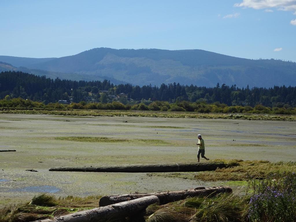
2 More than 8000 drone photos taken stitched together for base map 2

3 Flight lines of drone northern section 3

4 Sample of 3D Point Cloud model ( three dimensional coordinate system, a set of data points in space) south of Westcan divide Point cloud data were used to: - create custom geospatial elevation models, - apply contours to orthophotos, - generate new 3D models; - direct measurement tool. 4

5 Digital Elevation Model Now Available for 95% of the Estuary Digital elevation model DEM of the Salt Marsh South of Westcan Terminal Rd. Ducks Unlimited Property and reclaimed salt marsh 5


6 Ortho-mosaic created for estuary at 2-4cm resolution Zoomed Out Orthophoto Magnified Object (see arrow in opposite image) 6

7 Polygonal Mesh with Image Texture 3D models will be posted on a free, web-based viewing platform along with annotations to help explain CERCA s work and the ecological processes of the estuary. 7

8 Example of interactive web-based annotated 3-D model with resolution 2 to 7 cm 8

9 Training Session 9
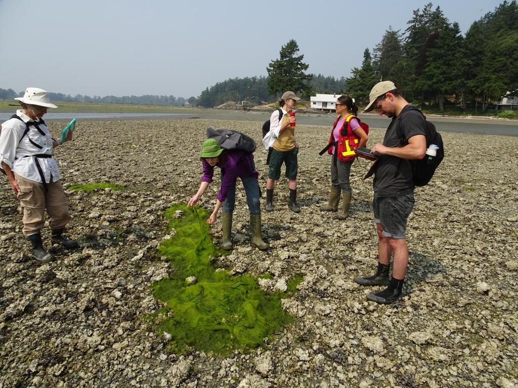
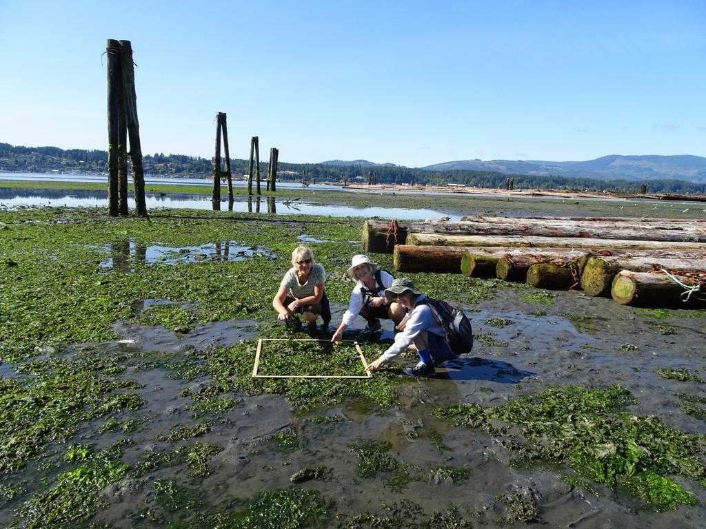
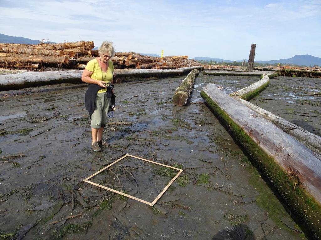
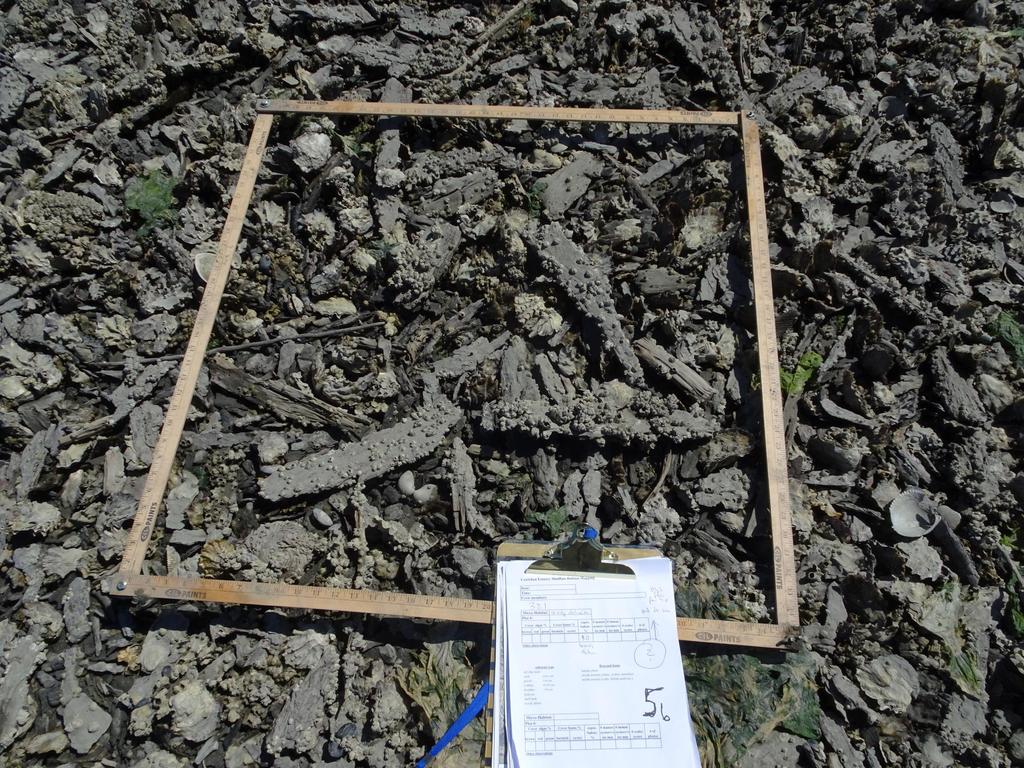
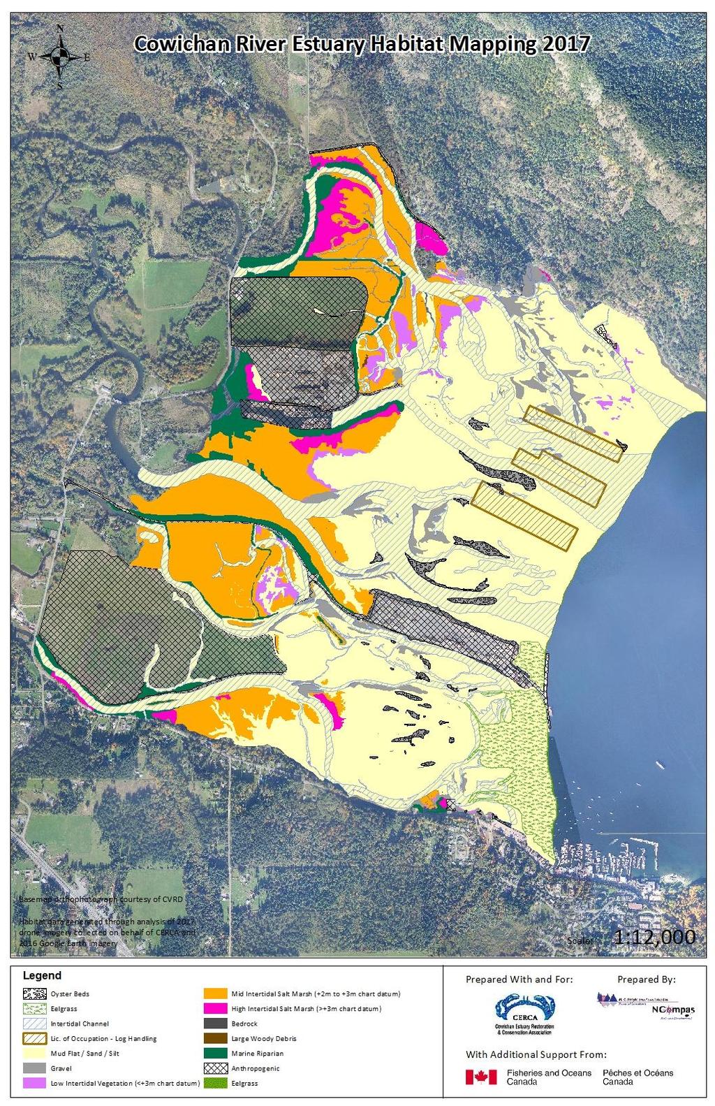
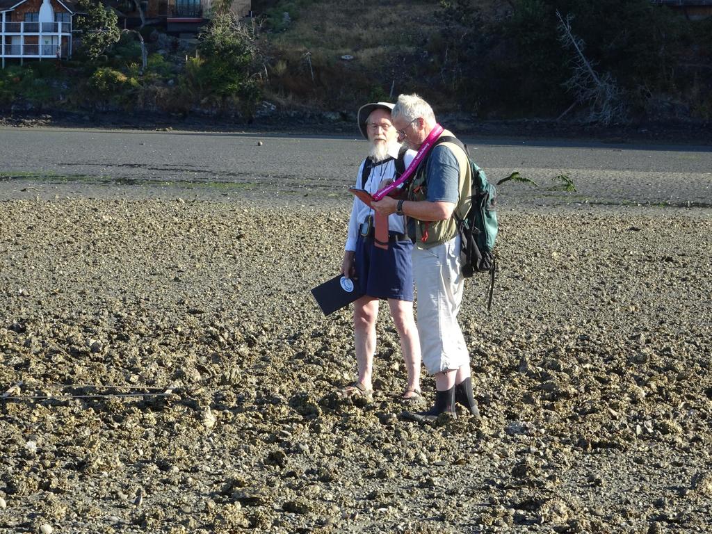
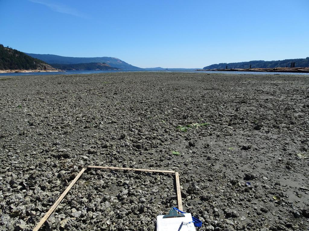
10 Estuary Habitat Mapping 1. Aerial photo- and 3-D drone imagery interpretation ; 2. Identify habitat polygons delineated on base; map/orthophoto (DFO Protocol; M. Wright &Associates); 3. Ground-truthing of habitat polygons by CERCA team: geo-referencing polygons; random sampling of each habitat polygon using one square meter sample plots; 4. Processing field data and finalizing habitat map. 10

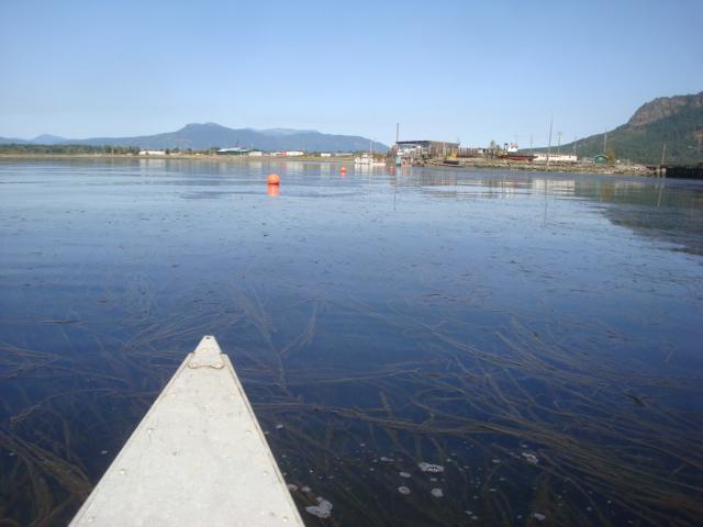
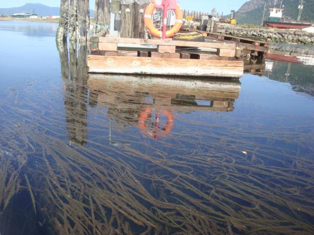
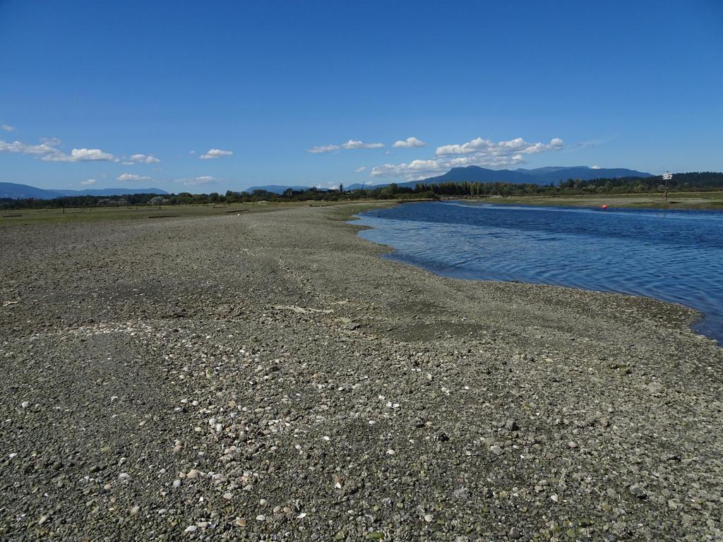
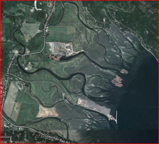
11 Survey Blocks Used for Ground-truthing Habitat Types of Mudflats and Oyster Survey (Low Tides) V VI VII IV III VIII II I I = 18 August II = 19 August III = 20 August IV = 21 August V = 22 August VI = 01 September VII = 02 September VIII = 03 September 11
, recorded as percent areal coverage. 3.")
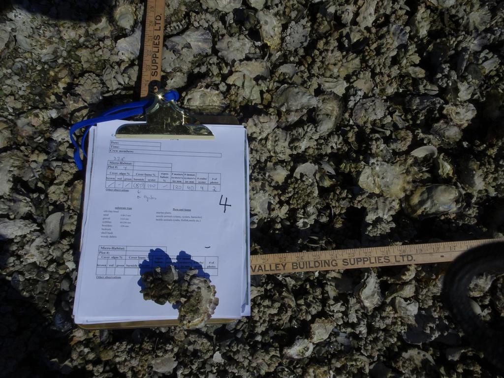
12 Intertidal Survey for Habitat Mapping (DFO Protocol) 1. Substrate Types (recorded as percent areal coverage). 2. Marine Plants Marine algae (green algae, red algae, brown algae), recorded as percent areal coverage. 3. Sessile Animals Invertebrates permanently attached to substrate as part of their life history (e.g. barnacles, oysters), recorded as percent areal coverage estimates. 4. Motile Animals (crabs numbers counted ) 12
13 13
14 14
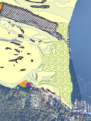
15 15
16 16
17 17

18 Sample of Waypoints Taken (Geo-referencing Habitat Polygons via Hand-held GPS) 3 18
19 19

20 Geo-referencing eelgrass distribution 20
21 21
22 22
23 Distribution and Size of Estuary Habitat Types (DFO Protocol) Habitat Type Total Area (m2) Total Area in ha % Gravel (silt, sand, gravel) 225, Mud Flat (organic layer 2 to 30 cm) 4,566, Low Intertidal Vegetation 76, Mid Intertidal Salt Marsh 779, High Intertidal Salt Marsh 107, Large Woody Debris 2, Bedrock Anthropogenic 1,000, Marine Riparian 213, Oyster Bed (mostly on gravel bars) 62, Eelgrass (on sand/silt) 179, Grand Total 7,214,
24 24
")

25 Past (right) and current (left) eelgrass distribution in the Estuary 25

26 Cowichan Estuary Oyster Research 26
27 ECOLOGICAL IMPORTANCE Oyster: a recognized Keystone species! providing habitat to numerous species (e.g. barnacles, crabs, invertebrates etc.); purifying water (one mature oyster filters up to 2.5 gallons of water/ hour; fast growing (i.e. 2-3cm/a); highly prolific + long life expectancy of up to 30 years; significant carbon busters (i.e. 12% of shell composed of carbon); 27
28 28
29 29
30 30
31 31


32 Impacts of Log Booms on Largest Oyster Bed of Cowichan Estuary 32


33 Destruction of Oyster Bed North of Log Transport Channel 33


34 Oyster Beds North and South of Westcan Estuary Divide 34
35 Results of Mature Oyster Inventory Total area of oyster beds North of Causeway (square m) 47,952 Total number of oysters 10cm and larger 3,297,740 Total number of oysters between 5-10cm Total number of crabs sheltered by oysters 1,859,180 9,451,470 Total area of oyster beds South of Causeway (square m) 14,500 Total number of oysters 10cm and larger 57, 928 Total number of oysters between 5-10cm 435, 000 Total number of crabs sheltered by oysters 290,000 Grand total area of oyster beds (square m) 62,452 Grand Total number of oysters 10cm and larger 3,355,668 Grand Total number of oysters between 5-10cm 2,294,180 Grand Total number of crabs sheltered by oysters 9,741,470 35


36 Oyster status South of causeway compared to North of causeway South: Larger mud-habitat areas Significantly less oysters Significantly younger specimens 36
37 Economic Value Oysters account for 80 per cent of all of B.C.'s farmed shellfish by weight and around 40 per cent of its value, with the small-butworld-famous fishery (worth some $33 million annually) a mainstay of the Gulf Island and Vancouver Island economies. BC s oyster production represents approximately 45% of Canada s total oyster production; on average 14,000 tonnes/a produced in BC; annual average farm-gate value of oyster is $2-7/dozen (oyster bar value $25/dozen!); number of marketable oysters in estuary approximately 5,258,348; at $5/dozen total current market value of the estuary oyster population approximately $2,190,978 37
38 Key Values of Current Estuary Oyster Population filtering approximately 141,246,200 gallons of water/day (at high tide); approximately 2.5 metric tons of carbon sequestered; total current farm-gate value of marketable oysters approximately $2,190,
Modeling habitat suitability for the European green crab using the ShoreZone mapping system
 Modeling habitat suitability for the European green crab using the ShoreZone mapping system Jodi N. Harney, Ph.D. and John R. Harper, Ph.D. Coastal and Ocean Resources Inc. Mary Morris, R.P. Bio. Archipelago
Community Mapping Network. Selected Coastal Atlases and Information Systems in British Columbia, Canada
 Community Mapping Network Selected Coastal Atlases and Information Systems in British Columbia, Canada Outline Community Mapping Network cmnbc.ca Pacific Coastal Resources Atlas for BC cmnbc.ca The Living
Create your own map for tidepooling, beach field trips, boating, camping, kayaking, fishing, and exploring the beaches in Southcentral Alaska.
 Create your own map for tidepooling, beach field trips, boating, camping, kayaking, fishing, and exploring the beaches in Southcentral Alaska. Here s an opportunity to download and customize your own free
Relatively little hard substrate occurs naturally in the
 CHAPTER FIVE Rock Habitats Relatively little hard substrate occurs naturally in the estuary, owing mainly to the vast quantities of fine sediment that have been deposited by the rivers. Rock habitat is
Wetland Mapping. Wetland Mapping in the United States. State Wetland Losses 53% in Lower US. Matthew J. Gray University of Tennessee
 Wetland Mapping Caribbean Matthew J. Gray University of Tennessee Wetland Mapping in the United States Shaw and Fredine (1956) National Wetlands Inventory U.S. Fish and Wildlife Service is the principle
3 SHORELINE CLASSIFICATION METHODOLOGY
 3 SHORELINE CLASSIFICATION METHODOLOGY Introduction The ESI scale, as described in Section 2, categorizes coastal habitats in terms of their susceptibility to spilled oil, taking into consideration a number
Coastal and Marine Ecological Classification Standard (CMECS)
") Coastal and Marine Ecological Classification Standard (CMECS) Mark Finkbeiner NOAA Coastal Services Center Presented at the International Workshop on Seabed Mapping Methods and Technology 18 October 2012
Coastal and Marine Ecological Classification Standard (CMECS) Mark Finkbeiner NOAA Coastal Services Center Presented at the International Workshop on Seabed Mapping Methods and Technology 18 October 2012
Geoduck Floating Nursery Monitoring Plan, Quarterly Reporting
 December 23, 2014 Mason County Department of Community Development Attn: Grace Miller, Senior Planner 411 N. Fifth Street PO Box 279 Shelton, WA 98584 Re: Geoduck Floating Nursery Monitoring Plan, Quarterly
Using Remote Sensing to Map the Evolution of Marsh Vegetation in the South Bay of San Francisco
 Using Remote Sensing to Map the Evolution of Marsh Vegetation in the South Bay of San Francisco Brian Fulfrost Design, Community and Environment (DC&E) 6 th Annual Bay-Delta Science Conference PROJECT
Channel Morphology in Carnation Creek: 2009 Survey Results
 Research Branch BC Ministry of Forests Channel Morphology in Carnation Creek: submitted to: Dan Hogan BC Ministry of Forests Rm 315 2202 Main Mall Vancouver B.C. V6T 1Z4 prepared by: Stephen Bird White
Geoduck Floating Nursery Monitoring Plan, Quarterly Reporting
 September 27, 2013 Mason County Department of Community Development Attn: Grace Miller, Senior Planner 411 N. Fifth Street PO Box 279 Shelton, WA 98584 Re: Geoduck Floating Nursery Monitoring Plan, Quarterly
CORRELATION ANALYSIS BETWEEN PALAEMONETES SHRIMP AND VARIOUS ALGAL SPECIES IN ROCKY TIDE POOLS IN NEW ENGLAND
 CORRELATION ANALYSIS BETWEEN PALAEMONETES SHRIMP AND VARIOUS ALGAL SPECIES IN ROCKY TIDE POOLS IN NEW ENGLAND Douglas F., Department of Biology,, Worcester, MA 01610 USA (D@clarku.edu) Abstract Palamonetes
Island Design. UMRS EMP Regional Workshop. Presentation for the
 Island Design Presentation for the UMRS EMP Regional Workshop by Jon Hendrickson Hydraulic Engineer Regional Technical Specialist, Water Quality and Habitat Restoration August 17 19, 2005 Project Delivery
PROBABILITY-BASED ESTIMATION OF NEARSHORE HABITAT CHARACTERISTICS
 In: Proceedings of Puget Research '98 Conference, Seattle, WA. PROBABILITY-BASED ESTIMATION OF NEARSHORE HABITAT CHARACTERISTICS Allison Bailey, Helen Berry, Betty Bookheim Washington State Department
Use of Bioengineering Techniques for Revegetation of Riparian Areas: Colomac Mine Remediation Project, NWT
 Use of Bioengineering Techniques for Revegetation of Riparian Areas: Colomac Mine Remediation Project, NWT McPherson, M. 1, Vanderspiegel, R. 2, Breadmore, R. 2, and Hewitt, M. 3 2012 RPIC Federal Contaminated
Coastal and Marine Ecological Classification Standard (CMECS)
") Coastal and Marine Ecological Classification Standard (CMECS) Kathy Goodin, NatureServe EMECS, August 2011 Baltimore, MD 1 Outline Objectives & Process Classification Content Questions 2 Objectives Develop
Coastal and Marine Ecological Classification Standard (CMECS) Kathy Goodin, NatureServe EMECS, August 2011 Baltimore, MD 1 Outline Objectives & Process Classification Content Questions 2 Objectives Develop
Virginia Shoreline Mapping Tools
 Virginia Shoreline Mapping Tools December 15, 2017 Karen Duhring Center for Coastal Resources Management Virginia Institute of Marine Science College of William & Mary Virginia Shoreline Mapping Tools
High Resolution Numerical Models of Tidal Marshes in the Delaware Bay
 High Resolution Numerical Models of Tidal Marshes in the Delaware Bay Ramona Stammermann Dept. of Civil, Architectural & Environmental Engineering, Drexel University, Philadelphia, PA Michael Piasecki
DUC 2017 Fieldwork Overview: Akaitcho Wetland Mapping Project
 DUC 2017 Fieldwork Overview: Akaitcho Wetland Mapping Project Prepared for MobileDemand Project Managers: Kevin Smith, Al Richard Lead Technical Analyst: *Michael Merchant Support Analysts: Becca Warren,
Habitat Mapping in The Hauraki Gulf Marine Park. Dan Breen
 Habitat Mapping in The Hauraki Gulf Marine Park Dan Breen Outline 1. Intro Habitat mapping 2. Coastal marine habitats and marine protected areas in the New Zealand Territorial Sea: a broad scale gap analysis
MANGROVES. What is a mangrove? Characteristics
 MANGROVES What is a mangrove? Mangrove plants include trees, shrubs, ferns and palms. These plants are found in the tropics and sub- tropics on river banks and along coastlines, being unusually adapted
APPENDIX E-4. Field Report: Intertidal Habitat and Marine Biota Survey
 APPENDIX E-4 Field Report: Intertidal Habitat and Marine Biota Survey Field Report Intertidal Habitat and Marine Biota Survey of the Vallejo Marine Terminal Site, Vallejo, California April 18, 2014 Prepared
BOEM Marine Minerals Program
 BOEM Marine Minerals Program Restoring and Protecting Our Nation s Coasts through Stewardship of OCS Sand Resources SECOORA 2018 Annual Meeting May 22-24 Doug Piatkowski Douglas.piatkowski@boem.gov 703-787-1833
Sea Level Rise Providing Nature A-Right-of Way
 Sea Level Rise Providing Nature A-Right-of Way Study Area Site 2: Skagit Bay Initial Condition 11.2 Inches by 2050 No Dikes 27.3 Inches by 2100 No Dikes The Problem Loss of coastal wetlands due to submergence
OCEAN ZONES. 1. Intertidal Zone 2. Near-Shore Zone 3. Open-Ocean Zone
 OCEAN ZONES 1. Intertidal Zone 2. Near-Shore Zone 3. Open-Ocean Zone Where the Ocean Meets the Land (Place) Intertidal Zone The intertidal zone is the area between the high- and low-tide lines. At high
OCEAN ZONES. 1. Intertidal Zone 2. Near-Shore Zone 3. Open-Ocean Zone
 OCEAN ZONES 1. Intertidal Zone 2. Near-Shore Zone 3. Open-Ocean Zone Where the Ocean Meets the Land (Place) Intertidal Zone The intertidal zone is the area between the high- and low-tide lines. At high
Oyster Reef for Shoreline Stabilization and Restoration. Jason Kirkpatrick Conservation Program Manager MacDill AFB Tampa, Florida
 Oyster Reef for Shoreline Stabilization and Restoration Jason Kirkpatrick Conservation Program Manager MacDill AFB Tampa, Florida Interbay Penninsula Port of Tampa X The few remaining mangroves are being
Major human activities affecting Norwegian coastal marine ecosystems; present status and challenges
 Major human activities affecting Norwegian coastal marine ecosystems; present status and challenges Erlend Moksness PICES Annual Meeting - Science Board Symposium 26. October 2009, Jeju, Korea FUTURE:
Developing Soil Maps and Interpretations for Shallow Subtidal Habitats
 Developing Soil Maps and Interpretations for Shallow Subtidal Habitats James D. Turenne Assistant State Soil Scientist Rhode Island (The Ocean State) USDA-NRCS Narragansett Bay Estuary LNB Coastal Lagoons
Joint Federal Agency Submerged Aquatic Vegetation Survey Guidance for the New England Region Updated August 11, 2016
 Joint Federal Agency Submerged Aquatic Vegetation Survey Guidance for the New England Region Updated August 11, 2016 FOREWORD This guidance is the result of on-going interagency collaboration between the
1 Shoreline Landforms 2. 2 Emergent v. Submergent 2. 3 Wavecutting 3. 4 Planview 4. 5 Marine Terraces 5. 6 California 7. 7 Tombolos, Sea Stacks 8
 Shorelines November 9, 2008 Contents 1 Shoreline Landforms 2 2 Emergent v. Submergent 2 3 Wavecutting 3 4 Planview 4 5 Marine Terraces 5 6 California 7 7 Tombolos, Sea Stacks 8 8 Active Processes 9 9 Emergence
Methods for Shellfish Population Density and Demographics in Living Shoreline Treatments
 PARTNERSHIP FOR THE DELAWARE ESTUARY Science Group Methods for Shellfish Population Density and Demographics in Living Shoreline Treatments Date Prepared: 09/12/2017 Prepared By: Joshua Moody Suggested
Shawn K. Staton Species at Risk Program Fisheries and Oceans Canada Burlington, Ontario
 Identification of Critical Habitat for Endangered Freshwater Mussels Shawn K. Staton Species at Risk Program Fisheries and Oceans Canada Burlington, Ontario Introduction Outline SARA & Critical Habitat
Coastline monitoring. Virginie Lafon Cyril Mallet. S. Capo, A. Dehouck, E. Maneux, A. Michot, C. Proisy, R. Walker
 Coastline monitoring Virginie Lafon Cyril Mallet Doris_Net May 29, 2012 Pessac, France S. Capo, A. Dehouck, E. Maneux, A. Michot, C. Proisy, R. Walker 29/05/2012 Spatial applications for coastal services
Planning for the Future of Humboldt Bay: Sea Level Rise, Sediment Management, Sand Spits and Salt Marshes. Joel Gerwein
 Planning for the Future of Humboldt Bay: Sea Level Rise, Sediment Management, Sand Spits and Salt Marshes Joel Gerwein Introduction to Humboldt Bay Setting Economy, community, and environment Sediment
Documenting Plants & Animals in Each Habitat
 Documenting Plants & Animals in Each Habitat STEP 25: UNDERSTAND THE QUADRAT SURVEY METHOD It is not possible to count all the plants and animals in a habitat unit, since the habitat unit could be quite
A Comparative Study of Shellfish Assemblage Patterns between a Man-made and a Natural Tidal Flat
 A Comparative Study of Shellfish Assemblage Patterns between a Man-made and a Natural Tidal Flat Naotomo OTA & Takashi KAWAI (Department of Civil Engineering, Anan National College of Technology, Japan)
Shoreline Assessment Job Aid National Oceanic and Atmospheric Administration NOAA Ocean Service Office of Response and Restoration Hazardous
 Shoreline Assessment Job Aid National Oceanic and Atmospheric Administration NOAA Ocean Service Office of Response and Restoration Hazardous Materials Response Division This job aid was produced and published
Puget Sound Shorelines. Announcements
 Announcements Puget Sound Shorelines Wednesday discussion of Bates paper Bham Bay project: Updates, finals week schedules Last portion of the class: Environmental issues in Puget Sound Puget Sound shorelines:
GPS and GIS use in Soil Mapping of The Sugarcane Industry. Lancelot H. White. Sugar Industry Research Institute
 73 rd Annual Jamaican Association of Sugar Technologists Conference 1 GPS and GIS use in Soil Mapping of The Sugarcane Industry By Lancelot H. White Sugar Industry Research Institute Presentation Outline
The Problem. Which ecosystems are the most sensitive? Where will ecosystems be migrating? Where will investments be overwhelmed?
 BC Parks BC Parks is responsible for the designation, management and conservation of a system of ecological reserves, provincial parks and recreation areas located throughout the province. British Columbia
10/24/2017. Determining Location. Where in the World are We Geodetically Speaking. Meades Ranch
 Determining Location Where in the World are We Geodetically Speaking Meades Ranch 1 How do we find the Mark? KG0640 DESCRIBED BY COAST AND GEODETIC SURVEY 1948 (MZB) KG0640 STATION IS LOCATED ABOUT 12
Name Hour. Section 4-1 The Role of Climate (pages 87-89) What Is Climate? (page 87) 1. How is weather different from climate?
 What Is Climate? (page 87) 1. How is weather different from climate?") Name Hour Section 4-1 The Role of Climate (pages 87-89) What Is Climate? (page 87) 1. How is weather different from climate? 2. What factors cause climate? The Greenhouse Effect (page 87) 3. Circle the
Name Hour Section 4-1 The Role of Climate (pages 87-89) What Is Climate? (page 87) 1. How is weather different from climate? 2. What factors cause climate? The Greenhouse Effect (page 87) 3. Circle the
SIF_7.1_v2. Indicator. Measurement. What should the measurement tell us?
 Indicator 7 Area of natural and semi-natural habitat Measurement 7.1 Area of natural and semi-natural habitat What should the measurement tell us? Natural habitats are considered the land and water areas
Treasure Coast Science Scope and Sequence
 Course: Marine Science I Honors Course Code: 2002510 Quarter: 3 Topic(s) of Study: Marine Organisms and Ecosystems Bodies of Knowledge: Nature of Science and Life Science Standard(s): 1: The Practice of
Home About Us Articles Press Releases Image Gallery Contact Us Media Kit Free Subscription 10/5/2006 5:56:35 PM
 Home About Us Articles Press Releases Image Gallery Contact Us Media Kit Free Subscription 10/5/2006 5:56:35 PM Industry Resources Industry Directory NASA Links Missions/Launches Calendar Human development
Coastal Habitat Mapping Program. Bristol Bay & Southwest Alaska Data Summary Report September 2012
 Coastal Habitat Mapping Program Bristol Bay & Southwest Alaska Data Summary Report September 2012 Prepared for: NOAA National Marine Fisheries Service Alaska Region On the Cover: Cape Lapin Kenmore Head
Ecology Chapter Teacher Sheet. Activity #1: Graphing San Diego Tides
 Ecology Chapter Teacher Sheet Activity #1: Graphing San Diego Tides California Content Standard Investigation and Experimentation 1i Objectives: To create a graph of monthly tides in San Diego, and label
IMAGE ANALYSIS MEASURING LANDSCAPE VEGETATION IN 1.3 MILLION PARCELS FOR OUTDOOR WATER BUDGETS
 IMAGE ANALYSIS MEASURING LANDSCAPE VEGETATION IN 1.3 MILLION PARCELS FOR OUTDOOR WATER BUDGETS Pete Vitt Santa Ana Watershed Project Authority (SAWPA) Doug Mende Statistical Research Inc. July 13, 2017
Required Documents. Title: Number: AEP Administration 2017 No. 1. Provincial Wetlands and Water Boundaries Section. Effective Date: September 1, 2017
 Title: Number: Program Name: Provincial Wetlands and Water Boundaries Section Effective Date: September 1, 2017 This document was updated on: August 25, 2017 The Provincial Wetlands and Water Boundaries
Spatial Process VS. Non-spatial Process. Landscape Process
 Spatial Process VS. Non-spatial Process A process is non-spatial if it is NOT a function of spatial pattern = A process is spatial if it is a function of spatial pattern Landscape Process If there is no
Aerial Survey of Coffee Estates
 Aerial Survey of Coffee Estates Why get an Aerial Survey of your Coffee Estate done? Aerial surveying produces high resolution and highly accurate image data about your coffee estate. This data can be
Third Annual Monitoring Report Tidal Wetland Restoration 159 Long Neck Point Road, Darien, CT NAE
 1) Project Overview Third Annual Monitoring Report Tidal Wetland Restoration 159 Long Neck Point Road, Darien, CT NAE-2007-1130 December 15, 2014 This is the third year of a five year monitoring program
COMPARING OFF-BOTTOM OYSTER CULTURE AND EELGRASS (Z. MARINA) BEDS USING A HABITAT SUITABILITY INDEX
 BEDS USING A HABITAT SUITABILITY INDEX") COMPARING OFF-BOTTOM OYSTER CULTURE AND EELGRASS (Z. MARINA) BEDS USING A HABITAT SUITABILITY INDEX P R O J E C T T E A M L E A D S : B O B B I H U D S O N, P A C I F I C S H E L L F I S H I N S T I T
COMPARING OFF-BOTTOM OYSTER CULTURE AND EELGRASS (Z. MARINA) BEDS USING A HABITAT SUITABILITY INDEX P R O J E C T T E A M L E A D S : B O B B I H U D S O N, P A C I F I C S H E L L F I S H I N S T I T
Background Information Methods Pre- Processing in ArcMap Processing in Fusion Analysis
 DETECTING RIPARIAN VEGETATION CHANGE USING LIDAR WILLIAM SERCOMBE ALEX THOMAS GEOG 593 PRESENTATION OVERVIEW Background Information Research Question Study Area Methods Pre- Processing in ArcMap Processing
Setting Priorities for Eelgrass Conservation and Restoration. Robert Buchsbaum Massachusetts Audubon Society
 Setting Priorities for Eelgrass Conservation and Restoration Robert Buchsbaum Massachusetts Audubon Society Eelgrass habitat values A rich, productive habitat for many marine organisms Nursery habitat
The Future of Soil Mapping using LiDAR Technology
 The Future of Soil Mapping using LiDAR Technology Jessica Philippe Soil Scientist/GIS Specialist March 24, 2016 Natural Resources Conservation Service Helping People Help the Land Area 12-STJ covers parts
STUDY PERFORMANCE REPORT
 STUDY PERFORMANCE REPORT State: Michigan Project No.: F-80-R-8 Study No.: 230702 Title: Effects of sediment traps on Michigan river channels Period Covered: October 1, 2006 to September 30, 2007 Study
Significant Ecological Marine Area Assessment Sheet
 Significant Ecological arine Area Assessment Sheet Name: Eastern Bay of Island Biogenic Soft Sediment Complex Summary: The semi-sheltered areas between the central islands of the Eastern Bay of Islands
Custom Soil Resource Report Soil Map
 121 3' 56'' W Custom Soil Resource Report Soil Map 121 2' 49'' W 45 16' 39'' N 5013800 5014000 5014200 5014400 5014600 5014800 5015000 5015200 5015400 5015600 651800 652000 652200 652400 652600 652800
TIDAL EROSION AT ELKHORN SLOUGH
 TIDAL EROSION AT ELKHORN SLOUGH Virtually all of California s tidal wetlands have been dramatically altered. Hydrological manipulations changes in water flow are widespread. Either flow has been decreased
DMS-UAV Accuracy Assessment: AP20 with Nikon D800E
 DMS-UAV Accuracy Assessment: AP20 with Nikon D800E Joe Hutton, Greg Lipa, James Lutes, Omer Mian Applanix, William Chan - GeoPixel Air Introduction The Direct Mapping Solution for Unmanned Aerial Vehicles
The use of GIS to facilitate wetland creation and restoration Andy Arkway
 The use of GIS to facilitate wetland creation and restoration Andy Arkway The many values provided by wetlands to the human population have only been recognized fairly recently. Historically the primary
Bob Van Dolah. Marine Resources Research Institute South Carolina Department of Natural Resources
 Bob Van Dolah Marine Resources Research Institute South Carolina Department of Natural Resources Shoreline Change Will Occur! On our front beaches where it is not easy to retreat Shoreline Change Will
-- Lessons from a successful salmon stream and estuary relocation on Gravina Island
 Re-inventing Government Creek -- Lessons from a successful salmon stream and estuary relocation on Gravina Island Jon Houghton, Ph.D. and Derek Ormerod, M.S., P.E. - Pentec Environmental/Hart Crowser,
Modeling Coastal Change Using GIS Technology
 Emily Scott NRS 509 Final Report December 5, 2013 Modeling Coastal Change Using GIS Technology In the past few decades, coastal communities around the world are being threatened by accelerating rates of
Annual transport rates at two locations on the fore-slope.
 Sediment Transport by Currents Fore-slope Sediment transport rates and sediment concentrations were computed from the hydrodynamic model runs as well as from direct measurements of current velocities at
Global UAV-based solutions for the industry and agriculture.
 Global UAV-based solutions for the industry and agriculture. Remote sensing of vegetation from drones (UAS). The example of the Trimble Unmanned Aerial Solution Emmanuel de Maistre, co-founder & CEO demaistre@redbird.fr
Why Sample Vegetation? Vegetation Sampling. Vegetation Sampling Metrics. Enumeration and Density
 Vegetation Sampling Key concepts Types of vegetation sampling Methods of vegetation sampling Definitions Density Cover Growth Vigor Utilization Transect Macroplot Quadrat Physiological status Why Sample
Introduction. Elevation Data Strategy. Status and Next Steps
 1 2 Introduction Elevation Data Strategy Status and Next Steps 3 Canada is the 2nd largest country in the world - 9.9 million sq km Surrounded by 3 oceans with 202 000 km of coastline Population over 35
GIS USE IN THE STUDY OF ESTUARINE SOILS AND SEDIMENTS Margot K. Payne NRS 509 November 30, 2005
 GIS USE IN THE STUDY OF ESTUARINE SOILS AND SEDIMENTS Margot K. Payne NRS 509 November 30, 2005 Throughout the world, estuaries are not only some of the most ecologically productive environments, but are
DETAILED DESCRIPTION OF STREAM CONDITIONS AND HABITAT TYPES IN REACH 4, REACH 5 AND REACH 6.
 DETAILED DESCRIPTION OF STREAM CONDITIONS AND HABITAT TYPES IN REACH 4, REACH 5 AND REACH 6. The Eklutna River was divided into study reaches (figure 1) prior to this site visit. Prominent geologic or
A Geographic Information System Based Model John L Marshall Geography 562 GIS Coastal Resources - Final Project: Fall 2017 University of Washington
 EFFECTS OF OYSTER CULTURE ON NATIVE EELGRASS AND RELATED NATURAL RESOURCES IN THE PUGET SOUND A Geographic Information System Based Model John L Marshall Geography 562 GIS Coastal Resources - Final Project:
Abstract. Introduction
 Southern California Aquaculture Site Assessment Model Caitlyn Raines University of Redlands Master of Science in Geographic Information Systems Program Abstract The Southern California Aquaculture Site
3.0 ROBERTS BANK TIDAL FLAT MORPHOLOGY
 Vancouver Port Authority Northwest Hydraulic Consultants Ltd. /Triton Consultants Ltd. Roberts Bank Container Expansion File: 33863 Coastal Geomorphology Study - 19 - November 2004 3.0 ROBERTS BANK TIDAL
These modules are covered with a brief information and practical in ArcGIS Software and open source software also like QGIS, ILWIS.
 Online GIS Training and training modules covered are: 1. ArcGIS, Analysis, Fundamentals and Implementation 2. ArcGIS Web Data Sharing 3. ArcGIS for Desktop 4. ArcGIS for Server These modules are covered
Appendix E: Cowardin Classification Coding System
 Appendix E: Cowardin Classification Coding System The following summarizes the Cowardin classification coding system and the letters and numbers used to define the USFWS NWI wetland types and subtypes:
Quantifying Coastal Evolution using Remote Sensing Approaches
 Quantifying Coastal Evolution using Remote Sensing Approaches Sojan Mathew, Linh Truong Hong, Xavier Pellicer*, Colman Gallagher University College Dublin Geological Survey of Ireland* INFOMAR SEMINAR,
Tidal Wetland Vegetation
 Wetlands Regional Monitoring Program Plan 00 Data Collection Protocol Michael Vasey San Francisco State University San Francisco CA John Callaway University of San Francisco San Francisco CA V. Thomas
Watershed concepts for community environmental planning
 Purpose and Objectives Watershed concepts for community environmental planning Dale Bruns, Wilkes University USDA Rural GIS Consortium May 2007 Provide background on basic concepts in watershed, stream,
The Use of Geographic Information Systems to Assess Change in Salt Marsh Ecosystems Under Rising Sea Level Scenarios.
 The Use of Geographic Information Systems to Assess Change in Salt Marsh Ecosystems Under Rising Sea Level Scenarios Robert Hancock The ecological challenges presented by global climate change are vast,
Percent cover standards
 Percent cover standards 2% 12% 20% 30% 35% 55% 75% 90% SEAGRASS SPECIES CODES ZC Zostera capricorni Hu Halodule uninervis 5 longitudinal veins Cross veins Leaf grows straight from rhizome ie no shoot trident
Minimum Standards for Wetland Delineations
 Minimum Standards for Wetland Delineations Jason Gipson Chief, Utah/Nevada Regulatory Branch Sacramento District Regulatory Program Workshop 16 Mar 2016 US Army Corps of Engineers Delineation Report Minimum
Do Local Interactions or the Landscape Determine Spatial Selforganization
 Do Local Interactions or the Landscape Determine Spatial Selforganization in Wetland Ecosystems? Johan van de Koppel Tjeerd Bouma Peter Herman Royal Netherlands Institute for Sea Research (NIOZ) Yerseke,
ASSESSMENT AND RESTORATION OF COASTAL ECOSYSTEMS USING REMOTE SENSING AND VISUALIZATION TOOLS FOR THE GULF OF MEXICO AND BEYOND
 ASSESSMENT AND RESTORATION OF COASTAL ECOSYSTEMS USING REMOTE SENSING AND VISUALIZATION TOOLS FOR THE GULF OF MEXICO AND BEYOND Remote Sensing as a Tool for Ecosystem Restoration George Graettinger Office
Marine Ecology Pacing Guide
 Marine Ecology Pacing Guide Course Description: The focus of the course is the interrelationships among marine organisms and the physical, chemical, geological and biological factors. North Carolina coastal
Appendix J Vegetation Change Analysis Methodology
 Appendix J Vegetation Change Analysis Methodology Regional Groundwater Storage and Recovery Project Draft EIR Appendix-J April 2013 APPENDIX J- LAKE MERCED VEGETATION CHANGE ANALYSIS METHODOLOGY Building
FUTURE MEANDER BEND MIGRATION AND FLOODPLAIN DEVELOPMENT PATTERNS NEAR RIVER MILES 200 TO 191 OF THE SACRAMENTO RIVER PHASE III REPORT
 FUTURE MEANDER BEND MIGRATION AND FLOODPLAIN DEVELOPMENT PATTERNS NEAR RIVER MILES 200 TO 191 OF THE SACRAMENTO RIVER PHASE III REPORT Eric W. Larsen REPORT FOR DUCKS UNLIMITED March 31, 2006-1 - Contents
Quick Response Report #126 Hurricane Floyd Flood Mapping Integrating Landsat 7 TM Satellite Imagery and DEM Data
 Quick Response Report #126 Hurricane Floyd Flood Mapping Integrating Landsat 7 TM Satellite Imagery and DEM Data Jeffrey D. Colby Yong Wang Karen Mulcahy Department of Geography East Carolina University
BIOMES. Copyright Cmassengale
 BIOMES Biogeography - study of where organisms live Continental drift - slow motion of continents Dispersal of organisms Movement of organisms from 1 place to another Dispersal is usually caused by wind,
STEREO ANALYST FOR ERDAS IMAGINE Stereo Feature Collection for the GIS Professional
 STEREO ANALYST FOR ERDAS IMAGINE Stereo Feature Collection for the GIS Professional STEREO ANALYST FOR ERDAS IMAGINE Has Your GIS Gone Flat? Hexagon Geospatial takes three-dimensional geographic imaging
Wetland Sediment Dynamics at Crissy Field Marsh Annual Report
 Wetland Sediment Dynamics at Crissy Field Marsh 27 Annual Report John Callaway Department of Environmental Science University of San Francisco 217 Fulton St. San Francisco, CA 94117 (415) 422-572 callaway@usfca.edu
Carbon Sequestration Potential from Coastal Wetlands Restoration Sites
 Carbon Sequestration Potential from Coastal Wetlands Restoration Sites Insert then choose Picture select your picture. Right click your picture and Send to back. Paul Krause, Alyssa Beach Emily Cooper,
Statewide wetland geospatial inventory update
 Statewide wetland geospatial inventory update Factsheet 1: Outcomes from the statewide wetland geospatial inventory update 1 Introduction In 2011 the Victorian Department of Environment and Primary Industries
Limits and Potentials of High Resolution Terrestrial Laser Scanning in Monitoring Estuarine Geomorphologic Variability.
 Limits and Potentials of High Resolution Terrestrial Laser Scanning in Monitoring Estuarine Geomorphologic Variability Charlie Endris January 20, 2010 Elkhorn Slough: Erosion and Habitat Loss Evolution
Ecological mapping using satellite imagery: an Abu Dhabi case study Middle East Geospatial Forum 16 th February 2015
 Ecological mapping using satellite imagery: an Abu Dhabi case study Middle East Geospatial Forum 16 th February 2015 Richard Flemmings rf@proteusgeo.com About Proteus Formed in UAE 2011 We specialise in
Geomorphic Importance of Winter Peak Flows and Annual Snowmelt Hydrographs in a Sierra Nevada Boulder-Bedrock River
 Geomorphic Importance of Winter Peak Flows and Annual Snowmelt Hydrographs in a Sierra Nevada Boulder-Bedrock River Scott McBain and Bill Trush McBain & Trush, Inc. Clavey River and Cherry Creek vicinity
Topographic Maps. Take Notes as you view the slides
 Topographic Maps Take Notes as you view the slides Lesson Objectives Define a topographic map and state its uses. Describe how contour lines show the elevations, shape, and slope of the land. Identify
Introduction. Methods. Keyword: Bulkhead, Armoring, Thurston County, SRFB, Forage Fish
 Bulkheading in Thurston County: Impacts on Forage Fish Spawning Habitat José Carrasquero-Verde (jcarrasquero@herrerainc.com), Tim Abbe (tabbe@herrerainc.com), Herrera Environmental Consultants Steven Morrison