Use of Bioengineering Techniques for Revegetation of Riparian Areas: Colomac Mine Remediation Project, NWT
|
|
|
- Branden Wilkerson
- 5 years ago
- Views:
Transcription
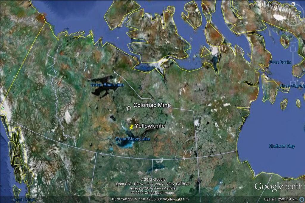
1 Use of Bioengineering Techniques for Revegetation of Riparian Areas: Colomac Mine Remediation Project, NWT McPherson, M. 1, Vanderspiegel, R. 2, Breadmore, R. 2, and Hewitt, M RPIC Federal Contaminated Sites National Workshop 2 May Fisheries and Oceans Canada, 2. Aboriginal Affairs and Northern Development Canada, 3. Flat River Consulting 1 1
2 2 2

3 Colomac Mine mid 1990s Tank Farm Steeves Lake shoreline 3 3

4 Steeves Lake Shoreline Remediation Contained and capped 750 meters of impacted shoreline Fish habitat compensation required under the Fisheries Act Included revegetation of shoreline and riparian areas 4 4


5 Steeves Lake Shoreline Remediation Steeves Lake berm construction Placement of infill 5 5


6 Steeves Lake Shoreline Remediation Placement of peat layer Aerial view of completed sediment cap 6 6


7 Revegetation Areas Steeves Lake Shoreline Rock berm trench Infill/cap 7 7

8 Revegetation Areas Truck Lake channel and shoreline Steeves Lake Truck Lake 8 8

9 Revegetation & Bioengineering Bioengineering training provided on-site Soil bioengineering techniques for riparian restoration Natural processes for restoration of disturbed sites me 9 9

10 Revegetation Plan Objective use natural processes Establish pioneering species Facilitate natural recovery and succession Soil bioengineering recommendations and techniques incorporated into revegetation approach Consultant contracted to help develop and implement revegetation plan 10 10
11 Revegetation Plan Planning questions 1 : Which species for initial cover? How to establish these species? What is the end land use? What about maintenance? Solutions: focus on ecology of site Identify limiting factors to natural recovery Identify natural conditions for recovery 1 Polster

12 Revegetation Plan Plan outline: Plant selection Revegetation prescriptions Methods Implementation Quality control Contingencies Monitoring and maintenance Steeves Lake shoreline cap As-Built w/ vegetation overlay 12 12


13 Revegetation Methods Revegetation materials collected and prepared on site 13 13


14 Revegetation Methods Collect Wetland Sedges Cut Willow Stakes Collect Alder Seed 14 14


15 Revegetation Methods Planting willow stakes using Live Gravel Bar Method 15 15

16 Revegetation Methods Planting willow stakes using Live Gravel Bar Method 16 16


17 Making sites rough and loose improves the natural recovery of sites Revegetation Methods De-compacts soils Creates micro-sites for seeds to lodge in and germinate Cost-effective way of preventing erosion 17 17


18 Revegetation Methods Live willow staking Transplanting wetland sedges 18 18


19 Revegetation Methods Transplanting sedge plugs can be an effective way of establishing wetland vegetation on disturbed wetland sites


20 Revegetation Methods Alder cone Alder seed separated from cones Seeding - Alder is a natural nitrogen-fixing pioneer species 20 20

21 Revegetation Methods Seeding alder native grass seed mix 21 21

22 Revegetation Monitoring Plan Monitoring: Fisheries Act Authorization requirement Annual monitoring for 5 years postconstruction Purpose: evaluate and verify success of revegetation establish framework and protocols to assess revegetation over time Objectives: pioneering species success rates natural succession trajectory Alder seedlings - Aug

23 Revegetation Monitoring Methods Quantitative Measure plants (willow and sedge) Vegetation plots (seeded and planted areas) Establish transects 100m 2 circular plots 1m 2 square plots Estimate surface coverage Overall seeding and planting areas Within vegetation plots Qualitative Photographic record Assess health of plantings Document other pioneering species 1m 2 vegetation plot 23 23

24 Revegetation Monitoring Results 2011 (Year 1 of 5) Preliminary assessment Observations and counts 2 vegetation plots Photographic record Recommendations for comprehensive monitoring program 24 24

25 Revegetation Monitoring Results Steeves Lake Shoreline Trench Success Rates: Willow cuttings - 69% Alder 80% Before After

26 Success rates: Rough and Loose Test Plot Revegetation Monitoring Results Steeves Lake Shoreline Infill Willow cuttings 91% Before After


27 Success rates: Seeding 60% Wetland sedges 100% Revegetation Monitoring Results Steeves Lake Shoreline Infill Before After

28 Revegetation Monitoring Results Truck Lake channel Success rates: Willow cuttings 44% Wetland sedge 75% Seed mix 60%

29 Revegetation Monitoring Results Truck Lake Shoreline Success rates: Willow cuttings 8% Alders 0% Truck Lake west shoreline 29 29


30 Revegetation Monitoring Results Baker Creek plantings w/ conventional grass seed cover less growth in 5 growing seasons Steeves Lake plantings rough and loose natural processes 1 growing season 30 30

31 Recommended Revegetation Monitoring 1 st cycle - Annually late summer for first 5 years 2 nd cycle - Every 5 years for 25 years Vegetation plots along transects 100m 2 circular plots 1m 2 plots on shoreline trench Photographic documentation 100m 2 circular plot 31 31

32 Lessons Learned Incorporate revegetation early in the planning process not as an afterthought! 32 32

33 Lessons Learned Use expertise at all stages in process 33 33


34 Lessons Learned Build restoration into remediation lasting benefits to ecosystem 34 34


35 Lessons Learned Community involvement build capacity and sense of ownership 35 35


36 Lessons Learned Use natural processes cheap, easy, and effective approach to restoration 36 36
37 Summary of Key Points Think beyond conventional revegetation methods Use natural processes to your advantage Work with existing on-site conditions, site-specific focus Make a plan early Use experts to plan, implement and monitor Build capacity Monitor and maintain 37 37
38 Acknowledgments Melissa Munger Aboriginal Affairs and Northern Development Canada David Polster - Polster Environmental Services Ltd. Public Works and Government Services Canada On-site engineers - AECOM Colomac Mine Remediation Contractor Tlicho Engineering and Environmental Services Ltd. (TEES) and Aboriginal Engineering Ltd. (AEL) 38 38

39 Questions? 39 39
VEGETATION EVA BOEHRINGER
 VEGETATION EVA BOEHRINGER April 2, 2014 WUP CONSULTATIVE COMMITTEE WUP Consultative Committee (WUP CC) recognized that riparian and wetland vegetation in the reservoir drawdown zone is valuable for fish,
RAILWAYS AND FISH: HOW TO PROTECT AND ENHANCE FISH HABITAT VALUES AT STREAM CROSSINGS THROUGH PROJECT DESIGN AND CONSTRUCTION
 RAILWAYS AND FISH: HOW TO PROTECT AND ENHANCE FISH HABITAT VALUES AT STREAM CROSSINGS THROUGH PROJECT DESIGN AND CONSTRUCTION Rail Environment Conference November 2016 AGENDA Objective Background Benefits
Island Design. UMRS EMP Regional Workshop. Presentation for the
 Island Design Presentation for the UMRS EMP Regional Workshop by Jon Hendrickson Hydraulic Engineer Regional Technical Specialist, Water Quality and Habitat Restoration August 17 19, 2005 Project Delivery
EAGLES NEST AND PIASA ISLANDS
 EAGLES NEST AND PIASA ISLANDS HABITAT REHABILITATION AND ENHANCEMENT PROJECT MADISON AND JERSEY COUNTIES, ILLINOIS ENVIRONMENTAL MANAGEMENT PROGRAM ST. LOUIS DISTRICT FACT SHEET I. LOCATION The proposed
Chapter Five. Synopsis
 Chapter Five Synopsis .0 Proposed Level Assessments. Prioritization of Level Assessments. Recommended Level P Locations.3 Level RAPP Locations 5 & Mosley Creek & RA.0 Proposed Level Assessments Based on
Fluvial Driven Alluvial Fans
 Fluvial Driven Alluvial Fans Restoration Project Evaluations - Examples from the Russian and Napa River Watersheds Mia Docto Masters Thesis UC Berkeley 1. Basic Fan Description 2. Fluvial Driven Fan Characteristics
Natural Shoreline Landscapes on Michigan Inland Lakes
 Natural Shoreline Landscapes on Michigan Inland Lakes Excerpts from Chapters 2 and 3 Photo Photo by Jane by Jane Herbert Herbert Did you know? Twenty-four species of amphibians, 25 species of reptiles,
Swift Creek Sediment Management Action Plan (SCSMAP)
") Swift Creek Sediment Management Action Plan (SCSMAP) PHASE 3 PROJECT PLAN PROPOSAL Whatcom County Public Works Department 322 N. Commercial Street, Suite 210 Bellingham, WA 98225 (360) 676-6692 June 2013
Swift Creek Sediment Management Action Plan (SCSMAP) PHASE 3 PROJECT PLAN PROPOSAL Whatcom County Public Works Department 322 N. Commercial Street, Suite 210 Bellingham, WA 98225 (360) 676-6692 June 2013
Opportunities to Improve Ecological Functions of Floodplains and Reduce Flood Risk along Major Rivers in the Puget Sound Basin
 Opportunities to Improve Ecological Functions of Floodplains and Reduce Flood Risk along Major Rivers in the Puget Sound Basin Christopher Konrad, US Geological Survey Tim Beechie, NOAA Fisheries Managing
Habitat Monitoring Update Hudson River CAG November 16, 2017
 Habitat Monitoring Update Hudson River CAG November 16, 2017 Habitat Reconstruction Overview: Habitats A habitat replacement program is being implemented in an Adaptive Management context to reconstruct
Native species (Forbes and Graminoids) Less than 5% woody plant species. Inclusions of vernal pools. High plant diversity
 Less than 5% woody plant species. Inclusions of vernal pools. High plant diversity") WILLAMETTE VALLEY WET-PRAIRIE RESTORATION MODEL WHAT IS A WILLAMETTE VALLEY WET-PRAIRIE Hot Spot s Native species (Forbes and Graminoids) Rare plant species Less than 5% woody plant species Often dominated
WILLAMETTE VALLEY WET-PRAIRIE RESTORATION MODEL WHAT IS A WILLAMETTE VALLEY WET-PRAIRIE Hot Spot s Native species (Forbes and Graminoids) Rare plant species Less than 5% woody plant species Often dominated
Second Annual Monitoring Report Tidal Wetland Restoration 159 Long Neck Point Road, Darien, CT NAE
 1) Project Overview Second Annual Monitoring Report Tidal Wetland Restoration 159 Long Neck Point Road, Darien, CT NAE-2007-1130 December 13, 2013 This is the second year of a five year monitoring program
Sediment Management in the Coastal Bays
 Sediment Management in the Coastal Bays Introduction Need for ecosystem view of sediment management in Coastal Bays Island loss and restoration Navigation needs Habitat Trade offs Living Shoreline Requirements
In-channel coarse sediment trap Best Management Practice
 In-channel coarse sediment trap Best Management Practice By Henry R. Hudson July 2002 Environmental Management Associates Ltd., Christchurch Complexity Environmental Value Cost Low Moderate High Low Moderate
Assessment. Assessment
 2001 SPRINGBROOK CREEK RESTORATION - THREE YEAR POST-CONSTRUCTION REVIEW - Presented by Bruce Henderson and Andy Harris 2005 River Restoration Northwest Symposium Skamania Lodge, Washington www.hendersonlandservices.com
APPENDIX E. GEOMORPHOLOGICAL MONTORING REPORT Prepared by Steve Vrooman, Keystone Restoration Ecology September 2013
 APPENDIX E GEOMORPHOLOGICAL MONTORING REPORT Prepared by Steve Vrooman, Keystone Restoration Ecology September 2 Introduction Keystone Restoration Ecology (KRE) conducted geomorphological monitoring in
Use of benthic invertebrate biological indicators in evaluating sediment deposition impairment on the Middle Truckee River, California
 Use of benthic invertebrate biological indicators in evaluating sediment deposition impairment on the Middle Truckee River, California David B. Herbst Sierra Nevada Aquatic Research Laboratory University
1.0 INSPECTION ANNUAL INSPECTION, JUNE 29, 2011 CARMACKS COPPER PROJECT, CARMACKS, YUKON. Dear Mr. West-Sells,
 Doc. No. 162 Rev. 0 Mr. Paul West-Sells President & Chief Operating Officer Western Copper Corporation 2060-1111 West Georgia Street Vancouver, BC V6E 4M3 ANNUAL INSPECTION, JUNE 29, 2011 CARMACKS COPPER
December 11, 2006 File:
 December 11, 2006 File: 15-85-38 Alberta Infrastructure and Transportation Room 301, Provincial Building 9621-96 Avenue Peace River, Alberta T8S 1T4 Attention: Mr. Ed Szmata PEACE REGION (SWAN HILLS AREA)
Tenmile Lakes Delta Building Study
 Tenmile Lakes Delta Building Study Since the late 1940 s, Tenmile Lakes has seen a sharp increase in sediment accumulation at the mouths of the tributaries that feed the lake. To monitor this sediment
Lessons Learned from Fish Spawning Reef Restoration in the St. Clair Detroit River System. Photo Credit: Adam Lintz
 Lessons Learned from Fish Spawning Reef Restoration in the St. Clair Detroit River System Photo Credit: Adam Lintz Outline and Presenters Jennifer Read, University of Michigan Water Center Introduction
Stage 2 Geography. Assessment Type 1: Fieldwork. Student Response
 Stage 2 Geography Assessment Type 1: Fieldwork Student Response Page 1 of 21 Page 2 of 21 Page 3 of 21 Image removed due to copyright. Page 4 of 21 Image removed due to copyright. Figure 5: A cause of
Coastal Inlets Research Program US Army Corps of Engineers Engineering Research and Development Center
 Coastal Inlets Research Program US Army Corps of Engineers Engineering Research and Development Center Site of Moriches Inlet Nov. 1951 Julie Dean Rosati and Nicholas C. Kraus, CIRP Program Manager Shinnecock
Restoration Goals TFG Meeting. Agenda
 San Joaquin River Restoration Program Restoration Goals TFG Meeting Reach 2B Update April 28, 2010 Agenda 1. Introductions 2. Program Restoration Goal Context 3. Program Update a) Interim Flows b) EIS/EIR
Learning Objectives: I can identify and interpret river flows and directions.
 Learning Objectives: I can identify and interpret river flows and directions. Bellringer Review: Check for Understanding Questions: 1 2 What Are The Key Parts Of A River s Anatomy? In your data notebooks
Third Annual Monitoring Report Tidal Wetland Restoration 159 Long Neck Point Road, Darien, CT NAE
 1) Project Overview Third Annual Monitoring Report Tidal Wetland Restoration 159 Long Neck Point Road, Darien, CT NAE-2007-1130 December 15, 2014 This is the third year of a five year monitoring program
Through their research, geographers gather a great deal of data about Canada.
 Ecozones What is an Ecozone? Through their research, geographers gather a great deal of data about Canada. To make sense of this information, they often organize and group areas with similar features.
Subcommittee on Sedimentation Draft Sediment Analysis Guidelines for Dam Removal
 Subcommittee on Sedimentation Draft Sediment Analysis Guidelines for Dam Removal August 4, 2011 Jennifer Bountry, M.S., P.E. Tim Randle, M.S., P.E., D.WRE. Blair Greimann, Ph.D., P.E. Sedimentation and
Review of Riparian Function Riparian Management Riparian Monitoring
 Review of Riparian Function Riparian Management Riparian Monitoring Water Shed Water Catchment Water catching creek Water shedding creek Properly functioning riparian area Properly Functioning Riparian
RANGE AND ANIMAL SCIENCES AND RESOURCES MANAGEMENT - Vol. II - Catchment Management A Framework for Managing Rangelands - Hugh Milner
 CATCHMENT MANAGEMENT A FRAMEWORK FOR MANAGING RANGELANDS Hugh Milner International Water Management Consultant, Australia Keywords: Rangeland management; catchments and watersheds; catchment management
Woodstock, Route 26 Stream Relocation Project
 MAINE DEPARTMENT OF TRANSPORTATION 2006 POST - CONSTRUCTION MONITORING REPORT: Woodstock, Route 26 Stream Relocation Project Year 1 of 5 Compensation for the Woodstock, Route 26 Highway Reconstruction
3.3 CLIMATE, GEOLOGY, TOPOGRAPHY, AND SOILS CLIMATE GEOLOGY TOPOGRAPHY
 3.3 CLIMATE, GEOLOGY, TOPOGRAPHY, AND SOILS This section describes the climate, geology, topography, and soil resource characteristics of the Yolo Bypass Wildlife Area (Wildlife Area). Agricultural soil
Ecological Succession
 Ecological Succession Most natural ecosystems are in a state of equilibrium. This means that their biotic and abiotic features remain relatively constant over time. The major biomes, for example, usually
Natural Shoreline Landscapes on Michigan Inland Lakes
 Natural Shoreline Landscapes on Michigan Inland Lakes Excerpts from Chapters 2 and 3 Photo Photo by Jane by Jane Herbert Herbert Session topics Characteristics of natural and altered shorelines Lakes,
Catastrophic Events Impact on Ecosystems
 Catastrophic Events Impact on Ecosystems Hurricanes Hurricanes An intense, rotating oceanic weather system with sustained winds of at least 74 mph and a welldefined eye Conditions for formation: Warm water
Channel Assessments of Selected Watersheds within TFL 52
 Channel Assessments of Selected Watersheds within TFL 52 prepared for: West Fraser Mills Ltd. Quesnel, BC prepared by: John Berry, M.Sc., R.P.F. Victoria, BC Channel Assessments TFL 52 Summary SUMMARY
Lower South Fork McKenzie River Floodplain Enhancement Project
 Lower South Fork McKenzie River Floodplain Enhancement Project McKenzie River Ranger District Willamette National Forest Project Location The project is located in the South Fork McKenzie River Watershed,
DETAILED DESCRIPTION OF STREAM CONDITIONS AND HABITAT TYPES IN REACH 4, REACH 5 AND REACH 6.
 DETAILED DESCRIPTION OF STREAM CONDITIONS AND HABITAT TYPES IN REACH 4, REACH 5 AND REACH 6. The Eklutna River was divided into study reaches (figure 1) prior to this site visit. Prominent geologic or
Rocky Mountain Field Institute 2015 Annual Report Waldo Canyon Fire Restoration December 17, 2015
 December 17, 2015 815 South 25 th St, Suite 101 Colorado Springs, CO 80904 www.rmfi.org Dedicated to the conservation and stewardship of public lands in the Pikes Peak Region 2 Background In the summer
Restoring Rivers in Cumbria Online Story Map of a case study on the River Lyvennet
 Restoring Rivers in Cumbria Online Story Map of a case study on the River Lyvennet Summary This Story Map presents a river restoration case study for the River Eden Catchment, Cumbria. Students can learn
Stabilization Study. Prepared For: The Town of Bethlehem. Henry Hudson Park Shoreline Stabilization Study. June 2011
 Henry Hudson Park Shoreline Stabilization Study Prepared For: The Town of Bethlehem 1 Company Introduction - OCC Ocean and Coastal Consultants (OCC) is a 50 person engineering consulting firm that specializes
Template for Sediment and Erosion Control Plan General Instructions. Section Instructions
 Template for Sediment and Erosion Control Plan General Instructions Introduction: Soil erosion and sediment deposition from farmlands can contribute to degraded surface water quality. Sediment delivery
Carmel River Bank Stabilization at Rancho San Carlos Road Project Description and Work Plan March 2018
 Carmel River Bank Stabilization at Rancho San Carlos Road Project Description and Work Plan March 2018 EXISTING CONDITION The proposed Carmel River Bank Stabilization at Rancho San Carlos Road Project
Which map shows the stream drainage pattern that most likely formed on the surface of this volcano? A) B)
 B)") 1. When snow cover on the land melts, the water will most likely become surface runoff if the land surface is A) frozen B) porous C) grass covered D) unconsolidated gravel Base your answers to questions
1. When snow cover on the land melts, the water will most likely become surface runoff if the land surface is A) frozen B) porous C) grass covered D) unconsolidated gravel Base your answers to questions
NRCS - THUNDER ROAD #3, TRIBUTARY TO QUILEUTE RIVER CULVERT REMOVAL AND REPLACEMENT PLAN CLALLAM COUNTY, WA., WRIA: 20, SITE:
 WDFW CONTROL POINT #1 Re-Bar, Elevation Northing 10004.441 Easting 8002.5905 WDFW CONTROL POINT #2 Re-Bar, Elevation 101.36 Northing 10031.6683 Easting 846.0623 Spike in Tree Elevation = 102.95 Elevation
Hydrologic Analysis for Ecosystem Restoration
 Hydrologic Analysis for Ecosystem Restoration Davis, California Objectives: To provide participants with: 1) an understanding of the issues in restoration studies; 2) an overview of Corps policies and
Wetlands and Riparian Mapping Framework Technical Meeting
 Wetlands and Riparian Mapping Framework Technical Meeting Meghan Burns Landscape Ecologist Linda Vance Senior Ecologist Why wetland and riparian mapping? Preliminary site assessment for the presence of
FUTURE MEANDER BEND MIGRATION AND FLOODPLAIN DEVELOPMENT PATTERNS NEAR RIVER MILES 200 TO 191 OF THE SACRAMENTO RIVER PHASE III REPORT
 FUTURE MEANDER BEND MIGRATION AND FLOODPLAIN DEVELOPMENT PATTERNS NEAR RIVER MILES 200 TO 191 OF THE SACRAMENTO RIVER PHASE III REPORT Eric W. Larsen REPORT FOR DUCKS UNLIMITED March 31, 2006-1 - Contents
Critical success factors for revegetation of heavily polluted sites.
 Critical success factors for revegetation of heavily polluted sites. A cost-benefit analysis tool. Jan Japenga, Paul Römkens, Luc Bonten Soil Science Centre ALTERRA Green World Research, Wageningen University
Template for Sediment and Erosion Control Plan General Instructions
 Template for Sediment and Erosion Control Plan General Instructions Introduction: Soil erosion and sediment deposition from farmlands can contribute to degraded surface water quality. Sediment delivery
Long Valley Meadow Restoration Project
 Long Valley Meadow Restoration Project USDA Forest Service Mogollon Rim Ranger District Coconino National Forest Coconino County, Arizona T13N, R9E, Section 12 and T13N, R10E, Sections 6 and 7 Gila and
TSEGI WASH 50% DESIGN REPORT
 TSEGI WASH 50% DESIGN REPORT 2/28/2014 Daniel Larson, Leticia Delgado, Jessica Carnes I Table of Contents Acknowledgements... IV 1.0 Project Description... 1 1.1 Purpose... 1 Figure 1. Erosion of a Headcut...
Succession. Lesson Overview. Lesson Overview. 4.3 Succession
 Lesson Overview 4.3 THINK ABOUT IT In 1883, the volcanic island of Krakatau in the Indian Ocean was blown to pieces by an eruption. The tiny island that remained was completely barren. Within two years,
Most natural ecosystems are in a state of equilibrium. This means that their biotic and abiotic features remain relatively constant over time.
 Most natural ecosystems are in a state of equilibrium. This means that their biotic and abiotic features remain relatively constant over time. The major biomes, for example, usually maintain a characteristic
CLIMATE RESILIENT ALTITUDINAL GRADIENTS (CRAGs)
") CLIMATE RESILIENT ALTITUDINAL GRADIENTS (CRAGs) BUILDING CLIMATE CHANGE RESILIENCE IN THE KIVU- RUSIZI WATERSHEDS Great Lake Conference Entebbe 2017 Chris Magero WHAT ARE CRAGs? Climate-Resilient Altitudinal
CLIMATE RESILIENT ALTITUDINAL GRADIENTS (CRAGs) BUILDING CLIMATE CHANGE RESILIENCE IN THE KIVU- RUSIZI WATERSHEDS Great Lake Conference Entebbe 2017 Chris Magero WHAT ARE CRAGs? Climate-Resilient Altitudinal
Best Management Practices for Coldwater Fisheries Enhancement and Restoration
 Best Management Practices for Coldwater Fisheries Enhancement and Restoration MACC Annual Environmental Conference 2017 March 3, 2017 Tim Dexter, MassDOT Highway Division 1 Leading the Nation in Transportation
Ecosystems Chapter 4. What is an Ecosystem? Section 4-1
 Ecosystems Chapter 4 What is an Ecosystem? Section 4-1 Ecosystems Key Idea: An ecosystem includes a community of organisms and their physical environment. A community is a group of various species that
Sustainable Methods for Reducing Shoreline Erosion
 Sustainable Methods for Reducing Shoreline Erosion Chris Randall Master s Student Natural Resources Institute University of Manitoba Disclaimer For advise on specific problems relating to erosion and bank
STONE MOUNTAIN. Owner: Kimberly Gale Powell. Technical Report for Tenures: , , , , ,
 STONE MOUNTAIN Owner: Kimberly Gale Powell Technical Report for Tenures: 415067, 415068, 415069, 415070, 415071, 415072. Approximate Property Location Latitude 49 29 3 North Longitude: 120 40 47 West Similkameen
Cowichan Estuary Habitat Mapping and Oyster Population Assessment. Cowichan Stewardship Round Table
 Cowichan Estuary Habitat Mapping and Oyster Population Assessment Presentation at Cowichan Stewardship Round Table June 21, 2018 By Dr. Goetz Schuerholz 1 More than 8000 drone photos taken stitched together
Mussel Powered Living Shorelines for Salt Marsh Erosion Control
 Mussel Powered Living Shorelines for Salt Marsh Erosion Control Laura Whalen Danielle Kreeger David Bushek Angela Padeletti Josh Moody Partnership for the Delaware Estuary Haskin Shellfish Research Lab
Chris Lenhart, John Nieber, Ann Lewandowski, Jason Ulrich TOOLS AND STRATEGIES FOR REDUCING CHANNEL EROSION IN MINNESOTA
 Chris Lenhart, John Nieber, Ann Lewandowski, Jason Ulrich TOOLS AND STRATEGIES FOR REDUCING CHANNEL EROSION IN MINNESOTA Background and approach Channel loading major source of sediment in much of MN River
Birch Creek Geomorphic Assessment and Action Plan
 Birch Creek Geomorphic Assessment and Action Plan Jim Webster Tim Hanrahan, PhD, CFM Jesse Schwartz, PhD Zach Hill January 22, 2015 White Eagle Grange This Project is a First Step in Strategy Planning
Joint Federal Agency Submerged Aquatic Vegetation Survey Guidance for the New England Region Updated August 11, 2016
 Joint Federal Agency Submerged Aquatic Vegetation Survey Guidance for the New England Region Updated August 11, 2016 FOREWORD This guidance is the result of on-going interagency collaboration between the
Seagrass Transplantation & Environmental & Marine Consulting Services, Inc. Drew Campbell, Vice President & Lead Scientst.
 Indian River Lagoon Symposium Seagrass Transplantation & Project Considerations Environmental & Marine Consulting Services, Inc. Drew Campbell, Vice President & Lead Scientst March 26 th, 2013 Regulatory
Columbia Estuary Province
 Rolling Provincial Review: Implementation 2001-2004 Province 73 Columbia Basin Fish & Wildlife Authority Province FY 2001-2004 Spending Summaries NPCC Recommendations and BPA Spending by Project Category,
Factors Governing Successful Tidal Wetland Mitigation. Walter I. Priest, III Wetland Design and Restoration ASWM Webinar 16 July 2018
 Factors Governing Successful Tidal Wetland Mitigation Walter I. Priest, III Wetland Design and Restoration ASWM Webinar 16 July 2018 Goals and Objectives Successful Tidal Wetland Mitigation Primary production
Heather Schlosser Army Corps of Engineers Coastal Studies Group August 28, 2008
 Got sand? Regional Sediment Management in Orange County Heather Schlosser Army Corps of Engineers Coastal Studies Group August 28, 2008 Regional Sediment Management Regional sediment management recognizes
CR AAO Bridge. Dead River Flood & Natural Channel Design. Mitch Koetje Water Resources Division UP District
 CR AAO Bridge Dead River Flood & Natural Channel Design Mitch Koetje Water Resources Division UP District Old County Road AAO Bridge Map courtesy of Marquette County Silver Lake Basin McClure Basin
NSW MINING Health, Safety, Environment & Community
 NSW MINING Health, Safety, Environment & Community Developing Natural Landform in Mine Overburden Rehabilitation Tasman Willis Land Management Officer Mangoola Open Cut - Glencore Developing Natural Landform
Stream Simulation: A Simple Example
 Stream Simulation: A Simple Example North Thompson Creek, CO Paul T. Anderson U.S.D.A. Forest Service Here s How We Started May 2011 2-1 USDA-Forest Service Here s How We Finished Forest Service Aquatic
Sprague River Basin Restoration Post Project Evaluations: Lessons Learned and Future Applications
 River Restoration Northwest, 2015 Sprague River Basin Restoration Post Project Evaluations: Lessons Learned and Future Applications Mark R. Tompkins, P.E., Ph.D. ACKNOWLEDGEMENTS The Klamath Tribes Larry
Description: Shrub-carrs
 Description: Shrub-carrs There are two other shrub-carr types in BC that are described in other accounts Grey-leaved willow glow moss (Sc02) Barclay willow arrow-leaved groundsell Valerian (Sc03) Shrub-carrs
Changes in Texas Ecoregions Copy the questions and answers
 Changes in Texas Ecoregions Copy the questions and answers 1. What are some kinds of damage that hurricanes cause? Roads and bridges might be washed away. Trees and power lines can be knocked down. Area
East Branch Grand Calumet River Great Lakes Legacy Act Sediment Remediation and Restoration Project
 East Branch Grand Calumet River Great Lakes Legacy Act Sediment Remediation and Restoration Project Jointly funded by the U.S. EPA Great Lakes Legacy Act, Indiana Department of Environmental Management
Carex nudata, a native sedge, as facilitator of restoration goals following passive restoration
 Carex nudata, a native sedge, as facilitator of restoration goals following passive restoration Middle Fork John Day River, Oxbow Conservation Area Confederated Tribes of the Warm Springs Matthew Goslin
Lake-Level Variability and Water Availability in the Great Lakes
 National Water Availability and Use Program Lake-Level Variability and Water Availability in the Great Lakes Circular 1311 U.S. Department of the Interior U.S. Geological Survey Front-cover photo: Drowned-river-mouth
NRCS - THUNDER ROAD #2, TRIBUTARY TO QUILEUTE RIVER CULVERT REMOVAL AND REPLACEMENT PLAN CLALLAM COUNTY, WA., WRIA: 20, SITE:
 WDFW CONTROL POINT #1 Re-Bar, Elevation 100.00 Northing 10004.441 Easting 8002.5905 WDFW CONTROL POINT #2 Re-Bar, Elevation 101.36 Northing 10031.6683 Easting 846.0623 WDFW TBM #1 Spike in Tree Elevation
Continuing Education Associated with Maintaining CPESC and CESSWI Certification
 Continuing Education Associated with Maintaining CPESC and CESSWI Certification Module 2: Stormwater Management Principles for Earth Disturbing Activities Sponsors: ODOTs Local Technical Assistance Program
Converse Consultants Geotechnical Engineering, Environmental & Groundwater Science, Inspection & Testing Services
 Converse Consultants Geotechnical Engineering, Environmental & Groundwater Science, Inspection & Testing Services Ms. Rebecca Mitchell Mt. San Antonio College Facilities Planning & Management 1100 North
Briggs Lake Water Quality Report 2014
 Briggs Lake Water Quality Report 2014 Seasonal Report for Briggs Lake Green Oak Township, Livingston Co. T1N, R6E, Sec. 3,4 74 Surface Acres 414 Hadley Street Holly, MI 48442 Main Phone: 248-634-8388 Northern
Directorate E: Sectoral and regional statistics Unit E-4: Regional statistics and geographical information LUCAS 2018.
 EUROPEAN COMMISSION EUROSTAT Directorate E: Sectoral and regional statistics Unit E-4: Regional statistics and geographical information Doc. WG/LCU 52 LUCAS 2018 Eurostat Unit E4 Working Group for Land
Permeable Treatment Wall Project
 West Valley Demonstration Project West Valley Environmental Services Permeable Treatment Wall Project 20614_1 John Chamberlain May 26, 2010 West Valley Citizen Task Force Meeting West Valley Demonstration
SEAGRASS COVERAGE TRENDS IN THE INDIAN RIVER LAGOON SYSTEM
 Biological Sciences SEAGRASS COVERAGE TRENDS IN THE INDIAN RIVER LAGOON SYSTEM R. W. VIRNSTEIN *,J.S.STEWARD, AND L. J. MORRIS St. Johns River Water Management District, Palatka, FL 32178 ABSTRACT: We
Ms. A. Mormando's Class *
 8 th Grade Science Essential Standard: 8.E.1.1 Explain the structure of the hydrosphere including: Water distribution on Earth; Local river basin and water availability Stream - A stream is a body of water
Module 2, Investigation 4: Log 1 Our coasts
 Module 2, Investigation 4: Log 1 Our coasts The coast is where the ocean meets land. Coastlines are always changing their shape. They are being worn away in some places and built up in others. Coasts can
TABLE OF CONTENTS LIST OF TABLES. Page
 TABLE OF CONTENTS Page 11.0 EFFECTS OF THE ENVIRONMENT ON THE PROJECT... 11-1 11.1 Weather Conditions... 11-1 11.2 Flooding... 11-2 11.3 Forest Fires... 11-2 11.4 Permafrost and Subsidence Risk... 11-3
Global Ecosystem Mapping For UN SEEA Ecosystem Accounting
 Global Ecosystem Mapping For UN SEEA Ecosystem Accounting Roger Sayre (U. S. Geological Survey); Dawn Wright, Sean Breyer, Charlie Frye, and others (Esri) UN SEEA Experts Forum on Ocean Ecosystem Accounting
5-ESS1-1 Earth's Place in the Universe
 5-ESS1-1 Earth's Place in the Universe 5-ESS1-1. Support an argument that the apparent brightness of the sun and stars is due to their relative distances from the Earth. [Assessment Boundary: Assessment
Consequences of river regulation works: altered fluvial processes + increasing flood hazard
 Consequences of river regulation works: altered fluvial processes + increasing flood hazard Dr. Tímea Kiss assistant professor Department of Physical Geography and Geoinformatics, University of Szeged,
Kyoto and Carbon Initiative - the Ramsar / Wetlands International perspective
 Kyoto and Carbon Initiative - the Ramsar / Wetlands International perspective (the thoughts of Max Finlayson, as interpreted by John Lowry) Broad Requirements Guideline(s) for delineating wetlands (specifically,
Steven Noble MDEQ - WRD Enbridge Response Unit
 EPA situation report, October 19, 2012 Steven Noble MDEQ - WRD Enbridge Response Unit Brief history of the spill Monitoring Monitoring the impacts Follow the oil The Current Situation A Look at the Future
SCOPE OF PRESENTATION STREAM DYNAMICS, CHANNEL RESTORATION PLANS, & SEDIMENT TRANSPORT ANALYSES IN RELATION TO RESTORATION PLANS
 DESIGN METHODS B: SEDIMENT TRANSPORT PROCESSES FOR STREAM RESTORATION DESIGN PETER KLINGEMAN OREGON STATE UNIVERSITY CIVIL ENGINEERING DEPT., CORVALLIS 2 ND ANNUAL NORTHWEST STREAM RESTORATION DESIGN SYMPOSIUM
MISSISSIPPI COASTAL IMPROVEMENTS
 MISSISSIPPI COASTAL IMPROVEMENTS PROGRAM (MsCIP) Comprehensive Barrier 237 27 200 237 27 200 Island 237 Restoration 27 200 Plan 80 9 27 252 74.59 255 255 255 0 0 0 63 63 63 3 32 22 239 65 53 0 35 20 2
3. MARINE HABITAT RESTORATION
 Feasibility Study for Restoration of Titlow Lagoon Fish Passage South Puget Sound Salmon Enhancement Group 3. MARINE HABITAT RESTORATION Marine habitat restoration at Titlow Park could include restoration
Detecting Landscape Changes in High Latitude Environments Using Landsat Trend Analysis: 2. Classification
 1 Detecting Landscape Changes in High Latitude Environments Using Landsat Trend Analysis: 2. Classification Ian Olthof and Robert H. Fraser Canada Centre for Mapping and Earth Observation Natural Resources
Utilization. Utilization Lecture. Residue Measuring Methods. Residual Measurements. 24 October Read: Utilization Studies and Residual Measurements
 Utilization Utilization Lecture 24 October Read: Utilization Studies and Residual Measurements Utilization is the proportion or degree of current year s forage production that is consumed or destroyed
ENVIRONMENTAL SCIENCE
 Advanced Placement ENVIRONMENTAL SCIENCE Geologic Processes & Soil Student 2014 Geologic Processes and Soil Geologic Processes The age of Earth is best measured by the geologic time scale. The idea that
ΛTKINS. Applications of Regional Sediment Management Concepts in Texas Estuarine Restoration Projects. Riparian Workshop Fort Worth, October 17, 2012
 Juan C Moya, PhD., PG Coastal Planning and Restoration Applications of Regional Sediment Management Concepts in Texas Estuarine Restoration Projects Riparian Workshop Fort Worth, October 17, 2012 West
6.11 Naas River Management Unit
 6.11 Naas River Management Unit 6.11.1 Site 41 Issue: Bed and bank erosion Location: E 0685848 N 6058358 Waterway: Naas River Management Unit: Naas River Facing downstream from Bobeyan Rd bridge Facing