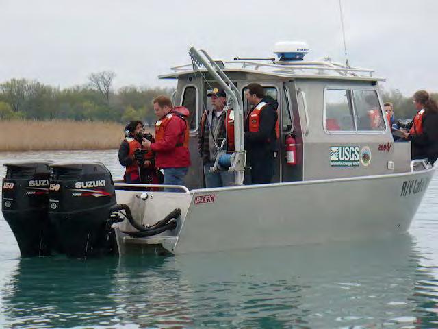
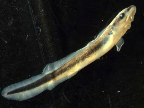
Lessons Learned from Fish Spawning Reef Restoration in the St. Clair Detroit River System. Photo Credit: Adam Lintz
|
|
|
- Noel Anderson
- 5 years ago
- Views:
Transcription


1 Lessons Learned from Fish Spawning Reef Restoration in the St. Clair Detroit River System Photo Credit: Adam Lintz
2 Outline and Presenters Jennifer Read, University of Michigan Water Center Introduction and team process Mary Bohling, Michigan Sea Grant Stakeholder engagement Rachel Echtinaw, SmithGroup JJR Reef siting and design Jim Boase, U.S. Fish and Wildlife Service Monitoring and evaluation Questions for presenters and two funders: Todd Hogrefe (NFWF) and Terry Heatlie (NOAA)


3 The Reef Restoration Team Scientists USGS, FWS, MDNR, U-M Team Facilitators UM Water Center and Michigan Sea Grant Design Engineers SmithGroup JJR Fishery Managers MDNR, FWS Outreach Specialists Michigan Sea Grant Local Champions & Partners Sturgeon for Tomorrow, DTE Energy, AOC Council Grant Managers UM Water Center and Michigan Sea Grant Advisors Fluvial Geomorphologists, Lake Carriers Association

4 The St. Clair Detroit River System


5 St. Clair Detroit River System Historically Huge runs of fish spawned here. Largest commercial GL fishery in late 1800s. Today Origin of much of Lake Erie s fishery, $2 billion/yr. More than 65 species of fish. 16 are threatened or endangered Largest remaining population of lake sturgeon in the Great Lakes. One of the few remaining free flowing, large rivers in region.


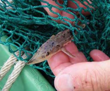
6 Native Fish Restoration Lake sturgeon Walleye Lake whitefish Northern madtom Others: suckers, perch, bass


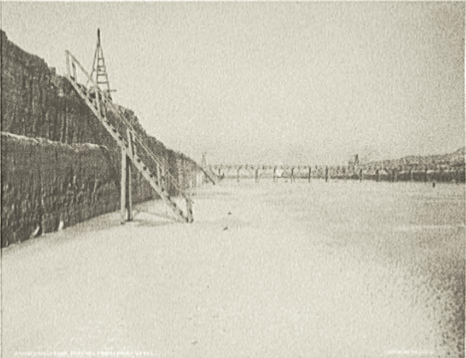
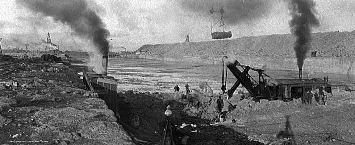
7 Navigation Channels Detroit River, : Created 60 miles of shipping channels Removed more than 60 million cubic yards of material Covered 15.5 square miles of river bottom Bennion and Manny 2011


8 Loss of Spawning Habitat

9 One Approach Constructed Spawning Reefs Photo Credit: Adam Lintz

10 Six Completed Reef Projects

11 Many Lessons Learned 1. Adaptive management 2. Stakeholder engagement 3. Reef siting and design 4. Monitoring and evaluation

12 Middle Channel Reef, St. Clair River (2012)

13


14 Hardness Index (Todd Wills, MDNR) 2012 Red most hard Green least hard 1 meter 2 resolution 2013


15 I. Lessons Learned Team Process Jennifer Read, UM Water Center Diverse input Team coordination Adaptive management


16 New Advisors, New Techniques Reef hydrodynamics workshop Feedback on siting and physical assessment Reef design modeling
17 A Well Rounded Restoration Team Scientists USGS, FWS, MDNR, U-M Team Facilitators UM Water Center and Michigan Sea Grant Design Engineers SmithGroup JJR Fishery Managers MDNR, FWS Outreach Specialists Michigan Sea Grant Local Champions & Partners Sturgeon for Tomorrow, DTE Energy, AOC Council Grant Managers UM Water Center and Michigan Sea Grant Advisors Fluvial Geomorphologists, Lake Carriers Association


18 Collaboration and Coordination Develop appropriate and rewarding roles Dedicate resources for coordination and facilitation Consistently acknowledge everyone s contributions Accommodate different styles of participation Talk openly about concerns. Seek multiple perspectives

19 An Adaptive Management Process


20 II. Lessons Learned Engagement Mary Bohling, Michigan Sea Grant Team engagement Integration with larger plans Communication with funders and stakeholders Consultation with users

21 Team Engagement Regional, cross-agency initiatives Proximity and relationships Early successes and challenges Recent funding - Great Lakes Restoration Initiative St. Clair Detroit River System Initiative


22 Integration with Larger Plans St. Clair and Detroit River AOC plans Sturgeon for Tomorrow

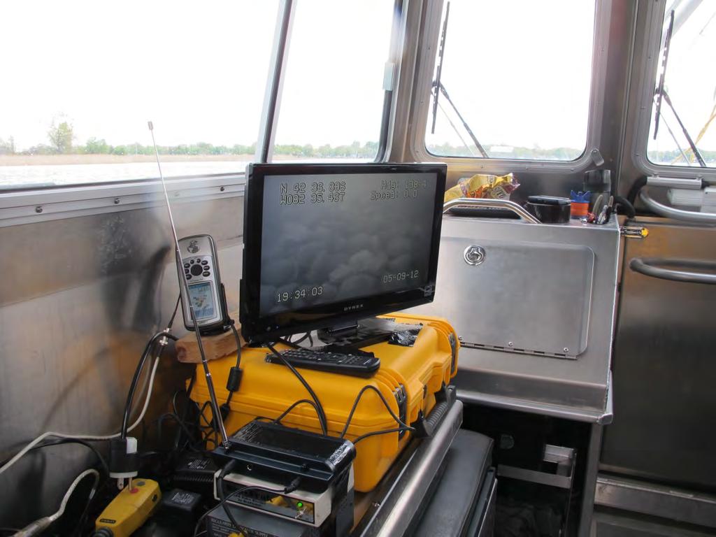
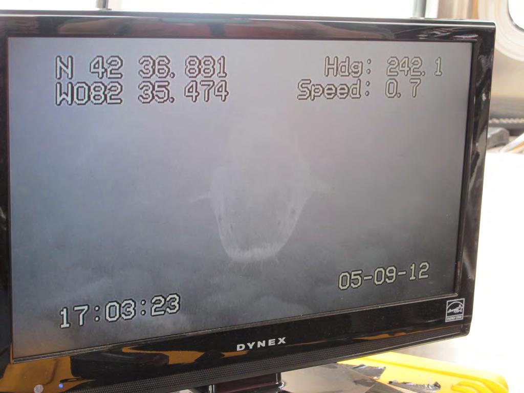
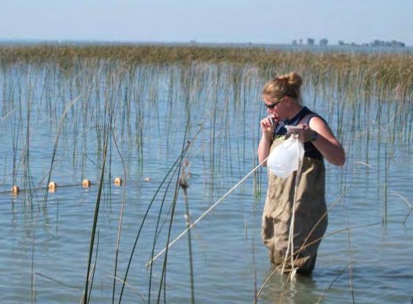
23 Communicating with Funders and Stakeholders


24 Communicating with funders and stakeholders What have we learned? What can we expect? How will the reefs benefit me?


25 Consultation with Users
26 Stakeholder Engagement Lessons Learned: Maintain team communications Consider a wide range of projects Understand potential conflicts Establish relationships with a broad range of stakeholders Foster relationships with local champions Be proactive in communications at all levels Admit shortcomings and celebrate successes


27 III. Lessons Learned Site Selection and Design Rachel Echtinaw, SmithGroupJJR Team effort of: Biologists Geologists Engineers Contractors Industry Experts Data Utilized: Physical Data Ecological Data Published Research Constructability Cost
28 Determining the Right Location Many Considerations to Determine the Reef Location Two Phases: 1. Prioritizing Restoration Locations Computer Modelling 2. Narrowing Down the Restoration Location Field Investigation


29 Phase 1: Prioritizing Restoration Locations GIS Model Additional Considerations: Proximity to Historic or Existing Spawning Locations Known Contamination Sediment Transport Bennion and Manny 2014, Journal of Great Lakes Research 40: 43-51
30 Phase 2: Narrowing Down the Restoration Location Field Investigations: Water Velocity ADCP Data Bathymetry and Sediment Characteristics Side Scan Sonar Underwater Video Scuba Diving Biological Activity Egg Collection Adult Fish Surveys Hydrodynamic Modeling: USGS Geomorphology and Sediment Transport Laboratory


31 Reef Design Reef Location within the Channel 2. Reef Shape 3. Reef Material Initial Projects - Experimental Spanned the channel Recent Projects Refined One large reef Optimally located within the channel 2015


32 Reef Shape Current Design Flat Surface Computer Model of Alternative Shapes Laura Alford, U-M


33 Reef Material Materials Tested: Coal Cinders Rounded Field Stone Rock Mixture Invasive Species Considerations Sea Lamprey Round Goby 4-8 Diameter Angular Limestone Locally Quarried, Inspected and Transported to Site

34 Project Permitting State Permit (MDEQ) Adjacent Landowner Permission Federal Permit (USACE) Public Comment International Review (DoS and DFAIT) Water Levels and Flow National Environmental Protection Act Environmental Assessment State Historic Preservation Office Review Rare Species Review (MNFI)


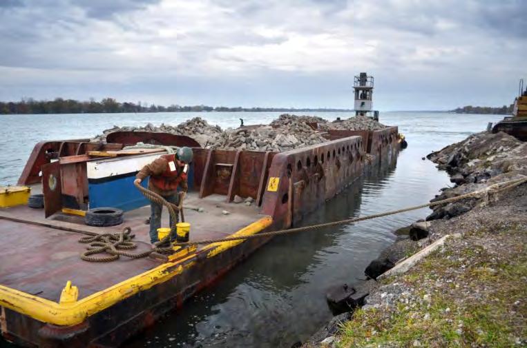


35 Construction Methods Crane and Clamshell Bucket Dump Barge


36 Construction Oversight Competitive Bidding (U-M) On-Going Communication with Contractor Final Construction Verification Bathymetric Survey Underwater Video Daily report: 410 tons 4,090 square feet Continued Monitoring


37 IV. Lessons Learned Monitoring Jim Boase, U.S. Fish and Wildlife Service Comprehensive monitoring Robust evaluation of changes Techniques that match the system


38 FWS, MDNR, OMNR Extensive Biological Monitoring USGS USGS U-M, FWS


39 Enhanced Physical Assessment Side scan sonar Underwater video ADCP (flow) Hydrodynamic modeling Scuba diving Upstream sediment sources Dredging records

40 Robust Evaluation of Changes Before After Control Impact Upstream/downstream comparisons for fish larvae Bouckaert et al. 2014

41 General Recommendations for Monitoring 1. Match the spatial and temporal extent of the biological responses and physical stressors 2. Monitor the physical and biological changes 3. Use consistent methods over time 4. Measure quantitative response variables From McLean et al. 2015

42 For More Information Table of Contents I. The Case for Fish Habitat Restoration II. An Adaptive Management Framework III. An Adaptive Management Team IV. Planning a Spawning Reef Project V. Avoiding Issues with Navigation and Sedimentation VI. Project Permitting, Construction and Monitoring VII. Selected Results and Outcomes VIII. Spawning Reef Project Case Studies


43 Many Partners to Thank Michigan Coastal Management Program
44 Questions and Comments? Jennifer Read, U-M Water Center Introduction and team process Mary Bohling, Michigan Sea Grant Stakeholder engagement Rachel Echtinaw, SmithGroup JJR Reef siting and design Jim Boase, U.S. Fish and Wildlife Service Monitoring and evaluation Todd Hogrefe, Sustain Our Great Lakes Terry Heatlie, NOAA Restoration Center
A Scientific Basis for Restoring Fish Spawning Habitat in the St. Clair and Detroit Rivers of the Laurentian Great Lakes
 A Scientific Basis for Restoring Fish Spawning Habitat in the St. Clair and Detroit Rivers of the Laurentian Great Lakes National Conference on Ecosystem Restoration April 18-22, 2016 Coral Springs, Florida
Overview of Methods. Terrestrial areas that are most important for conservation Conservation
 Overview of Methods The goal of the Western Lake Erie Coastal Conservation Vision project (WLECCV) is to define where we should be working locally to optimally achieve regional conservation impact. The
APEX 3508 MAJOR INLAND SPILL September 2, 2015 Lower Mississippi River MM 937
 APEX 3508 MAJOR INLAND SPILL September 2, 2015 Lower Mississippi River MM 937 RRT V Brief 5 NOV 2015 Sector Ohio Valley MSU Paducah Overview 469 river miles on the Ohio, Cumberland, Tennessee, and Mississippi
Technologies for sea bottom inhabitants' monitoring and Integral Costal Zones Management. Example of the Kandalaksha Bay, White Sea
 Technologies for sea bottom inhabitants' monitoring and Integral Costal Zones Management. Example of the Kandalaksha Bay, White Sea Mikhail Tokarev, Roman Pevzner Transfer Technology Office of Lomonosov
National Marine Sanctuary Program
 National Marine Sanctuary Program NMSP/USGS Joint Seabed Mapping Initiative: September 2004 AA National Ocean Service National Marine Sanctuaries Interim Report September 2004 Background: Since 2002,
Port of Kalama, 2013 TEMCO Berth Maintenance Dredging and In-water Flow-Lane Placement Project
 2014 WEDA ENVIRONMENTAL EXCELLENCE AWARDS Category: Navigation Dredging Port of Kalama, 2013 TEMCO Berth Maintenance Dredging and In-water Flow-Lane Placement Project Port of Kalama, Washington 18 April
BOEM Marine Minerals Program
 BOEM Marine Minerals Program Restoring and Protecting Our Nation s Coasts through Stewardship of OCS Sand Resources SECOORA 2018 Annual Meeting May 22-24 Doug Piatkowski Douglas.piatkowski@boem.gov 703-787-1833
Use of Bioengineering Techniques for Revegetation of Riparian Areas: Colomac Mine Remediation Project, NWT
 Use of Bioengineering Techniques for Revegetation of Riparian Areas: Colomac Mine Remediation Project, NWT McPherson, M. 1, Vanderspiegel, R. 2, Breadmore, R. 2, and Hewitt, M. 3 2012 RPIC Federal Contaminated
Coastal Response Research Center. Nancy Kinner University of New Hampshire (UNH) Michele Jacobi NOAA ORR. September 27, 2007
 Michele Jacobi NOAA ORR. September 27, 2007") Coastal Response Research Center Nancy Kinner University of New Hampshire (UNH) Michele Jacobi NOAA ORR September 27, 2007 1 Coastal Response Research Center (CRRC) CRRC is partnership between NOAA s Office
Coastal Response Research Center Nancy Kinner University of New Hampshire (UNH) Michele Jacobi NOAA ORR September 27, 2007 1 Coastal Response Research Center (CRRC) CRRC is partnership between NOAA s Office
Birch Creek Geomorphic Assessment and Action Plan
 Birch Creek Geomorphic Assessment and Action Plan Jim Webster Tim Hanrahan, PhD, CFM Jesse Schwartz, PhD Zach Hill January 22, 2015 White Eagle Grange This Project is a First Step in Strategy Planning
Kootenai River Habitat Restoration Program Update
 Kootenai River Habitat Restoration Program Update Kootenai Tribe of Idaho Kootenai Valley Resource Initiative November 19, 2012 Bonners Ferry, Idaho Changes to Kootenai Basin Beaver trapping Floodplain
Marine Debris in the Gulf of Mexico
 Marine Debris in the Gulf of Mexico Peter Murphy NOAA Marine Debris Program / Genwest Biloxi, Mississippi October 25, 2009 Outline 1. Project Background 2. Process 3. 2006-2007 Alabama, Mississippi 4.
Regional Sediment Management
 Regional Sediment Management Linda S. Lillycrop Program Manager Coastal Engineer US Army Engineer Research and Development Center Coastal and Hydraulics Laboratory Q AVG Coastal Resilience: The Environmental,
Presentation Outline. Project Overview. Sea Level Rise Assessment & Decision Tools. Community Engagement. Tina Whitman, Friends of the San Juans
 Healthy Beaches for People & Fish Sea Level Rise Adaptation Tools for San Juan County, WA Tina Whitman & Andrea MacLennan December 10, 2015 Presentation Outline Project Overview Tina Whitman, Friends of
Marine Spatial Planning: A Tool for Implementing Ecosystem-Based Management
 Marine Spatial Planning: A Tool for Implementing Ecosystem-Based Management Steven Murawski, Ph.D., Ecosystem Goal Team Lead National Oceanic and Atmospheric Administration NOAA November 16, 2009 1 To
Decline of Lake Michigan-Huron Levels Caused by Erosion of the St. Clair River
 Decline of Lake Michigan-Huron Levels Caused by Erosion of the St. Clair River W.F. & Associates Coastal Engineers (in association with Frank Quinn) April 13, 2005 Outline Problem Definition Understanding
The Arctic Landscape Conservation Cooperative Conservation Goals
 The Arctic Landscape Conservation Cooperative Conservation Goals Adopted by the Arctic LCC Steering Committee, 24 August 2010 Background : Landscape Conservation Cooperatives and Climate Science Centers
Biogeographic Approach to Coastal Assessments & Spatial Planning
 NOAA s Biogeographic Approach to Coastal Assessments & Spatial Planning Mark E. Monaco Mark.Monaco@noaa.gov Center for Coastal Monitoring and Assessment http://ccma.nos.noaa.gov/about/biogeography Biogeography
Summary Description Municipality of Anchorage. Anchorage Coastal Resource Atlas Project
 Summary Description Municipality of Anchorage Anchorage Coastal Resource Atlas Project By: Thede Tobish, MOA Planner; and Charlie Barnwell, MOA GIS Manager Introduction Local governments often struggle
Opening their Shells Getting commercial clammers involved in marine spatial planning
 Opening their Shells Getting commercial clammers involved in marine spatial planning Ed Lewandowski Coastal Communities Development Specialist University of Delaware/Delaware Sea Grant Highlights Background
Great Lakes Regional Collaboration and U.S. GEOSS/IOOS/GLOS Initiative Focus on the Huron to Erie Corridor
 Great Lakes Regional Collaboration and U.S. GEOSS/IOOS/GLOS Initiative Focus on the Huron to Erie Corridor USEPA Grosse Ile Lab October 17, 2005 Great Lakes Interagency Task Force Draft Plan calls for
MARINE SPATIAL PLANNING
 MARINE SPATIAL PLANNING Washington Uses Spatial Planning to Honor its Pacific Coast and Offshore Waters Past, Present and Future The Washington State Pacific Coast and offshore waters are diverse in both
Relatively little hard substrate occurs naturally in the
 CHAPTER FIVE Rock Habitats Relatively little hard substrate occurs naturally in the estuary, owing mainly to the vast quantities of fine sediment that have been deposited by the rivers. Rock habitat is
Framework on reducing diffuse pollution from agriculture perspectives from catchment managers
 Framework on reducing diffuse pollution from agriculture perspectives from catchment managers Photo: River Eden catchment, Sim Reaney, Durham University Introduction This framework has arisen from a series
Marine Spatial Planning (MSP): A practical approach to ecosystembased
: A practical approach to ecosystembased") Marine Spatial Planning (MSP): A practical approach to ecosystembased management Erik Olsen, Institute of Marine Research, Norway Fanny Douvere, International Oceanographic Commission Overview Why we need
Marine Spatial Planning (MSP): A practical approach to ecosystembased management Erik Olsen, Institute of Marine Research, Norway Fanny Douvere, International Oceanographic Commission Overview Why we need
Elwha River response to dam removals through four years and a big flood:
 Elwha River response to dam removals through four years and a big flood: Lessons learned, channel response, and sediment effects from the world s largest engineered dam removal Andy Ritchie NPS Elwha Restoration
U.S. Geological Survey Agency Briefing for MAPPS Mark L. DeMulder Director, National Geospatial Program. March 12, 2013
 + U.S. Geological Survey Agency Briefing for MAPPS Mark L. DeMulder Director, National Geospatial Program March 12, 2013 + 3D Elevation Program (3DEP) National Leadership The National Enhanced Elevation
Sri Lanka has a coastline of km excluding the shoreline of bays and inlets.
 Defining and Demarcating Coastal zones in Sri Lanka Procedure, Challenges and What needs to be done? Dr. Anil Premaratne Director General Coast Conservation Coast Conservation Department Sri Lanka 1 Sri
Environmental Response Management Application
 Environmental Response Management Application Coastal Response Research Center Nancy Kinner, Michele Jacobi, Rob Braswell, Kurt Schwehr & Amy Merten RRT III May 14, 2008 1 Talk Outline Overview of Center
EAGLES NEST AND PIASA ISLANDS
 EAGLES NEST AND PIASA ISLANDS HABITAT REHABILITATION AND ENHANCEMENT PROJECT MADISON AND JERSEY COUNTIES, ILLINOIS ENVIRONMENTAL MANAGEMENT PROGRAM ST. LOUIS DISTRICT FACT SHEET I. LOCATION The proposed
St. Clair River Conveyance Change 2007 to 2012
 St. Clair River Conveyance Change 2007 to 2012 Morphologic Change in the St. Clair River 2007 2012 Conveyance Change Report U.S. Army Corps of Engineers, Detroit District Great Lakes Hydraulics and Hydrology
WELCOME & INTRODUCTION
 MPA Management Capacity Building Training Module 1: WELCOME & INTRODUCTION Participants Distinguished Guests Welcome Site Overviews of MPAs represented Overview of Training Program What are Today s Objectives?
A PRIMER ON DAM REMOVALS IN MICHIGAN. Joe Rathbun Michigan Dept. Environmental Quality
 A PRIMER ON DAM REMOVALS IN MICHIGAN Joe Rathbun Michigan Dept. Environmental Quality rathbunj@michigan.gov Talk Outline Michigan dam factoids Effects of dams Removing a dam Steps Potential stumbling blocks
GIS-Based Sediment Quality Database for the St. Louis River Area of Concern (AOC): Overview Presentations and Demonstration
: Overview Presentations and Demonstration") GIS-Based Sediment Quality Database for the St. Louis River Area of Concern (AOC): Overview Presentations and Demonstration Judy L. Crane 1 and Dawn E. Smorong 2 1 Minnesota Pollution Control Agency, St.
GIS-Based Sediment Quality Database for the St. Louis River Area of Concern (AOC): Overview Presentations and Demonstration Judy L. Crane 1 and Dawn E. Smorong 2 1 Minnesota Pollution Control Agency, St.
WATER LEVEL REGIMES CLIMATE CHANGE SCENARIOS TRANSITIONAL HABITATS AND REFUGIA
 WATER LEVEL REGIMES CLIMATE CHANGE SCENARIOS TRANSITIONAL HABITATS AND REFUGIA Scudder D. Mackey University of Windsor/Habitat Solutions Funded by the Great Lakes Fishery Commission USFWS Restoration Act
GIS Data and Technology to Support Transportation & MPO Decision-Making & Planning. using an Eco-Logical* Approach within the Kansas City Region
 GIS Data and Technology to Support Transportation & MPO Decision-Making & Planning using an Eco-Logical* Approach within the Kansas City Region Authors (in alphabetical order): Tom Gerend, Tom Jacobs,
BURGAS CASE STUDY: LAND-SEA INTERACTIONS. Dr. Margarita Stancheva
 BURGAS CASE STUDY: LAND-SEA INTERACTIONS Dr. Margarita Stancheva Name of presentation NEED FOR COHERENCE BETWEEN LAND AND SEA ACTIVITIES Name presenter Burgas is the fourth largest city in Bulgaria and
THIN-LAYER PLACEMENT OF DREDGE MATERIAL FOR MARSH NOURISHMENT, RESOTRATION, AND RESPONSE TO SEA LEVEL RISE
 THIN-LAYER PLACEMENT OF DREDGE MATERIAL FOR MARSH NOURISHMENT, RESOTRATION, AND RESPONSE TO SEA LEVEL RISE Case studies and lesson learned regarding thin-layer deposition projects in Delaware, New Jersey,
Environment and Natural Resources Trust Fund 2019 Request for Proposals (RFP)
") Environment and Natural Resources Trust Fund 2019 Request for Proposals (RFP) Project Title: Data Visualization Tool for Minnesota Riverbed Habitat Category: A. Foundational Natural Resource Data and Information
Environment and Natural Resources Trust Fund 2019 Request for Proposals (RFP) Project Title: Data Visualization Tool for Minnesota Riverbed Habitat Category: A. Foundational Natural Resource Data and Information
A National Outer Continental Shelf Sand / Sediment Inventory
 A National Outer Continental Shelf Sand / Sediment Inventory Sand Resource Areas Lease Areas Lora Turner December 15, 2016 Restoring and Protecting Our Nation s Coasts through Stewardship of OCS Resources
Best Management Practices for Coldwater Fisheries Enhancement and Restoration
 Best Management Practices for Coldwater Fisheries Enhancement and Restoration MACC Annual Environmental Conference 2017 March 3, 2017 Tim Dexter, MassDOT Highway Division 1 Leading the Nation in Transportation
Appendix I. Dredged Volume Estimates. Draft Contractor Document: Subject to Continuing Agency Review
 Appendix I Dredged Volume Estimates Draft Contractor Document: Subject to Continuing Agency Review Interoffice Correspondence Date: April 6, 2007 To: L. Bossi (WHI) Copy: S. Thompson (WHI), B. Fidler (NNJ)
Environmental impact assessment study of the new offshore dumping sites for Šventoji port in Lithuania
 Environmental impact assessment study of the new offshore dumping sites for Šventoji port in Lithuania Introduction Summary In 2003 Lithuanian Ministry of Transport initiated the preparation of feasibility
SW Florida Escarpment Mapping Area
 Overview NOAA s Okeanos Explorer (EX) Program plans to conduct systematic mapping and telepresence-enabled ROV explorations in the Gulf of Mexico during Spring 2014. In 2011, the EX conducted mapping operations
National Perspectives - Portugal. Margarida Almodovar
 National Perspectives - Portugal Margarida Almodovar margarida.almodovar@mam.gov.pt from base line to the external limit of the continental shelf behind 200 miles and according to UNCLOS definitions Economic
Marine/Maritime Spatial Planning Andrej Abramić
 Marine/Maritime Spatial Planning Andrej Abramić EcoAqua SUMMER SCHOOL: Ecosystem approach to aquaculture 26-29th of October 2015 Research and Technology to enhance excellence in Aquaculture development
Inter State Large Navigable Rivers of the United States
 Inter State Large Navigable Rivers of the United States REVIEW OF NORTH AMERICAN BASINS: GREAT LAKES AND MISSISSIPPI RIVER HELEN A. BROHL, EXECUTIVE DIRECTOR US COMMITTEE ON THE MARINE TRANSPORTATION SYSTEM
Marine Spatial Planning Leslie-Ann McGee Battelle Memorial Institute
 Marine Spatial Planning Leslie-Ann McGee Battelle Memorial Institute Rev061708 1 Marine Spatial Planning What is it? Why is it different? Where is it currently being employed? What is happening in the
Chesapeake Bay Remote Sensing Pilot Executive Briefing
 Chesapeake Bay Remote Sensing Pilot Executive Briefing Introduction In his Executive Order 13506 in May 2009, President Obama stated The Chesapeake Bay is a national treasure constituting the largest estuary
DWH Restoration Funding at a Glance
 NCER 2018 DWH Restoration Funding at a Glance Natural Resource Damage Assessment: $8.1 Billion RESTORE Act: $5.3 Billion National Fish and Wildlife Foundation GEBF: $2.5 Billion National Academy of Sciences:
NOAA s OCM: Services, tools and collaboration opportunities & Puerto Rico s NE Marine Corridor as a case study
 NOAA s OCM: Services, tools and collaboration opportunities & Puerto Rico s NE Marine Corridor as a case study Dr. Antares Ramos Álvarez NOAA s Office of Coastal Management September 15 th, 2016 Conservation
GALVESTON BAY RSM Moving toward an Integrated, Cooperative, and Holistic Approach to Estuarine Sediments
 GALVESTON BAY RSM Moving toward an Integrated, Cooperative, and Holistic Approach to Estuarine Sediments RAE Conference 2010 Larry A. Wise Moffatt & Nichol RSM is a system-based approach for collaboratively
Application of GIS Technology in Reach- Scale Channel Migration Zone Mapping: Yellowstone River, Montana
 Application of GIS Technology in Reach- Scale Channel Migration Zone Mapping: Yellowstone River, Montana Karin Boyd Applied Geomorphology, Inc. Bozeman, MT Tony Thatcher DTM Consulting, Inc Bozeman, MT
Land Use Methods & Metrics Development Outcome
 Quarterly Progress Meeting November 15, 2018 Land Use Methods & Metrics Development Outcome Peter Claggett, USGS LUWG Coordinator Through the Chesapeake Bay Watershed Agreement, the Chesapeake Bay Program
University of New Hampshire Scholars' Repository
 University of New Hampshire University of New Hampshire Scholars' Repository Center for Coastal and Ocean Mapping Center for Coastal and Ocean Mapping 3-2009 Environmental Response Management Application
Catchment Guide Appendix 2: Case Studies
 Catchment Guide Appendix 2: Case Studies List of Case Studies 1. Ribble Catchment Online Information 2. Upper Thames Catchment Integrated Local Delivery The Ribble Catchment Question 8: What information
MESM Track. Environmental Policy and Management
 MESM Track Environmental Policy and Management Overview This interdisciplinary track prepares students for positions requiring an ability to integrate natural science into policy development and implementation
Outline National legislative & policy context Regional history with ESSIM ESSIM Evaluation Phase Government Integration via RCCOM Regional ICOM Framew
 What MSP Implementation could change in the Maritimes Region Tim Hall, Regional Manager Oceans and Coastal Management Division Ecosystem Management Branch Fisheries and Oceans Canada Maritimes Region BIO
Mobrand to Jones and Stokes. Sustainable Fisheries Management Use of EDT
 Sustainable Fisheries Management Use of EDT Ecosystem Diagnosis and Treatment EDT EDT designed to provide a practical, science-based approach for developing and implementing watershed plans. Provides decision
SOUTHEAST COASTAL ASSESSMENT: Creating a shared vision
 SOUTHEAST COASTAL ASSESSMENT: Creating a shared vision November 12, 2017 Jacqueline Keiser, PG, PMP Regional Sediment Management Regional Center of Expertise SOUTH ATLANTIC DIVISION U.S. ARMY CORPS OF
Application of an Enhanced, Fine-Scale SWAT Model to Target Land Management Practices for Maximizing Pollutant Reduction and Conservation Benefits
 Application of an Enhanced, Fine-Scale SWAT Model to Target Land Management Practices for Maximizing Pollutant Reduction and Conservation Benefits Amanda Flynn, Todd Redder, Joe DePinto, Derek Schlea Brian
Four Mile Run Levee Corridor Stream Restoration
 Four Mile Run Levee Corridor Stream Restoration 30% Design Summary U.S. Army Corps of Engineers, Baltimore District Presentation Outline Four Mile Run 1.) Historic Perspective 2.) Existing Conditions 3.)
Analysis of Environmental Impacts from the Port of Miami Expansion. Julienne Beblo
 Analysis of Environmental Impacts from the Port of Miami Expansion Julienne Beblo 6.28.16 The Port of Miami One of the most prominent ports for global tourism and commerce Contributes $28 billion/yr to
BURGAS CASE STUDY: LAND-SEA INTERACTIONS
 BURGAS CASE STUDY: LAND-SEA INTERACTIONS Dr. Margarita Stancheva IO-BAS, Bulgaria Name of presentation CROSS BORDER MARITIME SPATIAL PLANNING IN THE BLACK SEA ROMANIA AND BULGARIA (MARSPLAN BS) Project
Oyster Reef for Shoreline Stabilization and Restoration. Jason Kirkpatrick Conservation Program Manager MacDill AFB Tampa, Florida
 Oyster Reef for Shoreline Stabilization and Restoration Jason Kirkpatrick Conservation Program Manager MacDill AFB Tampa, Florida Interbay Penninsula Port of Tampa X The few remaining mangroves are being
Unmanned Aircraft Systems (UAS) Activities in Earth Sciences
 Activities in Earth Sciences") Unmanned Aircraft Systems (UAS) Activities in Earth Sciences Bruce K. Quirk quirk@usgs.gov Department of the Interior U.S. Geological Survey June 22, 2015 Department of the Interior Bureau of Land Management
Unmanned Aircraft Systems (UAS) Activities in Earth Sciences Bruce K. Quirk quirk@usgs.gov Department of the Interior U.S. Geological Survey June 22, 2015 Department of the Interior Bureau of Land Management
Restoring the Napa River:
 Restoring the Napa River: lessons learned from a long term private-public project Andy Collison Environmental Science Associates acollison@esassoc.com 1 Napa River Restoration Projects Rutherford Reach
MISSOURI LiDAR Stakeholders Meeting
 MISSOURI LiDAR Stakeholders Meeting East-West Gateway June 18, 2010 Tim Haithcoat Missouri GIO Enhanced Elevation Data What s different about it? Business requirements are changing.fast New data collection
Marine Geomorphology as a Determinant for Essential Life Habitat III
 Marine Geomorphology as a Determinant for Essential Life Habitat III marinecoastalgis.net/aag08 10:10 Dawn Wright, Oregon 10:30 Will McClintock, California 10:50 Daniel Sampson, Massachusetts 11:10 Gary
Author(s): Charles K. Cover, P.E. Federal Energy Regulatory Commission
: Charles K. Cover, P.E. Federal Energy Regulatory Commission") Using GIS to Help Manage a National Energy Program Author(s): Charles K. Cover, P.E. Federal Energy Regulatory Commission The Federal Energy Regulatory Commission (FERC) has statutory oversight on key
Using GIS to Help Manage a National Energy Program Author(s): Charles K. Cover, P.E. Federal Energy Regulatory Commission The Federal Energy Regulatory Commission (FERC) has statutory oversight on key
Case Study: Bulgarian part of the Black Sea
 Application of the MESMA Framework. Case Study: Bulgarian part of the Black Sea Schipper C.A. 1 Todorova V. 2, Doncheva V. 2 1 Deltares, P.O.Box 177, 2600 MH Delft, The Netherlands 2 Institute of Oceanology
Feasibility Study for Potential Removal of McLane & Goldman Dams Souhegan River, Milford, NH. Public Kick-off Meeting
 Feasibility Study for Potential Removal of McLane & Goldman Dams Souhegan River, Milford, NH Public Kick-off Meeting Mark Wamser Gomez and Sullivan Engineers, P.C. 603-428-4960 Aug 16, 2010 Agenda Opening
Modeling Fish Assemblages in Stream Networks Representation of Stream Network Introduction habitat attributes Criteria for Success
 Modeling Fish Assemblages in Stream Networks Joan P. Baker and Denis White Western Ecology Division National Health & Environmental Effects Research Laboratory U.S. Environmental Protection Agency baker.joan@epa.gov
Application for Geotourism Charter
 Application for Geotourism Charter Thank you for the interest in geotourism as a long-term strategy to foster wisely managed tourism and enlightened destination stewardship. National Geographic s Center
Long-Distance Pumping and Opportunities for Engineering with Nature
 Long-Distance Pumping and Opportunities for Engineering with Nature Tim Welp and Derek Wilson Tim Welp Research Hydraulic Engineer Coastal and Hydraulics Laboratory 23 October 2012 Engineering with Nature
Building capacity to support decisionmaking for protection and management of marine areas
 Credit_Deep Atlantic Stepping Stones Science Team_IFE_URI_NOAA_no3 Credit: John Weller, john@lastocean.com Credit: John Weller, john@lastocean.com Credit: John Weller, john@lastocean.com Credit: Sarah
Hydrologic Analysis for Ecosystem Restoration
 Hydrologic Analysis for Ecosystem Restoration Davis, California Objectives: To provide participants with: 1) an understanding of the issues in restoration studies; 2) an overview of Corps policies and
Visualizing Upper Trophic and Ecosystem Modeling Outputs with EverVIEW to Inform the Decision Process in Coastal Louisiana.
 Visualizing Upper Trophic and Ecosystem Modeling Outputs with EverVIEW to Inform the Decision Process in Coastal Louisiana 2012 Master Plan Craig Conzelmann Carol Parsons Richards Kevin Suir COMPREHENSIVE
The RRC would like to thank the sponsors of the RRC Annual Conference 2015 who support discounted places
 16 TH ANNUAL NETWORK CONFERENCE Tweet us using #RRC2015 People and Process-Based River Management: Restoring River Processes; Natural Flood Management; Healthy Catchments The RRC would like to thank the
Spatial Decision-Support for National Marine Conservation Areas in the Southern Strait of Georgia and Gwaii Haanas
 Spatial Decision-Support for National Marine Conservation Areas in the Southern Strait of Georgia and Gwaii Haanas Lindsay McBlane Krista Royle Greg MacMillan Photo: Mark Hiebert Western and Northern Service
Subcommittee on Sedimentation Draft Sediment Analysis Guidelines for Dam Removal
 Subcommittee on Sedimentation Draft Sediment Analysis Guidelines for Dam Removal August 4, 2011 Jennifer Bountry, M.S., P.E. Tim Randle, M.S., P.E., D.WRE. Blair Greimann, Ph.D., P.E. Sedimentation and
Mapping Maine s Working Waterfront: for Our Heritage and Economy
 Mapping Maine s Working Waterfront: for Our Heritage and Economy Abstract Mapping Maine s Working Waterfronts is a collaborative project led by the Island Institute that inventories the state s current
The IUCN Facilitated Independent Advisory Panel on Remediation and Rehabilitation of Biodiversity and Habitats of Oil Spill Sites in the Niger Delta
 World Conservation Congress, Jeju, Korea, September 2012 The IUCN Facilitated Independent Advisory Panel on Remediation and Rehabilitation of Biodiversity and Habitats of Oil Spill Sites in the Niger Delta
Why do we need a global framework for MPAs in ABNJ? Kristina M. Gjerde IUCN High Seas Policy Advisor
 Why do we need a global framework for MPAs in ABNJ? Kristina M. Gjerde IUCN High Seas Policy Advisor kgjerde@eip.com.pl 40% ocean heavily affected by humans (c) Halpern et al. 2008. Scientists found that
A Regional Database Tracking Fire Footprint Each Year within the South Atlantic Region: Current Database Description and Future Directions
 A Regional Database Tracking Fire Footprint Each Year within the South Atlantic Region: Current Database Description and Future Directions Last Updated on September 30, 2018 Contributors: NatureServe,
How to integrate maritime cultural heritage into maritime spatial planning?
 2ND SUBMARINER Conference #BetterOff Blue17 Creating synergies for a biobased society How to integrate maritime cultural heritage into maritime spatial planning? Susanne Altvater, s.pro 28.09.2017 #BetterOffBlue17
Sunset Harbour / Huntington Harbour Maintenance Dredging and Waterline Installation Project. CMANC 21 January 2016
 Sunset Harbour / Huntington Harbour Maintenance Dredging and Waterline Installation Project CMANC 21 January 2016 County of Orange Footprint Huntington Harbour Operational and Dredging Cost Sharing Agreements
STAMP Spa)al Tools for Arc)c Mapping & Planning. Creating an interactive data tool to improve access and usability of Arctic data
al Tools for Arc)c Mapping & Planning. Creating an interactive data tool to improve access and usability of Arctic data") STAMP Spa)al Tools for Arc)c Mapping & Planning Creating an interactive data tool to improve access and usability of Arctic data Mission Provide easy access to physical, chemical, and biological data Network
STAMP Spa)al Tools for Arc)c Mapping & Planning Creating an interactive data tool to improve access and usability of Arctic data Mission Provide easy access to physical, chemical, and biological data Network
Mapping on the Edge: shoreline mapping for regulation and voluntary stewardship
 Western Washington University Western CEDAR Salish Sea Ecosystem Conference 2016 Salish Sea Ecosystem Conference (Vancouver, BC) Mapping on the Edge: shoreline mapping for regulation and voluntary stewardship
The Great Lakes. Beyond the Book. FOCUS Book
 Build a model to show how the Great s formed. Use soil and large pieces of ice to model the role of ice sheets as they carved out the Great s Basin and then filled it with water. How will you make the
Alexandra Carvalho, Ph.D., GISP Kathy Fitzpatrick, P.E.
 Coastal Data Organization for Project Management and Coastal Planning Martin County, Florida Alexandra Carvalho, Ph.D., GISP Kathy Fitzpatrick, P.E. Outline County Coastal Programs Coastal Geodatabase
Material Workshop. Galveston District 2012 Beneficial Use of Dredged. Material Workshop. Custodians of the Coast
 Galveston District 2012 Beneficial Use of Dredged Material Workshop Galveston District 2012 Beneficial Use of Dredged Material Workshop US Army Corps of Engineers BUILDING STRONG Welcome Opening Remarks
1.1 What is Site Fingerprinting?
 Site Fingerprinting Utilizing GIS/GPS Technology 1.1 What is Site Fingerprinting? Site fingerprinting is a planning tool used to design communities where protection of natural resources is the primary
Current and Future Technology Applications for Coastal Zone Management. Bruce K. Carlisle, Acting Director Office of Coastal Zone Management
 Current and Future Technology Applications for Coastal Zone Management Bruce K. Carlisle, Acting Director Office of Coastal Zone Management The Massachusetts Coastal Zone Management Program Approved in
Heather Schlosser Army Corps of Engineers Coastal Studies Group August 28, 2008
 Got sand? Regional Sediment Management in Orange County Heather Schlosser Army Corps of Engineers Coastal Studies Group August 28, 2008 Regional Sediment Management Regional sediment management recognizes
Developing a nearshore geospatial framework for recovery assessment and planning
 Western Washington University Western CEDAR Salish Sea Ecosystem Conference 2018 Salish Sea Ecosystem Conference (Seattle, Wash.) Apr 6th, 10:30 AM - 10:45 AM Developing a nearshore geospatial framework
Background. North Cascades Ecosystem Grizzly Bear Restoration Plan/ Environmental Impact Statement. Steve Rochetta
 Grizzly Bear Restoration Plan/ Environmental Impact Statement Steve Rochetta Background Situated in the core of the North Cascades ecosystem (NCE), the North Cascades National Park Complex is surrounded
DEFRA FLOOD RISK MANAGEMENT AND MODELLING COMPETITION
 DEFRA FLOOD RISK MANAGEMENT AND MODELLING COMPETITION Why are we holding a competition on this topic? Recurrent flooding in the UK over recent years has catalysed a range of interesting academic work spanning
U.S. ARMY CORPS OF ENGINEERS
 CORPS FACTS Regulating Mississippi River Navigation Pools U.S. ARMY CORPS OF ENGINEERS BUILDING STRONG Historical Background Federal improvements in the interest of navigation on the Mississippi River
Red River Levee Panel
 Red River Levee Panel Mississippi River Commission Monday, August 9, 2017 Red River Levees in LA & AR NONE along TX & OK Boarder Red River Levee Issues Caddo Levee Cherokee Park Authorization Bossier Levee