Should (R)SET-MH data be used to forecast the effects of sea level rise on wetland resilience and carbon sequestration?
|
|
|
- Martin Gardner
- 5 years ago
- Views:
Transcription
1 Should (R)SET-MH data be used to forecast the effects of sea level rise on wetland resilience and carbon sequestration? Randall W. Parkinson, Ph.D., P.G. Institute for Water and Environment Florida International University Webb et al. 2013

2
3 What has changed since then: Introduction of (R)SET-MH methodology to quantify recent sedimentation Increased rate and magnitude of sea level rise forecast to accompany climate change What has not changed: Sedimentation rate discrepancies between methodologies, including (R)SET-MH, have not been resolved So what?
4 Radioisotopes and MH (R)SET-MH Pilot studies and formulation of standard methods Objective Why 1970s and 80s 1980s and early-90s Above and below ground processes including biogeochemistry and sedimentation Historic change in sedimentation How wetlands work Resiliency of habitat and ecosystem function to sea level rise and civil engineering Mid-1990s and 00s Recent sedimentation Resiliency (SLAMM) and restoration success (BACI) 2000s and 10s Carbon flux Climate change Evolution of approach and rationale used in wetland studies designed to quantify temporal and spatial changes in sedimentation
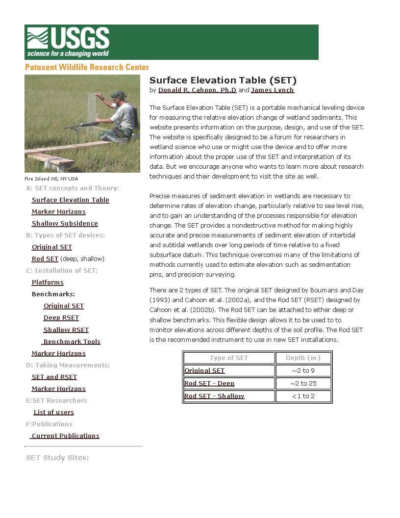
5 Recent (<10 years) Webb et al Figure 1. RSET-MH set-up in a coastal mangrove to quantify recent sedimentation. From Webb et al
6 Geologic (>100 yrs) Historic (100 to 50 yrs) 14 C Ln excess 210 Pb 137 Cs activity Webb et al Radioisotope geochronology data used to quantify geologic and historic sedimentation. Modified after Webb et al
7 (R)SET-MH Radiometric Recent Historic Geologic Duration of Location observations (mo) Accretion Elevation change Cs-137 Pb-210 C-14 Reference Wetlands (207) Maine (11) Goodman et al Massachusetts 1.83 (2) Redfield 1972 New York 0.02 Kolker et al New York Donnelly and Bertness 2001 Chesapeake Bay (8) (9) Cadol et al Chesapeake Bay Hussein 2009 South Carolina (4) 3.08 (4) Stagg et al Georgia (4) 11.2 (4) Stagg et al Georgia (3) 1.93 (3) Craft 2007 Georgia 3.70 Loomis and Craft 2010 Florida (4) Craft and Richardson 2008 Florida 0.10 (6) Choi and Wang 2004 Louisiana 2.48 (6) Nyman et al Louisiana Jarvis 2010 Louisiana (2) 2.9 (2) 6.85 (2) 5.75 (2) Rybczyk and Cahoon 2002 Louisiana (9) (9) Lane et al Louisiana 4.97 (6) 2.95 (6) Prouhet 2001 Louisiana Baustain et al Louisiana (2) DeLaune 1978 Louisiana (4) DeLaune et al. in review Louisiana 7.69 (6) 4.29 (3) 3.55 (15) Smith 2009 Louisiana 5.26 (9) 4.49 (9) Smith 2012 Texas 3.94 (32) White et al Western Gulf of Mexico 3.90 (2) 3.10 (2) Turner et al Gulf of Mexico 3.62 (4) Callaway et al Average Estimates of Atlantic and Gulf Coast marsh accretion rates (mm/yr) organized by location and method. Values decrease with increasing age of sediment (left to right). (11) = number of observations if more than one.
8 (R)SET-MH Radiometric Recent Historic Geologic Duration of Location observations (mo) Accretion Elevation change Cs-137 Pb-210 C-14 Reference Mangrove (65) Hutchinson Island, Florida 9.50 (5) 1.00 (6) Parkinson et al Florida Keys 3.22 (5) Callaway et al Southwest Florida (2) 3.80 (2) Whelan et al Southwest Florida 3.05 (2) Smoak et al Southwest Florida 0.60 (3) Parkinson et al Southwest Florida 1.10 (2) Parkinson et al Rookery Bay, Florida (5) 2.34 (5) Cahoon and Lynch 1997 Rookery Bay, Florida (7) 2.11 (7) McKee 2011 Rookery Bay, Florida Lynch et al Naples Bay, Florida 4.16 (5) 2.52 (7) Marchia et al Average Estimates of Atlantic and Gulf Coast mangrove accretion rates (mm/yr) organized by location and method. Values decrease with increasing age of sediment (left to right). (11) = number of observations if more than one.
9
10 Figure 3a. Published global distribution of coastal wetlands. Those hypothesized to be vulnerable to increases in relative sea-level encircled. Known SET locations plotted as orange circles. From Webb et al

11
12 Figure 1a. Comparison between local relative sea level rise and accretion rates for low- and high-elevation marshes of Atlantic and Gulf Coast salt marshes in North America and Europe. Dashed line is 1:1. From Kirwan et al
.")
13 Figure 3b. Threshold rates of sea level rise (grey band) above which marshes are not able to survive. The predicted probable range of global sea level rise rates in 2100 is indicated by the pale green and blue bands (IPCC AR5). From Kirwan et al
14 Sea Level (m) <1 mm/yr ESR, Submergence & Deltas Stabilization, Accretion & Progradation Overstep Early Middle Late Age (cal yr BP) Coastal response to sea level rise during Holocene Epoch (southeastern USA). ERS = erosional shoreface retreat. Sea level history from Balsillie and Donoghue (2004).
15 Aggrading Submerging Figure Linear trend in accretion verses relative sea level rise for mangrove sites in the SET network. From Cahoon et al
16 (R)SET-MH Summary of Observations SET-MH rates of coastal marsh sedimentation yield higher values than those based upon radiometric geochronology. SET-MH data generally represent less than a decade of observations. So the cumulative effects of subsurface processes have likely not been fully integrated into the stratigraphic sequence. Predictive models using SET-MH data forecast marsh resilience at rates of SLR inconsistent with the Holocene stratigraphic record. Radiometric geochronology is a more viable means of forecasting resilience because it yields estimates of marsh sedimentation operating over decades to centuries the same interval over which predictions of climate change and SLR are typically discussed.
 Accretion Rate (mm/yr) 1900-2010: 2.")

17 ~30 centimeters Figure 1. Location of six (6) sediment cores obtained in the Shark River Basin of Everglades National Park. From Breithaupt et al Kirwan et al : 4.8 mm/yr OC Accumulation Rate (g/m2/yr) Accretion Rate (mm/yr) : 2.7 mm/yr Accumulation Rate (g/m2/yr) Inorganic matter Organic matter 0 20 TN Accumulation Rate (g/m2/yr) 0 1 TP Accumulation Rate (g/m2/yr) Figure 4. Mean accumulation rates of five parameters derived from six cores and aggregated by decade from year 1900 to All values based upon 210 Pb activity profile. Bars represent 95% confidence. Adapted from Breithaupt et al

")
18 The restoration and avoided loss of tidal wetlands and coastal habitats offers significant potential for the sequestration of carbon, simultaneously restoring ecosystem health while reducing greenhouse gas (GHG) emissions. 2014

19
20 Webb et al. 2013
21 Radioisotopes and MH SET-MH Pilot studies and formulation of standard methods Objective Why 1970s and 80s 1980s and early-90s Above and below ground processes including biogeochemistry and sedimentation Historical change in sedimentation How wetlands work Resiliency of habitat and ecosystem function to sea level rise and civil engineering Mid-1990s and 00s Recent sedimentation Resiliency (SLAMM) and restoration success (BACI) 2000s and 10s Carbon flux Climate change Evolution of approach and rationale used in wetland studies designed to quantify temporal and spatial changes in sedimentation
22 A logical progression of errors.. Over the last decade, the UFSWS contracted SLAMM analysis of all 130+ coastal Refuges, including 22 in Florida. I looked at four: Merritt Island, Archie Carr, Hobe Sound, and the Ten Thousand Island. Modeling of marsh and mangrove habitat response to SLR was often based upon SET data: Acquired from habitat different than the target Refuge Not collected in the State of Florida Inconsistent with references cited Or unrealistic default values This yielded results that overestimated habitat resilience towards the year 2100.
23 Should (R)SET-MH data be used to forecast the effects of sea level rise on wetland resilience and carbon sequestration? Randall W. Parkinson, Ph.D., P.G. Institute for Water and Environment Florida International University Webb et al. 2013
Long-Term Patterns of Coastal Response to Changing Land Use and Climate: Examples from the Atlantic and Gulf Coastal Plains
 Long-Term Patterns of Coastal Response to Changing Land Use and Climate: Examples from the Atlantic and Gulf Coastal Plains Debra Willard, Christopher Bernhardt, and Miriam Jones U.S. Geological Survey,
The Use of Geographic Information Systems to Assess Change in Salt Marsh Ecosystems Under Rising Sea Level Scenarios.
 The Use of Geographic Information Systems to Assess Change in Salt Marsh Ecosystems Under Rising Sea Level Scenarios Robert Hancock The ecological challenges presented by global climate change are vast,
9 th INTECOL Orlando, Florida June 7, 2012
 Restoration of the Everglades Saline Wetlands and Florida Bay: Responses Driven from Land and Sea David Rudnick 1, Colin Saunders 2, Carlos Coronado 2, Fred Sklar 2 Erik Stabenau 1, Vic Engel 1, Rene Price
The rate and fate of coastal carbon burial
 The rate and fate of coastal carbon burial Matthew L. Kirwan, Virginia Institute of Marine Science Main Points Marsh size Marsh accretion 1. SLR drives wetland carbon burial in vertical and lateral dimensions
Preliminary Results from Coordinated Sea-Level Rise Modeling Using SLAMM, the Sea Level Affecting Marshes Model, Across the US Gulf of Mexico Coast
 Preliminary Results from Coordinated Sea-Level Rise Modeling Using SLAMM, the Sea Level Affecting Marshes Model, Across the US Gulf of Mexico Coast James W. Pahl, Ph.D., and Kristin DeMarco, State of Louisiana
Carbon Sequestration Potential from Coastal Wetlands Restoration Sites
 Carbon Sequestration Potential from Coastal Wetlands Restoration Sites Insert then choose Picture select your picture. Right click your picture and Send to back. Paul Krause, Alyssa Beach Emily Cooper,
Some Thoughts on the Role of Elevation
 Some Thoughts on the Role of Elevation Data in Sea-level Rise Impact Assessments Rob Thieler* U.S. Geological Survey Coastal and Marine Geology Program Woods Hole, MA *i l d t i l d f D C h D G h *includes
Mangrove Restoration and Migration in a Changing Climate: Climatic Drivers and Shifting Ecotones
 Mangrove Restoration and Migration in a Changing Climate: Climatic Drivers and Shifting Ecotones Michael J. Osland & Richard H. Day U.S. Geological Survey, National Wetlands Research Center U.S. Department
Wetland Sediment Dynamics at Crissy Field Marsh Annual Report
 Wetland Sediment Dynamics at Crissy Field Marsh 27 Annual Report John Callaway Department of Environmental Science University of San Francisco 217 Fulton St. San Francisco, CA 94117 (415) 422-572 callaway@usfca.edu
Sediment Dynamics in Restored Tidal Wetlands of San Francisco Bay
 Sediment Dynamics in Restored Tidal Wetlands of San Francisco Bay John Callaway & Jennifer Gagnon (USF) Lisa Schile (UC Berkeley) Evyan Borgnis & Tom Parker (SFSU) Donna Ball (HT Harvey & Assoc.) Gene
Monitoring seasonal variability of the soil profile with paired deep and shallow Surface Elevation Tables (SET) in the southwest coastal Everglades.
 in the southwest coastal Everglades.") Monitoring seasonal variability of the soil profile with paired deep and shallow Surface Elevation Tables (SET) in the southwest coastal Everglades. Karen M. Balentine Advisor: Dr. Larry Rex Ellis University
Monitoring seasonal variability of the soil profile with paired deep and shallow Surface Elevation Tables (SET) in the southwest coastal Everglades. Karen M. Balentine Advisor: Dr. Larry Rex Ellis University
Past, present and future
 Southern New Jersey and Delaware sea levels: Past, present and future Benjamin P. Horton Sea Level Research Department of Marine and Coastal Science Rutgers University bphorton@marine.rutgers.edu DRIVERS
Sea-level Rise on Cape Cod: How Vulnerable Are We? Rob Thieler U.S. Geological Survey Woods Hole, MA
 Sea-level Rise on Cape Cod: How Vulnerable Are We? Rob Thieler U.S. Geological Survey Woods Hole, MA Outline Sea-level and coastal processes Past sea-level change Predictions for the future Coastal responses
Tidal Wetlands & Climate Change
 Tidal Wetlands & Climate Change Tom Parker (SF State) John Callaway (Univ SF) Lisa Schile (UCB); Ellen Herbert (Indiana U); Evyan Borgnis (USF, SFSU) Jessica Vandenberg (SFSU) Vance Vredenburg (SF State)
Tony Pratt, DNREC to The Center for the Inland Bays Scientific and Technical Advisory Committee. August 21, 2009
 Sea Level Rise in Delaware Presented by Tony Pratt, DNREC to The Center for the Inland Bays Scientific and Technical Advisory Committee August 21, 2009 Sea level has been fluctuating ever since there have
Primer on Coastal Erosion And Habitat Creation
 2 nd Regional Conference Dredging, Beach Nourishment & Bird Conservation Primer on Coastal Erosion And Habitat Creation Timothy Kana Ph.D Source: Newsday 1962 Photo by Kelsey Aerials 1978 Source: U Mass
MISSISSIPPI RIVER DELTA OVERVIEW
 MISSISSIPPI RIVER DELTA OVERVIEW Science and Engineering Special Team Conference Louisiana State University October 9, 2012 Introduction Basics of the Mississippi Delta Natural and Human-Induced Land Loss
Application of the Sea-Level Affecting Marshes Model (SLAMM 6) to Ten Thousand Islands NWR
 to Ten Thousand Islands NWR") Application of the Sea-Level Affecting Marshes Model (SLAMM 6) to Ten Thousand Islands NWR Prepared for Gulf of Mexico Alliance Habitat Conservation and Restoration Priority Issue Team Corpus Christi,
Application of the Sea-Level Affecting Marshes Model (SLAMM 6) to Ten Thousand Islands NWR Prepared for Gulf of Mexico Alliance Habitat Conservation and Restoration Priority Issue Team Corpus Christi,
Australian Coastal Councils Conference
 Australian Coastal Councils Conference 11 March 2015 Estimating Future Coastal Inundation and Erosion Hazards Dr Andrew McCowan Dr Christine Lauchlan-Arrowsmith Warwick Bishop Background Victorian Future
Assessing marsh response from sea-level rise applying local site conditions: Humboldt Bay wetlands
 Assessing marsh response from sea-level rise applying local site conditions: Humboldt Bay wetlands U. S. Geological Survey, Western Ecological Research Center Addendum - Data Summary Report February 23,
Application of the Sea-Level Affecting Marshes Model (SLAMM 6) to Texas Point NWR
 to Texas Point NWR") Application of the Sea-Level Affecting Marshes Model (SLAMM 6) to Texas Point NWR U. S. Fish and Wildlife Service National Wildlife Refuge System Division of Natural Resources and Conservation Planning
Application of the Sea-Level Affecting Marshes Model (SLAMM 6) to Texas Point NWR U. S. Fish and Wildlife Service National Wildlife Refuge System Division of Natural Resources and Conservation Planning
Elkhorn Slough Marsh Stratigraphy
 Elkhorn Slough Marsh Stratigraphy Prehistoric marsh extent & recent sediment accretion Elizabeth Burke Watson, Ph.D. U.S. Environmental Protection Agency Narragansett, RI Paleoecology: Reconstruction of
Life EBRO-ADMICLIM: Adaptation and mitigation measures to climate change in the Ebro Delta
 Life EBRO-ADMICLIM: Adaptation and mitigation measures to climate change in the Ebro Delta Dr. Carles Ibáñez IRTA Aquatic Ecosystems Program 04/12/2014 0 Summary 1) Global change pressures in deltas 2)
Eco-hydromorphic Characterization of the Louisiana Coastal Region Using Multiple Remotely Sensed Data Sources and Analyses
 National Wetlands Research Center Eco-hydromorphic Characterization of the Louisiana Coastal Region Using Multiple Remotely Sensed Data Sources and Analyses 1Holly Beck, 2 Brady Couvillion, 1 Nadine Trahan
Assessing the Permanence of Blue Carbon Sinks
 Assessing the Permanence of Blue Carbon Sinks with Rising Sea Levels Gail L. Chmura and Dante D. Torio Department of Geography, McGill University and Global Environmental and Climate Change Centre Montreal,
Influence of the Major Drainages to the Mississippi River and Implications for System Level Management
 Influence of the Major Drainages to the Mississippi River and Implications for System Level Management Brian M. Vosburg Geologist Louisiana Coastal Protection and Restoration Authority brian.vosburg@la.gov
ON THE EVOLUTION OF A HOLOCENE BARRIER COAST
 ON THE EVOLUTION OF A HOLOCENE BARRIER COAST Response to sea-level change and sediment supply DANCORE Seminar 2014 COADAPT - Danish Coasts and Climate Adaptation Flooding Risk and Coastal Protection Mikkel
ΛTKINS. Applications of Regional Sediment Management Concepts in Texas Estuarine Restoration Projects. Riparian Workshop Fort Worth, October 17, 2012
 Juan C Moya, PhD., PG Coastal Planning and Restoration Applications of Regional Sediment Management Concepts in Texas Estuarine Restoration Projects Riparian Workshop Fort Worth, October 17, 2012 West
Modeling Hydrodynamic Effects and Salinity Intrusion. Presented by Dr. Eric Swain, USGS Water Science Center, Fort Lauderdale Florida
 Modeling Hydrodynamic Effects and Salinity Intrusion Presented by Dr. Eric Swain, USGS Water Science Center, Fort Lauderdale Florida Requirements Because coastal South Florida has unique features such
Marl Prairie vegetation response to 20th century land use and its implications for management in the Everglades
 Marl Prairie vegetation response to 20th century land use and its implications for management in the Everglades C. Bernhardt, D. Willard, B. Landacre US Geological Survey Reston, VA USA U.S. Department
Evaluation of Regional SLAMM Results to Establish a Consistent Framework of Data and Models
 Evaluation of Regional SLAMM Results to Establish a Consistent Framework of Data and Models Prepared for the Gulf Coast Prairie Landscape Conservation Cooperative June, 2015 Minor Revisions, March 2016
West Galveston Bay Regional Sediment Management Plan (An Eco-geomorphologic Approach)
") West Galveston Bay Regional Sediment Management Plan (An Eco-geomorphologic Approach) Juan Moya, Matthew Mahoney and Mike Smith Restore America s Estuaries Conference Tampa, FL, October 23, 2012 Atkins
West Galveston Bay Regional Sediment Management Plan (An Eco-geomorphologic Approach) Juan Moya, Matthew Mahoney and Mike Smith Restore America s Estuaries Conference Tampa, FL, October 23, 2012 Atkins
CHAPTER 1. Geo Challenges 1A to 1D. & World Map Activity
 CHAPTER 1 Geo Challenges 1A to 1D & World Map Activity SELECT YOUR CHALLENGE World Map Activity Challenge 1A Challenge 1B Challenge 1C Challenge 1D Challenge 1A WS PG. 2 STEP #1 Label the largest continent
SEA LEVEL RISE IN THE 2017 COASTAL MASTER PLAN
 SEA LEVEL RISE IN THE 2017 COASTAL MASTER PLAN James W. Pahl, Ph.D. Coastal Resources Scientist, Senior Presentation to the Barataria-Terrebonne National Estuary Program Management Conference Meeting Nicholls
Altered morphodynamics in tidallyinfluenced rivers: re-thinking catchment management, flood risk & material fluxes
 Altered morphodynamics in tidallyinfluenced rivers: re-thinking catchment management, flood risk & material fluxes Paul A. Brewer, Mark G. Macklin, Marc Huband and Sara Rassner Centre for Catchment and
Critical Coastal Habitat Assessment. Long-term monitoring in Tampa Bay
 Critical Coastal Habitat Assessment Long-term monitoring in Tampa Bay Kara Radabaugh, Ryan Moyer, Ed Sherwood, Gary Raulerson, Amanda Chappel, Taylor Nielsen, Reba Campbell, and Emma Dontis. Critical Coastal
Application of the Sea-Level Affecting Marshes Model (SLAMM 6) to Back Bay NWR
 to Back Bay NWR") Application of the Sea-Level Affecting Marshes Model (SLAMM 6) to Back Bay NWR U. S. Fish and Wildlife Service National Wildlife Refuge System Division of Natural Resources and Conservation Planning Conservation
Application of the Sea-Level Affecting Marshes Model (SLAMM 6) to Back Bay NWR U. S. Fish and Wildlife Service National Wildlife Refuge System Division of Natural Resources and Conservation Planning Conservation
Planning for Annapolis Sea Level Rise and Future Extreme Water Levels
 Planning for Annapolis Sea Level Rise and Future Extreme Water Levels U.S. Naval Academy Sea Level Rise Advisory Council 31 October 2017 CAPT Emil Petruncio, USN (Ret.), PhD Associate Professor Gina Henderson
USGS efforts to model sea-level rise impact to tidal marshes along the California coast.
 USGS efforts to model sea-level rise impact to tidal marshes along the California coast. Karen Thorne 1 J.Y Takekawa 1, K. Buffington 1, K. Swanson 2, J. Drexler 2, D.Schoellhamer 2, M. Casazza 3, and
Sea Level Affecting Marshes Model (SLAMM) for Coastal Long Island Sound:
 for Coastal Long Island Sound:") 2100 DATA VIEWER MANUAL Sea Level Affecting Marshes Model (SLAMM) for Coastal Long Island Sound: Using a Web Mapping Application Data Viewer to Examine Predicted Land Cover Change for 2100 AUTHOR: KEVIN
2100 DATA VIEWER MANUAL Sea Level Affecting Marshes Model (SLAMM) for Coastal Long Island Sound: Using a Web Mapping Application Data Viewer to Examine Predicted Land Cover Change for 2100 AUTHOR: KEVIN
Section 145 Climate Change and Sea Level Rise
 Section 145 Climate Change and Sea Level Rise A. Definitions Rhode Island Coastal Resources Management Program 1. Climate is the long-term weather average observed within a geographic region, and climate
Application of the Sea-Level Affecting Marshes Model (SLAMM 6) to Crocodile Lake NWR
 to Crocodile Lake NWR") Application of the Sea-Level Affecting Marshes Model (SLAMM 6) to Crocodile Lake NWR U. S. Fish and Wildlife Service National Wildlife Refuge System Division of Natural Resources and Conservation Planning
Application of the Sea-Level Affecting Marshes Model (SLAMM 6) to Crocodile Lake NWR U. S. Fish and Wildlife Service National Wildlife Refuge System Division of Natural Resources and Conservation Planning
Application of the Sea-Level Affecting Marshes Model (SLAMM 6) to Pelican Island NWR
 to Pelican Island NWR") Application of the Sea-Level Affecting Marshes Model (SLAMM 6) to Pelican Island NWR U. S. Fish and Wildlife Service National Wildlife Refuge System Division of Natural Resources and Conservation Planning
Application of the Sea-Level Affecting Marshes Model (SLAMM 6) to Pelican Island NWR U. S. Fish and Wildlife Service National Wildlife Refuge System Division of Natural Resources and Conservation Planning
Sea Level Rise in Connecticut A Risk-Informed Approach
 GZA GeoEnvironmental, Inc. CAFM Conference October 25, 2017 Proactive By Design. Our Company Commitment Proactive By Design. Our Company Commitment Sea Level Rise in Connecticut A Risk-Informed Approach
Lake Levels and Climate Change in Maine and Eastern North America during the last 12,000 years
 Maine Geologic Facts and Localities December, 2000 Lake Levels and Climate Change in Maine and Eastern North America during the last 12,000 years Text by Robert A. Johnston, Department of Agriculture,
Expanding the western Mediterranean Holocene relative sea-level records: new data from Balearic, Corsica and Sardinia Islands
 Expanding the western Mediterranean Holocene relative sea-level records: new data from Balearic, Corsica and Sardinia Islands Roma, 05-07-2018 Matteo Vacchi Lecturer at the College of Life and Environmental
RESULTS FROM THE TEXAS COASTAL SEDIMENT SOURCES: A GENERAL EVALUATION STUDY
 RESULTS FROM THE TEXAS COASTAL SEDIMENT SOURCES: A GENERAL EVALUATION STUDY JUAN MOYA KELSEY CALVEZ CRIS WEBER ANTHONY RISKO *KEVIN FRENZEL FREESE AND NICHOLS, INC. COASTAL AND WATERWAYS GROUP OBJECTIVES
Nathaniel Weston. Department of Geography & the Environment Villanova University 30 January 2013 Delaware Estuary Science & Environmental Summit
 Nathaniel Weston Department of Geography & the Environment Villanova University 30 January 2013 Delaware Estuary Science & Environmental Summit Land Use Change in Colonial Period Through 1900s Soil Erosion
Process-based Long Term Morphological Modelling the present state-of-the-art and the way ahead. Dirk-Jan Walstra
 Process-based Long Term Morphological Modelling the present state-of-the-art and the way ahead Dirk-Jan Walstra Deltares Delft Hydraulics Delft University of Technology Les littoraux à l heure du changement
Connectivity Between the Mangrove Ecotone Region and Florida Bay: Current Understanding in Carbon and Nutrient Fluxes
 Connectivity Between the Mangrove Ecotone Region and Florida Bay: Current Understanding in Carbon and Nutrient Fluxes Victor H. Rivera-Monroy, Stephen E. Davis III, Robert R. Twilley, Daniel L. Childers,
Mapping of Future Coastal Hazards. for Southern California. January 7th, David Revell, Ph.D. E.
 Mapping of Future Coastal Hazards for Southern California January 7th, 2014 David Revell, Ph.D. drevell@esassoc.com E. Vandebroek, 2012 Outline Coastal erosion hazard zones Flood hazard zones: Coastal
Modeling Sea-Level Rise in Coastal Wetlands: Understanding Potential Impacts and Their Implications for Management on Cape Cod
 Modeling Sea-Level Rise in Coastal Wetlands: Understanding Potential Impacts and Their Implications for Management on Cape Cod C a p e C o a s t a l C o n f e r e n c e H y a n n i s R e s o r t a n d
Sensitivity Analysis of Sea Level Rise Simulation To the Ocean Open Boundary Specification Using the 2017 CH3D-ICM
 Sensitivity Analysis of Sea Level Rise Simulation To the Ocean Open Boundary Specification Using the 2017 CH3D-ICM STAC WQSTM Peer Review July 7, 2017 Lew Linker, Ping Wang, Richard Tian, and the CBPO
Projected Impacts of Climate Change in Southern California and the Western U.S.
 Projected Impacts of Climate Change in Southern California and the Western U.S. Sam Iacobellis and Dan Cayan Scripps Institution of Oceanography University of California, San Diego Sponsors: NOAA RISA
Application of the Sea-Level Affecting Marshes Model (SLAMM 6) to Potomac River NWR Complex
 to Potomac River NWR Complex") Application of the Sea-Level Affecting Marshes Model (SLAMM 6) to Potomac River NWR Complex U. S. Fish and Wildlife Service National Wildlife Refuge System Division of Natural Resources and Conservation
Application of the Sea-Level Affecting Marshes Model (SLAMM 6) to Potomac River NWR Complex U. S. Fish and Wildlife Service National Wildlife Refuge System Division of Natural Resources and Conservation
Developed in Consultation with Florida Educators
 Developed in Consultation with Florida Educators Table of Contents Next Generation Sunshine State Standards Correlation Chart... 7 Benchmarks Chapter 1 The Practice of Science...................... 11
Semi-enclosed seas. Estuaries are only a particular type of semi-enclosed seas which are influenced by tides and rivers
 Semi-enclosed seas Estuaries are only a particular type of semi-enclosed seas which are influenced by tides and rivers Other semi-enclosed seas vary from each other, mostly by topography: Separated from
Adapting to Rising Sea Level & Extreme Weather Events:
 Adapting to Rising Sea Level g & Extreme Weather Events: A Florida Perspective Randall W. Parkinson, Ph.D., P.G. President RWParkinson Consulting, Inc. Melbourne, Florida & Administrator Space Coast Climate
The Role of the Mangrove Ecotone Region in Regulating Nutrient Cycling and Wetland Productivity in South Florida
 The Role of the Mangrove Ecotone Region in Regulating Nutrient Cycling and Wetland Productivity in South Florida Victor H. Rivera-Monroy, Stephen E. Davis III, Robert R. Twilley, Daniel L. Childers, Marc
Planning for Sea Level Rise in the Matanzas Basin
 Planning for Sea Level Rise in the Matanzas Basin Appendix C: Application of the Sea Level Affecting Marshes Model (SLAMM) in the Matanzas Basin June, 2015 Prepared by: Dr. Anna Cathey Linhoss and Dr.
Coastal Litigation in the Context of Science Literacy
 Coastal Litigation in the Context of Science Literacy Chris McLindon New Orleans Geological Society February 6, 7 Science Literacy The value of community participation in scientific research is widely
Integrating new coastline information and geographically coordinated coastal geomorphology data
 Integrating new coastline information and geographically coordinated coastal geomorphology data NOAA Contemporary Shoreline DOE Coastal Geomorphology Cynthia Miller Corbett Jeff Simley 1 National Hydrography
Coastal Oceanography. Coastal Oceanography. Coastal Waters
 Coastal Oceanography Coastal Oceanography 95% of ocean life is in coastal waters (320 km from shore) Estuaries and wetlands are among most productive ecosystems on Earth Major shipping routes, oil and
Scenarios for the NI coast in the 21 st Century
 Scenarios for the NI coast in the 21 st Century Prof Julian Orford Geography, Archaeology & Palaeoecology Queen s University, Belfast Challenging perspective Living by the coast is good for your health!
Sea Level Rise in Miami-Dade County Florida Implications for Management of Coastal Wetlands and the Everglades
 Sea Level Rise in Miami-Dade County Florida Implications for Management of Coastal Wetlands and the Everglades Peter W. Harlem Dr. John F. Meeder Florida International University Southeast Environmental
Evaluation of Regional SLAMM Results to Establish a Consistent Framework of Data and Models
 Evaluation of Regional SLAMM Results to Establish a Consistent Framework of Data and Models Gulf Coast Prairie Land Conservation Cooperative December 15, 2014 PO Box 315, Waitsfield VT, 05673 (802)-496-3476
Ecosystem History of Florida Bay and the Southern Estuaries Five Year Update. G. Lynn Wingard (USGS)
") Ecosystem History of Florida Bay and the Southern Estuaries Five Year Update G. Lynn Wingard (USGS) Progress since 2003 Florida Bay Science Conference Expansion of Ecosystem History Research into surrounding
Ecosystem History of Florida Bay and the Southern Estuaries Five Year Update G. Lynn Wingard (USGS) Progress since 2003 Florida Bay Science Conference Expansion of Ecosystem History Research into surrounding
Natural U-Th series radio-nuclides reveal important estuarine biogeochemical processes in the Delaware and Chesapeake Bays, USA
 Presentation to the 10th IEBC Meeting Xiamen, CHINA, 21 May 2008 Natural U-Th series radio-nuclides reveal important estuarine biogeochemical processes in the Delaware and Chesapeake Bays, USA Thomas M.
Subsidence in Terrebonne Parish May be Slowing Down
 Subsidence in Terrebonne Parish May be Slowing Down James M. Sothern, MS Adjunct Instructor of Geology Fletcher Technical Community College Houma, LA Introduction Natural subsidence across the gulf coast
2 Georgia: Its Heritage and Its Promise
 TERMS region, erosion, fault, elevation, Fall Line, aquifer, marsh, climate, weather, precipitation, drought, tornado, hurricane, wetland, estuary, barrier island, swamp PLACES Appalachian Mountains, Appalachian
Characterizing changes in storm surges and flood risk in the presence of sea level rise: statistical approaches and challenges
 Characterizing changes in storm surges and flood risk in the presence of sea level rise: statistical approaches and challenges Claudia Tebaldi Climate and Global Dynamics Division NCAR tebaldi@ucar.edu
Bob Van Dolah. Marine Resources Research Institute South Carolina Department of Natural Resources
 Bob Van Dolah Marine Resources Research Institute South Carolina Department of Natural Resources Shoreline Change Will Occur! On our front beaches where it is not easy to retreat Shoreline Change Will
Regional-scale understanding of the geologic character and sand resources of the Atlantic inner continental shelf, Maine to Virginia
 Regional-scale understanding of the geologic character and sand resources of the Atlantic inner continental shelf, Maine to Virginia Workshop on Dredging, Beach Nourishment and Bird Conservation Atlantic
Coastal Vulnerability and Risk Parameters
 European Water 11/12: 3-7, 2005. 2005 E.W. Publications Coastal Vulnerability and Risk Parameters E. Doukakis National Technical University of Athens-Dept. of Rural and Surveying Engineering, Lab. of Higher
Planning for the Future of Humboldt Bay: Sea Level Rise, Sediment Management, Sand Spits and Salt Marshes. Joel Gerwein
 Planning for the Future of Humboldt Bay: Sea Level Rise, Sediment Management, Sand Spits and Salt Marshes Joel Gerwein Introduction to Humboldt Bay Setting Economy, community, and environment Sediment
Recent studies indicate that both climate warming (1, 2) and
 and") Rapid shoreward encroachment of salt marsh cordgrass in response to accelerated sea-level rise Jeffrey P. Donnelly* and Mark D. Bertness Departments of *Geological Sciences and Ecology and Evolutionary
Rapid shoreward encroachment of salt marsh cordgrass in response to accelerated sea-level rise Jeffrey P. Donnelly* and Mark D. Bertness Departments of *Geological Sciences and Ecology and Evolutionary
Application of the Sea-Level Affecting Marshes Model (SLAMM 5.0) to Bon Secour National Wildlife Refuge
 to Bon Secour National Wildlife Refuge") Application of the Sea-Level Affecting Marshes Model (SLAMM 5.0) to Bon Secour National Wildlife Refuge Prepared For: Dr. Brian Czech, Conservation Biologist U. S. Fish and Wildlife Service National Wildlife
Application of the Sea-Level Affecting Marshes Model (SLAMM 5.0) to Bon Secour National Wildlife Refuge Prepared For: Dr. Brian Czech, Conservation Biologist U. S. Fish and Wildlife Service National Wildlife
Town of Old Orchard Beach: A summary of sea level rise science, storm surge, and some highlighted results from SLAWG work efforts
 Town of Old Orchard Beach: A summary of sea level rise science, storm surge, and some highlighted results from SLAWG work efforts October 15, 2013 Peter A. Slovinsky, Marine Geologist Maine Geological
Sediment and nutrient transport and storage along the urban stream corridor
 Sediment and nutrient transport and storage along the urban stream corridor Greg Noe, Cliff Hupp, Ed Schenk, Jackie Batson, Nancy Rybicki, Allen Gellis What is the role of floodplains everywhere? Noe 2013,
Adaptation to Sea Level Rise A Regional Approach
 Adaptation to Sea Level Rise A Regional Approach Project Partners: in Saco Bay, ME Peter Slovinsky, Marine Geologist Maine Geological Survey, Department of Conservation Project Funding from: Saco Bay Hazards
Application of the Sea-Level Affecting Marshes Model (SLAMM 6) to Guam NWR
 to Guam NWR") Application of the Sea-Level Affecting Marshes Model (SLAMM 6) to Guam NWR Prepared For U. S. Fish and Wildlife Service National Wildlife Refuge System Division of Natural Resources and Conservation Planning
Application of the Sea-Level Affecting Marshes Model (SLAMM 6) to Guam NWR Prepared For U. S. Fish and Wildlife Service National Wildlife Refuge System Division of Natural Resources and Conservation Planning
SEGMENTED BREAKWATERS AND THEIR USE IN COASTAL LOUISIANA
 SEGMENTED BREAKWATERS AND THEIR USE IN COASTAL LOUISIANA Prepared by: Louisiana Coastal Protection and Restoration Authority Engineering Division March 2016 The geology of Louisiana s coastal zone is intimately
Figure 1. Examples of vector displacement diagrams for two and three-plate systems.
 Figure 1. Examples of vector displacement diagrams for two and three-plate systems. Figure 2. Relationships between pole of rotation, great circles, ridge segments, small circles, transforms and fracture
Chesapeake Bay Seminar Series
 Chesapeake Bay Seminar Series Sea level rise and coastal change: What the last several hundred years and Hurricane Isabel tell us about future coastal vulnerability in Chesapeake Bay Michael Kearney (Department
Randall W. Parkinson, Ph.D., P.G. Institute of Water and Environment Florida International University
 An Update on Adaptation Action Activities Undertaken Since Completion of the City of Satellite Beach (FL) Vulnerability Assessment to Rising Seas (2010) Randall W. Parkinson, Ph.D., P.G. Institute of Water
Coastal Tidal Marshes
 Virginia s Wetlands Coastal Tidal Marshes Hydrology driven by lunar tides; Stresses include tidal inundation and/or salts; Found along high latitudes along intertidal coasts; Comprise ~ 70% wetlands of
NOAA s National Ocean Service. Center for Operational Oceanographic Products and Services
 NOAA s National Ocean Service Center for Operational Oceanographic Products and Services Richard Edwing, CO-OPS Acting Director January 27, 2010 Outline CO-OPS Overview Programs Observing Systems PORTS
Reducing Nitrogen Removal Uncertainty for Operation of Mississippi River Sediment Diversions: Nitrate Reduction Rates In Turbulent Flow Conditions
 Reducing Nitrogen Removal Uncertainty for Operation of Mississippi River Sediment Diversions: Nitrate Reduction Rates In Turbulent Flow Conditions Nia R. Hurst, John R. White, Kehui Xu, and MingCheng Ren
Optimal Design of Sediment Diversions for Delta Restoration: lessons learned from examples
 Optimal Design of Sediment Diversions for Delta Restoration: lessons learned from examples Samuel Bentley 1, Angelina Freeman 2, Clinton S. Willson 1, Liviu Giosan 3, Jaye Cable 4 1 LSU 2 EDF 3 WHOI 4
Application of the Sea-Level Affecting Marshes Model (SLAMM 5.0) to Cabo Rojo and Laguna Cartagena National Wildlife Refuge
 to Cabo Rojo and Laguna Cartagena National Wildlife Refuge") Application of the Sea-Level Affecting Marshes Model (SLAMM 5.0) to Cabo Rojo and Laguna Cartagena National Wildlife Refuge Prepared For: Dr. Brian Czech, Conservation Biologist U. S. Fish and Wildlife
Application of the Sea-Level Affecting Marshes Model (SLAMM 5.0) to Cabo Rojo and Laguna Cartagena National Wildlife Refuge Prepared For: Dr. Brian Czech, Conservation Biologist U. S. Fish and Wildlife
Application of the Sea-Level Affecting Marshes Model (SLAMM 5.0) to Green Cay National Wildlife Refuge
 to Green Cay National Wildlife Refuge") Application of the Sea-Level Affecting Marshes Model (SLAMM 5.0) to Green Cay National Wildlife Refuge Prepared For: Dr. Brian Czech, Conservation Biologist U. S. Fish and Wildlife Service National Wildlife
Application of the Sea-Level Affecting Marshes Model (SLAMM 5.0) to Green Cay National Wildlife Refuge Prepared For: Dr. Brian Czech, Conservation Biologist U. S. Fish and Wildlife Service National Wildlife
Lab 12 Coastal Geology
 Lab 12 Coastal Geology I. Fluvial Systems Hydrologic Cycle Runoff that flows into rivers = precipitation (rain and snowmelt) [infiltration (loss to groundwater) + evaporation (loss to atmosphere) + transpiration
Mangrove Erosion in the Mekong delta
 Mangrove Erosion in the Mekong delta 1. Introduction a. Mangrove coast - a balance between different forcing factors Mangroves are coastal environments frequently observed in the tropical muddy coasts.
Module 3. Basic Ecological Principles
 Module 3. Basic Ecological Principles Ecosystem Components Abiotic Biotic Species & Habitat The Biomes of North America Communities Energy & Matter Cycles in Ecosystems Primary Productivity Simple Ecosystem
THE GULF COAST VULNERABILITY ASSESSMENT:
 THE GULF COAST VULNERABILITY ASSESSMENT: Informing Adaptation Options in Landscape Conservation Design Cynthia Edwards GCPO and GCP LCC Wildlife Management Institute Peninsular Florida LCC Steering Committee
4.2 Tidal Wetlands. Phragmites Australis
 4.2 Tidal Wetlands Few topics elicit such strong emotions in Guilford as the current state of salt marshes. These marshes, more broadly known as tidal wetlands, are undergoing a transformation as sea level
Effects of Sea Level Rise in Florida
 Abstract International Research Journal of Earth Sciences ISSN 2321 2527 Int. Res.J. Earth Sci. Effects of Sea Level Rise in Florida Praveen Khanna, Udaya Kumar and Riyaz Ahamed Osankhan Department of
The Mississippi River: Its Role in Restoration Efforts and Potential Effects of Climate Change
 The Mississippi River: Its Role in Restoration Efforts and Potential Effects of Climate Change Clinton S. Willson, P.E., Ph.D. Department of Civil & Environmental Engineering Louisiana State University
Application of the Sea-Level Affecting Marshes Model (SLAMM 5.0) to Salinas River NWR
 to Salinas River NWR") Application of the Sea-Level Affecting Marshes Model (SLAMM 5.0) to Salinas River NWR Prepared For: Dr. Brian Czech, Conservation Biologist U. S. Fish and Wildlife Service National Wildlife Refuge System
Application of the Sea-Level Affecting Marshes Model (SLAMM 5.0) to Salinas River NWR Prepared For: Dr. Brian Czech, Conservation Biologist U. S. Fish and Wildlife Service National Wildlife Refuge System
Sea-level Rise and Storm Effects on Coastal Systems under Changing Global Climate. Cape May, NJ 12 January 2009
 Sea-level Rise and Storm Effects on Coastal Systems under Changing Global Climate 2009 Delaware Estuary Science Summit Cape May, NJ 12 January 2009 S. Jeffress Williams Senior Coastal Marine Geologist