Optimal Design of Sediment Diversions for Delta Restoration: lessons learned from examples
|
|
|
- Roderick Stephens
- 6 years ago
- Views:
Transcription
1 Optimal Design of Sediment Diversions for Delta Restoration: lessons learned from examples Samuel Bentley 1, Angelina Freeman 2, Clinton S. Willson 1, Liviu Giosan 3, Jaye Cable 4 1 LSU 2 EDF 3 WHOI 4 UNC
2 Are diversions of water and sediment from the Mississippi River useful tools for building land in the Mississippi River Delta? Sediment diversions are man-made channels for delivering sediment-laden river water to the coastal ecosystem. Diversions have been proposed for land building in the Mississippi River s lower delta plain. However, the suitability of diversions has also been the subject of vigorous scientific and policy debate, particularly given projected sea level rise and subsidence rates as well as the catastrophic rate of land loss that Louisiana s coast is experiencing. Our analysis considered the question: given these challenges, can diversions build enough land to make a difference?
3 Given these challenges, can diversions build enough land to make a difference? Our analysis: We considered the land building capacity of a diversion to be the ability of deposited sediment to increase the elevation of a land or seabed surface. More specifically, we viewed the change of elevation in relation to what we called sink factors. These include factors such as rises in global sea level and local subsidence as well as sediment compaction. We considered several case studies as part of our analysis, including different kinds of diversions: flood control, land building, and freshwater.
4 Outline Global examples Examples in the Mississippi River Delta (review of some relevant published examples) Synthesis Conclusions
5 Global Examples Po River Delta, NE Italy: managed intensely since the Renaissance Huang He River, China: multiple channel realignments to build land in northern Yellow Sea Brazos River Delta, Texas: channel realignments have infilled coastal bays Syvitski, J. P. M., and Saito, Y., 2007, Global and Planetary Change, v. 57, no. 3-4, p
6 MRD Diversion Examples Bonnet Carré Caernarvon Wax Lake Cubits Gap West Bay
7 Spillway for flood control Bonnet Carré Spillway Located near site of >10 crevasses during 18 th and 19 th centuries Spillway flow up to 9000 m 3 /s, about 20% of MR flow Sand captured mostly in spillway, mud dispersed to lake Millions of tons of sediment discharged per event References: Davis, D. W., 2000, in Colten, C. E., ed., University of Pittsburgh Press. Fabre et al., Marine Geology, in review Lane, R. R., Day, J. W., and Day, J. N., 2006, Wetlands, v. 4, p Nittrouer et al., 2012, Nature Geoscience


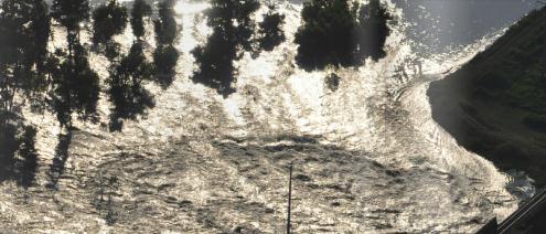
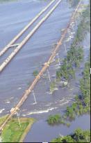
8 Spillway in operation

9 Sand versus mud distribution 2011 opening, muddy plume covers most of lake, and deposits sediment layer. Sand mostly trapped in spillway. 20 km

10 2011 Sand and Mud Deposition (Nittrouer et al., 2012, Fabre et al., in review) 7 Be Inventory Average Inventory 2D Water Graph Discharge 1 Cum. Sed. Disch. May Inventory Decay Days from Opening of Spillway Water Dishcarge m 3 /s 2.5e+6 2.0e+6 1.5e+6 1.0e+6 5.0e Cum. Sediment Disch. (Tons) Total Sand Deposition > 3 Mt (in spillway) Total Mud Deposition (Lake) 2.1±1.1 Mt
11 Total Sediment Discharge and Comparisons Sand supply to spillway appears to be delivered at concentrations above mean river sand concentration Mud supply is in equilibrium with mean river concentration 2011 new mud deposition of Mt for the entire lake. If this is correct, suggests close to 100% retention of spillway discharge Compare to 25-50% retention for diversions entering open embayments Mud Discharge is the same order as for West Bay ~10% of Wax Lake Delta annual discharge
12 MRD Diversion Examples Bonnet Carré Caernarvon Wax Lake Cubits Gap West Bay
13 Caernarvon Diversion, Mississippi River Primarily designed for fresh water diversion into Breton Sound region, not operated continuously or at high flow rates (<<500 m 3 /s) Opened to allow flow following DWH Spill, and in 2011 Inland basin, surrounded by wetlands Selected References Lopez et al., Basics of the Basin Proceedings, 2011 Lane, R. R., Day, J. W., and Thibodeaux, B., 1999, Estuaries and Coasts, v. 2, p Snedden, G. A., Cable, J. E., Swarzenski, C., and Swenson, E., 2007, Estuarine, Coastal and Shelf Science, v. 71, no. 1-2, p

14 Caernarvon Diversion, Mississippi River In 2011, > 4 km 2 of new land present in the receiving basin, built mostly since Lopez et al., 2011 Sediment retention rate not known, but probably high
15 MRD Diversion Examples Bonnet Carré Caernarvon Wax Lake Cubits Gap West Bay
16 Wax Lake Delta, Atchafalaya Bay Diversion built in 1944 to ease flooding in Morgan city Delta emerged subaerially in 1973, after major flood Unmanaged delta, most mature example of bay-head delta that might result from diversion construction References: Allen et al., 2012, Estuaries and Coasts Kim, W., Mohrig, D., Twilley, R., Paola, C., and Parker, G., 2009, EOS Trans AGU, v. 90, no. 42, p Roberts, H. H., 1998, Journal of Coastal Research, p Wellner et al., 2005, GCAGS Transcations
17 Wax Lake Delta, Atchafalaya Bay Growth of 1-3 km 2 /y, , depending on methodology (below from Roberts, 1998)


18 Wax Lake Delta, Atchafalaya Bay Growth rate strongly influenced by flooding events, especially 1973 flood Wellner et al., 2005

19 Wax Lake Delta, Atchafalaya Bay Kim et al., Delta growth maintained at relative sea level rise of 7 mm/y, and model results suggest growth possible at higher relative rate of sea level rise
20 MRD Diversion Examples Bonnet Carré Caernarvon Wax Lake Cubits Gap West Bay
21 Cubits Gap Subdelta, Mississippi River Manmade cut in east bank of MR, below Venice ca Land growth and decline over ca. 150 y timescale Active growth at present, possibly due to accomodation created by subsidence. References: Coleman and Gagliano, 1964 Kolker et al., in press Roberts, 1997, JCR Wells et al., 1983 (cited in Roberts, 1997)

22 Cubits Gap Subdelta Growth (Wells et al., 1983)

23 MRD Diversion Examples Bonnet Carré Caernarvon Wax Lake Cubits Gap West Bay

24 Manmade uncontrolled diversion Created in 2004, in location of historic subdelta documented by Coleman others Land emergent in 2011, following 2010 island construction and 2011 flood Closure planned References Andrus, 2007, LSU MS Thesis West Bay Andrus et al., 2012, State of the Coast Coleman, J. M., and Gagliano, S. M., 1964, GCAGS, v. 14, p Coleman and Prior, 1982 Kemp et al., 2011, National Audubon Society Kolker et al., 2012, ECSS


25 West Bay Region: historical subdeltas Coleman and Gagliano, 1964 Coleman and Prior, 1982
26 Island Construction ,000 yd 3 placed from Anchorage Island Dimensions: 5000 x 500 x 8 (+4 MSL) 60 acres Total BU acres built to date=511acres at $20M 4.19MCY $4.75/CY

27 Spring 2011 High Water Event From Kemp, 2011

28 Simulated Wave Height Reductions 0.18 m 0.1 m Wave reduction produced by placement of dredge-spoil islands 1 km
29 Considerations regarding diversions and subdeltas Natural subdeltas build and decline over timescales of years Sediment retention rates in natural subdeltas with open marine boundaries are 25-50% Increasing sediment retention rates (as for Bonnet Carre, near 100%, and possibly Caernarvon, and wave reduction in West Bay) may shorten timescales of growth The Mississippi has limited capacity for simultaneous operation of large diversions (each at 5-25% of total water discharge) Multiple diversions may be built to benefit several regions, and not all have to operate simultaneously
30 Approaches to maximize performance: Pulsed operation Focus on times and locations that will produce maximum sediment concentration and discharge during operation Engineer basin to maximize retention of mud Reduce shear stress from waves and currents with island construction, like West Bay Reduce tidal prism to reduce tidal flow rates? Allow time for mud to consolidate between discharge pulses, to increase shear stress for erosion

31 Acknowledgements: Many authors and researchers conducted work used in our report. Thanks to all of you. Questions?
The Mississippi River: Its Role in Restoration Efforts and Potential Effects of Climate Change
 The Mississippi River: Its Role in Restoration Efforts and Potential Effects of Climate Change Clinton S. Willson, P.E., Ph.D. Department of Civil & Environmental Engineering Louisiana State University
THE IMPORTANCE OF SCIENCE IN COASTAL RESTORATION IN LOUISIANA
 THE IMPORTANCE OF SCIENCE IN COASTAL RESTORATION IN LOUISIANA Barb Kleiss USACE, Mississippi Valley Division August 3, 2011 LCA S&T Office Authorized under WRDA 2007 Designed to address technical issues
DESIGN OF DIVERSIONS OF THE MISSISSIPPI RIVER TO BUILD NEW LAND IN SOUTHERN LOUISIANA
 DESIGN OF DIVERSIONS OF THE MISSISSIPPI RIVER TO BUILD NEW LAND IN SOUTHERN LOUISIANA Gary Parker, University of Illinois Urbana-Champaign along with Matthew Czapiga, Benjamin Hobbs, Melissa Kenney, Wonsuck
An Integrated Storm Surge, Hurricane Wave, Salinity and Sediment Transport Modeling System for Breton Sound, LA
 An Integrated Storm Surge, Hurricane Wave, Salinity and Sediment Transport Modeling System for Breton Sound, LA Q. Jim Chen Department of Civil and Environmental Engineering qchen@lsu.edu Acknowledgements
Influence of the Major Drainages to the Mississippi River and Implications for System Level Management
 Influence of the Major Drainages to the Mississippi River and Implications for System Level Management Brian M. Vosburg Geologist Louisiana Coastal Protection and Restoration Authority brian.vosburg@la.gov
Sedimentation Dynamics and Stratigraphy of the Middle Breton Sound Estuary, Southeastern Louisiana: Spatiotemporal Evidence for Subdeltaic Evolution
 Sedimentation Dynamics and Stratigraphy of the Middle Breton Sound Estuary, Southeastern Louisiana: Spatiotemporal Evidence for Subdeltaic Evolution Edwin J. Bomer IV 1, Samuel J. Bentley 1,2, Kehui Xu
Reducing Nitrogen Removal Uncertainty for Operation of Mississippi River Sediment Diversions: Nitrate Reduction Rates In Turbulent Flow Conditions
 Reducing Nitrogen Removal Uncertainty for Operation of Mississippi River Sediment Diversions: Nitrate Reduction Rates In Turbulent Flow Conditions Nia R. Hurst, John R. White, Kehui Xu, and MingCheng Ren
Mapping the River as it Reconnects with Its Delta: Field Studies in Big Mar and Bohemia
 Mapping the River as it Reconnects with Its Delta: Field Studies in Big Mar and Bohemia Ezra Boyd, John Lopez, Andy Baker, Theryn Henkel Lake Pontchartrain Basin Foundation Coastal Sustainability Program
MISSISSIPPI RIVER DELTA OVERVIEW
 MISSISSIPPI RIVER DELTA OVERVIEW Science and Engineering Special Team Conference Louisiana State University October 9, 2012 Introduction Basics of the Mississippi Delta Natural and Human-Induced Land Loss
KEY CONTROLS ON SEDIMENT BUDGETING IN THE MISSISSIPPI RIVER FROM SOURCE TO SINK
 KEY CONTROLS ON SEDIMENT BUDGETING IN THE MISSISSIPPI RIVER FROM SOURCE TO SINK Mead Allison The Water Institute of the Gulf & Tulane University What Controls the Availability of Sediment in the Restoration
Sediment Diversions on the Lower Mississippi River: Insight from Simple Analytical Models
 Sediment Diversions on the Lower Mississippi River: Insight from Simple Analytical Models Author(s): Robert G. Dean, John T. Wells, H.J. Fernando, and Peter Goodwin Source: Journal of Coastal Research,
Island Design. UMRS EMP Regional Workshop. Presentation for the
 Island Design Presentation for the UMRS EMP Regional Workshop by Jon Hendrickson Hydraulic Engineer Regional Technical Specialist, Water Quality and Habitat Restoration August 17 19, 2005 Project Delivery
L7/ Historical Perspec=ve, Deltas
 Colin Woodroffe (2002) Coasts: Form, Process and Evolu=on, Outline of Chapter 7: L7/1 L7/2 7.1. Historical Perspec=ve, 7.1.1. Deltas Herodotus (450, B.C.) delta = Shape of Nile River Delta = Δ Gilbert
AN ASSESSMENT OF RIVER RESOURCES FOR LOUISIANA COASTAL LAND PRESERVATION
 AN ASSESSMENT OF RIVER RESOURCES FOR LOUISIANA COASTAL LAND PRESERVATION Approved for Public Release; distribution unlimited Biedenharn Group, LLC Vicksburg, Mississippi Report Documentation Page Form
9 th INTECOL Orlando, Florida June 7, 2012
 Restoration of the Everglades Saline Wetlands and Florida Bay: Responses Driven from Land and Sea David Rudnick 1, Colin Saunders 2, Carlos Coronado 2, Fred Sklar 2 Erik Stabenau 1, Vic Engel 1, Rene Price
Tracking sediment-laden Mississippi River water through Louisiana's river diversions with MODIS data
 Tracking sediment-laden Mississippi River water through Louisiana's river diversions with MODIS data CSPP/IMAPP User s Meeting 2017 Alaric Haag, Nan Walker, Robert Iles, Shuzhan Fan haag@lsu.edu, nwalker@lsu.edu,
Wetland attenuation of Hurricane Rita s storm surge
 Wetland attenuation of Hurricane Rita s storm surge Pat Fitzpatrick, Yee Lau, Yongzuo Li, Nam Tran, Chris Hill, and Suzanne Shean Geosystems Research Institute, Mississippi State University Sponsors: NOAA
Unchain the River and Allow it to Build a Delta
 Unchain the River and Allow it to Build a Delta Harley S. Winer Atkins Harley.Winer@atkinsglobal.com Mississippi River Drainage Basin Basin Facts Drains 41% of continental U.S. Includes 31 states & 2 Canadian
Evolution of the Po Delta, Italy
 Evolution of the Po Delta, Italy Albert Kettner & James Syvitski, Charles Vörösmarty Dynamics and Vulnerability of River Delta Systems workshop September, 2007 Outline 21,000 years ago Effects of the ever
IS THERE ENOUGH SEDIMENT? Presentation at the State of the Estuary Conference San Francisco, CA, October 9-10, By Philip B.
 IS THERE ENOUGH SEDIMENT? Presentation at the State of the Estuary Conference San Francisco, CA, October 9-10, 2001 By Philip B. Williams 1. INTRO I AM TEMPTED TO MAKE THIS THE SHORTEST TALK OF THE CONFERENCE:
GALVESTON BAY RSM Moving toward an Integrated, Cooperative, and Holistic Approach to Estuarine Sediments
 GALVESTON BAY RSM Moving toward an Integrated, Cooperative, and Holistic Approach to Estuarine Sediments RAE Conference 2010 Larry A. Wise Moffatt & Nichol RSM is a system-based approach for collaboratively
Surface Water and Stream Development
 Surface Water and Stream Development Surface Water The moment a raindrop falls to earth it begins its return to the sea. Once water reaches Earth s surface it may evaporate back into the atmosphere, soak
Understanding the necessary conditions for avulsion in a delta channel is important in order to
 ABSTRACT Understanding the necessary conditions for avulsion in a delta channel is important in order to better predict an avulsion s timing and location. However, the specific conditions required for
The Coast: Beaches and Shoreline Processes
 1 2 3 4 5 6 7 8 9 The Coast: es and Shoreline Processes Trujillo & Thurman, Chapter 10 Oceanography 101 Chapter Objectives Recognize the various landforms characteristic of beaches and coastal regions.
Name: Date: Class: Louisiana: Our History, Our Home Chapter 1: Louisiana s Geography - Section 2: Natural Regions Guided Reading
 Instructions: Read the section and complete each item with words from the passages in this section. 1. The diversity of Louisiana s can surprise residents and visitors alike. 2. Physical geography is concerned
The Coast: Beaches and Shoreline Processes Trujillo & Thurman, Chapter 10
 The Coast: es and Shoreline Processes Trujillo & Thurman, Chapter 10 Oceanography 101 Chapter Objectives Recognize the various landforms characteristic of beaches and coastal regions. Identify seasonal
Types of Wetlands. Tidal Systems
 Types of Wetlands Tidal Systems 1 COASTAL WETLAND ECOSYSTEMS Tidal Salt Marshes Tidal Freshwater Marshes Mangrove Wetlands 2 Tidal Estuarine Wetland 3 Definition and Formation of Estuaries Estuary: : partially
Subtidal permanently flooded with tidal water. Irregularly exposed surface exposed by tides less often than daily
 Types of Wetlands Tidal Systems COASTAL WETLAND ECOSYSTEMS Tidal Salt Marshes Tidal Freshwater Marshes Mangrove Wetlands Tidal Estuarine Wetland 1 Definition and Formation of Estuaries u Estuary : partially
The Systems Approach. Alun Williams, ABPmer
 The Systems Approach Alun Williams, ABPmer Overview What is A Systems Approach? Behavioural / Qualitative Modelling? System Definition / Mapping (Behavioural Statements Objective) What is a Systems Approach?
Sediment Transport and Strata Formation in the Adriatic Sea
 Sediment Transport and Strata Formation in the Adriatic Sea Wayne R. Geyer James D. Irish Peter A. Traykovski Woods Hole Oceanographic Institution Woods Hole, MA 02543 Tel. (508) 289-2868, Fax: (508) 457-2194,
The Mississippi River and its Role in Restoration Efforts
 The Mississippi River and its Role in Restoration Efforts Clinton S. Willson, P.E., Ph.D. Department of Civil & Environmental Engineering Louisiana State University Acknowledgements LA Department of Natural
Prediction of changes in tidal system and deltas at Nakdong estuary due to construction of Busan new port
 Prediction of changes in tidal system and deltas at Nakdong estuary due to construction of Busan new port H. Gm1 & G.-Y. park2 l Department of Civil & Environmental Engineering, Kookmin University, Korea
Developed in Consultation with Florida Educators
 Developed in Consultation with Florida Educators Table of Contents Next Generation Sunshine State Standards Correlation Chart... 7 Benchmarks Chapter 1 The Practice of Science...................... 11
Mississippi River West Bay Diversion Geomorphic Assessment and 1-D Modeling Plan
 Mississippi River West Bay Diversion Geomorphic Assessment and 1-D Modeling Plan Freddie Pinkard and Charlie Little Research Hydraulic Engineers ERDC-CHL-River Engineering Branch 27 February 2009 Lane
LSU Digital Commons. Louisiana State University. Xiaoyu Sha Louisiana State University and Agricultural and Mechanical College
 Louisiana State University LSU Digital Commons LSU Master's Theses Graduate School 216 Characterization and Modeling of Sediment Settling, Consolidation and Suspension to Optimize the Retention Rate of
ΛTKINS. Applications of Regional Sediment Management Concepts in Texas Estuarine Restoration Projects. Riparian Workshop Fort Worth, October 17, 2012
 Juan C Moya, PhD., PG Coastal Planning and Restoration Applications of Regional Sediment Management Concepts in Texas Estuarine Restoration Projects Riparian Workshop Fort Worth, October 17, 2012 West
Elwha River response to dam removals through four years and a big flood:
 Elwha River response to dam removals through four years and a big flood: Lessons learned, channel response, and sediment effects from the world s largest engineered dam removal Andy Ritchie NPS Elwha Restoration
Semi-enclosed seas. Estuaries are only a particular type of semi-enclosed seas which are influenced by tides and rivers
 Semi-enclosed seas Estuaries are only a particular type of semi-enclosed seas which are influenced by tides and rivers Other semi-enclosed seas vary from each other, mostly by topography: Separated from
Coastal Oceanography. Coastal Oceanography. Coastal Waters
 Coastal Oceanography Coastal Oceanography 95% of ocean life is in coastal waters (320 km from shore) Estuaries and wetlands are among most productive ecosystems on Earth Major shipping routes, oil and
GIS 2010: Coastal Erosion in Mississippi Delta
 1) Introduction Problem overview To what extent do large storm events play in coastal erosion rates, and what is the rate at which coastal erosion is occurring in sediment starved portions of the Mississippi
Earth Science Chapter 6 Section 2 Review
 Name: Class: Date: Earth Science Chapter 6 Section Review Multiple Choice Identify the choice that best completes the statement or answers the question. 1. Most streams carry the largest part of their
Upper Truckee River Restoration Lake Tahoe, California Presented by Brendan Belby Sacramento, California
 Upper Truckee River Restoration Lake Tahoe, California Presented by Brendan Belby Sacramento, California Mike Rudd (Project Manager), Charley Miller & Chad Krofta Declines in Tahoe s Water Clarity The
Lab 12 Coastal Geology
 Lab 12 Coastal Geology I. Fluvial Systems Hydrologic Cycle Runoff that flows into rivers = precipitation (rain and snowmelt) [infiltration (loss to groundwater) + evaporation (loss to atmosphere) + transpiration
Coastal Litigation in the Context of Science Literacy
 Coastal Litigation in the Context of Science Literacy Chris McLindon New Orleans Geological Society February 6, 7 Science Literacy The value of community participation in scientific research is widely
How Do Human Impacts and Geomorphological Responses Vary with Spatial Scale in the Streams and Rivers of the Illinois Basin?
 How Do Human Impacts and Geomorphological Responses Vary with Spatial Scale in the Streams and Rivers of the Illinois Basin? Bruce Rhoads Department of Geography University of Illinois at Urbana-Champaign
Surface Water Short Study Guide
 Name: Class: Date: Surface Water Short Study Guide Multiple Choice Identify the letter of the choice that best completes the statement or answers the question. 1. The three ways in which a stream carries
Hypoxia in the Northern Gulf of Mexico in 2010: was the Deepwater Horizon Oil Spill a Factor? Nathaniel E. Ostrom
 Agricultural Outlook Forum Presented: February 24-25, 2011 U.S. Department of Agriculture Hypoxia in the Northern Gulf of Mexico in 2010: was the Deepwater Horizon Oil Spill a Factor? Nathaniel E. Ostrom
Regional-scale understanding of the geologic character and sand resources of the Atlantic inner continental shelf, Maine to Virginia
 Regional-scale understanding of the geologic character and sand resources of the Atlantic inner continental shelf, Maine to Virginia Workshop on Dredging, Beach Nourishment and Bird Conservation Atlantic
CHAPTER 107 DETERIORATION AND RESTORATION OF COASTAL WETLANDS
 CHAPTER 107 DETERIORATION AND RESTORATION OF COASTAL WETLANDS By Sherwood M Gagliano Hyuck J Kwon Johannes L van Beek Coastal Studies Institute Louisiana State University Baton Rouge, Louisiana 70803 ABSTRACT
High Resolution Numerical Models of Tidal Marshes in the Delaware Bay
 High Resolution Numerical Models of Tidal Marshes in the Delaware Bay Ramona Stammermann Dept. of Civil, Architectural & Environmental Engineering, Drexel University, Philadelphia, PA Michael Piasecki
SEGMENTED BREAKWATERS AND THEIR USE IN COASTAL LOUISIANA
 SEGMENTED BREAKWATERS AND THEIR USE IN COASTAL LOUISIANA Prepared by: Louisiana Coastal Protection and Restoration Authority Engineering Division March 2016 The geology of Louisiana s coastal zone is intimately
MORPHOLOGICAL DEVELOPMENT OF THE RIF AND THE ENGELSMANPLAAT, AN INTERTIDAL FLAT COMPLEX IN THE FRISIAN INLET, DUTCH WADDEN SEA
 MORPHOLOGICAL DEVELOPMENT OF THE RIF AND THE ENGELSMANPLAAT, AN INTERTIDAL FLAT COMPLEX IN THE FRISIAN INLET, DUTCH WADDEN SEA Z.B. Wang 1 and A.P. Oost 2 The Rif and the Engelsmanplaat form together a
MISSISSIPPI COASTAL IMPROVEMENTS
 MISSISSIPPI COASTAL IMPROVEMENTS PROGRAM (MsCIP) Comprehensive Barrier 237 27 200 237 27 200 Island 237 Restoration 27 200 Plan 80 9 27 252 74.59 255 255 255 0 0 0 63 63 63 3 32 22 239 65 53 0 35 20 2
RESULTS FROM THE TEXAS COASTAL SEDIMENT SOURCES: A GENERAL EVALUATION STUDY
 RESULTS FROM THE TEXAS COASTAL SEDIMENT SOURCES: A GENERAL EVALUATION STUDY JUAN MOYA KELSEY CALVEZ CRIS WEBER ANTHONY RISKO *KEVIN FRENZEL FREESE AND NICHOLS, INC. COASTAL AND WATERWAYS GROUP OBJECTIVES
 Red River Flooding June 2015 Caddo and Bossier Parishes Presented by: Flood Technical Committee Where the Rain Falls Matters I-30 versus I-20 I-20 Backwater and Tributary Floods (Localized) 2016 Flood
Sedimentation in the Nile River
 Advanced Training Workshop on Reservoir Sedimentation Sedimentation in the Nile River Prof. Dr. Abdalla Abdelsalam Ahmed 10-16 Oct. 2007, IRTCES, Beijing, China CWR,Sudan 1 Water is essential for mankind
Planning for the Future of Humboldt Bay: Sea Level Rise, Sediment Management, Sand Spits and Salt Marshes. Joel Gerwein
 Planning for the Future of Humboldt Bay: Sea Level Rise, Sediment Management, Sand Spits and Salt Marshes Joel Gerwein Introduction to Humboldt Bay Setting Economy, community, and environment Sediment
Facies Reconstruction of a Late Pleistocene Cypress Forest Discovered on the Northern Gulf of Mexico Continental Shelf
 Facies Reconstruction of a Late Pleistocene Cypress Forest Discovered on the Northern Gulf of Mexico Continental Shelf Suyapa Gonzalez 1, Samuel J. Bentley, Sr. 1, Kristine L. DeLong 3, Kehui Xu 2, Jeffrey
Canary in the Coal Mine: Subsidence in Coastal Louisiana Press Conference
 Canary in the Coal Mine: Subsidence in Coastal Louisiana Press Conference Samuel Bentley, LSU Department of Geology & Geophysics professor and Billy and Ann Harrison chair in sedimentary geology Mead Allison,
SUBJECT INDEX. ~ ~5 physico-chemical properties 254,255 Redox potential 254,255
 Aggregates: beds formed by deposition 81,82 breakup by fluid shear, introduction 85,86 deposition from flowing water 80 implications in cohesive sediment transport 102-105 needs for further research 83
Year 6. Geography. Revision
 Year 6 Geography Revision November 2017 Rivers and World knowledge How the water cycle works and the meaning of the terms evaporation, condensation, precipitation, transpiration, surface run-off, groundwater
Measurements of lateral flow from the Mississippi River at Mardi Gras Pass in the Bohemia Spillway using synoptic ADCP
 Measurements of lateral flow from the Mississippi River at Mardi Gras Pass in the Bohemia Spillway using synoptic ADCP A Technical Report Submitted to: The Lake Pontchartrain Basin Foundation Submitted
Forecasting Gulf of Mexico Hypoxia under Scenarios of Watershed and River Management
 Forecasting Gulf of Mexico Hypoxia under Scenarios of Watershed and River Management Dubravko Justic and Lixia Wang Department of Oceanography and Coastal Sciences College of the Coast and Environment
Bank Erosion and Morphology of the Kaskaskia River
 Bank Erosion and Morphology of the Kaskaskia River US Army Corps Of Engineers St. Louis District Fayette County Soil and Water Conservation District Team Partners : Carlyle Lake Ecosystem Partnership Vicinity
EAGLES NEST AND PIASA ISLANDS
 EAGLES NEST AND PIASA ISLANDS HABITAT REHABILITATION AND ENHANCEMENT PROJECT MADISON AND JERSEY COUNTIES, ILLINOIS ENVIRONMENTAL MANAGEMENT PROGRAM ST. LOUIS DISTRICT FACT SHEET I. LOCATION The proposed
Sediment Deposition LET THE RIVER RUN T E A C H E R. Activity Overview. Activity at a Glance. Time Required. Level of Complexity.
 Activity at a Glance Grade: 6 9 Subject: Science Category: Physical Science, Earth Science Topic: Deposition, River Systems Time Required Two 45-minute periods Level of Complexity Medium Materials* TI-73
mountain rivers fixed channel boundaries (bedrock banks and bed) high transport capacity low storage input output
 high transport capacity low storage input output") mountain rivers fixed channel boundaries (bedrock banks and bed) high transport capacity low storage input output strong interaction between streams & hillslopes Sediment Budgets for Mountain Rivers Little
mountain rivers fixed channel boundaries (bedrock banks and bed) high transport capacity low storage input output strong interaction between streams & hillslopes Sediment Budgets for Mountain Rivers Little
U.S. Army Corps of Engineers Detroit District. Sediment Trap Assessment Saginaw River, Michigan
 U.S. Army Corps of Engineers Detroit District December 2001 December 2001 This report has been prepared for USACE, Detroit District by: W.F. BAIRD & ASSOCIATES LTD. 2981 YARMOUTH GREENWAY MADISON, WISCONSIN
Material Workshop. Galveston District 2012 Beneficial Use of Dredged. Material Workshop. Custodians of the Coast
 Galveston District 2012 Beneficial Use of Dredged Material Workshop Galveston District 2012 Beneficial Use of Dredged Material Workshop US Army Corps of Engineers BUILDING STRONG Welcome Opening Remarks
Tidal Wetlands & Climate Change
 Tidal Wetlands & Climate Change Tom Parker (SF State) John Callaway (Univ SF) Lisa Schile (UCB); Ellen Herbert (Indiana U); Evyan Borgnis (USF, SFSU) Jessica Vandenberg (SFSU) Vance Vredenburg (SF State)
Design of Levee Breaches in Sheltered Water for Flood Risk Reduction & Marsh Restoration ASFMP; June 5, 2014 Presented By:
 Design of Levee Breaches in Sheltered Water for Flood Risk Reduction & Marsh Restoration ASFMP; June 5, 2014 Presented By: Rohin Saleh Alameda County Flood Control District Matt Powers, P.E. GEI Consultants
Nutrient and Sediment Cycling and Retention in Urban Floodplain Wetlands
 Nutrient and Sediment Cycling and Retention in Urban Floodplain Wetlands Greg Noe, Cliff Hupp, Nancy Rybicki, Ed Schenk, and Jackie Batson National Research Program, Reston VA U.S. Department of the Interior
Bathymetric and Hydrodynamic Analysis of Wax Lake Delta
 Bathymetric and Hydrodynamic Analysis of Wax Lake Delta I. Introduction A. Motivation The ability to explain and predict how any physical system behaves is paramount in understanding how that system will
COASTAL QUATERNARY GEOLOGY MAPPING FOR NSW: EXAMPLES AND APPLICATIONS
 COASTAL QUATERNARY GEOLOGY MAPPING FOR NSW: EXAMPLES AND APPLICATIONS A Troedson Geological Survey of New South Wales Abstract Detailed geological mapping of the coastal plains of regional NSW was undertaken
Decline of Lake Michigan-Huron Levels Caused by Erosion of the St. Clair River
 Decline of Lake Michigan-Huron Levels Caused by Erosion of the St. Clair River W.F. & Associates Coastal Engineers (in association with Frank Quinn) April 13, 2005 Outline Problem Definition Understanding
HEC-RAS Reservoir Transport Simulation of Three Reservoirs in the Lower Susquehanna River Basin. Mike Langland and Ed Koerkle
 HEC-RAS Reservoir Transport Simulation of Three Reservoirs in the Lower Susquehanna River Basin Mike Langland and Ed Koerkle Topics Background / Project Objectives Data Selection - Sediment and Geometric
River Model (Delft3D)
") A Short River Model (Delft3D) & DIVERSION ANALYSIS presented by Nina J. Reins, PE, PhD, PMP State of the Coast May 30-June 1, 2018 Overview of Presentation Problem Statement & Background Analysis Key Findings
A Short River Model (Delft3D) & DIVERSION ANALYSIS presented by Nina J. Reins, PE, PhD, PMP State of the Coast May 30-June 1, 2018 Overview of Presentation Problem Statement & Background Analysis Key Findings
Importance of Understanding Coastal Landforms
 Importance of Understanding Coastal Landforms Costa Concordia Shipwreck, Isola del Giglio, Italy Depositional Coastal Landforms Can interpret landforms in light of geomorphic processes, both terrestrial
Statewide wetland geospatial inventory update
 Statewide wetland geospatial inventory update Factsheet 1: Outcomes from the statewide wetland geospatial inventory update 1 Introduction In 2011 the Victorian Department of Environment and Primary Industries
Changes in Texas Ecoregions
 Comment On Lesson Changes in Texas Ecoregions The state of Texas can be divided into 10 distinct areas based on unique combinations of vegetation, topography, landforms, wildlife, soil, rock, climate,
Holocene Lower Mississippi River Avulsions: Autogenic Versus Allogenic Forcing*
 Holocene Lower Mississippi River Avulsions: Autogenic Versus Allogenic Forcing* Eric Prokocki 1,2 Search and Discovery Article #50330 (2010) Posted October 14, 2010 *Adapted from oral presentation at AAPG
water ISSN
 Water 2014, 6, 564-583; doi:10.3390/w6030564 Article OPEN ACCESS water ISSN 2073-4441 www.mdpi.com/journal/water A Hydrograph-Based Sediment Availability Assessment: Implications for Mississippi River
Application #: TEXT
 TOWN OF FORT MYERS BEACH 2008 PROPOSED COMPREHENSIVE PLAN AMENDMENTS Application #: 2008-13-TEXT Description: Modify the Coastal Management and Future Land Use Elements to reflect the state s new definition
Signals of sea-level rise in Delaware and Chesapeake Bay tides
 Signals of sea-level rise in Delaware and Chesapeake Bay tides Andrew C. Ross and Raymond G. Najjar Pennsylvania State University Also thanks to Ming Li, Serena Lee, Fan Zhang, Wei Liu Observations show
Assessment. Assessment
 2001 SPRINGBROOK CREEK RESTORATION - THREE YEAR POST-CONSTRUCTION REVIEW - Presented by Bruce Henderson and Andy Harris 2005 River Restoration Northwest Symposium Skamania Lodge, Washington www.hendersonlandservices.com
Floods Lecture #21 20
 Floods 20 Lecture #21 What Is a Flood? Def: high discharge event along a river! Due to heavy rain or snow-melt During a flood, a river:! Erodes channel o Deeper & wider! Overflows channel o Deposits sediment
Aquatic Transfer Facility (ATF) San Pablo Bay (SPB) Proposed Region of ATF. Proposed Seabed Pipeline
 San Pablo Bay (SPB) Proposed Region of ATF. Proposed Seabed Pipeline") Aquatic Transfer Facility (ATF) San Pablo Bay (SPB) Proposed Region of ATF Proposed Seabed Pipeline Technical Studies An Overview Scope: Provide background and new scientific information and analysis for
Aquatic Transfer Facility (ATF) San Pablo Bay (SPB) Proposed Region of ATF Proposed Seabed Pipeline Technical Studies An Overview Scope: Provide background and new scientific information and analysis for
Long-Distance Pumping and Opportunities for Engineering with Nature
 Long-Distance Pumping and Opportunities for Engineering with Nature Tim Welp and Derek Wilson Tim Welp Research Hydraulic Engineer Coastal and Hydraulics Laboratory 23 October 2012 Engineering with Nature
Vegetation Coverage and Change in Wax Lake Delta
 Vegetation Coverage and Change in Wax Lake Delta 1. Introduction: Kyle Wright GIS Project Report December 8, 2017 Coastal river deltas are regions of tremendous economic, ecological, and humanitarian importance,
Coastal Tidal Marshes
 Virginia s Wetlands Coastal Tidal Marshes Hydrology driven by lunar tides; Stresses include tidal inundation and/or salts; Found along high latitudes along intertidal coasts; Comprise ~ 70% wetlands of
EXTERNAL LAND FORMING PROCESSES
 NAME SCHOOL INDEX NUMBER DATE EXTERNAL LAND FORMING PROCESSES WEATHERING 1 1998 Q 7 (a) (i) What is the difference between weathering and mass wasting (ii) List five processes involved in chemical weathering
Integrating new coastline information and geographically coordinated coastal geomorphology data
 Integrating new coastline information and geographically coordinated coastal geomorphology data NOAA Contemporary Shoreline DOE Coastal Geomorphology Cynthia Miller Corbett Jeff Simley 1 National Hydrography
WHAT IS THE EARTH MADE OF? LITHOSPHERE AND HYDROSPHERE
 UNIT 8 WHAT IS THE EARTH MADE OF? LITHOSPHERE AND HYDROSPHERE TABLE OF CONTENTS 1 THE STRUCTURE OF THE EARTH... 2 2 THE FORMATION OF THE RELIEF: INTERNAL AND EXTERNAL FORCES.... 2 2.1 Internal forces:
Figure 1. Which part of the river is labelled in Figure 1? a) Mouth b) Source c) Lower course d) channel
 Mouth b) Source c) Lower course d) channel") Rivers 1. Study Figure 1 showing the long profile of a river Figure 1 A Which part of the river is labelled in Figure 1? a) Mouth b) Source c) Lower course d) channel (1 mark) 2. Complete the sentences
Rivers 1. Study Figure 1 showing the long profile of a river Figure 1 A Which part of the river is labelled in Figure 1? a) Mouth b) Source c) Lower course d) channel (1 mark) 2. Complete the sentences
Del Mar Sediment Management Study
 Del Mar Sediment Management Study Shoreline Preservation Working Group, June 7, 2018 Lindsey Sheehan Current work in Del Mar 2016 Sea-Level Rise Vulnerability Assessment 2018 Adaptation Plan 2018 Sediment
PART 5 MECHANISMS OF GROUND SETTLEMENT IN GREATER NEW ORLEANS
 PART 5 MECHANISMS OF GROUND SETTLEMENT IN GREATER NEW ORLEANS Predicted water depth in New Orleans flood inundation area based on water level of 2.37 ft in Lake Ponchartrain on Sept 2, 2005. Overlay on
Modeling Sea-Level Rise in Coastal Wetlands: Understanding Potential Impacts and Their Implications for Management on Cape Cod
 Modeling Sea-Level Rise in Coastal Wetlands: Understanding Potential Impacts and Their Implications for Management on Cape Cod C a p e C o a s t a l C o n f e r e n c e H y a n n i s R e s o r t a n d
Ocean circulation, sedimentation in the San Juans - compilation of mainstream scientific literature by Dave Hyde -
 Ocean circulation, sedimentation in the San Juans - compilation of mainstream scientific literature by Dave Hyde - Salish Sea has 3 principal estuaries SG, JDF,PS San Juan Islands ocean setting uniquely
The Geology of Sebago Lake State Park
 Maine Geologic Facts and Localities September, 2002 43 55 17.46 N, 70 34 13.07 W Text by Robert Johnston, Department of Agriculture, Conservation & Forestry 1 Map by Robert Johnston Introduction Sebago