THE IMPORTANCE OF SCIENCE IN COASTAL RESTORATION IN LOUISIANA
|
|
|
- Trevor Neal
- 6 years ago
- Views:
Transcription

1 THE IMPORTANCE OF SCIENCE IN COASTAL RESTORATION IN LOUISIANA Barb Kleiss USACE, Mississippi Valley Division August 3, 2011
2 LCA S&T Office Authorized under WRDA 2007 Designed to address technical issues encountered by restoration projects and systemwide issues Completed approximately 40 reports to date, provided technical assistance to District and State dozens of times Currently not supported by State of Louisiana
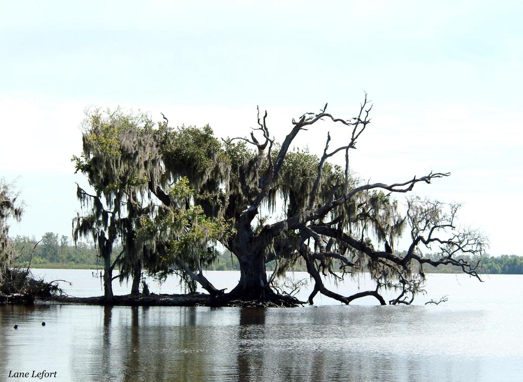
3 WETLANDS, STORM SURGES, AND WAVES barrier islands and bayous protected the low-lying coast from hurricanes and flooding.

4 BUILDING STRONG
 Gulf of")
5 Interaction of Hurricanes and Natural Coastal Features Louisiana Mississippi Research is needed to better define the actual role of natural environments in managing surge and waves; rules of thumb are just too inaccurate the Interagency Performance Evaluation Team (IPET) Gulf of Mexico
6 Motivation Commonly stated rule of thumb : -1ft per 2.75 mi (USACE 1963) When grouped by storm/area: -1 ft per 11.4 mi to -1 ft per 1 mi
7 Approach High-resolution modeling system is capable of representing complicated coastal landscapes (both engineered and natural features) and simulating all the primary relevant physical processes, including winds, airsea momentum transfer, atmospheric pressure, winddriven waves, river flows, tides, and friction due to land cover. Model system is applied to quantify the surge and wave reduction potential of these features and understand how to integrate these features in a holistic storm damage reduction system.


8 Approach Application of a high-resolution, integrated numerical modeling system IPET FEMA LaCPR MsCIP Surge Model Wind Field Wind Stresses MORPHOS PBL Wave Models 5 day storm simulation takes ~8 hours on 256 processors Coupling Surge model: ADCIRC System was validated against high water marks from Hurricanes Katrina and Rita Offcoast Waves: WAM Nearshore Waves: STWAVE

9 Biloxi Marsh Sensitivity Analysis Bathy/topo & Manning-n Marsh Restoration/Deterioration

10 Biloxi Marsh Restoration BILOXI MARSH Original Bathymetry RAISED to elevation of ~1 ft, NAVD 88 ( )

11 Biloxi Marsh Restoration Surge 5-10% Reduction Hurricane Katrina Raised - Original Similar % reduction for storm with half the surge potential of Katrina
12 Biloxi Marsh Restoration Waves ~10-20% Reduction ~10-20% Reduction Hurricane Katrina Raised - Original

13 Biloxi Marsh Deterioration Area LOWERED to depth of 2.0 ft, NAVD 88 ( )

14 Biloxi Marsh Deterioration Surge ~15% Increase Hurricane Katrina Lowered - Original ~10% Increase Similar % increase for storm with half the surge potential of Katrina
15 Biloxi Marsh Deterioration Waves ~40-50% Increase ~40-50% Increase ~10% Increase Hurricane Katrina Lowered - Original


16 Results Peak Surge ~10 ft surge at levee Katrina: Surge attenuates -1 ft per 4.3 mi of marsh Rita: Surge INCREASES +1 ft per 8.7 mi of marsh
17 Summary Analyses of model results indicate that surge attenuation rates estimated by the modeling system are consistent with observations. Wetlands do have the potential to reduce surges but is dependant on: Strength and duration of storm forcing: Track Intensity Forward speed Coastal landscape: Surrounding topography/bathymetry Vegetation type Results also suggest wetlands reduce wave heights and the magnitude of reduction is sensitive to water depths and the propagation distance across the wetland. Numerical models that simulate the relevant physical processes can provide valuable information on how to best integrate wetlands for coastal storm damage reduction.
18 SEDIMENT LOAD OF THE MISSISSIPPI RIVER Today millions of tons of sediment simply vanish off the continental shelf deep in the Gulf of Mexico.the levees limited any chance of recovery.


 Barb Kleiss (LCA Science &")
 Ehab Meselhe (University")
 Thad Pratt")
19 Constructing a Sediment Budget for the Mississippi-Atchafalaya River in Louisiana in Support of Coastal Restoration Mead Allison (University of Texas) Charlie Demas (USGS Baton Rouge) Barb Kleiss (LCA Science & Technology Office) Charlie Little (USACE-ERDC) Ehab Meselhe (University of Louisiana-Lafayette) Nancy Powell (USACE-New Orleans) Thad Pratt (USACE-ERDC) Brian Vosburg (LA-OCPR)

20 Tarbert Landing St. Francisville Baton Rouge Belle Chasse
21 (73) RED RIVER NATCHEZ 178 OLD RIVER STRUCTURES WATER FY in cubic ft. SIMMESPORT 251 MELVILLE 251 (sp) TARBERT LANDING 585 St. FRANCISVILLE 585 (br) MISSISSIPPI & ATCHAFALAYA MAINSTEM STATIONS WAX LAKE 116 MORGAN CITY 137 BATON ROUGE 573 BELLE CHASSE 558 Bonnet Carre Davis Pond 5.3
22 WATER FY in cubic ft. LOWER MISSISSIPPI EXITS DAVIS POND 3.2 GIWW NAOMI SIPHON PT. A LA HACHE SIPHON Grand Pass 56.8 West Bay 39.3 Small Cuts 11.0 BATON ROUGE 573 BONNET CARRE BELLE CHASSE 558 RM24? RM INDUSTRIAL CANAL CAERNARVON 2.2 BOHEMIA BAYOU LAMOQUE OSTRICA LOCKS Ft. St. Philip Baptiste Collette 54.0 Cubit s Gap 58.0 SW Pass South Pass Pass a Loutre
23 RED RIVER SIMMESPORT 49.4 WAX LAKE 22.6 MELVILLE 45.9 MORGAN CITY 30.8 NATCHEZ 39.3 OLD RIVER STRUCTURES TOTAL LOAD FY in 10 6 tons/y TARBERT LANDING St. FRANCISVILLE 99.5 BATON ROUGE BELLE CHASSE 97.3 DAVIS POND 0.53 GIWW NAOMI SIPHON PT. A LA HACHE SIPHON Grand Pass 5.6 West Bay 4.5 Small Cuts 1.1 BATON ROUGE BONNET CARRE BELLE CHASSE 97.3 RM24? STORAGE RM INDUSTRIAL CANAL CAERNARVON 0.38 BOHEMIA BAYOU LAMOQUE OSTRICA LOCKS Ft. St. Philip Baptiste Collette 10.3 Cubit s Gap 4.6 SW Pass South Pass Pass a Loutre
24 NATCHEZ 39.3 OLD RIVER STRUCTURES TOTAL LOAD FY in 10 6 tons/y LOSS (storage) GAIN (erosion) Sand Mud TARBERT LANDING Sand Mud Sand Mud St. FRANCISVILLE 99.5 BATON ROUGE BELLE CHASSE 97.3 Bonnet Carre Davis Pond 0.89 MISSISSIPPI MAINSTEM STATIONS Net basin storage of 74.8 (51.7 sand)
25 STF(425) BR(369) TAR (492) The Tidal Reach: Importance of the backwater effect Surface Slopes Impact: -river flow velocity -sediment transport stress -flux of bed materials through reach From Nittrouer, Mohrig and Allison, submitted. Sediment transport in the lowermost Mississippi River: effect of non-uniform flow.
 TRANSITIONAL (535,000-700,000 cfs) HIGH (greater than 700,000")
26 Comparison of Suspended Load With Discharge: Mississippi Stations LOW (less than 535,000 cfs) TRANSITIONAL (535, ,000 cfs) HIGH (greater than 700,000 cfs


27 19.6 mt/y Suspended Sand 2.3 mt/y Bedload Sand
28 Preliminary Conclusions: 1. Both Pathways Have Net Storage of Sediment Interannually -Mississippi (channel storage, batture?) -Atchafalaya (channel and overbank storage) 2. Significant Portion of Mississippi Discharge at Baton Rouge Exits Channel above HOP -42% water -60% sediment (some sand stored in channel)
29 Preliminary Conclusions: 3. Bedload Transport ~12% of the Sand flux 4. Hysteresis and Seasonal Bed Storage Concentrate Suspended Flux into Early Freshet Phase 5. Re-design of Suspended-Bedload Monitoring System Needed to Support Operation of Future Sediment Diversions
30 Conclusions Understanding the how the system works is critical to restoration project success and will still need to be accomplished In the future, science issues will have to be incorporated into individual projects System-wide or multi-project issues will be difficult to address

31 BUILDING STRONG
KEY CONTROLS ON SEDIMENT BUDGETING IN THE MISSISSIPPI RIVER FROM SOURCE TO SINK
 KEY CONTROLS ON SEDIMENT BUDGETING IN THE MISSISSIPPI RIVER FROM SOURCE TO SINK Mead Allison The Water Institute of the Gulf & Tulane University What Controls the Availability of Sediment in the Restoration
Mississippi River and Tributaries Project Mississippi River Geomorphology and Potamology Program
 Mississippi River and Tributaries Project Mississippi River Geomorphology and Potamology Program Barb Kleiss, Mississippi Valley Division Freddie Pinkard, Vicksburg District June, 2016 Program Objectives
Modeling Nearshore Waves for Hurricane Katrina
 Modeling Nearshore Waves for Hurricane Katrina Jane McKee Smith US Army Engineer Research & Development Center Coastal and Hydraulics Laboratory Outline Introduction Modeling Approach Hurricane Katrina
An Integrated Storm Surge, Hurricane Wave, Salinity and Sediment Transport Modeling System for Breton Sound, LA
 An Integrated Storm Surge, Hurricane Wave, Salinity and Sediment Transport Modeling System for Breton Sound, LA Q. Jim Chen Department of Civil and Environmental Engineering qchen@lsu.edu Acknowledgements
Appendix A STORM SURGE AND WAVE HEIGHT ANALYSIS
 Appendix A STORM SURGE AND WAVE HEIGHT ANALYSIS Memo To: Jeff Robinson, P.E., GEC, Inc. From: Silong Lu, Ph.D., P.E., D.WRE, Dynamic Solutions, LLC. Date: 1/9/2014 CC: Re: Chris Wallen, Vice President,
Wetland attenuation of Hurricane Rita s storm surge
 Wetland attenuation of Hurricane Rita s storm surge Pat Fitzpatrick, Yee Lau, Yongzuo Li, Nam Tran, Chris Hill, and Suzanne Shean Geosystems Research Institute, Mississippi State University Sponsors: NOAA
Optimal Design of Sediment Diversions for Delta Restoration: lessons learned from examples
 Optimal Design of Sediment Diversions for Delta Restoration: lessons learned from examples Samuel Bentley 1, Angelina Freeman 2, Clinton S. Willson 1, Liviu Giosan 3, Jaye Cable 4 1 LSU 2 EDF 3 WHOI 4
An analysis of storm surge attenuation by wetlands using USGS, FEMA, and NASA data
 An analysis of storm surge attenuation by wetlands using USGS, FEMA, and NASA data Pat Fitzpatrick Geosystems Research Institute Mississippi State University Walter Peterson and Courtney Buckley NASA Marshall
Computing the Joint Probability of Hurricane Sandy and Historical Coastal Storm Forcing Parameters from Maine to Virginia
 Computing the Joint Probability of Hurricane Sandy and Historical Coastal Storm Forcing Parameters from Maine to Virginia Chris Massey and Jeff Melby USACE-ERDC Coastal & Hydraulics Lab Chris.Massey@usace.army.mil
Influence of the Major Drainages to the Mississippi River and Implications for System Level Management
 Influence of the Major Drainages to the Mississippi River and Implications for System Level Management Brian M. Vosburg Geologist Louisiana Coastal Protection and Restoration Authority brian.vosburg@la.gov
MISSISSIPPI RIVER DELTA OVERVIEW
 MISSISSIPPI RIVER DELTA OVERVIEW Science and Engineering Special Team Conference Louisiana State University October 9, 2012 Introduction Basics of the Mississippi Delta Natural and Human-Induced Land Loss
Influence of Marsh Restoration and Degradation on Storm Surge and Waves
 Influence of Marsh Restoration and Degradation on Storm Surge and Waves by Ty V. Wamsley, Mary A. Cialone, Joannes Westerink, and Jane M. Smith PURPOSE: The purpose of this CHETN is to examine storm surge
AN ASSESSMENT OF RIVER RESOURCES FOR LOUISIANA COASTAL LAND PRESERVATION
 AN ASSESSMENT OF RIVER RESOURCES FOR LOUISIANA COASTAL LAND PRESERVATION Approved for Public Release; distribution unlimited Biedenharn Group, LLC Vicksburg, Mississippi Report Documentation Page Form
River Model (Delft3D)
") A Short River Model (Delft3D) & DIVERSION ANALYSIS presented by Nina J. Reins, PE, PhD, PMP State of the Coast May 30-June 1, 2018 Overview of Presentation Problem Statement & Background Analysis Key Findings
A Short River Model (Delft3D) & DIVERSION ANALYSIS presented by Nina J. Reins, PE, PhD, PMP State of the Coast May 30-June 1, 2018 Overview of Presentation Problem Statement & Background Analysis Key Findings
MISSISSIPPI COASTAL IMPROVEMENTS
 MISSISSIPPI COASTAL IMPROVEMENTS PROGRAM (MsCIP) Comprehensive Barrier 237 27 200 237 27 200 Island 237 Restoration 27 200 Plan 80 9 27 252 74.59 255 255 255 0 0 0 63 63 63 3 32 22 239 65 53 0 35 20 2
ΛTKINS. Applications of Regional Sediment Management Concepts in Texas Estuarine Restoration Projects. Riparian Workshop Fort Worth, October 17, 2012
 Juan C Moya, PhD., PG Coastal Planning and Restoration Applications of Regional Sediment Management Concepts in Texas Estuarine Restoration Projects Riparian Workshop Fort Worth, October 17, 2012 West
Mapping the River as it Reconnects with Its Delta: Field Studies in Big Mar and Bohemia
 Mapping the River as it Reconnects with Its Delta: Field Studies in Big Mar and Bohemia Ezra Boyd, John Lopez, Andy Baker, Theryn Henkel Lake Pontchartrain Basin Foundation Coastal Sustainability Program
Simulating Hurricane Storm Surge in the Lower Mississippi River under Varying Flow Conditions
 Simulating Hurricane Storm Surge in the Lower Mississippi River under Varying Flow Conditions R. C. Martyr, M.ASCE 1 ; J. C. Dietrich 2 ; J. J. Westerink, M.ASCE 3 ; P. C. Kerr 4 ; C. Dawson 5 ; J. M.
The Mississippi River and its Role in Restoration Efforts
 The Mississippi River and its Role in Restoration Efforts Clinton S. Willson, P.E., Ph.D. Department of Civil & Environmental Engineering Louisiana State University Acknowledgements LA Department of Natural
Mississippi River West Bay Diversion Geomorphic Assessment and 1-D Modeling Plan
 Mississippi River West Bay Diversion Geomorphic Assessment and 1-D Modeling Plan Freddie Pinkard and Charlie Little Research Hydraulic Engineers ERDC-CHL-River Engineering Branch 27 February 2009 Lane
Measurements of lateral flow from the Mississippi River at Mardi Gras Pass in the Bohemia Spillway using synoptic ADCP
 Measurements of lateral flow from the Mississippi River at Mardi Gras Pass in the Bohemia Spillway using synoptic ADCP A Technical Report Submitted to: The Lake Pontchartrain Basin Foundation Submitted
HURRICANE ISAAC WITH AND WITHOUT YEAR HSDRRS EVALUATION
 HURRICANE ISAAC WITH AND WITHOUT 2012 100-YEAR HSDRRS EVALUATION FINAL REPORT FEBRUARY 2013 Executive Summary EXECUTIVE SUMMARY SIGNIFICANT FINDINGS According to the Saffir-Simpson Hurricane Wind Scale,
Red River Levee Panel
 Red River Levee Panel Mississippi River Commission Monday, August 9, 2017 Red River Levees in LA & AR NONE along TX & OK Boarder Red River Levee Issues Caddo Levee Cherokee Park Authorization Bossier Levee
SLOSH New Orleans Basin 2012 Update
 SLOSH New Orleans Basin 2012 Update Michael Koziara Science and Operations Officer National Weather Service Slidell, LA The Basics What is storm surge? What is SLOSH? Details Assumptions Inundation = Storm
Forecasting Gulf of Mexico Hypoxia under Scenarios of Watershed and River Management
 Forecasting Gulf of Mexico Hypoxia under Scenarios of Watershed and River Management Dubravko Justic and Lixia Wang Department of Oceanography and Coastal Sciences College of the Coast and Environment
PART 5 MECHANISMS OF GROUND SETTLEMENT IN GREATER NEW ORLEANS
 PART 5 MECHANISMS OF GROUND SETTLEMENT IN GREATER NEW ORLEANS Predicted water depth in New Orleans flood inundation area based on water level of 2.37 ft in Lake Ponchartrain on Sept 2, 2005. Overlay on
Coastal Hazard Assessment for the Lowermost Mississippi River Management Program
 Coastal Hazard Assessment for the Lowermost Mississippi River Management Program USACE ERDC Coastal and Hydraulics Laboratory Mary Cialone Chris Massey Norberto Nadal USACE Mississippi Valley Division
Greater New Orleans Hurricane and Storm Damage Risk Reduction System 101
 Greater New Orleans Hurricane and Storm Damage Risk Reduction System 101 René Poché New Orleans District U.S. Army Corps of Engineers US Army Corps of Engineers BUILDING STRONG 1878 Gentilly Ridge Metairie
One-Dimensional Modeling of Sedimentation Impacts for the Mississippi River at the West Bay Diversion
 Journal of Water Resource and Protection, 2013, 5, 16-29 http://dx.doi.org/10.4236/jwarp.2013.59a002 Published Online September 2013 (http://www.scirp.org/journal/jwarp) One-Dimensional Modeling of Sedimentation
Reducing Nitrogen Removal Uncertainty for Operation of Mississippi River Sediment Diversions: Nitrate Reduction Rates In Turbulent Flow Conditions
 Reducing Nitrogen Removal Uncertainty for Operation of Mississippi River Sediment Diversions: Nitrate Reduction Rates In Turbulent Flow Conditions Nia R. Hurst, John R. White, Kehui Xu, and MingCheng Ren
THC-T-2013 Conference & Exhibition
 Modeling of Shutter Coastal Protection against Storm Surge for Galveston Bay C. Vipulanandan, Ph.D., P.E., Y. Jeannot Ahossin Guezo and and B. Basirat Texas Hurricane Center for Innovative Technology (THC-IT)
The Mississippi River: Its Role in Restoration Efforts and Potential Effects of Climate Change
 The Mississippi River: Its Role in Restoration Efforts and Potential Effects of Climate Change Clinton S. Willson, P.E., Ph.D. Department of Civil & Environmental Engineering Louisiana State University
Unchain the River and Allow it to Build a Delta
 Unchain the River and Allow it to Build a Delta Harley S. Winer Atkins Harley.Winer@atkinsglobal.com Mississippi River Drainage Basin Basin Facts Drains 41% of continental U.S. Includes 31 states & 2 Canadian
Dissipation due to Vegetation in Nearshore Wave Models
 Dissipation due to Vegetation in Nearshore Wave Models Jane McKee Smith US Army Engineer Research and Development Center, Coastal and Hydraulic Laboratory Alison Sleath Grzegorzewski, New Orleans District
Storm Surge Frequency Analysis using a Modified Joint Probability Method with Optimal Sampling (JPM-OS)
") Storm Surge Frequency Analysis using a Modified Joint Probability Method with Optimal Sampling (JPM-OS) Jay Ratcliff Coastal Hydraulics Lab, of Engineers (USACE) Engineering Research and Development Center
Storm Surge Frequency Analysis using a Modified Joint Probability Method with Optimal Sampling (JPM-OS) Jay Ratcliff Coastal Hydraulics Lab, of Engineers (USACE) Engineering Research and Development Center
water ISSN
 Water 2014, 6, 564-583; doi:10.3390/w6030564 Article OPEN ACCESS water ISSN 2073-4441 www.mdpi.com/journal/water A Hydrograph-Based Sediment Availability Assessment: Implications for Mississippi River
Water Level Statistics for Design of Transportation Facilities in Coastal Louisiana
 64 TRANSPORTATION RESEARCH RECORD 1483 Water Level Statistics for Design of Transportation Facilities in Coastal Louisiana JOSEPH SUtJAYDA, MOHAMED ALAWADY, AND BABAK NAGHAVI Results are presented of an
Groundwater dynamics and surface water-groundwater interaction in a prograding delta island, Louisiana, USA
 Supplementary Information Groundwater dynamics and surface water-groundwater interaction in a prograding delta island, Louisiana, USA Michael T. O Connor 1* and Kevan B. Moffett 1,2 1 Department of Geological
Simulating Hurricane Storm Surge in the Lower Mississippi River under Varying Flow. Westerink 1
 1 2 3 4 5 Simulating Hurricane Storm Surge in the Lower Mississippi River under Varying Flow Conditions R.C. Martyr 1*, J.C. Dietrich 2, J.J. Westerink 1, P.C. Kerr 1, C. Dawson 2, J.M. Smith 3, H. Pourtaheri
West Galveston Bay Regional Sediment Management Plan (An Eco-geomorphologic Approach)
") West Galveston Bay Regional Sediment Management Plan (An Eco-geomorphologic Approach) Juan Moya, Matthew Mahoney and Mike Smith Restore America s Estuaries Conference Tampa, FL, October 23, 2012 Atkins
West Galveston Bay Regional Sediment Management Plan (An Eco-geomorphologic Approach) Juan Moya, Matthew Mahoney and Mike Smith Restore America s Estuaries Conference Tampa, FL, October 23, 2012 Atkins
ERDC S COASTAL STORM MODELING SYSTEM COASTAL TEXAS, USA
 ERDC S COASTAL STORM MODELING SYSTEM COASTAL TEXAS, USA Chris Massey Research Mathematician, USACE-ERDC Coastal & Hydraulics Lab Chris.Massey@usace.army.mil 1 st Int. Workshop on Waves, Storm Surge and
MODELLING CATASTROPHIC COASTAL FLOOD RISKS AROUND THE WORLD
 MODELLING CATASTROPHIC COASTAL FLOOD RISKS AROUND THE WORLD Nicola Howe Christopher Thomas Copyright 2016 Risk Management Solutions, Inc. All Rights Reserved. June 27, 2016 1 OUTLINE MOTIVATION What we
 Red River Flooding June 2015 Caddo and Bossier Parishes Presented by: Flood Technical Committee Where the Rain Falls Matters I-30 versus I-20 I-20 Backwater and Tributary Floods (Localized) 2016 Flood
Development, Testing and Application of the Multi-Block LTFATE Hydrodynamic and Sediment Transport Model
 Development, Testing and Application of the Multi-Block LTFATE Hydrodynamic and Sediment Transport Model Earl Hayter Environmental Lab October 25, 2012 LTFATE Multi-Block Hydrodynamic, Water Quality and
Sea Level Rise and Hurricane Florence storm surge research methodology
 Sea Level Rise and Hurricane Florence storm surge research methodology Hurricane Florence storm surge analysis was conducted using a variety of input sources. In order to determine the maximum storm surge
2013 Louisiana Transportation Conference
 2013 Louisiana Transportation Conference Background FHWA/AASHTO study Objectives of LADOTD study Level III methodology Surge/Wave force methodology 100-Year Surge-Wave GIS Atlas Summary Questions Pensacola,
Miami-Dade County Technical Update Meeting South Florida Coastal Study. May 11, 2016
 Miami-Dade County Technical Update Meeting South Florida Coastal Study May 11, 2016 Welcome and Introductions FEMA Region IV Christina Lindemer Technical Lead Production and Technical Services (PTS) Contractor
Lab 12 Coastal Geology
 Lab 12 Coastal Geology I. Fluvial Systems Hydrologic Cycle Runoff that flows into rivers = precipitation (rain and snowmelt) [infiltration (loss to groundwater) + evaporation (loss to atmosphere) + transpiration
Report on the Damage Survey Caused by Hurricane Katrina (Tentative Report)
") Report on the Damage Survey Caused by Hurricane Katrina (Tentative Report) November 1, 2005 Coastal Disaster Prevention Technology Survey Team 1. Introduction Hurricane Katrina struck the United States
Report on the Damage Survey Caused by Hurricane Katrina (Tentative Report) November 1, 2005 Coastal Disaster Prevention Technology Survey Team 1. Introduction Hurricane Katrina struck the United States
Advances in Coastal Inundation Simulation Using Unstructured-Grid Coastal Ocean Models
 Advances in Coastal Inundation Simulation Using Unstructured-Grid Coastal Ocean Models Bob Beardsley (WHOI) Changsheng Chen (UMass-Dartmouth) Bob Weisberg (U. South Florida) Joannes Westerink (U. Notre
Smooth Cordgrass Varieties. Description and Performance
 Smooth Cordgrass Varieties Description and Performance Smooth cordgrass (Spartina alterniflora Loisel.) is a perennial grass native to intertidal saline marshes along the Gulf of Mexico and Atlantic coasts.
Eco-hydromorphic Characterization of the Louisiana Coastal Region Using Multiple Remotely Sensed Data Sources and Analyses
 National Wetlands Research Center Eco-hydromorphic Characterization of the Louisiana Coastal Region Using Multiple Remotely Sensed Data Sources and Analyses 1Holly Beck, 2 Brady Couvillion, 1 Nadine Trahan
Probabilistic design of levee and floodwall heights for the Hurricane Protection System in the New Orleans area
 Probabilistic design of levee and floodwall heights for the Hurricane Protection System in the New Orleans area Mathijs van Ledden (Haskoning Inc.), Pat Lynett (Texas A&M), Don Resio (ERDC) and Nancy Powell
Monitoring Hurricane Rita Inland Storm Surge
 Monitoring Hurricane Rita Inland Storm Surge By Benton D. McGee, Roland W. Tollett, and Burl B. Goree Pressure transducers (sensors) are accurate, reliable, and cost-effective tools to measure and record
3Chapter Three: Rescue and Response
 17 16 Report Science Title and the Storms: the USGS Response to the Hurricanes of 2005 3Chapter Three: Rescue and Response This chapter documents the U.S. Geological Survey s (USGS) humanitarian rescue
USACE-ERDC Coastal Storm Modeling System Updates Chris Massey, PhD
 USACE-ERDC Coastal Storm Modeling System Updates Chris Massey, PhD Research Mathematician USACE-ERDC Coastal & Hydraulics Lab Chris.Massey@usace.army.mil ERDC s Coastal Storm-Modeling System (ERDC CSTORM-MS)
Hurricane Surge Hazard Analysis for Southeast Louisiana
 Hurricane Surge Hazard Analysis for Southeast Louisiana SLFPA-E Coastal Advisory Committee and Invitees February 21, 2013 Presented by Bob Jacobsen PE, LLC Consulting Coastal Hydrologist Objective Review
Coupled, Unstructured Grid, Wave and Circulation Models: Validation and Resolution Requirements
 Coupled, Unstructured Grid, Wave and Circulation Models: Validation and Resolution Requirements J.C. Dietrich, J.J. Westerink University of Notre Dame C. Dawson University of Texas at Austin M. Zijlema,
COASTAL DATA APPLICATION
 2015 Coastal GeoTools Proactive By Design. Our Company Commitment COASTAL DATA APPLICATION Projecting Future Coastal Flood Risk for Massachusetts Bay Bin Wang, Tianyi Liu, Daniel Stapleton & Michael Mobile
US Army Corps of Engineers BUILDING STRONG
 Greater New Orleans Hurricane and Storm Damage Risk Reduction System Robert Rowlette Senior Senior Program Manager Task Force Hope U.S. Army Corps of Engineers April 19, 2012 US Army Corps of Engineers
Earth Wind & Fire. Game Changing Restoration Options in the Texas Chenier Plain
 Earth Wind & Fire Game Changing Restoration Options in the Texas Chenier Plain EARTH: The Chenier Plain is a 5 million acre coastal region in Southwest Louisiana and Southeast Texas providing landscape
Comparative Analysis of Hurricane Vulnerability in New Orleans and Baton Rouge. Dr. Marc Levitan LSU Hurricane Center. April 2003
 Comparative Analysis of Hurricane Vulnerability in New Orleans and Baton Rouge Dr. Marc Levitan LSU Hurricane Center April 2003 In order to compare hurricane vulnerability of facilities located in different
Coastal Litigation in the Context of Science Literacy
 Coastal Litigation in the Context of Science Literacy Chris McLindon New Orleans Geological Society February 6, 7 Science Literacy The value of community participation in scientific research is widely
Appendix 15 Computational Methodology
 Appendix 15 Computational Methodology Introduction This Appendix describes the process used by the risk team to determine the final loss exceedence values in the risk analysis. The process involved the
Forecast of Nearshore Wave Parameters Using MIKE-21 Spectral Wave Model
 Forecast of Nearshore Wave Parameters Using MIKE-21 Spectral Wave Model Felix Jose 1 and Gregory W. Stone 2 1 Coastal Studies Institute, Louisiana State University, Baton Rouge, LA 70803 2 Coastal Studies
Hurricane Tracks. Isaac versus previous storms Impacts and solutions. ( Continue by clicking on the slide bar to the right)
") Hurricane Tracks Isaac versus previous storms Impacts and solutions ( Continue by clicking on the slide bar to the right) 1 Hurricane Tracks 2 Sample Hurricanes The sample hurricanes selected were chosen
Hurricane Tracks Isaac versus previous storms Impacts and solutions ( Continue by clicking on the slide bar to the right) 1 Hurricane Tracks 2 Sample Hurricanes The sample hurricanes selected were chosen
ERDC S COASTAL STORM MODELING SYSTEM (AND APPLICATIONS)
") ERDC S COASTAL STORM MODELING SYSTEM (AND APPLICATIONS) Chris Massey Research Mathematician, USACE-ERDC Coastal & Hydraulics Lab Chris.Massey@usace.army.mil November 1-2, 2017 Team Acknowledgements Hung
ERDC S COASTAL STORM MODELING SYSTEM (AND APPLICATIONS) Chris Massey Research Mathematician, USACE-ERDC Coastal & Hydraulics Lab Chris.Massey@usace.army.mil November 1-2, 2017 Team Acknowledgements Hung
STORM SURGE ATTENUATION IN CHESAPEAKE BAY WETLANDS
 STORM SURGE ATTENUATION IN CHESAPEAKE BAY WETLANDS Seth Lawler, Dr. Celso Ferreira Department of Civil, Environmental and Infrastructure Engineering 1 Background: Surge & Natural Defenses 4 3 1 2 2 Background:
RESULTS FROM THE TEXAS COASTAL SEDIMENT SOURCES: A GENERAL EVALUATION STUDY
 RESULTS FROM THE TEXAS COASTAL SEDIMENT SOURCES: A GENERAL EVALUATION STUDY JUAN MOYA KELSEY CALVEZ CRIS WEBER ANTHONY RISKO *KEVIN FRENZEL FREESE AND NICHOLS, INC. COASTAL AND WATERWAYS GROUP OBJECTIVES
Frank Revitte National Weather Service. Weather Forecast Office New Orleans/Baton Rouge
 Frank Revitte National Weather Service Weather Forecast Office New Orleans/Baton Rouge Above normal activity 17 Total Named Storms 7 Tropical Storms 4 Hurricanes 6 Major Hurricanes Not the most active,
Tracking sediment-laden Mississippi River water through Louisiana's river diversions with MODIS data
 Tracking sediment-laden Mississippi River water through Louisiana's river diversions with MODIS data CSPP/IMAPP User s Meeting 2017 Alaric Haag, Nan Walker, Robert Iles, Shuzhan Fan haag@lsu.edu, nwalker@lsu.edu,
Impacts of Hurricane Rita on the Beaches of Western Louisiana
 Impacts of Hurricane Rita on the Beaches of Western Louisiana By Hilary F. Stockdon, Laura A. Fauver, Asbury H. Sallenger, Jr., and C. Wayne Wright Hurricane Rita made landfall as a category 3 storm in
CHAPTER FIVE: THE LOWER MISSISSIPPI REGION AND PLAQUEMINES PARISH
 CHAPTER FIVE: THE LOWER MISSISSIPPI REGION AND PLAQUEMINES PARISH 5.1 Overview Plaquemines Parish is the area where the last portion of the Mississippi River flows out into the Gulf of Mexico (see Figures
Probabilistic Assessment of Coastal Storm Hazards
 Resilience of Coastal Infrastructure Conference Hato Rey, PR March 8-9, 2017 Probabilistic Assessment of Coastal Storm Hazards Dr. Norberto C. Nadal-Caraballo Leader, Coastal Hazards Group Team: Victor
USING MIKE TO MODEL COASTAL CATASTROPHE RISK
 USING MIKE TO MODEL COASTAL CATASTROPHE RISK Nicola Howe, Christopher Thomas, Joss Matthewman, John Maskell* 1 SUMMARY About RMS Who are we and what do we do? How do we use MIKE in our workflow? Case study:
An Ensemble based Reliable Storm Surge Forecasting for Gulf of Mexico
 An Ensemble based Reliable Storm Surge Forecasting for Gulf of Mexico Umer Altaf Delft University of Technology, Delft ICES, University of Texas at Austin, USA KAUST, Saudi Arabia JONSMOD 2012, Ifremer,
Robert Weaver, Donald Slinn 1
 1 1 Robert Weaver, Donald Slinn 1 Department of Civil and Coastal Engineering, University of Florida, Gainesville, Florida Supported by the US Office of Naval Research AGU Fall Meeting 2002 Poster OS72A-0342
Long-Distance Pumping and Opportunities for Engineering with Nature
 Long-Distance Pumping and Opportunities for Engineering with Nature Tim Welp and Derek Wilson Tim Welp Research Hydraulic Engineer Coastal and Hydraulics Laboratory 23 October 2012 Engineering with Nature
Descriptions and Performance
 LSU AgCenter Coastal Plants Program Smooth Cordgrass Varieties: Descriptions and Performance Smooth cordgrass (Spartina alterniflora Loisel.) is a perennial grass native to intertidal saline marshes along
CHAPTER SEVEN: THE NEW ORLEANS EAST PROTECTED AREA
 7.1 Introduction CHAPTER SEVEN: THE NEW ORLEANS EAST PROTECTED AREA The New Orleans East (NEO) protected area includes some of the lowest ground in the metropolitan region. Therefore, it is not surprising
General background on storm surge. Pat Fitzpatrick and Yee Lau Mississippi State University
 General background on storm surge Pat Fitzpatrick and Yee Lau Mississippi State University Storm surge is an abnormal rise of water associated with a cyclone, not including tidal influences Low pressure
DESIGN OF DIVERSIONS OF THE MISSISSIPPI RIVER TO BUILD NEW LAND IN SOUTHERN LOUISIANA
 DESIGN OF DIVERSIONS OF THE MISSISSIPPI RIVER TO BUILD NEW LAND IN SOUTHERN LOUISIANA Gary Parker, University of Illinois Urbana-Champaign along with Matthew Czapiga, Benjamin Hobbs, Melissa Kenney, Wonsuck
GIS 2010: Coastal Erosion in Mississippi Delta
 1) Introduction Problem overview To what extent do large storm events play in coastal erosion rates, and what is the rate at which coastal erosion is occurring in sediment starved portions of the Mississippi
How Do Human Impacts and Geomorphological Responses Vary with Spatial Scale in the Streams and Rivers of the Illinois Basin?
 How Do Human Impacts and Geomorphological Responses Vary with Spatial Scale in the Streams and Rivers of the Illinois Basin? Bruce Rhoads Department of Geography University of Illinois at Urbana-Champaign
Sediment and nutrient transport and storage along the urban stream corridor
 Sediment and nutrient transport and storage along the urban stream corridor Greg Noe, Cliff Hupp, Ed Schenk, Jackie Batson, Nancy Rybicki, Allen Gellis What is the role of floodplains everywhere? Noe 2013,
HURRICANE IVAN CHARACTERISTICS and STORM TIDE EVALUATION
 HURRICANE IVAN CHARACTERISTICS and STORM TIDE EVALUATION By Robert Wang and Michael Manausa Sponsored by Florida Department of Environmental Protection, Bureau of Beaches and Coastal Systems Submitted
PROBABILISTIC DESIGN METHOD OF LEVEE AND FLOODWALL HEIGHTS FOR THE HURRICANE PROTECTION SYSTEM IN THE NEW ORLEANS AREA
 PROBABILISTIC DESIGN METHOD OF LEVEE AND FLOODWALL HEIGHTS FOR THE HURRICANE PROTECTION SYSTEM IN THE NEW ORLEANS AREA Mathijs van Ledden Haskoning Inc., 1 Galleria Blvd., Metairie, LA70001, United States,
Journal of Hydrology
 Journal of Hydrology 472 473 (2012) 340 354 Contents lists available at SciVerse ScienceDirect Journal of Hydrology journal homepage: www.elsevier.com/locate/jhydrol Numerical modeling of hydrodynamics
Hindcast and validation of Hurricane Ike (2008) waves, forerunner, and storm surge
 waves, forerunner, and storm surge") JOURNAL OF GEOPHYSICAL RESEARCH: OCEANS, VOL. 118, 1 37, doi:10.1002/jgrc.20314, 2013 Hindcast and validation of Hurricane Ike (2008) waves, forerunner, and storm surge M. E. Hope, 1 J. J. Westerink, 1
JOURNAL OF GEOPHYSICAL RESEARCH: OCEANS, VOL. 118, 1 37, doi:10.1002/jgrc.20314, 2013 Hindcast and validation of Hurricane Ike (2008) waves, forerunner, and storm surge M. E. Hope, 1 J. J. Westerink, 1
Regional-scale understanding of the geologic character and sand resources of the Atlantic inner continental shelf, Maine to Virginia
 Regional-scale understanding of the geologic character and sand resources of the Atlantic inner continental shelf, Maine to Virginia Workshop on Dredging, Beach Nourishment and Bird Conservation Atlantic
Sediment Deposition LET THE RIVER RUN T E A C H E R. Activity Overview. Activity at a Glance. Time Required. Level of Complexity.
 Activity at a Glance Grade: 6 9 Subject: Science Category: Physical Science, Earth Science Topic: Deposition, River Systems Time Required Two 45-minute periods Level of Complexity Medium Materials* TI-73
Tropical Weather Briefing
 Tropical Weather Briefing August 28, 2012 700 AM CDT National Weather Service Weather Forecast Office Slidell, LA Current Satellite Tropical Storm Isaac Watches/Warnings Tropical Storm Isaac Track Guidance
Laboratory Exercise #3 The Hydrologic Cycle and Running Water Processes
 Laboratory Exercise #3 The Hydrologic Cycle and Running Water Processes page - 1 Section A - The Hydrologic Cycle Figure 1 illustrates the hydrologic cycle which quantifies how water is cycled throughout
Evaluation of Storm Tide Measurements at Panama City Beach, FL
 Evaluation of Storm Tide Measurements at Panama City Beach, FL 1993-2007 Prepared by Mark E. Leadon Beaches and Shores Resource Center Florida State University May 2009 Prepared for Florida Department
Upper Truckee River Restoration Lake Tahoe, California Presented by Brendan Belby Sacramento, California
 Upper Truckee River Restoration Lake Tahoe, California Presented by Brendan Belby Sacramento, California Mike Rudd (Project Manager), Charley Miller & Chad Krofta Declines in Tahoe s Water Clarity The
Island Design. UMRS EMP Regional Workshop. Presentation for the
 Island Design Presentation for the UMRS EMP Regional Workshop by Jon Hendrickson Hydraulic Engineer Regional Technical Specialist, Water Quality and Habitat Restoration August 17 19, 2005 Project Delivery
Monitoring Coastal Marshes for Persistent Saltwater Intrusion
 Monitoring Coastal Marshes for Persistent Saltwater Intrusion Maria Kalcic, 1 Callie Hall, 2 Jeff Russell, 3 and Rose Fletcher 1 1 Science Systems and Applications, Inc., Bldg. 1105, John C. Stennis Space
US Army Corps of Engineers BUILDING STRONG. Mary Cialone, Norberto Nadal-Caraballo, and Chris Massey
 North Atlantic Coast Comprehensive Study Storm Selection and Numerical Modeling An Overview Computing the Joint Probability of Storm Forcing Parameters from Maine to Virginia Mary Cialone, Norberto Nadal-Caraballo,
SEGMENTED BREAKWATERS AND THEIR USE IN COASTAL LOUISIANA
 SEGMENTED BREAKWATERS AND THEIR USE IN COASTAL LOUISIANA Prepared by: Louisiana Coastal Protection and Restoration Authority Engineering Division March 2016 The geology of Louisiana s coastal zone is intimately
Sea-level Rise on Cape Cod: How Vulnerable Are We? Rob Thieler U.S. Geological Survey Woods Hole, MA
 Sea-level Rise on Cape Cod: How Vulnerable Are We? Rob Thieler U.S. Geological Survey Woods Hole, MA Outline Sea-level and coastal processes Past sea-level change Predictions for the future Coastal responses