The Mississippi River and its Role in Restoration Efforts
|
|
|
- Roderick Chandler
- 5 years ago
- Views:
Transcription
1 The Mississippi River and its Role in Restoration Efforts Clinton S. Willson, P.E., Ph.D. Department of Civil & Environmental Engineering Louisiana State University
2 Acknowledgements LA Department of Natural Resources Brown, Cunningham & Gannuch Forte & Tablada CREST Program USACE CHL National Center for Earth surface Dynamics LSU Center for Computation & Technology

3 Acknowledgements LSU Graduate Students: Erol Karadogan, Nathan Dill, Ryan Waldron, Samantha Danchuk, Molly Friedmann DTU Hydraulic Engineering M.S. Students LSU Undergraduate Students working at SSPM: Kevin Hanegan, Mark Leblanc, Erin Rooney, Paul Leonard, Kyle Breaux CE 4260 (Spring 2008) Hydrologic Design Class
4 Outline Background Sediment Studies Small Scale Physical Model (SSPM) Studies Modeling Desktop Delta Model HEC RAS Hydraulic Modeling High Performance Hydrodynamic & Sediment Transport Modeling Conclusions & Path Forward
5


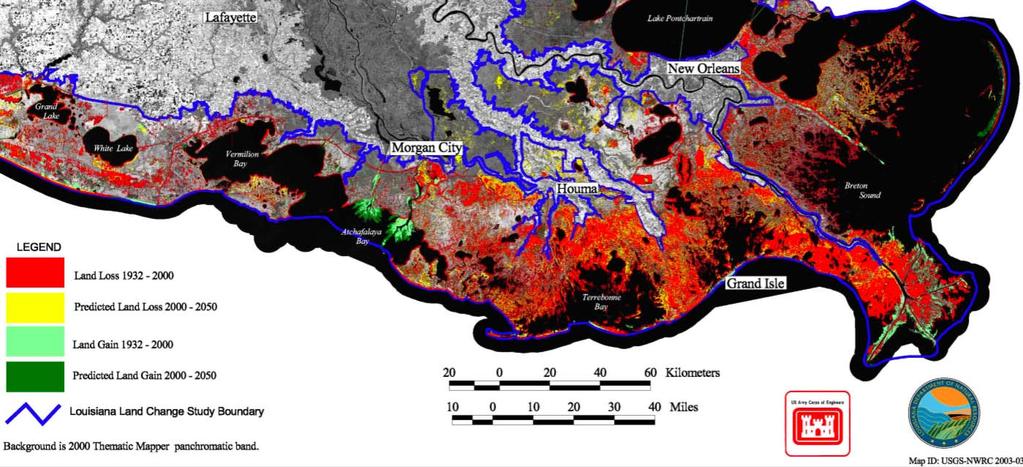
6 River Dominated Delta Sand Sediment Salt (3 S s) & Nutrients Not a static system Natural detail cycle River changes course Solid land to barrier islands Barrier islands to submerged sand bars; and more Delta is threatened by waves, tides, and storm surges Sea level rise and subsidence Changes in sediment loading Coleman & Gagliano, 1964
7 Possible Realignment of Lower Mississippi River The LACPR draft report does not consider this option, stating the alternative was considered to be beyond the scope of the current effort and could not be adequately evaluated within the scope of this effort. NRC recognizes that, while controversial, there needs to be careful study of a major realignment of the lower Mississippi River. An evaluation of how a major realignment of the lower Mississippi River mouth may affect sediment capture and diversion should be conducted 1 st Report from NRC on LACPR Program Review


8 The concept has been around
9 General Goals of Small River Diversion Reduce saltwater intrusion in historically fresh areas Reestablish favorable salinity levels Reduce the rate of land loss Improve fish and wildlife habitat

10 Larger River Diversion West Bay
11 Study of Diversions Field Tests monitor a process in a similar place Computer Modeling inexpensive, but discretization error and ability to incorporate all physical processes Physical Modeling model complex situations, but scale effects
12 Sediment Budget A 2006 NRC report questioned the viability of maintaining the current extent of coastal land areas saying Achieving no net loss is not a feasible objective because the social, political, and economic impediments are extensive; the sediment supply is limited; and the affected area is large If a LA coastal system wide sediment budget shows that there are not sufficient resources to sustain the existing landscape then proposed structural and nonstructural projects may be only partly feasible, or even infeasible. 1 st Report from NRC on LACPR Program Review
13 Sediment Sources for Restoration Divide the lower river into three parts Old River Control Structure to Baton Rouge Baton Rouge to below New Orleans Head of Passes to the Gulf Renewable sediment loads million tons ( ) million tons (70 s 90 s) 124 million tons (current) The fraction of sand has not changed much over time (~ 20%) Allison, 2006, CREST Presentation Nittruoer et al., 2008, JGR
14 Sediment Sources for Restoration Of the 124 million tons (current) 22.3 million tons is suspended sand (St. Francisville) At Belle Chase, the suspended sand load is only about 10 million tons At Head of Passes, the suspended sand load is only about 4 6 million tons Probable loss in suspended sand load may be bed aggradation More comprehensive measurements and long term monitoring is needed Since so little of the sand is found as bed load (? Maybe 0.1 million tons?), diversions that could carry suspended load may be the best way to deliver sand to the wetlands Allison, 2006, CREST Presentation Nittruoer et al., 2008, JGR
15 Sediment Sources for Restoration Lower river survey to identify sedimentary facies of Mississippi River channel bed (Nittrouer & Allison) Sections of river bottom at depths > ~35 m water depth are typically composed of exposed older substrate Sections of river bottom at depths ~ m water depth are commonly mantled with sandy dunes Sections of river bottom at shallow depths, < ~15 m are mantled by recent mud deposit Below New Orleans ~ 25% of riverbed is exposed substrate Where there is sand it is ~ 7m thick (average) Allison, 2006, CREST Presentation Nittruoer et al., 2008, JGR
16 Sediment Sources for Restoration Most of the sand is moved down the river during high flow events (~5 10% of time) Most of the sand moves in suspension It appears that there are regions of aggradation upstream of New Orleans where sand is stored until released during high flow events Allison, 2006, CREST Presentation Nittruoer et al., 2008, JGR

17 Small scale Physical Model Vincent A. Forte Coastal and River Engineering Research Laboratory Small Scale Physical Model


18 Movable Bed Modeling loose boundary flow rivers, streams, coastal zones and estuaries Large scale MBM study bed morphology Micro MBM education/outreach
19 Common techniques used in movable bed modeling Distorted Scales Necessary for modeling larger domains Limits ability to model bed morphology Lightweight Sediment Necessary for proper scaling of incipient motion and Re numbers There can be issues related to buoyant and cohesive effects Exaggerated Froude # Necessary for creating necessary gradients & velocities for sediment transport
20 Categorizing MBMs (CSS Categories) 1. Demonstration, education, and communication 2. Screening tool for alternatives to reduce maintenance and dredging of the navigation channel 3. Screening tool for alternatives of channel and navigation alignments 4. Screening tool for environmental evaluation of river modifications, side channel modifications, notches in dikes, etc 5. Screening tool for major navigation problems, around structures such as lock approaches, bridge approaches, confluences, etc.


21 SSPM Model Area Pointe a la Hache Head of Passes The total model platform dimension is 8.46 m x 7.41 m = m 2 reproducing a prototype surface area of about 9,027 km 2 equivalent to 3,526 square miles.
22 Model Scaling The following type of scales must be defined: geometric scales; E(L) = 1/12 000, E(H) = 1/500 (HIGH VERTICAL DISTORTION) dynamic scales; and sediment scales; The model is built according to: Froude similarity law for the hydraulics; and Schield s law for the inception of sediment transport. We do also utilize Re scaling to ensure turbulent flow in the river & through diversions
23 Sediment Transport Scaling Particle Reynolds Number Ratio of inertial to viscous forces on sediment grains Shields Number Ratio shear stress on bed to submerged weight of a particle Ratio of depth a grain size Surface tension effects Ratio of sediment density to water density Buoyant force on the sediment
24 Sediment Material Scale combining yields: Based on a model sediment with S.G. of 1.05 E(d) = 3.2 NOTE: this scale makes it practically impossible to simulate fine sediments along with sand
25 Hydraulic Time Scale The SSPM hydraulic time scale is determined from Fr scaling Hydraulically 1 day of prototype (river) time equals 161 seconds in the SSPM OR 1 year in river time equals ~ 16 hours in the SSPM
26 Sediment Time Scale Empirical Law derived by SOGREAH (Parthiot, 1988, Hamm et al., 2004) for use with Seine River Estuary Model E(ts) = This means that from a sediment transport time scale, 1 river year equals ~ 30 minutes in the SSPM
27 Water Surface Profiles The water surface profile, also known as the Hydraulic Gradient Line (HGL) of flow in an open channel, or simply Gradient is the elevation of the water s free surface plotted against the length of the channel Because of different horizontal and vertical scales, it is particularly important in distorted scale modeling for the gradient to be accurate
28 Waldron, 2008, M.S. Thesis
29 Waldron, 2008, M.S. Thesis
30 Hydraulic Time Scale Analysis Determine travel time/velocity Measure of Froude Number similarity Two Techniques Dye Confetti

31 Stretch 1 Stretch 2 Waldron, 2008, M.S. Thesis


32 Velocity & Froude # Analysis Waldron, 2008, M.S. Thesis
33 Discharge, Stage Level, and Sediment Data Discharge: The Mississippi river discharge, measured at Tarbert Landing, for the period , has been used as flow input at the head of the model near Point a la Hache,La. Stage Levels: Mississippi river upstream of Head of Passes West Pointe a la Hache Port Sulfur Empire Venice Head of Passes South West Pass Southwest Pass at Mile 9.2 Southwest Pass at East Jetty South Pass South Pass at Port Eads Particle Sizes: the particle size distribution of bottom material from the Mississippi river is estimated according to available data, mainly at Belle Chasse.
34 Model Verification Observation of the energy gradients in the Mississippi River for various discharges. Representation of the general model roughness. Observation of the flow characteristics of the discharge diverted from the river. Observation of the sediment movement and the nature of sedimentation in the Mississippi River and the various river arms (i.e., incipient motion, suspended load, etc ). Observation of the sedimentation at outlets of the above mentioned Passes.
35 Methodology 1. Run two year hydrograph in one hour period 2. Introduce sediment over identical hydrograph 3. Raise sea level ~1 ft every 25 years 1. Measure stage levels 2. Measure hydrographs 3. Measure dredged material 4. Image to obtain spatial distribution 5. Dye studies to obtain surface velocities and patterns 6. At conclusion of test, spatially collect sediment and measure amount and then sieve

36 SSPM Results Base Case
37 SSPM Results Large Diversion #2
38 SSPM Results Multiple Diversions
39 SSPM Results Eastern Navigation Channel (Hang a left)
40 Sediment Deposited
41 Sediment Dredged
42 SSPM Results # of Years % Dredged % Deposited % Out of Model Base Case Large Diversion # Large Diversion #2 (2) Multiple Diversions Multiple Diversions (w/mg) Eastern Navigation Channel DTU Pulsed LD#
43 Impact on Stage Level Relative Sea Level Rise Gauge 2 Water Surface Elevation (ft) Crest LD #2, Gage 2 ws el (ft) 1-2 years Crest LD #2, Gage 2 ws el (ft) 9-10 years Crest LD #2,Gage 2 ws el (ft) years Crest LD #2, Gage 2 ws el (ft) years Crest LD #2, Gage 2 ws el (ft) years Crest LD #2 Gage 2 ws el (ft) years Time Interval (annual hydrogaph)

44 Dye Studies Flourescent dye is injected at the head of model Time lapsed photos are taken Surface velocities and areas can be calculated from images Useful for estimating transport of silts and clays
45 Advantages & Limitations of SSPM Advantages of this model study are : Visualization and semi quantification of sedimentation process along and around the selected diversion channel arrangements. Model sedimentation time scale enables reproduction of one year s evolution in 30 minutes. Thus it is possible to reproduce fairly long term sedimentation process within a few hours testing (100 years sedimentation process in 50 hours testing) and asses the validity of a project concept, possibility of improvement, help to take decisions on site selection and/or design studies, etc. Due to large vertical distortion, the model should be thought of as reproducing the bulk 1D movement of water and sediment
46 Desktop Delta Model Developed by team of engineers & geologists Excel based model runs on a PC Based on hydraulics & sediment transport principals Can account for subsidence, sea level rise, sediment/sand fraction Able to simulate delta growth over decades

47 Desktop Delta Model DELTA MADE BY HUMANS: TAILINGS BASIN OF AN IRON MINE, LABRADOR, CANADA Sediment disposal rate: ~ 24 Mt/yr

48 Desktop Delta Model THE MODEL CAN REPRODUCE THE WAX LAKE DELTA S PAST Yellow: 38 Mt/yr White: 25 Mt/yr (suspended load)
49 Desktop Delta Model VERY preliminary comparisons LD2 50 years predicts 440 km 2 vs km 2 from SSPM 100 years predicts 620 km 2 vs km 2 from SSPM MD 100 years predicts 600 km 2 vs km 2 from SSPM Differences most likely due to assumptions concerning independence of individual diversion using DDM


50 Diversion Structures IN ORDER FOR THE DIVERSIONS TO BE SUCCESSFUL, CONTROL STRUCTURES AND SHORT GUIDE CHANNELS, NOT OVERFLOW POINTS, ARE NEEDED We need to get as much sand as possible into the new deltas. The present Caernarvon diversion, while helpful, delivers mostly mud. We know how to build the control structures that divert sand as well as mud, because we built the Old River Control Structure to regulate flow into the Atchafalaya River.
51 Numerical Modeling 1D modeling Steady and unsteady; with and without sediment transport Simulate long timescales 2D modeling Steady and unsteady; with and without sediment transport Time scales are much shorter (days to weeks) 3D modeling Probably steady; with and without sediment transport Simulate complex hydrodynamics and sediment transport in and around diversion structures
52 1D Computer Model Hydraulic Engineering Center River Analysis System (HEC RAS) Steady flow solves 1D energy equation Geometry Data same as SSPM ~ 1 XS/mi Same Discrete flow steps as SSPM; downstream WSL set using river gage data Simulations performed by Spring 2008 CE 4260 Hydrologic Design class

53 Account for flow out Bohemia Relief Three scenarios modeled: 1.Base Case 2.LD#2 3.Multiple Diversion
54 HEC RAS Results
55 HEC RAS Results

56 Hydrodynamic Modeling of SSPM Area Number of Nodes: Number of Elements: Total Mesh Area: 3.53 x 10 9 m 2 Resolution is down to: 60 m Karadogan, 2008, in progress
57 Alliance West Pointe A La Hache All of the gages shown in here are Army Corps Gages Port Sulphur Underlined Stations: Rating Curves are available in Sogreah Report Empire Venice Head of Passes Southwest Pass At Mile 9.2 Additional data is available for all gages for 1994 and 1997 floods together with current data (Southwest Pass) At East Jetty South Pass At Port Eads
58 BOUNDARY CONDITIONS INFLOW DISCHARGE TAIL WATER ELEVATION of 0.4 m Karadogan, 2008, in progress
59 Karadogan, 2008, in progress
60 SSPM Mesh; Water Surface Elevations, 500K, 750K, 1000K cfs Karadogan, 2008, in progress

61 SSPM Mesh; Velocity Magnitudes, 500K, 750K, 1000K cfs Karadogan, 2008, in progress

62 Medium SSPM Area w/ and w/o diversion # of Elements: # of Nodes: Total Mesh Area: e+08 m 2 # of Elements: # of Nodes: Total Mesh Area: e+08 m 2 Karadogan, 2008, in progress


63 Elevation Close Up View Diversion Channel 240 m wide 9 m deep

64 Mesh and Boundary Conditions 1000K cfs 0.4 m 1.16 m Karadogan, 2008, in progress
65 Water Surface Elevations Karadogan, 2008, in progress

66 Velocity Magnitudes Karadogan, 2008, in progress


67 Velocity Magnitudes Karadogan, 2008, in progress
68 Karadogan, 2008, in progress


69 Lake Grande Ecaille Hypothetical Diversion Mississippi Bay Lanaux N Bay De La Cheniere Diversion Channel Lake Washington Freeport Sulphur Canal Grand River Adam s Bay Bayou Bastian Bay Caprien Bay Bayou Huertes Bay Joe Wise Reference Map Feature Map

70 Empire Mesh Elevation Contours Karadogan, 2008, in progress


71 Empire Mesh - Adaption Initial Mesh Number of Nodes: Number of Elements: Total Mesh Area: Resolution is down to: km2 30 m Adapted Mesh Karadogan, 2008, in progress
72 INPUT CONDITIONS 100k cfs input discharge 0.3 m Tail Water Elevation 3 grain sizes: 0.08 mm (%10), 0.13 mm (%80) and 0.25 mm (%10) No cohesive properties Equilibrium Input Boundary Condition Karadogan, 2008, in progress
, 0.")
73 Concentration Contours for 0.08 mm (upper left), 0.13 mm (upper right) and 0.25 mm (bottom)
74 Bed Displacements for 0.08 mm (upper left), 0.13 mm (upper right) and 0.25 mm (bottom) Karadogan, 2008, in progress
75 Karadogan, 2008, in progress
76 Karadogan, 2008, in progress
77 Karadogan, 2008, in progress

78 Model Application (ADCIRC & RMA2) ADCIRC linear triangles 12,328 nodes, 24,457 elements RMA2 quadratic triangles or quadrilaterals 16,070 nodes, 7173 elements Dill, 2007, M.S. Thesis
 Overall")

79 Flow Distribution (ADCIRC) Overall nincrease Baseline Dill, 2007, M.S. Thesis
80 % Particles Remaining in Domain Baseline Overall n Increase Shallow n Increase RMA Days 100 Different residence times Impact of mesh & resolution Impact of wetting/drying routines % Particles Remaining in Domain Baseline Overall n Increase Shallow n Increase ADCIRC Days Dill, 2007, M.S. Thesis
81 Nutrients When nutrient levels are high enough to promote nuisance algal blooms, marsh plants can rapidly remove dissolved nitrogen; The added nutrients act to stabilize marshes though creation of new organic matter, particularly as part of their root systems Nuisance algae can also be controlled by pulsing flow through the diversion so that the temperature structure of the water column is not stable Day, 2006, CREST Presentation


82 Geophysical processes and geomorphic features control ecological patterns. Thus the structure and function of coastal ecosystems are dependent on critical processes specific to evolution of deltas. Links Delta Evolution to Ecological succession.

83 Next Step Add ecological models to the land building models Requires inputs of Sand Sediment Salinity nutrients
84 Conclusions & Where to Go From Here There is sand available for land building A majority of it is suspended load Very punctuated delivery of sand SSPM can be used to qualitatively and semi quantitatively investigate the bulk downstream transport of sand and the transport through diversions Tradeoffs between number of diversions, diversion sizes, pulsing, & dredging requirements Distorted scale limits application to design of actual diversions and impact on bed morphology Desktop Delta Model appears to be a very useful took for estimating land building capabilities of diversions Decent agreement between DDM & SSPM for LD#2 scenario (? Forced conveyance?) Easy to tie in ecological/habitat models
85 Conclusions & Where to Go From Here Simple HEC RAS model shows that diversion structures will have an impact on river gradients and velocities Advanced hydrodynamic & sediment transport models along with high performance computing allows for high resolution spatial & temporal modeling Improved understanding of velocities and currents Detailed numerical studies of sediment transport Study impact of eustatic sea level rise Need better bathy/topo data of potential diversion sites Better understanding of most effective diversion structures We have some good students we need more!
The Mississippi River: Its Role in Restoration Efforts and Potential Effects of Climate Change
 The Mississippi River: Its Role in Restoration Efforts and Potential Effects of Climate Change Clinton S. Willson, P.E., Ph.D. Department of Civil & Environmental Engineering Louisiana State University
THE IMPORTANCE OF SCIENCE IN COASTAL RESTORATION IN LOUISIANA
 THE IMPORTANCE OF SCIENCE IN COASTAL RESTORATION IN LOUISIANA Barb Kleiss USACE, Mississippi Valley Division August 3, 2011 LCA S&T Office Authorized under WRDA 2007 Designed to address technical issues
Mississippi River and Tributaries Project Mississippi River Geomorphology and Potamology Program
 Mississippi River and Tributaries Project Mississippi River Geomorphology and Potamology Program Barb Kleiss, Mississippi Valley Division Freddie Pinkard, Vicksburg District June, 2016 Program Objectives
Mississippi River West Bay Diversion Geomorphic Assessment and 1-D Modeling Plan
 Mississippi River West Bay Diversion Geomorphic Assessment and 1-D Modeling Plan Freddie Pinkard and Charlie Little Research Hydraulic Engineers ERDC-CHL-River Engineering Branch 27 February 2009 Lane
River Model (Delft3D)
") A Short River Model (Delft3D) & DIVERSION ANALYSIS presented by Nina J. Reins, PE, PhD, PMP State of the Coast May 30-June 1, 2018 Overview of Presentation Problem Statement & Background Analysis Key Findings
A Short River Model (Delft3D) & DIVERSION ANALYSIS presented by Nina J. Reins, PE, PhD, PMP State of the Coast May 30-June 1, 2018 Overview of Presentation Problem Statement & Background Analysis Key Findings
Appendix O. Sediment Transport Modelling Technical Memorandum
 Appendix O Sediment Transport Modelling Technical Memorandum w w w. b a i r d. c o m Baird o c e a n s engineering l a k e s design r i v e r s science w a t e r s h e d s construction Final Report Don
Optimal Design of Sediment Diversions for Delta Restoration: lessons learned from examples
 Optimal Design of Sediment Diversions for Delta Restoration: lessons learned from examples Samuel Bentley 1, Angelina Freeman 2, Clinton S. Willson 1, Liviu Giosan 3, Jaye Cable 4 1 LSU 2 EDF 3 WHOI 4
ΛTKINS. Applications of Regional Sediment Management Concepts in Texas Estuarine Restoration Projects. Riparian Workshop Fort Worth, October 17, 2012
 Juan C Moya, PhD., PG Coastal Planning and Restoration Applications of Regional Sediment Management Concepts in Texas Estuarine Restoration Projects Riparian Workshop Fort Worth, October 17, 2012 West
Technical Memorandum. To: From: Copies: Date: 10/19/2017. Subject: Project No.: Greg Laird, Courtney Moore. Kevin Pilgrim and Travis Stroth
 Technical Memorandum To: From: Greg Laird, Courtney Moore Kevin Pilgrim and Travis Stroth 5777 Central Avenue Suite 228 Boulder, CO 80301 www.otak.com Copies: [Electronic submittal] Date: 10/19/2017 Subject:
B-1. Attachment B-1. Evaluation of AdH Model Simplifications in Conowingo Reservoir Sediment Transport Modeling
 Attachment B-1 Evaluation of AdH Model Simplifications in Conowingo Reservoir Sediment Transport Modeling 1 October 2012 Lower Susquehanna River Watershed Assessment Evaluation of AdH Model Simplifications
KEY CONTROLS ON SEDIMENT BUDGETING IN THE MISSISSIPPI RIVER FROM SOURCE TO SINK
 KEY CONTROLS ON SEDIMENT BUDGETING IN THE MISSISSIPPI RIVER FROM SOURCE TO SINK Mead Allison The Water Institute of the Gulf & Tulane University What Controls the Availability of Sediment in the Restoration
U.S. Army Corps of Engineers Detroit District. Sediment Trap Assessment Saginaw River, Michigan
 U.S. Army Corps of Engineers Detroit District December 2001 December 2001 This report has been prepared for USACE, Detroit District by: W.F. BAIRD & ASSOCIATES LTD. 2981 YARMOUTH GREENWAY MADISON, WISCONSIN
A STUDY OF LOCAL SCOUR AT BRIDGE PIERS OF EL-MINIA
 A STUDY OF LOCAL SCOUR AT BRIDGE PIERS OF EL-MINIA Dr. Gamal A. Sallam 1 and Dr. Medhat Aziz 2 ABSTRACT Bridges are critical structures that require a substantial investment to construct and serve an important
State Water Survey Division SURFACE WATER SECTION
 State Water Survey Division SURFACE WATER SECTION AT THE UNIVERSITY OF ILLINOIS Illinois Department of Energy and Natural Resources SWS Miscellaneous Publication 88 SEDIMENTATION OF POOL 19 ON THE MISSISSIPPI
MISSISSIPPI RIVER DELTA OVERVIEW
 MISSISSIPPI RIVER DELTA OVERVIEW Science and Engineering Special Team Conference Louisiana State University October 9, 2012 Introduction Basics of the Mississippi Delta Natural and Human-Induced Land Loss
Decline of Lake Michigan-Huron Levels Caused by Erosion of the St. Clair River
 Decline of Lake Michigan-Huron Levels Caused by Erosion of the St. Clair River W.F. & Associates Coastal Engineers (in association with Frank Quinn) April 13, 2005 Outline Problem Definition Understanding
Influence of the Major Drainages to the Mississippi River and Implications for System Level Management
 Influence of the Major Drainages to the Mississippi River and Implications for System Level Management Brian M. Vosburg Geologist Louisiana Coastal Protection and Restoration Authority brian.vosburg@la.gov
Technical Memorandum No Sediment Model
 Pajaro River Watershed Study in association with Technical Memorandum No. 1.2.9 Sediment Model Task: Development of Sediment Model To: PRWFPA Staff Working Group Prepared by: Gregory Morris and Elsie Parrilla
SCOPE OF PRESENTATION STREAM DYNAMICS, CHANNEL RESTORATION PLANS, & SEDIMENT TRANSPORT ANALYSES IN RELATION TO RESTORATION PLANS
 DESIGN METHODS B: SEDIMENT TRANSPORT PROCESSES FOR STREAM RESTORATION DESIGN PETER KLINGEMAN OREGON STATE UNIVERSITY CIVIL ENGINEERING DEPT., CORVALLIS 2 ND ANNUAL NORTHWEST STREAM RESTORATION DESIGN SYMPOSIUM
One-Dimensional Modeling of Sedimentation Impacts for the Mississippi River at the West Bay Diversion
 Journal of Water Resource and Protection, 2013, 5, 16-29 http://dx.doi.org/10.4236/jwarp.2013.59a002 Published Online September 2013 (http://www.scirp.org/journal/jwarp) One-Dimensional Modeling of Sedimentation
ERDC/LAB TR-0X-X 100. Figure 7-3 Maximum velocity magnitudes for existing conditions for 100-year flood event
 ERDC/LAB TR-0X-X 100 Figure 7-3 Maximum velocity magnitudes for existing conditions for 100-year flood event ERDC/LAB TR-0X-X 101 Figure 7-4 Model schematization of Option 1 Figure 7-5 Bed displacement
Appendix A STORM SURGE AND WAVE HEIGHT ANALYSIS
 Appendix A STORM SURGE AND WAVE HEIGHT ANALYSIS Memo To: Jeff Robinson, P.E., GEC, Inc. From: Silong Lu, Ph.D., P.E., D.WRE, Dynamic Solutions, LLC. Date: 1/9/2014 CC: Re: Chris Wallen, Vice President,
Technical Memorandum No
 Pajaro River Watershed Study in association with Technical Memorandum No. 1.2.10 Task: Evaluation of Four Watershed Conditions - Sediment To: PRWFPA Staff Working Group Prepared by: Gregory Morris and
Modelling of flow and sediment transport in rivers and freshwater deltas Peggy Zinke
 1 Modelling of flow and sediment transport in rivers and freshwater deltas Peggy Zinke with contributions from Norwegian and international project partners 2 Outline 1. Introduction 2. Basic ideas of flow
Island Design. UMRS EMP Regional Workshop. Presentation for the
 Island Design Presentation for the UMRS EMP Regional Workshop by Jon Hendrickson Hydraulic Engineer Regional Technical Specialist, Water Quality and Habitat Restoration August 17 19, 2005 Project Delivery
Reactivation of Klingnau reservoir sidearm: Numerical simulation of sediment release downstream
 River Flow 2014 Schleiss et al. (Eds) 2014 Taylor & Francis Group, London, ISBN 978-1-138-02674-2 Reactivation of Klingnau reservoir sidearm: Numerical simulation of sediment release downstream A. Amini
Unchain the River and Allow it to Build a Delta
 Unchain the River and Allow it to Build a Delta Harley S. Winer Atkins Harley.Winer@atkinsglobal.com Mississippi River Drainage Basin Basin Facts Drains 41% of continental U.S. Includes 31 states & 2 Canadian
Case Study: Hydraulic Model Study for Abandoned Channel Restoration
 Engineering, 2013, 5, 989-996 Published Online December 2013 (http://www.scirp.org/journal/eng) http://dx.doi.org/10.4236/eng.2013.512120 Case Study: Hydraulic Model Study for Abandoned Channel Restoration
Reducing Nitrogen Removal Uncertainty for Operation of Mississippi River Sediment Diversions: Nitrate Reduction Rates In Turbulent Flow Conditions
 Reducing Nitrogen Removal Uncertainty for Operation of Mississippi River Sediment Diversions: Nitrate Reduction Rates In Turbulent Flow Conditions Nia R. Hurst, John R. White, Kehui Xu, and MingCheng Ren
MISSISSIPPI COASTAL IMPROVEMENTS
 MISSISSIPPI COASTAL IMPROVEMENTS PROGRAM (MsCIP) Comprehensive Barrier 237 27 200 237 27 200 Island 237 Restoration 27 200 Plan 80 9 27 252 74.59 255 255 255 0 0 0 63 63 63 3 32 22 239 65 53 0 35 20 2
Stream Restoration and Environmental River Mechanics. Objectives. Pierre Y. Julien. 1. Peligre Dam in Haiti (deforestation)
") Stream Restoration and Environmental River Mechanics Pierre Y. Julien Malaysia 2004 Objectives Brief overview of environmental river mechanics and stream restoration: 1. Typical problems in environmental
Stream Restoration and Environmental River Mechanics Pierre Y. Julien Malaysia 2004 Objectives Brief overview of environmental river mechanics and stream restoration: 1. Typical problems in environmental
Summary of Hydraulic and Sediment-transport. Analysis of Residual Sediment: Alternatives for the San Clemente Dam Removal/Retrofit Project,
 Appendix N SUMMARY OF HYDRAULIC AND SEDIMENT-TRANSPORT ANALYSIS OF RESIDUAL SEDIMENT: ALTERNATIVES FOR THE SAN CLEMENTE DAM REMOVAL/RETROFIT PROJECT, CALIFORNIA the San Clemente Dam Removal/Retrofit Project,
Dam Removal Analysis Guidelines for Sediment
 A review of: Dam Removal Analysis Guidelines for Sediment Joe Rathbun (Retired) rathbunj@sbcglobal.net Some Potential Sediment Issues Reservoir restoration Downstream water quality Downstream deposition
Lab 12 Coastal Geology
 Lab 12 Coastal Geology I. Fluvial Systems Hydrologic Cycle Runoff that flows into rivers = precipitation (rain and snowmelt) [infiltration (loss to groundwater) + evaporation (loss to atmosphere) + transpiration
Solutions to Flooding on Pescadero Creek Road
 Hydrology Hydraulics Geomorphology Design Field Services Photo courtesy Half Moon Bay Review Solutions to Flooding on Pescadero Creek Road Prepared for: San Mateo County Resource Conservation District
Sediment Transport Analysis for Stream Restoration Design: The Good, the Bad, and the Ugly.
 Sediment Transport Analysis for Stream Restoration Design: The Good, the Bad, and the Ugly. Brett Jordan Phd, PE HydroGeo Designs LLC. Land and Water Services Inc. THE GOOD THE BAD THE UGLY THE GOOD THE
SEDIMENT TRANSPORT IN RIVER MOUTH ESTUARY
 SEDIMENT TRANSPORT IN RIVER MOUTH ESTUARY Katsuhide YOKOYAMA, Dr.Eng. dredge Assistant Professor Department of Civil Engineering Tokyo Metropolitan University 1-1 Minami-Osawa Osawa, Hachioji,, Tokyo,
Sediment Traps. CAG Meeting May 21, 2012
 Sediment Traps CAG Meeting May 21, 2012 Agenda Background Fundamentals of Sediment Transport Sediment Trap Existing Information Next Steps 2 The Site Saginaw River 22 mile river beginning at confluence
Coastal Litigation in the Context of Science Literacy
 Coastal Litigation in the Context of Science Literacy Chris McLindon New Orleans Geological Society February 6, 7 Science Literacy The value of community participation in scientific research is widely
Numerical modeling of sediment flushing from Lewis and Clark Lake
 University of Nebraska - Lincoln DigitalCommons@University of Nebraska - Lincoln US Army Research U.S. Department of Defense 2013 Numerical modeling of sediment flushing from Lewis and Clark Lake Jungkyu
EAGLES NEST AND PIASA ISLANDS
 EAGLES NEST AND PIASA ISLANDS HABITAT REHABILITATION AND ENHANCEMENT PROJECT MADISON AND JERSEY COUNTIES, ILLINOIS ENVIRONMENTAL MANAGEMENT PROGRAM ST. LOUIS DISTRICT FACT SHEET I. LOCATION The proposed
Sessom Creek Sand Bar Removal HCP Task 5.4.6
 Sessom Creek Sand Bar Removal HCP Task 5.4.6 Prepared by: Dr. Thomas Hardy Texas State University Dr. Nolan Raphelt Texas Water Development Board January 6, 2013 DRAFT 1 Introduction The confluence of
Four Mile Run Levee Corridor Stream Restoration
 Four Mile Run Levee Corridor Stream Restoration 30% Design Summary U.S. Army Corps of Engineers, Baltimore District Presentation Outline Four Mile Run 1.) Historic Perspective 2.) Existing Conditions 3.)
Annual transport rates at two locations on the fore-slope.
 Sediment Transport by Currents Fore-slope Sediment transport rates and sediment concentrations were computed from the hydrodynamic model runs as well as from direct measurements of current velocities at
West Galveston Bay Regional Sediment Management Plan (An Eco-geomorphologic Approach)
") West Galveston Bay Regional Sediment Management Plan (An Eco-geomorphologic Approach) Juan Moya, Matthew Mahoney and Mike Smith Restore America s Estuaries Conference Tampa, FL, October 23, 2012 Atkins
West Galveston Bay Regional Sediment Management Plan (An Eco-geomorphologic Approach) Juan Moya, Matthew Mahoney and Mike Smith Restore America s Estuaries Conference Tampa, FL, October 23, 2012 Atkins
Regional Sediment Management
 Regional Sediment Management Linda S. Lillycrop Program Manager Coastal Engineer US Army Engineer Research and Development Center Coastal and Hydraulics Laboratory Q AVG Coastal Resilience: The Environmental,
Assessment of the Hood River Delta Hood River, Oregon
 Assessment of the Hood River Delta Hood River, Oregon Pacific Northwest Waterways Association Annual Meeting October 13, 2010 Michael McElwee, Executive Director Port of Hood River Overview U.S. Army Corps
Measurements of lateral flow from the Mississippi River at Mardi Gras Pass in the Bohemia Spillway using synoptic ADCP
 Measurements of lateral flow from the Mississippi River at Mardi Gras Pass in the Bohemia Spillway using synoptic ADCP A Technical Report Submitted to: The Lake Pontchartrain Basin Foundation Submitted
An Integrated Storm Surge, Hurricane Wave, Salinity and Sediment Transport Modeling System for Breton Sound, LA
 An Integrated Storm Surge, Hurricane Wave, Salinity and Sediment Transport Modeling System for Breton Sound, LA Q. Jim Chen Department of Civil and Environmental Engineering qchen@lsu.edu Acknowledgements
Mapping the River as it Reconnects with Its Delta: Field Studies in Big Mar and Bohemia
 Mapping the River as it Reconnects with Its Delta: Field Studies in Big Mar and Bohemia Ezra Boyd, John Lopez, Andy Baker, Theryn Henkel Lake Pontchartrain Basin Foundation Coastal Sustainability Program
ADDRESSING GEOMORPHIC AND HYDRAULIC CONTROLS IN OFF-CHANNEL HABITAT DESIGN
 ADDRESSING GEOMORPHIC AND HYDRAULIC CONTROLS IN OFF-CHANNEL HABITAT DESIGN Conor Shea - Hydrologist U.S. Fish and Wildlife Service Conservation Partnerships Program Arcata, CA Learning Objectives Examine
Birecik Dam & HEPP Downstream River Arrangement R. Naderer, G. Scharler Verbundplan GmbH, 5021 Salzburg, Austria
 Birecik Dam & HEPP Downstream River Arrangement R. Naderer, G. Scharler Verbundplan GmbH, 5021 Salzburg, Austria e-mail: scharlerg@verbund.co.at Abstract Birecik Dam & HEPP on the Euphrates river in Turkey
HEC-RAS Reservoir Transport Simulation of Three Reservoirs in the Lower Susquehanna River Basin. Mike Langland and Ed Koerkle
 HEC-RAS Reservoir Transport Simulation of Three Reservoirs in the Lower Susquehanna River Basin Mike Langland and Ed Koerkle Topics Background / Project Objectives Data Selection - Sediment and Geometric
Do you think sediment transport is a concern?
 STREAM RESTORATION FRAMEWORK AND SEDIMENT TRANSPORT BASICS Pete Klingeman 1 What is Your Restoration Project Like? k? Do you think sediment transport is a concern? East Fork Lewis River, WA Tidal creek,
MEMORANDUM 1. INTRODUCTION
 MEMORANDUM TO: Jim Well, Ducks Unlimited FROM: Mike Harvey, PhD, PG, Bob Mussetter, PhD, PE, Dai Thomas, PE SUBJECT: Two-dimensional Sediment-transport Modeling of the M&T/Llano Project No. US-CA-62-2
Bishopville Prong Study
 Bathymetric and Sediment Assessment in the Bishopville Prong of St. Martin River Darlene V. Wells, Richard A. Ortt, Jr., and Stephen Van Ryswick Funded by MCBP 2011-2012 Implementation Grant Objectives
Elwha River response to dam removals through four years and a big flood:
 Elwha River response to dam removals through four years and a big flood: Lessons learned, channel response, and sediment effects from the world s largest engineered dam removal Andy Ritchie NPS Elwha Restoration
Forecasting Gulf of Mexico Hypoxia under Scenarios of Watershed and River Management
 Forecasting Gulf of Mexico Hypoxia under Scenarios of Watershed and River Management Dubravko Justic and Lixia Wang Department of Oceanography and Coastal Sciences College of the Coast and Environment
THC-T-2013 Conference & Exhibition
 Modeling of Shutter Coastal Protection against Storm Surge for Galveston Bay C. Vipulanandan, Ph.D., P.E., Y. Jeannot Ahossin Guezo and and B. Basirat Texas Hurricane Center for Innovative Technology (THC-IT)
Seagrass Transplantation & Environmental & Marine Consulting Services, Inc. Drew Campbell, Vice President & Lead Scientst.
 Indian River Lagoon Symposium Seagrass Transplantation & Project Considerations Environmental & Marine Consulting Services, Inc. Drew Campbell, Vice President & Lead Scientst March 26 th, 2013 Regulatory
Wetland attenuation of Hurricane Rita s storm surge
 Wetland attenuation of Hurricane Rita s storm surge Pat Fitzpatrick, Yee Lau, Yongzuo Li, Nam Tran, Chris Hill, and Suzanne Shean Geosystems Research Institute, Mississippi State University Sponsors: NOAA
Long-Distance Pumping and Opportunities for Engineering with Nature
 Long-Distance Pumping and Opportunities for Engineering with Nature Tim Welp and Derek Wilson Tim Welp Research Hydraulic Engineer Coastal and Hydraulics Laboratory 23 October 2012 Engineering with Nature
Roger Andy Gaines, Research Civil Engineer, PhD, P.E.
 Roger Andy Gaines, Research Civil Engineer, PhD, P.E. Research Civil Engineer/Regional Technical Specialist Memphis District August 24, 2010 Objectives Where we have been (recap of situation and what s
Factors affecting confluence scour
 & Wang (eds) River Sedimentation 1999., Balkema, Rotterdam. ISBN 9 9 3. 17 19 Factors affecting confluence scour R. B. Rezaur & A. W. Jayawardena. Department of Civil Engineering, The University of Hong
Modeling of long-term sedimentation in the Osijek port basin
 Water Management and Hydraulic Engineering 2015 Litera Brno, ISBN 978-80-214-5230-5, ISSN 2410-5910 Modeling of long-term sedimentation in the Osijek port basin G. Gilja, N. Kuspilić (Faculty of civil
How Do Human Impacts and Geomorphological Responses Vary with Spatial Scale in the Streams and Rivers of the Illinois Basin?
 How Do Human Impacts and Geomorphological Responses Vary with Spatial Scale in the Streams and Rivers of the Illinois Basin? Bruce Rhoads Department of Geography University of Illinois at Urbana-Champaign
HYDRAULIC STRUCTURES, EQUIPMENT AND WATER DATA ACQUISITION SYSTEMS - Vol. I - Hydraulics of Two-Phase Flow: Water and Sediment - G R Basson
 HYDRAULICS OF TWO-PHASE FLOWS: WATER AND SEDIMENT G R Basson Dept. of Civil Engineering, University of Stellenbosch, South Africa. Keywords: sediment, sediment transport, turbulence, river regime, stream
Hydraulics of bendway weirs
 River Basin Management IV 389 Hydraulics of bendway weirs C. Thornton 1, S. Abt 1, D. Baird 2 & R. Padilla 3 1 Colorado State University, Fort Collins, CO, USA 2 U.S. Bureau of Reclamation, Denver, CO,
7.3 Sediment Delivery Analysis
 7.3 Sediment Delivery Analysis In order to evaluate potential changes in sedimentation patterns that could occur due to impacts from the FCP and LPP alignments, sediment assessment models were constructed
Field Observations and One-Dimensional Flow Modeling of Summit Creek in Mack Park, Smithfield, Utah
 Intermountain Center for River Rehabilitation and Restoration, Utah State University 31 July 2018 Field Observations and One-Dimensional Flow Modeling of Summit Creek in Mack Park, Smithfield, Utah I.
Swift Creek Sediment Management Action Plan (SCSMAP)
") Swift Creek Sediment Management Action Plan (SCSMAP) PHASE 2 PROJECT PLAN PROPOSAL Whatcom County Public Works Department 322 N. Commercial Street, Suite 210 Bellingham, WA 98225 (360) 676-6692 June 2013
Swift Creek Sediment Management Action Plan (SCSMAP) PHASE 2 PROJECT PLAN PROPOSAL Whatcom County Public Works Department 322 N. Commercial Street, Suite 210 Bellingham, WA 98225 (360) 676-6692 June 2013
 Red River Flooding June 2015 Caddo and Bossier Parishes Presented by: Flood Technical Committee Where the Rain Falls Matters I-30 versus I-20 I-20 Backwater and Tributary Floods (Localized) 2016 Flood
Flow estimations through spillways under submerged tidal conditions
 Computational Methods and Experimental Measurements XIII 137 Flow estimations through spillways under submerged tidal conditions P. D. Scarlatos 1, M. Ansar 2 & Z. Chen 2 1 Department of Civil Engineering
MATHEMATICAL MODELING OF FLUVIAL SEDIMENT DELIVERY, NEKA RIVER, IRAN. S.E. Kermani H. Golmaee M.Z. Ahmadi
 JOURNAL OF ENVIRONMENTAL HYDROLOGY The Electronic Journal of the International Association for Environmental Hydrology On the World Wide Web at http://www.hydroweb.com VOLUME 16 2008 MATHEMATICAL MODELING
L7/ Historical Perspec=ve, Deltas
 Colin Woodroffe (2002) Coasts: Form, Process and Evolu=on, Outline of Chapter 7: L7/1 L7/2 7.1. Historical Perspec=ve, 7.1.1. Deltas Herodotus (450, B.C.) delta = Shape of Nile River Delta = Δ Gilbert
Water quality needs: Flow, velocity. Fish biologists need: Critical depth or velocity. Hydrology gives flows m 3 /s or day
 Environmental Water Allocation Hydraulics Dr L Beevers Heriot Watt University, it UK l.beevers@hw.ac.uk Overview Why hydraulics in EWA? Different types of flows Theory Case studies Review Why do we need
NUMERICAL MODELLING IN ENVIRONMENTAL IMPACT ASSESSMENT OF CONSTRUCTION WORKS WITHIN RIVER BAYS - A CASE STUDY
 NUMERICAL MODELLING IN ENVIRONMENTAL IMPACT ASSESSMENT OF CONSTRUCTION WORKS WITHIN RIVER BAYS - A CASE STUDY M. Jovanović 1, R. Kapor, B. Zindović University of Belgrade Faculty of Civil Engineering E-mail:
Prediction of changes in tidal system and deltas at Nakdong estuary due to construction of Busan new port
 Prediction of changes in tidal system and deltas at Nakdong estuary due to construction of Busan new port H. Gm1 & G.-Y. park2 l Department of Civil & Environmental Engineering, Kookmin University, Korea
From micro to macro scale the impact on the sediment discharge after construction of the Three Gorges Dam on Yangtze River (Changjiang)
") From micro to macro scale the impact on the sediment discharge after construction of the Three Gorges Dam on Yangtze River (Changjiang) Aleksandra Dewiszek 9th International SedNet conference Solving societal
From micro to macro scale the impact on the sediment discharge after construction of the Three Gorges Dam on Yangtze River (Changjiang) Aleksandra Dewiszek 9th International SedNet conference Solving societal
Sediment Management in the Coastal Bays
 Sediment Management in the Coastal Bays Introduction Need for ecosystem view of sediment management in Coastal Bays Island loss and restoration Navigation needs Habitat Trade offs Living Shoreline Requirements
MEMORANDUM. Scott Pickard, CELRB-TD-EH Michael Asquith, CELRB-PM-PM. From: Paul R. Schroeder, Ph.D., PE Earl Hayter, Ph.D. Date: 14 March 2016
 DEPARTMENT OF THE ARMY ENGINEER RESEARCH AND DEVELOPMENT CENTER, CORPS OF ENGINEERS ENVIRONMENTAL LABORATORY WATERWAYS EXPERIMENT STATION, 3909 HALLS FERRY ROAD VICKSBURG, MISSISSIPPI 39180-6199 29 November
Securing Manoeuverability of a Deep Draft Ship in a Sediment loaded Tidal River Berth
 Securing Manoeuverability of a Deep Draft Ship in a Sediment loaded Tidal River Berth O. Stoschek 1, A. Matheja 1 & C. Zimmermann 1 1 Franzius-Institute for Hydraulic, Waterways and Coastal Engineering,
DESIGN OF DIVERSIONS OF THE MISSISSIPPI RIVER TO BUILD NEW LAND IN SOUTHERN LOUISIANA
 DESIGN OF DIVERSIONS OF THE MISSISSIPPI RIVER TO BUILD NEW LAND IN SOUTHERN LOUISIANA Gary Parker, University of Illinois Urbana-Champaign along with Matthew Czapiga, Benjamin Hobbs, Melissa Kenney, Wonsuck
River Restoration and Rehabilitation. Pierre Y. Julien
 River Restoration and Rehabilitation Pierre Y. Julien Department of Civil and Environmental Engineering Colorado State University Fort Collins, Colorado River Mechanics and Sediment Transport Lima Peru
Lower Susquehanna River Reservoir System Proposed Modeling Enhancements
 Lower Susquehanna River Reservoir System Proposed Modeling Enhancements Presented at the Chesapeake Bay Program Scientific and Technical Advisory Committee (STAC) Workshop January 13, 2016 Overview Due
!"#$%&&'()*+#$%(,-./0*)%(!
*+#$%(,-./0*)%(!") 8:30 Sign in Hoosic River Revival Coalition!"#$%&&'()*+#$%(,-./0*)%(! 12-#30+4/#"5-(60 9:00 Welcome and Introductions 9:15 Goals for Today s Program: A Description of the Planning Process 9:30 First Session:
8:30 Sign in Hoosic River Revival Coalition!"#$%&&'()*+#$%(,-./0*)%(! 12-#30+4/#"5-(60 9:00 Welcome and Introductions 9:15 Goals for Today s Program: A Description of the Planning Process 9:30 First Session:
SUBJECT INDEX. ~ ~5 physico-chemical properties 254,255 Redox potential 254,255
 Aggregates: beds formed by deposition 81,82 breakup by fluid shear, introduction 85,86 deposition from flowing water 80 implications in cohesive sediment transport 102-105 needs for further research 83
Sediment Deposition LET THE RIVER RUN T E A C H E R. Activity Overview. Activity at a Glance. Time Required. Level of Complexity.
 Activity at a Glance Grade: 6 9 Subject: Science Category: Physical Science, Earth Science Topic: Deposition, River Systems Time Required Two 45-minute periods Level of Complexity Medium Materials* TI-73
ES 105 Surface Processes I. Hydrologic cycle A. Distribution % in oceans 2. >3% surface water a. +99% surface water in glaciers b.
 ES 105 Surface Processes I. Hydrologic cycle A. Distribution 1. +97% in oceans 2. >3% surface water a. +99% surface water in glaciers b. >1/3% liquid, fresh water in streams and lakes~1/10,000 of water
Two-Dimensional Simulation of Truckee River Hydrodynamics
 Two-Dimensional Simulation of Truckee River Hydrodynamics by Stephen H. Scott PURPOSE: The purpose of this Coastal and Hydraulics Engineering Technical Note (CHETN) is to demonstrate the use of multidimensional
GIS 2010: Coastal Erosion in Mississippi Delta
 1) Introduction Problem overview To what extent do large storm events play in coastal erosion rates, and what is the rate at which coastal erosion is occurring in sediment starved portions of the Mississippi
Development and application of demonstration MIKE 21C morphological model for a bend in Mekong River
 Development and application of demonstration MIKE 21C morphological model for a bend in Mekong River September 2015 0 Table of Contents 1. Introduction... 2 2. Data collection... 3 2.1 Additional data...
AN ASSESSMENT OF RIVER RESOURCES FOR LOUISIANA COASTAL LAND PRESERVATION
 AN ASSESSMENT OF RIVER RESOURCES FOR LOUISIANA COASTAL LAND PRESERVATION Approved for Public Release; distribution unlimited Biedenharn Group, LLC Vicksburg, Mississippi Report Documentation Page Form
Mississippi River (Pool 2) 2-D ADH Model Development
 2-D ADH Model Development") Appendix E: Mississippi River (Pool 2) 2-D ADH Model Development (PREPARED BY WEST CONSULTANTS, 2011) Lower Pool 2 Channel Management Study: Boulanger Bend to Lock and Dam No. 2 US Army Corps of Engineers
Appendix E: Mississippi River (Pool 2) 2-D ADH Model Development (PREPARED BY WEST CONSULTANTS, 2011) Lower Pool 2 Channel Management Study: Boulanger Bend to Lock and Dam No. 2 US Army Corps of Engineers
low turbidity high turbidity
 What is Turbidity? Turbidity refers to how clear the water is. The greater the amount of total suspended solids (TSS) in the water, the murkier it appears and the higher the measured turbidity. Excessive
Eco-hydromorphic Characterization of the Louisiana Coastal Region Using Multiple Remotely Sensed Data Sources and Analyses
 National Wetlands Research Center Eco-hydromorphic Characterization of the Louisiana Coastal Region Using Multiple Remotely Sensed Data Sources and Analyses 1Holly Beck, 2 Brady Couvillion, 1 Nadine Trahan
Appendix G.18 Hatch Report Pacific NorthWest LNG Lelu Island LNG Potential Impacts of the Marine Structures on the Hydrodynamics and Sedimentation
 Appendix G.18 Hatch Report Pacific NorthWest LNG Lelu Island LNG Potential Impacts of the Marine Structures on the Hydrodynamics and Sedimentation Patterns Project Memo H345670 To: Capt. David Kyle From:
Coastal and Hydraulics Laboratory
 ERDC/CHL TR-09-6 Houston-Galveston Navigation Channels, Texas Project Navigation Channel Sedimentation Study, Phase 2 Plan Simulations Jennifer N. Tate and Cassandra G. Ross August 2009 Coastal and Hydraulics
Overview of fluvial and geotechnical processes for TMDL assessment
 Overview of fluvial and geotechnical processes for TMDL assessment Christian F Lenhart, Assistant Prof, MSU Research Assoc., U of M Biosystems Engineering Fluvial processes in a glaciated landscape Martin
Appendix G.19 Hatch Report Pacific NorthWest LNG Lelu Island LNG Maintenance Dredging at the Materials Offloading Facility
 Appendix G.19 Hatch Report Pacific NorthWest LNG Lelu Island LNG Maintenance Dredging at the Materials Offloading Facility Project Memo H345670 To: Capt. David Kyle From: O. Sayao/L. Absalonsen December