Process-based Long Term Morphological Modelling the present state-of-the-art and the way ahead. Dirk-Jan Walstra
|
|
|
- Molly Joseph
- 5 years ago
- Views:
Transcription
 Tuesday, 23 November")
1 Process-based Long Term Morphological Modelling the present state-of-the-art and the way ahead Dirk-Jan Walstra Deltares Delft Hydraulics Delft University of Technology Les littoraux à l heure du changement climatique (18-20 Nov 2011) Tuesday, 23 November 2010
2

3 Strategic Measures in Dealing with our Coasts Rotterdam Barrier (1998) Protect improvement of existing or design of new high water protection works Adjust/Adapt make overflowing proof structures, create local safe areas; floating communities; houses on local mounts of sediment, Managed retreat shift of human activities to higher, safer regions; include flood risks in spatial planning dwelling mounds (old concept)
4 Coastal Defence Strategies Multiple lines of defence Enhance stability and resilience of coastal and inland areas, Reducing (extreme) wave impact, Allowing wave overtopping and water overflowing, Resisting (extreme) wave impact, Reducing extreme flood levels, Risk-based and vulnerability-based approaches, Working with (and not against) ecosystems Long term coastal stability imperative for flood defence measures
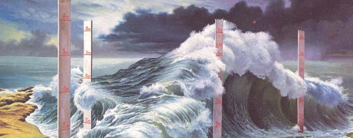
 (Relative) Sea Level Rise, Meteorological changes (storminess, river floods) Climate forecasting: The infamous Hockey Stick")
5 Working on a range of time scales Small scales (O(0.1 1) Km s & Days Years) Small bays, channel siltation, storm impact, rip channels Effectiveness and impact of protection measures (e.g. nourishments, constructions, channel re-alignments) Weather 8 O clock news Large Scales (O(10-100) Km s & Decades Centuries) Coastal systems (e.g. basins, estuaries, coastal cells, delta s) (Relative) Sea Level Rise, Meteorological changes (storminess, river floods) Climate forecasting: The infamous Hockey Stick
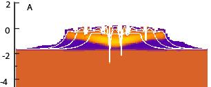
6 Process-based Models bottom depth waves current simulate basic processes upscaling approach equilibrium not known a priori detailed representation sediment transport bottom change loop back

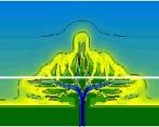
7 Currents
8
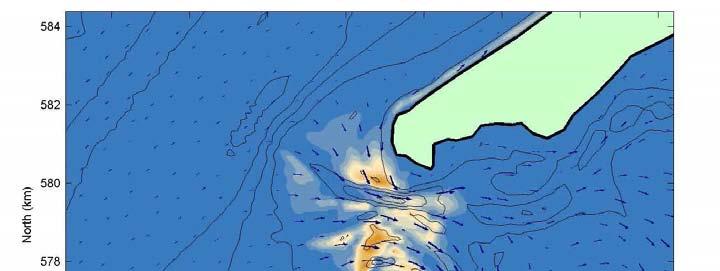
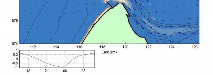
9
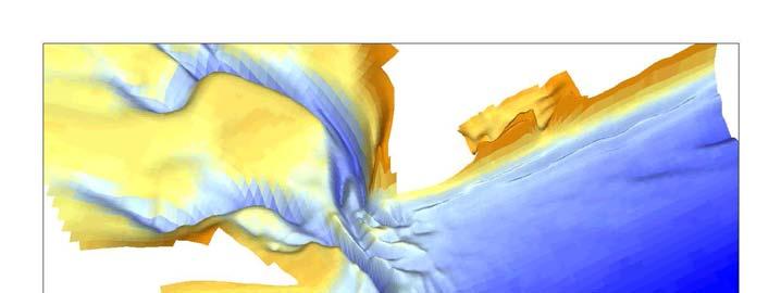
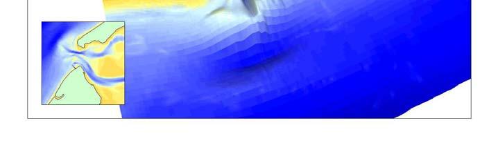
10
11 Comparison: morphological upscaling vs brute force
12 The role of process-based long term modelling design/develop coastal protection strategies and measures Using process models as testing facility (what if.) Underpinning of simpler model concepts Understanding variability in coastal behaviour (a shift in response) Trying to understand what is predictable and what not Modelling impacts of modified forcing (e.g. sea level rise, extreme events)
13 Challenges Small Scales Direct validation often possible (e.g. observed hydrodynamics & morphodynamics in field and laboratory) Large Scale No direct validation possible, forcing unknown Validity of Process Based Long Term Modelling? morphological output predictions truth time Morphosceptics view of bottom-up models
14 Approach to P.B. Long-term modelling Simple schematised cases (proof of concept) Resemble empirical (equilibrium) relations Identify dominant mechanisms (e.g. forcing or paleostratigraphy) Identification of equilibrium Impact of modified forcing Interpretation based on patterns and aggregated results Real cases Scenarios (e.g. climate forecasts)


15 River Discharge SAND Transect SILT
16 A first analogue: The Wax Delta (USA) Storms et al., 2007


17 Influence of initial conditions shallow basin deep basin Storms et al., 2007
18 Identification of morphodynamic-stratigraphic coupling Simulated field data km shallow basin Majersky et al., BRI Bulletin Storms et al., 2007
19 Classification of Delta s Orton & Reading, 1993
20 Free development of tidal estuary


21 Long-term behaviour of estuaries Given coastline and tidal boundaries, can we predict channel shapes, crosssection? Does equilibrium exist? vd Wegen et al, 2008

22 Predicting morphology Evaluate capability of model to create morphology from flat-bed Given tide and landboundaries Example: Western Scheldt


23 Results of Delft3D run Observed 1998 Initial flat bathymetry Modelled, 15 yrs Modelled, 30 yrs Modelled, 200 yrs
24 Comparison with empirical formulation Jarrett (1976) A = C * P n A P
25 Inlet Response to combined Tide & Wave action Basin Inlet Sea Slope 1:200 Tung et al, 2009


26 Schematic inlet systems (Tide & Waves)

 Wave Height H s (m) SIM1 15 0.50 1.")

 18 42 4 25 138 (Initial A c =")
27 Comparison to Empirical Formulation Table 1: Simulation scenarios, mode Scenario name Boundary conditions Basin Area A b (km 2 ) Tidal Ampl a 0 (m) Wave Height H s (m) SIM SIM SIM SIM SIM Ratio Tidal Prism and Longshore P/M Transport tot velocities) (Initial A c = 850 m 2 ; ϕ = 25, Tidal period = 12 hrs)
28 Compared to Escoffier
 Perturbation of")

29 So far average conditions, but Impact of extreme events (e.g. hurricanes, floods and tsunamis) Perturbation of equilibrium > Dune Erosion Shift to new equilibrium or different state > Inlet Closure/Generation, Delta Lobe switching
30 Conclusions P.B. Long-Term modeling A lot of natural behavior is captured in simple physics (depthaveraged tidal flow, waves, simple transport formula, no sediment interaction and simple stratigraphy) A number of empirical relationships are reproduced Long-term, process based simulations do not necessarily get out of hand: they tend towards realistic equilibrium situations Present generation of morphological models is becoming robust enough to survive long simulations and to model extreme events This allows us to use them as numerical lab
31 The way ahead Adding more processes will have limited added value Main challenge is to learn how to apply p.b. long term models Forcing (average conditions vs. extreme events) Initial conditions (bathymetry, sediment, paleostratigraphy) Interpretation of results (patterns, aggregation, detailed results) Embedding results in coastal management/policy plans Further validation Develop standardised approaches
SUPPLEMENTARY INFORMATION
 SUPPLEMENTARY INFORMATION DOI: 10.1038/NCLIMATE1664 Climate-change impact assessment for inlet-interrupted coastlines ROSHANKA RANASINGHE 1,2,3*, TRANG MINH DUONG 1,3, STEFAN UHLENROOK 1,2, DANO ROELVINK
Towards prediction of fines captures
 Towards prediction of fines captures over the wide range of depositional environments occurring simultaneously in a typical facility Luca Sittoni, Jill Hanssen, Hugo van Es, Jan van Kester, Rob Uittenbogaard,
Simulating the large-scale spatial sand-mud distribution in a schematized process-based tidal inlet system model
 DOI: 10.3990/2.196 Simulating the large-scale spatial sand-mud distribution in a schematized process-based tidal inlet system model F. Scheel1,2,3, M. van Ledden1,2, B.C. van Prooijen1 and M.J.F. Stive1
Main issues of Deltas
 Global sediment supply to coastal seas and oceans; location of major river deltas RIVER DELTAS Depositional processes - Course Coastal Morphodynamics GEO3-436; lecture 4 Nile Delta, Egypt Solo Delta, Java,
'Sand' Balance Approach. Assessing sediment budgets and transports using bathymetric data
 'Sand' Balance Approach Assessing sediment budgets and transports using bathymetric data Deltares, 2012 Contents 1 A sediment approach 1 1.1 Introduction 1 1.2 Dynamic stability of estuaries and management
A methodology for impact, vulnerability and adaptation assessment in the coastal zone
 UNFCCC expert meeting on methods and tools and on data and observations under the Nairobi work programme on impacts, vulnerability and adaptation to climate change Mexico City, Mexico, 4-7 March 2008 A
Geol 117 Lecture 18 Beaches & Coastlines. I. Types of Coastlines A. Definition:
 I. Types of Coastlines A. Definition: 1. Shore = narrow zone where ocean meets land (e.g. beach) 2. Coast is a broad area where both ocean and land processes act a. Includes onshore marshes, dunes, sea
Sea-level Rise on Cape Cod: How Vulnerable Are We? Rob Thieler U.S. Geological Survey Woods Hole, MA
 Sea-level Rise on Cape Cod: How Vulnerable Are We? Rob Thieler U.S. Geological Survey Woods Hole, MA Outline Sea-level and coastal processes Past sea-level change Predictions for the future Coastal responses
MORPHOLOGICAL DEVELOPMENT OF THE RIF AND THE ENGELSMANPLAAT, AN INTERTIDAL FLAT COMPLEX IN THE FRISIAN INLET, DUTCH WADDEN SEA
 MORPHOLOGICAL DEVELOPMENT OF THE RIF AND THE ENGELSMANPLAAT, AN INTERTIDAL FLAT COMPLEX IN THE FRISIAN INLET, DUTCH WADDEN SEA Z.B. Wang 1 and A.P. Oost 2 The Rif and the Engelsmanplaat form together a
New modelling tools for coastal problems related to climate change
 New modelling tools for coastal problems related to climate change Nils Drønen Coastal and Estuarine Department, CED, DHI Climate change and coastal engineering Natural system Beach and dune system Coastal
RISC-KIT: EWS-DSS Hotspot Tool
 RISC-KIT: EWS-DSS Hotspot Tool Robert McCall Ap van Dongeren Deltares www.risckit.eu This project has received funding from the European Union s Seventh Programme for Research, Technological Development
SEGMENTED BREAKWATERS AND THEIR USE IN COASTAL LOUISIANA
 SEGMENTED BREAKWATERS AND THEIR USE IN COASTAL LOUISIANA Prepared by: Louisiana Coastal Protection and Restoration Authority Engineering Division March 2016 The geology of Louisiana s coastal zone is intimately
Protection of Coasts
 Protection of Coasts [Coastal Zones] Jan van de Graaff Delft University of Technology 1 Coastal Zone: many definitions here: rather narrow strip of land adjacent to sea or large inland water (say: 150
Term Knowledge Using and applying Grade Criteria Autumn 1 Assessment window October Natural hazards pose major risks to people and property.
 Assessment Schedule Year 9 2015/6 Term Knowledge Using and applying Grade Criteria Autumn 1 Assessment window October 2015 3.1.1.2 Tectonic Natural hazards pose major risks to people and property. Definition
L7/ Historical Perspec=ve, Deltas
 Colin Woodroffe (2002) Coasts: Form, Process and Evolu=on, Outline of Chapter 7: L7/1 L7/2 7.1. Historical Perspec=ve, 7.1.1. Deltas Herodotus (450, B.C.) delta = Shape of Nile River Delta = Δ Gilbert
Sediment Connectivity and Exchange in Ameland Inlet
 Sediment Connectivity and Exchange in Ameland Inlet Stuart G. Pearson, Bram C. van Prooijen, Zheng Bing Wang, and Jasper P. Bak January 11 th, 2017 NCK Symposium on Sediment Sorting Study Site: Ameland
The use of MIKE21 to study the. barrier beach system of Inner Dingle Bay, Co. Kerry, Ireland. Dr. Michael O Shea Malachy Walsh and Partners
 The use of MIKE21 to study the morphodynamic evolution of the mid-bay barrier beach system of Inner Dingle Bay, Co. Kerry, Ireland Dr. Michael O Shea Malachy Walsh and Partners Contents Why Study Morphodynamics
Numerical models in context of coastal climate change, adaptation and protection schemes. Nils Drønen Head of Innovation, CED, DHI
 Numerical models in context of coastal climate change, adaptation and protection schemes Nils Drønen Head of Innovation, CED, DHI Agenda Introduction How can we quantify coastal response to climate change
Annual transport rates at two locations on the fore-slope.
 Sediment Transport by Currents Fore-slope Sediment transport rates and sediment concentrations were computed from the hydrodynamic model runs as well as from direct measurements of current velocities at
BYPASS IN GROYNE FIELDS: CASE STUDY ALONG THE LOBITO SPIT
 BYPASS IN GROYNE FIELDS: CASE STUDY ALONG THE LOBITO SPIT Sten Esbjørn Kristensen 1, Nils Drønen 2, Rolf Deigaard 3, Berry Elfrink 4 Abstract The Lobito spit, in Angola, is fronted by a groyne field along
Planning for coastal hazards in a changing climate
 March 2013 Planning for coastal hazards in a changing climate Catherine Knight, Coastal and Estuary Officer Sharyn French, Manager Land and Natural Environment Presentation overview Stormy past Council
SHORELINE AND BEACH PROCESSES: PART 2. Implications for Coastal Engineering
 SHORELINE AND BEACH PROCESSES: PART 2 Implications for Coastal Engineering Objectives of the lecture: Part 2 Show examples of coastal engineering Discuss the practical difficulties of ocean engineering
A new sediment budget for the Netherlands: the effect of 15 years of nourishing ( )
") A new sediment budget for the Netherlands: the effect of 15 years of nourishing (1991-2005) A new sediment budget for the Netherlands: the effect of 15 years of nourishing (1991-2005) Ad van der Spek
A new sediment budget for the Netherlands: the effect of 15 years of nourishing (1991-2005) A new sediment budget for the Netherlands: the effect of 15 years of nourishing (1991-2005) Ad van der Spek
Hindcasting morphodynamic evolution with sand mud interactions in the Yangtze Estuary
 doi:10.5194/piahs-368-430-2015 430 Remote Sensing and GIS for Hydrology and Water Resources (IAHS Publ. 368, 2015) (Proceedings RSHS14 and ICGRHWE14, Guangzhou, China, August 2014). Hindcasting morphodynamic
MORPHODYNAMIC PROCESSES IN ESTUARIES COMPARISON OF MARINE AND LIMNIC TIDAL FLATS
 MORPHODYNAMIC PROCESSES IN ESTUARIES COMPARISON OF MARINE AND LIMNIC TIDAL FLATS Thorsten Albers 1, Dagmar Much 2, Nino Ohle 2, Nicole von Lieberman 1, Eva Falke 1 Tidal flat areas in estuaries are affected
Coastal Flood Risk Study Project for East Coast Central Florida Study Area
 Coastal Flood Risk Study Project for East Coast Central Florida Study Area St Lucie County, Florida Flood Risk Review Meeting March 28, 2017 Introductions Risk MAP Project Team FEMA Region IV BakerAECOM,
Weathering of Rocks. Weathering - Breakdown of rocks into pieces (sediment) 2 main types of weathering to rocks
 2 main types of weathering to rocks") Weathering of Rocks Weathering - Breakdown of rocks into pieces (sediment) 2 main types of weathering to rocks Mechanical weathering requires physical forces to break rocks into smaller pieces. Chemical
Weathering of Rocks Weathering - Breakdown of rocks into pieces (sediment) 2 main types of weathering to rocks Mechanical weathering requires physical forces to break rocks into smaller pieces. Chemical
Morphological Modeling of Inlets and Adjacent Shorelines on Engineering Timescales
 CB&I Morphological Modeling of Inlets and Adjacent Shorelines on Engineering Timescales Challenges and Model Improvements based on Recent Studies Dobrochinski, J.P.H.; Benedet, L.; Signorin, M.; Pierro,
Strategic approach towards Post Tsunami Mitigation and Conservation of the Sri Lankan coastline
 Strategic approach towards Post Tsunami Mitigation and Conservation of the Sri Lankan coastline Dr. S.S.L.Hettiarachchi Dr. S.P.Samarawickrama University of Moratuwa Illustrated via a Case Study for the
Semi-enclosed seas. Estuaries are only a particular type of semi-enclosed seas which are influenced by tides and rivers
 Semi-enclosed seas Estuaries are only a particular type of semi-enclosed seas which are influenced by tides and rivers Other semi-enclosed seas vary from each other, mostly by topography: Separated from
THC-T-2013 Conference & Exhibition
 Modeling of Shutter Coastal Protection against Storm Surge for Galveston Bay C. Vipulanandan, Ph.D., P.E., Y. Jeannot Ahossin Guezo and and B. Basirat Texas Hurricane Center for Innovative Technology (THC-IT)
Issue to be addressed
 Climate change impacts in fluvial, coastal and transition zones in Mediterranean environments altered by human activities: Guadalfeo and Adra river mouths Andrea Lira Loarca - aliraloarca@ugr.es Manuel
MODELLING OF SEDIMENTATION OF DREDGED TRENCHES AND CHANNELS UNDER THE COMBINED ACTION OF TIDAL CURRENTS AND WAVES
 MODELLING OF SEDIMENTATION OF DREDGED TRENCHES AND CHANNELS UNDER THE COMBINED ACTION OF TIDAL CURRENTS AND WAVES D.J.R. Walstra 1, L.C. Van Rijn 1, S.E. Hoogewoning 2, S.G.J. Aarninkhof 1 Abstract: The
Scenarios for the NI coast in the 21 st Century
 Scenarios for the NI coast in the 21 st Century Prof Julian Orford Geography, Archaeology & Palaeoecology Queen s University, Belfast Challenging perspective Living by the coast is good for your health!
WP4: COASTAL PROCESSES
 WP4: COASTAL PROCESSES Coordinator: G. EBERHARDS Faculty of Geography and Earth Sciences, University of Latvia Daugavpils, 2008 Goal: The objective of this study is analysis of coastal changes and forecast
Morphodynamic Response of Tidal Mudflats to Marine Cohesive Sediment Influx
 Morphodynamic Response of Tidal Mudflats to Marine Cohesive Sediment Influx Wongsoredjo Samor Master of Science in Earth Sciences Thesis Utrecht, 2016 Utrecht University, Faculty of Geosciences Morphodynamic
DUNE EROSION NEAR SEA WALLS: MODEL-DATA COMPARISON
 DUNE EROSION NEAR SEA WALLS: MODEL-DATA COMPARISON Pieter van Geer 1, Bram de Vries 2, Ap van Dongeren 1 and Jaap van Thiel de Vries 1,2 This paper describes the validation of the dune erosion model XBeach
Coasts Key Word Glossary
 Coasts Key Word Glossary Abrasion Also known as corrosion. It is the wearing away of the cliff by sand, fragments of rock and boulders that are being hurled at the cliff by the waves. It causes grinding
Michael Walsworth, Ryan Sullivan, Simi Odueyungbo, William Budd
 Michael Walsworth, Ryan Sullivan, Simi Odueyungbo, William Budd Estuarine Environment At first (Pritchard, 1967), an estuary was defined by the salinity of the water. Then by Clifton (1982) as an inlet
The Systems Approach. Alun Williams, ABPmer
 The Systems Approach Alun Williams, ABPmer Overview What is A Systems Approach? Behavioural / Qualitative Modelling? System Definition / Mapping (Behavioural Statements Objective) What is a Systems Approach?
Benchmarking of Hydrodynamic Models for Development of a Coupled Storm Surge Hazard-Infrastructure Modeling Method to improve Inundation Forecasting
 Benchmarking of Hydrodynamic Models for Development of a Coupled Storm Surge Hazard-Infrastructure Modeling Method to improve Inundation Forecasting Abstract Fragility-based models currently used in coastal
SEDIMENT IMPORT BY TIDAL INLETS SEDBOX -model for tidal inlets Marsdiep and Vlie, Wadden sea, The Netherlands by L.C. van Rijn
 SEDIMENT IMPORT BY TIDAL INLETS SEDBOX -model for tidal inlets Marsdiep and Vlie, Wadden sea, The Netherlands by L.C. van Rijn 1. Physical processes of sandy tidal inlet systems 1.1 Introduction 1.2 Hydrodynamics
Mapping of Future Coastal Hazards. for Southern California. January 7th, David Revell, Ph.D. E.
 Mapping of Future Coastal Hazards for Southern California January 7th, 2014 David Revell, Ph.D. drevell@esassoc.com E. Vandebroek, 2012 Outline Coastal erosion hazard zones Flood hazard zones: Coastal
The Coast: Beaches and Shoreline Processes
 1 2 3 4 5 6 7 8 9 The Coast: es and Shoreline Processes Trujillo & Thurman, Chapter 10 Oceanography 101 Chapter Objectives Recognize the various landforms characteristic of beaches and coastal regions.
Coastal Inundation Forecasting and Community Response in Bangladesh
 WMO Coastal Inundation Forecasting and Community Response in Bangladesh Bapon (SHM) Fakhruddin Nadao Kohno 12 November 2015 System Design for Coastal Inundation Forecasting CIFDP-PSG-5, 14-16 May 2014,
The Coast: Beaches and Shoreline Processes Trujillo & Thurman, Chapter 10
 The Coast: es and Shoreline Processes Trujillo & Thurman, Chapter 10 Oceanography 101 Chapter Objectives Recognize the various landforms characteristic of beaches and coastal regions. Identify seasonal
TIDAL FLAT EVOLUTION AT THE CENTRAL JIANGSU COAST, CHINA
 Proceedings of the Sixth International Conference on Asian and Pacific Coasts (APAC 211) December 14 16, 211, Hong Kong, China TIDAL FLAT EVOLUTION AT THE CENTRAL JIANGSU COAST, CHINA Z. GONG State Key
Why I Am a Climate Realist. by Dr. Willem de Lange
 Why I Am a Climate Realist by Dr. Willem de Lange SPPI Commentary & Essay Series! May 27, 2009 Why I Am a Climate Realist by Dr. Willem de Lange May 23, 2009 In 1996 the United Nations Intergovernmental
Developed in Consultation with Florida Educators
 Developed in Consultation with Florida Educators Table of Contents Next Generation Sunshine State Standards Correlation Chart... 7 Benchmarks Chapter 1 The Practice of Science...................... 11
Coastal Barrier Island Network (CBIN): Management strategies for the future
: Management strategies for the future") Coastal Barrier Island Network (CBIN): Management strategies for the future Heather Joesting*, Amy Williams**, Rusty Feagin**, and William K. Smith* *Department of Biology, Wake Forest University, Winston
Coastal Barrier Island Network (CBIN): Management strategies for the future Heather Joesting*, Amy Williams**, Rusty Feagin**, and William K. Smith* *Department of Biology, Wake Forest University, Winston
GCSE 4242/02 GEOGRAPHY (Specification B) FOUNDATION TIER UNIT 2 SECTION B
 FOUNDATION TIER UNIT 2 SECTION B") Surname Centre Number Candidate Number Other Names 0 GCSE 4242/02 GEOGRAPHY (Specification B) FOUNDATION TIER UNIT 2 SECTION B S15-4242-02 P.M. WEDNESDAY, 3 June 2015 1 hour 30 minutes For s use Part Maximum
Surname Centre Number Candidate Number Other Names 0 GCSE 4242/02 GEOGRAPHY (Specification B) FOUNDATION TIER UNIT 2 SECTION B S15-4242-02 P.M. WEDNESDAY, 3 June 2015 1 hour 30 minutes For s use Part Maximum
PRESENTATION TITLE. Regional Sediment Management Application of a Coastal Model at the St. Johns River Entrance BUILDING STRONG
 PRESENTATION TITLE Regional Sediment Management Application of a Coastal Model at the St. Johns River Entrance Steven Bratos Senior Coastal Engineer U.S. Army Corps of Engineers Jacksonville District February
Ed Curtis, PE, CFM, FEMA Region IX and Darryl Hatheway, CFM, AECOM ASFPM 2016, Grand Rapids, MI
 Methodology to Determine Process-Based Total Water Level Profiles in Areas Dominated by Wave Runup Ed Curtis, PE, CFM, FEMA Region IX and Darryl Hatheway, CFM, AECOM ASFPM 2016, Grand Rapids, MI Thurs.
Assessment of climate change impacts on salinity intrusion in Hong-Thai Binh and Dong Nai river basins
 VNU Journal of Science, Earth Sciences 27 (2011) 54-61 Assessment of climate change impacts on salinity intrusion in Hong-Thai Binh and Dong Nai river basins Tran Hong Thai, Tran Thi Van* Vietnam Institute
NOAA s National Weather Service Philadelphia/Mt. Holly NJ
 Next Briefing Package: Friday, October 2, 2015 no later than 300 PM Hazards and Impacts: Overview: A dangerous weather pattern still threatens our region. Threats include very heavy rainfall, inland river
Groundwater dynamics and surface water-groundwater interaction in a prograding delta island, Louisiana, USA
 Supplementary Information Groundwater dynamics and surface water-groundwater interaction in a prograding delta island, Louisiana, USA Michael T. O Connor 1* and Kevan B. Moffett 1,2 1 Department of Geological
Mangrove Erosion in the Mekong delta
 Mangrove Erosion in the Mekong delta 1. Introduction a. Mangrove coast - a balance between different forcing factors Mangroves are coastal environments frequently observed in the tropical muddy coasts.
Supplemental Slides. Shore: Junction of Land & Water. Junction of Land & Water. Sea Level Variations. Shore vs. Coast. Sea Level Variations
 Shore: Junction of Land & Water Supplemental Slides Sediments come off land Most get dumped at the beach Sediment interacts with ocean waves and currents Junction of Land & Water Features: Breaking waves,
Shore: Junction of Land & Water. Sediments come off land Most get dumped at the beach Sediment interacts with ocean waves and currents
 Shore: Junction of Land & Water Supplemental Slides Sediments come off land Most get dumped at the beach Sediment interacts with ocean waves and currents Junction of Land & Water Features: Breaking waves,
QU: Where does sand do jail time? AIM: To explain the sediment cell concept as a system and what human and natural factors create/upset a dynamic
 QU: Where does sand do jail time? AIM: To explain the sediment cell concept as a system and what human and natural factors create/upset a dynamic equilibrium. ST: On your copy draw and label future depositional
Protecting the Storm Damage Prevention and Flood Control Interests of Coastal Resource Areas
 Protecting the Storm Damage Prevention and Flood Control Interests of Coastal Resource Areas Presented by: Massachusetts Department of Environmental Protection & Massachusetts Office of Coastal Zone Management
Marine Geology. Processes controlling the development of a river mouth spit
 Marine Geology 280 (2011) 116 129 Contents lists available at ScienceDirect Marine Geology journal homepage: www.elsevier.com/locate/margeo Processes controlling the development of a river mouth spit Sebastian
Prediction of changes in tidal system and deltas at Nakdong estuary due to construction of Busan new port
 Prediction of changes in tidal system and deltas at Nakdong estuary due to construction of Busan new port H. Gm1 & G.-Y. park2 l Department of Civil & Environmental Engineering, Kookmin University, Korea
Weathering, Erosion, and Deposition
 Weathering, Erosion, and Deposition E Q : H O W I S T H E E A R T H A F F E C T E D B Y C O N S T R U C T I V E A N D D E S T R U C T I V E F O R C E S? http://player.discoveryeducation.com/index.cfm?guidassetid=6b1e329e-5a77-4b36-bfa9-1d307f75441c&blnfromsearch=1&productcode=us
TIME-DEPENDENT EFFECTS OF NOURISHMENTS ON SHOREFACE BAR BEHAVIOUR. Abstract
 TIME-DEPENDENT EFFECTS OF NOURISHMENTS ON SHOREFACE BAR BEHAVIOUR Tommer Vermaas 1, Edwin Elias 2, Ad van der Spek 3 and Rena Hoogland 4 Abstract In 2011/2012 a shoreface nourishment was placed at Heemskerk,
TOOLS FOR RISK MANAGEMENT Related to climate change
 TOOLS FOR RISK MANAGEMENT Related to climate change copyright CONTENT 1 CLIMATE CHANGE AND ENVIRONMENTAL STUDIES 2 METHODS AND TOOLS DEVELOPED BY EGIS For infrastructures For urban areas For crisis management
Australian Coastal Councils Conference
 Australian Coastal Councils Conference 11 March 2015 Estimating Future Coastal Inundation and Erosion Hazards Dr Andrew McCowan Dr Christine Lauchlan-Arrowsmith Warwick Bishop Background Victorian Future
Keywords: storm surge barrier, hurricanes, probabilistic analysis, flood risk, coastal protection, flood defences
 RECONNAISSANCE LEVEL STUDIES ON A STORM SURGE S BARRIER FOR FLOOD OD RISK REDUCTION IN THE HOUSTON-GALVESTON BAY Sebastiaan N. Jonkman 1, Leslie Mooyaart 1,2, Mathijs van Ledden 1,2 Kasper Stoeten 1, Peter
CHAPTER 1 INTRODUCTION
 1 CHAPTER 1 INTRODUCTION 1.1 GENERAL Washover sandsheets are often found in low-lying coastal embayment s (Sedgwick and Davis 2003). Washover deposition of marine sand is usually attributed to storm activity
Sea level rise and coastal morphological changes on tropical islands New Caledonia and French Polynesia (South Pacific)
") Manuel Garcin, Marissa Yates, Goneri Le Cozannet, Patrice Walker, Vincent Donato Sea level rise and coastal morphological changes on tropical islands New Caledonia and French Polynesia (South Pacific)
Manuel Garcin, Marissa Yates, Goneri Le Cozannet, Patrice Walker, Vincent Donato Sea level rise and coastal morphological changes on tropical islands New Caledonia and French Polynesia (South Pacific)
Coastal Vulnerability and Risk Parameters
 European Water 11/12: 3-7, 2005. 2005 E.W. Publications Coastal Vulnerability and Risk Parameters E. Doukakis National Technical University of Athens-Dept. of Rural and Surveying Engineering, Lab. of Higher
Oceanography and Marine Research
 Journal of Oceanograp hy and Marine Research ISSN: 2572-3103 Journal of Oceanography and Marine Research Negm et al., Oceanography 2015, 3:1 DOI: 10.4172/2332-2632.1000132 Research Article Article Open
Workshop on MCCOE Radar Meteorology /Climatology in Indonesia. Segel Ginting Wanny K. Adidarma
 Workshop on MCCOE Radar Meteorology /Climatology in Indonesia BPPT, 28 Februari 2013 JAKARTA FLOOD EARLY WARNING SYSTEM (J-FEWS) Segel Ginting Wanny K. Adidarma JCP (Joint Cooperation Program) Indonesia
1 Shoreline Landforms 2. 2 Emergent v. Submergent 2. 3 Wavecutting 3. 4 Planview 4. 5 Marine Terraces 5. 6 California 7. 7 Tombolos, Sea Stacks 8
 Shorelines November 9, 2008 Contents 1 Shoreline Landforms 2 2 Emergent v. Submergent 2 3 Wavecutting 3 4 Planview 4 5 Marine Terraces 5 6 California 7 7 Tombolos, Sea Stacks 8 8 Active Processes 9 9 Emergence
The Marine Environment
 The Marine Environment SECTION 16.1 Shoreline Features In your textbook, read about erosional landforms, beaches, estuaries, longshore currents, and rip currents. For each statement below, write true or
ERDC/LAB TR-0X-X 100. Figure 7-3 Maximum velocity magnitudes for existing conditions for 100-year flood event
 ERDC/LAB TR-0X-X 100 Figure 7-3 Maximum velocity magnitudes for existing conditions for 100-year flood event ERDC/LAB TR-0X-X 101 Figure 7-4 Model schematization of Option 1 Figure 7-5 Bed displacement
SLOSH New Orleans Basin 2012 Update
 SLOSH New Orleans Basin 2012 Update Michael Koziara Science and Operations Officer National Weather Service Slidell, LA The Basics What is storm surge? What is SLOSH? Details Assumptions Inundation = Storm
TECHNIQUES FOR ASSESSING COASTAL HAZARD AREAS FOR THE GISBORNE DISTRICT COAST
 TECHNIQUES FOR ASSESSING COASTAL HAZARD AREAS FOR THE GISBORNE DISTRICT COAST July 1994 C.R. 1994/12 Jeremy G Gibb 2009 All rights reserved. This work is entitled to the full protection given by the Copyright
Modelling Coastal Environments Professional Consulting Services Coastal Inundation Tsunamis Coastal Hazard Adaptation Strategies Coastal Processes
 Modelling Coastal Environments Professional Consulting Services Coastal Inundation Tsunamis Coastal Hazard Adaptation Strategies Coastal Processes bmtwbm.com.au Coastal Inundation Risk Assessments Long-term
Numerical Study To Enhance Stability Condition Within The River Mouth; Case Study: Rosetta Promontory, Egypt
 City University of New York (CUNY) CUNY Academic Works International Conference on Hydroinformatics 8-1-2014 Numerical Study To Enhance Stability Condition Within The River Mouth; Case Study: Rosetta Promontory,
How to Read These Flood Hazard Maps
 How to Read These Flood Hazard Maps The United States Geological Survey (USGS) has developed the Coastal Storms Modeling System (CoSMoS), which projects coastal flooding and erosion from coastal storms,
Storm Induced Coastal Erosion for Flood Insurance Studies and Forecasting Coastal Flood Damage Impacts: Erosion, Runup & Overtopping
 Storm Induced Coastal Erosion for Flood Insurance Studies and Forecasting Coastal Flood Damage Impacts: Erosion, Runup & Overtopping Jeff Gangai- Dewberry Tucker Mahoney FEMA HQ Introduction Background
Flood Risk Mapping and Forecasting in England
 Flood Risk Mapping and Forecasting in England Mark Franklin Environment Agency, England NORDESS Workshop on Risk Assessment and Acceptable Risk Outline Flood risk in England Who we are and how we work
A probabilistic storm surge risk model for the German North and Baltic Sea coast
 A probabilistic storm surge risk model for the German North and Baltic Sea coast Jan-Henrik Grabbert 1), Jan Deepen 2), Andreas Reiner 2), Stephan Mai 3), Harvey Rodda 4), Dietmar Pfeifer 5) and Andreas
Dynamic preservation of the coastline
 Dynamic preservation of the coastline Content Introduction The Dutch coastal defence by dynamic processes Data collection Management of the sand resources Growing importance of marine sand and gravel resources
USING MIKE TO MODEL COASTAL CATASTROPHE RISK
 USING MIKE TO MODEL COASTAL CATASTROPHE RISK Nicola Howe, Christopher Thomas, Joss Matthewman, John Maskell* 1 SUMMARY About RMS Who are we and what do we do? How do we use MIKE in our workflow? Case study:
Mapping, monitoring, and modeling: USGS Coastal and Marine Geology activities along the Northeast coast
 Mapping, monitoring, and modeling: USGS Coastal and Marine Geology activities along the Northeast coast Coastal and Marine Geology Program Woods Hole Coastal and Marine Science Center St. Petersburg Coastal
A Quantitative Assessment of Human Interventions and Climate Change on the West African sediment budget
 Public Disclosure Authorized Public Disclosure Authorized A Quantitative Assessment of Human Interventions and Climate Change on the West African sediment budget Public Disclosure Authorized The West African
Draft for Discussion 11/11/2016
 Coastal Risk Consulting (CRC) Climate Vulnerability Assessment for Village of Key Biscayne Deliverable 1.1 in Statement of Work. Preliminary Vulnerability Assessment Identifying Flood Hotspots Introduction...
NOAA s National Weather Service Philadelphia/Mt. Holly NJ
 Next Briefing Package: Thursday, October 1, 2015 no later than 300 PM Hazards and Impacts: Overview: A dangerous weather pattern is developing for our region. Threats include very heavy rainfall, inland
Long-term estuary processes and morphological change
 Long-term estuary processes and morphological change Professor Ken Pye with contributions from Dr. Simon Blott and Dr. Daphne van der Wal Department of Geology Available top-down methods relying on data
Resilient deltas. Dr. Irina Overeem 1,2)
") Resilient deltas a case-study report on the Volga and Ganges delta systems Dr. Irina Overeem 1,2) 1) CSDMS, INSTAAR, University of Colorado, CO, Boulder, USA 2) Delft University of Technology, The Netherlands
Resilient deltas a case-study report on the Volga and Ganges delta systems Dr. Irina Overeem 1,2) 1) CSDMS, INSTAAR, University of Colorado, CO, Boulder, USA 2) Delft University of Technology, The Netherlands
Flood risk management the Dutch approach Patrick Poelmann
 Flood risk management the Dutch approach Patrick Poelmann Vice governor Province of Noord Holland Flood risk management Introduction Risk management in 20 th century The Dutch Delta Works Risk management
Regional-scale understanding of the geologic character and sand resources of the Atlantic inner continental shelf, Maine to Virginia
 Regional-scale understanding of the geologic character and sand resources of the Atlantic inner continental shelf, Maine to Virginia Workshop on Dredging, Beach Nourishment and Bird Conservation Atlantic
Ria de Aveiro marginal flooding: dependence on oceanic and fluvial drivers and on morphological evolution
 Ria de Aveiro marginal flooding: dependence on oceanic and fluvial drivers and on morphological evolution C.L. Lopes 1, I. Alvarez 1,2 and J.M. Dias 1 1 carinalopes@ua.pt NMEC, CESAM, Physics Department
River and Plume Deposition Ocean Storm Reworking
 River and Plume Deposition Ocean Storm Reworking Irina Overeem Community Surface Dynamics Modeling System University of Colorado at Boulder September 2008 1 Course outline 1 Lectures by Irina Overeem:
Comparing suspended sediment concentrations derived from a model and collected in a tidally dominated area
 Comparing suspended sediment concentrations derived from a model and collected in a tidally dominated area Maryam Rahbani, Department of oceanic and atmospheric science University of Hormozgan, maryamrahbani@yahoo.com
New Storm Surge Catastrophe Model for Great Britain and Beyond
 New Storm Surge Catastrophe Model for Great Britain and Beyond Richard Yablonsky, Mohammad Keshtpoor, and Austen Blair 33 rd Conference on Hurricanes and Tropical Meteorology American Meteorological Society
CHAPTER 126 ^^^C^SR, SEDIMENTATION STUDIES ON THE NIGER RIVER DELTA
 CHAPTER 126 SEDIMENTATION STUDIES ON THE NIGER RIVER DELTA Ramiro Mayor-Mora, D. Eng. (1) Preben Mortensen, M.Sc. (2) Jorgen Fredsoe, M.Sc. (2) 1. Introduction An area of the Niger River Delta was studied
Integrated geological approach to the study of coastal subsidence in Emilia-Romagna. Luisa PERINI Calabrese Lorenzo, Luciani Paolo, Severi Paolo,
 Integrated geological approach to the study of coastal subsidence in Emilia-Romagna Luisa PERINI Calabrese Lorenzo, Luciani Paolo, Severi Paolo, Subsidence hazard of Emilia-Romagna coastal plain Caputo