Nathaniel Weston. Department of Geography & the Environment Villanova University 30 January 2013 Delaware Estuary Science & Environmental Summit
|
|
|
- Elijah Allen
- 5 years ago
- Views:
Transcription

1 Nathaniel Weston Department of Geography & the Environment Villanova University 30 January 2013 Delaware Estuary Science & Environmental Summit


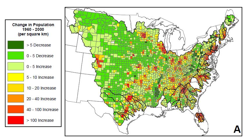
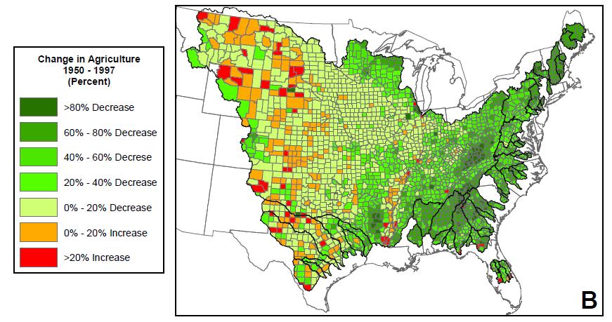
2 Land Use Change in Colonial Period Through 1900s


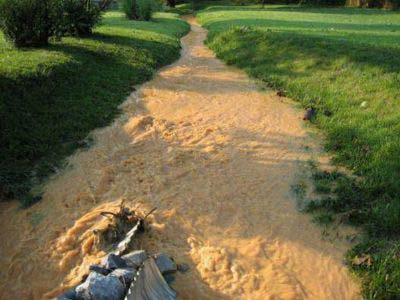
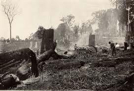
3 Soil Erosion and Sediment Pollution of Waterways
4 Suspended Sediment Concentration (mg L -1 ) Land Clearing Agriculture
5
 The wastage")


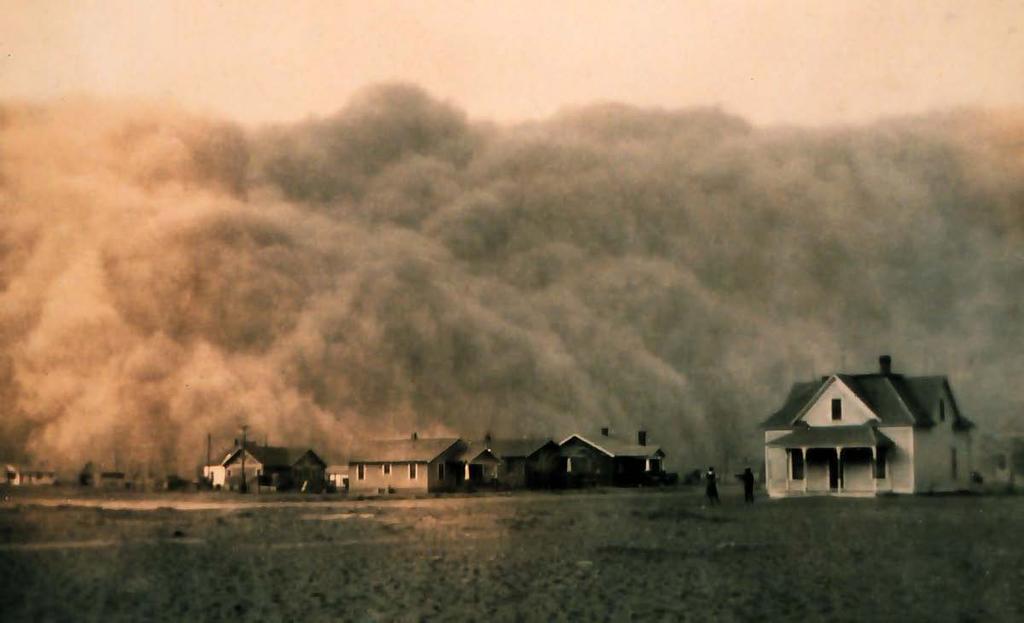
6 1935: Soil Conservation Service (USDA) The wastage of soil and moisture resources on farm, grazing, and forest lands... is a menace to the national welfare 1994: Natural Resources Conservation Service 1972: Clean Water Act

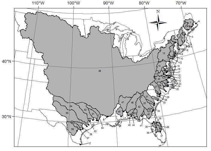
7
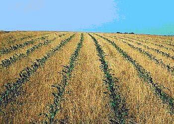
8 Suspended Sediment Concentration (mg L -1 ) Land Clearing Agriculture Damming Afforestation Soil Conservation
9 Sea Level Rise & Sediment Availability Global Sea Level (mm) Past Estimates Instrumental Record Projections Suspended Sediment Concentration (mg L -1 )
10 Marsh Accretion Suspended Sediments CO 2 Trapping by Vegetation & Deposition on Marsh Surface Burial Marsh Accretion Plant Biomass Inorganic Sediment Soil Organic Matter
11 200 Suspended Sediment Concentration (mg L -1 ) 20 2 Stable Unstable Modified from Kirwan & Murray (2007) Proceedings of the National Academy of Sciences Rate of Relative Sea Level Rise (mm yr- 1 )


12 Expansion of Marsh Following Settlement Tweel & Turner (2012) Limnology and Oceanography Kirwan et al. (2011) Geology

13
14 Is sediment delivery changing from watersheds to coastal wetlands along the East and Gulf Coasts? Can these changes be linked to activities in watersheds? What might these changes mean for tidal marsh vulnerability to climate change?
15 Analysis of Sediment Concentrations in Rivers Along East and Gulf Coasts 58 watersheds Average suspended sediment concentration (SSC) United States Geological Survey Change in suspended sediment concentrations over time (ΔSSC) SSC = (ΔSSC Date Date) + (ΔSSC Q Discharge) Watershed characteristics U.S. Department of Agriculture, U.S. Census Bureau, National Land Cover Dataset, National Inventory of Dams, Permanent Service for Mean Sea Level
16
 + 87.2(K w ) 23.5 R 2 = 0.")
17 SSC FWA-SSC = 64.8(Area) (LU Ag ) (K w ) 23.5 R 2 = 0.80 ; p < 0.001
18 Relative Sea Level Rise
19 SSC : RSLR SSC = 17.2 (RSLR) R² = 0.44 P < SSC (mg L -1 ) Relative Sea Level Rise (mm yr -1 )
20 ΔSSC
21 ΔSSC : RSLR ΔSSC (mg L -1 yr -1 ) ΔSSSDate = (RSLR) R² = 0.11 P = Relative Sea Level Rise (mm yr -1 )
22
 + 0.017 R 2 = 0.18; P = 0.")
23 Dams ΔSSC Date = 0.009(ΔDam RT ) 0.007(FWA-SSC) R 2 = 0.18; P = 0.004
24 St Croix Penobscot Kennebec Saco Merrimack Connecticut Housatonic Hudson Mohawk Passaic Raritan Delaware Schuylkill Susquehanna Potomac Rappahannock Pamunkey Mattaponi James Appomattox Nottoway Blackwater Roanoke Tar Neuse Contentnea Cape Fear Pee Dee Lynches Black Edisto Savannah Ogeechee Altamaha Satilla St Johns Ocklawaha Kissimmee Peace Withlacoochee Suwanee Ochlockonee Apalachicola Choctawhatchee Yellow Escambia Alabama Tombigbee Pascagoula Mississippi Atchafalaya Sabine Neches Trinity San Jacinto Brazos Colorado Guadalupe San Antonio Nueces Rio Grande Increasing Vulnerability Florida East Gulf Northeast Mid-Atlantic Southeast Mississippi West Gulf Increasing Resiliency
25 Delaware River SSC 300 Average Suspended Sediment (mg L -1 ) 's 1970's 1980's 1990's 2000's


26 SSC: 50 mg L -1 SSC: 20 mg L -1 J. Morris; Marsh Equilibration Model
27 Suspended Sediment Concentration (mg L -1 ) Marsh Expansion Marsh Maintenance? Marsh Loss?
28 Conclusions Suspended sediment concentrations have declined in many rivers (25 out of 58) along the East and Gulf Coasts Decline is most rapid in regions with rapid relative sealevel rise (RSLR) Decline in sediment availability together with accelerating RSLR increases marsh vulnerability Regionally, decreased resiliency in Mid-Atlantic (notably Delaware River), Southeast, Mississippi, and Texas Gulf


29 Acknowledgments Assistance Guillame Turcotte Craig Diziki Funding National Science Foundation Villanova University Data Sources U.S. Geological Survey U.S. Census Bureau U.S. Department of Agriculture U.S. Army Corps of Engineers Permanent Service for Mean Sea Level
The rate and fate of coastal carbon burial
 The rate and fate of coastal carbon burial Matthew L. Kirwan, Virginia Institute of Marine Science Main Points Marsh size Marsh accretion 1. SLR drives wetland carbon burial in vertical and lateral dimensions
Nutrient and Sediment Cycling and Retention in Urban Floodplain Wetlands
 Nutrient and Sediment Cycling and Retention in Urban Floodplain Wetlands Greg Noe, Cliff Hupp, Nancy Rybicki, Ed Schenk, and Jackie Batson National Research Program, Reston VA U.S. Department of the Interior
9 th INTECOL Orlando, Florida June 7, 2012
 Restoration of the Everglades Saline Wetlands and Florida Bay: Responses Driven from Land and Sea David Rudnick 1, Colin Saunders 2, Carlos Coronado 2, Fred Sklar 2 Erik Stabenau 1, Vic Engel 1, Rene Price
Tony Pratt, DNREC to The Center for the Inland Bays Scientific and Technical Advisory Committee. August 21, 2009
 Sea Level Rise in Delaware Presented by Tony Pratt, DNREC to The Center for the Inland Bays Scientific and Technical Advisory Committee August 21, 2009 Sea level has been fluctuating ever since there have
Changes in Texas Ecoregions
 Comment On Lesson Changes in Texas Ecoregions The state of Texas can be divided into 10 distinct areas based on unique combinations of vegetation, topography, landforms, wildlife, soil, rock, climate,
Factors influencing nutrient and sediment retention by riverine wetlands in the Chesapeake watershed Greg Noe, Cliff Hupp, Ed Schenk, Nancy Rybicki
 Factors influencing nutrient and sediment retention by riverine wetlands in the Chesapeake watershed Greg Noe, Cliff Hupp, Ed Schenk, Nancy Rybicki National Research Program, Reston VA U.S. Department
Module 3. Basic Ecological Principles
 Module 3. Basic Ecological Principles Ecosystem Components Abiotic Biotic Species & Habitat The Biomes of North America Communities Energy & Matter Cycles in Ecosystems Primary Productivity Simple Ecosystem
Influence of the Major Drainages to the Mississippi River and Implications for System Level Management
 Influence of the Major Drainages to the Mississippi River and Implications for System Level Management Brian M. Vosburg Geologist Louisiana Coastal Protection and Restoration Authority brian.vosburg@la.gov
Sediment and nutrient transport and storage along the urban stream corridor
 Sediment and nutrient transport and storage along the urban stream corridor Greg Noe, Cliff Hupp, Ed Schenk, Jackie Batson, Nancy Rybicki, Allen Gellis What is the role of floodplains everywhere? Noe 2013,
Reducing Nitrogen Removal Uncertainty for Operation of Mississippi River Sediment Diversions: Nitrate Reduction Rates In Turbulent Flow Conditions
 Reducing Nitrogen Removal Uncertainty for Operation of Mississippi River Sediment Diversions: Nitrate Reduction Rates In Turbulent Flow Conditions Nia R. Hurst, John R. White, Kehui Xu, and MingCheng Ren
EQ: Discuss main geographic landforms of the U.S. & Canada and examine varied landforms in relation to their lifestyles.
 EQ: Discuss main geographic landforms of the U.S. & Canada and examine varied landforms in relation to their lifestyles. Places & Terms for Discussion Appalachian Mountains Great Plains Canadian Shield
Natural Texas. Regions and Climates
 Natural Texas Regions and Climates Two Kinds: Physical geography Climate, vegetation, rivers, lakes, oceans, plateaus, plains, and mountain ranges Human geography Economic activities How we earn a living
Guided Reading Activity
 Guided Reading Activity Lesson 1 Physical Features Essential Question: How does geography influence the way people live? A Vast Land Directions: Read the lesson and use your text to decide whether each
Coastal Oceanography. Coastal Oceanography. Coastal Waters
 Coastal Oceanography Coastal Oceanography 95% of ocean life is in coastal waters (320 km from shore) Estuaries and wetlands are among most productive ecosystems on Earth Major shipping routes, oil and
2 Georgia: Its Heritage and Its Promise
 TERMS region, erosion, fault, elevation, Fall Line, aquifer, marsh, climate, weather, precipitation, drought, tornado, hurricane, wetland, estuary, barrier island, swamp PLACES Appalachian Mountains, Appalachian
4 th Grade Virginia Studies SOL Review Packet Geography of Virginia. 1. The Algonquian language group of Indians lived in what region of Virginia?
 4 th Grade Virginia Studies SOL Review Packet Geography of Virginia 1. The Algonquian language group of Indians lived in what region of Virginia? A. Allegheny B. Piedmont C. Ridge and Valley D. Tidewater
Preliminary Results from Coordinated Sea-Level Rise Modeling Using SLAMM, the Sea Level Affecting Marshes Model, Across the US Gulf of Mexico Coast
 Preliminary Results from Coordinated Sea-Level Rise Modeling Using SLAMM, the Sea Level Affecting Marshes Model, Across the US Gulf of Mexico Coast James W. Pahl, Ph.D., and Kristin DeMarco, State of Louisiana
Name: Date: Class: Louisiana: Our History, Our Home Chapter 1: Louisiana s Geography - Section 2: Natural Regions Guided Reading
 Instructions: Read the section and complete each item with words from the passages in this section. 1. The diversity of Louisiana s can surprise residents and visitors alike. 2. Physical geography is concerned
Signals of sea-level rise in Delaware and Chesapeake Bay tides
 Signals of sea-level rise in Delaware and Chesapeake Bay tides Andrew C. Ross and Raymond G. Najjar Pennsylvania State University Also thanks to Ming Li, Serena Lee, Fan Zhang, Wei Liu Observations show
RESULTS FROM THE TEXAS COASTAL SEDIMENT SOURCES: A GENERAL EVALUATION STUDY
 RESULTS FROM THE TEXAS COASTAL SEDIMENT SOURCES: A GENERAL EVALUATION STUDY JUAN MOYA KELSEY CALVEZ CRIS WEBER ANTHONY RISKO *KEVIN FRENZEL FREESE AND NICHOLS, INC. COASTAL AND WATERWAYS GROUP OBJECTIVES
The Delaware Environmental Monitoring & Analysis Center
 The Delaware Environmental Monitoring & Analysis Center Tina Callahan Delaware Estuary Science & Environmental Summit 2013 January 27-30, 2013 What is DEMAC? Delaware Environmental Monitoring & Analysis
Should (R)SET-MH data be used to forecast the effects of sea level rise on wetland resilience and carbon sequestration?
SET-MH data be used to forecast the effects of sea level rise on wetland resilience and carbon sequestration?") Should (R)SET-MH data be used to forecast the effects of sea level rise on wetland resilience and carbon sequestration? Randall W. Parkinson, Ph.D., P.G. Institute for Water and Environment Florida International
Should (R)SET-MH data be used to forecast the effects of sea level rise on wetland resilience and carbon sequestration? Randall W. Parkinson, Ph.D., P.G. Institute for Water and Environment Florida International
David Coffman, M.S. & Becky Griffith, Ph.D. July 31, 2013
 David Coffman, M.S. & Becky Griffith, Ph.D. July 31, 2013 Texas River Basins Sulphur River Watershed Sediment Sulphur River Watershed Sediment Sulphur River Watershed Sediment Sulphur River Watershed
Unit 1: Geography. For additional information, refer to this website: 1 G e o g r a p h y
 Unit 1: Geography For additional information, refer to this website: http://mryoungtms.weebly.com/ 1 G e o g r a p h y Continents and Oceans SOL USI. 2a Essential Understanding: Continents are large land
Terrain Units PALEOGEOGRAPHY: LANDFORM CREATION. Present Geology of NYS. Detailed Geologic Map of NYS
 NYS TOPOGRAPHY Why so? PALEOGEOGRAPHY: LANDFORM CREATION Prof. Anthony Grande AFG 014 Present Geology of NYS Detailed Geologic Map of NYS Generalized Geology Detailed Geology Hot links to the fold out
4th Grade U.S. Regional Geography
 4th Grade U.S. Regional Geography Multiple Choice Identify the choice that best completes the statement or answers the question. What does the term mainland mean in the sentence above? A the continent
Life EBRO-ADMICLIM: Adaptation and mitigation measures to climate change in the Ebro Delta
 Life EBRO-ADMICLIM: Adaptation and mitigation measures to climate change in the Ebro Delta Dr. Carles Ibáñez IRTA Aquatic Ecosystems Program 04/12/2014 0 Summary 1) Global change pressures in deltas 2)
Long-Term Patterns of Coastal Response to Changing Land Use and Climate: Examples from the Atlantic and Gulf Coastal Plains
 Long-Term Patterns of Coastal Response to Changing Land Use and Climate: Examples from the Atlantic and Gulf Coastal Plains Debra Willard, Christopher Bernhardt, and Miriam Jones U.S. Geological Survey,
Earth processes are dynamic actions that occur both on
 29 Weathering, Erosion, and Deposition R EA D I N G Earth processes are dynamic actions that occur both on the earth s surface and inside the earth. Any process that breaks down earth material, such as
Changes in sediment loads in rivers of the Atlantic drainage of the United States since 1900
 Changes in sediment loads in rivers of the Atlantic drainage of the United States since 1900 Robert H. Meade and Stanley W. Trimble Abstract. Changes in sediment loads in the Atlantic drainage can be related
East Asia & Southeast Asia region
 Deltas at Risk Dynamics and vulnerability of river delta system East Asia & Southeast Asia region Yoshiki Saito Geological Survey of Japan Huanghe (Yellow River) Plateau Tibetan Himalayas Old Huanghe (500
Geomorphology Of The Chilliwack River Watershed Landform Mapping At North Cascades National Park Service Complex, Washington By National Park Service
 Geomorphology Of The Chilliwack River Watershed Landform Mapping At North Cascades National Park Service Complex, Washington By National Park Service READ ONLINE Snowshed contributions to the Nooksack
ACCELERATED BEACH EROSION ALONG THE UPPER TEXAS COAST
 ACCELERATED BEACH EROSION ALONG THE UPPER TEXAS COAST Young Hyun Park 1, Billy L. Edge 2 and Sehyun Cheon 3 The upper Texas coast has been severely eroded and beach erosion is going on. It is not extreme
CHAPTER 1. Geo Challenges 1A to 1D. & World Map Activity
 CHAPTER 1 Geo Challenges 1A to 1D & World Map Activity SELECT YOUR CHALLENGE World Map Activity Challenge 1A Challenge 1B Challenge 1C Challenge 1D Challenge 1A WS PG. 2 STEP #1 Label the largest continent
Sea Level Rise in Connecticut A Risk-Informed Approach
 GZA GeoEnvironmental, Inc. CAFM Conference October 25, 2017 Proactive By Design. Our Company Commitment Proactive By Design. Our Company Commitment Sea Level Rise in Connecticut A Risk-Informed Approach
Status of Big Bend oyster populations The view from deep history
 Status of Big Bend oyster populations The view from deep history Greg Herbert School of Geosciences Stephen Hesterberg Integrative Biology Thomas Pluckhahn Department of Anthropology http://myfwc.com/media/4242314/chimmp2017-chapter01-introduction.pdf
How Do Human Impacts and Geomorphological Responses Vary with Spatial Scale in the Streams and Rivers of the Illinois Basin?
 How Do Human Impacts and Geomorphological Responses Vary with Spatial Scale in the Streams and Rivers of the Illinois Basin? Bruce Rhoads Department of Geography University of Illinois at Urbana-Champaign
Name period date assigned date due date returned. Texas Ecoregions
 Name period date assigned date due date returned Directions: Go to the following website: https://www-k6.thinkcentral.com/epc/start.do Use the log in that is taped to the top of your laptop. If you are
Objectives. Understand the different physical & human characteristics of each region
 TEXAS REGIONS Objectives Know the 4 regions of Texas Understand the different physical & human characteristics of each region Understand how physical differences affect human characteristics (way of life)
Earth Wind & Fire. Game Changing Restoration Options in the Texas Chenier Plain
 Earth Wind & Fire Game Changing Restoration Options in the Texas Chenier Plain EARTH: The Chenier Plain is a 5 million acre coastal region in Southwest Louisiana and Southeast Texas providing landscape
Climate. Annual Temperature (Last 30 Years) January Temperature. July Temperature. Average Precipitation (Last 30 Years)
 January Temperature. July Temperature. Average Precipitation (Last 30 Years)") Climate Annual Temperature (Last 30 Years) Average Annual High Temp. (F)70, (C)21 Average Annual Low Temp. (F)43, (C)6 January Temperature Average January High Temp. (F)48, (C)9 Average January Low Temp.
Climate Annual Temperature (Last 30 Years) Average Annual High Temp. (F)70, (C)21 Average Annual Low Temp. (F)43, (C)6 January Temperature Average January High Temp. (F)48, (C)9 Average January Low Temp.
Past, present and future
 Southern New Jersey and Delaware sea levels: Past, present and future Benjamin P. Horton Sea Level Research Department of Marine and Coastal Science Rutgers University bphorton@marine.rutgers.edu DRIVERS
The United States & Canada. A Regional Study of Anglo America
 A Regional Study of Anglo America Landform Regions of the United States & Canada world leaders in agricultural and industrial production because of... VAST LANDS stretch from the Atlantic Ocean on the
Name period date assigned date due date returned. Texas Ecoregions
 Name period date assigned date due date returned Directions: Go to the following website: https://www-k6.thinkcentral.com/epc/start.do Use the log in that is taped to the top of your laptop. If you are
Els van Lavieren (Conservation International Suriname) Prof. Sieuwnath Naipal (Anton de Kom University, Suriname) 1
 Prof. Sieuwnath Naipal (Anton de Kom University, Suriname) 1") Building with Nature at Weg naar Zee, Paramaribo, Suriname A nature based solution for coastal resilience & mangrove restoration Ecological Mangrove Restoration Concept Els van Lavieren (Conservation International
Building with Nature at Weg naar Zee, Paramaribo, Suriname A nature based solution for coastal resilience & mangrove restoration Ecological Mangrove Restoration Concept Els van Lavieren (Conservation International
Subject Name: SOIL AND WATER CONSERVATION ENGINEERING 3(2+1) COURSE OUTLINE
 COURSE OUTLINE") Subject Name: SOIL AND WATER CONSERVATION ENGINEERING 3(2+1) COURSE OUTLINE (Name of Course Developer: Prof. Ashok Mishra, AgFE Department, IIT Kharagpur, Kharagpur 721 302) Module 1: Introduction and
Subject Name: SOIL AND WATER CONSERVATION ENGINEERING 3(2+1) COURSE OUTLINE (Name of Course Developer: Prof. Ashok Mishra, AgFE Department, IIT Kharagpur, Kharagpur 721 302) Module 1: Introduction and
Quarterly Report. 01 July 30 September 2014
 Quarterly Report Faculty of FORESTY School of AGRICULTURAL, FOREST, AND ENVIRONMENTAL SCIENCES College of AGRICULTURE, FORESTRY & LIFE SCIENCES Baruch Institute of Coastal Ecology and Forest Sciences Hwy.
Developed in Consultation with Florida Educators
 Developed in Consultation with Florida Educators Table of Contents Next Generation Sunshine State Standards Correlation Chart... 7 Benchmarks Chapter 1 The Practice of Science...................... 11
[ 1.2 ] Texas Geography
![[ 1.2 ] Texas Geography](/thumbs/78/78091378.jpg "[ 1.2 ] Texas Geography") [ 1.2 ] Texas Geography [ 1.2 ] Texas Geography Learning Objectives Identify how geography helps people understand and organize information about a place. Compare the physical and human characteristics
[ 1.2 ] Texas Geography [ 1.2 ] Texas Geography Learning Objectives Identify how geography helps people understand and organize information about a place. Compare the physical and human characteristics
Optimal Design of Sediment Diversions for Delta Restoration: lessons learned from examples
 Optimal Design of Sediment Diversions for Delta Restoration: lessons learned from examples Samuel Bentley 1, Angelina Freeman 2, Clinton S. Willson 1, Liviu Giosan 3, Jaye Cable 4 1 LSU 2 EDF 3 WHOI 4
Mangrove Restoration and Migration in a Changing Climate: Climatic Drivers and Shifting Ecotones
 Mangrove Restoration and Migration in a Changing Climate: Climatic Drivers and Shifting Ecotones Michael J. Osland & Richard H. Day U.S. Geological Survey, National Wetlands Research Center U.S. Department
GIS and Coastal Nutrients Luke Cole
 GIS and Coastal Nutrients Luke Cole Human population density has been widely utilized as a valid predictor of terrestrial nitrogen loads into marine systems. As 50% of the world s population lives within
David R. Vallee Hydrologist in Charge NWS/Northeast River Forecast Center
 David R. Vallee Hydrologist in Charge NWS/Northeast River Forecast Center http://weather.gov/nerfc Providence Street West Warwick, RI at 1030 am Wednesday 3/31/10 A bit about the Northeast River Forecast
Preparing for STAAR Success in Social Studies
 Preparing for STAAR Success in Social Studies Century- a period of 100 years (ex. 1900-2000) Decade- a period of 10 years (ex. 1570-1580) Era-a period of time Millennium-a period of 1,000 years (ex. 1000-2000)
Sea-level Rise on Cape Cod: How Vulnerable Are We? Rob Thieler U.S. Geological Survey Woods Hole, MA
 Sea-level Rise on Cape Cod: How Vulnerable Are We? Rob Thieler U.S. Geological Survey Woods Hole, MA Outline Sea-level and coastal processes Past sea-level change Predictions for the future Coastal responses
Science of Natural Disasters: RIVERS& FLOODS! 27 April 2016
 Science of Natural Disasters: RIVERS& FLOODS! 27 April 2016 Rebecca Clotts Department of Geology, University of St Thomas Flood in St Paul, 2014, Star Tribune 1 2 What is a watershed? 3 4 5 6 7 What is
Year 6. Geography. Revision
 Year 6 Geography Revision November 2017 Rivers and World knowledge How the water cycle works and the meaning of the terms evaporation, condensation, precipitation, transpiration, surface run-off, groundwater
NOAA, National Weather Service Middle Atlantic River Forecast Center Briefing. 11:30am June 7, 2013
 NOAA, National Weather Service Middle Atlantic River Forecast Center Briefing 11:30am June 7, 2013 Key Messages Official river forecasts are calling for moderate flooding at 1 pt in NJ and minor flooding
Ecological Site Description Overview
 Ecological Site Description Overview 2018 Coastal Zone Soil Survey (CZSS) Work Planning Conference Savannah, GA January 9th, 2018 Greg Taylor Senior Regional Soil Scientist USDA-NRCS Raleigh, NC j.greg.taylor@nc.usda.gov
Coastal issues: Beaches and Estuaries
 Coastal issues: Beaches and Estuaries Definitions: Coast = broad zone where both marine & terrestrial processes act It includes the beach, lagoons, marshes, bars etc. Coastal processes act to shape the
The Use of Geographic Information Systems to Assess Change in Salt Marsh Ecosystems Under Rising Sea Level Scenarios.
 The Use of Geographic Information Systems to Assess Change in Salt Marsh Ecosystems Under Rising Sea Level Scenarios Robert Hancock The ecological challenges presented by global climate change are vast,
Sea Level Rise and the Scarborough Marsh Scarborough Land Trust Annual Meeting April 24, 2018
 Sea Level Rise and the Scarborough Marsh Scarborough Land Trust Annual Meeting April 24, 2018 Peter A. Slovinsky, Marine Geologist Maine Geological Survey Funded by: 50% 40% Figure modified from Griggs,
Some Thoughts on the Role of Elevation
 Some Thoughts on the Role of Elevation Data in Sea-level Rise Impact Assessments Rob Thieler* U.S. Geological Survey Coastal and Marine Geology Program Woods Hole, MA *i l d t i l d f D C h D G h *includes
Connectivity Between the Mangrove Ecotone Region and Florida Bay: Current Understanding in Carbon and Nutrient Fluxes
 Connectivity Between the Mangrove Ecotone Region and Florida Bay: Current Understanding in Carbon and Nutrient Fluxes Victor H. Rivera-Monroy, Stephen E. Davis III, Robert R. Twilley, Daniel L. Childers,
Lecture 3. Data Sources for GIS in Water Resources
 Lecture 3 Data Sources for GIS in Water Resources GIS in Water Resources Spring 2015 http://www.data.gov/ 1 USGS GIS data for Water http://water.usgs.gov/maps.html Watersheds of the US 2-digit water resource
LATITUDE. Latitude lines run to, but are measured & The 0 of latitude that circles the earth is called the?
 LATITUDE Latitude lines run to, but are measured & The 0 of latitude that circles the earth is called the? LATITUDE 0 0 Latitude lines run east to west, but are measured north & south The 0 of latitude
4th Grade Social Studies First Nine Weeks
 4th Grade Social Studies First Nine Weeks Multiple Choice Identify the choice that best completes the statement or answers the question. 1 Name the mountains that are located in the eastern United States.
Name period date assigned date due date returned. Texas Ecoregions
 Name period date assigned date due date returned Directions: Go to the following website: https://www-k6.thinkcentral.com/epc/start.do Use the log in that is taped to the top of your laptop. If you are
AP ENVIRONMENTAL SCIENCE 2013 SCORING GUIDELINES [14 pt space] Question 1
![AP ENVIRONMENTAL SCIENCE 2013 SCORING GUIDELINES [14 pt space] Question 1](/thumbs/77/74883235.jpg "AP ENVIRONMENTAL SCIENCE 2013 SCORING GUIDELINES [14 pt space] Question 1") AP ENVIRONMENTAL SCIENCE 2013 SCORING GUIDELINES [14 pt space] Question 1 (a) Identify TWO human activities that alter the natural flow of sediments into Gulf Coast ecosystems. Explain how each of the
AP ENVIRONMENTAL SCIENCE 2013 SCORING GUIDELINES [14 pt space] Question 1 (a) Identify TWO human activities that alter the natural flow of sediments into Gulf Coast ecosystems. Explain how each of the
Coastal Barrier Island Network (CBIN): Management strategies for the future
: Management strategies for the future") Coastal Barrier Island Network (CBIN): Management strategies for the future Heather Joesting*, Amy Williams**, Rusty Feagin**, and William K. Smith* *Department of Biology, Wake Forest University, Winston
Coastal Barrier Island Network (CBIN): Management strategies for the future Heather Joesting*, Amy Williams**, Rusty Feagin**, and William K. Smith* *Department of Biology, Wake Forest University, Winston
Potential Impacts of Climate Change on Soil Erosion Vulnerability Across the Conterminous U.S.
 Potential Impacts of Climate Change on Soil Erosion Vulnerability Across the Conterminous U.S. Catalina Segura 1, Ge Sun 2, Steve McNulty 2, and Yang Zhang 1 1 2 1 Soil Erosion Natural process by which
DRY LAND APPROVED JURISDICTIONAL DETERMINATION FORM 1 U.S.
 DRY LAND APPROVED JURISDICTIONAL DETERMINATION FORM 1 U.S. Army Corps of Engineers This form should be completed by following the instructions provided in Section IV of the JD Form Instructional Guidebook.
Kootenai River Habitat Restoration Program Update
 Kootenai River Habitat Restoration Program Update Kootenai Tribe of Idaho Kootenai Valley Resource Initiative November 19, 2012 Bonners Ferry, Idaho Changes to Kootenai Basin Beaver trapping Floodplain
Chapter 1: America s Land Lesson 1: Land and Climate
 Chapter 1: America s Land Lesson 1: Land and Climate Geography: Describe landforms and other physical features of the United States. Geography: Explain how and why climate varies throughout the United
discussion of North America s physical features, including its landforms and bodies of
 Chapter 7 Natural Environments of North America Chapter 7 focuses on the natural environments of North America. The chapter opens with a discussion of North America s physical features, including its landforms
Freshwater-Tidal Gradients: Eco-geomorphology Linkages to Watershed-Estuarine Dynamics
 Freshwater-Tidal Gradients: Eco-geomorphology Linkages to Watershed-Estuarine Dynamics Kathy Boomer (The Nature Conservancy) Scott Ensign (Stroud Research) Greg Noe (USGS) Concluding Speculations: It s
Impact & Recovery of Wetland Plant Communities after the Gulf Oil Spill in 2010 and Hurricane Isaac in 2012
 Impact & Recovery of Wetland Plant Communities after the Gulf Oil Spill in 2010 and Hurricane Isaac in 2012 Introduction: The coastal wetlands, estuaries and lagoon systems of the Gulf Coast are a hotspot
A little helpful hint.. PLEASE TAKE CORNELL NOTES AND THEN REWRITE YOUR NOTES AT HOME. YOU WILL NEED TO ORGANIZE YOUR NOTES USING EITHER MAIN IDEAS
 JOANNE HOWARD A little helpful hint.. PLEASE TAKE CORNELL NOTES AND THEN REWRITE YOUR NOTES AT HOME. YOU WILL NEED TO ORGANIZE YOUR NOTES USING EITHER MAIN IDEAS OR QUESTIONS Can you name the Regions of
Bob Van Dolah. Marine Resources Research Institute South Carolina Department of Natural Resources
 Bob Van Dolah Marine Resources Research Institute South Carolina Department of Natural Resources Shoreline Change Will Occur! On our front beaches where it is not easy to retreat Shoreline Change Will
Introduction: The Gulf of Mexico Alliance. The Gulf GAME project MERMAid and PHINS Results & Conclusions What s next? Examples
 AAG Las Vegas March 25, 2009 Introduction: Ocean governance and Ecosystem-Based Management The Gulf of Mexico Alliance Habitat Identification and Characterization The Gulf GAME project MERMAid and PHINS
Geography is the study of the earth, it s land, it s people and it s environments. When you study geography, you should be looking at five distinct
 I.N pg. 9 Geography is the study of the earth, it s land, it s people and it s environments. When you study geography, you should be looking at five distinct themes. LOCATION PLACE REGION MOVEMENT HUMANENVIRONMENTAL
A Thesis. The Department of Oceanography and Coastal Sciences. by Lauren Land B.S., University of Maryland College Park, 2008 December 2010
 PHYSICAL AND MICROBIAL RESPONSES OF DREDGED SEDIMENT TO TWO SOIL- STABILIZING AMENDMENTS, XANTHAN GUM AND GUAR GUM, FOR USE IN COASTAL WETLAND RESTORATION A Thesis Submitted to the Graduate Faculty of
HAWAII REGIONAL SEDIMENT MANAGEMENT
 HAWAII REGIONAL SEDIMENT MANAGEMENT KAUAI Workshop January 20, 2011 Kauai Veteran s Center Kihei, HI of Engineers, Honolulu District AGENDA 1300-1310 Welcome and Introductions Conger Conant 1310-1330 Regional
The Science of Sea Level Rise and the Impact of the Gulf Stream
 Old Dominion University ODU Digital Commons July 29, 2016: The Latest in Sea Level Rise Science Hampton Roads Sea Level Rise/Flooding Adaptation Forum 7-29-2016 The Science of Sea Level Rise and the Impact
The Capitan Aquifer - Ellenburger Production Wells Geothermal Engine Source?
 GEOTHERMAL ENERGY UTILIZATION ASSOCIATED WITH OIL & GAS DEVELOPMENT June 17-18, 2008 Southern Methodist University Dallas, Texas The Capitan Aquifer - Ellenburger Production Wells Geothermal Engine Source?
U.S. Department of the Interior U.S. Geological Survey. Krista Karstensen Mark Drummond
 USGS Land-Cover Trends: A focus on contemporary land-use and land-cover change within the LCCs U.S. Department of the Interior U.S. Geological Survey Krista Karstensen Mark Drummond The Challenge Land
All of Virginia's 4 main rivers flow into the... Chesapeake Bay. Along which river would Jamestown be found? James River. Appalachian Mountains
 All of Virginia's 4 main rivers flow into the... Along which river would Jamestown be found? The Blue Ridge Mountains and Valley and Ridge are part of what large mountain system? Define climate. Define
GCSE 4242/02 GEOGRAPHY (Specification B) FOUNDATION TIER UNIT 2 SECTION B
 FOUNDATION TIER UNIT 2 SECTION B") Surname Centre Number Candidate Number Other Names 0 GCSE 4242/02 GEOGRAPHY (Specification B) FOUNDATION TIER UNIT 2 SECTION B S15-4242-02 P.M. WEDNESDAY, 3 June 2015 1 hour 30 minutes For s use Part Maximum
Surname Centre Number Candidate Number Other Names 0 GCSE 4242/02 GEOGRAPHY (Specification B) FOUNDATION TIER UNIT 2 SECTION B S15-4242-02 P.M. WEDNESDAY, 3 June 2015 1 hour 30 minutes For s use Part Maximum
PHOTOGRAMMETRY AND GIS TECHNOL 1 OGIES FOR MONITORING COASTAL EROSION ALONG DAR ES SALAAM COASTLINE. By: Z.Y Masele, S.D Mayunga1.
 PHOTOGRAMMETRY AND GIS TECHNOL 1 OGIES FOR MONITORING COASTAL EROSION ALONG DAR ES SALAAM COASTLINE. By: Z.Y Masele, S.D Mayunga1 Abstract Dar Es salaam coastline is seriously suffering from coastal soil
Salinity Gradients in the Mission-Aransas National Estuarine Research Reserve. Kimberly Bittler GIS and Water Resources Fall 2011
 Salinity Gradients in the Mission-Aransas National Estuarine Research Reserve Kimberly Bittler GIS and Water Resources Fall 2011 INTRODUCTION Freshwater inflow has a widely recognized influence on estuary
Remaining Capacity in Great Lakes Reservoirs
 US Army Corps of Engineers Detroit District Remaining Capacity in Great Lakes Reservoirs Storage Capacity Behind Great Lakes Dams Field Data and Modeling Motivation for project Project overview Data and
Stream Restoration and Environmental River Mechanics. Objectives. Pierre Y. Julien. 1. Peligre Dam in Haiti (deforestation)
") Stream Restoration and Environmental River Mechanics Pierre Y. Julien Malaysia 2004 Objectives Brief overview of environmental river mechanics and stream restoration: 1. Typical problems in environmental
Stream Restoration and Environmental River Mechanics Pierre Y. Julien Malaysia 2004 Objectives Brief overview of environmental river mechanics and stream restoration: 1. Typical problems in environmental
Australian Coastal Councils Conference
 Australian Coastal Councils Conference 11 March 2015 Estimating Future Coastal Inundation and Erosion Hazards Dr Andrew McCowan Dr Christine Lauchlan-Arrowsmith Warwick Bishop Background Victorian Future
Wetland Sediment Dynamics at Crissy Field Marsh Annual Report
 Wetland Sediment Dynamics at Crissy Field Marsh 27 Annual Report John Callaway Department of Environmental Science University of San Francisco 217 Fulton St. San Francisco, CA 94117 (415) 422-572 callaway@usfca.edu
Supplemental Slides. Shore: Junction of Land & Water. Junction of Land & Water. Sea Level Variations. Shore vs. Coast. Sea Level Variations
 Shore: Junction of Land & Water Supplemental Slides Sediments come off land Most get dumped at the beach Sediment interacts with ocean waves and currents Junction of Land & Water Features: Breaking waves,
Shore: Junction of Land & Water. Sediments come off land Most get dumped at the beach Sediment interacts with ocean waves and currents
 Shore: Junction of Land & Water Supplemental Slides Sediments come off land Most get dumped at the beach Sediment interacts with ocean waves and currents Junction of Land & Water Features: Breaking waves,
APPENDIX F SEDIMENT DEPOSITION AND HABITAT CONVERSION ANALYSIS
 APPENDIX F SEDIMENT DEPOSITION AND HABITAT CONVERSION ANALYSIS San Dieguito Lagoon W-19 Restoration Project Draft EIR March 2017 Appendices Introduction: The following is an analysis to provide the volume
Quantifying effects of oil on coastal dune vegetation. Thomas Miller and Elise Gornish Biological Science, Florida State University
 Quantifying effects of oil on coastal dune vegetation Thomas Miller and Elise Gornish Biological Science, Florida State University Natural History of Barrier Islands in the Northern Gulf Make up ~70% of
Elwha River response to dam removals through four years and a big flood:
 Elwha River response to dam removals through four years and a big flood: Lessons learned, channel response, and sediment effects from the world s largest engineered dam removal Andy Ritchie NPS Elwha Restoration
1258 LEOPOLD ON FUTURE OP RESERVOIRS
 1258 LEOPOLD ON FUTURE OP RESERVOIRS irrigation. This project is being integrated by the Bureau of Reclamation and the Corps of Engineers of the U. S. Army and complies, in all respects, with the provisions