LATITUDE. Latitude lines run to, but are measured & The 0 of latitude that circles the earth is called the?
|
|
|
- Ira Johnson
- 6 years ago
- Views:
Transcription
1 LATITUDE Latitude lines run to, but are measured & The 0 of latitude that circles the earth is called the?


2 LATITUDE 0 0 Latitude lines run east to west, but are measured north & south The 0 of latitude that circles the earth is called the equator
3 L O N G I T U D E Longitude lines run to, but are measured and The 0 line of longitude that extends from the to the Pole is called the
4 L O N G I T U D E Longitude lines run north to south, but are measured east and west The 0 line of longitude that extends from the North to the South Pole is called the Prime Meridian 0 0
5 KWAKIUTL

 platform")
6 KWAKIUTL Northwest/Coastal Range Rainy but mild climate salmon (food) platform house w/totem pole
7 KWAKIUTL


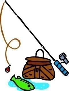
8 KWAKIUTL fisherman (economy) Canoe transportation
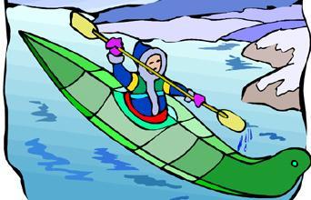
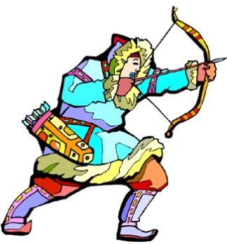
9 SIOUX/LAKOTA

")
10 SIOUX/LAKOTA Great Plains Dry grass land Buffalo (food) Teepee (homes)
11 SIOUX/LAKOTA


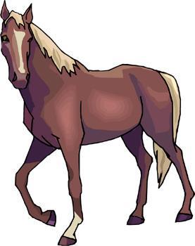
12 SIOUX/LAKOTA nomadic hunters (economy) Horses (transportation)
13 IROQUOIS


")
14 IROQUOIS Eastern Woodland Appalachian Mtn. Coastal Plain corn, beans, squash(3 sisters) deer wigwam/longhouse homes
15 IROQUOIS Family subgroup:


")
16 IROQUOIS Family splinter group: Seneca Cayuga Onondaga Oneida Mohawks Fur trading (occupation) Foot (transportation) heavily forested 4 seasons
17 INUIT


18 INUIT Canadian Shield Arctic Circle Alaska & Canada very cold/snow & ice Seal & whale (food) Igloo (homes)
19 INUIT
20 INUIT Hunting/fishing (economy) Dogsled & Kayak (transportation)
21 PUEBLO


")
22 PUEBLO Basin & Range southwest New Mexico/Arizona desert-hot/dry Corn=maize (food) pueblo/hogan (homes)
23 PUEBLO
24 PUEBLO Horse (transportation) Herdsmen, traders (economy)
25 AMERICAN INDIANS NATURAL RESOURCES
 ice/water")
26 AMERICAN INDIANS NATURAL RESOURCES forest (shelter) animal/animal skins (food & clothing) ice/water fish
27 BERINGIA
 into North")
28 BERINGIA Land bridge that allowed Asians to follow herds (migrate) into North America
29 COLORADO RIVER

30 COLORADO RIVER This river was explored by the Spanish & runs through the Grand Canyon
31 RIO GRANDE RIVER

32 RIO GRANDE RIVER Forms a border with Mexico
33 COLUMBIA RIVER
34 COLUMBIA RIVER Explored by Lewis & Clark
35 OHIO RIVER

36 OHIO RIVER Gateway to the west
37 MISSISSIPPI & MISSOURI RIVERS

38 MISSISSIPPI & MISSOURI RIVERS The transportation arteries for farm and industrial products. Links to ports and other parts of the world
39 GULF OF MEXICO Gulf of Mexico
40 GULF OF MEXICO Provided the French & Spanish with exploration routes to Mexico and parts of America

41 1-Lake Superior 2-Lake Huron 3-Lake Ontario 4-Lake Michigan 5-Lake Erie ATLANTIC & PACIFIC OCEANS Pacific Ocean 4 5 Atlantic Ocean

42 ATLANTIC & PACIFIC OCEANS Atlantic Ocean served as the highway for explorers, early settlers, & later immigrants
43
44 FACTS TO KNOW: America s waterways have been important for trade, transportation and settlement The location of the United States, with its Atlantic and Pacific Coasts, has provided access to other areas of the world

45 ST. LAWRENCE RIVER St. Lawrence River

46 ST. LAWRENCE RIVER Forms part of the NORTHEAST border with CANADA and connects the GREAT LAKES to the ATLANTIC OCEAN St. LAWRENCE RIVER CANADA U.S. ATLANTIC OCEAN


47 ST. LAWRENCE & HUDSON RIVERS Lake Huron Lake Superior St. Lawrence RiverLake Ontario Lake Michigan Hudson River Lake Erie GREAT LAKES

48 GREAT LAKES Inland port cities grew in the Midwest along the Great Lakes
49 COASTAL PLAIN
50 COASTAL PLAIN Location: along the Atlantic Ocean & Gulf of Mexico Physical Characteristics: broad lowland providing many excellent harbors
51 APPALACHIAN MOUNTAINS
52 APPALACHIAN MOUNTAINS Location: west of the Coastal Plain; extends from eastern Canada to western Alabama Physical Characteristics: old eroded mountains oldest mountain range in North America
53 CANADIAN SHIELD

54 CANADIAN SHIELD Location: wraps around the Hudson Bay in a horseshoe shape Characteristics: worn by erosion & hundreds of lakes carved by glaciers; some of the oldest rock formations in North America
55 INTERIOR LOWLANDS
56 INTERIOR LOWLANDS Location: west of the Appalachian Mountains & east of the Great Plains Characteristics: rolling flatlands with many rivers, broad river valleys, & grassy hills
57 GREAT PLAINS
58 GREAT PLAINS Location: west of the Interior Lowlands & east of the Rocky Mountains Characteristics: flat land that gradually increases in elevation as you go west; it has grasslands
59 ROCKY MOUNTAINS
60 ROCKY MOUNTAINS Location: west of the Great Plains & east of the Basin & Range Characteristics: rugged mountains stretching from Alaska to Mexico with high elevations; contains the Continental Dividewhich determines the flow of rivers

61 BASIN & RANGE ex. of basin
62 BASIN & RANGE Location: west of the Rocky Mtns., east of the Sierra Nevada Mtns., & the Cascade Mtns. Characteristics: an area of different elevations containing isolated mountain ranges and Death Valley, the lowest point in North America
63 COASTAL RANGE
64 COASTAL RANGE Location: rugged mountains located along the Pacific Coast that stretch from California to Canada Characteristics: contains many fertile valleys(land good for growing crops)

65 Name the 7 continents & 5 oceans A 1 2 B C D 6 A E 7

66 Arctic Ocean Pacific Ocean Atlantic Ocean Indian Ocean South Ocean
Unit 1: Geography. For additional information, refer to this website: 1 G e o g r a p h y
 Unit 1: Geography For additional information, refer to this website: http://mryoungtms.weebly.com/ 1 G e o g r a p h y Continents and Oceans SOL USI. 2a Essential Understanding: Continents are large land
Unit 1: Geography CLASS WEBSITE: QUIZLET GAMES: ONLINE RESOURCES
 Unit 1: Geography ONLINE RESOURCES CLASS WEBSITE: HTTPS://MRYOUNGTMS.WEEBLY.COM/GEOGRAPHY.HTML QUIZLET GAMES: HTTPS://QUIZLET.COM/JOIN/MSFYY94T5 1 G e o g r a p h y Continents and Oceans The Seven Continents
The United States & Canada. A Regional Study of Anglo America
 A Regional Study of Anglo America Landform Regions of the United States & Canada world leaders in agricultural and industrial production because of... VAST LANDS stretch from the Atlantic Ocean on the
discussion of North America s physical features, including its landforms and bodies of
 Chapter 7 Natural Environments of North America Chapter 7 focuses on the natural environments of North America. The chapter opens with a discussion of North America s physical features, including its landforms
EQ: Discuss main geographic landforms of the U.S. & Canada and examine varied landforms in relation to their lifestyles.
 EQ: Discuss main geographic landforms of the U.S. & Canada and examine varied landforms in relation to their lifestyles. Places & Terms for Discussion Appalachian Mountains Great Plains Canadian Shield
Physical Geography of the United States and Canada Chapter 5 A Land of Contrasts
 Physical Geography of the United States and Canada Chapter 5 A Land of Contrasts Land Area Together the U.S. and Canada cover more than 7 million square miles. In total area, Canada ranks 2 nd and the
Unit 2. United States Physical Geography
 Unit 2 United States Physical Geography Physical Geography U.S. extends from the Atlantic to Pacific U.S. is the 3rd largest country U.S. has fertile soils, vast forests, and variety of minerals All major
4th Grade Social Studies First Nine Weeks
 4th Grade Social Studies First Nine Weeks Multiple Choice Identify the choice that best completes the statement or answers the question. 1 Name the mountains that are located in the eastern United States.
U. S. History to 1865
 Social Studies Interactive Notebook U. S. History to 1865 First Nine Weeks Name: USI.2a The student will use maps, globes, photographs, pictures, or tables to a) locate the seven continents and five oceans
Grade 7 History Mr. Norton
 Grade 7 History Mr. Norton Section 1: Thinking Geographically Section 2: Land and Climates of the United States Section 3: The Tools of History Section 4: Economics and Other Social Sciences Grade 7 History
Grade Five Social Studies Assessment Regions/Native Americans
 Name Grade Five Social Studies Assessment Regions/Native Americans Use the map below to answer questions 1 and 2 1. (Geo 1) For this location give the name of the city found there. 38 N, 100 W a. Scottsbluff
CANADA S LANDFORM REGIONS
 CANADA S LANDFORM REGIONS Canada s Regions Canada is divided into Eight major regions. A Region is an area that is defined on the basis of the presence or absence of certain characteristics: Age of rock
CHAPTER 1. Geo Challenges 1A to 1D. & World Map Activity
 CHAPTER 1 Geo Challenges 1A to 1D & World Map Activity SELECT YOUR CHALLENGE World Map Activity Challenge 1A Challenge 1B Challenge 1C Challenge 1D Challenge 1A WS PG. 2 STEP #1 Label the largest continent
Chapter 6, Part Colonizers arriving in North America found extremely landscapes. It looked different to region showing great.
 Social Studies 9 Unit 1 Worksheet Chapter 6, Part 1. 1. Colonizers arriving in North America found extremely landscapes. It looked different to region showing great. 2. The Earth is years old and is composed
Life East of the Mississippi
 Life East of the Mississippi Physical Features ESSENTIAL QUESTION: How does geography influence the way people live? ~The United States can be divided into regions based on physical characteristics. Learning
North America ATLANTIC OCEAN PACIFIC OCEAN. The First Americans. Labrador Sea. Caribbean Sea. USI_ISN_U01_01.eps. Second Proof TCI19 65.
 G e o g r a p h y C h a l l e n g e North America 70 N 180 N 60 170 W 30 W 160 W 40 W Labrador Sea 150 W 50 N 50 W Hud s on B ay 140 W 40 N 60 W ATLANTIC OCEAN 30 N PACIFIC OCEAN Gulf of Mexico 20 N 130
Terms. divide headwaters tributary fall line fishery
 Chapter 5 Preview Section 1 The Land Objectives Identify some key similarities and differences in the physical geography of the United States and Canada. Explain why rivers have played such an important
COMMON CORE Lessons & Activities SAMPLE
 COMMON CORE essons & Activities SAMPE TEACH IT TODAY! About this Book This Common Core essons and Activities Book allows you to immediately meet new Common Core State Standards for English anguage Arts,
Guided Reading Activity
 Guided Reading Activity Lesson 1 Physical Features Essential Question: How does geography influence the way people live? A Vast Land Directions: Read the lesson and use your text to decide whether each
4th Grade U.S. Regional Geography
 4th Grade U.S. Regional Geography Multiple Choice Identify the choice that best completes the statement or answers the question. What does the term mainland mean in the sentence above? A the continent
Landforms in Canada. Canada is made up of three dis;nct types of landforms: Canadian Shield Highlands Lowlands
 Canada s Landforms What is a Landform? A landform is any physical feature of the Earth s surface having a characteris;c, recognizable shape, produced by natural causes. Landforms include major features
Terms to Know. divide headwaters tributary fall line fishery
 Chapter Objectives Describe the dominant landforms and natural resources of the United States and Canada. Discuss climate and vegetation in the United States and Canada. Section 1 The Land Section Objectives
Terrain Units PALEOGEOGRAPHY: LANDFORM CREATION. Present Geology of NYS. Detailed Geologic Map of NYS
 NYS TOPOGRAPHY Why so? PALEOGEOGRAPHY: LANDFORM CREATION Prof. Anthony Grande AFG 014 Present Geology of NYS Detailed Geologic Map of NYS Generalized Geology Detailed Geology Hot links to the fold out
Simple Solutions Social Studies Level 2. Level 2. Social Studies. Help Pages
 Level 2 Social Studies 147 148 adobe houses with bricks made of clay and straw ancestor a family member who lived before us appoint choose; leaders can appoint others barter trading one thing for another
Markville. CGC 1DL/PL Geography. Geography of Canada. Natural Environment Unit Test
 Markville CGC 1DL/PL Geography Geography of Canada Natural Environment Unit Test Name: Thinking /10 Knowledge /10 Application /10 Communication /10 Part A: Blanks (1 mark each) Thinking Choose the correct
Post Test Trimester 1 US & Canada 6th Grade-Study Guide
 Post Test Trimester 1 US & Canada 6th Grade-Study Guide Matching Fill in the blank by writing the letter of the correct term below. a. dominion f. indigenous b. Industrial Revolution g. interdependent
Physiographic Provinces (West, Ch. 13)
") Geology 229 Engineering Geology Lecture 13 Physiographic Provinces (West, Ch. 13) The definition of the term Physiography Physiography (n.) The science which treats of the earth's exterior physical features,
Geology 229 Engineering Geology Lecture 13 Physiographic Provinces (West, Ch. 13) The definition of the term Physiography Physiography (n.) The science which treats of the earth's exterior physical features,
MARS AREA SCHOOL DISTRICT CURRICULUM GRADE: Grade 4
 MARS AREA SCHOOL DISTRICT CURRICULUM GRADE: Grade 4 Course Title: Social Studies Brief Description Overview: Students will explore the history, geography, government, and economy of the United States with
Unit 1: Basics of Geography Test Review
 Name Date Period Unit 1: Basics of Geography Test Review Directions: Reading the following sections and complete the questions, charts, and diagrams. Types of Maps Maps that have a particular theme are
Topography of the conterminous United States
 Topography of the conterminous United States Potential Natural Vegetation Geology Coastal Ranges physiographic province Cascade-Sierra Mountains Cascades Mount Hood California central valley Sierra-Nevada
Landforms and Bodies of Water
 Chapter 5, Section 1 For use with textbook pages 115 120. The Land Terms to Know divide A high point or ridge that determines the direction that rivers flow (page 118) headwaters The source waters of a
[ 1.2 ] Texas Geography
![[ 1.2 ] Texas Geography](/thumbs/78/78091378.jpg "[ 1.2 ] Texas Geography") [ 1.2 ] Texas Geography [ 1.2 ] Texas Geography Learning Objectives Identify how geography helps people understand and organize information about a place. Compare the physical and human characteristics
[ 1.2 ] Texas Geography [ 1.2 ] Texas Geography Learning Objectives Identify how geography helps people understand and organize information about a place. Compare the physical and human characteristics
The Mississippi, Missouri, and Ohio Rivers
 The Mississippi, Missouri, and Ohio Rivers Mississippi River Mississippi River begins at Lake Itasca in northwest Minnesota and runs 2,320 miles to the Gulf of Mexico approx. 90 days for a drop of rain
KIPP: Inspire Academy Social Studies Benchmark 1 PART I. Use the map of Missouri to answer questions 7-9.
 PART I 1) A physical map key shows: A. Climate B. Cities and borders C. Elevation and water depth D. Geographic features Use the map of Missouri to answer questions 7-9. 2) Lines of latitude: A. Are parallel
2 Georgia: Its Heritage and Its Promise
 TERMS region, erosion, fault, elevation, Fall Line, aquifer, marsh, climate, weather, precipitation, drought, tornado, hurricane, wetland, estuary, barrier island, swamp PLACES Appalachian Mountains, Appalachian
PALEOGEOGRAPHY of NYS. Definitions GEOLOGIC PROCESSES. Faulting. Folding 9/6/2012. TOPOGRAPHIC RELIEF MAP of NYS GRADATIONAL TECTONIC
 TOPOGRAPHIC RELIEF MAP of NYS PALEOGEOGRAPHY of NYS Prof. Anthony Grande AFG 2012 Definitions GEOLOGIC PROCESSES Geography: study of people living on the surface of the earth. Geology: the scientific study
Tropical Moist Rainforest
 Tropical or Lowlatitude Climates: Controlled by equatorial tropical air masses Tropical Moist Rainforest Rainfall is heavy in all months - more than 250 cm. (100 in.). Common temperatures of 27 C (80 F)
MR. JOHNSON S. Geography OHIO COUNTY MIDDLE SCHOOL
 MR. JOHNSON S Geography OHIO COUNTY MIDDLE SCHOOL CHAPTER 1 Geography The science of geography is likely the oldest of all sciences. Geography is the answer to the question that the earliest humans asked,
GEOGRAPHY OF THE WEST
 GEOGRAPHY OF THE WEST ROCKIES TO THE PACIFIC The Rocky Mountains run through North America from north to south. They mark the end of the Midwest and the beginning of the West. MOUNTAINS AND MORE The Rocky
Five Themes of Geography Project Ms. Kiesel, Per 5. The United States of America
 Five Themes of Geography Project Ms. Kiesel, Per 5 The United States of America Location Absolute Location : The USA is located in the continent of North America in the northern and western hemispheres.
LANDFORM REGIONS IN CANADA. Classroom Notes and Descriptions
 LANDFORM REGIONS IN CANADA Classroom Notes and Descriptions Landform Regions in Canada There are eight distinct landforms in Canada: Western Cordillera Region Interior Plains Canadian Shield Hudson Bay
Introducing North America
 Introducing North America I. Quick Stats Includes U.S. & Canada U.S consists of 50 States Federal Government Democracy 4 th in world w/ land area 3 rd in population Economic leader of free world II. Major
4 th Grade Virginia Studies SOL Review Packet Geography of Virginia. 1. The Algonquian language group of Indians lived in what region of Virginia?
 4 th Grade Virginia Studies SOL Review Packet Geography of Virginia 1. The Algonquian language group of Indians lived in what region of Virginia? A. Allegheny B. Piedmont C. Ridge and Valley D. Tidewater
PHYSIOGRAPHIC REGIONS OF THE LOWER 48 UNITED STATES
 PHYSIOGRAPHIC REGIONS OF THE LOWER 48 UNITED STATES LAURENTIAN UPLAND 1. Superior Upland ATLANTIC PLAIN 2. Continental Shelf (not on map) 3. Coastal Plain a. Embayed section b. Sea Island section c. Floridian
Social Studies 9 UNIT 2 GEOGRAPHIC INFLUENCES ON IDENTITY: PLACE AND PEOPLE
 Social Studies 9 UNIT 2 GEOGRAPHIC INFLUENCES ON IDENTITY: PLACE AND PEOPLE The Structure of the Earth To understand the forces that create Canada's physical landscape we must understand the structure
Earth s Layers. Earth s Surface
 CHAPTER 1 LESSON 3 Earth s Layers Earth s Surface Key Concepts What are Earth s major landforms and how do they compare? What are the major landform regions of the United States? What do you think? Read
Acadia National Park, Maine
 Acadia National Park, Maine Monument Valley, Utah The Tongass National Forest in Southeastern Alaska, covering nearly 17 million acres, is the single largest national forest in America. Geography Handbook
Physical Geography. Ariel view of the Amazon Rainforest. A Look at the Seven Continents
 Physical Geography In this unit you will learn about general physical geography. The study of the Earth s surface features provides the setting for the human-environmental interactions and for the human
Chapter 1: America s Land Lesson 1: Land and Climate
 Chapter 1: America s Land Lesson 1: Land and Climate Geography: Describe landforms and other physical features of the United States. Geography: Explain how and why climate varies throughout the United
Massachusetts Curriculum Frameworks Science Grade: 4 - Adopted: 2016
 Main Criteria: Massachusetts Curriculum Frameworks Secondary Criteria: Subjects: Science, Social Studies Grade: 4 Correlation Options: Show Correlated Massachusetts Curriculum Frameworks Science Grade:
ELEMENTS OF BASIC WORLD GEOGRAPHY TABLE OF CONTENTS UNIT 1 THE BASICS OF GEOGRAPHY AND NORTH AMERICA
 TABLE OF CONTENTS UNIT 1 THE BASICS OF GEOGRAPHY AND NORTH AMERICA IMPORTANT WORDS TO KNOW... 1 CHAPTER 1 THE BASICS OF GEOGRAPHY GEOGRAPHY... 2 TOOLS OF GEOGRAPHY... 3 EARTH...4 SEASONS, CLIMATE, AND
World Geography Name This Country 4 th Grade
 World Geography Name This Country 4 th Grade West Brooke Curriculum By: Susan Adams & Jennifer Westbrook World Geography Name This Country 4 th Grade West Brooke Curriculum 2014 Written by: Susan Adams
Maps and Globes. By Kennedy s Korner
 Maps and Globes By Kennedy s Korner Map Key or Symbols Maps use symbols to show places and things on Earth. Symbols are drawings that stand for something real. A map key tells you what each symbol stands
Social Studies. Chapter 2 Canada s Physical Landscape
 Social Studies Chapter 2 Canada s Physical Landscape Introduction Canada s geography its landforms and climate - has a great impact on Canadians sense of identity. Planet Earth The earth is divided into
Table of Contents. French and Indian War Britain Gains Control... Britain Raises Revenue..18 Revolutionary Figures.19 20
 Table of Contents Section 1: Workbook Pages World Geography....2 Land and Water Features.... Geographical Regions.. Bodies of Water.... 6 American Indians.. 7 Early Exploration... 8 European Explorers..
Fig Major air masses of the world
 Fig. 9.3 Major air masses of the world CLASSIFICATION FOUR BASIC CATEGORIES OF AIR MASSES: POLAR - P ARCTIC - A TROPICAL - T EQUATORIAL - E TWO DESIGNATIONS OF SURFACE IN SOURCE REGION MARITIME - m. CONTINENTAL
AP Human Geography World Atlas Project
 AP Human Geography World Atlas Project - 2018 Welcome to Robert E. Lee High School and Advanced Placement Human Geography! You are going to thoroughly enjoy this class. It will be a lot of work, but the
HI SUMMER WORK
 HI-201 2018-2019 SUMMER WORK This packet belongs to: Dear Dual Enrollment Student, May 7 th, 2018 Dual Enrollment United States History is a challenging adventure. Though the year holds countless hours
All of Virginia's 4 main rivers flow into the... Chesapeake Bay. Along which river would Jamestown be found? James River. Appalachian Mountains
 All of Virginia's 4 main rivers flow into the... Along which river would Jamestown be found? The Blue Ridge Mountains and Valley and Ridge are part of what large mountain system? Define climate. Define
Alaska s Mount McKinley is the highest mountain in North
 1 1 Section Step-by-Step Instruction Objectives Social Studies 1. Learn where the are located. 2. Find out about the major landforms of the. 3. Explore major bodies of water that are important in the United
e Southeast Region of the United Statesg
 e Southeast of the United Statesg - relative location: the location of a place in relation to another place (i.e. south, near, bordering, next to) - barrier islands: located off the southeast coast of
Unit 1 Test - Version A
 Unit 1 Test - Version A 1. Approximately, how many degrees of longitude equal one time zone change? a. 5 b. 10 c. 15 d. 20 e. 25 2. The city of Lewisville has a population of 1,000 people living in 100
GEOGRAPHY OF CANADA 1. PHYSICAL GEOGRAPHY
 GEOGRAPHY OF CANADA 1. PHYSICAL GEOGRAPHY 1.1. CANADIAN SHIELD 1.2. VOLCANOES 1.3. WESTERN CORDILLERA 1.4. CANADIAN ARCTIC 1.5. CANADIAN INTERIOR PLAINS 1.6. GREAT LAKES AND ST LAWRENCE LOWLANDS 1.7. APPALACHIAN
REGIONS OF THE UNITED STATES
 REGIONS OF THE UNITED STATES Curriculum and Implementation Guide Grade 5 Social Sciences Dr. Edgar B. Hatrick Division Superintendent Ms. Sharon D. Ackerman Assistant Superintendent for Instruction Mr.
4th Grade US Regional Geography First Nine Weeks
 4th Grade US Regional Geography First Nine Weeks 2014-2015 Identify the choice that best completes the statement or answers the question. 1 The line identified as 0 runs west and east on the globe and
8th Geography Pre-Test
 Quiz Preview Go back Student's Name appears here Course Name appears here QuizStar 8th Geography Pre-Test Quiz Directions Choose the BEST answer for each question. Directions: 1. Answer the questions below
Grade 9 Social Studies Canadian Identity. Chapter 2 Review Canada s Physical Landscape
 Grade 9 Social Studies Canadian Identity Chapter 2 Review Canada s Physical Landscape Name: Unit 1: Empowerment Terms (notes or textbook) 1. Core 2. Crust 3. Mantle 4. Magma 5. Continental drift 6. Plate
Name: Political. Map of Canada. Map #1 - Locations to be labelled:
 5. Sketch in the west and east coast of the United States and label the U.S.A. 6. Label St. Pierre et Miquelon (France) 8. Colour the water blue and the United States green. Political maps are designed
Canadian Mapping Big Book
 Canadian Mapping Big Book Grades 4-6 Written by Lynda Golletz Illustrated by S&S Learning Materials About the Author: Lynda Golletz was an elementary school teacher for thirty-three years. She is the author
A. Geography Students know the location of places, geographic features, and patterns of the environment.
 Learning Targets Elementary Social Studies Grade 5 2014-2015 A. Geography Students know the location of places, geographic features, and patterns of the environment. A.5.1. A.5.2. A.5.3. A.5.4. Label North
Inter State Large Navigable Rivers of the United States
 Inter State Large Navigable Rivers of the United States REVIEW OF NORTH AMERICAN BASINS: GREAT LAKES AND MISSISSIPPI RIVER HELEN A. BROHL, EXECUTIVE DIRECTOR US COMMITTEE ON THE MARINE TRANSPORTATION SYSTEM
What is the largest country in the world? Russia
 What is the largest country in the world? #1 Russia CSCOPE 2007 2 Russia Dimensions #2-3 Spans 11 Time Zones From East to West: Gulf of Finland to Alaska From North to South: Above the Arctic Circle to
Introduction to Geography
 Introduction to Geography ropic of Cancer 3½ N Arctic Circle 90 N Prime Meridian 0 Arctic Ocean Mississippi R. Appalachian Mts. Europe Rocky Mountains N. America Atlantic Gulf of Ocean Mexico Caribbean
Complete Geography Overview: Year 1 to Year 6
 Option 1 Complete Geography Overview: Year 1 to Year 6 Autumn Term Spring Term Summer Term Year 1 Where do I live? Around the World The Four Seasons Year 2 At the Farm Let s go on Safari My World and Me
MAPPING THE EARTH HOW DO YOU FIND A LOCATION ON THE EARTH?
 MAPPING THE EARTH HOW DO YOU FIND A LOCATION ON THE EARTH? UNIT TOPICS TOPIC 1: LATITUDE & LONGITUDE TOPIC 2: FIELD MAPS TOPIC 3: TOPOGRAPHIC MAPS TOPIC 4: NYS LANDSCAPES TOPIC 1: LATITUDE & LONGITUDE
Name Date Class. a. High elevation and high relief b. High elevation and level surface c. Flat land and low relief
 Exploring Earth s Surface (pp. 21 27) This section describes factors that determine the shape of Earth s land surface. The section also describes how scientists divide Earth into four spheres. Use Target
Essential Questions What are the major physical components of the world, and how are they represented on a map? 3.4
 Third Grade Social Studies Unit One Six Weeks GEOGRAPHY Originally compiled by Russellville In order for students to understand that geography influences the development of a region as well as the interactions
Class Notes: Mapping the Earth
 Name: Date: Period: Mapping the Earth The Physical Setting: Earth Science Class Notes: Mapping the Earth I. Latitude and Longitude Map -! Latitude -! Also called These lines intersect Equator -! The North
Reference: climate data for Prince George and other locations at the back of this handout
 Name/Date: Socials 9 Unit 2: Cultures, Conflict, and Colonization in British North America 2A Physical Geography of Canada References: Cranny, M. (1998) Crossroads: A Meeting of Nations, Ch. 6 Canadian
Hello everybody! 1) Please read through each question carefully.
 Please read through each question carefully.") Hello everybody! Using the textbook that has been shared with you in Google please keep track of what you are learning here in this document. This is preparation for your tasks in The Amazing Race Canada,
Hello everybody! Using the textbook that has been shared with you in Google please keep track of what you are learning here in this document. This is preparation for your tasks in The Amazing Race Canada,
Chapter 1 Section 2. Land, Water, and Climate
 Chapter 1 Section 2 Land, Water, and Climate Vocabulary 1. Landforms- natural features of the Earth s land surface 2. Elevation- height above sea level 3. Relief- changes in height 4. Core- most inner
New National Curriculum Geography Skills Planning KS1
 New National Curriculum Geography Skills Planning KS1 Enquiry Question Objective-essential knowledge skills or understanding Locational Knowledge Standards /Success Criteria Lesson progression over half
Weathering and Soil Formation. Chapter 10
 Weathering and Soil Formation Chapter 10 Old and New Mountains The Appalachian Mountains appear very different from the Sierra Mountains. The Appalachians are smaller, rounded, gently sloping, and covered
World Geography. BY MARK STANGE and REBECCA LARATTA
 BY MARK STANGE and REBECCA LARATTA COPYRIGHT 2002 Mark Twain Media, Inc. ISBN 1-58037-205-8 Printing No. CD-1551 Mark Twain Media, Inc., Publishers Distributed by Carson-Dellosa Publishing Company, Inc.
Monday September 11, 2017
 Monday September 11, 2017 Need: 9/11 Interview Paper Agenda: Good things Warm Up: Video and Reflection Circles Sharing Interview Stories Discussion Questions Whole group sharing Summarizer: Living in a
Landform Regions of Canada
 Landform Regions of Canada The movement of the earth s plates, and the resulting folding, faulting, and volcanic activity, have combined with the forces of erosion and weathering to create a variety of
Changes in Texas Ecoregions
 Comment On Lesson Changes in Texas Ecoregions The state of Texas can be divided into 10 distinct areas based on unique combinations of vegetation, topography, landforms, wildlife, soil, rock, climate,
Did You Ever Wonder? Landforms, C52. Slow Changes on Land, C58. Fast Changes on Land, C68
 \ - i -Vt1 t _ 9 \ "» y \R Landforms, C52 Slow Changes on Land, C58 Fast Changes on Land, C68 w -4 Did You Ever Wonder? What forces shaped these rocks? Wind and rain shaped them over thousands of years.
What is a landform? These shapes (except for bodies of water) on the earth s surface are all examples of landforms.
 on the earth s surface are all examples of landforms.") Landforms What is a landform? These shapes (except for bodies of water) on the earth s surface are all examples of landforms. archipelago a large group of many islands. The Hawaiian Islands Lighthouse
Landforms What is a landform? These shapes (except for bodies of water) on the earth s surface are all examples of landforms. archipelago a large group of many islands. The Hawaiian Islands Lighthouse
Natural Texas. Regions and Climates
 Natural Texas Regions and Climates Two Kinds: Physical geography Climate, vegetation, rivers, lakes, oceans, plateaus, plains, and mountain ranges Human geography Economic activities How we earn a living
Erik Kabela and Greg Carbone, Department of Geography, University of South Carolina
 Downscaling climate change information for water resources Erik Kabela and Greg Carbone, Department of Geography, University of South Carolina As decision makers evaluate future water resources, they often
Factors Affecting Human Settlement
 Factors Affecting Human Settlement Physical Factors One of the most basic factors affecting settlement patterns is the physical geography of the land. Climate is key, because if a place is too dry, too
Name Date Class. well as the inland, found near the Tropics. 4. In the, or the regions near the Equator, you may find a lush
 WATER, CLIMATE, AND VEGETATION Vocabulary Activity DIRECTIONS: Fill in the Blanks Select a term from below to complete each of the following sentences. CHAPTER 1. The constant movement of water, a process
Unit 1 Physical Setting
 Unit 1 Physical Setting Chapter 1: Finding Your Way Chapter 2: Our Natural Environment Chapter 3: The Changing Weather Chapter 4: A Place To Live Chapter 1: Finding Our Way Key Terms Lines of Latitude
The First Americans. How did the first Americans adapt to their environment?
 The First Americans I N T E R A C T I V E S T U D E N T N O T E B O O K How did the first Americans adapt to their environment? P R E V I E W Carefully examine the photograph of a Canadian forest. Imagine
Continental Landscapes
 Continental Landscapes Landscape influenced by tectonics, climate & differential weathering Most landforms developed within the last 2 million years System moves toward an equilibrium Continental Landscapes
Geography and the Early Settlement of China
 Geography and the Early Settlement of I N T E R A C T I V E S T U D E N T N O T E B O O K How did geography affect life in ancient? P R E V I E W Physical Features 1. Circle the physical features that
5th social studies geography (5thsocstud_geography)
") Name: Date: 1. Many of the Native Americans who lived on the Great Plains were nomadic people. Why did they move from place to place? A. They were finding new areas to mine. B. They were looking for fertile
Name: Date: 1. Many of the Native Americans who lived on the Great Plains were nomadic people. Why did they move from place to place? A. They were finding new areas to mine. B. They were looking for fertile
L.O Students will learn about factors that influences the environment
 Name L.O Students will learn about factors that influences the environment Date 1. At the present time, glaciers occur mostly in areas of A) high latitude or high altitude B) low latitude or low altitude
Earth processes are dynamic actions that occur both on
 29 Weathering, Erosion, and Deposition R EA D I N G Earth processes are dynamic actions that occur both on the earth s surface and inside the earth. Any process that breaks down earth material, such as