APÉNDICE F. Evaluación Geotécnica
|
|
|
- Jerome Logan
- 6 years ago
- Views:
Transcription
1 APÉNDICE F Evaluación Geotécnica
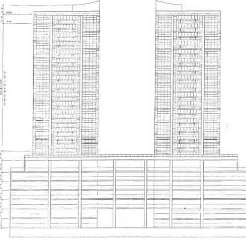
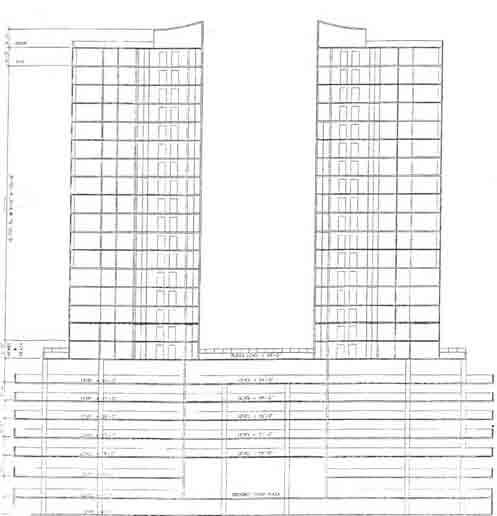
2 REPORT ON GEOTECHNICAL INVESTIGATION FOR PROPOSED LAGUNA DEL MAR PLAZA PROJECT ASHFORD AVE. SAN JUAN, PUERTO RICO GUTIERREZ - LATIMER - C.S.P. MR. ROBERTO CACHO I LAGUNA DEL MAR PRINCESS, INC. BY METROPOLITAN SOILS AND ENGINEERING MATERIALS LABORATORY, INC. MAY, 2004 A. INTRODUCTION: This is our report on a geotechnical investigation performed for the design of the foundations for the proposed Laguna del Mar Plaza project at Ashford Ave., Condado, San Juan, Puerto Rico. The project site, presently being operated as a parking lot for some 200 cars, is bounded north by Ashford Ave., south by the Laguna del Condado, and east by the multi-story Astor Condado Apartment Building. The proposed Laguna del Mar Plaza project shall consist of eight (8) levels of Parking [Levels -9'-0", + 0'-0", + 9'-0", +18'-0" + 27'-0", + 36'-0", + 45'-0" and + 54'-0"], a Plaza Level [Level + 66'-0"], and twin, separate, 16-floors-each Apartment Towers rising above Plaza Level. The 8 levels of Parking (and the Plaza Level) shall cover practically the entire lot's dimensions. The Apartment Towers shall each be some 65 feet wide by 110 feet deep, separated at the center of the lot some 65 feet.
3 OCEANO DEL CONDADO AGUNA
4
5
6 The soil exploration performed consisted of the ten (10) soil borings shown on the enclosed plan at the Appendix. Subsurface exploration data and results of laboratory tests reveal soil conditions and properties strictly at the borehole locations and over the borehole depths. The present lot downslopes significantly (an ESTIMATED 2.5 to 3 meters) toward the Laguna del Condado. The work performed was requested and authorized by Architect Enrique H. Gutiérrez i n behalf of Mr. Roberto Cacho 1 Laguna del Mar Princess, Inc. B. FIELD EXPLORATION : Field exploration Laboratory, Inc. was made by Metropolitan Soils and Engineering Materials The method of drilling through overburden was generally by power-advanced continuous-flight augers. [Overburden refers to any unconsolidated soil material lying above bedrock (including both natural soil formations and/or man-made fill) that can be drilled without resorting to rotary drilling with diamond bits.] The method of drilling through rock, if performed, and including rubble, concrete, stones, cobbles, boulders, etc. which could not be broken up nor displaced, was by diamond-bit rotary drilling [rock coring]. The method of sampling overburden was split-spoon drive. The individual samples were obtained by driving a 2-in. O.D. special split-barrel sampling spoon into material which has not been disturbed by the immediately preceding drilling operation. The method of sampling rock [bedrock, detached sections of rock, or large boulders into or through which core boring is necessary], if performed, was by continuous core-boring with a diamond core bit and a double-tube core barrel.
7 The Standard Penetration Test was performed in every split spoon sampling i ncident to estimate the in-situ density of granular [coarse-grained] soil materials and the consistency of fine-grained clayey soils. A 140-pound drop hammer, free-falling 30 inches, is utilized to drive the split-barrel sampler 12 inches and the corresponding number of blows recorded and annotated as the blow count or N-value. C. LABORATORY TESTS : Moisture content and unconfined compression routine tests were performed on the recovered split-spoon drive samples whenever possible. Special Atterberg limits, classification, unit weight, specific gravity of solids, unconfined compression [ Shelby-tube samples] and grain size and gradation distribution tests may have been performed to determine, estimate or correlate pertinent engineering properties to the type of project under consideration. D. GROUNDWATER LEVELS : The depth to groundwater, if groundwater was indeed observed at the location of the boring, has been shown on the log of the boring. Unless otherwise modified, the noted depth refers to the measured depth when first observed by the driller/logger while drilling and/or sampling at the particular boring location. I n particularly i mpermeable strata more reliable methods [like observation wells] should be adopted to measure the depth to the water level over a considerable length of time. The use of water during drilling, the use of casing, the penetration of strata of vastly different permeability, the occurrence of perched water, and the limited time
8 available for observation all contribute to the difficulty of obtaining reliable groundwater data during the time span of the actual field exploration. E. GENERAL GEOLOGY : The Geologic Map of the San Juan Quadrangle, Puerto Rico, by Pease, Jr. and Monroe, 1977, maps the project site in map unit Qb, Beach Deposits, described as: "Sand composed of grains of quartz, volcanic rock, and shell. Mostly quartz sand east of Punta Las Marías, predominantly shell sand elsewhere, beachrock common west of Punta Las Marías". F. SOIL CONDITIONS AND PROPERTIES : The 2 enclosed color profiles represent our own best interpretation of the disclosed existing soil conditions and properties east to west toward Ashford Ave., and the same toward the Condado Lagoon. The uppermost say 10 ft include sand-rock fragments-concrete fragments FILL, peat and peaty sand (toward the lagoon), and loose or low medium-dense beach sand. Below, and to a depth of 30+ ft Boring 8), in-situ soil is generally medium dense fine-and-medium- rained poorly graded uniforml graded) BEACH SAND with trace to little fines. At said depth of 30-plus ft a +/-10.5 ft-thick (except Boring 4 very stiff cla sand cla and sand silty cla stratum occurs which interrupts the continui deposit. of the BEACH SAND littoral
9 METROPOLITAN SOILS, Job: Laguna del MAr Projecto Geotechnical Consultants Date- May ' Américo Miranda Scale: 1"= 10' O" vertical Rio Piedras, Puerto Rico Pg. 1 of
10 La METROPOLITAN SOILS, Geotechnical Consultants Date: 1213 Americo Miranda " Scale: Rio Piedras, Puerto Rico Pg. I _ of
11 Apartment Building toward the southeast has a Basement Parking Level.] I nitial groundwater level readings recorded at 2 installed observation wells, 1 front, 1 rear, these after completing all 10 borings, were: Front (Ashford side) Rear (Lagoon side) -8'-3" -1'-8" Foundation for the proposed Laguna del Mar Plaza project is recommended on large diameter bored piles. Underneath the footprint of the 2 65' x 110' Apartment Towers we recommend using 36" bored piles, each with a design capacity of an estimated 365 tons in compression. We assume that 3 of these 36" piles shall be required per support point underneath the 2 Towers. Pile to pile spacing within i ndividual support points shall be 2.5 diameters minimum. Moving away from the 2 Tower footprints, and into the 8-story Parking Level areas, foundation is recommended on 24" to 32"a bored piles, each of length as above. pile. Allowable bored pile loads in compression are ESTIMATED in 215 tons er At least 3 load tests shall be performed for the project, 2 for the Tower piles and 1 for the Parking piles. day. We estimate that at least 4 bored piles can be completed within one working Because of the denseness of the fine-and-medium-grained beach sand, with generally only lesser amounts of fines, we do not believe that liquefaction shall be an i ssue in this particular project.

12 Also, because of the "intruding" upper clay stratum which effectively interrupts the otherwise deep sand stratum, we rule out vibroflotation as a cost-effective foundation solution. Heraclio A. Amadeo Lopategui
13 TABLE I DESCRIPTIVE TERMINOLOGY SOIL IDE NTIFICATION SYSTEM COHESIVE SOILS Descriptive Term Plasticit y I ndex SILT, trace clay, or ORGANIC SILT, trace clay 1-5 Clayey SILT, or ORGANIC clayey SILT 5-20 Silty CLAY, or ORGANIC silty CLAY CLAY or ORGANIC CLAY 40 plus GRANULAR SOILS Descriptive Term Per Cent b y Wt. trace 0-10 little some and 35-50
14 TABLE 11 DESCRIPTIVE TERMINOLOGY CONSISTENCY OF COHESIVE SOILS AND RELATIVE DENSITY OF GRANULAR SOILS COHESIVE SOILS N - Blows 1 Ft. (*) Unconfined Compressive Strenqth _See_ Terzaqhi & Peck Consistenc (T.S.F.) Less than 2 Very soft soft medium stiff very stiff more than 30 hard GRANULAR N - Blows 1 Ft. Relative Density 0-4 very loose 4-10 loose medium dense Over 50 very dense (*) Blows per foot on a 1-318" I. D. - 2" O. D. split spoon sampler driven by a 140 lbs. hammer with a free fall of 30 in.
15 APPENDIX

16 METROPOLITAN SOILS & ENGINEERING MATERIALS LABORATORY, INC. SUBSURFACE EXPLORATION LOG BORINGNO.-
17 METROPOLITAN SOILS & ENGINEERING MATERIALS LABORATORY, INC. SUBSURFACE EXPLORATION LOG JOB NO BORING NO. Sheet 2 of
18 .. UKT, INC. SUBSURFACE EXPLORATION LOG BORNGNO_- 2 JOB NO LOCATION CONDADO, SAMPLE HAMMER: Wt SAMPLER TYPE AND SIZE Sheet _ JOB TITLE LAGUNA DEL MAR P. R. DATE REF, ELEV DATUM LBS. DROP 30" CASING HAMMER: WT DROP 2" O.D. SPLIT SPOON Casin Size Augers
19 METROPOLITAN SOILS & ENGINEERING MATERIALS LABORATORY, INC. SUBSURFACE EXPLORATION LOG JOB NO BORING NO. Sheet 2 of-- 2
20 IN(; SUBSURFACE EX Exploration LOG BORING NO.- 3 Job No JOB TITLE LAGUNA DEL MAR LOCATION CONDADO, P.R. DATE SAMPLE REF ELEV.- HAMMER: WT. 140 LBS. DROP 30" CASING HAMMER: WT.SAMPLER TYPE ANDSIZE 2" O.D. SPLIT SPOON DATUM DROP - Casing Size Augers 7,10, a
21 METROPOLITAN SOILS & ENGINEERING MATERIALS LABORATORY, INC. SUBSURFACE EXPLORATION LOG 2898 BORING NO. 3 Job No Sheet 2 of 2

22 JOB NO LOCATION CONDADO, P.R. SAMPLE HAMMER: WT SAMPLER TYPE AND SIZE SUBSURFACE EXPLORATION LOG Boring No. 140 LBS. JOB TITLE LAGUNA DEL MAR Sheet 1.. of 2 - DATE REF. ELEV DATUM --- DROP 30 " CASING HAMMER: WT. DROP CASING SIZE AUGERS
23 METROPOLITAN SOILS & ENGINEERING MATERIALS LABORATORY, INC_ SUBSURFACE EXPLORATION LOG JOB NO BORING NO. Sheet o f
24 su s R F AC EXPL0RAT 1 IN' L JOB NO, 2898 Job TITLE LAGUNA DEL MAR PLAZA LOCATION CONDADO, P. R. Date RIF.ELEV. Sample HAMMER: WT. 140 LBS. DROP 30 Casing HAMMER: WT Sampler TYPE AND SIZE 2" O.D. SPL T T SPOON DATUM DROP Size AUGERS
25 METROPOLC'MN SSMLS & ENGINEERING MATERIALS LAUO R ATOéiv, I C SUBSURFACE EXPLORATION LO JOB NO _ Boring NO. Sheet 2 of 2
26 Subsurface XPLORATION LOG Boring neet- 1 of 2 JOB NO JOB TITLE LAG UNA DEL MAR PLAZA Location CONDADO, P. R. DATE Sample Hammer WT 140 LBS. DROP 30 CASING Hammer WT DROP_ SAMPLER TYPE AND SIZE 2" O.D. SPLIT S POON Casing Size AUGERS
27 METROPOLITAN Soils & ENGINEERING MATERIALS Lab Ratory INC.. SUBSURFACE Exploration Log JOB NO BORING NJ. ` 7 _ Sheet 2 of 2 END OF BORING 80_0'
28 SUBSURFACE EXPLORATION LOG BORINGNO Sheet - JOB NO. JOB TITLE CONDADO DEL MAR PLAZA Location. CONDADO, P. R. DATE REF. ELEV --- DATUM SAMPLE HAMMER: WT 140 LBS. DROP 30 " CASING HAMMER: WT. --- DROP_ SAMPLER TYPE AND SIZE 2 " O.D. SPLIT SPOON CASING SIZE - INC. 8. of. 2 AUGERS Description of Material
29 METROPOLITAN \SOILS & ENGINEERING MATERIALS LABORATORY, INC. SUBSURFACE EXPLORATION LOG JOB NO BORING NO. 8 Sheet 2 of 2
30 SUBSURFACE EXPLORATION LOG BORING NO.- 9 Sheet - of 2 JOB N JOB TITLE LAGUNA DEL MAR 1 LOCATION CONDADO, P. R. DATE REF. ELEV.. DATUM SAMPLE HAMMER: WT 1 40 LES. DROP 30" CASING HAMMER: WT. --- DROP ---- SAMPLER TYPE And SIZE 2 " O.D. SPLIT SPOON CASING SIZE AUGERS

31 JOB NO. METROPOLITAN SOILS $e ENGINEERING MATERIALS LABORATORY, INC. SUBSURFACE EXPLORATION LOG 2898 BORING NO. Sheet of 2
32 MATERIALS LABORATORY, I NC. SBSURFACE EXPLORATION LOG BORINGNO, 1.0 Sheet J0B NO. of 2 L AGUNA DEL MAR PLAZA JOB TITLE CONDADO, P.R. LOCATION DATE REP ELEV. DATUM SAMPLE HAMMER: WT 140 LBS. D ROP 30" CASING HAMMER: WT DROP SAMPLER TYPE AND SIZE 2 O.D. SPLIT SPOON CASING SIZE AUGERS
33 METROPOLITAN SOILS & ENGINEERING MATERIALS LABORATORY, INC. SUBSURFACE EXPLORATION LOG JOB NO BORING NO. _ 10 Sheet 2_0f END OF BORING 80_0'
34 A, 236 f L
35 GRAIN SIZE DISTRIBUTION TESTS

36 % COBBLES m 7 % GRAVEL _ % SAND %SILT I % CL=AY AASHTO PL 97.8 SP SIEVE PERCENT FINER SIEVE PERCENT FINER SOIL DESCRIPTION inches number size sae O O Fine & medium-grained BEACH SAND, trace fines. # # # # # # # # GRAIN SIZE REMARKS: D D D REUNION COEFFICIENTS o Location: BORING #9 METROPOLITAN SOILS Client: GUTIERREZ-LATIMER C.S.P. AND ENGINEERING MATERIALS LABORATORY, INC. Project: Project No.: LAGUNA DEL MAR PROJECT CONDADO Figure

37 %COBBLES % GRAVEL % SAND % SILT % CLAY USCS AASHTO PL LL O 96.9 SP 95.8 SP 75.5 SM SIEVE PERCENT FINER SIEVE PERCENT FINER SOIL DESCRIPTION inches O Cl A number O A size O Fine & medium-grained BEACH SAND, trace size silt. # # [1 Fine & medium-grained BEACH SAND, trace # fines_ # # # Fine-gained silty SAND, some 114 medium- # gained. GRAIN SIZE D D D COEFFICIENTS O Location: BORING #10 Location: BORING #10 Location: BORING #10 METROPOLITAN SOILS Client: GUTIERREZ-LATIMER C.S.P. Project: AND ENGINEERING LAGUNA DELMARPROJECT CONDADO REMARKS: MATERIALS LABORATORY, INC. Project No.: Fi ire

38 O COBBLES % GRAVEL % SAND % SILT % CLAY USCS AASHTO PL LL SM SIEVE PERCENT FINER SIEVE PERCENT FINER SOIL DESCRIPTION inches 0 number O O Medium-grained BEACH SAND, about 40% size fine-grained, trace fines. # # #40 0 Fine & medium-grained silty BEACH SAND, # # # # GRAIN SIZE REMARKS: D D D Cc 0.95 C u 3.11 o Location: BORING #5 0 Location: BORING #5 COEFFICIENTS METROPOLITAN SOILS AND ENGINEERING Client: GUTIERREZ-LATIMER C.S.P. Project: LAGUNA DEL MAR PROJECT CONDADO MATERIALS LABORATORY, INC. Pro'ectNo.: Fi ure

39 GOBBLES % GRAVEL % SAND % SILT % CLAY USCS AASHTO PL LL a 96.7 SP 93.5 SP-5M s inches size SIEVE PERCENT FINER SIEVE PERCENT FINER SOIL DESCRIPTION O 0 n umber O O Medium-grained BEACH SAND, about 1/3 fine-grained, rock fragments # upper 6.5 feet. # # p Fine & medium-grained BEACH SAND, little 96.4 # fines. # # # # GRAIN SIZE REMARKS: D ,528 0 D D COEFFICIENTS L Cc ,95 [ Cu Location: BORING #6 Location: BORING #6 METROPOLITAN SOILS Client: GUTIERREZ-LATIMER C.S.P. AND ENGINEERING Project: LAGUNA DELMARPROJECT MATERIALS LABORATORY, INC. CONDADO Project No.: Figure

40 COBBLES % GRAVEL % SAND % SILT % CLAY USCS AASHTO PL SP SP-SM SIEVE PERCENT FINER SIEVE PERCENT FINER SOIL DESCRIPTION inches O number O size O Medium-grained BEACH SAND, some fine- size grained, trace fines. # # #40 Fine-grained SAND, little fines # # # $ p Fine & medium-grained BEACH SAND, little # fines. GRAIN SIZE D COEFFICIENTS C c CU 3, Location: BORING #7 o Location: BORING #7 Location: BORING #7 METROPOLITAN SOILS Client: GUTIERREZ-LATIMERC.S.P. REMARKS: AND ENGINEERING Project: LAGUNA DEL MAR PROJECT CONDADO MATERIALS LABORATORY, INC. Pro'ect No.: Fi ure

41 D60 PARTICLE SIZE DISTRIBUTION TEST REPORT ! z z w 0 W a GRAIN SIZE - mm O O COBBLES % GRAVEL % SAND % SILT % CLAY USCS AASHTO PL LL SP 0 SP-SM SIEVE PERCENT FINER SIEVE PERCENT FINER SOIL DESCRIPTION inches size O number size O p p 0 Dark brown, v ery slightly organic, mostly fine- SAND, # #10 about 113 medium-grained # p Fine & medium-grained, poorly graded, # BEACH SAND; mostly brown & dark brown. # # A Medium-grained BEACH SAND, about 113 # fine-grained, some silt. # GRAIN SIZE REMARKS: D D c c 1.11 ~ o Location: BORING #8 Location: BORING #8 4 Location: BORING #8 COEFFICIENTS C u METROPOLITAN SOILS AND ENGINEERING MATERIALS LABORATORY, INC. Client: Project: Proiect No.: GUTIERREZ-LATIMER C.S.P. LAGUNA DEL MAR PROJECT CONDADO Figure
42 APÉNDICE G Estudio de Recursos Culturales Fase IA y IB
43
44
45
46
47
48
49
50
51
52
53
54
55
56
57
58
59
60
61
62
63
64
65
66

67
68
69
70
71
72
73
74
75
76
77
78
79
80
81
82
83
84
85
86
87
88
89
90
91
92
93

94
95
96
97
98
99
100
101
B-1 BORE LOCATION PLAN. EXHIBIT Drawn By: 115G BROOKS VETERINARY CLINIC CITY BASE LANDING AND GOLIAD ROAD SAN ANTONIO, TEXAS.
 N B-1 SYMBOLS: Exploratory Boring Location Project Mngr: BORE LOCATION PLAN Project No. GK EXHIBIT Drawn By: 115G1063.02 GK Scale: Checked By: 1045 Central Parkway North, Suite 103 San Antonio, Texas 78232
 SOIL CLASSIFICATION CHART COARSE-GRAINED SOILS MORE THAN 50% RETAINED ON NO.200 SIEVE FINE-GRAINED SOILS 50% OR MORE PASSES THE NO.200 SIEVE PRIMARY DIVISIONS GRAVELS MORE THAN 50% OF COARSE FRACTION RETAINED
 Photo 1 - Southerly view across 2700 parking lot toward existing building. Multi-residential building borders western side of property in upper right of view. Photo 2 - Southerly view across 2750 parking
Depth (ft) USCS Soil Description TOPSOIL & FOREST DUFF
 USCS Soil Description TOPSOIL & FOREST DUFF") Test Pit No. TP-6 Location: Latitude 47.543003, Longitude -121.980441 Approximate Ground Surface Elevation: 1,132 feet Depth (ft) USCS Soil Description 0 1.5 1.5 5.0 SM 5.0 8.0 SM Loose to medium dense,
Test Pit No. TP-6 Location: Latitude 47.543003, Longitude -121.980441 Approximate Ground Surface Elevation: 1,132 feet Depth (ft) USCS Soil Description 0 1.5 1.5 5.0 SM 5.0 8.0 SM Loose to medium dense,
 Project: ITHACA-TOMPKINS REGIONAL AIRPORT EXPANSION Project Location: ITHACA, NY Project Number: 218-34 Key to Soil Symbols and Terms TERMS DESCRIBING CONSISTENCY OR CONDITION COARSE-GRAINED SOILS (major
Geotechnical Engineering Report
 Geotechnical Engineering Report Turner Turnpike Widening Bridge B Bridge Crossing: South 257 th West Avenue Creek County, Oklahoma June 1, 2016 Terracon Project No. 04155197 Prepared for: Garver, LLC Tulsa,
Chapter 12 Subsurface Exploration
 Page 12 1 Chapter 12 Subsurface Exploration 1. The process of identifying the layers of deposits that underlie a proposed structure and their physical characteristics is generally referred to as (a) subsurface
Civil Engineering, Surveying and Environmental Consulting WASP0059.ltr.JLS.Mich Ave Bridge Geotech.docx
 2365 Haggerty Road South * Canton, Michigan 48188 P: 734-397-3100 * F: 734-397-3131 * www.manniksmithgroup.com August 29, 2012 Mr. Richard Kent Washtenaw County Parks and Recreation Commission 2330 Platt
Boreholes. Implementation. Boring. Boreholes may be excavated by one of these methods: 1. Auger Boring 2. Wash Boring 3.
 Implementation Boreholes 1. Auger Boring 2. Wash Boring 3. Rotary Drilling Boring Boreholes may be excavated by one of these methods: 4. Percussion Drilling The right choice of method depends on: Ground
DATA REPORT GEOTECHNICAL INVESTIGATION GALVESTON CRUISE TERMINAL 2 GALVESTON, TEXAS
 DATA REPORT GEOTECHNICAL INVESTIGATION GALVESTON CRUISE TERMINAL 2 GALVESTON, TEXAS SUBMITTED TO PORT OF GALVESTON 123 ROSENBERG AVENUE, 8TH FLOOR GALVESTON, TEXAS 77553 BY HVJ ASSOCIATES, INC. HOUSTON,
ENGINEERING ASSOCIATES
 July 16, 211 Vista Design, Inc. 11634 Worcester Highway Showell, Maryland 21862 Attention: Reference: Dear Mr. Polk: Mr. Richard F. Polk, P.E. Geotechnical Engineering Report Charles County RFP No. 11-9
Geotechnical Engineering Report
 Geotechnical Engineering Report Turner Turnpike Widening Polecat Creek Bridge (Bridge A) June 1, 2016 Terracon Project No. 04155197 Prepared for: Garver, LLC Prepared by: Terracon Consultants, Inc. TABLE
GEOTECHNICAL REPORT. Matanuska-Susitna Borough. Parks Highway Connections Museum Drive. Matanuska-Susitna Borough, Alaska.
 Matanuska-Susitna Borough GEOTECHNICAL REPORT Parks Highway Connections Museum Drive Matanuska-Susitna Borough, Alaska March 2, 20 Prepared By: John Thornley, PE Geotechnical Engineer 333 Arctic Blvd.,
APPENDIX C HYDROGEOLOGIC INVESTIGATION
 Figure B-5.7 Figure B-5.8 Preliminary Geotechnical and Environmental Report Appendix C Hydrogeologic Investigation APPENDIX C HYDROGEOLOGIC INVESTIGATION December 21, 2011 WESTSIDE SUBWAY EXTENSION PROJECT
Preliminary Geotechnical Investigation Cadiz / Trigg County I-24 Business Park. Cadiz, Kentucky
 Environmental & Geoscience, LLC 834 Madisonville Road Hopkinsville, KY 440 70.44.000 FAX 70.44.8300 www.wedrill.com A member of Trinity Energy & Infrastructure Group, LLC Preliminary Geotechnical Investigation
Appendix G GEOLOGICAL INVESTIGATION
 Appendix G GEOLOGICAL INVESTIGATION JOB NUMBER: 3268.001 DATE: 10-14-13 BY: CC SITE 0 2000 1"=2000' VICINITY MAP CARGILL PARCEL HICKORY STREET AND ENTERPRISE DRIVE NEWARK, CALIFORNIA FOR
Field Exploration. March 31, J-U-B ENGINEERS, Inc. 115 Northstar Avenue Twin Falls, Idaho Attn: Mr. Tracy Ahrens, P. E. E:
 March 31, 201 11 Northstar Avenue 83301 Attn: Mr. Tracy Ahrens, P. E. E: taa@jub.com Re: Geotechnical Data Report Preliminary Phase 1 Field Exploration Revision No. 1 Proposed Rapid Infiltration Basin
Geotechnical Data Report
 Geotechnical Data Report Downtown Greenville Future Conveyance Study December 1, 2015 Terracon Project No. 86155032 Prepared for: Prepared by: Terracon Consultants, Inc. December 1, 2015 561 Mauldin Road
Geotechnical Data Report
 Geotechnical Data Report ReWa Solar Farm at Durbin Creek Fountain Inn, South Carolina September 1, 2017 Terracon Project No. 86165043 Prepared for: Renewable Water Resources Greenville, South Carolina
SITE INVESTIGATION 1
 SITE INVESTIGATION 1 Definition The process of determining the layers of natural soil deposits that will underlie a proposed structure and their physical properties is generally referred to as site investigation.
ATTACHMENT A PRELIMINARY GEOTECHNICAL SUMMARY
 ATTACHMENT A PRELIMINARY GEOTECHNICAL SUMMARY Kevin M. Martin, P.E. KMM Geotechnical Consultants, LLC 7 Marshall Road Hampstead, NH 0384 603-489-6 (p)/ 603-489-8 (f)/78-78-4084(m) kevinmartinpe@aol.com
Limited Geotechnical Engineering Evaluation Classroom Additions Albany County Campus Laramie, Wyoming
 Limited Geotechnical Engineering Evaluation Classroom Additions Albany County Campus 2300 Missile Drive, Cheyenne, Wyoming 82001 Phone 307-635-0222 www.stratageotech.com Limited Geotechnical Engineering
GEOTECHNICAL INVESTIGATION REPORT
 GEOTECHNICAL INVESTIGATION REPORT SOIL INVESTIGATION REPORT FOR STATIC TEST FACILITY FOR PROPELLANTS AT BDL, IBRAHIMPATNAM. Graphics Designers, M/s Architecture & Engineering 859, Banjara Avenue, Consultancy
Geotechnical Engineering Report
 Geotechnical Engineering Report Turner Turnpike Widening Bridge D Bridge Crossing: South 209 th West Avenue Creek County, Oklahoma June 1, 2016 Terracon Project No. 04155197 Prepared for: Garver, LLC Tulsa,
The attitude he maintains in his relation to the engineer is very well stated in his own words:
 Su bsurface Soil Exploration, 53: 139 Foundation Engineering Geotechnical companies that have a history of experience in a given region usually have extensive boring logs and maps telling where the borings
M E M O R A N D U M. Mr. Jonathan K. Thrasher, P.E., Mr. Ian Kinnear, P.E. (FL) PSI
 PSI") M E M O R A N D U M TO: FROM: Mr. Mark Schilling Gulf Interstate Engineering Mr. Jonathan K. Thrasher, P.E., Mr. Ian Kinnear, P.E. (FL) PSI DATE: November 11, 2014 RE: Summary of Findings Geotechnical
M E M O R A N D U M TO: FROM: Mr. Mark Schilling Gulf Interstate Engineering Mr. Jonathan K. Thrasher, P.E., Mr. Ian Kinnear, P.E. (FL) PSI DATE: November 11, 2014 RE: Summary of Findings Geotechnical
PRELIMINARY GEOTECHNICAL REPORT. State College Redevelopment State College Borough, Centre County, Pennsylvania. CMT Laboratories File No.
 PRELIMINARY GEOTECHNICAL REPORT State College Redevelopment State College Borough, Centre County, Pennsylvania CMT Laboratories File No. 1638700 Prepared for: National Development Council One Battery Park
Safe bearing capacity evaluation of the bridge site along Syafrubesi-Rasuwagadhi road, Central Nepal
 Bulletin of the Department of Geology Bulletin of the Department of Geology, Tribhuvan University, Kathmandu, Nepal, Vol. 12, 2009, pp. 95 100 Safe bearing capacity evaluation of the bridge site along
IN SITU SPECIFIC GRAVITY VS GRAIN SIZE: A BETTER METHOD TO ESTIMATE NEW WORK DREDGING PRODUCTION
 IN SITU SPECIFIC GRAVITY VS GRAIN SIZE: A BETTER METHOD TO ESTIMATE NEW WORK DREDGING PRODUCTION Nancy Case O Bourke, PE 1, Gregory L. Hartman, PE 2 and Paul Fuglevand, PE 3 ABSTRACT In-situ specific gravity
B-1 SURFACE ELEVATION
 5A 5B LOGGED BY El. S. Bhangoo DRILLING CONTRACTOR Pitcher Drilling DRILLING METHOD Rotary Wash BEGIN DATE 12-14-12 SAMPLER TYPE(S) AND SIZE(S) (ID) SPT, MC BOREHOLE BACKFILL AND COMPLETION COMPLETION
ENCE 3610 Soil Mechanics. Site Exploration and Characterisation Field Exploration Methods
 ENCE 3610 Soil Mechanics Site Exploration and Characterisation Field Exploration Methods Geotechnical Involvement in Project Phases Planning Design Alternatives Preparation of Detailed Plans Final Design
PLATE 6 FEB G r o v e l a n d F l o o d w a l l - B o r e h o l e M a p. Legend. Groveland Floodwall Boreholes. Contour Lines.
 611 6 Defau FALS conto Conto DPLV lt Eurs20 01_to 3po Defau FALS conto Conto DPLV lt Eurs20 01_to 4po 612 Conto DPLV conto Defau FALS 01_to urs20 Elt po 5 Conto DPLV conto Defau FALS 01_to urs15 Elt po
Geotechnical Engineering Report
 Geotechnical Engineering Report Single-Span Bridge North Western Road & Hall of Fame Avenue August 25, 2015 Terracon Project No. 03155156 Prepared for: Olsson Associates Prepared by: Terracon Consultants,
APPENDIX A GEOTECHNICAL REPORT
 The City of Winnipeg Bid Opportunity No. 529-2017 Template Version: C420170317 - RW APPENDIX A GEOTECHNICAL REPORT Quality Engineering Valued Relationships KGS Group 2017 Industrial Street Rehabilitation
patersongroup Design for Earthquakes Consulting Engineers May 19, 2016 File: PG3733-LET.01
 patersongroup May 19, 2016 File: PG3733-LET.01 Hydro Ottawa Limited c/o Cresa Toronto 170 University Avenue, Suite 1 Toronto, Ontario M5H 3B3 Attention: Ms. Barbara Wright Consulting Engineers 154 Colonnade
Geotechnical Engineering Report
 Geotechnical Engineering Report SH-9 Bridge over Wewoka Creek Hughes County, Oklahoma Job Piece No. 27059(04) July 16, 2015 Terracon Project No. 04125055 Prepared for: Holloway, Updike, and Bellen, Inc.
PRELIMINARY GEOTECHNICAL ENGINEERING REPORT. Proposed Re-Development 44 Old Worcester Road Charlton, Massachusetts. Prepared For:
 PRELIMINARY GEOTECHNICAL ENGINEERING REPORT Proposed Re-Development 44 Old Worcester Road Charlton, Massachusetts Prepared For: Meridian Associates, Inc. 500 Cummings Center, Suite 5950 Beverly, Massachusetts
Ardaman & Associates, Inc. Geotechnical, Environmental and Materials Consultants
 SUBSURFACE SOIL EXPLORATION DRAINAGE IMPROVEMENTS TO THE HENDRY COUNTY, FLORIDA Ardaman & Associates, Inc. Geotechnical, Environmental and Materials Consultants OFFICES Orlando, 88 S. Orange Avenue, Orlando,
APPENDIX C. Borehole Data
 APPENDIX C Borehole Data MAJOR DIVISIONS SOIL CLASSIFICATION CHART SYMBOLS GRAPH LETTER TYPICAL DESCRIPTIONS ADDITIONAL MATERIAL
3.0 SUMMARY OF FINDINGS
 AECOM 500 W Jefferson St. Suite 1600 Louisville, KY 40202 www.aecom.com 502-569-2301 tel 502-569-2304 fax October 17, 2018 Big Rivers Electric Corporation Sebree Generating Station 9000 Highway 2096 Robards,
CITY OF VALDEZ Project Title: East Pioneer Reconstruction Project No.: Contract No.: TO: All Recipients Date: April 14, 2014
 CITY OF VALDEZ Project Title: East Pioneer Reconstruction Project No.: 13-3-1.32 Contract No.: 11 TO: All Recipients Date: April 14, 214 SUBJECT: Addendum No.1 This seventeen (17) page Addendum forms a
Appendix 11-B Preliminary Geotechnical Investigation
 Appendix 11-B Preliminary Geotechnical Investigation 11.0 Soil, Geology, and Seismology PRELIMINARY SUBSURFACE EXPLORATION AND CONCEPTUAL FOUNDATION ENGINEERING REPORT CPV VALLEY ENERGY CENTER Wawayanda,
ADDENDUM 1 FISHER SLOUGH RESTORATION PROJECT SKAGIT COUNTY, WASHINGTON
 F I N A L A D D E N D U M 1 R E P O R T ADDENDUM 1 FISHER SLOUGH RESTORATION PROJECT SKAGIT COUNTY, WASHINGTON REPORT OF GEOTECHNICAL INVESTIGATION URS JOB NO. 3376186 Prepared for Tetra Tech Inc. 142
APPENDIX E SOILS TEST REPORTS
 Otsego County, NY Site Work Specifications APPENDIX E SOILS TEST REPORTS Blue Wing Services, Inc. July 1, 2010 Blue Wing Services May 20, 2010 Page 2 the site, was not made available to Empire at this
Ardaman & Associates, Inc. Geotechnical, Environmental and Materials Consultants
 SUBSURFACE SOIL EXPLORATION 42-INCH FORCE MAIN REPLACEMENT CHIQUITA BOULEVARD S AND SW 34 TH STREET CAPE CORAL, LEE COUNTY, FLORIDA Ardaman & Associates, Inc. Geotechnical, Environmental and Materials
CE 240 Soil Mechanics & Foundations Lecture 3.2. Engineering Classification of Soil (AASHTO and USCS) (Das, Ch. 4)
 (Das, Ch. 4)") CE 240 Soil Mechanics & Foundations Lecture 3.2 Engineering Classification of Soil (AASHTO and USCS) (Das, Ch. 4) Outline of this Lecture 1. Particle distribution and Atterberg Limits 2. Soil classification
CE 240 Soil Mechanics & Foundations Lecture 3.2 Engineering Classification of Soil (AASHTO and USCS) (Das, Ch. 4) Outline of this Lecture 1. Particle distribution and Atterberg Limits 2. Soil classification
GZA GeoEnvironmental, Inc.
 GZA BORING NO.: GZ-1 SHEET: 1 of 1 PROJECT NO: 9.223. Drilling Co.: Geologic Type of Rig: Skid Boring Location: See Plan H. Datum: See Plan Rig Model: Mudline : Foreman: Ray Eastwood CME -.8 Final Boring
June 9, R. D. Cook, P.Eng. Soils Engineer Special Services Western Region PUBLIC WORKS CANADA WESTERN REGION REPORT ON
 PUBLIC WORKS CANADA WESTERN REGION REPORT ON GEOTECHNICAL INVESTIGATION PROPOSED MARTIN RIVER BRIDGE MILE 306.7 MACKENZIE HIGHWAY Submitted by : R. D. Cook, P.Eng. Soils Engineer Special Services Western
December 5, Junction Gateway, LLC 7551 W. Sunset Boulevard #203 Los Angeles, CA Mr. James Frost P: Dear Mr.
 December 5, 2014 Junction Gateway, LLC 7551 W. Sunset Boulevard #203 90046 Attn: Re: Mr. James Frost P: 323.883.1800 Geotechnical Update Letter Sunset & Effie Mixed Use Development 4301 to 4311 Sunset
REPORT OF PRELIMINARY SUBSURFACE EXPLORATION. VCU Basketball Practice Facility 1300/1328 West Marshall Street City of Richmond, Virginia.
 REPORT OF PRELIMINARY SUBSURFACE EXPLORATION VCU Basketball Practice Facility 100/18 West Marshall Street City of Richmond, Virginia For Mr. Carl F. Purdin, AIA Assistant Director of Design Services VCU
Introduction to Soil Mechanics Geotechnical Engineering-II
 Introduction to Soil Mechanics Geotechnical Engineering-II ground SIVA Dr. Attaullah Shah 1 Soil Formation Soil derives from Latin word Solum having same meanings as our modern world. From Geologist point
Report of Preliminary Geotechnical Exploration. CSO-012 Sewer Separation Cincinnati, Hamilton County, Ohio. February, 2011
 11242843_GeoTech_Preliminary - Feburary 2011_1/40 Report of Preliminary Geotechnical Exploration CSO-012 Sewer Separation Cincinnati, Hamilton County, Ohio February, 2011 11242843_GeoTech_Preliminary -
General. DATE December 10, 2013 PROJECT No TO Mary Jarvis Urbandale/Riverside South Development Corporation
 DATE December 10, 201 PROJECT No. 10-1121-0260- TO Mary Jarvis Urbandale/Riverside South Development Corporation CC Justin Robitaille, Urbandale Jonathan Párraga, J.L. Richards & Associates Limited FROM
UAS Student Residence
 General Notes, Abbreviations and Symbols C100 MATCH LINE - SEE SHEET L6 Existing Site Topographic Conditions C101 MATCH LINE - SEE SHEET L5 Existing Site Topographic Conditions C102 DEPTH(FT.) 5 FROZEN
Soil Mechanics Brief Review. Presented by: Gary L. Seider, P.E.
 Soil Mechanics Brief Review Presented by: Gary L. Seider, P.E. 1 BASIC ROCK TYPES Igneous Rock (e.g. granite, basalt) Rock formed in place by cooling from magma Generally very stiff/strong and often abrasive
AN EMPLOYEE OWNED COMPANY
 CTL Engineering, Inc. 2860 Fisher Road, P.O. Box 4448, Columbus, Ohio 43204338 Phone: 614/2768123 Fax: 614/2766377 Email: ctl@ctleng.com AN EMPLOYEE OWNED COMPANY Consulting Engineers Testing Inspection
The process of determining the layers of natural soil deposits that will underlie a proposed structure and their physical properties is generally
 The process of determining the layers of natural soil deposits that will underlie a proposed structure and their physical properties is generally referred to as sub surface investigation 2 1 For proper
Ardaman & Associates, Inc. Geotechnical, Environmental and Materials Consultants
 SUBSURFACE SOIL EXPLORATION ANALYSIS AND RECOMMENDATIONS LELY AREA STORMWATER IMPROVEMENT PROJECT (LASIP) COUNTY BARN ROAD AND WING SOUTH CHANNELS NAPLES, COLLIER CO., FLORIDA Ardaman & Associates, Inc.
10. GEOTECHNICAL EXPLORATION PROGRAM
 Geotechnical site investigations should be conducted in multiple phases to obtain data for use during the planning and design of the tunnel system. Geotechnical investigations typically are performed in
NAPLES MUNICIPAL AIRPORT
 NAPLES MUNICIPAL AIRPORT NAPLES MUNICIPAL AIRPORT (APF) TAXIWAY D REALIGNMENT AND DRAINAGE IMPROVEMENTS NORTH QUADRANT ADDENDUM NUMBER TWO March, The following Addendum is hereby made a part of the Plans
APPENDIX A. Borehole Logs Explanation of Terms and Symbols
 APPENDIX A Borehole Logs Explanation of Terms and Symbols Page 153 of 168 EXPLANATION OF TERMS AND SYMBOLS The terms and symbols used on the borehole logs to summarize the results of field investigation
Geotechnical Recommendations for Proposed Additions to the Three Mile Creek Severe Weather Attenuation Tank Project
 TECHNICAL MEMORANDUM Geotechnical Recommendations for Proposed Additions to the Three Mile Creek Severe Weather Attenuation Tank Project PREPARED FOR: PREPARED BY: DATE: June 28, 218 PROJECT NUMBER: 697482
Geotechnical Engineering Study, Conifer Senior High School Football Field Improvements, Conifer, Colorado
 2390 South Lipan Street Denver, CO 80223 phone: (303) 742-9700 fax: (303) 742-9666 email: kadenver@kumarusa.com www.kumarusa.com Office Locations: Denver (HQ), Colorado Springs, Fort Collins, and Frisco,
LEGEND ODOT CLASS A-3. A-3a. A-4a. A-6a. A-6b TOTAL VISUAL VISUAL VISUAL BORING LOCATION - PLAN VIEW
 PROJECT THE PROJECT CONSISTS IN PART OF CONSTRUCTING A SINGLE-SPAN BRIDGE ON RELOCATED SHUMWAY HOOW ROAD OVER THE CSXT RAILROAD. THE STRUCTURE AS ANNED, IS A SINGLE-SPAN STRUCTURE WITH MSE WAS AT THE ABUTMENTS.
GEOTECHNICAL ENGINEERING SERVICES REPORT
 GEOTECHNICAL ENGINEERING SERVICES REPORT BRIDGE OVER BIG CREEK APPROXIMATELY.8 MILES EAST OF THE INTERSECTION OF COUNTY ROAD EW1546 AND COUNTY ROAD 193 LEFLORE COUNTY, OKLAHOMA PROJECT No. J2-8616(5),
SOIL STABILITY ANALYSES
 AMERICAN WATER ENGINEERING SERVICES, LLC SOIL STABILITY ANALYSES OMLR 1 PERMIT APPLICATION VARRA PIT 2 AWES PROJECT # 0-0-VARRA July 27, 1 Prepared for: Prepared by: Varra Companies, Inc. AWES, LLC 80
DRILLED DISPLACMENT PILE PERFORMANCE IN COASTAL PLAIN AND RESIDUAL SOILS
 DRILLED DISPLACMENT PILE PERFORMANCE IN COASTAL PLAIN AND RESIDUAL SOILS Presented by: W. Morgan NeSmith, P.E. Berkel & Company Contractors Inc. 770.941.5100 mnesmith@berkelapg.com SC Engineering Conference
Geotechnical Investigation Juneau Seawalk - Taku Fisheries to Miner s Wharf Juneau, Alaska DM&A Job No
 Duane Miller & Associates 5821 Arctic Boulevard, Suite A Anchorage, AK 99518-1654 (907) 644-3200 Fax 644-0507 Arctic & Geotechnical Engineering May 4, 2006 Tetra Tech/KCM, Inc. 1971 First Avenue Seattle,
BR-01 PAINT BRIDGE NO. 55 C GENERAL PLAN 720'-0" VC 605'-0" VC 1. FOR INDEX TO PLANS, QUANTITIES, AND GENERAL NOTES, SEE "INDEX TO PLANS" SHEET.
 2'-" VC 6'-" VC BB EB 1 1 1 1 1 TV - " TV CONDUITS (COX E 8 - " ELECTRIC CONDUITS (SDG & E T - " TELEPHONE CONDUITS 1. FOR INDEX TO PLANS, QUANTITIES, AND GENERAL NOTES, SEE "INDEX TO PLANS" SHEET. 2.
New WW Hastings Hospital Geotechnical Investigation RFP Addendum #1
 88 E. Marshall Street, Suite 0 Tulsa, OK 76 98 8 9 Phone 98 8 798 FAX DATE: April 9, 0 ADDENDUM NO.: PROJECT: New WW Hastings Hospital BID PACKAGE NO: Geotechnical Investigation RFP SUBMITTED BY: CNCR
CITY OF CAPE CORAL NORTH 2 UTILITIES EXTENSION PROJECT CONTRACT 3
 GEOTECHNICAL REPORT CITY OF CAPE CORAL NORTH UTILITIES EXTENSION PROJECT CONTRACT City of Cape Coral Procurement Division Cultural Park Boulevard, nd Floor Cape Coral, FL ISSUED FOR BID VOLUME of GEOTECHNICAL
4. Soil Consistency (Plasticity) (Das, chapter 4)
 (Das, chapter 4)") 4. Soil Consistency (Plasticity) (Das, chapter 4) 1 What is Consistency? Consistency is a term used to describe the degree of firmness of fine-grained soils (silt and clay). The consistency of fine grained
4. Soil Consistency (Plasticity) (Das, chapter 4) 1 What is Consistency? Consistency is a term used to describe the degree of firmness of fine-grained soils (silt and clay). The consistency of fine grained
SUBSURFACE EXPLORATION REPORT FOR THE MARITIME INFRACTURE REHABILITATION AT WHISKEY ISLAND BULK TERMINAL CLEVELAND, OHIO PGI PROJECT NO.
 SUBSURFACE EXPLORATION REPORT FOR THE MARITIME INFRACTURE REHABILITATION AT WHISKEY ISLAND BULK TERMINAL CLEVELAND, OHIO PGI PROJECT NO. G1G PREPARED FOR KS ASSOCIATES, INC. PREPARED BY PRO GEOTECH, INC.
 R-1 Conveyor Relocation Project Legend 0 500 1000 1500 ft. This map is a user generated static output from an Internet mapping site and is for general reference only. Data layers that appear on this map
Geotechnical Indications Of Eastern Bypass Area In Port Harcourt, Niger Delta
 Geotechnical Indications Of Eastern Bypass Area In Port Harcourt, Niger Delta Warmate Tamunonengiyeofori Geostrat International Services Limited, Rivers State, Nigeria www.geostratinternational.com info@geostratinternational.com,
 FIGURES 200 200 200 SW 175TH AVE 350 SW SCHOLLS FERRY RD SW FRIENDLY LN Area 64 SW ROY ROGERS RD 300 250 SW ONEILL CT SW LUKE LN SW LEEDING LN SW TUSCANY ST SW 164TH AVE SW BULL MOUNTAIN RD SW 164TH AVE
Solution:Example 1. Example 2. Solution: Example 2. clay. Textural Soil Classification System (USDA) CE353 Soil Mechanics Dr.
 CE353 Soil Mechanics Dr.") CE353 Soil Mechanics CE353 Lecture 5 Geotechnical Engineering Laboratory SOIL CLASSIFICATION Lecture 5 SOIL CLASSIFICATION Dr. Talat A Bader Dr. Talat Bader 2 Requirements of a soil Systems Why do we need
CE353 Soil Mechanics CE353 Lecture 5 Geotechnical Engineering Laboratory SOIL CLASSIFICATION Lecture 5 SOIL CLASSIFICATION Dr. Talat A Bader Dr. Talat Bader 2 Requirements of a soil Systems Why do we need
Geotechnical Engineering Report
 Geotechnical Engineering Report Richland Creek Trunk Sewer Greenville, South Carolina March 31, 2014 Terracon Project No. 86145008 Prepared for: Renewable Water Resources Greenville, South Carolina Prepared
Geotechnical Data Report
 Geotechnical Data Report Emergency Bridge Package 6 Richland County, South Carolina May 12, 2016 SCDOT Project ID.: P029942, P029943, P029944 Terracon Project No. 73100L (Rev. 1) Prepared for: South Carolina
Geotechnical Investigation
 Geotechnical Investigation Slope Stability Analysis for the Existing Slope Southwest of the Proposed Condo Developments 50 Ann Street, Bolton, Ontario Prepared For: Brookfield Homes (Ontario) Limited GeoPro
SUPPLEMENTARY INVESTIGATION AND LABORATORY TESTING Aggregate Resource Evaluation Proposed Bernand Quarry San Diego County, California
 October 3, 2 Mr. Mark San Agustin Project No. 28-- Home Land Investments Document No. -92 2239 Curlew Street San Diego, CA 92 SUBJECT: SUPPLEMENTARY INVESTIGATION AND LABORATORY TESTING Aggregate Resource
REPORT. Explorations and Geotechnical Engineering Services
 REPORT September 9, 2015 15-0690 S Explorations and Geotechnical Engineering Services Runway 35 Localizer Slope Reconstruction MHT Airport Goffs Falls Road Manchester, New Hampshire PREPARED FOR: Jacobs
PRELIMINARY GEOTECHNICAL ENGINEERING REPORT
 PRELIMINARY GEOTECHNICAL ENGINEERING REPORT TOWN OF ASHLAND TOWN HALL 101 THOMPSON STREET ASHLAND, VIRGINIA JOB NUMBER: 39016 PREPARED FOR: PMA PLANNERS & ARCHITECTS 10325 WARWICK BOULEVARD NEWPORT NEWS,
REPORT OF SUBSURFACE EXPLORATION
 REPORT OF SUBSURFACE EXPLORATION GRAND RIVER DAM AUTHORITY HULBERT 69 KV SWITCHING STATION S. 440 Road Hulbert, Cherokee County, Oklahoma ENERCON PROJECT NO. GRDA006 MARCH 7, 2012 PREPARED FOR: C/O ENERCON
CONQUEST ENGINEERING LTD.
 CONQUEST ENGINEERING LTD. Geotechnical and Materials Engineers Concrete Technology, Blasting Consultants Construction Quality Assurance / Quality Control 8 Bluewater Road, Bedford, NS BB J6 Phone (9)85-7
APPENDIX F CORRELATION EQUATIONS. F 1 In-Situ Tests
 APPENDIX F 1 APPENDIX F CORRELATION EQUATIONS F 1 In-Situ Tests 1. SPT (1) Sand (Hatanaka and Uchida, 1996), = effective vertical stress = effective friction angle = atmosphere pressure (Shmertmann, 1975)
GEOTECHNICAL SUBSOIL PROPERTIES FOR WASIT GOVERNORATE
 ; www.jead.org Vol. 20, No.02, March 2016 ISSN 1813-7822 EVALUATION OF GEOTECHNICAL SUBSOIL PROPERTIES FOR WASIT GOVERNORATE *Hadeel Majid Hussein Assist Lecturer, Civil Engineering Department, Al-Esra'a
Appendix J. Geological Investigation
 Appendix J Geological Investigation Appendix J Geological Environment Table of Contents Page 1 INTRODUCTION...J-1 1.1 Purpose of the Investigation...J-1 1.2 Scope of the Investigation...J-1 2 METHODO OF
Report of Preliminary Geotechnical Investigation for Ponds
 Florida Department of TRANSPORTATION Report of Preliminary Geotechnical Investigation for Ponds Malabar Road (SR 514) PD&E Study From East of Babcock Street (SR 507) to US 1 Brevard County, Florida FPID:
REPORT ON SLOPE STABILITY INVESTIGATION DON MILLS ROAD AND EGLINTON AVENUE EAST TORONTO, ONTARIO. Prepared for:
 REPORT ON SLOPE STABILITY INVESTIGATION DON MILLS ROAD AND EGLINTON AVENUE EAST TORONTO, ONTARIO Prepared for: TORONTO AND REGION CONSERVATION AUTHORITY Prepared By: SIRATI & PARTNERS CONSULTANTS LIMITED
December 13, Washington County Public Works Department Myeron Road North Stillwater, MN Attn: Mr. Andrew Giesen
 CONSULTANTS ENVIRONMENTAL GEOTECHNICAL MATERIALS FORENSICS December 13, 2016 Washington County Public Works Department 11660 Myeron Road North Stillwater, MN 55082 Attn: Mr. Andrew Giesen RE: Geotechnical
INVITATION TO BID CITY OF CAPE CORAL SW 6&7 UTILITIES EXTENSION PROJECT CONTRACT VII CENTRAL AREA 6 AND CENTRAL AREA 8 ITB UT13-02/TM-G
 GEOTECHNICAL REPORT INVITATION TO BID CITY OF CAPE CORAL SW 6&7 UTILITIES EXTENSION PROJECT CONTRACT VII CENTRAL AREA 6 AND CENTRAL AREA 8 ITB UT13-02/TM-G City of Cape Coral Procurement Division 1015
Dashed line indicates the approximate upper limit boundary for natural soils. C L o r O L C H o r O H
 SYMBOL SOURCE 8 9 1 SOIL DATA NATURAL SAMPLE DEPTH WATER PLASTIC LIQUID PLASTICITY NO. CONTENT LIMIT LIMIT INDEX (%) (%) (%) (%) Client: County of Berthoud Project: Project No.: Boring B-2 S-1-5' 6.2 8
PARQUE COLON AGUADILLA (LAND PROPERTY OF MUNICIPIO AGUADA) LOT PROPERTY OF SUNC. ESTEVEZ BW-1 BW-5 BW-2 DB1 BW-3 DB2 BW-4 DB3 GWS-1
 LOT PROPERTY OF SUNC. ESTEVEZ BW-1 BW-5 BW-2 DB1 BW-3 DB2 BW-4 DB3 GWS-1") N 64650 N 64600 N 64550 N 64500 N 64450 N 64400 N 64350 N 64300 N 64250 N 64200 N 64150 N 64100 N 64050 N 64000 N 63950 N 63900 N 63850 N 63800 N 63750 N 63700 N 63650 N 63600 N 63550 N 63500 N 63450 N
N 64650 N 64600 N 64550 N 64500 N 64450 N 64400 N 64350 N 64300 N 64250 N 64200 N 64150 N 64100 N 64050 N 64000 N 63950 N 63900 N 63850 N 63800 N 63750 N 63700 N 63650 N 63600 N 63550 N 63500 N 63450 N
Pierce County Department of Planning and Land Services Development Engineering Section
 Page 1 of 7 Pierce County Department of Planning and Land Services Development Engineering Section PROJECT NAME: DATE: APPLICATION NO.: PCDE NO.: LANDSLIDE HAZARD AREA (LHA) GEOLOGICAL ASSESSMENT REPORT
patersongroup 1.0 Geotechnical Desktop Review Consulting Engineers April 18, 2017 PG4080-LET.01
 patersongroup April 18, 2017 PG080-LET.01 2015-2017 RR Ltd 311 Richmond Road, Suite 203 Ottawa, ON K1Z 6X3 Attention: Subject: Mr. Jonah Bonn Geotechnical Desktop Review Proposed Drive-Thru Lanes 2015-2017
GEOTECHNICAL INVESTIGATION
 GEOTECHNICAL INVESTIGATION I-80 WILDLIFE OVERCROSSING @ SILVER ZONE PASS ELKO COUNTY, NEVADA EA #73438 JULY 2011 MATERIALS DIVISION Table of Contents 1.0 INTRODUCTION... 1 2.0 PROJECT DESCRIPTION... 1
Sci.Int (Lahore), 25(4), , 2013 ISSN ; CODEN: SINTE 8 531
, 25(4), , 2013 ISSN ; CODEN: SINTE 8 531") Sci.Int (Lahore), 25(4),531-537, 2013 ISSN 1013-5316; CODEN: SINTE 8 531 PROFILING AND ZONING OF GEOTECHNICAL SUB-SOIL DATA USING GEOGRAPHIC INFORMATION SYSTEM Mahmood Ahmad*, Qaiser Iqbal and Fayaz Ahmad
Sci.Int (Lahore), 25(4),531-537, 2013 ISSN 1013-5316; CODEN: SINTE 8 531 PROFILING AND ZONING OF GEOTECHNICAL SUB-SOIL DATA USING GEOGRAPHIC INFORMATION SYSTEM Mahmood Ahmad*, Qaiser Iqbal and Fayaz Ahmad
LEGEND ODOT CLASS. A-4b. A-6a. A-6b TOTAL VISUAL WEATHERED SANDSTONE VISUAL BORING LOCATION - PLAN VIEW
 PROJECT THE PROJECT CONSISTS IN PART OF ACING TWO STRUCTURES, EASTBOUND AND WESTBOUND STRUCTURES, RESPECTIVELY FOR THE PROPOSED SR OVER BLUE ROAD (CR 9). THE TWO STRUCTURES AS ANNED, ARE SINGLE-SPAN STRUCTURES
APPENDIX E GEOTECHNICAL INVESTIGATIONS, 2014
 APPENDIX E GEOTECHNICAL INVESTIGATIONS, 14 Submerged Aquatic Vegetation Mitigation EA 2 SECTION 31 32 Geotechnical Data Report for Construction Dredging - Mitigation Prepared by Geotechnical Branch Engineering