PROSPECTING REPORT ON THE GARDEN LAKE AREA CLAIMS IN THE THUNDER BAY MINING DISTRICT FOR GRAVITY WEST MINING CORP NTS 52 H
|
|
|
- Joshua Ball
- 5 years ago
- Views:
Transcription
1 PROSPECTING REPORT ON THE GARDEN LAKE AREA CLAIMS IN THE THUNDER BAY MINING DISTRICT FOR GRAVITY WEST MINING CORP NTS 52 H Robert T. Chataway April 26, 2008 B.Sc. (Geology) Thunder Bay, Ontario.
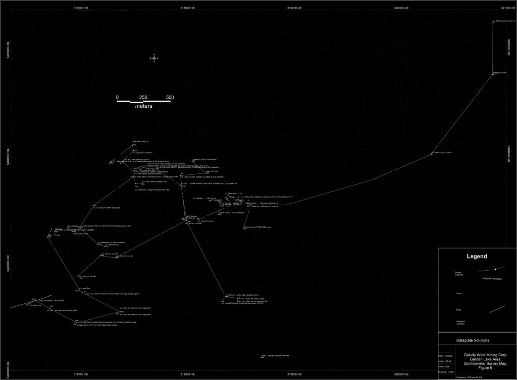
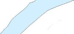
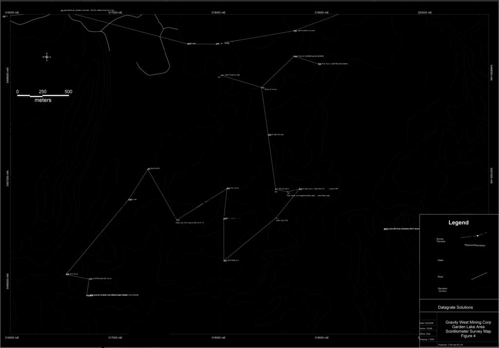
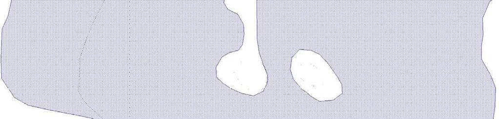
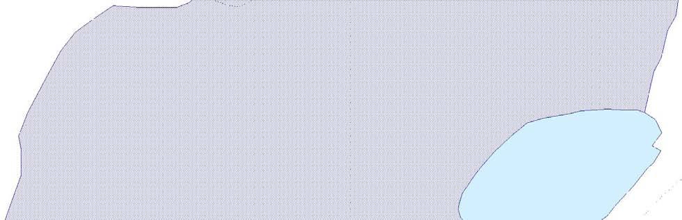
2 SUMMARY Gravity West Mining Corp carried out an exploration program for uranium on claims in the Garden Lake Area, Thunder Bay Mining Division during the summer of A twoman crew prospected using a scintilometer. Target areas included possible iron formation units as indicated from airborne magnetic surveys and unconformities along the east half of the property. Traverses were made in prospective areas and along new logging roads using a GPS for control. The survey failed to identify any anomalous areas with only a few readings of values slightly above the background used. i
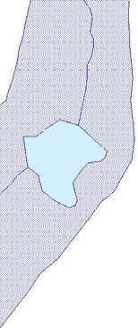
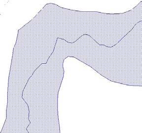
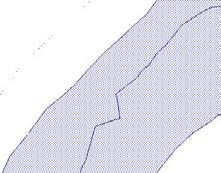
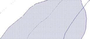
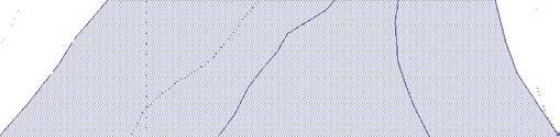
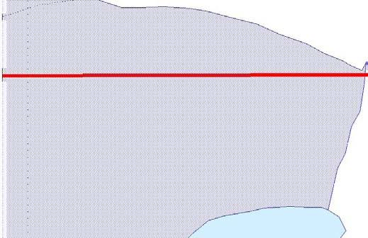
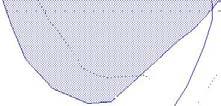
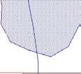
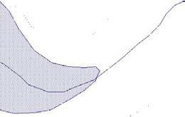
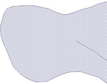
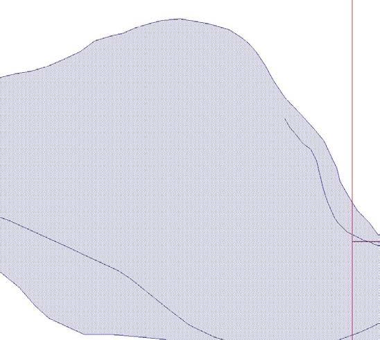
3 TABLE OF CONTENTS SUMMARY INTRODUCTION PROPERTY DESCRIPTION, LOCATION AND ACCESS CLIMATE AND PHYSIOGRAPHY PREVIOUS WORK REGIONAL GEOLOGY MINERALIZATION 2006 EXPLORATION PROGRAM RESULTS SUMMARY OF DAILY TRAVERSES CONCLUSION RECOMMENDATION CERTIFICATE OF QUALIFICATIONS REFERENCES LIST OF FIGURES, MAPS AND TABLES PROPERTY LOCATION MAP CLAIM MAP TABLE 1 - LIST OF CLAIMS SCINTILOMETER SURVEY MAP (W) SCINTILOMETER SURVEY MAP (E) SCINTILOMETER SURVEY MAP (S) DETAILED DAILY TRAVERSE NOTES IN BACK POCKET IN BACK POCKET IN BACK POCKET APPENDlXA
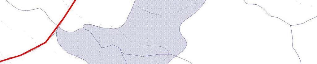
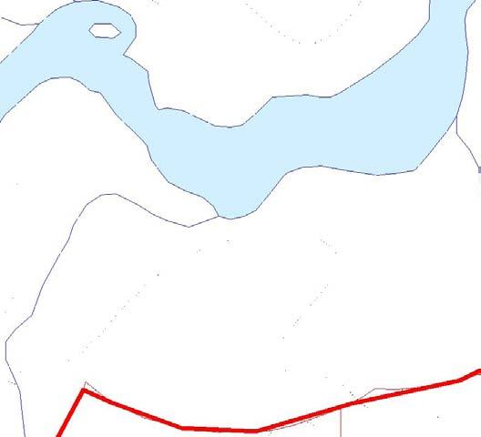
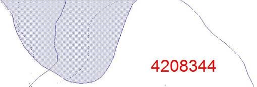
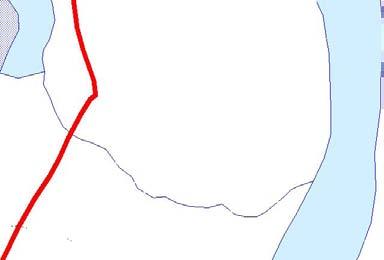
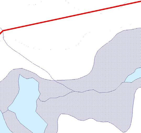
4 INTRODUCTION Gravity West Mining Corp completed an exploration program in 2006 on the Garden Lake area claims in search of uranium by prospecting with a scintilometer. A 2-man crew covered prospective areas based on known geology and magnetic high trends taken from published literature and also covered areas of unknown potential. PROPERTY DESCRIPTION, LOCATION AND ACCESS The property consists of 14 claims (approximately 164 units) in the Ruffo Lake Area, G-0756 and Kitchen Lake Area. Please refer to Table 1 for the details of the list of claims. The Garden Lake area is 120 kilometers north of Thunder Bay along Highway 527 and NW up Highway 811. The claims are located in the Garden Lake Greenstone Belt west of the unconformity with the Nipigon Basin sediments. The area worked covered a portion of the company's contiguous claims held in the area. Access to the claim area is excellent as Highway 527 and Highway 811 are open year round. New forestry roads provide access to the interior of the claims. CLIMATE AND PHYSIOGRAPHY The climate is typical of northern Boreal forests with cold winters with moderate snow fall and moderate to hot summers with rainfall mainly from thunderstorms. Breakup and freeze up periods are generally difficult times to carry out fieldwork. The field season can be up to 8 months per year. The relief is generally flat with some ridges of diabase rising to 150 feet. Several small rivers and numerous creeks drain the few lakes. The forests are actively being harvested with spruce, fir, pine and poplar the main tree types. Large areas of cutover are in various stages of re-growth. PREVIOUS WORK The area has seen little previous work except for gold and base metal exploration since the 1960's and more recently PGM's exploration since the 1990's. No uranium work has been reported in the assessment files. The gold exploration occurred in the Garden Lake area west of the claims. The interest was in the quartz veins with pyrite and arsenopyrite hosted in the greenstone belt volcanics. Several companies completed ground surveys and drilled their best targets with little success. More details are available from the assessment files in Thunder Bay for NTS 52 H NW. 1
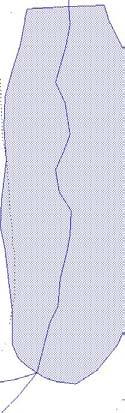
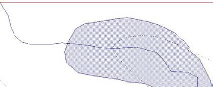
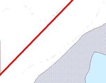
5 -95' -90' -85' -80', "' N ~ kilometers + ~.( 'Ih ~~ ONTARIO, o ~~ ~ Gravity West Property \~ it j ~'" i i _'\ ---,,---', - ',,' ~,.'---.'l.,_';jii., " '. I '~ ( '~ I,,,,,,1. (I' ': -.. '~- / " ),'>-'-'-. '1 \., (' \-'--,'\ 1'1;. I", -'\.::i/-'" '(1.,.\-;' "'~'~t- ~~'J' "'~"'~--~------'-""'--'--b-j.."t/j~ffi. ", -{l;{ i[ i:fiioer Bay, ~ Lake Supeno : r, I ",.' -' ~-_.. I -~ ' " /,"]-. ", ", -' -- """,.- Gravrty west MiIing COIJ> Propeny Loo;atlQn Mat> Goa"*, ukb """ Figure 1 -'",.,.. "

6 1 m 1 m. m ~ -"-

7 ~W. "CIoOno, _, "'-n.x.- Boy... [)Mo;oo.. -., "'-" '_".,.. _ CIMo"'"...,... n.., "'''.,...,.
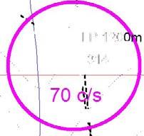
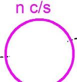
8 REGIONAL GEOLOGY The area is underlain by Precambrian and Proterozoic aged rocks with extensive Pleistocene glacial deposits. The claim area is comprised of a volcanic assemblage of metamorphosed mafic and intermediate volcanics minor felsic and mafic (gabbro) intrusive rocks of Archean age with cross-cutting Proterozoic diabase dykes. Sibley sediments overlie the volcanics on the east side of the property. The major units have a general NE strike with near vertical dips. The diabase strikes roughly northwest. MINERALIZATION Mineralization, in the form of pyrite, was noted in the mafic volcanics and gabbroic intrusives. Hematitic alteration was noted associated with quartz-filled fractures. No iron formation outcrops were mapped in the traverses EXPLORATION PROGRAM The focus of the current exploration program was uranium. The location of the claims is such that the unconformity between the Archean and the Proterozoic has been covered. The unconformity is projected to have a flat dip to the east and the present day exposure of the rocks is limited to a small area. Prospective ground was considered to be in the area of any iron formation associated with hematite alteration. Therefore, prospecting targets were prioritized utilizing the following criteria: iron formation, magnetics, volcanics, hematite alteration and outcrop density. The daily traverses were recorded on a GPS and the tracks and points of interest were recorded and described. Please refer to the appendix for a detailed account of the daily logs. A summary of the daily logs is found in the found below. A scintilometer was utilized to record any radioactivity. The two-man crew would wander randomly in prospective areas in search of outcrops or float to test with the scintilometer. The author, R.T. Chataway and Danny Rivard made up the crew and are both experienced in prospecting and field techniques. The local geology was described and notes on the radioactivity were recorded if anomalous values were encountered. Generally, the diabase exhibited low values (10-20 counts per second), the volcanics were considered background (35-50 c/s), and sediments and felsic intrusives and gneisses were elevated ( c/s) but still considered background. Results The final results of the prospecting for uranium on the Garden Lake area claims are not encouraging. Only several values exceeded background by a slight degree and these were recorded in gneisses where higher background counts can be expected. 5
9 Summary of Daily Traverses July 12, 2006 Claims and Waypoint 268: outcrop of carbonated mafic volcanic, (085/80S) Waypoint 274: outcrop of granodiorite gneiss, (095/65-80N) Waypoint 277: outcrop of banded granodiorite gneiss, reddish brown colour, (100/vert) Waypoint 287: outcrop of coarse grained mafic intrusive or flow Waypoint 290: outcrop of mafic flows Waypoint 295: outcrop of nonmagnetic gabbro The scintilometer survey had no values of interest, all were considered background or lower. July 13, 2006 Claims and Waypoint 310: outcrop of Sibley sediments, underlain by volcanics Waypoint 314: scintilometer readings of 70 c/s in overburden near granodiorite gneiss Waypoint 315: outcrop of mafic flows, (080/v), glacial direction is 170, some pillows The scintilometer had a value of 70 c/s in overburden within an area of probable granodiorite gneiss, the other values were less than background. July 14, 2006 Claim Waypoints : a large area of mafic flows to amygdaloidal basalts Waypoint 318: Gneiss boulders with scintilometer readings of 140 c/s The scintilometer peaked at 140 c/s for gneiss boulders. July 15, 2006 Claims , , , , Waypoint 330: outcrop of carbonate-rich banded mafic flow Waypoint 341: float, boulders of magnetic diorite, gneiss, Sibley seds Waypoint 349: Sibley Group seds, red beds, quartz arenite, flat lying stratigraphy No significant readings near the Sibley Group exposures July 16, 2006 Rain day, compile data July 17, Waypoint 350: outcrop of mafic flow 6
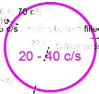
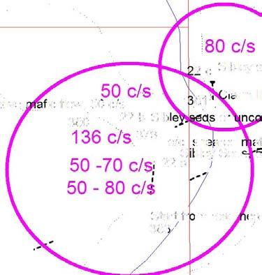
10 Waypoint 351: carb-rich mafic flow, finely banded, non-magnetic Waypoint 354: outcrop (bluff) of carb-rich mafic flow Waypoint 355: outcrop (bluff) of carb-rich mafic flow Waypoint 356: mafic flow, hematite stain, QV with hem, amethyst No significant scintilometer readings in the hematite altered rock. July 18, 2006 Claims , , Waypoint 360: outcrop of pillowed basalts Waypoint 361: outcrop of banded tuffs/seds, purple and green beds, 070/vert No significant scintilometer readings in seds. July 19, 2006 Claims , Waypoint 370: outcrop of pillowed basalts grades to intermediate tuff to NE, 075/vert Waypoint 371: outcrop of intermediate tuff with chlorite along slips. Waypoint 373: old drill core storage area, rock types include mafic flows, laminated chert IF, graphitic seds, hematitic alteration noted. The scintilometer did not detect any radiation of note when scanned over the available core. (Off property) Waypoint 374: o/c of elongated pillows, hematite, quartz and feldspar selvages. Specular hematite. Waypoint 375: o/c of massive mafic flow Waypoint 377: o/c of massive mafic flow, scintilometer reading of 48 c/s. Waypoint 378: o/c of brecciated mafic volcanic with quartz-feldspar filled joints July 20-21, 2006 Compile data. July 22, 2006 Claims , Waypoint 379: o/c of sheared mafic flow, minor quartz-hematite filled fractures with scintilometer readings of 136 c/s. Waypoint 380: o/c of massive mafic flow, readings of 50 c/s Waypoints 22a-d: various o/c's of Sibley seds with scintilometer readings of c/s Increased number of scintilometer readings near the unconformity that are approaching the background or better threshold. 7
11 CONCLUSION The claim area does not appear to have any uranium showings which could be classified as associated with the unconformity between the Archean and Proterozoic. The highest scintilometer readings were found in the granodiorite gneiss. The Sibley Group sediments located close to the probable unconformity gave results which were background or less in value indicating that the area is not likely prospective for uranium mineralization. RECOMMENDATION No further work is recommended on these claims in the search for uranium showings. 8
12 CERTIFICATE of QUALIFICATIONS 1) I, Robert T. Chataway of 139 Peter St. Thunder Bay, Ontario, P7A 5H6 do declare that I am a graduate geologist and am the author of this report titled Report on the Prospecting on the Garden Lake Area Claims in the Thunder Bay Mining District, for Gravity West Mining Corp. 2) I hold a Bachelor of Science Degree from the University of British Columbia (1970). 3) I am a Fellow of the Geological Association of Canada and a member and Director of the Northwest Ontario Prospector's Association. 4) I have been involved in many aspects of mineral exploration for 35 years and have experience with gold, base metal and uranium exploration mainly in the Canadian Shield of Canada. 5) I managed the daily operations on the property during July, 2006 and was part of the prospecting crew. 6) I have reviewed all the available data on the Property and this Assessment Report is my report of the 2006 prospecting program and results. Dated at Thunder Bay, Ontario, April 26, R. T. CHATAWAY, B. Sc. (Geology) "R. T. CHATAWAY" 9
13 REFERENCES Geology of the Garden Lake Area, District of Thunder Bay, Geological Report No. 25, V.G. Milne, ODM, 1964 Gravity West Mining Corp., Internal reports on the airborne geophysical surveys. Nipigon Basin data base, 2004, OGS. 10
14 APPENDIX A DAILY TRAVERSE NOTES
15 GRAVITY WEST MINING CORP DETAILED DAILY TRAVERSE NOTES GARDEN LAKE AREA CLAIMS JULY, 2006
16 Gravity West Garden Lake Project, July 12, 2006 Waypoint Date East/north Elev Description JUL U m N-S claim line, western boundary JUL U m Jnc, Holinshead Resort rd/camp 231 rd JUL U m o/c, mafic volc, carb /80S JUL U m Jnc Camp231 rd/rd 80A, new rd to S, BLK JUL U m Jnc Camp231 rd/rd, new rd to km9. Target py,po, hi mag JUL U m Tr. Pt. on Rd 80A, JUL U m N-S claim line, on road JUL U m E-W claim line on road JUL U m o/c, granodiorite gneiss,095/65-79n JUL U m Jnc, new road to E JUL U m KM JUL U m o/c, granodiorite gn, banded, lt and dark, 100/vert, reddish brown fsp in frac JUL U m small creek JUL U m Jnc, Rd 81 to South JUL U m Jnc, road to south in cut over JUL U m small creek JUL U m Jnc, Rd 85 to South into cut over, 17. Rd 84 to North for ATV JUL U m Jnc, Rd to South JUL U m End of loop JUL U m Jnc Rd. Line posts,?800m W of #4, (old), 400m W of #2, JUL U m Jnc Rd South JUL U m Jnc Rd South, o/c JUL U m Tr. Pt. on Rd, SE end JUL U m Jnc Rd to East JUL U m End of Road, o/c JUL U m Jnc Rd E JUL U m End of rd JUL U m End of rd JUL U m Jnc Rd S, from WP # JUL U m End of Road, o/c, gabbro, nonmagnetic JUL U m Jnc Camp 231/camp road JUL U m Camp 231 yard
17 Gravity West Garden Lake Project, July 12, 2006 page 2 Waypoint Date East/north Elev Description JUL U Holinshead Resort Rd Tr Pt JUL U m Emergency Location #5, on HH Rd, Long W, Lat N JUL U m Cabin at Resort NB: When WP 299 converted to Lat /Long error is 0.5 sec in both
18 Gravity West Garden Lake Project, July 13, 2006 Waypoint Date East/north Elev Description JUL U m Jnc 811 and Camp JUL U m Jnc Rd 40/ JUL U m Jnc new rd to SW corner of Magrum's claims JUL U m N-S Claim Line JUL U m Jnc, trail to S, cut over JUL U m Jnc, trail to N, cut over JUL U m Jnc, trail to S, cut over JUL U m Jnc, trail to N, cut over JUL U m Jnc, trail to S, cut over JUL U m o/c, Sibley seds, underlain by volcanics, at Km 12, Gravel pit at Km JUL U m Jnc, trail to N & S, cut over JUL U m Bridge over Gull R JUL U m Jnc Rd to E, last stn taken to E JUL U m LP 1200m E of # , 400m W #2, , o/b 70 c/s, granod. Gn JUL U m o/c, fg mafic flows, 080/v??, glacial grooves at 170 and pillow lava at 083 (elongated) JUL U m end, to N no o/c, River and Park, no EM anomalies.
19 Gravity West Garden Lake Project, July 14, 2006 Waypoint Date East/north Elev Description JUL U m o/c, mafic flow, cross-cutting 0.5m qfp dyke at JUL U m o/c, near continuous o/c from 317, mafic flows. Gneiss boulders, 140 c/s JUL U m o/c, mafic flow, pillows? Elongated E-W JUL U m o/c, coarser grained mafic flows, FeCo3 stain, Carb fractures. 105/75S JUL U m o/c, mafic flow, 095/vert to S JUL U m o/c, flow, cg'd, o/c 50 me of amygdaloidal basalt JUL U m o/c, fine banded flow, mafic, carb fractures JUL U m o/c, amygdaloidal basalt JUL U m o/c, amygdaloidal basalt, cg'd JUL U m o/c, amygdaloidal basalt, weak JUL U m o/c, carb-rich flow banded mafic volcanic, foliated. 105/70 S JUL U m o/c, carb-rich flow banded mafic volcanic, foliated JUL U m mafic flows, grey-green, foliated JUL U m fg flow banded mafic volcanic, narrow carb bands, 090/vert JUL U m c g'd flow, less foliated compared to 327 & 328 DR-data 14-a 14-Jul U o/c, mafic Jul-06 no o/c Jul-06 no o/c 14-b 14-Jul U o/c, mafic
20 Gravity West Garden Lake Project, July 15A, 2006 Waypoint Date East/north Elev Description JUL U m Jnc, Rd 81/Trail E to JUL U m Jnc Rd 81A/81B JUL U m Jnc to WP334 and 335. No o/c JUL U m End of rd. LP 400m W of #2, and 1200m E of # JUL U m End of rd. No o/c JUL U m Claim Line JUL U m Claim Line, E-W, post is 50m W of WP JUL U m Jnc. Rd 81B/Rd to N JUL U m Claim Line, E-W JUL U m Jnc. Rd to E and N JUL U m Float, boulders of magnetic diorite, gneiss, some Sibley seds JUL U m End of road, no o/c. Claim line N-S is 50m west of WP JUL U m End of road, low topo JUL U m Claim Line, E-W. No o/c JUL U m End of rd. No o/c JUL U m End of rd. No o/c JUL U m Claim Post. # and # JUL U m End of rd. No o/c, sand hills and boulders JUL U m Sibley gp seds, red beds, qtz arenite?, flat lying JUL U m LP, old series, 400m Sof #1, and 1200m N of #2, JUL U m o/c, carb-rich flow banded mafic. 100/55S JUL U m o/c, gabbroic intrusive, fractures at 160 and JUL U m o/c, carb-rich mafic flow, f g'd. band of amygdaloidal basalts, 090/70S 15A-a 15-Jul U LP, 400m W of # and 1200m E of # a 15-Jul U o/c, mafic, mg 15-b 15-Jul U o/c, mafic, fg 15-c 15-Jul U o/c, mafic 15-d 15-Jul U LP, 400m W of # and 1200m E of #
21 Gravity West Garden Lake Project, July 17, 2006 Waypoint Date East/north Elev Description JUL U m o/c, mafic flow JUL U m Jnc & o/c, carb-rich mafic flow, finely banded, non-mag, pale grey-green JUL U m Stop, Rd continues NW to Rd JUL U m N-S claim line, West bdy of Gravity West JUL U m o/c, mafic flow,carb-rich. O/c is large bluff JUL U m o/c, mafic flow,carb-rich. O/c is large bluff JUL U m o/c, mafic flows, hematite stain and alteration, QV with hem, amethyst, vuggy elongate pillows, 080, to N, intermediate pillow basalts JUL U m E-W claim line JUL U m LP, 1200m N of # , 400m S of # JUL U m End of ATV trail DR Data 17-a 16 U mafic, b 16 U mafic, c 16 U mafic, d 16 U mafic, e 16 U mafic, 0.3m porphyritic f 16 U mafic, 050? 17-g 16 U mafic breccia, 2m wide, pyrite, 070
22 Gravity West Garden Lake Project, July 18, 2006 Waypoint Date East/north Elev Description JUL U m o/c, pillowed basalts, ridge, elongated pilows JUL U m o/c, banded tuffs/seds, purple and green beds, 070/vert? JUL U m creek, end of traverse, trail continued JUL U m start of traverse JUL U m duplicate JUL U m duplicate JUL U m traverse pt, no o/c. cut over area JUL U m LP. 1200m E of # and 400m W of # JUL U m end of ATV trail DR-data 18-a 18-Jul U o/c, mafic with Sibley veining 18-b 18-Jul U o/c, mafic, qtz vns, hematite, 080
23 Gravity West Garden Lake Project, July 19, 2006 Waypoint Date East/north Elev Description JUL U m Start traverse to NE JUL U m o/c, pillow basalts, 075/vert, extends 80m E-NE grades to an int. tuff JUL U m o/c, int. fg'd tuff. Chlorite along slips JUL U m End of traverse Jul U old ddh core, BR-series, NE claims, 500m approx. fine to cg'd mafic flows, laminated chert IF, Graphitic seds. Hematite alteration JUL U m o/c, elongated pillows, 075/vert, with hematite and quartz-feldspar selvages. Spec. hem JUL U m o/c, fg massive mafic flow JUL U m End of trail, clear cut JUL U m o/c, fg massive mafic flow, 48 c/s JUL U m o/c, End. Mafic volcanic, brecc'd, q-f (reddish)-filled joints (E-W), q-carb N-S jnts. DR-data 19-a 19-Jul U o/c, altered tuff, py, mafic, magnetic 19-b 19-Jul U o/c, altered tuff, py, 19-c 19-Jul U o/c, mafic flow, d 19-Jul U o/c, granodiorite, pinkish to green feldspar 19-e 19-Jul U o/c, mafic pillows, hematite fractures 19-f 19-Jul U o/c, mafic pillows, hematite fractures x-cutting, strike at g 19-Jul U o/c, mafic flows, med gr'd. hematite stain h 19-Jul U o/c, mafic pillows, hematite, 090
24 Gravity West Garden Lake Project, July 22, 2006 Waypoint Date East/north Elev Description JUL U m o/c, sheared mafic flow, 136 c/s, minor qtz-hem filled fractures, horiz and vert JUL U m o/c, massive mafic flow, 50 c/s JUL U m Claim line, N-S JUL U m Traverse from WP 383 to 382, no o/c, JUL U m Start from road near unconformity JUL U m o/c, gabbro over a large area JUL U m o/c, diabase over a large area JUL U m o/c, massive mafic flow on Hwy JUL U m o/c, diabase on Hwy JUL U m diabase float DR-data 22-a 22-Jul U Sibley Seds, 50 to 80 c/s 22-b 22-Jul U Sibley seds or unconformity, 50 to 70 c/s 22-c 22-Jul U Sibley seds, 80 c/s 22-d 22-Jul U Sibley seds, 080 strike, 20 to 40 c/s NB: DR scint reads about 2/3 of RTC scint
25


26


27
for the Greenwood Mining Division, B.C. NTS 82E/7W 29' W, Longitude 118' 53' N Prepared by D. Dylan Watt, B.Sc.
 for the FltE NO: u VOLT 1, VOLT 2, VOLT 3, & VOLT 4 CLAIMS Greenwood Mining Division, B.C. NTS 82E/7W Latitude 49' 29' W, Longitude 118' 53' N Prepared by D. Dylan Watt, B.Sc. #309-1996 Trutch Street Vancouver,
TIGER GOLD EXPLORATION CORPORATION. Prospecting Over the HARKER HERITAGE PROPERTY AREA 10. Harker Township, Ontario
 PO Box 219, 14579 Government Road, Larder Lake, Ontario, P0K 1L0, Canada Phone (705) 643-2345 Fax (705) 643-2191 www.cxsltd.com TIGER GOLD EXPLORATION CORPORATION Prospecting Over the HARKER HERITAGE PROPERTY
for the Greenwood Mining Division, B.C. NTS 82E/7W Latitude 49' 27' W, Longitude 118' 5 Prepared by a= D. Dylan Watt, B.Sc.
 t. b LOGnO: 37~ -08 m. ACTIO#: for the AMP AMP 2 AMP 3 t AMP 4 CLAIMS Greenwood Mining Division, B.C. NTS 82E/7W Latitude 49' 27' W, Longitude 8' 5 %E c,w zc *& a w Prepared by a= -4c. D. Dylan Watt, B.Sc.
2013 GEOLOGICAL ASSESSMENT REPORT SHERIDAN HILL PROPERTY
 2013 GEOLOGICAL ASSESSMENT REPORT ON THE SHERIDAN HILL PROPERTY NEW WESTMINSTER MINING DIVISION BRITISH COLUMBIA NTS 092G07 49 16 31 NORTH LATITUDE, 122 39 48 WEST LONGITUDE PREPARED FOR Sheridan Hill
FIRST YEAR ASSESSMENT REPORT PROSPECTING LICENCE 16512M MARYSTOWN AREA, BURIN PENINSULA NTS 1M/3
 FIRST YEAR ASSESSMENT REPORT OF PROSPECTING ON LICENCE 16512M MARYSTOWN AREA, BURIN PENINSULA NTS 1M/3 BY NATHANIEL NOEL MSc. FOR E. MICHELE NOEL MINERAL LICENCES: 16512 M WORK CONDUCTED: MID-SEPTEMBER
MEMO. TO: Dennis Lapoint CC: FROM: Eriaan Wirosono DATE: April, 20 th 2014 SUBJECT: Exploration activity report March-April 2014_EW
 TO: Dennis Lapoint CC: FROM: Eriaan Wirosono DATE: April, 20 th 2014 SUBJECT: Exploration activity report March-April 2014_EW MEMO 1. Highlights and Productivity Overview pan sampling on target Areas 1
Summary of Rover Metals Geologic Mapping Program at the Up Town Gold Project, Northwest Territories
 October 13, 2017 Summary of Rover Metals Geologic Mapping Program at the Up Town Gold Project, Northwest Territories Vancouver, British Columbia, Canada - Rover Metals Corp., Rover, is pleased to provide
Prospecting Report 'S Office i DB Property, B.C. -J Negro Creek Nelson Mining District NTS 82F.050. Operator: Kootenay Gold Inc.
 . '.' I"' i9 12 Prospecting Report 'S Office i DB Property, B.C. -J Negro Creek Nelson Mining District NTS 82F.050 Operator: Kootenay Gold Inc. Owner: Darlene Lavoie Work Performed Summer of 2007 Report
Notes: Note. Township of GODSON Report NQ: 12. Diamond Dniiing. Hole NQ Footage Date. July/56. July/56. Aug/56. Aug/56. Claim NQ 487' K ' l-a
 Diamond Dniiing S2F«4NW«194 12 GODSON 010 Township of GODSON Report NQ: 12 Work performed by: KENNCO EXPLORATIONS (CANADA) LTD. Claim NQ Hole NQ Footage Date Note K 25434 l 487' July/56 l-a 48' July/56
The Cobalt Rainbow. Airborne geophysical maps show that a north trending aeromagnetic high suggests further undiscovered mineralisation.
 The Cobalt Rainbow The property is located on Greenstone Creek, approximately 4.8 kilometres south west of the creek mouth. The property is located about 24 km due west of Campbell River, in the east-central
NEW HAZELTON, OMINECA M.D.,
 PROSPECTING REPORT JUDI 1 TO 6 MINERAL CLAIMS NEW HAZELTON, OMINECA M.D., B.C. MAP 93M/4E, LAT. SS014'N, LONG. 127'33'W OWNED BY: A. L'ORSA ANTHONY L'ORSA Smithers, B.C. 21 February, 1981 TABLE OF CONTENTS
ASSESSMENT REPORT ON THE PEAVINE PROJECT. DGW & Associates # Alberni Street, Vancouver, British Columbia, V6E 4V2
 ASSESSMENT REPORT ON THE PEAVINE PROJECT KAMLOOPS MINING DIVISION BRITISH COLUMBIA NTS 082M 12 Latitude 51 36' 19.0"North -- Longitude --119 47' 27.0"West UTM Zone 11, NAD 83 5720827N 306744E Prepared
1 FILMED 1. FILE NO:!..rsrru -* -. GRAND TWO CLAIM
 FILE NO:!..rsrru -* -. GRAND TWO CLAIM REPORT ON 1993 ASSESSMENT WORK GRAND TWO CLAIM REC. NO. 301849 NELSON MINING DIVISION NTS MAP SHEET 82F6/W 49 25'51" NORTH 117 18'08" WEST 1 FILMED 1 AUTHOR: R. Jordan,
We are committed to providing accessible customer service. If you need accessible formats or communications supports, please contact us.
 We are committed to providing accessible customer service. If you need accessible formats or communications supports, please contact us. Nous tenons à améliorer l accessibilité des services à la clientèle.
Lands Parcels in IOL CO-20
 Lands Parcels in IOL CO-20 1 CO-20 The Izok Corridor Lupin - multi-million ounce past gold production (3.6 million oz of gold at average grade of 9.3 g/t Au) Approximately 1 million ounces of undeveloped
Gold Mineralization Potential in a Wabigoon Subprovince Granite-Greenstone Terrane, International Falls Area, Minnesota
 Gold Mineralization Potential in a Wabigoon Subprovince Granite-Greenstone Terrane, International Falls Area, Minnesota Manitoba Ontario Mn The State of Minnesota is located in the north-central portion
Detour West Gold Project Technical Overview. April, 2018
 Detour West Gold Project Technical Overview April, 2018 Detour West Project Overview Detour West is a 7,680 hectare property located at the northwest margin of the Abitibi Greenstone Belt, 20 km west of
ASSESSMENT REPORT MAGNETOMETER SURVEY GOLDEN ROD, GOLDEN ROD #2. Long.: General Delivery, Vananda, B. C.
 ASSESSMENT REPORT MAGNETOMETER SURVEY GOLDEN ROD, GOLDEN ROD #2 t=/ NTS 92~110w Lat.: Long.: 49O 44' N 124O 34' W Owner: E. Johanson General Delivery, Vananda, B. C. Operator: Rhyolite Resources I nc.
Negro Creek Fort Steele Minina Division. CRAIG KENNEDY Prospector
 AUG and SKAY Claims Negro Creek Fort Steele Minina Division NTS 82 F8/E Latitude 49O28 N Lonqi tude 116 Ol W BY CRAIG KENNEDY Prospector September 5, 1996 TABLE OF CONTENTS Page 1.00 INTRODUCTION 1.10
ASSESSMENT REPORT PROSPECTING PROGRAM ION/DIRTY JACK PROPERTY NELSON MINING DIVISION N.T.S. MAP SHEET 82F.023 UTM COORDINATES N E
 ASSESSMENT REPORT PROSPECTING PROGRAM ION/DIRTY JACK PROPERTY NELSON MINING DIVISION N.T.S. MAP SHEET 82F.023 UTM COORDINATES 5454800N - 0455235E Work Performed Summer 2007 OWNER >* ' Tom Kennedy >8 404-22
BALFOUR MINING LTD. (N.P.L.) HAM GROUP 92-P-6, CLINTON M. D.8 B. C. Lat 51 17'N, GEOCHEMICAL REPORT. V. CUKOR, P. Eng.
 HAM GROUP 92-P-6, CLINTON M. D.8 B. C. Lat 51 17'N, GEOCHEMICAL REPORT. V. CUKOR, P. Eng.") 34q '7 BALFOUR MINING LTD. (N.P.L.) HAM GROUP 92-P-6, CLINTON M. D.8 B. C. Lat 51 17'N, Long 12lo14'W GEOCHEMICAL REPORT, V. CUKOR, P. Eng. January 31, 1972 TABLE OF CONTENTS 1. INTRODUCTION 2. PROPERTY,
34q '7 BALFOUR MINING LTD. (N.P.L.) HAM GROUP 92-P-6, CLINTON M. D.8 B. C. Lat 51 17'N, Long 12lo14'W GEOCHEMICAL REPORT, V. CUKOR, P. Eng. January 31, 1972 TABLE OF CONTENTS 1. INTRODUCTION 2. PROPERTY,
Copper Reef to Drill Massive Sulphide Targets in Flin Flon
 12 Mitchell Road Tel: (204) 687-3500 Flin Flon, MB, R8A 1N1 CZC.CSE Fax: (204) 687-4762 copperreef.com February 28, 2019. Copper Reef to Drill Massive Sulphide Targets in Flin Flon Copper Reef Mining Corporation
FILE NO. ASSESSMENT REPORT VLF-EM GEOPHY S I CS BUCK CLAIMS. Moyie River and Perry Creek Area FORT STEELE MINING DIVISION. NTS 82 F/8 E and 82 G/5 W
 FILE NO. ASSESSMENT REPORT on - VLF-EM GEOPHY S I CS BUCK CLAIMS Moyie River and Perry Creek Area FORT STEELE MINING DIVISION NTS 82 F/8 E and 82 G/5 W Latitude 49 27' N Longitude 116 03' W PETER KLEWCHUK
Rockstar Gold Property Goudreau-Dog Lake Area, Wawa, Ontario. Argo Gold Inc. (ARQ)
") Rockstar Gold Property Goudreau-Dog Lake Area, Wawa, Ontario Argo Gold Inc. (ARQ) Location Map, Rockstar Gold Property Land Tenure, Rockstar Gold Property Regional Geology Michipicoten Greenstone Belt
Rockstar Gold Property Goudreau-Dog Lake Area, Wawa, Ontario Argo Gold Inc. (ARQ) Location Map, Rockstar Gold Property Land Tenure, Rockstar Gold Property Regional Geology Michipicoten Greenstone Belt
First Year assessment Report on Prospecting and Rock sampling, King George property, License M NTS 12A/05 Newfoundland and Labrador.
 First Year assessment Report on Prospecting and Rock sampling, King George property, License 016679M NTS 12A/05 Newfoundland and Labrador. Submitted by Shawn Rose For Shawn Rose January 2011 Work year
SUMMARY REPORT. ESSAR STEEL ALGOMA INC. 105 West Street, Sault Ste. Marie, Ontario, Canada P6A 7B4
 SUMMARY REPORT IRON LAKE PROPERTY Keating and Keating Additional Townships, Ontario, Canada ESSAR STEEL ALGOMA INC. 105 West Street, Sault Ste. Marie, Ontario, Canada P6A 7B4 Date: March 18, 2013 Prepared
GEOLOGY OF THE NICOLA GROUP BETWEEN MISSEZULA LAKE AND ALLISON LAKE
 GEOLOGY OF THE NICOLA GROUP BETWEEN MISSEZULA LAKE AND ALLISON LAKE (92H/15E. 10E1 By V. A. Preto INTRODUCTION Mapping was continued southward from the area covered in 1973 and an additional 55 square
APPENDIX 2 Table 2. Sample descriptions
 Table 2. descriptions 225 Felsic gneiss, fine-grained and very light-gray. From the upper part of the lower of the two layers, which connect. 226 Amphibolite, even-grained, fine-grained, medium-gray, little
PERCY CONTRACTING SERVICES LTD.
 GEOLOGICAL REPORT ON TEN PLACER LEASES (3139, 3140, 3141, 3142, 3143, 3144, 3145, 3146, 3147, 3148) MOREHEAD CREEK CARIB00 MINING DIVISION, B.C. 938/12W (52 38 N, 121 47 W) For PERCY CONTRACTING SERVICES
Total Magnetic Field and VLF Surveys on the Swayze Property. Claim Swayze Township. Porcupine Mining Division
 1 January, 016 NTS: 041 O 15 Total Magnetic Field and VLF Surveys on the Swayze Property Claim 475471 Swayze Township Porcupine Mining Division 380850E, 599450N UTM Z17N NAD83 Report Prepared for: 540
First Year Assessment Report: Report on Prospecting, Rock and Soil Sampling Carried Out From September/2012 to December/2012.
 First Year Assessment Report: Report on Prospecting, Rock and Soil Sampling Carried Out From September/2012 to December/2012 on the Clarkes Pond Property Licence 020334M Northwest Gander River,Central
TIGER GOLD EXPLORATION CORPORATION. Prospecting Over the HARKER HERITAGE PROPERTY AREA 1. Clifford Township, Ontario
 PO Box 219, 14579 Government Road, Larder Lake, Ontario, P0K 1L0, Canada Phone (705) 643-2345 Fax (705) 643-2191 www.cxsltd.com TIGER GOLD EXPLORATION CORPORATION Prospecting Over the HARKER HERITAGE PROPERTY
COMBINATION OF MMI AND ENZYME LEACH METHODS IN EXPLORATION FOR GOLD IN AN AREA OF THE CANADIAN SHIELD COVERED WITH GLACIAL SEDIMENTS: A CASE STUDY
 COMBINATION OF MMI AND ENZYME LEACH METHODS IN EXPLORATION FOR GOLD IN AN AREA OF THE CANADIAN SHIELD COVERED WITH GLACIAL SEDIMENTS: A CASE STUDY Nadia Yavorskaya 450 Bonner Ave., Winnipeg, MB, Canada
DiaMine Exploration Inc. Pickle Lake Option Property
 DiaMine Exploration Inc. Pickle Lake Option Property Rock Sampling Program and Field Observations Claims 4249174, 4249175, 4249176 and 4249177, Kapkichi Lake Area (G-2081) And Claims 4249178, 4249179 and
GRAVITY WEST MINING CORP. MACKENZIE JAIMS
 GRAVITY WEST MINING CORP. MACKENZIE JAIMS REPORT ON PHASE 2 - Chief Bay Road & Drake Hill Areas DIAMOND DRILLING PROGRAM VOLTAIRE LAKE PROPERTY, DISTRICT OF THUNDER BAY, ONTARIO by Colin Bowdidge, Ph.D.,
Compilation Report Hawke Hill South. Licence No M NTS 01N/06. Newfoundland and Labrador. Submitted by Gordon E. Cooper and Kevin P.
 Compilation Report 2010 Hawke Hill South Licence No. 017282M NTS 01N/06 Newfoundland and Labrador Submitted by Gordon E. Cooper and Kevin P. Ryan For Kevin P. Ryan (Licence holder) January, 2011 Work Year:
Nickel Division - Sudbury Operations
 * *-.. FALCONBRIDGE NICKEL MINES LIMITED Nickel Division - Sudbury Operations Falconbridge, Ontario 002261 GRAHAM 010 GEOLOGY OF TllE NORTH QUARTER OP LOT 2, CON. IV, GRAHAM TOWNSHIP, DISTRICT OP SUDBURY,
%+ '$# $) %, %*$ " $ $ ' %' !()'-!" %( %"%! " *'+ - % %$! $)! " $)!" !$ ' "! )( ! $ '%& ')- % % "!#( (( ((# $) ' ) ((* & *# ' % %"*# ( !!
 %, %*$ $ $ ' %' !()'-! %( %%! *'+ - % %$! $)! $)! !$ ' ! )( ! $ '%& ')- % % !#( (( ((# $) ' ) ((* & *# ' % %*# ( !!") 001L/14/0218 First Year Assessment Report of Prospecting, Rock and Stream Sediment Sampling On Licence 18880M, NTS 1L/14 Burin Peninsula Newfoundland and Labrador Submitted by: Keith Kelloway Work year:
001L/14/0218 First Year Assessment Report of Prospecting, Rock and Stream Sediment Sampling On Licence 18880M, NTS 1L/14 Burin Peninsula Newfoundland and Labrador Submitted by: Keith Kelloway Work year:
Magnetic Field and VLF Surveys on the Shining Tree Property. Claims: , , , , , , , ,
 December 29, 2014 NTS: 041P11 Magnetic Field and VLF Surveys on the Shining Tree Property Claims: 1203361, 4251801, 4251803, 4251805, 4263067, 4263068, 4270940, 4270436, 4276740 Churchill and Asquith Townships
For personal use only
 2 May 2018 METEORIC SECURES FURTHER HIGHLY PROSPECTIVE CANADIAN COBALT PROJECT Meteoric has secured the Beauchamp Cobalt Project 40km north of the Cobalt Camp, Ontario Beauchamp comprises 33.5km 2 being
DÉCOUVERTE Positioned for Discovery in James Bay, Quebec. Investor Presentation, January 2018 by Danae Voormeij, MSc, PGeo
 DÉCOUVERTE Positioned for Discovery in James Bay, Quebec Investor Presentation, January 2018 by Danae Voormeij, MSc, PGeo Location Maps and Infrastructure Location: Durango Resources 100% owned Découverte
vox 1wo LOG NO: SEP 1 019% RD. &CTlON. JG-1, PILOT GOLD, PILOT GOLD 1 h 2. AND GOLD WING 1 TO 6 CLAIMS for HAROLD ADAMS Box 1329 Princeton, B.C.
 LOG NO: SEP 1 019% RD. &CTlON. JG-1, PLOT GOLD, PLOT GOLD 1 h 2. AND GOLD WNG 1 TO 6 CLAMS r Weyrnan Creek Area Kamloops Mining Division 82L-5W (50O22' N. Lat., 119O59' W. Long.) for HAROLD ADAMS Box 1329
SECOND DRILL HOLE IHAD2 INTERSECTS MINERALIZED TAPLEY HILL FORMATION AND MINERALIZED BASEMENT IRON FORMATION
 Suite 304, 22 St Kilda Road St Kilda Vic 3182 Ph: +61 3 9692 7222; Fax: +61 3 9529 8057 For Immediate Release 14 th September 2007 SECOND DRILL HOLE IHAD2 INTERSECTS MINERALIZED TAPLEY HILL FORMATION AND
T'he Horn property comprises a group of forty. contiguous claims owned by Canadian Superior Exploration
 -1- INTRODUCTION T'he Horn property comprises a group of forty contiguous claims owned by Canadian Superior Exploration Limited. The group is located five miles nort'h of Motase Lake. In July and August,
Elephant Mountain, Alaska Intrusive Related Gold Project July Option to Earn 100%
 Elephant Mountain, Alaska Intrusive Related Gold Project July 2018 Option to Earn 100% CORPORATE Corporate DISCLOSURE Disclosure The information contained herein, while obtained from sources which we believe
Report. Mining Claim SO Butt Township. District of Nipissing. Southern Ontario Mining District. Richard Keevil ~ Geologist. August 29,2006.
 Report On Mining Claim SO 1077365 Butt Township District of Nipissing Southern Ontario Mining District ~ "'_I ""'..1 D I..:"'.U&O... ~u ~]. Richard Keevil ~ Geologist August 29,2006. Richard R. Keevil,
=%REPORT RECONNAISSANCE OF CHISHOLM LAKE PROSPECT. October 25, 1977
 =%REPORT ON FIELD RECONNAISSANCE OF CHISHOLM LAKE PROSPECT October 25, 1977 Bruce D. Vincent Imperial Oil Limited, Minerals - Coal, CALGARY, ALBERTA CHISHOLM LAKE PROSPECT Introduction The Chisholm Lake
GEOLOGY AND GEOCHRONOLOGY OF THE ISLAND LAKE GREENSTONE BELT, NORTHWESTERN SUPERIOR PROVINCE by J. Parks 1, S. Lin 1, M.T. Corkery and D.W.
 GS-17 GEOLOGY AND GEOCHRONOLOGY OF THE ISLAND LAKE GREENSTONE BELT, NORTHWESTERN SUPERIOR PROVINCE by J. Parks 1, S. Lin 1, M.T. Corkery and D.W. Davis 2 Parks, J., Lin, S., Corkery, M.T. and Davis, D.W.
FANCAMP EXPLORATION LTD.
 FANCAMP EXPLORATION LTD. Fancamp Exploration Ltd. Overview of Ontario Projects Prepared by: J. Kleinboeck, P.Geo. August 4 th, 2018 Dorothy Lake Project Comprised of 104 unpatented claims covering an
State Metallic Minerals Lease Sale Minnesota s Vermilion Gold District
 State Metallic Minerals Lease Sale Minnesota s Vermilion Gold District State Metallic Minerals Lease Sale Notice of Intent Scale 1:100,000 State Metallic Minerals Lease Sale This portion of the lease sale
Burchell Lake, A Copper, Gold and Molybdenum Property In Ontario. Corporate Presentation September, 2013
 Burchell Lake, A Copper, Gold and Molybdenum Property In Ontario Corporate Presentation September, 2013 Background Tanager Energy Inc. is a Canadian corporation whose shares are traded on the TSX Venture
GEOPHYSICAL REPORT THE CAVZ CLAIMS
 GEOPHYSICAL REPORT Magnetometer Survey on THE CAVZ CLAIMS CAVZ M.C.'s 1 to 12, 15 to 26, 29 to 40, 45 to 54 Trail Peak, Omineca M.D. 13 miles northeast of Fort Babine 550 ) 126 S.E. by G.Podolsky J.Russell
Geoloqv Assessment ReDort. Heather ProDertv. Victoria Mining Division NTS 92C/15, 16
 Litr NO: 03 04 ACTION: RO. FILE No: Geoloqv Assessment ReDort Heather ProDertv Victoria Mining Division NTS 92C/15, 16 48' 59' N Latitude 124' 30' W Longitude Owner: Minnova Inc. Operator: Minnova Inc.,
2014 AEROQUEST AIRBORNE HELI-BORNE VTEM PLUS AND HORIZONTAL MAGNETIC GRADIOMETER SURVEY ASSESSMENT REPORT CAMERON GOLD PROJECT
 2014 AEROQUEST AIRBORNE HELI-BORNE VTEM PLUS AND HORIZONTAL MAGNETIC GRADIOMETER SURVEY ASSESSMENT REPORT CAMERON GOLD PROJECT PREPARED BY: Nick Walker. January 2015 SUMMARY This report presents the results
GEOLOGICAL BRANCH ASSESSMENT REPORT
 GEOLOGICAL BRANCH ASSESSMENT REPORT REPORT ON GEOPHYSICAL GROUND SURVEYS ON THE CHILI CLAIM MAGNETIC, VLF DIP ANGLE ELECTROMAGNETIC, AND VLF RESISTIVITY SURVEYS BY HI LIMION SEPTEMBER 12, 1986 &! FILMED
REPORT ON DIAMOND DRILLING SUBSTITUTION EAST PROPERTY CLAIMS AND HEBERT TOWNSHIP ONTARIO, CANADA
 REPORT ON DIAMOND DRILLING SUBSTITUTION EAST PROPERTY CLAIMS 1248920 AND 1248921 HEBERT TOWNSHIP ONTARIO, CANADA Adroit Resources Inc. Suite #610-1111 Melville Street Vancouver, British Columbia, Canada
Golden Cross Resources
 Golden Cross Resources Labrador Uranium Joint Venture with Altius Resources Update - November 2007 Labrador Uranium - Canada LABRADOR URANIUM PROPERTIES Golden Cross Resources signed an agreement with
CHAMPION BEAR RESOURCES
 CHAMPION BEAR RESOURCES EXPLORING ADVANCED STAGE PRECIOUS METAL PROPERTIES IN ONTARIO Exploration Update January 2011 Forward Looking Statements This exploration update contains forward looking statements
FOCUSED ON ACQUIRING, EXPLORING AND ADVANCING QUALITY MINING PROJECTS IN THE AMERICAS CORPORATE PRESENTATION 1
 FOCUSED ON ACQUIRING, EXPLORING AND ADVANCING QUALITY MINING PROJECTS IN THE AMERICAS JUNE 2018 CORPORATE PRESENTATION 1 Disclaimer Except for the statements of historical fact contained herein, certain
Beekeeper Property The Geology South of Mint Lake. Cariboo Mining Division
 Beekeeper Property The Geology South of Mint Lake NTS: 93A/6 Cariboo Mining Division Claims: Beekeeper 1 #I2055 Beekeeper 2 #3892 Beekeeper 3 #7895 Beekeeper 4 #8503 Latitude: Longitude: 52 degrees 24
NTS 082F03SW N W U E N
 Prospecting Report JOCELYN CLAIM NTS 082F03SW N49 09 51 W 117 14 04 11U 482906E 5445737N NELSON MINING DIVISION Martin Ross PO Box 323 Salmo BC V0G 1Z0 Jan 31, 2012 PROSPECTING REPORT JOCELYN MINERAL CLAIM
CARIBOO - GRIZZLY ZINC PROJECT
 CARIBOO - GRIZZLY ZINC PROJECT The Grizzly Lake or Cariboo Zinc property straddles the gravel Weldwood 8400 logging road in the Grizzly Lake area about 55 kilometres northeast of Likely. Roads constructed
New gold discovery in the Paleoproterozoic Mauken greenstone belt
 New gold discovery in the Paleoproterozoic Mauken greenstone belt Mauken greenstone belt The Paleoproterozoic Mauken greenstone belt is situated in an unexplored and untested terrain in Northern Norway.
Nachicapau Zn-Cu project THE NEXT MAJOR DISCOVERER IN QUEBEC
 Nachicapau Zn-Cu project THE NEXT MAJOR DISCOVERER IN QUEBEC Nachicapau Project - Location Willbob & Pallas Projects Kuujjuaq Located about 150km south of Kuujjuaq, the closest community (has a port) 215
VANCOUVER, B.C. Tri 082F/ F/059
 GEOCHEMCAL REPORT t MAY L, 2006 Whbpper Mineral Claims Ailsa Lake Area Gold comm~ss16fl8f"s Offim on Mining Division VANCOUVER, B.C. Tri 082F/058 082F/059 3792 E 5486438 N Operator Kootenay Gold nc. Suite
GEOLOGIC REPORT. on the. NTS- 92 L/ 12 co-ords 50~37.5'~ 127~32'~ Owned by UTAH MINES LTD. GORDON MILBOURNE. Operator UTAH MINES LTD.
 GEOLOGIC REPORT on the " - SUNSET GROUP OF CLAIMS NTS- 92 L/ 12 co-ords 50~37.5'~ 127~32'~ Owned by UTAH MINES LTD. & GORDON MILBOURNE Operator UTAH MINES LTD. BY G.L. Holland Geol ogi st June 15, 1983
National Instrument Technical Report
 National Instrument 43-101Technical Report Pigeon River Property Hartington Township Ontario, Canada Thunder Bay Mining Division, NTS 42A4 Geology Updated Technical Report UTM: Zone 16, 277134m E, 5332229m
RECONNAISSANCE GEOCHEMICAL SURVEY
 RECONNAISSANCE GEOCHEMICAL SURVEY LEGAL, RITA, LOUISE FR. (CHAPLEAU GROUP) REVERTED CROWN GRANTS CHAPLEAU CREEK AREAJ, SLOC& MINING DIVISION 82 F/11W Lat: 49'44" Long: 117"22'W MINERAL RESOURCES BRANCH
COPPERSTONE RESOURCES AB INTERCEPTS ZONE OF CHALCOPYRITE-ARSENOPYRITE- BORNITE MINERALIZATION AT SVARTLIDEN IN FIRST DEEP DRILLHOLE FROM 720m-810m
 COPPERSTONE RESOURCES AB INTERCEPTS ZONE OF CHALCOPYRITE-ARSENOPYRITE- BORNITE MINERALIZATION AT SVARTLIDEN IN FIRST DEEP DRILLHOLE FROM 720m-810m In mid-january 2017 Copperstone Resource published a geological
Wabassi Resources, ULC. Wabassi Project. Defining a New Base and Precious Metal Camp, in the eastern Uchi Domain, Thunder Bay District, Ontario
 Wabassi Resources, ULC. Wabassi Project Defining a New Base and Precious Metal Camp, in the eastern Uchi Domain, Thunder Bay District, Ontario Ontario Prospectors Exploration Showcase, Thunder Bay, April
We are committed to providing accessible customer service. If you need accessible formats or communications supports, please contact us.
 We are committed to providing accessible customer service. If you need accessible formats or communications supports, please contact us. Nous tenons à améliorer l accessibilité des services à la clientèle.
PROSPECTING REPORT THE WALLACE CLAIM OMENICA MINING DIVISION. 54" x6" 3.d d. for. Reako Exlorat ions Ltd. Wallace Rev. C.G.
 PROSPECTING REPORT ON THE WALLACE CLAIM OMENICA MINING DIVISION 54"44 14 1x6" 3.d d by David A. Howard P.Eng. for Reako Exlorat ions Ltd. Claim Locat ion Wallace Rev. C.G. #1560 Dome Mountain Area 9 3
LOS AZULES April 2018
 April 2018 lies along the southern extensions of the highly productive Paleocene Mineral Belt in northern Chile that contains numerous important copper, gold and silver mines and projects, and to the south
Reconnaissance. Of the. Denis mineral claims. Situated at Kilometer 844 of the Alaska Highway. Liard Mining Division. Northeastern British Columbia
 Reconnaissance Of the Denis mineral claims Situated at Kilometer 844 of the Alaska Highway Liard Mining Division Northeastern British Columbia N.T.S. 94M.075 Latitude 59 42 25 Longitude 127 13 12 Field
GRISWOLD CREEK, B.C. 6 " GEOCHJ3lICAL REPORT
 GRISWOLD CREEK, B.C. 6 " GEOCHJ3lICAL REPORT AUTROR: W. Meyer, BSc. ENDORSED El!: John De Leen, BASc.* NASc., E.M., P. Eng. No. 3675 Vancouver, B.C. January 22nd, 1965. -I- During the period of July 27th
PROSPECTORS ASSISTANCE PROGRAM MINISTRY OF ENERGY AND MINES
 BRITISH COLUMBIA PROSPECTORS ASSISTANCE PROGRAM MINISTRY OF ENERGY AND MINES GEOLOGICAL SURVEY BRANCH PROGRAM YEAR: 1999/2000 REPORT #: PAP 99-l 6 NAME: KIM ANSCHETZ PROSPECTORS TlEPORT on the 99 LOUIS
SECOND and THIRD YEAR ASSESSMENT REPORT PROSPECTING LICENCE M, ROCK CUT PROPERTY, NTS 1N/12, NEWFOUNDLAND. ROY FRENCH (licence holder )
") SECOND and THIRD YEAR ASSESSMENT REPORT Of PROSPECTING On LICENCE 013704M, ROCK CUT PROPERTY, NTS 1N/12, NEWFOUNDLAND. By ROY FRENCH (licence holder ) Work Conducted: Sept. 17, 2008 Nov. 03, 2009 Total
SECOND and THIRD YEAR ASSESSMENT REPORT Of PROSPECTING On LICENCE 013704M, ROCK CUT PROPERTY, NTS 1N/12, NEWFOUNDLAND. By ROY FRENCH (licence holder ) Work Conducted: Sept. 17, 2008 Nov. 03, 2009 Total
Mishi Lake Gold Property Mishibishu Lake Area, Wawa
 Mishi Lake Gold Property Mishibishu Lake Area, Wawa Location, Accessibility, Infrastructure and Local Resources The property is located 40 km west of Wawa, Ontario, in the Mishibishu Lake Area, Sault Ste.
In the past century, prospectors discovered
 FEATURE Instrumentation GDD Inc. s Beep Map Is prospecting dead? By Edwin Gaucher, Eng., Ph.D. and Pierre Gaucher, Eng., MBA In the past century, prospectors discovered many mines while examining shorelines
ON THE LOST GOLD PROPERTY
 ON THE LOST GOLD PROPERTY NELSON MINING DIVISION BRITISH COLUMBIA Latitude: 49 18 North Longitude: 117 29.West TRIM MAPS: 82F1023,033 NTS: 8tF/5,6 By: Fred Critchlow . TABLE OF CONTENTS r PAGE lutroduction
We are committed to providing accessible customer service. If you need accessible formats or communications supports, please contact us.
 We are committed to providing accessible customer service. If you need accessible formats or communications supports, please contact us. Nous tenons à améliorer l accessibilité des services à la clientèle.
GEOPHYSICAL SURVEY ASSESSMENT REPORT FOR THE RHONE GROUP ROCK CREEK, B.C. AREA GREENWOOD MINING DIVISION, B.C. N.T.S.
 I ACTION: -I FILE NO:. -..J GEOPHYSICAL SURVEY ASSESSMENT REPORT FOR THE RHONE GROUP ROCK CREEK, B.C. AREA GREENWOOD MINING DIVISION, B.C. N.T.S. 82E/3E AND 82E/6E LATITUDE NORTH: 49O 15' LONGITUDE WEST:
EMPIRE DEVELOPMENT COMPANY LIMITED
 EMPIRE DEVELOPMENT COMPANY LIMITED 1017-736 Granville Street Vancouver 2, B.C. January 17, 1966 Chief Gold Commissioner, Department of Mines & Petroleum Reso,urces, Victoria, B.C. Dear Sir: The field work
We are committed to providing accessible customer service. If you need accessible formats or communications supports, please contact us.
 We are committed to providing accessible customer service. If you need accessible formats or communications supports, please contact us. Nous tenons à améliorer l accessibilité des services à la clientèle.
on the SALAL CREEK MOLYBDENUM PROPERTY, SALAL CREEK, B.C. LILLOOET MINING DIVISION, BRITISH COLUMBIA
 on the J PLUG 9-12, PLUG 19-24, BAT 10-14, BAT 15 Fr., BAT 16 Fr. MINERAL CLAIMS, SALAL CREEK MOLYBDENUM PROPERTY, SALAL CREEK, B.C. LILLOOET MINING DIVISION, BRITISH COLUMBIA N.T.S. 92 J 14 LATITUDE 50
J.D. Mason, Prof. Engineer. Report on the Reconnaissance Magnetometer Survey. Completed for. North American Platinum Corporation Ltd.
 Report on the Reconnaissance Magnetometer Survey Completed for North American Platinum Corporation Ltd. Olivine Mountain Property, Tulameen, B.C. J.D. Mason, Prof. Engineer. November 28, 1967. Certificate
REPORT. on the. Omineca Mining Division, British Columbia. Latitude N., Longitude W. NTS map sheet 93F/7E. James W. McLeod, P.Geo.
 REPORT on the CHU MOLYBDENUM PROPERTY Omineca Mining Division, British Columbia Latitude 53 21 N., Longitude 124 37 W. NTS map sheet 93F/7E James W. McLeod, P.Geo. on behalf of Mr. Chris Delorme TABLE
Project 81. Drill Ready Geophysical Targets & Trends. Timmins-Cochrane Northern Ontario Canada
 Project 81 Drill Ready Geophysical Targets & Trends Timmins-Cochrane Northern Ontario Canada FORWARD-LOOKING STATEMENT Certain statements contained in this presentation that are forwardlooking in nature
Assessment Report on Diamond Drilling and. Application for Bulk Sampling. Mortimer Soapstone Project. Garnet Township NTS 41 OINE
 2. 9276 Assessment Report on Diamond Drilling and Application for Bulk Sampling Mortimer Soapstone Project Garnet Township NTS 41 OINE September 17, 2008 Todd Keast P.Geo. , INTRODUCTION In February 2007
CJP EXPLORATION INC.
 PO Box 219 14579 Government Road Larder Lake, Ontario P0K 1L0, Canada Phone (705) 643-1122 Fax (705) 643-2191 CJP EXPLORATION INC. Spectrometer Survey Over the SHEBA PROPERTY Nouvel Township, Ontario TABLE
Anthill Resources Yukon - An Update on the Einarson Project
 Anthill Resources Yukon - An Update on the Einarson Project The Eastern Extension of a Carlin-type Gold Trend in the Selwyn Basin Anthill Resources Ltd Yukon Claim Holdings Over 2400 km 2 Property Location
CONTENTS. Location, Access and History...6. Tenure Status and Geology Regional Andy Property Geology Map...9
 TYPE OFWORK IN THIS REPORT EXTENT OF WORK (rn METRTC UNITS) ON WHICH CLAIMS PROJECT COSTS APPORTIONED (incl. support) GEOLOGICAL (scale, area) Ground, mapping Photo interpretation GEOPHYSICAL (line-kilometres)
BLURTON CREEK NICKEL PROPERTY. (Minfile # 082LNW-039)
") 5489153 BLURTON CREEK NICKEL PROPERTY (Minfile # 082LNW-039) Mara Lake Area / Salmon Arm B.C NTS - 82L-11 (UTM 83/Z10, 357690E, 5614220N) Prepared by: Jim Cuttle, B.Sc., P.Geo. 86 Cloudburst Road Whistler,
5489153 BLURTON CREEK NICKEL PROPERTY (Minfile # 082LNW-039) Mara Lake Area / Salmon Arm B.C NTS - 82L-11 (UTM 83/Z10, 357690E, 5614220N) Prepared by: Jim Cuttle, B.Sc., P.Geo. 86 Cloudburst Road Whistler,
Date Submitted: June General Nature of Report: Examination of Placer Samples
 General Nature of Report: Examination of Placer Samples Claim: Gold Channel, Record Number 3775!8 1 (Gold Channel Placer Property) Mining Division: Cariboo NTS 093 G 09 W and E Latitude 520 23 N' Longitude1210
PROSPECTING Survey Over the AULD PROPERTY Auld Township, Ontario
 PO Box 219, 14579 Government Road, Larder Lake, Ontario, P0K 1L0, Canada Phone (705) 643-2345 Fax (705) 643-2191 www.cxsltd.com PROSPECTING Survey Over the AULD PROPERTY C Jason Ploeger, B.Sc, P.Geo August
GPEX Mineral Property Portfolio. Coquihalla Gold Belt. ~ Ladner Suite ~
 GPEX Mineral Property Portfolio Coquihalla Gold Belt ~ Ladner Suite ~ GPEX s Ladner Suite consists of four properties, the Silver Salem, the Emancipation East, the Ladner Junction and West Hozameen claims.
Introducti on. Land Survey. Geomagnetic Survey. Geomagnetic Results and Interpretati ons - Conclusions and Recommendations C
 m M 42A86SW8281 63.42 PRICE 010 C O H T E H l 42A86SW828I 63.42 PRICE 010C Introducti on Land Survey Geomagnetic Survey Geomagnetic Results and Interpretati ons - Conclusions and Recommendations - - -
3. GEOLOGY. 3.1 Introduction. 3.2 Results and Discussion Regional Geology Surficial Geology Mine Study Area
 3. GEOLOGY 3.1 Introduction This chapter discusses the baseline study of the geology and mineralization characteristics of the mine study area. The study consolidates existing geological data and exploration
 ..m,"f.k*"--v- A tot,al of 18 line miles of magnetometer surveying was completed on the "B" and "J" claim groups during August of 197. Approximately two-thirds of the area covered by the survey is glaciated,
We are committed to providing accessible customer service. If you need accessible formats or communications supports, please contact us.
 We are committed to providing accessible customer service. If you need accessible formats or communications supports, please contact us. Nous tenons à améliorer l accessibilité des services à la clientèle.