HAZUS-MH: A Predictable Hurricane Risk Assessment Tool for the City of Houston and Harris County
|
|
|
- Aubrey Gallagher
- 5 years ago
- Views:
Transcription

1 HAZUS-MH: A Predictable Hurricane Risk Assessment Tool for the City of Houston and Harris County Presented by Melvin G. Spinks, P.E., President Annie Ding, PhD, GISP October 29, 2008 Rice University
2 Contents Overview of HAZUS-MH Harris County hurricane and flood risk assessment Real-time supporting disaster operations during Hurricane Rita, Tropical Storm Edouard,, and Hurricane Ike City of Houston Wind Reporting Tool Hurricane Ike ground truth
3 Overview of HAZUS-MH Developed by FEMA under contract with the National Institute of Building Sciences (NIBS) A GIS-based application package Predicts loss estimates based on current scientific knowledge of the effects of hurricane winds, floods, and earthquakes
4 Overview of HAZUS-MH Estimates debris and shelter needs Provides tools to model mitigation strategies Can be used to predict wind damage based on National Hurricane Center real-time Hurricane Advisories Can be used to support disaster event preparation & post storm recovery
5 Hurricane Wind and Flood Risk Assessment for Harris County County Wide Risk Assessment (Level 1) Hurricane Wind and Flood risk analysis using default building inventory & LiDAR DEM Watershed Analysis A Level 2 analysis for a pilot watershed using local building inventory data & LiDAR DEM Evaluation of HAZUS-MH with HEC-FDA
6 Harris County Hurricane Wind Risk HAZUS-MH Level 1 Modeled Category Building Stock Exposure Expected Building Damage (count) Essential Facility Functionality Building-Related Economic Loss (Million Dollars) Total Hospitals Schools Total Debris (Million Cubic Yards) Fire Stations Police Stations Building Loss Business Interruption # People Needing Short Term Shelter Residential Commercial Residential Commercial Saffir-Simpson Hurricane Scale $244 Billion (868,176 Buildings) 1,168 16, , ,977 1,108 16, , , ,898 12, % 99% 36% 0% 100% 100% 12% 0% 100% 100% 14% 0% 100% 100% 24% 0% ,101 51, ,560 39, , , ,859 62, ,522 56,134
7 Level 2 Analysis White Oak Bayou Watershed Area: 111 sq mi Population: 416,000 Census Blocks: 5,221 Local appraisal data LiDAR DEM (15 x 15 ) Using FIT TSARP Cross Sections
8 Level 2 Analysis Comparing Analysis Results Economic Loss Economic Loss in Millions $500 $400 $300 $200 $100 Level1 Level2 Residential HEC- FDA $0 0.2% Flood Frequency $500 Commercial 500-Year Floodplain FIT vs. TSARP TSARP: Tropical Storm Allison Recovery Project Economic Loss in Millions $400 $300 $200 $100 Level1 Level2 HEC- FDA HEC-FDA: USACE Hydrologic Engineering Center Flood Reduction Analysis $0 0.2% Flood Frequency


9 HAZUS-MH Supports Disaster Operations During Rita, Edouard,, and Ike

10 Ike Facts Made landfall on September 13, 2:10 am Landfall as Category 2 at Port Bolivar Winds of 110 mph Effected 25 counties and parish in Texas and Louisiana Third most costliest hurricane to ever hit the United States 31.5 billion estimated damage ($27 billion US coastal area) Wikipedia
 9/10/08, 12:00 pm 9/10/08, 5:00 pm 9/11/08, 9:00 am 9/11/08, 11:00 am 9/11/08, 5:00 pm 9/11/08, 10:00 pm 9/12/08, 7:00 am 9/12/08,")
11 HAZUS-MH runs begin at 10 am on Sept. 10, 2008 Advisory #1 #2 #3 #4 #5 #6 #7 #8 #9 #10 Release Time (CDT) 9/10/08, 12:00 pm 9/10/08, 5:00 pm 9/11/08, 9:00 am 9/11/08, 11:00 am 9/11/08, 5:00 pm 9/11/08, 10:00 pm 9/12/08, 7:00 am 9/12/08, 10:00 am 9/12/08, 5:00 pm 9/12/08, 10:00 pm Ike Economic Damage Advisories were released to Elected Officials, Public Officials, and Emergency management Agencies


12 Hurrevac Advisory #38 IKE 9/10/ :00AM CDT Direct Economic Losses of approximately $0.6M in wind-induced building and content damage for 5 counties Hurrevac Advisory #46 IKE 9/12/ :00AM CDT Direct Economic Losses of approximately $15 billion in wind-induced building and content damage for 5 counties Hurrevac Advisory #49A IKE 9/14/2008 4:00PM CDT Direct Economic Losses of approximately $9 billion in wind-induced building and content damage for 5 counties

13 Houstonhidefromthewind.org City of Houston Wind Data Website


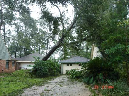
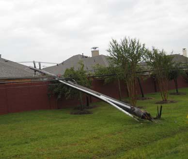
14 Hurricane Ike Ground Truth - Aftermath Model Validation Wind Field Debris Shelters Building Damages
15 Ike Landfall WeatherFlow Sensor & Florida Coastal Monitor Program Tower Location

16 Observed Peak Gust Wind WeatherFlow Sensor & Florida Coastal Monitor Program Tower Location


17 Kemah Max Gust: 75 mph Max Mean: 54 mph Precision WeatherFlow sensor installed, calibrated, and maintained by WeatherFlow


18 Pierce Junction Max Gust: 86 mph Max Mean: 58 mph Precision WeatherFlow sensor installed, calibrated, and maintained by WeatherFlow

19 Modeled Wind Field Peak Gust
20 Wind Data Comparison 140 Observed Wind (mph) y = x R 2 = WeatherFlow Data CFMP Tow er Data Linear Modeled Wind (mph)

21 Tree Debris Modeling with HAZUS-MH Default Data Ground roughness length Tree inventory Stems per acre Tree heights Predominate tree type Collection factor Bulking factor

22 Surveyed 49 Census Tracts
23 Tree Debris Data Comparison Surveyed (Cubic Yard/Household) y = x R 2 = Tree Debris Linear (Tree Modeled (Cubic Yard/Household)
24 Debris Estimation (Million Cubic Yards) Source of Estimation City of Houston Harris County Texas HAZUS-MH Tree Debris USACE HAZUS-MH Other Debris HAZUS-MH (L1) Beaumont Enterprise Debris Picked Up No Data 4.1* No Data 1.4** 8 21 No Data 18.3 No Data *City of Houston project total on 10/15/08: 5.6 million cubic yard; **As of 10/5/08. Harris County refer to areas within county boundary but outside City of Houston limits
25 Future Tree Debris Modeling with Improve Local Data Ground roughness length Tree inventory Stems per acre Tree heights Predominate tree type Collection factor Bulking factor
26 Ike Shelters Shelter Location Number of Residents Number of Shelters Source Austin Convention Center 6,000 "Hurricane Ike Evacuees Move From Austin Shelter", CBS 42 Reporter: Bettie Cross, 9/25 9:29am; San Antonio 4, "S.A. shelters brace for long haul", Web Posted: 09/16/2008 Dallas-Fort Worth Metroplex 1, "Thousands of Hurricane Ike evacuees take shelter in Dallas, Tarrant County"; dallas.bizjournals.com; Dallas Business Journal; 9/15/2008 Dallas 1,279 4 "Thousands of Hurricane Ike evacuees take shelter in Dallas, Tarrant County"; dallas.bizjournals.com; Dallas Business Journal; 9/15/2008 Waco 1,650 "Evacuees remain in Waco as Hurricane Ike cleanup continues", Cindy V. Culp, wacotrib.com, 9/16/2008 Greater Houston Area 1, "Red Cross to open shelters after Ike passes", blogs.chron.com, 9/12/2008; "First Lady visits Ike shelter in Houston"; / October 4, 2008; Others 15,456 "Red Cross to open shelters after Ike passes", blogs.chron.com, 9/12/2008; October 4, 2008 Statewide 33, "S.A. shelters brace for long haul", Web Posted: 09/16/2008


27 Ike Building Damages HAZUS-MH estimated Ike wind-induced building damage (Level 1) Texas Statewide Number of Structures: 6.6 million Estimated Damage: 460,000 Value of Structures: $1,328 billion Estimated Damage: $10 billion
 Harris")
 Value")
 *HAZUS-MH Level 2 analysis based")
28 Ike Building Damages HAZUS-MH estimated windinduced building damage (Level 2*) Harris County Number of Structures: 1.2 million Estimated Damage: 326,000 (27%) Value of Structures: $258 billion Estimated Damage: $5.3 billion (2%) *HAZUS-MH Level 2 analysis based on HCAD 2008 certified data.
29 Summary HAZUS-MH can provide reliable economic damage estimates for communities subject to floods, tropical storms, and hurricanes. Information can be generated near real-time and also pre- and post-disaster for storm and hurricane events on a county-level. With HAZUS-MH, government officials can better plan safe and secure communities ahead of severe storms.
30 Related Publications Evaluation of HAZUS-MH Flood Model with Local Data and Other Program,, A. Ding, J. F. White, et. al., Natural Hazard Reviews, Vol. 9(1), February Harris County, Texas Uses HAZUS-MH for Risk Assessment and Hurricane Preparedness, FEMA Website: City of Houston OEM Wind Data Website:
31 Thank you & Questions
Southington. Challenges
 Southington Southington, similar to its next-door neighbor Berlin, is a suburban community in the southeast part of the region. Originally an agricultural community, Southington has also hosted industry
Hazus: Estimated Damage and Economic Losses. North Carolina and South Carolina United States
 Hurricane Florence Advisory 53, 12 September 2018 1100 EST (1500Z) Hazus: Estimated Damage and Economic Losses North Carolina and South Carolina United States Caution: Due to the level of uncertainty associated
Risk Identification using Hazus
 Risk Identification using Hazus City of Boston, Suffolk County, MA Dave Shortman, GISP, CFM 6/21/2016 Agenda Objective Project Location Hazus Overview Hazus Level 2 Risk Assessment Comparison and Reporting
Preparing for Earthquakes in Dallas-Fort Worth Applying HAZUS to assess shelter accessibility. Crystal Curtis
 Preparing for Earthquakes in Dallas-Fort Worth Applying HAZUS to assess shelter accessibility Crystal Curtis Introduction 20+ earthquakes in the city of Irving October 2014 to March 2015 HAZUS can be used
HAZUS-MH: Earthquake Event Report
 HAZUS-MH: Earthquake Event Report Region Name: El Paso County Earthquake Scenario: El Paso County Random EQ Print Date: February 08, 2006 Disclaimer: The estimates of social and economic impacts contained
The Tampa Bay Catastrophic Plan Presentation to CFGIS Users Group FDOT District 5 Urban Offices - Orlando July 30, 2010
 The Tampa Bay Catastrophic Plan Presentation to CFGIS Users Group FDOT District 5 Urban Offices - Orlando July 30, 2010 Brady Smith Senior Planner Tampa Bay Regional Planning Council Introduction Recent
Hazus Methodology and Results Report
 Cumberland County 2014 All-Hazard Mitigation Plan Update Appendix G Hazus Methodology and Results Report The Cumberland County HMP used an enhanced Hazus run to model the 1% annual-chanceflood. Enhancements
Miami-Dade County Overview
 Miami-Dade County Overview 2,000 square miles World s busiest cruise port 2.6 million residents Second busiest US airport for international travelers Gateway to the Caribbean and Latin America Natural
Short-Term Job Growth Impacts of Hurricane Harvey on the Gulf Coast and Texas
 Short-Term Job Growth Impacts of Hurricane Harvey on the Gulf Coast and Texas Keith Phillips & Christopher Slijk Federal Reserve Bank of Dallas San Antonio Branch The views expressed in this presentation
2014 HAZUS Methodology and Results Reports
 Union County 2014 Hazard Vulnerability Assessment and Mitigation Plan Update Appendix F 2014 HAZUS Methodology and Results Reports F-1 Union County 2014 Hazard Vulnerability Assessment and Mitigation Plan
RISK ASSESSMENT COMMUNITY PROFILE NATURAL HAZARDS COMMUNITY RISK PROFILES. Page 13 of 524
 RISK ASSESSMENT COMMUNITY PROFILE NATURAL HAZARDS COMMUNITY RISK PROFILES Page 13 of 524 Introduction The Risk Assessment identifies and characterizes Tillamook County s natural hazards and describes how
Management Workshop. Sponsored by: University of Florida Hinkley Center for Solid and Hazardous Waste
 Hurricane Debris Management Workshop Sponsored by: Alachua County Solid Waste and Emergency Management University of Florida Hinkley Center for Solid and Hazardous Waste April 9, 2008 Agenda 9:45 10:00
A HURRICANE IS COMING. Presented by Atiba Upchurch Broward Emergency Management Division
 A HURRICANE IS COMING Presented by Atiba Upchurch Broward Emergency Management Division Mission Statement To safeguard the lives and property of the people of Broward County from major hazards and emergencies
Table 1: Saffir-Simpson Hurricane Wind Scale (NHC)
") SCIPP HURRICANE INFORMATION DOCUMENT INTRODUCTION TO HURRICANES : Since 1980, hurricanes and tropical storms have been responsible for $367.3 billion in damage out of all billion dollar U.S. climate and
SCIPP HURRICANE INFORMATION DOCUMENT INTRODUCTION TO HURRICANES : Since 1980, hurricanes and tropical storms have been responsible for $367.3 billion in damage out of all billion dollar U.S. climate and
Hurricane Readiness for Coastal Communities
 Hurricane Readiness for Participant Guide Developed for: Federal Emergency Management Agency Emergency Management Institute 16825 South Seton Avenue Emmitsburg, MD 21727-8998 Developed by: C² Technologies,
Superstorm Sandy What Risk Managers and Underwriters Learned
 Superstorm Sandy What Risk Managers and Underwriters Learned Gary Ladman Vice President, Property Underwriting AEGIS Insurance Services, Inc. Superstorm Sandy Change in the Weather Recent years appears
Alluvial Soils: Fine grained sediment, especially of mud or clay particles at the bottom of a river or lake.
 A Alluvial Soils: Fine grained sediment, especially of mud or clay particles at the bottom of a river or lake. Average Error Affected List: Average Error Swath: ARC: American Red Cross ASOS: Automated
 Hazard Warnings GE 4150 Natural Hazards September 17, 2007 http://www.sdr.gov/ndis_rev_oct27.pdf Sorensen, J.H. (2000) Hazard warning systems: Review of 20 years of progress. Natural Hazards Review, May,
Flood Event Analysis to Estimate the Avoided Damages Due to Flood Improvement Projects & Voluntary Buyout Program
 Flood Event Analysis to Estimate the Avoided Damages Due to Flood Improvement Projects & Voluntary Buyout Program Ataul Hannan, P.E., CFM Planning Division Director Harris County Flood Control District
Top 10 Actions a CIO Can Take to Prepare for a Hurricane
 May 2013 Walter E. Washington Convention Center Washington, DC Top 10 Actions a CIO Can Take to Prepare for a Hurricane Lessons learned from Hurricane Sandy Bill Venteicher Marketing Manager Dell Email
4.2: Disaster Mitigation Strategies
 WMO/CAS/WWW SEVENTH INTERNATIONAL WORKSHOP ON TROPICAL CYCLONES 4.2: Disaster Mitigation Strategies Rapporteurs: Bill Read Regional Specialized Meteorological Center (RSMC) WMO Region IV 11691 SW 17 th
Hurricane Harvey Flood Emergency Response
 Hot Science - Cool Talk # 114 Hurricane Harvey Flood Emergency Response Dr. David Maidment September 14, 2018 Produced by and for Hot Science - Cool Talks by the Environmental Science Institute. We request
Unit 4. This unit will enable you to improve coordination and communication with State and local agencies when hazardous weather threatens.
 Unit 4 This unit will enable you to improve coordination and communication with State and local agencies when hazardous weather threatens. In this unit we will discuss the role of Emergency Managers in
A New National Flood Inundation Mapping Science Initiative
 A New National Flood Inundation Mapping Science Initiative William Guertal, PhD. Director, USGS Indiana and Kentucky Water Science Centers U.S. Department of the Interior U.S. Geological Survey Courtesy
Baldwin County, Alabama
 2015 Baldwin County, Alabama Multi-Hazard Mitigation Plan I. Comprehensive Plan A multi-jurisdiction plan City of Bay Minette City of Daphne Town of Elberta City of Fairhope City of Foley City of Gulf
Glossary. ARC: American Red Cross. ASOS: Automated Surface Observing System (NWS & FAA) ATM: Abbreviated Transportation Model
 ATM: Abbreviated Transportation Model") A AFN Access and Functional Needs. People who may have additional needs before, during, and after an incident in functional areas, including but not limited to: maintaining independence, communication,
A AFN Access and Functional Needs. People who may have additional needs before, during, and after an incident in functional areas, including but not limited to: maintaining independence, communication,
Summary of Available Datasets that are Relevant to Flood Risk Characterization
 Inter-Agency Characterization Workshop February 25-27, 2014 USACE Institute for Water Resources, Alexandria, VA, IWR Classroom Summary of Available Datasets that are Relevant to Characterization National
Post-Hurricane Recovery: How Long Does it Take?
 Post-Hurricane Recovery: How Long Does it Take? Implications for disaster recovery after hurricanes Harvey and Irma In the following report, BuildFax analyzed the geographic areas impacted by three of
Municipal Mitigation Goals, Objectives, and Strategies
 Municipal Mitigation Goals, Objectives, and Strategies While the risks from natural hazards confronting the seven municipalities of Central Connecticut may be largely similar, priorities, concerns, economic
APPENDIX D REGION 5 ALL HAZARD MITIGATION PLAN EDITION PIERCE COUNTY OVERVIEW. Inherent Errors
 APPENDIX D REGION 5 ALL HAZARD MITIGATION PLAN 2015-2020 EDITION PIERCE COUNTY OVERVIEW This appendix contains the spatial results from the Hazus Earthquake Scenario results showing the Essential Facilities
Texas Statewide Mesonet Network (TexMesonet) Dr. Kantave Greene 11/15/17
 Dr. Kantave Greene 11/15/17") Texas Statewide Mesonet Network (TexMesonet) Dr. Kantave Greene 11/15/17 1 Observe weather features Why Mesonets? Thunderstorms Squall lines Dry-lines Sea breezes Improve weather & flood forecasts Drought
Texas Statewide Mesonet Network (TexMesonet) Dr. Kantave Greene 11/15/17 1 Observe weather features Why Mesonets? Thunderstorms Squall lines Dry-lines Sea breezes Improve weather & flood forecasts Drought
Like other coastal cities, Honolulu s
 Worst-Case Scenarios: Flooding and Evacuation Plans in Honolulu Karl Kim, Pradip Pant, Eric Yamashita Like other coastal cities, Honolulu s long-term viability depends on how well it can adapt to climate
Quick Response Report #126 Hurricane Floyd Flood Mapping Integrating Landsat 7 TM Satellite Imagery and DEM Data
 Quick Response Report #126 Hurricane Floyd Flood Mapping Integrating Landsat 7 TM Satellite Imagery and DEM Data Jeffrey D. Colby Yong Wang Karen Mulcahy Department of Geography East Carolina University
Hurricane Tracking Lab
 Hurricane Tracking Lab Background: Hurricanes are one of nature s most powerful disasters. To equal the power of a hurricane, one would have to set off about a thousand nuclear devices per second for as
Hazard Warnings and Warning Systems
 Hazard Warnings and Warning Systems Lecture Objectives: -Know the main features and limitations of our national warning system -learn the key features of an effective warning system Sorensen, J.H. (2000)
GC Briefing. Weather Sentinel Tropical Storm Michael. Status at 8 AM EDT (12 UTC) Today (NHC) Discussion. October 11, 2018
 Today (NHC) Discussion. October 11, 2018") GC Briefing Weather Sentinel Tropical Storm Michael October 11, 2018 After making landfall as a high-end category-4 hurricane on the Florida Panhandle, Michael weakened to tropical storm status early this
GC Briefing Weather Sentinel Tropical Storm Michael October 11, 2018 After making landfall as a high-end category-4 hurricane on the Florida Panhandle, Michael weakened to tropical storm status early this
The Saffir-Simpson Hurricane Wind Scale
 The Saffir-Simpson Hurricane Wind Scale The Saffir-Simpson Hurricane Wind Scale is a one to five categorization based on the hurricane's intensity at the indicated time. The scale provides examples of
HEC & GIS Modeling of the Brushy Creek HEC & GIS Watershed Modeling of the
 HEC & GIS Modeling of the Brushy Creek HEC & GIS Watershed Modeling of the By Cassandra Fagan 5, December 2014 http://ubcwatershedstudy.ursokr.com/images/ Contents Introduction... 3 Figure 1: 24-hour rainfall
LAND USE PLANNING AND RISK: LESSONS FROM THREE AUSTRALIAN PORT CITIES
 LAND USE PLANNING AND RISK: LESSONS FROM THREE AUSTRALIAN PORT CITIES Ken Granger Disaster Risk Scientist Slide No. 1 Land use planning is the single most important mitigation measure for limiting future
TXWARN Tabletop Exercise: Hurricane Helen
 TXWARN Tabletop Exercise: Hurricane Helen July 31, 2015 Administrative Details In-studio participants and remote participants Situation manual Evaluations Training hours 1 In Studio: Welcome and Introductions
KENTUCKY HAZARD MITIGATION PLAN RISK ASSESSMENT
 KENTUCKY HAZARD MITIGATION PLAN RISK ASSESSMENT Presentation Outline Development of the 2013 State Hazard Mitigation Plan Risk Assessment Determining risk assessment scale Census Data Aggregation Levels
HAZUS th Annual Conference
 HAZUS 2014 7 th Annual Conference VALIDATING THE HAZUS COASTAL SURGE MODEL FOR SUPERSTORM SANDY Spiridon Katehis 1 Jordan T. Hastings 1 1 University of Southern California 1 Superstorm Sandy, Oct 12 2
Tropical Revolving Storms: Cuba 2008 By The British Geographer
 Place Context Tropical Revolving Storms: Cuba 2008 By The British Geographer The Republic of Cuba is located in the northern tropics with in island chain of the Caribbean. It is made up of one large Island,
LECTURE #18: Hurricane Damage, Monitoring & Case Study
 GEOL 0820 Ramsey Natural Disasters Spring, 2018 LECTURE #18: Hurricane Damage, Monitoring & Case Study Date: 27 March 2018 I. Exam II grades now posted online o high: 98, low: 46, average: 80 (~3 points
Are You Ready For Hurricane Season? 2018 Hurricane Talk B Y : S T O R M T E A M 8 M E T E O R O L O G I S T J U L I E P H I L L I P S
 Are You Ready For Hurricane Season? 2018 Hurricane Talk B Y : S T O R M T E A M 8 M E T E O R O L O G I S T J U L I E P H I L L I P S About Me I am Currently a Weekday Meteorologist at WFLA Channel 8.
Hurricane Awareness 2017
 Hurricane Awareness 2017 Hurricane Isabel from the International Space Station NASCC Emergency Management Department When will a Hurricane hit Corpus Christi? Port Lavaca Rockport Corpus Christi Kingsville
AASHTO Committee on Maintenance 2018 Annual Meeting July 25, Hurricane Irma- Preparation and Response
 AASHTO Committee on Maintenance 2018 Annual Meeting July 25, 2018 Hurricane Irma- Preparation and Response Rudy Powell Director, Office of Maintenance Satellite Aerial Image (September 10, 2017) Hurricane
Welcome Jeff Orrock Warning Coordination Meteorologist National Weather Service Raleigh
 Welcome Jeff Orrock Warning Coordination Meteorologist National Weather Service Raleigh Jeff.orrock@noaa.gov Sources: Operational Significant Event Imagery and the Environmental Applications Team (EAT)
Storm Surge Analysis Update Meeting Cross City, Florida June 17, 2014
 Big Bend Coastal Storm Surge Study Storm Surge Analysis Update Meeting Cross City, Florida June 17, 2014 Introductions Risk MAP Project Team FEMA Region IV Florida Division of Emergency Management (FDEM)
Hurricanes. Cause: a low pressure storm system over warm ocean water. Effect: potential massive widespread destruction and flooding.
 Hurricanes Hurricanes Cause: a low pressure storm system over warm ocean water. Effect: potential massive widespread destruction and flooding. Hurricanes also known as: cyclone (Indian Ocean) or typhoon
HURRICANE MATTHEW A GIS PERSPECTIVE GLYNN COUNTY GIS
 HURRICANE MATTHEW A GIS PERSPECTIVE GLYNN COUNTY GIS Situation September 25 th October 9 th 2016 Hurricane Matthew tracked its way up the east coast bringing hurricane force winds and flooding from Haiti
Volusia County Emergency Management Division WELCOME. Citizen s s Academy. September 8, 2009
 Volusia County Emergency Management Division WELCOME Citizen s s Academy September 8, 2009 1 Vision Statement The Volusia County Emergency Management Program will continue as the premier program in the
Hurricane Harvey. Jeff Lindner. Meteorologist Harris County Flood Control District
 Hurricane Harvey Jeff Lindner Meteorologist Harris County Flood Control District Addicks and Barker Watersheds Hurricane Harvey Track A Category 4 Hurricane With Epic Flood Forecasts had to separate the
Hurricane Basics and Preparedness. Jim Weyman Director, Central Pacific Hurricane Center Phone Office:
 Hurricane Basics and Preparedness Jim Weyman Director, Central Pacific Hurricane Center Phone Office: 973-5270 james.weyman@noaa.gov United States Hurricane/Typhoon Centers National Hurricane Center, Miami
Hurricane Preparation and Recovery. October 11, 2011 Jon Nance, Chief Engineer, NCDOT
 Hurricane Preparation and Recovery October 11, 2011 Jon Nance, Chief Engineer, NCDOT North Carolina & Severe Weather Our state often bears the brunt of storms, which include: Ice storms Snow storms Heavy
Hurricane Katrina August 29 th, 2005 Costliest Disaster/One of the 5 deadliest Hurricanes in US History. Total Cost: Approx. $100 Billion in damages O
 Eddie Katz Hurricane Katrina August 29 th, 2005 Costliest Disaster/One of the 5 deadliest Hurricanes in US History. Total Cost: Approx. $100 Billion in damages Over 15 million affected by Katrina whether
Complete Weather Intelligence for Public Safety from DTN
 Complete Weather Intelligence for Public Safety from DTN September 2017 White Paper www.dtn.com / 1.800.610.0777 From flooding to tornados to severe winter storms, the threats to public safety from weather-related
CITY OF VESTAVIA HILLS
 CITY OF VESTAVIA HILLS FLOODPLAIN MANAGEMENT PLAN FMPC Meeting #3 September 29, 2015 ORGANIZATION OF 2015 FMP 2015 Floodplain Management Plan Structure Chapter 1 Introduction Chapter 2 Community Profile
Daily Operations Briefing. Monday, October 9, :30 a.m. EDT
 Daily Operations Briefing Monday, October 9, 2017 8:30 a.m. EDT Significant Activity Oct 8-9 Significant Events: Response for Hurricane Maria Tropical Activity: Atlantic Tropical Depression Seventeen Eastern
SECTION 6 VULNERABILITY ASSESSMENT
 SECTION 6 VULNERABILITY ASSESSMENT This section identifies and quantifies the vulnerability of the MEMA District 1 Region to the significant hazards identified in the previous sections (Hazard Identification
HVX-HURREVAC (Beta) Webinar Series
 Webinar Series") HVX-HURREVAC (Beta) Webinar Series Day 1 - An introduction to HURREVAC and the new web-based HVX platform 2018 HVX-HURREVAC Webinar Series 1. Intro to HURREVAC and General Overview of the Program (August
HVX-HURREVAC (Beta) Webinar Series Day 1 - An introduction to HURREVAC and the new web-based HVX platform 2018 HVX-HURREVAC Webinar Series 1. Intro to HURREVAC and General Overview of the Program (August
Earthquakes. & Expansive Soils
 Earthquakes & Expansive Soils January 22, 2009 Plan Update Flanagan & Associates, LLC Consultants Tulsa, OK www.rdflanagan.com rdflanagan@rdflanagan.com Plan can be reviewed at: www.rdflanagan.com/.html
Pacific Catastrophe Risk Assessment And Financing Initiative
 Pacific Catastrophe Risk Assessment And Financing Initiative PALAU September is expected to incur, on average,.7 million USD per year in losses due to earthquakes and tropical cyclones. In the next 5 years,
Pequabuck River Flooding Study and Flood Mitigation Plan The City of Bristol and Towns of Plainville and Plymouth, CT
 Pequabuck River Flooding Study and Flood Mitigation Plan The City of Bristol and Towns of Plainville and Plymouth, CT Raymond Rogozinski and Maged Aboelata The City of Bristol and Towns of Plainville and
Advisory Committee Meeting December 5, 2012
 SOUTH CENTRAL REGION MULTI-JURISDICTION HAZARD MITIGATION PLAN Advisory Committee Meeting December 5, 2012 MEETING PURPOSE Review Municipality Meetings and Capabilities Review Hazard Identification and
Extreme Precipitation, NOAA Atlas 14, Other InFRM Initiatives What Can You Do?
 Extreme Precipitation, NOAA Atlas 14, Other InFRM Initiatives What Can You Do? Date: 19 September2018 Audience: TX Civil Engineering Conference, San Marcos, TX Jerry L. Cotter P.E., Chief Water Resources
Hurricane Rita, at its peak, was the third most intense
 Rita Poses Texas-Sized Challenges A week in the life of Harris County Appraisal District By Jim Robinson Photo of Hurricane Andrew, August 1992, from NASA Goddard Laboratory for Atmospheres Archive Hurricane
NC Emergency Management A View from the Counties
 NC Emergency Management A View from the Counties Amy Bason, NCACC Rocky Hyder, Henderson County Jeff Batten, Durham County Norman Bryson, Onslow County PARTNERSHIP Emergency Management efforts require
2014 Annual Mitigation Plan Review Meeting
 2014 Annual Mitigation Plan Review Meeting Highland County EMA MEETING OBJECTIVES Understand Your Natural Disaster Risk Review of Previous Plans Current Plan Status Future Activity Plan/Needs of Each Community
hurricane harvey and equitable recovery
 hurricane harvey and equitable recovery Mapping social vulnerability and intensity of wind and flooding from Hurricane Harvey in Texas hurricane harvey s impact on texas In August 2017, Hurricane Harvey
MODELLING CATASTROPHIC COASTAL FLOOD RISKS AROUND THE WORLD
 MODELLING CATASTROPHIC COASTAL FLOOD RISKS AROUND THE WORLD Nicola Howe Christopher Thomas Copyright 2016 Risk Management Solutions, Inc. All Rights Reserved. June 27, 2016 1 OUTLINE MOTIVATION What we
Friday, October 19, :30 a.m. EDT
 Friday, October 19, 2018 8:30 a.m. EDT Significant Activity Oct 18-19 Significant Events: Tropical Storm Michael Response; Central Texas Flooding Tropical Activity: Atlantic No new tropical cyclones expected
The AIR Tropical Cyclone Model for Mexico
 The AIR Tropical Cyclone Model for Mexico In September 214, Hurricane Odile made landfall near Cabo San Lucas, Mexico, as a Category 3 hurricane, then moved up the center of Baja California, bringing strong
 Major Tennessee Disasters affecting animals *Macon Tornado February 5, 2008 Rutherford County DART *Opryland Hotel A weather system brought very heavy rain and severe thunderstorms plus 14 tornadoes from
Drought. Jeffrey Lindner Meteorologist Harris County Flood Control District September 20, 2011
 2010-2011 Drought Jeffrey Lindner Meteorologist Harris County Flood Control District September 20, 2011 Texas Annual Rainfall Texas Annual Rainfall 1895-2010 Texas Annual Temperature 1895-2010 Notice Any
The Use of Geographic Information Systems (GIS) by Local Governments. Giving municipal decision-makers the power to make better decisions
 by Local Governments. Giving municipal decision-makers the power to make better decisions") The Use of Geographic Information Systems (GIS) by Local Governments Giving municipal decision-makers the power to make better decisions Case Study: Examples of GIS Usage by Local Governments in North
The Use of Geographic Information Systems (GIS) by Local Governments Giving municipal decision-makers the power to make better decisions Case Study: Examples of GIS Usage by Local Governments in North
The Wind Hazard: Messaging the Wind Threat & Corresponding Potential Impacts
 The Wind Hazard: Messaging the Wind Threat & Corresponding Potential Impacts Scott Spratt Warning Coordination Meteorologist NWS Melbourne, FL David Sharp Science & Operations Officer NWS Melbourne, FL
Application of Geospatial Technology in an Emergency Management Academic Program
 Application of Geospatial Technology in an Emergency Management Academic Program Author Edwin Leachman Visiting Assistant Professor Department of Emergency Administration and Management Arkansas Tech University
Analysis & Optimization of Electricity Infrastructure Hardening Measures
 Analysis & Optimization of Electricity Infrastructure Hardening Measures Workshop for Research in Electricity Infrastructure Hardening Gainesville, FL June 9, 2006 Francis M Lavelle, PhD, PE Applied Research
HAZARD IDENTIFICATION... 1 HAZARD EFFECTS OF CLIMATE CHANGE... 2 OVERVIEW OF HAZARD ANALYSIS... 4 BUILDING VALUES... 5 POTENTIAL DOLLAR LOSSES...
 R ISK OVERVIEW IDENTIFICATION... 1 EFFECTS OF CLIMATE CHANGE... 2 OVERVIEW OF ANALYSIS... 4 BUILDING VALUES... 5 POTENTIAL DOLLAR LOSSES... 7 IDENTIFICATION This section begins the risk assessment, which
Initiative. Country Risk Profile: papua new guinea. Better Risk Information for Smarter Investments PAPUA NEW GUINEA.
 Pacific Catastrophe Risk Assessment And Financing Initiative PAPUA NEW GUINEA September 211 Country Risk Profile: papua new is expected to incur, on average, 85 million USD per year in losses due to earthquakes
Natural Disasters. in Florida. Severe Thunderstorms
 Natural Disasters in Florida SC.6.E.7.7 Investigate how natural disasters have affected human life in Florida. Severe Thunderstorms While the typical afternoon thunderstorm in Florida may not appear to
An electrical discharge that results from the buildup of positive and negative charges within a thunderstorm.
 SEVERE STORM HAZARD PROFILE Description The severe storm hazard includes hail, hurricane, lightning, thunderstorm, tropical storm, and tornados. A description of each of these is provided below. Hail:
City of Punta Gorda Community Emergency Management Plan 2013
 City of Punta Gorda Community Emergency Management Plan 2013 Hurricane Andrew- August 24, 1992 Category 5 hurricane. The second-most-destructive hurricane in U.S. history. The first named storm of the
SITUATION REPORT #7 September 8 th, 2017
 MCO AIRPORT EMERGENCY OPERATIONS CENTER SITUATION REPORT #7 September 8 th, 2017 STATE OF FLORIDA REGION V FEMA REGION IV GENERAL INFORMATION Local State of Emergency Declaration Number: 17-235 Dated:
HURRICANE HARVEY. Economic Impact Analysis. Updated September 19, 2017 SpendTrend
 HURRICANE HARVEY Economic Impact Analysis Updated September 19, 217 SpendTrend HURRICANE HARVEY ECONOMIC IMPACT ANALYSIS SEPTEMBER 217 FIRST DATA CORPORATION. ALL RIGHTS RESERVED Hurricane Harvey Economic
Kentucky Weather Hazards: What is Your Risk?
 Kentucky Weather Hazards: What is Your Risk? Stuart A. Foster State Climatologist for Kentucky 2010 Kentucky Weather Conference Bowling Green, Kentucky January 16, 2010 Perspectives on Kentucky s Climate
Earthquake Hazards in Douglas County
 Earthquake Hazards in Douglas County Craig M. depolo Nevada Bureau of Mines and Geology Nevada Hazard Mitigation Planning Committee August 9, 2012 Earthquake Truths The consequences of bad earthquakes
Analysis of fatalities attributed to Hurricane Florence in the US.
 Analysis of fatalities attributed to Hurricane Florence in the US. Jonathan van Leeuwen Hurricane Florence impacted the US East Coast in September 2018 resulting in dangerous surf conditions, strong winds,
Wind Tower Deployments and Pressure Sensor Installation on Coastal Houses Preliminary Data Summary _ Sea Grant Project No.
 Wind Tower Deployments and Pressure Sensor Installation on Coastal Houses Preliminary Data Summary _ Sea Grant Project No.:1020040317 Submitted to: South Carolina Sea Grant Consortium 287 Meeting Street
Hurricane Protection and Environmental Restoration
 November 16, 2010 Hurricane Protection and Environmental Restoration Presented by: Colonel (Ret.) Leonard Waterworth AGENDA How do we protect People/Environment/Economy 1900 Year Storm Hurricane Carla
Hurricane Katrina Tracking Lab
 Hurricane Katrina Tracking Lab Introduction: The 2005 hurricane season was the most active season on record resulting in 28 named storms. Hurricane Katrina was the eleventh named storm and would end up
The Coastal Change Analysis Program and the Land Cover Atlas. Rebecca Love NOAA Office for Coastal Management
 The Coastal Change Analysis Program and the Land Cover Atlas Rebecca Love NOAA Office for Coastal Management Natural Infrastructure = Greater Resilience NOAA C-CAP Regional Land Cover and Change coast.noaa.gov/digitalcoast/data/ccapregional
Pacific Catastrophe Risk Assessment And Financing Initiative
 Pacific Catastrophe Risk Assessment And Financing Initiative TIMOR-LESTE September Timor-Leste is expected to incur, on average, 5.9 million USD per year in losses due to earthquakes and tropical cyclones.
Urgent Computing for Hurricane Forecasts
 Urgent Computing for Hurricane Forecasts Gabrielle Allen Center for Computation & Technology Dept Computer Science Louisiana State University gallen@cct.lsu.edu Representing the SURA Coastal Ocean Observing
4.4 Assessing Vulnerability: Estimating Potential Losses
 4.4 Assessing Vulnerability: Estimating Potential Losses This section presents exposure, damage, and loss estimates, for each of the 8 hazards evaluated. The findings support planning efforts based on
Michelle Burnett, RI State Floodplain Manager Jess Stimson, RI Floodplain Mapping Coordinator
 The Sandy-est Aftermath: A Rhode Island Perspective After Hurricane Sandy Michelle Burnett, RI State Floodplain Manager Jess Stimson, RI Floodplain Mapping Coordinator June 13, 2013 Rhode Island Background
2008 Hurricane Caravan. Daniel Noah Meteorologist National Weather Service x1 May 22, 2008
 2008 Hurricane Caravan Daniel Noah Meteorologist National Weather Service daniel.noah@noaa.gov, 813-645-2323 x1 May 22, 2008 National Weather Service We never close! Open 24 hours a day 365 days per year
Business Preparedness and Hurricane Risk
 Business Preparedness and Hurricane Risk Hurricanes are one of the more predictable natural disasters compared to events such as earthquakes, wildfires and tornadoes. Meteorologists gather data to predict
Did Severe Rains and Flooding in May 2015 Affect Texas Poison Center Call Patterns?
 Did Severe Rains and Flooding in May 2015 Affect Texas Poison Center Call Patterns? Mathias Forrester Epidemiologist Texas Department of State Health Services (DSHS) mathias.forrester@dshs.state.tx.us