Zero Hours of System Training
|
|
|
- Richard Lynch
- 5 years ago
- Views:
Transcription

1 Zero Hours of System Training A challenge for the next 25 years Werner Kuhn Center for Spatial Studies Department of Geography University of California at Santa Barbara


2 Snow, J. (1855). On the mode of communication of cholera (2nd ed., 162pp).


3 2014


4 The Problem Asking and answering spatial questions is too hard GIScience / Geomatics have organized answers Data models: Peuquet 1998, Yuan 1999, Kjenstad 2006, Goodchild et al. 2007, Voudouris 2010 Algebras and Ontologies: Tomlin 1980, Albrecht 1998, Frank 2001, Couclelis 2010 GIS and Spatial Analysis text books GIS user interfaces User questions cut across these taxonomies unlike software engineering layers physical and social processes interact fields and objects occur together


5 Which farms are at risk from a bird flu outbreak? Istituto Zooprofilattico Sperimentale delle Venezie
6 The Challenge Making GIS usable for e.g. epidemiologists How many months of training do they need today? How many hours of training can they afford? Why is there such a gap? How much training does Google Directions take? Will they use GIS adequately? Can we achieve zero hour training to ask spatial questions?
7 The Solution Idea Organize the questions Through Core Concepts of Spatial Information 5 spatial concepts: location, field, object, network, event 2 information concepts: resolution, accuracy


8 Which farms are at risk from a bird flu outbreak? Question: what are an object s properties and relations? What is common to objects across all applications? identity location bounded, not necessarily with boundary spatially extensive attributes What is specific to turkey farm objects in Veneto? identity: CODICE317 location: multipoint no boundary # of turkeys: STAVICPOT!!

9 Which farms are at risk from a bird flu outbreak? Question: what is the value of attribute z at location x? What is common to fields across all applications? coverage function x z left complete has inverse z [x] spatially intensive attributes projections: time series and spatial profiles What is specific to turkey density in Veneto? coverage: administrative units?, cost-distance raster, coverage function computed from farm objects: KDE,...!

10 Which farms are at risk from a bird flu outbreak? Question: what did or could happen? What is common to events across all applications? bounded processes with participants: fields, objects, networks computing event outcomes conjecture: all events are movements at some granularity What is specific to bird flu outbreaks in Veneto? data from past outbreaks calibrate the model density predicts well (reflecting TFL: increased interactions) but: outliers

11 Which farms are at risk from a bird flu outbreak due to transportation? Question: what connections exist? What is common to networks across all applications? connections can be paths or links networks are well understood and computationally supported What is specific to networks in Veneto? outliers suggest to consider the roads that connect farms families and garbage trucks move between farms!
12 Information Concepts resolution: what is the minimal unit of information? what cell size should the cost-distance raster have? observation ontology! accuracy: what is the accuracy? how accurate is the farm visitor information? probabilistic, possibilistic, and other models of reality fit

13
14 The Science Behind It 1. A computational theory of asking (and answering) spatial questions starting from executable specifications of core concepts map to any GIS, R, Oracle, SciDB! 2. Design cloud computing architectures for domains declarative (rather than procedural) API s: what, not how developed and tested with domain specialists! 3. Teach spatial computing from core concepts beginning of introductory GIScience courses at UCSB micro-insertions in epidemiology, history, biology, political science
15 Conclusions years from now (or earlier), decision makers, scientists, and citizens should be able to perform spatial analyses with zero hours of software training 2. What does it take to reach this vision? A. admit that we are addicted to complexity B. study spatio-temporal questions C. implement generic and domain-specific API s to answer them D. K-12, undergraduate, graduate, life-long education on spatial thinking and computing 3. The success (or failure) of this effort will be measured by the degree to which the how of a computational solution complicates the what of the questions.

16

17


18 Thank You!
Spatializing Research Hypotheses a long- term research vision for
 Spatializing Research Hypotheses a long- term research vision for spatial@ucsb Werner Kuhn Center for Spatial Studies a vision for spatial Spatial computing shall reach the same level of general utility
A spatial literacy initiative for undergraduate education at UCSB
 A spatial literacy initiative for undergraduate education at UCSB Mike Goodchild & Don Janelle Department of Geography / spatial@ucsb University of California, Santa Barbara ThinkSpatial Brown bag forum
The Case for Space in the Social Sciences
 The Case for Space in the Social Sciences Don Janelle Center for Spatially Integrated Social Science University of California, Santa Barbara Roundtable on Geographical Voices and Geographical Analysis
Cognitive Engineering for Geographic Information Science
 Cognitive Engineering for Geographic Information Science Martin Raubal Department of Geography, UCSB raubal@geog.ucsb.edu 21 Jan 2009 ThinkSpatial, UCSB 1 GIScience Motivation systematic study of all aspects
Twenty Years of Progress: GIScience in Michael F. Goodchild University of California Santa Barbara
 Twenty Years of Progress: GIScience in 2010 Michael F. Goodchild University of California Santa Barbara Outline The beginnings: GIScience in 1990 Major accomplishments research institutional The future
Modeling Events. Lessons from Modeling Objects in GIScience. Werner Kuhn
 Modeling Events Lessons from Modeling Objects in GIScience Werner Kuhn Center for Spatial Studies Department of Geography University of California, Santa Barbara Kuhn, Ballatore AGILE 2015 # Motivation
From Research Objects to Research Networks: Combining Spatial and Semantic Search
 From Research Objects to Research Networks: Combining Spatial and Semantic Search Sara Lafia 1 and Lisa Staehli 2 1 Department of Geography, UCSB, Santa Barbara, CA, USA 2 Institute of Cartography and
A General Framework for Conflation
 A General Framework for Conflation Benjamin Adams, Linna Li, Martin Raubal, Michael F. Goodchild University of California, Santa Barbara, CA, USA Email: badams@cs.ucsb.edu, linna@geog.ucsb.edu, raubal@geog.ucsb.edu,
Advancing Green Chemistry Practices in Business
 Green Chemistry and Commerce Council: 6 th Annual GC3 Innovators Roundtable Advancing Green Chemistry Practices in Business Barbara Peterson, Ph.D. Marty Mulvihill, Ph.D. Program Director Executive Director,
Geospatial Semantics. Yingjie Hu. Geospatial Semantics
 Outline What is geospatial? Why do we need it? Existing researches. Conclusions. What is geospatial? Semantics The meaning of expressions Syntax How you express the meaning E.g. I love GIS What is geospatial?
Fundamental Spatial Concepts. Michael F. Goodchild University of California Santa Barbara
 Fundamental Spatial Concepts Michael F. Goodchild University of California Santa Barbara A spatial turn in science Adding space to theory the New Economic Geography space impeding flows of information,
Diffusion of GIS in Public Policy Doctoral Program
 Diffusion of GIS in Public Policy Doctoral Program By Fulbert Namwamba PhD Southern University This presentation demonstrate how GIS was introduced in the Public Policy Doctoral Program at Southern University,
Towards Geographic Information Observatories
 Towards Geographic Information Observatories Krzysztof Janowicz 1, Benjamin Adams 2, Grant McKenzie 1, and Tomi Kauppinen 3,4 1 University of California, Santa Barbara, USA 2 The University of Auckland,
Programme Study Plan
 Faculty of Social and Life Sciences Programme Study Plan Geographic Information Systems Programme Code: Programme Title: TGLIT Engineering: Surveying Technology and Geographical IT Credits: 180 Programme
CSISS Resources for Research and Teaching
 CSISS Resources for Research and Teaching Donald G. Janelle Center for Spatially Integrated Social Science University of California, Santa Barbara Montreal 26 July 2003 Workshop on Spatial Analysis for
Cyberinfrastructure and CyberGIS: Recent Advances and Key Themes
 Cyberinfrastructure and CyberGIS: Recent Advances and Key Themes Shaowen Wang CyberInfrastructure and Geospatial Information Laboratory (CIGI) Department of Geography Department of Computer Science National
Geographic Information Systems and Science: Today and Tomorrow. Michael F. Goodchild University of California Santa Barbara
 Geographic Information Systems and Science: Today and Tomorrow Michael F. Goodchild University of California Santa Barbara Geospatial technologies Positioning on the Earth s surface GPS, RFID Acquisition
CyberGIS: What Still Needs to Be Done? Michael F. Goodchild University of California Santa Barbara
 CyberGIS: What Still Needs to Be Done? Michael F. Goodchild University of California Santa Barbara Progress to date Interoperable location referencing coordinate transformations geocoding addresses point-of-interest
enny Mills chool of Civil ngineering & eosciences ewcastle University
 Future of Surveying: Educating the future geospatial expert A Newcastle University perspective enny Mills chool of Civil ngineering & eosciences ewcastle University Future of surveying: Do we still need
Curriculum Vitae. Dr. Danqing (Dana) Xiao. Ph.D. in Department of Geography, University of California Santa Barbara.
 Xiao. Ph.D. in Department of Geography, University of California Santa Barbara.") Curriculum Vitae Dr. Danqing (Dana) Xiao Personal Information Assistant Professor Department of Environmental, Geographical, and Geological Sciences (EGGS), Bloomsburg University of Pennsylvania Research
Curriculum Vitae Dr. Danqing (Dana) Xiao Personal Information Assistant Professor Department of Environmental, Geographical, and Geological Sciences (EGGS), Bloomsburg University of Pennsylvania Research
GIS Institute Center for Geographic Analysis
 GIS Institute Center for Geographic Analysis Welcome Intensive training in the application of GIS to research Collection, management, analysis, and communication of spatial data Topics include: data collection,
This Week s Topics. GIS and Forest Engineering Applications. FE 257. GIS and Forest Engineering Applications. Instructor Information.
 FE 257. GIS and Forest Engineering Applications Introduction Instructor Information Associate Professor in FERM Department Instructor for FE 257, FE 480, FE 432/532 PhD from Forest Resources with minor
CURRICULUM DESIGN FOR A UNIVERSITY GRADUATE COURSE ON ADVANCED TOPICS IN GIS FOR NATURAL RESOURCES MANAGEMENT
 CURRICULUM DESIGN FOR A UNIVERSITY GRADUATE COURSE ON ADVANCED TOPICS IN GIS FOR NATURAL RESOURCES MANAGEMENT Yousif Ali Hussin Department of Natural Resources, International Institute for Geoinformation
GRADUATE CERTIFICATE PROGRAM
 GRADUATE CERTIFICATE PROGRAM GEOGRAPHIC INFORMATION SCIENCES Department of Geography University of North Carolina Chapel Hill Conghe Song, Director csong @email.unc.edu 919-843-4764 (voice) 919-962-1537
An Ontology-based Framework for Modeling Movement on a Smart Campus
 An Ontology-based Framework for Modeling Movement on a Smart Campus Junchuan Fan 1, Kathleen Stewart 1 1 Department of Geographical and Sustainability Sciences, University of Iowa, Iowa City, IA, 52242,
CPSC 695. Future of GIS. Marina L. Gavrilova
 CPSC 695 Future of GIS Marina L. Gavrilova The future of GIS Overview What is GIS now How GIS was viewed before Current trends and developments Future directions of research What is GIS? Internet's definition
Reimaging GIS: Geographic Information Society. Clint Brown Linda Beale Mark Harrower Esri
 Reimaging GIS: Geographic Information Society Clint Brown Linda Beale Mark Harrower Esri 8 billion = Number of basemap requests per month on AGOL 14,000 = Unique requests per second 12,000 = New Items
geographic patterns and processes are captured and represented using computer technologies
 Proposed Certificate in Geographic Information Science Department of Geographical and Sustainability Sciences Submitted: November 9, 2016 Geographic information systems (GIS) capture the complex spatial
Pathways. Pathways through the Geography Major
 Pathways through the Major majors may structure their course selections around a sub-field of. Pathways are suggestions for classes in, in related disciplines, and skills training. Each pathway includes
California Reality and Nova Scotia Dreaming. Michael F. Goodchild University of California Santa Barbara
 California Reality and Nova Scotia Dreaming Michael F. Goodchild University of California Santa Barbara 1 The geospatial world Remote sensing Geographic information systems Automated cartography Global
The Underutilization of GIS & How to Cure It. Adam Carnow Esri
 The Underutilization of GIS & How to Cure It Adam Carnow Esri What is GIS? A framework to organize, communicate, and understand the science of our world Business Intelligence (BI) is the set of
Formalization of GIS functionality
 Formalization of GIS functionality Over the past four decades humans have invested significantly in the construction of tools for handling digital representations of spaces and their contents. These include
Prof. Benno Werlen Executive Director
 PROCLAIMED BY International Council for Science (ICSU) International Social Science Council (ISSC) International Council for Philosophy and Human Sciences (CIPSH) Prof. Benno Werlen Executive Director
Thinking about Spatial Computing
 Thinking about Spatial Computing Andrea Ballatore 1 and Werner Kuhn 1 Center for Spatial Studies University of California, Santa Barbara kuhn aballatore@spatial.ucsb.edu Workshop on Teaching Spatial Thinking
Your web browser (Safari 7) is out of date. For more security, comfort and the best experience on this site: Update your browser Ignore
 is out of date. For more security, comfort and the best experience on this site: Update your browser Ignore") Your web browser (Safari 7) is out of date. For more security, comfort and the best experience on this site: Update your browser Ignore U NLO CKING THE EDUCATIO NAL PO TENTIAL O F CITIZEN SCIENCE Essays
Your web browser (Safari 7) is out of date. For more security, comfort and the best experience on this site: Update your browser Ignore U NLO CKING THE EDUCATIO NAL PO TENTIAL O F CITIZEN SCIENCE Essays
TRAITS to put you on the map
 TRAITS to put you on the map Know what s where See the big picture Connect the dots Get it right Use where to say WOW Look around Spread the word Make it yours Finding your way Location is associated with
Animating Maps: Visual Analytics meets Geoweb 2.0
 Animating Maps: Visual Analytics meets Geoweb 2.0 Piyush Yadav 1, Shailesh Deshpande 1, Raja Sengupta 2 1 Tata Research Development and Design Centre, Pune (India) Email: {piyush.yadav1, shailesh.deshpande}@tcs.com
Geographical Information System GIS
 Geographical Information System GIS LOOM.02.331 anto.aasa@ut.ee Scale GIS and spatial planning National Regional Local Strategic (National Dev. Plan) National Goals and development policy Tactical (Regional
Specialist Meeting on Spatial Concepts in GIS and Design Santa Barbara, California. Geo-Spatial Design
 Specialist Meeting on Spatial Concepts in GIS and Design Santa Barbara, California Geo-Spatial Design Creativity is the synapse between two normally disassociated matrices of thought. Arthur Koestler William
A To Z GIS: An Illustrated Dictionary Of Geographic Information Systems PDF
 A To Z GIS: An Illustrated Dictionary Of Geographic Information Systems PDF An invaluable resource for anyone who uses or encounters GIS terminology in the classroom, on the job, or in the field, this
Dynamic Maps and Historical Context
 Dynamic Maps and Historical Context Jeanette Zerneke International Joint GIS-IDEAS and PNC/ECAI Conference December 2008 Dynamic Maps Roles and Functions of Dynamic Maps in Cultural Collections and Atlases
Advanced Algorithms for Geographic Information Systems CPSC 695
 Advanced Algorithms for Geographic Information Systems CPSC 695 Think about Geography What is Geography The 3 W s of Geography What is where Why is it there Why do I care Data - Data - Data We all got
Why Geography Matters
 Why Geography Matters Vocabulary words geography relative location absolute location physical feature human feature region modify adapt cause effect geography: The study of the Earth s physical and human
Modeling Discrete Processes Over Multiple Levels Of Detail Using Partial Function Application
 Modeling Discrete Processes Over Multiple Levels Of Detail Using Partial Function Application Paul WEISER a and Andrew U. FRANK a a Technical University of Vienna Institute for Geoinformation and Cartography,
Massachusetts Institute of Technology Department of Urban Studies and Planning
 Massachusetts Institute of Technology Department of Urban Studies and Planning 11.520: A Workshop on Geographic Information Systems 11.188: Urban Planning and Social Science Laboratory GIS Principles &
University of Lusaka
 University of Lusaka BSPH 315 Health Mapping & GIS Topic: Background of GIS Content: 1. Aim of the course 2. What do you know about GIS? 3. Difference between geographic data and geographic information
Spatial Analysis in Your Browser
 Spatial Analysis in Your Browser Joseph Kerski Education Manager Esri jkerski@esri.com http://www.youtube.com/geographyuberalles Twitter http://twitter.com/josephkerski 303-449-7779 x 18237 Joseph Kerski
XXIII CONGRESS OF ISPRS RESOLUTIONS
 XXIII CONGRESS OF ISPRS RESOLUTIONS General Resolutions Resolution 0: Thanks to the Czech Society commends: To congratulate The Czech Society, its president and the Congress Director Lena Halounová, the
ArcGIS. for Server. Understanding our World
 ArcGIS for Server Understanding our World ArcGIS for Server Create, Distribute, and Manage GIS Services You can use ArcGIS for Server to create services from your mapping and geographic information system
Geostatistics and Spatial Scales
 Geostatistics and Spatial Scales Semivariance & semi-variograms Scale dependence & independence Ranges of spatial scales Variable dependent Fractal dimension GIS implications Spatial Modeling Spatial Analysis
GIScience: Current Technology. Michael F. Goodchild University of California Santa Barbara
 GIScience: Current Technology Michael F. Goodchild University of California Santa Barbara What is a GIS? A class of software designed to handle geographic information and perform virtually any conceivable
The purpose of this report is to recommend a Geographic Information System (GIS) Strategy for the Town of Richmond Hill.
 Strategy for the Town of Richmond Hill.") Staff Report for Committee of the Whole Meeting Department: Division: Subject: Office of the Chief Administrative Officer Strategic Initiatives SRCAO.18.12 GIS Strategy Purpose: The purpose of this report
Staff Report for Committee of the Whole Meeting Department: Division: Subject: Office of the Chief Administrative Officer Strategic Initiatives SRCAO.18.12 GIS Strategy Purpose: The purpose of this report
Planning in a Geospatially Enabled Society. Michael F. Goodchild University of California Santa Barbara
 Planning in a Geospatially Enabled Society Michael F. Goodchild University of California Santa Barbara What is a geospatially enabled society? Knowing the locations of all points of interest and their
Statistical and epidemiological considerations in using remote sensing data for exposure estimation
 Statistical and epidemiological considerations in using remote sensing data for exposure estimation Chris Paciorek Department of Biostatistics Harvard School of Public Health Collaborators: Yang Liu, Doug
GEO Geohazards Community of Practice
 GEO Geohazards Community of Practice 1) Co-Chair of GHCP With input from: Stuart Marsh, GHCP Co-Chair Francesco Gaetani, GEO Secretariat and many GHCP contributors 1) Nevada Bureau of Mines and Geology
Welcome. C o n n e c t i n g
 Welcome C o n n e c t i n g YOU D i s c i p l i n e s Why is This Meeting......So Important Now? OUR WORLD Is Increasingly Challenged The Evidence Is Clear We Need Better Understanding and More Collaboration
8/28/2011. Contents. Lecture 1: Introduction to GIS. Dr. Bo Wu Learning Outcomes. Map A Geographic Language.
 Contents Lecture 1: Introduction to GIS Dr. Bo Wu lsbowu@polyu.edu.hk Department of Land Surveying & Geo-Informatics The Hong Kong Polytechnic University 1. Learning outcomes 2. GIS definition 3. GIS examples
Web-GIS based Framework for Solid Waste Complaint Management for Sustainable and Smart City
 Cloud Publications International Journal of Advanced Remote Sensing and GIS 2016, Volume 5, Issue 10, pp. 1930-1936 ISSN 2320-0243, DOI: 10.23953/cloud.ijarsg.71 Research Article Open Access Web-GIS based
The Social Life of Location. David Sonnen September 2008
 The Social Life of Location David Sonnen September 2008 Three Transformations Traditional Cartography -- 2300 B.C. - ~ 1980 Maps represent location and attributes Portable, persistent communication/ reference
UC Berkeley International Conference on GIScience Short Paper Proceedings
 UC Berkeley International Conference on GIScience Title Deriving Locational Reference through Implicit Information Retrieval Permalink https://escholarship.org/uc/item/0tn5s4v9 Journal International Conference
USDA CropScape Data Resources
 USDA CropScape Data Resources Zhengwei Yang, Claire Boryan, Rick Mueller USDA National Agricultural Statistics Service, Washington, DC 20250, USA Collaborators: Liping Di, Weiguo Han Center for Spatial
Linkage Methods for Environment and Health Analysis General Guidelines
 Health and Environment Analysis for Decision-making Linkage Analysis and Monitoring Project WORLD HEALTH ORGANIZATION PUBLICATIONS Linkage Methods for Environment and Health Analysis General Guidelines
Professional Masters Program in Geographic Information Systems Program Description
 University of Washington Department of Geography together with Professional and Continuing Education Professional Masters Program in Geographic Information Systems Program Description The Professional
The Importance of Spatial Literacy
 The Importance of Spatial Literacy Dr. Michael Phoenix GIS Education Consultant Taiwan, 2009 What is Spatial Literacy? Spatial Literacy is the ability to be able to include the spatial dimension in our
Ontologies and Spatial Decision Support
 Ontologies and Spatial Decision Support Naicong Li, Philip Murphy, The Redlands Institute, University of Redlands Krzysztof Janowicz, University of California, Santa Barbara Earth Science-Ontolog mini
USING GIS TO SUPPORT PROCESS BASED GEOGRAPHY EDUCATION IN TURKEY: A CASE STUDY
 USING GIS TO SUPPORT PROCESS BASED GEOGRAPHY EDUCATION IN TURKEY: A CASE STUDY Eyüp Artvinli Eskişehir Osmangazi University Faculty of Education TURKEY ====================================== LEARNING WITH
The Systems Biology Graphical Notation
 http://www.sbgn.org/ The Systems Biology Graphical Notation Nicolas Le Novère, EMBL-EBI (on the behalf of SBGN editors, authors and contributors) Different representations of a pathway No temporal sequence
Digital Map of Mexico Platform and MxSIG. March 2017
 Digital Map of Mexico Platform and MxSIG March 2017 1 I. Digital Map of Mexico Platform Concept Evolution II. Digital Map of Mexico online Concept Capabilities Information available Other state units information
Advanced network for the distribution of endangered species
 Advanced network for the distribution of endangered species Cristián Bonacic & Andrea Vásquez PONTIFICIA UNIVERSIDAD CATOLICA DE CHILE Sao Paulo May 2013 The problem: Wildlife Data Challenges in Latin
Crowdsourcing, Citizen Science & INSPIRE
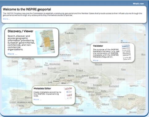
 Crowdsourcing, Citizen Science & INSPIRE Muki Haklay & Claire Ellul Extreme Citizen Science (ExCiteS) research group, UCL @mhaklay / @UCL_ExCiteS Outline Three eras of environmental information: By experts,
Development of Univ. of San Agustin Geographic Information System (USAGIS)
") , pp.170-176 http://dx.doi.org/10.14257/astl.2014.48.27 Development of Univ. of San Agustin Geographic Information System (USAGIS) Rosslin John H. Robles Chair, Computer Science Department, University
, pp.170-176 http://dx.doi.org/10.14257/astl.2014.48.27 Development of Univ. of San Agustin Geographic Information System (USAGIS) Rosslin John H. Robles Chair, Computer Science Department, University
ESM Geographic Information Systems - Spring 2014
 My Home / ESM 263 - S14 ESM 263 - GEOG. INFO. SYSTEMS - Spring 2014 SECTION LINKS 1 2 3 4 5 6 7 8 9 10 Jump to current week LATEST NEWS 12:24 PM,May 2 James Frew default workspace solution Older topics...
From User Requirements Analysis to Conceptual Design of a Mobile Augmented Reality Tool to be used in an Urban Geography Fieldwork Setting
 From User Requirements Analysis to Conceptual Design of a Mobile Augmented Reality Tool to be used in an Urban Geography Fieldwork Setting Xiaoling Wang, Corné P.J.M. van Elzakker, Menno-Jan Kraak 2016
Open data integration: from satellite to UAV for protection of built environment. The archaeological site in the Centa River bed in Albenga
 Open data integration: from satellite to UAV for protection of built environment. The archaeological site in the Centa River bed in Albenga L. Barazzetti a, R. Brumana a, B. Cuca a,b, M. Previtali a, R.
2013 AND 2025 THE FUTURE OF GIS
 THE FUTURE OF GIS 2013 AND 2025 What is the state of geospatial computing today? What are the issues today? Unresolved problems What will geospatial computing be like in 2025? What issues will be of concern
Esri and GIS Education
 Esri and GIS Education Organizations Esri Users 1,200 National Government Agencies 11,500 States & Regional Agencies 30,800 Cities & Local Governments 32,000 Businesses 8,500 Utilities 12,600 NGOs 11,000
Your web browser (Safari 7) is out of date. For more security, comfort and the best experience on this site: Update your browser Ignore
 is out of date. For more security, comfort and the best experience on this site: Update your browser Ignore") Your web browser (Safari 7) is out of date. For more security, comfort and the best experience on this site: Update your browser Ignore Activityengage MAPPING A LO NDON EPIDEMIC How can maps be used as
Your web browser (Safari 7) is out of date. For more security, comfort and the best experience on this site: Update your browser Ignore Activityengage MAPPING A LO NDON EPIDEMIC How can maps be used as
5. Comparing Map Calculus and Map Algebra in Dynamic GIS
 Haklay, M., 2007, Comparing Map Calculus and Map Algebra in Dynamic GIS, in Drummond, J., Billen, R., Forrest, D. and João, E. (eds), Dynamic & Mobile GIS: Investigating Change in Space and Time. Taylor
Resources for Spatial Thinking and Analysis
 Resources for Spatial Thinking and Analysis Donald G. Janelle Center for Spatially Integrated Social Science University of California, Santa Barbara New Orleans, 21 November 2002 Workshop on Spatial Analysis
Geographic information systems and science: today and tomorrow
 Procedia Earth and Planetary Science 1 (2009) 1037 1043 Procedia Earth and Planetary Science www.elsevier.com/locate/procedia 6th International Conference on Mining Science and Technology Geographic information
Greater Portland Pulse: an Evolution
 Greater Portland Pulse: an Evolution Measuring and Monitoring Community Outcomes portlandpulse.org Meg Merrick, Ph. D. Institute of Portland Metropolitan Studies Portland State University merrickmpdx.edu
The B.S.G.E. program is accredited by the Engineering Accreditation Commission of ABET,
 Geomatics Engineering The program of study leading to the Bachelor of Science in Geomatics Engineering (B.S.G.E.) deals with designing solutions to measure, map, model, analyze and graphically display
GIS-based Smart Campus System using 3D Modeling
 GIS-based Smart Campus System using 3D Modeling Smita Sengupta GISE Advance Research Lab. IIT Bombay, Powai Mumbai 400 076, India smitas@cse.iitb.ac.in Concept of Smart Campus System Overview of IITB Campus
The Spatial Perspective
 Department of Geography University of California at Santa Barbara GEOGRAPHY 5 MIDTERM REVIEW SHEET The Spatial Perspective - Review all of chapter 1 carefully except for Box 1.B (but do review Box 1.A
ArcGIS Enterprise: What s New. Philip Heede Shannon Kalisky Melanie Summers Sam Williamson
 ArcGIS Enterprise: What s New Philip Heede Shannon Kalisky Melanie Summers Sam Williamson ArcGIS Enterprise is the new name for ArcGIS for Server What is ArcGIS Enterprise ArcGIS Enterprise is powerful
City Life and Development
 City Life and Development City Life and Development Why study cities as a general course? Close relationship, Human survival, Enhancing our understanding of human existence, Affecting our daily life, Assisting
An Absorbing Markov Chain Model for Problem-Solving
 American Journal of Applied Mathematics and Statistics, 2016, Vol. 4, No. 6, 173-177 Available online at http://pubs.sciepub.com/ajams/4/6/2 Science and Education Publishing DOI:10.12691/ajams-4-6-2 An
Application of WebGIS and VGI for Community Based Resources Inventory. Jihn-Fa Jan Department of Land Economics National Chengchi University
 Application of WebGIS and VGI for Community Based Resources Inventory Jihn-Fa Jan Department of Land Economics National Chengchi University OUTLINE Introduction Methodology Results Conclusions 2 MOTIVATION
Introduction to Geographic Information Science. Updates/News. Last Lecture 1/23/2017. Geography 4103 / Spatial Data Representations
 Geography 4103 / 5103 Introduction to Geographic Information Science Spatial Data Representations Updates/News Waitlisted students First graded lab this week: skills learning Instructional labs vs. independence
Cluster Analysis using SaTScan. Patrick DeLuca, M.A. APHEO 2007 Conference, Ottawa October 16 th, 2007
 Cluster Analysis using SaTScan Patrick DeLuca, M.A. APHEO 2007 Conference, Ottawa October 16 th, 2007 Outline Clusters & Cluster Detection Spatial Scan Statistic Case Study 28 September 2007 APHEO Conference
Spatially Enabled Society Role of the Cadastre
 Spatially Enabled Society Role of the Cadastre Daniel STEUDLER, Switzerland and Abbas RAJABIFARD, Australia Key words: Spatially enabled society, Land administration, Cadastre SUMMARY The evolution from
Contents... GIS Approach. 4D Geo-referenced Database Approach for GIS. G IS Specific GIS Applications. FIG Working Week 2004.
 FIG Working Week 2004 4D Geo-referenced Database Approach for GIS Components of GIS GIS Approach How to Produce Maps Contents... Everything is moving with Earth by Time Why 4D Geo-referenced Database Design
Curriculum map GEOGRAPHY
 Curriculum map Learning outcomes (LOs): Having completed a major in Geography, a student will be able to: 1. Demonstrate an understanding of the major biophysical and social patterns in the world, and
Spatial Analysis and Modeling (GIST 4302/5302) Guofeng Cao Department of Geosciences Texas Tech University
 Guofeng Cao Department of Geosciences Texas Tech University") Spatial Analysis and Modeling (GIST 4302/5302) Guofeng Cao Department of Geosciences Texas Tech University TTU Graduate Certificate Geographic Information Science and Technology (GIST) 3 Core Courses and
Spatial Analysis and Modeling (GIST 4302/5302) Guofeng Cao Department of Geosciences Texas Tech University TTU Graduate Certificate Geographic Information Science and Technology (GIST) 3 Core Courses and
ARCGIS TRAINING AT KU GIS LABS: INTRODUCTION TO GIS: EXPLORING ARCCATALOG AND ARCGIS TOOLS
 PHASE 1_3 rd SESSION ARCGIS TRAINING AT KU GIS LABS: INTRODUCTION TO GIS: EXPLORING ARCCATALOG AND ARCGIS TOOLS 3 rd SESSION REPORT: 25 TH -27 TH JUNE 2014 SCHOOL OF ENVIRONMENTAL STUDIES COMPUTER LAB
Introducing GIS analysis
 1 Introducing GIS analysis GIS analysis lets you see patterns and relationships in your geographic data. The results of your analysis will give you insight into a place, help you focus your actions, or
M inds On GIS: Encouraging Spatial Thinking in an Introductory GIS Lab Sharla Lair
 M inds On GIS: Encouraging Spatial Thinking in an Introductory GIS Lab Sharla Lair D epartment of Geography The Florida State University Tallahassee, FL sbl04@ fsu.edu Typical GIS Labs M atch the teaching
Luc Anselin Spatial Analysis Laboratory Dept. Agricultural and Consumer Economics University of Illinois, Urbana-Champaign
 GIS and Spatial Analysis Luc Anselin Spatial Analysis Laboratory Dept. Agricultural and Consumer Economics University of Illinois, Urbana-Champaign http://sal.agecon.uiuc.edu Outline GIS and Spatial Analysis
THE DATA REVOLUTION HAS BEGUN On the front lines with geospatial data and tools
 THE DATA REVOLUTION HAS BEGUN On the front lines with geospatial data and tools Slidedoc of presentation for MEASURE Evaluation End of Project Meeting Washington DC May 22, 2014 John Spencer Geospatial
Abstract. Interoperable Framework for Mobile Dynamic Surveying based on open source components
 Interoperable Framework for Mobile Dynamic Surveying based on open source components Sergiusz Pawlowicz, Didier Leibovici, Richard Saull±, Mike Jackson, Chaoyu Ye, Wenchao Jiang, Natalie Adams 1, Suchith