GIS Institute Center for Geographic Analysis
|
|
|
- Edgar Lester
- 6 years ago
- Views:
Transcription
1 GIS Institute Center for Geographic Analysis
2 Welcome Intensive training in the application of GIS to research Collection, management, analysis, and communication of spatial data Topics include: data collection, management and manipulation, spatial and non-spatial analysis, and communication (graphic and cartographic) We are following a long tradition of GIS training and research at Harvard
3 Institute and CGA Team l Jason Ur, Director l Wendy Guan l Jill Kelly l Devika Kakkar l Jeff Blossom l Ben Lewis l Lex Berman l Paolo Corti l Josh Lieberman l Stacy Bogan l Fei Meng l Peter Bol, Founding Director
4 The Institute Team Week 1 will include end-of-day forums Today: Everyone Tuesday Friday: small group each day in thematic seminars Participant introductions, research interests, AND project topic Opportunity to learn more about each other s project and continue to develop project parameters

5 Locations CGA, Science Center
6 Learning Outcomes Integration of spatial analysis into research l Requirements l Limitations l Thinking Spatially/Geographically Use a research tool, vocabulary, and approach to thinking about problems Ask spatial and geographic questions
7 Goals Primary l Your projects Secondary l Asking spatial questions l Performing spatial analysis l Managing, displaying, and querying spatial data
8 Spatial Relevance vs. Spatial Analysis Some spatial questions don t require spatial analysis l Do some states have higher infant mortality than others? If so, which? Others do l Are states with higher infant mortality clustered together? Are infant mortality rates within states associated with other geographic phenomena?
9 Geographic Terminology Definitions are critical What does it mean for something to be: l Clustered, close, near, far, proximal, within, peripheral, central, distributed, regular, associated with something else, etc? Our view of the world also matters l Often in GIS we are limited by our data l The search for good data can take as much effort as the analysis we perform
10 Projects Contribute to the success of your research GIS exists to supplement your research: letting it play a role in conducting your research should be done thoughtfully Spatial analysis vs. analysis of place l Units of Analysis and Area of Study
11 Project Presentations While we have high expectations for your presentations we don t have the same expectations for each of you Grouped by theme l Topic l Technique l Place l Other Lunch, Social
12 Agenda Skills and Knowledge based Workshops and Exercises will focus on developing GIS and related software skills Lectures and Seminars will focus on providing background, context, and critical thinking opportunities
13 Agenda Week 1 focus is skill development related to creating, acquiring, managing, analyzing, and communicating spatial information Week 2 focus is critical thinking related to your personal research project Overall focus is generating a foundation in the practice and theory of spatial information
14 GIS Institute Center for Geographic Analysis What is GIS?
15 Outline The roots of GIS l Geography, Information, System Learning Outcomes l Distinguish between Geography and GIS l Describe advantages and limitations of taking a formal and quantitative view of the world
16 What is GIS? Roots of GIS l Geography, Information, System Geography: A discipline focused on the spatial arrangement of features (human and non-human) on and near the Earth s surface Information: facts about known reality System: a whole composed of parts based on rules and definitions 16

17 Geographic Concepts Spatial arrangements l Distributions, networks, areas Spatial relationships l Distance, direction, correlation Spatial processes l Flows, forces, movement Processes that alter spatial arrangements l Scale Energy 17
18 18
19 Geography Exploration of geographic phenomena l Modern day explorers of already discovered places Space vs. Place 19
20 Information Can come in many forms l Text, numbers, pictures, lists and tables, sounds, maps and images, movies, animation, models These forms can represent almost anything l locations, quantities, identities, time, emotions, attitudes, etc. 20
21 Value of Information Information is the basis for knowledge l Experience (and other modes or acquisition) exposes us to information l Exposure to information, along with understanding, leads to knowledge l Knowledge is the basis for problem solving (which at some point in history meant survival) 21

22 22 S4, Brown University
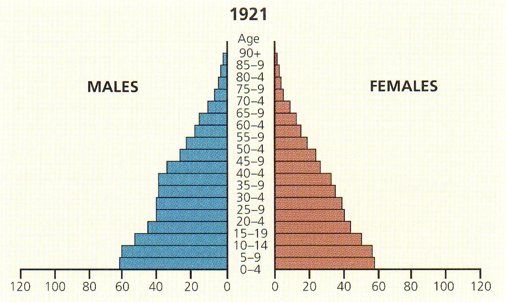
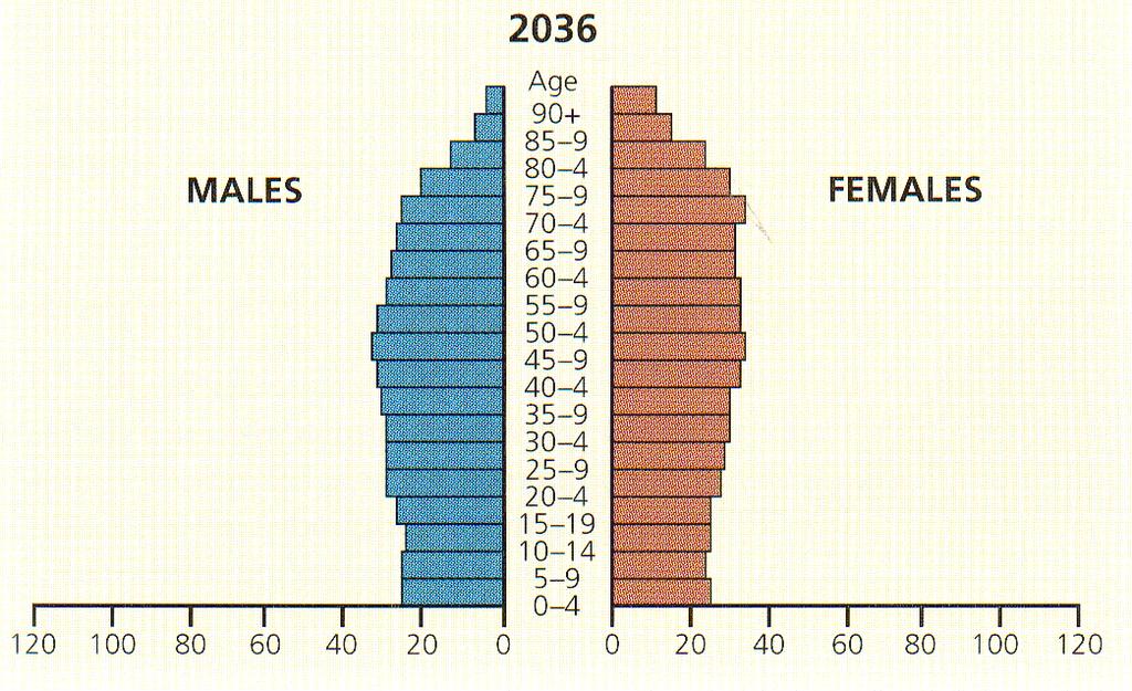
23 Spatial Representations A spatial representation uses aspects of space to communicate l Example include graphs, diagrams, cartoons, plots, plans, AND maps A spatial representation can communicate both spatial and non-spatial information l Population pyramids use space to summarize the age and sex distribution of a place s population 23
24 Representations of Space There are many ways we can summarize the geographic and spatial nature of the world l Route description, computer program, music, lyrics, novels, AND maps We are not limited to maps or other spatial representations when communicating about geographic or spatial entities, patterns, or information 24
25 System for Integrating Information System: a whole composed of parts (in an orderly arrangement) based on some scheme or plan l Not associated with a simple composition Information System (informal) l Provides the baseline for sharing and combining information l Not necessarily digital 25
26 Formal Information Systems Integration of information in a digital system l Provides formal rules for entry, storage, editing, relating, querying, and presenting information l While most of above could be done by hand, a computing environment makes it easier and faster (if you learn the language) l Benefits outweigh the drawbacks Drawbacks l Traditionally difficult to incorporate qualitative, fuzzy, affective information 26
 27 S4, Brown University")
27 Geographic Information Systems Formal structure for dealing with geographic information Generic and Specific technology GIS as an application l hardware, data, software and people needed to solve a problem GIS as software l Developer specific (i.e. Microsoft, Oracle, ESRI) 27 S4, Brown University

28 Essential Elements of GIS Location, Location, Location l Coordinate Systems Global Absolute vs Other (local, regional, personal, etc.) l Models of Earth Geodetic Datums Globes Maps l Models of Reality Data Models 28 S4, Brown University
29 GIS Software Spatially explicit commands and functionality l l Display, edit, change, transform, measure (distances, areas, volumes), and combine Manage, compare, judge, analyze, decide, predict, etc. The user combines their knowledge, with existing data, using generic hardware running GIS software l l Can range from free to very expensive Can focus on a subset of GIS functions or can cover the breadth of possible functions 29
30 30 S4, Brown University
netw rks Guided Reading Activity Essential Question: How does geography influence the way people live? What Is Geography?
 Guided Reading Activity What Is Geography? Lesson 1 Thinking Like a Geographer Essential Question: How does geography influence the way people live? Directions: Read the lesson and use your textbook to
Chapter 1, Section 1 Exploring Geography
 Chapter 1, Section 1 Exploring Geography (Pages 19 22) Setting a Purpose for Reading Think about these questions as you read: What are the physical and human features geographers study? How do geographers
GIS and Forest Engineering Applications FE 357 Lecture: 2 hours Lab: 2 hours 3 credits
 GIS and Forest Engineering Applications FE 357 Lecture: 2 hours Lab: 2 hours 3 credits Instructor: Michael Wing Assistant Professor Forest Engineering Department Oregon State University Peavy Hall 275
The Importance of Spatial Literacy
 The Importance of Spatial Literacy Dr. Michael Phoenix GIS Education Consultant Taiwan, 2009 What is Spatial Literacy? Spatial Literacy is the ability to be able to include the spatial dimension in our
Geography. Programme of study for key stage 3 and attainment target (This is an extract from The National Curriculum 2007)
") Geography Programme of study for key stage 3 and attainment target (This is an extract from The National Curriculum 2007) Crown copyright 2007 Qualifications and Curriculum Authority 2007 Curriculum aims
Geography Programme of study for key stage 3 and attainment target (This is an extract from The National Curriculum 2007) Crown copyright 2007 Qualifications and Curriculum Authority 2007 Curriculum aims
An Introduction to Geographic Information System
 An Introduction to Geographic Information System PROF. Dr. Yuji MURAYAMA Khun Kyaw Aung Hein 1 July 21,2010 GIS: A Formal Definition A system for capturing, storing, checking, Integrating, manipulating,
GEOG 508 GEOGRAPHIC INFORMATION SYSTEMS I KANSAS STATE UNIVERSITY DEPARTMENT OF GEOGRAPHY FALL SEMESTER, 2002
 GEOG 508 GEOGRAPHIC INFORMATION SYSTEMS I KANSAS STATE UNIVERSITY DEPARTMENT OF GEOGRAPHY FALL SEMESTER, 2002 Course Reference #: 13210 Meeting Time: TU 2:05pm - 3:20 pm Meeting Place: Ackert 221 Remote
World Geography TEKS 2nd Nine Weeks. Unit of Study Regional Studies; U.S. and Canada Regional Studies; Latin America; and Europe
 World Geography TEKS 2nd Nine Weeks Unit of Study Regional Studies; U.S. and Canada Regional Studies; Latin America; and Europe 1) History. The student understands how geography and processes of spatial
Labs: Chelsea Ackroyd Office Location: FMAB 005 Office Hours: M 08:45 11:45 AM or by appointment
 Introduction to Geographic Information Systems (GEOG 3140 and 314) & GIS Fundamentals (GEOG 6139) Fall 2017 Section 002 M 01:25 02:45 PM Section 003 M 03:00 4:20 PM Section 004 W 01:25 02:45 PM M Lib 1150
Introduction to Geographic Information Science. Updates/News. Last Lecture 1/23/2017. Geography 4103 / Spatial Data Representations
 Geography 4103 / 5103 Introduction to Geographic Information Science Spatial Data Representations Updates/News Waitlisted students First graded lab this week: skills learning Instructional labs vs. independence
GIS = Geographic Information Systems;
 What is GIS GIS = Geographic Information Systems; What Information are we talking about? Information about anything that has a place (e.g. locations of features, address of people) on Earth s surface,
GIS and Forest Engineering Applications FE 257 Lecture and laboratory, 3 credits
 GIS and Forest Engineering Applications FE 257 Lecture and laboratory, 3 credits Instructor: Michael Wing Associate Professor Forest Engineering, Resources, and Management Oregon State University Crop
FUNDAMENTALS OF GEOINFORMATICS PART-II (CLASS: FYBSc SEM- II)
") FUNDAMENTALS OF GEOINFORMATICS PART-II (CLASS: FYBSc SEM- II) UNIT:-I: INTRODUCTION TO GIS 1.1.Definition, Potential of GIS, Concept of Space and Time 1.2.Components of GIS, Evolution/Origin and Objectives
FUNDAMENTALS OF GEOINFORMATICS PART-II (CLASS: FYBSc SEM- II) UNIT:-I: INTRODUCTION TO GIS 1.1.Definition, Potential of GIS, Concept of Space and Time 1.2.Components of GIS, Evolution/Origin and Objectives
VOCABULARY SCAVENGER HUNT Five Themes of Geography
 SECTION: VOCABULARY SCAVENGER HUNT Five Themes of Geography Directions: Skim The Five Themes of Geography and define the following words. Geography: Absolute Location: Relative Location: Hemisphere: Equator:
STUDY GUIDE. Exploring Geography. Chapter 1, Section 1. Terms to Know DRAWING FROM EXPERIENCE ORGANIZING YOUR THOUGHTS
 For use with textbook pages 19 22. Exploring Geography Terms to Know location A specific place on the earth (page 20) absolute location The exact spot at which a place is found on the globe (page 20) hemisphere
A spatial literacy initiative for undergraduate education at UCSB
 A spatial literacy initiative for undergraduate education at UCSB Mike Goodchild & Don Janelle Department of Geography / spatial@ucsb University of California, Santa Barbara ThinkSpatial Brown bag forum
An introduction to plotting data
 An introduction to plotting data Eric D. Black California Institute of Technology v2.0 1 Introduction Plotting data is one of the essential skills every scientist must have. We use it on a near-daily basis
Cartographic Workshop
 http://lazarus.elte.hu/cet/ Cartographic Workshop One of the roles of the ICA, Commission on Education and Training is to provide member nations with cartographic workshop experiences that enhance the
Master Syllabus Department of Geography GEOG 121: Geography of the Cultural Environment Course Description
 Master Syllabus Department of Geography GEOG 121: Geography of the Cultural Environment Course Description Geography of the Cultural Environment utilizes qualitative methods to investigate relationships
Name: Date: Period: #: Chapter 1: Outline Notes What Does a Historian Do?
 Name: Date: Period: #: Chapter 1: Outline Notes What Does a Historian Do? Lesson 1.1 What is History? I. Why Study History? A. History is the study of the of the past. History considers both the way things
INTRODUCTION TO GIS. Dr. Ori Gudes
 INTRODUCTION TO GIS Dr. Ori Gudes Outline of the Presentation What is GIS? What s the rational for using GIS, and how GIS can be used to solve problems? Explore a GIS map and get information about map
GEOG 3340: Introduction to Human Geography Research
 GEOG 3340: Introduction to Human Geography Research Lecture 1: Course Overview Guofeng Cao www.myweb.ttu.edu/gucao Department of Geosciences Texas Tech University guofeng.cao@ttu.edu Fall 2015 Course Description
ENV208/ENV508 Applied GIS. Week 1: What is GIS?
 ENV208/ENV508 Applied GIS Week 1: What is GIS? 1 WHAT IS GIS? A GIS integrates hardware, software, and data for capturing, managing, analyzing, and displaying all forms of geographically referenced information.
TEMPLATE FOR CMaP PROJECT
 TEMPLATE FOR CMaP PROJECT Project Title: Native Utah Plants Created by: Anna Davis Class: Box Elder 2008 Project Description Community Issue or Problem Selected -How project evolved? Community Partner(s)
ECONOMIC AND SOCIAL COUNCIL 13 July 2007
 UNITED NATIONS E/CONF.98/CRP.34 ECONOMIC AND SOCIAL COUNCIL 13 July 2007 Ninth United Nations Conference on the Standardization of Geographical Names New York, 21-30 August 2007 Item 17(b) of the provisional
Geographical Information System GIS
 Geographical Information System GIS LOOM.02.331 anto.aasa@ut.ee Scale GIS and spatial planning National Regional Local Strategic (National Dev. Plan) National Goals and development policy Tactical (Regional
UNDER REVIEW. Abstract
 UNDER REVIEW Getting To Know ArcGIS Desktop By: Ormsby, Napoleon, Burke, Groessl, and Bowden, (2010). Format: (Softcover, 592 pp. ISBN: 9781589482609) Publisher: Redlands, California: ESRI Press Abstract
GIS (GEOGRAPHIC INFORMATION SYSTEMS)
") GIS (GEOGRAPHIC INFORMATION SYSTEMS) 1 1. DEFINITION SYSTEM Any organised assembly of resources and procedures united and regulated by interaction or interdependence to complete a set of specific functions.
GIS (GEOGRAPHIC INFORMATION SYSTEMS) 1 1. DEFINITION SYSTEM Any organised assembly of resources and procedures united and regulated by interaction or interdependence to complete a set of specific functions.
Representation of Geographic Data
 GIS 5210 Week 2 The Nature of Spatial Variation Three principles of the nature of spatial variation: proximity effects are key to understanding spatial variation issues of geographic scale and level of
GEOGRAPHICAL INFORMATION SYSTEMS. GIS Foundation Capacity Building Course. Introduction
 GEOGRAPHICAL INFORMATION SYSTEMS. GIS Foundation Capacity Building Course. Introduction In recent times digital mapping has become part and parcel of our daily lives with experience from Google Maps on
Unit 1 The Basics of Geography. Chapter 1 The Five Themes of Geography Page 5
 Unit 1 The Basics of Geography Chapter 1 The Five Themes of Geography Page 5 Geography comes from the Greek word geographia, which means to describe the earth. Geography is the study of the distribution
A GIS helps you answer questions and solve problems by looking at your data in a way that is quickly understood and easily shared.
 WHAT IS GIS? A geographic information system (GIS) integrates hardware, software, and data for capturing, managing, analyzing, and displaying all forms of geographically referenced information. GIS allows
Subject: Geography- Grade Descriptors
 Subject Grade s Developing - Secure This is the Grade at that level = 9 There are no s for 9 Exceptional ly in the top 20% at 8 is awarded 9 8 for 8 securely at 8 showing of AO1, A02 AO3 Excellent knowledge
Unit 1 Part 2. Concepts Underlying The Geographic Perspective
 Unit 1 Part 2 Concepts Underlying The Geographic Perspective Unit Expectations 1.B Enduring Understanding: Students will be able to.. Know that Geography offers asset of concepts, skills, and tools that
GEOG 100E Introduction to Geography (5 credits)
") Bellevue College GEOG 100E Introduction to Geography (5 credits) Fall, 2010 5:30 7:40 pm T, Th Room D273 Instructor: Charles Chip Dodd Phone: 425 564-2499 E-mail: cdodd@shoreline.edu Office Hours: 4:30
Bellevue College GEOG 100E Introduction to Geography (5 credits) Fall, 2010 5:30 7:40 pm T, Th Room D273 Instructor: Charles Chip Dodd Phone: 425 564-2499 E-mail: cdodd@shoreline.edu Office Hours: 4:30
settlement, economic interdependence), Interpret the relationship between physical environments and society
, Interpret the relationship between physical environments and society") Mrs. Newgard Lesson Plans World Geography Grade 9 Monday, September 19 o Objective: Compare and contrast world religions Go through religious terms animism, atheism, monotheism, polytheism, secularism,
Mrs. Newgard Lesson Plans World Geography Grade 9 Monday, September 19 o Objective: Compare and contrast world religions Go through religious terms animism, atheism, monotheism, polytheism, secularism,
Chapter 1. GIS Fundamentals
 1. GIS Overview Chapter 1. GIS Fundamentals GIS refers to three integrated parts. Geographic: Of the real world; the spatial realities, the geography. Information: Data and information; their meaning and
A Correlation of. Eastern Hemisphere. Ohio s Learning Standards Social Studies: K-12 Grade 6
 A Correlation of Eastern Hemisphere To Grade 6 to,, Grade 6 Introduction This document demonstrates how, Eastern Hemisphere, Ohio Edition, meets : K-12 Social Studies for Grade 6. Correlation page references
Climate Change: How it impacts Canadians and what we can do to slow it down.
 Climate Change: How it impacts Canadians and what we can do to slow it down. Lesson Overview This lesson takes stock of how climate change has already affected Canadians in geographic, economic, and cultural
SOCIAL STUDIES GRADE 6. I Can Checklist REGIONS AND PEOPLE OF THE EASTERN HEMISPHERE. Office of Teaching and Learning Curriculum Division
 SOCIAL STUDIES REGIONS AND PEOPLE OF THE EASTERN HEMISPHERE GRADE 6 I Can Checklist 2018-2019 Aligned with Ohio s Learning Standards for Social Studies Office of Teaching and Learning Curriculum Division
XXX Curriculum links. Key question. Objective NC link QCA link. Hot spot. 1 Resource 1 What are rainforests? To know the features of a rainforest
 Curriculum links National Curriculum Geography: Geographical enquiry and skills, Knowledge and understanding of places, Knowledge and understanding of patterns and processes, Knowledge and understanding
Dublin City Schools Social Studies Graded Course of Study Grade 5 K-12 Social Studies Vision
 K-12 Social Studies Vision The Dublin City Schools K-12 Social Studies Education will provide many learning opportunities that will help students to: develop thinking as educated citizens who seek to understand
Health and Medical Geography (GEOG 222)
") Spring 2019 Class meets: Tuesdays and Thursdays 12:30-1:45pm Carolina Hall Room 220 Instructor: Michael Emch Email: emch@unc.edu Course Objectives Health and Medical Geography (GEOG 222) This course is
Spring 2019 Class meets: Tuesdays and Thursdays 12:30-1:45pm Carolina Hall Room 220 Instructor: Michael Emch Email: emch@unc.edu Course Objectives Health and Medical Geography (GEOG 222) This course is
LOUISIANA STUDENT STANDARDS FOR SOCIAL STUDIES THAT CORRELATE WITH A FIELD TRIP TO DESTREHAN PLANTATION KINDERGARTEN
 LOUISIANA STUDENT STANDARDS FOR SOCIAL STUDIES THAT CORRELATE WITH A FIELD TRIP TO DESTREHAN PLANTATION KINDERGARTEN Standard 2 Historical Thinking Skills Students distinguish between events, people, and
Course Syllabus. Geospatial Data & Spatial Digital Technologies: Assessing Land Use/Land Cover Change in the Ecuadorian Amazon.
 Course Syllabus Geospatial Data & Spatial Digital Technologies: Assessing Land Use/Land Cover Change in the Ecuadorian Amazon Co- Instructors Dr. Carlos F. Mena, Universidad San Francisco de Quito, Ecuador
Understanding Geographic Information System GIS
 Understanding Geographic Information System GIS What do we know about GIS? G eographic I nformation Maps Data S ystem Computerized What do we know about maps? Types of Maps (Familiar Examples) Street Maps
Year 8 standard elaborations Australian Curriculum: Geography
 Purpose Structure The standard elaborations (SEs) provide additional clarity when using the Australian Curriculum achievement standard to make judgments on a five-point scale. These can be used as a tool
The 7th Annual SARGIS Workshop and Meeting. Welcome to SARGIS7!
 The 7th Annual SARGIS Workshop and Meeting Welcome to SARGIS7! The National Alliance for Public Safety GIS Foundation is a 501 (C) (3) not-forprofit organization» OUR VISION A Nation of emergency responders
Application of GIS in Public Transportation Case-study: Almada, Portugal
 Case-study: Almada, Portugal Doutor Jorge Ferreira 1 FSCH/UNL Av Berna 26 C 1069-061 Lisboa, Portugal +351 21 7908300 jr.ferreira@fcsh.unl.pt 2 FSCH/UNL Dra. FCSH/UNL +351 914693843, leite.ines@gmail.com
GTECH 380/722 Analytical and Computer Cartography Hunter College, CUNY Department of Geography
 GTECH 380/722 Analytical and Computer Cartography Hunter College, CUNY Department of Geography Fall 2014 Mondays 5:35PM to 9:15PM Instructor: Doug Williamson, PhD Email: Douglas.Williamson@hunter.cuny.edu
Geography: Place & Liveability
 Geography: Place & Liveability Learning Area(s) Geography Year(s) 6, 7 Description AC Geography : Year 6 A diverse and connected world takes a global view of geography and focuses particularly on the concepts
Implementing the Sustainable Development Goals: The Role of Geospatial Technology and Innovation
 Fifth High Level Forum on UN Global Geospatial Information Management Implementing the Sustainable Development Goals: The Role of Geospatial Technology and Innovation 28-30 November 2017 Sheraton Maria
Assessment Design. AGTA Conference Rotorua NZ January 2015
 Assessment Design AGTA Conference Rotorua NZ January 2015 The StAR team Standards, Assessment and Reporting How do we know? Assessment Urban settlement 1. List 3 advantages of living in your local town
An Introduction to Scientific Research Methods in Geography Chapter 3 Data Collection in Geography
 An Introduction to Scientific Research Methods in Geography Chapter 3 Data Collection in Geography Learning Objectives What is the distinction between primary and secondary data sources? What are the five
Cartography and Children Commission: Proposals for the next 4 years
 International Cartographic Association Cartography and Children Commission: Proposals for the next 4 years José Jesús Reyes Nuñez Eötvös Loránd University Dept. of Cartography and Geoinformatics Budapest,
Your web browser (Safari 7) is out of date. For more security, comfort and. the best experience on this site: Update your browser Ignore
 is out of date. For more security, comfort and. the best experience on this site: Update your browser Ignore") Your web browser (Safari 7) is out of date. For more security, comfort and lesson the best experience on this site: Update your browser Ignore Political Borders Why are the borders of countries located
Your web browser (Safari 7) is out of date. For more security, comfort and lesson the best experience on this site: Update your browser Ignore Political Borders Why are the borders of countries located
SRJC Applied Technology 54A Introduction to GIS
 SRJC Applied Technology 54A Introduction to GIS Overview Lecture of Geographic Information Systems Fall 2004 Santa Rosa Junior College Presented By: Tim Pudoff, GIS Coordinator, County of Sonoma, Information
COURSE INTRODUCTION & COURSE OVERVIEW
 week 1 COURSE INTRODUCTION & COURSE OVERVIEW topics of the week Instructor introduction Students introductions Course logistics Course objectives Definition of GIS The story of GIS introductions Who am
INTRODUCTION TO HUMAN GEOGRAPHY. Chapter 1
 INTRODUCTION TO HUMAN GEOGRAPHY Chapter 1 What Is Human Geography? The study of How people make places How we organize space and society How we interact with each other in places and across space How we
GRADE 8 LEAP SOCIAL STUDIES ASSESSMENT STRUCTURE. Grade 8 Social Studies Assessment Structure
 Grade 8 Social Studies Assessment Structure 1 In 2013-2014, the grade 8 LEAP test continues to assess Louisiana s social studies benchmarks. The design of the multiple-choice sessions of the test remains
Warmup. geography compass rose culture longitude
 Warmup geography compass rose culture longitude ecosystem latitude 1. study of the special physical and human characteristics of a place or region 2. learned system of shared beliefs, traits, and values
AP Human Geography Unit 1: Basic Concepts and Development Mr. Stepek Guided Reading/Study Guide
 AP Human Geography Unit 1: Basic Concepts and Development Mr. Stepek Guided Reading/Study Guide Directions: Follow the common directions distributed to you for guided reading assignments. Rubenstein p
Spatial Analysis and Modeling (GIST 4302/5302) Guofeng Cao Department of Geosciences Texas Tech University
 Guofeng Cao Department of Geosciences Texas Tech University") Spatial Analysis and Modeling (GIST 4302/5302) Guofeng Cao Department of Geosciences Texas Tech University TTU Graduate Certificate Geographic Information Science and Technology (GIST) 3 Core Courses and
Spatial Analysis and Modeling (GIST 4302/5302) Guofeng Cao Department of Geosciences Texas Tech University TTU Graduate Certificate Geographic Information Science and Technology (GIST) 3 Core Courses and
School of Geography and Geosciences. Head of School Degree Programmes. Programme Requirements. Modules. Geography and Geosciences 5000 Level Modules
 School of Geography and Geosciences Head of School Degree Programmes Graduate Diploma: Dr W E Stephens Health Geography Research Environmental History and Policy (see School of History) M.Res.: M.Litt.:
How GIS can be used for improvement of literacy and CE programmes
 How GIS can be used for improvement of literacy and CE programmes Training Workshop for Myanmar Literacy Resource Center (MLRC) ( Yangon, Myanmar, 11 20 October 2000 ) Presented by U THEIN HTUT GEOCOMP
HISTORY 1XX/ DH 1XX. Introduction to Geospatial Humanities. Instructor: Zephyr Frank, Associate Professor, History Department Office: Building
 HISTORY 1XX/ DH 1XX Introduction to Geospatial Humanities Instructor: Zephyr Frank, Associate Professor, History Department Office: Building 200-332 Course Description This course introduces undergraduate
OUTBREAK INVESTIGATION AND SPATIAL ANALYSIS OF SURVEILLANCE DATA: CLUSTER DATA ANALYSIS. Preliminary Programme / Draft_2. Serbia, Mai 2013
 OUTBREAK INVESTIGATION AND SPATIAL ANALYSIS OF SURVEILLANCE DATA: CLUSTER DATA ANALYSIS Preliminary Programme / Draft_2 Serbia, 20-24 Mai 2013 1. Course presentation Outbreak investigation is one of the
Why Geography Matters
 Why Geography Matters Vocabulary words geography relative location absolute location physical feature human feature region modify adapt cause effect geography: The study of the Earth s physical and human
Are You Maximizing The Value Of All Your Data?
 Are You Maximizing The Value Of All Your Data? Using The SAS Bridge for ESRI With ArcGIS Business Analyst In A Retail Market Analysis SAS and ESRI: Bringing GIS Mapping and SAS Data Together Presented
Introduction to Human Geography & Geographic Concepts
 Introduction to Human Geography & Geographic Concepts What is Geography? Literal definition: Description of the Earth Serves as a bridge between physical and human sciences the study of the earth and its
Welcome to NR502 GIS Applications in Natural Resources. You can take this course for 1 or 2 credits. There is also an option for 3 credits.
 Welcome to NR502 GIS Applications in Natural Resources. You can take this course for 1 or 2 credits. There is also an option for 3 credits. The 1st credit consists of a series of readings, demonstration,
Advanced Placement Human Geography
 Advanced Placement Human Geography Introduction to AP Human Geography The Advanced Placement course in Human Geography is designed to introduce students to the systematic study of the processes that have
M.Y. Pior Faculty of Real Estate Science, University of Meikai, JAPAN
 GEOGRAPHIC INFORMATION SYSTEM M.Y. Pior Faculty of Real Estate Science, University of Meikai, JAPAN Keywords: GIS, rasterbased model, vectorbased model, layer, attribute, topology, spatial analysis. Contents
Increasing GI awareness in local authorities in Poland experiences from the INSPIRE Academy training programme
 Increasing GI awareness in local authorities in Poland experiences from the INSPIRE Academy training programme http://www.akademiainspire.pl Maria Andrzejewska, Monika Rusztecka UNEP/GRID-Warsaw Centre,
State and National Standard Correlations NGS, NCGIA, ESRI, MCHE
 GEOGRAPHIC INFORMATION SYSTEMS (GIS) COURSE DESCRIPTION SS000044 (1 st or 2 nd Sem.) GEOGRAPHIC INFORMATION SYSTEMS (11, 12) ½ Unit Prerequisite: None This course is an introduction to Geographic Information
geographic patterns and processes are captured and represented using computer technologies
 Proposed Certificate in Geographic Information Science Department of Geographical and Sustainability Sciences Submitted: November 9, 2016 Geographic information systems (GIS) capture the complex spatial
GIS Workshop Data Collection Techniques
 GIS Workshop Data Collection Techniques NOFNEC Conference 2016 Presented by: Matawa First Nations Management Jennifer Duncan and Charlene Wagenaar, Geomatics Technicians, Four Rivers Department QA #: FRG
Geog418: Introduction to GIS Fall 2011 Course Syllabus. Textbook: Introduction to Geographic Information Systems edited by Chang (6th ed.
 Geog418: Introduction to GIS Fall 2011 Course Syllabus AH 1320 3:30 4:45 p.m.tr Instructor: Dr. Shunfu Hu Office: AH1413 Telephone 650-2281 Office hours: 10:00 11:00 a.m. TR or by appointment (shu@siue.edu)
Teaching Geography Author Phil GERSMEHL
 Teaching Geography Author Phil GERSMEHL University of Minnesota, USA 332 Review of International Geographical Education Online RIGEO, 2015, 5(3), 332-336 Publisher: The Guilford Press Publication Year:
Dr. Stephen J. Walsh Department of Geography, UNC-CH Fall, 2007 Monday 3:30-6:00 pm Saunders Hall Room 220. Introduction
 Geographic Information Systems Geography 491 Dr. Stephen J. Walsh Department of Geography, UNC-CH Fall, 2007 Monday 3:30-6:00 pm Saunders Hall Room 220 Introduction Organizations that have a planning,
Grade 6 Social Studies
 Unit Title: Africa : Movement Location Place Human Region : Subject/Course: 6 th Grade Social Studies Essential Questions: peoples, cultures and ideas of the world? How is a location identified using map
Quarterly Pacing Guide 6th grade Social Studies Content Expectations
 6.G1 The World in Spacial Term Terms: Geographical Habits of Mind 6.G1.1 Spacial Thinking 6 - G1.1.1 Use maps, globes, and web based geography technology to investigate the world at global, interregional,
GTECH 380/722 Analytical and Computer Cartography Hunter College, CUNY Department of Geography
 GTECH 380/722 Analytical and Computer Cartography Hunter College, CUNY Department of Geography Spring 2010 Wednesdays 5:35PM to 9:15PM Instructor: Doug Williamson, PhD Email: Douglas.Williamson@hunter.cuny.edu
GIS Visualization: A Library s Pursuit Towards Creative and Innovative Research
 GIS Visualization: A Library s Pursuit Towards Creative and Innovative Research Justin B. Sorensen J. Willard Marriott Library University of Utah justin.sorensen@utah.edu Abstract As emerging technologies
Geographical knowledge and understanding scope and sequence: Foundation to Year 10
 Geographical knowledge and understanding scope and sequence: Foundation to Year 10 Foundation Year 1 Year 2 Year 3 Year 4 Year 5 Year 6 Year level focus People live in places Places have distinctive features
West Virginia University Department of Civil and Environmental Engineering Course Syllabus
 West Virginia University Department of Civil and Environmental Engineering Course Syllabus Course: CE 305 - Introduction to Geomatics Semester: Summer 2012 (6 weeks) May 21 June 29 Course Format And Credit
Emerging Issues in Geographic Information Science (GEP680): Projections, Scale, Accuracy, and Interpolation Lehman College, Spring 2017
: Projections, Scale, Accuracy, and Interpolation Lehman College, Spring 2017") Emerging Issues in Geographic Information Science (GEP680): Projections, Scale, Accuracy, and Interpolation Lehman College, Spring 2017 Instructor: Gary Ostroff, P.E., Adjunct Lecturer E-mail: Gary.Ostroff@lehman.cuny.edu;
Emerging Issues in Geographic Information Science (GEP680): Projections, Scale, Accuracy, and Interpolation Lehman College, Spring 2017 Instructor: Gary Ostroff, P.E., Adjunct Lecturer E-mail: Gary.Ostroff@lehman.cuny.edu;
CERTIFICATE COURSE IN GEO-INFORMATICS 1 (GGFGIS7) 2016
 2016") UNIVERSITY OF JOHANNESBURG DEPARTMENT OF GEOGRAPHY, ENVIRONMENTAL MANAGEMENT AND ENERGY STUDIES CERTIFICATE COURSE IN GEO-INFORMATICS 1 (GGFGIS7) 2016 THE COURSE: The Geo-Informatics 1 course is an introduction
UNIVERSITY OF JOHANNESBURG DEPARTMENT OF GEOGRAPHY, ENVIRONMENTAL MANAGEMENT AND ENERGY STUDIES CERTIFICATE COURSE IN GEO-INFORMATICS 1 (GGFGIS7) 2016 THE COURSE: The Geo-Informatics 1 course is an introduction
Evolution or Devolution of Cartographic Education?
 Evolution or Devolution of Cartographic Education? Transformations in Teaching Cartographic Concepts and Techniques Aileen Buckley Cartographic Researcher, ESRI, Inc. abuckley@esri.com Terminology UCGIS*
Stratford School Academy Schemes of Work GEOG: RESTLESS EARTH
 Case studies Drawing maps, graphs and diagrams. Stratford School Academy Year 10 Restless Earth Geography: YEAR 10 Restless Earth Number of weeks Content of the unit Assumed prior learning (tested at the
GIS TECHNICIAN I GIS TECHNICIAN II
 GIS TECHNICIAN I GIS TECHNICIAN II CITY OF ROSEVILLE DEFINITION To perform a variety of technical office and field work duties related to the creation and maintenance of maps, tables, graphs and other
Basics of GIS. by Basudeb Bhatta. Computer Aided Design Centre Department of Computer Science and Engineering Jadavpur University
 Basics of GIS by Basudeb Bhatta Computer Aided Design Centre Department of Computer Science and Engineering Jadavpur University e-governance Training Programme Conducted by National Institute of Electronics
Texas Geography. Understanding the physical and human characteristics of our state
 Texas Geography Understanding the physical and human characteristics of our state To understand Texas you must first learn about its Geography. Geography- The study of the world, its people, and the interaction
Introduction-Overview. Why use a GIS? What can a GIS do? Spatial (coordinate) data model Relational (tabular) data model
 data model Relational (tabular) data model") Introduction-Overview Why use a GIS? What can a GIS do? How does a GIS work? GIS definitions Spatial (coordinate) data model Relational (tabular) data model intro_gis.ppt 1 Why use a GIS? An extension
Introduction-Overview Why use a GIS? What can a GIS do? How does a GIS work? GIS definitions Spatial (coordinate) data model Relational (tabular) data model intro_gis.ppt 1 Why use a GIS? An extension
Critical Thinking. 6. Earth science : astronomy :: a.changeable : solid b.subset : set c. theory : reality d.surrounding Earth : beyond Earth
 Skills Worksheet Critical Thinking ANALOGIES In the space provided, write the letter of the pair of terms or phrases that best complete the analogy shown. An analogy is a relationship between two pairs
Subject Matter and Geography Education
 Subject Matter and Geography Education Kwang Joon Cho Seoul Teachers College As Subject Education appears, the idea of the subject becomes clear arid the goals of Subject Education come to focus on character
Geoinformation in Environmental Modelling
 Geoinformation in Environmental Modelling Introduction to the topics ENY-C2005 Jaakko Madetoja 5.1.2018 Slides by Paula Ahonen-Rainio Topics today Orientation to geoinformation in environmental modelling
Unit 1: Introduction: Thinking Geographically, Basic Concepts
 Unit 1: Introduction: Thinking Geographically, Basic Concepts 38:180 Human Geography What does it mean to think like a geographer? Memorizing places? Countries, capital cities, rivers, etc School Geography
GEOGRAPHIC INFORMATION SYSTEMS SPECIALIST 3 DEFINITION:
 Hunterdon County Department of Planning and Land Use Vacancy: Geographic Information Systems Specialist 3 Full Time: 40 Hours per Week Compensation: $42,000.00 per year GEOGRAPHIC INFORMATION SYSTEMS SPECIALIST
Stellar Astronomy 1401 Spring 2009
 Stellar Astronomy 1401 Spring 2009 Instructor: Ron Wilhelm Office: Science Building Room 9 Contact information: Office Hours: 742-4707 or ron.wilhelm@ttu.edu MWF 10:00-11:00 PM T & Th 11:30-12:30 AM Or