Fundamental Spatial Concepts. Michael F. Goodchild University of California Santa Barbara
|
|
|
- Barbara Kelly
- 5 years ago
- Views:
Transcription
1 Fundamental Spatial Concepts Michael F. Goodchild University of California Santa Barbara
2 A spatial turn in science Adding space to theory the New Economic Geography space impeding flows of information, operation of markets transport costs Spatial Ecology a heterogeneous resource base space impeding interactions, breeding metapopulations Reasoning from spatial data cross-sectional new tools to overcome methodological problems impacts in all social, environmental disciplines

3 A growing literature Spatially Integrated Social Science (Goodchild and Janelle, OUP, 2004)
4 The drivers New technologies, new data geographic information systems (GIS) remote sensing positioning (GPS) using location to integrate providing spatial context delivery mechanisms Applications of science in policy, decision making, design
5 What fundamental concepts? How do people organize knowledge about space? How should we organize the tools? What does it mean to think spatially? are people who do fundamentally different? can one train to be a spatial thinker? would you know one if you met one?
6 Spatial thinking Larger than GIS compare GIScience What every Google Earth user needs to know One of Gardner s seven types of intelligence
7 1. Linguistic Children with this kind of intelligence enjoy writing, reading, telling stories or doing crossword puzzles. 2. Logical-Mathematical Children with lots of logical intelligence are interested in patterns, categories and relationships. They are drawn to arithmetic problems, strategy games and experiments. 3. Bodily-Kinesthetic These kids process knowledge through bodily sensations. They are often athletic, dancers or good at crafts such as sewing or woodworking. 4. Spatial These children think in images and pictures. They may be fascinated with mazes or jigsaw puzzles, or spend free time drawing, building with Lego or daydreaming. 5. Musical Musical children are always singing or drumming to themselves. They are usually quite aware of sounds others may miss. These kids are often discriminating listeners. 6. Interpersonal Children who are leaders among their peers, who are good at communicating and who seem to understand others' feelings and motives possess interpersonal intelligence. 7. Intrapersonal These children may be shy. They are very aware of their own feelings and are selfmotivated. Howard Gardner

8 What is spatial thinking? Three aspects of spatial ability: Spatial knowledge symmetry, orientation, scale, distance decay, etc. Spatial ways of thinking and acting using diagramming or graphing, recognizing patterns in data, change over space from change over time, etc. Spatial capabilities ability to use tools and technologies such as spreadsheet, graphical, statistical, and GIS software to analyze spatial data
9 Spatial thinking tasks Extracting spatial structures (encoding) perception and creation of representation show the spatial or conceptual relationships between elements with respect to reference frame Performing spatial transformations Drawing functional inferences complex spatial reasoning combining representations and transformations to evaluate or predict situations or events
10 The spatially literate student Knows where, when, how, and why to think spatially Practices spatial thinking with broad and deep knowledge of spatial concepts and representations well-developed spatial capabilities for using supporting tools and technologies Adopts a critical stance to spatial thinking can evaluate the quality of spatial data based on source, likely accuracy, reliability can use spatial data to construct, articulate, and defend a line of reasoning in solving problems and answering questions
11 What fundamental concepts exist in spatial intelligence? Are they sophisticated and abstract enough to warrant a place in the curriculum? like mathematics, statistics, language, music can spatial intelligence gain more respect? Are they an appropriate basis for improved GIS user interface design? does the interface need improvement?
12 A complex set of tools A GIS is capable of virtually any conceivable operation on spatial data how many conceivable operations are there? ArcGIS 9.2 toolkit 510 operations 10 headings, up to 4 levels of hierarchical organization headings include: Analysis, Spatial Analyst, 3D Analyst, Geostatistical Analyst, Spatial Statistics Data Management, Conversion Under which heading would you find the routine to convert a shapefile to KML?
13 Map algebra Local, focal, zonal, global raster only is there something equivalent for vector? van Duersen s scripting language c = a + b Andy Mitchell s books ESRI Press
14 Volume 1: Mapping where things are Mapping the most and least Mapping density Finding what s inside Finding what s nearby Volume 2: Calculating the center, dispersion, and trend Identifying patterns Identifying clusters Analyzing geographic relationships Mapping what s changed
15 Redundancy in operations SELECT FROM soilmap WHERE soiltype= A AND county= Santa Barbara if county is not an attribute in the soilmap shapefile invoke an identity operation Extend van Duersen s language to allow references to fields irrespective of their representation rasters with different pixel size area shapefiles with non-congruent areas a TIN and a collection of sample points
16 1. Location Defining and measuring location the impossibility of exact measurement From infinitesimal point to extended area Place how many places are there in the U.S.? what is the most populous city in the world? Location as context Location as common key It is important to know where events occur
17 2. Distance, direction Measurement plane, globe buffers Distance decay decline of interaction with distance cost, time impediments footprints of human behavior

18 The Economist, May 17, 3, 2003
 The Ghost Map.")
19 from Lance Waller, Emory University Snow, J. (1949) Snow on Cholera. Oxford University Press.! Johnson, S. (2006) The Ghost Map. Riverhead
20 3. Neighborhood/region/territory The context of individuals action space Homogeneous areas The reporting zone containing the individual arbitrarily imposed on a continuous Earth The ecological fallacy the modifiable areal unit problem Competition for space trade areas, bird territories functional regions
21
22

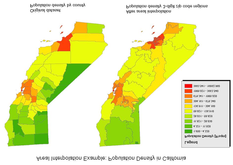
23 Level of detail 4. Scale the inevitability of generalization Extent generalizability of results Methods of upscaling, downscaling Fractal concepts Scale is always important many properties cannot be defined independently of scale length of a coastline slope of a topographic surface land use class
24 Unique to spatial thinking? Analogs of spatial scale in other domains Observed properties of spatial data what makes spatial special?
25 5. Spatial dependence All things are related, but nearby things are more related than distant things W.R. Tobler, A computer movie simulating urban growth in the Detroit region. Economic Geography 46: nearby things are more similar than distant things geostatistics, Moran statistic the most important property of any spatially distributed phenomenon Challenges the normal assumptions of statistical tests independent, randomly chosen samples
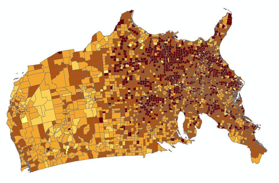
26 6. Spatial heterogeneity TFL describes a second-order effect properties of places taken two at a time a law of spatial dependence is there a law of places taken one at a time? Spatial heterogeneity non-stationarity uncontrolled variance
27 Practical implications A state is not a sample of the nation a country is not a sample of the world Results of any analysis will depend explicitly on spatial bounds Classification schemes will differ when devised by local jurisdictions Figures of the Earth will differ when devised by local surveying agencies Global standards will always compete with local standards Strong argument for place-based analysis, local statistics, geographically weighted regression
28 Summary Working with spatial data is not always simple and intuitive but it can yield great insights if handled appropriately There is a substantial body of knowledge that needs to be acquired by anyone working with spatial data you would never think of doing a t test without taking a course in statistics why would you consider using a GIS without taking a course in spatial thinking?


29 Other spaces the human brain molecular chemistry the cosmos nanoscience


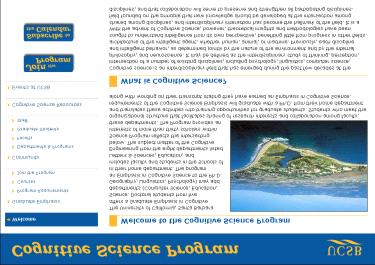

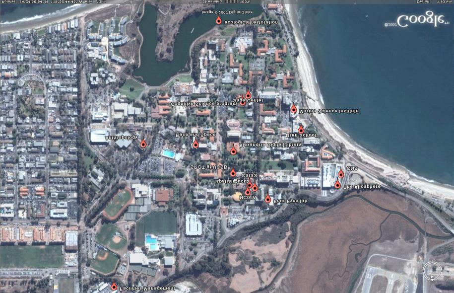
30 UCSB is spatial
31

 on spatial")
32 Humanities Fine Arts Education Social Sciences Representation Simulation Cognition Perception Space-time Patterns & Processes Analysis Information-technology Integration Physical & Bio Sciences Visualization Computation Modeling Application Engineering Management Planning & Policy Exchange ideas and resources Promote new tools, research, and applications Enhance spatial literacy Community of spatial thinkers Web portal on spatial UCSB Seminars and workshops Spatial help desk General course(s) on spatial thinking
33 Conclusions It is possible to enumerate the fundamental concepts of a spatial approach six broadly defined concepts 27 in recent publication De Smith, Goodchild, and Longley (2006) Geospatial Analysis
34 Conclusions (2) This is more than GIS an enveloping conceptual framework for many new technologies many drivers One of a minimal set of intelligences part of everyone s education
A spatial literacy initiative for undergraduate education at UCSB
 A spatial literacy initiative for undergraduate education at UCSB Mike Goodchild & Don Janelle Department of Geography / spatial@ucsb University of California, Santa Barbara ThinkSpatial Brown bag forum
Michael F. Goodchild University of California Santa Barbara
 The Changing Face of GIS Michael F. Goodchild University of California Santa Barbara 1 Two topics New data sources Critical spatial thinking 2 How is geographic information created? By authorities and
Michael F. Goodchild University of California Santa Barbara
 The Changing Face of GIS Michael F. Goodchild University of California Santa Barbara 1 Two topics New data sources Critical spatial thinking 2 How is geographic information created? By authorities and
Michael F. Goodchild University of California Santa Barbara
 Challenges in GIS Research Michael F. Goodchild University of California Santa Barbara Thanks to Ordnance Survey of GB SPLINT Leicester, Nottingham, UCL Organizers GIS research Since 1960s Changing agenda
The Case for Space in the Social Sciences
 The Case for Space in the Social Sciences Don Janelle Center for Spatially Integrated Social Science University of California, Santa Barbara Roundtable on Geographical Voices and Geographical Analysis
Institutional Opportunities and Constraints. Michael F. Goodchild
 Institutional Opportunities and Constraints Michael F. Goodchild A conceptual framework Nomothetic science knowledge that is true everywhere in space and time Idiographic science the study of the unique
The Importance of Spatial Literacy
 The Importance of Spatial Literacy Dr. Michael Phoenix GIS Education Consultant Taiwan, 2009 What is Spatial Literacy? Spatial Literacy is the ability to be able to include the spatial dimension in our
GIS and Spatial Statistics: One World View or Two? Michael F. Goodchild University of California Santa Barbara
 GIS and Spatial Statistics: One World View or Two? Michael F. Goodchild University of California Santa Barbara Location as attribute The data table Census summary table What value is location as an explanatory
Spatial Analysis and Modeling (GIST 4302/5302) Guofeng Cao Department of Geosciences Texas Tech University
 Guofeng Cao Department of Geosciences Texas Tech University") Spatial Analysis and Modeling (GIST 4302/5302) Guofeng Cao Department of Geosciences Texas Tech University TTU Graduate Certificate Geographic Information Science and Technology (GIST) 3 Core Courses and
Spatial Analysis and Modeling (GIST 4302/5302) Guofeng Cao Department of Geosciences Texas Tech University TTU Graduate Certificate Geographic Information Science and Technology (GIST) 3 Core Courses and
Types of spatial data. The Nature of Geographic Data. Types of spatial data. Spatial Autocorrelation. Continuous spatial data: geostatistics
 The Nature of Geographic Data Types of spatial data Continuous spatial data: geostatistics Samples may be taken at intervals, but the spatial process is continuous e.g. soil quality Discrete data Irregular:
GIScience: Current Technology. Michael F. Goodchild University of California Santa Barbara
 GIScience: Current Technology Michael F. Goodchild University of California Santa Barbara What is a GIS? A class of software designed to handle geographic information and perform virtually any conceivable
ENV208/ENV508 Applied GIS. Week 1: What is GIS?
 ENV208/ENV508 Applied GIS Week 1: What is GIS? 1 WHAT IS GIS? A GIS integrates hardware, software, and data for capturing, managing, analyzing, and displaying all forms of geographically referenced information.
Geostatistics and Spatial Scales
 Geostatistics and Spatial Scales Semivariance & semi-variograms Scale dependence & independence Ranges of spatial scales Variable dependent Fractal dimension GIS implications Spatial Modeling Spatial Analysis
Exploratory Spatial Data Analysis (ESDA)
") Exploratory Spatial Data Analysis (ESDA) VANGHR s method of ESDA follows a typical geospatial framework of selecting variables, exploring spatial patterns, and regression analysis. The primary software
Exploratory Spatial Data Analysis (ESDA) VANGHR s method of ESDA follows a typical geospatial framework of selecting variables, exploring spatial patterns, and regression analysis. The primary software
Overview of Statistical Analysis of Spatial Data
 Overview of Statistical Analysis of Spatial Data Geog 2C Introduction to Spatial Data Analysis Phaedon C. Kyriakidis www.geog.ucsb.edu/ phaedon Department of Geography University of California Santa Barbara
Esri and GIS Education
 Esri and GIS Education Organizations Esri Users 1,200 National Government Agencies 11,500 States & Regional Agencies 30,800 Cities & Local Governments 32,000 Businesses 8,500 Utilities 12,600 NGOs 11,000
Twenty Years of Progress: GIScience in Michael F. Goodchild University of California Santa Barbara
 Twenty Years of Progress: GIScience in 2010 Michael F. Goodchild University of California Santa Barbara Outline The beginnings: GIScience in 1990 Major accomplishments research institutional The future
Spatial Data, Spatial Analysis and Spatial Data Science
 Spatial Data, Spatial Analysis and Spatial Data Science Luc Anselin http://spatial.uchicago.edu 1 spatial thinking in the social sciences spatial analysis spatial data science spatial data types and research
Discovering Spatial Thinking
 Discovering Spatial Thinking Arnold Bregt UCSB, 5 October 2010 Experiment Contents Part 1: My discovery of Spatial Thinking Literature Framework for Spatial Thinking UCSB Questionnaire Part 2: Some projects
Spatial Analysis 1. Introduction
 Spatial Analysis 1 Introduction Geo-referenced Data (not any data) x, y coordinates (e.g., lat., long.) ------------------------------------------------------ - Table of Data: Obs. # x y Variables -------------------------------------
Michael Harrigan Office hours: Fridays 2:00-4:00pm Holden Hall
 Announcement New Teaching Assistant Michael Harrigan Office hours: Fridays 2:00-4:00pm Holden Hall 209 Email: michael.harrigan@ttu.edu Guofeng Cao, Texas Tech GIST4302/5302, Lecture 2: Review of Map Projection
GIS for ChEs Introduction to Geographic Information Systems
 GIS for ChEs Introduction to Geographic Information Systems AIChE Webinar John Cirucci 1 GIS for ChEs Introduction to Geographic Information Systems What is GIS? Tools and Methods Applications Examples
The Nature of Geographic Data
 4 The Nature of Geographic Data OVERVIEW Elaborates on the spatial is special theme Focuses on how phenomena vary across space and the general nature of geographic variation Describes the main principles
Geographical knowledge and understanding scope and sequence: Foundation to Year 10
 Geographical knowledge and understanding scope and sequence: Foundation to Year 10 Foundation Year 1 Year 2 Year 3 Year 4 Year 5 Year 6 Year level focus People live in places Places have distinctive features
Representation of Geographic Data
 GIS 5210 Week 2 The Nature of Spatial Variation Three principles of the nature of spatial variation: proximity effects are key to understanding spatial variation issues of geographic scale and level of
Spatial Modeling, Regional Science, Arthur Getis Emeritus, San Diego State University March 1, 2016
 Spatial Modeling, Regional Science, and UCSB Arthur Getis Emeritus, San Diego State University March 1, 2016 My Link to UCSB The 1980s at UCSB (summers and sabbatical) Problems within Geography: The Quantitative
CyberGIS: What Still Needs to Be Done? Michael F. Goodchild University of California Santa Barbara
 CyberGIS: What Still Needs to Be Done? Michael F. Goodchild University of California Santa Barbara Progress to date Interoperable location referencing coordinate transformations geocoding addresses point-of-interest
GEOGRAPHY (GE) Courses of Instruction
 Courses of Instruction") GEOGRAPHY (GE) GE 102. (3) World Regional Geography. The geographic method of inquiry is used to examine, describe, explain, and analyze the human and physical environments of the major regions of the
GEOGRAPHY (GE) GE 102. (3) World Regional Geography. The geographic method of inquiry is used to examine, describe, explain, and analyze the human and physical environments of the major regions of the
8/28/2011. Contents. Lecture 1: Introduction to GIS. Dr. Bo Wu Learning Outcomes. Map A Geographic Language.
 Contents Lecture 1: Introduction to GIS Dr. Bo Wu lsbowu@polyu.edu.hk Department of Land Surveying & Geo-Informatics The Hong Kong Polytechnic University 1. Learning outcomes 2. GIS definition 3. GIS examples
Abbotswood Junior School National Curriculum 2014
 Geography Purpose A high-quality geography education should inspire in pupils a curiosity and fascination about the world and its people that will remain with them for the rest of their lives. Teaching
BACK TO SCHO O L W ITH
 Your web browser (Safari 7) is out of date. For more security, comfort and the best experience on this site: Update your browser Ignore BACK TO SCHO O L W ITH GEO - L ITERACY Essays on Geo-Literacy For
SRJC Applied Technology 54A Introduction to GIS
 SRJC Applied Technology 54A Introduction to GIS Overview Lecture of Geographic Information Systems Fall 2004 Santa Rosa Junior College Presented By: Tim Pudoff, GIS Coordinator, County of Sonoma, Information
Are You Maximizing The Value Of All Your Data?
 Are You Maximizing The Value Of All Your Data? Using The SAS Bridge for ESRI With ArcGIS Business Analyst In A Retail Market Analysis SAS and ESRI: Bringing GIS Mapping and SAS Data Together Presented
ESSENTIAL CONCEPTS AND SKILL SETS OF THE IOWA CORE CURRICULUM
 ESSENTIAL CONCEPTS AND SKILL SETS OF THE IOWA CORE CURRICULUM SOCIAL STUDIES PROVIDED BY THE IOWA DEPARTMENT OF EDUCATION INTRODUCTION Social studies is the integrated study of the social sciences and
GIS Boot Camp for Education June th, 2011 Day 1. Instructor: Sabah Jabbouri Phone: (253) x 4854 Office: TC 136
 x 4854 Office: TC 136") GIS Boot Camp for Education June 27-30 th, 2011 Day 1 Instructor: Sabah Jabbouri Phone: (253) 833-9111 x 4854 Office: TC 136 Email: sjabbouri@greenriver.edu http://www.instruction.greenriver.edu/gis/ Summer
GIS Boot Camp for Education June 27-30 th, 2011 Day 1 Instructor: Sabah Jabbouri Phone: (253) 833-9111 x 4854 Office: TC 136 Email: sjabbouri@greenriver.edu http://www.instruction.greenriver.edu/gis/ Summer
GEOGRAPHIC INFORMATION SYSTEM ANALYST I GEOGRAPHIC INFORMATION SYSTEM ANALYST II
 CITY OF ROSEVILLE GEOGRAPHIC INFORMATION SYSTEM ANALYST I GEOGRAPHIC INFORMATION SYSTEM ANALYST II DEFINITION To perform professional level work in Geographic Information Systems (GIS) management and analysis;
SOCIAL SCIENCES. WORLD GEOGRAPHY LH Grade(s): 9 Pre-Req: N/A
: 9 Pre-Req: N/A") SOCIAL SCIENCES WORLD GEOGRAPHY 21033000 Grade(s): 9 The World Cultural Geography course consists of the following content area strands: American History, World History, Geography, Humanities, Civics and
SOCIAL SCIENCES WORLD GEOGRAPHY 21033000 Grade(s): 9 The World Cultural Geography course consists of the following content area strands: American History, World History, Geography, Humanities, Civics and
INTRODUCTION TO HUMAN GEOGRAPHY. Chapter 1
 INTRODUCTION TO HUMAN GEOGRAPHY Chapter 1 What Is Human Geography? The study of How people make places How we organize space and society How we interact with each other in places and across space How we
GIS Applications on Environmental Education in Taiwan
 GIS Applications on Environmental Education in Taiwan Track: Education Authors: Yu-Chen Lai, Mei-Ling Yeh, Tien-Yin Chou Abstract GIS is a perfect vehicle to deliver environmental knowledge and spatial
A GIS helps you answer questions and solve problems by looking at your data in a way that is quickly understood and easily shared.
 WHAT IS GIS? A geographic information system (GIS) integrates hardware, software, and data for capturing, managing, analyzing, and displaying all forms of geographically referenced information. GIS allows
MEADOWS PRIMARY SCHOOL and NURSERY GEOGRAPHY POLICY
 MEADOWS PRIMARY SCHOOL and NURSERY GEOGRAPHY POLICY Purpose of study The teaching of Geography at Meadows is done by following the 2014 National Curriculum. The planning and teaching of the subject aims
Statistical Perspectives on Geographic Information Science. Michael F. Goodchild University of California Santa Barbara
 Statistical Perspectives on Geographic Information Science Michael F. Goodchild University of California Santa Barbara Statistical geometry Geometric phenomena subject to chance spatial phenomena emphasis
CSISS Resources for Research and Teaching
 CSISS Resources for Research and Teaching Donald G. Janelle Center for Spatially Integrated Social Science University of California, Santa Barbara Montreal 26 July 2003 Workshop on Spatial Analysis for
GIS Certification: How will it be used to improve education?
 GIS Certification: How will it be used to improve education? Deidre Sullivan OSTO Workshop November 11, 2008 1 What is GIS? Geographic Information Systems It is a science, a tool, and a software It assists
ArcGIS. for Server. Understanding our World
 ArcGIS for Server Understanding our World ArcGIS for Server Create, Distribute, and Manage GIS Services You can use ArcGIS for Server to create services from your mapping and geographic information system
Arcgis And Spatial Analysis
 ARCGIS AND SPATIAL ANALYSIS PDF - Are you looking for arcgis and spatial analysis Books? Now, you will be happy that at this time arcgis and spatial analysis PDF is available at our online library. With
Techniques for Science Teachers: Using GIS in Science Classrooms.
 Techniques for Science Teachers: Using GIS in Science Classrooms. After ESRI, 2008 GIS A Geographic Information System A collection of computer hardware, software, and geographic data used together for
Geographical Information System GIS
 Geographical Information System GIS LOOM.02.331 anto.aasa@ut.ee Scale GIS and spatial planning National Regional Local Strategic (National Dev. Plan) National Goals and development policy Tactical (Regional
STAG LANE JUNIOR SCHOOL GEOGRAPHY POLICY
 Status-Recommended Prepared by: Megha Visavadia Date written January 2017 Shared with staff: Spring 2017 STAG LANE JUNIOR SCHOOL GEOGRAPHY POLICY Shared with governors: Spring 2018 Date for review: July
GEOGRAPHY POLICY STATEMENT. The study of geography helps our pupils to make sense of the world around them.
 GEOGRAPHY POLICY STATEMENT We believe that the study of geography is concerned with people, place, space and the environment and explores the relationships between the earth and its peoples. The study
GIST 4302/5302: Spatial Analysis and Modeling Lecture 2: Review of Map Projections and Intro to Spatial Analysis
 GIST 4302/5302: Spatial Analysis and Modeling Lecture 2: Review of Map Projections and Intro to Spatial Analysis Guofeng Cao http://www.spatial.ttu.edu Department of Geosciences Texas Tech University guofeng.cao@ttu.edu
GIST 4302/5302: Spatial Analysis and Modeling
 GIST 4302/5302: Spatial Analysis and Modeling Lecture 2: Review of Map Projections and Intro to Spatial Analysis Guofeng Cao http://thestarlab.github.io Department of Geosciences Texas Tech University
Luc Anselin Spatial Analysis Laboratory Dept. Agricultural and Consumer Economics University of Illinois, Urbana-Champaign
 GIS and Spatial Analysis Luc Anselin Spatial Analysis Laboratory Dept. Agricultural and Consumer Economics University of Illinois, Urbana-Champaign http://sal.agecon.uiuc.edu Outline GIS and Spatial Analysis
FIRE DEPARMENT SANTA CLARA COUNTY
 DEFINITION FIRE DEPARMENT SANTA CLARA COUNTY GEOGRAPHIC INFORMATION SYSTEM (GIS) ANALYST Under the direction of the Information Technology Officer, the GIS Analyst provides geo-spatial strategic planning,
GEOG 3340: Introduction to Human Geography Research
 GEOG 3340: Introduction to Human Geography Research Lecture 1: Course Overview Guofeng Cao www.myweb.ttu.edu/gucao Department of Geosciences Texas Tech University guofeng.cao@ttu.edu Fall 2015 Course Description
Zero Hours of System Training
 Zero Hours of System Training A challenge for the next 25 years Werner Kuhn Center for Spatial Studies Department of Geography University of California at Santa Barbara 1854 http://en.wikipedia.org/wiki/file:snow-cholera-map-1.jpg
State and National Standard Correlations NGS, NCGIA, ESRI, MCHE
 GEOGRAPHIC INFORMATION SYSTEMS (GIS) COURSE DESCRIPTION SS000044 (1 st or 2 nd Sem.) GEOGRAPHIC INFORMATION SYSTEMS (11, 12) ½ Unit Prerequisite: None This course is an introduction to Geographic Information
Formalization of GIS functionality
 Formalization of GIS functionality Over the past four decades humans have invested significantly in the construction of tools for handling digital representations of spaces and their contents. These include
Pikes Lane Primary School. Geography Statement of Practice
 Pikes Lane Primary School Geography Statement of Practice Subject Leader: Mrs Cawley Subject Link Governor: Mr Scholar & Mrs Azad Last Updated: September 2016 Review Date: September 2017 Aims and objectives
Systems (GIS) - with a focus on.
 - with a focus on.") Introduction to Geographic Information Systems (GIS) - with a focus on localizing the MDGs Carmelle J. Terborgh, Ph.D. ESRI www.esri.com Flying Blind Jul 24th 2003 The Economist We Live in Two Worlds Natural
Introduction to Geographic Information Systems (GIS) - with a focus on localizing the MDGs Carmelle J. Terborgh, Ph.D. ESRI www.esri.com Flying Blind Jul 24th 2003 The Economist We Live in Two Worlds Natural
2018 ESRI Education Summit. San Diego. California. Sunday July 8 th 2018 Harper College, Palatine, Illinois, USA Dr. Tong Cheng (Biology), Dr.
, Dr.") 2018 ESRI Education Summit. San Diego. California. Sunday July 8 th 2018 Harper College, Palatine, Illinois, USA Dr. Tong Cheng (Biology), Dr. James Gramlich (Sociology), Mukila Maitha (Geography), Dr.
2018 ESRI Education Summit. San Diego. California. Sunday July 8 th 2018 Harper College, Palatine, Illinois, USA Dr. Tong Cheng (Biology), Dr. James Gramlich (Sociology), Mukila Maitha (Geography), Dr.
Geography for Life. Course Overview
 Geography for Life Description In Geography for Life students will explore the world around them. Using the six essential elements established by the National Geographic Society students will be able to
Diffusion of GIS in Public Policy Doctoral Program
 Diffusion of GIS in Public Policy Doctoral Program By Fulbert Namwamba PhD Southern University This presentation demonstrate how GIS was introduced in the Public Policy Doctoral Program at Southern University,
Improving Spatial Data Interoperability
 Improving Spatial Data Interoperability A Framework for Geostatistical Support-To To-Support Interpolation Michael F. Goodchild, Phaedon C. Kyriakidis, Philipp Schneider, Matt Rice, Qingfeng Guan, Jordan
Canadian Board of Examiners for Professional Surveyors Core Syllabus Item C 5: GEOSPATIAL INFORMATION SYSTEMS
 Study Guide: Canadian Board of Examiners for Professional Surveyors Core Syllabus Item C 5: GEOSPATIAL INFORMATION SYSTEMS This guide presents some study questions with specific referral to the essential
[Figure 1 about here]
![[Figure 1 about here]](/thumbs/87/95828660.jpg "[Figure 1 about here]") TITLE: FIELD-BASED SPATIAL MODELING BYLINE: Michael F. Goodchild, University of California, Santa Barbara, www.geog.ucsb.edu/~good SYNONYMS: None DEFINITION: A field (or continuous field) is defined as
TITLE: FIELD-BASED SPATIAL MODELING BYLINE: Michael F. Goodchild, University of California, Santa Barbara, www.geog.ucsb.edu/~good SYNONYMS: None DEFINITION: A field (or continuous field) is defined as
GIS and the Built Environment
 GIS and the Built Environment GIS Workshop Active Living Research Conference February 9, 2010 Anne Vernez Moudon, Dr. es Sc. University of Washington Chanam Lee, Ph.D., Texas A&M University OBJECTIVES
Medical GIS: New Uses of Mapping Technology in Public Health. Peter Hayward, PhD Department of Geography SUNY College at Oneonta
 Medical GIS: New Uses of Mapping Technology in Public Health Peter Hayward, PhD Department of Geography SUNY College at Oneonta Invited research seminar presentation at Bassett Healthcare. Cooperstown,
St John s Catholic Primary School. Geography Policy. Mission Statement
 St John s Catholic Primary School Geography Policy Mission Statement We at St John s strive for excellence in education by providing a safe, secure and caring family environment where individuals are valued
GIS Spatial Statistics for Public Opinion Survey Response Rates
 GIS Spatial Statistics for Public Opinion Survey Response Rates July 22, 2015 Timothy Michalowski Senior Statistical GIS Analyst Abt SRBI - New York, NY t.michalowski@srbi.com www.srbi.com Introduction
CHARTING SPATIAL BUSINESS TRANSFORMATION
 CHARTING SPATIAL BUSINESS TRANSFORMATION An in-depth look at the business patterns of GIS and location intelligence adoption in the private sector EXECUTIVE SUMMARY The global use of geographic information
A To Z GIS: An Illustrated Dictionary Of Geographic Information Systems PDF
 A To Z GIS: An Illustrated Dictionary Of Geographic Information Systems PDF An invaluable resource for anyone who uses or encounters GIS terminology in the classroom, on the job, or in the field, this
30 YEARS SINCE Z_GIS FOUNDING: PROVIDING SOLUTIONS FOR SOCIETY AND BUSINESS
 30 YEARS SINCE Z_GIS FOUNDING: PROVIDING SOLUTIONS FOR SOCIETY AND BUSINESS Michael F Goodchild Emeritus Professor of Geography University of California, Santa Barbara Keynote GIScience Symposium, Salzburg,
History and Social Science: Advanced Placement Human Geography
 History and Social Science: Advanced Placement Human Geography A.P. Human Geography Curriculum for Loudoun County Public Schools Ashburn, Virginia 2016 This curriculum document for Advanced Placement Human
Your web browser (Safari 7) is out of date. For more security, comfort and. the best experience on this site: Update your browser Ignore
 is out of date. For more security, comfort and. the best experience on this site: Update your browser Ignore") Your web browser (Safari 7) is out of date. For more security, comfort and Activitydevelop the best experience on this site: Update your browser Ignore Places in the Park Why do we use symbols? Overview
Your web browser (Safari 7) is out of date. For more security, comfort and Activitydevelop the best experience on this site: Update your browser Ignore Places in the Park Why do we use symbols? Overview
Hestenes lectures, Part 5. Summer 1997 at ASU to 50 teachers in their 3 rd Modeling Workshop
 Hestenes lectures, Part 5. Summer 1997 at ASU to 50 teachers in their 3 rd Modeling Workshop WHAT DO WE TEACH? The question What do we teach? has to do with What do we want to learn? A common instructional
Download PDF Syllabus of Class 10th CBSE Mathematics Academic year
 Download PDF Syllabus of Class 10th CBSE Mathematics Academic year 2018-2019 Download PDF Syllabus of Class 11th CBSE Mathematics Academic year 2018-2019 The Syllabus in the subject of Mathematics has
A Spatial Analytical Methods-first Approach to Teaching Core Concepts
 Thomas Hervey 4.24.18 A Spatial Analytical Methods-first Approach to Teaching Core Concepts Introduction Teaching geospatial technologies is notoriously difficult regardless of the learning audience. Even
Chapter 1 Introduction
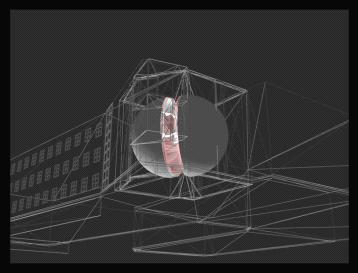
 1 Chapter 1 Introduction Figure 1.1: Westlake Plaza A warm sunny day on a downtown street and plaza, pedestrians pass on the sidewalks, people sit on benches and steps, enjoying a cup of coffee, shoppers
Resources for Spatial Thinking and Analysis
 Resources for Spatial Thinking and Analysis Donald G. Janelle Center for Spatially Integrated Social Science University of California, Santa Barbara New Orleans, 21 November 2002 Workshop on Spatial Analysis
A General Framework for Conflation
 A General Framework for Conflation Benjamin Adams, Linna Li, Martin Raubal, Michael F. Goodchild University of California, Santa Barbara, CA, USA Email: badams@cs.ucsb.edu, linna@geog.ucsb.edu, raubal@geog.ucsb.edu,
Planning in a Geospatially Enabled Society. Michael F. Goodchild University of California Santa Barbara
 Planning in a Geospatially Enabled Society Michael F. Goodchild University of California Santa Barbara What is a geospatially enabled society? Knowing the locations of all points of interest and their
North Carolina Essential Standards Kindergarten Social Studies
 North Carolina s Kindergarten Social Studies Kindergarten through second grade students are introduced to an integrative approach of Social Studies by exploring aspects of self, others, families and communities
Spatial Analysis I. Spatial data analysis Spatial analysis and inference
 Spatial Analysis I Spatial data analysis Spatial analysis and inference Roadmap Outline: What is spatial analysis? Spatial Joins Step 1: Analysis of attributes Step 2: Preparing for analyses: working with
World Geography. WG.1.1 Explain Earth s grid system and be able to locate places using degrees of latitude and longitude.
 Standard 1: The World in Spatial Terms Students will use maps, globes, atlases, and grid-referenced technologies, such as remote sensing, Geographic Information Systems (GIS), and Global Positioning Systems
Geog 469 GIS Workshop. Data Analysis
 Geog 469 GIS Workshop Data Analysis Outline 1. What kinds of need-to-know questions can be addressed using GIS data analysis? 2. What is a typology of GIS operations? 3. What kinds of operations are useful
Understanding China Census Data with GIS By Shuming Bao and Susan Haynie China Data Center, University of Michigan
 Understanding China Census Data with GIS By Shuming Bao and Susan Haynie China Data Center, University of Michigan The Census data for China provides comprehensive demographic and business information
Reimaging GIS: Geographic Information Society. Clint Brown Linda Beale Mark Harrower Esri
 Reimaging GIS: Geographic Information Society Clint Brown Linda Beale Mark Harrower Esri 8 billion = Number of basemap requests per month on AGOL 14,000 = Unique requests per second 12,000 = New Items
Mapping Your Educational Research: Putting Spatial Concepts into Practice with GIS. Mark Hogrebe Washington University in St.
 Mapping Your Educational Research: Putting Spatial Concepts into Practice with GIS Mapping Your Educational Research: Putting Spatial Concepts into Practice with GIS Mark Hogrebe Washington University
FUNDAMENTALS OF GEOINFORMATICS PART-II (CLASS: FYBSc SEM- II)
") FUNDAMENTALS OF GEOINFORMATICS PART-II (CLASS: FYBSc SEM- II) UNIT:-I: INTRODUCTION TO GIS 1.1.Definition, Potential of GIS, Concept of Space and Time 1.2.Components of GIS, Evolution/Origin and Objectives
FUNDAMENTALS OF GEOINFORMATICS PART-II (CLASS: FYBSc SEM- II) UNIT:-I: INTRODUCTION TO GIS 1.1.Definition, Potential of GIS, Concept of Space and Time 1.2.Components of GIS, Evolution/Origin and Objectives
GEOBIA state of the art, science or technology
 GEOBIA state of the art, science or technology Paul Aplin School of Geography, paul.aplin@nottingham.ac.uk Geographic Object-Based Image Analysis Aplin et al., 1999, Remote Sensing of Environment Progress?
Unlocking the Power of Geographic Inquiry. Thomas Herman, PhD Director, California Geographic Alliance Department of Geography, San Diego State Univ.
 Unlocking the Power of Geographic Inquiry Thomas Herman, PhD Director, California Geographic Alliance Department of Geography, San Diego State Univ. Why I am here, and how I got here A few words about
Year 8 standard elaborations Australian Curriculum: Geography
 Purpose Structure The standard elaborations (SEs) provide additional clarity when using the Australian Curriculum achievement standard to make judgments on a five-point scale. These can be used as a tool
Big Data Discovery and Visualisation Insights for ArcGIS
 Big Data Discovery and Visualisation Insights for ArcGIS Create Enrich - Collaborate Lee Kum Cheong GIS CONVERSATIONS At Esri, we believe people can do amazing things with applied geography. GIS CONVERSATIONS
LOUISIANA STUDENT STANDARDS FOR SOCIAL STUDIES THAT CORRELATE WITH A FIELD TRIP TO DESTREHAN PLANTATION KINDERGARTEN
 LOUISIANA STUDENT STANDARDS FOR SOCIAL STUDIES THAT CORRELATE WITH A FIELD TRIP TO DESTREHAN PLANTATION KINDERGARTEN Standard 2 Historical Thinking Skills Students distinguish between events, people, and
Enhancing Spatial Thinking in High-School Education: An Evaluation of Geography Textbooks in Taiwan
 Enhancing Thinking in High-School Education: An Evaluation of Geography Textbooks in Taiwan Jinn-Guey Lay 1, Chih-Ying Wu 2, Chia-Jung Wu 3, Chung-An Wang 4 1 National Taiwan University, No. 1, Sec. 4,
Joan Straumatis: Geography includes thinking in the abstract, understanding data, charts, graphs, representations of data, and diagrams.
 Facilitator: Bob Bednarz Spatial Learning in Geography Workshop Participants: Alec Murphy Dick Boehm Joan Straumatis Susan Gallagher Phil Gersmehl Dedre Gentner Anjan Chatterjee Mary Curtis Introduction
Nature of Spatial Data. Outline. Spatial Is Special
 Nature of Spatial Data Outline Spatial is special Bad news: the pitfalls of spatial data Good news: the potentials of spatial data Spatial Is Special Are spatial data special? Why spatial data require
Content Standard 1: Numbers, Number Sense, and Computation Place Value
 Content Standard 1: Numbers, Number Sense, and Computation Place Value Fractions Comparing and Ordering Counting Facts Estimating and Estimation Strategies Determine an approximate value of radical and
What are the five components of a GIS? A typically GIS consists of five elements: - Hardware, Software, Data, People and Procedures (Work Flows)
") LECTURE 1 - INTRODUCTION TO GIS Section I - GIS versus GPS What is a geographic information system (GIS)? GIS can be defined as a computerized application that combines an interactive map with a database
LECTURE 1 - INTRODUCTION TO GIS Section I - GIS versus GPS What is a geographic information system (GIS)? GIS can be defined as a computerized application that combines an interactive map with a database