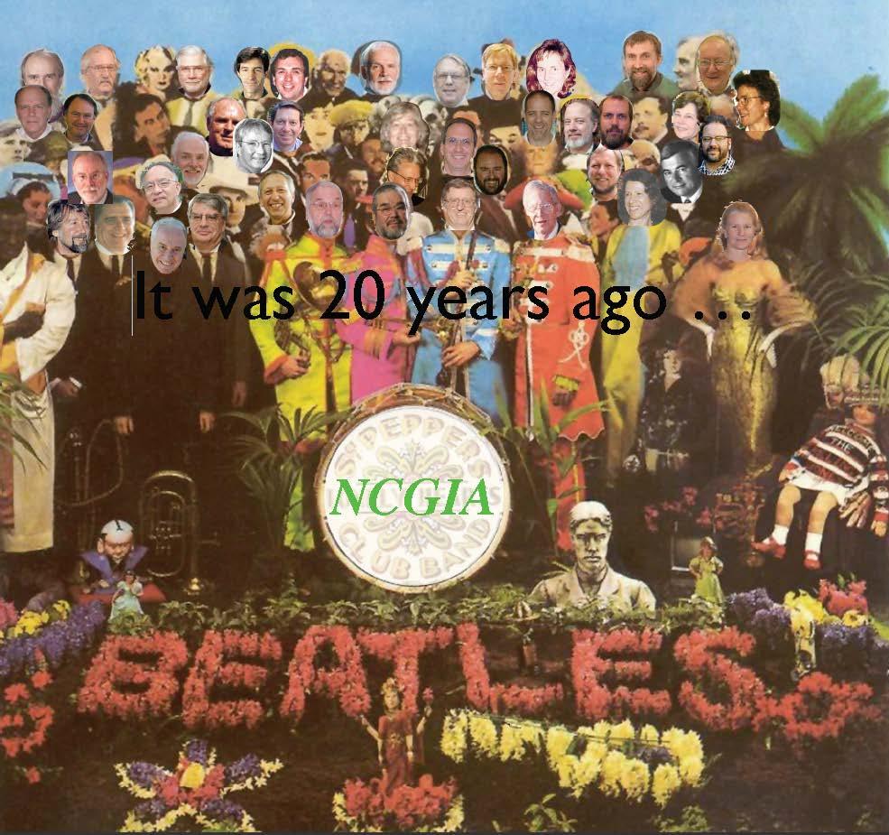
Twenty Years of Progress: GIScience in Michael F. Goodchild University of California Santa Barbara
|
|
|
- Buck Bell
- 6 years ago
- Views:
Transcription
1 Twenty Years of Progress: GIScience in 2010 Michael F. Goodchild University of California Santa Barbara
2 Outline The beginnings: GIScience in 1990 Major accomplishments research institutional The future
3 SDH 4, Zürich 1990 Spatial information science What, after all, is spatial data handling? It may describe what we do, but it gives no sense of why we do it. It suggests that spatial data is (sic) somehow difficult to handle, but will that always be so? It suggests a level of detachment from the data themselves, as if the USGS were to send out tapes labeled with the generic warning handle with difficulty We are concerned with much more than the mere handling and processing of data. We are more than the UPS of GIS. (Proceedings p.3)
4 GIScience Second European GIS Conference 1991 fleshes out the research agenda reference to geographic information science Rapid progress was made on algorithms and data structures in the 1970s and 1980s, but many of the hard problems of data modeling, error modeling, integration of spatial analysis, and institutional and managerial issues remain. Some of these may be unsolvable for example, there may simply be no generalities to be discovered (about) the process of adoption of GIS by government agencies, however easy it may be to pose the research question. (Proceedings pp )
5 G or S? A play on the acronym systems, science, services, studies Would discoveries about geographic space apply to all spaces? (1992) Geographical information science. International Journal of Geographical Information Systems 6(1):
6 The agenda in 1990 The content of GIScience (IJGIS 1992) Data collection and measurement Data capture Spatial statistics Data modeling and theories of spatial data Data structures, algorithms and processes Display Analytical tools Institutional, managerial, and ethical issues

7 Other lists NCGIA research agenda (IJGIS 1989) UCGIS research agendas (from 1997) Tests of inclusion problem is not yet solved truths remain to be discovered problem is generic problem is hard problem would be recognized by a scientist skilled in the art The Varenius framework the human the computer society
8 Definitions of GIScience David Mark in Foundations of Geographic Information Science, Taylor and Francis, 2003 the development and use of theories, methods, and data for understanding geographic processes, relationships and patterns (UCGIS, 2002) the basic research field that seeks to redefine geographic concepts and their use in the context of geographic information systems (Mark, 2000)
9 Major accomplishments in research International Symposium on Geographic Information Science 20 th anniversary of the funding of NCGIA Santa Barbara, Dec 11-12, participants Ten most significant discoveries? can GIScience be empirical?
10 Kate Beard, University of Maine Specification of spatial data types: object and objectrelational databases Specification of spatial relations Conditional simulation Local spatial statistics: local autocorrelation, GWR User interface Geographic brushing Standardization: common formats, specifications Dorling cartograms Generalization as constrained optimization Google Earth
11 Marc Armstrong, University of Iowa GIScience is transformational from map to machine biggest discovery is GIScience itself Abstraction/theory Transformation Topological concepts Hierarchical data structures Ontologies Geocoding Overlay and other manipulations Local spatial analysis
12
13
14

15
16
17
18 Classics from IJGIS ed. Fisher (2007) 19 prominent articles based on citation all basic research, one per researcher even distribution over 20 years
19 Openshaw, Charlton, Wymer, Craft: A Mark I Geographical Analysis Machine for the Automated Analysis of Point Data Sets (1987) Brassel and Weibel: A Review and Conceptual Framework of Automated Map Generalization (1988) Heuvelink, Burrough, Stein: Propagation of Errors in Spatial Modelling with GIS (1989) Skidmore: A Comparison of Techniques for Calculating Gradient and Aspect from a Gridded Digital Elevation Model (1989) Worboys, Hearnshaw, Maguire: Object-Oriented Data Modelling for Spatial Databases (1990) Egenhofer and Franzosa: Point-Set Topological Spatial Relations (1991) Miller: Modelling Accessibility Using Space-Time Prism Concepts within Geographical Information Systems (1991) Goodchild: Geographical Information Science (1992) Fisher: Algorithm and Implementation Uncertainty in Viewshed Analysis (1993) Raper and Livingstone: Development of a Geomorphological Spatial Model Using Object-Oriented Design (1995) Jankowski: Integrating Geographical Information Systems and Multiple Criteria Decision-Making Methods (1995) Fotheringham, Charlton, Brunsdon: The Geography of Parameter Space: An Investigation of Spatial Non-Stationarity (1996) Frank: Qualitative Spatial Reasoning: Cardinal Directions as an Example (1996) Kiiveri: Assessing, Representing, and Transmitting Positional Uncertainty in Maps (1997) Clarke and Gaydos: Loose-Coupling a Cellular Automaton Model and GIS: Long-Term Urban Growth Prediction for San Francisco and Washington/Baltimore (1998) Bishr: Overcoming the Semantic and Other Barriers to GIS Interoperability (1998) Andrienko and Andrienko: Interactive Maps for Visual Data Exploration (1999) Smith and Mark: Geographical Categories: An Ontological Investigation (2001) Llobera: Extending GIS-Based Visual Analysis: The Concept of Visualscapes (2003)
20 Andre Skupin, San Diego State University
21 My own (highly subjective) list Theories of representation discrete objects and continuous fields object fields, metamaps unification Models of uncertainty error propagation downscaling Principles of spatial cognition Theories of the geographic world spatial dependence, spatial heterogeneity
22 Institutional accomplishments Journals and articles IJGIS, CaGIS, J GISciences Conferences and societies Books and curricula 4 members of the US National Academy of Sciences 4 members of the Royal Society
23 What of the future? Max Egenhofer s list for 2010: Spatial cognition about geographic space and systems Spatial semantics for information systems A general theory of geographic space and time Spatial communication Societal issues of spatial information and spatial systems
24 Future prospects Knowing where everything is (at all times) every mobile phone every vehicle every farm animal every item in a store every construction beam every asset for emergency response every victim of a disaster
25 The role of the citizen Placenames, streets, social characteristics Early notification of change Early reports of damage from a disaster Both producer and consumer of geographic information The local expert
26 A technology of dynamics Real-time, continuous monitoring The state of the world at all times the state of the transportation network the state of human health the state of the environment Sensor networks static carried on moving objects humans as sensors
27 The third (and fourth) dimension The third spatial dimension data acquisition positioning The conceptual problem the map as metaphor The attribute dimension

28 Location as common key The stack of layers
29 But in reality Spatial databases are organized as layers horizontal integration not vertical property z about all places rather than all properties about location x tell me everything about location x overlay must be invoked explicitly graphical overlay or topological overlay many mashups are merely graphical overlay a visual spatial join
30
31
32
33
34 The spatial join Using location as a common key to link tables All location references are subject to uncertainty measurement error vagueness in feature identification indeterminate limits The probabilistic join
35 The challenge of education As the technology becomes easier to use as everyone utilizes geospatial technology What does everyone need to know? Critical spatial thinking an understanding of the fundamental concepts behind the technology What characterizes a spatial thinker?
36 A call for participation Technology will continue to advance and pose interesting and challenging research questions The domain of geographic information science is well defined and bounded Comparisons with other spaces will stimulate creative thinking in GIScience Much has been accomplished, but much more remains to be discovered and developed
Geographic Information Systems and Science: Today and Tomorrow. Michael F. Goodchild University of California Santa Barbara
 Geographic Information Systems and Science: Today and Tomorrow Michael F. Goodchild University of California Santa Barbara Geospatial technologies Positioning on the Earth s surface GPS, RFID Acquisition
The Future of Geography in an. Society. Michael F. Goodchild University of California Santa Barbara
 The Future of Geography in an Emerging Information-Technology Society Michael F. Goodchild University of California Santa Barbara Geographic technologies Positioning i on the Earth s surface GPS, RFID
CyberGIS: What Still Needs to Be Done? Michael F. Goodchild University of California Santa Barbara
 CyberGIS: What Still Needs to Be Done? Michael F. Goodchild University of California Santa Barbara Progress to date Interoperable location referencing coordinate transformations geocoding addresses point-of-interest
A General Framework for Conflation
 A General Framework for Conflation Benjamin Adams, Linna Li, Martin Raubal, Michael F. Goodchild University of California, Santa Barbara, CA, USA Email: badams@cs.ucsb.edu, linna@geog.ucsb.edu, raubal@geog.ucsb.edu,
Cartographic and Geospatial Futures
 Cartographic and Geospatial Futures 1. Web Cartography, WebGIS, & Virtual Globes--New Roles for Maps, GIS, and GIS professionals 2. Map Mashups, the Neo Neo-geography Movement, & Crowd-sourcing Geospatial
GEO-INFORMATION (LAKE DATA) SERVICE BASED ON ONTOLOGY
 SERVICE BASED ON ONTOLOGY") GEO-INFORMATION (LAKE DATA) SERVICE BASED ON ONTOLOGY Long-hua He* and Junjie Li Nanjing Institute of Geography & Limnology, Chinese Academy of Science, Nanjing 210008, China * Email: lhhe@niglas.ac.cn
GEO-INFORMATION (LAKE DATA) SERVICE BASED ON ONTOLOGY Long-hua He* and Junjie Li Nanjing Institute of Geography & Limnology, Chinese Academy of Science, Nanjing 210008, China * Email: lhhe@niglas.ac.cn
A spatial literacy initiative for undergraduate education at UCSB
 A spatial literacy initiative for undergraduate education at UCSB Mike Goodchild & Don Janelle Department of Geography / spatial@ucsb University of California, Santa Barbara ThinkSpatial Brown bag forum
Quality Assessment and Uncertainty Handling in Uncertainty-Based Spatial Data Mining Framework
 Quality Assessment and Uncertainty Handling in Uncertainty-Based Spatial Data Mining Framework Sk. Rafi, Sd. Rizwana Abstract: Spatial data mining is to extract the unknown knowledge from a large-amount
WELCOME. To GEOG 350 / 550 Introduction to Geographic Information Science
 WELCOME To GEOG 350 / 550 Introduction to Geographic Information Science 1 What will I learn? An overview of Geographic Information Science What is GIScience How does it differ front GISystems How GIS
Lecture 1: Geospatial Data Models
 Lecture 1: GEOG413/613 Dr. Anthony Jjumba Introduction Course Outline Journal Article Review Projects (and short presentations) Final Exam (April 3) Participation in class discussions Geog413/Geog613 A
Canadian Board of Examiners for Professional Surveyors Core Syllabus Item C 5: GEOSPATIAL INFORMATION SYSTEMS
 Study Guide: Canadian Board of Examiners for Professional Surveyors Core Syllabus Item C 5: GEOSPATIAL INFORMATION SYSTEMS This guide presents some study questions with specific referral to the essential
8/28/2011. Contents. Lecture 1: Introduction to GIS. Dr. Bo Wu Learning Outcomes. Map A Geographic Language.
 Contents Lecture 1: Introduction to GIS Dr. Bo Wu lsbowu@polyu.edu.hk Department of Land Surveying & Geo-Informatics The Hong Kong Polytechnic University 1. Learning outcomes 2. GIS definition 3. GIS examples
Planning in a Geospatially Enabled Society. Michael F. Goodchild University of California Santa Barbara
 Planning in a Geospatially Enabled Society Michael F. Goodchild University of California Santa Barbara What is a geospatially enabled society? Knowing the locations of all points of interest and their
Geographic information systems and science: today and tomorrow
 Procedia Earth and Planetary Science 1 (2009) 1037 1043 Procedia Earth and Planetary Science www.elsevier.com/locate/procedia 6th International Conference on Mining Science and Technology Geographic information
WEB-BASED SPATIAL DECISION SUPPORT: TECHNICAL FOUNDATIONS AND APPLICATIONS
 WEB-BASED SPATIAL DECISION SUPPORT: TECHNICAL FOUNDATIONS AND APPLICATIONS Claus Rinner University of Muenster, Germany Piotr Jankowski San Diego State University, USA Keywords: geographic information
FUTURE DATA. Future data Future hardware Future software Future issues. Getting Started With GIS. Chapter 10
 THE FUTURE OF GIS Getting Started With GIS Chapter 10 GIS Futures Future data Future hardware Future software Future issues Dursun Z. ªeker Theme of the book GIS's place in understanding geographic distributions
Zero Hours of System Training
 Zero Hours of System Training A challenge for the next 25 years Werner Kuhn Center for Spatial Studies Department of Geography University of California at Santa Barbara 1854 http://en.wikipedia.org/wiki/file:snow-cholera-map-1.jpg
Spatial Webs. Michael F. Goodchild University of California Santa Barbara
 Spatial Webs Michael F. Goodchild University of California Santa Barbara The locations of computing User location u the user interface Processing location p u-p 1960s < 10m dedicated lines ca 1970
Fundamentals of Geographic Information System PROF. DR. YUJI MURAYAMA RONALD C. ESTOQUE JUNE 28, 2010
 Fundamentals of Geographic Information System 1 PROF. DR. YUJI MURAYAMA RONALD C. ESTOQUE JUNE 28, 2010 CONTENTS OF THIS LECTURE PRESENTATION Basic concept of GIS Basic elements of GIS Types of GIS data
GEOGRAPHICAL INFORMATION SCIENCE FIFTEEN YEARS LATER
 GEOGRAPHICAL INFORMATION SCIENCE FIFTEEN YEARS LATER Michael F. Goodchild, University of California, Santa Barbara 1 INTRODUCTION In early 1990 Kurt Brassel asked me if I would be willing to give a keynote
CPSC 695. Future of GIS. Marina L. Gavrilova
 CPSC 695 Future of GIS Marina L. Gavrilova The future of GIS Overview What is GIS now How GIS was viewed before Current trends and developments Future directions of research What is GIS? Internet's definition
UTAH S STATEWIDE GEOGRAPHIC INFORMATION DATABASE
 UTAH S STATEWIDE GEOGRAPHIC INFORMATION DATABASE Data Information and Knowledge Management NASCIO Awards 2009 STATE GEOGRAPHIC INFORMATION DATABASE B. EXECUTIVE SUMMARY Utah has developed one of the most
Propagation of Errors in Spatial Analysis
 Stephen F. Austin State University SFA ScholarWorks Faculty Presentations Spatial Science 2001 Propagation of Errors in Spatial Analysis Peter P. Siska I-Kuai Hung Arthur Temple College of Forestry and
Basics of GIS reviewed
 Basics of GIS reviewed Martin Breunig Karlsruhe Institute of Technology martin.breunig@kit.edu GEODETIC INSTITUTE, DEPARTMENT OF CIVIL ENGINEERING, GEO AND ENVIRONMENTAL SCIENCES, CHAIR IN GEOINFORMATICS
Cognitive Engineering for Geographic Information Science
 Cognitive Engineering for Geographic Information Science Martin Raubal Department of Geography, UCSB raubal@geog.ucsb.edu 21 Jan 2009 ThinkSpatial, UCSB 1 GIScience Motivation systematic study of all aspects
Fundamental Spatial Concepts. Michael F. Goodchild University of California Santa Barbara
 Fundamental Spatial Concepts Michael F. Goodchild University of California Santa Barbara A spatial turn in science Adding space to theory the New Economic Geography space impeding flows of information,
Towards Geographic Information Observatories
 Towards Geographic Information Observatories Krzysztof Janowicz 1, Benjamin Adams 2, Grant McKenzie 1, and Tomi Kauppinen 3,4 1 University of California, Santa Barbara, USA 2 The University of Auckland,
Specialist Meeting on Spatial Concepts in GIS and Design Santa Barbara, California. Geo-Spatial Design
 Specialist Meeting on Spatial Concepts in GIS and Design Santa Barbara, California Geo-Spatial Design Creativity is the synapse between two normally disassociated matrices of thought. Arthur Koestler William
An Ontology-based Framework for Modeling Movement on a Smart Campus
 An Ontology-based Framework for Modeling Movement on a Smart Campus Junchuan Fan 1, Kathleen Stewart 1 1 Department of Geographical and Sustainability Sciences, University of Iowa, Iowa City, IA, 52242,
The Importance of Spatial Literacy
 The Importance of Spatial Literacy Dr. Michael Phoenix GIS Education Consultant Taiwan, 2009 What is Spatial Literacy? Spatial Literacy is the ability to be able to include the spatial dimension in our
An Introduction to Geographic Information System
 An Introduction to Geographic Information System PROF. Dr. Yuji MURAYAMA Khun Kyaw Aung Hein 1 July 21,2010 GIS: A Formal Definition A system for capturing, storing, checking, Integrating, manipulating,
TRAITS to put you on the map
 TRAITS to put you on the map Know what s where See the big picture Connect the dots Get it right Use where to say WOW Look around Spread the word Make it yours Finding your way Location is associated with
Powerful Combination: GIS and Web Services
 IEEE DISTRIBUTED SYSTEMS ONLINE 1541-4922 2004 Published by the IEEE Computer Society Vol. 5, No. 2; February 2004 Powerful Combination: GIS and Web Services Adam Stone At the University of North Texas's
Michael F. Goodchild University of California Santa Barbara
 Challenges in GIS Research Michael F. Goodchild University of California Santa Barbara Thanks to Ordnance Survey of GB SPLINT Leicester, Nottingham, UCL Organizers GIS research Since 1960s Changing agenda
GIS Visualization: A Library s Pursuit Towards Creative and Innovative Research
 GIS Visualization: A Library s Pursuit Towards Creative and Innovative Research Justin B. Sorensen J. Willard Marriott Library University of Utah justin.sorensen@utah.edu Abstract As emerging technologies
Key Words: geospatial ontologies, formal concept analysis, semantic integration, multi-scale, multi-context.
 Marinos Kavouras & Margarita Kokla Department of Rural and Surveying Engineering National Technical University of Athens 9, H. Polytechniou Str., 157 80 Zografos Campus, Athens - Greece Tel: 30+1+772-2731/2637,
GIS and Spatial Statistics: One World View or Two? Michael F. Goodchild University of California Santa Barbara
 GIS and Spatial Statistics: One World View or Two? Michael F. Goodchild University of California Santa Barbara Location as attribute The data table Census summary table What value is location as an explanatory
Design and Development of a Large Scale Archaeological Information System A Pilot Study for the City of Sparti
 INTERNATIONAL SYMPOSIUM ON APPLICATION OF GEODETIC AND INFORMATION TECHNOLOGIES IN THE PHYSICAL PLANNING OF TERRITORIES Sofia, 09 10 November, 2000 Design and Development of a Large Scale Archaeological
Cell-based Model For GIS Generalization
 Cell-based Model For GIS Generalization Bo Li, Graeme G. Wilkinson & Souheil Khaddaj School of Computing & Information Systems Kingston University Penrhyn Road, Kingston upon Thames Surrey, KT1 2EE UK
Improving SLEUTH Calibration with a Genetic Algorithm
 Improving SLEUTH Calibration with a Genetic Algorithm Keith C. Clarke Dept. of Geography, University of California, Santa Barbara, Santa Barbara CA 93106-4060 USA kclarke@geog.ucsb.edu What is SLEUTH?
30 YEARS SINCE Z_GIS FOUNDING: PROVIDING SOLUTIONS FOR SOCIETY AND BUSINESS
 30 YEARS SINCE Z_GIS FOUNDING: PROVIDING SOLUTIONS FOR SOCIETY AND BUSINESS Michael F Goodchild Emeritus Professor of Geography University of California, Santa Barbara Keynote GIScience Symposium, Salzburg,
Massachusetts Institute of Technology Department of Urban Studies and Planning
 Massachusetts Institute of Technology Department of Urban Studies and Planning 11.520: A Workshop on Geographic Information Systems 11.188: Urban Planning and Social Science Laboratory GIS Principles &
GIS = Geographic Information Systems;
 What is GIS GIS = Geographic Information Systems; What Information are we talking about? Information about anything that has a place (e.g. locations of features, address of people) on Earth s surface,
STATE GEOGRAPHIC INFORMATION DATABASE
 STATE GEOGRAPHIC INFORMATION DATABASE Data Information and Knowledge Management STATE GEOGRAPHIC INFORMATION DATABASE EXECUTIVE SUMMARY Utah has developed one of the most comprehensive statewide GIS resources
geographic patterns and processes are captured and represented using computer technologies
 Proposed Certificate in Geographic Information Science Department of Geographical and Sustainability Sciences Submitted: November 9, 2016 Geographic information systems (GIS) capture the complex spatial
Computational Biology, University of Maryland, College Park, MD, USA
 1 Data Sharing in Ecology and Evolution: Why Not? Cynthia S. Parr 1 and Michael P. Cummings 2 1 Institute for Advanced Computer Studies, 2 Center for Bioinformatics and Computational Biology, University
Lecture 12. Data Standards and Quality & New Developments in GIS
 Lecture 12 Data Standards and Quality & New Developments in GIS Lecture 12: Outline I. Data Standards and Quality 1. Types of Spatial Data Standards 2. Data Accuracy 3. III. Documenting Spatial Data Accuracy
PRELIMINARY STUDIES ON CONTOUR TREE-BASED TOPOGRAPHIC DATA MINING
 PRELIMINARY STUDIES ON CONTOUR TREE-BASED TOPOGRAPHIC DATA MINING C. F. Qiao a, J. Chen b, R. L. Zhao b, Y. H. Chen a,*, J. Li a a College of Resources Science and Technology, Beijing Normal University,
Representing Uncertainty: Does it Help People Make Better Decisions?
 Representing Uncertainty: Does it Help People Make Better Decisions? Mark Harrower Department of Geography University of Wisconsin Madison 550 North Park Street Madison, WI 53706 e-mail: maharrower@wisc.edu
Geographic Information Science
 Geographic Information Science David M. Mark Professor of Geography & Director, National Center for Geographic Information and Analysis University at Buffalo Part 1: Geographic Information Science and
GOVERNMENT GIS BUILDING BASED ON THE THEORY OF INFORMATION ARCHITECTURE
 GOVERNMENT GIS BUILDING BASED ON THE THEORY OF INFORMATION ARCHITECTURE Abstract SHI Lihong 1 LI Haiyong 1,2 LIU Jiping 1 LI Bin 1 1 Chinese Academy Surveying and Mapping, Beijing, China, 100039 2 Liaoning
Lecture 11. Data Standards and Quality & New Developments in GIS
 Lecture 11 Data Standards and Quality & New Developments in GIS Lecture 11: Outline I. Data Standards and Quality 1. Types of Spatial Data Standards 2. Data Accuracy II. New Developments/The Future of
Introduction to Geographic Information Science. Updates/News. Last Lecture 1/23/2017. Geography 4103 / Spatial Data Representations
 Geography 4103 / 5103 Introduction to Geographic Information Science Spatial Data Representations Updates/News Waitlisted students First graded lab this week: skills learning Instructional labs vs. independence
Visualizing Uncertainty In Environmental Work-flows And Sensor Streams
 Visualizing Uncertainty In Environmental Work-flows And Sensor Streams Karthikeyan Bollu Ganesh and Patrick Maué Institute for Geoinformatics (IFGI), University of Muenster, D-48151 Muenster, Germany {karthikeyan,pajoma}@uni-muenster.de
Re-imagining Religion: The Spatial Humanities as a Framework for New Scholarship
 2010 Re-imagining Religion: The Spatial Humanities as a Framework for New Scholarship David J. Bodenhamer The Polis Center at IUPUI Virtual Center for Spatial Humanities New Technologies and Interdisciplinary
G. I. Science Education: A Computing Perspective
 A Position Statement on G. I. Science Education: A Computing Perspective (A Panel Discussion in UCGIS Summer Assembly 2008) By Shashi Shekhar McKnight Distinguished University Professor Faculty of Computer
Digital Chart Cartography: Error and Quality control
 Digital Chart Cartography: Error and Quality control Di WU (PHD student) Session7: Advances in Cartography Venue: TU 107 Yantai Institute of Coastal Zone Research, CAS, Yantai 264003, ChinaC Key State
The Quality of Geospatial Context
 The Quality of Geospatial Context Michael F. Goodchild 1 1 Center for Spatial Studies, and Department of Geography, University of California, Santa Barbara, CA 93106-4060, USA good@geog.ucsb.edu Abstract.
What is GIS? G: Geographic, Geospatial, Geo
 GEOG 488/588: GIS I Introduction Instructor: Geoffrey Duh TA: David Graves What is GIS? G: Geographic, Geospatial, Geo Alternatives: Spatial Information Systems, Land Information Systems Geography diverse
VGIscience Summer School Interpretation, Visualisation and Social Computing of Volunteered Geographic Information (VGI)
") VGIscience Summer School Interpretation, Visualisation and Social Computing of Volunteered Geographic Information (VGI) TU Dresden, 11.-15. September 2017 Welcome PhD students working on research topics
VGIscience Summer School Interpretation, Visualisation and Social Computing of Volunteered Geographic Information (VGI) TU Dresden, 11.-15. September 2017 Welcome PhD students working on research topics
MODELING DEM UNCERTAINTY IN GEOMORPHOMETRIC APPLICATIONS WITH MONTE CARLO-SIMULATION
 MODELING DEM UNCERTAINTY IN GEOMORPHOMETRIC APPLICATIONS WITH MONTE CARLO-SIMULATION Juha Oksanen and Tapani Sarjakoski Finnish Geodetic Institute Department of Geoinformatics and Cartography P.O. Box
SVY2001: Lecture 15: Introduction to GIS and Attribute Data
 SVY2001: Databases for GIS Lecture 15: Introduction to GIS and Attribute Data Management. Dr Stuart Barr School of Civil Engineering & Geosciences University of Newcastle upon Tyne. Email: S.L.Barr@ncl.ac.uk
Statistical Perspectives on Geographic Information Science. Michael F. Goodchild University of California Santa Barbara
 Statistical Perspectives on Geographic Information Science Michael F. Goodchild University of California Santa Barbara Statistical geometry Geometric phenomena subject to chance spatial phenomena emphasis
Location Based Concierge Service with Spatially Extended Topology for Moving Objects
 The Journal of GIS Association of Korea, Vol. 17, No. 4, pp. 445-454, December 2009 Location Based Concierge Service with Spatially Extended Topology for Moving Objects Byoungjae Lee* ABSTRACT Beyond simple
Cyberinfrastructure and CyberGIS: Recent Advances and Key Themes
 Cyberinfrastructure and CyberGIS: Recent Advances and Key Themes Shaowen Wang CyberInfrastructure and Geospatial Information Laboratory (CIGI) Department of Geography Department of Computer Science National
John Laznik 273 Delaplane Ave Newark, DE (302)
") Office Address: John Laznik 273 Delaplane Ave Newark, DE 19711 (302) 831-0479 Center for Applied Demography and Survey Research College of Human Services, Education and Public Policy University of Delaware
Office Address: John Laznik 273 Delaplane Ave Newark, DE 19711 (302) 831-0479 Center for Applied Demography and Survey Research College of Human Services, Education and Public Policy University of Delaware
The Architecture of the Georgia Basin Digital Library: Using geoscientific knowledge in sustainable development
 GEOLOGIJA 46/2, 343 348, Ljubljana 2003 The Architecture of the Georgia Basin Digital Library: Using geoscientific knowledge in sustainable development B. BRODARIC 1, M. JOURNEAY 2, S. TALWAR 2,3, R. HARRAP
Chapter 5. GIS The Global Information System
 Chapter 5 GIS The Global Information System What is GIS? We have just discussed GPS a simple three letter acronym for a fairly sophisticated technique to locate a persons or objects position on the Earth
DP Project Development Pvt. Ltd.
 Dear Sir/Madam, Greetings!!! Thanks for contacting DP Project Development for your training requirement. DP Project Development is leading professional training provider in GIS technologies and GIS application
Identifying Audit, Evidence Methodology and Audit Design Matrix (ADM)
") 11 Identifying Audit, Evidence Methodology and Audit Design Matrix (ADM) 27/10/2012 Exercise XXX 2 LEARNING OBJECTIVES At the end of this session participants will be able to: 1. Identify types and sources
11 Identifying Audit, Evidence Methodology and Audit Design Matrix (ADM) 27/10/2012 Exercise XXX 2 LEARNING OBJECTIVES At the end of this session participants will be able to: 1. Identify types and sources
Cadcorp Introductory Paper I
 Cadcorp Introductory Paper I An introduction to Geographic Information and Geographic Information Systems Keywords: computer, data, digital, geographic information systems (GIS), geographic information
Space-adjusting Technologies and the Social Ecologies of Place
 Space-adjusting Technologies and the Social Ecologies of Place Donald G. Janelle University of California, Santa Barbara Reflections on Geographic Information Science Session in Honor of Michael Goodchild
3D BUILDING MODELS IN GIS ENVIRONMENTS
 A. N. Visan 3D Building models in GIS environments 3D BUILDING MODELS IN GIS ENVIRONMENTS Alexandru-Nicolae VISAN, PhD. student Faculty of Geodesy, TUCEB, alexvsn@yahoo.com Abstract: It is up to us to
Outline. Geographic Information Analysis & Spatial Data. Spatial Analysis is a Key Term. Lecture #1
 Geographic Information Analysis & Spatial Data Lecture #1 Outline Introduction Spatial Data Types: Objects vs. Fields Scale of Attribute Measures GIS and Spatial Analysis Spatial Analysis is a Key Term
Spatial Data, Spatial Analysis and Spatial Data Science
 Spatial Data, Spatial Analysis and Spatial Data Science Luc Anselin http://spatial.uchicago.edu 1 spatial thinking in the social sciences spatial analysis spatial data science spatial data types and research
Uncertainty in Geographic Information: House of Cards? Michael F. Goodchild University of California Santa Barbara
 Uncertainty in Geographic Information: House of Cards? Michael F. Goodchild University of California Santa Barbara Starting points All geospatial data leave the user to some extent uncertain about the
GEOGRAPHY 350/550 Final Exam Fall 2005 NAME:
 1) A GIS data model using an array of cells to store spatial data is termed: a) Topology b) Vector c) Object d) Raster 2) Metadata a) Usually includes map projection, scale, data types and origin, resolution
Exploring Digital Earth. Michael F. Goodchild University of California Santa Barbara
 Exploring Digital Earth Michael F. Goodchild University of California Santa Barbara Some explaining to do What a curious career Nevill Mott, Cavendish Professor of Physics, University of Cambridge, 1965
Linking local multimedia models in a spatially-distributed system
 Linking local multimedia models in a spatially-distributed system I. Miller, S. Knopf & R. Kossik The GoldSim Technology Group, USA Abstract The development of spatially-distributed multimedia models has
Lesson 16: Technology Trends and Research
 http://www.esri.com/library/whitepapers/pdfs/integrated-geoenabled-soa.pdf GEOG DL582 : GIS Data Management Lesson 16: Technology Trends and Research Overview Learning Objective Questions: 1. Why is integration
Development of Integrated Spatial Analysis System Using Open Sources. Hisaji Ono. Yuji Murayama
 Development of Integrated Spatial Analysis System Using Open Sources Hisaji Ono PASCO Corporation 1-1-2, Higashiyama, Meguro-ku, TOKYO, JAPAN; Telephone: +81 (03)3421 5846 FAX: +81 (03)3421 5846 Email:
The French SIGMA-Cassini Research Group The Agenda for
 Page 1 of 9 The French SIGMA-Cassini Research Group The Agenda for 2005-2008 M. Mainguenaud C. Weber michel.mainguenaud@insa-rouen.fr christiane.weber@lorraine.u-strasbg.fr http://www.sigma-cassini.org
Convex Hull-Based Metric Refinements for Topological Spatial Relations
 ABSTRACT Convex Hull-Based Metric Refinements for Topological Spatial Relations Fuyu (Frank) Xu School of Computing and Information Science University of Maine Orono, ME 04469-5711, USA fuyu.xu@maine.edu
Investigation, Conceptualization and Abstraction in Geographic Information Science: Some Methodological Parallels with Human Geography
 Investigation, Conceptualization and Abstraction in Geographic Information Science: Some Methodological Parallels with Human Geography Gregory Elmes Department of Geology and Geography West Virginia University
University of Lusaka
 University of Lusaka BSPH 315 Health Mapping & GIS Topic: Background of GIS Content: 1. Aim of the course 2. What do you know about GIS? 3. Difference between geographic data and geographic information
Mappings For Cognitive Semantic Interoperability
 Mappings For Cognitive Semantic Interoperability Martin Raubal Institute for Geoinformatics University of Münster, Germany raubal@uni-muenster.de SUMMARY Semantic interoperability for geographic information
GeoWorlds: Integrated Digital Libraries and Geographic Information Systems
 GeoWorlds: Integrated Digital Libraries and Geographic Information Systems http://www.isi.edu/geoworlds Robert Neches In-Young Ko, Robert MacGregor, Ke-Thia Yao Distributed Scalable Systems Division USC
[Figure 1 about here]
![[Figure 1 about here]](/thumbs/87/95828660.jpg "[Figure 1 about here]") TITLE: FIELD-BASED SPATIAL MODELING BYLINE: Michael F. Goodchild, University of California, Santa Barbara, www.geog.ucsb.edu/~good SYNONYMS: None DEFINITION: A field (or continuous field) is defined as
TITLE: FIELD-BASED SPATIAL MODELING BYLINE: Michael F. Goodchild, University of California, Santa Barbara, www.geog.ucsb.edu/~good SYNONYMS: None DEFINITION: A field (or continuous field) is defined as
Alexander Klippel and Chris Weaver. GeoVISTA Center, Department of Geography The Pennsylvania State University, PA, USA
 Analyzing Behavioral Similarity Measures in Linguistic and Non-linguistic Conceptualization of Spatial Information and the Question of Individual Differences Alexander Klippel and Chris Weaver GeoVISTA
GEOGRAPHIC INFORMATION SYSTEMS AND SCIENCE: TODAY AND TOMORROW
 GEOGRAPHIC INFORMATION SYSTEMS AND SCIENCE: TODAY AND TOMORROW Michael F. Goodchild 1 ABSTRACT Great strides have been made in geographic information systems and science over the past 14 years, through
Esri and GIS Education
 Esri and GIS Education Organizations Esri Users 1,200 National Government Agencies 11,500 States & Regional Agencies 30,800 Cities & Local Governments 32,000 Businesses 8,500 Utilities 12,600 NGOs 11,000
Geostatistics and Spatial Scales
 Geostatistics and Spatial Scales Semivariance & semi-variograms Scale dependence & independence Ranges of spatial scales Variable dependent Fractal dimension GIS implications Spatial Modeling Spatial Analysis
GEOGRAPHIC INFORMATION SYSTEMS Session 8
 GEOGRAPHIC INFORMATION SYSTEMS Session 8 Introduction Geography underpins all activities associated with a census Census geography is essential to plan and manage fieldwork as well as to report results
COURSE INTRODUCTION & COURSE OVERVIEW
 week 1 COURSE INTRODUCTION & COURSE OVERVIEW topics of the week Instructor introduction Students introductions Course logistics Course objectives Definition of GIS The story of GIS introductions Who am
A CARTOGRAPHIC DATA MODEL FOR BETTER GEOGRAPHICAL VISUALIZATION BASED ON KNOWLEDGE
 A CARTOGRAPHIC DATA MODEL FOR BETTER GEOGRAPHICAL VISUALIZATION BASED ON KNOWLEDGE Yang MEI a, *, Lin LI a a School Of Resource And Environmental Science, Wuhan University,129 Luoyu Road, Wuhan 430079,
Development of Univ. of San Agustin Geographic Information System (USAGIS)
") , pp.170-176 http://dx.doi.org/10.14257/astl.2014.48.27 Development of Univ. of San Agustin Geographic Information System (USAGIS) Rosslin John H. Robles Chair, Computer Science Department, University
, pp.170-176 http://dx.doi.org/10.14257/astl.2014.48.27 Development of Univ. of San Agustin Geographic Information System (USAGIS) Rosslin John H. Robles Chair, Computer Science Department, University
Modeling Temporal Uncertainty of Events: a. Descriptive Perspective
 Modeling Temporal Uncertainty of Events: a escriptive Perspective Yihong Yuan, Yu Liu 2 epartment of Geography, University of California, Santa Barbara, CA, USA yuan@geog.ucsb.edu 2 Institute of Remote
Brazil Paper for the. Second Preparatory Meeting of the Proposed United Nations Committee of Experts on Global Geographic Information Management
 Brazil Paper for the Second Preparatory Meeting of the Proposed United Nations Committee of Experts on Global Geographic Information Management on Data Integration Introduction The quick development of
Grand Challenges in GIScience: UCGIS experiences
 Grand Challenges in GIScience: UCGIS experiences 2006-2010 Tim Nyerges University of Washington University Consortium of Geographic Information Science (UCGIS) AAG Annual Meeting April 17, 2010 Outline
GIS AND COMMUNITY ENGAGEMENT: SOCIOSPATIAL APPROACHES TO RESEARCH AND POLICY
 GIS AND COMMUNITY ENGAGEMENT: SOCIOSPATIAL APPROACHES TO RESEARCH AND POLICY DR. SHEILA LAKSHMI STEINBERG BRANDMAN UNIVERSITY CHAPMAN UNIVERSITY SYSTEM GIS DAY PRESENTATION-UNIVERSITY OF KANSAS, NOVEMBER