The Case for Space in the Social Sciences
|
|
|
- Shana Walker
- 5 years ago
- Views:
Transcription

1 The Case for Space in the Social Sciences Don Janelle Center for Spatially Integrated Social Science University of California, Santa Barbara Roundtable on Geographical Voices and Geographical Analysis Methods Pontifica Universidade Católica de Minas Gerais Universidade Católica de Salvador August 2007

2 Center for Spatially Integrated Social Science Building resources for spatial analysis in the social sciences UCSB / Principal Investigator: M.F. Goodchild Co-PI: R.P. Appelbaum Program Director: D.G. Janelle Internet Gateway to Spatial Analysis Resources for Researchers and Teachers Summer National Workshop Program Spatial Analytic Tools Development L. Anselin
3
4 The CSISS Strategy and Plan
5 Modeling a Center for Spatially Integrated Social Science Critical Themes in Social Science + Tools and Concepts for Spatial Thinking + Infrastructure = Advances in Spatial Social Science
6 Some Critical Themes in the Social Sciences Space-time accessibility Equity Externality effects Risk assessment Small-area analysis Sense of place Cultural analysis Demographic processes Health and disease Crime mapping and law enforcement Community organization Governance Electoral processes Globalization International conflict Coupling human and environmental systems etc
7 Crime & Law Enforcement Biophysical-Human Interface Electoral Processes Population & Demographic Issues Space-Time Accessibility Urban & Regional Issues Critical Themes in Social Science Equity Externalities Globalization Key Investigators CSISS Specialist Meetings Cultural Analysis International Conflict Risk Theory Health & Disease Community Organization Small-Area Analysis Governance
8 Crime & Law Enforcement Biophysical-Human Interface Electoral Processes Population & Demographic Issues Space-Time Accessibility Critical Themes in Social Science Equity Externalities Globalization Key Investigators Urban & Regional Issues CSISS Specialist Meetings International Conflict Risk Theory Cultural Analysis Governance Health & Disease Community Organization Small-Area Analysis Tools Development Workshops Learning Resources Best- Practice Publications
9 Location-Allocation Modeling Spatial Econometrics Agent-Based Modeling S p a t i a l A n a l y s i s Flow Data Analysis GIS Specialist Meetings Tools Development Best-Practice Publications Virtual Community Point-Pattern Analysis Analytical Cartography C S I S S Workshops Learning Resources Internet Portal Place-Based Search ESDA Bayesian Analysis Spatial Interaction Modeling Dynamic Geo-visualization Advances in Theory New NSF Programs Diffusion of Spatial Analysis Interdisciplinary Collaboration O u t c o m e s New Journals International Conference(s) New Applications New Social Science Resources
10 Questions from the Skeptics
11 Spatial Social Science? Do spatial perspectives draw on and contribute to theory in the social sciences? Why should social scientists accept that variance across space really matters? And, is it worth the effort to incorporate space? Is there a tension between GIS (the technique) and thinking spatially? What structures in the social sciences have emerged in support of spatial analysis/thinking? Is there a community of spatial social science and can its growth be measured?
12 Documenting a Spatial Turn in the Social Sciences
 Popularization of Spatial technologies: Google Earth, Google Maps, Microsoft Virtual Earth geotagging in")
13 Interest in Spatial Perspectives New initiatives at leading universities and by science funding agencies A spatial turn in the social sciences The New Economic Geography adding space to social science theory (space impeding flows of information, operation of markets, transport costs) Popularization of Spatial technologies: Google Earth, Google Maps, Microsoft Virtual Earth geotagging in Wikimapia, Flikr, GIS, remote sensing, GPS geovisualization has impacted all science and media representation National Research Council report Learning to Think Spatially
14 Building on the Numbers Growth in scientific literature using spatial perspectives CSISS summer workshops (since 2000) >700 participants GeoDa (CSISS / Anselin) >20,000 downloads (May 2007) Need for documentation of the trends in literature, software adoption, and conference presence of spatial analysis across the sciences

15
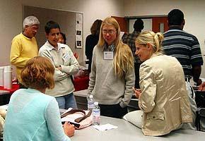
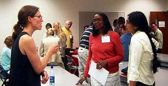
16
 www.csiss.")
17 A Growing Literature Spatially Integrated Social Science (Goodchild and Janelle, OUP, 2004)
18 The database includes 2329 demography articles from 1956 through 2004 drawn from the CSISS database and from nearly one thousand articles from journals and online databases that specialize in demography and population studies. See
19 CSISS Residential Workshops GIS and Spatial Analysis ( ) (building expertise and capacity for spatial thinking in the social sciences) Attended Applied Anthropology / Archaeology Criminology Demography, Population & Health Economics Environmental Studies Epidemiology GIS History 7 10 Human Geography Political Science Public Policy Regional Science 5 6 Sociology Statistics 9 22 Urban Studies & Urban Planning Other Totals:

20
21 CSISS Resources for Spatial Social Science


22 Download GeoDa i Tutorials Sample Data Workbook Openspace Mailing List Luc Anselin


23 Tobler's FlowMapper


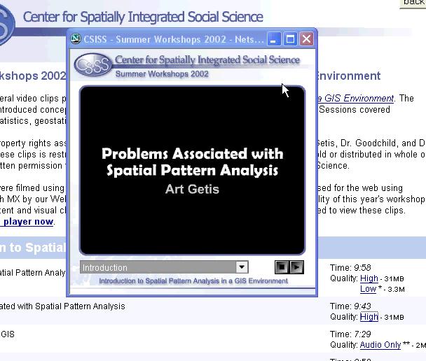
24 CSISS Video Clips of Summer Workshops
25

26
27

28
29 The Road to Universal Education in Spatial Thinking
30 Why Spatial Thinking? Spatial thinking should be one of the foundations for general undergraduate education (for informed citizenship and for general information analysis and assessment) Spatial perspectives provide a means of integrating theory within and across disciplines, and for matching it with evidence Spatial analysis can serve as a foundation for interdisciplinary cooperation (e.g., the coupling of environmental and social processes)
31 Identifying Foundation Concepts for Spatial Thinking Demonstrable at all levels of space & time Applicable to all of science Expandable from simple illustrations to advanced thought processes about scientific and social problems Expandable from a 5-minute explanation to a life-time career of research and/or application
32 Eight Foundation Concepts in Spatial Thinking 1 Location Places abstracted as points, lines, and areas, and represented as points, polylines, and polygons. Rasters and grid cells. Mathematical approximations to the geoid, map projections, coordinate systems. Measurement and tracking of location: GPS. Location in human discourse: place names, prepositions, and movement verbs. Positional accuracy. The characteristics or attributes of places: scales of measurement. Concepts of land ownership in different cultures, administrative hierarchies, postcodes, linear referencing. 2 Distance Metrics of distance on the plane and globe. Travel cost, travel time, and impacts on interaction and spatial behavior by humans and other organisms. Distance decay and spatial interaction models. Buffers. Weights matrices and their applications in spatial analysis and modeling. Geodesics, potential fields, and optimum paths. 3 Network Linear networks for transportation, communication, and social interaction. Network metrics. Models of network development and design. Small worlds and degrees of separation. Representation of networks in spatial databases. Models of network flow assignment. 4 Neighborhood and Region Definitions of neighborhood based on human spatial behavior. Formal and functional regions and concepts of territory. Models of region design and political districting. The modifiable areal unit problem and the ecological fallacy. Techniques of areal interpolation. Metrics of fragmentation and shape.
33 5 Scale Level of detail in spatial data sets. Definitions of scale: extent and resolution. Scale-related concepts: self-similarity (fractals), generalization and down-scaling, line and surface smoothing, recursive subdivision, variance decomposition, and multi-level analysis. The role of scale in process. 6 Spatial Heterogeneity 7 Spatial Dependence 8 Objects and Fields Heterogeneity as a fundamental characteristic of spatial data. Firstorder effects, non-stationarity, and uncontrolled variance. Implications of spatial heterogeneity for sampling and statistical inference. Place-based analysis, local indicators of spatial association, and geographically weighted regression. Metrics of spatial dependence: Moran and Geary indices. Getis and Ord G statistic. Geostatistics as a theoretical framework for spatial data. Spatial interpolation. Statistical inference in the presence of spatial dependence; explicit models of spatial dependence. Analysis of point patterns and cluster detection. The role of spatial dependence in uncertainty. Discrete objects and continuous fields as fundamental conceptualizations of space and as the basis for models of process. The dichotomy as an underpinning of methods of representation and analysis. Spatial correlation. Concepts of uncertainty in both conceptualizations.
34 Linking Foundation Concepts of Spatial Thinking to the Theories and Themes of the Social Sciences Social inequality Concentrated disadvantage Uneven development Externalities Neighborhood Community Social networks Social capital Collective efficacy Trust Power Service optimization Etc.
35 Building Foundations for Spatial Thinking in the Social Sciences Lessons from CSISS Recognize social science theoretic and thematic perspectives Emphasize added value of spatial thinking to social science theory and problem solving, re: integration of information / disciplines inference from form to process organizing and retrieving information links to policy
36 Challenges Leadership is needed to position spatial thinking as important (essential) to scientific understanding and to sound public policies Support resources need to be assembled, organized, and made easily accessible: Course units, exercises, instruments for learning assessment, etc. Networks of scholars / mentors GI Science tools need enhancement to meet the needs of science: Technologies for space-time integration of data Capabilities in analysis are needed that match the capabilities of micro-simulation methods to display spacetime processes
37 Conclusions The relevance of spatial perspective in science is increasingly appreciated across disciplines providing grounds for curriculum change A growing level of expertise exists across disciplines allies and potential leaders in curriculum change (need for documentation) The necessary conditions to imbue science education with the powerful insights of the spatial perspective and visualization are now in place
38 Obrigado Please visit Under development:
CSISS Resources for Research and Teaching
 CSISS Resources for Research and Teaching Donald G. Janelle Center for Spatially Integrated Social Science University of California, Santa Barbara Montreal 26 July 2003 Workshop on Spatial Analysis for
SPACE Workshop Santa Barbara, California July 2007
 SPACE Workshop Santa Barbara, California 15 20 July 2007 Modeling a Center for Spatially Integrated Social Science Critical Themes in Social Science + Tools and Concepts for Spatial Thinking + Infrastructure
Resources for Spatial Thinking and Analysis
 Resources for Spatial Thinking and Analysis Donald G. Janelle Center for Spatially Integrated Social Science University of California, Santa Barbara New Orleans, 21 November 2002 Workshop on Spatial Analysis
Institutional Opportunities and Constraints. Michael F. Goodchild
 Institutional Opportunities and Constraints Michael F. Goodchild A conceptual framework Nomothetic science knowledge that is true everywhere in space and time Idiographic science the study of the unique
A spatial literacy initiative for undergraduate education at UCSB
 A spatial literacy initiative for undergraduate education at UCSB Mike Goodchild & Don Janelle Department of Geography / spatial@ucsb University of California, Santa Barbara ThinkSpatial Brown bag forum
SPACE Workshop NSF NCGIA CSISS UCGIS SDSU. Aldstadt, Getis, Jankowski, Rey, Weeks SDSU F. Goodchild, M. Goodchild, Janelle, Rebich UCSB
 SPACE Workshop NSF NCGIA CSISS UCGIS SDSU Aldstadt, Getis, Jankowski, Rey, Weeks SDSU F. Goodchild, M. Goodchild, Janelle, Rebich UCSB August 2-8, 2004 San Diego State University Some Examples of Spatial
Spatial Analysis 1. Introduction
 Spatial Analysis 1 Introduction Geo-referenced Data (not any data) x, y coordinates (e.g., lat., long.) ------------------------------------------------------ - Table of Data: Obs. # x y Variables -------------------------------------
Techniques for Science Teachers: Using GIS in Science Classrooms.
 Techniques for Science Teachers: Using GIS in Science Classrooms. After ESRI, 2008 GIS A Geographic Information System A collection of computer hardware, software, and geographic data used together for
Fundamental Spatial Concepts. Michael F. Goodchild University of California Santa Barbara
 Fundamental Spatial Concepts Michael F. Goodchild University of California Santa Barbara A spatial turn in science Adding space to theory the New Economic Geography space impeding flows of information,
INTEGRATING GEOSPATIAL PERSPECTIVES IN THE ANTHROPOLOGY CURRICULUM AT THE UNIVERSITY OF NEW MEXICO (UNM)
") INTEGRATING GEOSPATIAL PERSPECTIVES IN THE ANTHROPOLOGY CURRICULUM AT THE UNIVERSITY OF NEW MEXICO (UNM) VERONICA ARIAS HEATHER RICHARDS JUDITH VAN DER ELST DEPARTMENT OF ANTHROPOLOGY MARCH 2005 INTEGRATING
INTEGRATING GEOSPATIAL PERSPECTIVES IN THE ANTHROPOLOGY CURRICULUM AT THE UNIVERSITY OF NEW MEXICO (UNM) VERONICA ARIAS HEATHER RICHARDS JUDITH VAN DER ELST DEPARTMENT OF ANTHROPOLOGY MARCH 2005 INTEGRATING
LEHMAN COLLEGE OF THE CITY UNIVERSITY OF NEW YORK. 1. Type of Change: Change in Degree Requirements
 Alpha Number: Hegis Code 1214 Program Code: 30600 1. Type of Change: Change in Degree Requirements 2. From: [The curriculum consists of 45 graduate credits and includes core courses, an area of specialization,
GOVERNMENT MAPPING WORKSHOP RECOVER Edmonton s Urban Wellness Plan Mapping Workshop December 4, 2017
 GOVERNMENT MAPPING WORKSHOP 12.4.17 RECOVER Edmonton s Urban Wellness Plan Mapping Workshop December 4, 2017 In July of 2017, City Council directed administration to develop RECOVER, Edmonton s Urban Wellness
Luc Anselin Spatial Analysis Laboratory Dept. Agricultural and Consumer Economics University of Illinois, Urbana-Champaign
 GIS and Spatial Analysis Luc Anselin Spatial Analysis Laboratory Dept. Agricultural and Consumer Economics University of Illinois, Urbana-Champaign http://sal.agecon.uiuc.edu Outline GIS and Spatial Analysis
Spatial Modeling, Regional Science, Arthur Getis Emeritus, San Diego State University March 1, 2016
 Spatial Modeling, Regional Science, and UCSB Arthur Getis Emeritus, San Diego State University March 1, 2016 My Link to UCSB The 1980s at UCSB (summers and sabbatical) Problems within Geography: The Quantitative
The Importance of Spatial Literacy
 The Importance of Spatial Literacy Dr. Michael Phoenix GIS Education Consultant Taiwan, 2009 What is Spatial Literacy? Spatial Literacy is the ability to be able to include the spatial dimension in our
Spatial Data, Spatial Analysis and Spatial Data Science
 Spatial Data, Spatial Analysis and Spatial Data Science Luc Anselin http://spatial.uchicago.edu 1 spatial thinking in the social sciences spatial analysis spatial data science spatial data types and research
GEOG 3340: Introduction to Human Geography Research
 GEOG 3340: Introduction to Human Geography Research Lecture 1: Course Overview Guofeng Cao www.myweb.ttu.edu/gucao Department of Geosciences Texas Tech University guofeng.cao@ttu.edu Fall 2015 Course Description
Introduction to Spatial Statistics and Modeling for Regional Analysis
 Introduction to Spatial Statistics and Modeling for Regional Analysis Dr. Xinyue Ye, Assistant Professor Center for Regional Development (Department of Commerce EDA University Center) & School of Earth,
PLANNING (PLAN) Planning (PLAN) 1
 Planning (PLAN) 1") Planning (PLAN) 1 PLANNING (PLAN) PLAN 500. Economics for Public Affairs Description: An introduction to basic economic concepts and their application to public affairs and urban planning. Note: Cross-listed
Planning (PLAN) 1 PLANNING (PLAN) PLAN 500. Economics for Public Affairs Description: An introduction to basic economic concepts and their application to public affairs and urban planning. Note: Cross-listed
Dr.Sinisa Vukicevic Dr. Robert Summers
 Dr.Sinisa Vukicevic Dr. Robert Summers "Planning" means the scientific, aesthetic, and orderly disposition of land, resources, facilities and services with a view to securing the physical, economic and
From Research Objects to Research Networks: Combining Spatial and Semantic Search
 From Research Objects to Research Networks: Combining Spatial and Semantic Search Sara Lafia 1 and Lisa Staehli 2 1 Department of Geography, UCSB, Santa Barbara, CA, USA 2 Institute of Cartography and
GIS and Spatial Statistics: One World View or Two? Michael F. Goodchild University of California Santa Barbara
 GIS and Spatial Statistics: One World View or Two? Michael F. Goodchild University of California Santa Barbara Location as attribute The data table Census summary table What value is location as an explanatory
GIS = Geographic Information Systems;
 What is GIS GIS = Geographic Information Systems; What Information are we talking about? Information about anything that has a place (e.g. locations of features, address of people) on Earth s surface,
The Scope and Growth of Spatial Analysis in the Social Sciences
 context. 2 We applied these search terms to six online bibliographic indexes of social science Completed as part of the CSISS literature search initiative on November 18, 2003 The Scope and Growth of Spatial
School of Geography and Geosciences. Head of School Degree Programmes. Programme Requirements. Modules. Geography and Geosciences 5000 Level Modules
 School of Geography and Geosciences Head of School Degree Programmes Graduate Diploma: Dr W E Stephens Health Geography Research Environmental History and Policy (see School of History) M.Res.: M.Litt.:
What is GIS? ESRI Canada. August 2011
 What is GIS? ESRI Canada August 2011 Geography Matters! Environmental Park Management Agriculture Public Utilities Health Care Emergency 911 Real Estate Marketing Environmental What are the effects of
STUDY GUIDE. Exploring Geography. Chapter 1, Section 1. Terms to Know DRAWING FROM EXPERIENCE ORGANIZING YOUR THOUGHTS
 For use with textbook pages 19 22. Exploring Geography Terms to Know location A specific place on the earth (page 20) absolute location The exact spot at which a place is found on the globe (page 20) hemisphere
GIS and Demography. John R. Weeks Professor of Geography and Director International Population Center
 GIS and Demography John R. Weeks Professor of Geography and Director International Population Center Introduction to Spatial Pattern Analysis in a GIS Environment Center for Spatially Integrated Social
Exploratory Spatial Data Analysis and GeoDa
 Exploratory Spatial Data Analysis and GeoDa Luc Anselin Spatial Analysis Laboratory Dept. Agricultural and Consumer Economics University of Illinois, Urbana-Champaign http://sal.agecon.uiuc.edu Outline
The Use of Spatial Weights Matrices and the Effect of Geometry and Geographical Scale
 The Use of Spatial Weights Matrices and the Effect of Geometry and Geographical Scale António Manuel RODRIGUES 1, José António TENEDÓRIO 2 1 Research fellow, e-geo Centre for Geography and Regional Planning,
Pathways. Pathways through the Geography Major
 Pathways through the Major majors may structure their course selections around a sub-field of. Pathways are suggestions for classes in, in related disciplines, and skills training. Each pathway includes
Spatial Analysis I. Spatial data analysis Spatial analysis and inference
 Spatial Analysis I Spatial data analysis Spatial analysis and inference Roadmap Outline: What is spatial analysis? Spatial Joins Step 1: Analysis of attributes Step 2: Preparing for analyses: working with
Spatial Analysis and Modeling (GIST 4302/5302) Guofeng Cao Department of Geosciences Texas Tech University
 Guofeng Cao Department of Geosciences Texas Tech University") Spatial Analysis and Modeling (GIST 4302/5302) Guofeng Cao Department of Geosciences Texas Tech University TTU Graduate Certificate Geographic Information Science and Technology (GIST) 3 Core Courses and
Spatial Analysis and Modeling (GIST 4302/5302) Guofeng Cao Department of Geosciences Texas Tech University TTU Graduate Certificate Geographic Information Science and Technology (GIST) 3 Core Courses and
ESSENTIAL CONCEPTS AND SKILL SETS OF THE IOWA CORE CURRICULUM
 ESSENTIAL CONCEPTS AND SKILL SETS OF THE IOWA CORE CURRICULUM SOCIAL STUDIES PROVIDED BY THE IOWA DEPARTMENT OF EDUCATION INTRODUCTION Social studies is the integrated study of the social sciences and
GIS Spatial Statistics for Public Opinion Survey Response Rates
 GIS Spatial Statistics for Public Opinion Survey Response Rates July 22, 2015 Timothy Michalowski Senior Statistical GIS Analyst Abt SRBI - New York, NY t.michalowski@srbi.com www.srbi.com Introduction
25. A Strategy for Integrating GIS
 25. A Strategy for Integrating GIS Richard P. Greene Introduction The teaching modules enabled middle and high school teachers in the Rockford public schools to explore the local community with geographic
Applied Spatial Analysis in Epidemiology
 Applied Spatial Analysis in Epidemiology COURSE DURATION Course material will be available from: June 1- June 30, 2018 INSTRUCTOR Rena Jones, PhD MS rena.jones@yale.edu COURSE DESCRIPTION This course will
geographic patterns and processes are captured and represented using computer technologies
 Proposed Certificate in Geographic Information Science Department of Geographical and Sustainability Sciences Submitted: November 9, 2016 Geographic information systems (GIS) capture the complex spatial
GRADUATE CERTIFICATE PROGRAM
 GRADUATE CERTIFICATE PROGRAM GEOGRAPHIC INFORMATION SCIENCES Department of Geography University of North Carolina Chapel Hill Conghe Song, Director csong @email.unc.edu 919-843-4764 (voice) 919-962-1537
Basics of GIS. by Basudeb Bhatta. Computer Aided Design Centre Department of Computer Science and Engineering Jadavpur University
 Basics of GIS by Basudeb Bhatta Computer Aided Design Centre Department of Computer Science and Engineering Jadavpur University e-governance Training Programme Conducted by National Institute of Electronics
HGP 470 GIS and Advanced Cartography for Social Science
 HGP 470 GIS and Advanced Cartography for Social Science Winter 2014 Instructor: Office: Tory 3-115 Telephone: 780-248-5758 E-mail: vukicevi@ualberta.ca Office hours: By appointment LECTURES AND LABS Lectures/Labs:
California Reality and Nova Scotia Dreaming. Michael F. Goodchild University of California Santa Barbara
 California Reality and Nova Scotia Dreaming Michael F. Goodchild University of California Santa Barbara 1 The geospatial world Remote sensing Geographic information systems Automated cartography Global
Write a report (6-7 pages, double space) on some examples of Internet Applications. You can choose only ONE of the following application areas:
 on some examples of Internet Applications. You can choose only ONE of the following application areas:") UPR 6905 Internet GIS Homework 1 Yong Hong Guo September 9, 2008 Write a report (6-7 pages, double space) on some examples of Internet Applications. You can choose only ONE of the following application
UPR 6905 Internet GIS Homework 1 Yong Hong Guo September 9, 2008 Write a report (6-7 pages, double space) on some examples of Internet Applications. You can choose only ONE of the following application
Temporal vs. Spatial Data
 Temporal vs. Spatial Data Temporal 1 dimensional Units: day, week, month Lag: t, t-1, t-2 Durbin-Watson Spatial 2-3 dimensional Units: county, mile, region Lag: near neighbor, networks (?) Moran s I Differencing
International Development
 International Development Office: The Payson Center for International Development and Technology Transfer, 300 Hébert Hall Phone: 504-865-5240 Fax: 504-865-5241 Website: www.payson.tulane.edu/ Program
GIScience in Urban Planning Education - Experience from University of Maryland
 GIScience in Urban Planning Education - Experience from University of Maryland February 3, 2007 University of Tokyo Qing Shen Professor of Urban Studies and Planning School of Architecture,
GIScience: Current Technology. Michael F. Goodchild University of California Santa Barbara
 GIScience: Current Technology Michael F. Goodchild University of California Santa Barbara What is a GIS? A class of software designed to handle geographic information and perform virtually any conceivable
Bridging Geo technology Competence Gaps among Kenyan Undergraduate Students: An Interdisciplinary GIS Training Model at Chuka University
 International Journal of Education, Culture and Society 2016; 1(3): 70-74 http://www.sciencepublishinggroup.com/j/ijecs doi: 10.11648/j.ijecs.20160103.11 Bridging Geo technology Competence Gaps among Kenyan
Introduction to GIS. Dr. M.S. Ganesh Prasad
 Introduction to GIS Dr. M.S. Ganesh Prasad Department of Civil Engineering The National Institute of Engineering, MYSORE ganeshprasad.nie@gmail.com 9449153758 Geographic Information System (GIS) Information
Diverse Places 3 days
 AS Level Geography Edexcel Diverse Places 3 days Deliver two days of fieldwork within a dynamic human environment and cover the recommended themes in depth. Fieldwork in these locations provides a contrast
Spatial Perspectives on Analysis for Curriculum Enhancement (SPACE)
") Spatial Perspectives on Analysis for Curriculum Enhancement (SPACE) NSF Proposal 0231263: NSF 02-043 CCLI National Dissemination Submitted 6 June 2002; Revised 29 April 2003 PI: Donald G. Janelle Co-PIs:
Spatial Perspectives on Analysis for Curriculum Enhancement (SPACE) NSF Proposal 0231263: NSF 02-043 CCLI National Dissemination Submitted 6 June 2002; Revised 29 April 2003 PI: Donald G. Janelle Co-PIs:
Geospatial Intelligence
 Geospatial Intelligence Geospatial analysis has existed as long as humans have made and studied maps but its importance to the intelligence community has skyrocketed in the past several years, with Unmanned
GIS Applications on Environmental Education in Taiwan
 GIS Applications on Environmental Education in Taiwan Track: Education Authors: Yu-Chen Lai, Mei-Ling Yeh, Tien-Yin Chou Abstract GIS is a perfect vehicle to deliver environmental knowledge and spatial
New Zealand Population Distribution
 New Zealand Population Distribution Requirements: Internet access Web browser (e.g. Internet Explorer, Mozilla Firefox, Google Chrome)** An Esri Global Account **Please insure that pop ups are not blocked
Michael Harrigan Office hours: Fridays 2:00-4:00pm Holden Hall
 Announcement New Teaching Assistant Michael Harrigan Office hours: Fridays 2:00-4:00pm Holden Hall 209 Email: michael.harrigan@ttu.edu Guofeng Cao, Texas Tech GIST4302/5302, Lecture 2: Review of Map Projection
Geography. Programme of study for key stage 3 and attainment target (This is an extract from The National Curriculum 2007)
") Geography Programme of study for key stage 3 and attainment target (This is an extract from The National Curriculum 2007) Crown copyright 2007 Qualifications and Curriculum Authority 2007 Curriculum aims
Geography Programme of study for key stage 3 and attainment target (This is an extract from The National Curriculum 2007) Crown copyright 2007 Qualifications and Curriculum Authority 2007 Curriculum aims
Applied Spatial Analysis in Epidemiology
 Applied Spatial Analysis in Epidemiology COURSE DURATION This is an on-line, distance learning course and material will be available from: June 1 30, 2017 INSTRUCTOR Rena Jones, PhD, MS renajones@gmail.com
A.P. Human Geography
 A.P. Human Geography 2012-2013 Instructor: Chris Vitt Brief Description of Course AP Human Geography is designed to provide students with a learning experience equivalent to that obtained in most college
Canadian Board of Examiners for Professional Surveyors Core Syllabus Item C 5: GEOSPATIAL INFORMATION SYSTEMS
 Study Guide: Canadian Board of Examiners for Professional Surveyors Core Syllabus Item C 5: GEOSPATIAL INFORMATION SYSTEMS This guide presents some study questions with specific referral to the essential
JOB DESCRIPTION. Research Associate - Urban Economy and Employment
 JOB DESCRIPTION Research Associate - Urban Economy and Employment 2 Research Associate Urban Economy and Employment About Us The Indian Institute for Human Settlements (IIHS) is a national education institution
Investigation, Conceptualization and Abstraction in Geographic Information Science: Some Methodological Parallels with Human Geography
 Investigation, Conceptualization and Abstraction in Geographic Information Science: Some Methodological Parallels with Human Geography Gregory Elmes Department of Geology and Geography West Virginia University
Diffusion of GIS in Public Policy Doctoral Program
 Diffusion of GIS in Public Policy Doctoral Program By Fulbert Namwamba PhD Southern University This presentation demonstrate how GIS was introduced in the Public Policy Doctoral Program at Southern University,
Grade Four Content Overview
 Grade Four Content Overview Physical features Regions Contributions of the states Our Country: Geography and Regions Coastal and inland communities Famous landmarks Physical and human characteristics Local,
The Spatial Perspective
 Department of Geography University of California at Santa Barbara GEOGRAPHY 5 MIDTERM REVIEW SHEET The Spatial Perspective - Review all of chapter 1 carefully except for Box 1.B (but do review Box 1.A
AAG CENTER FOR GLOBAL GEOGRAPHY EDUCATION Internationalizing the Teaching and Learning of Geography
 Using the CGGE Materials in Advanced Placement Human Geography Classes About the CGGE: The AAG Center for Global Geography Education (CGGE) is a collection of online modules for undergraduate courses in
The Link between GIS and spatial analysis. GIS, spatial econometrics and social science research
 J Geograph Syst (2000) 2:11±15 ( Springer-Verlag 2000 Part 2 The Link between GIS and spatial analysis GIS, spatial econometrics and social science research Luc Anselin Department of Agricultural and Consumer
Department of Geography, University of California Santa Barbara, USA b California NanoSystems Institute, University of California Santa Barbara, USA
 This article was downloaded by: On: 11 May 2010 Access details: Access Details: Free Access Publisher Routledge Informa Ltd Registered in England and Wales Registered Number: 1072954 Registered office:
Climate Change: How it impacts Canadians and what we can do to slow it down.
 Climate Change: How it impacts Canadians and what we can do to slow it down. Lesson Overview This lesson takes stock of how climate change has already affected Canadians in geographic, economic, and cultural
94-802Z: Geographic Information Systems Summer 2018
 94-802Z: Geographic Information Systems Summer 2018 Instructor: Professor Kristen Kurland Teaching Assistant(s): (Office hours to be posted on Canvas) TBA Class Web Site: http:/www.cmu.edu/canvas
Everything is related to everything else, but near things are more related than distant things.
 SPATIAL ANALYSIS DR. TRIS ERYANDO, MA Everything is related to everything else, but near things are more related than distant things. (attributed to Tobler) WHAT IS SPATIAL DATA? 4 main types event data,
Chapter 1, Section 1 Exploring Geography
 Chapter 1, Section 1 Exploring Geography (Pages 19 22) Setting a Purpose for Reading Think about these questions as you read: What are the physical and human features geographers study? How do geographers
Exploring Digital Welfare data using GeoTools and Grids
 Exploring Digital Welfare data using GeoTools and Grids Hodkinson, S.N., Turner, A.G.D. School of Geography, University of Leeds June 20, 2014 Summary As part of the Digital Welfare project [1] a Java
Overview of Statistical Analysis of Spatial Data
 Overview of Statistical Analysis of Spatial Data Geog 2C Introduction to Spatial Data Analysis Phaedon C. Kyriakidis www.geog.ucsb.edu/ phaedon Department of Geography University of California Santa Barbara
WORLD GEOGRAPHY GRADE 10
 Parent / Student Course Information SOCIAL STUDIES WORLD GEOGRAPHY GRADE 10 Counselors are available to assist parents and students with course selections and career planning. Parents may arrange to meet
Core Courses for Students Who Enrolled Prior to Fall 2018
 Biostatistics and Applied Data Analysis Students must take one of the following two sequences: Sequence 1 Biostatistics and Data Analysis I (PHP 2507) This course, the first in a year long, two-course
Systems (GIS) - with a focus on.
 - with a focus on.") Introduction to Geographic Information Systems (GIS) - with a focus on localizing the MDGs Carmelle J. Terborgh, Ph.D. ESRI www.esri.com Flying Blind Jul 24th 2003 The Economist We Live in Two Worlds Natural
Introduction to Geographic Information Systems (GIS) - with a focus on localizing the MDGs Carmelle J. Terborgh, Ph.D. ESRI www.esri.com Flying Blind Jul 24th 2003 The Economist We Live in Two Worlds Natural
The B.S.G.E. program is accredited by the Engineering Accreditation Commission of ABET,
 Geomatics Engineering The program of study leading to the Bachelor of Science in Geomatics Engineering (B.S.G.E.) deals with designing solutions to measure, map, model, analyze and graphically display
Announcement WORKSHOP ON "Introduction to R and Spatial Analysis with R Model Approaches, Maps, and Big Geodata. August 20 25, 2018
 Announcement WORKSHOP ON "Introduction to R and Spatial Analysis with R Model Approaches, Maps, and Big Geodata August 20 25, 2018 Conducted by International Institute for Population Sciences, Mumbai,
Spatial Tools for Econometric and Exploratory Analysis
 Spatial Tools for Econometric and Exploratory Analysis Michael F. Goodchild University of California, Santa Barbara Luc Anselin University of Illinois at Urbana-Champaign http://csiss.org Outline A Quick
Mapping and Analysis for Spatial Social Science
 Mapping and Analysis for Spatial Social Science Luc Anselin Spatial Analysis Laboratory Dept. Agricultural and Consumer Economics University of Illinois, Urbana-Champaign http://sal.agecon.uiuc.edu Outline
"Natural" Cultural Districts and Neighborhood Revitalization
 University of Pennsylvania ScholarlyCommons Culture and Community Revitalization: A Collaboration Social Impact of the Arts Project 6-2009 "Natural" Cultural Districts and Neighborhood Revitalization Mark
A Framework for the Study of Urban Health. Abdullah Baqui, DrPH, MPH, MBBS Johns Hopkins University
 This work is licensed under a Creative Commons Attribution-NonCommercial-ShareAlike License. Your use of this material constitutes acceptance of that license and the conditions of use of materials on this
METHODS FOR STATISTICS
 DYNAMIC CARTOGRAPHIC METHODS FOR VISUALIZATION OF HEALTH STATISTICS Radim Stampach M.Sc. Assoc. Prof. Milan Konecny Ph.D. Petr Kubicek Ph.D. Laboratory on Geoinformatics and Cartography, Department of
Economic and Social Council
 United Nations Economic and Social Council Distr.: General 2 July 2012 E/C.20/2012/10/Add.1 Original: English Committee of Experts on Global Geospatial Information Management Second session New York, 13-15
Finding Hot Spots in ArcGIS Online: Minimizing the Subjectivity of Visual Analysis. Nicholas M. Giner Esri Parrish S.
 Finding Hot Spots in ArcGIS Online: Minimizing the Subjectivity of Visual Analysis Nicholas M. Giner Esri Parrish S. Henderson FBI Agenda The subjectivity of maps What is Hot Spot Analysis? Why do Hot
Spatially Enabled Society
 International Seminar on Land Administration Trends and Issues in Asia and the Pacific Region Spatially Enabled Society Abbas Rajabifard Vice Chair PCGIAP-WG3 Vice-President (President Elect), GSDI Association
Your web browser (Safari 7) is out of date. For more security, comfort and. the best experience on this site: Update your browser Ignore
 is out of date. For more security, comfort and. the best experience on this site: Update your browser Ignore") Your web browser (Safari 7) is out of date. For more security, comfort and lesson the best experience on this site: Update your browser Ignore Political Borders Why are the borders of countries located
Your web browser (Safari 7) is out of date. For more security, comfort and lesson the best experience on this site: Update your browser Ignore Political Borders Why are the borders of countries located
Curriculum Unit. Instructional Unit #1
 Curriculum Unit Name of Course: AP Human Geography Grade Level(s): 9-12 Brief Description (Course Catalog): The purpose of the AP Human Geography course is to introduce students to the systematic study
CSISS Tools and Spatial Analysis Software
 CSISS Tools and Spatial Analysis Software June 5, 2006 Stephen A. Matthews Associate Professor of Sociology & Anthropology, Geography and Demography Director of the Geographic Information Analysis Core
Lessons Learned from the production of Gridded Population of the World Version 4 (GPW4) Columbia University, CIESIN, USA EFGS October 2014
 Columbia University, CIESIN, USA EFGS October 2014") Lessons Learned from the production of Gridded Population of the World Version 4 (GPW4) Columbia University, CIESIN, USA EFGS October 2014 Gridded Population of the World Gridded (raster) data product
Lessons Learned from the production of Gridded Population of the World Version 4 (GPW4) Columbia University, CIESIN, USA EFGS October 2014 Gridded Population of the World Gridded (raster) data product
Grade 6 Social Studies
 Grade 6 Social Studies Social Studies Grade(s) 6th Course Overview This course focuses on the five Wisconsin Model Academic standards for Social Studies: Geography, History, Political Science and Citizenship,
Purpose Study conducted to determine the needs of the health care workforce related to GIS use, incorporation and training.
 GIS and Health Care: Educational Needs Assessment Cindy Gotz, MPH, CHES Janice Frates, Ph.D. Suzanne Wechsler, Ph.D. Departments of Health Care Administration & Geography California State University Long
Towards Geographic Information Observatories
 Towards Geographic Information Observatories Krzysztof Janowicz 1, Benjamin Adams 2, Grant McKenzie 1, and Tomi Kauppinen 3,4 1 University of California, Santa Barbara, USA 2 The University of Auckland,
The Nature of Geographic Data
 4 The Nature of Geographic Data OVERVIEW Elaborates on the spatial is special theme Focuses on how phenomena vary across space and the general nature of geographic variation Describes the main principles
AP Human Geography Syllabus
 AP Human Geography Syllabus Textbook The Cultural Landscape: An Introduction to Human Geography. Rubenstein, James M. 10 th Edition. Upper Saddle River, N.J.: Prentice Hall 2010 Course Objectives This
GIST 4302/5302: Spatial Analysis and Modeling Lecture 2: Review of Map Projections and Intro to Spatial Analysis
 GIST 4302/5302: Spatial Analysis and Modeling Lecture 2: Review of Map Projections and Intro to Spatial Analysis Guofeng Cao http://www.spatial.ttu.edu Department of Geosciences Texas Tech University guofeng.cao@ttu.edu
GIST 4302/5302: Spatial Analysis and Modeling
 GIST 4302/5302: Spatial Analysis and Modeling Lecture 2: Review of Map Projections and Intro to Spatial Analysis Guofeng Cao http://thestarlab.github.io Department of Geosciences Texas Tech University
Types of spatial data. The Nature of Geographic Data. Types of spatial data. Spatial Autocorrelation. Continuous spatial data: geostatistics
 The Nature of Geographic Data Types of spatial data Continuous spatial data: geostatistics Samples may be taken at intervals, but the spatial process is continuous e.g. soil quality Discrete data Irregular:
Planning in a Geospatially Enabled Society. Michael F. Goodchild University of California Santa Barbara
 Planning in a Geospatially Enabled Society Michael F. Goodchild University of California Santa Barbara What is a geospatially enabled society? Knowing the locations of all points of interest and their
Compact guides GISCO. Geographic information system of the Commission
 Compact guides GISCO Geographic information system of the Commission What is GISCO? GISCO, the Geographic Information System of the COmmission, is a permanent service of Eurostat that fulfils the requirements