GIScience: Current Technology. Michael F. Goodchild University of California Santa Barbara
|
|
|
- Edwina Daniel
- 5 years ago
- Views:
Transcription
1 GIScience: Current Technology Michael F. Goodchild University of California Santa Barbara
2 What is a GIS? A class of software designed to handle geographic information and perform virtually any conceivable operation concept dates from 1965 first commercial software 1980 Geographic information? information that links a location to properties present at that location <x,z(x)> where x is a location in space-time
3 and how do I get one? ESRI, Redlands CA Environmental Systems Research Institute close to $1 billion annual revenue, 4,000 employees campus site license de facto standard GRASS supported by an enthusiastic scientific community Open-source software
4 Google Earth Geo-browsers Microsoft Virtual Earth NASA Worldwinds Google Maps Easy to use visualization at global to local scales virtually no analysis a powerful way of presenting results readily integrated with GIS output kml, kmz files
5 Is there anyone at my university who uses GIS and can help me get started? A host department geography civil engineering environmental science A campus service computing library a GIS center a GIS committee
6 What data types are used? Raster with numeric or alphanumeric values in cells but note problems of laying a raster over a curved surface Vector geo-browser solutions points, lines, areas, volumes with attributes in linked table points, polylines, polygons, polyhedra
7 Lat/long Coordinate systems but note issues for analysis Universal Transverse Mercator State Plane Coordinates Interoperable ArcGIS and county data the most female county
8 Higher-level structures Surfaces as irregular or irregular point samples as triangular mesh as isolines Networks as collections of links and nodes with connectivity Irregular tesselations reporting zones areas of uniform class
9 Data sources Warehouses, digital libraries, geo-portals searchable download Live data on-line services WMS servers Web Mapping Service standard of the Open Geospatial Consortium Web Coverage Service Web Feature Service IMS servers ESRI
10 Search tools Metadata standard geographic coverage, scale, theme, time Federal Geographic Data Committee ISO Data quality positional accuracy attribute accuracy completeness logical consistency lineage
11 Knowing where to look The skill of the spatially aware professional Geographic coverage Geospatial One-Stop Discipline LTER network Collection-level metadata
12 GOS coverage, 1/06
13 Software extensions ESRI extensions Tracking Analyst Agent Analyst Geostatistical Analyst Third-party extensions ESRI script library Data models for application domains ArcHydro flows
14 Address Agriculture Archiving Atmospheric Basemap Biodiversity Census-Administrative Boundaries Defense-Intel Energy Utilities Energy Utilities - MultiSpeak TM Environmental Regulated Facilities Forestry Geology Groundwater Health Historic Preservation and Archaeology Hydro International Hydrographic Organization (IHO) S-57 for ENC Land Parcels Local Government Marine Petroleum Pipeline Raster Telecommunications Transportation Water Utilities


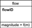
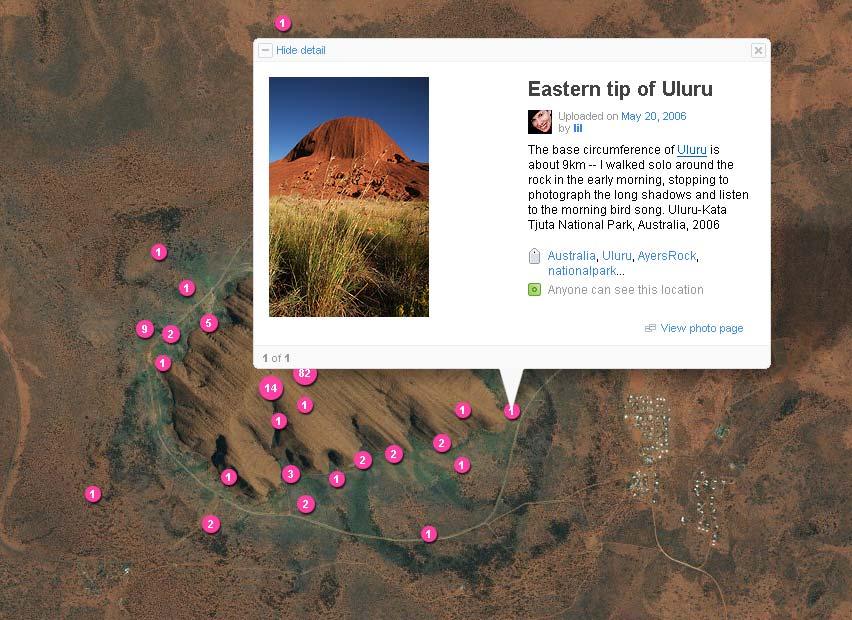
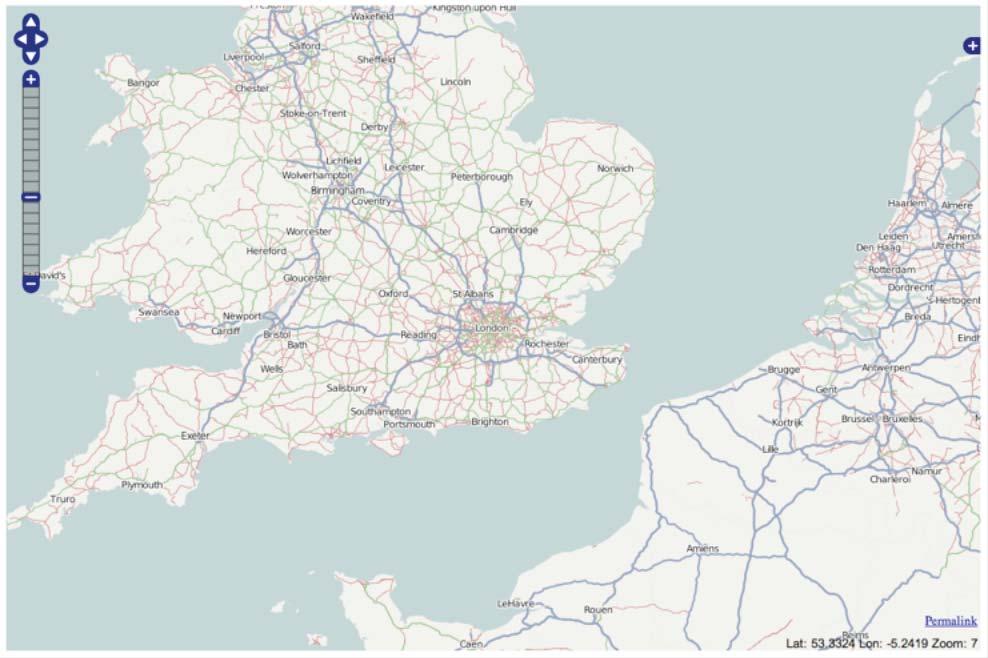
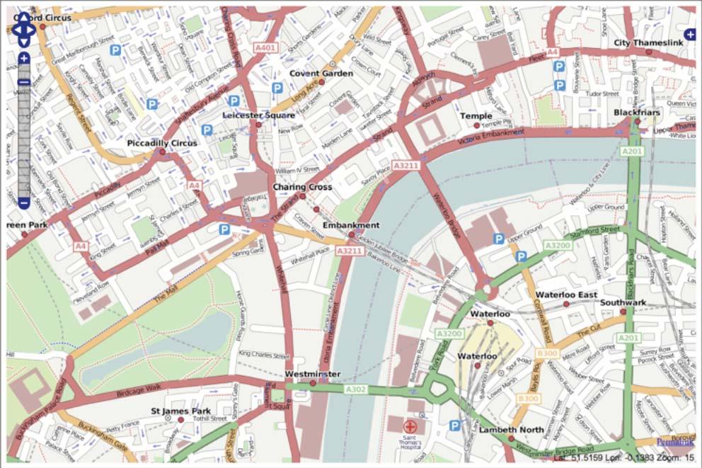
15 0..1 * * Generic Flow Model
16

17
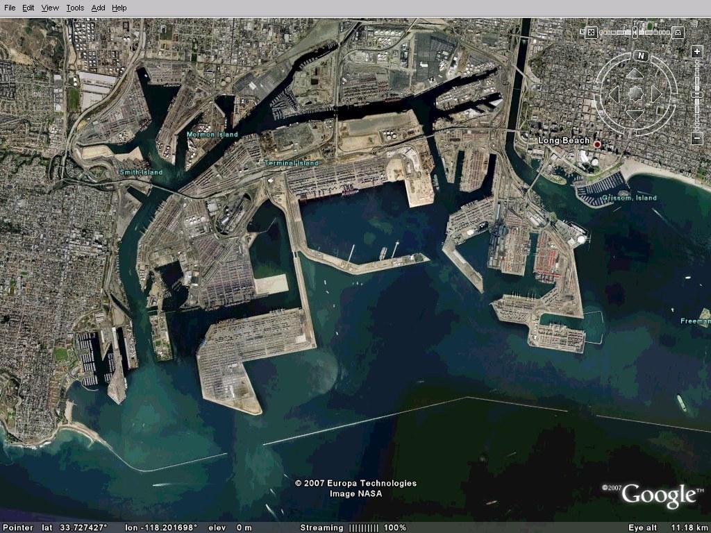
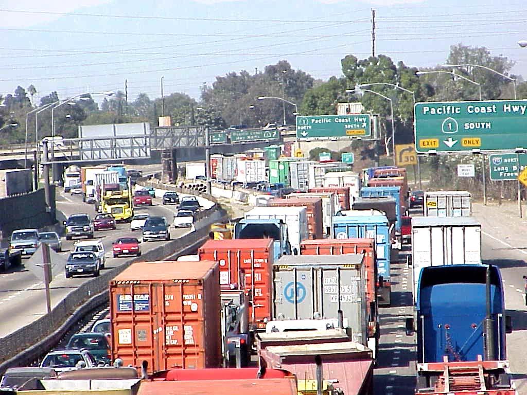
18
19 Some URLs to faculty/goodchild links to all of my courses, notes, labs basic textbook new online textbook on more sophisticated analysis University Consortium for Geographic Information Science
20 Where is it? Geography Earth Science Environmental Science and Management Anthropology Religious Studies Marine Science Institute
21 Courses Geography 176A, B, C

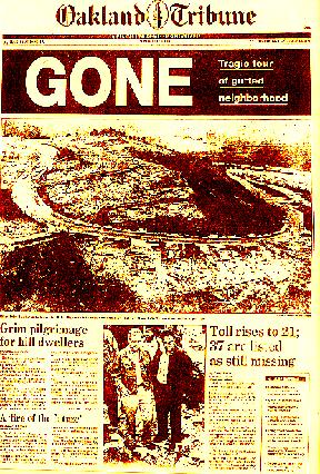
22 1. Google Earth image map of London from David Rumsey collection 3. Pump and death locations from my own web site

23 Source: Mason et al., Atlas of Cancer Mortality for U.S. Counties, NCI, 1975
24

25 Pacific Rim Trade - LA/LB ports 2002 = 10 million TEU containers 2003 = 11.8 million TEU containers 2004 = 13 million TEU containers 2005 = 14,194,442 TEU containers 2006 = estimated 8% growth Destination estimates? 50% Intermodal train (21% on-dock rail from ship) 50% Local distribution warehouses for local consumption and outbound distribution On-dock rail containers move from ship to train instead of being trucked to the rail ramps 23% In Los Angeles 27% in Long Beach Combined 1.5 million containers in 2005! This reduces the dwell time on dock and the amount of gate and yard transactions for the marine terminal further reducing yard congestion
26

27 L002: Port terminals
28 L002: LA Basin, 4 months

29
30
31
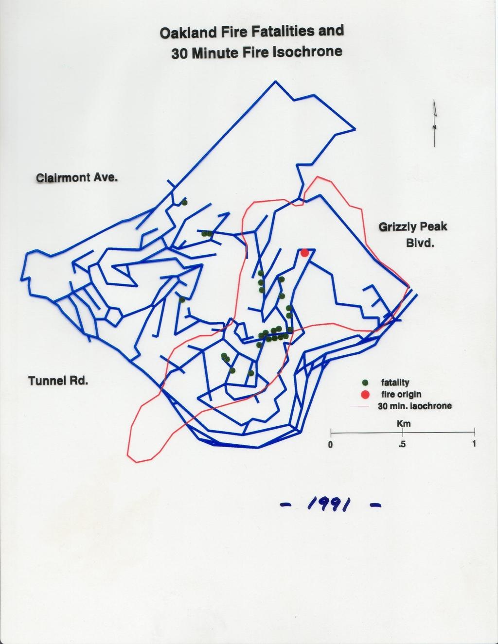
32 Simulations 1.8 vehicles per driveway Driver behavior influenced by: lane width slope view distances traffic control mechanisms information feedback driver aggressiveness 770 homes clearing times > 30 minutes 2D clip 3D clip
33
34
35
36
37
38


39
40
41
42
43
44
45
46 Where does your computer think it is?


47 Dynamic geographic information Live feed to desktop, laptop, mobile phone integrated with other map data
48
49
50


51

52
53 The GIScience research issues Representation time, 3D Standards interoperability Analysis, modeling violation of random sampling, independence assumptions Social issues privacy engaging the general public Uncertainty Modifiable Areal Unit Problem The nature of geographic data median house value and percent black by state
54
55
56
Geographic Information Systems and Science: Today and Tomorrow. Michael F. Goodchild University of California Santa Barbara
 Geographic Information Systems and Science: Today and Tomorrow Michael F. Goodchild University of California Santa Barbara Geospatial technologies Positioning on the Earth s surface GPS, RFID Acquisition
Citizens as Sensors: Web 2.0 and the World of Volunteered Geography. Michael F. Goodchild University of California Santa Barbara
 Citizens as Sensors: Web 2.0 and the World of Volunteered Geography Michael F. Goodchild University of California Santa Barbara How is geographic information created? By authorities USGS NGA Ordnance Survey
California Reality and Nova Scotia Dreaming. Michael F. Goodchild University of California Santa Barbara
 California Reality and Nova Scotia Dreaming Michael F. Goodchild University of California Santa Barbara 1 The geospatial world Remote sensing Geographic information systems Automated cartography Global
The Future of Geography in an. Society. Michael F. Goodchild University of California Santa Barbara
 The Future of Geography in an Emerging Information-Technology Society Michael F. Goodchild University of California Santa Barbara Geographic technologies Positioning i on the Earth s surface GPS, RFID
Innovation. The Push and Pull at ESRI. September Kevin Daugherty Cadastral/Land Records Industry Solutions Manager
 Innovation The Push and Pull at ESRI September 2004 Kevin Daugherty Cadastral/Land Records Industry Solutions Manager The Push and The Pull The Push is the information technology that drives research and
You are Building Your Organization s Geographic Knowledge
 You are Building Your Organization s Geographic Knowledge And Increasingly Making it Available Sharing Data Publishing Maps and Geo-Apps Developing Collaborative Approaches Citizens Knowledge Workers Analysts
Experiences and Directions in National Portals"
 FIG Seminar on e-land Administration Innsbruck/Austria 2-4 June 2004 "ESRI's Experiences and Directions in National Portals" Kevin Daugherty Cadastral/Land Records Manager ESRI Topic Points Technology
Joanne N. Halls, PhD Dept. of Geography & Geology David Kirk Information Technology Services
 Joanne N. Halls, PhD Dept. of Geography & Geology David Kirk Information Technology Services Geographic Information Systems manage and analyze data to solve spatial problems. Real World Abstraction Analysis
The Spatial Web: Visions for a Geospatial World. Michael F. Goodchild Walton Fellow National Centre for Geocomputation
 The Spatial Web: Visions for a Geospatial World Michael F. Goodchild Walton Fellow National Centre for Geocomputation Outline Context Current technology My own research Technological vision Social issues
ArcGIS Online Tools and Water-Related Web Services You Can Use Every Day of Your Life!
 ArcGIS Online Tools and Water-Related Web Services You Can Use Every Day of Your Life! Brian Rowley, PE, CFM FMA 2014 Annual Conference 1 Gold Rush (49ers) John Sutter Sutter s Mill South fork of American
These modules are covered with a brief information and practical in ArcGIS Software and open source software also like QGIS, ILWIS.
 Online GIS Training and training modules covered are: 1. ArcGIS, Analysis, Fundamentals and Implementation 2. ArcGIS Web Data Sharing 3. ArcGIS for Desktop 4. ArcGIS for Server These modules are covered
ArcGIS. for Server. Understanding our World
 ArcGIS for Server Understanding our World ArcGIS for Server Create, Distribute, and Manage GIS Services You can use ArcGIS for Server to create services from your mapping and geographic information system
GIS ADMINISTRATOR / WEB DEVELOPER EVANSVILLE-VANDERBURGH COUNTY AREA PLAN COMMISSION
 GIS ADMINISTRATOR / WEB DEVELOPER EVANSVILLE-VANDERBURGH COUNTY AREA PLAN COMMISSION SALARY RANGE INITIATION $43,277 SIX MONTHS $45,367 POSITION GRADE PAT VI The Evansville-Vanderburgh County Area Plan
Geospatial Data Sources. SLO GIS User Group June 8, 2010
 Geospatial Data Sources SLO GIS User Group June 8, 2010 Presenters Drew Decker USGS Southern California Geospatial Liaison Kelly Bobbitt Mike Bobbitt & Associates Joe Larson Cal Fire Peter Meertens Regional
A Geographer s role in a Google Maps World. Jeremy Bartley ESRI
 A Geographer s role in a Google Maps World Jeremy Bartley ESRI 1 It is a good time to be a Geographer. 2 Microsoft, Google, Yahoo, and others are pushing geographic awareness to the general public Providing
ESRI Survey Summit August Clint Brown Director of ESRI Software Products
 ESRI Survey Summit August 2006 Clint Brown Director of ESRI Software Products Cadastral Fabric How does Cadastral fit with Survey? Surveyors process raw field observations Survey measurements define high-order
Coast Survey Providing Improved Access to Maritime Navigation Products and Services
 Coast Survey Providing Improved Access to Maritime Navigation Products and Services Kurt A. Nelson, Branch Chief CGTP Leland Snyder, Branch Chief FADS Office of Coast Survey Agenda Current Coast Survey
GIS for ChEs Introduction to Geographic Information Systems
 GIS for ChEs Introduction to Geographic Information Systems AIChE Webinar John Cirucci 1 GIS for ChEs Introduction to Geographic Information Systems What is GIS? Tools and Methods Applications Examples
8/28/2011. Contents. Lecture 1: Introduction to GIS. Dr. Bo Wu Learning Outcomes. Map A Geographic Language.
 Contents Lecture 1: Introduction to GIS Dr. Bo Wu lsbowu@polyu.edu.hk Department of Land Surveying & Geo-Informatics The Hong Kong Polytechnic University 1. Learning outcomes 2. GIS definition 3. GIS examples
How does ArcGIS Server integrate into an Enterprise Environment? Willy Lynch Mining Industry Specialist ESRI, Denver, Colorado USA
 How does ArcGIS Server integrate into an Enterprise Environment? Willy Lynch Mining Industry Specialist ESRI, Denver, Colorado USA wlynch@esri.com ArcGIS Server Technology Transfer 1 Agenda Who is ESRI?
CyberGIS: What Still Needs to Be Done? Michael F. Goodchild University of California Santa Barbara
 CyberGIS: What Still Needs to Be Done? Michael F. Goodchild University of California Santa Barbara Progress to date Interoperable location referencing coordinate transformations geocoding addresses point-of-interest
Base Maps: Creating, Using & Participating
 Base Maps: Creating, Using & Participating Michael Fashoway & Erin Geraghty Montana Base Map Service Center 2010 MAGIP Technical Session October 28, 2010 What is a Base Map? Using a Base Map Creating a
Network Analysis with ArcGIS Online. Deelesh Mandloi Dmitry Kudinov
 Deelesh Mandloi Dmitry Kudinov Introductions Who are we? - Network Analyst Product Engineers Who are you? - Network Analyst users? - ArcGIS Online users? - Trying to figure out what is ArcGIS Online? Slides
GED 554 IT & GIS. Lecture 6 Exercise 5. May 10, 2013
 GED 554 IT & GIS Lecture 6 Exercise 5 May 10, 2013 Free GIS data sources ******************* Mapping numerical data & Symbolization ******************* Exercise: Making maps for presentation GIS DATA SOFTWARE
What is GIS? G: Geographic, Geospatial, Geo
 GEOG 488/588: GIS I Introduction Instructor: Geoffrey Duh TA: David Graves What is GIS? G: Geographic, Geospatial, Geo Alternatives: Spatial Information Systems, Land Information Systems Geography diverse
Improving Spatial Data Interoperability
 Improving Spatial Data Interoperability A Framework for Geostatistical Support-To To-Support Interpolation Michael F. Goodchild, Phaedon C. Kyriakidis, Philipp Schneider, Matt Rice, Qingfeng Guan, Jordan
GIS-based Smart Campus System using 3D Modeling
 GIS-based Smart Campus System using 3D Modeling Smita Sengupta GISE Advance Research Lab. IIT Bombay, Powai Mumbai 400 076, India smitas@cse.iitb.ac.in Concept of Smart Campus System Overview of IITB Campus
Introduction to the 176A labs and ArcGIS Purpose of the labs
 Introduction to the 176A labs and ArcGIS Purpose of the labs Acknowledgement: Slides by David Maidment, U Texas-Austin and Francisco Olivera (TAMU) Hands-on experience with a leading software package Introduction
Fundamental Spatial Concepts. Michael F. Goodchild University of California Santa Barbara
 Fundamental Spatial Concepts Michael F. Goodchild University of California Santa Barbara A spatial turn in science Adding space to theory the New Economic Geography space impeding flows of information,
Geospatial Preservation: State of the Landscape. A Quick Overview. Steve Morris NCSU Libraries
 Geospatial Preservation: State of the Landscape A Quick Overview Steve Morris NCSU Libraries SAA 2011 August 26, 2011 14 Brief Overview of the Problem 15 Variety of Geospatial Data Types Variety of producers
ArcGIS for INSPIRE. Paul Hardy. ArcGIS. ArcGIS for INSPIRE Enables Esri ArcGIS users to implement and comply with INSPIRE. INSPIRE Data Themes
 Enables Esri ArcGIS users to implement and comply with INSPIRE Paul Hardy phardy@esri.com EuroGeographics INSPIRE KEN (Schema Transformation) 8/9 October 2013, Marne la Vallée INSPIRE Data Themes Annex
Discovery and Access of Geospatial Resources using the Geoportal Extension. Marten Hogeweg Geoportal Extension Product Manager
 Discovery and Access of Geospatial Resources using the Geoportal Extension Marten Hogeweg Geoportal Extension Product Manager DISCOVERY AND ACCESS USING THE GEOPORTAL EXTENSION Geospatial Data Is Very
Michael F. Goodchild University of California Santa Barbara
 The Changing Face of GIS Michael F. Goodchild University of California Santa Barbara 1 Two topics New data sources Critical spatial thinking 2 How is geographic information created? By authorities and
Canadian Board of Examiners for Professional Surveyors Core Syllabus Item C 5: GEOSPATIAL INFORMATION SYSTEMS
 Study Guide: Canadian Board of Examiners for Professional Surveyors Core Syllabus Item C 5: GEOSPATIAL INFORMATION SYSTEMS This guide presents some study questions with specific referral to the essential
Digital Map of Mexico Platform and MxSIG. March 2017
 Digital Map of Mexico Platform and MxSIG March 2017 1 I. Digital Map of Mexico Platform Concept Evolution II. Digital Map of Mexico online Concept Capabilities Information available Other state units information
GIS CONCEPTS Part I. GIS ON THE WEB Part II
 Week 2 GIS CONCEPTS Part I GIS ON THE WEB Part II topics of the week part I GIS functions and GIS data Spatial relationships Organizing convention for spatial data Store Information by thematic layers
Introduction to GIS. Geol 4048 Geological Applications of Remote Sensing
 Introduction to GIS Geol 4048 Geological Applications of Remote Sensing GIS History: Before Computers GIS History Using maps for a long time Dr. Roger F. Tomlinson Father of GIS He was an English geographer
Key Points Sharing fosters participation and collaboration Metadata has a big role in sharing Sharing is not always easy
 Sharing Resources Geoff Mortson esri, Inc. SDI Solutions Team Key Points Sharing fosters participation and collaboration Metadata has a big role in sharing Sharing is not always easy Data Sharing is Good
Geospatial Analysis of Job-Housing Mismatch Using ArcGIS and Python
 Geospatial Analysis of Job-Housing Mismatch Using ArcGIS and Python 2016 ESRI User Conference June 29, 2016 San Diego, CA Jung Seo, Frank Wen, Simon Choi and Tom Vo, Research & Analysis Southern California
Reimaging GIS: Geographic Information Society. Clint Brown Linda Beale Mark Harrower Esri
 Reimaging GIS: Geographic Information Society Clint Brown Linda Beale Mark Harrower Esri 8 billion = Number of basemap requests per month on AGOL 14,000 = Unique requests per second 12,000 = New Items
Spatial Data Infrastructure Concepts and Components. Douglas Nebert U.S. Federal Geographic Data Committee Secretariat
 Spatial Data Infrastructure Concepts and Components Douglas Nebert U.S. Federal Geographic Data Committee Secretariat August 2009 What is a Spatial Data Infrastructure (SDI)? The SDI provides a basis for
ArcGIS Online Routing and Network Analysis. Deelesh Mandloi Matt Crowder
 ArcGIS Online Routing and Network Analysis Deelesh Mandloi Matt Crowder Introductions Who are we? - Members of the Network Analyst development team Who are you? - Network Analyst users? - ArcGIS Online
GIScience in Urban Planning Education - Experience from University of Maryland
 GIScience in Urban Planning Education - Experience from University of Maryland February 3, 2007 University of Tokyo Qing Shen Professor of Urban Studies and Planning School of Architecture,
ArcGIS Earth an Intro
 ArcGIS Earth an Intro Chris Andrews Product Manager, 3D and ArcGIS Earth Brian Sims 3D Content Lead 3D across the Esri product family ArcGIS Pro 3D Analyst CityEngine ArcGIS for Server ArcGIS Online ArcGIS
Introduction to the 176A labs and ArcGIS
 Introduction to the 176A labs and ArcGIS Acknowledgement: Slides by David Maidment, U Texas-Austin and Francisco Olivera (TAMU) Purpose of the labs Hands-on experience with one software pakage Introduction
ArcGIS Pro 3D Workflows. Zena Pelletier
 ArcGIS Pro 3D Workflows Zena Pelletier 3D as a GIS capability Core part of the platform Desktop Web Device Combine 2D and 3D in the same web GIS architecture Reuse dynamic services across clients Securely
Demystifying ArcGIS Online. Karen Lizcano Esri
 Demystifying ArcGIS Online Karen Lizcano Esri An Integrated Web GIS Platform Desktop Web Device Powered by Services Managed via Portal Access from any Device Portal Server Online Content and Services ArcGIS
Reprint of article that appeared in Hydro INTERNATIONAL November 2006 Volume 10 Issue 9
 Reprint of article that appeared in Hydro INTERNATIONAL November 2006 Volume 10 Issue 9 While Google Earth is the best known 3D web-mapping viewer currently in the public domain, there are alternative
OFWIM 2017 Annual Conference What Does Web GIS Really Mean for Fish and Wildlife Agencies?
 Content Open Mapping OFWIM 2017 Annual Conference What Does Web GIS Really Mean for Fish and Wildlife Agencies? Imagery Spatial Analysis Mike Bialousz, Esri 3D Data Exploration Real-Time Apps Visualization
VCCS Geospatial Institute 2011
 John McGee Jennifer McKee With support from: NSF DUE-0903270 Acquiring and Downloading Digital Data in partnership with: Geospatial Technician Education Through Virginia s Community Colleges (GTEVCC) Review
Creating a Staff Development Plan with Esri
 Creating a Staff Development Plan with Esri Michael Green David Schneider Guest Presenter: Shane Feirer, University of California Esri UC 2014 Technical Workshop Agenda What is a Staff Development Plan?
Make it Spatial. Josh Tanner. Theresa Burcsu. Tools, techniques, and tips for incorporating GIS into your research
 Make it Spatial Tools, techniques, and tips for incorporating GIS into your research Theresa Burcsu Josh Tanner Oregon GIS Framework Coordinator GIS Analyst & Web Administrator Geospatial Enterprise Office
BROOKINGS May
 Appendix 1. Technical Methodology This study combines detailed data on transit systems, demographics, and employment to determine the accessibility of jobs via transit within and across the country s 100
June 19 Huntsville, Alabama 1
 June 19 Huntsville, Alabama 1 Real-Time Geospatial Data: The Fusion of PI and ArcGIS Enabling Smarter Facilities Management OSIsoft and Esri Mapping and Location Analytics Platform Supporting Your Use
The Research Agenda of the Wisconsin Coastal Atlas
 The Research Agenda of the Wisconsin Coastal Atlas David Hart GIS Specialist University of Wisconsin Sea Grant Institute International Coastal Atlas Network Workshop 4 Trieste, Italy Tuesday, November
This Week is All About GIS, Geography and Sharing Our Knowledge
 Stockholm 2007 1 This Week is All About GIS, Geography and Sharing Our Knowledge Technology Methods Organization Data Processes Standards Projects Visualization And About You Applications Mapping Data
Incorporating ArcGIS Pro in your Curriculum
 AAG, Boston 2017 April 5, 2017 Incorporating ArcGIS Pro in your Curriculum Geri Miller Agenda Concerns Acknowledged Learning curve ArcGIS Pro does not have all the tools (perception) Licensing and offline
ESRI educational site license in Bahir Dar University. Tegegn Molla Abebe Mengaw Geospatial Data and Technology Center, BDU
 ESRI educational site license in Bahir Dar University Tegegn Molla Abebe Mengaw Geospatial Data and Technology Center, BDU September, 2016 Mission, Vision Purpose and Values of the GDTC Mission of GDTC
Esri and GIS Education
 Esri and GIS Education Organizations Esri Users 1,200 National Government Agencies 11,500 States & Regional Agencies 30,800 Cities & Local Governments 32,000 Businesses 8,500 Utilities 12,600 NGOs 11,000
Evaluating Sustainability of the Georesources Observation System
 Evaluating Sustainability of the Georesources Observation System Michael Mente Federal Institute for Geosciences and Natural Resources Germany, Hannover GEOSS-CBC Meeting Athens April 27th 28th, 2009 GEOSS-CBC
Implementing INSPIRE Geoportal in Turkey
 Implementing INSPIRE Geoportal in Turkey Gencay SERTER City and Regional Planner 1 Presentation Plan Introduction INSPIRE and Turkey Importance of al Spatial Planning Portal Logical&Legal Hierarchy GeoPortal
CSISS Resources for Research and Teaching
 CSISS Resources for Research and Teaching Donald G. Janelle Center for Spatially Integrated Social Science University of California, Santa Barbara Montreal 26 July 2003 Workshop on Spatial Analysis for
ENV208/ENV508 Applied GIS. Week 1: What is GIS?
 ENV208/ENV508 Applied GIS Week 1: What is GIS? 1 WHAT IS GIS? A GIS integrates hardware, software, and data for capturing, managing, analyzing, and displaying all forms of geographically referenced information.
Geography for the 2020 Round of Census
 Boundaries Key Census Data EA Id Population Male Female EA Id Area EA Id Num HH Avg HH size Geography for the 2020 Round of Census Linda Peters, Esri lpeters@esri.com Integration of Statistical and Geospatial
Key Questions and Issues. What is GIS? GIS is to geographic analysis as: What is GIS? 9/3/2013. GEO 327G/386G, UT Austin 1
 What is GIS? Key Questions and Issues Geology Elevation Transportation Hydrography Imagery What is GIS? What are the applications of GIS? How is the real world represented in GIS? What analyses can GIS
COURSE INTRODUCTION & COURSE OVERVIEW
 week 1 COURSE INTRODUCTION & COURSE OVERVIEW topics of the week Instructor introduction Students introductions Course logistics Course objectives Definition of GIS The story of GIS introductions Who am
INTEGRATING GEOSPATIAL PERSPECTIVES IN THE ANTHROPOLOGY CURRICULUM AT THE UNIVERSITY OF NEW MEXICO (UNM)
") INTEGRATING GEOSPATIAL PERSPECTIVES IN THE ANTHROPOLOGY CURRICULUM AT THE UNIVERSITY OF NEW MEXICO (UNM) VERONICA ARIAS HEATHER RICHARDS JUDITH VAN DER ELST DEPARTMENT OF ANTHROPOLOGY MARCH 2005 INTEGRATING
INTEGRATING GEOSPATIAL PERSPECTIVES IN THE ANTHROPOLOGY CURRICULUM AT THE UNIVERSITY OF NEW MEXICO (UNM) VERONICA ARIAS HEATHER RICHARDS JUDITH VAN DER ELST DEPARTMENT OF ANTHROPOLOGY MARCH 2005 INTEGRATING
UNIT 4: USING ArcGIS. Instructor: Emmanuel K. Appiah-Adjei (PhD) Department of Geological Engineering KNUST, Kumasi
 Department of Geological Engineering KNUST, Kumasi") UNIT 4: USING ArcGIS Instructor: Emmanuel K. Appiah-Adjei (PhD) Department of Geological Engineering KNUST, Kumasi Getting to Know ArcGIS ArcGIS is an integrated collection of GIS software products ArcGIS
UNIT 4: USING ArcGIS Instructor: Emmanuel K. Appiah-Adjei (PhD) Department of Geological Engineering KNUST, Kumasi Getting to Know ArcGIS ArcGIS is an integrated collection of GIS software products ArcGIS
Geospatial Decision Support Tools for Planning of Marine Protected Areas in California
 Geospatial Decision Support Tools for Planning of Marine Protected Areas in California WILL MCCLINTOCK (UNIVERSITY OF CALIFORNIA SANTA BARBARA), MATT MERRIFIELD (THE NATURE CONSERVANCY), SOPHIE DE BEUKELAER
FIRE DEPARMENT SANTA CLARA COUNTY
 DEFINITION FIRE DEPARMENT SANTA CLARA COUNTY GEOGRAPHIC INFORMATION SYSTEM (GIS) ANALYST Under the direction of the Information Technology Officer, the GIS Analyst provides geo-spatial strategic planning,
Why GIS & Why Internet GIS?
 Why GIS & Why Internet GIS? The Internet bandwagon Internet mapping (e.g., MapQuest) Location-based services Real-time navigation (e.g., traffic) Real-time service dispatch Business Intelligence Spatial
ArcGIS Platform For NSOs
 ArcGIS Platform For NSOs Applying GIS and Spatial Thinking to Official Statistics Esri UC 2014 Demo Theater Applying GIS at the NSO Generic Statistical Business Process Model (GSBPM) 1 Specify Needs 2
Purpose Study conducted to determine the needs of the health care workforce related to GIS use, incorporation and training.
 GIS and Health Care: Educational Needs Assessment Cindy Gotz, MPH, CHES Janice Frates, Ph.D. Suzanne Wechsler, Ph.D. Departments of Health Care Administration & Geography California State University Long
Hosted by Esri Official Distributor
 Hosted by Esri Official Distributor Esri European User Conference October 15-17, 2012 Oslo, Norway Hosted by Esri Official Distributor Interoperability and Standards Support in ArcGIS 10.1 Roberto Lucchi
GIS Building Communities beyond National Borders (Building Successful Spatial Data Infrastructures) Nick Land, ESRI Europe
 Nick Land, ESRI Europe") GIS Building Communities beyond National Borders (Building Successful Spatial Data Infrastructures) Nick Land, ESRI Europe UK worst flooding in the last 60 years 350,000 households without drinking water
GIS Building Communities beyond National Borders (Building Successful Spatial Data Infrastructures) Nick Land, ESRI Europe UK worst flooding in the last 60 years 350,000 households without drinking water
Display data in a map-like format so that geographic patterns and interrelationships are visible
 Vilmaliz Rodríguez Guzmán M.S. Student, Department of Geology University of Puerto Rico at Mayagüez Remote Sensing and Geographic Information Systems (GIS) Reference: James B. Campbell. Introduction to
The Emerging Role of Enterprise GIS in State Forest Agencies
 The Emerging Role of Enterprise GIS in State Forest Agencies Geographic Information System (GIS) A geographic information system (GIS) is a computer software system designed to capture, store, manipulate,
ArcGIS Earth for Enterprises DARRON PUSTAM ARCGIS EARTH CHRIS ANDREWS 3D
 ArcGIS Earth for Enterprises DARRON PUSTAM ARCGIS EARTH CHRIS ANDREWS 3D ArcGIS Earth is ArcGIS Earth is a lightweight globe desktop application that helps you explore any part of the world and investigate
NR402 GIS Applications in Natural Resources
 NR402 GIS Applications in Natural Resources Lesson 1 Introduction to GIS Eva Strand, University of Idaho Map of the Pacific Northwest from http://www.or.blm.gov/gis/ Welcome to NR402 GIS Applications in
GIS Boot Camp for Education June th, 2011 Day 1. Instructor: Sabah Jabbouri Phone: (253) x 4854 Office: TC 136
 x 4854 Office: TC 136") GIS Boot Camp for Education June 27-30 th, 2011 Day 1 Instructor: Sabah Jabbouri Phone: (253) 833-9111 x 4854 Office: TC 136 Email: sjabbouri@greenriver.edu http://www.instruction.greenriver.edu/gis/ Summer
GIS Boot Camp for Education June 27-30 th, 2011 Day 1 Instructor: Sabah Jabbouri Phone: (253) 833-9111 x 4854 Office: TC 136 Email: sjabbouri@greenriver.edu http://www.instruction.greenriver.edu/gis/ Summer
Are You Maximizing The Value Of All Your Data?
 Are You Maximizing The Value Of All Your Data? Using The SAS Bridge for ESRI With ArcGIS Business Analyst In A Retail Market Analysis SAS and ESRI: Bringing GIS Mapping and SAS Data Together Presented
Discovery and Access to Global Water Data, Maps and Services
 Discovery and Access to Global Water Data, Maps and Services David K. Arctur, PhD david.arctur@utexas.edu University of Texas at Austin Open Geospatial Consortium (OGC) Esri International User Conference
Applications: Introduction Task 1: Introduction to ArcCatalog Task 2: Introduction to ArcMap Challenge Question References
 CHAPTER 1 INTRODUCTION 1.1 GIS? 1.1.1 Components of a GIS 1.1.2 A Brief History of GIS 1.1.3 GIS Software Products Box 1.1 A List of GIS Software Producers and Their Main Products 1.2 GIS Applications
Three Ways the CSU is Using Geographic Information Systems (GIS) to Inform Decisions
 to Inform Decisions") Three Ways the CSU is Using Geographic Information Systems (GIS) to Inform Decisions Diana Lavery, Senior Research Analyst California State University, Office of the Chancellor California Association of
Three Ways the CSU is Using Geographic Information Systems (GIS) to Inform Decisions Diana Lavery, Senior Research Analyst California State University, Office of the Chancellor California Association of
LandScan Global Population Database
 LandScan Global Population Database The World s Finest Population Distribution Data Uncommon information. Extraordinary places. LandScan Global Population Database East View Cartographic is now offering
Introduction to ArcGIS Server Development
 Introduction to ArcGIS Server Development Kevin Deege,, Rob Burke, Kelly Hutchins, and Sathya Prasad ESRI Developer Summit 2008 1 Schedule Introduction to ArcGIS Server Rob and Kevin Questions Break 2:15
All About Spatial Data. Find it, Manage it, Use it
 All About Spatial Data Find it, Manage it, Use it Workshop Outline Define spatial data Spatial data formats Data Sources Metadata Evaluating Spatial Data Data Management Activities: define spatial data,
The Pace of Change Is Accelerating Creating Many Challenges
 VISION The Pace of Change Is Accelerating Creating Many Challenges Evidence Threatening Our Natural World and Our Future as Humans Social Conflict Mass Migration Ocean Acidification Food Population Urbanization
Teaching GIS for Land Surveying
 Teaching GIS for Land Surveying Zhanjing (John) Yu Evergreen Valley College, San Jose, California James Crossfield California State University at Fresno, Fresno California 7/13/2006 1 Outline of the Presentation
The Framework and Application of Geographic Information Systems (GIS)
") The Framework and Application of Geographic Information Systems (GIS) The Framework and Application of Geographic Information Systems (GIS) Part I The Geographic Framework The Geographic Framework Spatial
The Framework and Application of Geographic Information Systems (GIS) The Framework and Application of Geographic Information Systems (GIS) Part I The Geographic Framework The Geographic Framework Spatial
Geog 469 GIS Workshop. Data Analysis
 Geog 469 GIS Workshop Data Analysis Outline 1. What kinds of need-to-know questions can be addressed using GIS data analysis? 2. What is a typology of GIS operations? 3. What kinds of operations are useful
Paper UC1351. Conference: User Conference Date: 08/10/2006 Time: 8:30am-9:45am Room: Room 23-B (SDCC)
") Conference: User Conference Date: 08/10/2006 Time: 8:30am-9:45am Room: Room 23-B (SDCC) Title of Paper: Increasing the Use of GIS in the Federal Government Author Name: Miss Abstract This presentation
Conference: User Conference Date: 08/10/2006 Time: 8:30am-9:45am Room: Room 23-B (SDCC) Title of Paper: Increasing the Use of GIS in the Federal Government Author Name: Miss Abstract This presentation
Spatial Analysis in Your Browser
 Spatial Analysis in Your Browser Joseph Kerski Education Manager Esri jkerski@esri.com http://www.youtube.com/geographyuberalles Twitter http://twitter.com/josephkerski 303-449-7779 x 18237 Joseph Kerski
Introducing the. a partnership of
 Introducing the a partnership of Background Need for online atlas identified by managers and researchers to make coastal data available Shoreline data Ocean and coastal resources Sea-level rise potential
Introduction to Field Data Collection
 Introduction to Field Data Collection Dr. Yuji Murayama (Professor) Dr. Ko Ko Lwin (JSPS Postdoctoral Researcher) Division of Spatial Information Science Graduate School of Life and Environmental Sciences
Working with ArcGIS Online
 Esri International User Conference San Diego, CA Technical Workshops July 12, 2011 Working with ArcGIS Online Bern Szukalski, Deane Kensok Topics for this Session ArcGIS Online Overview ArcGIS Online Content
Course overview. Grading and Evaluation. Final project. Where and When? Welcome to REM402 Applied Spatial Analysis in Natural Resources.
 Welcome to REM402 Applied Spatial Analysis in Natural Resources Eva Strand, University of Idaho Map of the Pacific Northwest from http://www.or.blm.gov/gis/ Where and When? Lectures Monday & Wednesday
Watershed Sciences 4930 & 6920 GEOGRAPHIC INFORMATION SYSTEMS
 Watershed Sciences 4930 & 6920 GEOGRAPHIC INFORMATION SYSTEMS WEEK ONE Lecture 2 GIS Review & Intro to WebGIS Joe Wheaton TODAY S PLAN I. Housekeeping II. Review of GIS III. Alternatives to ArcGIS IV.
Imagery and the Location-enabled Platform in State and Local Government
 Imagery and the Location-enabled Platform in State and Local Government Fred Limp, Director, CAST Jim Farley, Vice President, Leica Geosystems Oracle Spatial Users Group Denver, March 10, 2005 TM TM Discussion
Data Management Brown Bag: Geographic Information Systems (GIS) Data A.K.A Spatial Data
 Data A.K.A Spatial Data") Data Management Brown Bag: Geographic Information Systems (GIS) Data A.K.A Spatial Data Joe Aufmuth GIS Librarian mapper@uflib.ufl.edu 273-0367 Today s Focus An overview of GIS: definition, principals,
Data Management Brown Bag: Geographic Information Systems (GIS) Data A.K.A Spatial Data Joe Aufmuth GIS Librarian mapper@uflib.ufl.edu 273-0367 Today s Focus An overview of GIS: definition, principals,