enny Mills chool of Civil ngineering & eosciences ewcastle University
|
|
|
- Harriet Joseph
- 5 years ago
- Views:
Transcription


1 Future of Surveying: Educating the future geospatial expert A Newcastle University perspective enny Mills chool of Civil ngineering & eosciences ewcastle University

2 Future of surveying: Do we still need higher education of surveying?

3 Future of surveying: Perceptions:
4 UAS, Drones etc.
5
6


7 Future of Surveying Technology Mobile Mapping /

8 Future of Surveying Technology

9 Education: is it needed?
10

11 Is education in Surveying still needed?
12 Student Learning
13 Future of Geomatics - some perceptions Google Earth / Maps means we no longer need maps Precise surveying can simply be undertaken with GPS Building surveys and models can just be conducted using laser scanning Network RTK GNSS provides cm accuracy everywhere across the country in real-time whilst mobile Precise point positioning GNSS means we always know where we are offshore to cm in real-time Observations from different systems can be seamlessly combined


14 Or So why do we still need to teach Surveying? What role does Surveying teaching in Higher Education still play?
15

16 Laser scanning

17 Laser scanning
18 Scale Factor
19 Understanding Geospatial data #NUFC
20 Understanding Geospatial data #MUFC
21 Understanding Geospatial data #swans

22 Understanding Geospatial data

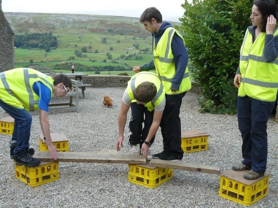
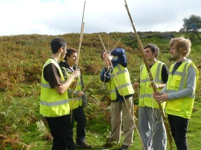
23 Understanding Geospatial data
24 Geomatics degree programmes at Newcastle University At Newcastle University BSc in Surveying and Mapping Science BSc in Geographic Information Science Surveying, GIS, GNSS, Geodesy, Photogrammetry, Laser Scanning, Remote sensing, Offshore surveying Underpinned by maths, IT, study skills Enhanced by law, professional practice, research methods, presentation/communication skills Fieldwork and team work throughout all 3 years Substantial investigative individual project in final year


25 Obsolete geomatics degree components? Theodolites? Use of tapes Manual booking Hand computations

26 Fundamental principles: Coordinate systems Understand different types of height and specify [ from kartoweb.itc.nl] At Newcastle, difference between heights above geoid and ellipsoid is 50 m Vital to use orthometric height for water to flow downhill


27 Fundamental principles: GNSS RTK suitable everywhere? Geometry and combined GNSS systems (but how)?

28 Fundamental principles: Laser scanning Laser scanning collects fantastic quantities of data But how to analyse? Processing time? Registration of point clouds


29 Fundamental principles: GIS Four different methods of interpolating the same data Must teach understanding and appreciation of the different methods
30 Teambuilding, Organisation, Communication

31 11 Jan 2012 Life During and Beyond Geomatics Raise industrial awareness Evening event Prize giving Attendance from Leading organisations e.g. Shell, BP, TSA, RICS, ICES, Leica, Topcon, Trimble, ESRI, AutoDesk Fact finding, internships, job hunting, networking

32 Stage 1 GIS and Surveying Basic Survey theory, instrumentation and computation Introduction to GNSS Principles of Remote Sensing Quantitative Methods Programming for Scientists Tutorial Study Skills Maths

 Levelling Detailing Computation &")
33 Residential Fieldcourse Stage 1 Fieldcourse Borrowdale, Lake District 8 Day consolidation of theory and practice in Surveying Triangulation Traverse (2D/3D) Levelling Detailing Computation & Plotting By hand/software

34 Stage 2 SMS/GIS Common Modules Digital Data Acquisition Map Projections and Geodetic Datums Photogrammetry and Laser Scanning Geographic Information Systems Remote Sensing Data Acquisition and Processing Law and Land Use Research and Practice in Geomatics BIM and Geospatial Modelling GIS SMS Database Systems Observation Processing and Analysis Optional 10 credits Survey Maths GNSS Theory and Practice
35 Stage 3 GIS/SMS Common Modules Individual Research Project Aspects of Applied Geomatics Professional Practice SMS Surveying Fieldcourse Geohazards and Deformation of the Earth Advanced Geodesy Photogrammetry and Laser Scanning Optional modules (20 credits) GIS GIS Fieldcourse Environmental Informatics Geohazards and Deformation of the Earth Optional Modules (30 credits)
36 Teaching of Surveying at Newcastle Understanding of: Data Methodologies Errors and Accuracy Coordinate System Limitations Graduate attributes: University Thorough grounding in principles (NOT button pushers) Problem-solvers, communicators and team players Adaptable to ever changing technology and industry demands
37 Desired entrants Excellent science A levels Maths essential (underpins almost all of what we do) Geography and IT desirable Geomatics becomes a selecting discipline (cf medicine, law), not a recruiting one Huge league table and financial pressure from the University to have only high A level grade entrants Formerly a government cap on student numbers, no longer a limit on entrants with ABB or better Students are in demand everywhere!!
38 The reality: Applications and entrants
39 Future of Geomatics at Newcastle University BSc: Surveying and Mapping Science BSc: Surveying and Mapping Science with Year in Industry BSc: Geographic Information Science BSc: Geographic Information Science with Year in Industry Master of Geomatics from year degree course, SMS + GIS Business module

40 Future of Geomatics at Newcastle University School of Engineering (no visibility of Geomatics to outside world)
41 Spatial Analytics and Modelling. New 2.25million research investment by Newcastle University 4 new professorial appointments in Engineering, Maths, Geography and, Architecture and Planning. University entre of excellence in Geographical Information Science: New spatial data handling approaches including Big Data. New spatial analysis and simulation modelling methods. New approaches to spatial data visualisation. Focus on Urban Sciences improved monitoring, analysis, modelling and visualisation of the physical and social structure of cities. Data capture via Newcastle University Urban Observatory sensor network. Spatial analysis of behavioural response to environmental risks and hazards. Simulation modelling future population dynamics, development and infrastructure requirements of cities. Integrated GIS and BIM data management for smart buildings, neighbourhoods and cities.
42 - Education establish a new 1-year Masters programme on spatial data analytics and modelling that combines spatial analysis, computing and modern statistical approaches to address the complex problems faced by cities today and into the future. provide a new suite of research-led modules to undergraduate programmes in Geomatics, Civil Engineering, Maths, Geography and, Architecture and Planning. provide new opportunity for CPD training both future researchers and school to university level teachers.

43 Summary Geomatics industry continually evolving, in response to technological and political developments Fundamental skills and understanding of geomatics principles taught on a degree will be more important than ever Perennial problem in attracting both sufficient quality and quantity of people to study, and hence enter the geomatics profession
44
THE NEW CHALLENGES FOR THE HIGHER EDUCATION OF GEODESY IN UACEG SOFIA
 THE NEW CHALLENGES FOR THE HIGHER EDUCATION OF GEODESY IN UACEG SOFIA Ivan Kunchev University of Architecture, Civil Engineering and Geodesy, 1 Hristo Smirnenski Blvd., Sofia 1046, Bulgaria Abstract Report
Undergraduate Study. Geomatics
 Undergraduate Study Geomatics 13 Geomatics How do satellite navigation systems work? How do we ensure construction projects match their design? How do we know the Earth s continents move? If we look at
A Broad View of Geospatial Technology & Systems
 A Broad View of Geospatial Technology & Systems Pete Large Vice President, Trimble On the shoulders of giants 1 Since their time, our ability to generate geospatial information has grown exponentially
geographic patterns and processes are captured and represented using computer technologies
 Proposed Certificate in Geographic Information Science Department of Geographical and Sustainability Sciences Submitted: November 9, 2016 Geographic information systems (GIS) capture the complex spatial
Programme Study Plan
 Faculty of Social and Life Sciences Programme Study Plan Geographic Information Systems Programme Code: Programme Title: TGLIT Engineering: Surveying Technology and Geographical IT Credits: 180 Programme
CE 200 Surveying Fall 2017
 Department of Civil and Environmental Engineering CE 200 Surveying Fall 2017 Instructor: Dr. Laramie Potts Contact: email lpotts@njit.edu Office Hours in 2510 GITC: Monday 4:00 5:30 pm Classroom: CULM
CONTENT. 2 Subject Aims 2. 6 Assessment Strategies 5. 7 Maintaining Standards 5. 9 Annexes 8
 CONTENT Page No Foreword III 1 Introduction 1 1.1 Subject Benchmark statement 1 1.2 Nature and Extent of the Subject 2 2 Subject Aims 2 3 Subject Knowledge and Understanding 3 4 Skills and Attitudes 4
RSC Analytical Division Strategy
 RSC Analytical Division Strategy 2013-2017 The Analytical Division aims to promote and support analytical chemistry at all levels from public outreach and school education to the most innovative and cutting
Bachelor of Geospatial Science The University of the South Pacific
 Bachelor of Geospatial Science The University of the South Pacific Geospatial Science Unit School of Geography, Earth Science and Environment Aleen Elisha Prasad Inesha Manzini Semisi Ketenilagi Geospatial
The B.S.G.E. program is accredited by the Engineering Accreditation Commission of ABET,
 Geomatics Engineering The program of study leading to the Bachelor of Science in Geomatics Engineering (B.S.G.E.) deals with designing solutions to measure, map, model, analyze and graphically display
CK107 BA in Geographical and Archaeological Sciences
 CK107 BA in Geographical and Archaeological Sciences CK107 BA in Geographical and Archaeological Science Geography and Archaeology are closely related disciplines, concerned with concepts of time and space
DIPLOMA IN GEOMATICS (NQF Level 6)
") DIPLOMA IN GEOMATICS ( 6) Programme Aims/Purpose: The Diploma in Geomatics programme was purposefully designed to prepare students for a career as survey technician, with specialised knowledge and skills
DIPLOMA IN GEOMATICS ( 6) Programme Aims/Purpose: The Diploma in Geomatics programme was purposefully designed to prepare students for a career as survey technician, with specialised knowledge and skills
Teaching GIS for Land Surveying
 Teaching GIS for Land Surveying Zhanjing (John) Yu Evergreen Valley College, San Jose, California James Crossfield California State University at Fresno, Fresno California 7/13/2006 1 Outline of the Presentation
Diffusion of GIS in Public Policy Doctoral Program
 Diffusion of GIS in Public Policy Doctoral Program By Fulbert Namwamba PhD Southern University This presentation demonstrate how GIS was introduced in the Public Policy Doctoral Program at Southern University,
XXIII CONGRESS OF ISPRS RESOLUTIONS
 XXIII CONGRESS OF ISPRS RESOLUTIONS General Resolutions Resolution 0: Thanks to the Czech Society commends: To congratulate The Czech Society, its president and the Congress Director Lena Halounová, the
Yrd. Doç. Dr. Saygın ABDİKAN Öğretim Yılı Güz Dönemi
 Yabancı Dil III (YDL285) Introduction to Geomatics Yrd. Doç. Dr. Saygın ABDİKAN 2017-2018 Öğretim Yılı Güz Dönemi 1 géomatique Geo (Earth) + informatics Geodesy + Geoinformatics Geomatics: The mathematics
PLANNING (PLAN) Planning (PLAN) 1
 Planning (PLAN) 1") Planning (PLAN) 1 PLANNING (PLAN) PLAN 500. Economics for Public Affairs Description: An introduction to basic economic concepts and their application to public affairs and urban planning. Note: Cross-listed
Planning (PLAN) 1 PLANNING (PLAN) PLAN 500. Economics for Public Affairs Description: An introduction to basic economic concepts and their application to public affairs and urban planning. Note: Cross-listed
Programme Specification (Undergraduate) For 2017/18 entry Date amended: 25/06/18
 For 2017/18 entry Date amended: 25/06/18") Programme Specification (Undergraduate) For 2017/18 entry Date amended: 25/06/18 1. Programme title(s) and UCAS code(s): BSc Biological Sciences C100 BSc Biological Sciences (Biochemistry) C700 BSc Biological
Programme Specification (Undergraduate) For 2017/18 entry Date amended: 25/06/18 1. Programme title(s) and UCAS code(s): BSc Biological Sciences C100 BSc Biological Sciences (Biochemistry) C700 BSc Biological
GEOGRAPHY (GE) Courses of Instruction
 Courses of Instruction") GEOGRAPHY (GE) GE 102. (3) World Regional Geography. The geographic method of inquiry is used to examine, describe, explain, and analyze the human and physical environments of the major regions of the
GEOGRAPHY (GE) GE 102. (3) World Regional Geography. The geographic method of inquiry is used to examine, describe, explain, and analyze the human and physical environments of the major regions of the
Land Administration and Cadastre
 Geomatics play a major role in hydropower, land and water resources and other infrastructure projects. Lahmeyer International s (LI) worldwide projects require a wide range of approaches to the integration
Exit Programme Outcomes (Qualification Outcomes): Upon completion of the Bachelor of Geomatics programme, graduates should be able to:
: Upon completion of the Bachelor of Geomatics programme, graduates should be able to:") BACHELOR OF GEOMATICS (NQF - Level 7) Programme Aims/Purpose: The Bachelor of Geomatics programme is purposefully designed prepare students for a career as professional surveyor, with high level knowledge
BACHELOR OF GEOMATICS (NQF - Level 7) Programme Aims/Purpose: The Bachelor of Geomatics programme is purposefully designed prepare students for a career as professional surveyor, with high level knowledge
Esri and GIS Education
 Esri and GIS Education Organizations Esri Users 1,200 National Government Agencies 11,500 States & Regional Agencies 30,800 Cities & Local Governments 32,000 Businesses 8,500 Utilities 12,600 NGOs 11,000
Europass Curriculum Vitae
 Europass Curriculum Vitae Personal information First name(s) / Surname(s) Clinci Tudorel Silviu Address Valea Doftanei, Prahova county, 107640, Romania E-mail(s) tudorelsilviu@yahoo.com Nationality Romanian
Industry Trends and Direction: a quick look! John Whitehead Trimble Navigation Ltd.
 Industry Trends and Direction: a quick look! John Whitehead Trimble Navigation Ltd. Converging forces have placed geospatial information at the center of an evolving ecosystem Technology Societal Forces
ENV208/ENV508 Applied GIS. Week 1: What is GIS?
 ENV208/ENV508 Applied GIS Week 1: What is GIS? 1 WHAT IS GIS? A GIS integrates hardware, software, and data for capturing, managing, analyzing, and displaying all forms of geographically referenced information.
Geography. Programme of study for key stage 3 and attainment target (This is an extract from The National Curriculum 2007)
") Geography Programme of study for key stage 3 and attainment target (This is an extract from The National Curriculum 2007) Crown copyright 2007 Qualifications and Curriculum Authority 2007 Curriculum aims
Geography Programme of study for key stage 3 and attainment target (This is an extract from The National Curriculum 2007) Crown copyright 2007 Qualifications and Curriculum Authority 2007 Curriculum aims
M.K. Gachari. Key words: Training programmes, curriculum, geomatic, Geospatial, GIS, Remote Sensing ABSTRACT
 Geospatial Information Education in Kenya: Evolution, Development, and Envisaged Future of Geoinformation Training Programmes at Jomo Kenyatta University M.K. Gachari Department of Geomatic Engineering
GEOMATICS. Shaping our world. A company of
 GEOMATICS Shaping our world A company of OUR EXPERTISE Geomatics Geomatics plays a mayor role in hydropower, land and water resources, urban development, transport & mobility, renewable energy, and infrastructure
CERTIFICATE PROGRAM IN
 CERTIFICATE PROGRAM IN GEOGRAPHIC INFORMATION SCIENCE Department of Geography University of Utah 260 S. Central Campus Dr., Rm 270 Salt Lake City, UT 84112-9155 801-581-8218 (voice); 801-581-8219 (fax)
Bachelor of Science in Geography (Fall 2016) Student
 Student") Bachelor of Science in Geography (Fall 2016) Student Student ID# Anticipated Graduation Term Advisor Minimum GPA 2.00 Today's Date 2016-2017 Undergraduate Catalog Requirements System Gen Ed Requirements
Bachelor of Science in Geography (Fall 2016) Student Student ID# Anticipated Graduation Term Advisor Minimum GPA 2.00 Today's Date 2016-2017 Undergraduate Catalog Requirements System Gen Ed Requirements
GIS Visualization: A Library s Pursuit Towards Creative and Innovative Research
 GIS Visualization: A Library s Pursuit Towards Creative and Innovative Research Justin B. Sorensen J. Willard Marriott Library University of Utah justin.sorensen@utah.edu Abstract As emerging technologies
Geography. Mrs Breider
 Geography Mrs Breider Who are these people? What do they have in common? Results 2016-17 Year 13 % A*/A 36 % A*- B 60 % A*- E 99 Why choose Geography? Studying geography arms students with a mix of skills
Applying to study geography (or geology) at university. David Richards on behalf of local Universities
 at university. David Richards on behalf of local Universities") Applying to study geography (or geology) at university David Richards on behalf of local Universities diverse relevant enabling What employers value in new graduates* Working under pressure Oral communication
Applying to study geography (or geology) at university David Richards on behalf of local Universities diverse relevant enabling What employers value in new graduates* Working under pressure Oral communication
ON THE ROAD JULY/AUGUST MAP PROJECTIONS The importance of horizontal and vertical datums in GIS mapping
 VOLUME 4 ISSUE 5 JULY/AUGUST 2014 ON THE ROAD 30 40 62 MAP PROJECTIONS The importance of horizontal and vertical datums in GIS mapping FOLLOW THE LEDDAR A special purpose sensor that does several 3D measurement
GEOMATICS ENGINEERING A TRADITIONAL DISCIPLINE TRANSFORMED IN AN INFORMATION TECHNOLOGY ERA
 Contents Page Presented at AEESEAP 99 Midterm Conference Bangkok, Thailand, May 12-14, 1999 GEOMATICS ENGINEERING A TRADITIONAL DISCIPLINE TRANSFORMED IN AN INFORMATION TECHNOLOGY ERA by Ian P. Williamson
Geomatics at HafenCity University Hamburg
 HCU HafenCity University Hamburg Geomatics at HafenCity University Hamburg Course information The broad spectrum that geomatics covers Geomatics is concerned with spatially orientated data, simply expressed
Geospatial Science and Technology Model Courses and Certificate:
 Geospatial Science and Technology Model Courses and Certificate: Guidelines and Tools to Align Curriculum to Workforce Needs Ann Johnson Associate Director gisajohnson@delmar.edu Funded by National Science
Department of Civil and Environmental Engineering. CE Surveying
 Department of Civil and Environmental Engineering CE 200 - Surveying Instructor: Dr. Laramie Potts Contact: email lpotts@njit.edu Office Hours in 2510 GITC: Wednesday 10:00 12:00 pm Classroom: CULM LEC
GEOMATICS.ORG.UK: A UK RESPONSE TO A GLOBAL AWARENESS PROBLEM
 GEOMATICS.ORG.UK: A UK RESPONSE TO A GLOBAL AWARENESS PROBLEM J. P. Mills *, D. Parker, S. J. Edwards School of Civil Engineering and Geosciences, University of Newcastle, Newcastle upon Tyne, NE1 7RU,
Future of Geography an international perspective
 Future of Geography an international perspective Colin Arrowsmith School of Mathematical and Geospatial Sciences RMIT University Melbourne, Victoria, Australia Mathematical and Geospatial Sciences Slide
Geography at Oxford Dr Lorraine Wild
 Open Day 2018 Geography at Oxford Geography at Oxford Dr Lorraine Wild Why is Oxford special? Why is Oxford special? The School of Geography and the Environment has been ranked 1 st in the 2018 QS World
8/28/2011. Contents. Lecture 1: Introduction to GIS. Dr. Bo Wu Learning Outcomes. Map A Geographic Language.
 Contents Lecture 1: Introduction to GIS Dr. Bo Wu lsbowu@polyu.edu.hk Department of Land Surveying & Geo-Informatics The Hong Kong Polytechnic University 1. Learning outcomes 2. GIS definition 3. GIS examples
Environmental Geography
 nvironmental Geography Master of Science Understanding the interactions between humans and their environment in space and time. Deciphering environmental processes and patterns often requires the bigger
Pathways. Pathways through the Geography Major
 Pathways through the Major majors may structure their course selections around a sub-field of. Pathways are suggestions for classes in, in related disciplines, and skills training. Each pathway includes
Rutgers-Newark PHYSICS RUTGERS THE STATE UNIVERSITY OF NEW JERSEY NEWARK
 THE STATE UNIVERSITY OF NEW JERSEY RUTGERS NEWARK Rutgers-Newark PHYSICS Number of programs offered.............. 4 Number of students in program........... 10 Average size of upper-level classes.............
DEPARTMENT OF PHYSICS AND ASTRONOMY. BSc/MSci Programme Structures (Full-time Undergraduate Degrees)
") DEPARTMENT OF PHYSICS AND ASTRONOMY BSc/MSci Programme Structures (Full-time Undergraduate Degrees) 2016/2017 Dates of College Terms The College terms for session 2016/2017 are: First Term: Monday 26 September
DEPARTMENT OF PHYSICS AND ASTRONOMY BSc/MSci Programme Structures (Full-time Undergraduate Degrees) 2016/2017 Dates of College Terms The College terms for session 2016/2017 are: First Term: Monday 26 September
GISc Technician model. Diploma in GISc / Geoinformatics NQF level 6. Minimum 240 credits
 GISc Technician model. Diploma in GISc / Geoinformatics NQF level. Minimum 20 credits The workforce and competency requirements of a GISc technicians is defined in terms of the Geomatics Act 19 of 2013,
The XXIV FIG International Congress April 2010, Sydney, Australia
 Impact of TEMPUS CARDS Project GIST- CroHE on the new MSc in Geoinformatics Curriculum and on the Implementation of Bologna Process at the Faculty of Geodesy, University of Zagreb, Croatia Damir Medak,
SOUTH DAKOTA BOARD OF REGENTS. Academic and Student Affairs ******************************************************************************
 SOUTH DAKOTA BOARD OF REGENTS Academic and Student Affairs AGENDA ITEM: 7 C (4) DATE: June 28-30, 2016 ****************************************************************************** SUBJECT: New Minor:
GIS Certification: How will it be used to improve education?
 GIS Certification: How will it be used to improve education? Deidre Sullivan OSTO Workshop November 11, 2008 1 What is GIS? Geographic Information Systems It is a science, a tool, and a software It assists
Surveyors, Cartographers, Photogrammetrists, and Surveying and Mapping Technicians
 http://www.bls.gov/oco/ocos040.htm Surveyors, Cartographers, Photogrammetrists, and Surveying and Mapping Technicians * Nature of the Work * Training, Other Qualifications, and Advancement * Employment
1. Pass GE1101E Geographical Journeys: Exploring World Environments. This will be counted towards the Faculty Core or UE requirements.
 H Geography At the Department of Geography, students are encouraged to develop a deeper and more critical understanding of both physical and human environments. Students will acquire knowledge, skills
John A. Ritter, Ph.D. Oregon Institute of Technology
 Oregon Institute of Technology Department t of Geomatics A GIS Degree That Merges GIS with Surveying Presented By Presented By John A. Ritter, Ph.D. Oregon Institute of Technology Presentation Objectives
Conference at a Glance
 Conference at a Glance 8:30 AM MONDAY ROOM 333 ROOM 327/328 ROOM 238 ROOM 296/298 WELCOME and KEYNOTE SPEAKER MICHAEL MILASKA 10 AM BREAK 10:30 AM Web Applications I 12 PM 1:30 PM Intro to R Data Science
Remote Sensing and EO activities at the University of Turku
 Remote Sensing and EO activities at the University of Turku Niina Käyhkö Associate Professor Department of Geography and Geology GEO meeting/syke May 23rd, 2018 Geospatial competence at the University
GCSE GEOGRAPHY. Your guide to GCSE St. Richard s Catholic College
 GCSE GEOGRAPHY Your guide to GCSE Geography @ St. Richard s Catholic College A Geographer s way of thinking Caring for the environment Understand cultural differences Understand and explore worldwide disasters
Academic Model in South Africa Some Background
 Academic Model in South Africa Some Background 6 Professional models. (Land, Hydro, Engineering, Photo, GISc) 4 Technologist Models. (Engineering, Mining, Photo, GISc) 4 Technician Models. (Engineering,
GEOSPATIAL ENGINEERING COMPETENCIES. Core Geospatial Competencies
 GEOSPATIAL ENGINEERING COMPETENCIES Core Geospatial Competencies Which Underpin the Chosen Specialism Revision 2018: Security mindedness added to GE CORE 02E The measurement, definition and portrayal,
GIS Geographical Information Systems. GIS Management
 GIS Geographical Information Systems GIS Management Difficulties on establishing a GIS Funding GIS Determining Project Standards Data Gathering Map Development Recruiting GIS Professionals Educating Staff
Proposal for Revision to the Geographic Information Systems (GIS) Academic Certificate Community College of Philadelphia.
 Academic Certificate Community College of Philadelphia.") Proposal for Revision to the Geographic Information Systems (GIS) Academic Certificate Community College of Philadelphia February 24, 2010 Kathy Smith Chair, Social Science Contributors Christopher Murphy
Proposal for Revision to the Geographic Information Systems (GIS) Academic Certificate Community College of Philadelphia February 24, 2010 Kathy Smith Chair, Social Science Contributors Christopher Murphy
School of Geography and Geosciences. Head of School Degree Programmes. Programme Requirements. Modules. Geography and Geosciences 5000 Level Modules
 School of Geography and Geosciences Head of School Degree Programmes Graduate Diploma: Dr W E Stephens Health Geography Research Environmental History and Policy (see School of History) M.Res.: M.Litt.:
What is special about geospatial? or A discipline in constant transition
 What is special about geospatial? or A discipline in constant transition Marinos Kavouras NTUA Ensuring the Rapid Response to Change, Ensuring the Surveyor of Tomorrow FIG 2015 Several paradigm shifts
CARTOGRAPHIC INFORMATION MANAGEMENT IN COLOMBIA REACH A LEVEL OF PERFECTION
 CARTOGRAPHIC INFORMATION MANAGEMENT IN COLOMBIA REACH A LEVEL OF PERFECTION Jaime Alberto Duarte Castro 1 Carrera 30 No. 48 51 Bogotá - Colombia, jduarte@igac.gov.co Claudia Inés Sepúlveda Fajardo 2 Carrera
1. Omit Human and Physical Geography electives (6 credits) 2. Add GEOG 677:Internet GIS (3 credits) 3. Add 3 credits to GEOG 797: Final Project
 2. Add GEOG 677:Internet GIS (3 credits) 3. Add 3 credits to GEOG 797: Final Project") The Department of Geography and the Office of Professional Studies propose to modify the Master of Professional Studies in Geospatial Information Sciences (GIS) as follows: 1. Omit Human and Physical Geography
The Department of Geography and the Office of Professional Studies propose to modify the Master of Professional Studies in Geospatial Information Sciences (GIS) as follows: 1. Omit Human and Physical Geography
Scope of the professional activities. Professional fields for the Surveyor. Traditional fields. Global drivers. The Surveyor of the XXIst Century
 The Surveyor of the XXIst Century Prof. Stig Enemark Aalborg University, Denmark Past Chair of FiG Commission 2 Prof. Pedro J. Cavero Technical University of University of Madrid Chair of FIG Commission
Cooperation is the key, FIG can facilitate
 Cooperation is the key, FIG can facilitate Mikael Lilje Vice President 2017-2020 Head, Geodetic infrastructure, Swedish mapping, cadastral and land registration authority Presented at the GIS/RS Conference
JOB DESCRIPTION. Research Associate - Urban Economy and Employment
 JOB DESCRIPTION Research Associate - Urban Economy and Employment 2 Research Associate Urban Economy and Employment About Us The Indian Institute for Human Settlements (IIHS) is a national education institution
Techniques for Science Teachers: Using GIS in Science Classrooms.
 Techniques for Science Teachers: Using GIS in Science Classrooms. After ESRI, 2008 GIS A Geographic Information System A collection of computer hardware, software, and geographic data used together for
HUMAN GEODESY SHAPING A NEW SCIENCE AND PROFESSION FOR THE WORLD OF TOMORROW. Walter Timo de Vries TUM München / Germany
 Presented at the FIG Working Week 2017, May 29 - June 2, 2017 in Helsinki, Finland HUMAN GEODESY SHAPING A NEW SCIENCE AND PROFESSION FOR THE WORLD OF TOMORROW Walter Timo de Vries TUM München / Germany
BACHELOR OF GEOINFORMATION TECHNOLOGY (NQF Level 7) Programme Aims/Purpose:
 Programme Aims/Purpose:") BACHELOR OF GEOINFORMATION TECHNOLOGY ( Level 7) Programme Aims/Purpose: The Bachelor of Geoinformation Technology aims to provide a skilful and competent labour force for the growing Systems (GIS) industry
BACHELOR OF GEOINFORMATION TECHNOLOGY ( Level 7) Programme Aims/Purpose: The Bachelor of Geoinformation Technology aims to provide a skilful and competent labour force for the growing Systems (GIS) industry
Cutting Edge Engineering for Modern Geospatial Systems Rear Admiral Dr. S Kulshrestha, retd
 Cutting Edge Engineering for Modern Geospatial Systems Rear Admiral Dr. S Kulshrestha, retd 11 Jun 2015 GeoIntelligence Asia 2015 The technology would become so pervasive that it becomes a part of you
State and National Standard Correlations NGS, NCGIA, ESRI, MCHE
 GEOGRAPHIC INFORMATION SYSTEMS (GIS) COURSE DESCRIPTION SS000044 (1 st or 2 nd Sem.) GEOGRAPHIC INFORMATION SYSTEMS (11, 12) ½ Unit Prerequisite: None This course is an introduction to Geographic Information
Declaration Population and culture
 Declaration Population and culture The ministers of the parties to the Alpine Convention regard the socio-economic and socio-cultural aspects mentioned in Article 2, Paragraph 2, Item a., as being central
Fluor pilot plant DEPARTMENT OF CHEMICAL AND PROCESS ENGINEERING
 Fluor pilot plant DEPARTMENT OF CHEMICAL AND PROCESS ENGINEERING OUR NEW AT SURREY, ONE OF OUR KEY AIMS IS TO PREPARE STUDENTS TO MEET THE CHALLENGES THEY WILL FACE IN THEIR FUTURE CAREERS. Within the
Geography Undergraduate Course Guide
 Geography 2019 Undergraduate Course Guide This is where it all begins... At Hull you get more than just in-depth classroom teaching. We place a strong focus on field trips, both in the UK and abroad, so
Institute of Geography and Spatial Planning (Portugal
 Institute of Geography and Spatial Planning (Portugal Institutional Information (Last update at: 05/0/015) School/Department name (Native language) AESOP reg Number AESOP Member Status University Address
The Next Generation GIS/LIS A Surveys Information System Integrated within a GIS
 The Next Generation GIS/LIS A Surveys Information System Integrated within a GIS Michael F. WEIR, USA Key words: Linking, Snapping, GIS, Measurements, Measurement Data, GIS Features, Spatial Quality. SUMMARY
Geospatial Services in Special Libraries: A Needs Assessment Perspective
 Purdue University Purdue e-pubs Libraries Faculty and Staff Scholarship and Research Purdue Libraries 5-17-2013 Geospatial Services in Special Libraries: A Needs Assessment Perspective Ilana R. Barnes
From Surveying to Geomatics and Land Management. About Future Perspectives of a Changing Discipline and Profession
 FIG President and Chair of Joint Board of Geospatial Information Societies O. Univ. Prof. Dr.-Ing. Holger Magel Director of TUM Institute of Geodesy, GIS and Land Management on From Surveying to Geomatics
COURSE SYLLABUS. GEOGRAPHY AND HISTORY Double Degree: GEOGRAPHIC INFORMATION SCIENCES Module:
 1. COURSE DESCRIPTION Degree: GEOGRAPHY AND HISTORY Double Degree: Course: GEOGRAPHIC INFORMATION SCIENCES Module: GEOGRAPHY Department: Geography, History and Philosophy Term: 1 Total Credits: 6 Year:
Geospatial Intelligence
 Geospatial Intelligence Geospatial analysis has existed as long as humans have made and studied maps but its importance to the intelligence community has skyrocketed in the past several years, with Unmanned
A Deformation Model to support a Next Generation Australian Geodetic Datum
 A Deformation Model to support a Next Generation Australian Geodetic Datum Richard Stanaway, Surveying and Geospatial Engineering School of Civil and Environmental Engineering multi-gnss + augmentation
Dr.Sinisa Vukicevic Dr. Robert Summers
 Dr.Sinisa Vukicevic Dr. Robert Summers "Planning" means the scientific, aesthetic, and orderly disposition of land, resources, facilities and services with a view to securing the physical, economic and
Excel Geomatics: Offering Excellence with Unique Consultancy & Services
 Excel Geomatics: Offering Excellence with Unique Consultancy & Services Providing consultancy and value Added Services using Remote Sensing, Photogrammetry and LiDAR in areas such as Agriculture, Forestry,
Advanced Readings. Environment and Land Use Concentration The following seminars and studios would apply
 Community Development and Housing Concentration URP 720 Urban Housing Policies URP 722 Community Development and Housing URP 724 Urban Revitalization Studio URP 726 Citizen Participation Strategies URP
Edexcel B GCSE Geography Course Options
 Edexcel B GCSE Geography Course Options For teaching from September 2016 Juniper Hall is an amazing location for fieldwork, set in a quiet wooded valley in an unspoilt area of the chalk North Downs at
Your web browser (Safari 7) is out of date. For more security, comfort and. the best experience on this site: Update your browser Ignore
 is out of date. For more security, comfort and. the best experience on this site: Update your browser Ignore") Your web browser (Safari 7) is out of date. For more security, comfort and Activityengage the best experience on this site: Update your browser Ignore Introduction to GIS What is a geographic information
Your web browser (Safari 7) is out of date. For more security, comfort and Activityengage the best experience on this site: Update your browser Ignore Introduction to GIS What is a geographic information
Programme title: MChem Chemistry (Mathematical and Computational Chemistry)
") Faculty of Life Sciences Programme Specification Programme title: MChem Chemistry (Mathematical and Computational Chemistry) Academic Year: 2018/19 Degree Awarding Body: Final and interim award(s): University
Faculty of Life Sciences Programme Specification Programme title: MChem Chemistry (Mathematical and Computational Chemistry) Academic Year: 2018/19 Degree Awarding Body: Final and interim award(s): University
OCR A-Level Geography Course Options
 OCR A-Level Geography Course Options For teaching from September 2016 Juniper Hall is an amazing location for fieldwork, set in a quiet wooded valley in an unspoilt area of the chalk North Downs at the
Informal Translation
 Informal Translation Examination regulations for the consecutive Master's program Geodetic Engineering in the Faculty of Agriculture at the University of Bonn On September 11, 2017 47th issue No. 25 September
Themes for Geomatics Conference. Geodesy Themes
 Themes for Geomatics Conference Geodesy Themes Geodynamics o Modeling the Deformation of the Earth s Crust o Recent Advances in Geometric Approaches to Deformation Analysis o Monitoring Systems (Sensors
What are the social, technical, environmental and economic benefits and opportunities of accessing and sharing geodetic data?
 What are the social, technical, environmental and economic benefits and opportunities of accessing and sharing geodetic data? Graeme Blick Group Manager Positioning and Resilience Land Information New
Teaching GIS Technology at UW-Superior. Volume 9, Number 8: May 23, 2003
 Teaching GIS Technology at UW-Superior Volume 9, Number 8: May 23, 2003 William Bajjali University of Wisconsin, department of Biology and Earth Science, Superior, WI 54880 Abstract As educators, it is
GIS Applications on Environmental Education in Taiwan
 GIS Applications on Environmental Education in Taiwan Track: Education Authors: Yu-Chen Lai, Mei-Ling Yeh, Tien-Yin Chou Abstract GIS is a perfect vehicle to deliver environmental knowledge and spatial
DOWNLOAD OR READ : WEB GIS PRINCIPLES AND APPLICATIONS PDF EBOOK EPUB MOBI
 DOWNLOAD OR READ : WEB GIS PRINCIPLES AND APPLICATIONS PDF EBOOK EPUB MOBI Page 1 Page 2 web gis principles and applications web gis principles and pdf web gis principles and applications Course Tutors
Geospatial capacity-building, best applications and practices**
 23 May 2005 English only Eighth United Nations Regional Cartographic Conference for the Americas New York, 27 June-1 July 2005 Item 8 (d) of the provisional agenda* Reports on achievements in geographic
HOW TO IMPROVE LINKS BETWEEN SCHOOL GEOGRAPHY DEPARTMENTS AND LOCAL UNIVERSITY GEOGRAPHY and EDUCATION DEPARTMENTS
 CGEOG (TEACHER) ONLINE CPD MODULE HOW TO IMPROVE LINKS BETWEEN SCHOOL GEOGRAPHY DEPARTMENTS AND LOCAL UNIVERSITY GEOGRAPHY and EDUCATION DEPARTMENTS By Garry Atterton Chartered Geographer (Teacher) The
Research Group Cartography
 Research Group Cartography Research Group Cartography Towards supporting wayfinding LBS components 1. Mobile devices 2. Communication Network 3. Positioning Component 4. Service and Application Provider
UNITED NATIONS E/CONF.96/CRP. 5
 UNITED NATIONS E/CONF.96/CRP. 5 ECONOMIC AND SOCIAL COUNCIL Eighth United Nations Regional Cartographic Conference for the Americas New York, 27 June -1 July 2005 Item 5 of the provisional agenda* COUNTRY
June 19 Huntsville, Alabama 1
 June 19 Huntsville, Alabama 1 Real-Time Geospatial Data: The Fusion of PI and ArcGIS Enabling Smarter Facilities Management OSIsoft and Esri Mapping and Location Analytics Platform Supporting Your Use