Disseminating Fire Weather/Fire Danger Forecasts through a Web GIS. Andrew Wilson Riverside Fire Lab USDA Forest Service
|
|
|
- Cornelius Hampton
- 6 years ago
- Views:
Transcription
1 Disseminating Fire Weather/Fire Danger Forecasts through a Web GIS Andrew Wilson Riverside Fire Lab USDA Forest Service
2 Hawaii Fire Danger System Supporters Hawaii Department of Forestry & Wildlife Pacific Disaster Center Fire Consortia For Advanced Modeling of Meteorology and Smoke (FCAMMS) USDA Forest Service Riverside Fire Lab Maui High Performance Computing Center National Weather Service Environmental Systems Research Institute
3 Clients: Users US Army HI Department of Forestry And Wildlife National Park Service County/City Fire Departments Civil Defense
4 Hawaii Fire Danger Project 1970 s tabular data Point Forecasts Stations weren t where resource concerns were Many hands, many steps Renewed interest with increased accessibility
5 First Output (1974) FOR HAWAII CIVIL DEFENSE HAWAII FIRE DANGER INDEXES FOR 00Z 29 JAN 74 STATION T RH FF PPP FFM IC SC ERC OI BI FLI KOKEE (161) BARK SANDS (162) LIHUE (165) WAIALEE (169) WHEELER (170) HONOLULU (182) FORECAST FOR HAWAII FIRE DANGER INDEXES FOR HAWAII CIVIL DEFENSE (EFFECTIVE 24 HOURS FROM 00Z 29 JAN 74) STATION T RH FF PPP FFM IC SC ERC OI BI FLI KOKEE (161) LIHUE (165) WAIALEE (169) HONOLULU (182) MOLOKAI AP (186)

6 Hawaii Fire Danger Project 1970 s tabular data Renewed interest with increased accessibility High resolution weather forecasts Open forecast models Inexpensive, powerful computers Internet mapping
7 Models: Forecast Sources RSM, MM5, WRF Scalable and spatial Mosaics: National Digital Forecast Database (NDFD) Various sources: human eye, uncertain provenance (source model, resolution)
8 Mesoscale model MM5 Steps down from global NCEP model to 12, 6, 3, or even? kilometers Accessible software / hardware Increase spatial resolution = Increase temporal resolution Increase in processing time Physics scaling questions

9 First Level MM5 Domain 27 km

10 Second Level MM5 Domain 9km

11 Third Level MM5 Domain 3km
12 National Digital Forecast Database (NDFD) Downloads twice or more time daily with adjustments potentially hourly for eight forecast periods per day 3-hour forecast intervals Mosaic of different models Current output format: GRIB (surface) - thrifty XML (point) format fat for surfaces! Shape files
13 Fire Danger Elements Element Fuels Est. potential for: Use Burn Index (BI) f(type) Flame Length Staffing Levels Energy Release Component (ERC) f(type) Energy/area (BTU/ft 2 ) Type of suppression Ignition Component (IC) 1-hour Ease of starting Pre-positioning units Spread Component (SC) f(type) Rate of Spread Need for speed to suppress Keetch-Byram Drought Index (KBDI) No Upper Soil Dryness Seasonal (slow reaction) index
14 National Fire Danger Rating System Structure (cf. H. Reinbold) Calculated Input Output Site Description Fuel Model Slope Class Live Fuel Types Climate Class Average Annual Precipitation KBDI (88) Latitude Drought Fuel Ignition Component IC 1300 LST Observation Relative Humidity Temperature Cloudiness Wind Speed Fuel Stick Moisture 24-Hour Observations Precipitation Max/Min RH Amount Min Temp Maximum Temperature Precipitation Duration Season Code & Greenness Factor (88) 1-hr FM 10-hr FM 100-hr FM 1000-hr FM Contribution of dead FM to SC Spread Component SC Contribution of dead FM to ERC Burning Index BI Carryover Fuel Moistures (FM) 100-Hour (88) 1000-Hour Periodic Measurements Live Woody FM Live FM Energy Release Component ERC
15 Fire Danger Input Fuels Mapping by WFAS, HI-DOFAW, PDC Mean Annual Precipitation Slope Weather! Temperature, humidity, wind, precipitation, cloud cover Temporal (24-48 forecast 1-3 hours) Dynamic (updates daily or more often)
16 Display Constraints Weather and fire danger surfaces = rasters Display, Visualization Transparency Speed Key elements sent to tables = points Software raster query problems Multiple elements, one query Flat table and views of query-able points
17 HFDRS Processing MS-SQL/sde IMS MM5 NDFD Ascii FLT N F D R S SDERaster SDE2Table Raster Point View image query IMS perl fortran python SQL java/js/xml
18 Step One Data to Calculator Get data from meteorology sources and formats to NFDRS calculator degrib converts Grib files to Floating-point flat files (FLT) GDAL project and clip NFDRS Calculations on pixel-by-pixel basis perl scripts convert, check, massage data
19 HFDRS Processing MS-SQL/sde IMS MM5 NDFD Ascii FLT N F D R S SDERaster SDE2Table Raster Point View image query IMS perl fortran python SQL java/js/xml
20 Step Two Results to Map Service Fire Danger & Weather forecasts are FLT (float) files Rasters Convert FLT to BSQ SDERASTER Points/tables/views Convert to dbf SDETABLE Python, perl, C
21 HFDRS Processing MS-SQL/sde IMS MM5 NDFD Ascii FLT N F D R S SDERaster SDE2Table Raster Point View image query IMS perl fortran python SQL java/js/xml
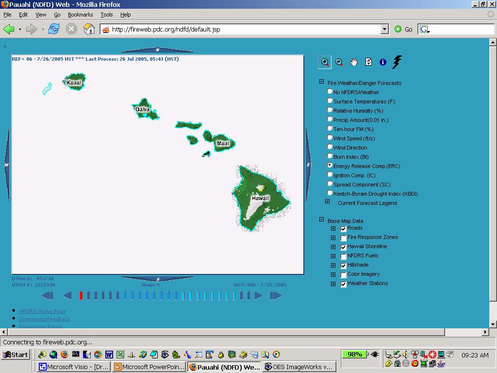
22 Step Three - Display IMS and other applications Philosophies: Keep it simple Make temporal aspect manageable Java, JavaScript, XML, HTML,.
23 HFDRS Display Activities Animation Raster Point View image query IMS Images/ Point Queries Fire Danger Forecast Web Pages (interactive maps) Hydrograms RRA Observations Validation
24
25 Current Environment NDFD NWS FTP site MM5 MHPCC - Super Computer UH (Dell Cluster), UCSB, DRI Fire Web ArcSDE 8.3, SQLServer 2000, ArcIMS Apache/Tomcat java, javascript Python 2.3, perl 1.7, degrib 1.7,. Single Processor 2.8 Ghz Intel PC
26 Scalability Current prototype system Multiple instances: Hawaii (PDC-Maui), Southern, Northern California Multiple tiers: Separate crunching, database and web services Multiple processes for each service Central Services multiple sites mutliple tiers
27 Support User Community: Hawaii Department of Forestry & Wildlife Big Island Wildfire Coordinating Group On-line (direct links and to forums) Development Web Log Cooperators: Pacific Disaster Center DOFAW USFS MHPCC
28 Future Continue to respond to user needs Adapt to advances in GIS technologies: Raster handling Temporal display and storage Open source, NFDRS-in-a-box Geospatial Explorers Discover differences between reality and whitepapers (scaling, portability)
29 Andrew Wilson Resource Information Specialist Riverside Fire Lab
The CANSAC/BLUESKY Connection
 The CANSAC/BLUESKY Connection Timothy Brown Desert Research Institute Program for Climate, Ecosystem and Fire Applications Reno, NV Partners USDA Forest Service Region 5 California Air Resources Board
Fire Weather Monitoring and Predictability in the Southeast
 Fire Weather Monitoring and Predictability in the Southeast Corey Davis October 9, 2014 Photo: Pains Bay fire in 2011 (courtesy Donnie Harris, NCFWS) Outline Fire risk monitoring Fire risk climatology
ECPC/NCEP March 2008 Seasonal Fire Danger Forecasts J. Roads 1, P. Tripp 1, H. Juang 2, J. Wang 2, S. Chen 3, F. Fujioka 3
 Roads, J., P. Tripp, H. Juang, J. Wang, S. Chen, F. Fujioka, 2008: ECPC/NCEP March 2008 Seasonal Fire Danger Forecasts. Experimental Long-Lead Forecasts Bulletin, 17, 7 pp. ECPC/NCEP March 2008 Seasonal
US National Fire Danger Rating System: Past, Present and Future
 US National Fire Danger System: Past, Present and Future Dr. W. Matt Jolly US Forest Service, Fire Sciences Laboratory Missoula, MT 17/09/2008 NWCG IRMWT 1 Outline Introduction to the US National Fire
SPC Fire Weather Forecast Criteria
 SPC Fire Weather Forecast Criteria Critical for temperature, wind, and relative humidity: - Sustained winds 20 mph or greater (15 mph Florida) - Minimum relative humidity at or below regional thresholds
Automated Conversion and Processing of Weather Data in Near-Real Time Daniel Konde QSS Group Inc. Rory Moore Raytheon
 Automated Conversion and Processing of Weather Data in Near-Real Time Daniel Konde QSS Group Inc. Rory Moore Raytheon 1.0 Abstract In the spring of 2003 the National Weather Service (NWS) developed an
Accomplishments and Deliverables
 ANNUAL REPORT 2015 Background In July 2002, the FIRESCOPE California Wildfire Agencies (CWA) approved a charter leading to the formation of the California and Nevada Smoke and Air Committee (CANSAC). The
GIS in Weather and Society
 GIS in Weather and Society Olga Wilhelmi Institute for the Study of Society and Environment National Center for Atmospheric Research WAS*IS November 8, 2005 Boulder, Colorado Presentation Outline GIS basic
FireFamilyPlus Version 5.0
 FireFamilyPlus Version 5.0 Working with the new 2016 NFDRS model Objectives During this presentation, we will discuss Changes to FireFamilyPlus Data requirements for NFDRS2016 Quality control for data
11.7 THE VALIDITY OF THE KEETCH/BYRAM DROUGHT INDEX IN THE HAWAIIAN ISLANDS
 11.7 THE VALIDITY OF THE KEETCH/BYRAM DROUGHT INDEX IN THE HAWAIIAN ISLANDS Klaus P. Dolling 1, Pao-Shin Chu 1, and Francis Fujioka 2 1 Department of Meteorology, University of Hawaii at Manoa, Honolulu,
July 5-6, 2010 Mytilene, Greece
 Web GIS platform for forest fire management Prof. Kostas Kalabokidis Principal Investigator Univ. of the Aegean, Dept. of Geography, Greece Prof. George Kallos Univ. of Athens, Dept. of Physics, Greece
TEXAS FIREFIGHTER POCKET CARDS
 TEXAS FIREFIGHTER POCKET CARDS UPDATED: FEBRUARY 2014 Table of Contents Guide to Percentiles and Thresholds... 1 Fire Business... 2 Predictive Service Area Map... 4 Firefighter Pocket Cards Central Texas...
Geospatial Fire Behavior Modeling App to Manage Wildfire Risk Online. Kenyatta BaRaKa Jackson US Forest Service - Consultant
 Geospatial Fire Behavior Modeling App to Manage Wildfire Risk Online Kenyatta BaRaKa Jackson US Forest Service - Consultant Fire Behavior Modeling and Forest Fuel Management Modeling Fire Behavior is an
Texas Wildland Fire Season Outlook. for. Winter 2009
 Texas Wildland Fire Season Outlook for Winter 2009 December 5, 2008 Contents Section Page Executive Summary 1 Introduction 2 Underlying Fuels Condition 4 Weather Outlook 8 Findings 10 Credits 11 Attachments
High Resolution Indicators for Local Drought Monitoring
 High Resolution Indicators for Local Drought Monitoring REBECCA CUMBIE, STATE CLIMATE OFFICE OF NC, NCSU Monitoring Drought Multiple indicators, multiple sources Local detail important 1 Point-Based Climate-Division
Page 1 of 6 SWCC MORNING INTELLIGENCE BRIEFING. June 1, Daily Summary
 SWCC MORNING INTELLIGENCE BRIEFING June 1, 2015 PDF Version Product Feedback Daily Summary SITUATION: With nine dispatch centers reporting, fire activity continues to be light throughout the Southwest
SDG&E Meteorology. EDO Major Projects. Electric Distribution Operations
 Electric Distribution Operations SDG&E Meteorology EDO Major Projects 2013 San Diego Gas & Electric Company. All copyright and trademark rights reserved. OCTOBER 2007 WILDFIRES In 2007, wildfires burned
Geoprocessing Hydrometeorological Datasets to Assess National Weather Service (NWS) Forecasts
 Forecasts") Geoprocessing Hydrometeorological Datasets to Assess National Weather Service (NWS) Forecasts Jack Settelmaier National Weather Service Southern Region HQ Fort Worth, Texas ABSTRACT The National Weather
Geoprocessing Hydrometeorological Datasets to Assess National Weather Service (NWS) Forecasts Jack Settelmaier National Weather Service Southern Region HQ Fort Worth, Texas ABSTRACT The National Weather
2008 California Fire Season Outlook
 2008 California Fire Season Outlook For July through October 2008 (issued 6/25/08) 1 North Ops Concerns and Implications for Management NOPS currently in a worsening drought, due to the driest spring on
Web GIS Based Disaster Portal Project ESRI INDIA
 Web GIS Based Disaster Portal Project ESRI INDIA Contents Requirements Overview Product Technology Used KSNDMC Application Architecture Tool Developed Benefits for the End User Problems faced during implementation
Weather in the Canadian Wildland Fire Information System
 Weather in the Canadian Wildland Fire Information System Forest Fires in Canada 35% are caused by lightning (higher proportion in west) 65% are caused by people 87% of the area burned is from lightning-caused
The WeatherShare Project: Aggregation and Dissemination of Weather Information for Public Safety
 slide1 The WeatherShare Project: Aggregation and Dissemination of Weather Information for Public Safety National Rural ITS Conference 2006 Big Sky Montana Monday, August 14th, 2006 12:30 pm Session B4:
Accessing and Using National Long Term Ecological Research (LTER) Climate and Hydrology Data from ClimDB and HydroDB: A Tutorial
 Climate and Hydrology Data from ClimDB and HydroDB: A Tutorial") Accessing and Using National Long Term Ecological Research (LTER) Climate and Hydrology Data from ClimDB and HydroDB: A Tutorial Gordon M. Heisler USDA Forest Service, Syracuse, NY Gary Fisher U.S. Geological
Accessing and Using National Long Term Ecological Research (LTER) Climate and Hydrology Data from ClimDB and HydroDB: A Tutorial Gordon M. Heisler USDA Forest Service, Syracuse, NY Gary Fisher U.S. Geological
Exploring ArcIMS Services to Deliver National Weather Service Datasets in Support of Decision-Makers
 Exploring ArcIMS Services to Deliver National Weather Service Datasets in Support of Decision-Makers 2007 ESRI Federal User Conference Washington, DC January 10, 2007 Jack Settelmaier Digital Techniques
Fire danger. The skill provided by ECMWF ensemble prediction system. Francesca Di Giuseppe and Claudia Vitolo Forecast Department, ECMWF
 Fire danger The skill provided by ECMWF ensemble prediction system Link to slides: https://goo.gl/qm15fk Francesca Di Giuseppe and Claudia Vitolo Forecast Department, ECMWF ECMWF August 2, 2016 Fire forecast
FireFamily Plus User s Guide
 United States Department of Agriculture Forest Service Rocky Mountain Research Station General Technical Report RMRS-GTR-67-WWW September 2000 FireFamily Plus User s Guide Version 2.0 Larry Bradshaw Erin
Development of U.S. Operational Fire Danger 15-Day Forecasts
 Program for Climate, Ecosystem and Fire Applications Development of U.S. Operational Fire Danger 15-Day Forecasts Beth L. Hall Timothy J. Brown Larry S. Bradshaw Division of Atmospheric Sciences. CEFA
StreamStats: Delivering Streamflow Information to the Public. By Kernell Ries
 StreamStats: Delivering Streamflow Information to the Public By Kernell Ries U.S. Department of the Interior U.S. Geological Survey MD-DE-DC District 410-238-4317 kries@usgs.gov StreamStats Web Application
Speedwell High Resolution WRF Forecasts. Application
 Speedwell High Resolution WRF Forecasts Speedwell weather are providers of high quality weather data and forecasts for many markets. Historically we have provided forecasts which use a statistical bias
High Resolution Weather Modeling for Improved Fire Management
 High Resolution Weather Modeling for Improved Fire Management Kevin Roe Maui High Performance Computing Center 550 Lipoa Parkway Kihei, HI 96753 808-879-5077 x288 kproe@mhpcc.edu Duane Stevens University
Open Source ENKI: Dynamic Environmental Model Framework. A possible pre-processor for WRF-Hydro?
 Open Source ENKI: Dynamic Environmental Model Framework A possible pre-processor for WRF-Hydro? 1st European Fully Coupled AtmosphericHydrological Modeling and WRF-Hydro Users workshop. University of Calabria.
FINAL REPORT Phase One
 FINAL REPORT Phase One FS Agreement Number: 03-JV-11222046-077 Cooperator Agreement Number: 2477 Evaluation of a New Dead Fuel Moisture Model in a Near-Real-Time Data Assimilation and Forecast Environment
Analyzing Multidimensional Scientific Data in ArcGIS. Nawajish Noman Deng Ding
 Analyzing Multidimensional Scientific Data in ArcGIS Nawajish Noman Deng Ding Outline Part I - ArcGIS Platform - Scientific Multidimensional Data - Ingest and Data Management Part II - Data Exploration
Elements of the National Weather Service Fire Weather Forecast By Casey Sullivan, National Weather Service, Chicago
 Elements of the National Weather Service Fire Weather Forecast By Casey Sullivan, National Weather Service, Chicago Today s Presentation Begins at 12 pm CST, 1 pm EST Please Take Our One Question Survey
MULTI-AGENCY COORDINATION SYSTEM PUBLICATION CALIFORNIA FIRE WEATHER PROGRAM RISK PREPAREDNESS GUIDE MACS 410-3
 MULTI-AGENCY COORDINATION SYSTEM PUBLICATION CALIFORNIA FIRE WEATHER PROGRAM RISK PREPAREDNESS GUIDE MACS 410-3 August 26, 2013 California Fire Weather Program Risk Preparedness Guide Table of Contents
HIGH RESOLUTION RAPID REFRESH COUPLED WITH SMOKE (HRRR- SMOKE): REAL-TIME AIR QUALITY MODELING SYSTEM AND ITS APPLICATION TO CASE STUDIES
: REAL-TIME AIR QUALITY MODELING SYSTEM AND ITS APPLICATION TO CASE STUDIES") HIGH RESOLUTION RAPID REFRESH COUPLED WITH SMOKE (HRRR- SMOKE): REAL-TIME AIR QUALITY MODELING SYSTEM AND ITS APPLICATION TO CASE STUDIES Ravan Ahmadov 1,2 (ravan.ahmadov@noaa.gov) Acknowledgement: G.
HIGH RESOLUTION RAPID REFRESH COUPLED WITH SMOKE (HRRR- SMOKE): REAL-TIME AIR QUALITY MODELING SYSTEM AND ITS APPLICATION TO CASE STUDIES Ravan Ahmadov 1,2 (ravan.ahmadov@noaa.gov) Acknowledgement: G.
Weather versus Climate: What is the difference? Sources of Weather Information
 Joel O. Paz, Extension Agrometerologist and Gerrit Hoogenboom, Professor & REI Coordinator Department of Biological and Agricultural Engineering Weather versus Climate: What is the difference? The difference
Focus Areas. Colorado Rio Grande Jemez. San Pedro. An NSF Science and Technology Center SAHRA
 Focus Areas 1 San Pedro Colorado Rio Grande Jemez Geo-database Structure 2 SGB Schemas Upper Rio Grande Research Data Flux Tower Data Public Data Hydrology Rules, Users and Procedures Jemez River Colorado
Lesson 2C - Weather. Lesson Objectives. Fire Weather
 Lesson 2C - Weather 2C-1-S190-EP Lesson Objectives 1. Describe the affect of temperature and relative humidity has on wildland fire behavior. 2. Describe the affect of precipitation on wildland fire behavior.
NWS Fire Weather Forecast, Wildland Fire Assessment Systems and OKMesonet Products Applications as Short Term Mitigation Tools for Emergency Response
 NWS Fire Weather Forecast, Wildland Fire Assessment Systems and OKMesonet Products Applications as Short Term Mitigation Tools for Emergency Response Presentation for The Southern Climate Impacts Planning
A Cloud-Based Flood Warning System For Forecasting Impacts to Transportation Infrastructure Systems
 A Cloud-Based Flood Warning System For Forecasting Impacts to Transportation Infrastructure Systems Jon Goodall Associate Professor, Civil and Environmental Engineering Associate Director, Link Lab April
4.5 Comparison of weather data from the Remote Automated Weather Station network and the North American Regional Reanalysis
 4.5 Comparison of weather data from the Remote Automated Weather Station network and the North American Regional Reanalysis Beth L. Hall and Timothy. J. Brown DRI, Reno, NV ABSTRACT. The North American
Application and verification of ECMWF products 2014
 Application and verification of ECMWF products 2014 Israel Meteorological Service (IMS), 1. Summary of major highlights ECMWF deterministic runs are used to issue most of the operational forecasts at IMS.
SuperPack North America
 SuperPack North America Speedwell SuperPack makes available an unprecedented range of quality historical weather data, and weather data feeds for a single annual fee. SuperPack dramatically simplifies
Great Lakes Information Network GIS (Queryable by topic, geography, organization, and upload date 73 layers as of October, 2009)
") Google Earth Files for the Great Lakes and Beyond GLOS Mapping Workshop Alpena, Michigan November 9, 2009 David Hart GIS Specialist University of Wisconsin Sea Grant Institute GREAT LAKES Great Lakes Information
Google Earth Files for the Great Lakes and Beyond GLOS Mapping Workshop Alpena, Michigan November 9, 2009 David Hart GIS Specialist University of Wisconsin Sea Grant Institute GREAT LAKES Great Lakes Information
Southern California Edison Wildfire Mitigation & Grid Resiliency
 Southern California Edison Wildfire Mitigation & Grid Resiliency California State Legislative Conference Committee on Wildfire Preparedness and Response August 7, 2018 CALIFORNIA S WILDFIRE RISK Year-Round
8.2 USING HIGH-RESOLUTION WEATHER DATA TO PREDICT FIRE SPREAD USING THE FARSITE SIMULATOR A CASE STUDY IN CALIFORNIA CHAPARRAL
 8.2 USING HIGH-RESOLUTION WEATHER DATA TO PREDICT FIRE SPREAD USING THE FARSITE SIMULATOR A CASE STUDY IN CALIFORNIA CHAPARRAL David R. Weise*, Shyh-Chin Chen, Philip J. Riggan, Francis M. Fujioka Forest
GIS at the Midwestern Regional Climate Center: A peek behind the curtain. Zoe Zaloudek, Geospatial Application Developer
 GIS at the Midwestern Regional Climate Center: A peek behind the curtain Zoe Zaloudek, Geospatial Application Developer CPASW, May 2018 What is the MRCC? GIS-based Maps and Products Regional Mesonet Program
Instructions - GFC Prescribed Burn Unit Plan
 Instructions - GFC Prescribed Burn Unit Plan This Prescribed Burn Unit Plan should be used by all GFC personnel when conducting prescribed burn assistance for landowners and when conducting prescribed
Development of a GIS Interface for WEPP Model Application to Great Lakes Forested Watersheds
 Development of a GIS Interface for WEPP Model Application to Great Lakes Forested Watersheds J.R. Frankenberger 1, S. Dun 2, D.C. Flanagan 1, J.Q. Wu 2, W.J. Elliot 3 1 USDA-ARS, West Lafayette, IN 2 Washington
Remote Sensing and Wildfires
 Workshop, San Diego, 5-7 August 2013 Measuring, Quantifying, and Reporting Drought Impacts Remote Sensing and Wildfires S. V. Nghiem 1 and M. Kafatos 2 1 NASA Jet Propulsion Laboratory California Institute
WRF Modeling System Overview
 WRF Modeling System Overview Wei Wang & Jimy Dudhia Nansha, Guangdong, China December 2015 What is WRF? WRF: Weather Research and Forecasting Model Used for both research and operational forecasting It
Symbology Modification for Climate Studies. Rich Baldwin (NCDC/NOAA) Glen Reid (IMSG)
 Glen Reid (IMSG)") Symbology Modification for Climate Studies Rich Baldwin (NCDC/NOAA) Glen Reid (IMSG) June 3, 2005 Abstract The National Climatic Data Center archives worldwide weather data from the present date back to
Symbology Modification for Climate Studies Rich Baldwin (NCDC/NOAA) Glen Reid (IMSG) June 3, 2005 Abstract The National Climatic Data Center archives worldwide weather data from the present date back to
CalWeedMapper. Mapping the Spread of Invasive Plant Species. Karsten Vennemann. Seattle
 CalWeedMapper Mapping the Spread of Invasive Plant Species Karsten Vennemann Seattle Talk Overview The CalWeedMapper Project this presentation is about the expert online editing tool (part of larger project)
Online visualization of multi-dimensional spatiotemporal
 Online visualization of multi-dimensional spatiotemporal data Visualization of weather data of Germany in a large time scale Keni Han Final presentation Supervisor: Dr.-Ing. Mathias Jahnke Univ.Prof. Mag.rer.nat.
An Integrated Fire, Smoke and Air Quality Data & Tools Network
 An Integrated Fire, Smoke and Air Quality Data & Tools Network Stefan Falke and Rudolf Husar Center for Air Pollution Impact and Trend Analysis Washington University in St. Louis Brooke Hemming US EPA
GeoSpatial Tools and Analysis David Currie
 GeoSpatial Tools and Analysis David Currie GeoSpatial Tools and Analysis Data for Good Sept 23, 2014 Focus on open source tools Bias towards remote sensing topics Some examples from completed projects
CAPACITY BUILDING FOR NON-NUCLEAR ATMOSPHERIC TRANSPORT EMERGENCY RESPONSE ACTIVITIES. (Submitted by RSMC-Beijing) Summary and purpose of document
 Summary and purpose of document") WORLD METEOROLOGICAL ORGANIZATION COMMISSION FOR BASIC SYSTEMS OPAG on DPFS Task Team on Development of Operational Procedures for non-nuclear ERA CBS-DPFS/TT-DOP-nNERA/Doc.8 (4.X.2012) Agenda item : 8
WORLD METEOROLOGICAL ORGANIZATION COMMISSION FOR BASIC SYSTEMS OPAG on DPFS Task Team on Development of Operational Procedures for non-nuclear ERA CBS-DPFS/TT-DOP-nNERA/Doc.8 (4.X.2012) Agenda item : 8
Exercie 5 Preparing GIS data for simulation with FARSITE REM407 GIS Applications in Fire Ecology and Management
 Exercie 5 Preparing GIS data for simulation with FARSITE REM407 GIS Applications in Fire Ecology and Management Assignment: Make maps of the Fuelmodel layer and the clipped Canopy cover layer and submit
Ed Tomlinson, PhD Bill Kappel Applied Weather Associates LLC. Tye Parzybok Metstat Inc. Bryan Rappolt Genesis Weather Solutions LLC
 Use of NEXRAD Weather Radar Data with the Storm Precipitation Analysis System (SPAS) to Provide High Spatial Resolution Hourly Rainfall Analyses for Runoff Model Calibration and Validation Ed Tomlinson,
Monthly Long Range Weather Commentary Issued: APRIL 18, 2017 Steven A. Root, CCM, Chief Analytics Officer, Sr. VP,
 Monthly Long Range Weather Commentary Issued: APRIL 18, 2017 Steven A. Root, CCM, Chief Analytics Officer, Sr. VP, sroot@weatherbank.com MARCH 2017 Climate Highlights The Month in Review The average contiguous
The Tahoe Climate Information Management System (Tahoeclim)
") The Tahoe Climate Information Management System (Tahoeclim) Final Report August 2016 Kelly T. Redmond 1, Geoff Schladow 2 1 Desert Research Institute Reno, NV 2 Tahoe Environmental Research Center, UC
The Tahoe Climate Information Management System (Tahoeclim) Final Report August 2016 Kelly T. Redmond 1, Geoff Schladow 2 1 Desert Research Institute Reno, NV 2 Tahoe Environmental Research Center, UC
Instituto de Pesquisas Meteorológicas - IPMet Universidade Estadual Paulista - Unesp
 IPMET WEB GIS APPLICATION FOR SEVERE WEATHER ALERT AND DECISION SUPPORT Jaqueline Murakami Kokitsu Instituto de Pesquisas Meteorológicas - IPMet Universidade Estadual Paulista - Unesp IPMet/Unesp Meteorological
LAYMAN S REPORT Floods and Fire Risk Assessment and Management
 LAYMAN S REPORT Floods and Fire Risk Assessment and Management FLIRE is 50% co-financed by LIFE + financial instrument of the European Union. Floods and Fire risk assessment and management Project s code
10.5 PROBABLISTIC LIGHTNING FORECASTS AND FUEL DRYNESS LEVEL FORECASTS IN THE GRAPHICAL FOREAST EDITOR: EXPANDED DOMAIN AND DISTRIBUTION FOR 2009
 10.5 PROBABLISTIC LIGHTNING FORECASTS AND FUEL DRYNESS LEVEL FORECASTS IN THE GRAPHICAL FOREAST EDITOR: EXPANDED DOMAIN AND DISTRIBUTION FOR 2009 Chris V. Gibson 1*, and P. D. Bothwell 2, S. Sharples 3,
FOREST FIRE HAZARD MODEL DEFINITION FOR LOCAL LAND USE (TUSCANY REGION)
") FOREST FIRE HAZARD MODEL DEFINITION FOR LOCAL LAND USE (TUSCANY REGION) C. Conese 3, L. Bonora 1, M. Romani 1, E. Checcacci 1 and E. Tesi 2 1 National Research Council - Institute of Biometeorology (CNR-
FOREST FIRE HAZARD MODEL DEFINITION FOR LOCAL LAND USE (TUSCANY REGION) C. Conese 3, L. Bonora 1, M. Romani 1, E. Checcacci 1 and E. Tesi 2 1 National Research Council - Institute of Biometeorology (CNR-
MesoWest Accessing, Storing, and Delivering Environmental Observations
 MesoWest Accessing, Storing, and Delivering Environmental Observations John Horel, University of Utah John.horel@utah.edu http://mesowest.utah.edu Goal: promote and support access, storage, and use of
YYT-C3002 Application Programming in Engineering GIS I. Anas Altartouri Otaniemi
 YYT-C3002 Application Programming in Engineering GIS I Otaniemi Overview: GIS lectures & exercise We will deal with GIS application development in two lectures. Because of the versatility of GIS data models
Customizable Drought Climate Service for supporting different end users needs
 1 Customizable Drought Climate Service for supporting different end users needs Ramona MAGNO, T. De Filippis, E. Di Giuseppe, M. Pasqui, E. Rapisardi, L. Rocchi (IBIMET-CNR; LaMMA Consortium) 1 Congresso
Forecasting activities on Intraseasonal Variability at APEC Climate Center
 International Conference on Subseasonal to Seasonal Prediction 12 th February 2014 Forecasting activities on Intraseasonal Variability at APEC Climate Center Hae Jeong Kim 1, Matthew C. Wheeler 2, June
Watershed Application of WEPP and Geospatial Interfaces. Dennis C. Flanagan
 Watershed Application of WEPP and Geospatial Interfaces Dennis C. Flanagan Research Agricultural Engineer USDA-Agricultural Research Service Adjunct Professor Purdue Univ., Dept. of Agric. & Biol. Eng.
National Wildland Significant Fire Potential Outlook
 National Wildland Significant Fire Potential Outlook National Interagency Fire Center Predictive Services Issued: September, 2007 Wildland Fire Outlook September through December 2007 Significant fire
WRF Modeling System Overview
 WRF Modeling System Overview Jimy Dudhia What is WRF? WRF: Weather Research and Forecasting Model Used for both research and operational forecasting It is a supported community model, i.e. a free and shared
Electric Program Investment Charge (EPIC)
") EPIC Final Report Program Electric Program Investment Charge (EPIC) Project EPIC 1.05 Demonstrate New Resource Forecast Methods to Better Predict Variable Resource Output Reference Name Department Project
EPIC Final Report Program Electric Program Investment Charge (EPIC) Project EPIC 1.05 Demonstrate New Resource Forecast Methods to Better Predict Variable Resource Output Reference Name Department Project
ArcGIS Enterprise: What s New. Philip Heede Shannon Kalisky Melanie Summers Shreyas Shinde
 ArcGIS Enterprise: What s New Philip Heede Shannon Kalisky Melanie Summers Shreyas Shinde ArcGIS Enterprise is the new name for ArcGIS for Server ArcGIS Enterprise Software Components ArcGIS Server Portal
J12.2 A CONSORTIUM FOR COMPREHENSIVE MESOSCALE WEATHER ANALYSIS AND FORECASTING TO MONITOR FIRE THREAT AND SUPPORT FIRE MANAGEMENT OPERATIONS
 J12.2 A CONSORTIUM FOR COMPREHENSIVE MESOSCALE WEATHER ANALYSIS AND FORECASTING TO MONITOR FIRE THREAT AND SUPPORT FIRE MANAGEMENT OPERATIONS Karl Zeller *,1, John McGinley 2, Ned Nikolov 1, Paul Schultz
Why GIS & Why Internet GIS?
 Why GIS & Why Internet GIS? The Internet bandwagon Internet mapping (e.g., MapQuest) Location-based services Real-time navigation (e.g., traffic) Real-time service dispatch Business Intelligence Spatial
A New Numerical Weather Prediction Approach to the NDFD's Sky Cover Grid
 A New Numerical Weather Prediction Approach to the NDFD's Sky Cover Grid Jordan Gerth Graduate Research Assistant Cooperative Institute for Meteorological Satellite Studies (CIMSS) and Department of Atmospheric
Calculates CAT and MWT diagnostics. Paired down choice of diagnostics (reduce diagnostic redundancy) Statically weighted for all forecast hours
 Statically weighted for all forecast hours") 1 Major Upgrades All diagnostics mapped to Eddy Dissipation Rate ADDS now displays EDR values CAT diagnostic extended down to 1000 feet MSL & forecast hours 15 and 18 New Mountain Wave diagnostic CAT diagnostics
1 Major Upgrades All diagnostics mapped to Eddy Dissipation Rate ADDS now displays EDR values CAT diagnostic extended down to 1000 feet MSL & forecast hours 15 and 18 New Mountain Wave diagnostic CAT diagnostics
2.7 A PROTOTYPE VERIFICATION SYSTEM FOR EXAMINING NDFD FORECASTS
 2.7 A PROTOTYPE VERIFICATION SYSTEM FOR EXAMINING NDFD FORECASTS Valery J. Dagostaro*, Wilson A. Shaffer, Michael J. Schenk, Jerry L. Gorline Meteorological Development Laboratory Office of Science and
Innovation. The Push and Pull at ESRI. September Kevin Daugherty Cadastral/Land Records Industry Solutions Manager
 Innovation The Push and Pull at ESRI September 2004 Kevin Daugherty Cadastral/Land Records Industry Solutions Manager The Push and The Pull The Push is the information technology that drives research and
WRF Modeling System Overview
 WRF Modeling System Overview Jimy Dudhia What is WRF? WRF: Weather Research and Forecasting Model Used for both research and operational forecasting It is a supported community model, i.e. a free and shared
Automated Hydrologic and Hydraulic Modeling of a Hydroelectric System UC1131 July 2012
 Automated Hydrologic and Hydraulic Modeling of a Hydroelectric System UC1131 July 2012 Author: Eok Ngo, Integrated Spatial Solutions, Inc. Contact: engo@issi-gis.com ABSTRACT Balancing the needs of regulatory
Using MAGIC to Access Spatial Imagery: Putting ER Mapper Image Web Server, ArcIMS and MrSID to work in your Library
 Using MAGIC to Access Spatial Imagery: Putting ER Mapper Image Web Server, ArcIMS and MrSID to work in your Library Patrick McGlamery Shirley Quintero University of Connecticut Libraries Building the Connecticut
NATS 101 Section 13: Lecture 25. Weather Forecasting Part II
 NATS 101 Section 13: Lecture 25 Weather Forecasting Part II NWP s First Baby Steps: Mid-Twentieth Century It wasn t until the development of computers in the 1940s and 1950s that NWP could be even attempted.
OPERATIONAL FDR IN SOUTH AFRICA LOWVELD FIRE DANGER RATING SYSTEM
 Thank You OPERATIONAL FDR IN SOUTH AFRICA LOWVELD FIRE DANGER RATING SYSTEM Presented By: Chris de Bruno Austin 1 CONTENTS The FDR System Weather Station Weather Station Placement Thank You FDR and Fire
Adaptation of the Nelson Dead Fuel Moisture Model for Fire Behavior and Fire Danger Software Application
 Adaptation of the Nelson Dead Fuel Moisture Model for Fire Behavior and Fire Danger Software Application April 2005 Collin D. Bevins Systems for Environmental Management Page 1 0. Introduction This document
Operational MRCC Tools Useful and Usable by the National Weather Service
 Operational MRCC Tools Useful and Usable by the National Weather Service Vegetation Impact Program (VIP): Frost / Freeze Project Beth Hall Accumulated Winter Season Severity Index (AWSSI) Steve Hilberg
8-km Historical Datasets for FPA
 Program for Climate, Ecosystem and Fire Applications 8-km Historical Datasets for FPA Project Report John T. Abatzoglou Timothy J. Brown Division of Atmospheric Sciences. CEFA Report 09-04 June 2009 8-km
Overview of Left Menu Items on the New OK-FIRE
 Overview of Left Menu Items on the New OK-FIRE In contrast to the current OK-FIRE (http://okfire.mesonet.org), in the new OK-FIRE there are only LEFT menu items (located within the orange rectangle added
Human-Caused Fires: An Exploratory Pattern Analysis
 Human-Caused Fires: An Exploratory Pattern Analysis J E N A F E R R A R E S E N I C H O L A S J O N E S D I G I T A L C O M P I L A T I O N A N D D A T A B A S E D E S I G N P O R T L A N D S T A T E U
Geostatistics and Spatial Scales
 Geostatistics and Spatial Scales Semivariance & semi-variograms Scale dependence & independence Ranges of spatial scales Variable dependent Fractal dimension GIS implications Spatial Modeling Spatial Analysis
Colorado Decision Support System for Prediction of Wildland Fire Weather, Fire Behavior, and Aircraft Hazards
 Colorado Decision Support System for Prediction of Wildland Fire Weather, Fire Behavior, and Aircraft Hazards Kick-off Briefing 3 December 2015 0 Fire Prediction Technology Description The CO-FPS will
Drought Criteria. Richard J. Heggen Department of Civil Engineering University of New Mexico, USA Abstract
 Drought Criteria Richard J. Heggen Department of Civil Engineering University of New Mexico, USA rheggen@unm.edu Abstract Rainwater catchment is an anticipatory response to drought. Catchment design requires
JOINT WMO TECHNICAL PROGRESS REPORT ON THE GLOBAL DATA PROCESSING AND FORECASTING SYSTEM AND NUMERICAL WEATHER PREDICTION RESEARCH ACTIVITIES FOR 2016
 JOINT WMO TECHNICAL PROGRESS REPORT ON THE GLOBAL DATA PROCESSING AND FORECASTING SYSTEM AND NUMERICAL WEATHER PREDICTION RESEARCH ACTIVITIES FOR 2016 New Zealand / Meteorological Service of New Zealand
Introduction to the 176A labs and ArcGIS Purpose of the labs
 Introduction to the 176A labs and ArcGIS Purpose of the labs Acknowledgement: Slides by David Maidment, U Texas-Austin and Francisco Olivera (TAMU) Hands-on experience with a leading software package Introduction
Current Status of the Stratospheric Ozone Layer From: UNEP Environmental Effects of Ozone Depletion and Its Interaction with Climate Change
 Goals Produce a data product that allows users to acquire time series of the distribution of UV-B radiation across the continental USA, based upon measurements from the UVMRP. Provide data in a format
SCOTIA WEATHER SERVICES INC.
 SCOTIA WEATHER SERVICES INC. Mission To provide high quality, reliable valued-added environmental information services based on measured and modeled atmospheric, land and/or oceanographic physical parameters
How does ArcGIS Server integrate into an Enterprise Environment? Willy Lynch Mining Industry Specialist ESRI, Denver, Colorado USA
 How does ArcGIS Server integrate into an Enterprise Environment? Willy Lynch Mining Industry Specialist ESRI, Denver, Colorado USA wlynch@esri.com ArcGIS Server Technology Transfer 1 Agenda Who is ESRI?
GIS Tools, Data, & Methods in the Weekly US Drought Monitor
 GIS Tools, Data, & Methods in the Weekly US Drought Monitor International Workshop on Agromet and GIS Applications for Agricultural Decision Making Jeju, South Korea December 5, 2016 Eric Luebehusen USDA/OCE/WAOB