Elements of the National Weather Service Fire Weather Forecast By Casey Sullivan, National Weather Service, Chicago
|
|
|
- Edmund Daniels
- 5 years ago
- Views:
Transcription


1 Elements of the National Weather Service Fire Weather Forecast By Casey Sullivan, National Weather Service, Chicago Today s Presentation Begins at 12 pm CST, 1 pm EST Please Take Our One Question Survey
2 Elements of the National Weather Service Fire Weather Forecast By Casey Sullivan, National Weather Service, Chicago
3 Elements of the National Weather Service Fire Weather Forecasts Casey Sullivan Meteorologist/Forecaster National Weather Service Chicago/Romeoville
4 National Weather Service Federal Agency NOAA (National Oceanic & Atmospheric Administration) DOC (Department of Commerce) Mission, protection of life and property 122 offices staffed 24/7/365 Approximately 25 staff per office 10 forecasters work rotating shifts
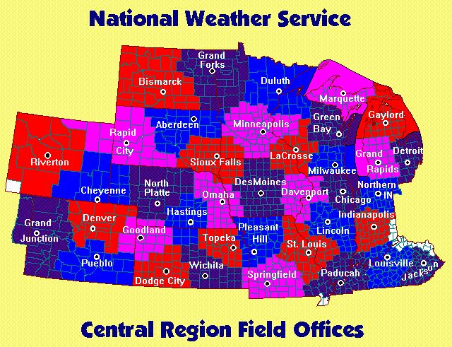
5 National Weather Service County Warning Area (CWA) All forecasts, watches, warnings, advisories River forecasts Aviation Marine Fire Weather NOAA All Hazards Weather Radio
6
7 NWS Fire Weather Program Fire Weather Program Manager at each office Liaison between their fire/land managers/agencies and their offices Coordinates changes, provides information and training and is the point of contact Additional training, experience and education Conducts outreach & training at meetings, symposiums or webinars
8 NWS Fire Weather Program Incident Meteorologist (IMET) Trained and certified to provide on-site weather support during wildfires Dispatched to the wildfire command center Often, but not always, the fire weather program manager Scattered across the country, but most western NWS offices have at least one IMET
9 NWS Fire Weather Program Important to build a relationship/partnership with your local NWS office and fire weather program manager Invite NWS forecasters to attend prescribed burns Invite fire weather program managers to present at or attend meetings & symposiums Ask for a tour of your local NWS office Sit down with the forecasters and learn about the forecast process
10 NWS Fire Weather Forecasts Vary by Office Time of year Detailed out to 36 or 48 hours Available parameters Units (knots or mph?) Ventilation scale/ranges Red flag criteria
11 NWS Fire Weather Forecasts Routine Daily Forecasts Usually issued twice a day in the early morning and mid/late afternoon County based Data is averaged over the entire county and over a 12 hour period Contains a discussion at the top Based off of data available in the hourly weather graphs
12 NWS Fire Weather Forecasts Hourly Weather Graphs Routine fire weather forecast is based off this data Provides hourly graphs out 36 to 48 hours for specific fire weather parameters (7 days for others) Grid points are 2.5 km by 2.5 km Much more detailed forecast Use hourly weather graphs for specific trend through the day!

13 NWS On-Line Hourly Weather Graph
14 NWS Fire Weather Forecasts Fire Weather Watch/Red Flag Warning Issued when a combination of dry fuels and weather conditions create extreme fire danger and/or fire behavior Watches issued 18 to 96 hours Warnings issued up to 48 hours NWS forecasters need your input/feedback! IMPORTANT: Criteria differ by NWS office/local user needs
15 NWS Fire Weather Forecasts NWS Chicago/Romeoville Criteria Sustained 20 foot winds of 20 mph or higher Afternoon relative humidity less than 25% 10 hour fuel moisture at 8% or less for one day
16 NWS Fire Weather Forecasts Spot Forecasts Site Specific User Requested On-line Prescribed Fire/Wildfire/Hazmat/SAR For all federal agencies/whenever federal agencies are involved or when public safety is involved
17 Fire Weather Elements Surface Winds Mixing Heights Transport Winds Ventilation Rate/Dispersion Haines Index NWS Forecasts
18 Surface Winds Several different heights Mid Flame Eye Level 20 Foot 10 Meter (~33 feet)
19 Surface Winds In meteorology, the surface wind is defined as a 10 meter wind If the forecast(s) doesn t specifically state the forecast height, assume the forecast is for 10 meters NWS forecasts are for 10 meters, except when specified for 20 foot in fire weather forecasts
20 Surface Winds NWS Chicago/Romeoville uses a standard 20% reduction or rule of thumb 10 meter wind is 10 mph, 20 foot wind is 8 mph Strong cold air advection could be less, 15% Strong warm air advection, could be more, 25%

21 Mixing Heights The height to which smoke will rise before spreading out (inversion = mixing height) Layer of stable air where temperatures warm with increasing height Acts as a lid, severely limiting amount of vertical motion
22 Mixing Heights Expressed in FT AGL (feet above ground level) Peaks in early/mid afternoon Typically will be very low at night, usually less than 1000 ft, sometimes at the surface, due to surface cooling 1700 Feet Minimum height most users want before burning Depends on location, size, fuel type, etc., of burn site
23 Mixing Heights Generally, an easy parameter to forecast, in terms of data availability Multiple computer forecast models Multiple forecasts levels & heights Hourly forecast data available from some models Forecast accuracy dependent on many factors Cloud cover and temperatures
24 Transport Winds Average wind speed and average direction in the mixed layer The mixed layer is the surface to the mixing height Depth changes as mixing height changes Example, the mixing height is 2000 feet, and the transport winds are South at 15 mph. This means that the average wind speed between the surface and 2,000 feet is 15 mph FROM the south
25 Ventilation Rate/Dispersion Multiplication of the mixing height in feet and the transport winds in knots Units differ based on user needs The larger the number, usually the better the ventilation Strong surface winds can prevent smoke column from rising sufficiently above surrounding areas
26 Ventilation Rate/Dispersion IMPORTANT, descriptors are determined by the users! Forecasters only provide/create the numbers. Range/descriptors below used by Chicago area fire/land managers Poor, < 40,000 knot feet Fair, 40,000 to 60,000 knot feet Good, 60,000 to 100,000 knot feet Very Good, 100,000 to 150,000 knot feet Excellent, > 150,000 knot feet
27 Ventilation Rate/Dispersion NWS text (FWF) forecasts typically display highest number or Vent Rate Max for a 12 hour period Important to remember this Max may only last a few hours (when mixing heights are at their peak in the afternoon) Use hourly weather graphs for specific ventilation trends through the day!
28 Haines Index Numerical value (2 to 6) used to describe atmospheric stability High values (5 & 6), dry & unstable air Low values (2 & 3), moist & stable air Uses temperatures and dewpoints at specific pressure surfaces aloft (lower atmosphere) Good indicator of extreme fire behavior for large fires/wildfires

29 Haines Index-3 Elevations
30 Haines Index Does not include any wind data Solely based on forecast information, similar to mixing heights/transport winds, difficult to verify/observe Changes primarily based on computer forecast model changes

31 Thank you
32 Thank you! Please take our one question concluding survey here:
 with Lindsey M. Shartell (MN Department of Natural Resources) Dawn S.")
33 Next Webinar: March 27, 2014 at 2:00 PM Eastern (1:00 PM Central) Characterizing Wildlife Communities of Fire-Dependent Ecosystems of the Northern Lake States and Exchanging Research, Inventory, and Monitoring Knowledge and Ideas R. Gregory Corace, III (US Fish and Wildlife Service-Seney National Wildlife Refuge) with Lindsey M. Shartell (MN Department of Natural Resources) Dawn S. Marsh (US Fish and Wildlife Service-Seney National Wildlife Refuge)
34 Thank you! To receive updates from the consortia, please visit our websites and sign up for our mailing lists: lakestatesfiresci.net
NWS Resources For Public Works
 NWS Resources For Public Works August 28th, 2016 Shawn DeVinny shawn.devinny@noaa.gov Meteorologist National Weather Service Twin Cities/Chanhassen, MN 1 APWA 2016 PWX 8/28/2016 National Weather Service
Innovative Decision Support Services for the 27 February 2011 Wildfire Outbreak Across the Texas Panhandle. Michael Scotten NOAA/NWS Amarillo, Texas
 Innovative Decision Support Services for the 27 February 2011 Wildfire Outbreak Across the Texas Panhandle Michael Scotten NOAA/NWS Amarillo, Texas NWS Amarillo s County Warning Area (CWA) Amarillo NWS
AMDAR Forecast Applications. Richard Mamrosh NWS Green Bay, Wisconsin, USA
 AMDAR Forecast Applications Richard Mamrosh NWS Green Bay, Wisconsin, USA AMDAR has many applications Aviation Low level wind shear Ceilings and visibilities Icing and turbulence Winter Storms Precipitation
Lesson 2C - Weather. Lesson Objectives. Fire Weather
 Lesson 2C - Weather 2C-1-S190-EP Lesson Objectives 1. Describe the affect of temperature and relative humidity has on wildland fire behavior. 2. Describe the affect of precipitation on wildland fire behavior.
PUBLIC SAFETY POWER SHUTOFF POLICIES AND PROCEDURES
 PACIFIC GAS AND ELECTRIC COMPANY PUBLIC SAFETY POWER SHUTOFF POLICIES AND PROCEDURES SEPTEMBER 2018 1 PACIFIC GAS AND ELECTRIC COMPANY PUBLIC SAFETY POWER SHUTOFF POLICIES AND PROCEDURES SEPTEMBER 2018
NWS Resources For School Districts
 NWS Resources For School Districts January 23rd, 2017 Shawn DeVinny shawn.devinny@noaa.gov Meteorologist National Weather Service Twin Cities/Chanhassen, MN Outline Watches/Warnings/Advisories Example
Significant Coastal Storm Today through Thursday, 11/7-8. Weather Briefing
 Significant Coastal Storm Today through Thursday, 11/7-8 Weather Briefing Prepared 10:00 am EST Wednesday, November 7, 2012 Presented by Gary Conte, Warning Coordination Meteorologist NOAA s National Weather
CHAPTER 13 WEATHER ANALYSIS AND FORECASTING MULTIPLE CHOICE QUESTIONS
 CHAPTER 13 WEATHER ANALYSIS AND FORECASTING MULTIPLE CHOICE QUESTIONS 1. The atmosphere is a continuous fluid that envelops the globe, so that weather observation, analysis, and forecasting require international
National Weather Service. Building a Weather Ready Nation
 National Weather Service Building a Weather Ready Nation The NWS is a federal agency Department of Commerce National Oceanic and Atmospheric Administration National Weather Service Today s National Weather
Counselor s Name: Counselor s Ph #: 1) Define meteorology. Explain how the weather affects farmers, sailors, aviators,
 Define meteorology. Explain how the weather affects farmers, sailors, aviators,") Weather Merit Badge Workbook This workbook is not required but is designed to help you with this merit badge. No one can add or subtract from the Boy Scout Requirements #33215. Use page backs & add pages
Weather Merit Badge Workbook This workbook is not required but is designed to help you with this merit badge. No one can add or subtract from the Boy Scout Requirements #33215. Use page backs & add pages
Understanding Michigan snowfall. Jim Keysor - NWS Gaylord
 Understanding Michigan snowfall Jim Keysor - NWS Gaylord Presentation Outline Topics Background information on lake effect Radar and lake effect snow Wind direction and lake effect Lake Enhanced snow Elevation
Tropical Update. 5 PM EDT Tuesday, September 5, 2017 Hurricane Irma, Tropical Storm Jose, and Tropical Depression Thirteen
 Tropical Update 5 PM EDT Tuesday, September 5, 2017 Hurricane Irma, Tropical Storm Jose, and Tropical Depression Thirteen This update is intended for government and emergency response officials, and is
Scout s Address: City State Zip:
 WEATHER BYU Merit Badge Pow Wow Official Merit Badge Worksheet New 2014 Requirements Scout s Name: Instructor s Name: Scout s Address: City State Zip: Instructions 1. The Scout is to review the merit badge
Page 1 of 6 SWCC MORNING INTELLIGENCE BRIEFING. June 1, Daily Summary
 SWCC MORNING INTELLIGENCE BRIEFING June 1, 2015 PDF Version Product Feedback Daily Summary SITUATION: With nine dispatch centers reporting, fire activity continues to be light throughout the Southwest
Climate Change Impacts in Alaska: the Weather Perspective
 Climate Change Impacts in Alaska: the Weather Perspective September 18, 2007 NOAA s National Weather Service, Alaska Region James Partain, Chief Environmental and Scientific Services Division NOAA NWS
Speakers: NWS Buffalo Dan Kelly and Sarah Jamison, NERFC Jeane Wallace. NWS Flood Services for the Black River Basin
 Speakers: NWS Buffalo Dan Kelly and Sarah Jamison, NERFC Jeane Wallace NWS Flood Services for the Black River Basin National Weather Service Who We Are The National Oceanic and Atmospheric Administration
MxVision WeatherSentry Web Services Content Guide
 MxVision WeatherSentry Web Services Content Guide July 2014 DTN 11400 Rupp Drive Minneapolis, MN 55337 00.1.952.890.0609 This document and the software it describes are copyrighted with all rights reserved.
TFS WEATHER BRIEF. Monday, March 25
 TFS WEATHER BRIEF Monday, March 25 Review: The leading edge of cooler and drier air was pushing through Central and East TX this morning. A few lingering thunderstorms were in progress south of I-20 in
Issued by: National Weather Service San Joaquin Valley - Hanford CA. Issue time: 409 AM PST Wed Jan
 Forecast Information Location: New_Exchequer_Dam Updated: January 16, 2019, 11:45 am NWS Weather Discussion: Issued by: National Weather Service San Joaquin Valley - Hanford CA Issue time: 409 AM PST Wed
MULTI-AGENCY COORDINATION SYSTEM PUBLICATION CALIFORNIA FIRE WEATHER PROGRAM RISK PREPAREDNESS GUIDE MACS 410-3
 MULTI-AGENCY COORDINATION SYSTEM PUBLICATION CALIFORNIA FIRE WEATHER PROGRAM RISK PREPAREDNESS GUIDE MACS 410-3 August 26, 2013 California Fire Weather Program Risk Preparedness Guide Table of Contents
SPEARFISH FIRE DEPARTMENT POLICIES AND PROCEDURES
 SPEARFISH FIRE DEPARTMENT POLICIES AND PROCEDURES Page 1 of 5 Volume: Operation Section: 20.00 Number: 20.09 Subject: Weather Watches, Warnings, Advisory s and Spotter Activation Date Issued: 28 March
Weather Merit Badge Workbook
 Merit Badge Workbook This workbook can help you but you still need to read the merit badge pamphlet. This Workbook can help you organize your thoughts as you prepare to meet with your merit badge counselor.
Charles Kuster Leadville, CO. Personal Overview
 Charles Kuster Leadville, CO Personal Overview Personal Overview Charles Kuster Leadville, CO OU to study meteorology Charles Kuster Leadville, CO Personal Overview OU to study meteorology Graduated in
Module 11: Meteorology Topic 5 Content: Weather Maps Notes
 Introduction A variety of weather maps are produced by the National Weather Service and National Oceanographic Atmospheric Administration. These maps are used to help meteorologists accurately predict
1st Annual Southwest Ohio Snow Conference April 8, 2010 Abner F. Johnson, Office of Maintenance - RWIS Coordinator
 1st Annual Southwest Ohio Snow Conference April 8, 2010 Abner F. Johnson, Office of Maintenance - RWIS Coordinator The Ohio Department of Transportation ODOT has approximately 5500 full-time employees
Using the environmental lapse rate (ELR) to forecast wildfire blow-ups
 to forecast wildfire blow-ups") Using the environmental lapse rate (ELR) to forecast wildfire blow-ups 2015 Project Update Greg Baxter Background Goal: To improve firefighter safety Objectives: Determine if the AIMMS sensor provides
Using the environmental lapse rate (ELR) to forecast wildfire blow-ups 2015 Project Update Greg Baxter Background Goal: To improve firefighter safety Objectives: Determine if the AIMMS sensor provides
July 24, 2017 Annapolis, MD Bryan A. Jackson NWS Sterling, VA Marine Program Leader
 When Wicked Weather Strikes Insights into Chesapeake Bay Weather July 24, 2017 Annapolis, MD Bryan A. Jackson NWS Sterling, VA Marine Program Leader Mission of the National Weather Service Provide climate,
Instructions - GFC Prescribed Burn Unit Plan
 Instructions - GFC Prescribed Burn Unit Plan This Prescribed Burn Unit Plan should be used by all GFC personnel when conducting prescribed burn assistance for landowners and when conducting prescribed
The mowed firebreaks are at least 10 wide and are usually 20. A rotary hay rake is used to clear larger firebreaks.
 The mowed firebreaks are at least 10 wide and are usually 20. A rotary hay rake is used to clear larger firebreaks. 24 Hand-raking is necessary to remove litter between the experimental prairie plots.
Weather can change quickly...are you on top of the changes?
 Weather Access Bob Glancy NOAA National Weather Service, Boulder, CO Near Cedar Point, CO May 9, 2004 Weather can change quickly...are you on top of the changes? National Weather Service Local offices:
NATS 101 Section 13: Lecture 25. Weather Forecasting Part II
 NATS 101 Section 13: Lecture 25 Weather Forecasting Part II NWP s First Baby Steps: Mid-Twentieth Century It wasn t until the development of computers in the 1940s and 1950s that NWP could be even attempted.
Tropical Update. 5 PM EDT Sunday, September 10, 2017 Hurricane Irma, Hurricane Jose, Tropical Wave (60%)
") Tropical Update 5 PM EDT Sunday, September 10, 2017 Hurricane Irma, Hurricane Jose, Tropical Wave (60%) This update is intended for government and emergency response officials, and is provided for informational
Tropical Update 5 PM EDT Sunday, September 10, 2017 Hurricane Irma, Hurricane Jose, Tropical Wave (60%) This update is intended for government and emergency response officials, and is provided for informational
NWS Fire Weather Forecast, Wildland Fire Assessment Systems and OKMesonet Products Applications as Short Term Mitigation Tools for Emergency Response
 NWS Fire Weather Forecast, Wildland Fire Assessment Systems and OKMesonet Products Applications as Short Term Mitigation Tools for Emergency Response Presentation for The Southern Climate Impacts Planning
Preparing For Winter Weather At Home & In The Workplace. Brandon Peloquin, Warning Coordination Meteorologist NWS Wilmington OH
 Preparing For Winter Weather At Home & In The Workplace Brandon Peloquin, Warning Coordination Meteorologist NWS Wilmington OH What We Will Talk About Introduction to the National Weather Service How we
Snowfall totals by zip code in ny
 Snowfall totals by zip code in ny 4-1-2018 Snowfall forecasts increased overnight for New Jersey with a large portion of the state expected to get 8 to 12 inches from 'bomb cyclone' nor'easter. NOAA National
Daily Operations Briefing Friday, November 11, :30 a.m. EST
 Daily Operations Briefing Friday, November 11, 2016 8:30 a.m. EST Significant Activity Nov 10-11 Significant Events: None Tropical Activity: Atlantic Tropical cyclone activity is not expected during the
Weather Briefing Mixed Winter Storm Event February 26-27, 2013
 Weather Briefing Mixed Winter Storm Event February 26-27, 2013 Prepared 1200 PM EST Tuesday, February 26th, 2013 Joe Miketta NOAA s NJ Forecast Office http://www.erh.noaa.gov/phi/ Purpose of Briefing Briefing
Building a Weather-Ready Wisconsin
 National Weather Service Session: Building a Weather-Ready Wisconsin WEMA Conference October 11, 2017 Jeff Last National Weather Service Green Bay Today s Presentation NWSChat in EM Operations The June
Using Temperature and Dew Point to Aid Forecasting Springtime Radiational Frost and/or Freezing Temperatures in the NWS La Crosse Service Area
 Using Temperature and Dew Point to Aid Forecasting Springtime Radiational Frost and/or Freezing Temperatures in the NWS La Crosse Service Area WFO La Crosse Climatology Series #21 The formation of radiational
Kane County Amateur Radio Emergency Service
 This script is to be used when severe weather is approaching or has reached Kane County. The script is divided into three parts. Part One is for use when the National Weather Service has issued a WATCH
Name 28-MAY-08. FA RP 1 Mr. Chase. 1. Which weather-station model shows an air pressure of millibars?
 FA RP 1 Mr. Chase Name 28-MAY-08 1. Which weather-station model shows an air pressure of 993.4 millibars? 2. Which station model shows the correct form for indicating a northwest wind at 25 knots and an
Safety Matters C ENTENNIAL SCHOOL DISTRICT
 C ENTENNIAL SCHOOL DISTRICT Volume 3, Number 7 Safety Matters Safety Matters is the monthly awareness letter of the Centennial School District certified Joint Labor/ Management Workplace Safety Committee.
Daily Operations Briefing Saturday, October 1, :30 a.m. EDT
 Daily Operations Briefing Saturday, October 1, 2016 8:30 a.m. EDT Significant Activity Sept 30-Oct 1 Significant Events: None Tropical Activity: Atlantic Hurricane Matthew (CAT4); Disturbance 1 Low (10%)
Tropical Update. 5 AM EDT Wednesday, September 6, 2017 Hurricane Irma, Tropical Storm Jose, and Tropical Storm Katia
 Tropical Update 5 AM EDT Wednesday, September 6, 2017 Hurricane Irma, Tropical Storm Jose, and Tropical Storm Katia This update is intended for government and emergency response officials, and is provided
Arkansas-Red Basin River Forecast Center Operations. RRVA Conference Durant, OK 8/22/2013 Jeff McMurphy Sr. Hydrologist - ABRFC
 Arkansas-Red Basin River Forecast Center Operations RRVA Conference Durant, OK 8/22/2013 Jeff McMurphy Sr. Hydrologist - ABRFC NWS River Forecast Centers NWS Weather Forecast Offices Operations Staffing
FAA-NWS Aviation Weather Weather Policy and Product Transition Panel. Friends and Partners in Aviation Weather October 22, 2014 NOAA NOAA
 FAA-NWS Aviation Weather Weather Policy and Product Transition Panel Friends and Partners in Aviation Weather October 22, 2014 Airplanes have changed. Lockheed Constellation Airbus A380 Aviation weather
Florida Division of Emergency Management State Watch Office
 Florida Division of Emergency Management State Watch Office Morning Situation Report Wednesday, November 7, 2018 State Emergency Operations Center Activation Level Level 2 Activation SERT On-Call Personnel
Accomplishments and Deliverables
 ANNUAL REPORT 2015 Background In July 2002, the FIRESCOPE California Wildfire Agencies (CWA) approved a charter leading to the formation of the California and Nevada Smoke and Air Committee (CANSAC). The
Tropical Update. 5 AM EDT Thursday, September 7, 2017 Hurricane Irma, Hurricane Jose, and Hurricane Katia
 Tropical Update 5 AM EDT Thursday, September 7, 2017 Hurricane Irma, Hurricane Jose, and Hurricane Katia This update is intended for government and emergency response officials, and is provided for informational
Remote Sensing and Sensor Networks:
 SDG&E Meteorology Remote Sensing and Sensor Networks: Providing meteorological intelligence to support system operations Mike Espinoza Project Manager Steven Vanderburg Senior Meteorologist Brian D Agostino
IWT Scenario 2 Integrated Warning Team Workshop National Weather Service Albany, NY October 31, 2014
 IWT Scenario 2 Integrated Warning Team Workshop National Weather Service Albany, NY October 31, 2014 09 10 11 12 13 Scenario 2 Timeline December 9-13 Tue Wed Thu Fri Sat Tue, Dec. 9 @ 5 am 2014 2014 2014
Overview of Left Menu Items on the New OK-FIRE
 Overview of Left Menu Items on the New OK-FIRE In contrast to the current OK-FIRE (http://okfire.mesonet.org), in the new OK-FIRE there are only LEFT menu items (located within the orange rectangle added
Situation Report KC#56896 Winter Storm 3/13-15/2017 Pennsylvania Emergency Management Agency
 Situation Report KC#56896 Winter Storm 3/13-15/2017 Pennsylvania Emergency Management Agency Report as of 14 Mar 2017 at 1000 hours Situation Report #03 *Changes indicated in Blue Contents: I. Incident
EVALUATION AND VERIFICATION OF PUBLIC WEATHER SERVICES. Pablo Santos Meteorologist In Charge National Weather Service Miami, FL
 EVALUATION AND VERIFICATION OF PUBLIC WEATHER SERVICES Pablo Santos Meteorologist In Charge National Weather Service Miami, FL WHAT IS THE MAIN DIFFERENCE BETWEEN A GOVERNMENT WEATHER SERVICE FORECAST
NOAA s National Weather Service Philadelphia/Mt. Holly NJ
 Early Week Coastal Flooding and snow Hazards and Impacts: Coastal Flooding: With the persistent onshore flow, and a new moon today, coastal flooding is expected at high tide through Tuesday morning. Moderate
Khalid Y. Muwembe UGANDA NATIONAL METEOROLOGICAL AUTHORITY (UNMA)
") Forecasting Severe Weather over Lake Victoria region in Uganda Khalid Y. Muwembe UGANDA NATIONAL METEOROLOGICAL AUTHORITY (UNMA) Outline Background Set-up of forecasting/alert service Diurnal circulation
Forecasting Severe Weather over Lake Victoria region in Uganda Khalid Y. Muwembe UGANDA NATIONAL METEOROLOGICAL AUTHORITY (UNMA) Outline Background Set-up of forecasting/alert service Diurnal circulation
2012 will likely be remembered for the significant cold injury damage that occurred to fruit during the spring season. Our scheduled first speaker
 2012 will likely be remembered for the significant cold injury damage that occurred to fruit during the spring season. Our scheduled first speaker this afternoon was unable to attend today. Unable to secure
Traffic and Weather. Soaring Safety Foundation. Tom Johnson CFIG
 Traffic and Weather Soaring Safety Foundation Tom Johnson CFIG Weather Contents Weather Gathering Sources Weather Acquisition Enroute Weather Analysis Weather Hazards Weather in the Landing Pattern Basic
Fire Weather Recording Form
 Form 1 Fire Weather Recording Form Fire Name: Fuel type: Date: Slope: Aspect: Location: Elevation: Assessor: Time Location or Marker Temp (Cº) Dry Wet bulb bulb RH (%) speed (avg) km/h speed (max) km/h
Daily Operations Briefing Friday, November 25, :30 a.m. EST
 Daily Operations Briefing Friday, November 25, 2016 8:30 a.m. EST Significant Activity Nov 24-25 Significant Events: Water Contamination Tropical Activity: Atlantic Tropical cyclone activity not expected
Storm Surge Forecast with Shifting Forecast Tracks
 Storm Surge Forecast with Shifting Forecast Tracks Storm Surge Findings in the Florida Keys Jon Rizzo Warning Coordination Meteorologist National Weather Service Florida Keys Florida Keys Life History
Reducing Risk When Coastal or Blue Water Cruising. Lee S Chesneau Lee Chesneau s Marine Weather
 Reducing Risk When Coastal or Blue Water Cruising Lee S Chesneau Lee Chesneau s Marine Weather www.weatherbylee.com lee@chesneaumarineweather.com Expect the Unexpected When anyone asks me how I can best
Marine Weather Hazards, Manual: West Coast Edition By Environment Canada READ ONLINE
 Marine Weather Hazards, Manual: West Coast Edition By Environment Canada READ ONLINE The trail runs along the west to Environment canada s Marine Weather Hazards Manual. mouth of large inlets in the winter.
National Weather Service Greenville-Spartanburg, Forecast Office
 National Weather Service Greenville-Spartanburg, Forecast Office CoCoRaHS Presentation: NC CERT Conference May, 2017 Introduction- who we are. Federal Agency Within the U.S. Dept. of Commerce Introduction-
Florida Division of Emergency Management State Watch Office
 Florida Division of Emergency Management State Watch Office Morning Situation Report Wednesday, November 21, 2018 State Emergency Operations Center Activation Level Level 3 Monitoring SERT On-Call Personnel
A Multi-Agency Approach to Ash-Fall Preparedness and Response in Alaska
 A Multi-Agency Approach to Ash-Fall Preparedness and Response in Alaska Christina Neal Volcanologist U.S. Geological Survey Alaska Volcano Observatory Anchorage, AK Originally Presented November 2012:
Tropical Update. 12 PM EDT Friday, October 7, 2016 Hurricane Matthew & Tropical Storm Nicole
 Tropical Update 12 PM EDT Friday, October 7, 2016 Hurricane Matthew & Tropical Storm Nicole This update is intended for government and emergency response officials, and is provided for informational and
Coastal Storm. Wednesday through Friday, 3/6-8/2013 Weather Briefing
 Coastal Storm Wednesday through Friday, 3/6-8/2013 Weather Briefing Prepared 2:00 PM EST Wednesday, March 6, 2013 National Weather Service New York, NY Purpose of Briefing Promote Situational Awareness
Jon W. Zeitler* NOAA/NWS/Austin/San Antonio Weather Forecast Office, TX. Paul G. Witsaman NOAA/NWS/Southern Region Headquarters, Ft.
 P1.48 ASYNOPTIC HIGH RESOLUTION UPPER-AIR DATA FOR HIGH IMPACT WEATHER EVENTS Jon W. Zeitler* NOAA/NWS/Austin/San Antonio Weather Forecast Office, TX Paul G. Witsaman NOAA/NWS/Southern Region Headquarters,
The Kentucky Mesonet: Entering a New Phase
 The Kentucky Mesonet: Entering a New Phase Stuart A. Foster State Climatologist Kentucky Climate Center Western Kentucky University KCJEA Winter Conference Lexington, Kentucky February 9, 2017 Kentucky
Prime Minister s Office- Meteorological Services
 15.3 METEOROLOGICAL SERVICES 15.3.1 The Mauritius Meteorological Services (MMS) operates under the aegis of the Prime Minister s Office. Its mission is to provide accurate, timely weather information and
Tropical Update. 11 AM EDT Wednesday, October 10, 2018 Hurricane Michael, Hurricane Leslie & Tropical Storm Nadine, Caribbean Low (40%)
") Tropical Update 11 AM EDT Wednesday, October 10, 2018 Hurricane Michael, Hurricane Leslie & Tropical Storm Nadine, Caribbean Low (40%) This update is intended for government and emergency response officials,
Tropical Update 11 AM EDT Wednesday, October 10, 2018 Hurricane Michael, Hurricane Leslie & Tropical Storm Nadine, Caribbean Low (40%) This update is intended for government and emergency response officials,
Southern California Edison Wildfire Mitigation & Grid Resiliency
 Southern California Edison Wildfire Mitigation & Grid Resiliency California State Legislative Conference Committee on Wildfire Preparedness and Response August 7, 2018 CALIFORNIA S WILDFIRE RISK Year-Round
What s the Weather? Compiled by: Nancy Volk
 Compiled by: Nancy Volk Weather Weather is the current state of the atmosphere in a given area. We are all fascinated by and interested in weather. It impacts what we wear, what we do, and how we do it.
TORNADO/high winds *
 TORNADO/high winds * WATCH Bring people inside. Secure outside objects. Clear window ledges & wall hangings Close drapes Protect windows Assemble and check supplies Call in applicable staff Pre-Storm:
SITUATION REPORT #7 September 8 th, 2017
 MCO AIRPORT EMERGENCY OPERATIONS CENTER SITUATION REPORT #7 September 8 th, 2017 STATE OF FLORIDA REGION V FEMA REGION IV GENERAL INFORMATION Local State of Emergency Declaration Number: 17-235 Dated:
Weather 101 Brad Jakubowski Doane College Water
 Weather 101 Fundamental Meteorology for Turf Managers Brad Jakubowski Doane College Do Baseballs Really Fly Farther at Coors Field? In theory, A well struck baseball should travel 10 percent farther at
IWT Scenario 1 Integrated Warning Team Workshop National Weather Service Albany, NY October 31, 2014
 Integrated Warning Team Workshop National Weather Service Albany, NY October 31, 2014 23 24 25 26 27 Scenario 1 Timeline November 23-27 Sun Mon Tue Wed Thu Thanksgiving Day Sunday, Nov. 23 @ 430 pm NWS
Hurricane Irma Page 1 HURRTRAK RM/Pro 2017 Summary Report for Tampa, FL 09/10/ EDT, Adv. # 46
 Hurricane Irma Page 1 Description of impact to Tampa, FL, Tampa, FL, is expected to receive a major impact from Hurricane Irma. The forecast maximum wind for this location has increased since the last
StormReady Supporter Application Form updated by NWS Chanhassen on April 7, Name of Applying Entity: Point of Contact: Title:
 NATIONAL WEATHER SERVICE 1733 Lake Drive West Chanhassen, Minnesota www.weather.gov/twincities www.stormready.noaa.gov 952-361-6671, todd.krause@noaa.gov StormReady Supporter Application Form updated by
SAMPLE. SITE SPECIFIC WEATHER ANALYSIS Wind Report. Robinson, Smith & Walsh. John Smith REFERENCE:
 SAMPLE SITE SPECIFIC WEATHER ANALYSIS Wind Report PREPARED FOR: Robinson, Smith & Walsh John Smith REFERENCE: JACK HIGGINS / 4151559-01 CompuWeather Sample Report Please note that this report contains
Smoke Fog Superfog - Smoke and Fog mixture Heavy rain and wind
 Smoke Fog Superfog - Smoke and Fog mixture Heavy rain and wind Florida Highway Patrol Training Academy Fog forms when water evaporates from a surface or is added to the air. Super fog is a combination
Winter Weather. National Weather Service Buffalo, NY
 Winter Weather National Weather Service Buffalo, NY Average Seasonal Snowfall SNOWFALL = BIG IMPACTS School / government / business closures Airport shutdowns/delays Traffic accidents with injuries/fatalities
MPCA Forecasting Summary 2010
 MPCA Forecasting Summary 2010 Jessica Johnson, Patrick Zahn, Natalie Shell Sonoma Technology, Inc. Petaluma, CA Presented to Minnesota Pollution Control Agency St. Paul, MN June 3, 2010 aq-ppt2-01 907021-3880
Frank Revitte National Weather Service. Weather Forecast Office New Orleans/Baton Rouge
 Frank Revitte National Weather Service Weather Forecast Office New Orleans/Baton Rouge Above normal activity 17 Total Named Storms 7 Tropical Storms 4 Hurricanes 6 Major Hurricanes Not the most active,
Tropical Update. 5 PM EDT Thursday, September 7, 2017 Hurricane Irma, Hurricane Jose, and Hurricane Katia
 Tropical Update 5 PM EDT Thursday, September 7, 2017 Hurricane Irma, Hurricane Jose, and Hurricane Katia This update is intended for government and emergency response officials, and is provided for informational
Hurricane Matthew Life Threatening Flash Flooding Likely
 Hurricane Matthew Life Threatening Flash Flooding Likely Threat Assessment for northeast South Carolina & southeast North Carolina National Weather Service Wilmington NC 12 AM EDT Saturday October 8, 2016
Florida Division of Emergency Management State Watch Office
 Florida Division of Emergency Management State Watch Office Morning Situation Report Monday, February 18, 2019 State Emergency Operations Center Activation Level Level 3 Monitoring SERT On-Call Personnel
Daily Operations Briefing. Wednesday, December 20, :30 a.m. EST
 Daily Operations Briefing Wednesday, December 20, 2017 8:30 a.m. EST Significant Activity Dec 19-20 Significant Events: Wildfires southern California Tropical Activity: Western Pacific No activity affecting
Boundary Layer Turbulence Index: Progress and Recent Developments
 Boundary Layer Turbulence Index: Progress and Recent Developments Kenneth L. Pryor Center for Satellite Applications and Research (NOAA/NESDIS) Camp Springs, MD 1. Introduction Turbulence is a frequently
Spring Water Supply and Weather Outlook How about that near Miracle March?
 Spring Water Supply and Weather Outlook How about that near Miracle March? tim.bardsley@noaa.gov NWS Reno 4.10.18 1 Out the Window March and early April have been Boom not Bust Key Points Up Front Wet
The CANSAC/BLUESKY Connection
 The CANSAC/BLUESKY Connection Timothy Brown Desert Research Institute Program for Climate, Ecosystem and Fire Applications Reno, NV Partners USDA Forest Service Region 5 California Air Resources Board
Hurricane Matthew Threats and Impacts Briefing for Eastern NC
 Hurricane Matthew Threats and Impacts Briefing for Eastern NC October 6 th, 2016 Date/Time Created: 10/6/2016, Noon EDT National Weather Service Newport/Morehead City, NC Hurricane Matthew Key Points Changes
CHAPTER 6 WEATHER OBJECTIVES INTRODUCTION BASIC FLORIDA WEATHER PRINCIPLES
 CHAPTER 6 WEATHER OBJECTIVES 1) Describe the various types of wind and how wind influences fire behavior. 2) Understand the temperature/humidity relationship. 3) Define stability, inversion, mixing height,
Severe Weather Potential for Southeast Texas
 Severe Weather Potential for Southeast Texas Dan Reilly, Kent Prochazka, Scott Overpeck National Weather Service Houston/Galveston 10 am Synopsis Storm to likely bring severe weather to Southeast Texas
P0.98 Composite Analysis of Heavy-Rain-Producing Elevated Thunderstorms in the MO-KS-OK region of the United States
 P0.98 Composite Analysis of Heavy-Rain-Producing Elevated Thunderstorms in the MO-KS-OK region of the United States Laurel P. McCoy and Patrick S. Market Department of Soil, Environmental, and Atmospheric
HURRICANES AND TORNADOES
 HURRICANES AND TORNADOES The most severe weather systems are hurricanes and tornadoes. They occur in extremely low pressure systems, or cyclones, when the air spirals rapidly into the center of a low.
New Forecast Section. connection. Volume 3 Issue 4 April 2012
 Volume 3 Issue 4 April 2012 connection www.mesonet.org New Forecast Section Spring has arrived, and so has storm season. For many, that means monitoring the weather and forecast more. To help users prepare
Tropical Update. 5 AM EDT Tuesday, September 12, 2017 Post-Tropical Cyclone Irma, Hurricane Jose, & Tropical Wave (10%)
") Tropical Update 5 AM EDT Tuesday, September 12, 2017 Post-Tropical Cyclone Irma, Hurricane Jose, & Tropical Wave (10%) This update is intended for government and emergency response officials, and is provided
Tropical Update 5 AM EDT Tuesday, September 12, 2017 Post-Tropical Cyclone Irma, Hurricane Jose, & Tropical Wave (10%) This update is intended for government and emergency response officials, and is provided
Comprehensive Emergency Management Plan
 Comprehensive Emergency Management Plan Section 6- Severe Weather/Wildfire Annex Blank Intentionally 2 CEMP Annex 6 11 Severe Weather / Wildfire Annex I. PURPOSE This plan outlines the procedures to be