Open Source ENKI: Dynamic Environmental Model Framework. A possible pre-processor for WRF-Hydro?
|
|
|
- Richard Morgan Stevenson
- 5 years ago
- Views:
Transcription

1 Open Source ENKI: Dynamic Environmental Model Framework A possible pre-processor for WRF-Hydro? 1st European Fully Coupled AtmosphericHydrological Modeling and WRF-Hydro Users workshop. University of Calabria June, 2014 John F. Burkhart Sjur Kolberg Sigbjørn Helset & Code Contributors 1
2 Overview Energy Management in practice Overview of the ENKI Hydrologic Modeling Framework ENKI as a prototyping framework for WRF-Hydro 2
3 What is ENKI? Software framework for model building and evaluation Extension and re-writing of PINE (Rinde, ), financed by Statkraft Simulation of temporal processes in spatial variables Primary application: Distributed hydrologic models Now: Open Source project under operationalisation Sumerian deity for sweet water, wisdom and magic 3
4 The Hydrologic Modeling Framework: ENKI Main objects are the model and the region A region is a set of static and dynamic GIS data A model is an ordered set of subroutines The subroutine variables are linked to the region s GIS data. It's Open Source and easily available (bitbucket) Linux and Python Porting are underway!
5 Distributed models and regional simulation One regional ENKI setup replaces many HBV models Q Common setup of input data using GIS tools Easy input of: Weather radar Satellite data Gridded met forecasts. Q Q The catchment is no longer the primary unit for Simulation Calibration Q Q 5
6 Distributed models Strong input gradients in mountainous basins Q Nonlinear processes Models need to be More physical Less calibrated but simpler Q Q Fewer states* Fewer parameters* Regional calibration Spatial parameter maps only where data allow Q Q 6

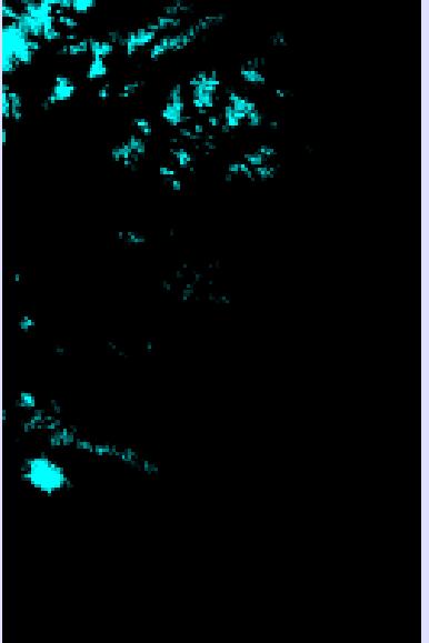
7 Regional simulation and calibration moh 7

8 Why regional calibration? In a distributed model, the parameters are applied to a different spatial unit than they can be inferred from. Operative management: Simulate arbitrary areas / catchments Compared to area scaling of discharge, differences in meteorology, elevation and land use are honoured In a regional model, the performance in gauged catchments is an estimator of the perfomance in the ungauged catchments Calibration: Robust parameter estimates By fitting several series simultaneously, the effect of errors and peculiarities in single catchments or series is reduced. Development: Discovery of errors and biases in model or data Adaptation to poor observation series is avoided Bad assumptions or data are exposed as errors But: Regional calibration always gives weaker performance in single catchments than specific calibration 8

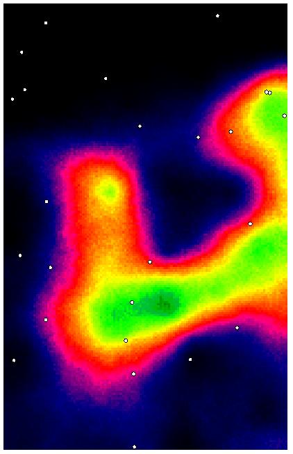
9 Regional and local R2 Average best R2 Regional Local Gridded HBV par Kirchner

")

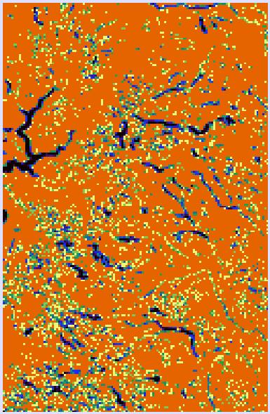
10 GIS based model setup: Elevation map (DTM) Subcatchment delination Meteorological station map Lake percentage map Forest cover map Glacier cover map
11 Procedure for model evaluation Selection: Operational needs Dominant processes Available data Validation Required performance Achievable performance Physical correctness? «All models are wrong. Some, however, are useful» (Box, 1979) «A model should not only work well, but work for the right reasons» (Klemes, 1986) 11
12 ENKI s three modes of operation Model use or evaluation: Interactive simulation, parameter estimation, import/export of GIS or TS data, construction of evaluation criteria etc. No need to know the routines or internal variables in the model Model building: Link process methods to a complete model, manipulate spatial distribution No need to code or compile Routine development: Implement new process routines No need to handle user interface, data I/O, administration of model runs, calibration routines etc. 12


13 Model dialog The ENKI framework Main objects are the model and the region A region is a set of static and dynamic GIS data A model is an ordered set of subroutines The subroutine variables are linked to the region s GIS data. Region dialog 13


14 Time series import Time series database uses NetCDF Discrete time series from ASCII files Raster time series from map groups GRIB and radar file import/reproj. 14

: Strength increases with nobs.")
15 Assessing performance Any simulated variable is available for evaluation Evaluation may be temporal or spatial A large number of objective functions are available: Additive: Information strength independent of nobs. Multiplicative (likelihood): Strength increases with nobs. Temporal evaluation Spatial evaluation 15
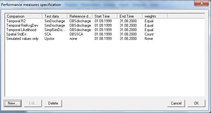
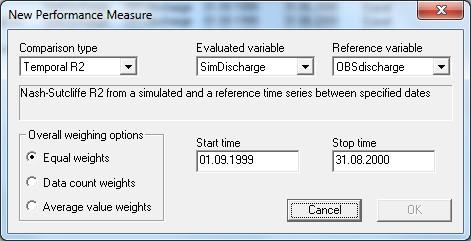
16 Performance Measure specification 16

17 Parameter estimation 17
18 A typical model setup Interpolation Interpolation The model framework does not know the function of each routine Each time step, the framework calls the routines in specified order Each routine maintains the spatial repetition loop The routines operate on spatial variables owned by the region The region copies data from/to two time series databases before and after each time step Interpolation Snow routine Soil water / evaporation Response Catchment aggregation Channel routing Results / Evaluation 18

19 Model building 1: Routine composition and order Loaded DLL methods in left window, with browse capability Selected routines in right window, where simulation order is set Generic methods may be used for more than one routine 19

20 Model building 2: Routine variable interface 20


21 Adding new variables Raster, point network, or scalar All are defined as GIS data Scalars have no external file The region owns the GIS variables
22 Main code modules in ENKI RegModel.exe Statkraft Connections Graphical user interface Based on MFC No visualisation, R&D oriented WEB based service Links to EnkiAPI + SmG database Daily operation oriented EnkiAPI DHM Model construction GIS and time series database Different run functions GIS data types Method prototypes GDAL integration Methods Method Base Class IDWtemp HBVSoil GamSnow Etc
23 Kobling mot Statkraft-system
24 Variable types i ENKI routines Raster: Rectangular grid, usually representing the simulation domain Network: Irregular point set, may extend outside the domain Scalar: Spatially constant quantity, located or not. Static: Time-invariant quantity not subject to calibration Elevation model, lake map, forest map, gauge staion map etc. Parameter: Time-invariant quantity, available for calibration Can be spatially distributed (raster, network), or calibrated (scalar) Input: Dynamic variable which is read, but not written Must either be in input database, or also be a response/state in earlier routine Response: Dynamic variable which is written, but not read. Output variabel, available for storage and evaluation State: Dynamic variable which is both read and written. Need initialisation values 24
25 Available Model Methods in ENKI Numerous hydrologic routines have been implemented and are available for model development Method classes are available as part of the open source distribution Active development of method classes Documentation is poor! We are working to improve this. Interpolation of input Snow routines Soil water / evaporation Response functions Catchment aggregation Results / Evaluation Automatic Calibration 25
26 Overview Energy Management in Statkraft Overview of the ENKI Hydrologic Modeling Framework ENKI as a prototyping framework for WRF-Hydro 26
27 ENKI s three modes of operation Model use or evaluation: Interactive simulation, parameter estimation, import/export of GIS or TS data, construction of evaluation kriteria etc. No need to know the routines or internal variables in the model Model building: Link process methods to a complete model, manipulate spatial distribution No need to code or compile Routine development: Implement new process routines No need to handle user interface, data I/O, administration of model runs, calibration routines etc. 27
28 Coding of new routines 28

29 Coding of new routines 29
30 Coding of new routines #include "lineartank.h // LinearTank.cpp implementation LinearTank::LinearTank() // Constructor { storconst = newmethvar("storconst",true,"methvar","parameter", Time constant, days",0); inflow = newmethvar("inflow",true,"methvar","input","inflow to linear tank"); storage = newmethvar("storage",true,"methvar","state","response tank storage in mm",0); outflow = newmethvar("outflow",true,"methvar","response","outflow from linear tank"); } bool LinearTank::Calc() // Response function { storage->value += inflow->value; outflow->value = storage->value * (1 - exp(-steplength.m_span / storconst->value)); storage->value -= outflow->value; return true; } CMethod* CreateMethodObject() // Object factory { CMethod *p = new LinearTank; return p; } 30

 Turbulent transfer Snow temperature Longwave")
31 Model composition Bayesian temperature kriging GRF precipitation simulation Kriging of radiation, humidity, wind Energy-sum snow melt Priestley-Taylor potential evap Air temperature Humidity Wind Clouds Shortwave radiation Power-law response (Kirchner, 2009) Turbulent transfer Snow temperature Longwave radiation Albedo 31
32 Main code modules in ENKI RegModel.exe Statkraft Connections Graphical user interface Based on MFC Minimal visualization, R&D oriented WEB based service Links to EnkiAPI + SmG database Daily operation oriented EnkiAPI DHM Model construction GIS and time series database Different run functions GIS data types Method prototypes GDAL integration Template Methods IDWtemp GamSnow Method Base Class HBVSoil Python Algorithms IDWtemp GamSnow Method Base Class HBVSoil
33 Summary ENKI an excellent tool for testing different model compositions and spatial setup alternatives Distributed modelling requires re-thinking of many subroutines, in particular regarding input data Regional calibration and restriction of calibration freedom show modest reduction of performance Improved parameter identifiability enables regionalisation ENKI recently released as OS under the LGPL license Currently in operationalisation phase both at Statkraft and among other companies 33
34 The Hydrologic Modeling Framework: ENKI Search: ENKI Hydrology Bitbucket is source for linux branch
35 Thank you all. John F. Burkhart Sjur Kolberg Sigbjørn Helset & Code Contributors 35
Operational water balance model for Siilinjärvi mine
 Operational water balance model for Siilinjärvi mine Vesa Kolhinen, Tiia Vento, Juho Jakkila, Markus Huttunen, Marie Korppoo, Bertel Vehviläinen Finnish Environment Institute (SYKE) Freshwater Centre/Watershed
VIC Hydrology Model Training Workshop Part II: Building a model
 VIC Hydrology Model Training Workshop Part II: Building a model 11-12 Oct 2011 Centro de Cambio Global Pontificia Universidad Católica de Chile Ed Maurer Civil Engineering Department Santa Clara University
Watershed simulation and forecasting system with a GIS-oriented user interface
 HydroGIS 96: Application of Geographic Information Systems in Hydrology and Water Resources Management (Proceedings of the Vienna Conference, April 1996). IAHS Publ. no. 235, 1996. 493 Watershed simulation
AN INTERNATIONAL SOLAR IRRADIANCE DATA INGEST SYSTEM FOR FORECASTING SOLAR POWER AND AGRICULTURAL CROP YIELDS
 AN INTERNATIONAL SOLAR IRRADIANCE DATA INGEST SYSTEM FOR FORECASTING SOLAR POWER AND AGRICULTURAL CROP YIELDS James Hall JHTech PO Box 877 Divide, CO 80814 Email: jameshall@jhtech.com Jeffrey Hall JHTech
Flood Forecasting Tools for Ungauged Streams in Alberta: Status and Lessons from the Flood of 2013
 Flood Forecasting Tools for Ungauged Streams in Alberta: Status and Lessons from the Flood of 2013 John Pomeroy, Xing Fang, Kevin Shook, Tom Brown Centre for Hydrology, University of Saskatchewan, Saskatoon
WRF Modeling System Overview
 WRF Modeling System Overview Louisa Nance National Center for Atmospheric Research (NCAR) Developmental Testbed Center (DTC) 27 February 2007 1 Outline What is WRF? WRF Modeling System WRF Software Design
WRF Modeling System Overview
 WRF Modeling System Overview Jimy Dudhia What is WRF? WRF: Weather Research and Forecasting Model Used for both research and operational forecasting It is a supported community model, i.e. a free and shared
Finnish Open Data Portal for Meteorological Data
 18.11.2013 1 Finnish Open Data Portal for Meteorological Data 14th Workshop on meteorological operational systems Roope Tervo Finnish Meteorological Institute Example of Data Sets -- Observations Data
The National Operational Hydrologic Remote Sensing Center Operational Snow Analysis
 The National Operational Hydrologic Remote Sensing Center Operational Snow Analysis World Meteorological Organization Global Cryosphere Watch Snow-Watch Workshop Session 3: Snow Analysis Products Andrew
Visualising and communicating probabilistic flow forecasts in The Netherlands
 Visualising and communicating probabilistic flow forecasts in The Netherlands Eric Sprokkereef Centre for Water Management Division Crisis Management & Information Supply 2-2-2009 Content The basins Forecasting
Role of Arc GIS in developing Real Time and Forecasting Water Resource System ANMOL BHARDWAJ 1, ANIL VYAS 2 1
 Role of Arc GIS in developing Real Time and Forecasting Water Resource System ANMOL BHARDWAJ 1, ANIL VYAS 2 1 Project Associate, Indian Institute of Technology Roorkee 2 ADE National Hydrology Project,
5. General Circulation Models
 5. General Circulation Models I. 3-D Climate Models (General Circulation Models) To include the full three-dimensional aspect of climate, including the calculation of the dynamical transports, requires
Uncertainty analysis of nonpoint source pollution modeling:
 2013 SWAT Conference Uncertainty analysis of nonpoint source pollution modeling: An important implication for Soil and Water Assessment Tool Professor Zhenyao Shen 2013-07-17 Toulouse Contents 1 2 3 4
Focus Areas. Colorado Rio Grande Jemez. San Pedro. An NSF Science and Technology Center SAHRA
 Focus Areas 1 San Pedro Colorado Rio Grande Jemez Geo-database Structure 2 SGB Schemas Upper Rio Grande Research Data Flux Tower Data Public Data Hydrology Rules, Users and Procedures Jemez River Colorado
Land Data Assimilation at NCEP NLDAS Project Overview, ECMWF HEPEX 2004
 Dag.Lohmann@noaa.gov, Land Data Assimilation at NCEP NLDAS Project Overview, ECMWF HEPEX 2004 Land Data Assimilation at NCEP: Strategic Lessons Learned from the North American Land Data Assimilation System
C o p e r n i c u s L a n d M o n i t o r i n g S e r v i c e
 C o p e r n i c u s L a n d M o n i t o r i n g S e r v i c e Integration into existing Snow and Ice Services and draft product specifications Annett BARTSCH b.geos Copernicus High Resolution Snow and
Lecture 3. Data Sources for GIS in Water Resources
 Lecture 3 Data Sources for GIS in Water Resources GIS in Water Resources Spring 2015 http://www.data.gov/ 1 USGS GIS data for Water http://water.usgs.gov/maps.html Watersheds of the US 2-digit water resource
Transactions on Information and Communications Technologies vol 18, 1998 WIT Press, ISSN
 STREAM, spatial tools for river basins, environment and analysis of management options Menno Schepel Resource Analysis, Zuiderstraat 110, 2611 SJDelft, the Netherlands; e-mail: menno.schepel@resource.nl
Hydrologic Modelling of the Upper Malaprabha Catchment using ArcView SWAT
 Hydrologic Modelling of the Upper Malaprabha Catchment using ArcView SWAT Technical briefs are short summaries of the models used in the project aimed at nontechnical readers. The aim of the PES India
MODULE 8 LECTURE NOTES 2 REMOTE SENSING APPLICATIONS IN RAINFALL-RUNOFF MODELLING
 MODULE 8 LECTURE NOTES 2 REMOTE SENSING APPLICATIONS IN RAINFALL-RUNOFF MODELLING 1. Introduction The most common application of the remote sensing techniques in the rainfall-runoff studies is the estimation
The HIGHTSI ice model and plans in SURFEX
 Air Snow T in Ice with snow cover T sfc x T snow Q si F si h s h s The HIGHTSI ice model and plans in SURFEX Bin Cheng and Laura Rontu Water Ice T ice h i Finnish Meteorological Institute, FI-11 Helsinki,
Towards operationalizing ensemble DA in hydrologic forecasting
 Towards operationalizing ensemble DA in hydrologic forecasting Albrecht Weerts DAFOH Ensemble Kalman Filter Rhine assimilation water levels 14 locations Operational since 1-1-2008 with 48 members See also
CWMS Modeling for Real-Time Water Management
 Hydrologic Engineering Center Training Course on CWMS Modeling for Real-Time Water Management August 2018 Davis, California The Corps Water Management System (CWMS) is a software and hardware system to
Creating Meteorology for CMAQ
 Creating Meteorology for CMAQ Tanya L. Otte* Atmospheric Sciences Modeling Division NOAA Air Resources Laboratory Research Triangle Park, NC * On assignment to the National Exposure Research Laboratory,
GEOG415 Mid-term Exam 110 minute February 27, 2003
 GEOG415 Mid-term Exam 110 minute February 27, 2003 1 Name: ID: 1. The graph shows the relationship between air temperature and saturation vapor pressure. (a) Estimate the relative humidity of an air parcel
Developments for a semi-distributed runoff modelling system and its application in the drainage basin Ötztal. Diplomarbeit
 Developments for a semi-distributed runoff modelling system and its application in the drainage basin Ötztal Diplomarbeit Zur Erlangung des akademischen Grades Magister der Naturwissenschaften an der Leopold-Franzens-Universität
Regional offline land surface simulations over eastern Canada using CLASS. Diana Verseghy Climate Research Division Environment Canada
 Regional offline land surface simulations over eastern Canada using CLASS Diana Verseghy Climate Research Division Environment Canada The Canadian Land Surface Scheme (CLASS) Originally developed for the
WRF Modeling System Overview
 WRF Modeling System Overview Wei Wang & Jimy Dudhia Nansha, Guangdong, China December 2015 What is WRF? WRF: Weather Research and Forecasting Model Used for both research and operational forecasting It
July, International SWAT Conference & Workshops
 July, 212 212 International SWAT Conference & Workshops Hydrological Modelling of Kosi and Gandak Basins using SWAT Model S. Dutta, Pritam Biswas, Sangita Devi, Suresh A Karth and Bimlesh kumar, Ganga
RHOAPS. Real-time Hydrology Ocean Atmosphere Prediction System. Pronunciation: Ropes Motto: More than just THREDDS
 RHOAPS Real-time Hydrology Ocean Atmosphere Prediction System Pronunciation: Ropes Motto: More than just THREDDS Key Aspects Integrated real-time data systems Atmospheric Hydrologic Coastal oceans Societal
Supplementary Materials for
 advances.sciencemag.org/cgi/content/full/3/12/e1701169/dc1 Supplementary Materials for Abrupt shift in the observed runoff from the southwestern Greenland ice sheet Andreas P. Ahlstrøm, Dorthe Petersen,
Drought Monitoring with Hydrological Modelling
 st Joint EARS/JRC International Drought Workshop, Ljubljana,.-5. September 009 Drought Monitoring with Hydrological Modelling Stefan Niemeyer IES - Institute for Environment and Sustainability Ispra -
Sea ice charts and SAR for sea ice classification. Patrick Eriksson Juha Karvonen Jouni Vainio
 Sea ice charts and SAR for sea ice classification Patrick Eriksson Juha Karvonen Jouni Vainio ECMWF Ocean Workshop, 22-25 January 2018 Ice service from past to present Finland has long experience in ice
QualiMET 2.0. The new Quality Control System of Deutscher Wetterdienst
 QualiMET 2.0 The new Quality Control System of Deutscher Wetterdienst Reinhard Spengler Deutscher Wetterdienst Department Observing Networks and Data Quality Assurance of Meteorological Data Michendorfer
Liliana Pagliero June, 15 th 2011
 Liliana Pagliero liliana.pagliero@jrc.ec.europa.eu June, 15 th 2011 2/18 SWAT MODELLING AT PAN EUROPEAN SCALE: THE DANUBE BASIN PILOT STUDY Introduction The Danube Model Available databases Model set up
Modelling snow accumulation and snow melt in a continuous hydrological model for real-time flood forecasting
 IOP Conference Series: Earth and Environmental Science Modelling snow accumulation and snow melt in a continuous hydrological model for real-time flood forecasting To cite this article: Ph Stanzel et al
WRF Modeling System Overview
 WRF Modeling System Overview Jimy Dudhia What is WRF? WRF: Weather Research and Forecasting Model Used for both research and operational forecasting It is a supported community model, i.e. a free and shared
INTRODUCTION TO HEC-HMS
 INTRODUCTION TO HEC-HMS Hydrologic Engineering Center- Hydrologic Modeling System US Army Corps of Engineers Hydrologic Engineering Center HEC-HMS Uses Schematics Enter properties: watershed, rivers (reaches),
Workshop: Build a Basic HEC-HMS Model from Scratch
 Workshop: Build a Basic HEC-HMS Model from Scratch This workshop is designed to help new users of HEC-HMS learn how to apply the software. Not all the capabilities in HEC-HMS are demonstrated in the workshop
Applying GIS to Hydraulic Analysis
 Texas A&M University Department of Civil Engineering CVEN689 Applications of GIS to Civil Engineering Instructor: Francisco Olivera, Ph.D., P.E. Applying GIS to Hydraulic Analysis Lim, Chae Kwan April
Appendix D. Model Setup, Calibration, and Validation
 . Model Setup, Calibration, and Validation Lower Grand River Watershed TMDL January 1 1. Model Selection and Setup The Loading Simulation Program in C++ (LSPC) was selected to address the modeling needs
Watershed Application of WEPP and Geospatial Interfaces. Dennis C. Flanagan
 Watershed Application of WEPP and Geospatial Interfaces Dennis C. Flanagan Research Agricultural Engineer USDA-Agricultural Research Service Adjunct Professor Purdue Univ., Dept. of Agric. & Biol. Eng.
Weather Forecasting: Lecture 2
 Weather Forecasting: Lecture 2 Dr. Jeremy A. Gibbs Department of Atmospheric Sciences University of Utah Spring 2017 1 / 40 Overview 1 Forecasting Techniques 2 Forecast Tools 2 / 40 Forecasting Techniques
Design and implementation of a new meteorology geographic information system
 Design and implementation of a new meteorology geographic information system WeiJiang Zheng, Bing. Luo, Zhengguang. Hu, Zhongliang. Lv National Meteorological Center, China Meteorological Administration,
GIS Frameworks in the National Weather Service
 GIS Frameworks in the National Weather Service Eugene Derner Senior Hydrologist NOAA/National Weather Service Missouri Basin River Forecast Center Agenda GIS Brief History In-house GIS Weather GIS Applications
4. GIS Implementation of the TxDOT Hydrology Extensions
 4. GIS Implementation of the TxDOT Hydrology Extensions A Geographic Information System (GIS) is a computer-assisted system for the capture, storage, retrieval, analysis and display of spatial data. It
MODERN TECHNOLOGIES IN HYDRO-METEOROLOGICAL INFORMATION SYSTEMS
 MODERN TECHNOLOGIES IN HYDRO-METEOROLOGICAL INFORMATION SYSTEMS MARK HEGGLI, INNOVATIVE HYDROLOGY CONSULTING METEOROLOGIST/HYDROLOGIST TO THE WORLD BANK AREAS OF TECHNOLOGY ADVANCEMENT RECENT TECHNOLOGY
REQUIREMENTS FOR WEATHER RADAR DATA. Review of the current and likely future hydrological requirements for Weather Radar data
 WORLD METEOROLOGICAL ORGANIZATION COMMISSION FOR BASIC SYSTEMS OPEN PROGRAMME AREA GROUP ON INTEGRATED OBSERVING SYSTEMS WORKSHOP ON RADAR DATA EXCHANGE EXETER, UK, 24-26 APRIL 2013 CBS/OPAG-IOS/WxR_EXCHANGE/2.3
USE OF SATELLITE INFORMATION IN THE HUNGARIAN NOWCASTING SYSTEM
 USE OF SATELLITE INFORMATION IN THE HUNGARIAN NOWCASTING SYSTEM Mária Putsay, Zsófia Kocsis and Ildikó Szenyán Hungarian Meteorological Service, Kitaibel Pál u. 1, H-1024, Budapest, Hungary Abstract The
István Ihász, Hungarian Meteorological Service, Budapest, Hungary
 Experiences using VarEPS products at the Hungarian Meteorological Service István Ihász, Hungarian Meteorological Service, Budapest, Hungary 1 Introduction ECMWF 15 day Variable Resolution Ensemble Prediction
Speedwell High Resolution WRF Forecasts. Application
 Speedwell High Resolution WRF Forecasts Speedwell weather are providers of high quality weather data and forecasts for many markets. Historically we have provided forecasts which use a statistical bias
Introduction-Overview. Why use a GIS? What can a GIS do? Spatial (coordinate) data model Relational (tabular) data model
 data model Relational (tabular) data model") Introduction-Overview Why use a GIS? What can a GIS do? How does a GIS work? GIS definitions Spatial (coordinate) data model Relational (tabular) data model intro_gis.ppt 1 Why use a GIS? An extension
Introduction-Overview Why use a GIS? What can a GIS do? How does a GIS work? GIS definitions Spatial (coordinate) data model Relational (tabular) data model intro_gis.ppt 1 Why use a GIS? An extension
Using the EartH2Observe data portal to analyse drought indicators. Lesson 4: Using Python Notebook to access and process data
 Using the EartH2Observe data portal to analyse drought indicators Lesson 4: Using Python Notebook to access and process data Preface In this fourth lesson you will again work with the Water Cycle Integrator
Climate Data for Non-experts: Standards-based Interoperability
 Climate Data for Non-experts: Standards-based Interoperability Ben Domenico Unidata Program Center University Corporation for Atmospheric Research April 2010 Working Together on A Mosaic for Atmospheric
Disseminating Fire Weather/Fire Danger Forecasts through a Web GIS. Andrew Wilson Riverside Fire Lab USDA Forest Service
 Disseminating Fire Weather/Fire Danger Forecasts through a Web GIS Andrew Wilson Riverside Fire Lab USDA Forest Service Hawaii Fire Danger System Supporters Hawaii Department of Forestry & Wildlife Pacific
Diana: A Free Meteorological Workstation. Lisbeth Bergholt and Helen Korsmo
 Diana: A Free Meteorological Workstation Lisbeth Bergholt and Helen Korsmo Audun Christoffersen Helen Korsmo Lisbeth Bergholt Anstein Foss Juergen Schulze We are a team of 5 people working with product
Hydrological modeling and flood simulation of the Fuji River basin in Japan
 Hydrological modeling and flood simulation of the Fuji River basin in Japan H. A. P. Hapuarachchi *, A. S. Kiem, K. Takeuchi, H. Ishidaira, J. Magome and A. Tianqi T 400-8511, Takeuchi-Ishidaira Lab, Department
YOPP archive: needs of the verification community
 YOPP archive: needs of the verification community B. Casati, B. Brown, T. Haiden, C. Coelho Talk Outline: P1 model and observation data P2 observation uncertainty P2 matched model and observation: time
* * * Table (1) Table (2)
 Table (2)") A step Forward to Atomize the Sudan Meteorological Authority (SMA) Net work Y.S. Odan Surface Instruments Department Tel: 00249 912220246 E-mail yaseen@ersad.gov.sd Abstract AWS has been introduced to
A step Forward to Atomize the Sudan Meteorological Authority (SMA) Net work Y.S. Odan Surface Instruments Department Tel: 00249 912220246 E-mail yaseen@ersad.gov.sd Abstract AWS has been introduced to
Lake Tahoe Watershed Model. Lessons Learned through the Model Development Process
 Lake Tahoe Watershed Model Lessons Learned through the Model Development Process Presentation Outline Discussion of Project Objectives Model Configuration/Special Considerations Data and Research Integration
THE METEOROLOGICAL DATA QUALITY MANAGEMENT OF THE ROMANIAN NATIONAL SURFACE OBSERVATION NETWORK
 THE METEOROLOGICAL DATA QUALITY MANAGEMENT OF THE ROMANIAN NATIONAL SURFACE OBSERVATION NETWORK Ioan Ralita, Ancuta Manea, Doina Banciu National Meteorological Administration, Romania Ionel Dragomirescu
A Temporal Hydrologic Database for Rapidly Changing Landscapes
 A Temporal Hydrologic Database for Rapidly Changing Landscapes Using Mt. St. Helens in Washington as a Pilot Site Adam Mosbrucker Geog 575 BACKGROUND: Client / User U.S. Geological Survey Cascades Volcano
Model Integration - How WEPP inputs are calculated from GIS data. ( ArcGIS,TOPAZ, Topwepp)
") Model Integration - How WEPP inputs are calculated from GIS data. ( ArcGIS,TOPAZ, Topwepp) ArcGIS 9.1-9.3 Allows user to locate area of interest, assemble grids, visualize outputs. TOPAZ Performs DEM
Model Integration - How WEPP inputs are calculated from GIS data. ( ArcGIS,TOPAZ, Topwepp) ArcGIS 9.1-9.3 Allows user to locate area of interest, assemble grids, visualize outputs. TOPAZ Performs DEM
Release Notes for Version 7 of the WegenerNet Processing System (WPS Level-2 data v7)
") Release Notes for Version 7 of the WegenerNet Processing System (WPS Level-2 data v7) WegenerNet Tech. Report No. 1/2018 J. Fuchsberger, G. Kirchengast, and T. Kabas March 2018 Wegener Center for Climate
Release Notes for Version 7 of the WegenerNet Processing System (WPS Level-2 data v7) WegenerNet Tech. Report No. 1/2018 J. Fuchsberger, G. Kirchengast, and T. Kabas March 2018 Wegener Center for Climate
Global Flash Flood Guidance System Status and Outlook
 Global Flash Flood Guidance System Status and Outlook HYDROLOGIC RESEARCH CENTER San Diego, CA 92130 http://www.hrcwater.org Initial Planning Meeting on the WMO HydroSOS, Entebbe, Uganda 26-28 September
Great Lakes Online Watershed Interface W. Elliot, Research Engineer USDA Forest Service Rocky Mountain Research Station, Moscow, ID March, 2016
 Great Lakes Online Watershed Interface W. Elliot, Research Engineer USDA Forest Service Rocky Mountain Research Station, Moscow, ID March, 2016 Guidelines for using the Web WEPP Watershed Tool to Support
Runoff-rainfall modelling: Predicting areal precipitation from runoff observations
 HydroPredict 212 Session M: Methodology, modelling, prediction and uncertainty 24. 27. September 212, Runoff-rainfall modelling: Predicting areal precipitation from runoff observations Mathew Herrnegger
Basin characteristics
 Basin characteristics From hydrological processes at the point scale to hydrological processes throughout the space continuum: point scale à river basin The watershed characteristics (shape, length, topography,
EFFICIENCY OF THE INTEGRATED RESERVOIR OPERATION FOR FLOOD CONTROL IN THE UPPER TONE RIVER OF JAPAN CONSIDERING SPATIAL DISTRIBUTION OF RAINFALL
 EFFICIENCY OF THE INTEGRATED RESERVOIR OPERATION FOR FLOOD CONTROL IN THE UPPER TONE RIVER OF JAPAN CONSIDERING SPATIAL DISTRIBUTION OF RAINFALL Dawen YANG, Eik Chay LOW and Toshio KOIKE Department of
The Model SNOW 4. A Tool to Operationally Estimate Precipitation Supply
 The Model SNOW 4 A Tool to Operationally Estimate Precipitation Supply Uwe BöhmB hm,, Thomas Reich, Gerold Schneider Deutscher Wetterdienst, Dep. Hydrometeorology, Germany Conceptual Design of SNOW 4 Conceptual
Management of Natural and Environmental Resources for Sustainable Agricultural Development
 World Meteorological Organization (WMO) Management of Natural and Environmental Resources for Sustainable Agricultural Development Use of the Object Modeling System for Operational Water Supply Forecasting
REVISION OF THE STATEMENT OF GUIDANCE FOR GLOBAL NUMERICAL WEATHER PREDICTION. (Submitted by Dr. J. Eyre)
") WORLD METEOROLOGICAL ORGANIZATION Distr.: RESTRICTED CBS/OPAG-IOS (ODRRGOS-5)/Doc.5, Add.5 (11.VI.2002) COMMISSION FOR BASIC SYSTEMS OPEN PROGRAMME AREA GROUP ON INTEGRATED OBSERVING SYSTEMS ITEM: 4 EXPERT
WORLD METEOROLOGICAL ORGANIZATION Distr.: RESTRICTED CBS/OPAG-IOS (ODRRGOS-5)/Doc.5, Add.5 (11.VI.2002) COMMISSION FOR BASIC SYSTEMS OPEN PROGRAMME AREA GROUP ON INTEGRATED OBSERVING SYSTEMS ITEM: 4 EXPERT
Development of a GIS Interface for WEPP Model Application to Great Lakes Forested Watersheds
 Development of a GIS Interface for WEPP Model Application to Great Lakes Forested Watersheds J.R. Frankenberger 1, S. Dun 2, D.C. Flanagan 1, J.Q. Wu 2, W.J. Elliot 3 1 USDA-ARS, West Lafayette, IN 2 Washington
way and atmospheric models
 Scale-consistent consistent two-way way coupling of land-surface and atmospheric models COSMO-User-Seminar 9-11 March 2009 Annika Schomburg, Victor Venema, Felix Ament, Clemens Simmer TR / SFB 32 Objective
The MRC Mekong Flood Forecasting and MRC Flash Flood Guidance Systems
 MEKONG RIVER COMMISSION The MRC Mekong Flood Forecasting and MRC Flash Flood Guidance Systems NGUYEN TIEN KIEN Regional Flood Management and Mitigation Centre Phnom Penh, Cambodia Outline 1. Operational
Operational Perspectives on Hydrologic Model Data Assimilation
 Operational Perspectives on Hydrologic Model Data Assimilation Rob Hartman Hydrologist in Charge NOAA / National Weather Service California-Nevada River Forecast Center Sacramento, CA USA Outline Operational
WegenerNet: A new climate station network in Eastern Styria/Austria for monitoring weather and climate at 1 km-scale resolution
 Session GI 2 Atmosphere, Ocean, Meteorological Instruments and Ocean Observatory Instrumentation ; EGU General Assembly 2008; 13-18 Apr 2008, Vienna, Austria. WegenerNet: A new climate station network
QGIS FLO-2D Integration
 EPiC Series in Engineering Volume 3, 2018, Pages 1575 1583 Engineering HIC 2018. 13th International Conference on Hydroinformatics Karen O Brien, BSc. 1, Noemi Gonzalez-Ramirez, Ph. D. 1 and Fernando Nardi,
Uncertainty in the SWAT Model Simulations due to Different Spatial Resolution of Gridded Precipitation Data
 Uncertainty in the SWAT Model Simulations due to Different Spatial Resolution of Gridded Precipitation Data Vamsi Krishna Vema 1, Jobin Thomas 2, Jayaprathiga Mahalingam 1, P. Athira 4, Cicily Kurian 1,
Model Calibration and Forecast Error for NFIE-Hydro
 Corey Van Dyk C E 397 Flood Forecasting 5/8/15 Model Calibration and Forecast Error for NFIE-Hydro Introduction The forecasting component of the National Flood Interoperability Experiment (NFIE), like
Advanced Geostationary Observations for the OzEWEX Community. Leon Majewski Bureau of Meteorology
 Advanced Geostationary Observations for the OzEWEX Community Leon Majewski Bureau of Meteorology Overview Geostationary satellite missions & sensors Meteorological applications Access for OzEWEX researchers
Hydrological modelling of the Lena River using SWIM
 Hydrological modelling of the Lena River using SWIM Michel Wortmann 1 1 Potsdam Institute for Climate Impact Research (PIK), Germany July 8, 214 Contents 1 The Lena catchment and data used 1 1.1 Discharge
Tropics & Sub-Tropics. How can predictive approaches be improved: Data Sparse Situations
 Tropics & Sub-Tropics How can predictive approaches be improved: Data Sparse Situations 1. Protocol for catchment function diagnostics and model setup. Use of a decision tree as a preliminary stage to
Jet Propulsion Laboratory California Institute of Technology. ASO In The Tuolumne: 3 Years Of Basin SWE, and PRMS Assimilation Results
 ASO In The Tuolumne: 3 Years Of Basin SWE, and PRMS Assimilation Results Bruce J. McGurk and Thomas H. Painter & ASO Team Hydroclimate Workshop, 8 Oct. 2015 Need frequent, dense SWE data at all elevations
Land Surface Processes and Their Impact in Weather Forecasting
 Land Surface Processes and Their Impact in Weather Forecasting Andrea Hahmann NCAR/RAL with thanks to P. Dirmeyer (COLA) and R. Koster (NASA/GSFC) Forecasters Conference Summer 2005 Andrea Hahmann ATEC
Inter-linkage case study in Pakistan
 7 th GEOSS Asia Pacific Symposium GEOSS AWCI Parallel Session: 26-28 May, 2014, Tokyo, Japan Inter-linkage case study in Pakistan Snow and glaciermelt runoff modeling in Upper Indus Basin of Pakistan Maheswor
Maria Antonia Brovelli
 Managing Satellite Precipitation Data (PERSIANN) Through Web GeoServices: A Case Study in North Vietnam Presenter: Maria Antonia Brovelli Truong Xuan Quang DIIAR, Politecnico di Milano Como Campus, Italy
ENV208/ENV508 Applied GIS. Week 1: What is GIS?
 ENV208/ENV508 Applied GIS Week 1: What is GIS? 1 WHAT IS GIS? A GIS integrates hardware, software, and data for capturing, managing, analyzing, and displaying all forms of geographically referenced information.
baltrad Mass media Overview
 48 Mass media Overview Weather information disseminated through mass media, like press, TV, and Internet is intended for its recipients, not for the media themselves. Therefore the addressees of the media
Hands On Applications of the Latin American and Caribbean Flood and Drought Monitor (LACFDM)
") Hands On Applications of the Latin American and Caribbean Flood and Drought Monitor (LACFDM) Colby Fisher, Eric F Wood, Justin Sheffield, Nate Chaney Princeton University International Training: Application
Hands On Applications of the Latin American and Caribbean Flood and Drought Monitor (LACFDM) Colby Fisher, Eric F Wood, Justin Sheffield, Nate Chaney Princeton University International Training: Application
10A.1 The Model Evaluation Tool
 10A.1 The Model Evaluation Tool Lacey Holland, John Halley Gotway, Barbara Brown, Randy Bullock, Eric Gilleland, and David Ahijevych National Center for Atmospheric Research Boulder, CO 80307 1. INTRODUCTION
Geospatial Fire Behavior Modeling App to Manage Wildfire Risk Online. Kenyatta BaRaKa Jackson US Forest Service - Consultant
 Geospatial Fire Behavior Modeling App to Manage Wildfire Risk Online Kenyatta BaRaKa Jackson US Forest Service - Consultant Fire Behavior Modeling and Forest Fuel Management Modeling Fire Behavior is an
Gridding of precipitation and air temperature observations in Belgium. Michel Journée Royal Meteorological Institute of Belgium (RMI)
") Gridding of precipitation and air temperature observations in Belgium Michel Journée Royal Meteorological Institute of Belgium (RMI) Gridding of meteorological data A variety of hydrologic, ecological,
Gridding of precipitation and air temperature observations in Belgium Michel Journée Royal Meteorological Institute of Belgium (RMI) Gridding of meteorological data A variety of hydrologic, ecological,
SNOW AND GLACIER HYDROLOGY
 SNOW AND GLACIER HYDROLOGY by PRATAP SINGH National Institute of Hydrology, Roorkee, India and VIJAY P. SINGH Department of Civil and Environmental Engineering, Louisiana State University, Baton Rouge,
Snow and glacier change modelling in the French Alps
 International Network for Alpine Research Catchment Hydrology Inaugural Workshop Barrier Lake Field Station, Kananaskis Country, Alberta, Canada 22-24 October 2015 Snow and glacier change modelling in
Current and Future Plans. R. Srinivasan
 Current and Future Plans R. Srinivasan Contents 1 The ArcSWAT Interface 2 VizSWAT: Output Visualization 3 User online support 4 MapWindows SWAT interface 5 ArcGIS SWAT/APEX interfaces 6 Radar Rainfall
Progress in Operational Quantitative Precipitation Estimation in the Czech Republic
 Progress in Operational Quantitative Precipitation Estimation in the Czech Republic Petr Novák 1 and Hana Kyznarová 1 1 Czech Hydrometeorological Institute,Na Sabatce 17, 143 06 Praha, Czech Republic (Dated:
LESSON HEC-HMS
 LESSON 2.2 - HEC-HMS Introduction: TEAM 8 SCS method: The input data: Thiessen Polygons: Concentration Lag Time: SCS Method: Calculation of CN: Result figures: CONSTRUCTING HYDROGRAPH WITH HEC-HMS: Rainfall
The relationship between catchment characteristics and the parameters of a conceptual runoff model: a study in the south of Sweden
 FRIEND: Flow Regimes from International Experimental and Network Data (Proceedings of the Braunschweie _ Conference, October 1993). IAHS Publ. no. 221, 1994. 475 The relationship between catchment characteristics
FLORA: FLood estimation and forecast in complex Orographic areas for Risk mitigation in the Alpine space
 Natural Risk Management in a changing climate: Experiences in Adaptation Strategies from some European Projekts Milano - December 14 th, 2011 FLORA: FLood estimation and forecast in complex Orographic