Development of a GIS Interface for WEPP Model Application to Great Lakes Forested Watersheds
|
|
|
- Sharleen Matthews
- 6 years ago
- Views:
Transcription
1 Development of a GIS Interface for WEPP Model Application to Great Lakes Forested Watersheds J.R. Frankenberger 1, S. Dun 2, D.C. Flanagan 1, J.Q. Wu 2, W.J. Elliot 3 1 USDA-ARS, West Lafayette, IN 2 Washington State University, Puyallup, WA 3 USDA Forest Service, Moscow, ID 2011 International Symposium on Erosion and Landscape Evolution September 19, 2011 Anchorage, AK
2 WEPP Model Background The Water Erosion Prediction Project (WEPP) model predicts soil erosion and runoff from hillslopes and small watersheds. Process based model includes climate and crop growth, channel processes, soil hydrology. No fertilizers, pesticides. Released in Major recent improvements for bedrock restrictive layer, detailed winter freeze/thaw by Shuhui Dun. US Forest Service has developed online web tools for roads, disturbed lands using hillslope WEPP.
3 WEPP GIS Options Desktop GeoWEPP, based on ArcGIS is used to run WEPP watershed applications. GeoWEPP is used by the Forest Service to evaluate remediation after fires. GeoWEPP requires ArcGIS expertise to prepare the data layers. The WEPP online interface for Great Lakes forested watersheds provides an alternative to GeoWEPP. More detailed followup simulations can be done with GeoWEPP. Focused on Forest Service applications, but can be used for other land uses and for areas outside the Great Lakes.
4 Objectives of Online GIS WEPP Allow users to easily run WEPP watershed simulations from standard web browsers. Customize online WEPP soils and land use databases for forest simulations. Develop methods to efficiently run the WEPP watershed simulations on servers. Allow GIS data from other sites to be used, such as USGS land use and NRCS soils data. Make the server setup configurable so it can be deployed on mirror sites.

5 Flowpath Erosion Output Map Flowpaths are determined by TOPAZ model. Each grid cell mapped to WEPP soil loss value on the profiles. 518 WEPP runs cover this area.
6 WEPP GIS Operations Change land use and/or soil for a subcatchment. Add a buffer to the end of a subcatchment. Change USGS land use association with a WEPP input. Add an impoundment to the end of a channel. Select a different set of channel properties.
7 WEPP GIS Operations Override soil or land use maps to evaluate potential impacts. Reclassify outputs to different soil loss thresholds. Apply PRISM climate adjustments to account for elevation changes from a base climate station. Vary the run type, all flowpaths (detailed) or representative hillslope (watershed channels).


8 Modifying Land Use Areas Original Forested Area Burned area generates more erosion Sediment to channel 11.1 t/yr Area with buffer next to channel. Yellow cells indicates deposition. Sediment to channel 6.8 t/yr
9 Hillslope Erosion Output Map Flowpaths are combined to create a representative hillslope. Each subcatchment area has 1 representative hillslope. 35 WEPP runs to cover the area

10 Runoff Output Map
11 Major Software Pieces OpenLayers+Google Images+MapServer Allows user to locate area of interest, assemble grids, visualize outputs. GDAL Geospatial Data Abstraction Library, GIS processing functions. TOPAZ Performs DEM analysis, watershed delineation, subcatchments, flow direction, channel network. Prepwepp Builds WEPP inputs from grids, runs WEPP model, produces output maps.
12 Software Architecture Client Web Browser OpenLayers (JavaScript, HTML Server PHP MapServer GIS Custom C++ Programs (Prepwepp) WEPP, TOPAZ, CLIGEN, GDAL External GIS Web Mapping Services (USGS, SSURGO, Google) Local GIS Data Temporary Modeling Data Google Map Image Data Other Web GIS Data NRCS SSURGO Soils Database
13 WEPP Watershed Inputs Topography Derived from USGS 30 meter DEM using TOPAZ model. Land Use From USGS Landcover map, general types are associated with WEPP management. Soil Built from SSURGO spatial and tabular data for area of interest. Can also use local forest soils. Climate Generated from CLIGEN, can be adjusted with PRISM grids to account for elevation differences. Watershed channel structure Determined from TOPAZ.
14 WEPP Modeling DEM (NED) Simulation control file Erosion Grids Flow vectors (TOPAZ) Subcatchments (TOPAZ) Cligen location Prepwepp invokes WEPP for all flowpaths and watershed (representative hillslopes, channels and impoundments) Soil Grid Land use grid Runoff Grid Model Text Output
15 Processing Flowpaths Watershed layers -Grid based 30m DEM -Grid based 30m land use -Grid based 30m soils Land Use Breaks Cells from land use grid Overlaid cells from soil grid. Soil Breaks DEM defines slope shape. Both the soil grid and land use grids define the OFE s. Grid cell id s are associated with WEPP management and soil input files. Can be changed by the user.

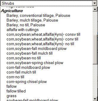
16 Land Use Choices

17 Landcover Map

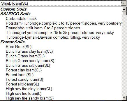
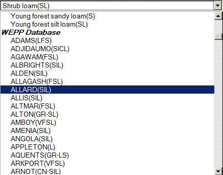
18 Soil Choices

19 NRCS SSURGO Map
20 Server Implementation o Server for Great Lakes WEPP watershed application o Dell PowerEdge, 2-CPU Intel Quad cores, 8GB memory, 250GB drive o Ubuntu Linux o General WEPP server for NSERL, hillslope and watershed o Custom built, 1-CPU Intel Quad core, 4GB memory, 150GB drive, 120GB SSD drive o Gentoo Linux
21 Performance Larger watershed area, including number of flowpaths and number of representative hillslopes increases runtime. Multiple OFE runs take longer. The more land use and soil changes along a profile the longer the simulation. Roughly linear. Length of simulation, whether all flowpaths are simulated. Server setup, number+speed of CPU s, hard disk types, compiler used for WEPP.
22 Performance Run on NSERL server (Intel Quad core) 134 ha watershed, 35 hillslopes, 15 channels, 518 flowpaths, single soil and land use, 1 year run. Concurrent Sessions Simulation Time (secs) Representative hillslopes only - < 1 second for 5 concurrent users.
23 Open Source Software Used GDAL Software Code to do GIS operations. OpenLayers Frontend for multiple GIS layers. MapServer online GIS, vector, grid data. GnuPlot General graphing TcPDF Create PDF documents from PHP PostgreSQL Server database Apache Web server PHP - Server side scripting
24 Conclusions Web based approaches simplify WEPP watershed setup. Forest specific land use and soils can be merged with existing data sets. Performance is reasonable for small areas and limited run times. Detailed simulations still require desktop WEPP and GeoWEPP.
Watershed Application of WEPP and Geospatial Interfaces. Dennis C. Flanagan
 Watershed Application of WEPP and Geospatial Interfaces Dennis C. Flanagan Research Agricultural Engineer USDA-Agricultural Research Service Adjunct Professor Purdue Univ., Dept. of Agric. & Biol. Eng.
The WEPP online GIS interface uses the OpenLayers (http://openlayers.org/) software to assist in setting
 software to assist in setting") WEPP Online GIS OpenLayers/Google Maps Interface February 15,2011 Website: http://milford.nserl.purdue.edu/ol/wepp/ The WEPP online GIS interface uses the OpenLayers (http://openlayers.org/) software to
WEPP Online GIS OpenLayers/Google Maps Interface February 15,2011 Website: http://milford.nserl.purdue.edu/ol/wepp/ The WEPP online GIS interface uses the OpenLayers (http://openlayers.org/) software to
Model Integration - How WEPP inputs are calculated from GIS data. ( ArcGIS,TOPAZ, Topwepp)
") Model Integration - How WEPP inputs are calculated from GIS data. ( ArcGIS,TOPAZ, Topwepp) ArcGIS 9.1-9.3 Allows user to locate area of interest, assemble grids, visualize outputs. TOPAZ Performs DEM
Model Integration - How WEPP inputs are calculated from GIS data. ( ArcGIS,TOPAZ, Topwepp) ArcGIS 9.1-9.3 Allows user to locate area of interest, assemble grids, visualize outputs. TOPAZ Performs DEM
Great Lakes Online Watershed Interface W. Elliot, Research Engineer USDA Forest Service Rocky Mountain Research Station, Moscow, ID March, 2016
 Great Lakes Online Watershed Interface W. Elliot, Research Engineer USDA Forest Service Rocky Mountain Research Station, Moscow, ID March, 2016 Guidelines for using the Web WEPP Watershed Tool to Support
 W. Elliot, PE, PhD USDA Forest Service, Rocky Mountain Research Station Moscow, Idaho Version: April, 2017 WEPP PEP The Water Erosion Prediction Project (WEPP) Post Fire Erosion Predictor (PEP) is an online
Conservation Planning evaluate land management alternatives to reduce soil erosion to acceptable levels. Resource Inventories estimate current and
 Conservation Planning evaluate land management alternatives to reduce soil erosion to acceptable levels. Resource Inventories estimate current and projected erosion levels and their impact on natural resource
GeoWEPP Tutorial Appendix
 GeoWEPP Tutorial Appendix Chris S. Renschler University at Buffalo - The State University of New York Department of Geography, 116 Wilkeson Quad Buffalo, New York 14261, USA Prepared for use at the WEPP/GeoWEPP
Geospatial Fire Behavior Modeling App to Manage Wildfire Risk Online. Kenyatta BaRaKa Jackson US Forest Service - Consultant
 Geospatial Fire Behavior Modeling App to Manage Wildfire Risk Online Kenyatta BaRaKa Jackson US Forest Service - Consultant Fire Behavior Modeling and Forest Fuel Management Modeling Fire Behavior is an
StreamStats: Delivering Streamflow Information to the Public. By Kernell Ries
 StreamStats: Delivering Streamflow Information to the Public By Kernell Ries U.S. Department of the Interior U.S. Geological Survey MD-DE-DC District 410-238-4317 kries@usgs.gov StreamStats Web Application
Using WEPP Technology to Predict Erosion and Runoff Following Wildfire
 An ASABE Meeting Presentation Paper Number: 068011 Using WEPP Technology to Predict Erosion and Runoff Following Wildfire William J. Elliot, PE, PhD, Project Leader (welliot@fs.fed.us) Ina Sue Miller,
GeoWEPP The Geo-spatial interface for the Water Erosion Prediction Project
 This is not a peer-reviewed article Paper Number: 022171 An ASAE Meeting Presentation GeoWEPP The Geo-spatial interface for the Water Erosion Prediction Project Chris S. Renschler University at Buffalo
Regionalization Methods for Watershed Management - Hydrology and Soil Erosion from Point to Regional Scales
 This paper was peer-reviewed for scientific content. Pages 1062-1067. In: D.E. Stott, R.H. Mohtar and G.C. Steinhardt (eds). 2001. Sustaining the Global Farm. Selected papers from the 10th International
Eagle Creek Post Fire Erosion Hazard Analysis Using the WEPP Model. John Rogers & Lauren McKinney
 Eagle Creek Post Fire Erosion Hazard Analysis Using the WEPP Model John Rogers & Lauren McKinney Columbia River Gorge at Risk: Using LiDAR and GIS-based predictive modeling for regional-scale erosion susceptibility
AN ASSESSMENT OF THE IMPACT OF RETENTION PONDS
 AN ASSESSMENT OF THE IMPACT OF RETENTION PONDS FOR SEDIMENT TRAPPING IN THE ADA CREEK AND LONGWOOD COVE USING REMOTELY SENSED DATA AND GIS ANALYSIS Sudhanshu Sekhar Panda Associate Professor, GIS/Env.
REPRESENTATIVE HILLSLOPE METHODS FOR APPLYING
 REPRESENTATIVE HILLSLOPE METHODS FOR APPLYING THE WEPP MODEL WITH DEMS AND GIS T. A. Cochrane, D. C. Flanagan ABSTRACT. In watershed modeling with WEPP, the process of manually identifying hillslopes and
PREDICTING BACKGROUND AND RISK-BASED SEDIMENTATION FOR FOREST WATERSHED TMDLS
 This is not a peer-reviewed article. Watershed Management to Meet Water Quality Standards and TMDLS (Total Maximum Daily Load) Proceedings of the Fourth Conference 10-14 March 2007 (San Antonio, Texas
Why GIS & Why Internet GIS?
 Why GIS & Why Internet GIS? The Internet bandwagon Internet mapping (e.g., MapQuest) Location-based services Real-time navigation (e.g., traffic) Real-time service dispatch Business Intelligence Spatial
Implementing a process-based decision support tool for natural resource management - the GeoWEPP example
 Implementing a process-based decision support tool for natural resource management - the GeoWEPP example Chris S. Renschler a and Dennis C. Flanagan b a Dept. of Geography, University at Buffalo - The
APPLYING ONLINE WEPP TO ASSESS FOREST WATERSHED HYDROLOGY
 APPLYING ONLINE WEPP TO ASSESS FOREST WATERSHED HYDROLOGY S. Dun, J. Q. Wu, W. J. Elliot, J. R. Frankenberger, D. C. Flanagan, D. K. McCool ABSTRACT. A new version of the online Water Erosion Prediction
Methodological Chain for Hydrological Management with Web-GIS Applications
 Advances in Geosciences Konstantinos Perakis & Athanasios Moysiadis, Editors EARSeL, 2012 Methodological Chain for Hydrological Management with Web-GIS Applications Alexandros Konstantinidis 1, Eleni Tzanou
CalWeedMapper. Mapping the Spread of Invasive Plant Species. Karsten Vennemann. Seattle
 CalWeedMapper Mapping the Spread of Invasive Plant Species Karsten Vennemann Seattle Talk Overview The CalWeedMapper Project this presentation is about the expert online editing tool (part of larger project)
Application of the WEPP model with digital geographic information GIS/EM4 No. 149
 4th International Conference on Integrating GIS and Environmental Modeling (GIS/EM4): Problems, Prospects and Research Needs. Banff, Alberta, Canada, September 2-8, 2000. Application of the WEPP model
Web (Java, ArcGIS Server [WebADF, flex, silverlight]) Mobile (ArcGIS Mobile, ArcPad, Windows Mobile) Deskt
![Web (Java, ArcGIS Server [WebADF, flex, silverlight]) Mobile (ArcGIS Mobile, ArcPad, Windows Mobile) Deskt](/thumbs/96/129284052.jpg "Web (Java, ArcGIS Server [WebADF, flex, silverlight]) Mobile (ArcGIS Mobile, ArcPad, Windows Mobile) Deskt") GIS Services company in Lincoln, NE Custom GIS database design and build (for local, county, state and private corporations) Custom (ESRI and non-esri) application design and build in Java, C++, C#,.Net
GIS Services company in Lincoln, NE Custom GIS database design and build (for local, county, state and private corporations) Custom (ESRI and non-esri) application design and build in Java, C++, C#,.Net
SoilView: Development of a Custom GIS Application for Publishing Soil Surveys
 SoilView: Development of a Custom GIS Application for Publishing Soil Surveys Allan Johnson and Mike Wigginton Abstract Currently, digital soils information can be obtained from many sources. Numerous
Recent findings related to measuring and modeling forest road erosion
 18 th World IMACS / MODSIM Congress, Cairns, Australia 13-17 July 2009 http://mssanz.org.au/modsim09 Recent findings related to measuring and modeling forest road erosion W. J. Elliot 1, R. B. Foltz 1
Modeling Sub-Basin Scale Erosion Using DEMs and Land Use Grids
 TITLE Modeling Sub-Basin Scale Erosion Using DEMs and Land Use Grids Lori H. Schnick ABSTRACT Suspended sediment concentration is an important factor that affects stream ecology and morphology. To determine
SMALL WATERSHED MODELING WITH WEPP USING GRID-BASED DEMS AND GIS
 Paper No. 993089 An ASAE Meeting Presentation SMALL WATERSHED MODELING WITH WEPP USING GRID-BASED DEMS AND GIS by T. A. Cochrane and D.C. Flanagan Agricultural and Biological Engineering Department and
A GIS-based Approach to Watershed Analysis in Texas Author: Allison Guettner
 Texas A&M University Zachry Department of Civil Engineering CVEN 658 Civil Engineering Applications of GIS Instructor: Dr. Francisco Olivera A GIS-based Approach to Watershed Analysis in Texas Author:
GeoSUR SRTM 30-m / TPS
 GeoSUR SRTM 30-m / TPS Wm Matthew Cushing (USGS) 16 May 2013 U.S. Department of the Interior U.S. Geological Survey SRTM Mission Shuttle Radar Topography Mission (SRTM) Space Shuttle Endeavour during the
Adapting WEPP (Water Erosion Prediction Project) for Forest Watershed Erosion Modeling
 for Forest Watershed Erosion Modeling") Adapting WEPP (Water Erosion Prediction Project) for Forest Watershed Erosion Modeling Joan Q. Wu Arthur C. Xu William J. Elliot Department of Biological Systems Engineering Rocky Mountain Research Station
Adapting WEPP (Water Erosion Prediction Project) for Forest Watershed Erosion Modeling Joan Q. Wu Arthur C. Xu William J. Elliot Department of Biological Systems Engineering Rocky Mountain Research Station
Validation of the Weather Generator CLIGEN with Precipitation Data from Uganda. W. J. Elliot C. D. Arnold 1
 Validation of the Weather Generator CLIGEN with Precipitation Data from Uganda W. J. Elliot C. D. Arnold 1 9/19/00 ABSTRACT. Precipitation records from highland and central plains sites in Uganda were
A probabilistic approach to modeling postfire erosion after the 2009 Australian bushfires
 18 th World IMACS / MODSIM Congress, Cairns, Australia 13-17 July 2009 http://mssanz.org.au/modsim09 A probabilistic approach to modeling postfire erosion after the 2009 Australian bushfires P.R. Robichaud
Karsten Vennemann, Seattle. QGIS Workshop CUGOS Spring Fling 2015
 Karsten Vennemann, Seattle 2015 a very capable and flexible Desktop GIS QGIS QGIS Karsten Workshop Vennemann, Seattle slide 2 of 13 QGIS - Desktop GIS originally a GIS viewing environment QGIS for the
Leveraging ArcGIS Online Elevation and Hydrology Services. Steve Kopp, Jian Lange
 Leveraging ArcGIS Online Elevation and Hydrology Services Steve Kopp, Jian Lange Topics An overview of ArcGIS Online Elevation Analysis Using Elevation Analysis Services in ArcGIS for Desktop Using Elevation
ADAPTING WEPP (WATER EROSION PREDICTION PROJECT) FOR FOREST WATERSHED EROSION MODELING SHUHUI DUN
 FOR FOREST WATERSHED EROSION MODELING SHUHUI DUN") ADAPTING WEPP (WATER EROSION PREDICTION PROJECT) FOR FOREST WATERSHED EROSION MODELING By SHUHUI DUN A thesis submitted in partial fulfillment of the requirements for the degree of MASTER OF SCIENCE IN
ADAPTING WEPP (WATER EROSION PREDICTION PROJECT) FOR FOREST WATERSHED EROSION MODELING By SHUHUI DUN A thesis submitted in partial fulfillment of the requirements for the degree of MASTER OF SCIENCE IN
Exercise 6: Using Burn Severity Data to Model Erosion Risk
 Exercise 6: Using Burn Severity Data to Model Erosion Risk Document Updated: November 2009 Software Versions: ERDAS Imagine 9.3 and ArcGIS 9.3, Microsoft Office 2007 Introduction A common use of burn severity
GPS-ASSISTED ROAD SURVEYS AND GIS-BASED ROAD EROSION MODELING USING THE WEPP MODEL
 Paper No. PNW-03-109 An ASAE Meeting Presentation This is not a peer-reviewed paper. GPS-ASSISTED ROAD SURVEYS AND GIS-BASED ROAD EROSION MODELING USING THE WEPP MODEL Erin S. Brooks 1, Jan Boll 2, and
Chapter 2. Commonalities in WEPP and WEPS and Efforts Towards a Single Erosion Process Model
 Chapter 2 Commonalities in WEPP and WEPS and Efforts Towards a Single Erosion Process Model D.C. Flanagan 1 & S.M. Visser 2 1 Agricultural Engineer & WEPP Leader USDA - Agricultural Research Service &
GIS APPLICATIONS IN SOIL SURVEY UPDATES
 GIS APPLICATIONS IN SOIL SURVEY UPDATES ABSTRACT Recent computer hardware and GIS software developments provide new methods that can be used to update existing digital soil surveys. Multi-perspective visualization
ROAD SEDIMENT ASSESSMENT & MODELING: KOOTENAI-FISHER TMDL PLANNING AREA ROAD GIS LAYERS & SUMMARY STATISTICS
 ROAD SEDIMENT ASSESSMENT & MODELING: KOOTENAI-FISHER TMDL PLANNING AREA ROAD GIS LAYERS & SUMMARY STATISTICS Prepared by: ATKINS Water Resources Group 820 North Montana Avenue Helena, MT 59601 November
Summary Description Municipality of Anchorage. Anchorage Coastal Resource Atlas Project
 Summary Description Municipality of Anchorage Anchorage Coastal Resource Atlas Project By: Thede Tobish, MOA Planner; and Charlie Barnwell, MOA GIS Manager Introduction Local governments often struggle
EXECUTIVE SUMMARY MANAGEMENT OF NONPOINT SOURCE POLLUTION AN INTEGRATIVE GIS-ANNAGNPS MODEL SEPTEMBER 2003
 EXECUTIVE SUMMARY MANAGEMENT OF NONPOINT SOURCE POLLUTION AN INTEGRATIVE GIS-ANNAGNPS MODEL SEPTEMBER 2003 CENTRAL PLAINS CENTER FOR BIOASSESSMENT KANSAS BIOLOGICAL SURVEY AND KANSAS GEOLOGICAL SURVEY
Updating Slope Topography During Erosion Simulations with the Water Erosion Prediction Project
 This paper was peer-reviewed for scientific content. Pages 882-887. In: D.E. Stott, R.H. Mohtar and G.C. Steinhardt (eds). 2001. Sustaining the Global Farm. Selected papers from the 10th International
Steve Pye LA /22/16 Final Report: Determining regional locations of reference sites based on slope and soil type. Client: Sonoma Land Trust
 Steve Pye LA 221 04/22/16 Final Report: Determining regional locations of reference sites based on slope and soil type. Client: Sonoma Land Trust Deliverables: Results and working model that determine
Current and Future Plans. R. Srinivasan
 Current and Future Plans R. Srinivasan Contents 1 The ArcSWAT Interface 2 VizSWAT: Output Visualization 3 User online support 4 MapWindows SWAT interface 5 ArcGIS SWAT/APEX interfaces 6 Radar Rainfall
Innovation. The Push and Pull at ESRI. September Kevin Daugherty Cadastral/Land Records Industry Solutions Manager
 Innovation The Push and Pull at ESRI September 2004 Kevin Daugherty Cadastral/Land Records Industry Solutions Manager The Push and The Pull The Push is the information technology that drives research and
Linking the WEPP Model to Stability Models
 Paper No. 002150. An ASAE Meeting Presentation Linking the WEPP Model to Stability Models by W. J. Elliot S. A. Lewis Project Leader Civil Engineer Soil and Water Engineering, Rocky Mountain Research Station
4. GIS Implementation of the TxDOT Hydrology Extensions
 4. GIS Implementation of the TxDOT Hydrology Extensions A Geographic Information System (GIS) is a computer-assisted system for the capture, storage, retrieval, analysis and display of spatial data. It
Fire Susceptibility Analysis Carson National Forest New Mexico. Can a geographic information system (GIS) be used to analyze the susceptibility of
 be used to analyze the susceptibility of") 1 David Werth Fire Susceptibility Analysis Carson National Forest New Mexico Can a geographic information system (GIS) be used to analyze the susceptibility of Carson National Forest, New Mexico to forest
1 David Werth Fire Susceptibility Analysis Carson National Forest New Mexico Can a geographic information system (GIS) be used to analyze the susceptibility of Carson National Forest, New Mexico to forest
Introduction-Overview. Why use a GIS? What can a GIS do? Spatial (coordinate) data model Relational (tabular) data model
 data model Relational (tabular) data model") Introduction-Overview Why use a GIS? What can a GIS do? How does a GIS work? GIS definitions Spatial (coordinate) data model Relational (tabular) data model intro_gis.ppt 1 Why use a GIS? An extension
Introduction-Overview Why use a GIS? What can a GIS do? How does a GIS work? GIS definitions Spatial (coordinate) data model Relational (tabular) data model intro_gis.ppt 1 Why use a GIS? An extension
Data Collection and GIS Applications
 Data Collection and GIS Applications Governor s s Conference on the Management of the Illinois River System Jeff Jack of all Trades Boeckler, IDNR Introduction Collecting available GIS data sets Creating
What is a watershed or landscape perspective?
 What is a watershed or landscape perspective? -remove sediment -add sediment -add wood, riparian manipulation -alter (engineer) channel/floodplain morphology -restore/abandon roads You are here What is
Using the Stock Hydrology Tools in ArcGIS
 Using the Stock Hydrology Tools in ArcGIS This lab exercise contains a homework assignment, detailed at the bottom, which is due Wednesday, October 6th. Several hydrology tools are part of the basic ArcGIS
Visualizing Big Data on Maps: Emerging Tools and Techniques. Ilir Bejleri, Sanjay Ranka
 Visualizing Big Data on Maps: Emerging Tools and Techniques Ilir Bejleri, Sanjay Ranka Topics Web GIS Visualization Big Data GIS Performance Maps in Data Visualization Platforms Next: Web GIS Visualization
Spatio-temporal models
 Spatio-temporal models Involve a least a three dimensional representation of one or more key attribute variation in planar (X-Y) space and through time. (a 4 th dimension could also be use, like Z for
These modules are covered with a brief information and practical in ArcGIS Software and open source software also like QGIS, ILWIS.
 Online GIS Training and training modules covered are: 1. ArcGIS, Analysis, Fundamentals and Implementation 2. ArcGIS Web Data Sharing 3. ArcGIS for Desktop 4. ArcGIS for Server These modules are covered
George Mason University Department of Civil, Environmental and Infrastructure Engineering. Dr. Celso Ferreira Prepared by Lora Baumgartner
 George Mason University Department of Civil, Environmental and Infrastructure Engineering Dr. Celso Ferreira Prepared by Lora Baumgartner Exercise Topic: Downloading Spatial Data Objectives: a) Become
ISU GIS CENTER S ARCSDE USER'S GUIDE AND DATA CATALOG
 ISU GIS CENTER S ARCSDE USER'S GUIDE AND DATA CATALOG 2 TABLE OF CONTENTS 1) INTRODUCTION TO ARCSDE............. 3 2) CONNECTING TO ARCSDE.............. 5 3) ARCSDE LAYERS...................... 9 4) LAYER
Erosion Susceptibility in the area Around the Okanogan Fire Complex, Washington, US
 Erosion Susceptibility in the area Around the Okanogan Fire Complex, Washington, US 1. Problem Construct a raster that represents susceptibility to erosion based on lithology, slope, cover type, burned
Hydrologic Modelling of the Upper Malaprabha Catchment using ArcView SWAT
 Hydrologic Modelling of the Upper Malaprabha Catchment using ArcView SWAT Technical briefs are short summaries of the models used in the project aimed at nontechnical readers. The aim of the PES India
Introduction to ArcGIS Server - Creating and Using GIS Services. Mark Ho Instructor Washington, DC
 Introduction to ArcGIS Server - Creating and Using GIS Services Mark Ho Instructor Washington, DC Technical Workshop Road Map Product overview Building server applications GIS services Developer Help resources
Arboretum Explorer: Using GIS to map the Arnold Arboretum
 Arboretum Explorer: Using GIS to map the Arnold Arboretum Donna Tremonte, Arnold Arboretum of Harvard University 2015 Esri User Conference (UC), July 22, 2015 http://arboretum.harvard.edu/explorer Mission
Geog 469 GIS Workshop. Managing Enterprise GIS Geodatabases
 Geog 469 GIS Workshop Managing Enterprise GIS Geodatabases Outline 1. Why is a geodatabase important for GIS? 2. What is the architecture of a geodatabase? 3. How can we compare and contrast three types
Erosion Risk Management Tool (ERMiT) User Manual
 User Manual") United States Department of Agriculture Forest Service Rocky Mountain Research Station General Technical Report RMRS-GTR-188 April 2007 Erosion Risk Management Tool (ERMiT) User Manual (version 2006.01.18)
United States Department of Agriculture Forest Service Rocky Mountain Research Station General Technical Report RMRS-GTR-188 April 2007 Erosion Risk Management Tool (ERMiT) User Manual (version 2006.01.18)
ArcGIS Enterprise: What s New. Philip Heede Shannon Kalisky Melanie Summers Shreyas Shinde
 ArcGIS Enterprise: What s New Philip Heede Shannon Kalisky Melanie Summers Shreyas Shinde ArcGIS Enterprise is the new name for ArcGIS for Server ArcGIS Enterprise Software Components ArcGIS Server Portal
ArcGIS Data Models: Raster Data Models. Jason Willison, Simon Woo, Qian Liu (Team Raster, ESRI Software Products)
") ArcGIS Data Models: Raster Data Models Jason Willison, Simon Woo, Qian Liu (Team Raster, ESRI Software Products) Overview of Session Raster Data Model Context Example Raster Data Models Important Raster
ArcGIS Data Models: Raster Data Models Jason Willison, Simon Woo, Qian Liu (Team Raster, ESRI Software Products) Overview of Session Raster Data Model Context Example Raster Data Models Important Raster
WEPP: MODEL USE, CALIBRATION,
 WEPP: MODEL USE, CALIBRATION, AND VALIDATION D. C. Flanagan, J. R. Frankenberger, J. C. Ascough II ABSTRACT. The Water Erosion Prediction Project (WEPP) model is a process-based, continuous simulation,
Geospatial Data, Services, and Products. National Surveying, mapping and geospatial conference
 Geospatial Data, Services, and Products Federal Programs -- USDA NRCS National Surveying, mapping and geospatial conference March 15, 2016 NRCS Applications using Geosaptial Products & Services Field
Among various open-source GIS programs, QGIS can be the best suitable option which can be used across partners for reasons outlined below.
 Comparison of Geographic Information Systems (GIS) software As of January 2018, WHO has reached an agreement with ESRI (an international supplier of GIS software) for an unlimited use of ArcGIS Desktop
Quality of Information collected with the help of Map-Based Questionnaires
 Quality of Information collected with the help of Map-Based Questionnaires Contents 1. Introduction 2. Case Studie: The Switch Project in Wilhelmsburg 3. The Web Platform 1. Technical Architecture 2. Interactive
Welcome to NetMap Portal Tutorial
 Welcome to NetMap Portal Tutorial Potential Applications What Can you do with the Portal? At least 25 things! 1) Locate the best potential fish habitats. 2) Identify biological hotspots. 3) Map floodplain
Lecture 3. Data Sources for GIS in Water Resources
 Lecture 3 Data Sources for GIS in Water Resources GIS in Water Resources Spring 2015 http://www.data.gov/ 1 USGS GIS data for Water http://water.usgs.gov/maps.html Watersheds of the US 2-digit water resource
A Temporal Hydrologic Database for Rapidly Changing Landscapes
 A Temporal Hydrologic Database for Rapidly Changing Landscapes Using Mt. St. Helens in Washington as a Pilot Site Adam Mosbrucker Geog 575 BACKGROUND: Client / User U.S. Geological Survey Cascades Volcano
Geo-spatial Analysis for Prediction of River Floods
 Geo-spatial Analysis for Prediction of River Floods Abstract. Due to the serious climate change, severe weather conditions constantly change the environment s phenomena. Floods turned out to be one of
CAPE FARM MAPPER - an integrated spatial portal
 CAPE FARM MAPPER - an integrated spatial portal Skukuza Dr Mike Wallace June 2017 Overview of GIS applications in WCDoA Spatial information and technology has become indispensable across a wide range of
Practical teaching of GIS at University of Liège
 Practical teaching of GIS at University of Liège Jean-Paul Kasprzyk, assistant Lessons Pr. Jean-Paul Donnay: For non-geographers (geologists, urban planners, engineers ) GIS users Master: Introduction
Web-GIS based Framework for Solid Waste Complaint Management for Sustainable and Smart City
 Cloud Publications International Journal of Advanced Remote Sensing and GIS 2016, Volume 5, Issue 10, pp. 1930-1936 ISSN 2320-0243, DOI: 10.23953/cloud.ijarsg.71 Research Article Open Access Web-GIS based
Date of Report: EPA agreement number: Center Name and Institution of Ctr. Director: Identifier used by Center for Project: Title of Project:
 Date of Report: March 31, 2003 EPA agreement number: R829515C003 Center Name and Institution of Ctr. Director: Rocky Mountain Regional Hazardous Substance Research Center, Colorado State University, Fort
Introduction to Geographic Information Systems
 Introduction to Geographic Information Systems Lynn_Carlson@brown.edu 401-863-9917 The Environmental And Remote TecHnologies Lab MacMillan Hall, Room 105 http://www.brown.edu/research/earthlab/ Outline
ArcGIS Online Tools and Water-Related Web Services You Can Use Every Day of Your Life!
 ArcGIS Online Tools and Water-Related Web Services You Can Use Every Day of Your Life! Brian Rowley, PE, CFM FMA 2014 Annual Conference 1 Gold Rush (49ers) John Sutter Sutter s Mill South fork of American
The BASINS Watershed Analysis System -- Evolving to Embrace New Data and Techniques. PH (404) ; author
 ; author") The BASINS Watershed Analysis System -- Evolving to Embrace New Data and Techniques Paul B. Duda 1, John L. Kittle, Jr. 1, Paul R. Hummel 1, Mark H. Gray 1, Russell S. Kinerson, Ph.D. 2 1 AQUA TERRA Consultants,
The BASINS Watershed Analysis System -- Evolving to Embrace New Data and Techniques Paul B. Duda 1, John L. Kittle, Jr. 1, Paul R. Hummel 1, Mark H. Gray 1, Russell S. Kinerson, Ph.D. 2 1 AQUA TERRA Consultants,
Development of a Web-Based GIS Management System for Agricultural Authorities in Iraq
 Development of a Web-Based GIS Management System for Agricultural Authorities in Iraq USCID Water Management Conference Phoenix, Arizona April 18, 2013 Gabriele Bonaiti Extension Program Specialist David
Development and Land Use Change in the Central Potomac River Watershed. Rebecca Posa. GIS for Water Resources, Fall 2014 University of Texas
 Development and Land Use Change in the Central Potomac River Watershed Rebecca Posa GIS for Water Resources, Fall 2014 University of Texas December 5, 2014 Table of Contents I. Introduction and Motivation..4
POSITION DESCRIPTION. Position Title: Geographic Information Systems (GIS) Coordinator Department: Engineering
 Coordinator Department: Engineering") POSITION DESCRIPTION Position Title: Geographic Information Systems (GIS) Coordinator Department: Engineering Reports To: Engineering Supervisor FLSA Status: Exempt Date: April 2018 PRIMARY OBJECTIVE OF
POSITION DESCRIPTION Position Title: Geographic Information Systems (GIS) Coordinator Department: Engineering Reports To: Engineering Supervisor FLSA Status: Exempt Date: April 2018 PRIMARY OBJECTIVE OF
Overview of Geospatial Open Source Software which is Robust, Feature Rich and Standards Compliant
 Overview of Geospatial Open Source Software which is Robust, Feature Rich and Standards Compliant Cameron SHORTER, Australia Key words: Open Source Geospatial Foundation, OSGeo, Open Standards, Open Geospatial
Lecture 2. Introduction to ESRI s ArcGIS Desktop and ArcMap
 Lecture 2 Introduction to ESRI s ArcGIS Desktop and ArcMap Outline ESRI What is ArcGIS? ArcGIS Desktop ArcMap Overview Views Layers Attribute Tables Help! Scale Tips and Tricks ESRI Environmental Systems
GRAPEVINE LAKE MODELING & WATERSHED CHARACTERISTICS
 GRAPEVINE LAKE MODELING & WATERSHED CHARACTERISTICS Photo Credit: Lake Grapevine Boat Ramps Nash Mock GIS in Water Resources Fall 2016 Table of Contents Figures and Tables... 2 Introduction... 3 Objectives...
Creating Watersheds and Stream Networks. Steve Kopp
 Creating Watersheds and Stream Networks Steve Kopp Workshop Overview Demo Data Understanding the tools Elevation Data Types DEM : Digital Elevation Model bare Earth DSM : Digital Surface Model Data Structure
Outline Brief Overview MapPlace Website Data Delivery & Map Themes Digital Geology
 BRITISH COLUMBIA GEOLOGICAL SURVEY Kirk Hancock Pat Desjardins Nick Massey BRITISH COLUMBIA Ministry of Energy and Mines Ward Kilby acknowledged developer of MapPlace Outline Brief Overview MapPlace Website
DESIGNING AND APPLICATION OF WEB-BASED GEOGRAPHICAL INFORMATION SYSTEM FOR VISUAL ASSESSMENT OF LAND LEVELS
 DOI: 10.21917/ijsc.2018.0235 DESIGNING AND APPLICATION OF WEB-BASED GEOGRAPHICAL INFORMATION SYSTEM FOR VISUAL ASSESSMENT OF LAND LEVELS Ri NamSong, Choe JongAe and Kim Jonggun Institute of Information
A Prototype of a Web Mapping System Architecture for the Arctic Region
 A Prototype of a Web Mapping System Architecture for the Arctic Region Han-Fang Tsai 1, Chih-Yuan Huang 2, and Steve Liang 3 GeoSensorWeb Laboratory, Department of Geomatics Engineering, University of
Bentley Map Advancing GIS for the World s Infrastructure
 Bentley Map Advancing GIS for the World s Infrastructure Presentation Overview Why would you need Bentley Map? What is Bentley Map? Where is Bentley Map Used? Why would you need Bentley Map? Because your
Remote Sensing and GIS Applications for Hilly Watersheds SUBASHISA DUTTA DEPARTMENT OF CIVIL ENGINEERING IIT GUWAHATI
 Remote Sensing and GIS Applications for Hilly Watersheds SUBASHISA DUTTA DEPARTMENT OF CIVIL ENGINEERING IIT GUWAHATI Deciding Alternative Land Use Options in a Watershed Using GIS Source: Anita Prakash
Geoprovisioning delivers geodata and its analysis for specific areas on request.
 DRAFT 27 February 2009 Geoprovisioning Geoprovisioning delivers geodata and its analysis for specific areas on request. What are the components of a geoprovisioning service? The sample web site geoprovisioning.com
Workshops funded by the Minnesota Environment and Natural Resources Trust Fund
 Workshops funded by the Minnesota Environment and Natural Resources Trust Fund Conservation Applications of LiDAR Data Workshops funded by: Minnesota Environment and Natural Resources Trust Fund Presented
Identifying Wildfire Risk Areas in Western Washington State
 Identifying Wildfire Risk Areas in Western Washington State Matthew Seto University of Washington Tacoma GIS Certification Program URISA 2015 Undergraduate Geospatial Skills Competition Introduction 2014
What s New in Topographic Information - USGS National Map
 + What s New in Topographic Information - USGS National Map SARGIS Workshop November 14, 2016 Rob Dollison, 703-648-5724 rdollison@usgs.gov + USGS 2 National Geospatial Program The National Geospatial
What are the five components of a GIS? A typically GIS consists of five elements: - Hardware, Software, Data, People and Procedures (Work Flows)
") LECTURE 1 - INTRODUCTION TO GIS Section I - GIS versus GPS What is a geographic information system (GIS)? GIS can be defined as a computerized application that combines an interactive map with a database
LECTURE 1 - INTRODUCTION TO GIS Section I - GIS versus GPS What is a geographic information system (GIS)? GIS can be defined as a computerized application that combines an interactive map with a database
Enabling ENVI. ArcGIS for Server
 Enabling ENVI throughh ArcGIS for Server 1 Imagery: A Unique and Valuable Source of Data Imagery is not just a base map, but a layer of rich information that can address problems faced by GIS users. >
Landscape and climate parameters
 The European Commission s science and knowledge service Joint Research Centre Landscape and climate parameters for the mapping of pesticide ERA Alberto Pistocchi PERSAM 2 http://esdac.jrc.ec.europa.eu/content/european-foodsafety-authority-efsa-data-persam-software-tool