Human-Caused Fires: An Exploratory Pattern Analysis
|
|
|
- Lindsey Gray
- 5 years ago
- Views:
Transcription

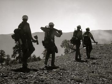
1 Human-Caused Fires: An Exploratory Pattern Analysis J E N A F E R R A R E S E N I C H O L A S J O N E S D I G I T A L C O M P I L A T I O N A N D D A T A B A S E D E S I G N P O R T L A N D S T A T E U N I V E R S I T Y G E O G F A L L Human Caused Fires: Exploratory Pattern Analysis Introduction Datasets Methods Applications Limitations Questions References A pretty picture 1


2 Introduction Why we chose this project Introduction Clearwater National Forest 1.8 million acres 612,400 visitors annually ~11% of fires are humancaused Average cost of large (>10 ac.) human-caused fires: $760,136 lightining-caused fires: $241,077 2
3 Introduction Database Design Objectives Integrate existing databases and shape files Derive additional useful feature classes Normalize database for efficiency and standardization of present and future data Create domains to limit future data entry options Define relationships that allow for exploration of fire occurrence patterns and predictions Establish topologies that enforce data integrity and ensure valid analyses Datasets Fire Data Points: Ignition Locations for All Fires Polygons: Extents for Fires >10 acres Human Features Data Points: Campgrounds, Boating Sites, Picnic Areas, etc Polylines: Roads and Trails Landscape Data Rasters: Anderson s Fire Behavior Fuel Model 3

4 Methods Data Organization Data Normalization Data Integrity Enforcement: Domain Establishment Relationship Class Creation Topology Creation and Validation Methods : Data Organization Created two feature datasets to hold spatial layers Raster and Tablular data located in geodatabase root 4


5 Methods : Normalization Created tables and reclassed spatial data fields to reduce redundancy Methods : Domains Created domains to codify values, ensuring data integrity of current and future data 5
6 Methods : Relationship Classes Linked tabular and spatial data In Arc10, can be located either with origin or destination data Methods : Topology Defined rules to limit and/or require certain relationships between feature classes Before doing a spatial analysis, features have to be in the correct location 6
7 Methods : Topology Example Rule : Trailheads must be covered by endpoints of Trails Failed Topology Successfully Validated Where to Move? Applications : Intended Identify problem areas of visitor behavior Identify best allocation of education and prevention resources Highlight high-priority areas for fuel treatments/ mitigation/reduction Inform fire management and enforcement decisions (e.g. campground fire bans, fire patrols, etc ) 7

8 Applications : Demonstration Clustering analysis of human-caused fires 1. Is there clustering? 2. If so, where is the clustering? 3. Is the clustering related to the presence of a humanmade feature, the available fuels or a combination of both? Applications : Patterns Is there any clustering? Used Average Nearest Neighbor tool Result:


9 Applications : Patterns Where is the clustering? Used Anselin Local Moran s I Applications : Patterns Is there an association with specific fuel models? 9


10 Applications : Patterns Applications : Patterns Is there an association with human-made features? Near Analysis of all fires in relation to developed recreation sites 10
11 Applications : Patterns Average distance to developed recreation feature human-caused fires: 3.5km lightning-caused fires: 3.8km Closest Feature Type: All fires Fires <1km from features Human Lightning Human Lightning Picnic Area 24.6% 3.6% 6.3% 0.5% Campground 13.4% 23.0% 12.5% 6.0% Trailhead 7.5% 10.6% 0.0% 4.7% Dispersed Rec Site 47.0% 52.2% 78.1% 81.9% Lookout Tower 5.2% 9.3% 3.1% 6.5% Boating Site 2.2% 0.6% 0.0% 0.5% Interpretation Site 0.0% 0.7% 0.0% 0.0% Conclusions Validation of initial assumption human-caused fires are clustered Anselin local Moran s I conclusion there are hotspots and spatial outliers throughout the study area, further investigation of those locations might be warranted Fuel model association human caused fires have a different concentration than naturally occurring wildfires Recreation association - more closely tied to frontcountry recreation areas 11

12 Limitations Updating requires revisiting multiple sources Does not consider/include weather data Coarse spatial resolution of fuel model may lead to seemingly erroneous results Ignition points are often best estimate with a lower than optimal accuracy and precision Human actions are more complex than captured in this database Questions? 12
13 References Anderson, H.E Aids to Determining Fuel Models For Estimating Fire Behavior. General Technical Report INT-122. Ogden, UT: USDA Forest Service Intermountain Forest and Range Experiment Station. 28p. Clearwater National Forest Trail Guide Descriptions and Information on Selected Trails Within the Clearwater National Forest. 47p. Retrieved from Accessed 11/13/2010. Clearwater National Forest GIS Library Accessed 10/10-11/30/2010. ESRI. ArcGIS Resource Center. Web-based Help. Accessed 10/15/ /04/2010. ESRI. ArcGIS: Working with Geodatabase Topology, An ESRI White Paper Retrieved from Accessed 11/13/2010. National Visitor Use Monitoring Results Clearwater National Forest. USDA Forest Service, Region 1. Accessed 11/28/2010. Olivera, F. and S. Koka. Arc Catalog and Geodatabases. CE/ArcGISMaterials/03Geodatabases/Class/ArcCatolog%20and%20Geodatabases1.ppt Accessed 11/13/2010. Oregon Department of Forestry GIS Metadata CAR Hazard:FBFM. 2p. Scott, J.H. and R.E. Burgan Standard Fire Behavior Fuel Models: A Comprehensive Set for Use with Rothermel s Surface Fire Spread Model. General Technical Report RMRS-GTR-153. Fort Collins, CO: USDA Forest Service Rocky Mountain Research Station. 80p. Wells, G The Rothermel Fire-Spread Model: Still Running Like a Champ. Fire Science Digest: 2. 11p. 13
Predicting wildfire ignitions, escapes, and large fire activity using Predictive Service s 7-Day Fire Potential Outlook in the western USA
 http://dx.doi.org/10.14195/978-989-26-0884-6_135 Chapter 4 - Fire Risk Assessment and Climate Change Predicting wildfire ignitions, escapes, and large fire activity using Predictive Service s 7-Day Fire
CHAPTER 7 PRODUCT USE AND AVAILABILITY
 CHAPTER 7 PRODUCT USE AND AVAILABILITY Julie Prior-Magee Photo from SWReGAP Training Site Image Library Recommended Citation Prior-Magee, J.S. 2007. Product use and availability. Chapter 7 in J.S. Prior-Magee,
Steve Pietersen Office Telephone No
 Steve Pietersen Steve.Pieterson@durban.gov.za Office Telephone No. 031 311 8655 Overview Why geography matters The power of GIS EWS GIS water stats EWS GIS sanitation stats How to build a GIS system EWS
These modules are covered with a brief information and practical in ArcGIS Software and open source software also like QGIS, ILWIS.
 Online GIS Training and training modules covered are: 1. ArcGIS, Analysis, Fundamentals and Implementation 2. ArcGIS Web Data Sharing 3. ArcGIS for Desktop 4. ArcGIS for Server These modules are covered
GIS and Forest Engineering Applications FE 357 Lecture: 2 hours Lab: 2 hours 3 credits
 GIS and Forest Engineering Applications FE 357 Lecture: 2 hours Lab: 2 hours 3 credits Instructor: Michael Wing Assistant Professor Forest Engineering Department Oregon State University Peavy Hall 275
FireFamily Plus User s Guide
 United States Department of Agriculture Forest Service Rocky Mountain Research Station General Technical Report RMRS-GTR-67-WWW September 2000 FireFamily Plus User s Guide Version 2.0 Larry Bradshaw Erin
Committee. Dr. Dyckman, chair Professor Sperry
 A PLAN FOR DESIGNATING PRIMITIVE CAMPING AREAS IN THE ESCALANTE CANYONS SPECIAL RECREATION MANAGEMENT AREA OF THE GRAND STAIRCASE-ESCALANTE NATIONAL MONUMENT Benjamin Fields Committee 2 Dr. Dyckman, chair
presents challenges related to utility infrastructure planning. Many of these challenges
 1 Introduction: - a. Purpose According to U.S. Census Bureau the population of stark county was 367,585 in 1990, and in 2000 it was increase to 378,098. Thus County is experiencing a growth that presents
HIGH RESOLUTION BASE MAP: A CASE STUDY OF JNTUH-HYDERABAD CAMPUS
 HIGH RESOLUTION BASE MAP: A CASE STUDY OF JNTUH-HYDERABAD CAMPUS K.Manjula Vani, Abhinay Reddy, J. Venkatesh, Ballu Harish and R.S. Dwivedi ABSTRACT The proposed work High Resolution Base map: A Case study
Geoprocessing Tools at ArcGIS 9.2 Desktop
 Geoprocessing Tools at ArcGIS 9.2 Desktop Analysis Tools Analysis Tools \ Extract Clip Analysis Tools \ Extract Select Analysis Tools \ Extract Split Analysis Tools \ Extract Table Select Analysis Tools
Geospatial Fire Behavior Modeling App to Manage Wildfire Risk Online. Kenyatta BaRaKa Jackson US Forest Service - Consultant
 Geospatial Fire Behavior Modeling App to Manage Wildfire Risk Online Kenyatta BaRaKa Jackson US Forest Service - Consultant Fire Behavior Modeling and Forest Fuel Management Modeling Fire Behavior is an
ArcMap - EXPLORING THE DATABASE Part I. SPATIAL DATA FORMATS Part II
 Week 5 ArcMap - EXPLORING THE DATABASE Part I SPATIAL DATA FORMATS Part II topics of the week Exploring the Database More on the Table of Contents Exploration tools Identify, Find, Measure, Map tips, Hyperlink,
Overview. Project Background Project Approach: Content and Application Development Application Demonstration Future Developments
 Overview Project Background Project Approach: Content and Application Development Application Demonstration Future Developments Southeast Pressures: Continued Population Growth Transportation Corridors
Towards Validation of DEVS-FIRE Wildfire Simulation Model
 Towards Validation of DEVS-FIRE Wildfire Simulation Model Feng Gu Dept. of Computer Science Georgia State University Atlanta, GA, 333 fgu1@student.gsu.edu Xiaolin Hu Dept. of Computer Science Georgia State
The National Integrated Land System (NILS) Larry Money June 24, 2005
 Larry Money June 24, 2005") The National Integrated Land System (NILS) Larry Money June 24, 2005 Purpose/Goal Functional Components Design Data Question BLM s Responsibilities (OMB A-16) Public Land Records Public land conveyance
The National Integrated Land System (NILS) Larry Money June 24, 2005 Purpose/Goal Functional Components Design Data Question BLM s Responsibilities (OMB A-16) Public Land Records Public land conveyance
Identifying Wildfire Risk Areas in Western Washington State
 Identifying Wildfire Risk Areas in Western Washington State Matthew Seto University of Washington Tacoma GIS Certification Program URISA 2015 Undergraduate Geospatial Skills Competition Introduction 2014
GIS in Weather and Society
 GIS in Weather and Society Olga Wilhelmi Institute for the Study of Society and Environment National Center for Atmospheric Research WAS*IS November 8, 2005 Boulder, Colorado Presentation Outline GIS basic
8.2 USING HIGH-RESOLUTION WEATHER DATA TO PREDICT FIRE SPREAD USING THE FARSITE SIMULATOR A CASE STUDY IN CALIFORNIA CHAPARRAL
 8.2 USING HIGH-RESOLUTION WEATHER DATA TO PREDICT FIRE SPREAD USING THE FARSITE SIMULATOR A CASE STUDY IN CALIFORNIA CHAPARRAL David R. Weise*, Shyh-Chin Chen, Philip J. Riggan, Francis M. Fujioka Forest
BASIC SPATIAL ANALYSIS TOOLS IN A GIS. data set queries basic statistics buffering overlay reclassification
 BASIC SPATIAL ANALYSIS TOOLS IN A GIS data set queries basic statistics buffering overlay reclassification GIS ANALYSIS TOOLS GIS ANALYSIS TOOLS Database tools: query and summarize (similar to spreadsheet
NR402 GIS Applications in Natural Resources
 NR402 GIS Applications in Natural Resources Lesson 1 Introduction to GIS Eva Strand, University of Idaho Map of the Pacific Northwest from http://www.or.blm.gov/gis/ Welcome to NR402 GIS Applications in
MODELING LIGHTNING AS AN IGNITION SOURCE OF RANGELAND WILDFIRE IN SOUTHEASTERN IDAHO
 MODELING LIGHTNING AS AN IGNITION SOURCE OF RANGELAND WILDFIRE IN SOUTHEASTERN IDAHO Keith T. Weber, Ben McMahan, Paul Johnson, and Glenn Russell GIS Training and Research Center Idaho State University
Introduction to the 176A labs and ArcGIS
 Introduction to the 176A labs and ArcGIS Acknowledgement: Slides by David Maidment, U Texas-Austin and Francisco Olivera (TAMU) Purpose of the labs Hands-on experience with one software pakage Introduction
Geodatabase An Overview
 Federal GIS Conference February 9 10, 2015 Washington, DC Geodatabase An Overview Ralph Denkenberger - esri Session Path The Geodatabase - What is it? - Why use it? - What types are there? Inside the Geodatabase
 W. Elliot, PE, PhD USDA Forest Service, Rocky Mountain Research Station Moscow, Idaho Version: April, 2017 WEPP PEP The Water Erosion Prediction Project (WEPP) Post Fire Erosion Predictor (PEP) is an online
A Regional Database Tracking Fire Footprint Each Year within the South Atlantic Region: Current Database Description and Future Directions
 A Regional Database Tracking Fire Footprint Each Year within the South Atlantic Region: Current Database Description and Future Directions Last Updated on September 30, 2018 Contributors: NatureServe,
THE DEEPENING OF A LOW-LEVEL TROUGH AS INDICATED BY DUST ALOFT IN GOES ' INFRARED PICTURES
 REFERENCES Baughman, R. G., and C. W. Schmid, Jr.: Lightning Storm Characteristics. U.S. Service, Intermountain Forest and Range ment Station, Research Paper in press. Davis, L. S., and R. W. Cooper, 1963:
Using the Analytic Hierarchy Process to Create a Wildfire Model
 Using the Analytic Hierarchy Process to Create a Wildfire Model Peter S. Johnson and Gary L. Christopherson The University of Arizona Abstract Some of the most important questions in wildland fire modeling
A Temporal Hydrologic Database for Rapidly Changing Landscapes
 A Temporal Hydrologic Database for Rapidly Changing Landscapes Using Mt. St. Helens in Washington as a Pilot Site Adam Mosbrucker Geog 575 BACKGROUND: Client / User U.S. Geological Survey Cascades Volcano
Jim Fox. copyright UNC Asheville's NEMAC
 Decisions and System Thinking Jim Fox November, 2012 1 UNC Asheville s s NEMAC National Environmental Modeling and Analysis Center Applied Research and technology development on integration of environmental
GIS: Definition, Software. IAI Summer Institute 19 July 2000
 GIS: Definition, Software IAI Summer Institute 19 July 2000 What is a GIS? Geographic Information System Definitions DeMers (1997): Tools that allow for the processing of spatial data into information,
Week 7 Last week: This week s topics. GIS and Forest Engineering Applications. FE 257. GIS and Forest Engineering Applications.
 FE 257. GIS and Forest Engineering Applications Week 7 Week 7 Last week: Spatial Projections Questions? Next week- read: Chapter 10: Updating GIS Databases Chapter 12: Synthesis of Techniques Applied to
The Invasion of False Brome in Western Oregon
 The Invasion of False Brome in Western Oregon GIS II Presentation Winter 2006 Will Fellers Kurt Hellerman Kathy Strope Statia Cupit False Brome (Brachypodium sylvaticum) Perennial bunchgrass native to
Using remote sensing and Detection of Early Season Invasives (DESI) to analyze the temporal dynamics of invasive cheatgrass (Bromus tectorum).
 to analyze the temporal dynamics of invasive cheatgrass (Bromus tectorum).") 2015 NASA Space Grant Consortium Research Fellowship 1 Using remote sensing and Detection of Early Season Invasives (DESI) to analyze the temporal dynamics of invasive cheatgrass (Bromus tectorum). Bishop,
2015 NASA Space Grant Consortium Research Fellowship 1 Using remote sensing and Detection of Early Season Invasives (DESI) to analyze the temporal dynamics of invasive cheatgrass (Bromus tectorum). Bishop,
Welcome to NR502 GIS Applications in Natural Resources. You can take this course for 1 or 2 credits. There is also an option for 3 credits.
 Welcome to NR502 GIS Applications in Natural Resources. You can take this course for 1 or 2 credits. There is also an option for 3 credits. The 1st credit consists of a series of readings, demonstration,
Geodatabase: Best Practices. Robert LeClair, Senior Instructor
 Geodatabase: Best Practices Robert LeClair, Senior Instructor Agenda Geodatabase Creation Data Ownership Data Model Data Configuration Geodatabase Behaviors Data Validation Extending Performance Geodatabase
GIS Test Drive What a Geographic Information System Is and What it Can Do. Alison Davis-Holland
 GIS Test Drive What a Geographic Information System Is and What it Can Do Alison Davis-Holland adavisholland@gmail.com WHO AM I? Geospatial Analyst M.S. in Geographic and Cartographic Sciences Use GIS
Putative Canada Lynx (Lynx canadensis) Movements across I-70 in Colorado
 Movements across I-70 in Colorado") Putative Canada Lynx (Lynx canadensis) Movements across I-70 in Colorado INTRODUCTION March 8, 2012 Jake Ivan, Mammals Researcher Colorado Parks and Wildlife 317 W. Prospect Fort Collins, CO 80526 970-472-4310
Putative Canada Lynx (Lynx canadensis) Movements across I-70 in Colorado INTRODUCTION March 8, 2012 Jake Ivan, Mammals Researcher Colorado Parks and Wildlife 317 W. Prospect Fort Collins, CO 80526 970-472-4310
GRAPEVINE LAKE MODELING & WATERSHED CHARACTERISTICS
 GRAPEVINE LAKE MODELING & WATERSHED CHARACTERISTICS Photo Credit: Lake Grapevine Boat Ramps Nash Mock GIS in Water Resources Fall 2016 Table of Contents Figures and Tables... 2 Introduction... 3 Objectives...
Esri Exam EADP10 ArcGIS Desktop Professional Version: 6.2 [ Total Questions: 95 ]
![Esri Exam EADP10 ArcGIS Desktop Professional Version: 6.2 [ Total Questions: 95 ]](/thumbs/73/68697597.jpg "Esri Exam EADP10 ArcGIS Desktop Professional Version: 6.2 [ Total Questions: 95 ]") s@lm@n Esri Exam EADP10 ArcGIS Desktop Professional Version: 6.2 [ Total Questions: 95 ] Question No : 1 An ArcGIS user runs the Central Feature geoprocessing tool on a polygon feature class. The output
s@lm@n Esri Exam EADP10 ArcGIS Desktop Professional Version: 6.2 [ Total Questions: 95 ] Question No : 1 An ArcGIS user runs the Central Feature geoprocessing tool on a polygon feature class. The output
Exercise 2: Working with Vector Data in ArcGIS 9.3
 Exercise 2: Working with Vector Data in ArcGIS 9.3 There are several tools in ArcGIS 9.3 used for GIS operations on vector data. In this exercise we will use: Analysis Tools in ArcToolbox Overlay Analysis
Arcgis Enterprise Performance And Scalability Best Practices
 Arcgis Enterprise Performance And Scalability Best Practices We have made it easy for you to find a PDF Ebooks without any digging. And by having access to our ebooks online or by storing it on your computer,
Introduction-Overview. Why use a GIS? What can a GIS do? Spatial (coordinate) data model Relational (tabular) data model
 data model Relational (tabular) data model") Introduction-Overview Why use a GIS? What can a GIS do? How does a GIS work? GIS definitions Spatial (coordinate) data model Relational (tabular) data model intro_gis.ppt 1 Why use a GIS? An extension
Introduction-Overview Why use a GIS? What can a GIS do? How does a GIS work? GIS definitions Spatial (coordinate) data model Relational (tabular) data model intro_gis.ppt 1 Why use a GIS? An extension
The Evolution of NWI Mapping and How It Has Changed Since Inception
 The Evolution of NWI Mapping and How It Has Changed Since Inception Some Basic NWI Facts: Established in 1974 Goal to create database on characteristics and extent of U.S. wetlands Maps & Statistics In
Session Objectives. Learn how to: Bring georeferenced aerial imagery into Civil 3D. Connect to and import GIS data using various tools and techniques.
 GIS into Civil 3D Data 70th Annual Wisconsin Society of Land Surveyors' Institute January 24, 2019 1 Learn how to: Session Objectives Bring georeferenced aerial imagery into Civil 3D. Connect to and import
Spatial Analysis I. Spatial data analysis Spatial analysis and inference
 Spatial Analysis I Spatial data analysis Spatial analysis and inference Roadmap Outline: What is spatial analysis? Spatial Joins Step 1: Analysis of attributes Step 2: Preparing for analyses: working with
EEOS 381 -Spatial Databases and GIS Applications
 EEOS 381 -Spatial Databases and GIS Applications Lecture 5 Geodatabases What is a Geodatabase? Geographic Database ESRI-coined term A standard RDBMS that stores and manages geographic data A modern object-relational
CAUSES FOR CHANGE IN STREAM-CHANNEL MORPHOLOGY
 CAUSES FOR CHANGE IN STREAM-CHANNEL MORPHOLOGY Chad A. Whaley, Department of Earth Sciences, University of South Alabama, MobileAL, 36688. E-MAIL: caw408@jaguar1.usouthal.edu The ultimate goal of this
The File Geodatabase API. Craig Gillgrass Lance Shipman
 The File Geodatabase API Craig Gillgrass Lance Shipman Schedule Cell phones and pagers Please complete the session survey we take your feedback very seriously! Overview File Geodatabase API - Introduction
Geodatabase An Introduction
 Federal GIS Conference 2014 February 10 11, 2014 Washington DC Geodatabase An Introduction Ralph Denkenberger esri Session Path The Geodatabase - What is it? - Why use it? - What types are there? Inside
 estrandh@uoregon.edu Introduction The general topic of this paper describes a unique cartographic project depicting a mountain landscape for the Friends of Opal Creek (F.O.C.), a non-profit organization.
GIS Boot Camp for Education June th, 2011 Day 1. Instructor: Sabah Jabbouri Phone: (253) x 4854 Office: TC 136
 x 4854 Office: TC 136") GIS Boot Camp for Education June 27-30 th, 2011 Day 1 Instructor: Sabah Jabbouri Phone: (253) 833-9111 x 4854 Office: TC 136 Email: sjabbouri@greenriver.edu http://www.instruction.greenriver.edu/gis/ Summer
GIS Boot Camp for Education June 27-30 th, 2011 Day 1 Instructor: Sabah Jabbouri Phone: (253) 833-9111 x 4854 Office: TC 136 Email: sjabbouri@greenriver.edu http://www.instruction.greenriver.edu/gis/ Summer
Chapter 6: Conclusion
 Chapter 6: Conclusion As stated in Chapter 1, the aim of this study is to determine to what extent GIS software can be implemented in order to manage, analyze and visually illustrate an IT-network between
LRS Task Force June 13, REVISION HISTORY
 North Carolina Department of Transportation Geographic Information Systems (GIS) Unit LINEAR REFERENCING SYSTEM (LRS) PROJECT DEFINITION Version 1.0 REVISION HISTORY Date Document Manager Revision Purpose
How GIS based Visualizations Support Land Use and Transportation Modeling
 How GIS based Visualizations Support Land Use and Transportation Modeling ESRI International Users Conference San Diego, CA - July 23, 2015 Prepared by: Troy Hightower Introduction This presentation will
Geodatabases and ArcCatalog
 Geodatabases and ArcCatalog Prepared by Francisco Olivera, Ph.D. and Srikanth Koka Department of Civil Engineering Texas A&M University February 2004 Contents Brief Overview of Geodatabases Goals of the
This lab exercise will try to answer these questions using spatial statistics in a geographic information system (GIS) context.
 context.") by Introduction Problem Do the patterns of forest fires change over time? Do forest fires occur in clusters, and do the clusters change over time? Is this information useful in fighting forest fires? This
by Introduction Problem Do the patterns of forest fires change over time? Do forest fires occur in clusters, and do the clusters change over time? Is this information useful in fighting forest fires? This
Summary Description Municipality of Anchorage. Anchorage Coastal Resource Atlas Project
 Summary Description Municipality of Anchorage Anchorage Coastal Resource Atlas Project By: Thede Tobish, MOA Planner; and Charlie Barnwell, MOA GIS Manager Introduction Local governments often struggle
Introduction to ArcGIS 10.2
 Introduction to ArcGIS 10.2 Francisco Olivera, Ph.D., P.E. Srikanth Koka Lauren Walker Aishwarya Vijaykumar Keri Clary Department of Civil Engineering April 21, 2014 Contents Brief Overview of ArcGIS 10.2...
LANDSLIDE HAZARD ANALYSIS AND ITS EFFECT ON ENDANGERED SPECIES HABITATS, GRAND COUNTY, UTAH
 12/5/2016 LANDSLIDE HAZARD ANALYSIS AND ITS EFFECT ON ENDANGERED SPECIES HABITATS, GRAND COUNTY, UTAH GIS Final Project Ashlyn Murphy Fall 2016 1. Introduction and Problem A well-known geologic hazard
Big Data Discovery and Visualisation Insights for ArcGIS
 Big Data Discovery and Visualisation Insights for ArcGIS Create Enrich - Collaborate Lee Kum Cheong GIS CONVERSATIONS At Esri, we believe people can do amazing things with applied geography. GIS CONVERSATIONS
Using Web GIS to Build Consensus and Combat Wildland Fire Threats
 Using Web GIS to Build Consensus and Combat Wildland Fire Threats By Mike Price, Entrada/San Juan, Inc. What You Will Need ArcGIS 10.3 for Desktop (any license level) An ArcGIS Online account (one comes
Arboretum Explorer: Using GIS to map the Arnold Arboretum
 Arboretum Explorer: Using GIS to map the Arnold Arboretum Donna Tremonte, Arnold Arboretum of Harvard University 2015 Esri User Conference (UC), July 22, 2015 http://arboretum.harvard.edu/explorer Mission
VCCS Geospatial Institute 2011
 John McGee Jennifer McKee With support from: NSF DUE-0903270 Acquiring and Downloading Digital Data in partnership with: Geospatial Technician Education Through Virginia s Community Colleges (GTEVCC) Review
Detecting Smoke Plumes and Analyzing Smoke Impacts Using Remote Sensing and GIS for the McNally Fire Incident
 Detecting Smoke Plumes and Analyzing Smoke Impacts Using Remote Sensing and GIS for the McNally Fire Incident Ricardo Cisneros USDA Forest Service, Region 5, Clovis, California Andrzej Bytnerowicz USDA
ArcGIS for Desktop. ArcGIS for Desktop is the primary authoring tool for the ArcGIS platform.
 ArcGIS for Desktop ArcGIS for Desktop ArcGIS for Desktop is the primary authoring tool for the ArcGIS platform. Beyond showing your data as points on a map, ArcGIS for Desktop gives you the power to manage
Great Lakes Online Watershed Interface W. Elliot, Research Engineer USDA Forest Service Rocky Mountain Research Station, Moscow, ID March, 2016
 Great Lakes Online Watershed Interface W. Elliot, Research Engineer USDA Forest Service Rocky Mountain Research Station, Moscow, ID March, 2016 Guidelines for using the Web WEPP Watershed Tool to Support
Objectives Define spatial statistics Introduce you to some of the core spatial statistics tools available in ArcGIS 9.3 Present a variety of example a
 Introduction to Spatial Statistics Opportunities for Education Lauren M. Scott, PhD Mark V. Janikas, PhD Lauren Rosenshein Jorge Ruiz-Valdepeña 1 Objectives Define spatial statistics Introduce you to some
Geography 38/42:376 GIS II. Topic 1: Spatial Data Representation and an Introduction to Geodatabases. The Nature of Geographic Data
 Geography 38/42:376 GIS II Topic 1: Spatial Data Representation and an Introduction to Geodatabases Chapters 3 & 4: Chang (Chapter 4: DeMers) The Nature of Geographic Data Features or phenomena occur as
Introduction to the 176A labs and ArcGIS Purpose of the labs
 Introduction to the 176A labs and ArcGIS Purpose of the labs Acknowledgement: Slides by David Maidment, U Texas-Austin and Francisco Olivera (TAMU) Hands-on experience with a leading software package Introduction
Chapter 6. Fundamentals of GIS-Based Data Analysis for Decision Support. Table 6.1. Spatial Data Transformations by Geospatial Data Types
 Chapter 6 Fundamentals of GIS-Based Data Analysis for Decision Support FROM: Points Lines Polygons Fields Table 6.1. Spatial Data Transformations by Geospatial Data Types TO: Points Lines Polygons Fields
Shootout 2017 Problem Statement
 Shootout 2017 Problem Statement Understanding Wildfires 1 Background In the fall of 2016, a number of wildfires occurred in the southeastern United States. Spanning over 5 states and several weeks, more
Suitability Analysis on Second Home Areas Selection in Smithers British Columbia
 GEOG 613 Term Project Suitability Analysis on Second Home Areas Selection in Smithers British Columbia Zhengzhe He November 2005 Abstract Introduction / background Data Source Data Manipulation Spatial
Make it Spatial. Josh Tanner. Theresa Burcsu. Tools, techniques, and tips for incorporating GIS into your research
 Make it Spatial Tools, techniques, and tips for incorporating GIS into your research Theresa Burcsu Josh Tanner Oregon GIS Framework Coordinator GIS Analyst & Web Administrator Geospatial Enterprise Office
The Emerging Role of Enterprise GIS in State Forest Agencies
 The Emerging Role of Enterprise GIS in State Forest Agencies Geographic Information System (GIS) A geographic information system (GIS) is a computer software system designed to capture, store, manipulate,
GIS Data Structure: Raster vs. Vector RS & GIS XXIII
 Subject Paper No and Title Module No and Title Module Tag Geology Remote Sensing and GIS GIS Data Structure: Raster vs. Vector RS & GIS XXIII Principal Investigator Co-Principal Investigator Co-Principal
Lecture 11. Data Standards and Quality & New Developments in GIS
 Lecture 11 Data Standards and Quality & New Developments in GIS Lecture 11: Outline I. Data Standards and Quality 1. Types of Spatial Data Standards 2. Data Accuracy II. New Developments/The Future of
Denis White NSI Technical Services Corporation 200 SW 35th St. Corvallis, Oregon 97333
 POLYGON OVERLAY TO SUPPORT POINT SAMPLE MAPPING: THE NATIONAL RESOURCES INVENTORY Denis White NSI Technical Services Corporation 200 SW 35th St. Corvallis, Oregon 97333 Margaret Maizel ' American Farmland
Applied Cartography and Introduction to GIS GEOG 2017 EL. Lecture-2 Chapters 3 and 4
 Applied Cartography and Introduction to GIS GEOG 2017 EL Lecture-2 Chapters 3 and 4 Vector Data Modeling To prepare spatial data for computer processing: Use x,y coordinates to represent spatial features
SUPPORTS SUSTAINABLE GROWTH
 DDSS BBUUN NDDLLEE G E O S P AT I A L G O V E R N A N C E P A C K A G E SUPPORTS SUSTAINABLE GROWTH www.digitalglobe.com BRISBANE, AUSTRALIA WORLDVIEW-3 30 CM International Civil Government Programs US
Construction in my Neighborhood - Communication with Stakeholder and Public -
 Construction in my Neighborhood - Communication with Stakeholder and Public - Presented by: Navneet Virk East Bay Municipal Utility District, Oakland, CA 0 Mission at EBMUD To manage the natural resources
Introduction to GIS. Dr. M.S. Ganesh Prasad
 Introduction to GIS Dr. M.S. Ganesh Prasad Department of Civil Engineering The National Institute of Engineering, MYSORE ganeshprasad.nie@gmail.com 9449153758 Geographic Information System (GIS) Information
ArcGIS Runtime: Migrating Your Apps from ArcGIS Engine. Eric Bader Lucas Danzinger Mike Branscomb
 ArcGIS Runtime: Migrating Your Apps from ArcGIS Engine Eric Bader Lucas Danzinger Mike Branscomb Migrating to ArcGIS Runtime ArcGIS Engine ArcGIS Runtime AppStudio for ArcGIS Apps: Collector, Workforce,
Introduction. Project Summary In 2014 multiple local Otsego county agencies, Otsego County Soil and Water
 Introduction Project Summary In 2014 multiple local Otsego county agencies, Otsego County Soil and Water Conservation District (SWCD), the Otsego County Planning Department (OPD), and the Otsego County
Land Accounts - The Canadian Experience
 Land Accounts - The Canadian Experience Development of a Geospatial database to measure the effect of human activity on the environment Who is doing Land Accounts Statistics Canada (national) Component
Digitization in a Census
 Topics Connectivity of Geographic Data Sketch Maps Data Organization and Geodatabases Managing a Digitization Project Quality and Control Topology Metadata 1 Topics (continued) Interactive Selection Snapping
GEOGRAPHY 350/550 Final Exam Fall 2005 NAME:
 1) A GIS data model using an array of cells to store spatial data is termed: a) Topology b) Vector c) Object d) Raster 2) Metadata a) Usually includes map projection, scale, data types and origin, resolution
Compilation of GIS data for the Lower Brazos River basin
 Compilation of GIS data for the Lower Brazos River basin Francisco Olivera, Ph.D., P.E. Srikanth Koka Lauren Walker Aishwarya Vijaykumar Department of Civil Engineering December 5, 2011 Contents Brief
Outline. Chapter 1. A history of products. What is ArcGIS? What is GIS? Some GIS applications Introducing the ArcGIS products How does GIS work?
 Outline Chapter 1 Introducing ArcGIS What is GIS? Some GIS applications Introducing the ArcGIS products How does GIS work? Basic data formats The ArcCatalog interface 1-1 1-2 A history of products Arc/Info
Alaska, USA. Sam Robbins
 Using ArcGIS to determine erosion susceptibility within Denali National Park, Alaska, USA Sam Robbins Introduction Denali National Park is six million acres of wild land with only one road and one road
High Resolution Weather Modeling for Improved Fire Management
 High Resolution Weather Modeling for Improved Fire Management Kevin Roe Maui High Performance Computing Center 550 Lipoa Parkway Kihei, HI 96753 808-879-5077 x288 kproe@mhpcc.edu Duane Stevens University
Census Mapping with ArcGIS
 Census Mapping with ArcGIS Jin Lee, GIS manager at the Lewis Mumford Center and Center for Social and Demographic Analysis Email: jwlee@albany.edu Phone: 442-5402 Quick summary of Day1 http://csda.albany.edu/events-news/gisworkshop_outline_fall_3-1.pdf
Lecture 9: Geocoding & Network Analysis
 Massachusetts Institute of Technology - Department of Urban Studies and Planning 11.520: A Workshop on Geographic Information Systems 11.188: Urban Planning and Social Science Laboratory Lecture 9: Geocoding
PREDICTING BACKGROUND AND RISK-BASED SEDIMENTATION FOR FOREST WATERSHED TMDLS
 This is not a peer-reviewed article. Watershed Management to Meet Water Quality Standards and TMDLS (Total Maximum Daily Load) Proceedings of the Fourth Conference 10-14 March 2007 (San Antonio, Texas
July 5-6, 2010 Mytilene, Greece
 Web GIS platform for forest fire management Prof. Kostas Kalabokidis Principal Investigator Univ. of the Aegean, Dept. of Geography, Greece Prof. George Kallos Univ. of Athens, Dept. of Physics, Greece
Some of the underlying goals of the GIS Library are to:
 1 2001 It was born out of the recognition that several of the regions prominent resource management agencies have similar, if not shared, requirements for GIS data. Some of the underlying goals of the
Gridded Ambient Air Pollutant Concentrations for Southern California, User Notes authored by Beau MacDonald, 11/28/2017
 Gridded Ambient Air Pollutant Concentrations for Southern California, 1995-2014 User Notes authored by Beau, 11/28/2017 METADATA: Each raster file contains data for one pollutant (NO2, O3, PM2.5, and PM10)
CE 365K Exercise 1: GIS Basemap for Design Project Spring 2014 Hydraulic Engineering Design
 CE 365K Exercise 1: GIS Basemap for Design Project Spring 2014 Hydraulic Engineering Design The purpose of this exercise is for you to construct a basemap in ArcGIS for your design project. You may execute
GIS Software. Evolution of GIS Software
 GIS Software The geoprocessing engines of GIS Major functions Collect, store, mange, query, analyze and present Key terms Program collections of instructions to manipulate data Package integrated collection
ESRI Object Models and Data Capture 2/1/2018
 Number 123 124 125 ESRI* Object Models; Data Capture Feature Class (spatial table) Age_Ma 142 136 1_sigma 1.5 2.0 Rx_Type B_schist G_schist Object Class (nonspatial table) Size_kg 3.4 1.3 Y Control Point
ESRI* Object Models; Data Capture
 ESRI* Object Models; Data Capture * Environmental Systems Research Institute Feature Class (spatial table) Number Age_Ma 1_sigma Rx_Type Size_kg 123 124 125 142 1.5 B_schist 136 2.0 G_schist Object Class