JOSEPH 84 GROUP (JOSEPH 5, 7, 9, 11 CLAIMS) KAMLOOPS MINING DIVISION NTS 82M/12W. Latitude 51 deg. Longitude 119 deg. J. M. Marr
|
|
|
- Dwain Perry
- 5 years ago
- Views:
Transcription
 : Barrier Reef Resources Ltd. 904 675 West Hastings St. Vancouver, B.C. V6B 1N2 Opera tor: Esso Resources Canada Ltd. 1600 409 Granville Street Vancouver, B.C. V6C 1T2 Date: November 8, 1984")
1 GEOLOGrCAL BRANCH ASSESSMENT RKPOIRT q 7 /'a 54 fl ENT REPORT JOSEPH 84 GROUP (JOSEPH 5, 7, 9, 11 CLAIMS) KAMLOOPS MINING DIVISION NTS 82M/12W Latitude 51 deg. Longitude 119 deg. 32' N 53' W by J. M. Marr Owner (43.5%) : Barrier Reef Resources Ltd West Hastings St. Vancouver, B.C. V6B 1N2 Opera tor: Esso Resources Canada Ltd Granville Street Vancouver, B.C. V6C 1T2 Date: November 8, 1984
 2! Fig. 2. Claim Map Joseph 84 Group (1 : 5 0,000) 5 / Fig. 3.")
2 TABLE OF CONTENTS Introduction Property History of the Property Regional Geology 1984 Drill Program Drilling Result Stratigraphy Mineralization Itemized Cost Statement Statement of Qualifications Appendix A Drill Logs List of Fiqures Fig. 1 Location of Joseph 84 Group (Reg.) 2! Fig. 2. Claim Map Joseph 84 Group (1 : 5 0,000) 5 / Fig Diamond Drill Hole Locations 6: (B2 Grid) (1 : 2500)

3 INTRODUCTION The Joseph 84 Group is located in southcentral B.C. about 100 km NNE of the city of Kamloops and 11 km south of the village of Birch Island. Approximate geographic centre of the property is a t 51 32' north latitude and llgo 53' west longitude. Access to the property is by four wheel drive vehicle, 15 km from Birch Island along the south side of the North Thompson River and thence 20 km south and west along the Jones Creek logging road. Terrain varies from steep, heavily wooded slopes in the lower part of the claims to open alpine meadows a t the highest points. Elevations vary between 1070 and 1980 metres. PROPERTY The Joseph 84 Group consists of four claims, each of 20 units. On the assumption that present assessment credits are accepted, statistics on these claims read as follows: Claim Units Month Record Expiry Date Joseph 5 20 Joseph 7 20 Joseph 9 20 Joseph Oct. 26, Oct. 26, 1986 I Oct. 26, Oct. 26, 1986

4

5 ... HISTORY OF THE PROPERTY The Joseph 84 claims are located several km to the west of Foghorn Mountain, a traditional focus of exploration activity in the area. The Foghorn galenabearing vein system was developed principally in 1915/1916 and further investigated by Rexspar Uranium and Metals Co. in 1958, by Craigmont Mines Ltd. in 1980 and by Esso in The district east of the Foghorn vein system has also seen extensive exploration, centred mainly around the Rexspar deposit, 4 km to the northeast and the Harper Creek copper deposit, approximately 8 km to the east. The Joseph 84 area was flown in the spring of 1979 with a Dighem I1 airborne electromagnetic, resistivity and magnetics survey, jointly by Craigmont Mines Ltd. and Barrier Reef Resources Ltd. Several bands of conductors, magnetic highs and resistivity lows were delineated in 1980 and 1981, Craigmont and Barrier Reef initiated ground followup geophysical and soil geochemical surveys to cover the airborne anomalies. The attractive exploration targets were drilled. Esso Resources Canada Ltd. optioned the entire property in REGIONAL GEOLOGY The area of the Joseph 84 claims is shown in most regional detail on Prelim. Map No. 53 (1983), "Geology of the Barriere River Clearwater Area". It covers units of the lower structural division of the Fennel1 formation, a Devonian to Permian, allochthonous, internally imbricated oceanic terrain. These units are close to the eastern margin of the Fennel1 Formation, where it is shown in fault contact with the Mississippian and older Eagle Bay Forma tion.
6 1984 DRILL PROGRAM Two diamond drill holes (842 and 843) were drilled on Joseph 84 in August 1984 to test a northsouth oriented linear zone of anomalous soil geochemistry related to a band of argillite and chert within basalts. Craigmont had drilled three short holes (AQ) in the area in 1979, producing, despite poor core recovery, one 3.3 m intersection of 3.06 % Pb, 0.25 % Zn and 1.90 oz/t Ag. The locations of the two 1984 diamond drill holes are shown on Fig. 3. This section of the B2 grid is keyed to the property situation and to the claim outlines on Fig. 2. The holes were drilled between August 5th and August 11th 1984, by Core Enterprises Ltd. of Clinton, B.C. The Craigmont access roads were upgraded by D8 cat to permit movement of the drill.

7 SCALE 1 : metres

8

9 Statistics for these two holes read as follows: Hole Dates Core Elev Lenstk Inclin. Azimuth /08/84 NQ Not 93.6 m 45 deg 090 deg 08/08/84 Recorded /08/84 NQ Not 80.1 m 45 deg 090 deg 11/08/84 Recorded Core is stored close to the site of each drill hole. Stratigraphy As the attached drill logs indicate, both holes lie within a sedimentary panel which appears to dip steeply to the west. The sedimentary sequence is composed mainly of argillite and chert with minor amounts of chertpebble comglomerate. Wayup within this unit is unknown. The sediments are contained within a basalt sequence which is known from surface exposures to be quite extensive. Deformation is intense within this sediment package, shown by local areas of intense gouge and brecciation within broader zones of cleavage and fracturing. These relatively weak units appear to have absorbed much of the regional strain in contrast to the more massive basalts.

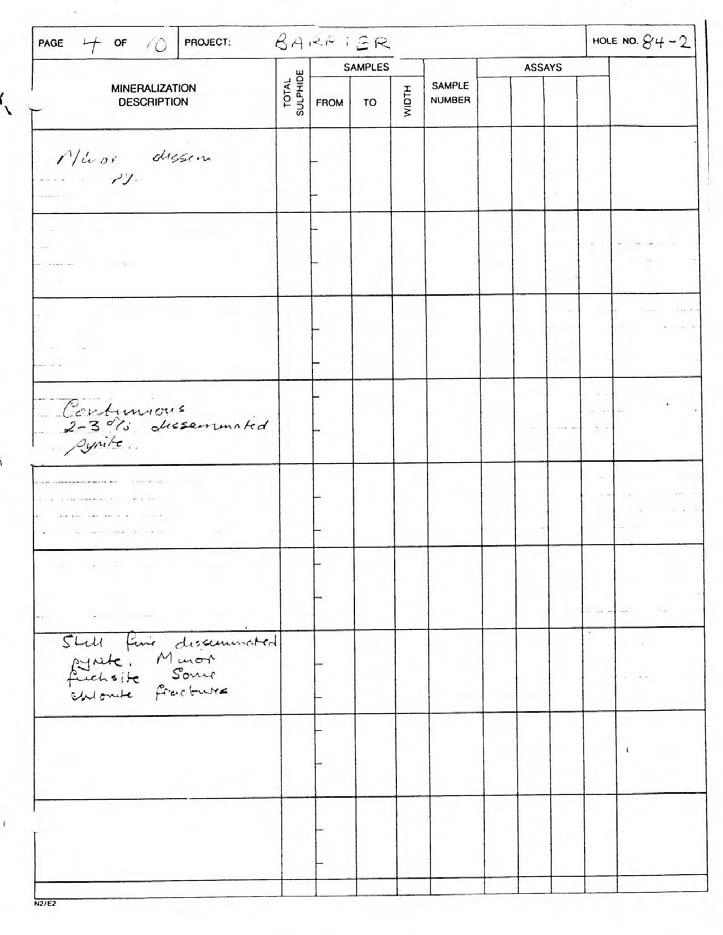
10 Mineralization Significant mineralization within both diamond drill holes takes the form of irregular veins of galena and pyrite. The galena is medium to coarsegrained and associated with equal amounts of pyrite and minor sphalerite. Th e sulphides are associated with quartz and some carbonate or occur as nearly massive aggregates. Mineralization is fairly widespread (see assay data) but most significant concentrations occur in a zone some 8 m in true width, with in wh ich are th e best intersections. Th e mineralization appears to be stra tabound. The economic implications of this mineralization have not yet been determined.
 ~ccommoda tion 18 man days X $40/day Assays (AU, Ag, Cur Pb, Zn, Bat Mo) 32 X $49.")
11 ... Joseph 84 GrouE ITEMIZED COST STATEMENT Salaries District Geologist 9 $274/day Project Geologist 20 $ 215/day Field Assistant 7 104/day Technician 7 198/day Vehicle (fuel, oil, rental) ~ccommoda tion 18 man days X $40/day Assays (AU, Ag, Cur Pb, Zn, Bat Mo) 32 X $49.00 Services D8 Cat (Roadwork) Drilling (DDH's 842, 3) Support Staff, equipment and supplies TOTAL

12 ... STATEMENT OF QUALIFICATIONS I obtained a B.Sc. (Hons) from St. Andrews University, Scotland, in 1968 and an M.Sc. from the University of Manitoba in Since that time I have been employed in Mineral Exploratior: activities in Canada and Australia, for the past twelve years with Esso Resources Canada Limited.

13 APPENDIX A Diamond D r i l l Hole Logs

14 MINERALS SECTION DRILL LOG I

15 PAGE 2 OF,'> PROJECT: /J',~),/J~~ /. c4 7 HOLE NO. glf 2 MINERALIZATION DESCRIPTION W J 0 $ I 0 aj I 2 FROM SAMPLES TO I 3 SAMPLE NUMBER ASSAYS I I qru C L * ~ ~ ~ r * r 4 ~ ~ ~ k d l p4& oac5 LAA bnidt, (ij?3) I I /7.7 6,r l~d~~ff oh < [! pi I I N2lEZ r l I J
16

17

18 PAGE OF /O MINERALIZATION DESCRIPTION. 6/_8"62 0 SOAA~ PROJECT. /.y&c sil3els &ZL39 35% &5 py 4 +GL d c* ihl.=, g 5/, Q,+Jh;k Coy.S&~,u 21Gjo &dh"ec ccleltbh w 72 r , 5 6 &a, 5phd 73 4 "b 5 L.L. w,+ SO J/,, Q&4, 45 w, 303, p ~ & z d qpa+ & 7315 N. 2 Lye qb6lc 5.5&d.Ctot\ &&?A ;6l< ' r?rd +J cow TU~J ydcno di r~s.suuukd u& L ~ p j ' q Xhc~ccoAr/ ftl~tscc~ 4fP 1 $c$;$f: w SAMPLES ASSAYS s$. T I SAMPLE I d d, FROM TO NUMBER I 2 3 c.,, L I I I.:& ('/50s 7, omsn.o, Ll 5 i'd <? L dljz 5.3 a f,z 0.9 Lx , A (':3' 6, , :. / L ' c / I / / OP ~ ~ /, 0,l 3.!(?, ' I ( fip I\;, ' 9,)/ ' L) 32 c "'%*., *.."U,./ /67 73bp ~03.O$ 0.7 I?,?+ ~;rj0,03/.26 ii5!2d.4ri/l~~ 00~4 F.cz~,004,pn7,03 45 f75 i; 25 ;: sc jiy5/? ?,Ye A,, ' 0.02 J,O~ /2 7c D.CZ [Sc 0 z / I 0.5 O 0s 0,mj 6 :I,'.A CIS Q,BC/ 52 C1035 L13 C 03 G,?h, 3.04? z ~ ~ ~ ~ o o z B. o 003 ~ /, / CGC~ o 0&,0.& ~ ~ v c U~L{ 7250 / / :, 1 < : 1 * /,~:,:....+,,,, CJ,ZL;& 0,% ,49 /, 0 17f: &Of.. /7+3t05 4 Y?. 0" & I Q COI O 65 oe@n ~ o Ccj 4 SS o co5 2 IS 000d; 1 p' 0cbi O ~ I Z 5 cci 4. A, ) : ', 2, N2/E2

19

20 ItvtrcnIHL UIL LIIWI I tu MINERALS SECTION DRILL LOG

21

22

23

24
GEOPHYSICAL REPORT CHU CHUA PROJECT Green Mountain Group. KAMLOOPS MINING DIVISION NTS 92P/8E, 82M/5W Lat: 51'24' N Long: 120'00' w
 I GEOPHYSICAL REPORT CHU CHUA PROJECT Green Mountain Group KAMLOOPS MINING DIVISION NTS 92P/8E, 82M/5W Lat: 51'24' N Long: 120'00' w I rvm #.,_..._..._._._.- $...-...! 1 VANCOUVER, B.C. 1 G E 0 I, 0.G
ASSESSMENT REPORT ON THE PEAVINE PROJECT. DGW & Associates # Alberni Street, Vancouver, British Columbia, V6E 4V2
 ASSESSMENT REPORT ON THE PEAVINE PROJECT KAMLOOPS MINING DIVISION BRITISH COLUMBIA NTS 082M 12 Latitude 51 36' 19.0"North -- Longitude --119 47' 27.0"West UTM Zone 11, NAD 83 5720827N 306744E Prepared
CSA Mine Observations Applied to the Development of Regional Exploration Models
 CSA Mine Observations Applied to the Development of Regional Exploration Models 1 Introduction Recent work completed by the geology team has resulted in an improved understanding of the CSA mine system
GEOCHEMICAL REPORT THE 82M/12 FH GROUP BIRCH ISLAND, B.C. S1 119O NOW. ROYAL CANADIAN VENTUR 3S LTD. By: Vollo, P. Eng. N.B. Pay 28th, 1969.
 c GEOCHEMICAL REPORT ON THE 82M/12 FH GROUP AT BIRCH ISLAND, BC S1 119O NOW BY ROYAL CANADIAN VENTUR 3S LTD NB By: Vollo, P Eng Pay 28th, 1969 Approximately 700 samples were collected over 14 miles of
2013 GEOLOGICAL ASSESSMENT REPORT SHERIDAN HILL PROPERTY
 2013 GEOLOGICAL ASSESSMENT REPORT ON THE SHERIDAN HILL PROPERTY NEW WESTMINSTER MINING DIVISION BRITISH COLUMBIA NTS 092G07 49 16 31 NORTH LATITUDE, 122 39 48 WEST LONGITUDE PREPARED FOR Sheridan Hill
cpw 6. E. Spencer Engineering Ltd. HANNA 9 M. C. 104 REP 0 RT DIAMOND DRILLING PROGRAMME LIARD MINING DISTRICT, K.T.S. FOR TAURUS RESOURCES LTD.
 6. E. Spencer Engineering Ltd. LlJ REP 0 RT ON DAMOND DRLLNG PROGRAMME cpw HANNA 9 M. C. LARD MNNG DSTRCT, K.T.S. 104 P@g FOR TAURUS RESOURCES LTD. BY B. E. SPENCER, P. ENG. B. E. SPENCER ENGNEERNG LTD.
COMINCO LTD. HORIZONTAL LOOP EM AND MAGNETIC SURVEYS ON SHA. CLAIMS 1, 2, 7 and 8 NELSON AND FORT STEELE MINING DIVISIONS, B.C.
 COMINCO LTD. EXPLORATION WESTERN DISTRICT NTS: 82-F/1 HORIZONTAL LOOP EM AND MAGNETIC SURVEYS ON SHA CLAIMS 1, 2, 7 and 8 - ASSESSMENT REPORT - NELSON AND FORT STEELE MINING DIVISIONS, B.C. Latitude Longitude
Gold Mountain Group Gold Mtn. A, B, C & D Mineral Claims Record Nos. 697, 698, 699 & 700. Island Mountain Cariboo Mining Division British Columbia
 GOLD POINT RESOURCES LTD. Geophysical Survey Gold Mountain Group Gold Mtn. A, B, C & D Mineral Claims Record Nos. 697, 698, 699 & 700 Island Mountain Cariboo Mining Division British Columbia Vancouver,
for the Greenwood Mining Division, B.C. NTS 82E/7W Latitude 49' 27' W, Longitude 118' 5 Prepared by a= D. Dylan Watt, B.Sc.
 t. b LOGnO: 37~ -08 m. ACTIO#: for the AMP AMP 2 AMP 3 t AMP 4 CLAIMS Greenwood Mining Division, B.C. NTS 82E/7W Latitude 49' 27' W, Longitude 8' 5 %E c,w zc *& a w Prepared by a= -4c. D. Dylan Watt, B.Sc.
Reconnaissance. Of the. Denis mineral claims. Situated at Kilometer 844 of the Alaska Highway. Liard Mining Division. Northeastern British Columbia
 Reconnaissance Of the Denis mineral claims Situated at Kilometer 844 of the Alaska Highway Liard Mining Division Northeastern British Columbia N.T.S. 94M.075 Latitude 59 42 25 Longitude 127 13 12 Field
49" 3-4 I4 I \ Y 59 tj
 ASSESSMENT REPORT Mary 4 FORT STEELE M.D. NTS 82G/5W 49" 3-4 4 \ Y 59 tj Owner: St. Eugene Mining Corporation Limited Operator : St. Eugene Mining Corporation Limited Author: John R. Wilson Date Submitted:
PHYSICAL WORK REPORT. the BAY CLAIMS. Omineca Mining Division Smithers, British Columbia N.T.S. 93E 13E/W
 PHYSICAL WORK REPORT the BAY CLAIMS Omineca Mining Division Smithers, British Columbia a N.T.S. 93E 13E/W LATITUDE: 53 57 00 N I LONGITUDE: 127 45 OO W for Home Ventures Ltd. 1201-675 West Hastings Street
on the Diamond Drilling done on the LAKESIOE GROUP of Mineral Claims SLOCAN MINING DIVISION 82-F-14-W Long ' Lat '
 Assessment Work Report on the Diamond Drilling done on the LAKESIOE GROUP of Mineral Claims SLOCAN MINING DIVISION 82-F-14-W Long 117 22' Lat. 49 58' ADRIAN KESLER SILVERTON, B.C. operator LEVON RESOURCES
TABLE OF CONTENTS APPENDICES SUMMARY DRILL LOG STATEMENT OF QUALIFICATION STATEMENT OF EXPENDITURES LIST OF FIGURES
 ASSESSMENT WORK REPORT DIAMOND DRILLING PROGRAM AUGUST AND SEPTEMBER, 1980 ON CLAIMS Molly Tom 1-4 and 8 Omineca Mining Division NTS 93M/llU 55'35'N, 127"29'W by David A. Bending Owner: Operator: Texasgulf
Copper Reef to Drill Massive Sulphide Targets in Flin Flon
 12 Mitchell Road Tel: (204) 687-3500 Flin Flon, MB, R8A 1N1 CZC.CSE Fax: (204) 687-4762 copperreef.com February 28, 2019. Copper Reef to Drill Massive Sulphide Targets in Flin Flon Copper Reef Mining Corporation
PROSPECTORS ASSISTANCE PROGRAM MINISTRY OF ENERGY AND MINES
 BRITISH COLUMBIA PROSPECTORS ASSISTANCE PROGRAM MINISTRY OF ENERGY AND MINES GEOLOGICAL SURVEY BRANCH PROGRAM YEAR: 1999/2000 REPORT #: PAP 99-l 6 NAME: KIM ANSCHETZ PROSPECTORS TlEPORT on the 99 LOUIS
Advancing High Grade Gold Assets in Red Lake, Ontario
 Advancing High Grade Gold Assets in Red Lake, Ontario Forward Looking Statement Except for historical information contained herein, this presentation may contain forward-looking statements including but
GEOLOGICAL SURVEY BRANCH ASSESSMENT REPORT
 GEOLOGICAL SURVEY BRANCH ASSESSMENT REPORTS DATE RECEIVED NOV 1 3 1996 ASSESSMENT REPORT -. on LINE CUTTING and DIAMOND DRILLING ABITIBI MINING CORPORATION BARR PROPERTY Palmer Bar Creek Area Fort Steele
CARIBOO - GRIZZLY ZINC PROJECT
 CARIBOO - GRIZZLY ZINC PROJECT The Grizzly Lake or Cariboo Zinc property straddles the gravel Weldwood 8400 logging road in the Grizzly Lake area about 55 kilometres northeast of Likely. Roads constructed
GRANGES EXPLORATION AB CANADIAN DIVISION
 GRANGES EXPLORATON AB CANADAN DVSON GEOCHEMCAL REPORT ON "B" and "D" CLAMS OMNECA MNNG DEVSON FAWNE NOSE AREA LATTUDE: 53O 19' LONGTUDE: 125O 1' MNERAL RESOURCES BRANCH N.T.S 93F/6 E Owner and Operator
GEOLOGICAL MAPPING OF SKARNS ON THE SHEEP AND EWE CLAIMS, TURNAGAIN RIVER, B.C. DURING THE 1979 SUMMER SEASON
 GEOLOGICAL MAPPING OF SKARNS ON THE SHEEP AND EWE CLAIMS, TURNAGAIN RIVER, B.C. DURING THE 1979 SUMMER SEASON CLAIMS: Sheep 1 to 4 Ewe 1, 3, 4 to 8 Lamb 12 Fraction Liard Mining Division, B.C. NTS 104
ASSESSMENT REPORT TITLE PAGE AND SUMMARY
 ASSESSMENT REPORT TITLE PAGE AND SUMMARY TITLE OF REPORT: 2016 Prospecting Report Sphynx Claim TOTAL COST: $167.56 AUTHOR(S): Giacomo Grassi SIGNATURE(S): NOTICE OF WORK PERMIT NUMBER(S)/DATE(S): STATEMENT
PROSPECTING REPORT. Medallion Property. EVENT # TENURE # Tenure Name: GPEX CLVIII Medallion
 2006-2007 PROSPECTING REPORT Medallion Property EVENT # 4167980 TENURE # 540362 Tenure Name: GPEX CLVIII Medallion Watson Bar Region Clinton Mining Division Map 092O Central Coordinate Reference Long.
ASX Announcement. 28 January Drill results indicate large Porphyry Copper Gold System at Peenam
 ASX Announcement 28 January 2010 Drill results indicate large Porphyry Copper Gold System at Peenam Highlights: 270 metres of visible copper (gold) mineralisation in first diamond core hole at Peenam Prospect
7 miles West of Kamloops, B.C.
 MINERAL RESOURCES BRANCH ASSEWAENT RiPORT of hole # 78-11 NO. drilled on the ZZ # 18 Claim of China Commercial Corporation Ltd situated 7 miles West of Kamloops, B.C. in the Kamloops Mining Division D.R.
RECONNAISSANCE GEOCHEMICAL SURVEY
 RECONNAISSANCE GEOCHEMICAL SURVEY LEGAL, RITA, LOUISE FR. (CHAPLEAU GROUP) REVERTED CROWN GRANTS CHAPLEAU CREEK AREAJ, SLOC& MINING DIVISION 82 F/11W Lat: 49'44" Long: 117"22'W MINERAL RESOURCES BRANCH
EXPLORATION & DEVELOPMENT
 EXPLORATION & DEVELOPMENT ZINC LEAD SILVER GOLD COPPER PRAIRIE CREEK MINE PERMITTING COMPLETED PRAIRIE CREEK MINE, NORTHWEST TERRITORIES NEWFOUNDLAND PROJECTS www.canadianzinc.com invest@canadianzinc.com
SUPPLEMENT TO MAGNETOMETER 6 ELECTROMAGNETIC SURVEY REPORT. DATED NOVEMBER l, 1973 CIGLEN INVESTMENTS LIMITED CLAIMS GROUP BAD VERMILLION LAKE AREA
 ^ A R l ^ 1974 010 PROJECTS UNIT SUPPLEMENT TO MAGNETOMETER 6 ELECTROMAGNETIC SURVEY REPORT DATED NOVEMBER l, 1973 CIGLEN INVESTMENTS LIMITED CLAIMS GROUP BAD VERMILLION LAKE AREA DISTRICT OF RAINY RIVER
GEOPHYSICAL REPORT. Airborne Magnetometer Survey. of the SHEEP-GOAT GROUP OF MINERAL CLAIMS. near Li l looet, B.C.
 GEOPHYSICAL REPORT 977 Airborne Magnetometer Survey of the SHEEP-GOAT GROUP OF MINERAL CLAIMS near Li l looet, B.C. Lillooet Mining Division (Lat.51 'lot Long. 122 40' 7 5t0[2L05E. for DUFFEY LAKES MINES
REPORT ON GEOPHYSICAL SURVEYS. ASTA AND RITA CLAIMS Nanaimo Mining District NTS 92L1 Latitude 58' 08'N Longitude 126O 12'W for FALCONBRIDGE LTD.
 REPORT ON GEOPHYSICAL SURVEYS ASTA AND RITA CLAIMS Nanaimo Mining District NTS 92L1 Latitude 58' 08'N Longitude 126O 12'W for FALCONBRIDGE LTD. Vancouver, B. C. November, 1 984 J. L. Lebel, P. Eng. MPH
for the Greenwood Mining Division, B.C. NTS 82E/7W 29' W, Longitude 118' 53' N Prepared by D. Dylan Watt, B.Sc.
 for the FltE NO: u VOLT 1, VOLT 2, VOLT 3, & VOLT 4 CLAIMS Greenwood Mining Division, B.C. NTS 82E/7W Latitude 49' 29' W, Longitude 118' 53' N Prepared by D. Dylan Watt, B.Sc. #309-1996 Trutch Street Vancouver,
VANCOUVER, B.C. Tri 082F/ F/059
 GEOCHEMCAL REPORT t MAY L, 2006 Whbpper Mineral Claims Ailsa Lake Area Gold comm~ss16fl8f"s Offim on Mining Division VANCOUVER, B.C. Tri 082F/058 082F/059 3792 E 5486438 N Operator Kootenay Gold nc. Suite
GEOLOGICAL MAPPING REPORT ON THE ASH MINERAL CLAIM OSOYOOS MINING DIVISION ASHNOLA RIVER MAP SHEET NTS M092,H019 MCBRIDE CREEK AREA, ASHNOLA RIVER,
 GEOLOGICAL MAPPING REPORT ON THE ASH MINERAL CLAIM OSOYOOS MINING DIVISION ASHNOLA RIVER MAP SHEET NTS M092,H019 LATITUDE 49 o O6, LONGITUDE 120 o 22 MCBRIDE CREEK AREA, ASHNOLA RIVER, KEREMEOS, B.C. CANADA
ASSESSMENT REPORT TITLE PAGE AND SUMMARY
 ASSESSMENT REPORT TITLE PAGE AND SUMMARY TITLE OF REPORT: 2016 Prospecting Report Mystery Beryl TOTAL COST: $1299.09 AUTHOR(S): Giacomo Grassi SIGNATURE(S): NOTICE OF WORK PERMIT NUMBER(S)/DATE(S): STATEMENT
PRECIOUS METALS. owner. JMT Services Corp. GEOCHPlICAL SAMPLING CHELASLIE WCE, NORTH CENTRAL, B.C. OMINECA MINING DIVISION NTS 93F/5E & 6W
 PRECIOUS METALS REPORT ON 1980 RECONNAISSANCE GEOCHPlICAL SAMPLING CHELASLIE WCE, NORTH CENTRAL, B.C. OMINECA MINING DIVISION NTS 93F/5E & 6W LATITUDE 53O28 N LONGITUDE 125O31 W DATES Qp WORK: JULY 10
Lat. 52' 43' N Long ' W
 &A exploration ltd MINING ENGINEERING GEOLOGY- GEOPHYSICS 4570 HOSKINS ROAD, NORTH VANCOUVER, 6. C. TELEPHONE (804) 985,7921 V7K 2R1 GEOLOGICAL AND GEOCHEMICAL REPORT on the BLUE CLAIMS Cariboo Mining
VLF and GRADIOMETER SURVEY OVER THE CAT GROUP, INVERMERE AREA GOLDEN MINING DIVISION, BRITISH COLUMBIA NTS 82K/O8W LAT/LONG 50 29' ' FOR
 VLF and GRADIOMETER SURVEY OVER THE CAT GROUP, INVERMERE AREA GOLDEN MINING DIVISION, BRITISH COLUMBIA NTS 82K/O8W LAT/LONG 50 29' - 116 15' FOR W. POCHYLKO STETTLER, ALBERTA BY T.R.B. DUNDAS ISOGEOS EXPLORATION
PROSPECTING REPORT. Broken Hill Property. EVENT # TENURE # Tenure Name: Broken Hill. New Westminster Mining Division Map 092H
 2009-2010 PROSPECTING REPORT Broken Hill Property EVENT # 4514071 TENURE # 600988 Tenure Name: Broken Hill New Westminster Mining Division Map 092H Central Coordinate Reference 121 24 26.2 W Longitude
NEW COBAR-STYLE COPPER DISCOVERY IN NSW
 ASX / MEDIA RELEASE 2 AUGUST 2011 NEW COBAR-STYLE COPPER DISCOVERY IN NSW Broad zone of copper-polymetallic mineralisation intersected at 4-Mile prospect Highlights: Wide zone of copper-silver-gold-lead-zinc
51 46'N Latitude, 119'44'1;!
 COMI)!CO LTD. EXPLORATION NTS: 82 1'1/13E GEOCHEKICAL ASSESSMENT REPORT ON THE SI 1 MINERAL CLAIM in the Kamloops Mining Division 51 46'N Latitude, 119'44'1;! Longitude Work Period: June 25, 1979 - July
The Cobalt Rainbow. Airborne geophysical maps show that a north trending aeromagnetic high suggests further undiscovered mineralisation.
 The Cobalt Rainbow The property is located on Greenstone Creek, approximately 4.8 kilometres south west of the creek mouth. The property is located about 24 km due west of Campbell River, in the east-central
First Drill Hole Completed at Bluebush Zinc Project
 11 September 2017 Highlights First Drill Hole Completed at Bluebush Zinc Project The first drill hole (BB01-17) on the Bluebush Zinc Project has been completed at 431.9m Rocks prospective for SEDEX style
Serengeti Resources Inc GEOCHEMICAL REPORT ON THE SHADOW PROPERTY a.
 Serengeti Resources Inc. 2004 GEOCHEMICAL REPORT ON THE SHADOW PROPERTY a. Located in the Johanson Lake Area Omenica Mining Division NTS 94D/9 6 degrees and 32 minutes North Latitude 126 degrees and 2
The MAPLE BAY PROJECT Copper Silver - Gold
 The MAPLE BAY PROJECT Copper Silver - Gold Good grade and tonnage potential within close proximity to Tidewater The Maple Bay Copper Silver Gold Project covers highly favourable geological host rocks of
NTS 93L/9W GEOCHEMICAL AND GEOPHYSICAL REPORT MONA CLAIM OMINICA MINING DIVISION. Lati tude 54036'N; Longitude 'W
 GEOCHEMICAL AND GEOPHYSICAL REPORT ON MONA CLAIM OMINICA MINING DIVISION Lati tude 54036'N; Longitude 126018'W NTS 93L/9W April 1981 Paul Plicka Consulting Geologist LOCATION MAP INTRODUCTION TABLE OF
Queenston intersects Contact Zone on the Pandora Property and new gold zones in Kirkland Lake
 1 Queenston intersects Contact Zone on the Pandora Property and new gold zones in Kirkland Lake TORONTO, Ontario, March 7, 2003. Queenston Mining Inc. (QMI-TSX) reports diamond drill results on its 100%
SOIL GEOCHEMISTRY ENTERPRISE MINE NTS 82 F/14 W ARCTEX ENGINEERING SERVICES CONSULTANT, OWNER, OPERATOR, AUTHOR JANUARY, 1.981
 SOIL GEOCHEMISTRY ENTERPRISE MINE t SLOCAN MINING DIVISION, Bn C, NTS 82 F/14 W LATITUDE 49'49') LONGITUDE 1'19' ARCTEX ENGINEERING SERVICES I L, B, GOLDSMITH, PiENG, CONSULTANT, OWNER, OPERATOR, AUTHOR
Summary of Rover Metals Geologic Mapping Program at the Up Town Gold Project, Northwest Territories
 October 13, 2017 Summary of Rover Metals Geologic Mapping Program at the Up Town Gold Project, Northwest Territories Vancouver, British Columbia, Canada - Rover Metals Corp., Rover, is pleased to provide
GEOCSZNICAL - SURVEY. ICAMLOOPS Kl.D. 2'' 6;kr. HY "'f. Alfred R. Allen,P.Eng. 1 NO.%=...,... 6"- 'I.
 t i.i GEOCSZNICAL - SURVEY i p' ICAMLOOPS Kl.D. 2'' 6;kr HY 50-64 +."'f 121-51 NE 5-10-70 : 19-10-70 Alfred R. Allen,P.Eng. I) ' 1 6"- 'I. 1 NO.%=...,..... Q.C. EXPLORATIONS LTD. 2Cl- 535 Kowe Street Vancouver
41,a* h0.iiii*bll*i2l,i DEADWOOD CREEK. for. James R. on the BOMBINI GROUP OF CLAIMS. GREENWOOD, British Columbia. Lat. 49'07' Long. 118'43 f.
 GEOLOGCAL REPORT on the BOMBN GROUP OF CLAMS DEADWOOD CREEK GREENWOOD, British Columbia Lat. 49'07' Long. 118'43 f in the GREENWOOD MNNG DVSON for FURY EXPLORATONS LTD. (N. P. L. ) Vancouver, B. C. December
TYPE OF WORK IN THIS REPORT EXTENT OF WORK (IN METRIC UNITS) APPORTIONED (incl. support) GEOLOGICAL (scale, area) Photo interpretation
 APPORTIONED (incl. support) GEOLOGICAL (scale, area) Photo interpretation") TYPE OF WORK IN THIS REPORT EXTENT OF WORK (IN METRIC UNITS) ON WHICH CLAIMS PROJECT COSTS APPORTIONED (incl. support) GEOLOGICAL (scale, area) Ground, mapping 1:10000, 570ha 949889, 929017, 844686 8970.59
TYPE OF WORK IN THIS REPORT EXTENT OF WORK (IN METRIC UNITS) ON WHICH CLAIMS PROJECT COSTS APPORTIONED (incl. support) GEOLOGICAL (scale, area) Ground, mapping 1:10000, 570ha 949889, 929017, 844686 8970.59
Carrapateena Mineral Resources Explanatory Notes April OZ Minerals Limited. Carrapateena Mineral Resources Statement April
 OZ Minerals Limited Carrapateena Mineral Resources Statement April 14 2011 CARRAPATEENA MINERAL RESOURCE STATEMENT April 14, 2011 The Carrapateena Resource Statement relates to an upgrading to an Inferred
t+o...&zz!. ASSESSMENT REPORT Department of Miner and Petroleum Resources MAP.,- INDUCED POLAKIZATION SURVEY OVER THE BROOKS PROSPECT
 5873 INDUCED POLAKIZATION SURVEY OVER THE BROOKS PROSPECT BROOKS PENINSULA AREA VANCOUVER ISLAND, B.C. NANAIMO AND ALBERNI MINING DIVISIONS BY Z. B. DOBORZYNSKI JANUARY, 1976 Department of Miner and Petroleum
GRISWOLD CREEK, B.C. 6 " GEOCHJ3lICAL REPORT
 GRISWOLD CREEK, B.C. 6 " GEOCHJ3lICAL REPORT AUTROR: W. Meyer, BSc. ENDORSED El!: John De Leen, BASc.* NASc., E.M., P. Eng. No. 3675 Vancouver, B.C. January 22nd, 1965. -I- During the period of July 27th
DIAMOND DRILL REPORT ON THE LOCATED IN THE OMINECA MINING DIVISION FAWNIE NOSE AREA LATITUDE: 53O 17' LONGITUDE: 125O 10' NTS 93F 6E
 GRANGES EXPLORATION AB CANADIAN DIVISION DIAMOND DRILL REPORT ON THE G, H and I CLAIM BLOCKS LOCATED IN THE OMINECA MINING DIVISION FAWNIE NOSE AREA LATITUDE: 53O 17' LONGITUDE: 125O 10' NTS 93F 6E. -.
CONSULTING GEOLOGICAL 8: MINING ENGINEERS STINGS STREET DA V6E 2E9 GEOPHYSICAL SURVEY SILVER QUEEN 2 ZEBALLOS AREA. B.C.
 DOLMAGE CAMPBELL & ASSOCIATES (1 975) LTD. CONSULTING GEOLOGICAL 8: MINING ENGINEERS STINGS STREET DA V6E 2E9 '' 1E O L 0 G I C A.L B'x;&a:f2:#& 'SESSMENT REPObT 12, Assessment RESOURCES LTD. 111 ReDort
Geo chemi c a1 Rep or t SILVER KING FAST GROUP. H. S. Lazenby Geologist. Vancouver, B.C. 16 November 1967
 Geo chemi c a1 Rep or t on SILVER KING FAST GROUP 1967 Vancouver, B.C. 16 November 1967 H. S. Lazenby Geologist Contents Introduction P. 1 Method of Survey P. 1 Interpretation of Results p. L&2 Statement
Golden Cross Resources
 Golden Cross Resources Labrador Uranium Joint Venture with Altius Resources Update - November 2007 Labrador Uranium - Canada LABRADOR URANIUM PROPERTIES Golden Cross Resources signed an agreement with
Geochemical Assessment Report. on the. Situated Nineteen Kilometres rth-northeast of Hope, B. C. in the. New Westminster Mining Division
 7 I Geochemical Assessment Report r on the r- I 1 Norm 1 to Norm 4 Mineral Claims c - I - 7 Situated Nineteen Kilometres rth-northeast of Hope, B. C. in the New Westminster Mining Division itude 49*32'N.,
R.A. COMINCO LTD. EXPLORATION NTS: 92H/16. WESTERN DISTRICT January 6, 1982 ASSESSMENT REPORT 1981 SOIL GEOCHEMISTRY ON THE TROUT PROPERTY
 COMINCO LTD. EXPLORATION NTS: 92H/16 WESTERN DISTRICT January 6, 1982 ASSESSMENT REPORT 1981 SOIL GEOCHEMISTRY ON THE TROUT PROPERTY (Trout 1 and 6 Claims) SIWASH LAKE AREA, SIMILKAMEEN M.D., B.C. (Work
AND HORSEFLY PROSPECTS, N.W. BRITISH COLUMBIA NTS, 103H/ll, 14 FOR ATNA RESOURCES LTD DELTA GEOSCIENCE LTD
 AND HORSEFLY PROSPECTS, N.W. BRITISH COLUMBIA NTS, 103H/ll, 14 FOR ATNA RESOURCES LTD BY DELTA GEOSCIENCE LTD FE T A. HENDRICKSON, P.GEO. 1 . TABLE OF CONTENTS Introduction............. Page 1. Personnel..........
ASSESSMENT REPORT TITLE PAGE AND SUMMARY
 ASSESSMENT REPORT TITLE PAGE AND SUMMARY TITLE OF REPORT: 2016 Prospecting Report Midas Claim TOTAL COST: $314.61 AUTHOR(S): Giacomo Grassi SIGNATURE(S): NOTICE OF WORK PERMIT NUMBER(S)/DATE(S): STATEMENT
A PRELIMINARY REPORT ON THE ZYMOST2 CLAIM GROtP, TERRACE, B.C.
 NATIVE EXPLORATIONS LTD. A PRELIMINARY REPORT ON THE ZYMOST2 CLAIM GROtP, TERRACE, B.C. INTRODUCTION': The Zymoetz claim group is, at present, held under option by Native Explorations Ltd.. On the 19th
DÉCOUVERTE Positioned for Discovery in James Bay, Quebec. Investor Presentation, January 2018 by Danae Voormeij, MSc, PGeo
 DÉCOUVERTE Positioned for Discovery in James Bay, Quebec Investor Presentation, January 2018 by Danae Voormeij, MSc, PGeo Location Maps and Infrastructure Location: Durango Resources 100% owned Découverte
4J)SESSMEN'I' REPORT BRANCH. cc" FILE No: ASSESSMENT REPORT VICTORIA MINING DIVISION. Latitude 123O SF' Longitude 48O S5'
SESSMEN'I' REPORT BRANCH. cc FILE No: ASSESSMENT REPORT VICTORIA MINING DIVISION. Latitude 123O SF' Longitude 48O S5'") ASSESSMENT REPORT - ON THE ORM 1 MINERAL CLAIM VICTORIA MINING DIVISION NTS 92B cc" Latitude 123O SF' Longitude 48O S5' 3-2. w N C FILE No: @&@LOGI.CAL BRANCH 4J)SESSMEN'I' REPORT Date : June 1, 1990 TABLE
ASSESSMENT REPORT - ON THE ORM 1 MINERAL CLAIM VICTORIA MINING DIVISION NTS 92B cc" Latitude 123O SF' Longitude 48O S5' 3-2. w N C FILE No: @&@LOGI.CAL BRANCH 4J)SESSMEN'I' REPORT Date : June 1, 1990 TABLE
The Cerattepe Massive Sulphide Property, Northeastern Turkey
 Integrated Exploration Case Histories Paper 139 Explor97 Master Page Explor97 Contents Previous Paper G O T O Author Index Section Contents The Cerattepe Massive Sulphide Property, Northeastern Turkey
OSOYOOS UINING DIVISION. 49% - 20' North Latitude 120% - 05' West Longitude. GOOD HOPE RESOURCES LTD West Hastings Street Vancouver, B. C.
 REPORT ON HORSEFLY PROPERTY DIAMOND DRILLING - 1982 OSOYOOS UINING DIVISION 49% - 20' North Latitude 120% - 05' West Longitude 9 x It/YG FOR GOOD HOPE RESOURCES LTD. 1518-1177 West Hastings Street Vancouver,
Elephant Mountain, Alaska Intrusive Related Gold Project July Option to Earn 100%
 Elephant Mountain, Alaska Intrusive Related Gold Project July 2018 Option to Earn 100% CORPORATE Corporate DISCLOSURE Disclosure The information contained herein, while obtained from sources which we believe
Work performed between August 1 and December 1, 1975 COMINCO LTD. WESTERN DISTRICT NTS 93 '(~15 EXPLORATION GEOCHEMICAL SURVEY THE CRY AND CAB CLAIMS
 COMINCO LTD. EXPLORATION WESTERN DISTRICT NTS 93 '(~15 GEOCHEMICAL SURVEY ON THE CRY AND CAB CLAIMS CRIN PROPERTY Work performed between August 1 and December 1, 1975 NICHOLAS L. SZABO TABLE OF CONTENTS
UNION MINIERE EXPLORATIONS AND MINING CORPORATION LIMITED ASSESSMENT REPORT ON FITINAT MINERAL CLAIM. Alberni Mining Division Record No.
 M F )( UNION MINIERE EXPLORATIONS AND MINING CORPORATION LIMITED Suite 200, 4299 Canada Way, Burnaby, B.C. V5G 1 H4 Telephone (604) 437-9491 ASSESSMENT REPORT ON GEOCHEMICAL SOIL SURVEYS AND ROCKSAMPLING
CERRO PRIETO PROJECT MINERAL CONCESSIONS LOCATION AND ACCESS
 Cerro Prieto CERRO PRIETO PROJECT MINERAL CONCESSIONS The Cerro Prieto Project is comprised of three mining exploitation concessions encompassing 2,723 hectares in northern Sonora, Mexico. Oroco holds
NEWS RELEASE Ocean Park Ventures Identifies Large Multi-Structure Sulfide Mineralized System Trapper Gold Project, British Columbia
 Suite 302 750 West Pender St Vancouver, BC V6C 2T7 Tel: 604-681-0084 Fax: 604-681-0094 www.oceanparkventures.com TSX-V SYMBOL: OCP NEWS RELEASE Ocean Park Ventures Identifies Large Multi-Structure Sulfide
ASX / MEDIA RELEASE 6 MAY MILE SILVER-LEAD-ZINC DISCOVERY; HIGH GRADE SILVER-GOLD IN ROCK CHIPS AT RUBY SILVER
 ASX / MEDIA RELEASE 6 MAY 2011 4-MILE SILVER-LEAD-ZINC DISCOVERY; HIGH GRADE SILVER-GOLD IN ROCK CHIPS AT RUBY SILVER Highlights: Silver-lead-zinc discovery at 4-Mile; mineralisation intersected in all
490 20' 30" North Latitude ' 30" West Longitude
 _._.. I CONSULTING GEOLOGISTS 605-602 WEST HASTINGS STREET, VANCOUVER, B.C. V6B 1P2 TELEPHONE: (604) 689-5533 6 I F: ASSESSMENT REPORT ON THE PATSY 1 MINERAL CLAIM ' '?%2% I WHISTLE CREEK, HEDLEY ARE L-l-
OYUT ULAAN COPPER GOLD PROJECT RECONNAISSANCE DRILLING RESULTS
 ASX / MEDIA RELEASE Manager Company Announcements By Electronic Lodgement 7 pages Company Announcements Office 6 June 2013 Australian Securities Exchange 4th Floor, 20 Bridge Street SYDNEY NSW 2001 OYUT
GEOLOGICAL BRANCH ASSESSMENT REPORT 12. FItE NO: ACTION: THE GOLDEN MINING DIVISION, GOLDEN, Including THE NTS MAP; M82K/15W
 ACTION: FItE NO: Including 1990 GEO-CHEM SURVEY RESULTS -- THE AVD CLAIMS - THE GOLDEN MINING DIVISION, GOLDEN, B.C. NTS MAP; M82K/15W Lat. 50 deg. 55 Min. Long 116 deg. 55 min. For GEOLOGICAL BRANCH ASSESSMENT
NEWS RELEASE CANADIAN ZINC REPORTS REMAINING DRILL RESULTS AT LEMARCHANT DEPOSIT, SOUTH TALLY POND PROJECT, NEWFOUNDLAND
 NEWS RELEASE CZN-TSX CZICF-OTCQB FOR IMMEDIATE RELEASE March 5, 2018 CANADIAN ZINC REPORTS REMAINING DRILL RESULTS AT LEMARCHANT DEPOSIT, SOUTH TALLY POND PROJECT, NEWFOUNDLAND 2017 drill program successfully
zccaw- d 4, I SUB- RECORDER 1 GEOLOGICAL IBIRANC)~ SEP ASSESSMENT REPORT FRENO: ACTION: 2[-;tc,u,eAAA RECEIVED M.R.#... $... VANCOUVER, B.C.
~ SEP ASSESSMENT REPORT FRENO: ACTION: 2[-;tc,u,eAAA RECEIVED M.R.#... $... VANCOUVER, B.C.") c ON THE LOGMI: /+dq(. m. BONBON MINERAL CLAIM ' ACTION: 2[-;tc,u,eAAA -- FRENO: h zccaw- d 4, FOR LUCIA SPECOGNA I SUB- RECORDER 1 RECEIVED SEP 25 1990 M.R.#... $... VANCOUVER, B.C. i BY MARINO SPECOGNA
c ON THE LOGMI: /+dq(. m. BONBON MINERAL CLAIM ' ACTION: 2[-;tc,u,eAAA -- FRENO: h zccaw- d 4, FOR LUCIA SPECOGNA I SUB- RECORDER 1 RECEIVED SEP 25 1990 M.R.#... $... VANCOUVER, B.C. i BY MARINO SPECOGNA
ASSESSMENT REPORT N 0. REPORT ON HORIZONTAL COPLANAR LOOP ELECTROMAGNETIC SURVEY HOUSTON AREA OF BRITISH COLUMBIA AQUITAINE COMPANY OF CANADA DURING
 tf 62 33 REPORT ON HORIZONTAL COPLANAR LOOP ELECTROMAGNETIC SURVEY IN THE HOUSTON AREA OF BRITISH COLUMBIA BY AQUITAINE COMPANY OF CANADA c DURING MARCH 21 - MARCH 25, 1977 MINERAL RESOURCES BRANCH ASSESSMENT
RE~ORT ON. J.F.V. MILLAR, P. Eng. GEOCHEMICAL SURVEY TIMBASKET AND MOGUL MINERAL CLAIMS. Kinbasket Lake, B. C. 51 degrees 118 degrees N.E.
 RE~ORT ON GEOCHEMICAL SURVEY TIMBASKET AND MOGUL MINERAL CLAIMS Kinbasket Lake, B. C. 51 degrees 118 degrees N.E. J.F.V. MILLAR, P. Eng. Lease held by J.F.V. MILLAR Work done Sept. 22 - Oct. 3, 1967. REPORT
BALFOUR MINING LTD. (N.P.L.) HAM GROUP 92-P-6, CLINTON M. D.8 B. C. Lat 51 17'N, GEOCHEMICAL REPORT. V. CUKOR, P. Eng.
 HAM GROUP 92-P-6, CLINTON M. D.8 B. C. Lat 51 17'N, GEOCHEMICAL REPORT. V. CUKOR, P. Eng.") 34q '7 BALFOUR MINING LTD. (N.P.L.) HAM GROUP 92-P-6, CLINTON M. D.8 B. C. Lat 51 17'N, Long 12lo14'W GEOCHEMICAL REPORT, V. CUKOR, P. Eng. January 31, 1972 TABLE OF CONTENTS 1. INTRODUCTION 2. PROPERTY,
34q '7 BALFOUR MINING LTD. (N.P.L.) HAM GROUP 92-P-6, CLINTON M. D.8 B. C. Lat 51 17'N, Long 12lo14'W GEOCHEMICAL REPORT, V. CUKOR, P. Eng. January 31, 1972 TABLE OF CONTENTS 1. INTRODUCTION 2. PROPERTY,
1 i I.; :<7 6EOLOGICAL BRANCH ASSESSMENT REPORT HLEM, VLF-EM AND MAGNETOMETER TEST SURVEY ON THE ARC PROPERTY FOR SURVEY BY SJ GEOPHYSICS LTD.
 f - ~ --- j LOG NO: MAR 2 a 1992,,, -- - - - -- L$TiC'P;: I.; 1 i HLEM, VLF-EM AND MAGNETOMETER TEST SURVEY ON THE ARC PROPERTY FOR SURVEY BY SJ GEOPHYSICS LTD. SLOCAN M.D., B.C. N.T.S. 88 F/10 d 2- :
Namex Explorations Inc. Report on Drill Holes PC & PC Post Creek Property Claim S.l , Norman Township Sudbury Mining District
 . 368 4: Namex Explorations nc. Report on Drill Holes PC - 12-06 & PC -- 13-06 Post Creek Property Claim S.l 094826, Norman Township Sudbury Mining District RECEVED DEC 1 0 =:~7 ntroduction GEOSCENCf ASSESSMENT
GEOPHYSICAL ASSESSMENT REPORT (TOP & BOTTOM CLAIMS) MCINTYRE LAKE. VERNON MINING DIVISION, B-Cm
 MCINTYRE LAKE. VERNON MINING DIVISION, B-Cm") GEOPHYSICAL ASSESSMENT REPORT on the TOP PROPERTY (TOP & BOTTOM CLAIMS) MCINTYRE LAKE VERNON MINING DIVISION, B-Cm NTS : Latitude: 50'04' North Longitude: Owner: Consultant : Author : 118'33 ' West Brican
GEOPHYSICAL ASSESSMENT REPORT on the TOP PROPERTY (TOP & BOTTOM CLAIMS) MCINTYRE LAKE VERNON MINING DIVISION, B-Cm NTS : Latitude: 50'04' North Longitude: Owner: Consultant : Author : 118'33 ' West Brican
GEOPHYSICAL REPORT ON A VLF-EM SURVEY OVER THE BOSS 1 AND 2 CLAIMS HEDLEY AREA SIMILKAMEEN MINING DIVISION BRITISH COLUMBIA
 GEOPHYSICAL REPORT i ON A VLF-EM SURVEY OVER THE BOSS 1 AND 2 CLAIMS HEDLEY AREA SIMILKAMEEN MINING DIVISION BRITISH COLUMBIA PROPERTY SURVEYED BY : 11.0 h S60W of Bedley : 49' 120O SE : N.T.S. 92~18~
Rail Lake Copper Property (WB Claims) G.M. Depaoli, B.Sc. Geophysicist J.F. ALl.an, P.Eng. (B.C.! July 1973
 G.M. Depaoli, B.Sc. Geophysicist J.F. ALl.an, P.Eng. (B.C.! July 1973") 1973 Geophysical Report TITLE AUTHORS DATE, COI"4ODITY LOCATION-A rea -Mining Division -Coordinates -NTS Rail Lake Copper Property (WB Claims) GM Depaoli, BSc Geophysicist JF ALlan, PEng (BC! July 1973
1973 Geophysical Report TITLE AUTHORS DATE, COI"4ODITY LOCATION-A rea -Mining Division -Coordinates -NTS Rail Lake Copper Property (WB Claims) GM Depaoli, BSc Geophysicist JF ALlan, PEng (BC! July 1973
GEOCHEMICAL REPORT ON THE YEP CLAIMS, Clinton Mining Division. P.E. Fox, PhD. P.Eng.
 CLNTON 1 MNNG RECORDER GEOCHEMCAL REPORT ON THE YEP CLAMS, Clinton Mining Division P.E. Fox, PhD. P.Eng. Fox Geological Consultants Ltd 204-635 Victoria St. Kamloops, B. C. August 5, 1974 Work done: Juge
Playfair Mining Ltd. November,
 Playfair Mining Ltd. November, 2 2016 To Discover a Significant High Grade Gold Deposit in a Favourable Jurisdiction To us: Significant means + 3 million ounces High Grade means + 10 gpt Favourable Jurisdiction
Uranium Exploration in North West Manitoba
 CanAlaska Uranium Ltd. Uranium Exploration in North West Manitoba Ross Polutnik K. Schimann, R. Duff, S. Napier Manitoba Mining and Minerals Convention: Nov 15-17, 2012 1 NW Manitoba Project: Outline Project
121 deg 44' W and 53 deg 07' N
 M.R. #. R... VANCOUVER, B.C. REPORT ON THE WILLOW AND WILLOW I CLAIMS RECORD NO. 8475 AND 8476 CARIBOO MINING DIVISION NTS 93 H/4 121 deg 44' W and 53 deg 07' N 'W OWNER AND OPERATOR: RUZA RESOURCES LTD.
PROSPECTING REPORT THE WALLACE CLAIM OMENICA MINING DIVISION. 54" x6" 3.d d. for. Reako Exlorat ions Ltd. Wallace Rev. C.G.
 PROSPECTING REPORT ON THE WALLACE CLAIM OMENICA MINING DIVISION 54"44 14 1x6" 3.d d by David A. Howard P.Eng. for Reako Exlorat ions Ltd. Claim Locat ion Wallace Rev. C.G. #1560 Dome Mountain Area 9 3
ON THE LOST GOLD PROPERTY
 ON THE LOST GOLD PROPERTY NELSON MINING DIVISION BRITISH COLUMBIA Latitude: 49 18 North Longitude: 117 29.West TRIM MAPS: 82F1023,033 NTS: 8tF/5,6 By: Fred Critchlow . TABLE OF CONTENTS r PAGE lutroduction
ASSESSMENT REPORT ON THE VLF-EM SURVEY. Trail Creek Mining Division NTS: 82 F/4 W Longitude: 1 17' 49' 50" Latitude: 49O 03' 40"
 ASSESSMENT REPORT ON THE JERO 5 MINERAL CLAIM ROSSLAND, BRJTISH COLUMBIA VLF-EM SURVEY Trail Creek Mining Division NTS: 82 F/4 W Longitude: 1 17' 49' 50" Latitude: 49O 03' 40" Owner: Operator: Author:
High Grade Gold Intercepts at Bangaba
 20th March 2012 ASX Announcement High Grade Gold Intercepts at Bangaba Level 2, 9 Colin Street West Perth WA 6005 ABN 11 127 171 877 p (08) 9216 1000 f (08) 9481 7939 w www.predictivediscovery.com e info@predictivediscovery.com
SILVER CITY MINERALS LIMITED ABN Silver City Minerals
 ABN 68 130 933 309 ASX Code: SCI Silver City Minerals Annual General Meeting 20 November 2014 SILVER CITY MINERALS SNAPSHOT BROKEN HILL (Ag-Pb-Zn) Project Review and Prioritization: Focus and Plan Razorback
Update on Dargues Gold Mine and future exploration plans Mining NSW Conference
 Update on Dargues Gold Mine and future exploration plans Mining NSW Conference 27 August 2014 Unity Mining Limited Disclaimer This presentation has been prepared by Unity Mining Limited ( Company ). The
MINERAL MOUNTAIN RESOURCES LTD. MMV.TSX-V
 MINERAL MOUNTAIN RESOURCES LTD. 201-1416 West 8 th Avenue Vancouver, B.C. V6H 1E1 T: 604-714-0111 F: 604-714-1119 MMV.TSX-V NEWS RELEASE March 3, 2011 No. 2011-04 MINERAL MOUNTAIN DRILLS 3.17 g/t OVER
A Report on a Magnetometer Survey. Division, British Columbia. Gypsy 1-32 and Gypsy 1 Fr-9 Fr. 27 miles north of Smithers
 - A Report on a Magnetometer Survey on the Gypsy Claims, Omineca Mining Division, British Columbia Covering: Gypsy 1-32 and Gypsy 1 Fr-9 Fr Located: 27 miles north of Smithers Latitude 55O11' N Longitude
%+ '$# $) %, %*$ " $ $ ' %' !()'-!" %( %"%! " *'+ - % %$! $)! " $)!" !$ ' "! )( ! $ '%& ')- % % "!#( (( ((# $) ' ) ((* & *# ' % %"*# ( !!
 %, %*$ $ $ ' %' !()'-! %( %%! *'+ - % %$! $)! $)! !$ ' ! )( ! $ '%& ')- % % !#( (( ((# $) ' ) ((* & *# ' % %*# ( !!") 001L/14/0218 First Year Assessment Report of Prospecting, Rock and Stream Sediment Sampling On Licence 18880M, NTS 1L/14 Burin Peninsula Newfoundland and Labrador Submitted by: Keith Kelloway Work year:
001L/14/0218 First Year Assessment Report of Prospecting, Rock and Stream Sediment Sampling On Licence 18880M, NTS 1L/14 Burin Peninsula Newfoundland and Labrador Submitted by: Keith Kelloway Work year:
For personal use only
 ANNOUNCEMENT TO THE AUSTRALIAN SECURITIES EXCHANGE: 28 NOVEMBER 2012 DRILLING UPDATE MABILO PROJECT The Directors of Sierra Mining Limited ( Sierra ) are pleased to announce further results from reconnaissance