Ellis County-Midlothian to Waxahachie Trail Corridor Research
|
|
|
- Hilary Hodge
- 6 years ago
- Views:
Transcription

1 Ellis County- to Trail Corridor Research The University of Texas at Arlington Program in Landscape Architecture, School of Architecture and The Institute of Urban Studies, The School of Urban and Public Affairs
2 The University Partnership Program North Central Texas Council of Governments The University of Texas Ellis County City of City of The University of Texas at Arlington Program in Landscape Architecture, School of Architecture and The Institute of Urban Studies, The School of Urban and Public Affairs 2
3 Presentation Outline Existing Corridor Information Inventory: Natural Features Inventory: Manmade Features Recent and Future Development Photo Inventory: Existing Corridor Areas and Character Summary Analysis and Concept Proposed Trail Corridor Elements and Alternatives Key Issues and Questions Next Steps 3
4 The Regional Veloweb, 2010 Data Source: NCTCOG GIS Data,
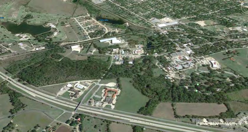
5 Study Area Trail Corridor Study Area Data Source: NCTCOG GIS Data,

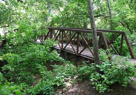
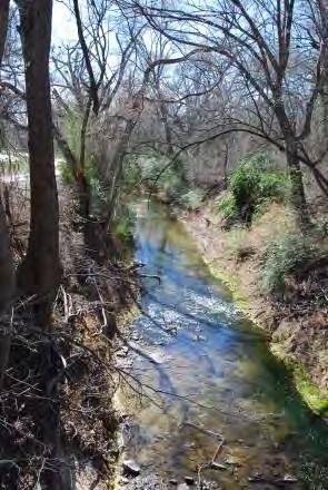
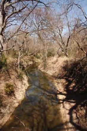
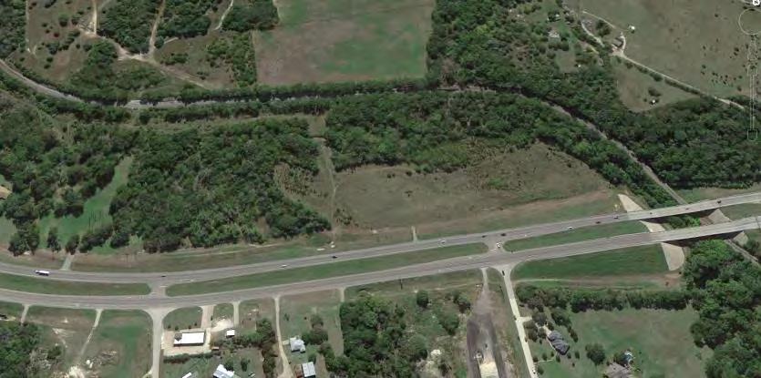
6 The Trail Corridor Railroad Creek Data Source: NCTCOG GIS Data,
7 - Corridor Inventory Natural Features - Creeks and Streams - Lakes - Vegetation & Land Cover Year Flood Plain Human Features - Roads and Highways - Schools - Cemeteries - Parks - Railroad Land Use - Land Use - Parcels 7

8 Natural Features Inventory Creek Data Source: NCTCOG GIS Data,
9 Human Features Inventory - Airport Railroad Sardis Data Source: NCTCOG GIS Data,

10 Land Use/Parcels Railroad Data Source: NCTCOG GIS Data,

11 Distance Relationships 1 Mile Radius 3 Mile Radius 5 Mile Radius - Airport Railroad Sardis 5 Mile Radius 3 Mile Radius 1 Mile Radius 0.5 mi = approx. 10 min. walk 3 mi = approx. 15 min. bicycle ride Data Source: NCTCOG GIS Data,
12 Proximity to Trail Corridor Creek 0.5 mi = approx. 10 min. walk 3 mi = approx. 15 min. bicycle ride Data Source: NCTCOG GIS Data,
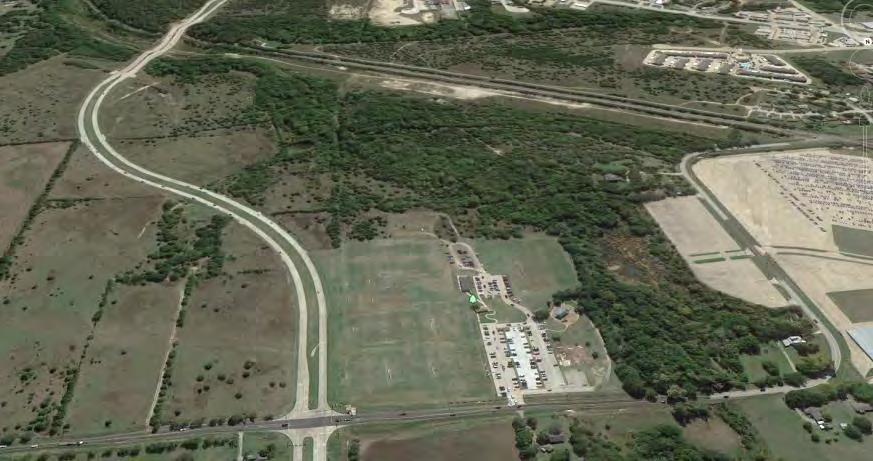
13 Recent and Future Development Plans MIDTOWNE DIAMOND J RANCH KEMP RANCH Data Source: NCTCOG GIS Data,

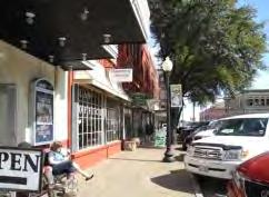
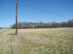


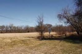
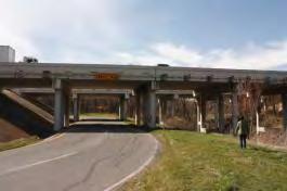
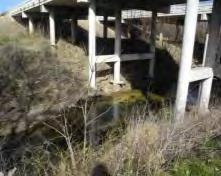
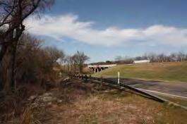
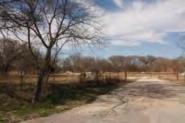
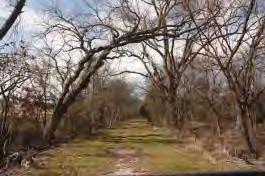
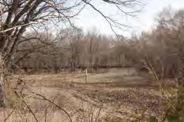

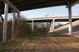

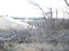
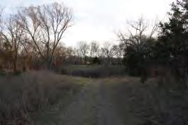
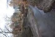

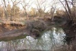
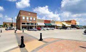

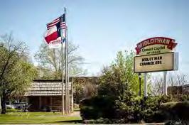
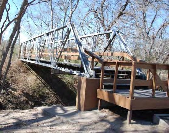
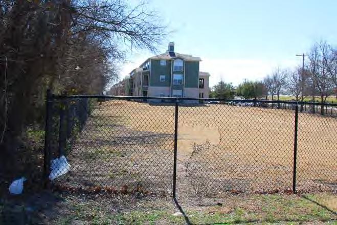
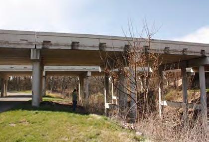
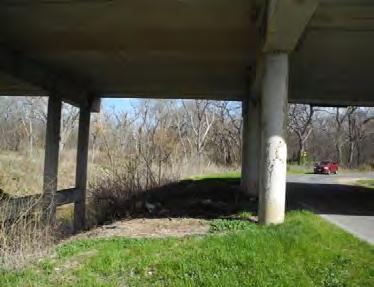
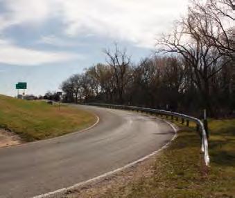
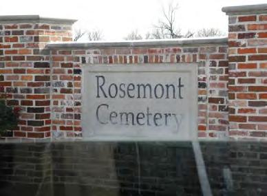
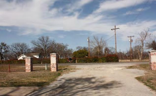
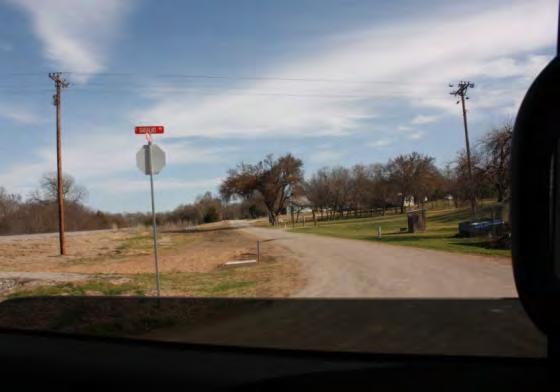
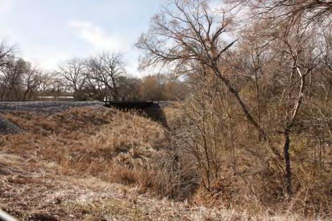
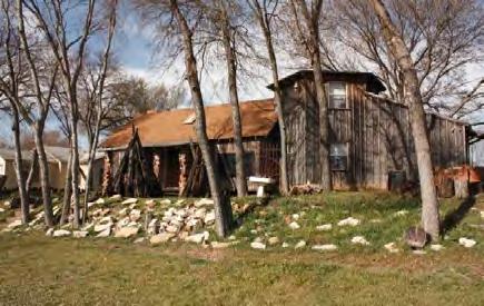
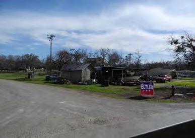
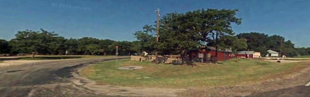
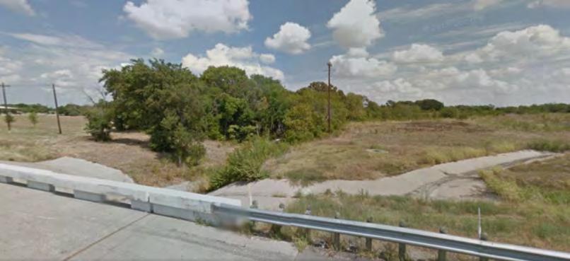
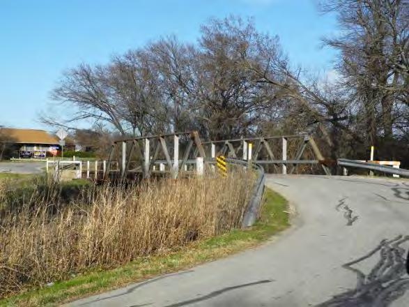
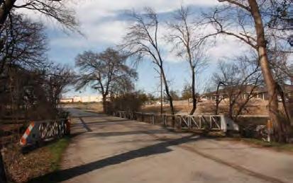
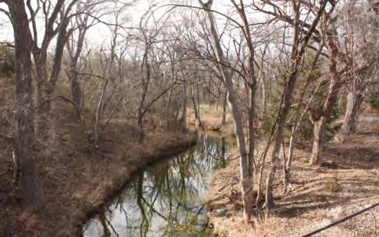
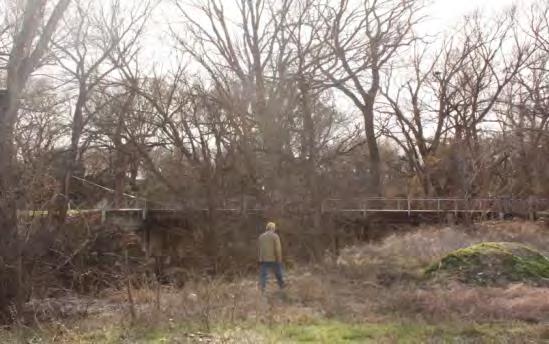
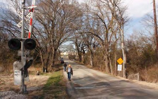
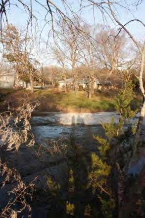
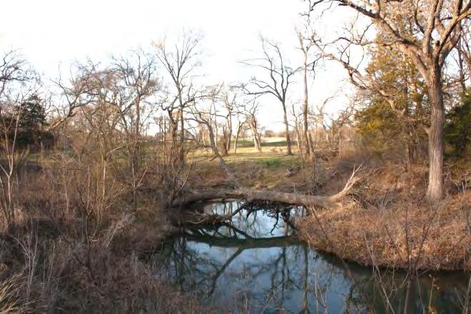
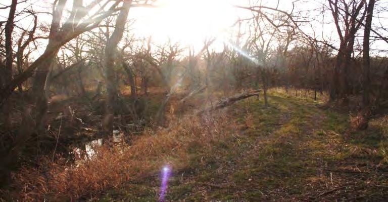
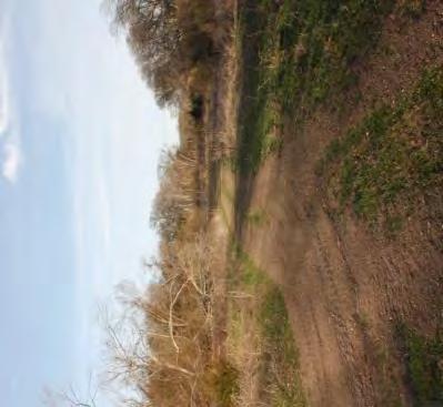
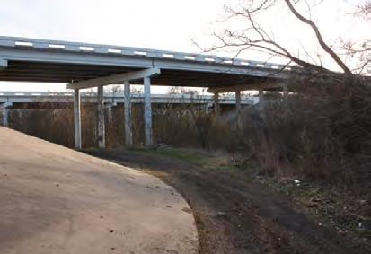
14 Photo Inventory and Observations 14

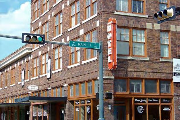

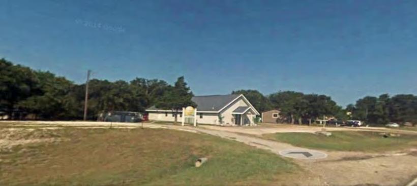
15 City of 15

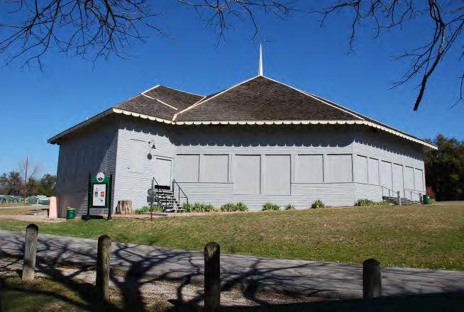
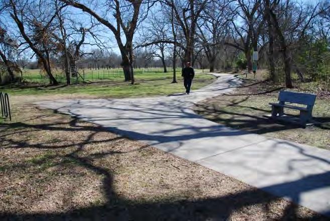
16 Getzendaner Memorial Park 16


17 Trail Map A Google Maps,

18 Trail Map A 18

19 Trail Map A 19

20 Trail Map B 20

21 Trail Map B: Sardis 21


22 Trail Map C: Airport Access Google Maps, 2014 Google Maps, 2014 Google Maps, 2014 Google Maps,


23 Trail Map C Google Maps,


24 Trail Map C: Community Access 24

25 Trail Map D 25


26 Trail Map D 26

27 Trail Map D 27


28 City of Insert new urbanist community here Google Maps, 2014 Google Maps, 2014 Google Maps, 2014 Google Maps,
29 Summary Analysis: Key Sites PARK DOWNTOWN 287 CROSSING and GATEWAY PARK OPPORUTNITY TRAILHEAD OPPORTUNITY MIDTOWNE LAKE GROVE PARK DIAMOND J RANCH 287 CROSSING OPPORTUNITY SARDIS CEMETERY I-35 CROSSING KEMP RANCH PARK ANCHOR Data Source: NCTCOG GIS Data,
30 Summary Analysis: Community Access DOWNTOWN MIDTOWNE PARK RESIDENTIAL INFILL 287 CROSSING and GATEWAY PARK OPPORUTNITY TRAILHEAD OPPORTUNITY AIRPORT LAKE GROVE PARK LAKES DIAMOND J RANCH CEMETERY, SCENIC LANES 287 CROSSING OPPORTUNITY SARDIS CEMETERY I-35 CROSSING KEMP RANCH PARK ANCHOR Data Source: NCTCOG GIS Data,

31 Linkage Opportunities PARK DOWNTOWN RESIDENTIAL INFILL 287 CROSSING and GATEWAY PARK/ANCHOR OPPORUTNITY TRAILHEAD OPPORTUNITY MIDTOWNE AIRPORT LAKES 287 CROSSING OPPORTUNITY LAKE GROVE PARK DIAMOND J RANCH CEMETERY, SCENIC LANES SARDIS CEMETERY I-35 CROSSING KEMP RANCH PARK ANCHOR Data Source: NCTCOG GIS Data,

32 Exploring Detailed Alignments Generally, yellow route maximizes creek views and adjacency Orange route more closely follows rail r.o.w. where feasible Optional spur linkages to resources and community access Connections to the city trail systems 32
33 Legend 33

34 - Trail Concepts NCTCOG GIS Data,
35 Trail Concept Map A NCTCOG GIS Data,

36 Trail Concept Map A KEMP RANCH NCTCOG GIS Data,

37 Trail Concept Map B NCTCOG GIS Data,
38 Trail Concept Map B NCTCOG GIS Data,

39 Trail Concept Map C NCTCOG GIS Data,

40 Trail Concept Map C NCTCOG GIS Data,

41 Trail Concept Map D NCTCOG GIS Data,
42 Trail Concept Map D NCTCOG GIS Data,

43 Length: 11.1 miles 11.3 miles ateway acquisitions: Trail heads: Bridges: RR Crossings: Underpasses: Properties Crossed: Miles of RR r.o.w.: ORANGE ROUTE YELLOW ROUTE NCTCOG GIS Data,
44 Key Issues: What we need to know Alternative main trail routings: Yellow route? Orange route? Hybrid/mixed? Community Access routes: Extent and destination Future parkland and easement opportunities Gateway parks Function of trail (high speed vs. recreation) Scenic value/character of trail experience What do we take forward? 44
45 Next Steps Today s feedback Revisions based on feedback Opinion of concept level budget Implementation strategies Draft report 45


46 Acknowledgements North Central Texas Council of Governments The University of Texas Ellis County City of City of The University of Texas at Arlington Program in Landscape Architecture, School of Architecture and The Institute of Urban Studies, The School of Urban and Public Affairs 46
47 47
48 Key System Elements: Quantifications Length: Gateway acquistions: Trail heads: Bridges: RR Crossings: Underpasses: Properties Crossed: Miles of RR r.o.w.: 11.1 miles miles ORANGE ROUTE YELLOW ROUTE 48
Great California Delta Trail Blueprint for Contra Costa and Solano Counties GIS AND MAPPING MEMORANDUM JULY 2010
 Great California Delta Trail Blueprint for Contra Costa and Solano Counties GIS AND MAPPING MEMORANDUM JULY 2010 {DRAFT} July 2010 Introduction Geographic Information Systems (GIS) are computer-based
NCTCOG GIS File Locations
 Boundaries Area Codes k:\bnd\region\area_codes.shp Area Type k:\bnd\region\areatype.shp Ciry Centroids (World) k:\bnd\usa_world\cities.shp City Centroids (NCTCOG Region) k:\bnd\region\city_point.shp vector.vector.bnd_city_point
MAPS AND THEIR CLASSIFICATION
 MAPPING MAPS AND THEIR CLASSIFICATION WHAT IS A MAP? A map is representation of the Earth's surface, showing how things are related to each other by distance, direction, and size. Maps are a way of showing
[Leveraging & Improving Neighborhood Connections] Area E Cedar Creek
![[Leveraging & Improving Neighborhood Connections] Area E Cedar Creek](/thumbs/86/93508963.jpg "[Leveraging & Improving Neighborhood Connections] Area E Cedar Creek") Community Charrette LINC Dallas [Leveraging & Improving Neighborhood Connections] Area E Cedar Creek 06.02.12 LINC Workshop Area E Area E has the unique distinction of at-grade frontage to the Trinity
Community Charrette LINC Dallas [Leveraging & Improving Neighborhood Connections] Area E Cedar Creek 06.02.12 LINC Workshop Area E Area E has the unique distinction of at-grade frontage to the Trinity
Louisiana Transportation Engineering Conference. Monday, February 12, 2007
 Louisiana Transportation Engineering Conference Monday, February 12, 2007 Agenda Project Background Goal of EIS Why Use GIS? What is GIS? How used on this Project Other site selection tools I-69 Corridor
III. FORECASTED GROWTH
 III. FORECASTED GROWTH In order to properly identify potential improvement projects that will be required for the transportation system in Milliken, it is important to first understand the nature and volume
FOR SALE +/- 419 ACRES ¼ Mile South of Alliance Airport
 FOR SALE +/- 419 ACRES ¼ Mile South of Alliance Airport Alliance Airport Subject property +/- 419 AC Pat McDowell +1 817 334 8106 pat.mcdowell@am.jll.com JLL 201 Main Street, Suite 1440 Fort Worth, TX
Neighborhood Locations and Amenities
 University of Maryland School of Architecture, Planning and Preservation Fall, 2014 Neighborhood Locations and Amenities Authors: Cole Greene Jacob Johnson Maha Tariq Under the Supervision of: Dr. Chao
Huron Creek Watershed 2005 Land Use Map
 Huron Creek Watershed 2005 Land Use Map Created By: Linda Kersten, 12/20/06 Created For: MTU Introduction to GIS Class (FW 5550) The Huron Creek Watershed Advisory Committee Michigan Technological University,
The following maps must be provided as a part of the ADA. The appropriate scale for each map should be determined at the pre application conference.
 Main Street @ Coconut Creek DRI QUESTION 9 MAPS The following maps must be provided as a part of the ADA. The appropriate scale for each map should be determined at the pre application conference. Map
GIS in Community & Regional Planning
 GIS in Community & Regional Planning The The role role of of GIS GIS in in Re-writing the the Zoning Bylaw for for the the City City of of Vernon LandInfo Technologies Presentation Overview The GIS Initiative
Southwest Light Rail Transit Bicycle Facility Assessment Technical Memorandum #3 Prioritization. July 23, P age
 Southwest Light Rail Transit Bicycle Facility Assessment Technical Memorandum 3 Prioritization July 23, 2015 1 P age Contents Introduction... 3 Project Definition... 3 Prioritization Criteria and Data
HORIZON 2030: Land Use & Transportation November 2005
 PROJECTS Land Use An important component of the Horizon transportation planning process involved reviewing the area s comprehensive land use plans to ensure consistency between them and the longrange transportation
V. THE INTERACTIVE MAP
 V. THE INTERACTIVE MAP The on-line map Missoula County Industrial Lands Survey and Inventory, located at (http://mcgis.maps.arcgis.com/apps/viewer/index.html?appid=b1165eaeb51144c4bf51e630b73d0a08) provides
PIONEERING A NEW FRONTIER IN PEACHTREE CORNERS 3550ENGINEERING.COM
 PIONEERING A NEW FRONTIER IN PEACHTREE CORNERS Project Snapshot Recently acquired by Icarus Alternative Investments and Scipio Ventures, 3550 Engineering Drive is a 4-story, 101,809 square foot suburban
Crow River Plaza - Retail Development South Diamond Lake Rd. Rogers, MN FOR LEASE 1,024 SF Retail Space. Lease Rate: $16.
 FEATURES: - Available in Rogers, MN Lease Rate: $16.00 / psf NNN - Excellent location with freeway signage on I-94! - Near large retailers such as Target, Kohls, & Applebees. Taxes $3.65 / psf Cam $3.20
High Speed / Commuter Rail Suitability Analysis For Central And Southern Arizona
 High Speed / Commuter Rail Suitability Analysis For Central And Southern Arizona Item Type Reports (Electronic) Authors Deveney, Matthew R. Publisher The University of Arizona. Rights Copyright is held
NCTCOG Regional GIS Meeting 6-Years and Going Strong. May 15, 2018 hosted by: Tarrant County
 NCTCOG Regional GIS Meeting 6-Years and Going Strong May 15, 2018 hosted by: Tarrant County Woolpert at a Glance 1911 Founded in Dayton, Ohio 25+ Offices across the nation 800+ Global employees 25+ OFFICES
GIS for the Non-Expert
 GIS for the Non-Expert Ann Forsyth University of Minnesota February 2006 GIS for the Non-Expert 1. Definitions and problems 2. Measures being tested in Twin Cities Walking Study Basic approach, data, variables
APPENDIX PHASE 1 GREEN INFRASTRUCTURE FRAMEWORK
 APPENDIX PHASE 1 GREEN INFRASTRUCTURE FRAMEWORK KANSAS MISSOURI CONTENTS A DATA WISHLIST 4 B PRECEDENTS 7 C WORKSHOP MATERIALS 13 D ANALYSIS PROCESS 124 E ATLAS & PLAYBOOK DETAILS 156 F POLICY ANALYSIS
CITY OF CAMBRIDGE Growth & Intensification Study Secondary Plan Stakeholder Session June 26th, 2017
 CITY OF CAMBRIDGE Growth & Intensification Study Secondary Plan Stakeholder Session June 26th, 2017 Dillon Consulting Limited Watson & Associates Economists Curtis Planning Inc. Tim Welch Consulting Inc.
Date: June 19, 2013 Meeting Date: July 5, Consideration of the City of Vancouver s Regional Context Statement
 Section E 1.5 To: From: Regional Planning and Agriculture Committee Lee-Ann Garnett, Senior Regional Planner Planning, Policy and Environment Department Date: June 19, 2013 Meeting Date: July 5, 2013 Subject:
Crow River Plaza - Retail Development South Diamond Lake Rd. Rogers, MN FOR LEASE 2,066 SF Retail Space. Lease Rate: $16.
 FEATURES: - 2,066 SF End Cap Retail Space Available in Rogers, MN - Excellent location with freeway signage on I-94! - Near large retailers such as Target, Kohls, & Applebees. - Convenient location off
PIONEERING A NEW FRONTIER IN PEACHTREE CORNERS
 PIONEERING A NEW FRONTIER IN PEACHTREE CORNERS Project Snapshot R ER S TR C H and Scipio Ventures, 3550 Engineering Drive is a 4-story, W Y R 3550 Engineering is poised for companies who place high IN
Abstract: Contents. Literature review. 2 Methodology.. 2 Applications, results and discussion.. 2 Conclusions 12. Introduction
 Abstract: Landfill is one of the primary methods for municipal solid waste disposal. In order to reduce the environmental damage and to protect the public health and welfare, choosing the site for landfill
CLAREMONT MASTER PLAN 2017: LAND USE COMMUNITY INPUT
 Planning and Development Department 14 North Street Claremont, New Hampshire 03743 Ph: (603) 542-7008 Fax: (603) 542-7033 Email: cityplanner@claremontnh.com www.claremontnh.com CLAREMONT MASTER PLAN 2017:
City of Pocatello. Comprehensive Plan Update
 City of Pocatello Comprehensive Plan 2015 Update Adopted March 5, 2015 Acknowledgements City of Pocatello Comprehensive Plan Update 2015 Mayor Brian Blad City Council Craig Cooper Steve Brown W. James
NEW WATERFRONT METROPARK. P u b l i c O p e n H o u s e, J u n e 2 1,
 NEW WATERFRONT METROPARK P u b l i c O p e n H o u s e, J u n e 2 1, 2 0 1 7 U N D E R S T A N D I N G YO U R P E R S P E C T I V E PUBLIC OPEN HOUSE Welcome/Introductions Project Presentation Project
Airport Employment Growth District
 Legend Employment Area Boundary* Industrial - Heavy Parcel Fabric Utilities Farm with Retail/Industrial Use Institutional Potential Area for Redevelopment Redevelopment Vacant Land Industrial - Light Non-Developable
presents challenges related to utility infrastructure planning. Many of these challenges
 1 Introduction: - a. Purpose According to U.S. Census Bureau the population of stark county was 367,585 in 1990, and in 2000 it was increase to 378,098. Thus County is experiencing a growth that presents
WELCOME! Meeting 3 July 9, 2014 Wichita, Kansas
 WELCOME! Kansas Freight Advisory Committee Meeting 3 July 9, 2014 Wichita, Kansas TODAY S MEETING 1. Meeting 2 Recap and Port of Catoosa Tour Highlights 2. Draft Freight Corridors of Significance Highway
2040 MTP and CTP Socioeconomic Data
 SE Data 6-1 24 MTP and CTP Socioeconomic Data Purpose of Socioeconomic Data The socioeconomic data (SE Data) shows the location of the population and employment, median household income and other demographic
Aggregating Local GIS Inquiry for Regional Perspectives
 Aggregating Local GIS Inquiry for Regional Perspectives RYAN ULSBERGER CENTER FOR URBAN WATERS PUGET SOUND INSTITUTE SEPTEMBER 13, 2012 Acknowledgements I would like to thank the donors to the UWT Urban
East Bay BRT. Planning for Bus Rapid Transit
 East Bay BRT Planning for Bus Rapid Transit Regional Vision Draper Prison The Bottleneck is a State-Level issue, Salt Lake County 2050 Population: 1.5M Draper Prison hopefully with some State-Level funding!
TABLE OF CONTENTS ARTICLE I. POLK COUNTY COMPREHENSIVE PLAN VOLUME 1. Page CHAPTER 1. GENERAL... A-1
 TABLE OF CONTENTS ARTICLE I. POLK COUNTY COMPREHENSIVE PLAN VOLUME 1 Page CHAPTER 1. GENERAL... A-1 DIVISION 1.100 GENERAL PROVISIONS... A-1 DIVISION 1.200 BASIC PRINCIPLES... A-6 DIVISION 1.300 THE PLANNING
3.0 ANALYSIS OF FUTURE TRANSPORTATION NEEDS
 3.0 ANALYSIS OF FUTURE TRANSPORTATION NEEDS In order to better determine future roadway expansion and connectivity needs, future population growth and land development patterns were analyzed as part of
VOLUME 2 RURAL SETTLEMENT AREA PLANS & SECONDARY PLANS
 Table of Contents VOLUME 2 RURAL SETTLEMENT AREA PLANS & SECONDARY PLANS POLICIES AND SECONDARY PLAN MAPS CHAPTER A, RURAL SETTLEMENT AREA PLANS In Rural Hamilton Official Plan CHAPTER B, SECONDARY PLANS
California Urban Infill Trip Generation Study. Jim Daisa, P.E.
 California Urban Infill Trip Generation Study Jim Daisa, P.E. What We Did in the Study Develop trip generation rates for land uses in urban areas of California Establish a California urban land use trip
S P A C E F O R B I G I D E A S
 D I S C O V E R S P A C E F O R B I G I D E A S E X P L O R E T H E P O S S I B I L I T I E S L O F T O F F I C E S P A C E IN P E A C H T R E E C O R N E R S It starts here. The resurgence of Peachtree
Designing GIS Databases to Support Mapping and Map Production Charlie Frye, ESRI Redlands Aileen Buckley, ESRI Redlands
 Designing GIS Databases to Support Mapping and Map Production Charlie Frye, ESRI Redlands Aileen Buckley, ESRI Redlands 1 Designing GIS Databases to Support Mapping and Map Production Charlie Frye, ESRI
Urban Residential Subdivisions Ancaster
 Legend Development Active Registered Plan (62M) Draft Approved Subdivision (25T) Applied Subdivision (25T) Completed Registered Plan (62M) Other Features Community Boundary John C. Munro International
Figure 8.2a Variation of suburban character, transit access and pedestrian accessibility by TAZ label in the study area
 Figure 8.2a Variation of suburban character, transit access and pedestrian accessibility by TAZ label in the study area Figure 8.2b Variation of suburban character, commercial residential balance and mix
Alternatives Analysis
 Alternatives Analysis Prepared for: Metropolitan Atlanta Rapid Transit Authority Prepared by: AECOM/Jacobs-JJG Joint Venture Atlanta, GA November 2012 Page Left Intentionally Blank ii TABLE OF CONTENTS
Study Overview. the nassau hub study. The Nassau Hub
 Livable Communities through Sustainable Transportation the nassau hub study AlternativeS analysis / environmental impact statement The Nassau Hub Study Overview Nassau County has initiated the preparation
Understanding Land Use and Walk Behavior in Utah
 Understanding Land Use and Walk Behavior in Utah 15 th TRB National Transportation Planning Applications Conference Callie New GIS Analyst + Planner STUDY AREA STUDY AREA 11 statistical areas (2010 census)
Urbanization factors in the Gilleland Creek watershed, Travis County, Texas. Michael Kanarek GEO386G Final Project Dec. 2, 2011
 Urbanization factors in the Gilleland Creek watershed, Travis County, Texas Michael Kanarek GEO386G Final Project Dec. 2, 2011 1 Introduction The watershed of Gilleland Creek, which flows through eastern
Geodatabase for Sustainable Urban Development. Presented By Rhonda Maronn Maurice Johns Daniel Ashney Jack Anliker
 Geodatabase for Sustainable Urban Development Presented By Rhonda Maronn Maurice Johns Daniel Ashney Jack Anliker Objective Build a Geodatabase that will enable urban planners to create and assess the
TREASURE COAST REGIONAL PLANNING COUNCIL M E M O R A N D U M. To: Council Members AGENDA ITEM 4B10
 TREASURE COAST REGIONAL PLANNING COUNCIL M E M O R A N D U M To: Council Members AGENDA ITEM 4B10 From: Date: Subject: Staff December 14, 2018 Council Meeting Local Government Comprehensive Plan Review
Ecological Land Cover Classification For a Natural Resources Inventory in the Kansas City Region, USA
 Ecological Land Cover Classification For a Natural Resources Inventory in the Kansas City Region, USA by Applied Ecological Services, Inc. In cooperation with the Mid-America Regional Council 600 Broadway,
THE TRINITY RIVER VISION/ GATEWAY PARK / PANTHER ISLAND
 Quarterly Project Status Report May 2018 THE TRINITY RIVER VISION/ GATEWAY PARK / PANTHER ISLAND Flood Control Project Update Construction of North Main Street Bridge by TxDOT s bridge contractor, Texas
Land Use and Zoning Page 1 of 10 LAND USE AND ZONING
 LAND USE AND ZONING Land Use and Zoning Page 1 of 10 BACKGROUND The Clifton-Fruitvale planning area is about 3,962 acres (6.2 sq. miles) with a population of 14,000 residents. The density of the area is
THE TRINITY RIVER VISION/ GATEWAY PARK / PANTHER ISLAND Flood Control Project Update
 Quarterly Project Status Report September 2018 THE TRINITY RIVER VISION/ GATEWAY PARK / PANTHER ISLAND Flood Control Project Update TxDot s contractor has nearly completed the superstructure false work
Local Area Key Issues Paper No. 13: Southern Hinterland townships growth opportunities
 Draft Sunshine Coast Planning Scheme Review of Submissions Local Area Key Issues Paper No. 13: Southern Hinterland townships growth opportunities Key Issue: Growth opportunities for Southern Hinterland
Lesson 2 Introduction to Maps. Key Terms
 Lesson 2 Introduction to Maps U.S. ARMY Key Terms J R O T C WHAT YOU WILL LEARN TO DO Use map reading skills bar scale contrast elevation intermittent landforms legend man-made marginal information orient
Regional Snapshot Series: Transportation and Transit. Commuting and Places of Work in the Fraser Valley Regional District
 Regional Snapshot Series: Transportation and Transit Commuting and Places of Work in the Fraser Valley Regional District TABLE OF CONTENTS Complete Communities Daily Trips Live/Work Ratio Commuting Local
Country Residential High and Low Density Areas
 Country Residential Low Density Subject Area HIGHWAY 16 SHERWOOD PARK HIGHWAY HIGHWAY 21 AIR PHOTO Country Residential Low Density Area Subject Area PLANNING & DEVELOPMENT SERVICES Drawn By: M.Fraser Date
Public Open House Meeting Thursday, February 22, Broken Arrow to Tulsa Mass Transit Feasibility Study
 Public Open House Meeting Thursday, February 22, 2007 Broken Arrow to Tulsa Mass Transit Feasibility Study Meeting Agenda Welcome Where we Are What we ve Learned Corridor Study Map Stations (Commuter Rail
Mapping Accessibility Over Time
 Journal of Maps, 2006, 76-87 Mapping Accessibility Over Time AHMED EL-GENEIDY and DAVID LEVINSON University of Minnesota, 500 Pillsbury Drive S.E., Minneapolis, MN 55455, USA; geneidy@umn.edu (Received
Sensitivity of estimates of travel distance and travel time to street network data quality
 Sensitivity of estimates of travel distance and travel time to street network data quality Paul Zandbergen Department of Geography University of New Mexico Outline Street network quality Approaches to
CORRIDORS OF FREEDOM Access Management (Ability) Herman Pienaar: Director City Transformation and Spatial Planning
 Herman Pienaar: Director City Transformation and Spatial Planning") CORRIDORS OF FREEDOM Access Management (Ability) 2016 Herman Pienaar: Director City Transformation and Spatial Planning PLANNING DEVELOPMENT PROCESS RATHER THAN A PLAN CAPITAL INVESTMENT DEVELOPMENT FACILITATION
CORRIDORS OF FREEDOM Access Management (Ability) 2016 Herman Pienaar: Director City Transformation and Spatial Planning PLANNING DEVELOPMENT PROCESS RATHER THAN A PLAN CAPITAL INVESTMENT DEVELOPMENT FACILITATION
City of Roswell, GA GIS VIEWER USER GUIDE
 City of Roswell, GA GIS VIEWER USER GUIDE Version 1.0 06/27/2018 GIS VIEWER USER GUIDE This user guide will introduce and outline the various tools available through the City of Roswell s Public GIS Viewer.
StanCOG Transportation Model Program. General Summary
 StanCOG Transportation Model Program Adopted By the StanCOG Policy Board March 17, 2010 What are Transportation Models? General Summary Transportation Models are technical planning and decision support
APPLICATION TO AMEND THE FUTURE LAND USE MAP (FLUM) SMALL SCALE
 SMALL SCALE") DEPARTMENT OF DEVELOPMENT & PLANNING 825 Ohio Avenue - Lynn Haven, FL 32444 (850) 265-2961 - (850) 265-3478 APPLICATION TO AMEND THE FUTURE LAND USE MAP (FLUM) SMALL SCALE Deadline to submit is 30 days
DEPARTMENT OF DEVELOPMENT & PLANNING 825 Ohio Avenue - Lynn Haven, FL 32444 (850) 265-2961 - (850) 265-3478 APPLICATION TO AMEND THE FUTURE LAND USE MAP (FLUM) SMALL SCALE Deadline to submit is 30 days
1 Summary Monetary Component Public Purpose Land Provision Introduction Document Structure...
 1 Summary... 1 1.1 Monetary Component... 1 1.2 Public Purpose Land Provision... 1 2 Introduction... 5 2.1 Document Structure... 5 2.2 Planning & Environment Act 1987... 5 2.3 Strategic Planning & Justification...
Topographic Maps. Take Notes as you view the slides
 Topographic Maps Take Notes as you view the slides Lesson Objectives Define a topographic map and state its uses. Describe how contour lines show the elevations, shape, and slope of the land. Identify
Complete Bicycle Network Project Prioritization
 6.3C BICYCLE STUDY PRIORITIES PAGE 6 Appendix C Complete Bicycle Network Project Prioritization This appendix provides a prioritized list of proposed bicycle facilities within each of the municipalities
Regional Transit Development Plan Strategic Corridors Analysis. Employment Access and Commuting Patterns Analysis. (Draft)
") Regional Transit Development Plan Strategic Corridors Analysis Employment Access and Commuting Patterns Analysis (Draft) April 2010 Contents 1.0 INTRODUCTION... 4 1.1 Overview and Data Sources... 4 1.2
Regional Transit Development Plan Strategic Corridors Analysis Employment Access and Commuting Patterns Analysis (Draft) April 2010 Contents 1.0 INTRODUCTION... 4 1.1 Overview and Data Sources... 4 1.2
Hillsborough County MPO Transit Study. Technical Team August 23, 2007
 Hillsborough County MPO Transit Study Technical Team August 23, 2007 Meeting Agenda Technology Choices Needs and Opportunities Transit Concepts Comparative Land Use Analysis Measures of Effectiveness System
Forecasts for the Reston/Dulles Rail Corridor and Route 28 Corridor 2010 to 2050
 George Mason University Center for Regional Analysis Forecasts for the Reston/Dulles Rail Corridor and Route 28 Corridor 21 to 25 Prepared for the Fairfax County Department of Planning and Zoning Lisa
Smart Solutions for Spatial Planning
 Smart Solutions for Spatial Planning Aedas R&D [Computational Design Research] Centre for Evolutionary Computing in Architecture [CECA @ UEL] Knowledge Transfer [breaking silos] * constructing consensus
Application #: TEXT
 TOWN OF FORT MYERS BEACH 2008 PROPOSED COMPREHENSIVE PLAN AMENDMENTS Application #: 2008-13-TEXT Description: Modify the Coastal Management and Future Land Use Elements to reflect the state s new definition
EIGHT POINTS RETAIL DEVELOPMENT
 EIGHT POINTS RETAIL DEVELOPMENT FOR LEASE NEC HWY 67 & OAK GROVE RD NEW RETAIL DEVELOPMENT ANCHORED BY MENARDS AND WALMART NEIGHBORHOOD MARKET IN THE HEART OF POPLAR BLUFF RETAIL CORRIDOR. MARKET OVERVIEW
Com munity Advisor y C ommitte e Meeting
 Community Advisor y Committee Meeting J u n e 1 5, 2 0 1 7 Project Scope 14 miles of enhanced service from Downtown Portland to Cleveland Park & Ride 41 Stations with 82 Platforms 1/3 mile approximate
APPENDIX 1 LITTLE EGYPT FROM THE AIR
 APPENDIX 1 LITTLE EGYPT FROM THE AIR FIGURE 1. In this 1930 City of Dallas aerial photo, the land surrounding Little Egypt is seen as cultivated fields and agricultural structures. The Hill property is
Red River Levee Panel
 Red River Levee Panel Mississippi River Commission Monday, August 9, 2017 Red River Levees in LA & AR NONE along TX & OK Boarder Red River Levee Issues Caddo Levee Cherokee Park Authorization Bossier Levee
FHWA GIS Outreach Activities. Loveland, Colorado April 17, 2012
 FHWA GIS Outreach Activities Loveland, Colorado April 17, 2012 GIS for Improved Decision Making FHWA believes that geographic information systems and other geospatial technologies (remote sensing and GPS)
INDIANAMAP VIEWING APPLICATION
 INDIANAMAP VIEWING APPLICATION (VERSION 1.0 ) Based on the 2005 Developed for the Indiana Department of Homeland Security by: IndianaMap Viewing Application Introduction The IndianaMap Viewing Application
Existing road transport network of the National Capital Region was examined for the existing connectivity, mobility and accessibility in the study.
 2 Road Network 2.1 Existing Road Network The existing transport network in National Capital Region is radial in nature. It comprises of expressways, national highways, state highways, major district and
The importance of visioning in urban strategic planning By Peter Robinson. MILE Master Class Urban Strategic Planning March 2016
 The importance of visioning in urban strategic planning By Peter Robinson MILE Master Class Urban Strategic Planning March 2016 Typical strategic planning process Where are we now? Where are we going?
City of Saginaw Right of Way Division Snow and Ice Removal Policy January 18, 2016
 Snow and Ice Removal Policy January 18, 2016 It is the policy of the to provide snowplowing and ice removal services in order to: Provide safe traveling conditions for motorists and pedestrians Assist
Urban Planning Word Search Level 1
 Urban Planning Word Search Level 1 B C P U E C O S Y S T E M P A R E U O E U R B A N P L A N N E R T N S T D H E C O U N T Y G E R E R D W R E N I C I T Y C O U N C I L A A A S U G G C I L A G P R I R
APPENDIX C-6 - TRAFFIC MODELING REPORT, SRF CONSULTING GROUP
 APPENDIX C-6 - TRAFFIC MODELING REPORT, SRF CONSULTING GROUP Scott County 2030 Comprehensive Plan Update Appendix C Scott County Traffic Model Final Report and Documentation March 2008 Prepared for: Scott
A GIS TOUR OF DES MOINES PRESENTED BY ANNA WHIPPLE, GIS MANAGER APRIL 20, 2015
 A GIS TOUR OF DES MOINES PRESENTED BY ANNA WHIPPLE, GIS MANAGER APRIL 20, 2015 Welcome to Des Moines! Capital of Iowa Among 100 largest metropolitan areas Insurance, biotech, healthcare, and entertainment
Eastside 230 kv Project Constraint and Opportunity Study for Linear Site Selection
 Eastside 230 kv Project Constraint and Opportunity Study for Linear Site Selection Prepared for Puget Sound Energy Prepared by Tetra Tech, Inc. 19801 North Creek Parkway Bothell, WA 98011 December 2013
APPENDIX I - AREA PLANS
 ROUTE 37 WEST LAND USE PLAN ROUTE 37 WEST LAND USE PLAN Recent land use decisions and development trends have drawn attention to the land within the Route 37 western by-pass area between Route 50 and
Long Term Plan What is planned for Murchison?
 Long Term Plan 2018-2028 What is planned for Murchison? 1.0 Introduction The following information provides an overview of significant projects Council has planned for the Murchison settlement in the Long
Field Observations and One-Dimensional Flow Modeling of Summit Creek in Mack Park, Smithfield, Utah
 Intermountain Center for River Rehabilitation and Restoration, Utah State University 31 July 2018 Field Observations and One-Dimensional Flow Modeling of Summit Creek in Mack Park, Smithfield, Utah I.
Lecture 9: Reference Maps & Aerial Photography
 Lecture 9: Reference Maps & Aerial Photography I. Overview of Reference and Topographic Maps There are two basic types of maps? Reference Maps - General purpose maps & Thematic Maps - maps made for a specific
Pierce Cedar Creek Institute GIS Development Final Report. Grand Valley State University
 Pierce Cedar Creek Institute GIS Development Final Report Grand Valley State University Major Goals of Project The two primary goals of the project were to provide Matt VanPortfliet, GVSU student, the
About places and/or important events Landmarks Maps How the land is, hills or flat or mountain range Connected to maps World Different countries
 What do you think you know about geography? About places and/or important events Landmarks Maps How the land is, hills or flat or mountain range Connected to maps World Different countries What do you
Illustrator: Vector base Each line/point store some sort of information Mapping Representation of the world
 Illustrator: Vector base Each line/point store some sort of information Mapping Representation of the world Photoshop Raster base Images can be overlaid Pixel vector data model: [data models] A representation
Promoting synergy between airports and cities to achieve sustainable development
 Promoting synergy between airports and cities to achieve sustainable development Content 1. Airports / Aviation 2. Urbanization 3. Shared Threads & Opportunities 4. Synergistic Development for Sustainability
BRIEFING BOOK. Natural Gas Energy Parcel Level GIS
 Natural Gas Energy Parcel Level GIS BRIEFING BOOK Examination of techniques & protocols for incorporating National Parcel Layer content to vastly reduce cost of transaction to better meet accelerating
Susan Clark NRS 509 Nov. 29, 2005
 Susan Clark NRS 509 Nov. 29, 2005 The original intent of this project was to look at the role of GIS in the inventory of bicycle and pedestrian facilities. The research, however, indicates a different
Committee Meeting November 6, 2018
 Committee Meeting November 6, 2018 Agenda Where we are in the process Land Use Plan Transportation Element Housing & Neighborhoods Elements Next Steps Schedule November 6: Plan Elements December: Plan
Practical Uses of LiDAR in NL A Consultants Perspective
 Practical Uses of LiDAR in NL A Consultants Perspective Adam Anderson, R.P.F. President & CEO Presented by: Peter Davison, R.P.F. Photo Interpretation Specialist Introduction Resource Innovations Inc.
CHAPTER 4: INVENTORY & LEVEL OF SERVICE ANALYSIS
 CHAPTER 4: INVENTORY & LEVEL OF SERVICE ANALYSIS A. Introduction This section provides an overview and analysis of the parks, recreation, trails, and open space system in Cary, North Carolina. First, the
Maps of the Rush Creek Watershed
 Maps of the Watershed Yuba River Watershed South Yuba River Watershed Watershed 1 Monitoring Sites 5 Land Cover 8 Parcel Density 2 Topology & Hydrology 6 Land Use 9 Road Density 3 Public Ownership 7 Parcels
Tourist-Accommodation (T-A) Zone
 Zone") DRAFT September 12, 2017 Tourist-Accommodation (T-A) Zone Chelan Comprehensive Plan & Municipal Code Update Draft September 12, 2017 Overview... 1 T-A Zone Acreage and Developable Land... 1 Conditions...
DRAFT September 12, 2017 Tourist-Accommodation (T-A) Zone Chelan Comprehensive Plan & Municipal Code Update Draft September 12, 2017 Overview... 1 T-A Zone Acreage and Developable Land... 1 Conditions...
Advancing Transportation Performance Management and Metrics with Census Data
 Advancing Transportation Performance Management and Metrics with Census Data Authors: Ivana Tasic, University of Utah, Department of Civil and Environmental Engineering, 110 Central Campus Drive, Salt