Hillsborough County MPO Transit Study. Technical Team August 23, 2007
|
|
|
- Lenard Byrd
- 5 years ago
- Views:
Transcription

1 Hillsborough County MPO Transit Study Technical Team August 23, 2007
2 Meeting Agenda Technology Choices Needs and Opportunities Transit Concepts Comparative Land Use Analysis Measures of Effectiveness System Design Issues Current Activities and Next Steps
3 Technology Choices


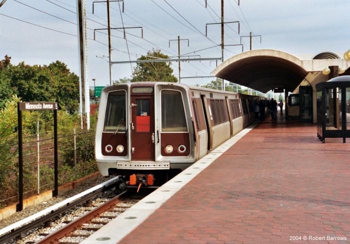

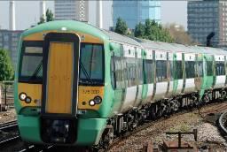
4 Heavy Rail New York Atlanta Washington DC


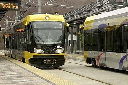


5 Light Rail Charlotte Houston Minneapolis


6 Commuter Rail Charlotte South Florida Chicago

7 DMU VS. Conventional Commuter Rail
8 Needs and Opportunities
9 Regional Rail Opportunities Pasco North Pinellas USF Plant City Lakeland & Orlando Existing CSX or New Track Westshore Brandon Peak Travel Downtown Park & Ride Lots St Petersburg South Shore Sarasota


10 Light Rail Opportunities USF Westshore Downtown Brandon New Track or Existing Track Continuous Service Links Major Centers Activity Center Gateway

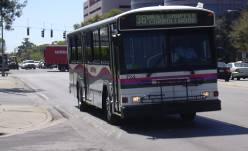
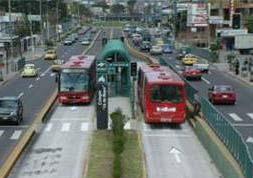
11 Bus Opportunities Citrus Park USF Westshore Downtown Tampa Brandon BRT - Dedicated Lane or Traffic Priority Express Service South Shore Activity Center Gateway

12 Transit Needs & Opportunities
13 Transit Concepts
14 Transit Future Concept For Transit Concept, FTA documents require support of local land use policies and plans The Concept provides an updated framework and support Future works includes analysis of land use policies and adjustments, if needed
15 Concept A: Diagram
16 USF Downtown St Petersburg Part of Regional Transit System needs Tampa to St Petersburg Builds upon past work (Tampa Rail)
17 Concept B: Diagram
18 Brandon Westchase + S Tampa Enables Brandon to become a regional player Provides accessibility to suburban areas Enables Quality of Life choices Focuses development Serves County development and growth needs Provides access to TIA Airport Provides infill and revitalization opportunity Improves existing transit service for Choice Riders
19 Concept C: Diagram
20 Regional Commuter Rail Connection Provides commuter connections to Plant City and SouthShore Serves Hillsborough County s needs to support regional transit service to Lakeland, Manatee, Brooksville
21 Comparative Land Use Analysis for Transit Concepts
22 Concept A: Stations Urban Core

23 Concept A: HH Increment/ Acre by TAZ
24 Concept A: Jobs Increment/ Acre by TAZ
25 Concept A Incremental Growth in Station Areas
26 Concept A Trend 2050
27 Concept A Transit-Oriented 2050
28 Concept B: Stations Urban Corridors
29 Concept B: HH Increment/ Acre by TAZ
30 Concept B: Jobs Increment/ Acre by TAZ
31 Concept B Incremental Growth in Station Areas
32 2050 Trend TAZ Totals Concept B Trend 2050

33 Concept B2 TAZ Totals Concept B Transit-Oriented 2050

34 Concept C: Stations Urban Centers
35 Concept C: HH Increment/ Acre by TAZ
36 Concept C: Jobs Increment/ Acre by TAZ
37 Concept C Incremental Growth Concept C Incremental Growth in Station Areas
38 Concept C Trend 2050
39 Concept C Transit-Oriented 2050

40 Concept ABC: Stations
41 Concept ABC Incremental Growth
42 Concept ABC Trend 2050
43 Concept ABC Transit-Oriented 2050
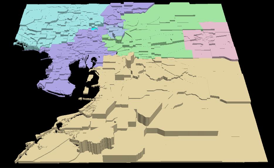


44 Sub-Regions With TAZ Boundaries Northwest Northeast Tampa Temple Terrace Plant City Southeast
45 Employment Trend By Sub-Region 100% 90% 80% 70% 60% 50% 40% 30% 20% 10% 0% 3% 3% 3% 34% 49% 44% 30% 18% 13% 4% 4% 6% 20% 21% 15% 10% 10% 12% 2000 Emp 2025 Emp 2000 TAZ 2025 TAZ 2050 Trend Northeast Northwest Plant City Southeast Tampa Temple Terrace
46 Employment Trend by Transit Concept for Sub-Regions 100% 90% 80% 70% 60% 50% 40% 30% 20% 10% 0% 3% 3% 3% 2% 3% 34% 40% 42% 40% 44% 30% 28% 27% 28% 26% 6% 4% 4% 4% 3% 15% 15% 14% 14% 14% 12% 10% 11% 11% 10% 2050 Emp50- Trend Trend Concept Concept A B Concept Concept EMP50_A EMP50_B EMP50_C EMP50_ABC C ABC Northeast Northwest Plant City Southeast Tampa Temple Terrace
47 2050 Employment with Transit by Concept Concept A Concept B Concept C Concept ABC 2050 Forecast Employment 170, , , ,768 1,430,199 % of 2050 Forecast 11.94% 20.30% 15.11% 25.71%
48 Population Trend for Sub-Regions Share of Households 2000 Share of Households 2050
49 2050 Population with Transit by Concept Concept A Concept B Concept C Concept ABC 2050 Forecast Population 175, , , ,798 2,034,180 % of 2050 Forecast 8.62% 20.68% 15.49% 29.29%
50 Measures of Effectiveness
51 Land Use Population near Stations Employment near Stations Potential TOD Acreage Incremental increase in Land Value
52 Mobility Carrying capacity of Transit System Transit Ridership Miles and Hours of Travel Speed and Congestion
53 Environment Air Quality Fuel Consumption - Energy
54 Financial Capital Costs O&M Costs
55 Systems Integration Countywide and Regional Service Characteristics System Capacity
56 System Design Issues
57 System Design Issues Connecting Downtown and Westshore Downtown Tampa USF Area I-4 Corridor


58 Tampa Rail Project Locally Preferred Alternative
59 Tampa Rail Project Locally Preferred Alternative

60 Rail Concept with Regional and Airport Connection


61 Main Street Downtown Tampa Nebraska Avenue Ybor West Ybor/ 16 th Street Ybor East U. Of Tampa Arts Center Ashley Drive Riverfront Central Park Franklin Street Marion Street Union Station Downtown Tampa Conceptual Alignments


62 UCH Medical Center Fletcher Avenue 131 st Street USF Village 22 nd 22 nd Street 22 nd 22 nd Street Pine Drive 30 th 30 th Street McKinley/ Busch Gardens USF Area Conceptual Alignment USF/ Sundome Fowler/ MOSI


63 USF Conceptual Alignment 131 st Street Medical Center Fletcher Avenue USF Village Pine Drive USF/ Sundome
64 I-4 Right of Way CSX A Line CSX S Line Conceptual Alignments for I-4 and CSX


65 CSX S Line Conceptual Alignments for I-4 and CSX
66 Current Activities and Next Steps
67 Meetings MPO and Committees (Aug and Sep) Leadership Team (Aug 20) Technical Team (Aug 23) MOSI Open House (Aug 25)
68 Next Steps Transit Needs & Opportunities (May) Evaluation of Scenarios (Jun-Jul) Public Outreach (Aug) System Concept (Sept) Strategies (Oct-Nov)
2040 MTP and CTP Socioeconomic Data
 SE Data 6-1 24 MTP and CTP Socioeconomic Data Purpose of Socioeconomic Data The socioeconomic data (SE Data) shows the location of the population and employment, median household income and other demographic
Public Open House Meeting Thursday, February 22, Broken Arrow to Tulsa Mass Transit Feasibility Study
 Public Open House Meeting Thursday, February 22, 2007 Broken Arrow to Tulsa Mass Transit Feasibility Study Meeting Agenda Welcome Where we Are What we ve Learned Corridor Study Map Stations (Commuter Rail
The CRP stresses a number of factors that point to both our changing demographics and our future opportunities with recommendations for:
 Plan Overview The CRP represents the first broad planning initiative covering Lake, Porter and LaPorte counties. Unlike previous plans released by NIRPC, which focused primarily on transportation, the
East Bay BRT. Planning for Bus Rapid Transit
 East Bay BRT Planning for Bus Rapid Transit Regional Vision Draper Prison The Bottleneck is a State-Level issue, Salt Lake County 2050 Population: 1.5M Draper Prison hopefully with some State-Level funding!
Wesley Chapel Area Roadway Needs Study Build-Out Analysis (Beardsley Dr/Oldwoods Ave Need Study) Project Progress Meeting 1
 Project Progress Meeting 1") Build-Out Analysis (Beardsley Dr/Oldwoods Ave Need Study) Project Progress Meeting 1 9:30 AM Pasco County Development Services Conference Room 1. Welcome/Introductions 2. Project Overview Purpose Major
Build-Out Analysis (Beardsley Dr/Oldwoods Ave Need Study) Project Progress Meeting 1 9:30 AM Pasco County Development Services Conference Room 1. Welcome/Introductions 2. Project Overview Purpose Major
Regional Growth Strategy Regional TOD Advisory Committee
 Regional Strategy Regional TOD Advisory Committee September 21, 2018 Overview Regional Geographies Transit-Oriented Development Goal Scenarios Next Steps 2 Schedule + Process September 6 Management Policy
THE FUTURE OF FORECASTING AT METROPOLITAN COUNCIL. CTS Research Conference May 23, 2012
 THE FUTURE OF FORECASTING AT METROPOLITAN COUNCIL CTS Research Conference May 23, 2012 Metropolitan Council forecasts Regional planning agency and MPO for Twin Cities metropolitan area Operates regional
Land Use Advisory Committee. Updating the Transit Market Areas
 Land Use Advisory Committee Updating the Transit Market Areas March 20, 2014 Agenda Transit Market Areas Purpose of Transit Market Areas Transit Market Index Current Market Area boundaries Updating the
StanCOG Transportation Model Program. General Summary
 StanCOG Transportation Model Program Adopted By the StanCOG Policy Board March 17, 2010 What are Transportation Models? General Summary Transportation Models are technical planning and decision support
APPENDIX I: Traffic Forecasting Model and Assumptions
 APPENDIX I: Traffic Forecasting Model and Assumptions Appendix I reports on the assumptions and traffic model specifications that were developed to support the Reaffirmation of the 2040 Long Range Plan.
Study Overview. the nassau hub study. The Nassau Hub
 Livable Communities through Sustainable Transportation the nassau hub study AlternativeS analysis / environmental impact statement The Nassau Hub Study Overview Nassau County has initiated the preparation
3.0 ANALYSIS OF FUTURE TRANSPORTATION NEEDS
 3.0 ANALYSIS OF FUTURE TRANSPORTATION NEEDS In order to better determine future roadway expansion and connectivity needs, future population growth and land development patterns were analyzed as part of
Com munity Advisor y C ommitte e Meeting
 Community Advisor y Committee Meeting J u n e 1 5, 2 0 1 7 Project Scope 14 miles of enhanced service from Downtown Portland to Cleveland Park & Ride 41 Stations with 82 Platforms 1/3 mile approximate
Public Transportation Infrastructure Study (PTIS) - 2 nd Technical Advisory Committee Meeting
 - 2 nd Technical Advisory Committee Meeting") Public Transportation Infrastructure Study (PTIS) - 2 nd Technical Advisory Committee Meeting Presentation to: Technical Advisory Committee (TAC) Presented by: and Team July 8th, 2009 Public Transportation
Public Transportation Infrastructure Study (PTIS) - 2 nd Technical Advisory Committee Meeting Presentation to: Technical Advisory Committee (TAC) Presented by: and Team July 8th, 2009 Public Transportation
Appendixx C Travel Demand Model Development and Forecasting Lubbock Outer Route Study June 2014
 Appendix C Travel Demand Model Development and Forecasting Lubbock Outer Route Study June 2014 CONTENTS List of Figures-... 3 List of Tables... 4 Introduction... 1 Application of the Lubbock Travel Demand
Doug Belden, Tax Collector. Detailed Distribution Data Report
 Doug Belden, Tax Collector Hillsborough County Tax Collector P.O. Box 30012 Tampa, Florida 33630-3012 http://www.hillstax.org Detailed Distribution Data Report Run: 09/30/2014 Report Description DISTRIBUTION
Forecasts for the Reston/Dulles Rail Corridor and Route 28 Corridor 2010 to 2050
 George Mason University Center for Regional Analysis Forecasts for the Reston/Dulles Rail Corridor and Route 28 Corridor 21 to 25 Prepared for the Fairfax County Department of Planning and Zoning Lisa
FREIGHT STRATEGY EVALUATION PROCESS
 INTRODUCTION This appendix describes the process to define and evaluate the relative priority of needed freight transportation improvement strategies within the Strategic Freight Plan. It describes the
Regional Growth Strategy Work Session Growth Management Policy Board
 Regional Growth Strategy Work Session Growth Management Policy Board September 6, 2018 1 Overview Recap June GMPB work session Objectives and outcomes Regional geographies Growth scenarios Breakout Discussion:
2014 Certification Review Regional Data & Modeling
 2014 Certification Review Regional Data & Modeling July 22, 2014 Regional Data Census Program Coordination PAG works with and for member agencies to ensure full participation in all Census Bureau programs
TRANSIT FORECASTING UNCERTAINTY & ACCURACY DAVID SCHMITT, AICP WITH VERY SPECIAL THANKS TO HONGBO CHI
 TRANSIT FORECASTING UNCERTAINTY & ACCURACY DAVID SCHMITT, AICP WITH VERY SPECIAL THANKS TO HONGBO CHI November 18, 2016 TOPICS Motivation Database Historical Transit Demand Forecasting Accuracy Impact
Alternatives Analysis
 Alternatives Analysis Prepared for: Metropolitan Atlanta Rapid Transit Authority Prepared by: AECOM/Jacobs-JJG Joint Venture Atlanta, GA November 2012 Page Left Intentionally Blank ii TABLE OF CONTENTS
California Urban Infill Trip Generation Study. Jim Daisa, P.E.
 California Urban Infill Trip Generation Study Jim Daisa, P.E. What We Did in the Study Develop trip generation rates for land uses in urban areas of California Establish a California urban land use trip
Regional Transit Development Plan Strategic Corridors Analysis. Employment Access and Commuting Patterns Analysis. (Draft)
") Regional Transit Development Plan Strategic Corridors Analysis Employment Access and Commuting Patterns Analysis (Draft) April 2010 Contents 1.0 INTRODUCTION... 4 1.1 Overview and Data Sources... 4 1.2
Regional Transit Development Plan Strategic Corridors Analysis Employment Access and Commuting Patterns Analysis (Draft) April 2010 Contents 1.0 INTRODUCTION... 4 1.1 Overview and Data Sources... 4 1.2
Internal Capture in Mixed-Use Developments (MXDs) and Vehicle Trip and Parking Reductions in Transit-Oriented Developments (TODs)
 and Vehicle Trip and Parking Reductions in Transit-Oriented Developments (TODs)") Internal Capture in Mixed-Use Developments (MXDs) and Vehicle Trip and Parking Reductions in Transit-Oriented Developments (TODs) Reid Ewing City and Metropolitan Planning University of Utah ewing@arch.utah.edu
Internal Capture in Mixed-Use Developments (MXDs) and Vehicle Trip and Parking Reductions in Transit-Oriented Developments (TODs) Reid Ewing City and Metropolitan Planning University of Utah ewing@arch.utah.edu
3. THE TRANSPORTATION AND TRANSIT MASTER PLAN
 The Master Plan Report Page 3-1 3. THE TRANSPORTATION AND TRANSIT MASTER PLAN 3.1 The Strategy Through the technical and consultation processes "A Balanced Road and Transit System" has been defined as
Coordinated Transit and Land Use Planning in the Region of Waterloo
 Coordinated Transit and Land Use Planning in the Region of Waterloo Jeffrey M. Casello University of Waterloo Kevin Curtis Graham Vincent Region of Waterloo Transportation Research Board Best Practices:
The Role of Transitways in Our Region s Economic Competitiveness. The 23rd CTS Annual Research Conference St. Paul, MN May 23, 2012
 The Role of Transitways in Our Region s Economic Competitiveness The 23rd CTS Annual Research Conference St. Paul, MN May 23, 2012 1 2 Twin Cities Competitive Clusters 3 Competitive Clusters interconnected
Kitsap County 2016 Comprehensive Plan Update. Appendix A: Growth Estimates
 Kitsap County 2016 Comprehensive Plan Update Appendix A: Growth Estimates Appendix A 1 April 2016 Kitsap County 2016 Comprehensive Plan Update Appendix A: Growth Estimates Land Capacity Land capacity
6:00 am August 3, 2015 Heavy Rain & Coastal Flood Update
 6:00 am August 3, 2015 Heavy Rain & Coastal Flood Update Synopsis/Overview: An area of low pressure spinning over the northeast Gulf of Mexico off the Nature Coast will continue to provide the threat for
Frequently Asked Questions
 What is the Regional Transit Engagement Series? As one of the fastest growing regions in the country, there is recognition that long-term transit planning efforts should be accelerated if we are to remain
GIS Analysis of Crenshaw/LAX Line
 PDD 631 Geographic Information Systems for Public Policy, Planning & Development GIS Analysis of Crenshaw/LAX Line Biying Zhao 6679361256 Professor Barry Waite and Bonnie Shrewsbury May 12 th, 2015 Introduction
MPOs SB 375 LAFCOs SCAG Practices/Experiences And Future Collaborations with LAFCOs
 Connecting LAFCOs and COGs for Mutual Benefits MPOs SB 375 LAFCOs SCAG Practices/Experiences And Future Collaborations with LAFCOs Frank Wen, Manager Research & Analysis Land Use & Environmental Planning
River North Multi-Modal Transit Analysis
 River North Multi-Modal Transit Analysis November 7, 2006 Dan Meyers, AICP URS Corporation 612-373-6446 / dan_meyers@urscorp.com River North Study Area Reasons for initiating the study Downtown areas north
Simplified Trips-on-Project Software (STOPS): Strategies for Successful Application
: Strategies for Successful Application") Simplified Trips-on-Project Software (STOPS): Strategies for Successful Application presented to Transit Committee Florida Model Task Force presented by Cambridge Systematics, Inc. John (Jay) Evans, AICP
Simplified Trips-on-Project Software (STOPS): Strategies for Successful Application presented to Transit Committee Florida Model Task Force presented by Cambridge Systematics, Inc. John (Jay) Evans, AICP
Regional Performance Measures
 G Performance Measures Regional Performance Measures Introduction This appendix highlights the performance of the MTP/SCS for 2035. The performance of the Revenue Constrained network also is compared to
Regional Performance Measures
 G Performance Measures Regional Performance Measures Introduction This appendix highlights the performance of the MTP/SCS for 2035. The performance of the Revenue Constrained network also is compared to
Beginning to Enjoy the Outside View A Glance at Transit Forecasting Uncertainty & Accuracy Using the Transit Forecasting Accuracy Database
 Beginning to Enjoy the Outside View A Glance at Transit Forecasting Uncertainty & Accuracy Using the Transit Forecasting Accuracy Database presented by David Schmitt, AICP with very special thanks to Hongbo
Westside Extension Los Angeles, California
 Westside Extension Los Angeles, California Rail~Volution 2010 Portland, Oregon Monica Villalobos AECOM History of Westside Suburban Growth in the Westside (1920 1970 s) LA Centers Concept + Employment
Appendix C: City of Mississauga Transportation Strategy Update
 Appendix C: City of Mississauga Transportation Strategy Update Transportation Strategy Update Transportation and Works Department Agenda - Objectives - What has changed? - Forecasted trends and issues
Foreword. Vision and Strategy
 GREATER MANCHESTER SPATIAL FRAMEWORK Friends of Walkden Station Consultation Response January 2017 Foreword Friends of Walkden Station are a group of dedicated volunteers seeking to raise the status and
Opportunities to Strengthen Transit-Oriented Development through the New Starts Process
 Opportunities to Strengthen Transit-Oriented Development through the New Starts Process Congressional Testimony of Shelley Poticha, President Reconnecting America Presented before the Subcommittee on Highways
Transit Market Index. Validating Local Potential for Transit Ridership
 Transit Market Index Validating Local Potential for Transit Ridership Transit Market Areas Characteristics 2010 TPP Characterized by different levels of transit service. Core Areas, 1 & 2: A variety of
The Tampa Bay Catastrophic Plan Presentation to CFGIS Users Group FDOT District 5 Urban Offices - Orlando July 30, 2010
 The Tampa Bay Catastrophic Plan Presentation to CFGIS Users Group FDOT District 5 Urban Offices - Orlando July 30, 2010 Brady Smith Senior Planner Tampa Bay Regional Planning Council Introduction Recent
Local Economic Activity Around Rapid Transit Stations
 Local Economic Activity Around Rapid Transit Stations The Case of Chicago s Orange Line Julie Cooper, MPP 2014 Harris School of Public Policy Transport Chicago June 6, 2014 Motivation Impacts of transit
Impact of Metropolitan-level Built Environment on Travel Behavior
 Impact of Metropolitan-level Built Environment on Travel Behavior Arefeh Nasri 1 and Lei Zhang 2,* 1. Graduate Research Assistant; 2. Assistant Professor (*Corresponding Author) Department of Civil and
TREASURE COAST REGIONAL PLANNING COUNCIL M E M O R A N D U M. To: Council Members AGENDA ITEM 4B10
 TREASURE COAST REGIONAL PLANNING COUNCIL M E M O R A N D U M To: Council Members AGENDA ITEM 4B10 From: Date: Subject: Staff December 14, 2018 Council Meeting Local Government Comprehensive Plan Review
Analyzing the Market Share of Commuter Rail Stations using LEHD Data
 Analyzing the Market Share of Commuter Rail Stations using LEHD Data Using Census Data for Transportation Applications Conference, Irvine, CA October 26, 2011 1. What is the size of Metrolink s commute
Mapping Accessibility Over Time
 Journal of Maps, 2006, 76-87 Mapping Accessibility Over Time AHMED EL-GENEIDY and DAVID LEVINSON University of Minnesota, 500 Pillsbury Drive S.E., Minneapolis, MN 55455, USA; geneidy@umn.edu (Received
The World Bank. Key Dates. Project Development Objectives. Components. Public Disclosure Authorized. Implementation Status & Results Report
 Public Disclosure Authorized EAST ASIA AND PACIFIC Vietnam Transport & ICT Global Practice IBRD/IDA Specific Investment Loan FY 2008 Seq No: 16 ARCHIVED on 28-Dec-2016 ISR26429 Implementing Agencies: Hanoi
SMALL STARTS PROJECT DESCRIPTION TEMPLATE
 PROJECT NAME: Lead Agency Metropolitan Planning Organization Transit Agency State Department of Transportation Other Relevant Agencies Other Relevant Agencies Other Relevant Agencies Project Definition
PlaceTypes. How the built environment is measured. Variables Measures Levels. AREA TYPE + DEVELOPMENT TYPE = PlaceType
 PlaceTypes In order to better understand land use and transportation interactions and to make more informed policy decisions, neighborhood characteristics can be analyzed by the role that they play in
Alternatives Analysis Report
 1.0 PURPOSE AND NEED The Southern California Association of Governments (SCAG), in coordination with the Los Angeles County Metropolitan Transportation Authority (Metro) and the Orange County Transportation
Bureau of Economic and Business Research May 29, Measuring Population Density for Counties in Florida
 Bureau of Economic and Business Research May 29, 2015 Measuring Population Density for Counties in Florida By: Stefan Rayer, PhD; Ying Wang, PhD https://www.bebr.ufl.edu/content/measuring-population-density-counties-florida
Measuring Urban Form and Examining Its Impact on Traffic Congestion in Florida
 Measuring Urban Form and Examining Its Impact on Traffic Congestion in Florida By Vince Wang Chair: Ruth Steiner Co-Chair: Andres Blanco March 04, 2011 Department of Urban and Regional Planning Overview
Transit Development Planning: Flagler County Needs Assessment & Implementation Program INTERGOVERNMENTAL MEETING OF FLAGLER COUNTY APRIL 13, 2010
 Transit Development Planning: nty Needs Assessment & Implementation Program INTERGOVERNMENTAL MEETING OF FLAGLER COUNTY APRIL 13, 2010 Rob Gregg & Justin Begley, Center for Urban Transportation Research
ACCESSIBILITY OF INTERMODAL CENTERS STUDY
 ACCESSIBILITY OF INTERMODAL CENTERS STUDY Presentation for VDOT Forum - Coordinating Transportation Planning and Land Use Wednesday, April 2, 2014 Vlad Gavrilovic, AICP - Renaissance Planning Group Tasks
Metrolinx Transit Accessibility/Connectivity Toolkit
 Metrolinx Transit Accessibility/Connectivity Toolkit Christopher Livett, MSc Transportation Planning Analyst Research and Planning Analytics Tweet about this presentation #TransitGIS OUTLINE 1. Who is
PINELLAS COUNTY METROPOLITAN PLANNING ORGANIZATION FORECAST 2035 EMPLOYMENT SOCIOECONOMIC DATA FINAL REPORT
 PINELLAS COUNTY METROPOLITAN PLANNING ORGANIZATION FORECAST 2035 EMPLOYMENT SOCIOECONOMIC DATA FINAL REPORT PREPARED FOR: Pinellas County Metropolitan Planning Organization 600 Cleveland Street, Suite
Density and Walkable Communities
 Density and Walkable Communities Reid Ewing Professor & Chair City and Metropolitan Planning University of Utah ewing@arch.utah.edu Department of City & Metropolitan Planning, University of Utah MRC Research
The 3V Approach. Transforming the Urban Space through Transit Oriented Development. Gerald Ollivier Transport Cluster Leader World Bank Hub Singapore
 Transforming the Urban Space through Transit Oriented Development The 3V Approach Gerald Ollivier Transport Cluster Leader World Bank Hub Singapore MDTF on Sustainable Urbanization The China-World Bank
III. FORECASTED GROWTH
 III. FORECASTED GROWTH In order to properly identify potential improvement projects that will be required for the transportation system in Milliken, it is important to first understand the nature and volume
HORIZON 2030: Land Use & Transportation November 2005
 PROJECTS Land Use An important component of the Horizon transportation planning process involved reviewing the area s comprehensive land use plans to ensure consistency between them and the longrange transportation
Chao Liu, Ting Ma, and Sevgi Erdogan National Center for Smart Growth Research & Education (NCSG) University of Maryland, College Park
 University of Maryland, College Park") Chao Liu, Ting Ma, and Sevgi Erdogan National Center for Smart Growth Research & Education (NCSG) University of Maryland, College Park 2015 GIS in Transit, September 1-3, 2015 Shared-use Vehicle Services
Chao Liu, Ting Ma, and Sevgi Erdogan National Center for Smart Growth Research & Education (NCSG) University of Maryland, College Park 2015 GIS in Transit, September 1-3, 2015 Shared-use Vehicle Services
Varying Influences of the Built Environment on Household Travel in Fifteen Diverse Regions of the United states
 Varying Influences of the Built Environment on Household Travel in Fifteen Diverse Regions of the United states Ewing, R., G. Tian, J.P. Goates, M. Zhang, M. Greenwald, Lane Council of Governments, A.
The Elusive Connection between Density and Transit Use
 The Elusive Connection between Density and Transit Use Abstract: The connection between density and transportation is heralded by planners, yet results are often elusive. This paper analyzes two regions,
Assessment of Models to Estimate Bus-Stop Level Transit Ridership using Spatial Modeling Methods
 Assessment of Models to Estimate Bus-Stop Level Transit Ridership using Spatial Modeling Methods Assessment of Models to Estimate Bus-Stop Level Transit Ridership using Spatial Modeling Methods Srinivas
APPENDIX IV MODELLING
 APPENDIX IV MODELLING Kingston Transportation Master Plan Final Report, July 2004 Appendix IV: Modelling i TABLE OF CONTENTS Page 1.0 INTRODUCTION... 1 2.0 OBJECTIVE... 1 3.0 URBAN TRANSPORTATION MODELLING
Tropical Update 6 AM EDT Friday, October 7, 2016 Hurricane Matthew & Hurricane Nicole
 Tropical Update 6 AM EDT Friday, October 7, 2016 Hurricane Matthew & Hurricane Nicole This update is intended for government and emergency response officials, and is provided for informational and situational
Voluntary Prekindergarten Estimating Conference Executive Summary December 7, Principals. Mark Armstrong, Designee
 Voluntary Prekindergarten Estimating Executive Summary December 7, 2009 Principals Office Office of Economic & Demographic Research (Chair) Executive Office of the Governor House of Representatives Senate
POCATELLO REGIONAL TRANSIT MASTER TRANSIT PLAN MARKET ASSESSMENT
 POCATELLO REGIONAL TRANSIT MASTER TRANSIT PLAN MARKET ASSESSMENT September 2017 Table of Contents Introduction... 4 Land Use and Urban Form... 5 Location... 5 Historical Context and Urban Form... 6 Land
Existing road transport network of the National Capital Region was examined for the existing connectivity, mobility and accessibility in the study.
 2 Road Network 2.1 Existing Road Network The existing transport network in National Capital Region is radial in nature. It comprises of expressways, national highways, state highways, major district and
Satellite and Radar. 5:55 am Infrared Satellite with Surface Wind Arrows. 6:15 am Ruskin Doppler Radar. Large southerly wind field
 Satellite and Radar 5:55 am Infrared Satellite with Surface Wind Arrows 6:15 am Ruskin Doppler Radar Large southerly wind field Developing showers rotating onshore NHC Forecast Hurricane Warning Big Bend
Land Use and Zoning Page 1 of 10 LAND USE AND ZONING
 LAND USE AND ZONING Land Use and Zoning Page 1 of 10 BACKGROUND The Clifton-Fruitvale planning area is about 3,962 acres (6.2 sq. miles) with a population of 14,000 residents. The density of the area is
The World Bank Ho Chi Minh City Green Transport Development (P126507)
") Public Disclosure Authorized EAST ASIA AND PACIFIC Vietnam Transport & ICT Global Practice IBRD/IDA Investment Project Financing FY 2015 Seq No: 6 ARCHIVED on 25-Dec-2017 ISR31002 Implementing Agencies:
Public Disclosure Authorized EAST ASIA AND PACIFIC Vietnam Transport & ICT Global Practice IBRD/IDA Investment Project Financing FY 2015 Seq No: 6 ARCHIVED on 25-Dec-2017 ISR31002 Implementing Agencies:
Uses of Travel Demand Models Beyond the MTP. Janie Temple Transportation Planning and Programming Division
 Uses of Travel Demand Models Beyond the MTP Janie Temple Transportation Planning and Programming Division October 12, 2011 Presentation Outline What is a Travel Demand Model? Cautionary notes on using
Growth Management: Analysis of Comments Received and Responses Comments received as of October 16, 2017
 Growth Management: Analysis of Comments Received and s Comments received as of October 16, Comments informing the Region of Peel s growth management work have been summarized with responses below. These
NORTH HOUSTON HIGHWAY IMPROVEMENT PROJECT (NHHIP)
") NORTH HOUSTON HIGHWAY IMPROVEMENT PROJECT (NHHIP) Project Overview Briefing Packet September 2015 RECOMMENDED ALTERNATIVES Environmental Impact Statement (EIS) Project Divided into 3 Segments Segment 1:
NORTH HOUSTON HIGHWAY IMPROVEMENT PROJECT (NHHIP) Project Overview Briefing Packet September 2015 RECOMMENDED ALTERNATIVES Environmental Impact Statement (EIS) Project Divided into 3 Segments Segment 1:
Guidelines on Using California Land Use/Transportation Planning Tools
 Guidelines on Using California Land Use/Transportation Planning Tools 1. Selecting Ds Analysis Modules Appropriate to a Region In almost all cases, the appropriate Ds Analysis Module to use for analysis
GAMINGRE 8/1/ of 7
 FYE 09/30/92 JULY 92 0.00 254,550.00 0.00 0 0 0 0 0 0 0 0 0 254,550.00 0.00 0.00 0.00 0.00 254,550.00 AUG 10,616,710.31 5,299.95 845,656.83 84,565.68 61,084.86 23,480.82 339,734.73 135,893.89 67,946.95
Subject: Note on spatial issues in Urban South Africa From: Alain Bertaud Date: Oct 7, A. Spatial issues
 Page 1 of 6 Subject: Note on spatial issues in Urban South Africa From: Alain Bertaud Date: Oct 7, 2009 A. Spatial issues 1. Spatial issues and the South African economy Spatial concentration of economic
Economic Activity Economic A ctivity
 5 Economic Economic Activity Activity ECONOMIC ACTIVITY 5.1 EMPLOYMENT... 5-7 5.1.1 OBJECTIVE... 5-7 5.1.2 POLICIES... 5-7 5.2 PROTECTING THE AREA OF EMPLOYMENT... 5-9 5.2.1 OBJECTIVE... 5-9 5.2.2 POLICIES...
The Future of Met Council Forecasts
 The Future of Met Council Forecasts Todd Graham todd.graham@metc.state.mn.us Dennis Farmer dennis.farmer@metc.state.mn.us Metropolitan Council Research Today s Agenda Why we forecast, how we use forecasts
NORTH HOUSTON HIGHWAY IMPROVEMENT PROJECT (NHHIP)
") NORTH HOUSTON HIGHWAY IMPROVEMENT PROJECT (NHHIP) Planning for a Mega Project in a Metropolitan Area TxDOT Short Course October 13, 2015 RECOMMENDED ALTERNATIVES Environmental Impact Statement (EIS) Project
NORTH HOUSTON HIGHWAY IMPROVEMENT PROJECT (NHHIP) Planning for a Mega Project in a Metropolitan Area TxDOT Short Course October 13, 2015 RECOMMENDED ALTERNATIVES Environmental Impact Statement (EIS) Project
Your web browser (Safari 7) is out of date. For more security, comfort and the best experience on this site: Update your browser Ignore
 is out of date. For more security, comfort and the best experience on this site: Update your browser Ignore") Your web browser (Safari 7) is out of date. For more security, comfort and the best experience on this site: Update your browser Ignore urban area For the complete encyclopedic entry with media resources,
Your web browser (Safari 7) is out of date. For more security, comfort and the best experience on this site: Update your browser Ignore urban area For the complete encyclopedic entry with media resources,
Sketch Transit Modeling Based on 2000 Census Data. Norm Marshall and Brian Grady. Norm Marshall
 Sketch Transit Modeling Based on 2000 Census Data Norm Marshall and Brian Grady Norm Marshall nmarshall@smartmobility.com Brian Grady bgrady@smartmobility.com Both at Smart Mobility Inc. P. O. Box 750
VRE System Map Source: VRE 2014
 V System ap Source: V 2014 T IS TH STU? STU AA P In August 20, V initiated a two-year planning and design study for an 11-mile extension of the anassas Line from the City of anassas through Gainesville
Sustainable Suburbs: Restructuring Suburban Development
 Sustainable Suburbs: Restructuring Suburban Development Stephen B. Friedman, AICP, CRE ULI Forum, October 8, 2009 The Vocabulary of Growth CAVE NIMBY BANANA NOTE NOPE NIMEY Triple Bottom Line Profitability
CERTIFIED RESOLUTION. introduction: and dated May 29, 2017, as attached, as appropriate
 15322 Buena Vista Avenue, White Rock BC, Canada V4B 1Y6 www.whiterockcity.ca City of White Rock P: 604.541.22121 F: 604.541.9348 /2tC% City Clerk s Office IT E ROC K June 13,2017 Stephanie Lam, Deputy
King City URA 6D Concept Plan
 King City URA 6D Concept Plan King City s Evolution Among the fastest growing cities 2000 Census 1,949 2010 Census 3,111 60% increase 2016 Census estimate 3,817 23% increase Average annual rate 4.3% Surpassing
Expanding the GSATS Model Area into
 Appendix A Expanding the GSATS Model Area into North Carolina Jluy, 2011 Table of Contents LONG-RANGE TRANSPORTATION PLAN UPDATE 1. Introduction... 1 1.1 Background... 1 1.2 Existing Northern Extent of
6 th Line Municipal Class Environmental Assessment
 6 th Line Municipal Class Environmental Assessment County Road 27 to St John s Road Town of Innisfil, ON September 6, 2016 APPENDIX L: TRAVEL DEMAND FORECASTING MEMORANDUM Accessible formats are available
Committee Meeting November 6, 2018
 Committee Meeting November 6, 2018 Agenda Where we are in the process Land Use Plan Transportation Element Housing & Neighborhoods Elements Next Steps Schedule November 6: Plan Elements December: Plan
CHAPTER 2. Strategic Context
 CHAPTER 2 Strategic Aim: To facilitate the future development of Cork as a national gateway city within the integrated land use and transportation framework set out in the Cork Area Strategic Plan 2001
Brian J. Morton Center for Urban and Regional Studies University of North Carolina - Chapel Hill June 8, 2010
 Brian J. Morton Center for Urban and Regional Studies University of North Carolina - Chapel Hill June 8, 2010 1. TRANUS Highway vehicle technology Trips Mode choice Link-level traffic volumes and average
Regional Growth Strategy Regional Staff Committee
 Regional Growth Strategy Regional Staff Committee June 21, 2018 1 Overview Summary of June Growth Management Policy Board Regional Growth Strategy Objectives Regional Geographies Regional Growth Strategy
VHD Daily Totals. Population 14.5% change. VMT Daily Totals Suffolk 24-hour VMT. 49.3% change. 14.4% change VMT
 6.9 Suffolk 6-54 VMT Population and Travel Characteristics Population 14.5% change 2014 1,529,202 VHD Daily Totals 2014 251,060 49.3% change 2040 1,788,175 2040 374,850 VMT Daily Totals 2014 39,731,990
Final City of Colusa STREETS & ROADWAYS MASTER PLAN. October J Street Suite 390 Sacramento, CA 95814
 Final City of Colusa STREETS & ROADWAYS MASTER PLAN October 2009 660 J Street Suite 390 Sacramento, CA 95814 TABLE OF CONTENTS I. INTRODUCTION... 1 Report Organization...1 II. ANALYSIS METHODOLOGY... 2
Modeling Mode in a Statewide Context
 Modeling Mode in a Statewide Context CDM Smith ADOT Transportation Planning Applications Conference May 6, 2013 Presentation Overview Development Team AZTDM3 Overview AZTDM3 Modes of Travel Transit Abstraction
CTfastrak East. Stakeholder Meeting #2 Manchester Town Hall December 15, 2015
 CTfastrak East Stakeholder Meeting #2 Manchester Town Hall December 15, 2015 Today s Agenda Overview of November Meeting CTfastrak East planning process Role of CTfastrak East Markets for CTfastrak East