King City URA 6D Concept Plan
|
|
|
- Helena Dixon
- 5 years ago
- Views:
Transcription
1 King City URA 6D Concept Plan
2 King City s Evolution Among the fastest growing cities 2000 Census 1, Census 3,111 60% increase 2016 Census estimate 3,817 23% increase Average annual rate 4.3% Surpassing population forecasts Among the most densely developed King City: 2010 Census 2,667 units / sq. mile Beaverton 2581 units / sq. mile Portland 1,990 units / sq. mile Tigard -1,970 units / sq. mile
 Non-white 1.")
3 King City s Evolution More diverse population Median age 76 to 58 yrs. (2000 to 2015) Non-white 1.7% to 11% (2000 to 2010)
4 King City s Evolution Growth-related Change Virtually no developable land 2018 Housing Needs Analysis land availability: 2.3 ac. Commercial 1.5 ac. Residential Can accommodate only 4% of forecast demand Deficit of 980 units Redevelopment potential is limited Built since mid-60s Small lots Vacancy rates well below region & state

5 Regional Context Logical UGB Expansion Existing urban areas to east & north Tualatin R. floodplain south Roy Rogers Rd. / EFU west Consistent with Metro direction Coordinated with Tigard & Beaverton expansion

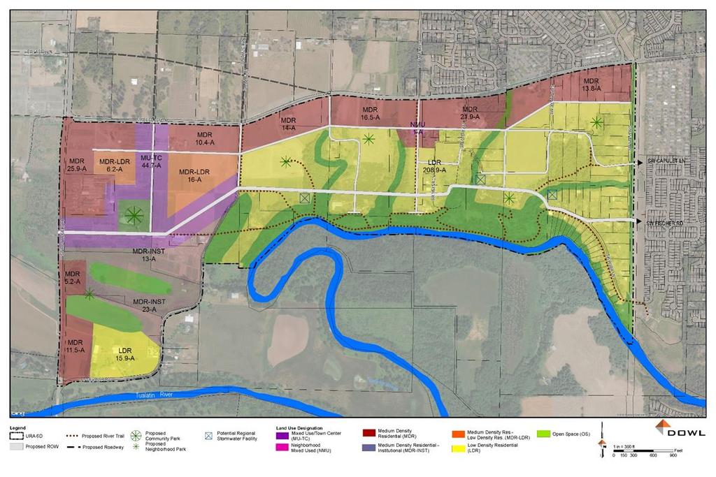
6 Snapshot 528 ac. / 318 ac. developable 3,500± units proposed 12+ du / ac. average density

7 Frameworks Natural Resources Land Use Mobility Shaped other frameworks Protection & enhancement Compatibility with existing development Range of housing types Interconnected Active transportation priority Infrastructure Cost-effective Equitable financing responsibilities

8 Tualatin R. floodplain Riparian corridors Natural Resources Associated upland wildlife habitat Shaped plan concepts

9 Land Use - 4 Neighborhoods Main Street / Town Center Beef Bend Neighborhood Central Neighborhood Rural Character Neighborhood


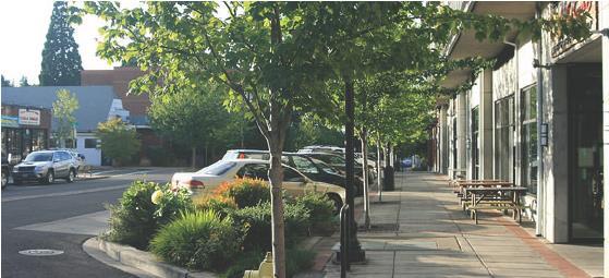
10 Main Street / Town Center Mixed-use & highest density 3-5 stories Single story retail & restaurant Civic uses library, city hall or school Campus-style employment or institutional uses Pedestrian-friendly / transit ready


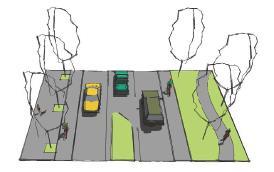
11 Beef Bend Neighborhood Attached / detached residences Potential neighborhood commercial Connected neighborhoods Beef Bend as green boulevard with multi-use path Parks & natural areas


12 Central Neighborhood Residential character Primarily attached / detached single family Connected neighborhoods Parks & natural areas Natural areas on the edge


13 Rural Neighborhood Low density rural character Modest redevelopment Minimize paved areas Shared streets Lower volume traffic Natural areas on the edge and within neighborhoods
14 Development Summary Dwelling Unit Type Main Street / Town Center Beef Bend Central Neighborhood Low-Mod Totals Multifamily Single Family Attached Single Family Detached Totals
15 Affordable Housing Historically King City has a wide range of permitted housing types including manufactured homes, apartments, and condos. 1 parking space / residence consistent with Metro guidance ADUs allowed Concept Plan Promotes a wide range of housing types


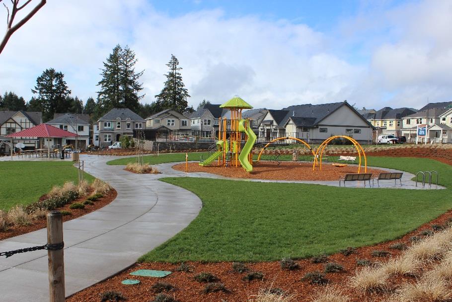
16 Parks and Open Space Interconnected system Neighborhood-oriented Connected with trails & natural areas Potential joint location with school

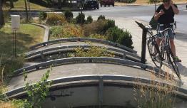
17 Internal connectivity URA 6D Concept Plan Multi-modal circulation Mobility Connected with trails & natural areas Encourage active transportation Limit reliance on nearby arterial streets

18 Capacity available System improvements for service Additional reservoir capacity 410 ft. pressure zone Continued coordination with Tigard Water URA 6D Concept Plan Infrastructure - Water

19 Infrastructure - Sanitary Proposed CWS pump station Roy Rogers Rd Option 1: gravity trunk service Option 2: subdistrict pump stations Further evaluation during master plan


20 Infrastructure - Stormwater Will utilize existing drainage pattern Water quality facilities meeting CWS standards Variety of large / small scale options Remediation opportunities to address current stormwater issues

21 Financing 4 Funding Categories: Local developer Sub-district multiple developers District shared infrastructure cost for all development in URA Major Off-site shared infrastructure cost for URA & surrounding areas
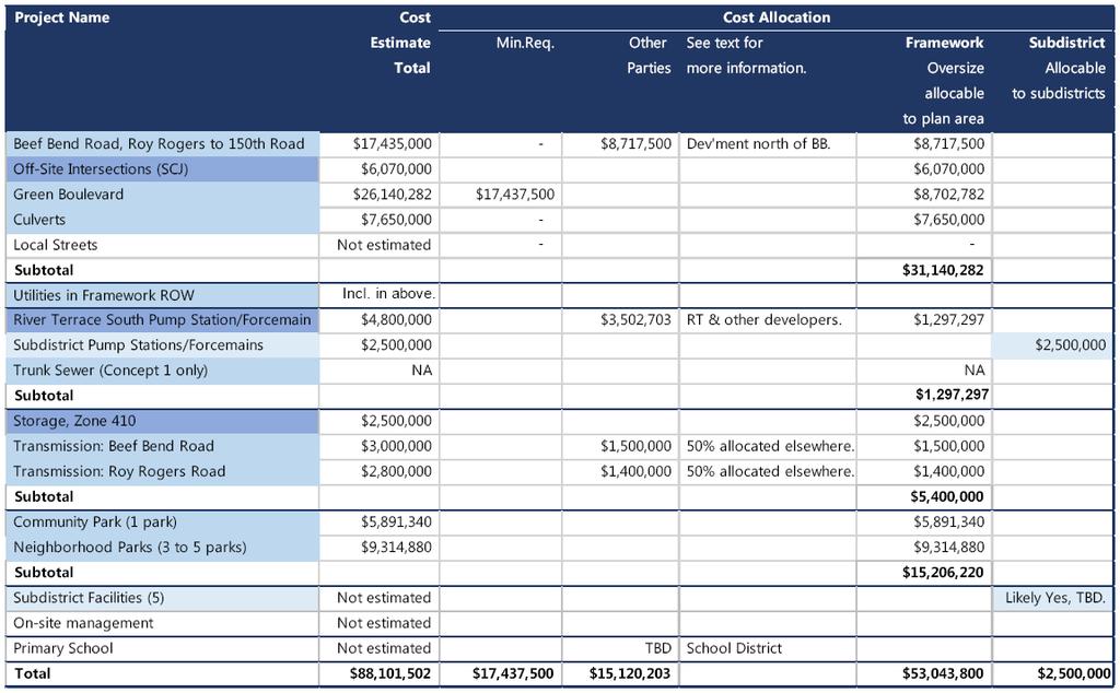
22 INFRASTRUCTURE EXPENSES
23 INFRASTRUCTURE FRAMEWORK COSTS
24 INFRASTRUCTURE FINANCE
25 Next Steps Master Plan Continued stakeholder & agency involvement Refine land use Affordable housing strategy Update transportation/infrastructure analysis Plan & Ordinance Amendments Comprehensive Plan Community Development Code Financing Mechanisms
26 QUESTIONS
CERTIFIED RESOLUTION. introduction: and dated May 29, 2017, as attached, as appropriate
 15322 Buena Vista Avenue, White Rock BC, Canada V4B 1Y6 www.whiterockcity.ca City of White Rock P: 604.541.22121 F: 604.541.9348 /2tC% City Clerk s Office IT E ROC K June 13,2017 Stephanie Lam, Deputy
APPENDIX I: Traffic Forecasting Model and Assumptions
 APPENDIX I: Traffic Forecasting Model and Assumptions Appendix I reports on the assumptions and traffic model specifications that were developed to support the Reaffirmation of the 2040 Long Range Plan.
Committee Meeting November 6, 2018
 Committee Meeting November 6, 2018 Agenda Where we are in the process Land Use Plan Transportation Element Housing & Neighborhoods Elements Next Steps Schedule November 6: Plan Elements December: Plan
Proposed Scope of Work Village of Farmingdale Downtown Farmingdale BOA Step 2 BOA Nomination Study / Draft Generic Environmental Impact Statement
 Proposed Scope of Work Village of Farmingdale Downtown Farmingdale BOA Step 2 BOA Nomination Study / Draft Generic Environmental Impact Statement The scope of work that follows incorporates and covers
Local Area Key Issues Paper No. 13: Southern Hinterland townships growth opportunities
 Draft Sunshine Coast Planning Scheme Review of Submissions Local Area Key Issues Paper No. 13: Southern Hinterland townships growth opportunities Key Issue: Growth opportunities for Southern Hinterland
Attachment 3. Updating UBC s Regional Context Statement. University of British Columbia CONSIDERATION MEMORANDUM OF CONSULTATION INPUT
 Attachment 3 University of British Columbia Updating UBC s Regional Context Statement CONSIDERATION MEMORANDUM OF CONSULTATION INPUT Campus and Community Planning February 24, 2014 1 CONSIDERATION MEMORANDUM
3D - Boulder Valley Comprehensive Plan. Lesli Ellis Comprehensive Planning Manager City of Boulder
 3D - Boulder Valley Comprehensive Plan Lesli Ellis Comprehensive Planning Manager City of Boulder Presentation Boulder s use of 3D GIS and other tools in Comprehensive Planning (e.g., story maps, CityEngine,
Technical Memorandum #2 Future Conditions
 Technical Memorandum #2 Future Conditions To: Dan Farnsworth Transportation Planner Fargo-Moorhead Metro Council of Governments From: Rick Gunderson, PE Josh Hinds PE, PTOE Houston Engineering, Inc. Subject:
Land Use and Zoning Page 1 of 10 LAND USE AND ZONING
 LAND USE AND ZONING Land Use and Zoning Page 1 of 10 BACKGROUND The Clifton-Fruitvale planning area is about 3,962 acres (6.2 sq. miles) with a population of 14,000 residents. The density of the area is
Growth Management: Analysis of Comments Received and Responses Comments received as of October 16, 2017
 Growth Management: Analysis of Comments Received and s Comments received as of October 16, Comments informing the Region of Peel s growth management work have been summarized with responses below. These
East Bay BRT. Planning for Bus Rapid Transit
 East Bay BRT Planning for Bus Rapid Transit Regional Vision Draper Prison The Bottleneck is a State-Level issue, Salt Lake County 2050 Population: 1.5M Draper Prison hopefully with some State-Level funding!
Riocan Centre Study Area Frontenac Mall Study Area Kingston Centre Study Area
 OVERVIEW the biggest challenge of the next century (Dunham Jones, 2011). New books are continually adding methods and case studies to a growing body of literature focused on tackling this massive task.
Public Transportation Infrastructure Study (PTIS) - 2 nd Technical Advisory Committee Meeting
 - 2 nd Technical Advisory Committee Meeting") Public Transportation Infrastructure Study (PTIS) - 2 nd Technical Advisory Committee Meeting Presentation to: Technical Advisory Committee (TAC) Presented by: and Team July 8th, 2009 Public Transportation
Public Transportation Infrastructure Study (PTIS) - 2 nd Technical Advisory Committee Meeting Presentation to: Technical Advisory Committee (TAC) Presented by: and Team July 8th, 2009 Public Transportation
Kitsap County 2016 Comprehensive Plan Update. Appendix A: Growth Estimates
 Kitsap County 2016 Comprehensive Plan Update Appendix A: Growth Estimates Appendix A 1 April 2016 Kitsap County 2016 Comprehensive Plan Update Appendix A: Growth Estimates Land Capacity Land capacity
City of Chino Hills General Plan Update 13GPA02 Scoping Meeting. June 4, 2013
 13GPA02 Scoping Meeting June 4, 2013 Every California city must adopt a comprehensive, long-term general plan. The General Plan is the City s constitution or blueprint for its long-range physical development.
CITY OF CAMBRIDGE Growth & Intensification Study Secondary Plan Stakeholder Session June 26th, 2017
 CITY OF CAMBRIDGE Growth & Intensification Study Secondary Plan Stakeholder Session June 26th, 2017 Dillon Consulting Limited Watson & Associates Economists Curtis Planning Inc. Tim Welch Consulting Inc.
Economic Activity Economic A ctivity
 5 Economic Economic Activity Activity ECONOMIC ACTIVITY 5.1 EMPLOYMENT... 5-7 5.1.1 OBJECTIVE... 5-7 5.1.2 POLICIES... 5-7 5.2 PROTECTING THE AREA OF EMPLOYMENT... 5-9 5.2.1 OBJECTIVE... 5-9 5.2.2 POLICIES...
HORIZON 2030: Land Use & Transportation November 2005
 PROJECTS Land Use An important component of the Horizon transportation planning process involved reviewing the area s comprehensive land use plans to ensure consistency between them and the longrange transportation
Date: June 19, 2013 Meeting Date: July 5, Consideration of the City of Vancouver s Regional Context Statement
 Section E 1.5 To: From: Regional Planning and Agriculture Committee Lee-Ann Garnett, Senior Regional Planner Planning, Policy and Environment Department Date: June 19, 2013 Meeting Date: July 5, 2013 Subject:
California Urban Infill Trip Generation Study. Jim Daisa, P.E.
 California Urban Infill Trip Generation Study Jim Daisa, P.E. What We Did in the Study Develop trip generation rates for land uses in urban areas of California Establish a California urban land use trip
Managing Growth: Integrating Land Use & Transportation Planning
 Managing Growth: Integrating Land Use & Transportation Planning Metro Vancouver Sustainability Community Breakfast Andrew Curran Manager, Strategy June 12, 2013 2 Integrating Land Use & Transportation
Council Workshop on Neighbourhoods Thursday, October 4 th, :00 to 4:00 p.m. Burlington Performing Arts Centre
 Council Workshop on Neighbourhoods Thursday, October 4 th, 2012 1:00 to 4:00 p.m. Burlington Performing Arts Centre Agenda Introductions Warm-Up Exercise Presentation Exercise Neighbourhood Planning Break
APPENDIX D FOLSOM HOLDING CAPACITY METHODOLOGY
 APPENDIX D FOLSOM HOLDING CAPACITY METHODOLOGY This page intentionally left blank. APPENDIX D FOLSOM HOLDING CAPACITY METHODOLOGY 1. INTRODUCTION This document provides a description of the assumptions
Long Term Plan What is planned for Murchison?
 Long Term Plan 2018-2028 What is planned for Murchison? 1.0 Introduction The following information provides an overview of significant projects Council has planned for the Murchison settlement in the Long
MPOs SB 375 LAFCOs SCAG Practices/Experiences And Future Collaborations with LAFCOs
 Connecting LAFCOs and COGs for Mutual Benefits MPOs SB 375 LAFCOs SCAG Practices/Experiences And Future Collaborations with LAFCOs Frank Wen, Manager Research & Analysis Land Use & Environmental Planning
GIS Analysis of Crenshaw/LAX Line
 PDD 631 Geographic Information Systems for Public Policy, Planning & Development GIS Analysis of Crenshaw/LAX Line Biying Zhao 6679361256 Professor Barry Waite and Bonnie Shrewsbury May 12 th, 2015 Introduction
Geodatabase for Sustainable Urban Development. Presented By Rhonda Maronn Maurice Johns Daniel Ashney Jack Anliker
 Geodatabase for Sustainable Urban Development Presented By Rhonda Maronn Maurice Johns Daniel Ashney Jack Anliker Objective Build a Geodatabase that will enable urban planners to create and assess the
PlaceTypes. How the built environment is measured. Variables Measures Levels. AREA TYPE + DEVELOPMENT TYPE = PlaceType
 PlaceTypes In order to better understand land use and transportation interactions and to make more informed policy decisions, neighborhood characteristics can be analyzed by the role that they play in
The 3V Approach. Transforming the Urban Space through Transit Oriented Development. Gerald Ollivier Transport Cluster Leader World Bank Hub Singapore
 Transforming the Urban Space through Transit Oriented Development The 3V Approach Gerald Ollivier Transport Cluster Leader World Bank Hub Singapore MDTF on Sustainable Urbanization The China-World Bank
CLAREMONT MASTER PLAN 2017: LAND USE COMMUNITY INPUT
 Planning and Development Department 14 North Street Claremont, New Hampshire 03743 Ph: (603) 542-7008 Fax: (603) 542-7033 Email: cityplanner@claremontnh.com www.claremontnh.com CLAREMONT MASTER PLAN 2017:
Port Cities Conference: How Regional Planning can Help Support a Competitive Port. Christina DeMarco Metro Vancouver
 Port Cities Conference: How Regional Planning can Help Support a Competitive Port Christina DeMarco Metro Vancouver June 12. 2008 Metro Vancouver Regional Growth Management Three ways to help support the
APPENDIX I - AREA PLANS
 ROUTE 37 WEST LAND USE PLAN ROUTE 37 WEST LAND USE PLAN Recent land use decisions and development trends have drawn attention to the land within the Route 37 western by-pass area between Route 50 and
Application #: TEXT
 TOWN OF FORT MYERS BEACH 2008 PROPOSED COMPREHENSIVE PLAN AMENDMENTS Application #: 2008-13-TEXT Description: Modify the Coastal Management and Future Land Use Elements to reflect the state s new definition
Land Use Advisory Committee. Updating the Transit Market Areas
 Land Use Advisory Committee Updating the Transit Market Areas March 20, 2014 Agenda Transit Market Areas Purpose of Transit Market Areas Transit Market Index Current Market Area boundaries Updating the
3.0 ANALYSIS OF FUTURE TRANSPORTATION NEEDS
 3.0 ANALYSIS OF FUTURE TRANSPORTATION NEEDS In order to better determine future roadway expansion and connectivity needs, future population growth and land development patterns were analyzed as part of
The importance of visioning in urban strategic planning By Peter Robinson. MILE Master Class Urban Strategic Planning March 2016
 The importance of visioning in urban strategic planning By Peter Robinson MILE Master Class Urban Strategic Planning March 2016 Typical strategic planning process Where are we now? Where are we going?
WOODRUFF ROAD CORRIDOR ORIGIN-DESTINATION ANALYSIS
 2018 WOODRUFF ROAD CORRIDOR ORIGIN-DESTINATION ANALYSIS Introduction Woodruff Road is the main road to and through the commercial area in Greenville, South Carolina. Businesses along the corridor have
TREASURE COAST REGIONAL PLANNING COUNCIL M E M O R A N D U M. To: Council Members AGENDA ITEM 4B10
 TREASURE COAST REGIONAL PLANNING COUNCIL M E M O R A N D U M To: Council Members AGENDA ITEM 4B10 From: Date: Subject: Staff December 14, 2018 Council Meeting Local Government Comprehensive Plan Review
[Leveraging & Improving Neighborhood Connections] Area E Cedar Creek
![[Leveraging & Improving Neighborhood Connections] Area E Cedar Creek](/thumbs/86/93508963.jpg "[Leveraging & Improving Neighborhood Connections] Area E Cedar Creek") Community Charrette LINC Dallas [Leveraging & Improving Neighborhood Connections] Area E Cedar Creek 06.02.12 LINC Workshop Area E Area E has the unique distinction of at-grade frontage to the Trinity
Community Charrette LINC Dallas [Leveraging & Improving Neighborhood Connections] Area E Cedar Creek 06.02.12 LINC Workshop Area E Area E has the unique distinction of at-grade frontage to the Trinity
A GIS TOUR OF DES MOINES PRESENTED BY ANNA WHIPPLE, GIS MANAGER APRIL 20, 2015
 A GIS TOUR OF DES MOINES PRESENTED BY ANNA WHIPPLE, GIS MANAGER APRIL 20, 2015 Welcome to Des Moines! Capital of Iowa Among 100 largest metropolitan areas Insurance, biotech, healthcare, and entertainment
Date: March 31, 2014 PATE; fyril 2.3,2 >H
 aj BRAMPTON fifs Rower City XH-l-f r.t "»* City Council The Corporation of the City of Brampton SRAMPTON CITY COUNCIL Date: March 31, 2014 PATE; fyril 2.3,2 >H File: POO GR VisWhtoJed ^t'th-meeh'^a Subject:
Goodlette/Pine Ridge Commercial Infill Subdistrict. Exhibit IV.B Amendment Language. Revise the FUTURE LAND USE ELEMENT
 Revise the FUTURE LAND USE ELEMENT TABLE OF CONTENTS * FUTURE LAND USE MAP SERIES * Future Land Use Map * Mixed Use & Interchange Activity Centers Maps * Properties Consistent by Policy (5.9, 5.10, 5.11,
Regional Growth Strategy Work Session Growth Management Policy Board
 Regional Growth Strategy Work Session Growth Management Policy Board September 6, 2018 1 Overview Recap June GMPB work session Objectives and outcomes Regional geographies Growth scenarios Breakout Discussion:
ZONING DISTRICT REGULATIONS. Table 4-2 Permitted Uses by Zoning Districts Use Types AG RR R-1 R-2 R-3 MH LC CC DC GC LI GI P Addl Reg
 ZONING DITRICT REGULATION Table 4-2 Permitted Uses by Zoning Districts Agricultural Uses Horticulture P P P P P P P P P 39.06.002a Crop Production P P P 39.06.002a Type I Animal Production Type II Animal
Shall we Dense?: Policy Potentials. Summary. Simon McPherson Director SJB Urban Australia au
 Shall we dense? Shall we Dense?: Policy Potentials Simon McPherson Director SJB Urban Australia smcpherson@sjb.com. au Adam Haddow Director SJB Architects Australia ahaddow@sjb.com.au Summary This paper
TOD Priority Tool Executive Summary
 TOD Priority Tool Executive Summary A Resource for Identifying TOD Opportunities to Support High-Capacity Transit Capital Metropolitan Transportation Authority Austin, Texas 3 TOD PRIORITY TOOL THE TOD
OREGON POPULATION FORECAST PROGRAM
 OREGON POPULATION FORECAST PROGRAM PROGRAM OVERVIEW BACKGROUND Beginning in 1973 with the passage of Senate Bill (SB) 100, Oregon s growth management system has relied on population forecasts as the primary
ENVISIONING OUR CITY: 2041 PUBLIC INFORMATION CENTRE #2 November 16, 2017
 ENVISIONING OUR CITY: 2041 PUBLIC INFORMATION CENTRE #2 November 16, 2017 Purpose of the Public Information Centre The City of Brantford is undertaking three studies to guide future development to 2041
Analysis of Change in Land Use around Future Core Transit Corridors: Austin, TX, Eric Porter May 3, 2012
 Analysis of Change in Land Use around Future Core Transit Corridors: Austin, TX, 1990-2006 PROBLEM DEFINITION Eric Porter May 3, 2012 This study examines the change in land use from 1990 to 2006 in the
2016 Housing Units Built
 Montgomery County Data: HOUSING 2016 Housing Units Built Montgomery County, Pennsylvania The total number of units built in 2016 increased by 16% Housing construction in Montgomery County continued to
Alternatives Analysis Report
 1.0 PURPOSE AND NEED The Southern California Association of Governments (SCAG), in coordination with the Los Angeles County Metropolitan Transportation Authority (Metro) and the Orange County Transportation
CORPORATION OF THE CITY OF COURTENAY COUNCIL MEETING AGENDA
 CORPORATION OF THE CITY OF COURTENAY COUNCIL MEETING AGENDA DATE: Monday, January 14, 2013 PLACE: City Hall Council Chambers TIME: 4:00 p.m. 1.00 ADOPTION OF MINUTES 1. Adopt January 7, 2013 Regular Council
TABLE OF CONTENTS ARTICLE I. POLK COUNTY COMPREHENSIVE PLAN VOLUME 1. Page CHAPTER 1. GENERAL... A-1
 TABLE OF CONTENTS ARTICLE I. POLK COUNTY COMPREHENSIVE PLAN VOLUME 1 Page CHAPTER 1. GENERAL... A-1 DIVISION 1.100 GENERAL PROVISIONS... A-1 DIVISION 1.200 BASIC PRINCIPLES... A-6 DIVISION 1.300 THE PLANNING
5.0 POPULATION, HOUSEHOLD AND EMPLOYMENT FORECASTS
 5.0 POPULATION, HOUSEHOLD AND EMPLOYMENT FORECASTS 5.1 Hemson Consulting Ltd. Forecasts Hemson Consulting Ltd. was retained in 03 to prepare new growth projections for the County as part of its Official
Los Alamos Planning Advisory Committee. Stephen Peterson March 19, 2007
 Los Alamos Planning Advisory Committee Stephen Peterson March 19, 2007 What makes Los Alamos so special? Very small, compact town surrounded by large parcel working agriculture and open space areas Old
The CRP stresses a number of factors that point to both our changing demographics and our future opportunities with recommendations for:
 Plan Overview The CRP represents the first broad planning initiative covering Lake, Porter and LaPorte counties. Unlike previous plans released by NIRPC, which focused primarily on transportation, the
GROWTH MANAGEMENT REPORT Wiarton South Settlement Area
 GROWTH MANAGEMENT REPORT Wiarton South Settlement Area Designations in the Town of Wiarton Prepared for: The Municipality of South Bruce Peninsula P.O. Box 310 315 George St. Wiarton, ON N0H 2T0 Prepared
Urban White Paper on Tokyo Metropolis 2002
 Urban White Paper on Tokyo Metropolis 2002 By Bureau of City Planning Tokyo Metropolitan Government Part I. "Progress in IT and City Building" Effects of computer networks on cities and cities' response
Westside Extension Los Angeles, California
 Westside Extension Los Angeles, California Rail~Volution 2010 Portland, Oregon Monica Villalobos AECOM History of Westside Suburban Growth in the Westside (1920 1970 s) LA Centers Concept + Employment
Winning Farm of Winchester
 Winning Farm of Winchester Planning Board Presentation Winning Farm of Winchester 12.9 acres of undeveloped forest on the former Winning Farm site Located north of Thornberry Road in the northwestern corner
GIS in Community & Regional Planning
 GIS in Community & Regional Planning The The role role of of GIS GIS in in Re-writing the the Zoning Bylaw for for the the City City of of Vernon LandInfo Technologies Presentation Overview The GIS Initiative
Alternatives Analysis
 Alternatives Analysis Prepared for: Metropolitan Atlanta Rapid Transit Authority Prepared by: AECOM/Jacobs-JJG Joint Venture Atlanta, GA November 2012 Page Left Intentionally Blank ii TABLE OF CONTENTS
City of Cambridge. HEMSON C o n s u l t i n g L t d.
 GROWTH MANAGEMENT STRATEGY LAND INVENTORY AND CAPACITY ANALYSIS City of Cambridge C o n s u l t i n g L t d. October 2009 EXECUTIVE SUMMARY This report examines the residential and employment land inventory
Trip Generation Model Development for Albany
 Trip Generation Model Development for Albany Hui (Clare) Yu Department for Planning and Infrastructure Email: hui.yu@dpi.wa.gov.au and Peter Lawrence Department for Planning and Infrastructure Email: lawrence.peter@dpi.wa.gov.au
Study Overview. the nassau hub study. The Nassau Hub
 Livable Communities through Sustainable Transportation the nassau hub study AlternativeS analysis / environmental impact statement The Nassau Hub Study Overview Nassau County has initiated the preparation
Appendix: Development Patterns and Design
 Appendix: Development Patterns and Design Development Patterns Figure 1 lists the amount of land converted from undeveloped to some other form of land for the 13 county and 20 county Atlanta Region. In
Lee County, Alabama 2015 Forecast Report Population, Housing and Commercial Demand
 Lee County, Alabama 2015 Forecast Report Population, Housing and Commercial Demand Thank you for purchasing this report, which contains forecasts of population growth, housing demand and demand for commercial
MODULE 1 INTRODUCING THE TOWNSHIP RENEWAL CHALLENGE
 MODULE 1 INTRODUCING THE TOWNSHIP RENEWAL CHALLENGE FOCUS OF THE MODULE Township renewal challenges and developmental outcomes covered in this module: Historical origins of townships and the inherited
BENBROOK ECONOMIC DEVELOPMENT CORPORATION COME GROW WITH US.
 BENBROOK ECONOMIC DEVELOPMENT CORPORATION COME GROW WITH US www.benbrook-tx.gov Introduction: Who Are We Video included 04 Benbrook Demographics Click for larger image of aerial 05 Retail Opportunites
Transportation Statistical Data Development Report OKALOOSA-WALTON OUTLOOK 2035 LONG RANGE TRANSPORTATION PLAN
 Transportation Statistical Data Development Report OKALOOSA-WALTON OUTLOOK 2035 LONG RANGE TRANSPORTATION PLAN Prepared for the Okaloosa-Walton Transportation Planning Organization and The Florida Department
Shaping Your Neighbourhood
 Shaping Your Neighbourhood Building a Core Sustainable Neighbourhood Action Plan Nov. 25 & 26, 2006 Welcome! Peter Russell Planner, Holland Barrs Planning Group Inc. Role in this project: Work with the
THE TRINITY RIVER VISION/ GATEWAY PARK / PANTHER ISLAND
 Quarterly Project Status Report May 2018 THE TRINITY RIVER VISION/ GATEWAY PARK / PANTHER ISLAND Flood Control Project Update Construction of North Main Street Bridge by TxDOT s bridge contractor, Texas
Thoughts toward autonomous land development. Introduction
 Thoughts toward autonomous land development Spatial Transformation of Regular grid Irrigation Frameworks Bangkok and Cairo A Work in Progress Information based on student workshop June 2009 and earlier
INDUSTRIAL MARKET OVERVIEW
 INDUSTRIAL MARKET OVERVIEW Presented to: Metro Vancouver Planning Committee Presented by: Curtis Scott Manager, Market Intelligence Western Roy Pat Industrial Sales & Leasing Canada Vancouver PRESENTATION
THE TRINITY RIVER VISION/ GATEWAY PARK / PANTHER ISLAND Flood Control Project Update
 Quarterly Project Status Report September 2018 THE TRINITY RIVER VISION/ GATEWAY PARK / PANTHER ISLAND Flood Control Project Update TxDot s contractor has nearly completed the superstructure false work
Local Economic Activity Around Rapid Transit Stations
 Local Economic Activity Around Rapid Transit Stations The Case of Chicago s Orange Line Julie Cooper, MPP 2014 Harris School of Public Policy Transport Chicago June 6, 2014 Motivation Impacts of transit
Regional Growth Strategy Regional Staff Committee
 Regional Growth Strategy Regional Staff Committee June 21, 2018 1 Overview Summary of June Growth Management Policy Board Regional Growth Strategy Objectives Regional Geographies Regional Growth Strategy
Forecasts for the Reston/Dulles Rail Corridor and Route 28 Corridor 2010 to 2050
 George Mason University Center for Regional Analysis Forecasts for the Reston/Dulles Rail Corridor and Route 28 Corridor 21 to 25 Prepared for the Fairfax County Department of Planning and Zoning Lisa
Randall W. Parkinson, Ph.D., P.G. Institute of Water and Environment Florida International University
 An Update on Adaptation Action Activities Undertaken Since Completion of the City of Satellite Beach (FL) Vulnerability Assessment to Rising Seas (2010) Randall W. Parkinson, Ph.D., P.G. Institute of Water
Allo Fiber City Checklist
 Allo Fiber City Checklist Experience Fiber Internet + TV + Phone Like Never Before. Gigabit Internet speeds have the power to move communities forward by contributing to economic development and heightening
Chelmsford Local Plan
 Chelmsford Local Plan 2021-2036. The Issues and Options Consultation document a summary Question1 Do you think that Section 3 provides an adequate range of facts and figures about Chelmsford today? If
Crow River Plaza - Retail Development South Diamond Lake Rd. Rogers, MN FOR LEASE 1,024 SF Retail Space. Lease Rate: $16.
 FEATURES: - Available in Rogers, MN Lease Rate: $16.00 / psf NNN - Excellent location with freeway signage on I-94! - Near large retailers such as Target, Kohls, & Applebees. Taxes $3.65 / psf Cam $3.20
Regional Transit Development Plan Strategic Corridors Analysis. Employment Access and Commuting Patterns Analysis. (Draft)
") Regional Transit Development Plan Strategic Corridors Analysis Employment Access and Commuting Patterns Analysis (Draft) April 2010 Contents 1.0 INTRODUCTION... 4 1.1 Overview and Data Sources... 4 1.2
Regional Transit Development Plan Strategic Corridors Analysis Employment Access and Commuting Patterns Analysis (Draft) April 2010 Contents 1.0 INTRODUCTION... 4 1.1 Overview and Data Sources... 4 1.2
Creation of built environment indices
 Creation of built environment indices Daniel A. Rodriguez, Ph.D Department of City and Regional Planning, University of North Carolina, Chapel Hill with Lawrence J. Frank, Ph.D. Department of Community
Transport Planning in Large Scale Housing Developments. David Knight
 Transport Planning in Large Scale Housing Developments David Knight Large Scale Housing Developments No longer creating great urban spaces in the UK (Hall 2014) Transport Planning Transport planning processes
GIS Data and Technology to Support Transportation & MPO Decision-Making & Planning. using an Eco-Logical* Approach within the Kansas City Region
 GIS Data and Technology to Support Transportation & MPO Decision-Making & Planning using an Eco-Logical* Approach within the Kansas City Region Authors (in alphabetical order): Tom Gerend, Tom Jacobs,
Wiarton Revitalization Committee (WRC) Supporting Economic Opportunities for our Town
 Supporting Economic Opportunities for our Town") Wiarton Revitalization Committee (WRC) Supporting Economic Opportunities for our Town Continued Brand Development From Gateway where people are passing through Wiarton Generalist being all things to all
Wiarton Revitalization Committee (WRC) Supporting Economic Opportunities for our Town Continued Brand Development From Gateway where people are passing through Wiarton Generalist being all things to all
Understanding Land Use and Walk Behavior in Utah
 Understanding Land Use and Walk Behavior in Utah 15 th TRB National Transportation Planning Applications Conference Callie New GIS Analyst + Planner STUDY AREA STUDY AREA 11 statistical areas (2010 census)
APPENDIX Q. Updated Storm Drain Demands
 APPENDIX Q Updated Storm Drain Demands Teclmical Memorandum July 21, 201 0 Page 1 of8 TECHNICAL MEMORANDUM Date: July 21,2010 To: From: TMNo.: Subject: Bob Shattuck, Lennar Communities Scott Hartstein,
Presented by: Bryan Bloch GIS Specialist DNREC Division of Watershed Stewardship
 Presented by: Bryan Bloch GIS Specialist DNREC Division of Watershed Stewardship Bryan Hall, AICP Sussex County Circuit Rider Planner, Office of State Planning Coordination, OMB November 19, 2012 UD Sustainable
MIAMI 21 PUBLIC HEARING-FIRST READING
 TABLE OF CONTENTS 2.1 Purpose and Intent 2.2 Applicability II.1 EAST QUADRANT MIAMI 21 ATLAS The Official Miami 21 Atlas is maintained in the Office of the City Clerk. II.2 2.1 PURPOSE AND INTENT 2.1.1
Tourist-Accommodation (T-A) Zone
 Zone") DRAFT September 12, 2017 Tourist-Accommodation (T-A) Zone Chelan Comprehensive Plan & Municipal Code Update Draft September 12, 2017 Overview... 1 T-A Zone Acreage and Developable Land... 1 Conditions...
DRAFT September 12, 2017 Tourist-Accommodation (T-A) Zone Chelan Comprehensive Plan & Municipal Code Update Draft September 12, 2017 Overview... 1 T-A Zone Acreage and Developable Land... 1 Conditions...
Regional Growth Strategy Regional TOD Advisory Committee
 Regional Strategy Regional TOD Advisory Committee September 21, 2018 Overview Regional Geographies Transit-Oriented Development Goal Scenarios Next Steps 2 Schedule + Process September 6 Management Policy
Carrying Capacity: A New Model For Mature Cities (UC359 )
") Carrying Capacity: A New Model For Mature Cities (UC359 ) Elaine M. Dennehy, AICP City of Arlington, TX Carmen Oprea City of Arlington, TX John Huggins HUD Raha Pouladi UT Arlington (not present) www.arlington-tx.gov/cdp/wp-content/uploads/sites/11/2015/06/carrying_capacityseq.pdf
Carrying Capacity: A New Model For Mature Cities (UC359 ) Elaine M. Dennehy, AICP City of Arlington, TX Carmen Oprea City of Arlington, TX John Huggins HUD Raha Pouladi UT Arlington (not present) www.arlington-tx.gov/cdp/wp-content/uploads/sites/11/2015/06/carrying_capacityseq.pdf
City of Pocatello. Comprehensive Plan Update
 City of Pocatello Comprehensive Plan 2015 Update Adopted March 5, 2015 Acknowledgements City of Pocatello Comprehensive Plan Update 2015 Mayor Brian Blad City Council Craig Cooper Steve Brown W. James
Six (6) Unit Apartment Building Along Garfield Boulevard - Bank Owned WEST GARFIELD BOULEVARD CHICAGO, IL DETAILS PROPERTY OVERVIEW
 Unit Apartment Building Along Garfield Boulevard - Bank Owned WEST GARFIELD BOULEVARD CHICAGO, IL DETAILS PROPERTY OVERVIEW") 907-909 WEST GARFIELD BOULEVARD CHICAGO, IL 60621 DETAILS Sale Price $370,000 Lot Size 7,500 SF Building Size 8,538 SF Taxes (2016) $6,021.31 Zoning R-1, Low Density Residential Market South Chicago Cross
907-909 WEST GARFIELD BOULEVARD CHICAGO, IL 60621 DETAILS Sale Price $370,000 Lot Size 7,500 SF Building Size 8,538 SF Taxes (2016) $6,021.31 Zoning R-1, Low Density Residential Market South Chicago Cross
Crow River Plaza - Retail Development South Diamond Lake Rd. Rogers, MN FOR LEASE 2,066 SF Retail Space. Lease Rate: $16.
 FEATURES: - 2,066 SF End Cap Retail Space Available in Rogers, MN - Excellent location with freeway signage on I-94! - Near large retailers such as Target, Kohls, & Applebees. - Convenient location off
Lee County, Florida 2015 Forecast Report Population, Housing and Commercial Demand
 Lee County, Florida 2015 Forecast Report Population, Housing and Commercial Demand Thank you for purchasing this report, which contains forecasts of population growth, housing demand and demand for commercial
Urban Planning Word Search Level 1
 Urban Planning Word Search Level 1 B C P U E C O S Y S T E M P A R E U O E U R B A N P L A N N E R T N S T D H E C O U N T Y G E R E R D W R E N I C I T Y C O U N C I L A A A S U G G C I L A G P R I R
City of Manitou Springs
 March 2018 City of Manitou Springs Implementing Land Use tools to reduce and mitigate natural hazard risk Context & History Past Present Historic homes Older infrastructure Hillside development Creekside