East Bay BRT. Planning for Bus Rapid Transit
|
|
|
- Teresa Stevens
- 5 years ago
- Views:
Transcription

1 East Bay BRT Planning for Bus Rapid Transit

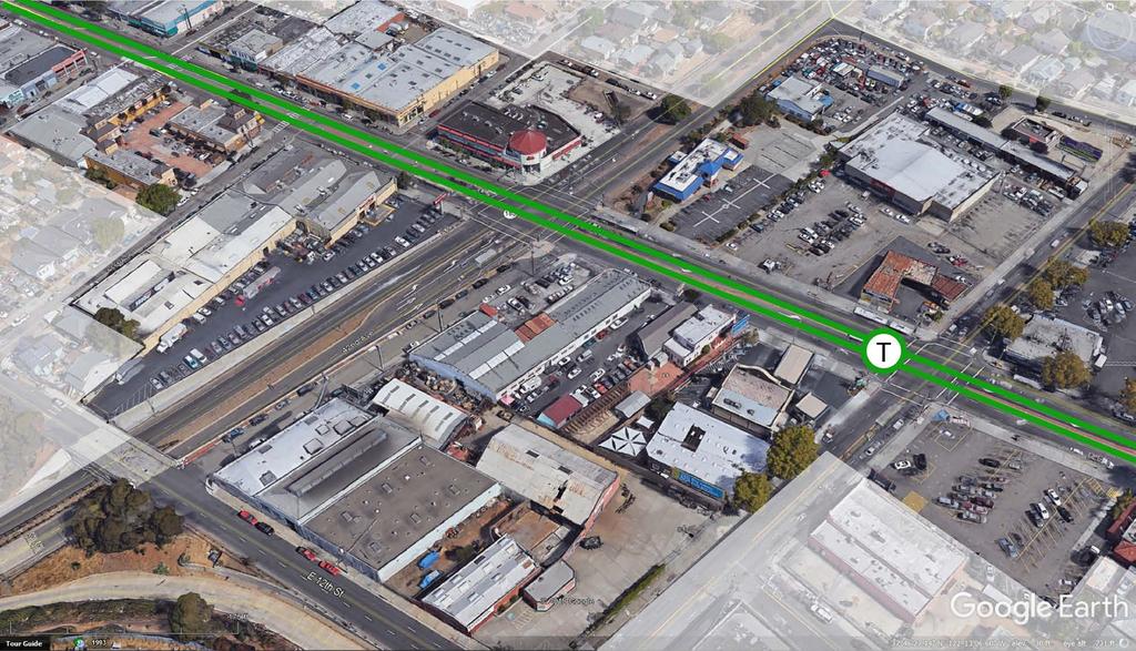
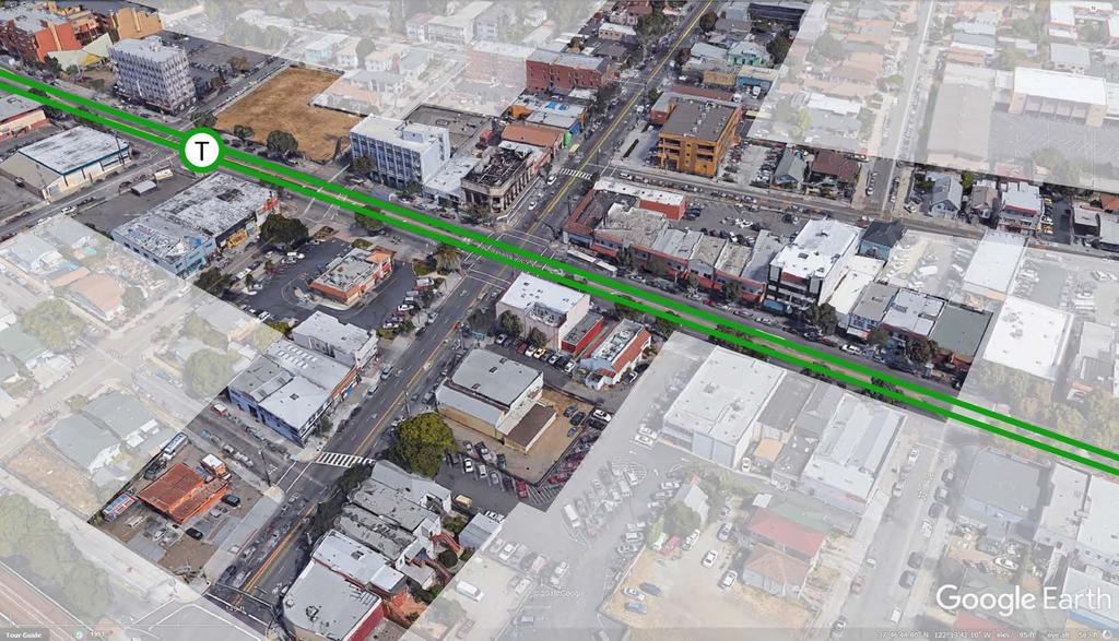
2 Regional Vision Draper Prison

3 The Bottleneck is a State-Level issue, Salt Lake County 2050 Population: 1.5M Draper Prison hopefully with some State-Level funding! Utah County 2050 Population: 1.3M Source: Kem C. Gardner Policy Institute


4 STUDY AREA OPPORTUNITIES Capitalize on location at population center and large community of educated workers, Optimize transit and infrastructure investments by coordinating development, Define an innovation hub that attracts institutional partners.

5 2016 EDCUtah Site Selector Study


6 Jobs/Housing Imbalance MIX MIX JOBS Housing is rapidly locating in western SLCo and UTCo Lack of jobs/housing balance creates eastwest traffic congestion. HOUSING HOUSING JOBS However, jobs will continue to locate near/around I-15


7 UTA is the best large public transportation system in North America" - American Public Transportation Association
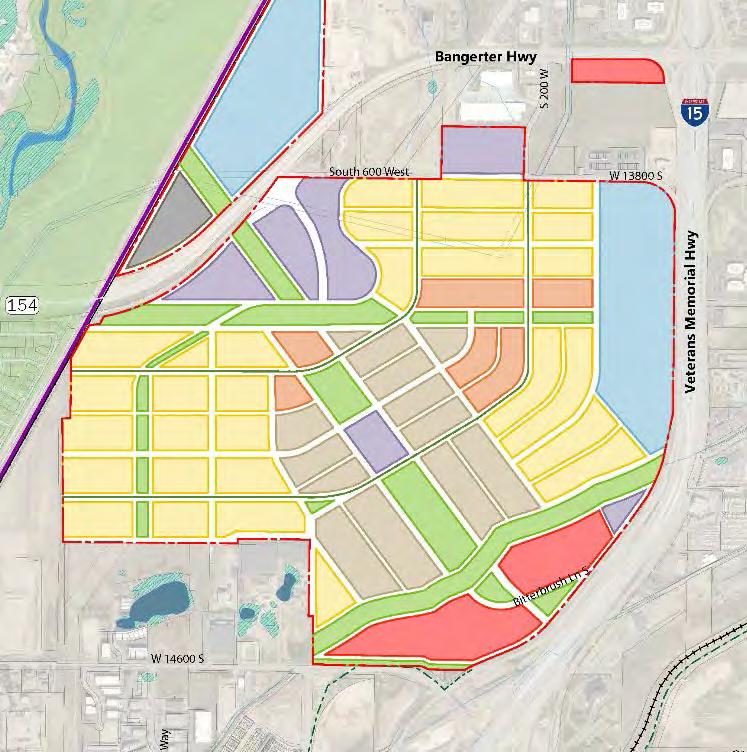
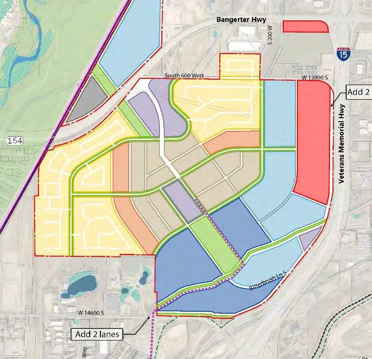
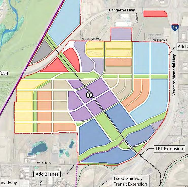
8 LIGHT RAIL EXTENSION


9 BUS RAPID TRANSIT EXPANSION Three UTA Routes 1 2 3

10 Scenarios A B C D
11 Jobs & Economy A/C B/D/E
12 Transportation A B C D E
13 Community Design A B C D/E
14 Recreation A/C B/D/E
15 Air Quality A B/C D E

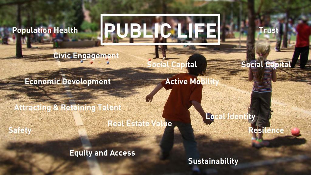
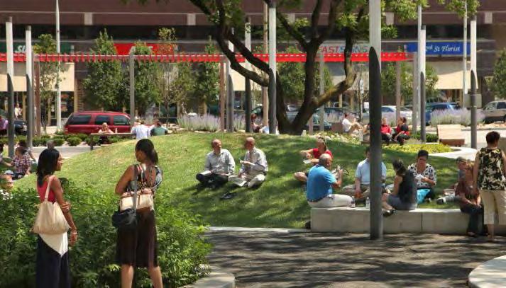
16 Infrastructure for Health the conditions in which peopleare born, grow, work, live, and age, and the wider set of forces and systems shaping the conditions of daily life. (WHO,2017)

17 Infrastructure for Health 70% of air pollution in this area is attributable to Traffic the conditions in which peopleare born, grow, work, live, and age, and the wider set of forces and systems shaping the conditions of daily life. (WHO,2017)

18 Planning for Health HEALTH Aging Open Space Access Quality of Life SOCIAL Prioritizing People Culture Equity Multi-Generational INNOVATION Mobility / Livability Connectivity Attraction / Retention Education Economic Development
19

20 So what do we do?

21 How? 1. Visualize VALUE; 2. Think CORRIDORS, instead of stations ; 3. Think COMMUNITY, instead of transportation ; 4. Think PARTNER, instead of competitor ; and 5. Think CHAMPIONS, instead of stakeholders.
22 1. Visualize VALUE

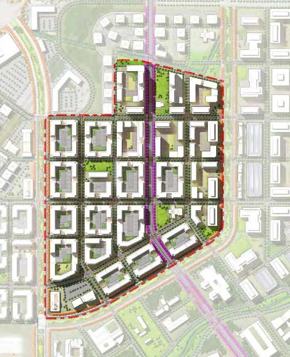
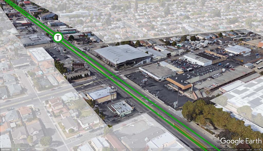
23 1. Visualize VALUE RETAIL / GROCERY SHOPPING / AMENITY SERVICES ACTIVE TRANSPORTATION GATHERINGS + FRIENDS AFFORDABLE HOUSING SIGNATURE PARKS CONVENIENT TRANSIT ACCESS NEW JOBS
24
25
26
27

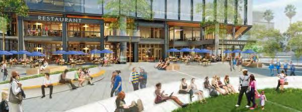
28 2. Think CORRIDORS Employment clusters drive regional transit use. Promote growth in corridors. Integrate land use and transit planning. Salt Lake City, UTA Corridor

29 2. Think CORRIDORS Mix of land uses Density around transit Quarter-mile spacing within commercial / jobs zones. Draper, UTA Station Project

30 KEY ELEMENTS Case Study T T T T T T DRAPER PLAN
31 Case Study T T T T T T LEGEND BRT LRT DRAPER PLAN


32 KEY ELEMENTS Dedicated BRT lane must travel faster than a private vehicle! Adjacent to highest-density residential and commercial uses Buffered Bike Lane equity follows safety


33 OFFICE DISTRICT DEDICATED TRANSIT


34 3. Think COMMUNITY


35 MIXED USE TOWN CENTER Mix of Uses near BRT Residential units; Office Space; Ground floor retail and amenities; and 9 acres of new destination parks, civic use and open space.


36 RESIDENTIAL NEIGHBORHOOODS Recommended Densities Minimum du/acre for BRT; Recommended du/acre; With 5-story apartment blocks, we ve shown 90-du/acre along BRT.


37 4. Think PARTNER

38 5. Think CHAMPION Major anchor institutions (healthcare, education providers) and real estate community are natural champions. For example, Cleveland Line. University of Utah


39 RESEARCH / CATALYTIC DISTRICT Key Elements Future Academic or large Employer 12 acres of Civic and Open Space New Attraction: Draper Guard Tower Public Transit Plaza
40 02 Wrapping it Up


41 KEY ELEMENTS Light Rail Transit Dedicated BRT Lanes Micro-transit Shuttles

42 Success Metrics Appx 4,000 jobs accessible within a 10-minutes of a station Appx 6,500 people living within a quarter of a mile of transit How? Integrated Land Use + Transit Planning Connections where they matter Free fare option 15 minute headways

43 Success Metrics Total 2050 emissions. Regional is Utah, Salt Lake, Davis, and Weber counties. Preferred assumes 30% electric vehicles.
44


45 What makes great Public / Private Research Clusters? MIXED-USE OFFICE HOTELS CONFERENCE FACILITIES SHARED SPACE TRANSIT USEABLE OPEN SPACE CAMPUS ENVIRONMENT


46 RESEARCH / CATALYTIC DISTRICT Public Partner Stanford, Redwood City T Private Partner Gilead, Foster City
47

48 THE RETURN OF GREAT STREETS
49


50 What makes great Transit Oriented-Employment Clusters? VIBRANT DIVERSE USES INFILL RAIL HIGHER DENSITIES USEABLE OPEN SPACE
51 Thank You!
The 3V Approach. Transforming the Urban Space through Transit Oriented Development. Gerald Ollivier Transport Cluster Leader World Bank Hub Singapore
 Transforming the Urban Space through Transit Oriented Development The 3V Approach Gerald Ollivier Transport Cluster Leader World Bank Hub Singapore MDTF on Sustainable Urbanization The China-World Bank
Council Workshop on Neighbourhoods Thursday, October 4 th, :00 to 4:00 p.m. Burlington Performing Arts Centre
 Council Workshop on Neighbourhoods Thursday, October 4 th, 2012 1:00 to 4:00 p.m. Burlington Performing Arts Centre Agenda Introductions Warm-Up Exercise Presentation Exercise Neighbourhood Planning Break
CORRIDORS OF FREEDOM Access Management (Ability) Herman Pienaar: Director City Transformation and Spatial Planning
 Herman Pienaar: Director City Transformation and Spatial Planning") CORRIDORS OF FREEDOM Access Management (Ability) 2016 Herman Pienaar: Director City Transformation and Spatial Planning PLANNING DEVELOPMENT PROCESS RATHER THAN A PLAN CAPITAL INVESTMENT DEVELOPMENT FACILITATION
CORRIDORS OF FREEDOM Access Management (Ability) 2016 Herman Pienaar: Director City Transformation and Spatial Planning PLANNING DEVELOPMENT PROCESS RATHER THAN A PLAN CAPITAL INVESTMENT DEVELOPMENT FACILITATION
The CRP stresses a number of factors that point to both our changing demographics and our future opportunities with recommendations for:
 Plan Overview The CRP represents the first broad planning initiative covering Lake, Porter and LaPorte counties. Unlike previous plans released by NIRPC, which focused primarily on transportation, the
Foreword. Vision and Strategy
 GREATER MANCHESTER SPATIAL FRAMEWORK Friends of Walkden Station Consultation Response January 2017 Foreword Friends of Walkden Station are a group of dedicated volunteers seeking to raise the status and
California Urban Infill Trip Generation Study. Jim Daisa, P.E.
 California Urban Infill Trip Generation Study Jim Daisa, P.E. What We Did in the Study Develop trip generation rates for land uses in urban areas of California Establish a California urban land use trip
Regional Growth Strategy Work Session Growth Management Policy Board
 Regional Growth Strategy Work Session Growth Management Policy Board September 6, 2018 1 Overview Recap June GMPB work session Objectives and outcomes Regional geographies Growth scenarios Breakout Discussion:
Economic Activity Economic A ctivity
 5 Economic Economic Activity Activity ECONOMIC ACTIVITY 5.1 EMPLOYMENT... 5-7 5.1.1 OBJECTIVE... 5-7 5.1.2 POLICIES... 5-7 5.2 PROTECTING THE AREA OF EMPLOYMENT... 5-9 5.2.1 OBJECTIVE... 5-9 5.2.2 POLICIES...
CERTIFIED RESOLUTION. introduction: and dated May 29, 2017, as attached, as appropriate
 15322 Buena Vista Avenue, White Rock BC, Canada V4B 1Y6 www.whiterockcity.ca City of White Rock P: 604.541.22121 F: 604.541.9348 /2tC% City Clerk s Office IT E ROC K June 13,2017 Stephanie Lam, Deputy
GIS Analysis of Crenshaw/LAX Line
 PDD 631 Geographic Information Systems for Public Policy, Planning & Development GIS Analysis of Crenshaw/LAX Line Biying Zhao 6679361256 Professor Barry Waite and Bonnie Shrewsbury May 12 th, 2015 Introduction
Proposed Scope of Work Village of Farmingdale Downtown Farmingdale BOA Step 2 BOA Nomination Study / Draft Generic Environmental Impact Statement
 Proposed Scope of Work Village of Farmingdale Downtown Farmingdale BOA Step 2 BOA Nomination Study / Draft Generic Environmental Impact Statement The scope of work that follows incorporates and covers
CLAREMONT MASTER PLAN 2017: LAND USE COMMUNITY INPUT
 Planning and Development Department 14 North Street Claremont, New Hampshire 03743 Ph: (603) 542-7008 Fax: (603) 542-7033 Email: cityplanner@claremontnh.com www.claremontnh.com CLAREMONT MASTER PLAN 2017:
CHAPTER 2. Strategic Context
 CHAPTER 2 Strategic Aim: To facilitate the future development of Cork as a national gateway city within the integrated land use and transportation framework set out in the Cork Area Strategic Plan 2001
Regional Performance Measures
 G Performance Measures Regional Performance Measures Introduction This appendix highlights the performance of the MTP/SCS for 2035. The performance of the Revenue Constrained network also is compared to
PlaceTypes. How the built environment is measured. Variables Measures Levels. AREA TYPE + DEVELOPMENT TYPE = PlaceType
 PlaceTypes In order to better understand land use and transportation interactions and to make more informed policy decisions, neighborhood characteristics can be analyzed by the role that they play in
Regional Performance Measures
 G Performance Measures Regional Performance Measures Introduction This appendix highlights the performance of the MTP/SCS for 2035. The performance of the Revenue Constrained network also is compared to
King City URA 6D Concept Plan
 King City URA 6D Concept Plan King City s Evolution Among the fastest growing cities 2000 Census 1,949 2010 Census 3,111 60% increase 2016 Census estimate 3,817 23% increase Average annual rate 4.3% Surpassing
Forecasts for the Reston/Dulles Rail Corridor and Route 28 Corridor 2010 to 2050
 George Mason University Center for Regional Analysis Forecasts for the Reston/Dulles Rail Corridor and Route 28 Corridor 21 to 25 Prepared for the Fairfax County Department of Planning and Zoning Lisa
_INTRODUCTION TSHWANE...3 EXISTING SPATIAL FORM... 3 NATURE OF THE PROBLEM...3 STUDY AREA...5 INTRODUCTION
 CHAPTER: 1 _INTRODUCTION TSHWANE...3 EXISTING SPATIAL FORM... 3 NATURE OF THE PROBLEM...3 STUDY AREA...5 INTRODUCTION 2 TSHWANE Pretoria, the inner city region of Tshwane, a place of great significance,
Coordinated Transit and Land Use Planning in the Region of Waterloo
 Coordinated Transit and Land Use Planning in the Region of Waterloo Jeffrey M. Casello University of Waterloo Kevin Curtis Graham Vincent Region of Waterloo Transportation Research Board Best Practices:
Committee Meeting November 6, 2018
 Committee Meeting November 6, 2018 Agenda Where we are in the process Land Use Plan Transportation Element Housing & Neighborhoods Elements Next Steps Schedule November 6: Plan Elements December: Plan
New Partners for Smart Growth: Building Safe, Healthy, and Livable Communities Mayor Jay Williams, Youngstown OH
 New Partners for Smart Growth: Building Safe, Healthy, and Livable Communities Mayor Jay Williams, Youngstown OH The City of Youngstown Youngstown State University Urban Strategies Inc. Youngstown needed
Integrated Infrastructure Planning & Spatial Mapping
 Integrated Infrastructure Planning & Spatial Mapping Presenter: Heidi Dixon, Principal Social Planner, DTPLI 23 May 2014 PART 1 PLAN MELBOURNE : Metropolitan Planning Strategy PART 2 Case Study: DTPLI
CITY OF CAMBRIDGE Growth & Intensification Study Secondary Plan Stakeholder Session June 26th, 2017
 CITY OF CAMBRIDGE Growth & Intensification Study Secondary Plan Stakeholder Session June 26th, 2017 Dillon Consulting Limited Watson & Associates Economists Curtis Planning Inc. Tim Welch Consulting Inc.
Regional Growth Strategy Regional TOD Advisory Committee
 Regional Strategy Regional TOD Advisory Committee September 21, 2018 Overview Regional Geographies Transit-Oriented Development Goal Scenarios Next Steps 2 Schedule + Process September 6 Management Policy
Study Overview. the nassau hub study. The Nassau Hub
 Livable Communities through Sustainable Transportation the nassau hub study AlternativeS analysis / environmental impact statement The Nassau Hub Study Overview Nassau County has initiated the preparation
HORIZON 2030: Land Use & Transportation November 2005
 PROJECTS Land Use An important component of the Horizon transportation planning process involved reviewing the area s comprehensive land use plans to ensure consistency between them and the longrange transportation
Frequently Asked Questions
 What is the Regional Transit Engagement Series? As one of the fastest growing regions in the country, there is recognition that long-term transit planning efforts should be accelerated if we are to remain
Get Over, and Beyond, the Half-Mile Circle (for Some Transit Options)
") Get Over, and Beyond, the Half-Mile Circle (for Some Transit Options) Arthur C. Nelson, Ph.D., FAICP Associate Dean for Research & Discovery College of Architecture, Planning and Landscape Architecture
Get Over, and Beyond, the Half-Mile Circle (for Some Transit Options) Arthur C. Nelson, Ph.D., FAICP Associate Dean for Research & Discovery College of Architecture, Planning and Landscape Architecture
MPOs SB 375 LAFCOs SCAG Practices/Experiences And Future Collaborations with LAFCOs
 Connecting LAFCOs and COGs for Mutual Benefits MPOs SB 375 LAFCOs SCAG Practices/Experiences And Future Collaborations with LAFCOs Frank Wen, Manager Research & Analysis Land Use & Environmental Planning
Understanding Land Use and Walk Behavior in Utah
 Understanding Land Use and Walk Behavior in Utah 15 th TRB National Transportation Planning Applications Conference Callie New GIS Analyst + Planner STUDY AREA STUDY AREA 11 statistical areas (2010 census)
Urban development. The compact city concept was seen as an approach that could end the evil of urban sprawl
 The compact city Outline 1. The Compact City i. Concept ii. Advantages and the paradox of the compact city iii. Key factor travel behavior 2. Urban sustainability i. Definition ii. Evaluating the compact
Leveraging Urban Mobility Strategies to Improve Accessibility and Productivity of Cities
 Leveraging Urban Mobility Strategies to Improve Accessibility and Productivity of Cities Aiga Stokenberga World Bank GPSC African Regional Workshop May 15, 2018 Roadmap 1. Africa s urbanization and its
Westside Extension Los Angeles, California
 Westside Extension Los Angeles, California Rail~Volution 2010 Portland, Oregon Monica Villalobos AECOM History of Westside Suburban Growth in the Westside (1920 1970 s) LA Centers Concept + Employment
Port Cities Conference: How Regional Planning can Help Support a Competitive Port. Christina DeMarco Metro Vancouver
 Port Cities Conference: How Regional Planning can Help Support a Competitive Port Christina DeMarco Metro Vancouver June 12. 2008 Metro Vancouver Regional Growth Management Three ways to help support the
Growth Management: Analysis of Comments Received and Responses Comments received as of October 16, 2017
 Growth Management: Analysis of Comments Received and s Comments received as of October 16, Comments informing the Region of Peel s growth management work have been summarized with responses below. These
38th UNWTO Affiliate Members Plenary Session Yerevan, Armenia, 4 October 2016
 38th UNWTO Affiliate Members Plenary Session Yerevan, Armenia, 4 October 2016 17:00-19:00 Open Debate 5: City Tourism Introduced and Moderated by Dr. Donald Hawkins George Washington University World urban
Making space for a more foundational construction sector in Brussels
 Making space for a more foundational construction sector in Brussels Sarah De Boeck, David Bassens & Michael Ryckewaert Social innovation in the Foundational Economy Cardiff, 5 th of September 2018 1.
TOD Priority Tool Executive Summary
 TOD Priority Tool Executive Summary A Resource for Identifying TOD Opportunities to Support High-Capacity Transit Capital Metropolitan Transportation Authority Austin, Texas 3 TOD PRIORITY TOOL THE TOD
convenience truth 4 concepts and their SYNTHESIS a convenience truth 5.0
 5.0 Concept 1 Interconnected Places: Use the framework of our arterials to both connect and distinguish urban places Vancouver s existing urban structure, based on the original streetcar city pattern,
NEW WATERFRONT METROPARK. P u b l i c O p e n H o u s e, J u n e 2 1,
 NEW WATERFRONT METROPARK P u b l i c O p e n H o u s e, J u n e 2 1, 2 0 1 7 U N D E R S T A N D I N G YO U R P E R S P E C T I V E PUBLIC OPEN HOUSE Welcome/Introductions Project Presentation Project
Shaping Your Neighbourhood
 Shaping Your Neighbourhood Building a Core Sustainable Neighbourhood Action Plan Nov. 25 & 26, 2006 Welcome! Peter Russell Planner, Holland Barrs Planning Group Inc. Role in this project: Work with the
PIONEERING A NEW FRONTIER IN PEACHTREE CORNERS 3550ENGINEERING.COM
 PIONEERING A NEW FRONTIER IN PEACHTREE CORNERS Project Snapshot Recently acquired by Icarus Alternative Investments and Scipio Ventures, 3550 Engineering Drive is a 4-story, 101,809 square foot suburban
An online data and consulting resource of THE UNIVERSITY OF TOLEDO THE JACK FORD URBAN AFFAIRS CENTER
 An online data and consulting resource of THE JACK FORD URBAN AFFAIRS CENTER THE CENTER FOR GEOGRAPHIC INFORMATION SCIENCE AND APPLIED GEOGRAPHICS DEPARTMENT OF GEOGRAPHY AND PLANNING THE UNIVERSITY OF
Urbanization and Sustainable Development of Cities: A Ready Engine to Promote Economic Growth and Cooperation
 Urbanization and Sustainable Development of Cities: A Ready Engine to Promote Economic Growth and Cooperation Wan Portia Hamzah Institute of Strategic and International Studies (ISIS) Malaysia 10 September
Introduction and Project Overview
 Greater New Orleans Regional Land Use Modeling GIS Techniques in a P olitical C ontext Louisiana Remote Sensing and GIS Workshop Wednesday, April 24, 2013 Working Towards a Shared Regional Vision Introduction
APPENDIX I - AREA PLANS
 ROUTE 37 WEST LAND USE PLAN ROUTE 37 WEST LAND USE PLAN Recent land use decisions and development trends have drawn attention to the land within the Route 37 western by-pass area between Route 50 and
URBAN TRANSPORTATION SYSTEM (ASSIGNMENT)
") BRANCH : CIVIL ENGINEERING SEMESTER : 6th Assignment-1 CHAPTER-1 URBANIZATION 1. What is Urbanization? Explain by drawing Urbanization cycle. 2. What is urban agglomeration? 3. Explain Urban Class Groups.
BRANCH : CIVIL ENGINEERING SEMESTER : 6th Assignment-1 CHAPTER-1 URBANIZATION 1. What is Urbanization? Explain by drawing Urbanization cycle. 2. What is urban agglomeration? 3. Explain Urban Class Groups.
MODULE 1 INTRODUCING THE TOWNSHIP RENEWAL CHALLENGE
 MODULE 1 INTRODUCING THE TOWNSHIP RENEWAL CHALLENGE FOCUS OF THE MODULE Township renewal challenges and developmental outcomes covered in this module: Historical origins of townships and the inherited
Density and Walkable Communities
 Density and Walkable Communities Reid Ewing Professor & Chair City and Metropolitan Planning University of Utah ewing@arch.utah.edu Department of City & Metropolitan Planning, University of Utah MRC Research
Hillsborough County MPO Transit Study. Technical Team August 23, 2007
 Hillsborough County MPO Transit Study Technical Team August 23, 2007 Meeting Agenda Technology Choices Needs and Opportunities Transit Concepts Comparative Land Use Analysis Measures of Effectiveness System
Initial Findings from Regional Initiatives Planning Enhancement Fair Housing & Equity Assessment
 NEW YORK AND CONNECTICUT SUSTAINABLE COMMUNITIES Initial Findings from Regional Initiatives Planning Enhancement Fair Housing & Equity Assessment July 30, 2013 White Plains Library Federal grant to improve
GOVERNMENT MAPPING WORKSHOP RECOVER Edmonton s Urban Wellness Plan Mapping Workshop December 4, 2017
 GOVERNMENT MAPPING WORKSHOP 12.4.17 RECOVER Edmonton s Urban Wellness Plan Mapping Workshop December 4, 2017 In July of 2017, City Council directed administration to develop RECOVER, Edmonton s Urban Wellness
Transit Market Index. Validating Local Potential for Transit Ridership
 Transit Market Index Validating Local Potential for Transit Ridership Transit Market Areas Characteristics 2010 TPP Characterized by different levels of transit service. Core Areas, 1 & 2: A variety of
Guidelines on Using California Land Use/Transportation Planning Tools
 Guidelines on Using California Land Use/Transportation Planning Tools 1. Selecting Ds Analysis Modules Appropriate to a Region In almost all cases, the appropriate Ds Analysis Module to use for analysis
Alternatives Analysis
 Alternatives Analysis Prepared for: Metropolitan Atlanta Rapid Transit Authority Prepared by: AECOM/Jacobs-JJG Joint Venture Atlanta, GA November 2012 Page Left Intentionally Blank ii TABLE OF CONTENTS
PIONEERING A NEW FRONTIER IN PEACHTREE CORNERS
 PIONEERING A NEW FRONTIER IN PEACHTREE CORNERS Project Snapshot R ER S TR C H and Scipio Ventures, 3550 Engineering Drive is a 4-story, W Y R 3550 Engineering is poised for companies who place high IN
Com munity Advisor y C ommitte e Meeting
 Community Advisor y Committee Meeting J u n e 1 5, 2 0 1 7 Project Scope 14 miles of enhanced service from Downtown Portland to Cleveland Park & Ride 41 Stations with 82 Platforms 1/3 mile approximate
Economic and Social Urban Indicators: A Spatial Decision Support System for Chicago Area Transportation Planning
 Economic and Social Urban Indicators: A Spatial Decision Support System for Chicago Area Transportation Planning Piyushimita Thakuriah (Vonu), P.S. Sriraj, Paul Metaxatos, Inshu Minocha & Tanushri Swarup
Transit Time Shed Analyzing Accessibility to Employment and Services
 Transit Time Shed Analyzing Accessibility to Employment and Services presented by Ammar Naji, Liz Thompson and Abdulnaser Arafat Shimberg Center for Housing Studies at the University of Florida www.shimberg.ufl.edu
NATURE AND EXTENT OF PROPOSED DEVELOPMENT. Amount of Development Development Zones Distribution of Density Policies
 NATURE AND EXTENT OF PROPOSED DEVELOPMENT Amount of Development Development Zones Distribution of Density Policies DRAFT POOLBEG PLANNING SCHEME Amount of Development 78 4.1 The rationale for the overall
A Comparison of the Accessibility of Three Neighborhoods Institutions and Amenities in Frederick, MD
 A Comparison of the Accessibility of Three Neighborhoods Institutions and Amenities in Frederick, MD Elizabeth Hampton Christopher Johansson Yana Demireva Albert Engel Table of Contents EXECUTIVE SUMMARY...
2040 MTP and CTP Socioeconomic Data
 SE Data 6-1 24 MTP and CTP Socioeconomic Data Purpose of Socioeconomic Data The socioeconomic data (SE Data) shows the location of the population and employment, median household income and other demographic
A/Prof. Mark Zuidgeest ACCESSIBILITY EFFECTS OF RELOCATION AND HOUSING PROJECT FOR THE URBAN POOR IN AHMEDABAD, INDIA
 A/Prof. Mark Zuidgeest ACCESSIBILITY EFFECTS OF RELOCATION AND HOUSING PROJECT FOR THE URBAN POOR IN AHMEDABAD, INDIA South African Cities Network/University of Pretoria, 09 April 2018 MOBILITY Ability
Regional Snapshot Series: Transportation and Transit. Commuting and Places of Work in the Fraser Valley Regional District
 Regional Snapshot Series: Transportation and Transit Commuting and Places of Work in the Fraser Valley Regional District TABLE OF CONTENTS Complete Communities Daily Trips Live/Work Ratio Commuting Local
Exploring Reciprocal Relationships of Land-Uses in a Historical Mixed-Use Quarter of Istanbul
 Exploring Reciprocal Relationships of Land-Uses in a Historical Mixed-Use Quarter of Istanbul Measuring mixed-use patterns of Cihangir Ahu Sokmenoglu 1, N. Onur Sonmez 2 Istanbul Technical University,
Data driven approaches to Urban Planning Experience from Derry/Londonderry
 Data driven approaches to Urban Planning Experience from Derry/Londonderry Anna Rose RTPI Belfast 11 th of September 1 June 26 07:47AM 2 The value of the City The space of the city is a theatre: playing
Mapping and Health Equity Advocacy
 Mapping and Health Equity Advocacy Sarah Treuhaft PolicyLink November 7, 2008 About us PolicyLink National research and action institute that advances policies to achieve economic and social equity Center
Subject: Note on spatial issues in Urban South Africa From: Alain Bertaud Date: Oct 7, A. Spatial issues
 Page 1 of 6 Subject: Note on spatial issues in Urban South Africa From: Alain Bertaud Date: Oct 7, 2009 A. Spatial issues 1. Spatial issues and the South African economy Spatial concentration of economic
Policy Note 6. Measuring Unemployment by Location and Transport: StepSA s Access Envelope Technologies
 6 Measuring Unemployment by Location and Transport: StepSA s Access Envelope Technologies Introduction Increasing emphasis is coming onto spatial planning as government in South Africa moves to address
Economic Geography of the Long Island Region
 Geography of Data Economic Geography of the Long Island Region Copyright 2011 AFG 1 The geography of economic activity requires: - the gathering of spatial data - the location of data geographically -
[Leveraging & Improving Neighborhood Connections] Area E Cedar Creek
![[Leveraging & Improving Neighborhood Connections] Area E Cedar Creek](/thumbs/86/93508963.jpg "[Leveraging & Improving Neighborhood Connections] Area E Cedar Creek") Community Charrette LINC Dallas [Leveraging & Improving Neighborhood Connections] Area E Cedar Creek 06.02.12 LINC Workshop Area E Area E has the unique distinction of at-grade frontage to the Trinity
Community Charrette LINC Dallas [Leveraging & Improving Neighborhood Connections] Area E Cedar Creek 06.02.12 LINC Workshop Area E Area E has the unique distinction of at-grade frontage to the Trinity
Metrolinx Transit Accessibility/Connectivity Toolkit
 Metrolinx Transit Accessibility/Connectivity Toolkit Christopher Livett, MSc Transportation Planning Analyst Research and Planning Analytics Tweet about this presentation #TransitGIS OUTLINE 1. Who is
November 29, World Urban Forum 6. Prosperity of Cities: Balancing Ecology, Economy and Equity. Concept Note
 November 29, 2010 World Urban Forum 6 Prosperity of Cities: Balancing Ecology, Economy and Equity Concept Note 1 CONTENT Thematic Continuity Conceptualizing the Theme The 6 Domains of Prosperity The WUF
Growing Lagging Regions:
 Growing Lagging Regions: Case study: North of England OECD seminar, June 28 2010 Richard Baker Policy & Research Manager, Northern Way richard.baker@thenorthernway.co.uk Presentation Address discussion
Joint Planning Advisory Council July 19, 2011
 Joint Planning Advisory Council July 19, 2011 Global Cities Program Objectives Helping advance strategic thinking in a variety of critical areas. Facilitating informed decisionmaking on the part of public
Land Use and Zoning Page 1 of 10 LAND USE AND ZONING
 LAND USE AND ZONING Land Use and Zoning Page 1 of 10 BACKGROUND The Clifton-Fruitvale planning area is about 3,962 acres (6.2 sq. miles) with a population of 14,000 residents. The density of the area is
The National Spatial Strategy
 Purpose of this Consultation Paper This paper seeks the views of a wide range of bodies, interests and members of the public on the issues which the National Spatial Strategy should address. These views
Note on Transportation and Urban Spatial Structure
 Note on Transportation and Urban Spatial Structure 1 By Alain Bertaud, Washington, ABCDE conference, April 2002 Email: duatreb@msn.com Web site: http://alain-bertaud.com/ http://alainbertaud.com/ The physical
3.0 ANALYSIS OF FUTURE TRANSPORTATION NEEDS
 3.0 ANALYSIS OF FUTURE TRANSPORTATION NEEDS In order to better determine future roadway expansion and connectivity needs, future population growth and land development patterns were analyzed as part of
Transport Planning in Large Scale Housing Developments. David Knight
 Transport Planning in Large Scale Housing Developments David Knight Large Scale Housing Developments No longer creating great urban spaces in the UK (Hall 2014) Transport Planning Transport planning processes
StanCOG Transportation Model Program. General Summary
 StanCOG Transportation Model Program Adopted By the StanCOG Policy Board March 17, 2010 What are Transportation Models? General Summary Transportation Models are technical planning and decision support
Assessment of Sustainable Land Use within the Town Planning Process Experiences with a Multi Criteria Approach (MCA)
") Assessment of Sustainable Land Use within the Town Planning Process Experiences with a Multi Criteria Approach (MCA) Dipl.-Geogr. Sophie Schetke Dipl.-Ing. Benedikt Frielinghaus, University of Bonn, Germany
Assessment of Sustainable Land Use within the Town Planning Process Experiences with a Multi Criteria Approach (MCA) Dipl.-Geogr. Sophie Schetke Dipl.-Ing. Benedikt Frielinghaus, University of Bonn, Germany
BROOKINGS May
 Appendix 1. Technical Methodology This study combines detailed data on transit systems, demographics, and employment to determine the accessibility of jobs via transit within and across the country s 100
Riocan Centre Study Area Frontenac Mall Study Area Kingston Centre Study Area
 OVERVIEW the biggest challenge of the next century (Dunham Jones, 2011). New books are continually adding methods and case studies to a growing body of literature focused on tackling this massive task.
Land Use Modeling at ABAG. Mike Reilly October 3, 2011
 Land Use Modeling at ABAG Mike Reilly michaelr@abag.ca.gov October 3, 2011 Overview What and Why Details Integration Use Visualization Questions What is a Land Use Model? Statistical relationships between
INTERNATIONAL EXPERIENCE IN INNOVATIONS IN METRO RAIL. Gerald Ollivier Transport Cluster Leader Singapore, World Bank
 INTERNATIONAL EXPERIENCE IN INNOVATIONS IN METRO RAIL Gerald Ollivier Transport Cluster Leader Singapore, World Bank Innovation 1: Density Aligned with Transit From Serge Salat London s Jobs densities
Towards a City Model for Heritage-Led Regeneration and Tourism Development
 Towards a City Model for Heritage-Led Regeneration and Tourism Development Brian Smith, Secretary General European Association of Historic Towns and Regions Summary of Presentation Objective Background
Local Economic Activity Around Rapid Transit Stations
 Local Economic Activity Around Rapid Transit Stations The Case of Chicago s Orange Line Julie Cooper, MPP 2014 Harris School of Public Policy Transport Chicago June 6, 2014 Motivation Impacts of transit
Regional Transit Development Plan Strategic Corridors Analysis. Employment Access and Commuting Patterns Analysis. (Draft)
") Regional Transit Development Plan Strategic Corridors Analysis Employment Access and Commuting Patterns Analysis (Draft) April 2010 Contents 1.0 INTRODUCTION... 4 1.1 Overview and Data Sources... 4 1.2
Regional Transit Development Plan Strategic Corridors Analysis Employment Access and Commuting Patterns Analysis (Draft) April 2010 Contents 1.0 INTRODUCTION... 4 1.1 Overview and Data Sources... 4 1.2
Crow River Plaza - Retail Development South Diamond Lake Rd. Rogers, MN FOR LEASE 1,024 SF Retail Space. Lease Rate: $16.
 FEATURES: - Available in Rogers, MN Lease Rate: $16.00 / psf NNN - Excellent location with freeway signage on I-94! - Near large retailers such as Target, Kohls, & Applebees. Taxes $3.65 / psf Cam $3.20
Alternatives Analysis Report
 1.0 PURPOSE AND NEED The Southern California Association of Governments (SCAG), in coordination with the Los Angeles County Metropolitan Transportation Authority (Metro) and the Orange County Transportation
A Unique Building For the Discerning Client P O S T ROA D E A S T W E S T P O R T, C O N N E C T I C U T
 A Unique Building For the Discerning Client 1 0 3 2 P O S T ROA D E A S T W E S T P O R T, C O N N E C T I C U T 1032 Post Road East Westport represents a unique opportunity to acquire or lease a brand
GRB QUICK REFERENCE: Contact Information.
 1 GEORGE R. BROWN C O N V E N T I O N C E N T E R WITH A VIBRANT DOWNTOWN, a walkable convention district and one of the largest convention facilities in America, there has never been a better time to
Regional Growth Strategy Regional Staff Committee
 Regional Growth Strategy Regional Staff Committee June 21, 2018 1 Overview Summary of June Growth Management Policy Board Regional Growth Strategy Objectives Regional Geographies Regional Growth Strategy
GIS Geographical Information Systems. GIS Management
 GIS Geographical Information Systems GIS Management Difficulties on establishing a GIS Funding GIS Determining Project Standards Data Gathering Map Development Recruiting GIS Professionals Educating Staff
Neighborhood Locations and Amenities
 University of Maryland School of Architecture, Planning and Preservation Fall, 2014 Neighborhood Locations and Amenities Authors: Cole Greene Jacob Johnson Maha Tariq Under the Supervision of: Dr. Chao
Crow River Plaza - Retail Development South Diamond Lake Rd. Rogers, MN FOR LEASE 2,066 SF Retail Space. Lease Rate: $16.
 FEATURES: - 2,066 SF End Cap Retail Space Available in Rogers, MN - Excellent location with freeway signage on I-94! - Near large retailers such as Target, Kohls, & Applebees. - Convenient location off
I. M. Schoeman North West University, South Africa. Abstract
 Urban Transport XX 607 Land use and transportation integration within the greater area of the North West University (Potchefstroom Campus), South Africa: problems, prospects and solutions I. M. Schoeman