WELCOME! Meeting 3 July 9, 2014 Wichita, Kansas
|
|
|
- Tobias Atkinson
- 5 years ago
- Views:
Transcription
1 WELCOME! Kansas Freight Advisory Committee Meeting 3 July 9, 2014 Wichita, Kansas
2 TODAY S MEETING 1. Meeting 2 Recap and Port of Catoosa Tour Highlights 2. Draft Freight Corridors of Significance Highway Primary and Secondary Rail Primary and Secondary Multimodal Freight Corridors of Statewide and Regional Significance 3. Draft Freight Corridors of Significance Breakout Sessions and Report Backs 4. Public-Private Partnerships for Future Freight Investment Strategies 5. Future Private Sector Needs 6. Meeting 4 Topics and Goals
3 MEETING 2 RECAP 1. Truck Driver Shortage/Training Issues 2. Regional Freight Logistics Opportunities and Challenges 3. Base Criteria for Multimodal Freight Corridors of Significance 4. Geometric Impediments 5. Overview of Draft Highway Freight Corridors of Significance

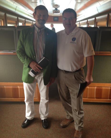
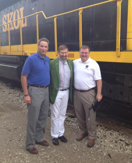
4 PORT OF CATOOSA VISIT
5 D R A F T F R E I G H T C O R R I D O R S O F S I G N I F I C A N C E Freight corridors members of the group identified during our last meeting Primary Secondary North-South East-West Interstate System KDOT planning data and staff input

6 F R E I G H T A D V I S O R Y C O M M I T T E E H I G H W AY F R E I G H T C O R R I D O R S O F S I G N I F I C A N C E M E M B E R M A P S U M M A R Y
7 K FA C D R A F T H I G H WAY F R E I G H T C O R R I D O R S O F S I G N I F I C A N C E M A P
8 K F A C D R A F T P R I M A R Y F R E I G H T C O R R I D O R S O F S I G N I F I C A N C E U S - 83 Route Length : 227 miles Vehicles: 2,867 Trucks (FHWA Class 8): 1,021 KDOT Investments TOTAL = $353,000,000 Businesses Along Route 5 Miles Each Side of Route Unique Highway Characteristics: Height restrictions include 17 8 near Oakley and 17 2 near Sublette Bridge weight restrictions (>120K) near Liberal and Garden City Northern portion has limited passing opportunities Connections to Liberal, Garden City, Oakley and North Platte
9 K F A C D R A F T P R I M A R Y F R E I G H T C O R R I D O R S O F S I G N I F I C A N C E U S - 81 Route Miles: 79 miles Vehicles: 5,618 Trucks (FHWA Class) 8: 1,890 KDOT Investments Businesses Along Route 5 Miles Each Side of Route TOTAL = $296,900,000 Unique Highway Characteristics: Includes several bridge height restrictions ranging from 15 4 to 16 0 Serves wind energy industry (OSOW) and several agricultural and construction equipment dealers Connections to I-80, Wichita, Oklahoma City and Dallas/Fort Worth
10 K F A C D R A F T P R I M A R Y F R E I G H T C O R R I D O R S O F S I G N I F I C A N C E U S - 69 Route Length: 177 miles Vehicles: 22,044 Trucks (FHWA Class 8): 2,073 KDOT Investments Businesses Along Route 5 Miles Each Side of Route TOTAL = $1,267,700,000 Unique Highway Characteristics: Roundabout exists at US-69 and K-66 Weight restricted bridges (>120K) on southern portion Connect Pittsburg with the Kansas City Metro Area
11 K F A C D R A F T F R E I G H T P R I M A R Y C O R R I D O R S O F S I G N I F I C A N C E U S - 54 Route Length: 380 miles Vehicles: 7,884 Trucks (FHWA Class 8): 1,176 KDOT Investments Businesses Along Route 5 Miles Each Side of Route TOTAL = $1,124,300,000 Unique Highway Characteristics: Bridge height restrictions of near Liberal and in Bucklin Serves agricultural and ethanol industries Connects Guymon, Liberal, Platt, Kingman and Wichita
12 K F A C D R A F T F R E I G H T P R I M A R Y C O R R I D O R S O F S I G N I F I C A N C E U S Route Length: 338 miles Vehicles: 8,950 Trucks (FHWA Class 8): 1,227 KDOT Investments Businesses Along Route 5 Miles Each Side of Route TOTAL = $237,300,000 Unique Highway Characteristics: Bridge height restrictions ranging from 16 0 in Garden City and 16 3 in Dodge City Has a roundabout at US-400 and K-47 in Fredonia Major route for wind tower sections (OSOW), manufacturing (aviation and boats), agriculture and livestock Connects Dodge City, Wichita and Parsons

13 K F A C D R A F T S E C O N D A R Y F R E I G H T C O R R I D O R S O F S I G N I F I C A N C E U S Route Length: 149 miles Vehicles: 2,847 Trucks (FHWA Class 8): 416 KDOT Investments Businesses Along Route 5 Miles Each Side of Route TOTAL = $158,400,000 Unique Highway Characteristics: Bridge height restriction of 15 9 at i-70 in Hays Only has two existing passing lane opportunities Serves wind energy (OSOW) and agricultural industries
14 K F A C D R A F T S E C O N D A R Y F R E I G H T C O R R I D O R S O F S I G N I F I C A N C E U S - 75 Route Length: 66 miles Vehicles: 8,979 Trucks (FHWA Class 8): 1,154 KDOT Investments Businesses Along Route 5 Miles Each Side of Route TOTAL = $304,100,000 Unique Highway Characteristics: No passing opportunities north of Holton Carries heavy agriculture and wind energy tower (OSOW) loads Connects Topeka to Omaha
15 K F A C D R A F T S E C O N D A R Y F R E I G H T C O R R I D O R S O F S I G N I F I C A N C E U S Route Length: 172 miles Vehicles: 15,585 Trucks (FHWA Class 8): 1,797 KDOT Investments Businesses Along Route 5 Miles Each Side of Route TOTAL = $388,670,000 Unique Highway Characteristics: Has roundabout at K-96 and US-59 in Anderson County Has two railroad bridges near Coffeyville that have height restrictions of 14 7 Serves the Port of Catoosa Connects Kansas City, Chanute, Coffeyville and Tulsa

16 K A N S A S R A I L R O A D S Y S T E M I N C L U D I N G K E Y C O N N E C T I O N P O I N T S A N D U N I T L O A D E R L O C AT I O N S

17 C T P A N D T- W O R K S I N V E S T M E N T S I N T H E S H O R T L I N E R A I L S Y S T E M State Funds Loans: $20,710,000 Grants: $15,820,000 Acquisition Assistance Grant: $11,500,000 Local Funds: $19,640,000 TOTAL PPP Investment: $67,670,000 Number of rehabilitation projects: 51 Number of acquisition assistance projects: 1

18 K A N S A S S H O R T L I N E R A I L R O A D 2 8 6, P O U N D R A I L C A R C O M PAT I B I L I T Y
19 B R E A K O U T S E S S I O N S BLUE GREEN YELLOW ORANGE RED Osage Room Maple Room Cedar Room Oak Room Red Bud Room (main room)
20 - LUNCH Freight Data Collection and Sharing John Prather Groendyke Transport, Inc.
21 BREAKOUT SESSIONS REPORT BACKS
22 Emerging Industry Trends/Needs
23 PUBLIC PARTNERSHIPS TO SERVE PRIVATE SECTO R TRANSPORTATION NEEDS
24 M EETING 4 AUGUST 20, 2014 Overland Park Tentative Agenda: FINAL Freight Corridors of Significance Future Freight Transportation Needs - Infrastructure, Operational, Technology Private Sector Partners Local Governmental Partners Multimodal Freight Investment Strategies Future Freight Advisory Committee Efforts Thank You Reception
25 THANK YOU! Kansas Freight Advisory Committee KFAC Website Next Meeting: Wednesday, August 20 Overland Park -
2014 UTP Public Meeting July 18, 2013
 2014 UTP Public Meeting July 18, 2013 What is the Unified Transportation Program (UTP)? 3 UTP is Updated Annually by August 31st Spring - Summer 2013 UTP 2014 UTP UTP Development Process 4 UTP Connects
why is a national or regional context important?
 The need Accessibility to opportunities, Efficient movement of people and goods, Environmental Health Strength and competitiveness of the economy, Availability and cost of energy, Safety and Security,
KANSAS CLIMATE SUMMARY January 2018
 KANSAS CLIMATE SUMMARY January 2018 Some welcome moisture After an extended period with little to no moisture, parts of Kansas recorded some significant precipitation. At Tribune, a small snow event on
Ellis County-Midlothian to Waxahachie Trail Corridor Research
 Ellis County- to Trail Corridor Research The University of Texas at Arlington Program in Landscape Architecture, School of Architecture and The Institute of Urban Studies, The School of Urban and Public
Regional Economic Competitiveness Local Comprehensive Planning. An End-of-year Update to the Metropolitan Council Community Development Committee
 Regional Economic Competitiveness Local Comprehensive Planning An End-of-year Update to the Metropolitan Council Community Development Committee 12/21/2015 Regional Economic Competitiveness The ability
FOR SALE +/- 419 ACRES ¼ Mile South of Alliance Airport
 FOR SALE +/- 419 ACRES ¼ Mile South of Alliance Airport Alliance Airport Subject property +/- 419 AC Pat McDowell +1 817 334 8106 pat.mcdowell@am.jll.com JLL 201 Main Street, Suite 1440 Fort Worth, TX
Regional Growth Strategy Work Session Growth Management Policy Board
 Regional Growth Strategy Work Session Growth Management Policy Board September 6, 2018 1 Overview Recap June GMPB work session Objectives and outcomes Regional geographies Growth scenarios Breakout Discussion:
City of Grand Island Tuesday, August 14, 2018 Council Session
 City of Grand Island Tuesday, August 14, 2018 Council Session Item I-1 #2018-240 - Consideration of Approving Update to Resolution No. 2015-120; Designated Truck Routes within the City of Grand Island
Weather Information for Surface Transportation (WIST): Update on Weather Impacts and WIST Progress
: Update on Weather Impacts and WIST Progress") Weather Information for Surface Transportation (WIST): Update on Weather Impacts and WIST Progress Samuel P. Williamson Office of the Federal Coordinator for Meteorological Services and Supporting Research
Weather Information for Surface Transportation (WIST): Update on Weather Impacts and WIST Progress Samuel P. Williamson Office of the Federal Coordinator for Meteorological Services and Supporting Research
City of Saginaw Right of Way Division Snow and Ice Removal Policy January 18, 2016
 Snow and Ice Removal Policy January 18, 2016 It is the policy of the to provide snowplowing and ice removal services in order to: Provide safe traveling conditions for motorists and pedestrians Assist
GAMPO 2018 FALL MEETING. National Performance Research Data Set GAMPO 2018 FALL MEETING (NPMRDS) CASE STUDY GAMPO FALL MEETING SEPTEMBER 2018
 CASE STUDY GAMPO FALL MEETING SEPTEMBER 2018") GAMPO 2018 FALL MEETING National Performance Research Data Set GAMPO 2018 FALL MEETING (NPMRDS) CASE STUDY Agenda Introduction and Overview NPMRDS Tool Access Use / Applications Examples Questions 2 Establish
GAMPO 2018 FALL MEETING National Performance Research Data Set GAMPO 2018 FALL MEETING (NPMRDS) CASE STUDY Agenda Introduction and Overview NPMRDS Tool Access Use / Applications Examples Questions 2 Establish
Dunn County Snow Removal Policy
 Dunn County Snow Removal Policy OVERVIEW With the advent of another winter season in the northern plains comes the possibility of snow, freezing rain and slippery roadways, and area resident s concern
DRAFT PROGRAM Registration of participants, welcome coffee, exhibition tour
 DRAFT PROGRAM 20 Feb 2018 09.00-10.00 Registration of participants, welcome coffee, exhibition tour 10.00 12.00 ROUND TABLE: INTERNATIONAL COOPERATION IN THE ARCTIC PROJECTS: CHALLENGES AND OPPORTUNITIES
KANSAS CLIMATE SUMMARY April 2017
 KANSAS CLIMATE SUMMARY April 2017 Epic Blizzard While much of the month was warmer than normal, the last week brought a return to cold, wintery weather in the western third of the state, and cold rainy
Environmental Justice Analysis FOR THE MINNESOTA STATEWIDE FREIGHT SYSTEM PLAN
 Environmental Justice Analysis FOR THE MINNESOTA STATEWIDE FREIGHT SYSTEM PLAN Presentation Overview Minnesota Freight Plan Summary Environmental Justice (EJ) Background Freight Plan EJ Analysis Methodology
WORK SESSION AGENDA COMMITTEE-OF-THE-WHOLE APRIL 1, 2019 CITY COUNCIL CHAMBERS IMMEDIATELY FOLLOWING THE COUNCIL MEETING
 WORK SESSION AGENDA COMMITTEE-OF-THE-WHOLE APRIL 1, 2019 CITY COUNCIL CHAMBERS IMMEDIATELY FOLLOWING THE COUNCIL MEETING 1. Snow Removal Procedures Steven Lang 2. 2020 Budget Streets & Highways Tom Dankert
KANSAS CLIMATE SUMMARY August 2015
 KANSAS CLIMATE SUMMARY August 2015 Cool and Dry August was drier than normal in most of the state. State-wide average precipitation was 2.80 inches or 85 percent of normal. The Northeast division of the
Vibration Analysis of Gantry Structures
 Vibration Analysis of Gantry Structures KSU Bridge Design Workshop October 13 th, 2017 Seth Weber KDOT Bridge Design Engineer (785) 296-6946 Seth.Weber@ks.gov Dr. Hayder Rasheed Ph.D., P.E., F.ASCE Professor,
City of Brainerd, Minnesota Snowplowing Policy
 City of Brainerd, Minnesota Snowplowing Policy 1. Introduction The city of Brainerd, Minnesota, finds that it is in the best interest of the residents of the city to assume basic responsibility for control
Joint Planning Advisory Council July 19, 2011
 Joint Planning Advisory Council July 19, 2011 Global Cities Program Objectives Helping advance strategic thinking in a variety of critical areas. Facilitating informed decisionmaking on the part of public
Proposed Scope of Work Village of Farmingdale Downtown Farmingdale BOA Step 2 BOA Nomination Study / Draft Generic Environmental Impact Statement
 Proposed Scope of Work Village of Farmingdale Downtown Farmingdale BOA Step 2 BOA Nomination Study / Draft Generic Environmental Impact Statement The scope of work that follows incorporates and covers
CFIRE. Exploratory Data Project: Freight Resiliency Performance Measures. CFIRE March 2010
 Exploratory Data Project: Freight Resiliency Performance Measures CFIRE CFIRE 03-23 March 2010 National Center for Freight & Infrastructure Research & Education Department of Civil and Environmental Engineering
KANSAS CLIMATE SUMMARY February 2017
 KANSAS CLIMATE SUMMARY February 2017 Warm and dry February was much warmer and drier than normal. The state-wide average temperature was 41.9 o F, which is 7.9 degrees warmer than normal. This places it
High-Level Euro-Asia Regional Meeting on Improving Cooperation on Transit, Trade Facilitation and the 2030 Agenda for Sustainable Development
 High-Level Euro-Asia Regional Meeting on Improving Cooperation on Transit, Trade Facilitation and the 2030 Agenda for Sustainable Development Date: 7 to 9 March 2017 Sheraton Hanoi Hotel Hanoi, Vietnam
Rail Baltica Growth Corridor Driver of Change
 Rail Baltica Growth Corridor Driver of Change Malla Paajanen, Aalto University CEMAT Railway Engineering 2011 Paris, May 16, 2011 Rail Baltica in 2011 In 1935, steam train from Tallinn to Berlin travelled
Doug Kluck NOAA Kansas City, MO National Center for Environmental Information (NCEI) National Integrated Drought Information System (NIDIS)
 National Integrated Drought Information System (NIDIS)") National Integrated Drought Information System (NIDIS) for the Missouri River Basin Drought Early Warning Information System (DEWS) & Runoff Trends in the Missouri Basin & Latest Flood Outlook Doug Kluck
National Integrated Drought Information System (NIDIS) for the Missouri River Basin Drought Early Warning Information System (DEWS) & Runoff Trends in the Missouri Basin & Latest Flood Outlook Doug Kluck
H. R heading to fund the award and oversight by the Administrator of grants made under this heading. FEDERAL HIGHWAY ADMINISTRATION
 H. R. 1 92 heading to fund the award and oversight by the Administrator of grants made under this heading. FEDERAL HIGHWAY ADMINISTRATION HIGHWAY INFRASTRUCTURE INVESTMENT For an additional amount for
KANSAS CLIMATE SUMMARY October 2016
 KANSAS CLIMATE SUMMARY October 2016 Record warmth Temperatures continued the warmer than normal pattern through much of October. The state-wide average temperature was 60.9 of, or 5.6 degrees warmer than
Frequently Asked Questions
 What is the Regional Transit Engagement Series? As one of the fastest growing regions in the country, there is recognition that long-term transit planning efforts should be accelerated if we are to remain
Internet GIS Sites. 2 OakMapper webgis Application
 Internet GIS Sites # Name URL Description 1 City of Sugar Land http://www.sugarlandtx.gov/index.htm It is a city in Texas with 65,000 Residents. The City of Sugar Land, Texas, provides ArcIMS-based maps
Crow River Plaza - Retail Development South Diamond Lake Rd. Rogers, MN FOR LEASE 1,024 SF Retail Space. Lease Rate: $16.
 FEATURES: - Available in Rogers, MN Lease Rate: $16.00 / psf NNN - Excellent location with freeway signage on I-94! - Near large retailers such as Target, Kohls, & Applebees. Taxes $3.65 / psf Cam $3.20
GIS ANALYSIS METHODOLOGY
 GIS ANALYSIS METHODOLOGY No longer the exclusive domain of cartographers, computer-assisted drawing technicians, mainframes, and workstations, geographic information system (GIS) mapping has migrated to
Committee Meeting November 6, 2018
 Committee Meeting November 6, 2018 Agenda Where we are in the process Land Use Plan Transportation Element Housing & Neighborhoods Elements Next Steps Schedule November 6: Plan Elements December: Plan
KANSAS CLIMATE SUMMARY November 2017
 KANSAS CLIMATE SUMMARY November 2017 Dry The major climate feature for November was the dryness. Statewide average precipitation was just 0.10 inches, which is a 3-way tie for the sixth driest November
What s next for the Port Waterfront?
 What s next for the Port Waterfront? WATERFRONT LAND USE PLAN UPDATE The Port of San Francisco s Waterfront Land Use Plan ( Waterfront Plan ) guides land use and development on the Port s 7 1/2 mile public
Oklahoma Department of Emergency Managment. Crisis Communications
 Oklahoma Department of Emergency Managment Crisis Communications Before a Disaster Before a Disaster Plan, plan, plan Public information plan Identify a public information officer Training! Social media
Remarks. for. H.E. Mr. Gyan Chandra Acharya
 Please check against delivery Remarks for H.E. Mr. Gyan Chandra Acharya Under-Secretary-General and High Representative for the Least Developed Countries, Landlocked Developing Countries and Small Island
Assessing the Vulnerability of Tennessee Transportation Assets to Extreme Weather
 Assessing the Vulnerability of Tennessee Transportation Assets to Extreme Weather Dr. Mark Abkowitz, Vanderbilt University 8 th Annual Intermodal Conference Memphis TN October 7, 2014 Requires states to
KANSAS CLIMATE SUMMARY June 2016
 KANSAS CLIMATE SUMMARY June 2016 Summer arrives early June made a quick turn-around with both temperature and precipitation in most of the state. Only the Southwest Division averaged above normal precipitation
Crow River Plaza - Retail Development South Diamond Lake Rd. Rogers, MN FOR LEASE 2,066 SF Retail Space. Lease Rate: $16.
 FEATURES: - 2,066 SF End Cap Retail Space Available in Rogers, MN - Excellent location with freeway signage on I-94! - Near large retailers such as Target, Kohls, & Applebees. - Convenient location off
GIS Data and Technology to Support Transportation & MPO Decision-Making & Planning. using an Eco-Logical* Approach within the Kansas City Region
 GIS Data and Technology to Support Transportation & MPO Decision-Making & Planning using an Eco-Logical* Approach within the Kansas City Region Authors (in alphabetical order): Tom Gerend, Tom Jacobs,
Com munity Advisor y C ommitte e Meeting
 Community Advisor y Committee Meeting J u n e 1 5, 2 0 1 7 Project Scope 14 miles of enhanced service from Downtown Portland to Cleveland Park & Ride 41 Stations with 82 Platforms 1/3 mile approximate
Technical Memorandum #2 Future Conditions
 Technical Memorandum #2 Future Conditions To: Dan Farnsworth Transportation Planner Fargo-Moorhead Metro Council of Governments From: Rick Gunderson, PE Josh Hinds PE, PTOE Houston Engineering, Inc. Subject:
Arlington County, Virginia
 Arlington County, Virginia METRO METRO 2015 2024 CIP Metro Funding Project Description The Washington Metropolitan Area Transit Authority (WMATA/Metro) is a unique federal-state-local partnership formed
KANSAS CLIMATE SUMMARY March 2018
 KANSAS CLIMATE SUMMARY March 2018 Another Dry Month The Southwest Division again missed out on most of the precipitation during March. State-wide the average precipitation was 0.97 inches or 41 percent
511 Traveler Information
 511 Traveler Information Table of Contents 511 Entry Page Information Page 2 511 Overview/Introduction Page 3 511 Fact Sheet Page 4 511 Frequently Asked Questions Page 5-7 Tips/Information for Using 511
III. FORECASTED GROWTH
 III. FORECASTED GROWTH In order to properly identify potential improvement projects that will be required for the transportation system in Milliken, it is important to first understand the nature and volume
Dust Storms in Arizona: The Challenge to Ensure Motorist Safety Jennifer Toth, P.E. Deputy Director for Transportation
 Dust Storms in Arizona: The Challenge to Ensure Motorist Safety Jennifer Toth, P.E. Deputy Director for Transportation Arizona Department of Transportation AASHTO Extreme Weather Event Symposium May 21,
The CRP stresses a number of factors that point to both our changing demographics and our future opportunities with recommendations for:
 Plan Overview The CRP represents the first broad planning initiative covering Lake, Porter and LaPorte counties. Unlike previous plans released by NIRPC, which focused primarily on transportation, the
NOAA Surface Weather Program
 NOAA Surface Weather Program Maintenance Decision Support System Stakeholder Meeting #9 Jim O Sullivan NOAA Surface Weather Program Manager NWS Office of Climate, Water, and Weather Services September
Integrated Infrastructure Planning & Spatial Mapping
 Integrated Infrastructure Planning & Spatial Mapping Presenter: Heidi Dixon, Principal Social Planner, DTPLI 23 May 2014 PART 1 PLAN MELBOURNE : Metropolitan Planning Strategy PART 2 Case Study: DTPLI
Decision Support Part 1: Tools to aid travel planning
 Decision Support Part 1: Tools to aid travel planning Decision Support: Tools to Aid Travel Planning Decision support systems are so much more than simply saying when to plow and how much chemical to apply.
KANSAS CLIMATE SUMMARY May 2018
 KANSAS CLIMATE SUMMARY May 2018 From Cold to Hot May came close to setting the record as the hottest since 1895. The state-wide average temperature for the month was 70.6 o F. This was 7.2 degrees warmer
NEWARN Tabletop Exercise Norfolk, Nebraska
 NEWARN Tabletop Exercise Norfolk, Nebraska August 21, 2012 Participant Situation Manual Sponsored by: U.S. EPA and NEWARN Facilitated by: The Horsley Witten Group, Inc. TABLE OF CONTENTS Subject Page Exercise
GIS Capability Maturity Assessment: How is Your Organization Doing?
 GIS Capability Maturity Assessment: How is Your Organization Doing? Presented by: Bill Johnstone Principal Consultant Spatial Vision Group November 8, 2018 1. Motivation for Capability Maturity Models
Winter Maintenance Report
 98.4 Official State Snowfall 150 Truck Stations 1,813 Full-time and Backup Snowfighters 840 Plow trucks - includes 47 reserve plows 30,585 Lane Miles 85% Frequency Achieving Bare Lanes 2017-18 Winter Maintenance
Surviving the Big One: Understanding and Preparing for a Major Earthquake in Western Oregon
 Surviving the Big One: Understanding and Preparing for a Major Earthquake in Western Oregon May 21, 2013 City of Salem Salem Public Library Althea Rizzo, Geological Hazards Program Coordinator Oregon Emergency
Flood Scenario Worksheet
 Flood Scenario Worksheet Scenario adapted from: http://www.epa.gov/watersecurity/tools/trainingcd/simple/source/scenario-8/ssc8-0.pdf Simple Tabletop Exercise, Interdependency Natural Disaster Scenario,
UN-GGIM: Strengthening Geospatial Capability
 Fifth Plenary Meeting of UN-GGIM: Europe Brussels, 6-7 June 2018 UN-GGIM: Strengthening Geospatial Capability Walking the talk to leave no one behind Greg Scott, UN-GGIM Secretariat Environmental Statistics
Study Overview. the nassau hub study. The Nassau Hub
 Livable Communities through Sustainable Transportation the nassau hub study AlternativeS analysis / environmental impact statement The Nassau Hub Study Overview Nassau County has initiated the preparation
THE WEATHER CASE STUDIES
 THE WEATHER CASE STUDIES Hedi Maurer, NEA (Panteia) Athens, 23.04.2012 Case studies, regions and modes 1. Flood of 2002 in Eastern Germany 2. Summer heat 2007 in Southern Europe 3. Flooding of the rail
NATHAN HALE HIGH SCHOOL PARKING AND TRAFFIC ANALYSIS. Table of Contents
 Parking and Traffic Analysis Seattle, WA Prepared for: URS Corporation 1501 4th Avenue, Suite 1400 Seattle, WA 98101-1616 Prepared by: Mirai Transportation Planning & Engineering 11410 NE 122nd Way, Suite
CITY OF CAMBRIDGE Growth & Intensification Study Secondary Plan Stakeholder Session June 26th, 2017
 CITY OF CAMBRIDGE Growth & Intensification Study Secondary Plan Stakeholder Session June 26th, 2017 Dillon Consulting Limited Watson & Associates Economists Curtis Planning Inc. Tim Welch Consulting Inc.
Texas Statewide Mesonet Network (TexMesonet) Dr. Kantave Greene 11/15/17
 Dr. Kantave Greene 11/15/17") Texas Statewide Mesonet Network (TexMesonet) Dr. Kantave Greene 11/15/17 1 Observe weather features Why Mesonets? Thunderstorms Squall lines Dry-lines Sea breezes Improve weather & flood forecasts Drought
Texas Statewide Mesonet Network (TexMesonet) Dr. Kantave Greene 11/15/17 1 Observe weather features Why Mesonets? Thunderstorms Squall lines Dry-lines Sea breezes Improve weather & flood forecasts Drought
Deploying the Winter Maintenance Support System (MDSS) in Iowa
 in Iowa") Deploying the Winter Maintenance Support System (MDSS) in Iowa Dennis A. Kroeger Center for Transportation Research and Education Iowa State University Ames, IA 50010-8632 kroeger@iastate.edu Dennis Burkheimer
Deploying the Winter Maintenance Support System (MDSS) in Iowa Dennis A. Kroeger Center for Transportation Research and Education Iowa State University Ames, IA 50010-8632 kroeger@iastate.edu Dennis Burkheimer
Down East RPO. Strategic Prioritization Office of Transportation Local Input Point Assignment Methodology. Introduction
 Down East RPO Introduction Strategic Prioritization Office of Transportation Local Input Point Assignment Methodology The Down East Rural Planning Organization (DERPO) is required by state law to develop
ALASKA ITS. Vehicles and Observations in the cloud
 ALASKA ITS Vehicles and Observations in the cloud 1 YOUR PRESENTERS Wilf Nixon, Salt Institute Mark DeVries, Vaisala Dan Schacher, ADOT&PF 2 Today s Agenda A Cloud Based Overview connected and autonomous
OXFORD HEIGHTS SUBDIVISION EMERGENCY EVACUATION PLAN
 OXFORD HEIGHTS SUBDIVISION EMERGENCY EVACUATION PLAN March 27, 2007 Oxford Heights Overview and Historical Conditions Oxford Heights is a medium sized community located on the southern side of Elizabeth
Merging and DOT Data
 Merging 9-1-1 and DOT Data Presented By: Ken Nelson - GIO - State of Kansas Patrick Melancon - Product Manager - GeoComm Date: Wednesday 9/27/2017 @10:30am Primary NG911 project goals Deploy an IP-based
An online data and consulting resource of THE UNIVERSITY OF TOLEDO THE JACK FORD URBAN AFFAIRS CENTER
 An online data and consulting resource of THE JACK FORD URBAN AFFAIRS CENTER THE CENTER FOR GEOGRAPHIC INFORMATION SCIENCE AND APPLIED GEOGRAPHICS DEPARTMENT OF GEOGRAPHY AND PLANNING THE UNIVERSITY OF
NEW YORK AND CONNECTICUT SUSTAINABLE COMMUNITIES. Fair Housing & Equity Assessment & Regional Planning Enhancement
 NEW YORK AND CONNECTICUT SUSTAINABLE COMMUNITIES Fair Housing & Equity Assessment & Regional Planning Enhancement November 18, 2013 Fordham University Bronx, NY Federal grant to improve regional planning
Section 2. Indiana Geographic Information Council: Strategic Plan
 Section 2. Indiana Geographic Information Council: Strategic Plan Introduction A geographic information system (GIS) is an automated tool that allows the collection, modification, storage, analysis, and
INDOT Office of Traffic Safety
 Intro to GIS Spatial Analysis INDOT Office of Traffic Safety Intro to GIS Spatial Analysis INDOT Office of Traffic Safety Kevin Knoke Section 130 Program Manager Highway Engineer II Registered Professional
Regional Snapshot Series: Transportation and Transit. Commuting and Places of Work in the Fraser Valley Regional District
 Regional Snapshot Series: Transportation and Transit Commuting and Places of Work in the Fraser Valley Regional District TABLE OF CONTENTS Complete Communities Daily Trips Live/Work Ratio Commuting Local
10 years after Hurricane Charley
 10 years after Hurricane Charley Hurricane Charley (2004) A Retrospective Scott M. Spratt Warning Coordination Meteorologist NWS Melbourne, FL Florida Governors Hurricane Conference May 15, 2014 11 AM
Initial Findings from Regional Initiatives Planning Enhancement Fair Housing & Equity Assessment
 NEW YORK AND CONNECTICUT SUSTAINABLE COMMUNITIES Initial Findings from Regional Initiatives Planning Enhancement Fair Housing & Equity Assessment July 30, 2013 White Plains Library Federal grant to improve
Nepal-China Economic Relationship: Learning and Unlearning from Chinese Model of Development
 1 WELCOME TO THE PRESENTATION ON Nepal-China Economic Relationship: Learning and Unlearning from Chinese Model of Development Pukar Lamichhane 2 Presentation Outline 1. Introduction 2. Overview of Chinese
The Kentucky Mesonet: Entering a New Phase
 The Kentucky Mesonet: Entering a New Phase Stuart A. Foster State Climatologist Kentucky Climate Center Western Kentucky University KCJEA Winter Conference Lexington, Kentucky February 9, 2017 Kentucky
2018/1 The integration of statistical and geospatial information. The Regional Committee of UN-GGIM: Americas:
 The following are the conclusions and recommendations of the Regional Committee of the United Nations on Global Geospatial Information Management for the Americas, during its Fifth Session, Thursday 8
Southwest Light Rail Transit Bicycle Facility Assessment Technical Memorandum #3 Prioritization. July 23, P age
 Southwest Light Rail Transit Bicycle Facility Assessment Technical Memorandum 3 Prioritization July 23, 2015 1 P age Contents Introduction... 3 Project Definition... 3 Prioritization Criteria and Data
FHWA GIS Outreach Activities. Loveland, Colorado April 17, 2012
 FHWA GIS Outreach Activities Loveland, Colorado April 17, 2012 GIS for Improved Decision Making FHWA believes that geographic information systems and other geospatial technologies (remote sensing and GPS)
Identifying Megaregions in the US: Implications for Infrastructure Investment
 7. 10. 2 0 08 Identifying Megaregions in the US: Implications for Infrastructure Investment Dr. Myungje Woo Dr. Catherine L. Ross Jason Barringer Harry West Jessica Lynn Harbour Doyle Center for Quality
The Integrated Warning Partnership: Opportunities for Improved Community-Level Benefits. Dale Morris Oklahoma Climatological Survey April 18, 2006
 The Integrated Warning Partnership: Opportunities for Improved Community-Level Benefits Dale Morris Oklahoma Climatological Survey April 18, 2006 My Personal Motivation Sunday Evening, September 5, 1992
VHD Daily Totals. Population 14.5% change. VMT Daily Totals Suffolk 24-hour VMT. 49.3% change. 14.4% change VMT
 6.9 Suffolk 6-54 VMT Population and Travel Characteristics Population 14.5% change 2014 1,529,202 VHD Daily Totals 2014 251,060 49.3% change 2040 1,788,175 2040 374,850 VMT Daily Totals 2014 39,731,990
1. Departmental Presentation - Away Goes Trouble Down the Drain - Highway Division. 3. Continued Discussion an Ordinance for Disorderly Residences
 City of Keene New Hampshire MUNICIPAL SERVICES, FACILITIES AND INFRASTRUCTURE COMMITTEE AGENDA Council Chambers B October 11, 2017 6:00 PM Janis O. Manwaring Randy L. Filiault Robert J. O'Connor Stephen
KANSAS CLIMATE SUMMARY June 2017
 KANSAS CLIMATE SUMMARY June 2017 Uneven rainfall The wet May gave way to uneven rainfall in June. The statewide average precipitation was 3.23 inches or 74 percent of normal. The East Central and West
PRECAP. Rivers Breakout Session Final Presentation CAPSTONE 14
 Rivers Breakout Session Final Presentation CAPSTONE 14 Rivers Session Team -Army Corps of Engineers -3 Divisions, 4 Districts -Navigation & Emergency Management -U.S. Coast Guard -U.S. Department of Transportation
First Coast TIM Meeting
 First Coast TIM Meeting Tuesday, November 15 th, 2016 Meeting Minutes **Please note: The list of attendees, agenda, and meeting handouts are attached to these meeting minutes. ** Introductions Dee Dee
East Bay BRT. Planning for Bus Rapid Transit
 East Bay BRT Planning for Bus Rapid Transit Regional Vision Draper Prison The Bottleneck is a State-Level issue, Salt Lake County 2050 Population: 1.5M Draper Prison hopefully with some State-Level funding!
Research Question: What is the history of the railroad line that winds along the north and east side of the pond?
 Katharine Mead Oral History and Community Memory Research Assignment #1 Research Question: What is the history of the railroad line that winds along the north and east side of the pond? The tracks in question,
With sincere respect, «Made in Udmurtia» team.
 Dear colleagues, partners, friends! We invite you to participate in The international forum «Made in Udmurtia» which will take place on November 1-2nd, 2018 in Udmurtia. The main topics of this year's
Revenue Estimating Conference Transportation Revenues March 6, 2009 Forecast, Adjusted for 2009 Law Changes Executive Summary
 Revenue Estimating Conference Transportation Revenues March 6, 2009 Forecast, Adjusted for 2009 Law Changes Executive Summary Session Update: SB1806 provides for a General Revenue Service Charge increase
KANSAS CLIMATE SUMMARY June 2018
 KANSAS CLIMATE SUMMARY June 2018 Continued Heat While the heat wasn t as dramatic as in May, June still came in as the 7 th warmest since 1895. The statewide average for the month was 77.9 o F. This was
Legalectric, Inc. Carol Overland Attorney at Law, MN # Energy Consultant Transmission, Power Plants, Nuclear Waste
 Legalectric, Inc. Carol Overland Attorney at Law, #254617 Energy Consultant Transmission, Power Plants, Nuclear Waste overland@legalectric.org 1110 West Avenue P.O. Box 69 Red Wing, Minnesota 55066 Port
Westside Extension Los Angeles, California
 Westside Extension Los Angeles, California Rail~Volution 2010 Portland, Oregon Monica Villalobos AECOM History of Westside Suburban Growth in the Westside (1920 1970 s) LA Centers Concept + Employment
Implementing the Sustainable Development Goals: The Role of Geospatial Technology and Innovation
 Fifth High Level Forum on UN Global Geospatial Information Management Implementing the Sustainable Development Goals: The Role of Geospatial Technology and Innovation 28-30 November 2017 Sheraton Maria
Colorado Front Range Wildfires Situation Report #7 Monday, July 02, :15 AM (MDT)
") Colorado Front Range Wildfires Situation Report #7 Monday, July 02, 2012 10:15 AM (MDT) Mandatory evacuations for the Waldo Canyon fire have been reduced from 35,000 to 3,000. Remaining evacuations are
Colorado Front Range Wildfires Situation Report #7 Monday, July 02, 2012 10:15 AM (MDT) Mandatory evacuations for the Waldo Canyon fire have been reduced from 35,000 to 3,000. Remaining evacuations are
Translines EXPRESS March 5, 2014
 Translines EXPRESS March 5, 2014 KDOT Blog The KDOT blog is going viral: KDOT s blog, http:// kansastransportation.blogspot.com/, achieved a milestone this week by having more than 10,000 views. Recently,
CLAREMONT MASTER PLAN 2017: LAND USE COMMUNITY INPUT
 Planning and Development Department 14 North Street Claremont, New Hampshire 03743 Ph: (603) 542-7008 Fax: (603) 542-7033 Email: cityplanner@claremontnh.com www.claremontnh.com CLAREMONT MASTER PLAN 2017:
NEW YORK AND CONNECTICUT SUSTAINABLE COMMUNITIES. Fair Housing & Equity Assessment & Regional Planning Enhancement
 NEW YORK AND CONNECTICUT SUSTAINABLE COMMUNITIES Fair Housing & Equity Assessment & Regional Planning Enhancement November 19, 2013 White Plains Public Library Federal grant to improve regional planning