CityGML Tutorial. Prof. Dr. Thomas H. Kolbe. Institute for Geodesy and Geoinformation Science Berlin University of Technology
|
|
|
- Ruby Cobb
- 6 years ago
- Views:
Transcription

1 Technische Universität Berlin CityGML Tutorial Prof. Dr. Thomas H. Kolbe Institute for Geodesy and Geoinformation Science Berlin University of Technology 27th of August, st Joint Workshop on the Sino-Germany Bundle Project Interoperation of 3D Urban Geoinformation in Urumqi, China
2 Overview Introduction: Urban Information Modelling CityGML overview and status OGC Geography Markup Language (GML) CityGML details Extending CityGML Application examples Relations to other standards Summary 2 T. H. Kolbe CityGML Tutorial
3 Urban Information Modelling 3 T. H. Kolbe CityGML Tutorial


4 Applications of Virtual 3D City Models SI, Universität Stuttgart Fa. Conterra IKG, Universität Bonn T-Mobile Rheinmetall Defence Electronics 4 T. H. Kolbe CityGML Tutorial Sony Corporation

5 3D City Modelling is far more than the 3D visualization of reality In fact, the geometry and its appearance are only one aspect of an entity! Key issue: Semantic Modelling 5 T. H. Kolbe CityGML Tutorial
6 Geospatial Information Modelling Ongoing paradigm shift in spatial modelling: from geometry / graphics oriented models to representation of well-defined objects with their properties (among them spatial and graphical ones), structures, and interrelationships Concerning 2D data: long tradition in European cadastres Germany: ALKIS/ATKIS/AFIS (AAA) UK: Ordnance Survey Mastermap Netherlands: Top10NL Concerning 3D data: often seen as being identical with 3D graphics models of the respective region Google Earth [KML, COLLADA], X3D, 3D PDF, 3D Studio Max However: numerous applications beyond 3D visualization 6 T. H. Kolbe CityGML Tutorial
7 3D City and Landscape Models are a product family on their own (like Building Information Models, BIM, are a product family) with specific applications (differing from BIM) Characteristics complete representation of city topography / structures as observed (typically not as planned ) often full spatial coverage of a city or district built-up environment (buildings, infrastructure) natural features (vegetation, water bodies, terrain) 3D geometry, topology, semantics, and appearance homogeneous data quality (at least on the same scale) 7 T. H. Kolbe CityGML Tutorial


8 Information Modelling at Different Scales Model content, structure, and employed modelling principles depend on Scale Scope (application contexts) Taken from the Homepage of the Helmholtz Research Center Karlsruhe, Karl-Heinz-Häfele 8 T. H. Kolbe CityGML Tutorial
9 Overview & Status 9 T. H. Kolbe CityGML Tutorial

10 CityGML Modelling Urban Spaces Application independent Geospatial Information Model for virtual 3D city and landscape models comprises different thematic areas (buildings, vegetation, water, terrain, traffic etc.) data model (UML) acording to ISO 191xx standard family exchange format results from rule-based mapping of the UML diagrams to a GML3 application schema ongoing standardisation process in OGC CityGML represents 3D geometry, 3D topology, semantics and appearance in 5 discrete scales (Levels of Detail, LOD) 10 T. H. Kolbe CityGML Tutorial
11 CityGML Development Originator: SIG 3D of the Initiative Geodata Infrastructure North-Rhine Westphalia in Germany GDI NRW Open group of more than 70 parties / institutions working on technical and organizational issues about virtual 3D city models T-Mobile, Bayer AG, Rheinmetall Defence, Environmental Agencies, Municipalities, State Mapping Agencies, UK Ordnance Survey, 11 Univ. CityGML was brought into Open Geospatial Consortium for international standardisation by the end of 2004 Handled by the 3D Information Modelling Working Group (3DIM WG) Current status: OGC Best Practice Paper [since July 2007] Roadmap: International Standard [December 2007] 11 T. H. Kolbe CityGML Tutorial
12 Goals of CityGML (I) Establish high degree of semantic (and syntactic) interoperability enabling multifunctional usage of 3D city models definition of a common information model (ontology) 3D geo base data (in the tradition of most European 2D digital landscape models, cadastre models) Representation of 3D topography as observed explicit 3D shapes; mainly surfaces & volumes identification of most relevant feature types usable in a wide variety of applications limited inclusion of functional aspects in base model 12 T. H. Kolbe CityGML Tutorial
13 Goals of CityGML (II) Suitability for Spatial Data Infrastructures mapping to appropriate exchange format -> GML3 needs high degree of expressivity wrt. OO models must be usable in the context of OGC Web Services possibility to link any CityGML feature to more specialised, functional models / external data sources Must be simple to use for applications well-defined semantics for feature types; however semantic structure not too fine-grained subset of GML3 geometries (no curved lines, surfaces) Boundary representation with absolute coordinates advantage: directly manageable within 3D GIS / geo DB 13 T. H. Kolbe CityGML Tutorial
14 CityGML along the Processing Chain Users of virtual 3D city models / Clients from application domains Surveyers / Photogram. Mapping agencies Integrators / Brokers Application user Application end user Registration Continuation Qualification Refinement/ Integration Qualification / Integration for applicat. Specific Application 2D + 2.5D geobase data 3D GIS 3D Geo-DB 3D GIS 3D Geo-DB Application database possibly iterated Added value 14 T. H. Kolbe CityGML Tutorial
15 Difficulties along the Processing Chain Diverse qualities of 3D models in the different steps different degree of fidelity of geometry, topology, appearance from simple structured objects to complex application models Until now: often change of data models and exchange formats inbetween the processing steps loss of data because of limited modeling powers / expressivity of models and formats difficult preservation of object identities Missing back links / references to original data of preceding processes causes problems with updates / continuations CityGML can be used along the full processing chain 15 T. H. Kolbe CityGML Tutorial
16 CityGML Status The new version (0.4.0) of the specification document has been adopted as an OGC Best Practice Paper at the recent OGC TC Meeting in Paris, July 2007 New version deprecates version Version is downloadable from the OGC Homepage (section Documents, subsection Best Practice Papers ) Version is backwards compatible to V Changes + new features: see next slide 16 T. H. Kolbe CityGML Tutorial
![address <<Feature>> 0..* Address <<Feature>> <<Feature>> 0..* _CityObject _Site address lodxsolid, X [1..4] <<Geometry>> * 0..* gml::_solid 0..1 <<Feature>> 0.](/docs-images/72/66273940/images/17-0.jpg ".1 lod4solid _AbstractBuilding lodxmulticurve, X [2..4] +class[0..1]:buildingclasstype * 0..1 <<Feature>> +function[0..*]: BuildingFunctionType interiorroom Room +usage[0.")
![.*]:buildingusagetype <<Geometry>> +class[0..1]: RoomClassType * * +yearofconstruction[0..1]: xs:gyear gml:: MultiCurve Installation +yearofdemolition[0..1]: xs:gyear * 0..1 +function[0.](/docs-images/72/66273940/images/17-1.jpg ".*]: RoomFunctionType * lodxt errainintersection, X [1..4] * +rooftype[0..1]: RoofTypeType +usage[0..*]: RoomUsageType * +measuredheight[0..1]: gml:lengthtype 0..1 0..1 0..1 +storeysaboveground[0.")
![.1]: xs:nonnegativeinteger * +storeysbelowground[0..1]: xs:nonnegativeinteger interiorfurniture +storeyheightsaboveground[0..1]: gml:measureornulllisttype +storeyheightsbelowground[0.](/docs-images/72/66273940/images/17-2.jpg ".1]: gml:measureornulllisttype * roominstallation boundedby * lodxm ultisurface, X [1.")
![.4] lod4implicitrepresentation <<Feature>> BuildingFurniture * * * lod4geometry <<Object>> * <<Feature>> Im plicitg eom etry lod4g eom etry IntBuildingInstallation 0..1 0..1 lodxgeometry, X [2.](/docs-images/72/66273940/images/17-3.jpg ".4] <<Geometry>> gml::_geometry 0..1 * * <<Feature>> BuildingInstallation * * <<Feature>> lodxmultisurface, X [2..4] opening 0.")
17 address <<Feature>> 0..* Address <<Feature>> <<Feature>> 0..* _CityObject _Site address lodxsolid, X [1..4] <<Geometry>> * 0..* gml::_solid 0..1 <<Feature>> 0..1 lod4solid _AbstractBuilding lodxmulticurve, X [2..4] +class[0..1]:buildingclasstype * 0..1 <<Feature>> +function[0..*]: BuildingFunctionType interiorroom Room +usage[0..*]:buildingusagetype <<Geometry>> +class[0..1]: RoomClassType * * +yearofconstruction[0..1]: xs:gyear gml:: MultiCurve Installation +yearofdemolition[0..1]: xs:gyear * function[0..*]: RoomFunctionType * lodxt errainintersection, X [1..4] * +rooftype[0..1]: RoofTypeType +usage[0..*]: RoomUsageType * +measuredheight[0..1]: gml:lengthtype storeysaboveground[0..1]: xs:nonnegativeinteger * +storeysbelowground[0..1]: xs:nonnegativeinteger interiorfurniture +storeyheightsaboveground[0..1]: gml:measureornulllisttype +storeyheightsbelowground[0..1]: gml:measureornulllisttype * roominstallation boundedby * lodxm ultisurface, X [1..4] lod4implicitrepresentation <<Feature>> BuildingFurniture * * * lod4geometry <<Object>> * <<Feature>> Im plicitg eom etry lod4g eom etry IntBuildingInstallation lodxgeometry, X [2..4] <<Geometry>> gml::_geometry 0..1 * * <<Feature>> BuildingInstallation * * <<Feature>> lodxmultisurface, X [2..4] opening 0..2 _BoundarySurface * <<Feature>> Door <<Feature>> <<Feature>> <<Feature>> <<Feature>> <<Feature>> <<Feature>> <<Feature>> <<Feature>> CeilingSurface InteriorW alls urface FloorSurface RoofSurface WallSurface GroundSurface ClosureSurface Window * lodxmultisurface, X [3,4] <<G eom etry>> * <<Feature>> * gml::multisurface _Opening 0..1 lod4multisurface 0..1 Changes from previous version Introduction of a new appearance model Introduction of Application Domain Extensions (ADE) Minor changes to the building model <<Feature>> _CityObject parent association in CityObjectGroup 0..1 parent * 1..* groupmember * 0..1 Role +role [1]: xs:string <<Feature>> CityObjectGroup +class[0..1]: xs:string +function[0..*]: xs:string +usage[0..*]: xs:string * geometry 0..1 <<Geometry>> gml::_geometry Terrain Intersection Curves (TIC) added to city furniture Revision of external code lists Revision of UML diagrams 17 T. H. Kolbe CityGML Tutorial interiorbuilding outerbuildinginstallation boundedby
18 Geography Markup Language 18 T. H. Kolbe CityGML Tutorial
19 Geography Markup Language (GML) GML is an International Standard for the exchange and storage of geodata Issued by the Open Geospatial Consortium (OGC) Version 3 was released in 2003 CityGML is based on (current stable) version Specification freely downloadable from Further development jointly by OGC & ISO: GML will be published as ISO Standard Several national topography and cadastre models are already based on ISO 191xx and GML e.g. in Germany, United Kingdom, Netherlands 19 T. H. Kolbe CityGML Tutorial
20 Design Goals of GML3 Open, vendor independent framework for the definition of spatial data models Transport and storage of schemas and datasets Support for the specification of application schemas GML is a meta format; i.e. concrete exchange formats are specified by GML application schemas (like CityGML) Support of distributed spatial application schemas and datasets (over the Intra-/Internet) Possibility to create profiles (subsets of GML3) Facilitate Interoperability in the handling of geodata 20 T. H. Kolbe CityGML Tutorial
21 GML3 Overview Object oriented modelling capabilities Generalisation / specialisation & aggregations Simple and complex geometries 0D: points 1D: straight lines, splines, arcs 2D: planar surfaces, nonplanar surfaces (spline, NURBS, TINs) 3D: volumes by using Boundary Representation (B-Rep) Composed geometries Topology (with or without associated geometry) Coordinate and time reference systems Coverages (regular and irregular rasters, TINs, maps) 21 T. H. Kolbe CityGML Tutorial
22 Difference to other GIS exchange formats Object oriented; facilitates semantic modelling In contrast to pure geometry models (like CAD formats or VRML) or geometry oriented GIS models (like Shapefiles): Identifiable objects (with ID) Spatial and nonspatial properties Specialization hierarchies (taxonomies) Aggregation hierarchies Associations / relations between objects Mixed usage of different spatial reference systems within the same dataset possible XML based 22 T. H. Kolbe CityGML Tutorial

23 Details 23 T. H. Kolbe CityGML Tutorial


24 Multi-scale modelling: 5 levels of details LOD 0 Regional model 2.5D Digital Terrain Model LOD 1 City / Site model block model w/o roof structures LOD 2 City / Site model textured, differenciated roof structures LOD 3 City / Site model detailed architecture model LOD 4 Interior model walkable architecture models 24 T. H. Kolbe CityGML Tutorial
25 Thematic Modelling in CityGML <<FeatureCollection>> CityModel * <<Feature>> _CityObject * * ExternalReference - informationsystem: anyuri - externalreference: ExternalObjectReferenceType _Transportation Objects _City Furniture CityObject Group _Water Bodies _Site Relief Feature lod1geometryproperty lod2geometryproperty Geometry _Vegetation lod3geometryproperty 25 T. H. Kolbe CityGML Tutorial
26 Digital Terrain Models DTM for each Level of Detail can be composed of TINs (Triangulated Irregular Network), Grids, 3D Breaklines, and 3D Mass Points Each DTM component may be restricted to be valid in a specific region by providing a validity extent polygon detailed TIN coarse Grid Validity extent polygon can have holes which allow nested DTMs! 26 T. H. Kolbe CityGML Tutorial
27 Digital Terrain Model: UML Diagram extent City Object ReliefFeature + lod: integer [1] * _ReliefComponent + lod: integer [1] 0..1 TIN Relief 1 gml: Polygon Raster Relief 1 gml:gridcoverage gml:triangulatedsurface BreaklineRelief gml: MultiCurve MassPointRelief 1 1 gml: MultiPoint 27 T. H. Kolbe CityGML Tutorial
28 Site Model _CityObject _Site Excavation Wall _Abstract Building Tunnel Bridge 28 T. H. Kolbe CityGML Tutorial

![) [from LOD2] building installations like dormers, stairs, balconies [from LOD2] openings like doors and windows [from LOD3] rooms](/docs-images/72/66273940/images/29-1.jpg "and furniture [in LOD4] Components contain relevant thematic attributes name, class, function, usage, construction and demolition")
29 Building Model Coherent aggregation of spatial and semantical components (recursive) composition of building parts thematic surfaces (roof surface, wall surface, etc.) [from LOD2] building installations like dormers, stairs, balconies [from LOD2] openings like doors and windows [from LOD3] rooms and furniture [in LOD4] Components contain relevant thematic attributes name, class, function, usage, construction and demolition date, roof type, address no. of storeys above / below ground, storey heights 29 T. H. Kolbe CityGML Tutorial
30 Building Model in LoD1: UML Diagram 0..1 _AbstractBuilding + function: BuildingFunction[0..*] + yearofconstruction:integer[0..1] + rooftype: RoofType[0..1] + measuredheigth: LengthType[0..1] + lod1geometry Property Solid Geometry 0..* BuildingPart 1 0..* Building Address + zipcode: int + city: String + street: String + housenumber: String Implemented in in CityGML using the the xnal standard from from OASIS 30 T. H. Kolbe CityGML Tutorial
31 Building Model in LoD2 LoD1 LoD2 _CityObject _AbstractBuilding + function: BuildingFunction[0..*] + yearofconstruction:integer[0..1] + rooftype: RoofType[0..1] + measuredheigth: LengthType[0..1] lod1solidproperty lod2solidproperty lod2surfaceproperty lod2lineproperty lod2terrain IntersectionCurve Solid Geometry Surface Geometry Line Geometry _BoundarySurface lod2surfaceproperty Roof Wall Ground ClosureSurface 31 T. H. Kolbe CityGML Tutorial
32 Building Model in LoD3+4 LoD1 LoD2 LoD3 LoD4 Building Characteristic Building Furniture interior exterior interior interior Room _Abstract Building lod3geometryprop. lod4geometry Property lod4geometryproperty Solid Geometry Opening Window Door _BoundarySurface lod4geometryproperty lod3geometryprop. Surface Geometry Ceiling Interior Wall Floor Roof Wall Ground Closure Surface 32 T. H. Kolbe CityGML Tutorial
 Interior wall Room")
 33 T. H.")
33 Building Features in LoD4 Exterior Shell Roof Opening (Window) Interior wall Room Floor Ground Wall Ceiling Interior wall Opening (Door) 33 T. H. Kolbe CityGML Tutorial
34 Building in LoD4 Interior Model Can be used e.g. for escape route planning in disaster management or for mobile robotics Topology implies Accessibility Graph! Back room Passage (w/o door) Living room Rooms Entrance door Hallway Doorway (with door) 34 T. H. Kolbe CityGML Tutorial
35 Example for CityGML file structure <?xml version="1.0" encoding="utf-8"?> <CityModel xmlns=" namespaces omitted> <gml:name>cologne</gml:name> <gml:boundedby> <gml:envelope Combined horizontal and vertical CRS srsname="urn:ogc:def:crs,crs:epsg:6.12:31466,crs:epsg:6.12:5783"> <gml:pos> </gml:pos> <gml:pos> </gml:pos> </gml:envelope> </gml:boundedby> Bounding volume of the whole city model <!-- now come the CityObjects like Buildings, DTM, Roads etc. --> <cityobjectmember> <Building gml:id= Building0815"> <!-- shown on following slides --> </Building> </cityobjectmember> <!-- more CityObjects here --> </CityModel > 35 T. H. Kolbe CityGML Tutorial
36 Example: Simple Building in CityGML 1/3... <Building gml:id= Building0815"> <gml:name>my nice building</gml:name> <externalreference> <informationsystem> <externalobject> <uri>urn:adv:oid:dehe </uri> </externalobject> </externalreference> <function>1012</function> <yearofconstruction>1985</yearofconstruction> <rooftype>3100</rooftype> <measuredheight uom="m">8.0</measuredheight> <lod2solid> <!-- geometry (for Level of Detail 2) see next slide --> </lod2solid> </Building> T. H. Kolbe CityGML Tutorial
37 Example: Simple Building in CityGML 2/3 <! continued from previous slide --> <lod2solid> <gml:solid gml:id= solid0815" > </lod2solid> <gml:exterior> <gml:compositesurface> <gml:surfacemember> <gml:polygon gml:id= polygon4711"> <gml:exterior> <gml:linearring> <gml:pos> </gml:pos> <gml:pos> </gml:pos>... </gml:linearring> </gml:exterior> </gml:polygon> <gml:surfacemember> Please note that geometries are objects that can have IDs <!-- further surfaces of the solid; closing tags omitted due to limited space --> 37 T. H. Kolbe CityGML Tutorial
38 Example: Simple Building in CityGML 3/3 <Building gml:id= Building0815"> <lod2solid> <gml:solid> <gml:exterior> <gml:compositesurface> <gml:surfacemember> <!-- front surface as in previous slide --> </gml:surfacemember> <gml:surfacemember> <!-- side surface --> </gml:surfacemember> <!-- here come side, back, roof, and ground surfaces --> </gml:compositesurface> </gml:exterior> </gml:solid> </lod2solid> </Building> 38 T. H. Kolbe CityGML Tutorial
 39 T. H.")
39 Spatio-semantical Composition 3D-Modell: Stadt Coburg BuildingInstallation (Dormer) BuildingPart Building BuildingPart Building Building surface (WallSurface) 39 T. H. Kolbe CityGML Tutorial

40 Coherent Building Model in Level of Detail 3 3D-Modell: Dr. Benner, Forschungszentrum Karlsruhe 40 T. H. Kolbe CityGML Tutorial
41 Transportation Objects LoD1 LoD2..4 gml:_abstractfeature +name[0..*]: String CityModel * * CityObject ExternalReference Track Road Railway _TransportationObject TransportationComplex + function[0..*] Square gml:_surface LoDXGeometry, x in {1..4} 41 T. H. Kolbe CityGML Tutorial AuxillaryTrafficArea + function[0..*] + surfacematerial[0..1] TrafficArea + function[0..*] + usage[0..*] + surfacematerial[0..1]

42 Example: Transportation Model in LoD2 Traffic Area Traffic Area Traffic Area Auxillary Traffic Areas Road 42 T. H. Kolbe CityGML Tutorial
43 Water Bodies gml:_abstractfeature +name[0..*]: String CityModel * * CityObject ExternalReference WaterBody + function[0..*] LoDXSolid Geometry, x in {1..4} LoD0Curve Geometry gml:solid gml:multicurve WaterSurface + waterlevel[0..1] * * * GroundSurface ClosureSurface LoDXGeometry, x in {1..4} gml:_surface LoDXGeometry, x in {1..4} 43 T. H. Kolbe CityGML Tutorial
44 Illustration of a Water Body WaterSurface Water Closure Surface WaterBody GroundSurface 44 T. H. Kolbe CityGML Tutorial
45 Further CityGML Concepts Support for generalization of 3D data Generalized objects are linked to the original objects on the larger scale Explicit linking Every CityGML object can have an arbitrary number of links to external resources (files, objects, database entries) Object history Objects may have a lifespan (incl. termination date) Support for spatial homogenization / integration e.g. Terrain Intersection Curves (for integration of 3D objects with the terrain) 45 T. H. Kolbe CityGML Tutorial

46 External References Facility Cadastral DB Management System Every object (part) may have references to corresponding objects from external resources Connection with external information, e.g.: Telecomm. DB building: link to cadastre, owner's contact information door, antenna: link to facility management systems 46 T. H. Kolbe CityGML Tutorial


47 Terrain Intersection Curve (TIC) Interface between 3D objects and the terrain ensure matching of object textures with the DTM DTM may be locally warped to fit the TIC 47 T. H. Kolbe CityGML Tutorial


48 Closure Surfaces Seal open 3D objects in order to be able to compute their volumes 48 T. H. Kolbe CityGML Tutorial
49 Geometric-topological Composition recursive aggregation arbitrary depth Wall face should be partitioned into 2 faces Solid Geometry Solid Solid Aggregate explicit topol. connection - but: goes beyond B-Rep S.1 S.2 Solid aggregate Solid 1 Solid 2? 49 T. H. Kolbe CityGML Tutorial
50 Backdoor Topology How to allow for flexible usage of topology? until now, most 3D city models do not consider topology need to represent city models with geometry only Topology model of GML3 sophisticated, but complex would make it necessary to implement 2 options for the representation of spatial properties Approach in CityGML: topological connections are represented by Xlinks GML3 geometries are objects; composites/aggregates can include subgeometries by value or by reference; references express topological relations 50 T. H. Kolbe CityGML Tutorial

51 Semantic Relations by Topology Multiple referencing of geometry (components) by distinct geospatial features (from different feature classes) realizes topological, but also semantic relations redundancy free description of space and surfaces possible, thus no overlaps occur Rheinmetall Defence Electronics This surface is part of the geometries of the bridge object and the road object 51 T. H. Kolbe CityGML Tutorial
52 CityGML Extensions to Standard GML3 Surface Materials Colors, Textures (adopted from X3D & COLLADA) Appearance information can be assigned to any surface Implicit geometries (Prototypic shapes) Shape of a 3D object in local coordinates Instancing at anchor points (+ further transformations) Both are concepts used in scene graphs directly transformable to VRML, X3D, U3D etc. however only simple & limited extensions tailored to the demand of 3D city models easy to support by exporting / importing applications 52 T. H. Kolbe CityGML Tutorial

53 Prototypic 3D Objects 3D city models often contain large numbers of geoobjects of identical shape but at different locations Examples: trees, traffic lights, street lamps, benches, etc. in GML3, all geometries have absolute coordinates every copy / instance would have to be explicitly represented CityGML: Implicit Geometries Separation of shape definition and georeferencing (anchor point + transform.) Comparable to scene graph concepts 53 T. H. Kolbe CityGML Tutorial
54 Grouping of CityObjects Feature type CityObjectGroup has arbitrary CityObjects as members CityObjectGroup is a CityObject can become again member of another group every member can denote its role in a group usable for user-defined aggregations e.g. results of classifications or selection usable also to group CityObjects wrt. some function or area, e.g. city districts, building storeys, or evacuation areas 54 T. H. Kolbe CityGML Tutorial
55 The new appearance model (since V 0.4.0) Reasons Extension of the GML3 geometry model by class TexturedSurface Textured terrain unsupported Georeferenced textures unsupported Material model limited to a single visual surface property Consequences Material model of CityGML still supported but marked as deprecated Introduction of georeferenced and parameterized textures; multiple appearances per object Lossless conversion to new appearance model possible Existing CityGML instance documents are still valid 55 T. H. Kolbe CityGML Tutorial
56 New: Georeferenced Textures 56 T. H. Kolbe CityGML Tutorial

57 New: Parameterized Textures Georeferenced Photography: Projected onto 3D surfaces: using worldtotexture parameterization 57 T. H. Kolbe CityGML Tutorial

58 (Some) CityGML Implementation Issues 58 T. H. Kolbe CityGML Tutorial
59 CityGML Implementation Issues (I) (City)GML files become very large (several GB for bigger cities) file sizes can be effectively reduced by gzip compression ( 10%) but: XML validation and processing can be problematic (classical DOM parsing not feasible due to main memory limitations) WFS access might have to be realized in an asynchronous way in order to avoid timeouts Complex data model extensive use of OO modeling -> puts considerable demands on the modelling power of processing and storage components Aggregation hierarchies: nested objects Specialization hierarchies: inheritance of object properties 59 T. H. Kolbe CityGML Tutorial
60 CityGML Implementation Issues (II) XLinks Complex objects can be represented inline, in a self-contained way But: sub-objects may be also distributed over different files (even Web Services) and only referenced by their parent objects GML object referencing employs the XLink standard of the W3C Topology topological relations are realized by reusing (partial) geometries; reusage: referencing the same geometry from different objects referencing uses XLinks, referenced geometries need to have IDs Geometry Model See next slide 60 T. H. Kolbe CityGML Tutorial
61 Geometry Model of ISO / GML3 3D GML geometries are represented as B-Rep with absolute (world) coordinates (but always with CRS!) no scene graph concepts like transformation nodes the CRS is (one) key to the integration of different spatial datasets No generative modeling principles like CSG, Sweep Repr. Very few implicit (parametric) shape definitions (e.g. Box, TIN) Reusability of geometry within a dataset is limited However useful to express topological connectivity of different features or semantic relations between them Advantages of the GML3 geometry model easy to spatially index and manage within spatial databases and GIS; native support by Oracle, PostGIS, MySQL etc. visualization (transformation to X3D) is immediate 61 T. H. Kolbe CityGML Tutorial
62 Extending CityGML 62 T. H. Kolbe CityGML Tutorial
63 Extending CityGML 1. Generic Attributes & GenericCityObjects every CityObject can have an arbitrary number of extra attributes allows to extend objects like Buildings, Roads, etc. without the need of new application schemas GenericCityObjects can have arbitrary geometries (and generic attributes) for every LOD extension during runtime 2. Application Domain Extensions (ADE) extra XML schemas referring to the CityGML XML schema (defined by information communities) extensions to be formally specified in XML schema 63 T. H. Kolbe CityGML Tutorial
64 Generic CityObjects and Attributes Explicitly modeled feature types have the advantage of well-defined object semantics, attributes, and relations basis for semantic interoperability between different actors However, often concrete models comprise additional attributes or features not covered by the model Incorporation of generic CityObjects and attributes every CityObject can have an arbitrary number of additional generic attributes (string, int, real, date, URI) GenericCityObject is subclass of CityObject arbitrary GML3 geometry for each LOD shall only be used, if there is no appropriate concept provided by CityGML (problematic wrt. semantic interop.) 64 T. H. Kolbe CityGML Tutorial
65 Example for Generic Attributes <Building gml:id= Building0815"> <!-- other properties of feature type Building --> <stringattribute name= BuildingOwner"> <value>mr. Smith</value> </stringattribute> <doubleattribute name= Value"> <value> </value> </stringattribute> <!-- further properties of feature type Building --> </Building> Available data types: integer, real (double), string, date, URI 65 T. H. Kolbe CityGML Tutorial
66 3D Information Communities Extending CityGML for specific application domains 66 T. H. Kolbe CityGML Tutorial
67 Application Specific Extensions to CityGML CityGML should be considered a base information model for virtual 3D city models But: Specific applications need specific extra information typically in close interaction with CityGML base information Examples Environmental simulations like noise immission mapping need information about noise absorption of surfaces Cultural heritage needs to augment objects by their heritage and history, and has to consider the development along time Utility networks need to represent pipes, pipe tunnels, connectors, transforming devices 67 T. H. Kolbe CityGML Tutorial
68 Application Domain Extensions (ADE) NoiseSimul. Disaster management... CityGML AAA // NAS... GML XML 68 T. H. Kolbe CityGML Tutorial
69 Extension Considerations (I) Information Communities should be able to define extensions on their own they must be able to associate new attributes to concrete CityGML feature types formal definition of new properties / feature types in XML schema similar situation to the specification of GML application schemas Different extensions should be usable simultaneously e.g. CityGML Building features extended both by properties from real estate and noise pollution simulation Requires combinable application schemas What about non-schema aware CityGML readers? 69 T. H. Kolbe CityGML Tutorial
70 Extension Considerations (II) Generally two types of domain specific extensions: Extension of existing CityGML feature types by additional spatial and non-spatial attributes additional relations / associations Definition of new feature types preferably based on CityGML abstract base class CityObject Both are typically covered by the subclassing / inheritance mechanism of XML schema Create subclass of a CityGML feature type and add new properties to this class 70 T. H. Kolbe CityGML Tutorial
71 Typical Extension Approach create a new feature type by deriving the feature type from an (abstract) CityGML feature type like e.g. _CityObject, or extend an instantiable feature type by deriving a subtype from the concrete CityGML feature type and add new properties to this class the extended CityGML class has to receive a new element name like BuildingWithNoiseProperties Problem: how to combine this with other extensions? Problem: non-schema aware readers are not able to detect that a <BuildingWithNoiseProperties> is basically a <Building> element with some extra properties 71 T. H. Kolbe CityGML Tutorial
72 Application Domain Extensions (ADE) Extension of the CityGML XML Schema declarations: <xsd:complextype name="building" > <xsd:element ref="_genericapplicationpropertyofbuilding" minoccurs="0" maxoccurs="unbounded"/> </xsd:complextype> <xs:element name="_genericapplicationpropertyofbuilding" abstract="true" type="xs:anytype"/> will allow to inject further XML structures into CityGML feature types at a later point in time (hooks for ADEs). one hook for each CityGML feature type 72 T. H. Kolbe CityGML Tutorial
73 Application Domain Extensions (ADE) Declaration of application domain specific attributes for existing CityGML features (e.g. Building, XML schema): <xsd:element name="noisereflection" type="xsd:string" substitutiongroup= "citygml:_genericapplicationpropertyofbuilding"> </xsd:element> <xsd:element name="buildinghabitants" type="xsd:positiveinteger" substitutiongroup= "citygml:_genericapplicationpropertyofbuilding"> </xsd:element> 73 T. H. Kolbe CityGML Tutorial
74 Application Domain Extensions (ADE) Example for a CityGML Building feature with application specific extra information (qualified by a namespace): <Building> </Building> <function>1000</function> <noise:noisereflection>12</noise:buildingreflection> <noise:buildinghabitants>8</noise:buildinghabitants>... <lod2solid> </lod2solid> 74 T. H. Kolbe CityGML Tutorial
75 Application Examples 75 T. H. Kolbe CityGML Tutorial

76 The Official 3D City Model of Stuttgart Screenshot of administration system (SupportGIS) LOD2 - Objects have full thematic Information -texture acquisition ongoing 76 T. H. Kolbe CityGML Tutorial


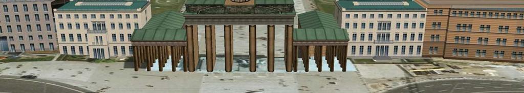


77 The Official 3D City Model of Berlin 3D visualization is the result of a portrayaling of Berlin s 3D city model (modeled according to CityGML) 77 T. H. Kolbe CityGML Tutorial
78 Berlin 3D: Realization with OGC Web Services 3D Geo Database SDI Berlin / Internet 3D City Model DTM Orthophotos Version and History Management Web Coverage Service Web Feature Service CityGML Web Terrain Service + Web 3D Service Presentation System CityGML 3D City Model Editor 78 T. H. Kolbe CityGML Tutorial
79 Application of CityGML for Noise Mapping CityGML is applied in an ongoing project in Germany: Computation of noise pollution maps in the state North Rhine-Westphalia (18 million citizens) Background: Environmental Noise Directive from the European Commission Spatial Data Infrastructure uses following Web Services: WFS, WMS; Data formats: CityGML, GeoTIFF Estimated savings (wrt. proprietary systems): >10 Mio Extension of CityGML by noise relevant attributes and features: CityGML Noise ADE 79 T. H. Kolbe CityGML Tutorial


 80 T.")
80 Illustration of Noise Pollution Mapping 3D block model in CityGML from WFS-T DTM 10m grid in GeoTiff from WCS noise immission simulation noise pollution maps for European Union reporting (using WMS) 80 T. H. Kolbe CityGML Tutorial
81 Application Example 4: Homeland Security Testbed OWS-4 of the Open Geospatial Consortium Runtime 6/ /2006 Fictive Scenario: Explosion of a dirty bomb in New York harbour area Aim: Supporting the planning staff with the installation of a field hospital Finding an appropriate location Identification of a suitable building (size, room sizes, air conditioning) Thematic queries & visual inspection Coupling of different OGC Web Services and client applications, data formats: CityGML and IFC 81 T. H. Kolbe CityGML Tutorial

82 Application Example 4: Homeland Security 82 T. H. Kolbe CityGML Tutorial
83 Relations to other Standards 83 T. H. Kolbe CityGML Tutorial

84 Approaches to Virtual 3D City Modelling Computer Graphics Scene Graphs Geospatial / GIS (Semantic) City and Landscape Models 3D AEC / CAAD Building Information Models Computer Games / Simulation Simulation and Interaction Models 84 T. H. Kolbe CityGML Tutorial
85 Computer Graphics Approach What is modelled? geometry (parametric primitives; boundary representation) material / appearance limited topology typically no semantic information interaction methods and object behaviour all elements are structured within scene graphs aggregation using group nodes; transformation nodes allows to define prototypes / reuse object definitions some exchange formats support georeferencing GeoVRML, X3D, KML but: models are restricted to cartesian coordinate system 85 T. H. Kolbe CityGML Tutorial
86 AEC / CAAD Approach What is modelled? geometry (parametric primitives; boundary representation; constructive solid geometry; sweep volumes) topology limited material / appearance explicit semantics within building information models (BIM) (but not with legacy CAD formats) Most important BIM exchange format is IFC (Industry Foundation Classes) IFC defines a product data model for buildings / sites elements of a BIM dataset are aggregated within a project only the format IFG (IFC for GIS) supports georeferencing but: models are restricted to cartesian coordinate system 86 T. H. Kolbe CityGML Tutorial
87 Geospatial / GIS Approach What is modelled? geometry (3D in ISO 19107: only boundary representation) topology semantic information limited appearance / material properties Models are based on the notion of geographic features (according to ISO 19109); exchange format is GML Application schemas define ontologies, i.e. taxonomies and partonomies of feature types (using OO concepts) Ontology for 3D city models: CityGML always georeferenced; any 3D coordinate reference system (CRS) can be used (and mixed within the same dataset) all geometries must belong to a CRS; up to now no nesting 87 T. H. Kolbe CityGML Tutorial
88 Who standardizes (geo)virtual 3D worlds? Open Geospatial Consortium (OGC) Exchange format GML; CityGML; KML; Web Services: WFS, WTS, W3DS International Alliance for Interoperability (IAI) Product model for AEC/FM: Industry Foundation Classes (IFC) Web 3D Consortium (W3D) Originator of VRML, GeoVRML, X3D 3D Industry Forum (3DIF) Graphics format Universal 3D (U3D) -> direct embedding in PDF Khronos Group Exchange format COLLADA (used within Playstation, Google Earth) International De Jure Standardisation: ISO ISO standards of the 191xx family ( OGC Standards), X3D, IFC 88 T. H. Kolbe CityGML Tutorial
89 Virtual Reality Exchange Formats X3D U3D KML COLLADA IFC CityGML geometry georeferencing + + (IFG) + ++ appearance topology semantics 0 0/ linking / embedding Legend: 0 = basic, + = sophisticated, ++ = comprehensive; empty = not supported 89 T. H. Kolbe CityGML Tutorial
90 What about other data formats? (I) (Georeferenced) 3D Graphics Standards (Geo)VRML, X3D, U3D, KML focus on geometry & appearance in general, no adequate concepts for semantic feature models X3D is extensible, but no common rules for modeling of geographic features, relations, geometry, topology Generic (Proprietary) Exchange Formats 3D Shapefile, DXF, etc. limited expressivity wrt. to complex models no common information model for 3D city models do not address semantic interoperability 90 T. H. Kolbe CityGML Tutorial
91 What about other data formats? (II) Semantic Information Models Industry Foundation Classes (IFC) good: objects with well-defined semantics (product model) however, mostly focused on buildings; few natural features very complex geometry model (CSG & B-Rep); no native support by / mapping to spatial datatypes of DBMS developed independently from ISO 191xx and OGC standards LandXML good: cadastre model / DLM with well-defined semantics no buildings; no geometric 3D primitives; appearances? Generally missing features: multiscale modeling, complex DTMs; natural objects 91 T. H. Kolbe CityGML Tutorial


92 Relationships BIM 3D Graphics 92 T. H. Kolbe CityGML Tutorial
93 CityGML from the BIM perspective Provision of information about the surroundings / environment of buildings and sites Embedding of 3D models into the real world s coordinate frame Analysis and identification of suitable locations for construction Querying 3D urban objects with geospatial selection criteria Useful for planners, architects, and engineers Can be a source format for the creation of Building Information Models from observed data for example CityGML -> IFC CityGML objects already carry semantic information which are helpful in interpretation processes CityGML especially suited for the stepwise reconstruction and refinement of urban objects (coping with different model qualities) 93 T. H. Kolbe CityGML Tutorial
94 BIM from the CityGML perspective Behind IFC there is also a semantically rich information model In fact, it is more detailed than CityGML However, lack of other city features; limited georeferencing Source for highly detailed building model data with respect to geometry and semantics can be used to provide LOD3 and LOD4 models CityGML building model adopted some of the conceptual modelings of IFC IFC spaces -> CityGML rooms IFC Property Sets -> CityGML generic attributes, now also ADEs 94 T. H. Kolbe CityGML Tutorial
95 Deriving LOD4 models from IFC IFC Model Current research of Benner, Geiger, Leinemann Helmholtz Research Center Karlsruhe 95 T. H. Kolbe CityGML Tutorial


96 Deriving LOD4 models from IFC IFC Model Derived CityGML object Current research of Benner, Geiger, Leinemann Helmholtz Research Center Karlsruhe 96 T. H. Kolbe CityGML Tutorial
97 CityGML from the 3D visualization perspective Provision of large amounts of 3D geospatial data rich attributes and geometric and semantic decompositions Not optimized wrt. transfer size and efficient visualization absolute world coordinates (need for projection or transformation) no grouping according to scene graph concepts however: easy to map to 3D graphics as only the Boundary Representation is being used No support of more sophisticated appearance properties, shaders, graphical materials, and light sources but: can be derived in many cases from the semantic information of the CityGML features option: definition of a CityGML High Definition Graphics ADE 97 T. H. Kolbe CityGML Tutorial
98 3D visualization from the CityGML perspective 3D visualization is the result of a portraying process applied to a CityGML model CityGML is a source structure for visualization processes; not intended to be used as a 3D graphics format Portraying simplest form: 1:1 conversion of geometry and appearance data to a 3D graphics format (incl. coordinate transformations) more sophisticated: 3D cartographic design, for example: Text and label placement Symbolization and non-photo realistic rendering Generalization Appropriate OGC Web Services for 3D portrayaling: Web 3D Service and Web Terrain Service 98 T. H. Kolbe CityGML Tutorial

99 3D visualization from the CityGML perspective 3D visualization is the result of a portrayaling process applied to a CityGML model CityGML is a source structure for visualization processes; not intended to be used as a 3D graphics format Portrayaling simplest form: 1:1 conversion of geometry and appearance data to a 3D graphics format (incl. coordinate transformations) more sophisticated: 3D cartographic design, for example: Text and label placement Symbolization and non-photo realistic rendering Generalization Appropriate OGC Web Services for 3D portrayaling: Web 3D Service and Web Terrain Service Non-photo realistic rendering. J. Döllner & M. Walter, T. H. Kolbe CityGML Tutorial

100 Coming to the end 100 T. H. Kolbe CityGML Tutorial
101 Summary CityGML is a Geospatial Information Model (based on ISO 191xx) and Exchange Format for virtual 3D city and regional models (realised as GML3 Application Schema) CityGML represents Geometry, Topology, Semantics, and Appearance esp. semantic / structural information is needed for a range of applications Should be considered as a rich 3D information source for the generation of (also cartographic) 3D visualizations WFS [CityGML] -> W3DS [X3D and KML / COLLADA] 101 T. H. Kolbe CityGML Tutorial
102 What is CityGML s Use for Research? Base model / base ontology for geodatabase developments project specific extensions (like relations or new feature types) Could be target model of 3D extraction methods concerning feature types, aggregation structures 5 discrete scales usable for 3D generalisation Exchange format lossless information exchange between subsystems / GeoDB increasing number of available implementations / 3D-GeoDB Good amounts of real testdata available Berlin, Bonn, Bochum, Hamburg, Stuttgart, Recklinghausen, also 3 freely accessible Web Feature Services delivering CItyGML 102 T. H. Kolbe CityGML Tutorial
; teaching language: English Degree: Master of Science (MSc.")
103 Studying 3D City Models (and much more!) International Master s Program at Techn. University Berlin Geodesy and Geoinformation Science Duration: 4 terms (2 yrs.); teaching language: English Degree: Master of Science (MSc.) Candidates prerequisites: qualifying university degree Bachelor or Master of Science (or Diploma) from following fields: Geodesy, Geomatics, Cartography, (Geo-)Informatics, Construction Engineering, Earth Sciences, or related T. H. Kolbe CityGML Tutorial Berlin Partner GmbH, Google Earth
CityGML in Detail Part 1
 CityGML in Detail Part 1 Prof. Dr. Thomas H. Kolbe Institute for Geodesy and Geoinformation Science Berlin University of Technology kolbe@igg.tu-berlin.de May 2008 EduServ6 Course on CityGML Copyright
CityGML in Detail Part 2
 CityGML in Detail Part 2 Prof. Dr. Thomas H. Kolbe Institute for Geodesy and Geoinformation Science Berlin University of Technology kolbe@igg.tu-berlin.de May 2008 EduServ6 Course on CityGML Copyright
CityGML 3D Geospatial and Semantic Modelling of Urban Structures
 Technische Universität Berlin CityGML 3D Geospatial and Semantic Modelling of Urban Structures Prof. Dr. Thomas H. Kolbe Institute for Geodesy and Geoinformation Science Berlin University of Technology
3D Geospatial Information Modelling with CityGML
 Technische Universität Berlin 3D Geospatial Information Modelling with CityGML Prof. Dr. Thomas H. Kolbe Institute for Geodesy and Geoinformation Science Berlin University of Technology kolbe@igg.tu-berlin.de
Status and Roadmap. Dr. Thomas H. Kolbe Dr. Gerhard Gröger. Institut für Kartographie und Geoinformation, Uni Bonn Lehrstuhl für Geoinformation
 Institut für Kartographie und Geoinformation, Uni Bonn Lehrstuhl für Geoinformation CityGML Status and Roadmap Dr. Thomas H. Kolbe Dr. Gerhard Gröger November 2005 Institute for Cartography and Geoinformation,
CityGML Background and Design
 Institut für Kartographie und Geoinformation, Uni Bonn Lehrstuhl für Geoinformation CityGML Background and Design Dr. Thomas H. Kolbe OWS-4 Kickoff Meeting June 14, 2006 Institut für Kartographie und Geoinformation,
Overview of CityGML. Dave Capstick, Ordnance Survey Research Department
 Overview of CityGML Dave Capstick, Ordnance Survey Research Department Introduction Why is citygml necessary CityGML development who is responsible? Ordnance Surveys interest 3D modelling basic concepts
Making interoperability persistent: A 3D geo database based on CityGML
 Making interoperability persistent: A 3D geo database based on CityGML Alexandra Stadler, Claus Nagel, Gerhard König, Thomas H. Kolbe Technische Universität Berlin Chair of Geoinformation Science Motivation
Web 3D Service & CityGML Update
 Technische Universität Berlin Web 3D Service & CityGML Update Thomas H. Kolbe Institute for Geodesy and Geoinformation Science Berlin University of Technology kolbe@igg.tu-berlin.de 2nd of November, 2007
Geoinformation Science at TU Berlin
 Technische Universität Berlin Department of Geoinformation Science Geoinformation Science at TU Berlin Prof. Dr. Thomas H. Kolbe Institute for Geodesy and Geoinformation Science Berlin University of Technology
GIS-based Smart Campus System using 3D Modeling
 GIS-based Smart Campus System using 3D Modeling Smita Sengupta GISE Advance Research Lab. IIT Bombay, Powai Mumbai 400 076, India smitas@cse.iitb.ac.in Concept of Smart Campus System Overview of IITB Campus
Conversion of IFC to CityGML
 Technische Universität Berlin Conversion of IFC to CityGML Claus Nagel Thomas H. Kolbe Institute for Geodesy and Geoinformation Science Technische Universität Berlin OGC 3DIM WG, Paris Agenda Part I: Talk
Semantic 3D City Models for Strategic Energy Planning in Berlin & London
 Semantic 3D City Models for Strategic Energy Planning in Berlin & London The content of this presentation is provided by Zhihang Yao, Robert Kaden, and Thomas H. Kolbe Chair of Geoinformatics, TU München
Representing and Exchanging 3D City Models with CityGML
 Chapter 2 Representing and Exchanging 3D City Models with CityGML Thomas H. Kolbe Abstract. CityGML is an open data model and XML-based format for the representation and exchange of virtual 3D city models.
New Concepts for Structuring 3D City Models an Extended Level of Detail Concept for CityGML Buildings
 New Concepts for Structuring 3D City Models an Extended Level of Detail Concept for CityGML Buildings Marc-O. Löwner a, Joachim Benner b, Gerhard Gröger c, Karl-Heinz Häfele b a Institute for Geodesy and
Pushing the Standards Edge: Collaborative Testbeds to Accelerate Standards Development and Implementation
 Pushing the Standards Edge: Collaborative Testbeds to Accelerate Standards Development and Implementation Mark E. Reichardt President mreichardt@opengeospatial.org 31 October 2006 2006 Open Geospatial
Final Report on the EuroSDR CityGML Project
 Final Report on the EuroSDR CityGML Project Thomas H. Kolbe Institute for Geodesy and Geoinformation Science Chair of Geoinformation Science Technische Universität Berlin Straße des 17. Juni 135 D-10623
From CityGML to Energy ADE - Workflow
 From CityGML to Energy ADE - Workflow KIT Universität von Baden-Württemberg und nationales Forschungszentrum der Helmholtz Gemeinschaft www.kit.edu Workflow overview CityGML import Geometric / semantic
USE OF VIRTUAL 3D-LANDSCAPES FOR EMERGENCY DRIVER-TRAINING
 USE OF VIRTUAL 3D-LANDSCAPES FOR EMERGENCY DRIVER-TRAINING Dipl.-Ing. Bodo Randt * Head of Database Generation and Tools Dipl.-Inf. Frank Bildstein * Head of Ground Driving Database Team Dr. Thomas H.
Developing 3D Geoportal for Wilayah Persekutuan Iskandar
 Developing 3D Geoportal for Wilayah Persekutuan Iskandar Dionnald Beh BoonHeng and Alias Abdul Rahman Department of Geoinformatics, Faculty of Geoinformation Engineering and Sciences, Universiti Teknologi
GIS for 3D Object Generation, Modelling, and Exploitation. Paul Hardy Esri
 GIS for 3D Object Generation, Modelling, and Exploitation Paul Hardy Esri ArcGIS has long understood 3D Multipatch data type in geodatabase - 3D volumetric objects - Collection of triangles, strips, fans,
GIS-based Smart Campus System using 3D Modeling
 GIS-based Smart Campus System using 3D Modeling Hardik Panchal & Rizwan Khan, Smita Sengupta, GISE Advance Lab, Indian Institute of Technology, Bombay, India N.L. Sarda, Dept. Of Computer Science, Indian
CityGML XFM Application Template Documentation. Bentley Map V8i (SELECTseries 2)
") CityGML XFM Application Template Documentation Bentley Map V8i (SELECTseries 2) Table of Contents Introduction to CityGML 1 CityGML XFM Application Template 2 Requirements 2 Finding Documentation 2 To
CityGML XFM Application Template Documentation Bentley Map V8i (SELECTseries 2) Table of Contents Introduction to CityGML 1 CityGML XFM Application Template 2 Requirements 2 Finding Documentation 2 To
Features and Benefits
 Autodesk LandXplorer Features and Benefits Use the Autodesk LandXplorer software family to help improve decision making, lower costs, view and share changes, and avoid the expense of creating physical
Semantic 3D City Models for Urban Information Fusion and City Lifecycle Management
 Technische Universität Berlin Semantic 3D City Models for Urban Information Fusion and City Lifecycle Management Thomas H. Kolbe Institute for Geodesy & Geoinformation Science Technische Universität Berlin
CityGML OGC Standard for Photogrammetry?
 Kolbe, Nagel, Stadler 1 CityGML OGC Standard for Photogrammetry? THOMAS H. KOLBE, CLAUS NAGEL, ALEXANDRA STADLER, Berlin ABSTRACT Virtual 3D city models are an important data source for an increasing number
Using OGC standards to improve the common
 Using OGC standards to improve the common operational picture Abstract A "Common Operational Picture", or a, is a single identical display of relevant operational information shared by many users. The
Integrating Building Information Models with Open Geospatial Web Services
 Open Geospatial Consortium Interoperability Testbed 4 for CAD/GIS/BIM Integrating Building Information Models with Open Geospatial Web Services Prepared by: Paul Cote Harvard Graduate School of Design
12th AGILE International Conference on Geographic Information Science 2009 page 1 of 9 Leibniz Universität Hannover, Germany
 12th AGILE International Conference on Geographic Information Science 2009 page 1 of 9 A Framework for the Generalization of 3D City Models Richard Guercke and Claus Brenner Institute of Cartography and
Compression Techniques for 3D SDI
 Compression Techniques for 3D SDI Bernad S. ChengXi and Alias Abdul Rahman 3D GIS Research Lab Faculty of Geoinformation and Real Estate Universiti Teknologi Malaysia Outline Introduction Background of
The INSPIRE Building Model for Energy Applications
 The INSPIRE Building Model for Energy Applications 1 Gerhard Gröger Institute for Geodesy and Geoinformation University of Bonn, Germany 2nd Joint SIG 3D and OGC Workshop - CityGML EnergyADE for building
A Railway Simulation Landscape Creation Tool Chain Considering OpenStreetMap Geo Data
 A Railway Simulation Landscape Creation Tool Chain Considering OpenStreetMap Geo Data Christian Rahmig, Andreas Richter DLR Institute of Transportation Systems Braunschweig, Germany SUMO Conference 2014
<Insert Picture Here> Oracle Spatial 11g. Dr. Siva Ravada
 Oracle Spatial 11g Dr. Siva Ravada New in Oracle Spatial 11g 3D Support Spatial Web Services Network Data Model GeoRaster Performance Improvements 3D Applications Location-based services
3D-SDI contribution to energy-efficient cities 3D CityModels for Energy Demand Simulation
 HFT Research 3D-SDI contribution to energy-efficient cities 3D CityModels for Energy Demand Simulation Claudia Schulte, HFT Stuttgart, Institute for Applied Research Prof. Dr. Volker Coors, HFT Stuttgart,
7 11 August 2011, Vancouver. Don Brutzman, Benjamin Hagedorn. The OGC: Making Location Count
 OGC 3D Portrayal Interoperability Experiment, OGC 3D Summit 2011 SIGGRAPH 2011 7 11 August 2011, Vancouver Don Brutzman, Benjamin Hagedorn The OGC: Making Location Count What is the Open Geospatial Consortium?
CITYGML MODELLING FOR SINGAPORE 3D NATIONAL MAPPING
 CITYGML MODELLING FOR SINGAPORE 3D NATIONAL MAPPING K. H. Soon* and V. H. S. Khoo Land Survey Division, Singapore Land Authority, 55 Newton Road, #12-01, 307987 Singapore - (soon_kean_huat, victor_khoo)@sla.gov.sg
Web-based Exploration of and Interaction with Large and Deeply Structured Semantic 3D City Models using HTML5 and WebGL
 Web-based Exploration of and Interaction with Large and Deeply Structured Semantic 3D City Models using HTML5 and WebGL KANISHK CHATURVEDI 1, ZHIHANG YAO 2 & THOMAS H. KOLBE 1 Abstract: The aim of the
OGC 3D Portrayal Interoperability Experiment (3DPIE) Insights and Results
 Insights and Results") OGC 3D Portrayal Interoperability Experiment (3DPIE) Insights and Results Jan Klimke, Benjamin Hagedorn (Hasso-Plattner-Institut at the University Potsdam) Web 3D 2012 Los Angeles, August 4, 2012 Agenda
OGC 3D Portrayal Interoperability Experiment (3DPIE) Insights and Results Jan Klimke, Benjamin Hagedorn (Hasso-Plattner-Institut at the University Potsdam) Web 3D 2012 Los Angeles, August 4, 2012 Agenda
Towards Interoperating CityGML and IFC Building Models: A Unified Model Based Approach
 Towards Interoperating CityGML and IFC Building Models: A Unified Model Based Approach Mohamed El-Mekawy, Anders Östman, and Khurram Shahzad Abstract CityGML represents 3D urban objects that can be shared
3D Urban Information Models in making a smart city the i-scope project case study
 UDC: 007:528.9]:004; 007:912]:004; 004.92 DOI: 10.14438/gn.2014.17 Typology: 1.04 Professional Article 3D Urban Information Models in making a smart city the i-scope project case study Dragutin PROTIĆ
Extension of Electronical Nautical Charts for 3D interactive Visualization via CityGML
 Extension of Electronical Nautical Charts for 3D interactive Visualization via CityGML Kristine HAASE und Reinhard KOCH Multimedia Information Processing Group, Department of Computer Science Christian-Albrechts-University
Data Conversion to I3S for 3D Modeling from CityGML. Christian Dahmen (con terra GmbH) Satish Sankaran (Esri)
 Satish Sankaran (Esri)") Data Conversion to I3S for 3D Modeling from CityGML Christian Dahmen (con terra GmbH) Satish Sankaran (Esri) 3D Across the ArcGIS Platform Manage Multiscale 3D Models 3D Geodesign ArcGIS for 3D Cities
Data Conversion to I3S for 3D Modeling from CityGML Christian Dahmen (con terra GmbH) Satish Sankaran (Esri) 3D Across the ArcGIS Platform Manage Multiscale 3D Models 3D Geodesign ArcGIS for 3D Cities
3D-geodata infrastructure in the city of coburg - Origin process und vision. INGeoForum e.v. Open Geospatial Consortium
 INGeoForum e.v. Open Geospatial Consortium at Fraunhofer Institut for Computer Graphics in Darmstadt 3D-geodata infrastructure in the city of coburg - Origin process und vision 29. September 2009 Requirements
Questions and Answers
 AUTODESK LANDXPLORER SOFTWARE FAMILY Questions and Answers The Autodesk LandXplorer 3D city model software family can help you create, analyze, and visualize digital city models. Contents Autodesk Landxplorer
Smart Cities: Visualization
 Smart Cities: Visualization ISO/IEC JTC 1/SC24 Meetings 20-25 January 2019 Seoul, Korea Peter Ryan 1 and Myeong Won Lee 2 1 Defence Science & Technology Group, Australia 2 University of Suwon, Korea Presentation
ISO Series Standards in a Model Driven Architecture for Landmanagement. Jürgen Ebbinghaus, AED-SICAD
 ISO 19100 Series Standards in a Model Driven Architecture for Landmanagement Jürgen Ebbinghaus, AED-SICAD 29.10.2003 The Company 100% SIEMENS PTD SIEMENS Business Services Shareholder & Strategic Business
Scope and design principles of the CityGML Utility Network ADE
 Scope and design principles of the CityGML Utility Network ADE Tatjana Kutzner, Thomas H. Kolbe Chair of Geoinformatics kutzner@tum.de, thomas.kolbe@tum.de Joint Energy ADE and Utility Network ADE workshop
Overview of Geospatial Open Source Software which is Robust, Feature Rich and Standards Compliant
 Overview of Geospatial Open Source Software which is Robust, Feature Rich and Standards Compliant Cameron SHORTER, Australia Key words: Open Source Geospatial Foundation, OSGeo, Open Standards, Open Geospatial
3D City/Landscape Modeling Non-Building Thematic: Vegetation
 3D City/Landscape Modeling Non-Building Thematic: Vegetation Presenter: Shafarina Wahyu Trisyanti shafarina.wahyu@gmail.com Co-Author: Deni Suwardhi, Agung Budi Harto dsuwardhi@kk-insig.org, agung@gd.itb.ac.id
Investigating the practical relationship between GIS and BIM; then relating that to a 3D cadastre. J. Gabriel van Wyk, Johan Nel
 Investigating the practical relationship between GIS and BIM; then relating that to a 3D cadastre. J. Gabriel van Wyk, Johan Nel Overview So exactly what is BIM? Available BIM offerings in the market Traditional
Digital Map of Mexico Platform and MxSIG. March 2017
 Digital Map of Mexico Platform and MxSIG March 2017 1 I. Digital Map of Mexico Platform Concept Evolution II. Digital Map of Mexico online Concept Capabilities Information available Other state units information
IDBE. Common conceptual framework and roadmap of collaboration in Spatial Standards for the Digital Built Environment
 IDBE Common conceptual framework and roadmap of collaboration in Spatial Standards for the Digital Built Environment GeoBIM: 3D GIS in China Mei Xue: In my opinion, what matters most in the integration
Technical Specifications. Form of the standard
 Used by popular acceptance Voluntary Implementation Mandatory Legally enforced Technical Specifications Conventions Guidelines Form of the standard Restrictive Information System Structures Contents Values
BIM Building Information Modelling/Management
 1 BIM Building Information Modelling/Management Outline What is the Industry Foundation Classes? Background Schema Domains What is the Information Delivery Manual? 2 Managing Data Requirements The Information
BIM Week October 2013 Munich, GERMANY
 BIM Week October 2013 Munich, GERMANY Paul Scarponcini, PE, PhD Bentley Systems, Inc. COBie (for Buildings) Based on MVD of Building IFCs no geometry extended constraints, attributes, relationships Uses
Application Domain Extensions definition for crowd source and Volunteer Geographic Information for smart-cities services deployment.
 Application Domain Extensions definition for crowd source and Volunteer Geographic Information for smart-cities services deployment. F. Prandi, R. de Amicis, P. Parslow, M. Ford, E. D Hondt Outlook Introduction
Part 1: Fundamentals
 Provläsningsexemplar / Preview INTERNATIONAL STANDARD ISO 19101-1 First edition 2014-11-15 Geographic information Reference model Part 1: Fundamentals Information géographique Modèle de référence Partie
Spatial Data Infrastructure Concepts and Components. Douglas Nebert U.S. Federal Geographic Data Committee Secretariat
 Spatial Data Infrastructure Concepts and Components Douglas Nebert U.S. Federal Geographic Data Committee Secretariat August 2009 What is a Spatial Data Infrastructure (SDI)? The SDI provides a basis for
The Conversion from CityGML to 3D Property Units
 Shen YING, Fengzan JIN, Renzhong GUO, Lin LI, Jie YANG and Yujie ZHOU, China Key words: 3D Property Unit, CityGML, 3D Cadastre, Data Conversion SUMMARY Due to the fast growth of building construction technology
GEOGRAPHY 350/550 Final Exam Fall 2005 NAME:
 1) A GIS data model using an array of cells to store spatial data is termed: a) Topology b) Vector c) Object d) Raster 2) Metadata a) Usually includes map projection, scale, data types and origin, resolution
Virtual Cities of the Future and Past. Paul Cote Geographic Information Systems Specialist Harvard University Graduate School of Design
 Virtual Cities of the Future and Past Paul Cote Geographic Information Systems Specialist Harvard University Graduate School of Design 500 Design Students 250 Architecture 50 Urban Planning 100 Urban Design
Introduction to GIS I
 Introduction to GIS Introduction How to answer geographical questions such as follows: What is the population of a particular city? What are the characteristics of the soils in a particular land parcel?
Exporting 3D Geoinformation from Baggis Database to CityGML
 Exporting 3D Geoinformation from Baggis Database to CityGML Erik Olsson Master s of Science Thesis in Geoinformatics TRITA-GIT EX 09-05 Division of Geoinformatics Royal Institute of Technology (KTH) 100
UBGI and Address Standards
 Workshop on address standards UBGI and Address Standards 2008. 5.25 Copenhagen, Denmark Sang-Ki Hong Convenor, WG 10 1 Evolution of Geographic Information Visualization Feature (Contents) Context Accessibility
Energy Visualization and 3D city modelling using GIS. Polycity conference,
 Energy Visualization and 3D city modelling using GIS Polycity conference, 17.9.2010 Prof. Dr. Volker Coors, 30.07.2010 1 Szenario Scharnhauser Park MODELING ENERGY DEMAND FOR HEATING AT CITY SCALE Aneta
Smart Cities: Data Representation Model
 Smart Cities: Data Representation Model ISO/IEC JTC 1/SC24 Meetings 19-24 January 2019 Seoul, Korea Peter Ryan 1 and Myeong Won Lee 2 1 Defence Science & Technology Group, Australia 2 University of Suwon,
Key Words: geospatial ontologies, formal concept analysis, semantic integration, multi-scale, multi-context.
 Marinos Kavouras & Margarita Kokla Department of Rural and Surveying Engineering National Technical University of Athens 9, H. Polytechniou Str., 157 80 Zografos Campus, Athens - Greece Tel: 30+1+772-2731/2637,
Version 1.1 GIS Syllabus
 GEOGRAPHIC INFORMATION SYSTEMS CERTIFICATION Version 1.1 GIS Syllabus Endorsed 1 Version 1 January 2007 GIS Certification Programme 1. Target The GIS certification is aimed at: Those who wish to demonstrate
Local SDI Collaboration on SOA
 Institute of Geodesy Local SDI Collaboration on SOA Dr.-Ing. Jörg Blankenbach Dipl.-Ing. Christian Hickel FIG Commission 3 Workshop Paris, 27.10.2011 Agenda Local SDI in Hesse: GDI-Südhessen Overview Service
AEC 3 United Kingdom. Industry Foundation Classes. Norwegian IFG project Harmonisation IFC and gml3. Dr. Thomas Liebich, Jeffrey Wix AEC3 Ltd.
 Industry Foundation Classes AEC 3 United Kingdom Thatcham, Berkshire RG18 3ES Tel: +44-1635 86 4590 Fax: +44-1635 86 0673 email: jeffrey.wix@aec3.com Germany D-80636 München Tel: +49-89-1870 3223 Fax:
GIS = Geographic Information Systems;
 What is GIS GIS = Geographic Information Systems; What Information are we talking about? Information about anything that has a place (e.g. locations of features, address of people) on Earth s surface,
Bentley Map Advancing GIS for the World s Infrastructure
 Bentley Map Advancing GIS for the World s Infrastructure Presentation Overview Why would you need Bentley Map? What is Bentley Map? Where is Bentley Map Used? Why would you need Bentley Map? Because your
E-Government and SDI in Bavaria, Germany
 135 E-Government and SDI in Bavaria, Germany Wolfgang STOESSEL, Germany Key words: GDI-BY, Bavaria, Spatial Data Infrastructure SUMMARY Spatial Data Infrastructure (SDI) is an important part of the e-government
The (Rough) road to BIM- Geospatial standards. Leif Granholm BIM ambassador
 road to BIM- Geospatial standards. Leif Granholm BIM ambassador") The (Rough) road to BIM- Geospatial standards Leif Granholm BIM ambassador What is Structured Semantic data BIM Graphics to objects Drawings geometry are graphics (appearance important) A Model consists
The (Rough) road to BIM- Geospatial standards Leif Granholm BIM ambassador What is Structured Semantic data BIM Graphics to objects Drawings geometry are graphics (appearance important) A Model consists
Virtual 3D Cities. Chapter VIII. Virtual 3D Cities. 8.1 Introduction. Components. Chapter VIII: Virtual 3D Cities 1
 Chapter VIII Virtual 3D Cities 8.1 Introduction 8.2 CityGML 8.3 Google Earth 8.4 Virtual Earth 8.5 Conclusions Virtual 3D Cities 8.1 Introduction 3D Visualization of cities Languages such as CityGML New
Arne SCHILLING, Steffen NEUBAUER, Alexander ZIPF Germany. Key words: 3D city models, OpenGIS, SDI, interoperability, service oriented architecture
 Putting GDI-3D into practice: Experiences from developing an 3D spatial data infrastructure based on OpenGIS standards for the sustainable management of urban areas Arne SCHILLING, Steffen NEUBAUER, Alexander
CityGML and the Streets of New York A Proposal for Detailed Street Space Modeling
 LEONHARD OBERMEYER CENTER TUM CENTER OF DIGITAL METHODS FOR THE BUILT ENVIRONMENT CityGML and the Streets of New York A Proposal for Detailed Street Space Modeling Christof Beil & Thomas H. Kolbe Chair
Geospatial Products V8i (SELECTseries 1)
") Geospatial Products V8i (SELECTseries 1) Keith Raymond Product Manager Geospatial Desktop Products Presentation Overview What are the various products? Why would you need them? Demonstrations 2 WWW.BENTLEY.COM
Geospatial Products V8i (SELECTseries 1) Keith Raymond Product Manager Geospatial Desktop Products Presentation Overview What are the various products? Why would you need them? Demonstrations 2 WWW.BENTLEY.COM
From BIM to GIS at the Smithsonian Institution
 From BIM to GIS at the Smithsonian Institution Detlef Günther-Diringer a a University of Applied Sciences, Karlsruhe, Germany; Smithsonian Fellow March August 2016; detlef.guenther-diringer@hskarlsruhe.de
New Perspectives in GIS Databases. «80% of the data throughout the world have some geographic basis» New Perspectives in GIS Databases
 New Perspectives in GIS Databases Pr. Robert LAURINI University of Lyon (INSA), France University of Venice (IUAV), Italy «80% of the data throughout the world have some geographic basis» New Perspectives
3D MAPS SCALE, ACCURACY, LEVEL OF DETAIL
 26 th International Cartographic Conference August 25 30, 2013 Dresden, Germany 3D MAPS SCALE, ACCURACY, LEVEL OF DETAIL Prof. Dr. Temenoujka BANDROVA Eng. Stefan BONCHEV University of Architecture, Civil
UrbIS Products User Guide
 UrbIS Products User Guide Avenue des Arts 21 Kunstlaan Bruxelles 1000 Brussel T 32 2 282 47 70 F 32 2 230 31 07 www.cirb.brussels www.cibg.brussels Table of contents 1. Introduction... 4 1.1. Context...
Integrating Legal and Physical Dimensions of Urban Environments
 ISPRS Int. J. Geo-Inf. 2015, 4, 1442-1479; doi:10.3390/ijgi4031442 Article Integrating Legal and Physical Dimensions of Urban Environments Ali Aien *, Abbas Rajabifard, Mohsen Kalantari and Davood Shojaei
Innovation. The Push and Pull at ESRI. September Kevin Daugherty Cadastral/Land Records Industry Solutions Manager
 Innovation The Push and Pull at ESRI September 2004 Kevin Daugherty Cadastral/Land Records Industry Solutions Manager The Push and The Pull The Push is the information technology that drives research and
Esri UC2013. Technical Workshop.
 Esri International User Conference San Diego, California Technical Workshops July 9, 2013 CAD: Introduction to using CAD Data in ArcGIS Jeff Reinhart & Phil Sanchez Agenda Overview of ArcGIS CAD Support
Qualitative Spatio-Temporal Reasoning & Spatial Database Design
 Qualitative Spatio-Temporal Reasoning Focus on 2 research topics at the of the University of Liège J-P. Donnay P. Hallot F. Laplanche Curriculum in «Surveying & Geomatics» in the Faculty of Sciences of
DGIWG 200. Defence Geospatial Information Framework (DGIF) Overview
 Overview") DGIWG 200 Defence Geospatial Information Framework (DGIF) Overview Document type: Standard Document date: 28 November 2017 Edition: 2.0.0 Responsible Party: Audience: Abstract: Copyright: Defence Geospatial
DGIWG 200 Defence Geospatial Information Framework (DGIF) Overview Document type: Standard Document date: 28 November 2017 Edition: 2.0.0 Responsible Party: Audience: Abstract: Copyright: Defence Geospatial
Geography 38/42:376 GIS II. Topic 1: Spatial Data Representation and an Introduction to Geodatabases. The Nature of Geographic Data
 Geography 38/42:376 GIS II Topic 1: Spatial Data Representation and an Introduction to Geodatabases Chapters 3 & 4: Chang (Chapter 4: DeMers) The Nature of Geographic Data Features or phenomena occur as
Bentley Map Advancing GIS for the World s Infrastructure
 Bentley Map Advancing GIS for the World s Infrastructure Presentation Overview Why would you need Bentley Map? What is Bentley Map? Where is Bentley Map Used? Red text signifies new things in Bentley Map
CARTOGRAPHIC WEB SERVICES AND CARTOGRAPHIC RULES A NEW APPROACH FOR WEB CARTOGRAPHY
 CARTOGRAPHIC WEB SERVICES AND CARTOGRAPHIC RULES A NEW APPROACH FOR WEB CARTOGRAPHY 1. Introduction Ionut Iosifescu, Marco Hugentobler, Lorenz Hurni ETH Zurich, Institute of Cartography Wolfgang-Pauli-Str.
Sustainable and Harmonised Development for Smart Cities The Role of Geospatial Reference Data. Peter Creuzer
 Sustainable and Harmonised Development for Smart Cities The Role of Geospatial Reference Data Peter Creuzer 1. Introduction - Smart Cities and Geodata 2. Geodata in Germany 3. Examples 4. Data and Service
EEOS 381 -Spatial Databases and GIS Applications
 EEOS 381 -Spatial Databases and GIS Applications Lecture 5 Geodatabases What is a Geodatabase? Geographic Database ESRI-coined term A standard RDBMS that stores and manages geographic data A modern object-relational
Modern Education at Universities: Improvements through the Integration of a Spatial Data Infrastructure SDI into an e-learning Environment
 Modern Education at Universities: Improvements through the Integration of a Spatial Data Infrastructure SDI into an e-learning Environment Ingo Simonis Institute for Geoinformatics, University of Muenster
SEMANTIC APPROACH TO 3D HISTORICAL RECONSTRUCTION
 SEMANTIC APPROACH TO 3D HISTORICAL RECONSTRUCTION M. Lorenzini a a Università degli Studi di Pisa, Pisa, Italy. matteo.lorenzini@gmail.com Commission V, WG 4 KEY WORDS: 3D, Semantic, CityGML, Open Source,
Paper UC1351. Conference: User Conference Date: 08/10/2006 Time: 8:30am-9:45am Room: Room 23-B (SDCC)
") Conference: User Conference Date: 08/10/2006 Time: 8:30am-9:45am Room: Room 23-B (SDCC) Title of Paper: Increasing the Use of GIS in the Federal Government Author Name: Miss Abstract This presentation
Conference: User Conference Date: 08/10/2006 Time: 8:30am-9:45am Room: Room 23-B (SDCC) Title of Paper: Increasing the Use of GIS in the Federal Government Author Name: Miss Abstract This presentation
OGC Standards Update 29 November 2018 Orlando
 OGC Standards Update 29 November 2018 Orlando Mark Reichardt mreichardt@opengeospatial.org +1 301 840-1361 OGC S INTEREST It s simple You have this or this and you need to make this... or this Courtesy
Bentley Map V8i (SELECTseries 3)
") Bentley Map V8i (SELECTseries 3) A quick overview Why Bentley Map Viewing and editing of geospatial data from file based GIS formats, spatial databases and raster Assembling geospatial/non-geospatial data
Bentley Map V8i (SELECTseries 3) A quick overview Why Bentley Map Viewing and editing of geospatial data from file based GIS formats, spatial databases and raster Assembling geospatial/non-geospatial data
Imagery and the Location-enabled Platform in State and Local Government
 Imagery and the Location-enabled Platform in State and Local Government Fred Limp, Director, CAST Jim Farley, Vice President, Leica Geosystems Oracle Spatial Users Group Denver, March 10, 2005 TM TM Discussion
GENERATING INSPIRE PLU DATA ON BASE OF THE GERMAN NATIONAL STANDARD XPLANUNG. Dr. Joachim Benner Dr. Kai-Uwe Krause September
 GENERATING INSPIRE PLU DATA ON BASE OF THE GERMAN NATIONAL STANDARD XPLANUNG Dr. Joachim Benner Dr. Kai-Uwe Krause September Introduction city state Hamburg North Sea Hamburg Hamburg as a city state is
TOWARDS UNIFIED 3D CITY MODELS
 TOWARDS UNIFIED 3D CITY MODELS T. H. Kolbe, G. Gröger Institute for Cartography and Geoinformation, University of Bonn, Meckenheimer Allee 172, 53115 Bonn, Germany (kolbe groeger)@ikg.uni-bonn.de KEY WORDS: