FARM 1065 PORTION 1, ATLANTIS TRAFFIC IMPACT ASSESSMENT
|
|
|
- Betty Casey
- 5 years ago
- Views:
Transcription
1 FARM 1065 PORTION 1, ATLANTIS TRAFFIC IMPACT ASSESSMENT February 2018 FIRST ISSUE Prepared by: JG AFRIKA (PTY) LTD Branch: Cape Town PO Box Postal code: 7430 Telephone: jgafrika.com Project manager: Iris Wink
2
3 FARM 1065 PORTION 1, ATLANTIS TRAFFIC IMPACT ASSESSMENT TABLE OF CONTENTS 1 INTRODUCTION Background Scope of Work Extent of Study Area Peak Hours Analysed Assessment Scenarios DEVELOPMENT LOCATION & SURROUNDING ROAD NETWORK Site Location Surrounding Road Network ACCESS AND PARKING Site Access Parking PUBLIC TRANSPORT AND NON-MOTORISED TRANSPORT Public Transport Non-motorised Transport (NMT) KOEBERG TRAFFIC EVACUATION PLAN TRAFFIC FLOWS & TRIP GENERATION Existing Traffic Volumes Future Traffic Volumes Development Traffic Trip Distribution and Assignment INTERSECTION CAPACITY ANALYSIS Study Area Results of Capacity Analysis Analysis Results Discussion of Analysis Results SUMMARY The Site Access and Parking Public Transport and Non-Motorised Transportation Intersection Capacity Analysis... 3 Page i
4 TABLES Table 1-1: Parking Requirements Table 6-1: TMH17 Trip rates Table 6-2: Generated Trips for the proposed Development Table 7-1: Level of Service Definition Table 7-2: 2018 Capacity Analysis Scenario Table 7-3: 2023 Capacity Analysis Scenario Table 7-4: 2023 Analysis scenario with intersection improvements FIGURES Figure 1-1: Locality Map Figure 1-2: The Site Figure 4-1: MyCiTy Bus Routes close to the site (Extract from MyCiTi website route map) Figure 6-1: Traffic count locations ANNEXURES Annexure A: SITE SDP Annexure B: 2018 EXISTING TRAFFIC Annexure C: 2023 PROJECTED TRAFFIC (WITHOUT DEVELOPMENT) Annexure D: PROPOSED DEVELOPMENT TRAFFIC DISTRIBUTION Annexure E: WITH DEVELOPMENT TRAFFIC DISTRIBUTION Annexure F: WITH DEVELOPMENT TRAFFIC DISTRIBUTION ANNEXURE G: RECOMMENDED INTERSECTION LAYOUTS Page ii
 Ltd was appointed by Smith Architects on behalf of their client to")

 to the north, the R304 to the east and the remainder of Farm")
5 1 INTRODUCTION 1.1 Background JG Afrika (Pty) Ltd was appointed by Smith Architects on behalf of their client to undertake a Traffic Impact Assessment for a mixed land use development to be located on Farm 1065 Portion 1, Atlantis. The site is located to the south of the Witsand residential area and is bounded by John Dreyer Street (also called Blombosch Road) to the north, the R304 to the east and the remainder of Farm 1065 to the south and west. The proposed development will accommodate an industrial and commercial component as well as space for a school. Figure 1-1: Locality Map N THE SITE
6 1.2 Scope of Work The report will deal with the items listed below and focuses on the surrounding road network in the vicinity of the site: Extent of the traffic study and study area, The proposed development, Transport design input for the layout and design of the proposed development, The existing road network and future road planning proposals, Trip generation for the proposed development, Traffic impact of the proposed development, Recommended road upgrades if necessary, Access requirements, Parking requirements, Public Transport, Non-motorised Transport and Recommended public transport and NMT upgrades if necessary. The following guidelines have been used to determine the extent of the traffic study: Manual for Traffic Impact Studies, Department of Transport, 1995 TRH26 South African Road Classification and Access Management Manual, COTO TMH 16 South African Traffic Impact and Site Traffic Assessment Manual (Vol 1), COTO, August 2016 Google Earth Pro Chief Surveyor General Website For this study, more than 50 peak hour trips are expected to be generated by the development. A Traffic Impact Assessment is required if a development generates more than 50 peak hour vehicle trips. 1.3 Extent of Study Area Based on experience with similar traffic studies, the anticipated traffic impact on the surrounding road network and its location within the wider road network, the following intersections were included in the scope of this study: 1. John Dreyer Street / Access Road to Witsand 2. John Dreyer Street / R Peak Hours Analysed The critical peak hour or critical traffic scenario from a road capacity point of view occurs when the traffic generated by the development is at a maximum, or when the highest combination of existing external traffic and traffic generated by the development occurs. For commercial and industrial developments, the critical peak hours occur generally during the morning peak (AM), afternoon peak (PM), as well as the Saturday midday peak.
7 1.5 Assessment Scenarios To determine the impact of the development traffic on the surrounding road network, the following scenarios were used for the analyses. Scenario 1 Present traffic (2018) demand without the proposed development. The purpose of this scenario is to obtain the present levels of service () on the adjacent road network. Scenario 2 - Future Traffic (2023) without the proposed development. The purpose of this scenario is to establish the future levels of service and operating conditions on the surrounding road network in a 5-year horizon. Scenario 3 - Present traffic (2018) with the proposed development. The purpose of this scenario is to establish the impact of the proposed development on the existing road network. Scenario 4 - Future Traffic (2023) with the proposed development. The purpose of this scenario is to establish the future impact of the proposed development on the existing road network A site visit was conducted on Monday, 22 January 2018, where the access points, site boundaries, affected intersections and sight lines were determined. This information provided valuable input into this traffic study.


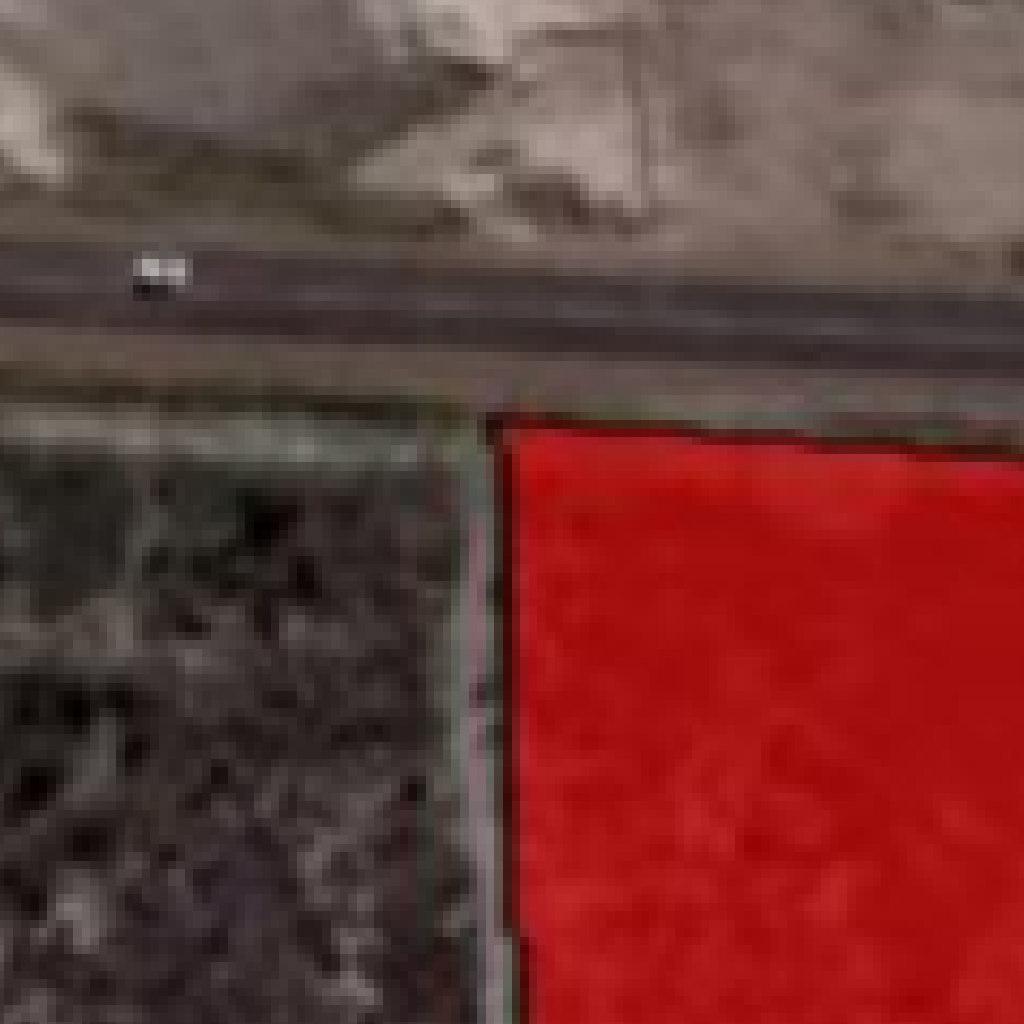
8 2 DEVELOPMENT LOCATION & SURROUNDING ROAD NETWORK 2.1 Site Location Farm 1065 Portion 1 is located to the south of the Witsand residential area and is bounded by John Dreyer Street to the north, the R304 to the east and the remainder of Farm 1065 to the south and west. The site is currently undeveloped. Figure 1-2: The Site N THE SITE

 John Dreyer Street is currently classified as a Class 4 Local Distributor. This road runs parallel in an east-west direction between the R304 and Neil Hare Road.")
9 2.2 Surrounding Road Network The road classification mentioned below has been derived from the COTO s South African Road Classification and Access Management Manual (TRH26, 2012). R304 The R304 is a Class 2 Primary Arterial. The road is a single carriageway with one lane per direction and is located along the eastern boundary of the site. It has a surfaced shoulder on both sides. This road is running in a North-South direction linking Melkbosstrand Road (M19) on its southern end with Atlantis on its northern end. John Dreyer Street (Blombosch Road) John Dreyer Street is currently classified as a Class 4 Local Distributor. This road runs parallel in an east-west direction between the R304 and Neil Hare Road. It is also named Blombosch Road. It is a single carriageway with one lane per direction. The Road Network Map of the City of Cape Town from August 2013 shows Blombosch Road being partially earmarked to be upgraded to a Class 2 road once future road extensions in the area have been constructed. However, at this point in time, no changes have been actioned.
10 3 ACCESS AND PARKING 3.1 Site Access Site access is proposed to be located on John Dreyer Street, opposite the existing road to the Witsand residential area and in approximately 290 metres from the John Dreyer Street / R304 intersection. To maintain sight lines, the proposed access needs to be kept clear of vegetation, such as shrubs and trees. It is understood that there will be no access control to the proposed development area. However, the detail design of the access road will need to provide suitable lane widths to accommodate light as well as heavy vehicle traffic. Furthermore, the access to the proposed school will need to be planned to ensure safe drop-off / pick-up facilities and suitable infrastructure for pedestrian movement of school children. The detailed investigation into the access layout will form part of the design stage. 3.2 Parking The on-site parking to be provided needs to be in accordance with the City of Cape Town s Municipal Planning By-Law (2015), unless otherwise agreed with and approved by the respective Authority. The site is currently still considered to be in a Standard parking area in terms of parking requirements. With the MyCiTi bus system having been implemented and the existing minibus taxi network available close to the site, it is motivated that the area be categorised as at least a Public Transport Zone 1 (PT1) area, with reduced parking requirements than a Standard parking area. Based on the Site Development Plan (SDP) and the Gross Leasable Area (GLA) expected to be accommodated on site, the by-law stipulates the following minimum parking bays to be accommodated for a PT1 area: Table 1-1: Parking Requirements Land use Minimum Parking Requirement On Site Parking requirement Resulting Bays Retail (9979 m 2 GLA) Industrial/warehousing (33 838m2 GLA based on a rate of 0.6) 2 bays/100 m² GLA 200 (4 disabled bays) 1 bay/100 m² GLA 338 (6 disabled bays) School (worst case estimated at 400 students) 6 offices and 10 class rooms 1 bay/ class room and office plus stop and drop facility 16+ drop off facility Total 554
11 It is recommended that these reduced parking requirements be accepted, taking also into account that a significant number of customers will walk from Witsand to the retail shops. The total parking bays required for the site is 554. A drop-off / pick-up zone needs to be provided for the school and on-site loading bays need to be provided for the business land use component and retail shops.
12 4 PUBLIC TRANSPORT AND NON-MOTORISED TRANSPORT In terms of the National Land Transport Act (NLTA) (Act No.5 of 2009), it is a requirement that an assessment of the available public transport services be included in Traffic Impact Assessments. The following comments are relevant in respect to the public transport availability for the proposed development. 4.1 Public Transport Existing Services There are currently minibus taxis that travel along the R304 as well as John Dreyer Street. The MyCiTi IRT bus system operates in the Atlantis area with the closest bus stop to the site being located at the intersection of John Dreyer Street and Neil Hare Road, approximately 1.5km from the proposed development access point. Based on the minibus taxi routes researched and outlined by the so called WhereIsMyTransport website, there are two taxi routes to Atlantis. The routes connect the Atlantis taxi rank to the Cape Town city centre taxi rank and the Bellville taxi rank. The Atlantis taxi rank is located at the Atlantis City centre, which is approximately 4.6km from the site. The taxi rank can be accessed by using a MyCiTi bus, for which a bus stop is located approximately 1.5km west of the site as previously mentioned, or a taxi on the R304, which is located 300m east of the site. There are currently no available passenger train services at Atlantis.


13 Figure 4-1: MyCiTy Bus Routes close to the site (Extract from MyCiTi website route map) N THE SITE
14 4.1.2 Planned Transport Services The current taxi and bus services in the vicinity of the site are in line with the City of Cape Town s 2032 Integrated Public Transport Network (IPTN) Plan. Based on this information there are currently no further planned transport services envisaged near the site. However, it is recommended to consider a formal taxi embayment at or close to the site on John Dreyer Street to cater for commuters between the surrounding areas and the proposed development. 4.2 Non-motorised Transport (NMT) It is recommended that sidewalks with a minimum width of 1.5m be constructed along the frontage of the site on John Dreyer Street to allow safe pedestrian links to the site. Sidewalks also need to be provided along the internal access roads of the site to ensure safety for pedestrians, including safe crossing points at strategic locations. Universal accessibility needs to be ensured by providing suitable dropped kerbs and safe crossings. As previously mentioned, it is proposed to provide a school on the corner of the access road to the proposed site and John Dreyer Street, and as such, it is of the utmost importance to ensure safe pedestrian facilities be provided. It is expected that school children will mainly travel from the Witsand area north of the site and therefore it is recommended that a raised pedestrian crossing be provided at the Witsand / Site Access / John Dreyer Street intersection.
15 5 KOEBERG TRAFFIC EVACUATION PLAN The City of Cape Town has developed the Koeberg Traffic Evacuation Model (TEM) for any developments falling into the following defined zones: The Public Exclusion Boundary (PEB): the area within approximately 2km from the PEB of the Koeberg nuclear facility. The Inner Emergency Protection Zone (Inner EPZ) is an area radiating 5km from the reactor. The Intermediate Emergency Protection Zone (Intermediate EPZ) extends 5km to 16km from the reactor. The Outer EPZ extends from 16km to 80km from the reactor. Farm 1065 Portion 1 is located approximately 11km from the nuclear power station and hence falls within the Intermediate EPZ. The main evacuation routes include John Dreyer Street, the R304 and Klein Dassenberg Road. When implementing the proposed development, the principles of the TEM, as well as the Traffic Evacuation Plan must be adhered to. The Evacuation Plan for this development needs to be made available and visible to all tenants and customers.
.")
16 6 TRAFFIC FLOWS & TRIP GENERATION 6.1 Existing Traffic Volumes Traffic counts were conducted at the intersections of John Dreyer Street / Access road to Witsand and John Dreyer Street / R304 (see Figure 5-1 below). The counts where conducted during: 1. Afternoon peak period on Friday, 26 th January 2018, 2. Mid-day peak period on Saturday, 27 th January 2018, and 3. Morning peak period on Tuesday, 30 th January The counts are summarized in Annexure B. The overall resulting peak hours were observed from 06h45 to 07h45 for the AM, 12h00 to 13h00 for the mid-day and 16h00 to 17h00 for the PM. Figure 6-1: Traffic count locations 6.2 Future Traffic Volumes It is a requirement that the traffic impact of the development be assessed with the background traffic that will exist in a 5-year design horizon, i.e The expected 2023 traffic volumes were derived by applying a 2% per annum growth rate to the 2018 traffic volumes. The 2% growth rate is estimated to be the average annual traffic growth rate in the area considering the magnitude of on-going development in and around the area. This growth rate is understood as a realistic rate. The future 2023 traffic volumes for the intersections are summarised in Annexure C.
17 6.3 Development Traffic The development traffic generated by the proposed development was assumed taking the following into account: Present traffic patterns, TMH17 Volume 1 Trip Generation Rates and Splits Current limited modes of public transport. Table 6-1 summarises the TMH17 prescribed trip rates and split. Table 6-1: TMH17 Trip rates LAND USE AM PM SATURDAY Fast food (RATE/100 m 2 GLA) IN/OUT 55/45 55/45 Retail N/A (RATE/100 m 2 GLA) IN/OUT 65/35 50/50 50/50 Industrial (RATE/100 m 2 GLA) IN/OUT 70/30 25/75 30/70 School (RATE/ STUDENT) IN/OUT 50/50 50/50 N/A The following assumptions are made in estimating the generated trips: TMH17 Volume 1 suggested trip rates with a 40%, 30%, 20%, and 50% trip reduction due to low vehicle ownership for the fast food, retail, shopping centre, industrial, and school land use s respectively. Taking into account the in/out ratio suggested by TMH17 Volume 1. Not much information is available on the number of pupils to be accommodated at the proposed school. The worst-case scenario of 400 students is assumed (i.e. max students for small sized secondary school). This value is based on the Department of Education s National Minimum Uniform Norms and Standards for School Infrastructure. The industrial component GLA is estimated at 60% of total industrial ERF size.
18 Table 6-2: Generated Trips for the proposed Development Development Type AM PM Saturday IN OUT IN OUT IN OUT Fast food (700 m 2 GLA) N/A N/A Pass-by N/A N/A N/A N/A Diverted N/A N/A N/A N/A Retail (9279 m 2 GLA) Pass-by N/A N/A Diverted N/A N/A Industrial ( m 2 GLA) School (400 STUDENTS) TOTAL Trip Distribution and Assignment The development traffic for the proposed development was distributed on the surrounding road network taking the following into account: Proposed links with surrounding road network, Present traffic patterns, and Available public transport services in the vicinity of the site. The development traffic distribution for the proposed development is summarised in Annexure D for the AM, PM and Saturday peak hour respectively. The 2018 traffic volumes including the proposed development traffic is summarised in Annexure E for the AM, PM and Saturday peak hour respectively. The 2023 traffic volumes without development traffic is summarised in Annexure C for the AM, PM and Saturday peak hour respectively. The 2023 traffic volumes with development traffic is summarised in Annexure F.
19 7 INTERSECTION CAPACITY ANALYSIS 7.1 Study Area The intersections as listed below were analysed for their operational performance: John Dreyer Street/Access Road to Witsand John Dreyer Street/R304 Capacity analyses of these intersections were carried out using AutoJ Analysis software. The purpose of the analysis is to determine the current and future expected traffic situation on the external road network. 7.2 Results of Capacity Analysis General To assess the impact of the proposed development on the road network, the results of the capacity analyses with and without the proposed development are compared. The attachments summarise the level of service ( see definitions in Table 7-1), volume/capacity ratio (v/c) and average delay (in seconds) for each approach as well as for the overall intersections. Table 7-1: Level of Service Definition Level of Service () Delay (d) in seconds Signals and Traffic Circles Stop and Yield Controlled DEGREE OF PERFORMANCE A d < 10 d < 10 Excellent intersection performance B 10 < d <20 10 < d < 15 Good intersection performance C 20 < d < < d < 25 Fair intersection performance (improvements may be needed in future) D 35 < d < < d < 35 Poor Intersection performance E 55 < d < < d < 50 F d > 80 d > 50 The average delay is calculated from the time a vehicle comes to a stop to driving over stop line at a respective approach. In a research project, it was found that drivers accept a maximum delay or waiting time of around 55 seconds at a signalised intersection, but only 35 seconds at a stop controlled intersection. Thereafter the driver will become impatient and the intersection is deemed to not operate well anymore. Another factor that plays a role when calculating the level of service at an intersection is the queuing distance, which is the number of vehicles waiting at an intersection. The following Tables summarise the capacity analyses results.
20 7.3 Analysis Results Table 7-2: 2018 Capacity Analysis Scenario Intersection/ 2018 TRAFFIC WITHOUT DEVELOPMENT 2018 TRAFFIC WITH DEVELOPMENT Approach AM PM SATURDAY AM PM SATURDAY MIDDAY MIDDAY v/c Delay (sec) v/c Delay (sec) v/c Delay (sec) v/c Delay (sec) v/c Delay (sec) 1 R304/John Dreyer st v/c 2 Delay (sec) John Dreyer/ Witsand R304 (SB) F F F F F F R304 (NB) F F C F F F John Dreyer St. (EB) D F B F F B Overall F F D F F F Witsand (SB) B A A D B A Site Access (NB) N/A F F C John Dreyer St. (EB) A A A A A A John Dreyer St. (WB) A A A A A A Overall A A A F F A
21 Table 7-3: 2023 Capacity Analysis Scenario Intersection/ 2023 TRAFFIC WITHOUT DEVELOPMENT 2023 TRAFFIC WITH DEVELOPMENT Approach AM PM SATURDAY AM PM SATURDAY MIDDAY MIDDAY v/c Delay (sec) v/c Delay (sec) 1 R304/John Dreyer st v/c Delay (sec) v/c Delay (sec) v/c Delay (sec) 2 John Dreyer/ Witsand v/c Delay (sec) R304 (SB) F F F F F F R304 (NB) F F John Dreyer St. (EB) F F D B F F F F F C Overall F F F F F F Witsand (SB) B A A F C Site Access (NB) N/A F F F John Dreyer St. (EB) John Dreyer St. (WB) Overall A A A A A A A A A A A A A A A A F F C
22 Table 7-4: 2023 Analysis scenario with intersection improvements Intersection/ Approach 2023 TRAFFIC WITH DEVELOPMENT AM PM SATURDAY MIDDAY 1 2 R304/John Dreyer st John Dreyer/ Witsand 3 stage signal, leading flash from north (addition of dedicated turning lanes on all approaches) v/c Delay (sec) v/c Delay (sec) v/c Delay (sec) R304 (SB) A B A R304 (NB) C C A John Dreyer St. (EB) C B C Overall B C B Witsand (SB) F C A Site Access (NB) F F B John Dreyer St. (EB) A A A John Dreyer St. (WB) A A A Overall F F A Addition of turning lanes (right turn on NB approach and left turn on WB approach)
23 7.4 Discussion of Analysis Results John Dreyer Street/R304 The intersection performs at an overall Level of Service () F across all analysed scenarios with the exception of the 2018 Saturday Peak scenario, which performs at D Scenarios Currently the AM peak performs on all approaches at F with the exception of the eastbound approach which performs close to capacity at D. The performance drops further during the PM peak with all approaches at F. The Saturday Peak fairs better with an overall close to capacity at D. The northbound approach performs adequately at C while the east bound approach performs well at B During the with development scenarios, all intersection approaches perform at F with the exception of the east bound approach during the Saturday peak hour, which performs well at B. However, it must be noted that the intersection is currently performing close to capacity and thus an intersection upgrade is warranted based on the current volumes Scenarios During the year 2023 without development scenario, the intersection performs at F in all analysed scenarios. The Saturday Peak scenarios experience a slight increase in delays, causing the northbound approach to perform close to capacity at D. However, the eastbound approach still performs well at B. All intersection approaches are at capacity once the development is added, with the exception of the eastbound approach which performs adequately at C during the Saturday peak period. The delays observed and summarised above can be attributed to the high turning movement demand with no dedicated turning lane provided at present and an intersection control that does not efficiently allow for the dispersal of the queuing volumes. Recommendations It is recommended that the intersection be signalised with a 3-staged signal plan (leading green on the north approach) and that short turning lanes be added at all three intersection approaches (see Annexure G).
24 7.4.2 John Dreyer Street/Witsand Without development The intersection performs at A during the 2018 and 2023 without development scenarios. All approaches are also at Los A across the analysed scenarios. With development The addition of the development traffic causes the intersection to perform poorly at F for the 2018 and 2023 with development scenarios if no geometric upgrades are done. The eastbound and westbound approaches still perform excellently at A across both scenarios. The southbound approach performs adequately during the 2018 AM and PM peak with development scenario. During the 2023 with development scenario the approach performs at capacity for the AM and PM peak with the Saturday Peak performing at A. The northbound approach performs at capacity F during the 2018 and 2023 with development scenario. The delays experienced once the development is added can be attributed to a lack of passing opportunities for the turning movements. The east and westbound approaches experience free flowing movements as they are on a priority route. Recommendations The intersection fails to meet spacing requirements for signalisation and space constraints prevent the addition of a roundabout that can accommodate the heavy vehicles that frequent the route. It is thus recommended that a right-turn lane be provided at the site access (i.e. northbound approach) and a left-turn lane be provided at the eastbound approach to improve the delays at this intersection.
25 8 SUMMARY 8.1 The Site The site is currently undeveloped and is located on Portion 1 of Farm 1065 just south of the Witsand residential area and east of the R304. It is proposed to establish a mixed land use development with a commercial component (i.e. line shops with anchor tenant), industrial/warehousing component and a school. All these components are outlined in the Site Development Plan. 8.2 Access and Parking The site will be accessed from John Dreyer Street and the proposed access road will be the fourth approach on the intersection of John Dreyer Street / Witsand. The future detail design must ensure that it accommodates light and heavy vehicle traffic, as well as taking universal accessibility principles into account. It is recommended that a total of 554 parking bays be provided on site. A drop-off / pick-up facility needs to be provided for the school. 8.3 Public Transport and Non-Motorised Transportation Available public transport services in the vicinity of the site include the MyCiTi bus as well as minibus taxis. The closest MyCiTi bus stop is located approximately 1.5km west of the site, while the R304, located just 300m east of the site and is part of a minibus taxi route. It is recommended to provide safe pedestrian sidewalks along the frontages of the site, as well as on the internal roads and a raised pedestrian crossing at the John Dreyer Street / Witsand / Site Access intersection. 8.4 Intersection Capacity Analysis John Dreyer Street/R304 It is recommended that the intersection be signalised and that turning lanes be provided on all the approaches. John Dreyer Street/Witsand It is recommended that a right turn lane be provided at the northbound approach, and a left turn lane be provided at the west bound approach to reduce delays. The proposed development is supported from a traffic engineering point of view provided that the recommendations made are adhered to.
26 Annexure A: SITE SDP


27
28 Annexure B: 2018 EXISTING TRAFFIC
29 Light (Heavy) 2018 Am Peak (without development traffic) WITSAND JOHN DREYER 57 ( 0 ) L 49 ( 6 ) L 145 ( 21 ) T 0 ( 1 ) T 0 ( 0 ) R 102 ( 0 ) 0 ( 0 ) 46 ( 3 ) 142 ( 17 ) R 137 ( 9 ) 310 ( 22 ) 2 ( 0 ) R T L R T L 1 2 L T R R 27 ( 0 ) L T R R 0 ( 0 ) 0 ( 0 ) 0 ( 0 ) 0 ( 0 ) T 354 ( 28 ) 246 ( 20 ) 97 ( 15 ) 0 ( 0 ) T 0 ( 0 ) L 0 ( 0 ) L 0 ( 0 ) R 304 R 304 SITE (ERF 1065) Light (Heavy) 2018 Pm Peak (without development traffic) WITSAND JOHN DREYER 51 ( 0 ) L 105 ( 11 ) L 266 ( 43 ) T 0 ( 0 ) T 0 ( 0 ) R 47 ( 2 ) 0 ( 0 ) 30 ( 4 ) 191 ( 36 ) R 56 ( 9 ) 163 ( 17 ) 5 ( 1 ) R T L R T L 1 2 L T R R 26 ( 4 ) L T R R 0 ( 0 ) 0 ( 0 ) 0 ( 0 ) 0 ( 0 ) T 109 ( 34 ) 75 ( 29 ) 212 ( 14 ) 2 ( 0 ) T 0 ( 0 ) L 0 ( 0 ) L 1 ( 0 ) R 304 R 304 SITE (ERF 1065) Light (Heavy) 2018 Saturday Midday Peak (without development traffic) WITSAND JOHN DREYER 30 ( 1 ) L 42 ( 2 ) L 87 ( 14 ) T 5 ( 1 ) T 0 ( 0 ) R 23 ( 1 ) 0 ( 0 ) 25 ( 2 ) 66 ( 14 ) R 36 ( 2 ) 172 ( 11 ) 14 ( 0 ) R T L R T L 1 2 L T R R 24 ( 2 ) L T R R 11 ( 0 ) 0 ( 0 ) 0 ( 0 ) 0 ( 0 ) T 56 ( 14 ) 42 ( 13 ) 145 ( 9 ) 2 ( 0 ) T 2 ( 1 ) L 0 ( 0 ) L 2 ( 0 ) R 304 R 304 SITE (ERF 1065)
30 Annexure C: 2023 PROJECTED TRAFFIC (WITHOUT DEVELOPMENT)
31 Light (Heavy) 2023 Am Peak (without development traffic) WITSAND Light (Heavy) JOHN DREYER JOHN DREYER 63 ( 0 ) L 55 ( 7 ) L 161 ( 24 ) T 0 ( 2 ) T 0 ( 0 ) R 113 ( 0 ) 0 ( 0 ) 51 ( 4 ) 157 ( 19 ) R 152 ( 10 ) 343 ( 25 ) 3 ( 0 ) R T L R T L 1 2 L T R R 30 ( 0 ) L T R R 0 ( 0 ) 0 ( 0 ) 0 ( 0 ) 0 ( 0 ) T 391 ( 31 ) 272 ( 23 ) 108 ( 17 ) 0 ( 0 ) T 0 ( 0 ) L 0 ( 0 ) L 0 ( 0 ) SITE (ERF 1065) WITSAND 2023 Pm Peak (without development traffic) 57 ( 0 ) L 116 ( 13 ) L 294 ( 48 ) T 0 ( 0 ) T 0 ( 0 ) R 52 ( 3 ) 0 ( 0 ) 34 ( 5 ) 211 ( 40 ) R 62 ( 10 ) 180 ( 19 ) 6 ( 2 ) R T L R T L 1 2 L T R R 29 ( 5 ) L T R R 0 ( 0 ) 0 ( 0 ) 0 ( 0 ) 0 ( 0 ) T 121 ( 38 ) 83 ( 33 ) 235 ( 16 ) 3 ( 0 ) T 0 ( 0 ) L 0 ( 0 ) L 2 ( 0 ) R 304 R 304 R 304 R 304 SITE (ERF 1065) Light (Heavy) 2023 Saturday Midday Peak (without development traffic) WITSAND JOHN DREYER 34 ( 2 ) L 47 ( 3 ) L 97 ( 16 ) T 6 ( 2 ) T 0 ( 0 ) R 26 ( 2 ) 0 ( 0 ) 28 ( 3 ) 73 ( 16 ) R 40 ( 3 ) 190 ( 13 ) 16 ( 0 ) R T L R T L 1 2 L T R R 27 ( 3 ) L T R R 13 ( 0 ) 0 ( 0 ) 0 ( 0 ) 0 ( 0 ) T 62 ( 16 ) 47 ( 15 ) 161 ( 10 ) 3 ( 0 ) T 3 ( 2 ) L 0 ( 0 ) L 3 ( 0 ) R 304 R 304 SITE (ERF 1065)
32 Annexure D: PROPOSED DEVELOPMENT TRAFFIC DISTRIBUTION
33 Light Heavy A Peak developet traffic WITSAND JOHN DREYER L L T T R R R T L R T L L T R R L T R R T T L L R R SITE ERF Light Heavy P Peak developet traffic WITSAND JOHN DREYER L L T T R R R T L R T L L T R R L T R R T T L L R R SITE ERF Light Heavy Saturday Midday Peak developet traffic WITSAND JOHN DREYER L L T T R R R T L R T L L T R R L T R R T T L L R R SITE ERF
34 Light (Heavy) 2018 Am Peak (Trip redistribution for passer by and diverted trips) WITSAND Light (Heavy) JOHN DREYER JOHN DREYER 57 ( 0 ) L 49 ( 6 ) L 145 ( 21 ) T 0 ( 1 ) T 0 ( 0 ) R 102 ( 0 ) 0 ( 0 ) 46 ( 3 ) 142 ( 17 ) R 137 ( 9 ) 310 ( 22 ) 2 ( 0 ) R T L R T L 1 2 L T R R 27 ( 0 ) L T R R 0 ( 0 ) 0 ( 0 ) 0 ( 0 ) 0 ( 0 ) T 354 ( 28 ) 246 ( 20 ) 97 ( 15 ) 0 ( 0 ) T 0 ( 0 ) L 0 ( 0 ) L 0 ( 0 ) SITE (ERF 1065) WITSAND 2018 Pm Peak (Trip redistribution for passer by and diverted trips) 51 ( 0 ) L 135 ( 13 ) L 191 ( 43 ) T 0 ( 0 ) T 75 ( 0 ) R 47 ( 2 ) 27 ( 0 ) 3 ( 4 ) 235 ( 36 ) R 101 ( 9 ) 118 ( 17 ) 5 ( 1 ) R T L R T L 1 2 L T R R 26 ( 4 ) L T R R 0 ( 0 ) 85 ( 2 ) 0 ( 0 ) 176 ( 3 ) T 24 ( 34 ) 142 ( 32 ) 145 ( 11 ) 2 ( 0 ) T 0 ( 0 ) L 197 ( 3 ) L 1 ( 0 ) R 304 R 304 R 304 R 304 SITE (ERF 1065) Light (Heavy) 2018 Saturday Midday Peak (Trip redistribution for passer by and diverted trips) WITSAND JOHN DREYER 30 ( 1 ) L 79 ( 2 ) L 80 ( 14 ) T 5 ( 1 ) T 7 ( 0 ) R 23 ( 1 ) 0 ( 0 ) 25 ( 2 ) 92 ( 14 ) R 62 ( 2 ) 146 ( 11 ) 14 ( 0 ) R T L R T L 1 2 L T R R 24 ( 2 ) L T R R 11 ( 0 ) 7 ( 0 ) 0 ( 0 ) 70 ( 2 ) T 49 ( 14 ) 79 ( 15 ) 108 ( 7 ) 2 ( 0 ) T 2 ( 1 ) L 70 ( 2 ) L 2 ( 0 ) R 304 R 304 SITE (ERF 1065)
35 Annexure E: WITH DEVELOPMENT TRAFFIC DISTRIBUTION
36 Light Heay A Peak ith deelopet traffic WITSAND JOHN DREYER L L T T R R R T L R T L L T R R L T R R T T L L R R SITE ERF Light Heay P Peak ith deelopet traffic WITSAND JOHN DREYER L L T T R R R T L R T L L T R R L T R R T T L L R R SITE ERF Light Heay Saturday Midday Peak ith deelopet traffic WITSAND JOHN DREYER L L T T R R R T L R T L L T R R L T R R T T L L R R SITE ERF
37 Annexure F: WITH DEVELOPMENT TRAFFIC DISTRIBUTION
38 Light Heay A Peak ith deelopet traffic WITSAND JOHN DREYER L L T T R R R T L R T L L T R R L T R R T T L L R R SITE ERF Light Heay P Peak ith deelopet traffic WITSAND JOHN DREYER L L T T R R R T L R T L L T R R L T R R T T L L R R SITE ERF Light Heay Saturday Midday Peak ith deelopet traffic WITSAND JOHN DREYER L L T T R R R T L R T L L T R R L T R R T T L L R R SITE ERF
39 ANNEXURE G: RECOMMENDED INTERSECTION LAYOUTS
40
JEP John E. Jack Pflum, P.E. Consulting Engineering 7541 Hosbrook Road, Cincinnati, OH Telephone:
 JEP John E. Jack Pflum, P.E. Consulting Engineering 7541 Hosbrook Road, Cincinnati, OH 45243 Email: jackpflum1@gmail.com Telephone: 513.919.7814 MEMORANDUM REPORT Traffic Impact Analysis Proposed Soccer
WEBER ROAD RESIDENTIAL DEVELOPMENT Single Family Residential Project
 WEBER ROAD RESIDENTIAL DEVELOPMENT Single Family Residential Project WEBER ROAD RESIDENTIAL DEVELOPMENT TRAFFIC IMPACT STUDY TABLE OF CONTENTS 1.0 Executive Summary Page 2.0 Introduction 2.1 DEVELOPMENT
CVS Derwood. Local Area Transportation Review
 CVS Derwood Montgomery County, Maryland May 27, 2016 Local Area Transportation Review Prepared for: JC Bar Properties, Inc. Steve Fleming, PE 415 Fallowfield Road, Suite 301 Camp Hill, Pennsylvania 17011
MEMORANDUM. The study area of the analysis was discussed with City staff and includes the following intersections:
 MEMORANDUM DATE: JULY 6, 2012 TO: FROM: RE: CC: MELANIE KNIGHT BRAD BYVELDS/ JENNIFER LUONG 1050 SOMERSET STREET PRELIMINARY TRAFFIC ANALYSIS OUR FILE NO. 111152 NEIL MALHOTRA The purpose of this memo
FINAL Traffic Report for the Proposed Golden Valley Road and Newhall Ranch Road Projects in the City of Santa Clarita, California May 5, 2005
 FINAL Traffic Report for the Proposed Golden Valley Road and Newhall Ranch Road Projects in the City of Santa Clarita, California May 5, 2005 Prepared For: EDAW, Inc. 1420 Kettner Boulevard, Suite 620
April 10, Mr. Curt Van De Walle, City Manager City of Castle Hills 209 Lemonwood Drive Castle Hills, Texas 78213
 Mr. Curt Van De Walle, City Manager City of Castle Hills 209 Lemonwood Drive Castle Hills, Texas 78213 Subject: Revised Castle Hills BASIS Charter School Traffic Impact Analysis Review City of Castle Hills,
Traffic Impact Study
 Traffic Impact Study Statham DRI One University Parkway Prepared for: Barrow County Prepared by: October 2012 Table of Contents Executive Summary i Section 1. Introduction 1 Project Description 1 Methodology
Market Street PDP. Nassau County, Florida. Transportation Impact Analysis. VHB/Vanasse Hangen Brustlin, Inc. Nassau County Growth Management
 Transportation Impact Analysis Market Street PDP Nassau County, Florida Submitted to Nassau County Growth Management Prepared for TerraPointe Services, Inc. Prepared by VHB/Vanasse Hangen Brustlin, Inc.
Parking Regulations Dundas Street West, from Bathurst Street to Dovercourt Road
 STAFF REPORT ACTION REQUIRED Parking Regulations Dundas Street West, from Bathurst Street to Dovercourt Road Date: October 28, 2008 To: From: Toronto and East York Community Council Director, Transportation
Signalized Intersections
 Signalized Intersections Kelly Pitera October 23, 2009 Topics to be Covered Introduction/Definitions D/D/1 Queueing Phasing and Timing Plan Level of Service (LOS) Signal Optimization Conflicting Operational
NATHAN HALE HIGH SCHOOL PARKING AND TRAFFIC ANALYSIS. Table of Contents
 Parking and Traffic Analysis Seattle, WA Prepared for: URS Corporation 1501 4th Avenue, Suite 1400 Seattle, WA 98101-1616 Prepared by: Mirai Transportation Planning & Engineering 11410 NE 122nd Way, Suite
Focused Traffic Analysis for the One Lincoln Park Project
 September 15, 2015 Mr. Bill Johnson Coldwell Banker 511 Sir Francis Drake Boulevard Greenbrae, CA 94904 Focused Traffic Analysis for the One Lincoln Park Project Dear Mr. Johnson; As requested, W-Trans
CHAPTER 3. CAPACITY OF SIGNALIZED INTERSECTIONS
 CHAPTER 3. CAPACITY OF SIGNALIZED INTERSECTIONS 1. Overview In this chapter we explore the models on which the HCM capacity analysis method for signalized intersections are based. While the method has
930 Old Northern Rd & 4 Post Office Rd, Glenorie
 Proposed Mixed Use Development 930 Old Northern & 4, Glenorie TRAFFIC AND PARKING ASSESSMENT REPORT 13 December 2016 Ref 16264 Suite 6, 20 Young Street, Neutral Bay NSW 2089 - PO Box 1868, Neutral Bay
TRAFFIC IMPACT STUDY. Platte Canyon Villas Arapahoe County, Colorado (Arapahoe County Case Number: Z16-001) For
 For") TRAFFIC IMPACT STUDY For Platte Canyon Villas Arapahoe County, Colorado (Arapahoe County Case Number: Z16-001) February 2015 Revised: August 2015 April 2016 July 2016 September 2016 Prepared for: KB Home
TRAFFIC IMPACT STUDY For Platte Canyon Villas Arapahoe County, Colorado (Arapahoe County Case Number: Z16-001) February 2015 Revised: August 2015 April 2016 July 2016 September 2016 Prepared for: KB Home
Appendix B. Traffic Analysis Report
 Appendix B Traffic Analysis Report Report No. 14369/TR/WN02 August 2007 SALLINS BYPASS BYPASS OPTIONEERING ANALYSIS - TRAFFIC REPORT Kildare County Council Áras Chill Dara, Devoy Park, Naas, Co Kildare
HALFF 16196? TRAFFIC MANAGEMENT PLAN. Richardson ISD Aikin Elementary School Dallas, Texas North Bowser Road Richardson, Texas 75081
 30280 16196? TRAFFIC MANAGEMENT PLAN Exhibit 572B Aikin Elementary School Planned Development District No. 572 Approved City Plan Commission October20, 2016 July 12, 2016 Prepared for HALFF AVO 31586 PHO1
I. M. Schoeman North West University, South Africa. Abstract
 Urban Transport XX 607 Land use and transportation integration within the greater area of the North West University (Potchefstroom Campus), South Africa: problems, prospects and solutions I. M. Schoeman
TRANSPORTATION AND TRAFFIC ANALYSIS REPORT
 Square One Drive Extension Municipal Class Environmental Assessment Environmental Study Report Appendix B Transportation and Traffic Analysis Report TRANSPORTATION AND TRAFFIC ANALYSIS REPORT FINAL DRAFT
PW 001 SNOW REMOVAL AND SANDING FOR ROADWAYS AND SIDEWALKS October 6, 2014 (#223-14) Original October 19, 2015; October 15, 2018 Public Works
 Original October 19, 2015; October 15, 2018 Public Works") Policy Statement: The Village of Kitscoty will provide snow and ice control on municipal streets and sidewalks according to determined priorities. Purpose: To provide direction and information to employees
Policy Statement: The Village of Kitscoty will provide snow and ice control on municipal streets and sidewalks according to determined priorities. Purpose: To provide direction and information to employees
Table of Contents Introduction... 4 Study Area... 5
 Table of Contents Introduction... 4 Study Area... 5 Streets and s... 5 Traffic Volumes... 8 Recent and Anticipated Development... 10 Crash Analysis... 10 Projected Traffic Volumes... 11 Trip Generation...
VHD Daily Totals. Population 14.5% change. VMT Daily Totals Suffolk 24-hour VMT. 49.3% change. 14.4% change VMT
 6.9 Suffolk 6-54 VMT Population and Travel Characteristics Population 14.5% change 2014 1,529,202 VHD Daily Totals 2014 251,060 49.3% change 2040 1,788,175 2040 374,850 VMT Daily Totals 2014 39,731,990
COUNCIL POLICY MANUAL
 COUNCIL POLICY MANUAL SECTION: PUBLIC WORKS SUBJECT: SNOW & ICE CONTROL POLICY 2012/2013 GOAL: Pages: 1 of 10 Approval Date: Dec. 3, 2012 Res. # 1001/2012 To annually identify the winter maintenance costs
MADISON, WI STONE HOUSE DEVELOPMENT 1000 E. WASHINGTON AVENUE REDEVELOPMENT TRANSPORTATION STUDY DECEMBER 14, 2015
 MADISON, WI STONE HOUSE DEVELOPMENT 1000 E. WASHINGTON AVENUE REDEVELOPMENT TRANSPORTATION STUDY DECEMBER 14, 2015 TABLE OF CONTENTS... 3 Proposed Development... 3 Methodology... 3 Phase 1 Development...
Appendix C Traffic Study
 Final Environmental Impact Statement Appendix C Traffic Study Schofield Generating Station Project, Hawaii October 2015 C-1 Final Environmental Impact Statement This page intentionally left blank. Schofield
APPENDIX IV MODELLING
 APPENDIX IV MODELLING Kingston Transportation Master Plan Final Report, July 2004 Appendix IV: Modelling i TABLE OF CONTENTS Page 1.0 INTRODUCTION... 1 2.0 OBJECTIVE... 1 3.0 URBAN TRANSPORTATION MODELLING
PLAZA MEXICO RESIDENCES
 PLAZA MEXICO RESIDENCES TRAFFIC STUDY PREPARED FOR: 3000 E. IMPERIAL, LLC. 6940 Beach Boulevard, D-501 Buena Park, California 90621 PREPARED BY: OCTOBER 5, 2017 translutions the transportatio n solutions
Drehid MBT Facility- Waste Licence EIS
 11 TRAFFIC 11.1 INTRODUCTION This Chapter assesses the potential impact that both the construction and operational phases of the proposed Mechanical Biological Treatment (MBT) Facility will have on the
Tahlequah Public Schools Inclement Weather Transportation Plan
 Tahlequah Public Schools Inclement Weather Transportation Plan Inclement Weather with Ice and Snow From time to time throughout the school year, weather may force a change in the District s normal operating
Trip Generation Study: A 7-Eleven Gas Station with a Convenience Store Land Use Code: 945
 Trip Generation Study: A 7-Eleven Gas Station with a Convenience Store Land Use Code: 945 Introduction The Brigham Young University Institute of Transportation Engineers student chapter (BYU ITE) completed
TRANSPORTATION IMPACT STUDY WHEELER STREET CLOSURE
 TRANSPORTATION IMPACT STUDY WHEELER STREET CLOSURE Village of Greene, Chenango County, New York Prepared for: VILLAGE OF GREENE 49 Genesee Street Greene, NY 13778 Prepared by: LARSON DESIGN GROUP 1000
TRAFFIC IMPACT STUDY MANUFACTURING COMPANY
 TRAFFIC IMPACT STUDY For MANUFACTURING COMPANY Prepared For: Airway Heights, WA Prepared By: SUNBURST ENGINEERING, P. S. 4310 S. Ball Dr. Veradale, WA 99037 April, 2013 TRAFFIC IMP ACT STUDY Manufacturing
Appendix I: Traffic Study
 City of Fontana Sierra Lakes Commerce Center Draft EIR Appendix I: Traffic Study FirstCarbon Solutions H:\Client (PN JN)\0144\01440050\EIR\1 ADEIR\01440050 Sec99 99 Appendix Dividers.doc THIS PAGE INTENTIONALLY
Greater Toronto Area Cordon Count Summary Analysis of Traffic Trends 1985 to 2011
 Greater Toronto Area Cordon Count Summary Analysis of Traffic Trends 1985 to 2011 Prepared by: Data Management Group Department of Civil Engineering University of Toronto Telephone: (416) 978-3916 Table
Appendixx C Travel Demand Model Development and Forecasting Lubbock Outer Route Study June 2014
 Appendix C Travel Demand Model Development and Forecasting Lubbock Outer Route Study June 2014 CONTENTS List of Figures-... 3 List of Tables... 4 Introduction... 1 Application of the Lubbock Travel Demand
Appendix B.1 EMME Model Calibration Memo
 Appendix B.1 EMME Model Calibration Memo itrans 144 Front Street West, Suite 655 Toronto, ON M5J 2L7 Tel: (416) 847-0005 Fax: (905) 882-1557 www.hdrinc.com www.itransconsulting.com File: 2.0 Memorandum
6 th Line Municipal Class Environmental Assessment
 6 th Line Municipal Class Environmental Assessment County Road 27 to St John s Road Town of Innisfil, ON September 6, 2016 APPENDIX L: TRAVEL DEMAND FORECASTING MEMORANDUM Accessible formats are available
WOODRUFF ROAD CORRIDOR ORIGIN-DESTINATION ANALYSIS
 2018 WOODRUFF ROAD CORRIDOR ORIGIN-DESTINATION ANALYSIS Introduction Woodruff Road is the main road to and through the commercial area in Greenville, South Carolina. Businesses along the corridor have
MEMORANDUM. Trip Generation Analysis
 MEMORANDUM To: RMC Architects From: Matthew Palmer, PE Subject: Trip Generation, Parking Analysis & Level of Service Project: Port of Everett, GTC #13-053 Date: August 25, 2014 The trip generation and
Metro Emergency Security Operations Center (ESOC) 410 Center Street City of Los Angeles
 410 Center Street City of Los Angeles") Metro Emergency Security Operations Center (ESOC) 410 Center Street City of Los Angeles Traffic Study August 31, 2015 AECOM 515 South Flower Street, 4 th Floor Los Angeles, CA 90071 Job Number: 60323255
Metro Emergency Security Operations Center (ESOC) 410 Center Street City of Los Angeles Traffic Study August 31, 2015 AECOM 515 South Flower Street, 4 th Floor Los Angeles, CA 90071 Job Number: 60323255
SUBJECT: SUMMARY OF FINDINGS. October 29, Mr. Carter Redish Carter Group Architects, Inc S. El Camino Real, Suite F San Clemente, CA 92672
 October 29, 2018 Mr. Carter Redish Carter Group Architects, Inc. 1810 S. El Camino Real, Suite F San Clemente, CA 92672 SUBJECT: CANYON STEEL FOCUSED TRAFFIC IMPACT ANALYSIS Dear Mr. Carter Redish: Urban
Traffic Impact Analysis. for the STARBUCKS STORE. Located at 9900 BALBOA BOULEVARD. Submitted to CITY OF LOS ANGELES. January 2017.
 Traffic Impact Analysis for the STARBUCKS STORE Located at 9900 BALBOA BOULEVARD Submitted to CITY OF LOS ANGELES January 2017 Submitted By January 5, 2017 Ken A. Aitchison, P.E. Transportation Engineering
Appendix C Final Methods and Assumptions for Forecasting Traffic Volumes
 Fairview Ave. and Main St. Improvements and Local Streets Plan Appendices Ada County Highway District Appendix C Final Methods and Assumptions for Forecasting Traffic Volumes January 3, 207 Appendices
City of Saginaw Right of Way Division Snow and Ice Removal Policy January 18, 2016
 Snow and Ice Removal Policy January 18, 2016 It is the policy of the to provide snowplowing and ice removal services in order to: Provide safe traveling conditions for motorists and pedestrians Assist
Prepared for. 3D/International, Inc West Loop South, Suite 400 Houston, Texas November 2006
 DRAFT TRAFFIC IMPACT STUDY FOR PHASED DEVELOPMENT OF TAMU CC Prepared for 3D/International, Inc. 1900 West Loop South, Suite 400 Houston, Texas 77027 November 2006 Interim Review Only Document Incomplete:
INTRODUCTION PURPOSE DATA COLLECTION
 DETERMINATION OF VEHICLE OCCUPANCY ON THE KATY AND NORTHWEST FREEWAY MAIN LANES AND FRONTAGE ROADS Mark Ojah and Mark Burris Houston Value Pricing Project, March 2004 INTRODUCTION In the late 1990s, an
S.170 th Street Micro-Simulation Seattle-Tacoma International Airport Port of Seattle/Aviation Planning
 Seattle-acoma International Airport Port of Seattle/Aviation Planning Port of Seattle PO OF SEAE Aviation Planning Airport Operations January 24, 2013 Summary he Port is planning to relocate the cell phone
Speed Limit Review. Montague Road, West End. Prepared for Brisbane City Council CEB06842 CEB06842
 Speed Limit Review Montague Road, West End CEB06842 CEB06842 Prepared for Brisbane City Council 2 November 2016 Speed Limit Review Montague Road, West End Document Information Prepared for Brisbane City
CONTINUING PLANNING PROGRAM LOCAL TRANSPORTATION AND TRAFFIC DATA PRODUCT REPORT [OH Corridors]
![CONTINUING PLANNING PROGRAM LOCAL TRANSPORTATION AND TRAFFIC DATA PRODUCT REPORT [OH Corridors]](/thumbs/94/120123757.jpg "CONTINUING PLANNING PROGRAM LOCAL TRANSPORTATION AND TRAFFIC DATA PRODUCT REPORT [OH Corridors]") CONTINUING PLANNING PROGRAM LOCAL TRANSPORTATION AND TRAFFIC DATA PRODUCT REPORT [OH Corridors] Travel Time and Delay Analysis for Belpre (OH) and Marietta (OH) Fiscal Year 2009 Report WOOD WASHINGTON
CONTINUING PLANNING PROGRAM LOCAL TRANSPORTATION AND TRAFFIC DATA PRODUCT REPORT [OH Corridors] Travel Time and Delay Analysis for Belpre (OH) and Marietta (OH) Fiscal Year 2009 Report WOOD WASHINGTON
KAISER SOUTH NORTHERN VIRGINIA HUB TRAFFIC IMPACT STUDY PRINCE WILLIAM COUNTY, VIRGINIA TABLE OF CONTENTS. Section 2 BACKGROUND INFORMATION 12
 KAISER SOUTH NORTHERN VIRGINIA HUB TRAFFIC IMPACT STUDY PRINCE WILLIAM COUNTY, VIRGINIA TABLE OF CONTENTS Page EXECUTIVE SUMMARY 1 Purpose of Report and Study Objectives... 1 Site Location and Study Area...
FY 2010 Continuing i Planning Program Product Report. Local Transportation and Traffic Data. Wood-Washington-Wirt Interstate Planning Commission
 FY 2010 Continuing i Planning Program Product Report Local Transportation and Traffic Data Travel Time and Delay Data for Belpre and Marietta, Ohio Wood-Washington-Wirt Interstate Planning Commission CONTINUING
APPENDIX I: Traffic Forecasting Model and Assumptions
 APPENDIX I: Traffic Forecasting Model and Assumptions Appendix I reports on the assumptions and traffic model specifications that were developed to support the Reaffirmation of the 2040 Long Range Plan.
Flood Scenario Worksheet
 Flood Scenario Worksheet Scenario adapted from: http://www.epa.gov/watersecurity/tools/trainingcd/simple/source/scenario-8/ssc8-0.pdf Simple Tabletop Exercise, Interdependency Natural Disaster Scenario,
Subject: Desert Palisades Specific Plan - Tram Way Access Sight Distance
 Endo Engineering Traffic Engineering Air Quality Studies Noise Assessments July 13, 2015 Mr. Ed Freeman Pinnacle View, LLC P.O. Box 1754 Lake Oswego, OR 97035-0579 Subject: Desert Palisades Specific Plan
Date: June 19, 2013 Meeting Date: July 5, Consideration of the City of Vancouver s Regional Context Statement
 Section E 1.5 To: From: Regional Planning and Agriculture Committee Lee-Ann Garnett, Senior Regional Planner Planning, Policy and Environment Department Date: June 19, 2013 Meeting Date: July 5, 2013 Subject:
California Urban Infill Trip Generation Study. Jim Daisa, P.E.
 California Urban Infill Trip Generation Study Jim Daisa, P.E. What We Did in the Study Develop trip generation rates for land uses in urban areas of California Establish a California urban land use trip
QUANTIFICATION OF THE NATURAL VARIATION IN TRAFFIC FLOW ON SELECTED NATIONAL ROADS IN SOUTH AFRICA
 QUANTIFICATION OF THE NATURAL VARIATION IN TRAFFIC FLOW ON SELECTED NATIONAL ROADS IN SOUTH AFRICA F DE JONGH and M BRUWER* AECOM, Waterside Place, Tygerwaterfront, Carl Cronje Drive, Cape Town, South
A Study of Red Light Cameras in Kansas City, MO
 A Study of Red Light s in Kansas City, MO Prepared by the Special Operations Division Executive Summary This paper will analyze the crash data for the 29 red light cameras located in 17 intersections in
City of Laramie, Wyoming SNOW AND ICE POLICY
 City of Laramie, Wyoming SNOW AND ICE POLICY 11/02/89; rev 10/15/2007 I. INTRODUCTION The intention of this Policy is to set reasonable goals and general practices as a guide for the conduct of snow and
Snow and Ice Control POLICY NO. P-01/2015. CITY OF AIRDRIE Snow and Ice Control Policy
 Page 1 CITY OF AIRDRIE Snow and Ice Control Effective Date: Approved By: Approved On: March 17, 2015 City Council March 16, 2015 Revision Date: Resolution #: ------ PURPOSE: The City of Airdrie is responsible
TRAFFIC IMPACT STUDY
 TRAFFIC IMPACT STUDY TERRE HAUTE CONVENTION CENTER WABASH AVENUE & 9 TH STREET TERRE HAUTE, INDIANA PREPARED FOR 8365 Keystone Crossing, Suite 201 Indianapolis, IN 46240 Phone: (317) 202-0864 Fax: (317)
Typical information required from the data collection can be grouped into four categories, enumerated as below.
 Chapter 6 Data Collection 6.1 Overview The four-stage modeling, an important tool for forecasting future demand and performance of a transportation system, was developed for evaluating large-scale infrastructure
CITY OF BEAVER DAM SNOW & ICE REMOVAL POLICY
 CITY OF BEAVER DAM SNOW & ICE REMOVAL POLICY Revised January, 2016 Approved by Operations Committee: February 1, 2016 This snow and ice removal policy guides Public Works personnel with deicing, plowing,
5.1 Introduction. 5.2 Data Collection
 Chapter 5 Traffic Analysis 5.1 Introduction This chapter of the EIS assesses the traffic impacts of the proposed N5 Westport to Turlough Road Project (the proposed scheme). The proposed scheme will provide
The Highline Development Traffic Impact Study
 The Highline Development Traffic Impact Study Columbia Falls, Montana Prepared For: TD&H Engineering 450 Corporate Drive, Suite 101 Kalispell, MT 59901 June, 2018 130 South Howie Street Helena, Montana
Snow / Inclement Weather Closure Policy
 Snow / Inclement Weather Closure Policy Balfour Primary School Date: January 2016 Date approved: 10 th February 2016 (FGB) Review Date: Feb 2018 Contents Snow/Inclement Weather Closure Policy... 3 Rationale...
Regal House #CREATESOMETHING. ALL ENQUIRIES 53,647 sq.ft. RE-DEVELOPMENT OPPORTUNITY SUITABLE FOR A VARIETY OF USES OFFICE HOTEL RESIDENTIAL
 SK1 3AA #CREATESOMETHING RE-DEVELOPMENT OPPORTUNITY OFFICE HOTEL RESIDENTIAL Stockport has everything Excellent motorway access First class rail links Efficient local bus services Easy access to Manchester
FINAL REPORT. City of Toronto. Contract Project No: B
 City of Toronto SAFETY IMPACTS AND REGULATIONS OF ELECTRONIC STATIC ROADSIDE ADVERTISING SIGNS TECHNICAL MEMORANDUM #2B BEFORE/AFTER COLLISION ANALYSIS AT MID-BLOCK LOCATIONS FINAL REPORT 3027 Harvester
Moor Hall Primary School Transport Statement Acivico Ltd. 3 February 2017
 Moor Hall Primary School Transport Statement Acivico Ltd 3 February 2017 Moor Hall Primary School Transport Statement Notice This document and its contents have been prepared and are intended solely for
Measuring connectivity in London
 Measuring connectivity in London OECD, Paris 30 th October 2017 Simon Cooper TfL City Planning 1 Overview TfL Connectivity measures in TfL PTALs Travel time mapping Catchment analysis WebCAT Current and
Data Collection. Lecture Notes in Transportation Systems Engineering. Prof. Tom V. Mathew. 1 Overview 1
 Data Collection Lecture Notes in Transportation Systems Engineering Prof. Tom V. Mathew Contents 1 Overview 1 2 Survey design 2 2.1 Information needed................................. 2 2.2 Study area.....................................
Proposed restaurant with drive-through facility and residential development on land at Peniel Green Road, Birchgrove, Swansea TRANSPORT ASSESSMENT
 SRT Development Ltd Proposed restaurant with drive-through facility and residential development on land at Peniel Green Road, Birchgrove, Swansea TRANSPORT ASSESSMENT October 2017 Applicant: SRT Development
TOWN OF GRAND FALLS WINDSOR
 TOWN OF GRAND FALLS WINDSOR DEPARTMENT OF ENGINEERING AND WORKS FREQUENTLY ASKED QUESTIONS FOR WINTER OPERATIONS... What streets are the first to be plowed & salted/sanded? The roads crews are each assigned
DOLLAR GENERAL PROJECT FOCUSED TRAFFIC ANALYSIS (REVISED) May 20, 2015
 May 20, 2015") DOLLAR GENERAL PROJECT FOCUSED TRAFFIC ANALYSIS (REVISED) May 20, 2015 May 20, 2015 Mr. Dan Biswas, VP of Development CJS DEVELOPMENT II, LLC 5111 North Scottsdale Road, Suite 200 Scottsdale, CA 85250
DOLLAR GENERAL PROJECT FOCUSED TRAFFIC ANALYSIS (REVISED) May 20, 2015 May 20, 2015 Mr. Dan Biswas, VP of Development CJS DEVELOPMENT II, LLC 5111 North Scottsdale Road, Suite 200 Scottsdale, CA 85250
Introduction / Background
 TECHNICAL NOTE 4 Proposed Redevelopment of the Former Leyland Test Track Site, Leyland Planning Application Reference 07/2017/3361/ORM CT/15043/TN04 Rev B 11 October 2018 Introduction / Background 1. A
Forecasts from the Strategy Planning Model
 Forecasts from the Strategy Planning Model Appendix A A12.1 As reported in Chapter 4, we used the Greater Manchester Strategy Planning Model (SPM) to test our long-term transport strategy. A12.2 The origins
1.0 BACKGROUND. January 6, 2006 Proj #
 January 6, 2006 Proj # 4565-01 Mr. Eugene Wat Director of Engineering City of Port Moody 100 Newport Drive Box 36 Port Moody, BC V3H 3E1 Dear Mr. Wat: RE: ALDERSIDE ROAD & IOCO ROAD PEDESTRIAN CROSSING
TRAFFIC STUDY FOR THE GAFFEY POOL PROJECT LOS ANGELES, CALIFORNIA CITY OF LOS ANGELES, BUREAU OF ENGINEERING OCTOBER 2013 PREPARED FOR PREPARED BY
 TRAFFIC STUDY FOR THE GAFFEY POOL PROJECT LOS ANGELES, CALIFORNIA OCTOBER 2013 PREPARED FOR CITY OF LOS ANGELES, BUREAU OF ENGINEERING PREPARED BY DRAFT TRAFFIC STUDY FOR THE GAFFEY POOL PROJECT October
APPENDIX I - AREA PLANS
 ROUTE 37 WEST LAND USE PLAN ROUTE 37 WEST LAND USE PLAN Recent land use decisions and development trends have drawn attention to the land within the Route 37 western by-pass area between Route 50 and
Traffic signal design-ii
 CHAPTER 4. TRAFFIC SIGNAL DESIGN-II NPTEL May 3, 007 Chapter 4 Traffic signal design-ii 4.1 Overview In the previous chapter, a simple design of cycle time was discussed. Here we will discuss how the cycle
570 Hazeldean Road, Ottawa, ON Transportation Brief Mattamy Homes. Prepared By: Stantec Consulting Ltd. Project Number:
 570 Hazeldean Road, Ottawa, ON Transportation Brief Mattamy Homes Prepared By: Stantec Consulting Ltd. Project Number: 163600871 March 2013 570 HAZELDEAN ROAD, OTTAWA, ON TRANSPORTATION BRIEF MARCH 2013
CITY OF ORILLIA POLICY MANUAL. Winter Operations. Table of Contents. WINTER CONTROL Objectives 2. WINTER CONTROL Season 3
 Page 1 of 12 Winter Operations Table of Contents WINTER CONTROL Objectives 2 WINTER CONTROL Season 3 SNOW ACCUMULATION Road Plowing 4,5 ICY ROADWAYS Application of Deicers/Abrasives 6 SNOW ACCUMULATION
GIS and Remote Sensing Support for Evacuation Analysis
 GIS and Remote Sensing Support for Evacuation Analysis Presented to GIS for Transportation Symposium Rapid City, South Dakota March 28-31, 2004 Demin Xiong Oak Ridge National Laboratory 2360 Cherahala
Dublin Chamber submission on Dublin City Development Plan : Outdoor Advertising Strategy
 Dublin Chamber submission on Dublin City Development Plan 2011 2017: Outdoor Advertising Strategy January 2012 Key Points: Sustainable and appropriate advertising can play an important positive role in
City of Hermosa Beach Beach Access and Parking Study. Submitted by. 600 Wilshire Blvd., Suite 1050 Los Angeles, CA
 City of Hermosa Beach Beach Access and Parking Study Submitted by 600 Wilshire Blvd., Suite 1050 Los Angeles, CA 90017 213.261.3050 January 2015 TABLE OF CONTENTS Introduction to the Beach Access and Parking
International Journal of Scientific & Engineering Research Volume 9, Issue 6, June ISSN
 International Journal of Scientific & Engineering Research Volume 9, Issue 6, June-2018 109 Quantifying Traffic Congestion by Studying Traffic Flow Characteristics in Wolaita Sodo Town, Ethiopia Mengistu
III. FORECASTED GROWTH
 III. FORECASTED GROWTH In order to properly identify potential improvement projects that will be required for the transportation system in Milliken, it is important to first understand the nature and volume
SHORT NIGHTTIME WATER SHUTDOWN TO OCCUR IN EARLY HOURS OF MAY 29
 Thank you for your interest in the Center City Connector Streetcar. In this weekly update, you ll find information about ongoing construction for the 1st phase of utility work in Pioneer Square. UPDATES
Palmerston North Area Traffic Model
 Palmerston North Area Traffic Model Presentation to IPWEA 7 November 2014 PNATM Presentation Overview Model Scope and type Data collected The model Forecasting inputs Applications PNCC Aims and Objectives
Town of Barnstable. Department of Public Work. Snow and Ice Control Operations Plan
 Town of Barnstable Department of Public Work Snow and Ice Control Operations Plan I. Mission: The mission of the Department of Public Works is to remove accumulations of snow and ice from town, county
2014 Data Collection Project ITE Western District
 2014 Data Collection Project ITE Western District Project Completed By: Oregon State University OSU ITE Student Chapter 101 Kearney Hall Corvallis, OR 97331 Student Coordinator: Sarah McCrea (OSU ITE Student
Brandywine Road Speed Study FINAL REPORT
 Brandywine Road Speed Study FINAL REPORT City of Albuquerque Brandywine Road Speed Study Final Report Albuquerque, New Mexico City of Albuquerque May, 2016 Brandywine Road Speed Study Final Report City
1 Summary Monetary Component Public Purpose Land Provision Introduction Document Structure...
 1 Summary... 1 1.1 Monetary Component... 1 1.2 Public Purpose Land Provision... 1 2 Introduction... 5 2.1 Document Structure... 5 2.2 Planning & Environment Act 1987... 5 2.3 Strategic Planning & Justification...
6711 LEE HIGHWAY TRAFFIC IMPACT STUDY ARLINGTON, VIRGINIA
 6711 TRAFFIC IMPACT STUDY ARLINGTON, VIRGINIA Prepared for: NVR, Inc. Prepared by: Wells + Associates, Inc. Michael J. Workosky, PTP, TOPS, TSOS John J. Andrus William L. Zeid, PE 703.917.6620 May 4, 2017
Trip and Parking Generation Study of Orem Fitness Center-Abstract
 Trip and Parking Generation Study of Orem Fitness Center-Abstract The Brigham Young University Institute of Transportation Engineers student chapter (BYU ITE) completed a trip and parking generation study
ALTA VISTA COMMERCIAL/ RESIDENTIAL PROJECT
 ALTA VISTA COMMERCIAL/ RESIDENTIAL PROJECT TRAFFIC IMPACT ANALYSIS Prepared For: Paul Conzelman SC Development 2151 Michelson Drive, Suite 140 Irvine, CA 92612 Prepared By: 2030 Main Street, Suite 1200
Foreword. Vision and Strategy
 GREATER MANCHESTER SPATIAL FRAMEWORK Friends of Walkden Station Consultation Response January 2017 Foreword Friends of Walkden Station are a group of dedicated volunteers seeking to raise the status and
CHAPTER 2. CAPACITY OF TWO-WAY STOP-CONTROLLED INTERSECTIONS
 CHAPTER 2. CAPACITY OF TWO-WAY STOP-CONTROLLED INTERSECTIONS 1. Overview In this chapter we will explore the models on which the HCM capacity analysis method for two-way stop-controlled (TWSC) intersections
I-10 East at Redd closes for 24 hours this Sunday, Feb 11. Then, I-10 West at Resler closes for 27 hours on Feb 25
 NEWS RELEASE a TxDOT Project For immediate release EL PASO DISTRICT Jennifer Wright (915) 790-4340 Jennifer.Wright3@txdot.gov February 9, 2018 I-10 East at Redd closes for 24 hours this Sunday, Feb 11
North Carolina s First Quadrant Left: History and Lessons Learned
 North Carolina s First Quadrant Left: History and Lessons Learned Michael P. Reese, P.E. (Corresponding Author) Congestion Management Section Project Engineer North Carolina Department of Transportation