CHAPTER 9: URBAN GEOGRAPHY
|
|
|
- Patricia Francis
- 6 years ago
- Views:
Transcription

1 CHAPTER 9: URBAN GEOGRAPHY Copyright 2012 John Wiley & Sons, Inc. All rights reserved. APHUG BHS Ms. Justice
 reflects the rise, fall, and revitalization of the central business district (CBD) in Detroit.")
2 Field Note: Ghosts of Detroit? The semicircular shaped Grand Circus Park in Detroit, Michigan is divided by several streets, making it look like the hub and spokes of a bicycle wheel from above. The grouping of buildings along Grand Circus Park (Fig 9.1) reflects the rise, fall, and revitalization of the central business district (CBD) in Detroit. The central business district is a concentration of business and commerce in the city s downtown Abandoned high-rise buildings called the ghosts of Detroit are joined by empty singlefamily homes to account for 10,000 abandoned buildings in the city John Wiley & Sons, Inc. All rights reserved.
3 Key Questions: Chapter When and why did people start living in cities? 9.2 Where are cities located and why? 9.3 How are cities organized, and how do they function? 9.4 How do people shape cities? 9.5 What role do cities play in globalization?
4 Key Question 9.1 When and why did people start living in cities? 2012 John Wiley & Sons, Inc. All rights reserved.
5 60 Second Reflection In your notes, respond to the following: Based on what you know right now, would you say Bremerton is a city? Explain your response.


6 When and Why Did People Start Living in Cities? Urban: the built-up space of the central city and suburbs Includes the city and surrounding environs connected to the city Is distinctively non-rural and nonagricultural This 2012 John Wiley & Sons, Inc. All rights reserved. not this guy


7 When and Why Did People Start Living in Cities? A city is an agglomeration of people and buildings clustered together to serve as a center of politics, culture, and economics. Kansas City, MO
8 Urban Collage Use words and images from magazines to create a collage that is a visual representation of the term urban

9 Urban Population Figure 9.3, p

10 In Megapolitan America, Arthur C. Nelson and Robert E. Lang look ahead to 2040, a point in time when they foresee a United States dominated by 23 "megapolitan" areas, or large regions of interconnected metropolitan areas (projected to house about two-thirds of the U.S. population in 2040).

11 When and Why Did People Start Living in Cities? The Hearths of Urbanization Agricultural surplus and social stratification enabled cities to stabilize and grow. The leadership class, or urban elite, consisted of a group of decision makers and organizers who controlled the resources John Wiley & Sons, Inc. All rights reserved.

12 When and Why Did People Start Living in Cities? The Hearths of Urbanization The innovation of the city is called the first urban revolution, and it occurred independently in six separate hearths, a case of independent invention. The six urban hearths are tied closely to agriculture John Wiley & Sons, Inc. All rights reserved.

13 When and Why Did People Start Living in Cities? The Six Hearths of Urbanization 1. Mesopotamia, 3500 B.C.E. 2. Nile River Valley, 3200 B.C.E. 3. Indus River Valley, 2200 B.C.E. 4. Huang He Valley, 500 B.C.E. 5. Mesoamerica, 1100 B.C.E. 6. Peru, 900 B.C.E John Wiley & Sons, Inc. All rights reserved.

14 When and Why Did People Start Living in Cities? The Role of the Ancient City in Society Served as: economic nodes chief marketplaces anchors of culture and society, the focal points of power, authority, and change 2012 John Wiley & Sons, Inc. All rights reserved.

15 Ancient City: Machu Picchu, Peru 2012 John Wiley & Sons, Inc. All rights reserved.

16 Ancient City: Machu Picchu, Peru 2012 John Wiley & Sons, Inc. All rights reserved.
17 60 Second Reflection In your notes, respond to the following: What was the role of ancient cities (Machu Picchu and others). Use specific examples in your response.

18 When and Why Did People Start Living in Cities? Greek Cities Greece was a secondary hearth of urbanization Every city had its acropolis, on which the people built the most impressive structures. Agora (market) became the focus of commercial activity. Urbanization diffused from Greece to the Roman Empire John Wiley & Sons, Inc. All rights reserved.

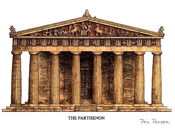
19 The Parthenon: Athens, Greece
20 When and Why Did People Start Living in Cities? Roman Cities When the Romans succeeded the Greeks (and Etruscans) as rulers of the region, their empire incorporated the Mediterranean shores and a large part of interior Europe and North Africa. The site of a city is its absolute location, often chosen for its advantages in trade or defense, or as a center for religious practice. The situation of a city is based on its role in the larger, surrounding context: A city s situation changes with time. Ex.: Rome becoming the center of the Roman Catholic Church.

21 When and Why Did People Start Living in Cities? Roman Cities Whenever possible, Romans adopted the way the Greeks planned their colonial cities; in a rectangular, grid pattern. Functional zonation reveals how different areas or segments of a city serve different purposes or functions within the city. Ex.: the Forum 2012 John Wiley & Sons, Inc. All rights reserved.

22 2012 John Wiley & Sons, Inc. All rights reserved.
23 2012 John Wiley & Sons, Inc. All rights reserved.

24 Field Note: Roman Forum There can be few spaces of greater significance to the development of Western civilization than the Roman Forum. This was the nerve center of a vast empire that transformed the face of western Europe, Southwest Asia, and North Africa. It was also the place where the decisions were made that carried forward Greek ideas about governance, art, urban design, and technology. The very organization of space found in the Roman Forum is still with us: rectilinear street patterns; distinct buildings for legislative, executive, and judicial functions; and public spaces adorned with statues and fountains John Wiley & Sons, Inc. All rights reserved.
25 30 Second Reflection In your notes, respond to the following: How did ancient Greek cities influence ancient Roman cities?

26 When and Why Did People Start Living in Cities? Urban Growth After Greece and Rome During Europe s Middle Ages, urbanization continued vigorously outside of Europe. In West Africa, trading cities developed along the southern margin of the Sahara. The Americas also experienced significant urban growth, especially within Mayan and Aztec empires John Wiley & Sons, Inc. All rights reserved.
 Coastal cities remained crucial after exploration led to colonialism The trade networks European powers commanded (including the slave trade) brought unprecedented riches to Europe")
27 When and Why Did People Start Living in Cities? Site and Situation during European Exploration After European exploration took off during the 1400s, the dominance of interior cities declined. (Ex. - Paris and Xian) Coastal cities remained crucial after exploration led to colonialism The trade networks European powers commanded (including the slave trade) brought unprecedented riches to Europe s cities 2012 John Wiley & Sons, Inc. All rights reserved.

28 Field Note: Genoa The contemporary landscape of Genoa stands as a reminder of the city s historic importance. Long before Europe became divided up into states, a number of cities in northern Italy freed themselves from the strictures of feudalism and began to function autonomously. Genoa and Venice were two of these, and they became the foci of significant Mediterranean maritime trading empires. In the process, they also became magnificent, wealthy cities. Although most buildings in Genoa s urban core date from a more recent era, the layout of streets and public squares harkens back to the city s imperial days. Is it a surprise that the city gave birth to one of the most famous explorers of all time: Christopher Columbus?

29 When and Why Did People Start Living in Cities? Industrialization (1800s) caused more people to move to manufacturing cities. With industrialization, cities became unregulated jumbles of activity. Living conditions were dreadful for workers in cities, and working conditions were shocking. The soot-covered cities of the British Midlands were deemed the black towns.
30 Illustrated Timeline of Urbanization Create an illustrated timeline of urban growth that spans from 3500 BCE the Industrial Revolution. Use your notes and your APHUG textbook as references.
31 Archaeologists have found that the houses in Indus River cities, such as Mohenjo-Daro and Harappa, were a uniform size: each house had access to a sewer system, and palaces were absent from the cultural landscape. Derive a theory as to why these conditions were present in these cities that had both a leadership class and a surplus of agricultural goods John Wiley & Sons, Inc. All rights reserved.
32 Key Question 9.2 Where are cities located, and why? 2012 John Wiley & Sons, Inc. All rights reserved.

33 Where Are Cities Located, and Why? Three key components arise frequently in urban geography: population, trade area, and distance. Every city and town has a trade area, an adjacent region within which the city has influence. Consumers from smaller towns come to the city to shop and conduct business. The city s newspapers and tv stations are dominant.
34 60 Second Reflection In your notes, respond to the following: Explain how Bremerton is in the trade area of a larger city. Provide specific examples.

35
36 Where Are Cities Located, and Why? Rank and Size in the Urban Matrix The rank-size rule represents a numerical relationship between the population size of cities within a country: The 2 nd ranked city is approx. ½ the size of the largest city The 3 rd ranked city is approx. 1/3 the size of the largest city The 4 th ranked city is approx. ¼ the size of the largest city The rank-size rule is more likely in developed countries with complex economies and stable political organization Apply the rank-size rule to the following scenarios: The largest city has a population of 1,000,000 The 3 rd largest city has a population of 4,000,000
37 Where Are Cities Located, and Why? Rank and Size in the Urban Matrix The rank-size rule generally does not apply in smaller countries that are less developed and less recently urbanized, with a colonial history. Often these countries have a primate city. A primate city: The country s largest city Population is generally many times greater than the 2 nd and 3 rd largest cities Dominates the country s culture, politics, economy, media, universities, etc. Often the capital city Examples of primate cities: Paris, London, Mexico City, Bangkok

38 Where Are Cities Located, and Why? Central Place Theory Central place theory: Walter Christaller, The Central Places in Southern Germany (1933), had five assumptions: 1. The surface of the ideal region would be flat and have no physical barriers. 2. Soil fertility would be the same everywhere 3. Population and purchasing power would be evenly distributed. 4. The region would have a uniform transportation network to permit direct travel from each settlement to the other. 5. From any given place, a good or service could be sold in all directions out to a certain distance.
39 Where Are Cities Located, and Why? Central Place Theory Each central place has a surrounding complementary region, an exclusive trade area within which the town has a monopoly on the sale of certain goods. Hexagonal Hinterlands Christaller chose perfectly fitted hexagonal regions as the shape of each trade area John Wiley & Sons, Inc. All rights reserved.

40 Guest Field Note: Broken Arrow, Oklahoma Many trade areas in the United States are named, and their names typically coincide with the vernacular region, the region people perceive themselves as living in. In promoting a trade area, companies often adopt, name, or shape the name of the vernacular region. In Oklahoma, the label Green Country refers to the northeastern quarter of the state, the trade area served by Tulsa. Credit: Brad Bays, Oklahoma State University 2012 John Wiley & Sons, Inc. All rights reserved.
41 Where Are Cities Located, and Why? Central Places Today New factors, forces, and conditions not anticipated by Christaller s models and theories (such as the interstate system and the Internet) make them less relevant today. Assumptions of the Central Place Theory: featureless landscape on infinite plane uniform population distribution consumers shop at closest place possible consumers do not go beyond the range of the good


42 Urban Theories & Models Book Using the guidelines and rubric provided, create a book of important urban geographic theories and models. Use your APHUG textbook as a reference. Due date: Friday, April 25 You will present one model to the class on the due date.
43 Key Question 9.3 How are cities organized, and how do they function? 2012 John Wiley & Sons, Inc. All rights reserved.
44 How Are Cities Organized, and How Do They Function? Functional Zones Functional zonation: the division of the city into certain regions (zones) for certain purposes (functions). Most city models define the key economic zone of the city as the central business district (CBD). Central city describes the urban area that is not suburban. In effect, central city refers to the older city as opposed to the newer suburbs. A suburb is an outlying, functionally uniform part of an urban area, and is often (but not always) adjacent to the central city. Suburbanization is the process by which lands that were previously outside of the urban environment become urbanized, as people and businesses from the city move to these spaces.
45 How Are Cities Organized, and How Do They Function? Modeling the North American City Concentric zone model: resulted from sociologist Ernest Burgess s study of Chicago in the 1920s. Burgess s model divides the city into five concentric zones, defined by their function: 1. Zone 1: CBD is itself subdivided into several subdistricts. 2. Zone 2: Zone of transition is characterized by residential deterioration and encroachment by business and light manufacturing. 3. Zone 3 is a ring of closely spaced but adequate homes occupied by the blue-collar labor force. 4. Zone 4 consists of middle-class residences. 5. Zone 5 is the suburban ring.


46 Concentric Zone Model
47 How Are Cities Organized, and How Do They Function? Modeling the North American City Homer Hoyt: Sector model The city grows outward from the center, so a low-rent area could extend all the way from the CBD to the city s outer edge, creating zones that are shaped like a piece of pie. The pie-shaped pieces describe the high-rent residential, intermediate rent residential, low-rent residential, education and recreation, transportation, and industrial sectors.


48 Hoyt Sector Model
49 How Are Cities Organized, and How Do They Function? Modeling the North American City Chauncy Harris and Edward Ullman: Multiple Nuclei Model This model recognizes that the CBD was losing its dominant position as the single nucleus of the urban area. Edge cities: Suburban downtowns developed mainly around big regional shopping centers; they attracted industrial parks, office complexes, hotels, restaurants, entertainment facilities, and sports stadiums.


50 Multiple Nuclei Model

51 Figure 9.23 Tysons Corner, Virginia. In the suburbs of Washington, D.C., on Interstate 495 (the Beltway), Tysons Corner has developed as a major edge city, with offices, retail, and commercial services. Rob Crandall/The Image Works John Wiley & Sons, Inc. All rights reserved.

52 How Are Cities Organized, and How Do They Function? Modeling the Cities of the Global Periphery and Semiperiphery Primate cities in developing countries are called megacities when the city has a large population, a vast territorial extent, rapid inmigration, and a strained, inadequate infrastructure. Concept Caching: Mumbai, India 2012 John Wiley & Sons, Inc. All rights reserved. Harm de Blij

53 How Are Cities Organized, and How Do They Function? The South American City Griffin-Ford model South American cities blend traditional elements of South American culture with globalization forces that are reshaping the urban scene, combining radial sectors and concentric zones. The thriving CBD anchors the model. Shantytowns are unplanned groups of crude dwellings and shelters made of scrap wood, iron, and pieces of cardboard that develop around cities.

54

55 Field Note: Rio de Janeiro February 1, A long-held hope came true today: thanks to a Brazilian intermediary I was allowed to enter and spend a day in two of Rio de Janeiro s hillslope favelas, an eight-hour walk through one into the other. Here live millions of the city s poor, in areas often ruled by drug lords and their gangs, with minimal or no public services, amid squalor and stench, in discomfort and danger John Wiley & Sons, Inc. All rights reserved.
56 How Are Cities Organized, and How Do They Function? The African City The imprint of European colonialism can still be seen in many African cities. During colonialism, Europeans laid out prominent urban centers. The centers of South Africa s major cities (Johannesburg, Cape Town, and Durban) remain essentially Western. Studies of African cities indicate that the central city often consists of not one but three CBDs: a remnant of the colonial CBD, an informal and sometimes periodic market zone, and a transitional business center where commerce is conducted.

57 2012 John Wiley & Sons, Inc. All rights reserved.

58 The Southeast Asian City Figure 9.27 Model of the Large Southeast Asian City. A model of land use in the medium-sized Southeast Asian city includes sectors and zones within each sector. Adapted with permission from: T. G. McGee, The Southeast Asian City, London: Bell, 1967, p. 128.
59 Key Question 9.4 How do people share cities? 2012 John Wiley & Sons, Inc. All rights reserved.


60 How Do People Share Cities? Zoning laws: Cities define areas of the city and designate the kinds of development allowed in each zone. Portland is often described as the best planned city in North America because it is built around free transportation in the central city. Offices and residential zones are in close proximity to encourage walking, biking, and public transportation.


61 Urban Cultural Landscapes Figure 9.28 Figure 9.29

62 Field Note: Cairo Central Cairo is full of the multistory buildings, transportation arteries, and commercial signs that characterize most contemporary big cities. Outside of a number of mosques, few remnants of the old medieval city remain. The first blow came in the nineteenth century, when a French educated ruler was determined to recast Cairo as a world-class city. Inspired by the planning ideas of Paris s Baron von Hausman, he transformed the urban core into a zone of broad, straight streets. In more recent years the forces of modern international capitalism have had the upper hand. There is little sense of an overall vision for central Cairo. Instead, it seems to be a hodge-podge of buildings and streets devoted to commerce, administration, and a variety of producer and consumer services John Wiley & Sons, Inc. All rights reserved.
 effort to keep up with the city s exploding growth.")
63 Field Note: Cairo Moving out from central Cairo, evidence of the city s rapid growth is all around you. These hastily built housing units are part of the (often losing) effort to keep up with the city s exploding growth. From a city of just one million people in 1930, Cairo s population expanded to six million by And then high growth rates really kicked in. Although no one knows the exact size of the contemporary city, most estimates suggest that Cairo s population has doubled in the last 20 years. This growth has placed a tremendous strain on city services. Housing has been a particularly critical problem leading to a landscape outside the urban core dominated by hastily built, minimally functional, and aesthetically non-descript housing projects John Wiley & Sons, Inc. All rights reserved.


64 How Do People Share Cities? Shaping Cities in the Global Periphery and Semiperiphery Particularly in the economic periphery, people crowd together in overpopulated apartments, dismal tenements, and teeming slums. Cities in poorer parts of the world generally lack enforceable zoning laws. Across the global periphery, the one trait all major cities display is the stark contrast between the wealthy and poor. Sao Paulo, Brazil

65 How Do People Share Cities? Shaping Cities in the Global Core During the segregation era in the United States, realtors, financial lenders, and city governments defined and segregated spaces in urban environments: Redlining refusal to offer loans for homes in neighborhoods encircled by red lines on maps Blockbusting realtors convinced white residents to sell their homes under the guise that the neighborhood was going downhill a black family had moved in This produced white flight movement of whites from the city and adjacent neighborhoods to the outlying suburbs.
66 60 Second Reflection In your notes, respond to the following: In what ways are the consequences of procedures like redlining and blockbusting still evident today? Explain your response using specific examples.


67 How Do People Share Cities? In order to counter the suburbanization trend, city governments are encouraging Commercialization - transforming the central business district into an area attractive to residents and tourists alike. Gentrification - rehabilitation of houses in older neighborhoods. Teardowns - suburban homes meant for demolition; the intention is to replace them with McMansions (oversize, cookie-cutter houses). before after

68 Field Note: Fort Worth, Texas In 2008, downtown Fort Worth, Texas looked quite different than it did when I first visited in In that eleven year period, business leaders in the City of Fort Worth gentrified the downtown. The Bass family, who has a great deal of wealth from oil holdings and who now owns about 40 blocks of downtown Fort Worth, was instrumental in the city s gentrification. In the 1970s and 1980s, members of the Bass family looked at the empty, stark, downtown Fort Worth, and sought a way to revitalize the downtown. They worked with the Tandy family to build and revitalize the spaces of the city, which took off in the late 1990s and into the present century. The crown jewel in the gentrified Fort Worth is the beautiful cultural center called the Bass Performance Hall, named for Nancy Lee and Perry R. Bass, which opened in John Wiley & Sons, Inc. All rights reserved.


69 How Do People Share Cities? Urban Sprawl and New Urbanism Urban sprawl: unrestricted growth of housing, commercial developments, and roads over large expanses of land, with little concern for urban planning
70 How Do People Share Cities? Urban Sprawl and New Urbanism To counter urban sprawl, a group of architects, urban planners, and developer outlined an urban design vision they call new urbanism: development, urban revitalization, and suburban reforms that create walkable neighborhoods with a diversity of housing and jobs. Intended to reduce how long people spend in traffic, increase supply of affordable housing, promote a sense of community and a sense of place Criticisms: designed for the affluent, become exclusionary communities that deepen racial segregation of cities, take away much of the grittiness and character of the city


71 New Urbanism: Celebration, Florida


72 Field Note: Celebration, Florida When I visited Celebration, Florida, in 1997, I felt like I was walking onto a movie or television set. The architecture in the Walt Disney designed new urbanist development looked like the quintessential New England town. Each house has a porch, but on the day I was there, the porches sat empty waiting to welcome the arrival of their owners at the end of the work day. We walked through town, past the 50s-style movie marquee, and ate lunch at a 50s-style diner. At that point, Celebration was still growing. Across the street from the Bank of Celebration stood a sign marking the future home of the Church in Celebration John Wiley & Sons, Inc. All rights reserved.


73 Urban Revitalization: Bremerton
74 Bremerton: Harborside Condominiums
75 60 Second Reflection In your notes, respond to the following: In your opinion, have the revitalization efforts in downtown Bremerton changed the city? &/or changed the city s image? Explain your response using specific examples.

76 Gated Communities How Do People Share Cities? Fenced-in neighborhoods with controlled access gates for people and automobiles. Main objective is to create a space of safety within the uncertain urban world. Secondary objective is to maintain or increase housing values in the neighborhood through enforcement of the neighborhood association s bylaws. Many fear that the gated communities are a new form of segregation.

77 How Do People Share Cities? Ethnic Neighborhoods in the European City Ethnic neighborhoods in European cities are typically affiliated with migrants from former colonies. Migration to Europe is constrained by government policies and laws. European cities are typically more compact, densely populated, and walkable than American cities. Housing in the European city is often combined with places of work.

78 How Do People Share Cities? Ethnic Neighborhoods in the Global Periphery and Semiperiphery City In cities of the periphery and semiperiphery, a sea of slum development typically begins where the permanent buildings end, in some cases engulfing and dwarfing the central city. Millions of migrants travel to such environments every year. City governments do not have the resources to adequately educate, medicate, or police the burgeoning populations.


79 How Do People Share Cities? Power and Ethnicity The settlement patterns of cities developed during the colonial period often persist long after The Informal Economy The economy that is not taxed and is not counted toward a country s gross national income Repairing broken items, sorting through waste for salvageable items, trading and selling from makeshift stands, etc.
80 Key Question 9.5 What role do cities play in globalization? 2012 John Wiley & Sons, Inc. All rights reserved.

81 What Role Do Cities Play in Globalization? World cities function at the global scale, beyond the reach of the state borders, functioning as the service centers of the world economy. Some countries such as the United States and Germany have two or more world cities within their state borders.


82 What Role Do Cities Play in Globalization? Cities as Spaces of Consumption Media corporations are helping transform urban centers into major entertainment districts where items are consumed
83 Thinking through the challenges to the state presented in Chapter 8, predict whether and under what circumstances world cities could replace states as the basic and most powerful form of political organization in the world John Wiley & Sons, Inc. All rights reserved.
84 Additional Resources Celebration, Florida Congress for the New Urbanism Globalization and World Cities Opposition to Urban Sprawl Seaside, Florida
URBAN GEOGRAPHY. Chapter 9
 URBAN GEOGRAPHY Chapter 9 When and Why Did People Start Living in Cities? City: A conglomeration of people and buildings clustered together to serve as a center of politics, culture, and economics Urban:
Chapter 9 Urban Geography (Making questions from notes)
") Chapter 9 Urban Geography (Making questions from notes) Remember that you book is laid out rather neatly in that it divides sections of the chapter into Key Questions. What you want to do is make up questions
Chapter 9 Urban Geography (Making questions from notes) Remember that you book is laid out rather neatly in that it divides sections of the chapter into Key Questions. What you want to do is make up questions
Chapter 9: Urban Geography
 Chapter 9: Urban Geography The Five Steps to Chapter Success Step 1: Read the Chapter Summary below, preview the Key Questions, and Geographic Concepts. Step 2: Complete the Pre-Reading Activity (PRA)
Unit 8 Settlement Geography: Urban and Rural, Cities and City Life
 Unit 8 Settlement Geography: Urban and Rural, Cities and City Life 38:180 Human Geography Settlement Geography Principally urban, but a continuum: Hamlet Village Town City plus rural World is predominantly
c. What is the most distinctive above ground result of high land costs and intensive land use? i. Describe the vertical geography of a skyscraper?
 AP Human Geography Unit 7b Guided Reading: Urban Patterns and Social Issues Mr. Stepek Key Issue #1: Why Do Services Cluster Downtown? (Rubenstein p 404 410) 1. What is the CBD? What does it contain and
MULTIPLE CHOICE. Choose the one alternative that best completes the statement or answers the question.
 AP Test 13 Review Name MULTIPLE CHOICE. Choose the one alternative that best completes the statement or answers the question. 1) Compared to the United States, poor families in European cities are more
AP Human Geography Unit 7a: Services Guided Reading Mr. Stepek Introduction (Rubenstein p ) 1. What is the tertiary sector of the economy?
 1. What is the tertiary sector of the economy?") Public Business Consumer AP Human Geography Unit 7a: Services Guided Reading Mr. Stepek Introduction (Rubenstein p 372 374) 1. What is the tertiary sector of the economy? 2. What is a service activity?
Public Business Consumer AP Human Geography Unit 7a: Services Guided Reading Mr. Stepek Introduction (Rubenstein p 372 374) 1. What is the tertiary sector of the economy? 2. What is a service activity?
Urban Geography Unit Test (Version B)
") Urban Geography Unit Test (Version B) 1. What function do the majority of the world s ten most populated cities serve? a. a fortress city to resist foreign invasion b. a port city for transporting people
Urban Geography Unit Test (Version B) 1. What function do the majority of the world s ten most populated cities serve? a. a fortress city to resist foreign invasion b. a port city for transporting people
Problems In Large Cities
 Chapter 11 Problems In Large Cities Create a list of at least 10 problems that exist in large cities. Consider problems that you have read about in this and other chapters and/or experienced yourself.
Unit 7. Cities and Urban Land Use
 Unit 7 Cities and Urban Land Use Define Urbanism Population Depends on the Location Portugal Ethiopia Norway Define Urbanism Metropolitan Statistical Area Census Central City Immediate Interacting Communities
Chapter 12. Key Issue Three: Why do business services locate in large settlements?
 Chapter 12 Key Issue Three: Why do business services locate in large settlements? Business Services and Settlements World cities Ancient world cities Medieval world cities Modern world cities Hierarchy
VII. Cities and Urban Land Use
 VII. Cities and Urban Land Use Tuesday, May 2, 2017 8:13 AM Enduring Understandings Learning Objectives Essential Knowledge A. The form, function, and size of urban settlements are constantly changing
Chapter 12. Services
 Chapter 12 Services Where di services originate? Key Issue #1 Shoppers in Salzburg, Austria Origins & Types of Services Types of services Consumer services Business services Public services Changes in
Key Issue 1: Where Are Services Distributed? INTRODUCING SERVICES AND SETTLEMENTS LEARNING OUTCOME DESCRIBE THE THREE TYPES OF SERVICES
 Revised 2017 NAME: PERIOD: Rubenstein: The Cultural Landscape (12 th edition) Chapter Twelve Services and Settlements (pages 430 thru 457) This is the primary means by which you will be taking notes this
Contemporary Human Geography 3 rd Edition
 Contemporary Human Geography 3 rd Edition Chapter 13: Urban Patterns Marc Healy Elgin Community College Services are attracted to the Central Business District (CBD) because of A. accessibility. B. rivers.
CLAREMONT MASTER PLAN 2017: LAND USE COMMUNITY INPUT
 Planning and Development Department 14 North Street Claremont, New Hampshire 03743 Ph: (603) 542-7008 Fax: (603) 542-7033 Email: cityplanner@claremontnh.com www.claremontnh.com CLAREMONT MASTER PLAN 2017:
pg 273 -In studying the size of cities and distances between them, urban geographers explored the trade areas of different size cities -trade areas
 pg 273 -In studying the size of cities and distances between them, urban geographers explored the trade areas of different size cities -trade areas the adjacent region to every city and town within which
Name Date Period Barron s (6 th edition) Chapter 7 Urban Geography
 Chapter 7 Urban Geography") Name Date Period Barron s (6 th edition) Chapter 7 Urban Geography Historical Geography of Urban Environments 1. In what way did the development of different types of occupations (carpenters, merchants,
Name Date Period Barron s (6 th edition) Chapter 7 Urban Geography Historical Geography of Urban Environments 1. In what way did the development of different types of occupations (carpenters, merchants,
Contemporary Human Geography 3 rd Edition
 Chapter 13 Lecture Contemporary Human Geography 3 rd Edition Chapter 13: Urban Patterns Marc Healy Elgin Community College 13.1 The Central Business District The best-known and most visually distinctive
AP Human Geography Free-response Questions
 AP Human Geography Free-response Questions 2000-2010 2000-preliminary test 1. A student concludes from maps of world languages and religions that Western Europe has greater cultural diversity than the
2. What is a settlement? Why do services cluster in settlements?
 Chapter 12: Services Introduction and Case Study (p. 397-399) 1. What is a service? How do LDCs and MDCs differ in regards to the number of workers employed in service- sector jobs? 2. What is a settlement?
Human Geography. Urban Development. Urban Development. Urban Development. Unit 8: Urban Development. I. Why are Settlements Established?
 I. Why are Settlements Established? A. Rural Settlements B. Urban Settlements Human Geography Unit 8: I. Why are Settlements Established? C. REASONS FOR ESTABLLISHING SETTLEMENTS 1. Cultural Religious
Social Studies Continuum
 Historical Skills chronological thinking understand that we can learn about the past from different sorts of evidence begin to use historical resources apply research skills by investigating a topic in
Key Issue 1: Why Do Services Cluster Downtown?
 Key Issue 1: Why Do Services Cluster Downtown? Pages 460-465 1. Define the term CBD in one word. 2. List four characteristics of a typical CBD. Using your knowledge of services from chapter 12, define
Chapter 12: Services
 Chapter 12: Services The Cultural Landscape: An Introduction to Human Geography Services Service = any activity that fulfills a human want or need Services are located in settlements Location of services
MARS AREA SCHOOL DISTRICT CURRICULUM GRADE: Grade 4
 MARS AREA SCHOOL DISTRICT CURRICULUM GRADE: Grade 4 Course Title: Social Studies Brief Description Overview: Students will explore the history, geography, government, and economy of the United States with
Curriculum Unit. Instructional Unit #1
 Curriculum Unit Name of Course: AP Human Geography Grade Level(s): 9-12 Brief Description (Course Catalog): The purpose of the AP Human Geography course is to introduce students to the systematic study
accessibility accessibility by-pass bid-rent curve bridging point administrative centre How easy or difficult a place is to reach.
 accessibility accessibility How easy or difficult a place is to reach. How easy or difficult it is to enter a building. administrative centre bid-rent curve The function of a town which is a centre for
Stillwater Area Schools Curriculum Guide for Elementary Social Studies
 Stillwater Area Schools Curriculum Guide for Elementary Social Studies Grade Four Draft March 21, 2006 Minnesota and the St. Croix Valley I. Historical Skills A. The student will acquire skills of chronological
Key Issue 1: Why Do Services Cluster Downtown?
 Key Issue 1: Why Do Services Cluster Downtown? Pages 460-465 ***Always keep your key term packet out whenever you take notes from Rubenstein. As the terms come up in the text, think through the significance
I CAN STATEMENTS 6TH GRADE SOCIAL STUDIES
 6TH GRADE SOCIAL STUDIES I can compare historical issues involving rights, roles and statues of individuals. I can describe the relationships among specialization, division of labor, productivity of workers
Grade 7 Social Studies
 Standard 1: History Students will examine the major movements, events, and figures that contributed to the development of nations in modern Africa, Asia, and the Southwest Pacific from acient civilizations
A foreign-exchange student is assigned to our school district. You are in charge of taking him/her on a tour of our community.
 A foreign-exchange student is assigned to our school district. You are in charge of taking him/her on a tour of our community. What conclusions can be drawn by focusing on the buildings and other structures
Ch. 13: Urban Patterns
 Ch. 13: Urban Patterns Name: Introduction & Case Study (p. 430-432) 1. Describe some differences between urban and rural environments. 2. Why do MDCs have a higher percentage of people living in urban
The Cultural Landscape Eleventh Edition
 Chapter 13 Lecture The Cultural Landscape Eleventh Edition Urban Patterns Matthew Cartlidge University of Nebraska-Lincoln Key Issues Why do services cluster downtown? Where are people distributed within
Services includes: Intro to Services Central Place Theory Urban Hierarchies
 Services includes: Intro to Services Central Place Theory Urban Hierarchies Introduction Services any activity that fulfills human wants/needs Services are located in settlements therefore our study of
TYPES OF GOVERNMENTS
 While the terms country, state, and nation are often used interchangeably, there is a difference. A State (note the capital "S") is a self-governing political entity. The term State can be used interchangeably
It is clearly necessary to introduce some of the difficulties of defining rural and
 UNIT 2 CHANGING HUMAN ENVIRONMENTS G2 Theme 2 Investigating Settlement Change in MEDCs 2.1 What are the distinctive features of settlements? It is clearly necessary to introduce some of the difficulties
Growth of Urban Areas. Urban Hierarchies
 Growth of Urban Areas Urban Hierarchies Directions: In your notebook, complete the following on the right: Create a chart to explain and analyze the gravity model, central place theory, bid-rent theory,
LOUISIANA STUDENT STANDARDS FOR SOCIAL STUDIES THAT CORRELATE WITH A FIELD TRIP TO DESTREHAN PLANTATION KINDERGARTEN
 LOUISIANA STUDENT STANDARDS FOR SOCIAL STUDIES THAT CORRELATE WITH A FIELD TRIP TO DESTREHAN PLANTATION KINDERGARTEN Standard 2 Historical Thinking Skills Students distinguish between events, people, and
22 cities with at least 10 million people See map for cities with red dots
 22 cities with at least 10 million people See map for cities with red dots Seven of these are in LDC s, more in future Fastest growing, high natural increase rates, loss of farming jobs and resulting migration
Peoples, Places and Cultures in Africa, Asia and the Southwest Pacific
 GRADE 7 Peoples, Places and Cultures in Africa, Asia and the Southwest Pacific Course 0470-07 Students in seventh grade explore the history, geography, government, economic systems, current issues, and
Urban Foundations. Early American Cities. Early American Cities. Early American Cities. Cities in America to 1945
 Urban Foundations Cities in America to 1945 Early American Cities The design of early American cities was highly influenced by European traditions The roots of many of these traditions can in turn be traced
AP Human Geography. Course Outline Geography: Its Nature and Perspectives: Weeks 1-4
 AP Human Geography The Course The AP Human Geography course is designed to provide secondary students with the equivalent of one semester of a college introductory human geography class. The purpose of
Social Studies Grade 2 - Building a Society
 Social Studies Grade 2 - Building a Society Description The second grade curriculum provides students with a broad view of the political units around them, specifically their town, state, and country.
Book Title: World Studies, Medieval Times to Today 2005 Grade Level: 6 Publisher: Pearson Prentice Hall Subject/Course: Social Studies, Grade 6
 Book Title: World Studies, 2005 Grade Level: 6 Publisher: Pearson Prentice Hall Subject/Course: Social Studies, Grade 6 Geography The World in Spatial Terms Grade 6 1. Use latitude and longitude to determine
AP * human Geography. Syllabus. Course Description. Course Description Materials. Course Goals
 AP * human Geography Syllabus Course Description AP Human Geography is a college-level, yearlong course designed to prepare students for the Advanced Placement (AP) Human Geography Exam. The goal of this
AP Human Geography. Additional materials, including case studies, videos, and aerial photos, will be used to supplement primary course materials.
 Course Introduction AP Human Geography is a yearlong college-level course designed to prepare students for the Advanced Placement (AP) Human Geography Exam. The course focuses on the study of human populations
GRADE LEVEL EXPECTATIONS CORRELATION NOTATIONS
 Book Title: World Studies: The Eastern Hemisphere 2005 Grade Level: 6 Publisher: Pearson Prentice Hall Subject/Course: Social Studies, Grade 6 Geography The World in Spatial Terms Grade 6 1. Use latitude
AP Human Geography AP EXAM Free Response Questions and Possible Future Questions
 AP Human Geography AP EXAM Free Response Questions and Possible Future Questions FRQ Exam Questions: Population & Migration 2003- European Migration and Demographic Transition Model 2004- Population Pyramids
Book Title: History of Our World, The Early Ages Edition 2005 Grade Level: 6 Publisher: Pearson Prentice Hall Subject/Course: World History, Grade 6
 Book Title: History of Our World, The Early Ages Edition 2005 Grade Level: 6 Publisher: Pearson Prentice Hall Subject/Course: World History, Grade 6 Geography The World in Spatial Terms Grade 6 1. Use
Cities, Countries, and Population
 Cities, Countries, and Population After the world industrialized, better food, improved sanitation, and new medicines caused the world population to soar. To understand how heavily populated an area is,
EXAM INFORMATION. SETTLEMENT and the Changing Landscape SETTLEMENT. HIERARCHY of SETTLEMENT. Culture 3/1/2016
 EXAM INFORMATION Exam One is Tues, Mar 8th. Bring: #2 pencil, eraser, pen. Format. Multiple choice questions on material covered through Human Geog III; some aimed at maps/diagrams and a choice of 2 of
Cultural Diffusion. AP HG SRMHS Mr. Hensley
 Cultural Diffusion AP HG SRMHS Mr. Hensley Space-time compression: The reduction in time it takes for something to reach another place Because of technology, connections have reduced distance (not literally
Rural Gentrification: Middle Class Migration from Urban to Rural Areas. Sevinç Bahar YENIGÜL
 'New Ideas and New Generations of Regional Policy in Eastern Europe' International Conference 7-8 th of April 2016, Pecs, Hungary Rural Gentrification: Middle Class Migration from Urban to Rural Areas
Norwich City Schools Social Studies 6
 Social Studies 6 Topic: Maps and Globes and Graphs and Time Transferable Concepts: change 3: Geography Geography Geographers use maps, globes, and graphs to study the Earth and everything on it. Types
Central Valley School District Social Studies Curriculum Map Grade 7. August - September
 August - September Geographical/Historical Skills Identify and analyze timelines. Construct and use cause and effect charts. Differentiate between fact and opinion. Use of word webs, flip charts, outlines
A.P. Human Geography
 A.P. Human Geography 2012-2013 Instructor: Chris Vitt Brief Description of Course AP Human Geography is designed to provide students with a learning experience equivalent to that obtained in most college
Social Studies Curriculum Sixth Grade
 Social Studies Curriculum Sixth Grade A. History Students will examine the key historic movements, events, and figures that contributed to the development of modern Europe and American nations from early
Dublin City Schools Social Studies Graded Course of Study Grade 5 K-12 Social Studies Vision
 K-12 Social Studies Vision The Dublin City Schools K-12 Social Studies Education will provide many learning opportunities that will help students to: develop thinking as educated citizens who seek to understand
AP Human Geography Free Response Questions Categorized
 AP Human Geography Free Response Questions Categorized 2002-2010 2. Population (13-17%) 3. Over the past 150 years, Europe has changed from a source to a destination region for international migration.
Factors Affecting Human Settlement
 Factors Affecting Human Settlement Physical Factors One of the most basic factors affecting settlement patterns is the physical geography of the land. Climate is key, because if a place is too dry, too
Proposed AKS for 6 th Grade Social Studies
 Proposed AKS for 6 th Grade Social Studies A. Map and Globe Skills 1. use cardinal directions 2. use intermediate directions 3. use a letter/number grid system to determine location 4. compare and contrast
Discerning sprawl factors of Shiraz city and how to make it livable
 Discerning sprawl factors of Shiraz city and how to make it livable 1. Introduction: Iran territory has now been directly affected by urban land-uses which are shaping landscapes in cities and around them.
ENVIRONMENTALLY ORIENTED PLANNING FOR HUMAN SETTLEMENTS
 40 TOPIC 7 ENVIRONMENTALLY ORIENTED PLANNING FOR HUMAN SETTLEMENTS Scope The process of rapid population growth and urbanization taking place in practically all the less developed countries will have an
Subject: Note on spatial issues in Urban South Africa From: Alain Bertaud Date: Oct 7, A. Spatial issues
 Page 1 of 6 Subject: Note on spatial issues in Urban South Africa From: Alain Bertaud Date: Oct 7, 2009 A. Spatial issues 1. Spatial issues and the South African economy Spatial concentration of economic
HSC Geography. Year 2013 Mark Pages 10 Published Jul 4, Urban Dynamics. By James (97.9 ATAR)
") HSC Geography Year 2013 Mark 92.00 Pages 10 Published Jul 4, 2017 Urban Dynamics By James (97.9 ATAR) Powered by TCPDF (www.tcpdf.org) Your notes author, James. James achieved an ATAR of 97.9 in 2013 while
HSC Geography Year 2013 Mark 92.00 Pages 10 Published Jul 4, 2017 Urban Dynamics By James (97.9 ATAR) Powered by TCPDF (www.tcpdf.org) Your notes author, James. James achieved an ATAR of 97.9 in 2013 while
Date: June 19, 2013 Meeting Date: July 5, Consideration of the City of Vancouver s Regional Context Statement
 Section E 1.5 To: From: Regional Planning and Agriculture Committee Lee-Ann Garnett, Senior Regional Planner Planning, Policy and Environment Department Date: June 19, 2013 Meeting Date: July 5, 2013 Subject:
LEARNING OUTCOMES SST (G1-G12)
") LEARNING OUTCOMES SST (G1-G12) Grade 1 Learning Outcomes Students will be expected to: - demonstrate an understanding of the importance of interactions between people - demonstrate an understanding of
LEARNING OUTCOMES SST (G1-G12) Grade 1 Learning Outcomes Students will be expected to: - demonstrate an understanding of the importance of interactions between people - demonstrate an understanding of
Background the Ch. 12
 Ch. 12 -Services Background the Ch. 12 Shopping Mall Sydney, Australia Services: an activity that provides a human want or need in exchange for money Settlement: permanent collection of buildings where
Kuby, Michael, John Harner, and Patricia Gober. Human Geography in Action. 6 th Edition. New York: John Wiley, 2012
 2016-2017 Syllabus AP Human Geography Course Description: AP Human Geography is a yearlong course which focuses on the distribution, processes and effects of human populations on the planet. Units of study
Your web browser (Safari 7) is out of date. For more security, comfort and the best experience on this site: Update your browser Ignore
 is out of date. For more security, comfort and the best experience on this site: Update your browser Ignore") Your web browser (Safari 7) is out of date. For more security, comfort and the best experience on this site: Update your browser Ignore urban area For the complete encyclopedic entry with media resources,
Your web browser (Safari 7) is out of date. For more security, comfort and the best experience on this site: Update your browser Ignore urban area For the complete encyclopedic entry with media resources,
Edexcel Geography Advanced Paper 2
 Edexcel Geography Advanced Paper 2 SECTION B: SHAPING PLACES Assessment objectives AO1 Demonstrate knowledge and understanding of places, environments, concepts, processes, interactions and change, at
Cheat Sheets Law of the sea: -Territorial sea: -EEZ (Exclusive Economic Zone): -Median-line principle:
: -Median-line principle:") Cheat Sheets I in no way guarantee these as FRQs. As predicted by OTHER AP HUG TEACHERS (WHO HAVE BEEN TEACHING LONGER THAN ME), these are possibly FRQs; either way, they reinforce concepts studied. UN
Cheat Sheets I in no way guarantee these as FRQs. As predicted by OTHER AP HUG TEACHERS (WHO HAVE BEEN TEACHING LONGER THAN ME), these are possibly FRQs; either way, they reinforce concepts studied. UN
A Profile of the United States
 Chapter 6, Section World Geography Chapter 6 A Profile of the United States Copyright 2003 by Pearson Education, Inc., publishing as Prentice Hall, Upper Saddle River, NJ. All rights reserved. Chapter
The study of Geography and the use of geographic tools help us view the world in new ways.
 S How does Geography help us understand our world? What factors shape the Earth s different environments? 7.1.9 7.2.9 BIG IDEAS COMPETENCIES Text pages or The study of Geography and the use of geographic
Key Issue 1: Where Are Services Distributed?
 Key Issue 1: Where Are Services Distributed? Pages 430-433 *See the Introduction on page 430 to answer questions #1-4 1. Define service: 2. What sector of the economy do services fall under? 3. Define
Chapter 13: Urban Patterns The Cultural Landscape:
 Chapter 13: Urban Patterns The Cultural Landscape: An Introduction to Human Geography Key Issues Why do services cluster downtown? Where are people distributed within urban areas? Why are urban areas expanding?
ANALYZING CITIES & POPULATION: POPULATION GEOGRAPHY
 ANALYZING CITIES & POPULATION: POPULATION GEOGRAPHY Population Geography Population Geography study of the number, contribution, and distribution of human populations Demography the study of the characteristics
Urban Planning Word Search Level 1
 Urban Planning Word Search Level 1 B C P U E C O S Y S T E M P A R E U O E U R B A N P L A N N E R T N S T D H E C O U N T Y G E R E R D W R E N I C I T Y C O U N C I L A A A S U G G C I L A G P R I R
São Paulo Metropolis and Macrometropolis - territories and dynamics of a recent urban transition
 São Paulo Metropolis and Macrometropolis - territories and dynamics of a recent urban transition Faculty of Architecture and Urbanism of São Paulo University Prof. Dr. Regina M. Prosperi Meyer WC2 - World
2/25/2019. Taking the northern and southern hemispheres together, on average the world s population lives 24 degrees from the equator.
 Where is the world s population? Roughly 88 percent of the world s population lives in the Northern Hemisphere, with about half north of 27 degrees north Taking the northern and southern hemispheres together,
Lee County, Alabama 2015 Forecast Report Population, Housing and Commercial Demand
 Lee County, Alabama 2015 Forecast Report Population, Housing and Commercial Demand Thank you for purchasing this report, which contains forecasts of population growth, housing demand and demand for commercial
Advanced Placement Human Geography
 Advanced Placement Human Geography Introduction to AP Human Geography The Advanced Placement course in Human Geography is designed to introduce students to the systematic study of the processes that have
INTRODUCTION TO HUMAN GEOGRAPHY. Chapter 1
 INTRODUCTION TO HUMAN GEOGRAPHY Chapter 1 What Is Human Geography? The study of How people make places How we organize space and society How we interact with each other in places and across space How we
Key Issue 1: Where Is Industry Distributed?
 Key Issue 1: Where Is Industry Distributed? Pages 395-397 ***Always keep your key term packet out whenever you take notes from Rubenstein. As the terms come up in the text, think through the significance
Introduction to Human Geography. Chapter 1
 Introduction to Human Geography Chapter 1 Key Question: What is Human Geography? Human Geography The study of how people make places, how we organize space and society, how we interact with each other
The Spatial Structure of Cities: International Examples of the Interaction of Government, Topography and Markets
 Module 2: Spatial Analysis and Urban Land Planning The Spatial Structure of Cities: International Examples of the Interaction of Government, Topography and Markets Alain Bertaud Urbanist Summary What are
Introduction to Human Geography. What is Human Geography? Human Geography. Chapter 1
 Introduction to Human Geography Chapter 1 Key Question: What is Human Geography? Human Geography The study of how people make places, how we organize space and society, how we interact with each other
Revised February 15, 2017
 Revised February 15, 2017 I-C-1 I-A-1* I-D-1* II-E-2* Describe and compare the characteristics of Describe the relationships among ancient Organize information by sequencing, Describe, locate, and compare
GREAT BRITAIN: INDUSTRIAL REVOLUTION TO 1851 Student Worksheet
 GREAT BRITAIN: INDUSTRIAL REVOLUTION TO 1851 Student Worksheet Theme of Map This thematic map captures the industrial development of Britain at a time when it had transformed the British economy and society.
Urbanization 5/17/2002 1
 Urbanization Study of processes of urbanization in sociology is called urban sociology. Urbanization is the process of increase in the percentage of a population living in cities. A city is a densely settled
A Framework for the Study of Urban Health. Abdullah Baqui, DrPH, MPH, MBBS Johns Hopkins University
 This work is licensed under a Creative Commons Attribution-NonCommercial-ShareAlike License. Your use of this material constitutes acceptance of that license and the conditions of use of materials on this
Strand 1: Principles of Constitutional Democracy. Strand 2: Principles and Processes of Governance Systems
 Social Studies GLE S - Grade 4 Strand 1: Principles of Constitutional Democracy 1. Knowledge of the principles expressed in documents shaping constitutional democracy in the United States A. Knowledge
Services By Eugene Stanton
 Chapter 12 Services By Eugene Stanton Services The regular distribution (of settlements) observed over North America and over other more developed countries is not seen in less developed countries. The
The 3V Approach. Transforming the Urban Space through Transit Oriented Development. Gerald Ollivier Transport Cluster Leader World Bank Hub Singapore
 Transforming the Urban Space through Transit Oriented Development The 3V Approach Gerald Ollivier Transport Cluster Leader World Bank Hub Singapore MDTF on Sustainable Urbanization The China-World Bank
THEORIES OF URBAN MORPHOLOGY. Component-I(A) - Personal Details Role Name Affiliation
 - Personal Details Role Name Affiliation") THEORIES OF URBAN MORPHOLOGY Component-I(A) - Personal Details Role Name Affiliation Principal Investigator Prof. Masood A Siddiqui Department of Geogra Jam Jamia Millia Islamia, New Delhi Paper Coordinator,
THEORIES OF URBAN MORPHOLOGY Component-I(A) - Personal Details Role Name Affiliation Principal Investigator Prof. Masood A Siddiqui Department of Geogra Jam Jamia Millia Islamia, New Delhi Paper Coordinator,
GRADE 5 SOCIAL STUDIES SOCIAL STUDIES APPLICATION. SOCIAL STUDIES STANDARDS for Grade 5
 GRADE 5 SOCIAL STUDIES The Archdiocese of Cincinnati has established the following Social Studies standards based on the most current teachings which are aligned to Ohio New Learning Social Studies Standards.
Cambridge International Examinations Cambridge International General Certificate of Secondary Education
 Cambridge International Examinations Cambridge International General Certificate of Secondary Education *1869999605* GEOGRAPHY 0460/11 Paper 1 October/November 2017 Candidates answer on the Question Paper.
3 rd Grade Social Studies
 3 rd Grade Social Studies UNITED STATES HISTORY Year 1: American Indian Cultures through Colonization In third grade, students begin a three-year study of United States history in which all four strands