Prof. Jouni Pulliainen
|
|
|
- Chastity O’Brien’
- 5 years ago
- Views:
Transcription

1
2 Prof. Jouni Pulliainen Arctic and Space Finnish Meteorological Institute, Arctic Space Center
 Radioactivity")

3 Long arctic time series from the meteor. observatory in Sodankylä First thermo-/barometer based records in 1856 Meteor. station during the 1st Int.Geophysics Year 1882/83 Continuous homogenized synoptic weather records Upper air soundings from 1949 onwards Solar radiation observations since 1957/58 (1st IPY) Radioactivity monitoring since 1963 Air quality observations since 1970s Ozone and UV-observations 1988 Stratospheric Aerosol/Humitidy mid 1990s Micrometeorological tower 1999 Weather radar at Luosto 2000 Satellite data processing 1998 Satellite data reception 2003 Large capacity satellite data reception & archiving 2011 WMO hosted comparative instrument set of snow/rain observations 2013 WMO GAW and GCW primary site ICOS primary site
 NSDC provides")
 SAR applications: Flood monitoring Ice charting (information for")
 and ice conditions in the Gulf of")
4 FMI Arctic Activities: National Satellite Data Centre (NSDC) Satellite data reception and products for Finnish and international users (FMI Sodankylä centre) NSDC provides real-time radar (SAR) data for the Arctic (eliminating the effect of cloudiness/darkness) SAR applications: Flood monitoring Ice charting (information for ice breakers) Infrastructure conditions (roads, dams, bridges) COSMO-SkyMed SAR data products: Flood area/depth in Pudasjärvi (17/5/2015) and ice conditions in the Gulf of Bothnia (30/4/2014) 4
")


5 NSDC Processing Facilities at Sodankylä Customized processing of satellite data and CAL-VAL (in situ, ground-based remote sensing) Long-term archiving and high speed data delivery (10 Gbit /s) Open data delivery and cloud services Hosting external processing lines in virtual environments Security/Safety standards according to ESA requirements UPS + backup generator Dual cooling and air-conditioning Fire extinguisher system Sodankylä GS 5
 COSMO-SkyMed (Italy) Copernicus Sentinel ground segment (free access) Sentinel-1 Collaborative GS: National Mirror Site and data downlink (local reception) Sentinel-2/3")
6 NSDC Real-Time Satellite Data Acquisition and Processing Current operational (free access) EOS-Terra/MODIS (USA) EOS-Aura/OMI (USA) Suomi-NPP/VIIRS, OMPS (USA) FY-3B & FY-3C / MERSI (China) Current operational (commercial) COSMO-SkyMed (Italy) Copernicus Sentinel ground segment (free access) Sentinel-1 Collaborative GS: National Mirror Site and data downlink (local reception) Sentinel-2/3 Collaborative GS : National Mirror Site Helsinki Sodankylä 6

7

 in 1 Dec.")

8 Sodankylä NSDC Arctic Products: Snow Cover and Soil Frost of the Northern Hemisphere from Microwave Radiometer Satellite Data Snow mass (SWE) in 1 Dec and the day of soil freezing in autumn/winter of 2013 using U.S. DMSP SSMIS and ESA SMOS satellite data
 Revision in 2016 under FP-7 ERA-CLIM2 project NRT processing in operation: daily, September May Implemented in former ESA GlobSnow project, future with EUMETSAT H-SAF www.globsnow.")
 NRT processing in operation: daily, year-round (lat-lon grid) hsaf.")
9 FMI-NSDC Products for Hemispheric and Regional SWE: Snow extent and mass using space-borne microwave radiometry GlobSnow Hemispheric 25-km-SWE daily CDR on SWE (EaseGrid/0.25⁰ lat-lon grid) Revision in 2016 under FP-7 ERA-CLIM2 project NRT processing in operation: daily, September May Implemented in former ESA GlobSnow project, future with EUMETSAT H-SAF EU-Copernicus Land Monitoring Service s Hemispheric 5-km-SWE NRT processing starting 2016: daily, year-round (EaseGrid) VIIRS/IMS-mask for the snow extent (Sentinel-3 SLSTR in future) Data servicestbd Copernicus Hemispheric 5-km-SWE, 2016/03/16 Super-Resolution-SWE, 2013/02/16 EUMETSAT H-SAF Pan-European 0.25⁰-SWE (H13) NRT processing in operation: daily, year-round (lat-lon grid) hsaf.meteoam.it Prototype Pan-European 0.05⁰-Super-Resolution- SWE (SR-SWE) NRT processing in operation: daily, year-round (lat-lon grid) VIIRS/IMS-mask for the snow extent (Sentinel-3 SLSTR in future) saana.nsdc.fi 9

10 Finnish Sentinel Collaborative Ground Segment at NSDC 1. Local reception of Sentinel-1 SAR Direct Broadcast Focus on NRT and Quasi-Real-Time products Special Interests: S1 -> Baltic Sea ice conditions, oil spills, floods, infrastructure N E 2. National Sentinel mirror site Provision of Sentinel data to Finnish and other Data users S1, S2, S3 and S5P (free access) Medium-term data archive Automated data processing lines for customized products Hosting of processing services Sentinel Core GS DHuS National Sentinel Mirror Archive S1, S2, S3, S5P National DHuS SEN3APP Sentinel 1 Spacecraft Sodankylä GS S-1 Reception Chain Sentinel-1 L0 L1 S5P UV S1 S2 S3 NRT data NRT data FMI Ice Service 10


11 Finnish Collaborative GS 1. Collaborative Acquisition Station Local downlink of Sentinel-1 pass-through data Focus on Quasi-Real-Time services Ice monitoring to support icebreakers operating in Baltic Sea Data requirements S1 pass-through EW HH+HV AoI: Baltic Sea Timeliness: QRT < 1 hrs Daily products Current status: S1 DFEP and IPF installed S/C tasking in progress Automated scheduling of downlink and processing to be developed Sodankylä National Satellite Data Centre 11


12 Baltic Sea Ice Monitoring Commercial and environmental needs Finland is essentially an island ~90% of Finland s import and export via sea routes Gulf of Finland is one of the most busiest marine routes for oil transport Operative Service Availability target 99.9% Quasi-real-time / NRT needs Daily products Customer: Finnish Transport Agency Finnish, Swedish, Estonian Ice breakers Operations: Fully automated processing lines at Sodankylä Operators and ice analysts in 2 shift /7 monitoring of the processing lines Data need: Sentinel-1 EW HH+HV pass-through (+RSAT2, CSK, TSX) AOI: Baltic Sea Time: Nov May FMI Sodankylä CMEMS RSAT2 CSK TSX FMI Helsinki Sodankylä National Satellite Data Centre S1 CSK L0 processing L1 processing L2 processing Ice Service 24/7 monitoring Ice analysts 12

 FINHUB data dissemination opened in May 2016 Areas of Interest Marine research EW HH+HW, Arctic")

13 Finnish Collaborative GS 2. Collaborative Archive Centre Local mirror site: S1, S2, S3, S5P Dissemination to local users and neighboring countries Long-Term Archiving Bulk processing Automated product generation (water quality, snow cover and SWE ) Hosted processing services (IaaS, PaaS) Current status: Automated downloading in place S1 downloaded from colhub since spring 2015 S2 downloading: Operational since May 2016 Dissemination system (FINHUB) FINHUB data dissemination opened in May 2016 Areas of Interest Marine research EW HH+HW, Arctic Ocean, Greenland Caspian sea, Antarctica Operational use: EW HH+HW, Baltic Sea operational backup Land applications: IW VV+VH IW HH+HV Areas of Interest Water quality: - Baltic Sea drainage basin Snow and Hydrology: - Baltic Sea drainage basin Land use applications - Finnish and Estonian land area Areas of Interest SLSTR: - Baltic Sea drainage basin (FSC, lake ice, Land cover) - Northern Hemisphere (FSC, SWE) OCLI: - Pan-European (FSC, lake ice, Phenology) Sodankylä National Satellite Data Centre 13


14 Data dissemination - FINHUB Sentinels data dissemination to users Utilises the ESA developed DHuS system Easy to migrate from ESA SciHub Same Graphical user interface Same M2M interface Mostly Finnish users, but also users from Skandinavia, Central Europe Current archive data volume: > 150 TB Sodankylä National Satellite Data Centre 14

15 Data volumes - estimate Sodankylä National Satellite Data Centre 15


16 Calibration and Validation at NSDC ESA
 Validation and calibration of JAXA GOSAT and NASA OCO-2 carbon monitoring satellites Column")
 microwave radiometer Continuous SMOS reference measurement Ground moisture/frost algorithm development Also")
17 Major NSDC Reference and Calibration Instruments for Earth Observation Satellites Sodankylä FTIR (Fourier Transform Infrared Spectrometer) Validation and calibration of JAXA GOSAT and NASA OCO-2 carbon monitoring satellites Column amounts of CO2, CH4 and N2O ESA Elbara-II for SMOS satellite CAL-VAL L-band (1.4 GHz) microwave radiometer Continuous SMOS reference measurement Ground moisture/frost algorithm development Also reference for NASA SMAP mission Sodankylä FTIR station
 CO 2 päivätase (gco 2 m -2 d -1 ) T H M H T K H E S L M J 22.6.")
18 CO 2 concentration and daily fluxes at Pallas (north boreal spruce forest) CO 2 pitoisuus (ppm) CO 2 päivätase (gco 2 m -2 d -1 ) T H M H T K H E S L M J


19 Strategy in connecting EO, in situ data and models in high latitude carbon studies


20 Mixed / spruce forest, thicker organic layer Pine forest, mineral soil Saariselkä tundra site Sparse forested wetland Open wetland

 operational")
21 Hydrological Modelling to follow from snow to energy Development of FMI in-house Operational Hydrologic Forecasting Capability (HOPS) Gridded Conceptual model with physically based parameterization schemas as a basis Detailed modeling of actual watershed processes is excessively complex for operational applications Physically based models requires more data than available in many areas A simple conceptual model with physically based parameter estimation enables faster model implementation and likely more or less similar results System components adapted from NWS (USA) operational hydrological models


 Campaigns and training schools")
 Snow physics training school (2015, 2017) 4 cars - 5")
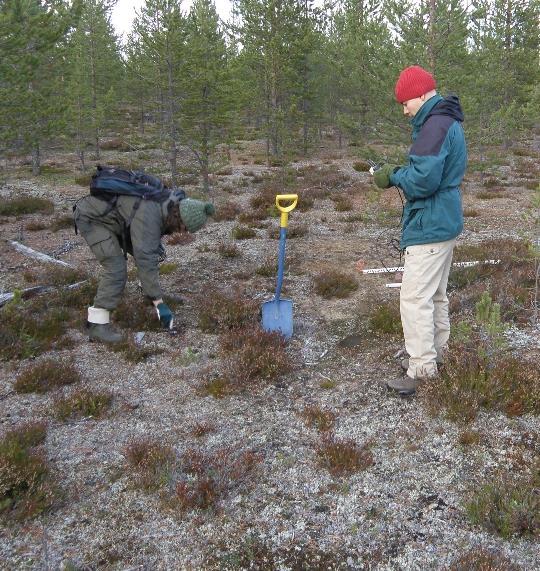
22 Arctic Research Centre/NSDC On-site facilities Accommodation up to 40 persons, canteen Lecture hall Several meeting rooms Extensive wifi Workshops: metal, wood, electronics Biological laboratory Dark room Several saunas and river-side hut Main focus on Satellite activities: reception, processing and archiving CAL-VAL super-site Freeze/thaw measurements Snow measurements: in-situ, airborne and spaceborne Atmospheric soundings Meteorological observatory CO2 and CH4 fluxes (different ecosystems) Campaigns and training schools ESA/NoSREx ( ) COST-Pergamon summer school (2013) WMO/SPICE meeting (2014) Snow physics training school (2015, 2017) 4 cars - 5 snowmobiles - 2 ATVs
 Located near Sodankylä on the main road E75 between")

, snowdrift and road")
, 0-300 cm Road weather camera Nearby")

23 Intelligent Road weather station Built in year 2011(basic equipment) Located near Sodankylä on the main road E75 between Sodankylä Rovaniemi Electricity + Warm equipment booth, Control PC Basic set of road weather station measurements Road temp, air temp, wind, rain Verified additional measurements Visibility measurement (Vaisala PWD 22), snowdrift and road snowdrift Frost and road frost depth measurement (Stevens Hydra Probe II), cm Road weather camera Nearby measurements Distrometer, weather radar, snow depth Communication Data link to FMI with Viola 3G link Data link to FMI ARC with Wi-Fi under configuration 23 23


24 Improving road weather measurements Basic set of road weather station measurements Road surface temperature, air temperature + moisture, wind speed and direction, rain Verified additional data Friction Surface condition Salt level Visibility Other Rosa system LEDGUIDE Combined Road Weather Station and Road Side Unit 24 24
25 Proposal for NSDC Cryospheric/Baltic Thematic/Regional Exploitation Platform Satellite data traditionally processed in monolithic processing centres Paradigm change towards distributed centres Thematic/Regional Exploitation Platform provides: Fast access to thematic/regional data Processing capacity: cloud, grid, clusters (IaaS) Processing software: toolboxes, commercial sw (PaaS) => Cloud services enabling product development and value-added services of private sector and other users Satellites ESA missons 3rd party missions Sentinel missons EUMETSAT missons Data User Community Data Sourcing Data Provisioning Data archiving Service Provisioning Sentinel Core GS Sentinel Coll. Missions External data archives 3rd party Mission data arch. Scientists Application developers Legacy mission data arch.

26 Thank You for Your Attention! Arktisten alueiden ympäristöhavainnointia Sodankylässä / Jyri Heilimo 26 Kuva: Matias Takala
FMI Arctic Space Centre. Jyri Heilimo Finnish Meteorological Institute
 FMI Arctic Space Centre Jyri Heilimo Finnish Meteorological Institute FMI - Arctic Space Center Studies of atmospheric phenomena and their interaction with biosphere and cryosphere in high latitudes Hydrology,
National Satellite Data Centre and Finnish Sentinel Collaborative Ground Segment. Jyri Heilimo Finnish Meteorological Instute
 National Satellite Data Centre and Finnish Sentinel Collaborative Ground Segment Jyri Heilimo Finnish Meteorological Instute Sodankylä National Satellite Data Centre National satellite data centre providing
Examples on Sentinel data applications in Finland, possibilities, plans and how NSDC will be utilized - Snow
 Examples on Sentinel data applications in Finland, possibilities, plans and how NSDC will be utilized - Snow Kari Luojus, Jouni Pulliainen, Jyri Heilimo, Matias Takala, Juha Lemmetyinen, Ali Arslan, Timo
Regional Activities and Perspectives on GCW: Relevant FMI Activities at Northern Finland and Suggestions for GCW Monitoring Site Requirements
 Regional Activities and Perspectives on GCW: Relevant FMI Activities at Northern Finland and Suggestions for GCW Monitoring Site Requirements Jouni Pulliainen 21 November 2011 Suggestions for GCW monitoring
Soil frost from microwave data. Kimmo Rautiainen, Jouni Pulliainen, Juha Lemmetyinen, Jaakko Ikonen, Mika Aurela
 Soil frost from microwave data Kimmo Rautiainen, Jouni Pulliainen, Juha Lemmetyinen, Jaakko Ikonen, Mika Aurela Why landscape freeze/thaw? Latitudinal variation in mean correlations (r) between annual
Environmental observations over Arctic areas potential for monitoring the spread of infectious diseases
 Environmental observations over Arctic areas potential for monitoring the spread of infectious diseases Ali Nadir Arslan ali.nadir.arslan@fmi.fi ARCTIC RESEARCH DEAPARTMENT / FMI ARKTIKO Seminar, Helsinki,
Copernicus Global Land Service
 Copernicus Global Land Service Cryosphere Products Kari Luojus on behalf the consortium Follow us on: Copernicus EU CopernicusEU www.copernicus.eu Copernicus Services Land Marine Atmosphere Emergency Security
Global SWE Mapping by Combining Passive and Active Microwave Data: The GlobSnow Approach and CoReH 2 O
 Global SWE Mapping by Combining Passive and Active Microwave Data: The GlobSnow Approach and CoReH 2 O April 28, 2010 J. Pulliainen, J. Lemmetyinen, A. Kontu, M. Takala, K. Luojus, K. Rautiainen, A.N.
C o p e r n i c u s L a n d M o n i t o r i n g S e r v i c e
 C o p e r n i c u s L a n d M o n i t o r i n g S e r v i c e Integration into existing Snow and Ice Services and draft product specifications Annett BARTSCH b.geos Copernicus High Resolution Snow and
Remote sensing of snow at SYKE Sari Metsämäki
 Remote sensing of snow at SYKE 2011-01-21 Sari Metsämäki Activities in different projects Snow extent product in ESA DUE-project GlobSnow Long term datasets (15-30 years) on Snow Extent (SE) and Snow Water
ESA GlobSnow - project overview
 ESA GlobSnow - project overview GCW 1 st Implementation meeting Geneve, 23 Nov. 2011 K. Luojus & J. Pulliainen (FMI) + R. Solberg (NR) Finnish Meteorological Institute 1.12.2011 1 ESA GlobSnow ESA-GlobSnow
Copernicus Today and Tomorrow GEO Week Group on Earth Observation Geneva, 16 January 2014 The Copernicus Space Infrastructure
 Copernicus Today and Tomorrow GEO Week Group on Earth Observation Geneva, 16 January 2014 The Copernicus Space Infrastructure Thomas Beer, Policy Coordinator, Copernicus Space Office, ESA-ESRIN, Frascati
EUMETSAT SAF NETWORK. Lothar Schüller, EUMETSAT SAF Network Manager
 1 EUMETSAT SAF NETWORK Lothar Schüller, EUMETSAT SAF Network Manager EUMETSAT ground segment overview METEOSAT JASON-2 INITIAL JOINT POLAR SYSTEM METOP NOAA SATELLITES CONTROL AND DATA ACQUISITION FLIGHT
Remote Sensing of SWE in Canada
 Remote Sensing of SWE in Canada Anne Walker Climate Research Division, Environment Canada Polar Snowfall Hydrology Mission Workshop, June 26-28, 2007 Satellite Remote Sensing Snow Cover Optical -- Snow
Helsinki Testbed - a contribution to NASA's Global Precipitation Measurement (GPM) mission
 mission") Helsinki Testbed - a contribution to NASA's Global Precipitation Measurement (GPM) mission Ubicasting workshop, September 10, 2008 Jarkko Koskinen, Jarmo Koistinen, Jouni Pulliainen, Elena Saltikoff, David
Helsinki Testbed - a contribution to NASA's Global Precipitation Measurement (GPM) mission Ubicasting workshop, September 10, 2008 Jarkko Koskinen, Jarmo Koistinen, Jouni Pulliainen, Elena Saltikoff, David
Assimilation of GlobSnow Data in HIRLAM. Suleiman Mostamandy Kalle Eerola Laura Rontu Katya Kourzeneva
 Assimilation of GlobSnow Data in HIRLAM Suleiman Mostamandy Kalle Eerola Laura Rontu Katya Kourzeneva 10/03/2011 Contents Introduction Snow from satellites Globsnow Other satellites The current study Experiment
Sentinel-1 Mission Status
 Sentinel-1 Mission Status Pierre Potin, Sentinel-1 Mission Manager, ESA Luca Martino, Technical Support Engineer, ESA... and the Sentinel-1 operations team PSTG SAR Coordination Working Group 14 December
Snow Cover Applications: Major Gaps in Current EO Measurement Capabilities
 Snow Cover Applications: Major Gaps in Current EO Measurement Capabilities Thomas NAGLER ENVEO Environmental Earth Observation IT GmbH INNSBRUCK, AUSTRIA Polar and Snow Cover Applications User Requirements
Application of EO for Environmental Monitoring at the Finnish Environment Institute
 Application of EO for Environmental Monitoring at the Finnish Environment Institute Data Processing (CalFin) and Examples of Products Markus Törmä Finnish Environment Institute SYKE markus.torma@ymparisto.fi
C o p e r n i c u s a n d W I G O S
 C o p e r n i c u s a n d W I G O S Jean-Noël Thépaut & Mark Dowell 24 October 2017 GEO XIV, Washington DC, 23-28 October 2017 T h e C o p e r n i c u s P r o g r a m m e Copernicus is the European Union
EUMETSAT SAF NETWORK. Lothar Schüller, EUMETSAT SAF Network Manager
 1 EUMETSAT SAF NETWORK Lothar Schüller, EUMETSAT SAF Network Manager EUMETSAT ground segment overview METEOSAT JASON-2 INITIAL JOINT POLAR SYSTEM METOP NOAA SATELLITES CONTROL AND DATA ACQUISITION FLIGHT
The indicator can be used for awareness raising, evaluation of occurred droughts, forecasting future drought risks and management purposes.
 INDICATOR FACT SHEET SSPI: Standardized SnowPack Index Indicator definition The availability of water in rivers, lakes and ground is mainly related to precipitation. However, in the cold climate when precipitation
sentinel-3 A BIGGER PICTURE FOR COPERNICUS
 sentinel-3 A BIGGER PICTURE FOR COPERNICUS SATELLITES TO SERVE By providing a set of key information services for a wide range of practical applications, Europe s Copernicus programme has been put in place
EUMETSAT STATUS AND PLANS
 1 EUM/TSS/VWG/15/826793 07/10/2015 EUMETSAT STATUS AND PLANS François Montagner, Marine Applications Manager, EUMETSAT WMO Polar Space Task Group 5 5-7 October 2015, DLR, Oberpfaffenhofen PSTG Strategic
Floating Ice: Progress in Addressing Science Goals
 Polar Floating Ice: Progress in Addressing Science Goals Stephen Howell 1, Leif Toudal Pedersen 2 and Roberto Saldo 3 1 Environment Canada, Climate Research Division, Toronto, Canada 2 Danish Meteorological
Validation of satellite derived snow cover data records with surface networks and m ulti-dataset inter-comparisons
 Validation of satellite derived snow cover data records with surface networks and m ulti-dataset inter-comparisons Chris Derksen Climate Research Division Environment Canada Thanks to our data providers:
EUMETSAT Climate Activities
 EUMETSAT Climate Activities Jörg Schulz EUMETSAT s Role in Climate Monitoring EUMETSAT has a prominent role in the world for providing services relevant to climate: EUMETSAT maintains some of the longest
Sea ice charts and SAR for sea ice classification. Patrick Eriksson Juha Karvonen Jouni Vainio
 Sea ice charts and SAR for sea ice classification Patrick Eriksson Juha Karvonen Jouni Vainio ECMWF Ocean Workshop, 22-25 January 2018 Ice service from past to present Finland has long experience in ice
ESA Status Report. ET-SAT-11, WMO, Geneva, CH, 4 April Prepared by Earth Observation Programmes Directorate
 ESA Status Report ET-SAT-11, WMO, Geneva, CH, 4 April 2017 Prepared by Earth Observation Programmes Directorate Presented by Ivan Petiteville, ESA, Earth Observation Programmes Issue/Revision: 0.0 Reference:
ESA snow monitoring initiatives
 ESA snow monitoring initiatives Bojan R. Bojkov Head, Sensor Performance, Products and Algorithms (SPPA) Directorate of Earth Observation Programmes ESA/ESRIN Why snow at ESA? Downstream services ESA instrument
UN COPUOS 52 nd session of the Scientific and Technical Subcommittee. COPERNICUS - an European Achievement. S. Jutz Head, ESA Copernicus Space Office
 UN COPUOS 52 nd session of the Scientific and Technical Subcommittee COPERNICUS - an European Achievement S. Jutz Head, ESA Copernicus Space Office 11 Feb 2015, Vienna 1 2 What is Copernicus? European
FINDINGS OF THE ARCTIC METEOROLOGY SUMMIT
 FINDINGS OF THE ARCTIC METEOROLOGY SUMMIT 2018 WWW.FMI.FI CHAIR S SUMMARY: 1 2 3 We need to be curious to explore the known unknowns. Meteorology is an elemental part of international collaboration in
AirCore flights at Sodankylä Rigel Kivi, Pauli Heikkinen, Juha Hatakka, Tuomas Laurila, Leif Backman, Jouni Pulliainen (1), Huilin Chen (2, 3)
, Huilin Chen (2, 3)") AirCore flights at Sodankylä Rigel Kivi, Pauli Heikkinen, Juha Hatakka, Tuomas Laurila, Leif Backman, Jouni Pulliainen (1), Huilin Chen (2, 3) 1) Finnish Meteorological Institute, Sodankylä/Helsinki, Finland;
AirCore flights at Sodankylä Rigel Kivi, Pauli Heikkinen, Juha Hatakka, Tuomas Laurila, Leif Backman, Jouni Pulliainen (1), Huilin Chen (2, 3) 1) Finnish Meteorological Institute, Sodankylä/Helsinki, Finland;
Joint Polar Satellite System. 3 rd Post-EPS User Consultation Workshop Mike Haas
 3 rd Post-EPS User Consultation Workshop Mike Haas Overview Introduction - Policy Drivers - Management System Description - Space Segment - Ground Segment Partnerships Status Benefits 2 Introduction (Policy
FTS measurements of greenhouse gases over Sodankylä, Finland
 FTS measurements of greenhouse gases over Sodankylä, Finland Rigel Kivi, Pauli Heikkinen, Johanna Tamminen, Simo Tukiainen, Hannakaisa Lindqvist, Janne Hakkarainen, Juha Hatakka, Tuomas Laurila, Leif Backman,
Climate Data Records (CDR) provided by CM SAF. Martin Werscheck Deutscher Wetterdienst
 provided by CM SAF. Martin Werscheck Deutscher Wetterdienst") Climate Data Records (CDR) provided by CM SAF Martin Werscheck Deutscher Wetterdienst CM SAF: EUMETSAT Satellite Application Facility on Climate Monitoring GCOS SCIENCE DAY IMPORTANCE OF THE CLIMATE OBSERVATIONS
Climate Data Records (CDR) provided by CM SAF Martin Werscheck Deutscher Wetterdienst CM SAF: EUMETSAT Satellite Application Facility on Climate Monitoring GCOS SCIENCE DAY IMPORTANCE OF THE CLIMATE OBSERVATIONS
Copernicus Space Component
 Copernicus Space Component Core and Collaborative Ground Segment, Operations Concept, Data Access Simon.Jutz (@esa.int) Head, Copernicus Space Office European Space Agency, Earth Observation Programmes
Sentinel-1 Mission Status
 Sentinel-1 Mission Status Pierre Potin, Sentinel-1 Mission Manager 5TH GEOGLAM RAPP Workshop 16-17 May 2017, ESRIN Sentinel-1: Copernicus radar imaging mission for ocean, land, emergency Part of the Copernicus
CopernicusEU. the EU's Earth Observation Programme. Sara Zennaro Atre Delegation of the European Union to Japan
 Copernicus the EU's Earth Observation Programme Sara Zennaro Atre Delegation of the European Union to Japan Status Overview, Sept 2016 & Ocean Policies Seminar 4 October 2016 ollow us on: Copernicus EU
CLIMATE CHANGE AND REGIONAL HYDROLOGY ACROSS THE NORTHEAST US: Evidence of Changes, Model Projections, and Remote Sensing Approaches
 CLIMATE CHANGE AND REGIONAL HYDROLOGY ACROSS THE NORTHEAST US: Evidence of Changes, Model Projections, and Remote Sensing Approaches Michael A. Rawlins Dept of Geosciences University of Massachusetts OUTLINE
The ESA Earth observation programmes overview and outlook
 The ESA Earth observation programmes overview and outlook Dr. Volker Liebig Director, ESA EO Programmes ILA 2008, Berlin ENVISAT mission: 6 years! Bam earthquake Tectonic uplift (Andaman) Arctic 2007 First
DLR s TerraSAR-X contributes to international fleet of radar satellites to map the Arctic and Antarctica
 DLR s TerraSAR-X contributes to international fleet of radar satellites to map the Arctic and Antarctica The polar regions play an important role in the Earth system. The snow and ice covered ocean and
Reykjavik, 28 th Jan Dr. Eamon McKeogh Igor Kerin
 GNSS meteorology - Ireland National report 3rd ES1206 Workshop GNSS4SWEC - Advanced Global Navigation Satellite Systems tropospheric products for monitoring severe weather events and climate Reykjavik,
Julia Figa-Saldaña & Klaus Scipal
 Julia Figa-Saldaña & Klaus Scipal julia.figa@eumetsat.int klaus.scipal@esa.int Meeting, Outline MetOp/EPS status MetOp/EPS Second Generation status 2016 scatterometer conference Other European ocean programme
Effective Utilization of Synthetic Aperture Radar (SAR) Imagery in Rapid Damage Assessment
 Imagery in Rapid Damage Assessment") Effective Utilization of Synthetic Aperture Radar (SAR) Imagery in Rapid Damage Assessment Case Study Pakistan Floods SUPARCO M. Maisam Raza, Ahmad H. Rabbani SEQUENCE Flood Monitoring using Satellite
Effective Utilization of Synthetic Aperture Radar (SAR) Imagery in Rapid Damage Assessment Case Study Pakistan Floods SUPARCO M. Maisam Raza, Ahmad H. Rabbani SEQUENCE Flood Monitoring using Satellite
Polar Space Task Group Space Agency Report
 Polar Agency Report EUMETSAT WMO HQ, Geneva 16-18 October, 2018 EUMETSAT News EPS OSI SAF products Sentinel-3 PSTG8 Meeting, WMO, 16-18 Oct., 2018 EUMETSAT Polar System: Metop- C Launch Preparation Metop-C
H-SAF Snow products and their use in applications. Matias Takala
 H-SAF Snow products and their use in applications Matias Takala Matias.takala@fmi.fi H-SAF snow products H-SAF: EUMETSAT funded satellite application facility (SAF) for Support to Operational Hydrology
Meteorological Cooperation in the Arctic. Perspectives from Finland
 Meteorological Cooperation in the Arctic Perspectives from Finland Improving public safety, better data coverage, enhancing arctic climate science VAWS Webinar Series Fairbanks, Alaska May 10th 2017 Finland
SMAP and SMOS Integrated Soil Moisture Validation. T. J. Jackson USDA ARS
 SMAP and SMOS Integrated Soil Moisture Validation T. J. Jackson USDA ARS Perspective Linkage of SMOS and SMAP soil moisture calibration and validation will have short and long term benefits for both missions.
Japanese Programs on Space and Water Applications
 Japanese Programs on Space and Water Applications Tamotsu IGARASHI Remote Sensing Technology Center of Japan June 2006 COPUOS 2006 Vienna International Centre Water-related hazards/disasters may occur
METEOSAT THIRD GENERATION
 METEOSAT THIRD GENERATION FACTS AND FIGURES MONITORING WEATHER AND CLIMATE FROM SPACE A HIGHLY INNOVATIVE GEOSTATIONARY SATELLITE SYSTEM FOR EUROPE AND AFRICA The Meteosat Third Generation (MTG) system
The known requirements for Arctic climate services
 The known requirements for Arctic climate services based on findings described in STT White paper 8/2015 Johanna Ekman / EC PHORS STT Regional drivers The Arctic region is home to almost four million people
H SAF SATELLITE APPLICATION FACILITY ON SUPPORT TO OPERATIONAL HYDROLOGY AND WATER MANAGEMENT EUMETSAT NETWORK OF SATELLITE APPLICATION FACILITIES
 H SAF SATELLITE APPLICATION FACILITY ON SUPPORT TO OPERATIONAL HYDROLOGY AND WATER MANAGEMENT EUMETSAT NETWORK OF SATELLITE APPLICATION FACILITIES H-SAF: SATELLITE PRODUCTS FOR OPERATIONAL HYDROLOGY H-SAF
IMPORTANCE OF SATELLITE DATA (FOR REANALYSIS AND BEYOND) Jörg Schulz EUMETSAT
 Jörg Schulz EUMETSAT") IMPORTANCE OF SATELLITE DATA (FOR REANALYSIS AND BEYOND) Jörg Schulz EUMETSAT Why satellite data for climate monitoring? Global coverage Global consistency, sometimes also temporal consistency High spatial
IMPORTANCE OF SATELLITE DATA (FOR REANALYSIS AND BEYOND) Jörg Schulz EUMETSAT Why satellite data for climate monitoring? Global coverage Global consistency, sometimes also temporal consistency High spatial
The Earth Explorer Missions - Current Status
 EOQ N 66 July 2000 meteorology earthnet remote sensing solid earth future programmes Earth Observation Quarterly The Earth Explorer Missions - Current Status G. Mégie (1) and C.J. Readings (2) (1) Institut
A BRIEF INTRODUCTION TO COPERNICUS AND CAMS
 A BRIEF INTRODUCTION TO COPERNICUS AND CAMS Juan Garcés de Marcilla Director of Copernicus Services European Centre for Medium-Range Weather Forecasts Copernicus EU Copernicus EU Copernicus EU www.copernicus.eu
ECMWF. ECMWF Land Surface Analysis: Current status and developments. P. de Rosnay M. Drusch, K. Scipal, D. Vasiljevic G. Balsamo, J.
 Land Surface Analysis: Current status and developments P. de Rosnay M. Drusch, K. Scipal, D. Vasiljevic G. Balsamo, J. Muñoz Sabater 2 nd Workshop on Remote Sensing and Modeling of Surface Properties,
Status report on current and future satellite systems by EUMETSAT Presented to CGMS-44, Plenary session, agenda item D.1
 Status report on current and future satellite systems by EUMETSAT Presented to CGMS-44, Plenary session, agenda item D.1 CGMS-44-EUMETSAT-WP-19.ppt, version 1 (# 859110), 8 June 2016 MISSION PLANNING YEAR...
CGMS Baseline. Sustained contributions to the Global Observing System. Endorsed by CGMS-46 in Bengaluru, June 2018
 CGMS Baseline Sustained contributions to the Global Observing System Best Practices for Achieving User Readiness for New Meteorological Satellites Endorsed by CGMS-46 in Bengaluru, June 2018 CGMS/DOC/18/1028862,
The Copernicus Sentinel-5 Mission: Daily Global Data for Air Quality, Climate and Stratospheric Ozone Applications
 SENTINEL-5 The Copernicus Sentinel-5 Mission: Daily Global Data for Air Quality, Climate and Stratospheric Ozone Applications Yasjka Meijer RHEA for ESA, Noordwijk, NL 15/04/2016 Co-Authors: Jörg Langen,
CGMS Baseline In response to CGMS action/recommendation A45.01 HLPP reference: 1.1.8
 Prepared by WGIII Agenda Item: 7.1 Discussed in WGIII CGMS Baseline In response to CGMS action/recommendation A45.01 HLPP reference: 1.1.8 In CGMS-45, Working Group III agreed to hold a review of the CGMS
2 nd Cryonet-Asia Worskshop Salekhard, Russian Federation (2-5 February 2016)
") WMO 2 nd Cryonet-Asia Worskshop Salekhard, Russian Federation (2-5 February 2016) WMO Rolling Review of Requirements (RRR) Etienne Charpentier Chief, WMO Observing Systems Division WMO; Name of Department
WMO 2 nd Cryonet-Asia Worskshop Salekhard, Russian Federation (2-5 February 2016) WMO Rolling Review of Requirements (RRR) Etienne Charpentier Chief, WMO Observing Systems Division WMO; Name of Department
SIMULATION OF SPACEBORNE MICROWAVE RADIOMETER MEASUREMENTS OF SNOW COVER FROM IN-SITU DATA AND EMISSION MODELS
 SIMULATION OF SPACEBORNE MICROWAVE RADIOMETER MEASUREMENTS OF SNOW COVER FROM IN-SITU DATA AND EMISSION MODELS Anna Kontu 1 and Jouni Pulliainen 1 1. Finnish Meteorological Institute, Arctic Research,
WMO RA VI Hydrological Forum. H-SAF: from products to end users
 WMO RA VI Hydrological Forum Oslo, 20 September 2016 H-SAF: from products to end users Lt. Col. Francesco Zauli ITAF-COMet H-SAF Project Manager 1 H-SAF Objectives Satellite Application Facility in Support
A state of the art and user driven Copernicus service Physics and Biogeochemistry
 C M E M S P r e s e n t a n d F u t u r e R e q u i r e m e n t s f o r I n - S i t u a n d S a t e l l i t e O b s e r v a t i o n s Antonio REPPUCCI; Pierre Yves LE TRAON Mercator Ocean International
Report. Northern Africa. RAIDEG-8, 1-2 Nov 2017
 Report Northern Africa RAIDEG-8, 1-2 Nov 2017 Report Northern Africa RAIDEG-8, 1-2 Nov 2017 Important Note: Formal letters have been sent from the PR of Morocco with WMO to PRs of Algeria, Tunisia, Libya
MONITORING WEATHER AND CLIMATE FROM SPACE
 MONITORING WEATHER AND CLIMATE FROM SPACE EUMETSAT Report on New Services Anders Meier Soerensen New X/L-band antenna, Greenland Athens: New 3.0 m L/X-band antenna New 2.4 m L/Xband antenna Installations
ECMWF snow data assimilation: Use of snow cover products and In situ snow depth data for NWP
 snow data assimilation: Use of snow cover products and In situ snow depth data for NWP Patricia de Rosnay Thanks to: Ioannis Mallas, Gianpaolo Balsamo, Philippe Lopez, Anne Fouilloux, Mohamed Dahoui, Lars
Geoscience Australia Report on Cal/Val Activities
 Medhavy Thankappan Geoscience Australia Agency Report I Berlin May 6-8, 2015 Outline 1. Calibration / validation at Geoscience Australia Corner reflector infrastructure for SAR calibration (for information)
Merged sea-ice thickness product from complementary L-band and altimetry information
 Merged sea-ice thickness product from complementary L-band and altimetry information Contributors AWI Team Stefan Hendricks Robert Ricker Stephan Paul University Hamburg Team Lars Kaleschke Xiangshan Tian-Kunze
Copernicus Land Monitoring Services
 Copernicus Land Monitoring Services TASK 3: CONTINUATION OF SNOW & ICE TASK D 3.2: Summary Report to Support EEA Date: June 2017 Version: 1.0 Prepared by: Marketa Jindrova (GISAT) Joan Bauzà Llinàs Alaitz
Ice surveys, meteorological and oceanographic data What is available and up-to-date?
 Ice surveys, meteorological and oceanographic data What is available and up-to-date? Leader of the Norwegian Ice Service +47 77 62 13 15 - nick.hughes@met.no Norwegian Meteorological Institute met.no 1
Studying snow cover in European Russia with the use of remote sensing methods
 40 Remote Sensing and GIS for Hydrology and Water Resources (IAHS Publ. 368, 2015) (Proceedings RSHS14 and ICGRHWE14, Guangzhou, China, August 2014). Studying snow cover in European Russia with the use
ADVANCEMENTS IN SNOW MONITORING
 Polar Space Task Group ADVANCEMENTS IN SNOW MONITORING Thomas Nagler, ENVEO IT GmbH, Innsbruck, Austria Outline Towards a pan-european Multi-sensor Snow Product SnowPEx Summary Upcoming activities SEOM
The Copernicus Climate Change (C3) service: State of play
 service: State of play") Enterprise and Industry The Copernicus Climate Change (C3) service: State of play B. Pinty (a) & J-N. Thépaut (b) (a) Copernicus G.2 unit (b) ECMWF CCI October2014 Legal frame & MS consultations Publica6on
Enterprise and Industry The Copernicus Climate Change (C3) service: State of play B. Pinty (a) & J-N. Thépaut (b) (a) Copernicus G.2 unit (b) ECMWF CCI October2014 Legal frame & MS consultations Publica6on
EUMETSAT Activities Related to Climate
 EUMETSAT Activities Related to Climate Jörg Schulz joerg.schulz@eumetsat.int Slide: 1 What we do USER REQUIREMENTS European National Meteorological Services Operating Agency! European Space Industry Private
ASSESSMENT OF NORTHERN HEMISPHERE SWE DATASETS IN THE ESA SNOWPEX INITIATIVE
 ASSESSMENT OF NORTHERN HEMISPHERE SWE DATASETS IN THE ESA SNOWPEX INITIATIVE Kari Luojus 1), Jouni Pulliainen 1), Matias Takala 1), Juha Lemmetyinen 1), Chris Derksen 2), Lawrence Mudryk 2), Michael Kern
Question 1: Do you have any comments on our approach to this review?:
 Question 1: Do you have any comments on our approach to this review?: No. Question 2: Do you have any comments on our broad overview of the satellite sector set out in this section? In particular, do you
IPSENTINEL. The Collaborative Infrastructure for Sentinel Data in Portugal. IPSentinel
 IPSENTINEL The Collaborative Infrastructure for Sentinel Data in Portugal 1 MISSION The Directorate-General for the Territory Development (DGT) and the Portuguese Institute for the Sea and the Atmosphere
ATMOSPHERIC RESEARCH IN HELSINKI LINKS TO IAGOS
 ATMOSPHERIC RESEARCH IN HELSINKI LINKS TO IAGOS Associate Prof. Katrianne Lehtipalo University of Helsinki Finnish Meteorological Institute Presentation Name / Firstname Lastname 26/07/2018 1 INSTITUTE
EO4SEE - THE PATHFINDER OF OPERATIONAL SATELLITE MONITORING FOR THE REGION OF THE BLACK SEA AND CENTRAL EUROPE
 EO4SEE: Pathfinder assessment for regional high volume data access, processing and information service delivery platforms - South East Region EO4SEE - THE PATHFINDER OF OPERATIONAL SATELLITE MONITORING
Ocean and Sea Ice TAC
 Ocean and Sea Ice TAC A CMEMS Element provided by the WITS Consortium (Wind, Ice and Temperature at the Sea Surface) Bruce Hackett, on behalf of the WITS team Presented at CMEMS User Workshop, Brussels,
Climate Change Service
 Service Metadata for the Data Store Dick Dee, ECMWF C3S: data + expertise + operational Open and free access to climate data (observations, reanalyses, model predictions) Tools and best scientific practices
HY-2A Satellite User s Guide
 National Satellite Ocean Application Service 2013-5-16 Document Change Record Revision Date Changed Pages/Paragraphs Edit Description i Contents 1 Introduction to HY-2 Satellite... 1 2 HY-2 satellite data
Climate Change. Climate Change Service
 Service The C3S m ission To support European adaptation and mitigation policies by: Providing consistent and authoritative information about climate Building on existing capabilities and infrastructures
The use of Direct Broadcast Processing System in Poland
 The use of Direct Broadcast Processing System in Poland B.Łapeta, P.Struzik Satellite Remote Sensing Department, Institute of Meteortology and Water Management National Reasearch Institute About IMWM-NRI
The National Operational Hydrologic Remote Sensing Center Operational Snow Analysis
 The National Operational Hydrologic Remote Sensing Center Operational Snow Analysis World Meteorological Organization Global Cryosphere Watch Snow-Watch Workshop Session 3: Snow Analysis Products Andrew
Steve Colwell. British Antarctic Survey
 Global Climate Observing System (GCOS) Steve Colwell British Antarctic Survey Goal and Structure of GCOS The Goal of GCOS is to provide continuous, reliable, comprehensive data and information on the state
JRC Agency Report: 1. Land Activities 2. Ocean Color Activities. Giuseppe Zibordi
 JRC Agency Report: 1. Land Activities 2. Ocean Color Activities Giuseppe Zibordi LAND ACTIVITIES: 1. RAMI (Radiative Transfer Model Intercomparison) 2. QA4ECV (Quality Assurance for Essential Climate Variables)
Surface UV Irradiance from OMI on EOS Aura. Atmospheric Science Conference ESRIN, 8-12 May 2006 Aapo Tanskanen
 Surface UV Irradiance from OMI on EOS Aura Atmospheric Science Conference ESRIN, 8-12 May 2006 Aapo Tanskanen Contents OMI Surface UV Algorithm N. Krotkov /GEST Center, University of Maryland J. Herman
LIFE12 ENV/FIN/ st summary report of snow data 30/09/2014
 LIFE Project Number 1st summary report of snow data Reporting Date 30/09/2014 LIFE+ PROJECT NAME or Acronym Climate change indicators and vulnerability of boreal zone applying innovative observation and
The use of earth observation technology to improve the characterization of ice and snow
 The use of earth observation technology to improve the characterization of ice and snow Swedish Meteorological and Hydrological Institute (SMHI) Outline: EO and ice/snow CryoLand North Hydrology EO in
REVISION OF THE STATEMENT OF GUIDANCE FOR GLOBAL NUMERICAL WEATHER PREDICTION. (Submitted by Dr. J. Eyre)
") WORLD METEOROLOGICAL ORGANIZATION Distr.: RESTRICTED CBS/OPAG-IOS (ODRRGOS-5)/Doc.5, Add.5 (11.VI.2002) COMMISSION FOR BASIC SYSTEMS OPEN PROGRAMME AREA GROUP ON INTEGRATED OBSERVING SYSTEMS ITEM: 4 EXPERT
WORLD METEOROLOGICAL ORGANIZATION Distr.: RESTRICTED CBS/OPAG-IOS (ODRRGOS-5)/Doc.5, Add.5 (11.VI.2002) COMMISSION FOR BASIC SYSTEMS OPEN PROGRAMME AREA GROUP ON INTEGRATED OBSERVING SYSTEMS ITEM: 4 EXPERT
Monitoring of grass cutting with Sentinel-1 time series
 Monitoring of grass cutting with Sentinel-1 time series pilot results and vision for operational service based on big data tools and cloud computing Kaupo Voormansik 21st MARS Conference November 25, 2015
Some NOAA Products that Address PSTG Satellite Observing Requirements. Jeff Key NOAA/NESDIS Madison, Wisconsin USA
 Some NOAA Products that Address PSTG Satellite Observing Requirements Jeff Key NOAA/NESDIS Madison, Wisconsin USA WMO Polar Space Task Group, 4 th meeting, Greenbelt, 30 September 2014 Relevant Missions
Status of EUMETSAT Operational Services & EUMETCast Africa Dissemination Baseline Updates
 Status of EUMETSAT Operational Services & EUMETCast Africa Dissemination Baseline Updates Sally Wannop User Relations Manager 1 8th WMO RAIDEG meeting 1-2 November 2017 # 951881 Overview EUMETCast Overview
Copernicus Climate Change Service. Jean-Noël Thépaut Dick Dee
 Copernicus Climate Change Service Jean-Noël Thépaut Dick Dee C3S components Climate Data Store Sectoral Information System Evaluation and Quality Control Outreach and Dissemination ECVs past, present and
Contribution to global Earth observation from satellites
 Contribution to global Earth observation from satellites - JAXA s Earth Observation strategy - April 16, 2008 Makoto Kajii Japan Aerospace Exploration Agency Earth Observation Summits and GEOSS 1 st EO
Status of the Sentinel-5 Precursor Presented by C. Zehner S5p, S4, and S5 Missions Manager - ESA
 Status of the Sentinel-5 Precursor Presented by C. Zehner S5p, S4, and S5 Missions Manager - ESA European response to global needs: to manage the environment, to mitigate the effects of climate change
MSG/SEVIRI AND METOP/AVHRR SNOW EXTENT PRODUCTS IN H-SAF
 MSG/SEVIRI AND METOP/AVHRR SNOW EXTENT PRODUCTS IN H-SAF Niilo Siljamo, Otto Hyvärinen Finnish Meteorological Institute, Erik Palménin aukio 1, Helsinki, Finland Abstract Weather and meteorological processes