Regional Activities and Perspectives on GCW: Relevant FMI Activities at Northern Finland and Suggestions for GCW Monitoring Site Requirements
|
|
|
- Lisa Norman
- 5 years ago
- Views:
Transcription

1 Regional Activities and Perspectives on GCW: Relevant FMI Activities at Northern Finland and Suggestions for GCW Monitoring Site Requirements Jouni Pulliainen 21 November 2011
2 Suggestions for GCW monitoring sites: Case of sub-arctic and boreal forest zone Supersites with detailed integrated monitoring - Soil-snow-vegetation-atmosphere interaction - CAL-VAL of satellite instruments (including satellite reference systems) - Open data delivery and archiving Regular sites with a relaxed monitoring programme - Monitoring of key variables of the cryospheric processes - Coverage over different snow regimes needed - Open data delivery and archiving
3 Suggestions for GCW monitoring sites: Coverage over different snow regimes Snow cover class Typical characteristics Indicative range of max. SWE before melt (mm) Tundra A thin, cold and wind blown snow cover; high density Taiga Thin/moderate depth cold snow cover with low density, depth hoar typical Alpine A deep snow pack with intermediate to cold temperatures, some wind crust and some melt-refreeze effects Maritime A warm deep snow cover, melt features very common Ephimeral A thin, very warm snow cover Prairie A thin (except in drifts) moderately cold snow cover. Wind effects Mountain (special class) Highly variable snow cover -
4 Preliminary suggestions for GCW monitoring sites: Supersite requirements (a) Continuous automatic data (distributed observations covering e.g. different ecosystems/soil/land cover types) Soil moisture profiles (distributed) Soil temperature/soil frost profiles (distributed) Snow depth and/or SWE (distributed) Snow temperature profiles (distributed) Automatic synoptic weather station observations (including temperature 2 m, temperature ground, dew point temperature, air pressure, air relative humidity, wind speed, wind direction, precipitation, cloud height, amount of clouds, visibility, snow depth, prevailing weather code) Radiation observations (incoming and reflected) Distrometer observations on precipitation Atmospheric soundings (troposphere and stratosphere) CO2 and/or methane fluxes between the atmosphere and soil-vegetation system (preferably for different ecosystems) Water table depth on wetlands
5 Preliminary suggestions for GCW monitoring sites: Supersite requirements (b) Regular manual observations SWE and snow depth on snow pits (forest and bog sites) Snowpack layering and snow grain size on snow pits (visible snow grain size observations/photography and/or SSA measurements) Soil frost depth Snow surveys (snow courses with a preferable length of some kilometers) Optionally Specific reference measurements for Earth Observation (EO) instruments (e.g. reference systems of cryosphere monitoring satellite instruments) Aerosol optical depth Energy fluxes (sensible, latent and soil heat), evaporation/transpiration and soil respiration.
6 Preliminary suggestions for GCW monitoring sites: Regular site requirements Continuous automatic data Soil moisture profiles Soil temperature/soil frost profiles Snow depth and SWE Snow temperature profiles Automatic synoptic weather station observations Radiation observations (incoming and reflected) Regular manual observations SWE and snow depth on snow pits (forest and bog sites) Snowpack layering and snow grain size on snow pits (visible snow grain size observations) Snow surveys (snow courses with a preferable length of some kilometers)
7 Example of Feasible Regional Monitoring: Case of Northern Finland (Cryospheric) Monitoring Programme A proposed contribution to GCW
 Sodankylä: stratosphere ionosphere column measurements satellite observations")
8 Pallas-Sodankylä GAW Station, northern Finland Pallas: tropospheric air chemistry atmosphere/ biosphere interactions (also in Sodankylä) Sodankylä: stratosphere ionosphere column measurements satellite observations (CAL-VAL)


9 Long term times series from the meteorological observatory First thermo-/barometer based records in 1856 Met station during the 1st IGY 1882/83 Continuous homogenized synoptic weather records from 1908 onwards Upper air soundings from 1949 onwards Solar radiation observations since 1957/58 (1st IPY) Radioactivity monitoring since 1963 Air quality observations since 1970s Ozone and UV-observations 1988 Stratospheric Aerosol/Humitidy mid 1990s Micrometeorological tower 1999 Weather radar at Luosto 2000 Satellite data processing 1998 Satellite data reception 2003
 aerosol")

10 The measurements at Sammaltunturi include reactive gases (ozone, sulphur dioxide and nitrogen oxides) greenhouse gas concentrations (carbon dioxide, methane, nitrous oxide and sulphur hexafluoride) aerosol particle number concentration and size distribution PM 10 particle mass concentration aerosol scattering coefficient black carbon volatile organic compounds (ethane, propane etc.) stable isotopes radon-222 meteorological parameters

11 Pallas-Sodankylä GAW Station, northern Finland


12 Relevant Sodankylä-Pallas Activities: Satellite CAL-VAL Sodankylä site: Reference instruments for various EO missions: ELBARA-II of ESA : Reference for SMOS (global soil moisture and ocean salinity) SnowScat of ESA: Reference for the planned CoReH2O SWE mapping SAR mission SodRad: Reference for SSMI/I and AMSR-E Mast-based spectrometer: Reference for MODIS, MERIS etc. ELBARA-II SMOS

13 SodRad and ESA-Elbara-II: References for space-borne radiometers

 Globally unique CAL-VAL site at (northern) boreal forest region 0.")

14 Sodankylä-Pallas satellite CAL-VAL-site (Satellite Pixel) Providing in situ data on atmospheric and surface parameters for remote sensing instruments Co-operation e.g. with NASA,ESA and EUMETSAT) Globally unique CAL-VAL site at (northern) boreal forest region 0.08 Measured spectrum from mast Radiance [ W/m^2] Measured reference spectrum Measured forest spectrum Measured open land spectrum Wavelenght
 Large ongoing ESA campaign activities (NOSREX 1,2&3 with participation from Finland, Canada, USA, Switzerland, Austria,")
15 ESA CoReH2O preparation work at Sodankylä Cold Regions Hydrology Highresolution Observatory Dual frequency (X / Ku band) SAR for cryospheric mapping ESA Earth Explorer candidate - Phase A (decision for launch early 2012) Large ongoing ESA campaign activities (NOSREX 1,2&3 with participation from Finland, Canada, USA, Switzerland, Austria, France, UK )
 for NWP, hydrology and climate modeling - Coordinated activities with Canadian experiments at Churchill (Univ.")
16 ESA NoSREx campaign: Reference instruments for space-borne monitoring of the cryosphere Extensive ESA campaign activities at Sodankylä Reference instrument for the planned CoReH 2 O Earth Explorer - Dual frequency SAR for the global investigation of snow cover (Snow Water Equivalent) for NWP, hydrology and climate modeling - Coordinated activities with Canadian experiments at Churchill (Univ. of Waterloo and Environment Canada) Reference instruments for ESA SMOS and operational microwave radiometers of USA and Japan


 Average maximum snow")
17 Sodankylä Intensive Observation Area (IOA) N E Site typical boreal coniferous forest on mineral soil FMI Arctic Research Centre, Sodankylä, Finland Average permanent snow cover: 6th Nov 25 May ( ) Average maximum snow depth: 80 cm Easy access and technical support

18 IOA instrumentation Elbara-II SodRad radiometer 10, 18, 36, and 90 GHz SodRad2 21 and 150 GHz radiometer installed during coming winter SnowScat GHz scatterometer ASD spectrometer nm spectrophotometer Reference measurements soil moisture and temperature snow parameters meteorological parameters CO2 flux etc.
 Grain size profile")
 Snow")

19 Manual snow measurements Weekly observed parameters Stratigraphy Density profile (snow fork and snow scale) Grain size profile Temperature profile Snow moisture Bulk values for SD, SWE, density Detailed snow measurements (one campaign period each year) Snow depth/swe distribution SSA measurements/ NIR photography High resolution penetromety Instruments in continuous observation mode (diurnal change observation)
 and radiation")
20 Automated measurements snow depth and snow water equivalent (acoustic and gamma ray measurements) soil moisture vertical profile soil temperature profiles and frost depth snow temperature profile weather (AWS) and radiation measurements


21 Northern Finland test area Northern Finland test area 300x300 km Sodankylä-Pallas CAL/VAL area 150x150 km Other 0.8 % Open ( barren ) 1.2 % Bog 23.3 % Forest 70.9 % Lakes & rivers 3.7 % Sodankylä

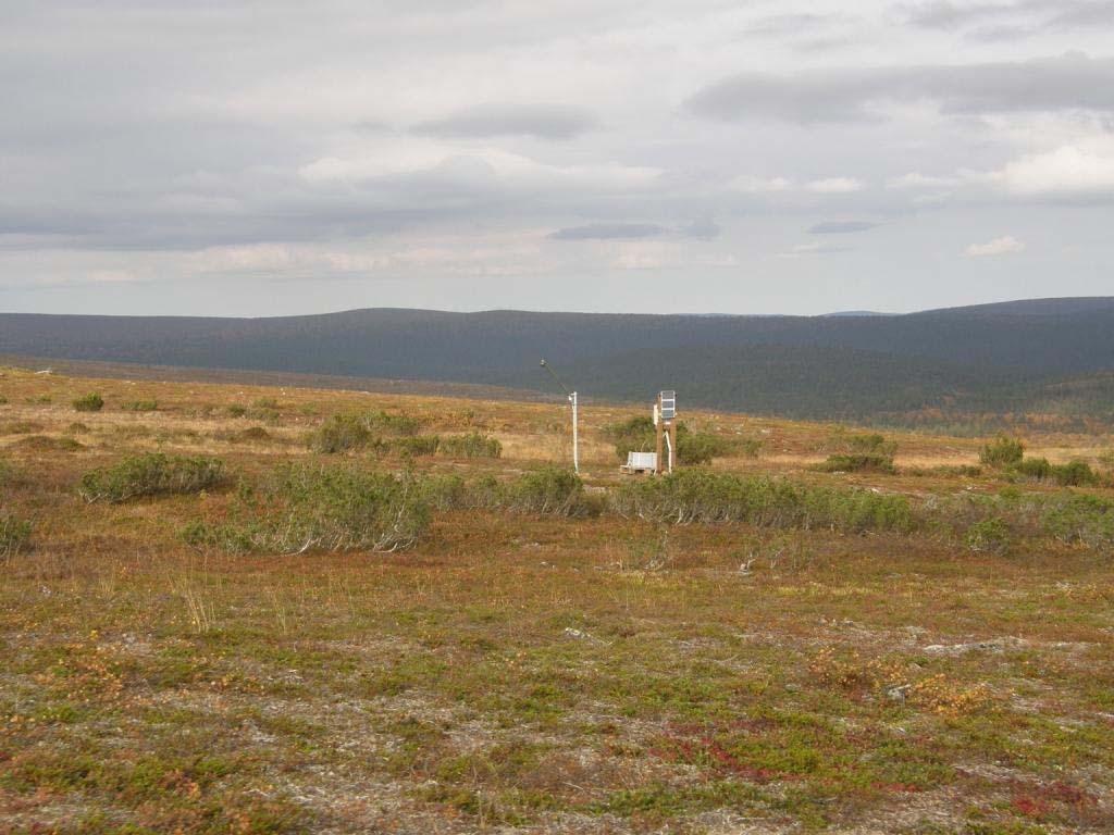
22 New SM / ST vertical profile stations

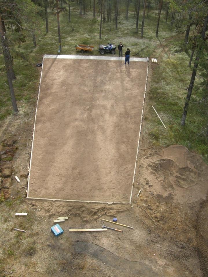
23 Sodankylä area in-situ measurements Continuous automatic soil/snow measurements Soil moisture vertical profile + top layer measurements Soil temperature vertical profile + top layer measurements Snow depth and snow water equivalent Snow temperature profiles Manual in-situ measurements Snow pits on three locations Frost tubes on forest, open area and bog

24

25

26

27 CoReH 2 O MAG, Innsbruck, Austria
28 Connecting in situ observations and satellite data: Products and observations for GCW


29 New Sodankylä Processing Facility Data processing Archiving Delivery (already open database operational litdb.fmi.fi)
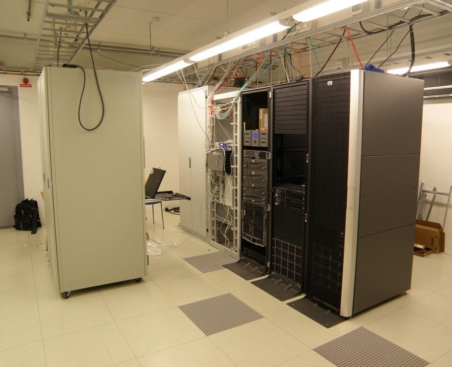

30 Finnish Meteorological Institute

31 EUMETSAT: H-SAF FMI is responsible to the development of real-time snow mapping services for Europe SWE mapping approach is based on the further development of GlobSnow system EC: CryoLand Multinational EC project carrying partially on with GlobSnow efforts Development of operational satellite-based snow & land ice products
32 EC SnowCarbo estimation of CO2 balance of Northern areas Weather station data: Synoptic weather data Satellite data: Snow Covered Area Snow Depth/Water equivalent REMO JSBACH Model System REMO Regional Climate Model JSBACH Biosphere-Atmosphere Model Product validatio n Validation and error estimation Output: CO2 flux maps with error estimates CO2 consentration maps with error estimates Direct validation: CO2 flux measurements CO2 consentration measurements In direct validation: NDVI time series driven features Spring increase in photosynthesis Vegetation summer maximum Beginning of dormancy Timing of soil freezing Snow melt onset Snow clearance
33 Daily CO 2 balances at the spruce forest site in 2003 mean PPFD (μmol m -2 s -1 ) Daily CO 2 balance (mgco 2 m -2 d -1 ) Soil temperature Air temperature PPFD CO 2 balance Temperature (C) -20 Jan Feb Mar Apr May Jun Jul Aug Sep Oct Nov Dec 2003

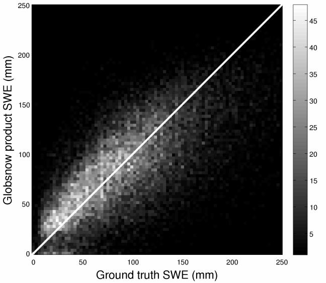
34 30 year-long Climate Data Record (CDR) on snow conditions of Northern Hemisphere (ESA-GlobSnow) First time reliable daily map information on snow: - Snow Water Equivalent (SWE) - Snow Extent and melt Spaceborne passive microwave radiometer data combined with ground-based synoptic snow observations - Variational data-assimilation Part of Sodankylä Cryospheric Data Archive -system - 30-year-long time-series Continuous real-time hemispehirical processing started on October 2010
")
 INTAS-SCONE data Melts earlier Melts later")

35 Trend in the snow melt date based on GlobSnow 30-year long product (change in days/decade) Satellite retrieval ECHAM5 (Obs. SST) INTAS-SCONE data Melts earlier Melts later Conclusion: Confidence on the climate model s ability to represent Eurasian snow cover with reasonable accuracy


36 Seasonal behaviour and hemispherical trend of snow mass 1995 Finnish Meteorological Institute

37 Thank You for Your Attention!
Global SWE Mapping by Combining Passive and Active Microwave Data: The GlobSnow Approach and CoReH 2 O
 Global SWE Mapping by Combining Passive and Active Microwave Data: The GlobSnow Approach and CoReH 2 O April 28, 2010 J. Pulliainen, J. Lemmetyinen, A. Kontu, M. Takala, K. Luojus, K. Rautiainen, A.N.
Soil frost from microwave data. Kimmo Rautiainen, Jouni Pulliainen, Juha Lemmetyinen, Jaakko Ikonen, Mika Aurela
 Soil frost from microwave data Kimmo Rautiainen, Jouni Pulliainen, Juha Lemmetyinen, Jaakko Ikonen, Mika Aurela Why landscape freeze/thaw? Latitudinal variation in mean correlations (r) between annual
ESA GlobSnow - project overview
 ESA GlobSnow - project overview GCW 1 st Implementation meeting Geneve, 23 Nov. 2011 K. Luojus & J. Pulliainen (FMI) + R. Solberg (NR) Finnish Meteorological Institute 1.12.2011 1 ESA GlobSnow ESA-GlobSnow
Remote Sensing of SWE in Canada
 Remote Sensing of SWE in Canada Anne Walker Climate Research Division, Environment Canada Polar Snowfall Hydrology Mission Workshop, June 26-28, 2007 Satellite Remote Sensing Snow Cover Optical -- Snow
FMI Arctic Space Centre. Jyri Heilimo Finnish Meteorological Institute
 FMI Arctic Space Centre Jyri Heilimo Finnish Meteorological Institute FMI - Arctic Space Center Studies of atmospheric phenomena and their interaction with biosphere and cryosphere in high latitudes Hydrology,
SIMULATION OF SPACEBORNE MICROWAVE RADIOMETER MEASUREMENTS OF SNOW COVER FROM IN-SITU DATA AND EMISSION MODELS
 SIMULATION OF SPACEBORNE MICROWAVE RADIOMETER MEASUREMENTS OF SNOW COVER FROM IN-SITU DATA AND EMISSION MODELS Anna Kontu 1 and Jouni Pulliainen 1 1. Finnish Meteorological Institute, Arctic Research,
Assimilation of GlobSnow Data in HIRLAM. Suleiman Mostamandy Kalle Eerola Laura Rontu Katya Kourzeneva
 Assimilation of GlobSnow Data in HIRLAM Suleiman Mostamandy Kalle Eerola Laura Rontu Katya Kourzeneva 10/03/2011 Contents Introduction Snow from satellites Globsnow Other satellites The current study Experiment
Remote sensing of snow at SYKE Sari Metsämäki
 Remote sensing of snow at SYKE 2011-01-21 Sari Metsämäki Activities in different projects Snow extent product in ESA DUE-project GlobSnow Long term datasets (15-30 years) on Snow Extent (SE) and Snow Water
Snow Cover Applications: Major Gaps in Current EO Measurement Capabilities
 Snow Cover Applications: Major Gaps in Current EO Measurement Capabilities Thomas NAGLER ENVEO Environmental Earth Observation IT GmbH INNSBRUCK, AUSTRIA Polar and Snow Cover Applications User Requirements
Examples on Sentinel data applications in Finland, possibilities, plans and how NSDC will be utilized - Snow
 Examples on Sentinel data applications in Finland, possibilities, plans and how NSDC will be utilized - Snow Kari Luojus, Jouni Pulliainen, Jyri Heilimo, Matias Takala, Juha Lemmetyinen, Ali Arslan, Timo
The indicator can be used for awareness raising, evaluation of occurred droughts, forecasting future drought risks and management purposes.
 INDICATOR FACT SHEET SSPI: Standardized SnowPack Index Indicator definition The availability of water in rivers, lakes and ground is mainly related to precipitation. However, in the cold climate when precipitation
Copernicus Global Land Service
 Copernicus Global Land Service Cryosphere Products Kari Luojus on behalf the consortium Follow us on: Copernicus EU CopernicusEU www.copernicus.eu Copernicus Services Land Marine Atmosphere Emergency Security
Remote sensing with FAAM to evaluate model performance
 Remote sensing with FAAM to evaluate model performance YOPP-UK Workshop Chawn Harlow, Exeter 10 November 2015 Contents This presentation covers the following areas Introduce myself Focus of radiation research
Helsinki Testbed - a contribution to NASA's Global Precipitation Measurement (GPM) mission
 mission") Helsinki Testbed - a contribution to NASA's Global Precipitation Measurement (GPM) mission Ubicasting workshop, September 10, 2008 Jarkko Koskinen, Jarmo Koistinen, Jouni Pulliainen, Elena Saltikoff, David
Helsinki Testbed - a contribution to NASA's Global Precipitation Measurement (GPM) mission Ubicasting workshop, September 10, 2008 Jarkko Koskinen, Jarmo Koistinen, Jouni Pulliainen, Elena Saltikoff, David
Validation of satellite derived snow cover data records with surface networks and m ulti-dataset inter-comparisons
 Validation of satellite derived snow cover data records with surface networks and m ulti-dataset inter-comparisons Chris Derksen Climate Research Division Environment Canada Thanks to our data providers:
Environmental observations over Arctic areas potential for monitoring the spread of infectious diseases
 Environmental observations over Arctic areas potential for monitoring the spread of infectious diseases Ali Nadir Arslan ali.nadir.arslan@fmi.fi ARCTIC RESEARCH DEAPARTMENT / FMI ARKTIKO Seminar, Helsinki,
ECMWF. ECMWF Land Surface Analysis: Current status and developments. P. de Rosnay M. Drusch, K. Scipal, D. Vasiljevic G. Balsamo, J.
 Land Surface Analysis: Current status and developments P. de Rosnay M. Drusch, K. Scipal, D. Vasiljevic G. Balsamo, J. Muñoz Sabater 2 nd Workshop on Remote Sensing and Modeling of Surface Properties,
Prof. Jouni Pulliainen
 Prof. Jouni Pulliainen Arctic and Space Finnish Meteorological Institute, Arctic Space Center Long arctic time series from the meteor. observatory in Sodankylä First thermo-/barometer based records in
SEA ICE MICROWAVE EMISSION MODELLING APPLICATIONS
 SEA ICE MICROWAVE EMISSION MODELLING APPLICATIONS R. T. Tonboe, S. Andersen, R. S. Gill Danish Meteorological Institute, Lyngbyvej 100, DK-2100 Copenhagen Ø, Denmark Tel.:+45 39 15 73 49, e-mail: rtt@dmi.dk
Assimilation of satellite derived soil moisture for weather forecasting
 Assimilation of satellite derived soil moisture for weather forecasting www.cawcr.gov.au Imtiaz Dharssi and Peter Steinle February 2011 SMOS/SMAP workshop, Monash University Summary In preparation of the
EUMETSAT SAF NETWORK. Lothar Schüller, EUMETSAT SAF Network Manager
 1 EUMETSAT SAF NETWORK Lothar Schüller, EUMETSAT SAF Network Manager EUMETSAT ground segment overview METEOSAT JASON-2 INITIAL JOINT POLAR SYSTEM METOP NOAA SATELLITES CONTROL AND DATA ACQUISITION FLIGHT
REVISION OF THE STATEMENT OF GUIDANCE FOR GLOBAL NUMERICAL WEATHER PREDICTION. (Submitted by Dr. J. Eyre)
") WORLD METEOROLOGICAL ORGANIZATION Distr.: RESTRICTED CBS/OPAG-IOS (ODRRGOS-5)/Doc.5, Add.5 (11.VI.2002) COMMISSION FOR BASIC SYSTEMS OPEN PROGRAMME AREA GROUP ON INTEGRATED OBSERVING SYSTEMS ITEM: 4 EXPERT
WORLD METEOROLOGICAL ORGANIZATION Distr.: RESTRICTED CBS/OPAG-IOS (ODRRGOS-5)/Doc.5, Add.5 (11.VI.2002) COMMISSION FOR BASIC SYSTEMS OPEN PROGRAMME AREA GROUP ON INTEGRATED OBSERVING SYSTEMS ITEM: 4 EXPERT
Remote Sensing of Snow GEOG 454 / 654
 Remote Sensing of Snow GEOG 454 / 654 What crysopheric questions can RS help to answer? 2 o Where is snow lying? (Snow-covered area or extent) o How much is there? o How rapidly is it melting? (Area, depth,
Terrestrial Snow Cover: Properties, Trends, and Feedbacks. Chris Derksen Climate Research Division, ECCC
 Terrestrial Snow Cover: Properties, Trends, and Feedbacks Chris Derksen Climate Research Division, ECCC Outline Three Snow Lectures: 1. Why you should care about snow: Snow and the cryosphere Classes of
The Challenge of. Guy Brasseur
 The Challenge of Monitoring and Predicting Chemical Weather Guy Brasseur Introduction: What is Chemical Weather? What is Chemical Weather? Local, regional, and global distributions of important trace gases
CLIMATE CHANGE AND REGIONAL HYDROLOGY ACROSS THE NORTHEAST US: Evidence of Changes, Model Projections, and Remote Sensing Approaches
 CLIMATE CHANGE AND REGIONAL HYDROLOGY ACROSS THE NORTHEAST US: Evidence of Changes, Model Projections, and Remote Sensing Approaches Michael A. Rawlins Dept of Geosciences University of Massachusetts OUTLINE
Snow property extraction based on polarimetry and differential SAR interferometry
 Snow property extraction based on polarimetry and differential SAR interferometry S. Leinß, I. Hajnsek Earth Observation and Remote Sensing, Institute of Enviromental Science, ETH Zürich TerraSAR X and
Dual-Frequency Ku- Band Radar Mission Concept for Snow Mass
 Dual-Frequency Ku- Band Radar Mission Concept for Snow Mass Chris Derksen Environment and Climate Change Canada Study Team: Climate Research Division/Meteorological Research Division, ECCC Canadian Space
The use of earth observation technology to improve the characterization of ice and snow
 The use of earth observation technology to improve the characterization of ice and snow Swedish Meteorological and Hydrological Institute (SMHI) Outline: EO and ice/snow CryoLand North Hydrology EO in
LIFE12 ENV/FIN/ st summary report of snow data 30/09/2014
 LIFE Project Number 1st summary report of snow data Reporting Date 30/09/2014 LIFE+ PROJECT NAME or Acronym Climate change indicators and vulnerability of boreal zone applying innovative observation and
Snow-atmosphere interactions at Dome C, Antarctica
 Snow-atmosphere interactions at Dome C, Antarctica Éric Brun, Vincent Vionnet CNRM/GAME (Météo-France and CNRS) Christophe Genthon, Delphine Six, Ghislain Picard LGGE (CNRS and UJF)... and many colleagues
EUMETSAT STATUS AND PLANS
 1 EUM/TSS/VWG/15/826793 07/10/2015 EUMETSAT STATUS AND PLANS François Montagner, Marine Applications Manager, EUMETSAT WMO Polar Space Task Group 5 5-7 October 2015, DLR, Oberpfaffenhofen PSTG Strategic
FTS measurements of greenhouse gases over Sodankylä, Finland
 FTS measurements of greenhouse gases over Sodankylä, Finland Rigel Kivi, Pauli Heikkinen, Johanna Tamminen, Simo Tukiainen, Hannakaisa Lindqvist, Janne Hakkarainen, Juha Hatakka, Tuomas Laurila, Leif Backman,
Steve Colwell. British Antarctic Survey
 Global Climate Observing System (GCOS) Steve Colwell British Antarctic Survey Goal and Structure of GCOS The Goal of GCOS is to provide continuous, reliable, comprehensive data and information on the state
Assimilation of ASCAT soil wetness
 EWGLAM, October 2010 Assimilation of ASCAT soil wetness Bruce Macpherson, on behalf of Imtiaz Dharssi, Keir Bovis and Clive Jones Contents This presentation covers the following areas ASCAT soil wetness
Lake ice cover and surface water temperature II: Satellite remote sensing
 Lake ice cover and surface water temperature II: Satellite remote sensing Claude Duguay University of Waterloo (Canada) Earth Observation Summer School ESA-ESRIN, Frascati, Italy (4-14 August 2014) Lecture
EUMETSAT SAF NETWORK. Lothar Schüller, EUMETSAT SAF Network Manager
 1 EUMETSAT SAF NETWORK Lothar Schüller, EUMETSAT SAF Network Manager EUMETSAT ground segment overview METEOSAT JASON-2 INITIAL JOINT POLAR SYSTEM METOP NOAA SATELLITES CONTROL AND DATA ACQUISITION FLIGHT
C o p e r n i c u s L a n d M o n i t o r i n g S e r v i c e
 C o p e r n i c u s L a n d M o n i t o r i n g S e r v i c e Integration into existing Snow and Ice Services and draft product specifications Annett BARTSCH b.geos Copernicus High Resolution Snow and
EUMeTrain Snow Week 2010 Session 3 (MRG069305) (MRG069305)
 (MRG069305)") EUMeTrain Snow Week 2010 Session 3 (MRG069305) Event Name: Subject Name: Leader: Start Time: End Time: EUMeTrain Snow Week 2010 Session 3 (MRG069305) (MRG069305) Vesa Nietosvaara (Vesa) 2/3/10 2:00 pm
EUMeTrain Snow Week 2010 Session 3 (MRG069305) Event Name: Subject Name: Leader: Start Time: End Time: EUMeTrain Snow Week 2010 Session 3 (MRG069305) (MRG069305) Vesa Nietosvaara (Vesa) 2/3/10 2:00 pm
ECMWF. ECMWF Land Surface modelling and land surface analysis. P. de Rosnay G. Balsamo S. Boussetta, J. Munoz Sabater D.
 Land Surface modelling and land surface analysis P. de Rosnay G. Balsamo S. Boussetta, J. Munoz Sabater D. Vasiljevic M. Drusch, K. Scipal SRNWP 12 June 2009 Slide 1 Surface modelling (G. Balsamo) HTESSEL,
Interpretation of Polar-orbiting Satellite Observations. Atmospheric Instrumentation
 Interpretation of Polar-orbiting Satellite Observations Outline Polar-Orbiting Observations: Review of Polar-Orbiting Satellite Systems Overview of Currently Active Satellites / Sensors Overview of Sensor
AirCore flights at Sodankylä Rigel Kivi, Pauli Heikkinen, Juha Hatakka, Tuomas Laurila, Leif Backman, Jouni Pulliainen (1), Huilin Chen (2, 3)
, Huilin Chen (2, 3)") AirCore flights at Sodankylä Rigel Kivi, Pauli Heikkinen, Juha Hatakka, Tuomas Laurila, Leif Backman, Jouni Pulliainen (1), Huilin Chen (2, 3) 1) Finnish Meteorological Institute, Sodankylä/Helsinki, Finland;
AirCore flights at Sodankylä Rigel Kivi, Pauli Heikkinen, Juha Hatakka, Tuomas Laurila, Leif Backman, Jouni Pulliainen (1), Huilin Chen (2, 3) 1) Finnish Meteorological Institute, Sodankylä/Helsinki, Finland;
Biomes and Biodiversity
 Biomes and Biodiversity Agenda 2/4/13 Biomes review terrestrial and aquatic Biodiversity Climate Change Introduction Weather Terrestrial Biomes Review Tundra Boreal Forest (Taiga) Temperate Forest Temperate
ADVANCEMENTS IN SNOW MONITORING
 Polar Space Task Group ADVANCEMENTS IN SNOW MONITORING Thomas Nagler, ENVEO IT GmbH, Innsbruck, Austria Outline Towards a pan-european Multi-sensor Snow Product SnowPEx Summary Upcoming activities SEOM
Permafrost: Earth Observation Applications: Introduction
 Polar Meeting 3 Permafrost: Earth Observation Applications: Introduction Mark Drinkwater CNES, Paris, 22 23 May, 2013 Remote Sensing of Permafrost which Remote Sensing products? applicability to Permafrost
Climate Models and Snow: Projections and Predictions, Decades to Days
 Climate Models and Snow: Projections and Predictions, Decades to Days Outline Three Snow Lectures: 1. Why you should care about snow 2. How we measure snow 3. Snow and climate modeling The observational
Climate Change Service
 Service Metadata for the Data Store Dick Dee, ECMWF C3S: data + expertise + operational Open and free access to climate data (observations, reanalyses, model predictions) Tools and best scientific practices
2015 Fall Conditions Report
 2015 Fall Conditions Report Prepared by: Hydrologic Forecast Centre Date: December 21 st, 2015 Table of Contents Table of Figures... ii EXECUTIVE SUMMARY... 1 BACKGROUND... 2 SUMMER AND FALL PRECIPITATION...
Match (one-to-one) the following (1 5) from the list (A E) below.
 the following (1 5) from the list (A E) below.") GEO 302C EXAM 1 Spring 2009 Name UID You may not refer to any other materials during the exam. For each question (except otherwise explicitly stated), select the best answer for that question. Read all
GEO 302C EXAM 1 Spring 2009 Name UID You may not refer to any other materials during the exam. For each question (except otherwise explicitly stated), select the best answer for that question. Read all
Evaluation and Assimilation of Remotely- Sensed Lake Surface Temperature in the HIRLAM Weather Forecasting System
 Evaluation and Assimilation of Remotely- Sensed Lake Surface Temperature in the HIRLAM Weather Forecasting System H. Kheyrollah Pour 1, C.R. Duguay 1, L. Rontu 2 with contributions from Kalle Eerola 2,
Simulations of Lake Processes within a Regional Climate Model
 Simulations of Lake Processes within a Regional Climate Model Jiming Jin Departments of Watershed Sciences and Plants, Soils, and Climate Utah State University, Logan, Utah Utah State University 850 Faculty
THE EARTH S CLIMATE SYSTEM
 THE EARTH S CLIMATE SYSTEM Earth s Climate System is driven by interactions between the parts of our biosphere So.what is the Biosphere? a relatively thin layer of Earth that has conditions suitable for
Interannual variation of MODIS NDVI in Lake Taihu and its relation to climate in submerged macrophyte region
 Yale-NUIST Center on Atmospheric Environment Interannual variation of MODIS NDVI in Lake Taihu and its relation to climate in submerged macrophyte region ZhangZhen 2015.07.10 1 Outline Introduction Data
Observing Snow: Conventional Measurements, Satellite and Airborne Remote Sensing. Chris Derksen Climate Research Division, ECCC
 Observing Snow: Conventional Measurements, Satellite and Airborne Remote Sensing Chris Derksen Climate Research Division, ECCC Outline Three Snow Lectures: 1. Why you should care about snow 2. How we measure
SMAP and SMOS Integrated Soil Moisture Validation. T. J. Jackson USDA ARS
 SMAP and SMOS Integrated Soil Moisture Validation T. J. Jackson USDA ARS Perspective Linkage of SMOS and SMAP soil moisture calibration and validation will have short and long term benefits for both missions.
Observed State of the Global Climate
 WMO Observed State of the Global Climate Jerry Lengoasa WMO June 2013 WMO Observations of Changes of the physical state of the climate ESSENTIAL CLIMATE VARIABLES OCEANIC ATMOSPHERIC TERRESTRIAL Surface
BMKG Research on Air sea interaction modeling for YMC
 BMKG Research on Air sea interaction modeling for YMC Prof. Edvin Aldrian Director for Research and Development - BMKG First Scientific and Planning Workshop on Year of Maritime Continent, Singapore 27-3
Remote sensing of sea ice
 Remote sensing of sea ice Ice concentration/extent Age/type Drift Melting Thickness Christian Haas Remote Sensing Methods Passive: senses shortwave (visible), thermal (infrared) or microwave radiation
Course outline, objectives, workload, projects, expectations
 Course outline, objectives, workload, projects, expectations Introductions Remote Sensing Overview Elements of a remote sensing observing system 1. platform (satellite, surface, etc) 2. experimental design
Chapter outline. Reference 12/13/2016
 Chapter 2. observation CC EST 5103 Climate Change Science Rezaul Karim Environmental Science & Technology Jessore University of science & Technology Chapter outline Temperature in the instrumental record
The Canadian Land Data Assimilation System (CaLDAS)
") The Canadian Land Data Assimilation System (CaLDAS) Marco L. Carrera, Stéphane Bélair, Bernard Bilodeau and Sheena Solomon Meteorological Research Division, Environment Canada Dorval, QC, Canada 2 nd Workshop
The Canadian Land Data Assimilation System (CaLDAS) Marco L. Carrera, Stéphane Bélair, Bernard Bilodeau and Sheena Solomon Meteorological Research Division, Environment Canada Dorval, QC, Canada 2 nd Workshop
Toward improving the representation of the water cycle at High Northern Latitudes
 Toward improving the representation of the water cycle at High Northern Latitudes W. A. Lahoz a, T. M. Svendby a, A. Griesfeller a, J. Kristiansen b a NILU, Kjeller, Norway b Met Norway, Oslo, Norway wal@nilu.no
Modelling and Data Assimilation Needs for improving the representation of Cold Processes at ECMWF
 Modelling and Data Assimilation Needs for improving the representation of Cold Processes at ECMWF presented by Gianpaolo Balsamo with contributions from Patricia de Rosnay, Richard Forbes, Anton Beljaars,
Remote Sensing Applications for Land/Atmosphere: Earth Radiation Balance
 Remote Sensing Applications for Land/Atmosphere: Earth Radiation Balance - Introduction - Deriving surface energy balance fluxes from net radiation measurements - Estimation of surface net radiation from
Snowcover interaction with climate, topography & vegetation in mountain catchments
 Snowcover interaction with climate, topography & vegetation in mountain catchments DANNY MARKS Northwest Watershed Research Center USDA-Agricultural Agricultural Research Service Boise, Idaho USA RCEW
Canadian Prairie Snow Cover Variability
 Canadian Prairie Snow Cover Variability Chris Derksen, Ross Brown, Murray MacKay, Anne Walker Climate Research Division Environment Canada Ongoing Activities: Snow Cover Variability and Links to Atmospheric
The Canadian Precipitation Analysis (CaPA) and the Canadian Land Data Assimilation System (CaLDAS)
 and the Canadian Land Data Assimilation System (CaLDAS)") The Canadian Precipitation Analysis (CaPA) and the Canadian Land Data Assimilation System (CaLDAS) Vincent Fortin (and many collaborators) Division de la recherche en météorologie Environnement en Changement
The Canadian Precipitation Analysis (CaPA) and the Canadian Land Data Assimilation System (CaLDAS) Vincent Fortin (and many collaborators) Division de la recherche en météorologie Environnement en Changement
THE USE OF MERIS SPECTROMETER DATA IN SEASONAL SNOW MAPPING
 THE USE OF MERIS SPECTROMETER DATA IN SEASONAL SNOW MAPPING Miia Eskelinen, Sari Metsämäki The Finnish Environment Institute Geoinformatics and Land use division P.O.Box 140, FI 00251 Helsinki, Finland
Development of the Canadian Precipitation Analysis (CaPA) and the Canadian Land Data Assimilation System (CaLDAS)
 and the Canadian Land Data Assimilation System (CaLDAS)") Development of the Canadian Precipitation Analysis (CaPA) and the Canadian Land Data Assimilation System (CaLDAS) Marco L. Carrera, Vincent Fortin and Stéphane Bélair Meteorological Research Division Environment
Development of the Canadian Precipitation Analysis (CaPA) and the Canadian Land Data Assimilation System (CaLDAS) Marco L. Carrera, Vincent Fortin and Stéphane Bélair Meteorological Research Division Environment
The Atmosphere and Atmospheric Energy Chapter 3 and 4
 The Atmosphere and Atmospheric Energy Chapter 3 and 4 Size of the Earth s Atmosphere Atmosphere produced over 4.6 billion years of development Protects us from radiation Completely surrounds the earth
Satellite-based Lake Surface Temperature (LST) Homa Kheyrollah Pour Claude Duguay
 Homa Kheyrollah Pour Claude Duguay") Satellite-based Lake Surface Temperature (LST) Homa Kheyrollah Pour Claude Duguay Lakes in NWP models Interaction of the atmosphere and underlying layer is the most important issue in climate modeling
Satellite-based Lake Surface Temperature (LST) Homa Kheyrollah Pour Claude Duguay Lakes in NWP models Interaction of the atmosphere and underlying layer is the most important issue in climate modeling
Studying snow cover in European Russia with the use of remote sensing methods
 40 Remote Sensing and GIS for Hydrology and Water Resources (IAHS Publ. 368, 2015) (Proceedings RSHS14 and ICGRHWE14, Guangzhou, China, August 2014). Studying snow cover in European Russia with the use
Assimilation of Globsnow data into HIRLAM. Mostamandy Suleiman Sodankyla August 2011
 Assimilation of Globsnow data into HIRLAM Mostamandy Suleiman Sodankyla August 2011 Motivation Small number of observations (especially in eastern Europe and Russia) 00 cm of snow problem Non-uniform in
Climate Modeling Research & Applications in Wales. John Houghton. C 3 W conference, Aberystwyth
 Climate Modeling Research & Applications in Wales John Houghton C 3 W conference, Aberystwyth 26 April 2011 Computer Modeling of the Atmosphere & Climate System has revolutionized Weather Forecasting and
Climate and the Atmosphere
 Climate and Biomes Climate Objectives: Understand how weather is affected by: 1. Variations in the amount of incoming solar radiation 2. The earth s annual path around the sun 3. The earth s daily rotation
Discritnination of a wet snow cover using passive tnicrowa ve satellite data
 Annals of Glaciology 17 1993 International Glaciological Society Discritnination of a wet snow cover using passive tnicrowa ve satellite data A. E. WALKER AND B. E. GOODISON Canadian Climate Centre, 4905
A R C T E X Results of the Arctic Turbulence Experiments Long-term Monitoring of Heat Fluxes at a high Arctic Permafrost Site in Svalbard
 A R C T E X Results of the Arctic Turbulence Experiments www.arctex.uni-bayreuth.de Long-term Monitoring of Heat Fluxes at a high Arctic Permafrost Site in Svalbard 1 A R C T E X Results of the Arctic
1. The frequency of an electromagnetic wave is proportional to its wavelength. a. directly *b. inversely
 CHAPTER 3 SOLAR AND TERRESTRIAL RADIATION MULTIPLE CHOICE QUESTIONS 1. The frequency of an electromagnetic wave is proportional to its wavelength. a. directly *b. inversely 2. is the distance between successive
Quenching the Valley s thirst: The connection between Sierra Nevada snowpack & regional water supply
 Quenching the Valley s thirst: The connection between Sierra Nevada snowpack & regional water supply Roger Bales, UC Merced Snow conditions Snow & climate change Research directions Sierra Nevada snow
The importance of long-term Arctic weather station data for setting the research stage for climate change studies
 The importance of long-term Arctic weather station data for setting the research stage for climate change studies Taneil Uttal NOAA/Earth Systems Research Laboratory Boulder, Colorado Things to get out
Instrumentation planned for MetOp-SG
 Instrumentation planned for MetOp-SG Bill Bell Satellite Radiance Assimilation Group Met Office Crown copyright Met Office Outline Background - the MetOp-SG programme The MetOp-SG instruments Summary Acknowledgements:
Regional offline land surface simulations over eastern Canada using CLASS. Diana Verseghy Climate Research Division Environment Canada
 Regional offline land surface simulations over eastern Canada using CLASS Diana Verseghy Climate Research Division Environment Canada The Canadian Land Surface Scheme (CLASS) Originally developed for the
Recent Data Assimilation Activities at Environment Canada
 Recent Data Assimilation Activities at Environment Canada Major upgrade to global and regional deterministic prediction systems (now in parallel run) Sea ice data assimilation Mark Buehner Data Assimilation
Central Asia Regional Flash Flood Guidance System 4-6 October Hydrologic Research Center A Nonprofit, Public-Benefit Corporation
 http://www.hrcwater.org Central Asia Regional Flash Flood Guidance System 4-6 October 2016 Hydrologic Research Center A Nonprofit, Public-Benefit Corporation FFGS Snow Components Snow Accumulation and
GCOM-W1 now on the A-Train
 GCOM-W1 now on the A-Train GCOM-W1 Global Change Observation Mission-Water Taikan Oki, K. Imaoka, and M. Kachi JAXA/EORC (& IIS/The University of Tokyo) Mini-Workshop on A-Train Science, March 8 th, 2013
H-SAF Snow products and their use in applications. Matias Takala
 H-SAF Snow products and their use in applications Matias Takala Matias.takala@fmi.fi H-SAF snow products H-SAF: EUMETSAT funded satellite application facility (SAF) for Support to Operational Hydrology
USE OF SATELLITE INFORMATION IN THE HUNGARIAN NOWCASTING SYSTEM
 USE OF SATELLITE INFORMATION IN THE HUNGARIAN NOWCASTING SYSTEM Mária Putsay, Zsófia Kocsis and Ildikó Szenyán Hungarian Meteorological Service, Kitaibel Pál u. 1, H-1024, Budapest, Hungary Abstract The
Climate Change and Arizona s Rangelands: Management Challenges and Opportunities
 Climate Change and Arizona s Rangelands: Management Challenges and Opportunities Mike Crimmins Climate Science Extension Specialist Dept. of Soil, Water, & Env. Science & Arizona Cooperative Extension
OSI SAF Sea Ice products
 OSI SAF Sea Ice products Lars-Anders Brevik, Gorm Dybkjær, Steinar Eastwood, Øystein Godøy, Mari Anne Killie, Thomas Lavergne, Rasmus Tonboe, Signe Aaboe Norwegian Meteorological Institute Danish Meteorological
3. Climate Change. 3.1 Observations 3.2 Theory of Climate Change 3.3 Climate Change Prediction 3.4 The IPCC Process
 3. Climate Change 3.1 Observations 3.2 Theory of Climate Change 3.3 Climate Change Prediction 3.4 The IPCC Process 3.1 Observations Need to consider: Instrumental climate record of the last century or
Land Data Assimilation for operational weather forecasting
 Land Data Assimilation for operational weather forecasting Brett Candy Richard Renshaw, JuHyoung Lee & Imtiaz Dharssi * *Centre Australian Weather and Climate Research Contents An overview of the Current
ASSESSMENT OF NORTHERN HEMISPHERE SWE DATASETS IN THE ESA SNOWPEX INITIATIVE
 ASSESSMENT OF NORTHERN HEMISPHERE SWE DATASETS IN THE ESA SNOWPEX INITIATIVE Kari Luojus 1), Jouni Pulliainen 1), Matias Takala 1), Juha Lemmetyinen 1), Chris Derksen 2), Lawrence Mudryk 2), Michael Kern
CGMS Baseline. Sustained contributions to the Global Observing System. Endorsed by CGMS-46 in Bengaluru, June 2018
 CGMS Baseline Sustained contributions to the Global Observing System Best Practices for Achieving User Readiness for New Meteorological Satellites Endorsed by CGMS-46 in Bengaluru, June 2018 CGMS/DOC/18/1028862,
Global Climates. Name Date
 Global Climates Name Date No investigation of the atmosphere is complete without examining the global distribution of the major atmospheric elements and the impact that humans have on weather and climate.
Improvement of objective analysis of lake surface state in HIRLAM using satellite observations
 HIRLAM ASM 2013 & ALADIN 23 rd Workshop Reykjavik, Iceland 15-19 April, 2013 Improvement of objective analysis of lake surface state in HIRLAM using satellite observations H. Kheyrollah Pour, C.R. Duguay
Status of ESA EO Programmes
 Status of ESA EO Programmes 54 th ESSC Plenary Meeting 24 November 2017 Maurice Borgeaud, ESA Head of the ESA Earth Observation Science, Applications and Climate Department Issue/Revision: 0.0 Reference:
Today s Lecture: Land, biosphere, cryosphere (All that stuff we don t have equations for... )
") Today s Lecture: Land, biosphere, cryosphere (All that stuff we don t have equations for... ) 4 Land, biosphere, cryosphere 1. Introduction 2. Atmosphere 3. Ocean 4. Land, biosphere, cryosphere 4.1 Land
Today s Lecture: Land, biosphere, cryosphere (All that stuff we don t have equations for... ) 4 Land, biosphere, cryosphere 1. Introduction 2. Atmosphere 3. Ocean 4. Land, biosphere, cryosphere 4.1 Land
and soils characterizing would be defined.
 Working out of the basic network for monitoring of natural and climatic processes in Siberia M.V. Kabanov, V.V. Zuev, V.А. Krutikov Institute of Monitoring of Climatic and Ecological Systems SB RAS, Tomsk,
Climate Roles of Land Surface
 Lecture 5: Land Surface and Cryosphere (Outline) Climate Roles Surface Energy Balance Surface Water Balance Sea Ice Land Ice (from Our Changing Planet) Surface Albedo Climate Roles of Land Surface greenhouse
Extreme Weather and Climate Change: the big picture Alan K. Betts Atmospheric Research Pittsford, VT NESC, Saratoga, NY
 Extreme Weather and Climate Change: the big picture Alan K. Betts Atmospheric Research Pittsford, VT http://alanbetts.com NESC, Saratoga, NY March 10, 2018 Increases in Extreme Weather Last decade: lack