Monitoring of grass cutting with Sentinel-1 time series
|
|
|
- Gwenda Smith
- 5 years ago
- Views:
Transcription


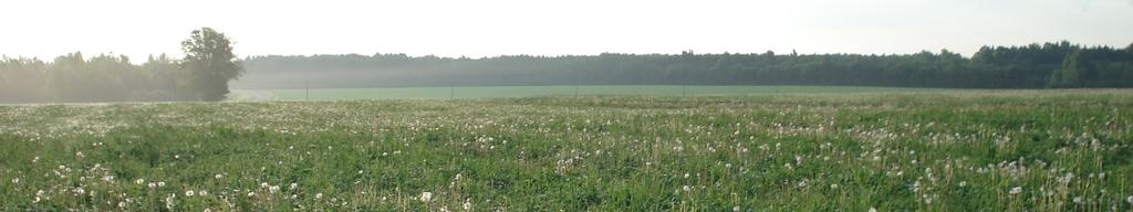
1 Monitoring of grass cutting with Sentinel-1 time series pilot results and vision for operational service based on big data tools and cloud computing Kaupo Voormansik 21st MARS Conference November 25, Thessaloniki Tartu Observatory s SAR team Applied research for grassland parameters retrieval since 2011, 3 campaigns, 5 research papers. Main research partner Main user partner 1

2 The problem According to risk analysis 0.83% of grasslands in Estonia violate the cutting requirement. In Estonia there are ha grasslands, the violation results in of false payments. Infeasible to do total checks with inspectors. If we had tools to check it, the money could be saved and re-distributed from sofa-farmers to actual active farmers. Vision for the solution Copernicus Sentinel-1 time series to detect cutting/grazing in the parcels. Parcel borders from paying agency databases. S1 time series SAR satellite data analysis Parcel borders Updated GIS data with cutting info Paying agency GIS database 2


3 27/11/2015 Why Sentinel-1 data? Synthetic Aperture Radar, weather independence continuous regular monitoring. Free and open data policy input data available at zero cost. Image source: European Space Agency, 2015 NASA MODIS Terra image, July 31,


")
 8 4")
4 27/11/2015 Sentinel-1 SAR image, July 31, 2015 MAY 2017 Sentinel-1 data takes at Northern Europe (60ᵒ latitude) S1B (A) S1B (A) S1B (A) S1B (A) S1B (A) 8 4
5 MAY 2017 Sentinel-1 data takes at Central Europe (48ᵒ latitude) S1B (A) S1B (A) 9 What we did the experiment setup Sentinel-1 time series IW mode, VV/VH pol. 20 m by 5 m resol. 3 different acq. geometries. May to August Total of 32 images. Careful field surveys Wet and dry biomass. Grass height and cutting status. Soil moisture. In situ photographs. Weekly monitoring. Transect method, 10 data points per field. 5
6 What we did the data processing Studying backscatter, interferometric and polarimetric SAR parameters. Taking account sensor specific noise effects and meteorological data. Applying the accumulated experience of past 5 years and two PhD theses experiment results Very encouraging results. We can tell the grassfield cutting status and likely cutting dates with high reliability. Can t discover the details yet, will be published in peer-reviewed journals in


7 27/11/2015 Pilot results delivered to Estonian paying agency Pilot results delivered to Estonian paying agency 7
8 Side-product of the research. Detection of the ploughed and non-ploughed fields in spring. Estimation of ploughing date. In all weather conditions. Sentinel-1 vs high resolution SAR data (e.g. COSMO SkyMED, TerraSAR-X) Main limitation of S1: only the spatial res. works on parcels with minimum diameter of 70 m. High res. SAR data can monitor parcels with minimum diameter of 20 m or less, but: The grass cutting detection reliability of S1 is even higher thanks to the temporal resolution dense time series! Cost and coverage advantage of S1 data. 8
9 OK, Sentinel-1 and -2 loads of nice and useful data but how to handle this? Future of EO Data processing Challenge by the amount of data for (a) data transfer and (b) processing power. Sentinel-1 EU covering data volume 390 TB/year (depending on latitude repeated coverages per year). Sentinel-2 EU covering data volume 610 TB/year (depending on latitude repeated coverages per year). Infeasible to download all this to every user, who needs the info in the data. 9
 Other GIS vector and raster data * Webserver or other IS * Transfer of light-weight data mainly")
10 EO Community Platforms Server side in cloud User side (desktop, notebook, tablet, smart phone) * Web-based or other user interface S1, S2 and other satellite data EO and GIS software Powerful computing resource (several multicore CPUs, GPU-based computing, memory [128+ GB], large disk space) Other GIS vector and raster data * Webserver or other IS * Transfer of light-weight data mainly (text, final raster or vector map, remote desktop) Source: European Space Agency s Ground- Segment Evolution Strategy Document Paying agency subsidy claims check service architecture concept EO Community platform Paying agency s info systems and databases EO and GIS software Powerful computing resource (several multicore CPUs, GPUbased computing, memory [128+ GB], large disk space) S1, S2 and other satellite data Other GIS vector and raster data Parcel borders Updated GIS data with checks results Specific software architecture in each country 10
11 Announcement Establishment of TO spin-off company, start-up KappaZeta OÜ. Concentrating on paying agency checks applications and SAR-based precision agriculture technology. Contact: and KappaZeta OÜ Free limited area grass-cutting and ploughed fields detection demos. About 2015 [if you have the field inspector archive data]. During vegetative season of Needed input: parcel database to carry out the checks. 11

12 Future developments Starting to use Sentinel-2 multispectral data in Higher res. - can do grass cutting detection on parcels with min. diameter of 30 m (cloud-free conditions). Further improving the reliability with S1+S2 hybrid method. Applying meteo-data for improvements. Conclusion (1) Copernicus Sentinel data offers the possibility to improve subsidy checks and save tens to hundreds of millions euros EU tax-payer money every year. Reducing the need for field surveys and making the checks more objective. Objective data source to solve disputes. Sentinel-1 based pilot in Summer 2015 very encouraging results. 12
13 Conclusion (2) Copernicus S1 and S2 taking EO to the Big Data era. Traditional data processing and transfer methods are infeasible. ESA s vision: EO Community platforms, processing next to data. Establishment of TO spin-off company KappaZeta, first products: grass cutting detection and mapping of ploughed fields each spring under all weather conditions. Opportunity for demo processing in your country. List of publications from our group K. Voormansik, T. Jagdhuber, A. Olesk, I. Hajnsek and K. P. Papahtanassiou, "Towards a detection of grassland cutting practices with dual polarimetric TerraSAR-X data," International Journal of Remote Sensing, vol. 34, no. 22, pp , K. Voormansik, T. Jagdhuber, I. Hajnsek and K. P. Papathanassiou, "Improving Semi-natural Grassland Administration with TerraSAR-X," in Proceedings of the 17th GeoCAP Annual Conference, edited by: D. Fasbender, K. Taşdemir, Ph. Loudjani, V. Angileri, C. Lucau, P. Milenov, W. Devos, R. De Kok, S. Lemajic, A. Tarko and P. Pizziol, pp , Tallinn, K. Zalite, O. Antropov, J. Praks, K. Voormansik, M. Noorma, Towards detecting mowing of agricultural grasslands from multi-temporal COSMO-SkyMed data, 2014 IEEE International Geoscience and Remote Sensing Symposium (IGARSS), pp , K. Voormansik, T. Jagdhuber, K. Zalite, M. Noorma, I. Hajnsek, Obervations of Cutting Practices in Agricultural Grasslands using Polarimetric SAR, IEEE Journal of Selected Topics in Applied Earth Observations and Remote Sensing, 2015 [accepted] K. Zalite, O. Antropov, J. Praks, K. Voormansik, M. Noorma X-band Repeat-Pass Interferometry for Monitoring of Grasslands, IEEE Journal of Selected Topics in Applied Earth Observations and Remote Sensing, 2015 [accepted] 13

14 27/11/2015 Thank you! Questions? 14
Effective Utilization of Synthetic Aperture Radar (SAR) Imagery in Rapid Damage Assessment
 Imagery in Rapid Damage Assessment") Effective Utilization of Synthetic Aperture Radar (SAR) Imagery in Rapid Damage Assessment Case Study Pakistan Floods SUPARCO M. Maisam Raza, Ahmad H. Rabbani SEQUENCE Flood Monitoring using Satellite
Effective Utilization of Synthetic Aperture Radar (SAR) Imagery in Rapid Damage Assessment Case Study Pakistan Floods SUPARCO M. Maisam Raza, Ahmad H. Rabbani SEQUENCE Flood Monitoring using Satellite
Leveraging Sentinel-1 time-series data for mapping agricultural land cover and land use in the tropics
 Leveraging Sentinel-1 time-series data for mapping agricultural land cover and land use in the tropics Caitlin Kontgis caitlin@descarteslabs.com @caitlinkontgis Descartes Labs Overview What is Descartes
EO4SEE - THE PATHFINDER OF OPERATIONAL SATELLITE MONITORING FOR THE REGION OF THE BLACK SEA AND CENTRAL EUROPE
 EO4SEE: Pathfinder assessment for regional high volume data access, processing and information service delivery platforms - South East Region EO4SEE - THE PATHFINDER OF OPERATIONAL SATELLITE MONITORING
C o p e r n i c u s L a n d M o n i t o r i n g S e r v i c e
 C o p e r n i c u s L a n d M o n i t o r i n g S e r v i c e Grassland Harvest Estimation (Bavaria, Germany) Copernicus EU Copernicus EU Copernicus EU www.copernicus.eu G R A S S L A N D H A R V E S T
U s i n g t h e E S A / E U M E T C A S T N a v i g a t o r s
 U s i n g t h e E S A / E U M E T C A S T N a v i g a t o r s Copernicus User Uptake Information Sessions Copernicus EU Copernicus EU Copernicus EU www.copernicus.eu I N T R O D U C T I O N O F U S E C
C o p e r n i c u s L a n d M o n i t o r i n g S e r v i c e
 C o p e r n i c u s L a n d M o n i t o r i n g S e r v i c e Integration into existing Snow and Ice Services and draft product specifications Annett BARTSCH b.geos Copernicus High Resolution Snow and
Comparison between Multitemporal and Polarimetric SAR Data for Land Cover Classification
 Downloaded from orbit.dtu.dk on: Sep 19, 2018 Comparison between Multitemporal and Polarimetric SAR Data for Land Cover Classification Skriver, Henning Published in: Geoscience and Remote Sensing Symposium,
Geoscience Australia Report on Cal/Val Activities
 Medhavy Thankappan Geoscience Australia Agency Report I Berlin May 6-8, 2015 Outline 1. Calibration / validation at Geoscience Australia Corner reflector infrastructure for SAR calibration (for information)
Monitoring Sea Ice with Space-borne Synthetic Aperture Radar
 Monitoring Sea Ice with Space-borne Synthetic Aperture Radar Torbjørn Eltoft UiT- the Arctic University of Norway CIRFA A Centre for Research-based Innovation cirfa.uit.no Sea ice & climate Some basic
The Polar Ice Sheets Monitoring Project A Coordinated Response from Space Agencies
 The Polar Ice Sheets Monitoring Project A Coordinated Response from Space Agencies Yves Crevier / Members of the PSTG SAR Coordination WG Canadian Space Agency CEOS SIT-28 Meeting Hampton, Virginia, USA
NASA Flood Monitoring and Mapping Tools
 National Aeronautics and Space Administration ARSET Applied Remote Sensing Training http://arset.gsfc.nasa.gov @NASAARSET NASA Flood Monitoring and Mapping Tools www.nasa.gov Outline Overview of Flood
Operational ice charting in mid-latitudes using Near-Real-Time SAR imagery
 Operational ice charting in mid-latitudes using Near-Real-Time SAR imagery Sergey Vernyayev Ice Engineer ICEMAN.KZ Carles Debart Project Manager Energy, Environment and Security Yevgeniy Kadranov Ice charting
C o p e r n i c u s a n d W I G O S
 C o p e r n i c u s a n d W I G O S Jean-Noël Thépaut & Mark Dowell 24 October 2017 GEO XIV, Washington DC, 23-28 October 2017 T h e C o p e r n i c u s P r o g r a m m e Copernicus is the European Union
EONav Satellite data in support of maritime route optimization
 EONav Satellite data in support of maritime route optimization Leif Eriksson Department of Space, Earth and Environment Chalmers University of Technology Outline Why is maritime navigation support needed?
Ice surveys, meteorological and oceanographic data What is available and up-to-date?
 Ice surveys, meteorological and oceanographic data What is available and up-to-date? Leader of the Norwegian Ice Service +47 77 62 13 15 - nick.hughes@met.no Norwegian Meteorological Institute met.no 1
Synthetic Aperture Radars for Humanitarian Purposes: Products and Opportunities
 Synthetic Aperture Radars for Humanitarian Purposes: Products and Opportunities Donato Amitrano, Gerardo Di Martino, Antonio Iodice, Daniele Riccio, Giuseppe Ruello Department of Electrical and Information
Evaluation of sub-kilometric numerical simulations of C-band radar backscatter over the french Alps against Sentinel-1 observations
 Evaluation of sub-kilometric numerical simulations of C-band radar backscatter over the french Alps against Sentinel-1 observations Gaëlle Veyssière, Fatima Karbou, Samuel Morin, Matthieu Lafaysse Monterey,
Space research. Horizon Work Programme. "Countdown to Horizon 2020 Space" Earth Observation topics. Brussels, 12 December 2013
 Space research Horizon 2020 - Work Programme "Countdown to Horizon 2020 Space" Earth Observation topics Brussels, 12 December 2013 richard.gilmore@ec.europa.eu Table of contents FP/Copernicus - general
DLR s TerraSAR-X contributes to international fleet of radar satellites to map the Arctic and Antarctica
 DLR s TerraSAR-X contributes to international fleet of radar satellites to map the Arctic and Antarctica The polar regions play an important role in the Earth system. The snow and ice covered ocean and
GEO-VIII November Geohazard Supersites and Natural Laboratories Progress Report. Document 9
 GEO-VIII 16-17 November 2011 Geohazard Supersites and Natural Laboratories Progress Report Document 9 This document is submitted to GEO-VIII for information. Geohazard Supersites and Natural Laboratories
Snow Cover Applications: Major Gaps in Current EO Measurement Capabilities
 Snow Cover Applications: Major Gaps in Current EO Measurement Capabilities Thomas NAGLER ENVEO Environmental Earth Observation IT GmbH INNSBRUCK, AUSTRIA Polar and Snow Cover Applications User Requirements
Possible Use of Synthetic Aperture Radar Images in IACS
 Possible Use of Synthetic Aperture Radar Images in IACS 51st Panta Rhei Conference Hungary - April 2017. György Surek Zoltán Friedl - Gizella Nádor - Mátyás Rada - Anikó Kulcsár - Irén Hubik Government
EU collaborations with NASA LCLUC Program & Current Priorities
 & Current Priorities ioannis Manakos, Dr. Centre for Research and Technology Hellas Information Technologies Institute Visual Analytics, Virtual & Augmented Reality Laboratory European Association of Remote
CopernicusEU. the EU's Earth Observation Programme. Sara Zennaro Atre Delegation of the European Union to Japan
 Copernicus the EU's Earth Observation Programme Sara Zennaro Atre Delegation of the European Union to Japan Status Overview, Sept 2016 & Ocean Policies Seminar 4 October 2016 ollow us on: Copernicus EU
State of Israel Ministry of Housing and Construction Survey of Israel. The Hydrological project case
 State of Israel Ministry of Housing and Construction Survey of Israel The Hydrological project case Survey of Israel Content Introduction To the Survey of Israel The operation assumptions The main responsibilities
Earth Observation + Artificial Intelligence = Smart Society 2.0
 Earth Observation + Artificial Intelligence = Smart Society 2.0 Dag Anders Moldestad Norwegian Space Centre Dag.anders.moldestad@spacecentre.no 22 51 18 09 Automatic sea ice analysis based on AMSR2 & Sentinel-1
Opportunities for advanced Remote Sensing; an outsider s perspective
 Opportunities for advanced Remote Sensing; an outsider s perspective Ramon Hanssen Delft University of Technology 1 Starting questions Can we do more with the data we are already acquire? What s in stock
EuroGEOSS Protected Areas Pilot
 EuroGEOSS Protected Areas Pilot Max Craglia European Commission Joint Research Centre Part 1: the present MyNatura2000 Mobile app. Awareness raising & volunteered data collection. Natura2000 covers 18%
Open Data meets Big Data
 Open Data meets Big Data Max Craglia, Sven Schade, Anders Friis European Commission Joint Research Centre www.jrc.ec.europa.eu Serving society Stimulating innovation Supporting legislation JRC is Technical
Customizable Drought Climate Service for supporting different end users needs
 1 Customizable Drought Climate Service for supporting different end users needs Ramona MAGNO, T. De Filippis, E. Di Giuseppe, M. Pasqui, E. Rapisardi, L. Rocchi (IBIMET-CNR; LaMMA Consortium) 1 Congresso
Remote Sensing products and global datasets. Joint Research Centre, European Commission
 Remote Sensing products and global datasets Joint Research Centre, European Commission Setting the stage. Needs and requirements for integrated approach(es) for land degradation assessment. in Special
Application of EO for Environmental Monitoring at the Finnish Environment Institute
 Application of EO for Environmental Monitoring at the Finnish Environment Institute Data Processing (CalFin) and Examples of Products Markus Törmä Finnish Environment Institute SYKE markus.torma@ymparisto.fi
Application of Net Present Benefit to InSAR Monitoring. Audrey K. Moruza, Virginia Transportation Research Council (VDOT)
") Application of Net Present Benefit to InSAR Monitoring Audrey K. Moruza, Virginia Transportation Research Council (VDOT) 11/27/2017 2 11/27/2017 3 11/27/2017 4 In S A R Interferometric Synthetic Aperture
Application of Net Present Benefit to InSAR Monitoring Audrey K. Moruza, Virginia Transportation Research Council (VDOT) 11/27/2017 2 11/27/2017 3 11/27/2017 4 In S A R Interferometric Synthetic Aperture
Space-based Weather and Climate Extremes Monitoring (SWCEM) Toshiyuki Kurino WMO Space Programme IPET-SUP-3, 2-4 May 2017
 Toshiyuki Kurino WMO Space Programme IPET-SUP-3, 2-4 May 2017") Space-based Weather and Climate Extremes Monitoring (SWCEM) Toshiyuki Kurino WMO Space Programme IPET-SUP-3, 2-4 May 2017 based on outcome from Workshop on Operational SWCEM 15-17 February 2017, Geneva
Space-based Weather and Climate Extremes Monitoring (SWCEM) Toshiyuki Kurino WMO Space Programme IPET-SUP-3, 2-4 May 2017 based on outcome from Workshop on Operational SWCEM 15-17 February 2017, Geneva
Osservazione della terra da piattaforme remore ed in-situ fisse e mobili. Massimo Caccia CNR - ISSIA
 Osservazione della terra da piattaforme remore ed in-situ fisse e mobili Massimo Caccia CNR - ISSIA massimo.caccia@ge.issia.cnr.it 1 Research themes geo-physical monitoring environmental hazards monitoring
RADAR BACKSCATTER AND COHERENCE INFORMATION SUPPORTING HIGH QUALITY URBAN MAPPING
 RADAR BACKSCATTER AND COHERENCE INFORMATION SUPPORTING HIGH QUALITY URBAN MAPPING Peter Fischer (1), Zbigniew Perski ( 2), Stefan Wannemacher (1) (1)University of Applied Sciences Trier, Informatics Department,
Daniel Hogan 19. CSIR, Pretoria, South Africa Natural Resources & Environment Earth Observations
 Daniel Hogan 19 CSIR, Pretoria, South Africa Natural Resources & Environment Earth Observations My (initial) Work Initially, my project was an extension of the work from last year. I was to download and
Shared Knowledge for Decision-Making on Environment and Health Issues in the Arctic
 Shared Knowledge for Decision-Making on Environment and Health Issues in the Arctic RADARSAT Global View of the Arctic Ocean Credit : NASA JPL, University of Alaska - Fairbanks Nancy G. Maynard, Ph.D.
Sentinel-1 Mission Status
 Sentinel-1 Mission Status Pierre Potin, Sentinel-1 Mission Manager 5TH GEOGLAM RAPP Workshop 16-17 May 2017, ESRIN Sentinel-1: Copernicus radar imaging mission for ocean, land, emergency Part of the Copernicus
GEOMATICS AND DISASTER MANAGEMENT: Early Impact assessment in Haiti
 GEOMATICS AND DISASTER MANAGEMENT: Early Impact assessment in Haiti We will talk about... Post-disaster response: the main questions to be answered Post-disaster rapid mapping: the role of Geomatics The
C O P E R N I C U S F O R G I P R O F E S S I O N A L S
 C O P E R N I C U S F O R G I P R O F E S S I O N A L S Downstream Applications MALTA 2017-06-26 Pascal Lory, EUROGI EU EU EU www.copernicus.eu S c o p e Identifying urban housing density: Stella Ofori-Ampofo,
Collaborative Systems for the Creation of Marine Services
 Collaborative Systems for the Creation of Marine Services INSPIRE 2016 Nuno Almeida Nuno Catarino Barcelona, 28 th September 2016 Elecnor Deimos is a trademark which encompasses Elecnor Group companies
National Satellite Data Centre and Finnish Sentinel Collaborative Ground Segment. Jyri Heilimo Finnish Meteorological Instute
 National Satellite Data Centre and Finnish Sentinel Collaborative Ground Segment Jyri Heilimo Finnish Meteorological Instute Sodankylä National Satellite Data Centre National satellite data centre providing
Sentinel-1 Mission Status
 Sentinel-1 Mission Status Pierre Potin, Sentinel-1 Mission Manager, ESA Luca Martino, Technical Support Engineer, ESA... and the Sentinel-1 operations team PSTG SAR Coordination Working Group 14 December
Use of climate reanalysis for EEA climate change assessment. Blaz Kurnik. European Environment Agency (EEA)
") Use of climate reanalysis for EEA climate change assessment Blaz Kurnik European Environment Agency (EEA) 2016: EEA content priorities Circular economy Climate and Energy Sustainable Development Goals
Use of climate reanalysis for EEA climate change assessment Blaz Kurnik European Environment Agency (EEA) 2016: EEA content priorities Circular economy Climate and Energy Sustainable Development Goals
Snow property extraction based on polarimetry and differential SAR interferometry
 Snow property extraction based on polarimetry and differential SAR interferometry S. Leinß, I. Hajnsek Earth Observation and Remote Sensing, Institute of Enviromental Science, ETH Zürich TerraSAR X and
INSPIREd solutions for Air Quality problems Alexander Kotsev
 INSPIREd solutions for Air Quality problems Alexander Kotsev www.jrc.ec.europa.eu Serving society Stimulating innovation Supporting legislation The European data puzzle The European data puzzle 24 official
Data Visualization and Evaluation
 Data Visualization and Evaluation Juan Paulo Ramírez, Ph.D. University of Nebraska 5th Annual Environmental Evaluators Networking Forum June 2010 Purpose and Objectives Purpose Introduce to program evaluators
AN INTERNATIONAL SOLAR IRRADIANCE DATA INGEST SYSTEM FOR FORECASTING SOLAR POWER AND AGRICULTURAL CROP YIELDS
 AN INTERNATIONAL SOLAR IRRADIANCE DATA INGEST SYSTEM FOR FORECASTING SOLAR POWER AND AGRICULTURAL CROP YIELDS James Hall JHTech PO Box 877 Divide, CO 80814 Email: jameshall@jhtech.com Jeffrey Hall JHTech
Copernicus Today and Tomorrow GEO Week Group on Earth Observation Geneva, 16 January 2014 The Copernicus Space Infrastructure
 Copernicus Today and Tomorrow GEO Week Group on Earth Observation Geneva, 16 January 2014 The Copernicus Space Infrastructure Thomas Beer, Policy Coordinator, Copernicus Space Office, ESA-ESRIN, Frascati
Sources of Imagery and GIS Data Layers (Last updated October 2005)
") Sources of Imagery and GIS Data Layers (Last updated October 2005) The question of where to find data is one often asked by beginners in precision agriculture and other geospatial projects. The following
Sources of Imagery and GIS Data Layers (Last updated October 2005) The question of where to find data is one often asked by beginners in precision agriculture and other geospatial projects. The following
ENVIRONMENTAL OBSERVATION IN THE CIRCUM SAHARA. GMES&Africa in Northern Africa OSS EXPERIENCE
 ENVIRONMENTAL OBSERVATION IN THE CIRCUM SAHARA GMES&Africa in Northern Africa OSS EXPERIENCE OSS International organisation 25 African countries : 7 countries of the North 7 African sub-regional organizations
Crisis Management and Natural Disasters Overview of JRC operational or pre-operational activities A. Annunziato, D. Al-Khudhairy
 Papagayo, Costarica 3-4 November 2009 Security Science and The Americas 1 Joint Research Centre (JRC) Crisis Management and Natural Disasters Overview of JRC operational or pre-operational activities A.
Towards best practices for using satellite Earth Observation in mining and extractives
 Towards best practices for using satellite Earth Observation in mining and extractives EU-Latin America Mining & Exploration Convention and Trade Show METS 2018 11 April 2018 Madrid Marriott Auditorium
ASCAT-B Level 2 Soil Moisture Validation Report
 EUMETSAT EUMETSAT Allee 1, D-64295 Darmstadt, Doc.No. : EUM/OPS/DOC/12/3849 Germany Tel: +49 6151 807-7 Issue : v2 Fax: +49 6151 807 555 Date : 20 December 2012 http://www.eumetsat.int Page 1 of 25 This
OPERATIONAL AVALANCHE ACTIVITY MONITORING USING RADAR SATELLITES: FROM NORWAY TO WORLDWIDE ASSISTANCE IN AVALANCHE FORECASTING
 OPERATIONAL AVALANCHE ACTIVITY MONITORING USING RADAR SATELLITES: FROM NORWAY TO WORLDWIDE ASSISTANCE IN AVALANCHE FORECASTING Markus Eckerstorfer 1,, Eirik Malnes 1, Hannah Vickers 1, Karsten Müller 2,
The Future of Remote Sensing
 The Future of Remote Sensing BELSPO - 30 Years of Remote Sensing Research 17 September 2015, Brussels Research and Michael Berger Earth Observation Sector Directorate Climate Action and Resource Efficiency
SAR Coordination for Snow Products
 Polar SAR Coordination Working Meeting 5 SAR Coordination for Snow Products David Small 1, Thomas Nagler 2, David Jäger 1, Christoph Rohner 1, Adrian Schubert 1 1: University of Zurich, Switzerland 2:
Ivana Zinno, Francesco Casu, Claudio De Luca, Riccardo Lanari, Michele Manunta. CNR IREA, Napoli, Italy
 An Unsupervised Implementation of the P-SBAS DiNSAR Algorithm for Processing Large Data Volumes through Distributed Computing Infrastructures within Operational Environments Ivana Zinno, Francesco Casu,
Copernicus Schaffung einer europäischen Kapazität für die operationelle Erdbeobachtung
 Copernicus Schaffung einer europäischen Kapazität für die operationelle Erdbeobachtung ESOC, Darmstadt, 23 April 2015 Simon Jutz, ESA Head, Copernicus Space Office (EOP-CO) Earth Observation Programmes
Space for Smarter Government Programme
 Space for Smarter Government Programme Development of Operational National Satellite Imaging Flood Mapping Capability Project Number: 59287-454144 Web: http://www.spaceforsmartergovernment.uk/ Email: ssgp@sa.catapult.org.uk
Synergic use of Sentinel-1 and Sentinel-2 images for operational soil moisture mapping at high spatial resolution over agricultural areas
 Synergic use of Sentinel-1 and Sentinel-2 images for operational soil moisture mapping at high spatial resolution over agricultural areas Mohammad El Hajj, N. Baghdadi, M. Zribi, H. Bazzi To cite this
Harrison 1. Identifying Wetlands by GIS Software Submitted July 30, ,470 words By Catherine Harrison University of Virginia
 Harrison 1 Identifying Wetlands by GIS Software Submitted July 30, 2015 4,470 words By Catherine Harrison University of Virginia cch2fy@virginia.edu Harrison 2 ABSTRACT The Virginia Department of Transportation
Making a case for full-polarimetric radar remote sensing
 Making a case for full-polarimetric radar remote sensing Jeremy Nicoll Alaska Satellite Facility, University of Alaska Fairbanks 1 Polarization States of a Coherent Plane Wave electric field vector vertically
World Meteorological Organization
 World Meteorological Organization Opportunities and Challenges for Development of Weather-based Insurance and Derivatives Markets in Developing Countries By Maryam Golnaraghi, Ph.D. Head of WMO Disaster
Overview on Land Cover and Land Use Monitoring in Russia
 Russian Academy of Sciences Space Research Institute Overview on Land Cover and Land Use Monitoring in Russia Sergey Bartalev Joint NASA LCLUC Science Team Meeting and GOFC-GOLD/NERIN, NEESPI Workshop
Transboundary water management with Remote Sensing. Oluf Jessen DHI Head of Projects, Water Resources Technical overview
 Transboundary water management with Remote Sensing Oluf Jessen DHI Head of Projects, Water Resources Technical overview ozj@dhigroup.com Transboundary water management Water management across national
Geohazard Supersites and Natural Laboratories
 Geohazard Supersites and Natural Laboratories FRINGE 2011, Frascati, Italy, September 19, 2011 Wolfgang Lengert, ESA Falk Amelung, University of Miami, GEO task lead Craig Dobson, NASA, CEOS task lead
European Space Agency
 Guidelines - Guidelines how/when to interact during the WebEx session: - Due to the number of attendees, please keep always your webcam and microphone switched-off - You can use anytime the chat to all
Infrastructure monitoring using SAR interferometry
 Infrastructure monitoring using SAR interferometry Hossein Nahavandchi Roghayeh Shamshiri Norwegian University of Science and Technology (NTNU), Department of Civil and Environmental Engineering Geodesy
European Drought Observatory Progress on Drought Monitoring
 European Drought Observatory Progress on Drought Monitoring Alfred de Jager Diego Magni European Commission Joint Research Centre (JRC) Disaster Risk Management Unit Outline 1. Introduction Philosophy
GMES Initial Operations- Network for Earth Observation Research and Training
 GMES Initial Operations- Network for Earth Observation Research and Training Sybrand van Beijma, Dr. Virginia Nicolás-Perea, Prof. Heiko Balzter Centre for Landscape and Climate Research, University of
Soil frost from microwave data. Kimmo Rautiainen, Jouni Pulliainen, Juha Lemmetyinen, Jaakko Ikonen, Mika Aurela
 Soil frost from microwave data Kimmo Rautiainen, Jouni Pulliainen, Juha Lemmetyinen, Jaakko Ikonen, Mika Aurela Why landscape freeze/thaw? Latitudinal variation in mean correlations (r) between annual
GeoSUR SRTM 30-m / TPS
 GeoSUR SRTM 30-m / TPS Wm Matthew Cushing (USGS) 16 May 2013 U.S. Department of the Interior U.S. Geological Survey SRTM Mission Shuttle Radar Topography Mission (SRTM) Space Shuttle Endeavour during the
Copernicus Global Land Service
 Copernicus Global Land Service Cryosphere Products Kari Luojus on behalf the consortium Follow us on: Copernicus EU CopernicusEU www.copernicus.eu Copernicus Services Land Marine Atmosphere Emergency Security
Dual-Frequency Ku- Band Radar Mission Concept for Snow Mass
 Dual-Frequency Ku- Band Radar Mission Concept for Snow Mass Chris Derksen Environment and Climate Change Canada Study Team: Climate Research Division/Meteorological Research Division, ECCC Canadian Space
Geohazard Supersites and Natural Laboratories
 Geohazard Supersites and Natural Laboratories FRINGE 2011, Frascati, Italy, September 19, 2011 Wolfgang Lengert, ESA Falk Amelung, University of Miami, GEO task lead Craig Dobson, NASA, CEOS task lead
Innovative Ways to Monitor Land Displacement
 ARTICLE Innovative Ways to Monitor Land Displacement When people think about landslides, they usually imagine large mud streams which cause considerable loss of life. Whereas such large-scale disasters
EVALUATION OF CLASSIFICATION METHODS WITH POLARIMETRIC ALOS/PALSAR DATA
 EVALUATION OF CLASSIFICATION METHODS WITH POLARIMETRIC ALOS/PALSAR DATA Anne LÖNNQVIST a, Yrjö RAUSTE a, Heikki AHOLA a, Matthieu MOLINIER a, and Tuomas HÄME a a VTT Technical Research Centre of Finland,
EUMETSAT SAF NETWORK. Lothar Schüller, EUMETSAT SAF Network Manager
 1 EUMETSAT SAF NETWORK Lothar Schüller, EUMETSAT SAF Network Manager EUMETSAT ground segment overview METEOSAT JASON-2 INITIAL JOINT POLAR SYSTEM METOP NOAA SATELLITES CONTROL AND DATA ACQUISITION FLIGHT
Spanish national plan for land observation: new collaborative production system in Europe
 ADVANCE UNEDITED VERSION UNITED NATIONS E/CONF.103/5/Add.1 Economic and Social Affairs 9 July 2013 Tenth United Nations Regional Cartographic Conference for the Americas New York, 19-23, August 2013 Item
Adding value to Copernicus services with member states reference data
 www.eurogeographics.org Adding value to Copernicus services with member states reference data Neil Sutherland neil.sutherland@os.uk GIS in the EU 10 November 2016 Copyright 2016 EuroGeographics 61 member
The use of earth observation technology to improve the characterization of ice and snow
 The use of earth observation technology to improve the characterization of ice and snow Swedish Meteorological and Hydrological Institute (SMHI) Outline: EO and ice/snow CryoLand North Hydrology EO in
UN COPUOS 52 nd session of the Scientific and Technical Subcommittee. COPERNICUS - an European Achievement. S. Jutz Head, ESA Copernicus Space Office
 UN COPUOS 52 nd session of the Scientific and Technical Subcommittee COPERNICUS - an European Achievement S. Jutz Head, ESA Copernicus Space Office 11 Feb 2015, Vienna 1 2 What is Copernicus? European
Merged sea-ice thickness product from complementary L-band and altimetry information
 Merged sea-ice thickness product from complementary L-band and altimetry information Contributors AWI Team Stefan Hendricks Robert Ricker Stephan Paul University Hamburg Team Lars Kaleschke Xiangshan Tian-Kunze
ESA s Earth Observation Programmes
 ESA s Earth Observation Programmes 2015 DRAGON Symposium Interlaken, 23 June 2015 Maurice Borgeaud Head of the Department Science, Applications, and Future Technologies ESA Earth Observation Programmes
ADVANCEMENTS IN SNOW MONITORING
 Polar Space Task Group ADVANCEMENTS IN SNOW MONITORING Thomas Nagler, ENVEO IT GmbH, Innsbruck, Austria Outline Towards a pan-european Multi-sensor Snow Product SnowPEx Summary Upcoming activities SEOM
Imagery and the Location-enabled Platform in State and Local Government
 Imagery and the Location-enabled Platform in State and Local Government Fred Limp, Director, CAST Jim Farley, Vice President, Leica Geosystems Oracle Spatial Users Group Denver, March 10, 2005 TM TM Discussion
Web GIS Based Disaster Portal Project ESRI INDIA
 Web GIS Based Disaster Portal Project ESRI INDIA Contents Requirements Overview Product Technology Used KSNDMC Application Architecture Tool Developed Benefits for the End User Problems faced during implementation
GIS and Remote Sensing
 Spring School Land use and the vulnerability of socio-ecosystems to climate change: remote sensing and modelling techniques GIS and Remote Sensing Katerina Tzavella Project Researcher PhD candidate Technology
The indicator can be used for awareness raising, evaluation of occurred droughts, forecasting future drought risks and management purposes.
 INDICATOR FACT SHEET SSPI: Standardized SnowPack Index Indicator definition The availability of water in rivers, lakes and ground is mainly related to precipitation. However, in the cold climate when precipitation
Remote Sensing I: Basics
 Remote Sensing I: Basics Kelly M. Brunt Earth System Science Interdisciplinary Center, University of Maryland Cryospheric Science Laboratory, Goddard Space Flight Center kelly.m.brunt@nasa.gov (Based on
ArcGIS GeoAnalytics Server: An Introduction. Sarah Ambrose and Ravi Narayanan
 ArcGIS GeoAnalytics Server: An Introduction Sarah Ambrose and Ravi Narayanan Overview Introduction Demos Analysis Concepts using GeoAnalytics Server GeoAnalytics Data Sources GeoAnalytics Server Administration
Urban areas & climate change
 Urban areas & climate change Paolo Gamba University of Pavia University of Pavia The UNIPV TLC & RS Lab is a dynamic research group developing in the past years many techniques devoted to the analysis
EasyChair Preprint. Height Accuracy and Data Coverage for the Final Global TanDEM-X DEM Data
 EasyChair Preprint 123 Height Accuracy and Data Coverage for the Final Global TanDEM-X DEM Data Christopher Wecklich, Carolina Gonzalez and Paola Rizzoli EasyChair preprints are intended for rapid dissemination
We greatly appreciate the thoughtful comments from the reviewers. According to the reviewer s comments, we revised the original manuscript.
 Response to the reviews of TC-2018-108 The potential of sea ice leads as a predictor for seasonal Arctic sea ice extent prediction by Yuanyuan Zhang, Xiao Cheng, Jiping Liu, and Fengming Hui We greatly
Contribution to global Earth observation from satellites
 Contribution to global Earth observation from satellites - JAXA s Earth Observation strategy - April 16, 2008 Makoto Kajii Japan Aerospace Exploration Agency Earth Observation Summits and GEOSS 1 st EO
Floating Ice: Progress in Addressing Science Goals
 Polar Floating Ice: Progress in Addressing Science Goals Stephen Howell 1, Leif Toudal Pedersen 2 and Roberto Saldo 3 1 Environment Canada, Climate Research Division, Toronto, Canada 2 Danish Meteorological
Monitoring vegetation activity in Hungary using Direct Broadcast MODIS data
 Monitoring vegetation activity in Hungary using Direct Broadcast MODIS data Anikó Kern1 Contributors: Szilárd Pásztor1, Péter Bognár1, Zoltán Barcza2, Gábor Timár1, János Lichtenberger1, Péter Steinbach3,
FMI Arctic Space Centre. Jyri Heilimo Finnish Meteorological Institute
 FMI Arctic Space Centre Jyri Heilimo Finnish Meteorological Institute FMI - Arctic Space Center Studies of atmospheric phenomena and their interaction with biosphere and cryosphere in high latitudes Hydrology,