Monitoring vegetation activity in Hungary using Direct Broadcast MODIS data
|
|
|
- Bathsheba Ferguson
- 5 years ago
- Views:
Transcription


1 Monitoring vegetation activity in Hungary using Direct Broadcast MODIS data Anikó Kern1 Contributors: Szilárd Pásztor1, Péter Bognár1, Zoltán Barcza2, Gábor Timár1, János Lichtenberger1, Péter Steinbach3, Gábor Molnár1 and Csaba Ferencz1 1 Department of Geophysics and Space Science, Eötvös Loránd University, Budapest, Hungary 2 Department of Meteorology, Eötvös Loránd University, Budapest, Hungary 3 MTA-ELTE Research Group for Geology, Geophysics and Space science


2 The HRPT - MODIS receiving station at Budapest Foundation: 2002 Location: Eötvös Loránd University, Budapest, Hungary Since 2004: Direct Broadcast MODIS data of satellite Terra and Aqua (+ earlier: data of Chibis and Relec measuring electromagnetic waves of megnetosphere) HUNGARY
3 Automatic processing chain for the DB MODIS data The applied MODIS related software: (1) SeaDAS MODIS Level1DB Software Package (v1.8) (2) MODIS Destripe Direct Broadcast Software (3) IMAPP MODIS Level2 (v3.0) (4) DBCRAS numerical weather prediction software (5) + Nested DBCRAS (6) (7) (8) (9) (10)


4 DBCRAS & NDBCRAS Since
 SeaDAS MODIS Level1DB Software Package (v1.")
 (4) DBCRAS numerical weather prediction software (5) Nested DBCRAS (6)")
5 Automatic processing chain for the DB MODIS data The applied MODIS related software: (1) SeaDAS MODIS Level1DB Software Package (v1.8) (2) MODIS Destriping Software (3) IMAPP MODIS Level2 (v3.0) (4) DBCRAS numerical weather prediction software (5) Nested DBCRAS (6) IDEA-I air quality forecast (v1.1) (7) (8) (9) (10)

6 IDEA-I Since
7 Automatic processing chain for the DB MODIS data The applied MODIS related software: (1) SeaDAS MODIS Level1DB Software Package (v1.8) (2) MODIS Destriping Software (3) IMAPP MODIS Level2 (v3.0) (4) DBCRAS numerical weather prediction software (5) Nested DBCRAS (6) IDEA-I air quality forecast (v1.1) (7) MOD14 DB software, Identification of fire and thermal anomalies (8) (9) (10)


8 MOD14 DB Identification of thermal anomalies Since Aqua/MODIS
 (4) DBCRAS numerical weather prediction software (5) Nested DBCRAS (6) IDEA-I air quality forecast (v1.")
9 Automatic processing chain for the DB MODIS data The applied MODIS related software: (1) SeaDAS MODIS Level1DB Software Package (v1.8) (2) MODIS Destriping Software (3) IMAPP MODIS Level2 (v3.0) (4) DBCRAS numerical weather prediction software (5) Nested DBCRAS (6) IDEA-I air quality forecast (v1.1) (7) MOD14 DB software, Identification of fire and thermal anomalies (8) MODIS True Color software (9) Direct Broadcast Google Earth software (v1.2) (10) Polar2grid & IMAPP MODIS GeoTIFF Web Mapping Service (WMS)


10 Direct Broadcast Google Earth Since

11 IMAPP MODIS GeoTIFF Web Mapping Service Since
12 Automatic processing chain for the DB MODIS data The applied MODIS related software: (1) SeaDAS MODIS Level1DB Software Package (v1.8) (2) MODIS Destriping Software (3) IMAPP MODIS Level2 (v3.0) (4) DBCRAS numerical weather prediction software (5) Nested DBCRAS (6) IDEA-I (v1.1) (7) MOD14 DB software, Identification of fire and thermal anomalies (8) MODIS True Color software (9) Direct Broadcast Google Earth software (v1.2) (10) Polar2grid & IMAPP MODIS GeoTIFF Web Mapping Service (WMS) + DB MODIS Surface Reflectance software
13 Monitoring Vegetation Activity Aim of the research: study the state and behaviour of the vegetation within Hungary based on: MOD13, MOD17 data 10 years long received DB data between Level1b data for downloaded from NASA/Reverb Echo Calculating atmospherically corrected surface reflectances using the DB MODIS Surface Reflectance software package Determining the cloudmask using the IMAPP Level2 software package Calculating country-averaged NDVI values for Hungary
 were distinguished Using the MOD13 product (EVI & NDVI) comparison with the DB NDVI Using archive meteorological database (daily data with 1/6 grid resolution) the")
14 Monitoring Vegetation Activity Using the IGBP MODIS land cover classification (included in the MOD12 product) with enhancements by the CORINE land cover 2000 database the main land cover types (croplands, grasslands and forests) were distinguished Using the MOD13 product (EVI & NDVI) comparison with the DB NDVI Using archive meteorological database (daily data with 1/6 grid resolution) the effects of weather on vegetation activity and growth were also investigated
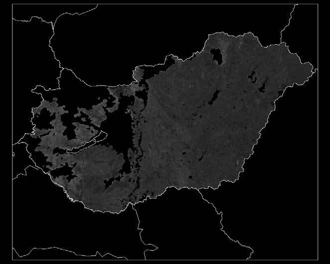
15 Data shown: - all Monitoring Vegetation Activity
16 Monitoring Vegetation Activity Data shown: - only with sensor senith angle lower than 35 - data coverage of the country is higher than 25%
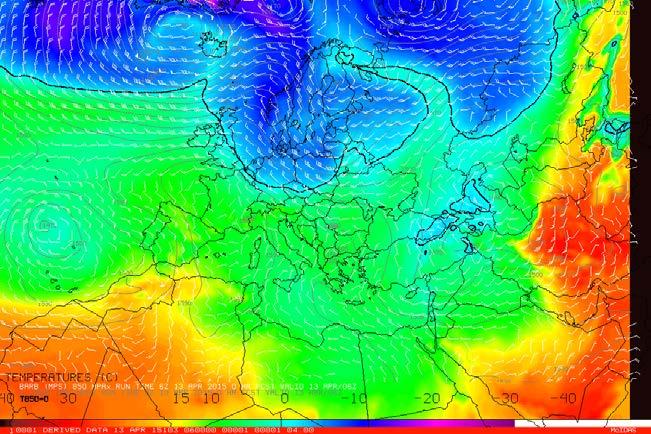
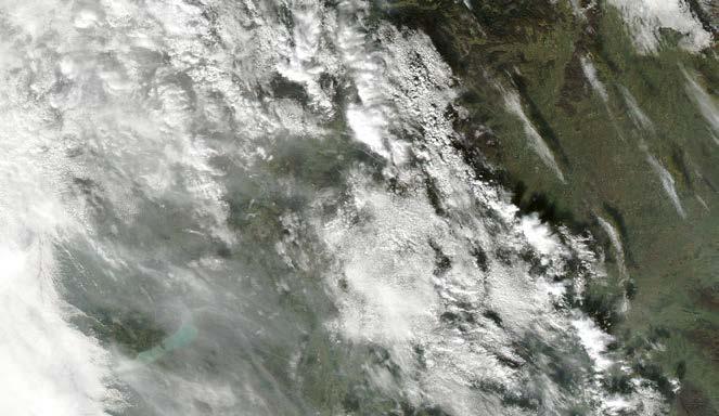
17 Monitoring Vegetation Activity Small cumulus clouds remain after cloudscreening :00 Terra


18 Monitoring Vegetation Activity Small cumulus clouds remain after cloudscreening :00 Terra
19 Monitoring Vegetation Activity Data shown: - only with lower sensor senith angle than 40 - data coverage of the country is higher than 25%


20 Monitoring Vegetation Activity Aqua, :15 Aqua, :25
21 Monitoring Vegetation Activity Unresolved source of errors on corrected reflectances: Cloud shadows Remaining small cumulus clouds Cirrus clouds High atmospehric water vapor content Creating monthly mean NDVI values Correlations between monthly mean DB NDVI & MOD13 NDVI (12 years): Croplands Grasslands Forests Bias: RMSE: R 2 :


22 2D plots of mean NDVI for Hungary DB data Entire Hungary Croplands Julian day Julian day Grasslands Forests Julian day Julian day


23 D plots of mean NDVI for Hungary MOD13 Entire Hungary Grasslands Julian day Croplands Can we find quantitative relationship between NDVI Julian day Julian day and the environmental variables? Forests Julian day
24 Monitoring Vegetation Activity Relationship between the mean temperature of the period May-October and the land cover specific mean NDVI values of the period May-October for Hungary based on DB NDVI data All: R 2 = 0.78 Agriculture: R 2 = 0.80 Grass: R 2 = 0.79 p = p = p = Forest: R 2 = 0.40 p = NDVI Temperature [ C]
25 Monitoring Vegetation Activity Relationship between the precipitation sum of the period May-October and the land cover specific mean NDVI values of the period May-October for Hungary based on DB NDVI data All: R 2 = 0.48 p = Agriculture: R 2 = 0.46 p = Grass: R 2 = 0.55 p = Forest: R 2 = 0.36 p = NDVI Precipitation [mm]
26 Monitoring Vegetation Activity Relationship between the precipitation sum of three consecutive months and the NDVI anomaly of the period s last month separately for the different land cover types for June-August Croplands Grasslands Forests R 2 = 0.76 p = R 2 = 0.78 p = R 2 = 0.80 p = NDVI anomaly NDVI anomaly NDVI anomaly Total precipitation [mm] Total precipitation [mm] Total precipitation [mm]
27 Crop yield estimations based on DB NDVI data Lowest yearly precipitation Heat wave in July in Hungary Highest yearly precipitation Heat wave in Europe Based on the crop yield data of Hungarian Statistical Office
28 Thanks to KATHY STRABALA LIAM E. GUMLEY AND THE IMAPP-TEAM NASA & EOSDIS FOR THE MOD12, MOD13 HUNGARIAN SCIENTIFIC RESEARCH FUND (OTKA PD & K )

29 2D plots of mean NDVI, EVI and GPP for Hungary


30 Precipitation conditions in Hungary ( ) The monthly precipitation amounts and its anomaly The monthly precipitation amounts The average values during the 15 years Precipitation anomaly

31 Temperature conditions in Hungary ( ) The monthly maximum, mean and minimum temperatures and the anomaly of the mean temperature The monthly maximum temperature The monthly mean temperature The monthly minimum temperature The range of the monthly maximum, mean and minimum temperatures during the 15 years Mean temperature anomaly
Application of IMAPP at East China Normal University
 CSPP / IMAPP Users Group Meeting Application of IMAPP at East China Normal University Yan an Liu 1, 2, Wei Gao 1, Runhe Shi 1, Allen Huang 2, Kathy Strabala 2, Liam Gumley 2, Yunzhu Chen 1, Xiaoyun Zhuang
EOS Direct Broadcast Real-Time Products for the US National Weather Service
 EOS Direct Broadcast Real-Time Products for the US National Weather Service Liam E. Gumley,, K. Strabala, J. Gerth,, S. Bachmeier, R. Dengel,, S. Dutcher, and J. Robaidek Liam.Gumley@ssec.wisc.edu University
Performance and Application of CSPP/IMAPP in East China
 Performance and Application of CSPP/IMAPP in East China Yan-An Liu 1, Wei Gao 1, Runhe Shi 1, Allen Huang 2, Kathy Strabala 2, Liam Gumley 2 1. East China Normal University 2. University of Wisconsin-Madison
IMAPP: Software to Transform EOS Direct Broadcast Data into Science Products. Kathleen Strabala, Liam Gumley, Allen Huang, Elisabeth Weisz, Jun Huang
 IMAPP: Software to Transform EOS Direct Broadcast Data into Science Products Kathleen Strabala, Liam Gumley, Allen Huang, Elisabeth Weisz, Jun Huang Overview of Wisconsin DB Activities Real time data processing
Satellite-derived Wind, Cloud, and Surface Products at Direct Broadcast Sites in the Antarctic and Arctic
 Satellite-derived Wind, Cloud, and Surface Products at Direct Broadcast Sites in the Antarctic and Arctic William Straka III +, Jeff Key*, Dave Santek +, Matthew Lazzara #, Liam Gumley +, Kathy Strabala
The use of Direct Broadcast Processing System in Poland
 The use of Direct Broadcast Processing System in Poland B.Łapeta, P.Struzik Satellite Remote Sensing Department, Institute of Meteortology and Water Management National Reasearch Institute About IMWM-NRI
DRARS Coordination Meeting Contribution from IMD
 DRARS Coordination Meeting Contribution from IMD Dr. Ashim Kumar Mitra Ministry of Earth Sciences India Meteorological Department New Delhi-INDIA 11-13 March 2015 The Processing System of NOAA/METOP/MODIS
Once a specific data set is selected, NEO will list related data sets in the panel titled Matching Datasets, which is to the right of the image.
 NASA Earth Observations (NEO): A Brief Introduction NEO is a data visualization tool that allows users to explore a wealth of environmental data collected by NASA satellites. The satellites use an array
Recent updates of the UW/CIMSS high spectral resolution global land surface infrared emissivity database
 Recent updates of the UW/CIMSS high spectral resolution global land surface infrared emissivity database Eva E. Borbas, Suzanne Wetzel Seemann, Robert O. Knuteson, Elisabeth Weisz, and Allen Huang Space
USE OF SATELLITE INFORMATION IN THE HUNGARIAN NOWCASTING SYSTEM
 USE OF SATELLITE INFORMATION IN THE HUNGARIAN NOWCASTING SYSTEM Mária Putsay, Zsófia Kocsis and Ildikó Szenyán Hungarian Meteorological Service, Kitaibel Pál u. 1, H-1024, Budapest, Hungary Abstract The
European Space Agency
 Guidelines - Guidelines how/when to interact during the WebEx session: - Due to the number of attendees, please keep always your webcam and microphone switched-off - You can use anytime the chat to all
Application and verification of ECMWF products 2009
 Application and verification of ECMWF products 2009 Hungarian Meteorological Service 1. Summary of major highlights The objective verification of ECMWF forecasts have been continued on all the time ranges
Customizable Drought Climate Service for supporting different end users needs
 1 Customizable Drought Climate Service for supporting different end users needs Ramona MAGNO, T. De Filippis, E. Di Giuseppe, M. Pasqui, E. Rapisardi, L. Rocchi (IBIMET-CNR; LaMMA Consortium) 1 Congresso
Recent Update on MODIS C6 and VIIRS Deep Blue Aerosol Products
 Recent Update on MODIS C6 and VIIRS Deep Blue Aerosol Products N. Christina Hsu, Photo taken from Space Shuttle: Fierce dust front over Libya Corey Bettenhausen, Andrew M. Sayer, and Rick Hansell Laboratory
Transboundary water management with Remote Sensing. Oluf Jessen DHI Head of Projects, Water Resources Technical overview
 Transboundary water management with Remote Sensing Oluf Jessen DHI Head of Projects, Water Resources Technical overview ozj@dhigroup.com Transboundary water management Water management across national
Comparison of NASA AIRS and MODIS Land Surface Temperature and Infrared Emissivity Measurements from the EOS AQUA platform
 Comparison of NASA AIRS and MODIS Land Surface Temperature and Infrared Emissivity Measurements from the EOS AQUA platform Robert Knuteson, Hank Revercomb, Dave Tobin University of Wisconsin-Madison 16
USGS/EROS Accomplishments and Year 3 Plans. Enhancement of the U.S. Drought Monit Through the Integration of NASA Vegetation Index Imagery
 USGS/EROS Accomplishments and Year 3 Plans Enhancement of the U.S. Drought Monit Through the Integration of NASA Vegetation Index Imagery Jesslyn Brown Team Meeting, Austin, TX, 10/6/09 U.S. Department
WEATHER AND CLIMATE EXTREMES MONITORING BASED ON SATELLITE OBSERVATION : INDONESIA PERSPECTIVE RIRIS ADRIYANTO
 WEATHER AND CLIMATE EXTREMES MONITORING BASED ON SATELLITE OBSERVATION : INDONESIA PERSPECTIVE RIRIS ADRIYANTO INDONESIA AGENCY FOR METEOROLOGY, CLIMATOLOGY AND GEOPHYSICS (BM KG) 1. INTRODUCTION - BMKG
MAIN ATTRIBUTES OF THE PRECIPITATION PRODUCTS DEVELOPED BY THE HYDROLOGY SAF PROJECT RESULTS OF THE VALIDATION IN HUNGARY
 MAIN ATTRIBUTES OF THE PRECIPITATION PRODUCTS DEVELOPED BY THE HYDROLOGY SAF PROJECT RESULTS OF THE VALIDATION IN HUNGARY Eszter Lábó OMSZ-Hungarian Meteorological Service, Budapest, Hungary labo.e@met.hu
Moderate Resolution Imaging Spectroradiometer (MODIS) Products and Potential Applications For Environmental and Climatic Monitoring in China
 Products and Potential Applications For Environmental and Climatic Monitoring in China") Moderate Resolution Imaging Spectroradiometer (MODIS) Products and Potential Applications For Environmental and Climatic Monitoring in China Jianhe (John) Qu Center for Earth Observing and Space Research
Moderate Resolution Imaging Spectroradiometer (MODIS) Products and Potential Applications For Environmental and Climatic Monitoring in China Jianhe (John) Qu Center for Earth Observing and Space Research
Software requirements * : Part III: 2 hrs.
 Title: Product Type: Developer: Target audience: Format: Software requirements * : Data: Estimated time to complete: Mapping snow cover using MODIS Part I: The MODIS Instrument Part II: Normalized Difference
Comparison of NASA AIRS and MODIS Land Surface Temperature and Infrared Emissivity Measurements from the EOS AQUA platform
 Comparison of NASA AIRS and MODIS Land Surface Temperature and Infrared Emissivity Measurements from the EOS AQUA platform Robert Knuteson, Steve Ackerman, Hank Revercomb, Dave Tobin University of Wisconsin-Madison
István Ihász, Máté Mile and Zoltán Üveges Hungarian Meteorological Service, Budapest, Hungary
 Comprehensive study of the calibrated EPS products István Ihász, Máté Mile and Zoltán Üveges Hungarian Meteorological Service, Budapest, Hungary 1. Introduction Calibration of ensemble forecasts is a new
Indian National (Weather) SATellites for Agrometeorological Applications
 SATellites for Agrometeorological Applications") Indian National (Weather) SATellites for Agrometeorological Applications Bimal K. Bhattacharya Agriculture-Terrestrial Biosphere- Hydrology Group Space Applications Centre (ISRO) Ahmedabad 380015, India
Indian National (Weather) SATellites for Agrometeorological Applications Bimal K. Bhattacharya Agriculture-Terrestrial Biosphere- Hydrology Group Space Applications Centre (ISRO) Ahmedabad 380015, India
The Palfai Drought Index (PaDI) Expansion of applicability of Hungarian PAI for South East Europe (SEE) region Summary
 Expansion of applicability of Hungarian PAI for South East Europe (SEE) region Summary") The Palfai Drought Index () Expansion of applicability of Hungarian PAI for South East Europe (SEE) region Summary In Hungary the Palfai drought index (PAI) worked out for users in agriculture and in water
The Palfai Drought Index () Expansion of applicability of Hungarian PAI for South East Europe (SEE) region Summary In Hungary the Palfai drought index (PAI) worked out for users in agriculture and in water
Enhancement of the U.S. Drought Monitor Through the Integration of NASA Vegetation Index Imagery
 Enhancement of the U.S. Drought Monitor Through the Integration of NASA Vegetation Index Imagery Project and Related Activities at USGS/EROS Jim Verdin, Jesslyn Brown, Yingxin Gu, Gail Schmidt, Troy McVay
The Delaware Environmental Monitoring & Analysis Center
 The Delaware Environmental Monitoring & Analysis Center Tina Callahan Delaware Estuary Science & Environmental Summit 2013 January 27-30, 2013 What is DEMAC? Delaware Environmental Monitoring & Analysis
McIDAS-X Software Development and Demonstration. PDA Animated Weather (PAW) Status by Russ Dengel. Dave Santek and Jay Heinzelman.
 Status by Russ Dengel. Dave Santek and Jay Heinzelman.") McIDAS-X Software Development and Demonstration Dave Santek and Jay Heinzelman 2 June 2009 PDA Animated Weather (PAW) Status by Russ Dengel Overview McIDAS-X 2008, 2009.1 McIDAS-XRD 2008, 2009.1 Software
McIDAS-X Software Development and Demonstration Dave Santek and Jay Heinzelman 2 June 2009 PDA Animated Weather (PAW) Status by Russ Dengel Overview McIDAS-X 2008, 2009.1 McIDAS-XRD 2008, 2009.1 Software
Weather and climate outlooks for crop estimates
 Weather and climate outlooks for crop estimates CELC meeting 2016-04-21 ARC ISCW Observed weather data Modeled weather data Short-range forecasts Seasonal forecasts Climate change scenario data Introduction
Observing land from space: Interacting with land data from NASA s LP DAAC
 Observing land from space: Interacting with land data from NASA s LP DAAC Danielle Golon Innovate! Inc., contractor to the U.S. Geological Survey (USGS) Earth Resources Observation and Science (EROS) Center
ISO MODIS NDVI Weekly Composites for Canada South of 60 N Data Product Specification
 ISO 19131 MODIS NDVI Weekly Composites for South of 60 N Data Product Specification Revision: A Data specification: MODIS NDVI Composites for South of 60 N - Table of Contents - 1. OVERVIEW... 3 1.1. Informal
SuperPack North America
 SuperPack North America Speedwell SuperPack makes available an unprecedented range of quality historical weather data, and weather data feeds for a single annual fee. SuperPack dramatically simplifies
European Drought Observatory Progress on Drought Monitoring
 European Drought Observatory Progress on Drought Monitoring Alfred de Jager Diego Magni European Commission Joint Research Centre (JRC) Disaster Risk Management Unit Outline 1. Introduction Philosophy
PYROGEOGRAPHY OF THE IBERIAN PENINSULA
 PYROGEOGRAPHY OF THE IBERIAN PENINSULA Teresa J. Calado (1), Carlos C. DaCamara (1), Sílvia A. Nunes (1), Sofia L. Ermida (1) and Isabel F. Trigo (1,2) (1) Instituto Dom Luiz, Universidade de Lisboa, Lisboa,
The use of satellite images to forecast agricultural production
 The use of satellite images to forecast agricultural production Artur Łączyński Central Statistical Office, Agriculture Department Niepodległości 208 Warsaw, Poland E-mail a.laczynski@stat.gov.pl DOI:
Evaluation of a New Land Surface Model for JMA-GSM
 Evaluation of a New Land Surface Model for JMA-GSM using CEOP EOP-3 reference site dataset Masayuki Hirai Takuya Sakashita Takayuki Matsumura (Numerical Prediction Division, Japan Meteorological Agency)
Global reanalysis: Some lessons learned and future plans
 Global reanalysis: Some lessons learned and future plans Adrian Simmons and Sakari Uppala European Centre for Medium-Range Weather Forecasts With thanks to Per Kållberg and many other colleagues from ECMWF
Impact of vegetation cover estimates on regional climate forecasts
 Impact of vegetation cover estimates on regional climate forecasts Phillip Stauffer*, William Capehart*, Christopher Wright**, Geoffery Henebry** *Institute of Atmospheric Sciences, South Dakota School
Jay Lawrimore NOAA National Climatic Data Center 9 October 2013
 Jay Lawrimore NOAA National Climatic Data Center 9 October 2013 Daily data GHCN-Daily as the GSN Archive Monthly data GHCN-Monthly and CLIMAT messages International Surface Temperature Initiative Global
A Facility for Producing Consistent Remotely Sensed Biophysical Data Products of Australia
 TERRESTRIAL ECOSYSTEM RESEARCH NETWORK - AusCover - A Facility for Producing Consistent Remotely Sensed Biophysical Data Products of Australia June, 2011 Mervyn Lynch Professor of Remote Sensing Curtin
Use of satellite information in research and operational activities at NIMH of Bulgaria
 Use of satellite information in research and operational activities at NIMH of Bulgaria Rilka Valcheva NIMH, Bulgaria WMO/EUMETSAT Satellite Products Training Course 24-28 April 2017, Budapest, Hungary
From ITPP, IAPP, IMAPP to CSPP Supporting Direct Broadcast Users Over Three Decades
 From ITPP, IAPP, IMAPP to CSPP Supporting Direct Broadcast Users Over Three Decades Allen Huang PI of IMAPP & CSPP-LEO allenh@ssec.wisc.edu Space Science & Engineering Center (SSEC) University of Wisconsin-Madison
Permanent Ice and Snow
 Soil Moisture Active Passive (SMAP) Ancillary Data Report Permanent Ice and Snow Preliminary, v.1 SMAP Science Document no. 048 Kyle McDonald, E. Podest, E. Njoku Jet Propulsion Laboratory California Institute
PROJECT REPORT (ASL 720) CLOUD CLASSIFICATION
 CLOUD CLASSIFICATION") PROJECT REPORT (ASL 720) CLOUD CLASSIFICATION SUBMITTED BY- PRIYANKA GUPTA 2011CH70177 RINI KAPOOR 2011CH70179 INDIVIDUAL CONTRIBUTION- Priyanka Gupta- analysed data of region considered in India (West:80,
PROJECT REPORT (ASL 720) CLOUD CLASSIFICATION SUBMITTED BY- PRIYANKA GUPTA 2011CH70177 RINI KAPOOR 2011CH70179 INDIVIDUAL CONTRIBUTION- Priyanka Gupta- analysed data of region considered in India (West:80,
Sources of Imagery and GIS Data Layers (Last updated October 2005)
") Sources of Imagery and GIS Data Layers (Last updated October 2005) The question of where to find data is one often asked by beginners in precision agriculture and other geospatial projects. The following
Sources of Imagery and GIS Data Layers (Last updated October 2005) The question of where to find data is one often asked by beginners in precision agriculture and other geospatial projects. The following
Overview on Land Cover and Land Use Monitoring in Russia
 Russian Academy of Sciences Space Research Institute Overview on Land Cover and Land Use Monitoring in Russia Sergey Bartalev Joint NASA LCLUC Science Team Meeting and GOFC-GOLD/NERIN, NEESPI Workshop
Performance of sounding retrievals from AIRS, GOES10, MODIS and HIRS Radiances during Mini-Barca campaign June 2008
 Performance of sounding retrievals from AIRS, GOES10, MODIS and HIRS Radiances during Mini-Barca campaign June 2008 Simone Sievert da Costa 1 Jurandir Ventura Rodrigues 1 Weber Andrade Gonçalves 1 Rodrigo
Land Surface Temperature Measurements From the Split Window Channels of the NOAA 7 Advanced Very High Resolution Radiometer John C.
 Land Surface Temperature Measurements From the Split Window Channels of the NOAA 7 Advanced Very High Resolution Radiometer John C. Price Published in the Journal of Geophysical Research, 1984 Presented
Cross-Sensor Continuity Science Algorithm
 Cross-Sensor Continuity Science Algorithm - Long Term Vegetation Index and Phenology Workshop - Javzan Tsend-Ayush and Tomoaki Miura Department of Natural Resources and Environmental Management University
Monitoring daily evapotranspiration in the Alps exploiting Sentinel-2 and meteorological data
 Monitoring daily evapotranspiration in the Alps exploiting Sentinel-2 and meteorological data M. Castelli, S. Asam, A. Jacob, M. Zebisch, and C. Notarnicola Institute for Earth Observation, Eurac Research,
IDEA. from research to routine
 IDEA. from research to routine A collaboration between NASA, EPA, NOAA and CIMSS Cooperative Institute for Meteorological Satellite Studies Infusing satellite Data in Environmental Applications (IDEA)
A high spectral resolution global land surface infrared emissivity database
 A high spectral resolution global land surface infrared emissivity database Eva E. Borbas, Robert O. Knuteson, Suzanne W. Seemann, Elisabeth Weisz, Leslie Moy, and Hung-Lung Huang Space Science and Engineering
The MODIS Cloud Data Record
 The MODIS Cloud Data Record Brent C. Maddux 1,2 Steve Platnick 3, Steven A. Ackerman 1 Paul Menzel 1, Kathy Strabala 1, Richard Frey 1, 1 Cooperative Institute for Meteorological Satellite Studies, 2 Department
P1.34 MULTISEASONALVALIDATION OF GOES-BASED INSOLATION ESTIMATES. Jason A. Otkin*, Martha C. Anderson*, and John R. Mecikalski #
 P1.34 MULTISEASONALVALIDATION OF GOES-BASED INSOLATION ESTIMATES Jason A. Otkin*, Martha C. Anderson*, and John R. Mecikalski # *Cooperative Institute for Meteorological Satellite Studies, University of
CadasterENV Sweden Time series in support of a multi-purpose land cover mapping system at national scale
 CadasterENV Sweden Time series in support of a multi-purpose land cover mapping system at national scale Mats Rosengren, Camilla Jönsson ; Metria AB Marc Paganini ; ESA ESRIN Background CadasterENV Sweden
Assessing Drought in Agricultural Area of central U.S. with the MODIS sensor
 Assessing Drought in Agricultural Area of central U.S. with the MODIS sensor Di Wu George Mason University Oct 17 th, 2012 Introduction: Drought is one of the major natural hazards which has devastating
GE G Climate Science Lab
 GE G Climate Science Lab North American Soil Moisture Database: Development and Applications Steven M. Quiring Texas A&M University Trenton Ford Texas A&M University http://climatology.tamu.edu http://facebook.com/geogcsl
GI Technology for Disaster Management
 GI Technology for Disaster Management 17 th ICC on the Regional Space Applications Programme for Sustainable Development (RESAP) 26 th Nov 2013 Bangkok Thailand Period and time of seasonal in thailand
Extended-range Fire Weather Products within the Canadian Wildland Fire Information System
 Extended-range Fire Weather Products within the Canadian Wildland Fire Information System Kerry Anderson, Richard Carr, Peter Englefield, John Little, Rod Suddaby Canadian Forest Service Introduction Introduction
Great Lakes Information Network GIS (Queryable by topic, geography, organization, and upload date 73 layers as of October, 2009)
") Google Earth Files for the Great Lakes and Beyond GLOS Mapping Workshop Alpena, Michigan November 9, 2009 David Hart GIS Specialist University of Wisconsin Sea Grant Institute GREAT LAKES Great Lakes Information
Google Earth Files for the Great Lakes and Beyond GLOS Mapping Workshop Alpena, Michigan November 9, 2009 David Hart GIS Specialist University of Wisconsin Sea Grant Institute GREAT LAKES Great Lakes Information
Applications of yield monitoring systems and agricultural statistics in agricultural (re)insurance
insurance") Image: used under license from shutterstock.com Applications of yield monitoring systems and agricultural statistics in agricultural (re)insurance 18 October 2018 Ernst Bedacht Agenda Introduction 1. Munich
Image: used under license from shutterstock.com Applications of yield monitoring systems and agricultural statistics in agricultural (re)insurance 18 October 2018 Ernst Bedacht Agenda Introduction 1. Munich
MeteoSwiss Spatial Climate Analyses: Documentation of Datasets for Users
 Federal Department of Home Affairs FDHA Federal Office of Meteorology and Climatology MeteoSwiss MeteoSwiss Spatial Climate Analyses: Documentation of Datasets for Users Figure 1: Distribution of the 48-hour
Climate Prediction Center National Centers for Environmental Prediction
 NOAA s Climate Prediction Center Climate Monitoring Tool Wassila M. Thiaw and CPC International Team Climate Prediction Center National Centers for Environmental Prediction CPC International Team Vadlamani
NASA Flood Monitoring and Mapping Tools
 National Aeronautics and Space Administration ARSET Applied Remote Sensing Training http://arset.gsfc.nasa.gov @NASAARSET NASA Flood Monitoring and Mapping Tools www.nasa.gov Outline Overview of Flood
Comparison of MSG-SEVIRI and SPOT-VEGETATION data for vegetation monitoring over Africa
 Comparison of MSG-SEVIRI and SPOT-VEGETATION data for vegetation monitoring over Africa Bernard LACAZE CNRS UMR 8586 PRODIG Pôle Image et Campus Spatial, Université Paris Diderot Paris 7 Objectives Comparison
Data Fusion and Multi-Resolution Data
 Data Fusion and Multi-Resolution Data Nature.com www.museevirtuel-virtualmuseum.ca www.srs.fs.usda.gov Meredith Gartner 3/7/14 Data fusion and multi-resolution data Dark and Bram MAUP and raster data Hilker
Amita Mehta and Ana Prados
 Building Capacity in Utilizing NASA Remote Sensing Observations in SWAT for Water Resources and Agricultural Management Applications Amita Mehta and Ana Prados NASA - University of Maryland Baltimore County
USGS Water Census Guidelines and Specifications for ET Remote Sensing
 USGS Water Census Guidelines and Specifications for ET Remote Sensing U.S. Department of the Interior U.S. Geological Survey Guidelines and specifications Many prior and ongoing crop ET remote sensing
Direct Readout at the Meteorological Service of Canada
 Direct Readout at the Meteorological Service of Canada CSPP Users Meeting 2015 Darmstadt, Germany April 14-16, 2015 David Bradley Manager, Earth Observation and Geomatics Meteorological Service of Canada
The European Forest Fire Information System User Guide to EFFIS applications
 The European Forest Fire Information System User Guide to EFFIS applications Version 2.3.3, May 2018 1 Contents Current Situation Application... 3 Map Tools... 4 Layer controls... 5 Analysis tools... 6
An Integrated Approach to the Prediction of Weather, Renewable Energy Generation and Energy Demand in Vermont
 1 An Integrated Approach to the Prediction of Weather, Renewable Energy Generation and Energy Demand in Vermont James P. Cipriani IBM Thomas J. Watson Research Center Yorktown Heights, NY Other contributors
QualiMET 2.0. The new Quality Control System of Deutscher Wetterdienst
 QualiMET 2.0 The new Quality Control System of Deutscher Wetterdienst Reinhard Spengler Deutscher Wetterdienst Department Observing Networks and Data Quality Assurance of Meteorological Data Michendorfer
Updates to the IMAPP AIRS Utility Software
 SPACE SCIENCE AND ENGINEERING CENTER Updates to the IMAPP AIRS Utility Software Elisabeth Weisz, Hung-Lung Huang and Kathy Strabala Cooperative Institute for Meteorological Satellite Studies Space Science
Generation and Initial Evaluation of a 27-Year Satellite-Derived Wind Data Set for the Polar Regions NNX09AJ39G. Final Report Ending November 2011
 Generation and Initial Evaluation of a 27-Year Satellite-Derived Wind Data Set for the Polar Regions NNX09AJ39G Final Report Ending November 2011 David Santek, PI Space Science and Engineering Center University
The benefits and developments in ensemble wind forecasting
 The benefits and developments in ensemble wind forecasting Erik Andersson Slide 1 ECMWF European Centre for Medium-Range Weather Forecasts Slide 1 ECMWF s global forecasting system High resolution forecast
Interannual variation of MODIS NDVI in Lake Taihu and its relation to climate in submerged macrophyte region
 Yale-NUIST Center on Atmospheric Environment Interannual variation of MODIS NDVI in Lake Taihu and its relation to climate in submerged macrophyte region ZhangZhen 2015.07.10 1 Outline Introduction Data
Module 11: Meteorology Topic 5 Content: Weather Maps Notes
 Introduction A variety of weather maps are produced by the National Weather Service and National Oceanographic Atmospheric Administration. These maps are used to help meteorologists accurately predict
Country Report - Singapore
 Country Report - Singapore The 5th Meeting of the Coordinating Group Vladivostok city, Russky Island, Russia Far Eastern Federal University of the RA II WIGOS Satellite Project 21 October 2017 Outline
A Cotton Irrigator s Decision Support System Using National, Regional and Local Data
 A Cotton Irrigator s Decision Support System Using National, Regional and Local Data ISESS 2015, Melbourne Jamie Vleeshouwer, Nicholas J. Car, John Hornbuckle 26 March 2015 LAND & WATER FLAGSHIP / AGRICULTURE
Ganbat.B, Agro meteorology Section
 NATIONAL AGENCY FOR METEOROLOGY, HYDROLOGY AND ENVIRONMENT MONITORING OF MONGOLIA Ganbat.B, Agro meteorology Section OF INSTITUTE OF METEOROLOGY AND HYDROLOGY 2009 YEAR Location Climate Northern Asia,
Patrick Leinenkugel. German Aerospace Center (DLR) Vortrag > Autor > Dokumentname > Datum
 Vortrag > Autor > Dokumentname > Datum") Characterisation of land surface phenology and land cover for the Mekong Basin on the basis of multitemporal and multispectral satellite data from the MODIS Sensor Patrick Leinenkugel German Aerospace
Characterisation of land surface phenology and land cover for the Mekong Basin on the basis of multitemporal and multispectral satellite data from the MODIS Sensor Patrick Leinenkugel German Aerospace
4.5 Comparison of weather data from the Remote Automated Weather Station network and the North American Regional Reanalysis
 4.5 Comparison of weather data from the Remote Automated Weather Station network and the North American Regional Reanalysis Beth L. Hall and Timothy. J. Brown DRI, Reno, NV ABSTRACT. The North American
Application and verification of ECMWF products in Croatia
 Application and verification of ECMWF products in Croatia August 2008 1. Summary of major highlights At Croatian Met Service, ECMWF products are the major source of data used in the operational weather
INVESTIGATION OF SAHARAN DUST TRANSPORT ON THE BASIS OF AEROLOGICAL MEASUREMENTS
 INVESTIGATION OF SAHARAN DUST TRANSPORT ON THE BASIS OF AEROLOGICAL MEASUREMENTS R. TÓTH 1, L. NYITRAI 1 ABSTRACT. Investigation of Saharan dust transport on the basis of aerological measurements. The
Auxiliary Materials for Paper. Widespread Decline in Greenness of Amazonian Vegetation Due to the 2010 Drought
 Auxiliary Materials for Paper Widespread Decline in Greenness of Amazonian Vegetation Due to the 2010 Drought Liang Xu, 1* Arindam Samanta, 2* Marcos H. Costa, 3 Sangram Ganguly, 4 Ramakrishna R. Nemani,
Estimation of satellite observations bias correction for limited area model
 Estimation of satellite observations bias correction for limited area model Roger Randriamampianina Hungarian Meteorological Service Budapest, Hungary roger@met.hu ITSC-XV, Maratea,, Italy, 4-104 October
Greening of Arctic: Knowledge and Uncertainties
 Greening of Arctic: Knowledge and Uncertainties Jiong Jia, Hesong Wang Chinese Academy of Science jiong@tea.ac.cn Howie Epstein Skip Walker Moscow, January 28, 2008 Global Warming and Its Impact IMPACTS
Analyzing Long-Term Drought Effects on Land Surface Temperature and Vegetation Using National Oceanic Atmospheric Administration Satellite s Data
 Analyzing Long-Term Drought Effects on Land Surface Temperature and Vegetation Using National Oceanic Atmospheric Administration Satellite s Data Cornelius Holmes, Derek Morris Jr. S Abstract Analyzing
ANALYSIS OF FLOODS AND DROUGHTS IN THE BAGO RIVER BASIN, MYANMAR, UNDER CLIMATE CHANGE
 ANALYSIS OF FLOODS AND DROUGHTS IN THE BAGO RIVER BASIN, MYANMAR, UNDER CLIMATE CHANGE Myo Myat Thu* MEE15631 ABSTRACT 1 Supervisor: Dr. Maskym Gusyev** Dr. Akira Hasegawa** This study investigates floods
AGOG 485/585 /APLN 533 Spring Lecture 5: MODIS land cover product (MCD12Q1). Additional sources of MODIS data
. Additional sources of MODIS data") AGOG 485/585 /APLN 533 Spring 2019 Lecture 5: MODIS land cover product (MCD12Q1). Additional sources of MODIS data Outline Current status of land cover products Overview of the MCD12Q1 algorithm Mapping
AGOG 485/585 /APLN 533 Spring 2019 Lecture 5: MODIS land cover product (MCD12Q1). Additional sources of MODIS data Outline Current status of land cover products Overview of the MCD12Q1 algorithm Mapping
Algorithm for MERIS land surface BRDF/albedo retrieval and its validation using contemporaneous EO data products
 Algorithm for MERIS land surface BRDF/albedo retrieval and its validation using contemporaneous EO data products Jan-Peter Muller* (UCL) Carsten Brockmann, Marco Zühlke, Norman Fomferra (BC) Jürgen Fischer,
VIC Hydrology Model Training Workshop Part II: Building a model
 VIC Hydrology Model Training Workshop Part II: Building a model 11-12 Oct 2011 Centro de Cambio Global Pontificia Universidad Católica de Chile Ed Maurer Civil Engineering Department Santa Clara University
Assimilating terrestrial remote sensing data into carbon models: Some issues
 University of Oklahoma Oct. 22-24, 2007 Assimilating terrestrial remote sensing data into carbon models: Some issues Shunlin Liang Department of Geography University of Maryland at College Park, USA Sliang@geog.umd.edu,
C O P E R N I C U S F O R G I P R O F E S S I O N A L S
 C O P E R N I C U S F O R G I P R O F E S S I O N A L S Downstream Applications MALTA 2017-06-26 Pascal Lory, EUROGI EU EU EU www.copernicus.eu S c o p e Identifying urban housing density: Stella Ofori-Ampofo,
Satellite-based Lake Surface Temperature (LST) Homa Kheyrollah Pour Claude Duguay
 Homa Kheyrollah Pour Claude Duguay") Satellite-based Lake Surface Temperature (LST) Homa Kheyrollah Pour Claude Duguay Lakes in NWP models Interaction of the atmosphere and underlying layer is the most important issue in climate modeling
Satellite-based Lake Surface Temperature (LST) Homa Kheyrollah Pour Claude Duguay Lakes in NWP models Interaction of the atmosphere and underlying layer is the most important issue in climate modeling
Monitoring of grass cutting with Sentinel-1 time series
 Monitoring of grass cutting with Sentinel-1 time series pilot results and vision for operational service based on big data tools and cloud computing Kaupo Voormansik 21st MARS Conference November 25, 2015
Predicting Future CO2 Amounts and Monitoring Seasonal CO2 Fluctuations QUANTIFYING CO2 ANNUAL INCREASE
 http://visibleearth.nasa.gov/view.php?id=5772 3 Predicting Future CO2 Amounts and Monitoring Seasonal CO2 Fluctuations QUANTIFYING CO2 ANNUAL INCREASE Aguilera, Kimberly GEO 3276: GIS & GPS Applications
Impact of NASA EOS data on the scientific literature: 16 years of published research results from Terra, Aqua, Aura, and Aquarius
 Impact of NASA EOS data on the scientific literature: 16 years of published research results from Terra, Aqua, Aura, and Aquarius Gene R. Major NASA Goddard Library Nebulous Connections April 4, 2017 RESACs/RA
Summary of Research Report for NASA Award NNX14AK06G Reporting Period: 6/06/2014 to 11/04/2017
 Summary of Research Report for NASA Award NNX14AK06G Reporting Period: 6/06/2014 to 11/04/2017 International MODIS/AIRS Processing Package (IMAPP) Maintenance and Development of Real-time Applications
Application and verification of ECMWF products 2015
 Application and verification of ECMWF products 2015 Hungarian Meteorological Service 1. Summary of major highlights The objective verification of ECMWF forecasts have been continued on all the time ranges